

List of municipalities in Lycoming County, Pennsylvania
Encyclopedia
United States
The United States of America is a federal constitutional republic comprising fifty states and a federal district...
. Under Pennsylvania
Pennsylvania
The Commonwealth of Pennsylvania is a U.S. state that is located in the Northeastern and Mid-Atlantic regions of the United States. The state borders Delaware and Maryland to the south, West Virginia to the southwest, Ohio to the west, New York and Ontario, Canada, to the north, and New Jersey to...
law, there are three types of incorporated municipalities
Municipal corporation
A municipal corporation is the legal term for a local governing body, including cities, counties, towns, townships, charter townships, villages, and boroughs. Municipal incorporation occurs when such municipalities become self-governing entities under the laws of the state or province in which...
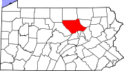
in Lycoming County
Lycoming County, Pennsylvania
-Appalachian Mountains and Allegheny Plateau:Lycoming County is divided between the Appalachian Mountains in the south, the dissected Allegheny Plateau in the north and east, and the valley of the West Branch Susquehanna River between these.-West Branch Susquehanna River:The West Branch of the...
: cities, boroughs and townships. Any municipality
Municipality
A municipality is essentially an urban administrative division having corporate status and usually powers of self-government. It can also be used to mean the governing body of a municipality. A municipality is a general-purpose administrative subdivision, as opposed to a special-purpose district...
in Pennsylvania with more than 10 persons can incorporate as a borough. Any township or borough with a population of at least 10,000 can ask the state legislature to become chartered as a city. There are no unincorporated areas in the county, since all territory in Pennsylvania is incorporated.
The 52 incorporated municipalities in Lycoming County are the subject of the first list, which gives their names and etymologies
Etymology
Etymology is the study of the history of words, their origins, and how their form and meaning have changed over time.For languages with a long written history, etymologists make use of texts in these languages and texts about the languages to gather knowledge about how words were used during...
, dates settled and incorporated, what they were formed from, area, population, and location within the county. Two other lists dealing with former parts of Lycoming County are included. The second list is of former incorporated townships and gives the same information as above on their current status. The third list gives information on the eighteen other Pennsylvania counties which were formed from or contain land originally in the county.
In the 2000 census, the population of Lycoming County was 120,044, making it a "Fifth Class County" (defined by Pennsylvania law as "having a population of 95,000 and more, but less than 145,000 inhabitants"). It is included in the Williamsport
Williamsport, Pennsylvania
Williamsport is a city in and the county seat of Lycoming County, Pennsylvania in the United States. In 2009, the population was estimated at 29,304...
, Pennsylvania Metropolitan Statistical Area and its county seat
County seat
A county seat is an administrative center, or seat of government, for a county or civil parish. The term is primarily used in the United States....
is Williamsport. Lycoming County is located in north central Pennsylvania, about 130 miles (209 km) northwest of Philadelphia and 165 miles (266 km) east-northeast of Pittsburgh, as the crow flies.
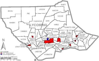
Municipalities
, Lycoming County has 52 incorporated municipalities: 1 city, 9 boroughs, and 42 townships. Lycoming County's townships include 1 census-designated placeCensus-designated place
A census-designated place is a concentration of population identified by the United States Census Bureau for statistical purposes. CDPs are delineated for each decennial census as the statistical counterparts of incorporated places such as cities, towns and villages...
(CDP) and 50 village
Village
A village is a clustered human settlement or community, larger than a hamlet with the population ranging from a few hundred to a few thousand , Though often located in rural areas, the term urban village is also applied to certain urban neighbourhoods, such as the West Village in Manhattan, New...
s. CDPs are geographical areas designated by the U.S. Census Bureau
United States Census Bureau
The United States Census Bureau is the government agency that is responsible for the United States Census. It also gathers other national demographic and economic data...
for the purposes of compiling demographic data. Villages are marked with signs by the Pennsylvania Department of Transportation
Pennsylvania Department of Transportation
The Pennsylvania Department of Transportation oversees transportation issues in the Commonwealth of Pennsylvania. The administrator of PennDOT is the Pennsylvania Secretary of Transportation, currently Barry Schoch Presently, PennDOT supports over of state roads and highways, about 25,000...
. Neither CDPs nor villages are actual jurisdictions under Pennsylvania law and their territory is legally part of the township(s) where they are located. The first list also notes the CDP
Garden View, Pennsylvania
Garden View is a census-designated place in Lycoming County, Pennsylvania, United States. The population was 2,679 at the 2000 census. It is part of the Williamsport, Pennsylvania Metropolitan Statistical Area.-Geography:...
and villages within their respective townships.
At 1244 square miles (3,221.9 km²) as of 2007, Lycoming County is the largest county by land area in Pennsylvania (Erie County
Erie County, Pennsylvania
Erie County is a county located in the U.S. state of Pennsylvania. As of 2010, the population was 280,566. Its county seat is the City of Erie.- Geography :...
is larger, but nearly half of its area is in Lake Erie
Lake Erie
Lake Erie is the fourth largest lake of the five Great Lakes in North America, and the tenth largest globally. It is the southernmost, shallowest, and smallest by volume of the Great Lakes and therefore also has the shortest average water residence time. It is bounded on the north by the...
). Lycoming County is also larger than Rhode Island
Rhode Island
The state of Rhode Island and Providence Plantations, more commonly referred to as Rhode Island , is a state in the New England region of the United States. It is the smallest U.S. state by area...
, the smallest U.S. state
U.S. state
A U.S. state is any one of the 50 federated states of the United States of America that share sovereignty with the federal government. Because of this shared sovereignty, an American is a citizen both of the federal entity and of his or her state of domicile. Four states use the official title of...
, which has an area of 1214 square miles (3,144.2 km²). Its incorporated municipalities range in size from 0.6 square miles (1.6 km²) (three of the boroughs) to 76.5 square miles (198.1 km²) (McHenry Township). The city of Williamsport has the highest population of any municipality (30,706 or 25.6% of the county total as of 2000), while Brown Township in the northwest corner of the county has the lowest population (111 or 0.092%). Most of the county's population is in the valley along the West Branch Susquehanna River
West Branch Susquehanna River
The West Branch Susquehanna River is one of the two principal branches, along with the North Branch, of the Susquehanna River in the northeastern United States. The North Branch, which rises in upstate New York, is generally regarded as the extension of the main branch, with the shorter West Branch...
.
| Municipality (type) |
Remarks | Settled | Incorporated | Formed from | Area in square miles (km²) | Population as of 2000 |
Map |
|---|---|---|---|---|---|---|---|
| Williamsport Williamsport, Pennsylvania Williamsport is a city in and the county seat of Lycoming County, Pennsylvania in the United States. In 2009, the population was estimated at 29,304... (city) |
Named for William Ross (son of founder Michael Ross); county seat County seat A county seat is an administrative center, or seat of government, for a county or civil parish. The term is primarily used in the United States.... ; laid out 1796 |
1769 | 1806 (borough), 1866 (city) |
Loyalsock Township | sq mi (24.7 km²) |
30,706 |  |
| Duboistown Duboistown, Pennsylvania Duboistown is a borough in Lycoming County, Pennsylvania, United States. The population was 1,280 at the 2000 census. It is part of the Williamsport, Pennsylvania Metropolitan Statistical Area.-History:... (borough) |
Named for founders John and Mathias Dubois, laid out 1852 | 1773 | 1878 | Armstrong Township Armstrong Township, Lycoming County, Pennsylvania Armstrong Township is a township in Lycoming County, Pennsylvania, in the United States. The population was 717 at the 2000 census. It is part of the Williamsport, Pennsylvania Metropolitan Statistical Area.-History:... |
sq mi (1.7 km²) |
1,280 |  |
| Hughesville Hughesville, Pennsylvania Hughesville is a borough in Lycoming County, Pennsylvania, United States. The population was 2,220 at the 2000 census. It is part of the Williamsport, Pennsylvania Metropolitan Statistical Area.-History:... (borough) |
Named for founder Jeptha Hughes; laid out 1816 | 1816 | 1852 | Muncy Township | sq mi (1.7 km²) |
2,200 | |
| Jersey Shore Jersey Shore, Pennsylvania Jersey Shore is a borough in Lycoming County, Pennsylvania, United States. It is on the West Branch Susquehanna River, west by south of Williamsport. It is part of the Williamsport, Pennsylvania Metropolitan Statistical Area. In the past, Jersey Shore held farms, railroad shops, cigar factories, a... (borough) |
Named the "Jersey Shore" as its founders were from New Jersey New Jersey New Jersey is a state in the Northeastern and Middle Atlantic regions of the United States. , its population was 8,791,894. It is bordered on the north and east by the state of New York, on the southeast and south by the Atlantic Ocean, on the west by Pennsylvania and on the southwest by Delaware... and it was on the shore of the West Branch Susquehanna River West Branch Susquehanna River The West Branch Susquehanna River is one of the two principal branches, along with the North Branch, of the Susquehanna River in the northeastern United States. The North Branch, which rises in upstate New York, is generally regarded as the extension of the main branch, with the shorter West Branch... ; laid out 1820 |
1785 | 1826 | Porter Township Porter Township, Lycoming County, Pennsylvania Porter Township is a township in Lycoming County, Pennsylvania, in the United States. The population was 1,633 at the 2000 census. It is part of the Williamsport, Pennsylvania Metropolitan Statistical Area.-History:Porter Township, named for David R... |
sq mi (3.2 km²) |
4,482 | |
| Montgomery Montgomery, Pennsylvania Montgomery is a borough in Lycoming County, Pennsylvania, in the United States. The population was 1,695 at the 2000 census. It is part of the Williamsport, Pennsylvania Metropolitan Statistical Area.-History:... (borough) |
Named for the "Montgomery Station" post office; known as "Black Hole" until circa 1836 (for Black Hole Creek) | 1783 | 1887 | Clinton Township Clinton Township, Lycoming County, Pennsylvania Clinton Township is a township in Lycoming County, Pennsylvania, in the United States. The population was 3,947 at the 2000 census. It is part of the Williamsport, Pennsylvania Metropolitan Statistical Area.-History:... |
sq mi (1.5 km²) |
1,695 | |
| Montoursville Montoursville, Pennsylvania Montoursville is a borough in Lycoming County, Pennsylvania, in the United States. As of the 2000 census, the borough population was 4,777. It is part of the Williamsport, Pennsylvania Metropolitan Statistical Area. It was named for Madame Montour, a Native American leader and skilled interpreter... (borough) |
Named for Madame Montour and her son Andrew Montour; laid out 1820 | 1768 | 1850 | Fairfield Township Fairfield Township, Lycoming County, Pennsylvania Fairfield Township is a township in Lycoming County, Pennsylvania, in the United States. The population was 2,659 at the 2000 census. It is part of the Williamsport, Pennsylvania Metropolitan Statistical Area.-History:... |
sq mi (10.8 km²) |
4,777 | 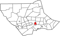 |
| Muncy Muncy, Pennsylvania For other places named 'Muncy', please see Muncy .Muncy is a borough in Lycoming County, Pennsylvania, in the United States. The name Muncy comes from the Munsee Indians who once lived in the area. The population was 2,663 at the 2000 census. It is part of the Williamsport, Pennsylvania... (borough) |
Named for the Munsee Christian Munsee The Christian Munsee were a group of Lenape native American Indians, primarily Munsee-speaking, who converted to Christianity, following the teachings of the Moravian missionaries... phratry Phratry In ancient Greece, a phratry ατρία, "brotherhood", "kinfolk", derived from φρατήρ meaning "brother") was a social division of the Greek tribe... of the Lenape Lenape The Lenape are an Algonquian group of Native Americans of the Northeastern Woodlands. They are also called Delaware Indians. As a result of the American Revolutionary War and later Indian removals from the eastern United States, today the main groups live in Canada, where they are enrolled in the... ; laid out 1797 |
1797 | 1826 | Muncy Township | sq mi (2.2 km²) |
2,663 | 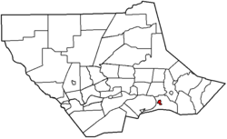 |
| Picture Rocks Picture Rocks, Pennsylvania Picture Rocks is a borough in Lycoming County, Pennsylvania, in the United States. The population was 693 at the 2000 census. It is part of the Williamsport, Pennsylvania Metropolitan Statistical Area.-History:... (borough) |
Named for Indian pictographs found on the cliffs above Muncy Creek | 1848 | 1857 | Wolf Township | sq mi (2.4 km²) |
693 | |
| Salladasburg (borough) | Named for founder Jacob P. Sallada; laid out 1837 | 1837 | 1884 | Mifflin Township Mifflin Township, Lycoming County, Pennsylvania Mifflin Township is a township in Lycoming County, Pennsylvania, in the United States. The population was 1,145 at the 2000 census. It is part of the Williamsport, Pennsylvania Metropolitan Statistical Area.- History :... |
sq mi (2.0 km²) |
260 | |
| South Williamsport South Williamsport, Pennsylvania South Williamsport is a borough in Lycoming County, Pennsylvania, United States. The population was 6,412 at the 2000 census. It is part of the Williamsport, Pennsylvania Metropolitan Statistical Area.-History:... (borough) |
Named for its geographic location, south of Williamsport Williamsport, Pennsylvania Williamsport is a city in and the county seat of Lycoming County, Pennsylvania in the United States. In 2009, the population was estimated at 29,304... ; |
1790 | 1886 | Armstrong Township Armstrong Township, Lycoming County, Pennsylvania Armstrong Township is a township in Lycoming County, Pennsylvania, in the United States. The population was 717 at the 2000 census. It is part of the Williamsport, Pennsylvania Metropolitan Statistical Area.-History:... |
sq mi (5.5 km²) |
6,412 | |
| Anthony Township Anthony Township, Lycoming County, Pennsylvania Anthony Township is a township in Lycoming County, Pennsylvania, in the United States. The population was 904 at the 2000 census. It is part of the Williamsport, Pennsylvania Metropolitan Statistical Area.-History:... |
Named for Joseph B. Anthony, a county judge circa 1844 and later Pennsylvania Supreme Court justice | 1773 | 1844 | Lycoming Township | sq mi (41.1 km²) |
904 | |
| Armstrong Township Armstrong Township, Lycoming County, Pennsylvania Armstrong Township is a township in Lycoming County, Pennsylvania, in the United States. The population was 717 at the 2000 census. It is part of the Williamsport, Pennsylvania Metropolitan Statistical Area.-History:... |
Named for James Armstrong, a local lawyer | 1795 | 1842 | Clinton Township Clinton Township, Lycoming County, Pennsylvania Clinton Township is a township in Lycoming County, Pennsylvania, in the United States. The population was 3,947 at the 2000 census. It is part of the Williamsport, Pennsylvania Metropolitan Statistical Area.-History:... |
sq mi (66.2 km²) |
717 | 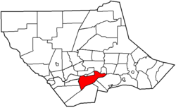 |
| Bastress Township | Named for Solomon Bastress of Jersey Shore, former member of the state legislature and associate judge | 1837 | 1854 | Susquehanna Township Susquehanna Township, Lycoming County, Pennsylvania Susquehanna Township is a township in Lycoming County, Pennsylvania, in the United States. The population was 993 at the 2000 census. It is part of the Williamsport, Pennsylvania Metropolitan Statistical Area.-History:... |
sq mi (22.4 km²) |
574 | |
| Brady Township Brady Township, Lycoming County, Pennsylvania Brady Township is a township in Lycoming County, Pennsylvania, in the United States. The population was 494 at the 2000 census. It is part of the Williamsport, Pennsylvania Metropolitan Statistical Area.-History:... |
Named for the Brady family, some of the earliest settlers in the area | 1790 | 1855 | Washington Township Washington Township, Lycoming County, Pennsylvania Washington Township is a township in Lycoming County, Pennsylvania, in the United States. The population was 1,613 at the 2000 census. It is part of the Williamsport, Pennsylvania Metropolitan Statistical Area.-History:... |
sq mi (22.4 km²) |
494 | 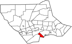 |
| Brown Township Brown Township, Lycoming County, Pennsylvania Brown Township is a township in Lycoming County, Pennsylvania, in the United States. The population was 111 at the 2000 census. It is part of the Williamsport, Pennsylvania Metropolitan Statistical Area.-History:... |
Named for Jacob Brown Jacob Brown Jacob Jennings Brown was an American army officer in the War of 1812. His successes on the northern border during that war made him a hero. In 1821 he was appointed commanding general of the U.S. Army and held that post until his death.-Early life:Born in Bucks County, Pennsylvania, Jacob Jennings... , a general from Pennsylvania in the War of 1812 War of 1812 The War of 1812 was a military conflict fought between the forces of the United States of America and those of the British Empire. The Americans declared war in 1812 for several reasons, including trade restrictions because of Britain's ongoing war with France, impressment of American merchant... ; includes the villages of Cedar Run and Slate Run |
1790 | 1815 | Mifflin Mifflin Township, Lycoming County, Pennsylvania Mifflin Township is a township in Lycoming County, Pennsylvania, in the United States. The population was 1,145 at the 2000 census. It is part of the Williamsport, Pennsylvania Metropolitan Statistical Area.- History :... and Pine Township Pine Township, Lycoming County, Pennsylvania Pine Township is a township in Lycoming County, Pennsylvania, in the United States. The population was 329 at the 2000 census. It is part of the Williamsport, Pennsylvania Metropolitan Statistical Area.-History:... s |
sq mi (190.8 km²) |
111 | |
| Cascade Township | Named for its cascading mountain streams; includes the village of Kellyburg | 1843 | 1843 | Hepburn and Plunketts Creek Townships | sq mi (105.9 km²) |
419 | 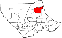 |
| Clinton Township Clinton Township, Lycoming County, Pennsylvania Clinton Township is a township in Lycoming County, Pennsylvania, in the United States. The population was 3,947 at the 2000 census. It is part of the Williamsport, Pennsylvania Metropolitan Statistical Area.-History:... |
Named for DeWitt Clinton DeWitt Clinton DeWitt Clinton was an early American politician and naturalist who served as United States Senator and the sixth Governor of New York. In this last capacity he was largely responsible for the construction of the Erie Canal... , governor of New York New York New York is a state in the Northeastern region of the United States. It is the nation's third most populous state. New York is bordered by New Jersey and Pennsylvania to the south, and by Connecticut, Massachusetts and Vermont to the east... (1817 - 1822, 1824 - 1828) |
1825 | 1825 | Washington Township Washington Township, Lycoming County, Pennsylvania Washington Township is a township in Lycoming County, Pennsylvania, in the United States. The population was 1,613 at the 2000 census. It is part of the Williamsport, Pennsylvania Metropolitan Statistical Area.-History:... |
sq mi (74.5 km²) |
3,947 | |
| Cogan House Township | Named for David Cogan, a pioneer who settled on Larrys Creek Larrys Creek Larrys Creek is a tributary of the West Branch Susquehanna River in Lycoming County in the U.S. state of Pennsylvania. A part of the Chesapeake Bay drainage basin, its watershed drains in six townships and a borough... in 1825; includes the villages of Beech Grove, Brookside, Cogan House, and White Pine |
1825 | 1843 | Jackson Jackson Township, Lycoming County, Pennsylvania Jackson Township is a township located in northern Lycoming County, Pennsylvania in the United States. The population was 414 at the 2000 census. It is part of the Williamsport, Pennsylvania Metropolitan Statistical Area.... and Mifflin Township Mifflin Township, Lycoming County, Pennsylvania Mifflin Township is a township in Lycoming County, Pennsylvania, in the United States. The population was 1,145 at the 2000 census. It is part of the Williamsport, Pennsylvania Metropolitan Statistical Area.- History :... s |
sq mi (181.1 km²) |
974 | 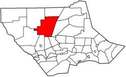 |
| Cummings Township Cummings Township, Lycoming County, Pennsylvania Cummings Township is a township in Lycoming County, Pennsylvania, in the United States. The population was 355 at the 2000 census. It is part of the Williamsport, Pennsylvania Metropolitan Statistical Area... |
Named for John Cummings, an associate on the bench; includes the village of Waterville, as well as two state parks: Little Pine Little Pine State Park Little Pine State Park is a Pennsylvania state park on in Cummings Township, Lycoming County, Pennsylvania in the United States. Little Pine State park is along of Little Pine Creek, a tributary of Pine Creek, in the midst of the Tiadaghton State Forest. A dam on the creek has created a lake... and Upper Pine Bottom Upper Pine Bottom State Park Upper Pine Bottom State Park is a Pennsylvania state park in Lycoming County, Pennsylvania in the United States. The park is in Cummings Township on Pennsylvania Route 44 and is surrounded by the Tiadaghton State Forest. It is on Upper Pine Bottom Run, which gave the park its name and is a... |
1784 | 1832 | Mifflin Mifflin Township, Lycoming County, Pennsylvania Mifflin Township is a township in Lycoming County, Pennsylvania, in the United States. The population was 1,145 at the 2000 census. It is part of the Williamsport, Pennsylvania Metropolitan Statistical Area.- History :... and Brown Township Brown Township, Lycoming County, Pennsylvania Brown Township is a township in Lycoming County, Pennsylvania, in the United States. The population was 111 at the 2000 census. It is part of the Williamsport, Pennsylvania Metropolitan Statistical Area.-History:... s |
sq mi (179.7 km²) |
355 | |
| Eldred Township Eldred Township, Lycoming County, Pennsylvania Eldred Township is a township in Lycoming County, Pennsylvania, in the United States. The population was 2,178 at the 2000 census. It is part of the Williamsport, Pennsylvania Metropolitan Statistical Area. The unincorporated village of Warrensville is located in Eldred Township.-Formation and... |
Named for C. D. Eldred, an associate on the bench; includes the village of Warrensville | 1802 | 1858 | Hepburn Township | sq mi (37.1 km²) |
2,178 | |
| Fairfield Township Fairfield Township, Lycoming County, Pennsylvania Fairfield Township is a township in Lycoming County, Pennsylvania, in the United States. The population was 2,659 at the 2000 census. It is part of the Williamsport, Pennsylvania Metropolitan Statistical Area.-History:... |
Named for "beautiful rolling land of the fertile river bottom" | 1742 | 1825-1826 | Muncy Township | sq mi (30.4 km²) |
2,659 | 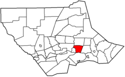 |
| Franklin Township Franklin Township, Lycoming County, Pennsylvania Franklin Township is a township in Lycoming County, Pennsylvania, in the United States. The population was 915 at the 2000 census. It is part of the Williamsport, Pennsylvania Metropolitan Statistical Area.-History:... |
Named for Benjamin Franklin Benjamin Franklin Dr. Benjamin Franklin was one of the Founding Fathers of the United States. A noted polymath, Franklin was a leading author, printer, political theorist, politician, postmaster, scientist, musician, inventor, satirist, civic activist, statesman, and diplomat... ; includes the village of Lairdsville |
1795 | 1822 | Moreland Township | sq mi (63.4 km²) |
915 | |
| Gamble Township | Named for James Gamble, the judge who authorized the election that led to its creation; includes the village of Calvert and Rose Valley Lake Rose Valley Lake (Pennsylvania) Rose Valley Lake is a reservoir that covers in Gamble Township, Lycoming County, Pennsylvania, in the United States. The fish and waters of the lake are managed by the Pennsylvania Fish and Boat Commission. The lake is owned by the Commonwealth of Pennsylvania. The primary use of Rose Valley Lake... |
1784 | 1875 | Lewis Lewis Township, Lycoming County, Pennsylvania Lewis Township is a township in Lycoming County, Pennsylvania, in the United States. The population was 1,139 at the 2000 census. It is part of the Williamsport, Pennsylvania Metropolitan Statistical Area.-History:... and Cascade Townships |
sq mi (119.5 km²) |
854 | 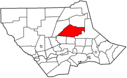 |
| Hepburn Township | Named for William Hepburn, a founding father of Williamsport and Lycoming County; includes the villages of Cogan Station (also in Lycoming Township) and Hepburnville | 1784 | 1804 | Loyalsock Township | sq mi (43.1 km²) |
2,836 | 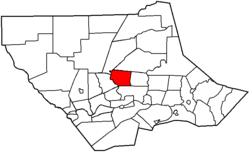 |
| Jackson Township Jackson Township, Lycoming County, Pennsylvania Jackson Township is a township located in northern Lycoming County, Pennsylvania in the United States. The population was 414 at the 2000 census. It is part of the Williamsport, Pennsylvania Metropolitan Statistical Area.... |
Named for Andrew Jackson Andrew Jackson Andrew Jackson was the seventh President of the United States . Based in frontier Tennessee, Jackson was a politician and army general who defeated the Creek Indians at the Battle of Horseshoe Bend , and the British at the Battle of New Orleans... (prior to his presidency); includes the village of Buttonwood |
1811 | 1824 | Lycoming Township | sq mi (92.2 km²) |
414 | 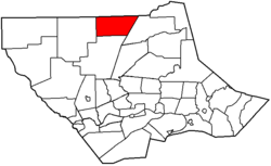 |
| Jordan Township Jordan Township, Lycoming County, Pennsylvania Jordan Township is a township in Lycoming County, Pennsylvania, in the United States. The population was 878 at the 2000 census. It is part of the Williamsport, Pennsylvania Metropolitan Statistical Area.-History:... |
Named for Alexander Jordan, president judge of the district court when formed; includes the villages of Lungerville and Unityville | 1812 | 1854 | Franklin Township Franklin Township, Lycoming County, Pennsylvania Franklin Township is a township in Lycoming County, Pennsylvania, in the United States. The population was 915 at the 2000 census. It is part of the Williamsport, Pennsylvania Metropolitan Statistical Area.-History:... |
sq mi (53.6 km²) |
878 |  |
| Lewis Township Lewis Township, Lycoming County, Pennsylvania Lewis Township is a township in Lycoming County, Pennsylvania, in the United States. The population was 1,139 at the 2000 census. It is part of the Williamsport, Pennsylvania Metropolitan Statistical Area.-History:... |
Named for Ellis Lewis, president judge of the district court when formed; includes the villages of Bodines, Field Station, and Trout Run | 1812 | 1835 | Hepburn Township | sq mi (98.0 km²) |
1,139 | |
| Limestone Township Limestone Township, Lycoming County, Pennsylvania Limestone Township is a township in Lycoming County, Pennsylvania, in the United States. The population was 2,136 at the 2000 census. It is part of the Williamsport, Pennsylvania Metropolitan Statistical Area.-History:... |
Named for its abundant limestone Limestone Limestone is a sedimentary rock composed largely of the minerals calcite and aragonite, which are different crystal forms of calcium carbonate . Many limestones are composed from skeletal fragments of marine organisms such as coral or foraminifera.... , originally known as "Adams Township" for John Adams John Adams John Adams was an American lawyer, statesman, diplomat and political theorist. A leading champion of independence in 1776, he was the second President of the United States... (name changed 1835); includes the villages of Collomsville, Oriole, and Oval |
1789 | 1824 | Nippenose and Wayne Townships Wayne Township, Clinton County, Pennsylvania Wayne Township is a township located in Clinton County, Pennsylvania. As of the 2000 census, the township had a total population of 1,363.- Geography :... |
sq mi (88.5 km²) |
2,136 | 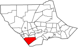 |
| Loyalsock Township | Named for Loyalsock Creek Loyalsock Creek Loyalsock Creek is a tributary of the West Branch Susquehanna River located chiefly in Sullivan and Lycoming counties in Pennsylvania in the United States... ; second most populous municipality in the county |
1768 | 1786 | Muncy Township | sq mi (55.0 km²) |
10,876 | |
| Lycoming Township | Named for Lycoming Creek Lycoming Creek Lycoming Creek is a tributary of the West Branch Susquehanna River located in Tioga and Lycoming counties in Pennsylvania in the United States.-Geography:... ; includes the villages of Cogan Station (also in Hepburn Township) and Quiggleville |
1773 | 1858 | Old Lycoming Township | sq mi (39.8 km²) |
1,606 | 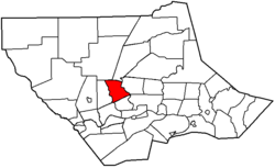 |
| McHenry Township | Named for Alexander H. McHenry, a Jersey Shore surveyor; includes the villages of Cammal, Haneyville, Jersey Mills, and Okome | 1785 | 1861 | Brown Brown Township, Lycoming County, Pennsylvania Brown Township is a township in Lycoming County, Pennsylvania, in the United States. The population was 111 at the 2000 census. It is part of the Williamsport, Pennsylvania Metropolitan Statistical Area.-History:... and Cummings Townships Cummings Township, Lycoming County, Pennsylvania Cummings Township is a township in Lycoming County, Pennsylvania, in the United States. The population was 355 at the 2000 census. It is part of the Williamsport, Pennsylvania Metropolitan Statistical Area... |
sq mi (198.1 km²) |
145 | |
| McIntyre Township | Named for Archibald McIntyre, a founder of the Williamsport and Elmira Railroad Williamsport and Elmira Railroad The Elmira and Williamsport Railroad is a historic railroad that operated in Pennsylvania.The W&E was organized in 1832 and ran between Williamsport, Pennsylvania and Elmira, New York... ; includes the villages of Marsh Hill and Ralston |
1794 | 1848 | Lewis Township Lewis Township, Lycoming County, Pennsylvania Lewis Township is a township in Lycoming County, Pennsylvania, in the United States. The population was 1,139 at the 2000 census. It is part of the Williamsport, Pennsylvania Metropolitan Statistical Area.-History:... |
sq mi (122.4 km²) |
539 | 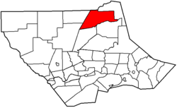 |
| McNett Township | Named for H. I. McNett, who led the drive for its formation; includes the villages of Chemung, Ellenton, Leolyn, Penbryn, and Roaring Branch | 1805 | 1878 | McIntyre Township | sq mi (87.5 km²) |
211 | 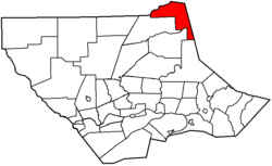 |
| Mifflin Township Mifflin Township, Lycoming County, Pennsylvania Mifflin Township is a township in Lycoming County, Pennsylvania, in the United States. The population was 1,145 at the 2000 census. It is part of the Williamsport, Pennsylvania Metropolitan Statistical Area.- History :... |
Named for Thomas Mifflin Thomas Mifflin Thomas Mifflin was an American merchant and politician from Philadelphia, Pennsylvania. He was a major general in the Continental Army during the American Revolution, a member of the Pennsylvania Provincial Assembly, a Continental Congressman from Pennsylvania, President of the Continental... , the first governor Governor A governor is a governing official, usually the executive of a non-sovereign level of government, ranking under the head of state... of Pennsylvania (1790 - 1799) |
1790 | 1803 | Old Lycoming Township | sq mi (72.2 km²) |
1,145 | |
| Mill Creek Township Mill Creek Township, Lycoming County, Pennsylvania Mill Creek Township is a township in Lycoming County, Pennsylvania, in the United States. The population was 572 at the 2000 census. It is part of the Williamsport, Pennsylvania Metropolitan Statistical Area.-History:... |
Named for Mill Creek Mill Creek (Loyalsock Creek) Mill Creek is the name of four different tributaries of Loyalsock Creek in Lycoming and Sullivan counties in Pennsylvania in the United States.There are two more streams named "Mill Creek" in the Loyalsock Creek drainage basin and one named "Mill Run".... ; includes part of the village of Huntersville (also in Wolf Township) |
1795 | 1879 | Muncy Township | sq mi (29.5 km²) |
572 | 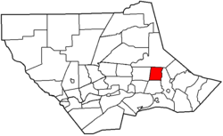 |
| Moreland Township | Named for a legend that the acres surveyed here were larger than a standard acre; includes the village of Opp | 1790 | 1813 | Muncy Creek Township | sq mi (62.0 km²) |
1,036 | |
| Muncy Township | Named for the Munsee Christian Munsee The Christian Munsee were a group of Lenape native American Indians, primarily Munsee-speaking, who converted to Christianity, following the teachings of the Moravian missionaries... phratry Phratry In ancient Greece, a phratry ατρία, "brotherhood", "kinfolk", derived from φρατήρ meaning "brother") was a social division of the Greek tribe... of the Lenape Lenape The Lenape are an Algonquian group of Native Americans of the Northeastern Woodlands. They are also called Delaware Indians. As a result of the American Revolutionary War and later Indian removals from the eastern United States, today the main groups live in Canada, where they are enrolled in the... ; as it is older than Lycoming County, it is often called the "Mother Township"; includes the village of Pennsdale |
1772 | 1772 | One of the seven original townships of Northumberland County Northumberland County, Pennsylvania There were 38,835 households out of which 27.30% had children under the age of 18 living with them, 52.40% were married couples living together, 9.60% had a female householder with no husband present, and 34.10% were non-families. 30.20% of all households were made up of individuals and 15.50% had... |
sq mi (40.8 km²) |
1,059 | |
| Muncy Creek Township | Named for Muncy Creek Muncy Creek Muncy Creek is a tributary of the West Branch Susquehanna River in Lycoming and Sullivan counties, Pennsylvania, USA. Little Muncy Creek is its major tributary.-Course:The creek is long. For much of its length, U.S. Route 220 runs parallel to Muncy Creek.... ; includes the village of Clarkstown |
1773 | 1797 | Muncy Township | sq mi (53.7 km²) |
3,487 | 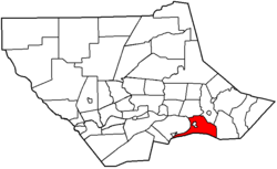 |
| Nippenose Township | Named for the Indian phrase, "Nippeno-wi", meaning a warm and genial summer like place; includes the village of Antes Fort, which was named for Fort Antes Fort Antes Fort Antes was a stockade surrounding the home of Colonel John Henry Antes, built circa 1778 in Revolutionary Pennsylvania in the United States. The fort was built under the direction of Colonel Antes, who was a member of the Pennsylvania militia... (abandoned during the Big Runaway Big Runaway The Big Runaway occurred in 1778, during the American Revolutionary War, when settlements throughout the West Branch Susquehanna Valley in Pennsylvania in what became the United States were attacked by Loyalists and Native Americans allied with the British... ) |
1769 | 1786 | Bald Eagle Township | sq mi (29.1 km²) |
729 | |
| Old Lycoming Township | Named indirectly for Lycoming Creek Lycoming Creek Lycoming Creek is a tributary of the West Branch Susquehanna River located in Tioga and Lycoming counties in Pennsylvania in the United States.-Geography:... , it was originally part of Lycoming Township, the name was changed in 1858 when the township was divided; includes the census-designated place Census-designated place A census-designated place is a concentration of population identified by the United States Census Bureau for statistical purposes. CDPs are delineated for each decennial census as the statistical counterparts of incorporated places such as cities, towns and villages... of Garden View |
1773 | 1785 | Iroquois land purchased Treaty of Fort Stanwix The Treaty of Fort Stanwix was an important treaty between North American Indians and the British Empire. It was signed in 1768 at Fort Stanwix, located in present-day Rome, New York... as part of Northumberland County Northumberland County, Pennsylvania There were 38,835 households out of which 27.30% had children under the age of 18 living with them, 52.40% were married couples living together, 9.60% had a female householder with no husband present, and 34.10% were non-families. 30.20% of all households were made up of individuals and 15.50% had... , before this was run by the Fair Play Men Fair Play Men The Fair Play Men were illegal settlers who established their own system of self-rule from 1773 to 1785 in the West Branch Susquehanna River valley of Pennsylvania in what is now the United States. Because they settled in territory claimed by Native Americans, they had no recourse to the... |
sq mi (24.6 km²) |
5,508 | 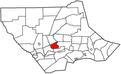 |
| Penn Township Penn Township, Lycoming County, Pennsylvania Penn Township is a township in Lycoming County, Pennsylvania, in the United States. The population was 900 at the 2000 census. It is part of the Williamsport, Pennsylvania Metropolitan Statistical Area.-History:... |
Named for Penn Township Penn Township, Berks County, Pennsylvania Penn Township is a township in Berks County, Pennsylvania, United States. The population was 1,993 at the 2000 census.-Geography:According to the United States Census Bureau, the township has a total area of 19.1 square miles , of which, 18.6 square miles of it is land and... , Berks County Berks County, Pennsylvania -Demographics:As of the census of 2000, there were 373,638 people, 141,570 households, and 98,532 families residing in the county. The population density was 435 people per square mile . There were 150,222 housing units at an average density of 175 per square mile... ; includes part of the village of Glen Mawr (also in Shrewsbury Township) |
1774 | 1828 | Muncy Township | sq mi (69.2 km²) |
900 | |
| Piatt Township | Named for William Piatt, an associate county judge when it was created; includes the village of Larryville | 1769 | 1858 | Mifflin Township Mifflin Township, Lycoming County, Pennsylvania Mifflin Township is a township in Lycoming County, Pennsylvania, in the United States. The population was 1,145 at the 2000 census. It is part of the Williamsport, Pennsylvania Metropolitan Statistical Area.- History :... |
sq mi (26.3 km²) |
1,259 | 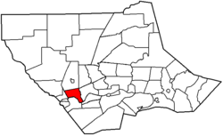 |
| Pine Township Pine Township, Lycoming County, Pennsylvania Pine Township is a township in Lycoming County, Pennsylvania, in the United States. The population was 329 at the 2000 census. It is part of the Williamsport, Pennsylvania Metropolitan Statistical Area.-History:... |
Named for its vast stands of pine trees; includes the villages of English Center and Oregon Hill | 1806 | 1856 | Brown Brown Township, Lycoming County, Pennsylvania Brown Township is a township in Lycoming County, Pennsylvania, in the United States. The population was 111 at the 2000 census. It is part of the Williamsport, Pennsylvania Metropolitan Statistical Area.-History:... , Cummings Cummings Township, Lycoming County, Pennsylvania Cummings Township is a township in Lycoming County, Pennsylvania, in the United States. The population was 355 at the 2000 census. It is part of the Williamsport, Pennsylvania Metropolitan Statistical Area... and Cogan House Townships |
sq mi (196.3 km²) |
329 | 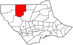 |
| Plunketts Creek Township | Named for Plunketts Creek Plunketts Creek (Loyalsock Creek) Plunketts Creek is an approximately tributary of Loyalsock Creek in Lycoming and Sullivan counties in the U.S. state of Pennsylvania. Two unincorporated villages and a hamlet are on the creek, and its watershed drains in parts of five townships... ; includes the villages of Barbours and Proctor |
1776 | 1838 | Franklin Township Franklin Township, Lycoming County, Pennsylvania Franklin Township is a township in Lycoming County, Pennsylvania, in the United States. The population was 915 at the 2000 census. It is part of the Williamsport, Pennsylvania Metropolitan Statistical Area.-History:... and Davidson Township now part of Sullivan County Sullivan County, Pennsylvania Sullivan County is a county located in the U.S. state of Pennsylvania. As of 2010, the population is 6,428. Sullivan County was created on March 15, 1847, from part of Lycoming County and named for Charles Sullivan, leader of the Pennsylvania Senate... |
sq mi (143.1 km²) |
771 | |
| Porter Township Porter Township, Lycoming County, Pennsylvania Porter Township is a township in Lycoming County, Pennsylvania, in the United States. The population was 1,633 at the 2000 census. It is part of the Williamsport, Pennsylvania Metropolitan Statistical Area.-History:Porter Township, named for David R... |
Named for David R. Porter David R. Porter David Rittenhouse Porter was the ninth Governor of Pennsylvania. He served from 1839 to 1845.-Life:Porter, the first governor under the State Constitution of 1838 was born October 31, 1788, near Norristown, Montgomery County, Pennsylvania spending his boyhood at Selma Mansion, a home built by his... , Pennsylvania governor Governor A governor is a governing official, usually the executive of a non-sovereign level of government, ranking under the head of state... (1839-1845) |
1772 | 1840 | Mifflin Township Mifflin Township, Lycoming County, Pennsylvania Mifflin Township is a township in Lycoming County, Pennsylvania, in the United States. The population was 1,145 at the 2000 census. It is part of the Williamsport, Pennsylvania Metropolitan Statistical Area.- History :... |
sq mi (20.6 km²) |
1,633 | 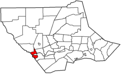 |
| Shrewsbury Township Shrewsbury Township, Lycoming County, Pennsylvania Shrewsbury Township is a township in Lycoming County, Pennsylvania, in the United States. The population was 433 at the 2000 census. It is part of the Williamsport, Pennsylvania Metropolitan Statistical Area.-History:... |
Named for Shrewsbury Township Shrewsbury Township, New Jersey Shrewsbury Township is a township in Monmouth County, New Jersey, United States. As of the 2010 United States Census, the township population was 1,141.-History:... , New Jersey New Jersey New Jersey is a state in the Northeastern and Middle Atlantic regions of the United States. , its population was 8,791,894. It is bordered on the north and east by the state of New York, on the southeast and south by the Atlantic Ocean, on the west by Pennsylvania and on the southwest by Delaware... ; includes the villages of Glen Mawr (also in Penn Township) and Tivoli |
1794 | 1804 | Muncy Township | sq mi (45.3 km²) |
433 | 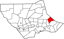 |
| Susquehanna Township Susquehanna Township, Lycoming County, Pennsylvania Susquehanna Township is a township in Lycoming County, Pennsylvania, in the United States. The population was 993 at the 2000 census. It is part of the Williamsport, Pennsylvania Metropolitan Statistical Area.-History:... |
Named for the West Branch Susquehanna River West Branch Susquehanna River The West Branch Susquehanna River is one of the two principal branches, along with the North Branch, of the Susquehanna River in the northeastern United States. The North Branch, which rises in upstate New York, is generally regarded as the extension of the main branch, with the shorter West Branch... which forms the northern boundary; includes the village of Nisbet |
1801 | 1838 | Nippenose and Armstrong Township Armstrong Township, Lycoming County, Pennsylvania Armstrong Township is a township in Lycoming County, Pennsylvania, in the United States. The population was 717 at the 2000 census. It is part of the Williamsport, Pennsylvania Metropolitan Statistical Area.-History:... s |
sq mi (20.2 km²) |
993 | 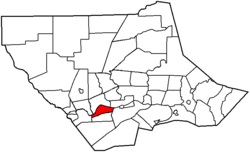 |
| Upper Fairfield Township | Originally named "Pollock Township" for local judge, name changed to Fairfield Township in 1853; includes the villages of Farragut and Loyalsockville | 1796 | 1851 | Fairfield Township Fairfield Township, Lycoming County, Pennsylvania Fairfield Township is a township in Lycoming County, Pennsylvania, in the United States. The population was 2,659 at the 2000 census. It is part of the Williamsport, Pennsylvania Metropolitan Statistical Area.-History:... |
sq mi (47.2 km²) |
1,854 | |
| Washington Township Washington Township, Lycoming County, Pennsylvania Washington Township is a township in Lycoming County, Pennsylvania, in the United States. The population was 1,613 at the 2000 census. It is part of the Williamsport, Pennsylvania Metropolitan Statistical Area.-History:... |
Named for George Washington George Washington George Washington was the dominant military and political leader of the new United States of America from 1775 to 1799. He led the American victory over Great Britain in the American Revolutionary War as commander-in-chief of the Continental Army from 1775 to 1783, and presided over the writing of... ; includes the village of Elimsport |
1760 | 1785 | Bald Eagle Township | sq mi (125.7 km²) |
1,613 | 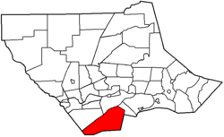 |
| Watson Township Watson Township, Lycoming County, Pennsylvania Watson Township is a township in Lycoming County, Pennsylvania, in the United States. The population was 550 at the 2000 census. It is part of the Williamsport, Pennsylvania Metropolitan Statistical Area.-History:... |
Named for Oliver Watson, president of a bank Bank A bank is a financial institution that serves as a financial intermediary. The term "bank" may refer to one of several related types of entities:... in Williamsport Williamsport, Pennsylvania Williamsport is a city in and the county seat of Lycoming County, Pennsylvania in the United States. In 2009, the population was estimated at 29,304... ; includes the village of Tombs Run |
1784 | 1845 | Porter Porter Township, Lycoming County, Pennsylvania Porter Township is a township in Lycoming County, Pennsylvania, in the United States. The population was 1,633 at the 2000 census. It is part of the Williamsport, Pennsylvania Metropolitan Statistical Area.-History:Porter Township, named for David R... and Cummings Township Cummings Township, Lycoming County, Pennsylvania Cummings Township is a township in Lycoming County, Pennsylvania, in the United States. The population was 355 at the 2000 census. It is part of the Williamsport, Pennsylvania Metropolitan Statistical Area... s |
sq mi (61.0 km²) |
550 | |
| Wolf Township | Named for George Wolf George Wolf George Wolf was the seventh Governor of Pennsylvania from 1829 to 1835.Wolf was born in Allen Township, Pennsylvania. He studied law, was admitted to the bar in 1799 and commenced practice in Easton, Pennsylvania. He served as postmaster of Easton in 1802 and 1803... , governor Governor A governor is a governing official, usually the executive of a non-sovereign level of government, ranking under the head of state... of Pennsylvania (1829 - 1835); |
1777 | 1834 | Muncy Township | sq mi (50.7 km²) |
2,707 | |
| Woodward Township Woodward Township, Lycoming County, Pennsylvania Woodward Township is a township in Lycoming County, Pennsylvania, in the United States. The population was 2,397 at the 2000 census. It is part of the Williamsport, Pennsylvania Metropolitan Statistical Area.-History:... |
Named for Apollos Woodward, an associate judge; includes the village of Huntersville (also in Mill Creek Township) | 1772 | 1855 | Anthony Township Anthony Township, Lycoming County, Pennsylvania Anthony Township is a township in Lycoming County, Pennsylvania, in the United States. The population was 904 at the 2000 census. It is part of the Williamsport, Pennsylvania Metropolitan Statistical Area.-History:... |
sq mi (35.3 km²) |
2,397 | 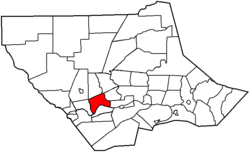 |
| Garden View Garden View, Pennsylvania Garden View is a census-designated place in Lycoming County, Pennsylvania, United States. The population was 2,679 at the 2000 census. It is part of the Williamsport, Pennsylvania Metropolitan Statistical Area.-Geography:... , (census-designated place Census-designated place A census-designated place is a concentration of population identified by the United States Census Bureau for statistical purposes. CDPs are delineated for each decennial census as the statistical counterparts of incorporated places such as cities, towns and villages... ) |
Not a municipality, just a part of Old Lycoming Township | sq mi (2.7 km²) |
2,679 | ||||
Former townships
The territory which today makes up Lycoming County was purchased from the IroquoisIroquois
The Iroquois , also known as the Haudenosaunee or the "People of the Longhouse", are an association of several tribes of indigenous people of North America...
in two treaties signed at Fort Stanwix
Fort Stanwix
Fort Stanwix was a colonial fort whose construction was started on August 26, 1758, by British General John Stanwix, at the location of present-day Rome, New York, but was not completed until about 1762. The fort guarded a portage known as the Oneida Carrying Place during the French and Indian War...
in New York: the first treaty
Treaty of Fort Stanwix
The Treaty of Fort Stanwix was an important treaty between North American Indians and the British Empire. It was signed in 1768 at Fort Stanwix, located in present-day Rome, New York...
was in 1768, and the second treaty
Treaty of Fort Stanwix (1784)
The Treaty of Fort Stanwix was a treaty signed in October 1784 at Fort Stanwix, located in present-day Rome, New York, between the United States and Native Americans...
was in 1784. The county was formed on April 13, 1795 from part of Northumberland County
Northumberland County, Pennsylvania
There were 38,835 households out of which 27.30% had children under the age of 18 living with them, 52.40% were married couples living together, 9.60% had a female householder with no husband present, and 34.10% were non-families. 30.20% of all households were made up of individuals and 15.50% had...
. The county originally contained seven townships when formed: Lower Bald Eagle, Loyalsock, Lycoming, Muncy, Nippenose, Pine Creek, and Washington. Today Pine Creek is part of Clinton County and Lower Bald Eagle is part of both Centre and Clinton counties, but the rest are still in Lycoming County, although many other municipalities have been formed from these since.
When originally formed in 1795, Lycoming County was "roughly estimated at about 12,000 square miles" (31,000 km2). Its territory stretched north to the New York
New York
New York is a state in the Northeastern region of the United States. It is the nation's third most populous state. New York is bordered by New Jersey and Pennsylvania to the south, and by Connecticut, Massachusetts and Vermont to the east...
state line, west to the Allegheny River
Allegheny River
The Allegheny River is a principal tributary of the Ohio River; it is located in the Eastern United States. The Allegheny River joins with the Monongahela River to form the Ohio River at the "Point" of Point State Park in Downtown Pittsburgh, Pennsylvania...
, south nearly to the source of the West Branch Susquehanna River
West Branch Susquehanna River
The West Branch Susquehanna River is one of the two principal branches, along with the North Branch, of the Susquehanna River in the northeastern United States. The North Branch, which rises in upstate New York, is generally regarded as the extension of the main branch, with the shorter West Branch...
, and east to include modern Sullivan County and a bit beyond. However by 1800, just five years after its formation, the first territory was taken from it to form new counties, a process that continued until 1847.
Twenty other Pennsylvania counties today contain land that was once part of Lycoming County: five were formed completely from it (Jefferson
Jefferson County, Pennsylvania
Jefferson County is a county located in the U.S. state of Pennsylvania. In 2010, its population was 45,200. It was established on March 26, 1804, from part of Lycoming County and named for then-President Thomas Jefferson. Its county seat is Brookville...
, McKean
McKean County, Pennsylvania
As of the census of 2000, there were 45,936 people, 18,024 households, and 12,094 families residing in the county. The population density was 47 people per square mile . There were 21,644 housing units at an average density of 22 per square mile...
, Potter
Potter County, Pennsylvania
Potter County is a county located in the U.S. state of Pennsylvania. It is in the Allegheny Plateau region. As of 2010, the population was 17,457. Its county seat is Coudersport. Potter County was named after James Potter, who was a general from Pennsylvania in the Continental Army during the...
, Tioga
Tioga County, Pennsylvania
Tioga County is a county located in the U.S. state of Pennsylvania. As of the 2010 census, the population was 41,981. Tioga County was created on March 26, 1804, from part of Lycoming County and named for the Tioga River. Its county seat is Wellsboro....
, and Sullivan
Sullivan County, Pennsylvania
Sullivan County is a county located in the U.S. state of Pennsylvania. As of 2010, the population is 6,428. Sullivan County was created on March 15, 1847, from part of Lycoming County and named for Charles Sullivan, leader of the Pennsylvania Senate...
), eight were formed from it and other counties (Armstrong
Armstrong County, Pennsylvania
Armstrong County is a county located in the U.S. state of Pennsylvania. As of the 2010 census, the population was 68,941. It is located northeast of Pittsburgh and Allegheny County. Armstrong County was added to the Pittsburgh Metropolitan Statistical Area in 2003.The county seat is Kittanning...
, Bradford
Bradford County, Pennsylvania
-Demographics:As of the census of 2000, there were 62,761 people, 24,453 households, and 17,312 families residing in the county. The population density was 54 people per square mile . There were 28,664 housing units at an average density of 25 per square mile...
, Centre
Centre County, Pennsylvania
Centre County is a county located in the U.S. state of Pennsylvania. It is part of the State College, Pennsylvania Metropolitan Statistical Area. As of 2010, the population was 153,990....
, Clearfield
Clearfield County, Pennsylvania
Clearfield County is a county located in the U.S. state of Pennsylvania. As of 2010, the population was 81,642.Clearfield County was created on March 26, 1804, from parts of Huntingdon and Lycoming Counties but was administered as part of Centre County until 1812...
, Clinton
Clinton County, Pennsylvania
As of the census of 2000, there were 37,914 people, 14,773 households, and 9,927 families residing in the county. The population density was 43 people per square mile . There were 18,166 housing units at an average density of 20 per square mile...
, Indiana
Indiana County, Pennsylvania
-Government and politics:As of November 2008, there are 58,077 registered voters in Indiana County .* Democratic: 26,653 * Republican: 24,159 * Other Parties: 7,265 -County commissioners:*Rodney Ruddock, Chairman, Republican...
, Venango
Venango County, Pennsylvania
Venango County is a county located in the U.S. state of Pennsylvania. As of the 2010 census, the population was 54,984. Its county seat is Franklin.-History:Venango County was created on March 12, 1800 from parts of Allegheny and Lycoming Counties...
, and Warren
Warren County, Pennsylvania
Warren County is a county located in the U.S. state of Pennsylvania. As of 2010, the population was 41,815. It was formed in 1800 from parts of Allegheny and Lycoming counties; attached to Crawford County until 1805 and then to Venango County until Warren was formally organized in 1819. Its county...
), three were formed from counties that were themselves formed partly from it (Cameron
Cameron County, Pennsylvania
As of the census of 2000, there were 5,974 people, 2,465 households, and 1,624 families residing in the county. The population density was 15 people per square mile . There were 4,592 housing units at an average density of 12 per square mile...
, Clarion
Clarion County, Pennsylvania
As of the census of 2000, there were 41,765 people, 16,052 households, and 10,738 families residing in the county. The population density was 69 people per square mile . There were 19,426 housing units at an average density of 32 per square mile...
, and Elk
Elk County, Pennsylvania
Elk County is a county located in the U.S. state of Pennsylvania. As of the 2010 census, the population was 31,946.Elk County was created on April 18, 1843, from parts of Jefferson, Clearfield and McKean Counties, and is named for the Eastern elk that historically inhabited the region. Its county...
), Forest
Forest County, Pennsylvania
Forest County is a county located in the U.S. state of Pennsylvania. As of 2010, the population is 7,716. Forest County is famous as a rural retreat. Nearly 75% of all dwellings in the county are second or vacation homes . Forest County does not have a single traffic light, the only county in the...
was formed from a county that was formed completely from it, two (Luzerne
Luzerne County, Pennsylvania
- Demographics :As of the 2010 census, the county was 90.7% White, 3.4% Black or African American, 0.2% Native American, 1.0% Asian, 3.3% were of some other race, and 1.5% were two or more races. 6.7% of the population was of Hispanic or Latino ancestry...
and Wyoming
Wyoming County, Pennsylvania
Wyoming County is a county located in the U.S. state of Pennsylvania. It was created in 1842 from part of Luzerne County. Its county seat is Tunkhannock.-Geography:According to the U.S...
) contain territory that was part of lycoming County in 1795, and finally Union
Union County, Pennsylvania
-Demographics:As of the census of 2000, there were 41,624 people, 13,178 households, and 9,211 families residing in the county. The population density was 131 people per square mile . There were 14,684 housing units at an average density of 46 per square mile...
received a township from it in 1861.
The second table lists each of the twenty two known former incorporated areas in the county, and information on the modern township successors of these today. Note that former townships are only known for nine of the twenty counties containing land from Lycoming.
| Municipality (type) |
Remarks | Settled | Incorporated | Area in square miles (km²) | Population as of 2000 |
Map |
|---|---|---|---|---|---|---|
| Allison Township | Now in Clinton County Clinton County, Pennsylvania As of the census of 2000, there were 37,914 people, 14,773 households, and 9,927 families residing in the county. The population density was 43 people per square mile . There were 18,166 housing units at an average density of 20 per square mile... , incorporated as part of Lycoming County |
? | before 1839 | mi2 (5.2 km2) |
198 |  |
| Brady Township Gregg Township, Union County, Pennsylvania Gregg Township is a township in Union County, Pennsylvania, United States. The population was 4,687 at the 2000 census, .-History:Gregg Township, named for U.S... (now Gregg Township) |
Now in Union County Union County, Pennsylvania -Demographics:As of the census of 2000, there were 41,624 people, 13,178 households, and 9,211 families residing in the county. The population density was 131 people per square mile . There were 14,684 housing units at an average density of 46 per square mile... , incorporated as part of Lycoming County |
1798 | 1798 | mi² (39.2 km²) |
4,687 | |
| Ceres Township | Now in McKean County McKean County, Pennsylvania As of the census of 2000, there were 45,936 people, 18,024 households, and 12,094 families residing in the county. The population density was 47 people per square mile . There were 21,644 housing units at an average density of 22 per square mile... , incorporated as part of Lycoming County |
1798 | 1798 | mi2 (105.4 km2) |
1,003 | |
| Chapman Township Chapman Township, Clinton County, Pennsylvania -References:... |
Now in Clinton County Clinton County, Pennsylvania As of the census of 2000, there were 37,914 people, 14,773 households, and 9,927 families residing in the county. The population density was 43 people per square mile . There were 18,166 housing units at an average density of 20 per square mile... , incorporated as part of Lycoming County |
1780 | before 1839 | mi² (258.7 km²) |
848 | 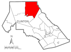 |
| Cherry Township Cherry Township, Sullivan County, Pennsylvania Cherry Township is a township in Sullivan County, Pennsylvania, United States. The population was 1,718 at the 2000 census.-Geography:According to the United States Census Bureau, the township has a total area of , of which, of it is land and of it is water.Cherry Township is bordered by... |
Now in Sullivan County Sullivan County, Pennsylvania Sullivan County is a county located in the U.S. state of Pennsylvania. As of 2010, the population is 6,428. Sullivan County was created on March 15, 1847, from part of Lycoming County and named for Charles Sullivan, leader of the Pennsylvania Senate... , incorporated as part of Lycoming County |
1816 | 1824 | mi2 (149.8 km2) |
1,718 |  |
| Colebrook Township | Now in Clinton County Clinton County, Pennsylvania As of the census of 2000, there were 37,914 people, 14,773 households, and 9,927 families residing in the county. The population density was 43 people per square mile . There were 18,166 housing units at an average density of 20 per square mile... , incorporated as part of Lycoming County |
1777 | before 1839 | mi² (48.4 km²) |
179 | |
| Davidson Township | Now in Sullivan County Sullivan County, Pennsylvania Sullivan County is a county located in the U.S. state of Pennsylvania. As of 2010, the population is 6,428. Sullivan County was created on March 15, 1847, from part of Lycoming County and named for Charles Sullivan, leader of the Pennsylvania Senate... , incorporated as part of Lycoming County |
1806 | 1833 | mi² (202.3 km²) |
626 | 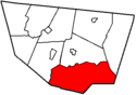 |
| Dunnstable Township | Now in Clinton County Clinton County, Pennsylvania As of the census of 2000, there were 37,914 people, 14,773 households, and 9,927 families residing in the county. The population density was 43 people per square mile . There were 18,166 housing units at an average density of 20 per square mile... , incorporated as part of Lycoming County |
1785 | before 1810 | mi2 (24.8 km2) |
993 | |
| Elkland Township | Now in Sullivan County Sullivan County, Pennsylvania Sullivan County is a county located in the U.S. state of Pennsylvania. As of 2010, the population is 6,428. Sullivan County was created on March 15, 1847, from part of Lycoming County and named for Charles Sullivan, leader of the Pennsylvania Senate... , incorporated as part of Lycoming County |
1798 | 1804 | mi² (100.2 km²) |
607 | 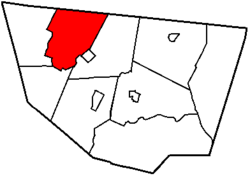 |
| Forks Township Forks Township, Sullivan County, Pennsylvania Forks Township is a township in Sullivan County, Pennsylvania, USA. The population was 407 at the 2000 census.-Geography:According to the United States Census Bureau, the township has a total area of , of which, of it is land and of it is water.... |
Now in Sullivan County Sullivan County, Pennsylvania Sullivan County is a county located in the U.S. state of Pennsylvania. As of 2010, the population is 6,428. Sullivan County was created on March 15, 1847, from part of Lycoming County and named for Charles Sullivan, leader of the Pennsylvania Senate... , incorporated as part of Lycoming County |
1794 | 1833 | mi² (113.7 km²) |
407 | 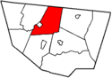 |
| Fox Township Fox Township, Sullivan County, Pennsylvania Fox Township is a township in Sullivan County, Pennsylvania, United States. The population was 332 at the 2000 census.-Geography:According to the United States Census Bureau, the township has a total area of , of which, of it is land and of it is water.Fox Township is bordered by Bradford County... |
Now in Sullivan County Sullivan County, Pennsylvania Sullivan County is a county located in the U.S. state of Pennsylvania. As of 2010, the population is 6,428. Sullivan County was created on March 15, 1847, from part of Lycoming County and named for Charles Sullivan, leader of the Pennsylvania Senate... , incorporated as part of Lycoming County |
1800 | 1839 | mi² (100.0 km²) |
332 | 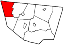 |
| Grove Township | Now in Cameron County Cameron County, Pennsylvania As of the census of 2000, there were 5,974 people, 2,465 households, and 1,624 families residing in the county. The population density was 15 people per square mile . There were 4,592 housing units at an average density of 12 per square mile... , incorporated as part of Lycoming County, then one of twelve original townships in Clinton County (1839), then one of four original townships in Cameron (1860) |
1811 | before 1839 | mi2 (191.6 km2) |
179 | |
| Limestone Township (now Crawford Township) | Now in Clinton County Clinton County, Pennsylvania As of the census of 2000, there were 37,914 people, 14,773 households, and 9,927 families residing in the county. The population density was 43 people per square mile . There were 18,166 housing units at an average density of 20 per square mile... , incorporated as part of Lycoming County, name changed 1841. |
1780 | 1824 | mi² (57.2 km²) |
848 | 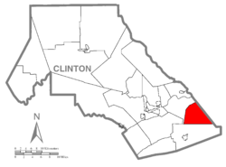 |
| Lower Bald Eagle Township (now Bald Eagle Township) | Now in Clinton Clinton County, Pennsylvania As of the census of 2000, there were 37,914 people, 14,773 households, and 9,927 families residing in the county. The population density was 43 people per square mile . There were 18,166 housing units at an average density of 20 per square mile... County, incorporated as part of Northumberland County, became part of Lycoming County in 1795 |
1772 | 1772 | mi² (107.7 km²) |
1,898 | 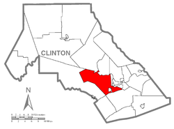 |
| Lumber Township | Now in Cameron County Cameron County, Pennsylvania As of the census of 2000, there were 5,974 people, 2,465 households, and 1,624 families residing in the county. The population density was 15 people per square mile . There were 4,592 housing units at an average density of 12 per square mile... , incorporated as part of Lycoming County, then one of twelve original townships in Clinton County (1839), then one of four original townships in Cameron (1860) |
1810 | before 1839 | mi² (133.4 km²) |
241 | 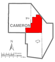 |
| Pine Creek Township Pine Creek Township, Clinton County, Pennsylvania Pine Creek Township is a township in Clinton County, Pennsylvania, United States. The population was 3,184 at the 2000 census. Pine Creek Township is named for Pine Creek which flows into the West Branch Susquehanna River at the border of the township is Lycoming County between the boroughs of Avis... |
Now in Clinton County Clinton County, Pennsylvania As of the census of 2000, there were 37,914 people, 14,773 households, and 9,927 families residing in the county. The population density was 43 people per square mile . There were 18,166 housing units at an average density of 20 per square mile... , incorporated as part of Lycoming County |
1785 | 1772 | mi² (38.6 km²) |
3,184 | |
| Pine Creek Township Pine Creek Township, Jefferson County, Pennsylvania Pine Creek Township is a township in Jefferson County, Pennsylvania, United States. The population was 1,369 at the 2000 census.-Geography:... |
Now in Jefferson County Jefferson County, Pennsylvania Jefferson County is a county located in the U.S. state of Pennsylvania. In 2010, its population was 45,200. It was established on March 26, 1804, from part of Lycoming County and named for then-President Thomas Jefferson. Its county seat is Brookville... , incorporated as part of Lycoming County |
1785 | 1772 | mi2 (73.9 km2) |
1,369 | |
| Plunketts Creek Township (now Hillsgrove Township) | Now in Sullivan County Sullivan County, Pennsylvania Sullivan County is a county located in the U.S. state of Pennsylvania. As of 2010, the population is 6,428. Sullivan County was created on March 15, 1847, from part of Lycoming County and named for Charles Sullivan, leader of the Pennsylvania Senate... , incorporated as part of Lycoming County, name changed in 1856. |
1786 | 1847 | mi2 (73.6 km2) |
265 | 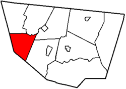 |
| Shrewsbury Township Shrewsbury Township, Sullivan County, Pennsylvania Shrewsbury Township is a township in Sullivan County, Pennsylvania, United States. The population was 328 at the 2000 census.-Geography:According to the United States Census Bureau, the township has a total area of 48.1 square miles , of which, 47.8 square miles of it is land and... |
Now in Sullivan County Sullivan County, Pennsylvania Sullivan County is a county located in the U.S. state of Pennsylvania. As of 2010, the population is 6,428. Sullivan County was created on March 15, 1847, from part of Lycoming County and named for Charles Sullivan, leader of the Pennsylvania Senate... , incorporated as part of Lycoming County |
1799 | 1803 | mi² (124.5 km²) |
328 | 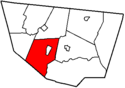 |
| Tioga Township | Now in Tioga County Tioga County, Pennsylvania Tioga County is a county located in the U.S. state of Pennsylvania. As of the 2010 census, the population was 41,981. Tioga County was created on March 26, 1804, from part of Lycoming County and named for the Tioga River. Its county seat is Wellsboro.... , incorporated as part of Lycoming County |
1792 | 1797 | mi2 (104.8 km2) |
995 | |
| Upper Bald Eagle Township Spring Township, Centre County, Pennsylvania Spring Township is a township in Centre County, Pennsylvania, United States. It is part of the State College, Pennsylvania Metropolitan Statistical Area... (now Spring Township) |
Now in Centre County Centre County, Pennsylvania Centre County is a county located in the U.S. state of Pennsylvania. It is part of the State College, Pennsylvania Metropolitan Statistical Area. As of 2010, the population was 153,990.... , incorporated as part of Northumberland County, became part of Lycoming County in 1795; Name changed in 1801 to "Spring Township" |
1772 | 1772 | mi2 (67.0 km2) |
6,117 | |
| Wayne Township Wayne Township, Clinton County, Pennsylvania Wayne Township is a township located in Clinton County, Pennsylvania. As of the 2000 census, the township had a total population of 1,363.- Geography :... |
Now in Clinton County Clinton County, Pennsylvania As of the census of 2000, there were 37,914 people, 14,773 households, and 9,927 families residing in the county. The population density was 43 people per square mile . There were 18,166 housing units at an average density of 20 per square mile... , incorporated as part of Lycoming County; named for "Mad" Anthony Wayne Anthony Wayne Anthony Wayne was a United States Army general and statesman. Wayne adopted a military career at the outset of the American Revolutionary War, where his military exploits and fiery personality quickly earned him a promotion to the rank of brigadier general and the sobriquet of Mad Anthony.-Early... |
1768 | 1798 | mi2 (59.2 km2) |
1,363 | |
Clickable map
The map shown below is clickable; click on any municipality label to be redirected to the article for that city, borough or township.See also
- History of Lycoming County, PennsylvaniaHistory of Lycoming County, Pennsylvania-Early inhabitants:The first recorded inhabitants of Lycoming County were the Iroquoian speaking Susquehannocks. Their name meant 'people of the muddy river' in Lenape. Decimated by diseases and warfare, they had died out, moved away, or been assimilated into other tribes by the early 18th century...
- List of villages in Lycoming County, Pennsylvania