
List of former Maryland state highways
Encyclopedia
The following is a list of former state highways in Maryland. They may have been renumbered or turned back to local authorities.
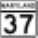
MD 37

Maryland Route 37 is the former designation for two routes:
- US 219U.S. Route 219 in MarylandU.S. Route 219 is a part of the U.S. Highway System that runs from Rich Creek, Virginia to West Seneca, New York. In the U.S. state of Maryland, the federal highway runs from the West Virginia state line near Red House to the Pennsylvania state line near Grantsville...
between the West VirginiaWest VirginiaWest Virginia is a state in the Appalachian and Southeastern regions of the United States, bordered by Virginia to the southeast, Kentucky to the southwest, Ohio to the northwest, Pennsylvania to the northeast and Maryland to the east...
state line and Interstate 68Interstate 68Interstate 68 is a Interstate highway in the U.S. states of West Virginia and Maryland, connecting in Morgantown to in Hancock. is also Corridor E of the Appalachian Development Highway System. From 1965 until the freeway's construction was completed in 1991, it was designated as...
through OaklandOakland, MarylandOakland is a town in the west-central part of Garrett County, Maryland, United States. With a population of 1,925 according to United States Census 2010 figures, it is the most populated community in Garrett County... - 0.5 miles of McDonogh Road over I-795Interstate 795 (Maryland)Interstate 795 , also known as the Northwest Expressway, is a nine-mile freeway linking Baltimore's northwestern suburbs of Pikesville, Owings Mills and Reisterstown, Maryland to the Baltimore Beltway...
and the Gwynns Falls near Owings MillsOwings Mills, MarylandOwings Mills is an unincorporated community and a census-designated place in Baltimore County, Maryland, United States. It is a suburb of Baltimore. The population was 20,193 at the 2000 census. Owings Mills is home to the northern terminus for the Baltimore Metro Subway and to Owings Mills Mall....
MD 41

The original Maryland Route 41
Maryland Route 41
Maryland Route 41 is a state highway in the U.S. state of Maryland. Known for most of its length as Perring Parkway, the state highway runs from MD 147 in Baltimore north to Waltham Woods Road in Carney. MD 41 is a four- to six-lane divided highway that connects portions of Northeast Baltimore,...
was located in Garrett County
Garrett County, Maryland
Garrett County is the westernmost county of the U.S. state of Maryland. Created from Allegany County, Maryland in 1872 it was the last Maryland county to be formed. It was named for John Work Garrett , railroad executive, industrialist, and financier. Garrett served as president of the Baltimore...
; it ran along Mountain Cove Rd. from MD 38
Maryland Route 38
Maryland Route 38 is a state highway in the U.S. state of Maryland. Known as Kitzmiller Road, the state highway runs from the West Virginia state line at the Potomac River in Kitzmiller, where the highway continues south as West Virginia Route 42 , north to MD 135 on top of Backbone Mountain...
east of Oakland
Oakland, Maryland
Oakland is a town in the west-central part of Garrett County, Maryland, United States. With a population of 1,925 according to United States Census 2010 figures, it is the most populated community in Garrett County...
to the Pennsylvania
Pennsylvania
The Commonwealth of Pennsylvania is a U.S. state that is located in the Northeastern and Mid-Atlantic regions of the United States. The state borders Delaware and Maryland to the south, West Virginia to the southwest, Ohio to the west, New York and Ontario, Canada, to the north, and New Jersey to...
state line.
MD 44

Maryland Route 44 was originally assigned to the entrance to Fort Frederick State Park
Fort Frederick State Park
Fort Frederick State Park is a Maryland state park surrounding the restored Fort Frederick, a fort from the French and Indian War and American Revolutionary War. The park is south of the town of Big Pool on the Potomac River; the Chesapeake and Ohio Canal runs through the park grounds...
in Washington County
Washington County, Maryland
Washington County is a county located in the western part of the U.S. state of Maryland, bordering southern Pennsylvania to the north, northern Virginia to the south, and the Eastern Panhandle of West Virginia to the south and west. As of the 2010 Census, its population is 147,430...
. It ran between the park entrance and MD 56
Maryland Route 56
Maryland Route 56 is a state highway in the U.S. state of Maryland. Known as Big Pool Road, the state highway runs from Interstate 70 in Big Pool east to MD 68 near Pinesburg in western Washington County. MD 56, which features a pair of one-lane bridges, provides access to Fort Frederick State...
.
MD 45

The original Maryland Route 45
Maryland Route 45
Maryland Route 45 is a state highway in the U.S. state of Maryland. Known for most of its length as York Road, the state highway runs from U.S. Route 1 in Baltimore north to the Pennsylvania state line in Maryland Line, where the highway continues as SR 3001...
ran along Water St. in Frostburg
Frostburg, Maryland
Frostburg is a city in Allegany County, Maryland, United States located at the head of the Georges Creek Valley. It is part of the Cumberland, MD-WV Metropolitan Statistical Area. The population was 7,873 at the 2000 census...
.
MD 46

Maryland Route 46 is the former designation of the segment of I-195
Interstate 195 (Maryland)
Interstate 195 is an Interstate highway in the U.S. state of Maryland. Known as Metropolitan Boulevard, the highway runs from Baltimore/Washington International Thurgood Marshall Airport in Linthicum north to I-95 in Arbutus, where Metropolitan Boulevard continues north as Maryland Route 166 ,...
between the Baltimore-Washington Parkway
Baltimore-Washington Parkway
The Baltimore–Washington Parkway is a highway in the U.S. state of Maryland, running southwest from Baltimore to Washington, D.C. The road begins at an interchange with U.S. Route 50 and Maryland Route 201 near Cheverly in Prince George's County at the D.C...
and BWI Airport
Baltimore-Washington International Thurgood Marshall Airport
Baltimore/Washington International Thurgood Marshall Airport is an international airport serving the Baltimore-Washington Metropolitan Area in the United States. It is commonly called BWI, BWI Airport or BWI Marshall, BWI being an initialism for "Baltimore/Washington International" and the...
.
MD 48

Maryland Route 48 was assigned to a sliver of a road between US 220
U.S. Route 220 in Maryland
U.S. Route 220 is a part in the U.S. Highway System that runs from Rockingham, North Carolina to Waverly, New York. In Maryland, the federal highway runs from the West Virginia state line at the Potomac River in McCoole north to the Pennsylvania state line in Dickens...
and the Pennsylvania
Pennsylvania
The Commonwealth of Pennsylvania is a U.S. state that is located in the Northeastern and Mid-Atlantic regions of the United States. The state borders Delaware and Maryland to the south, West Virginia to the southwest, Ohio to the west, New York and Ontario, Canada, to the north, and New Jersey to...
state line.
MD 52

Maryland Route 52 was assigned to Williams Rd. east of Cumberland
Cumberland, Maryland
Cumberland is a city in the far western, Appalachian portion of Maryland, United States. It is the county seat of Allegany County, and the primary city of the Cumberland, MD-WV Metropolitan Statistical Area. At the 2010 census, the city had a population of 20,859, and the metropolitan area had a...
.
MD 54

The original Maryland Route 54 was assigned to Canada Hill Rd., running between Myersville
Myersville, Maryland
Myersville is a town in Frederick County, Maryland, United States. The population was 1,382 at the 2000 census.-History:The Peter of P. Grossnickel Farm was listed on the National Register of Historic Places in 1998.-Geography:...
and Jerusalem.
MD 59

Maryland Route 59 was assigned to Holter Rd., between MD 17
Maryland Route 17
Maryland Route 17 is a state highway in the U.S. state of Maryland. The state highway begins at the Virginia state line at the Potomac River in Brunswick, where the highway continues south as Virginia State Route 287 . MD 17 runs north from the Brunswick Bridge to the Frederick–Washington...
and MD 180
Maryland Route 180
Maryland Route 180 is a state highway in the U.S. state of Maryland. Known for most of its length as Jefferson Pike, the state highway runs from U.S. Route 340 in Knoxville east to MD 351 and Interstate 70 in Frederick. MD 180 is the old alignment of US 340 through Knoxville, Petersville, and...
.
MD 61

The original Maryland Route 61
Maryland Route 61
Maryland Route 61 is an unsigned state highway in the U.S. state of Maryland. Known as Canal Parkway, the state highway begins at the West Virginia state line at the Potomac River opposite Wiley Ford, where the highway continues south as West Virginia Route 28 . The state highway runs north as...
was assigned to Old Forge Rd., east of Antietam Dr. in Washington County
Washington County, Maryland
Washington County is a county located in the western part of the U.S. state of Maryland, bordering southern Pennsylvania to the north, northern Virginia to the south, and the Eastern Panhandle of West Virginia to the south and west. As of the 2010 Census, its population is 147,430...
.
MD 69

Maryland Route 69 (deleted by 1961) was assigned to Jefferson Blvd., running from MD 59 to Alt US 40.
MD 71

Maryland Route 71 is the former designation for two routes:
- US 301U.S. Route 301 in MarylandU.S. Route 301 in Maryland is a major highway that runs from Delaware to the Governor Harry W. Nice Memorial Bridge into Virginia. It passes through three of Maryland's four main regions: the Eastern Shore, the Baltimore-Washington Metropolitan Area, and Southern Maryland...
's current routing on the Eastern ShoreEastern Shore of MarylandThe Eastern Shore of Maryland is a territorial part of the U.S. state of Maryland that lies predominately on the east side of the Chesapeake Bay and consists of nine counties. The origin of term Eastern Shore was derived to distinguish a territorial part of the State of Maryland from the Western...
; MD 71 was replaced in the 1960s - All of MD 194Maryland Route 194Maryland Route 194 is a state highway in the U.S. state of Maryland. The state highway runs from MD 26 in Ceresville north to the Pennsylvania state line near Taneytown, where the highway continues as Pennsylvania Route 194 toward Hanover...
in Frederick CountyFrederick County, MarylandFrederick County is a county located in the western part of the U.S. state of Maryland, bordering the southern border of Pennsylvania and the northeastern border of Virginia. As of the 2010 Census, the population was 233,385....
, before being changed to match PA 194Pennsylvania Route 194Pennsylvania Route 194 is a long north–south state highway located in south-central Pennsylvania. The southern end is at the Maryland State Line and the northern terminus is at the intersection with PA 74 in the town of Dillsburg.-Route description:PA 194 begins at the Maryland border in...
.
MD 72

Maryland Route 72 is the former designation for three roads: Powell Rd., Lewistown Rd., and Old Frederick Rd., between US 15
U.S. Route 15 in Maryland
U.S. Route 15 is a part of the U.S. Highway System that runs from Walterboro, South Carolina to Painted Post, New York. In Maryland, the highway runs from the Virginia state line at the Potomac River in Point of Rocks north to the Pennsylvania state line near Emmitsburg. US 15 is...
and MD 77
Maryland Route 77
Maryland Route 77 is a state highway in the U.S. state of Maryland. The state highway runs from MD 64 in Smithsburg east to MD 194 in Keymar. MD 77 is the main east–west highway of northern Frederick County...
.
MD 73

Maryland Route 73 is the former designation for two roads: Yellow Springs Rd. and Bethel Rd., north of Frederick
Frederick, Maryland
Frederick is a city in north-central Maryland. It is the county seat of Frederick County, the largest county by area in the state of Maryland. Frederick is an outlying community of the Washington-Arlington-Alexandria, DC-VA-MD-WV Metropolitan Statistical Area, which is part of a greater...
.
MD 74

Maryland Route 74 was assigned to Oppossumtown Pike north of Frederick
Frederick, Maryland
Frederick is a city in north-central Maryland. It is the county seat of Frederick County, the largest county by area in the state of Maryland. Frederick is an outlying community of the Washington-Arlington-Alexandria, DC-VA-MD-WV Metropolitan Statistical Area, which is part of a greater...
.
MD 78

Maryland Route 78 is the original designation of Ballenger Creek Pike south of Frederick
Frederick, Maryland
Frederick is a city in north-central Maryland. It is the county seat of Frederick County, the largest county by area in the state of Maryland. Frederick is an outlying community of the Washington-Arlington-Alexandria, DC-VA-MD-WV Metropolitan Statistical Area, which is part of a greater...
, before being redesignated as MD 351
Maryland Route 351
Maryland Route 351 is a state highway in the U.S. state of Maryland. Known as Ballenger Creek Pike, the state highway runs from the beginning of state maintenance near Adamstown north to MD 180 and Interstate 70 in Frederick. MD 351 connects Frederick with its suburb of Ballenger Creek and the...
.
MD 81

Maryland Route 81 is the original designation of Sabillasville Rd. north of Thurmont
Thurmont, Maryland
Thurmont is a town in Frederick County, Maryland, United States. The population was 5,588 at the 2000 census. The town is located in the northern part of Frederick County , approximately ten miles from the Pennsylvania border, along U.S. Highway 15...
, before being redesignated as MD 550
Maryland Route 550
Maryland Route 550 is a state highway in the U.S. state of Maryland. The state highway runs from MD 26 in Libertytown north to Pen Mar Road in Fort Ritchie...
.
MD 82
Maryland Route 82 was assigned to Leland Street and Maple Avenue in Chevy ChaseChevy Chase, Maryland
Chevy Chase is the name of both a town and an unincorporated census-designated place in Montgomery County, Maryland. In addition, a number of villages in the same area of Montgomery County include "Chevy Chase" in their names...
, connecting MD 191
Maryland Route 191
Maryland Route 191 is a state highway in the U.S. state of Maryland. The route runs from Maryland Route 190 in Potomac to Maryland Route 185 in Chevy Chase.-Route description:...
and MD 410
Maryland Route 410
Maryland Route 410 is a state highway in the U.S. state of Maryland. Known for most of its length as East–West Highway, the highway runs from MD 355 in Bethesda east to Pennsy Drive in Landover Hills...
.
MD 83

Maryland Route 83 was assigned to a very short inner-city street, Church St., in New Windsor
New Windsor, Maryland
New Windsor is a town in Carroll County, Maryland, United States. The population was 1,303 at the 2000 census. It is a suburb of Westminster, which is about 6 miles east of New Windsor on Maryland Route 31. It contains many neighborhoods, the most known being the 100-acre Atlee Ridge, or "The...
.
MD 87

Maryland Route 87 is the original designation for Leisters Church Rd., between MD 27
Maryland Route 27
Maryland Route 27 is a state highway in the central part of the U.S. state of Maryland.-Route description:MD 27, also known as Ridge Road and Manchester Road , begins in Germantown at MD 355...
and MD 482
Maryland Route 482
Maryland Route 482 is a state highway in the U.S. state of Maryland. Known as Hampstead Mexico Road, the state highway runs from MD 27 in Mexico east to MD 30 Business in Hampstead. In conjunction with MD 27, MD 482 connects Westminster with Hampstead. The state highway was constructed at both...
. The segment between the two aforementioned routes is now designated MD 849, with the rest being turned back.
MD 89

Maryland Route 89 was assigned to Lower Beckleysville Rd., running between MD 88
Maryland Route 88
Maryland Route 88 is a state highway in the U.S. state of Maryland, located in Carroll County and Baltimore County. It is a simple two-lane road, beginning at its western terminus at Main Street in Hampstead and ending at its eastern terminus at Falls Road in Butler.-Route description:Maryland...
and the Carroll County
Carroll County, Maryland
Carroll County is a county located in the U.S. state of Maryland. In 2010, its population was 167,134. It was named for Charles Carroll of Carrollton , signer of the American Declaration of Independence. Its county seat is Westminster....
line.
MD 90

The original Maryland Route 90
Maryland Route 90
Maryland Route 90 is a state highway in the U.S. state of Maryland. Known as the Ocean City Expressway, the state highway runs from U.S. Route 50 near Whaleyville to MD 528 in Ocean City. MD 90 is a two-lane expressway that provides one of the main access routes to Ocean City, especially the...
was assigned to two roads in Carroll County
Carroll County, Maryland
Carroll County is a county located in the U.S. state of Maryland. In 2010, its population was 167,134. It was named for Charles Carroll of Carrollton , signer of the American Declaration of Independence. Its county seat is Westminster....
: Carrollton Rd. and Houcksville Rd.
MD 92

Maryland Route 92 was assigned to Rowe Rd. near Smithsburg
Smithsburg, Maryland
Smithsburg is a town in Washington County, Maryland, United States. Its population was 2,146 at the 2000 census and latest 2008 estimates are at 2,908. Smithsburg is close to Fort Ritchie army base and just west of the presidential retreat Camp David....
in Washington County
Washington County, Maryland
Washington County is a county located in the western part of the U.S. state of Maryland, bordering southern Pennsylvania to the north, northern Virginia to the south, and the Eastern Panhandle of West Virginia to the south and west. As of the 2010 Census, its population is 147,430...
.
MD 93

Maryland Route 93 was assigned to Oakland Rd. in Carroll County
Carroll County, Maryland
Carroll County is a county located in the U.S. state of Maryland. In 2010, its population was 167,134. It was named for Charles Carroll of Carrollton , signer of the American Declaration of Independence. Its county seat is Westminster....
. The route was turned back after its bridge over the Patapsco River
Patapsco River
The Patapsco River is a river in central Maryland which flows into Chesapeake Bay. The river's tidal portion forms the harbor for the city of Baltimore...
was removed as a result of the creation of Liberty Reservoir
Liberty Reservoir
The Liberty Reservoir is a reservoir in the suburbs of Baltimore, Maryland. It is owned by the City of Baltimore Department of Public Works, but is located outside of the city, and it divides Baltimore and Carroll Counties.-History:...
.
MD 95

Maryland Route 95 is the former designation of Comus Rd. west of MD 109
Maryland Route 109
Maryland Route 109 is a Maryland state highway that goes from MD 107 in Poolesville, Maryland to MD 355 in Hyattstown, Maryland. The entire route is in Montgomery County.-Route description:...
in Montgomery County
Montgomery County, Maryland
Montgomery County is a county in the U.S. state of Maryland, situated just to the north of Washington, D.C., and southwest of the city of Baltimore. It is one of the most affluent counties in the United States, and has the highest percentage of residents over 25 years of age who hold post-graduate...
. It was 0.85 miles (1.4 km) long. The designation was removed in 2000.
MD 96

Maryland Route 96 was assigned to Daisy Rd. in Howard County
Howard County, Maryland
-2010:Whereas according to the 2010 U.S. Census Bureau:*62.2% White*17.5% Black*0.3% Native American*14.4% Asian*0.0% Native Hawaiian or Pacific Islander*3.6% Two or more races*2.0% Other races*5.8% Hispanic or Latino -2000:...
, between MD 144
Maryland Route 144
Maryland Route 144 is a collection of state highways in the U.S. state of Maryland. These highways are sections of old alignment of U.S. Route 40 between Cumberland and Baltimore...
and the former MD 583.
MD 98

Maryland Route 98 was assigned to Folly Quarter Rd. in Howard County
Howard County, Maryland
-2010:Whereas according to the 2010 U.S. Census Bureau:*62.2% White*17.5% Black*0.3% Native American*14.4% Asian*0.0% Native Hawaiian or Pacific Islander*3.6% Two or more races*2.0% Other races*5.8% Hispanic or Latino -2000:...
, running between MD 32
Maryland Route 32
Maryland Route 32 is a state highway in the U.S. state of Maryland. The state highway runs from Interstate 97 and MD 3 in Millersville west and north to Washington Road in Westminster. The east–west portion of MD 32 is the Patuxent Freeway, a four- to six-lane...
and MD 144
Maryland Route 144
Maryland Route 144 is a collection of state highways in the U.S. state of Maryland. These highways are sections of old alignment of U.S. Route 40 between Cumberland and Baltimore...
.
MD 126
Maryland Route 126 was assigned to Gwynn Oak Avenue, which runs through the Arlington and Howard Park areas of Northwest BaltimoreBaltimore
Baltimore is the largest independent city in the United States and the largest city and cultural center of the US state of Maryland. The city is located in central Maryland along the tidal portion of the Patapsco River, an arm of the Chesapeake Bay. Baltimore is sometimes referred to as Baltimore...
and the Woodlawn
Woodlawn, Baltimore County, Maryland
Woodlawn is an unincorporated community and a census-designated place in Baltimore County, Maryland, United States. The population was 36,079 at the 2000 census. It is home to both the headquarters of the Social Security Administration as well as the Centers for Medicare and Medicaid Services...
area of Baltimore County, running between Liberty Heights Avenue and Windsor Mill Road.
MD 127
Maryland Route 127 was assigned to E. Chatsworth Avenue, which currently runs from Main StreetMaryland Route 140
Maryland Route 140 is a local long route in northern Maryland, United States.-Route description:MD 140 is known by various names depending on location; south of Reisterstown it is known as Reisterstown Road. Though Reisterstown itself is named after John Reister, the road is named after Jacob...
to its eastern terminus at Wabash Avenue in the Reisterstown/Glyndon
Glyndon, Maryland
Glyndon, Maryland is an unincorporated community in Baltimore County, Maryland, United States. Founded in 1871 by Dr. Charles A. Leas, the village is located in the northwest section of Baltimore County and serves primarily as a residential suburb of metropolitan Baltimore City...
area of Baltimore County.
MD 142

Maryland Route 142 was assigned to the entire length of White Hall Road within Baltimore County
Baltimore County, Maryland
Baltimore County is a county located in the northern part of the US state of Maryland. In 2010, its population was 805,029. It is part of the Baltimore-Washington Metropolitan Area. Its county seat is Towson. The name of the county was derived from the barony of the Proprietor of the Maryland...
, running between Wiseburg Road and the Harford County line.
MD 143

Maryland Route 143 was assigned to Warren Rd. and Merrymans Mill Rd. in Baltimore County
Baltimore County, Maryland
Baltimore County is a county located in the northern part of the US state of Maryland. In 2010, its population was 805,029. It is part of the Baltimore-Washington Metropolitan Area. Its county seat is Towson. The name of the county was derived from the barony of the Proprietor of the Maryland...
, running between MD 45
Maryland Route 45
Maryland Route 45 is a state highway in the U.S. state of Maryland. Known for most of its length as York Road, the state highway runs from U.S. Route 1 in Baltimore north to the Pennsylvania state line in Maryland Line, where the highway continues as SR 3001...
and MD 146
Maryland Route 146
Maryland Route 146 is a state highway in the U.S. state of Maryland. The state highway runs from MD 45 in Towson north to MD 23 near Jarrettsville. MD 146 connects Towson with Loch Raven Reservoir, an impoundment of Gunpowder Falls. The state highway also serves the northern Baltimore County...
, excepting the portion of roadway within the vicinity of the Loch Raven Reservoir which was maintained by both Baltimore County
Baltimore County, Maryland
Baltimore County is a county located in the northern part of the US state of Maryland. In 2010, its population was 805,029. It is part of the Baltimore-Washington Metropolitan Area. Its county seat is Towson. The name of the county was derived from the barony of the Proprietor of the Maryland...
and the City of Baltimore. Warren Rd is west of the reservoir while Merrymans Mill Rd is east of the reservoir. See related article on MD 943.
MD 149

Maryland Route 149 is the former designation of two roads:
- Ebenezer Road, in Baltimore CountyBaltimore County, MarylandBaltimore County is a county located in the northern part of the US state of Maryland. In 2010, its population was 805,029. It is part of the Baltimore-Washington Metropolitan Area. Its county seat is Towson. The name of the county was derived from the barony of the Proprietor of the Maryland...
between US 40U.S. Route 40 in MarylandU.S. Route 40 in the U.S. state of Maryland runs from western Maryland to Cecil County in the state's northeastern corner. With a total length of over , it is the longest numbered highway in Maryland. Almost half of the road overlaps with Interstate 68 or Interstate 70, while the old alignment...
and MD 150Maryland Route 150Maryland Route 150 is a state highway in the U.S. state of Maryland. Known for most of its length as either Eastern Avenue or Eastern Boulevard, the state highway runs from U.S. Route 40 in Baltimore east to Graces Quarters Road in Chase in eastern Baltimore County. MD 150 connects Baltimore... - The unbuilt Windlass Freeway in southeastern Baltimore County
MD 154
Maryland Route 154 is the former designation of Thomas Run Rd. near Harford Community College:- Thomas Run Rd., in Harford CountyHarford County, MarylandHarford County is a county in the U.S. state of Maryland. In 2010, its population was 244,826. Its county seat is Bel Air. Harford County forms part of the Baltimore-Washington Metropolitan Area.-History:...
MD 183

Maryland Route 183 was the designation for Montrose Road, Randolph Road, and Cherry Hill Road running from Maryland Route 355
Maryland Route 355
Maryland Route 355 is a north–south road in western central Maryland in the United States. The southern terminus of the route is at the Washington, D.C. border in Friendship Heights, Montgomery County, where it continues south as Wisconsin Avenue into Washington. The northern terminus is...
in Rockville
Rockville, Maryland
Rockville is the county seat of Montgomery County, Maryland, United States. It is a major incorporated city in the central part of Montgomery County and forms part of the Baltimore-Washington Metropolitan Area. The 2010 U.S...
to Maryland Route 650
Maryland Route 650
Maryland Route 650 is a state highway in the U.S. state of Maryland. Known as New Hampshire Avenue for most of its length, the state highway runs from Eastern Avenue at the Washington, D.C. border north to MD 108 in Etchison...
in Colesville
Colesville, Maryland
Colesville is a census-designated place and an unincorporated area in Montgomery County, Maryland in the USA.-Geography:As an unincorporated area, Colesville's boundaries are not officially defined. Also, many residents consider the town to be one of the many neighborhoods of Silver Spring, Maryland...
in Montgomery County
Montgomery County, Maryland
Montgomery County is a county in the U.S. state of Maryland, situated just to the north of Washington, D.C., and southwest of the city of Baltimore. It is one of the most affluent counties in the United States, and has the highest percentage of residents over 25 years of age who hold post-graduate...
.
MD 230

Maryland Route 230 was the former designation for Mt. Victoria Road, south of Newburg
Newburg, Maryland
Newburg is an unincorporated community in Charles County, Maryland, United States. Newburg has two stores, a lodge hall, a fire department, as well as the Piccowaxen Middle School and Dr. Thomas L. Higdon Elementary, both serving the entire Cobb Neck peninsula ....
in Charles County
Charles County, Maryland
Charles County is a county in the south central portion of the U.S. state of Maryland.As of 2010, the population was 146,551. Its county seat is La Plata. This county was named for Charles Calvert , third Baron Baltimore....
. Its northern terminus was with the former alignment of Maryland Route 3
Maryland Route 3
Maryland Route 3, also part of Robert Crain Highway, is the designation given to the former alignment of U.S. Route 301 from Bowie, Maryland, USA, to Baltimore. It is named for Robert Crain of Baltimore.-Route description:...
, now designated as Maryland Route 257
Maryland Route 257
Maryland Route 257 is a state highway in the U.S. state of Maryland. Known as Rock Point Road, the state highway runs from MD 254 near Rock Point north to U.S. Route 301 in Newburg...
, and its southern terminus was at an undetermined point prior to the unincorporated area
Unincorporated area
In law, an unincorporated area is a region of land that is not a part of any municipality.To "incorporate" in this context means to form a municipal corporation, a city, town, or village with its own government. An unincorporated community is usually not subject to or taxed by a municipal government...
of Mt. Victoria
Mount Victoria, Maryland
Mount Victoria is an unincorporated community in southern Charles County, Maryland, United States, between the Wicomico and Potomac Rivers. It was named for an enormous farm of owned by Robert Crain, an attorney and farmer whose lobbying efforts led to the opening in 1927 of the Maryland portion...
.
MD 248
Maryland Route 248 was the designation for Cedar Point Road, a road that extended east from Maryland Route 246Maryland Route 246
Maryland Route 246 is a state highway in the U.S. state of Maryland. Known as Great Mills Road and Cedar Point Road, the state highway runs from MD 5 in Great Mills east to the entrance to Naval Air Station Patuxent River just east of the highway intersection with MD 235 in Lexington Park...
to an indeterminate point on the Cedar Point peninsula in St. Mary's County. This route had its designation removed when Naval Air Station Patuxent River
Naval Air Station Patuxent River
"Pax River" redirects here. For the river, see Patuxent River.Naval Air Station Patuxent River , also known as NAS Pax River, is a United States Naval Air Station located in St. Mary's County, Maryland on the Chesapeake Bay near the mouth of the Patuxent River. It is home to the U.S...
was built in 1942. Much of the road was removed to construct the runways at the military base.
MD 269

Maryland Route 269 connected Maryland 222
Maryland Route 222
Maryland Route 222 is a state highway in the U.S. state of Maryland. The state highway runs from MD 7 in Perryville north to U.S. Route 1 near Conowingo. MD 222 parallels the Susquehanna River in western Cecil County, connecting Perryville and Conowingo with Port...
north of Port Deposit, Maryland
Port Deposit, Maryland
Port Deposit is a town in Cecil County, Maryland, United States. It is located on the north bank of the Susquehanna River near its discharge into the Chesapeake Bay...
with MD 272
Maryland Route 272
Maryland Route 272 is a state highway in the U.S. state of Maryland. The state highway runs from Turkey Point within Elk Neck State Park north through North East to the Pennsylvania state line near Calvert, where the highway continues as Pennsylvania Route 272...
in Cecil County
Cecil County, Maryland
Cecil County is a county located in the U.S. state of Maryland. It is part of the Delaware Valley. It was named for Cæcilius Calvert, 2nd Baron Baltimore , who was the first Proprietary Governor of the colony of Maryland from 1632 until his death in 1675. The county seat is Elkton. The newspaper...
. It ran from Maryland Route 222
Maryland Route 222
Maryland Route 222 is a state highway in the U.S. state of Maryland. The state highway runs from MD 7 in Perryville north to U.S. Route 1 near Conowingo. MD 222 parallels the Susquehanna River in western Cecil County, connecting Perryville and Conowingo with Port...
on the Susquehanna River
Susquehanna River
The Susquehanna River is a river located in the northeastern United States. At long, it is the longest river on the American east coast that drains into the Atlantic Ocean, and with its watershed it is the 16th largest river in the United States, and the longest river in the continental United...
, heading northeast as Granite Street. The highway turned left to head mostly north as Liberty Grove Road, turning east at the intersection with McCauley Road. Crossing Maryland Route 276
Maryland Route 276
Maryland Route 276 is a state highway in the U.S. state of Maryland. Known for most of its length as Jacob Tome Memorial Highway, the state highway runs from MD 222 in Port Deposit north to U.S. Route 1 near Rising Sun. MD 276 is named for Jacob Tome, a lumber magnate, state senator, and...
, the highway changed names to Barnes Corner Road. It is not clear whether the road ended at Maryland Route 274
Maryland Route 274
Maryland Route 274 is a state highway in the U.S. state of Maryland. Known for most of its length as Joseph Biggs Memorial Highway, the state highway runs from MD 273 in Rising Sun east to MD 272 in Bay View. In conjunction with MD 272, MD 274 connects Rising Sun with Interstate 95 in central...
, or continued along Smith Road and Calvert Road to MD 272. The designation was removed before 1980; however, it still appears on some maps.
MD 278

Maryland Route 278 is the former designation of Maryland Route 896
Maryland Route 896
Maryland Route 896 is an unsigned state highway in the U.S. state of Maryland. Known as New London Road, the state highway runs from the Delaware state line north to the Pennsylvania state line in far northeastern Cecil County...
in Cecil County
Cecil County, Maryland
Cecil County is a county located in the U.S. state of Maryland. It is part of the Delaware Valley. It was named for Cæcilius Calvert, 2nd Baron Baltimore , who was the first Proprietary Governor of the colony of Maryland from 1632 until his death in 1675. The county seat is Elkton. The newspaper...
.
MD 280

Maryland Route 280 is the former designation of present day Maryland Route 213
Maryland Route 213
Maryland Route 213 is a state highway located on the Eastern Shore of Maryland in the United States. The route runs from Maryland Route 662 in Wye Mills, Queen Anne's County north to the Pennsylvania border in Cecil County, where it continues into that state as Pennsylvania Route 841...
between U.S. Route 40
U.S. Route 40
U.S. Route 40 is an east–west United States highway. As with most routes whose numbers end in a zero, U.S. 40 once traversed the entire United States. It is one of the original 1920s U.S. Highways, and its first termini were San Francisco, California, and Atlantic City, New Jersey...
in Elkton
Elkton, Maryland
The town of Elkton is the county seat of Cecil County, Maryland, United States. The population was 11,893 as of the 2000 census and 14,842 according to current July 2008 census estimates. It is the county seat of Cecil County...
and the Pennsylvania
Pennsylvania
The Commonwealth of Pennsylvania is a U.S. state that is located in the Northeastern and Mid-Atlantic regions of the United States. The state borders Delaware and Maryland to the south, West Virginia to the southwest, Ohio to the west, New York and Ontario, Canada, to the north, and New Jersey to...
border in Cecil County
Cecil County, Maryland
Cecil County is a county located in the U.S. state of Maryland. It is part of the Delaware Valley. It was named for Cæcilius Calvert, 2nd Baron Baltimore , who was the first Proprietary Governor of the colony of Maryland from 1632 until his death in 1675. The county seat is Elkton. The newspaper...
.
MD 283

Maryland Route 283 is the former designation of Maryland Route 282
Maryland Route 282
Maryland Route 282 is a state highway in the U.S. state of Maryland. The state highway runs from Crystal Beach east to the Delaware state line in Warwick, where the highway continues east as Delaware Route 299...
(Crystal Beach Road) west of Grove Neck Road when MD 282 followed Grove Neck Road in Cecil County
Cecil County, Maryland
Cecil County is a county located in the U.S. state of Maryland. It is part of the Delaware Valley. It was named for Cæcilius Calvert, 2nd Baron Baltimore , who was the first Proprietary Governor of the colony of Maryland from 1632 until his death in 1675. The county seat is Elkton. The newspaper...
.
MD 301

Maryland Route 301 is the former designation for Maryland Route 290
Maryland Route 290
Maryland Route 290 is a state highway in the U.S. state of Maryland. The state highway runs from MD 300 at Dudley Corners north to MD 299 in Sassafras. MD 290 roughly parallels U.S. Route 301 , which it intersects twice, as it connects the communities of Crumpton in northern Queen Anne's County...
between Maryland Route 300
Maryland Route 300
Maryland Route 300 is a state highway in the U.S. state of Maryland. Known for most of its length as Sudlersville Road, the state highway runs from MD 213 in Church Hill east to the Delaware state line, where the highway continues as Delaware Route 300...
and Maryland Route 291
Maryland Route 291
Maryland Route 291 is a state highway in the U.S. state of Maryland. The state highway runs from MD 20 in Chestertown east to the Delaware state line east of Millington, where the highway continues east as Delaware Route 6...
in Queen Anne's
Queen Anne's County, Maryland
Queen Anne's County is a county located on the Eastern Shore of the U.S. state of Maryland.As of 2010, the population was 47,798. Its county seat and most populous municipality is Centreville. The census-designated place of Stevensville is the county's most populous place...
and Kent
Kent County, Maryland
Kent County is a county located in the U.S. state of Maryland, on its Eastern Shore. It was named for the county of Kent in England. Its county seat is Chestertown. In 2010, the county population was 20,197...
Counties. It was renumbered as part of Maryland Route 290 when U.S. Route 301
U.S. Route 301 in Maryland
U.S. Route 301 in Maryland is a major highway that runs from Delaware to the Governor Harry W. Nice Memorial Bridge into Virginia. It passes through three of Maryland's four main regions: the Eastern Shore, the Baltimore-Washington Metropolitan Area, and Southern Maryland...
was extended into Maryland in 1940.
MD 338

Maryland Route 338 is the former designation for a portion of Rowlandsville Road running south from U.S. Route 1
U.S. Route 1 in Maryland
U.S. Route 1 is the easternmost and longest of the major north–south routes of the United States Numbered Highway System, running from Key West, Florida to Fort Kent, Maine. In the U.S...
and U.S. Route 222 in Conowingo
Conowingo, Maryland
Conowingo is a small community in western Cecil County, Maryland, USA.Conowingo is a Susquehannock word for "at the rapids".Conowingo was originally located on the eastern bank of the Susquehanna River at the confluence of the Conowingo Creek with the river...
, Cecil County
Cecil County, Maryland
Cecil County is a county located in the U.S. state of Maryland. It is part of the Delaware Valley. It was named for Cæcilius Calvert, 2nd Baron Baltimore , who was the first Proprietary Governor of the colony of Maryland from 1632 until his death in 1675. The county seat is Elkton. The newspaper...
.
MD 356

Maryland Route 356 is the former designation for Kingston Lane between Maryland Route 413
Maryland Route 413
Maryland Route 413 is a state highway in Somerset County in the U.S. state of Maryland. The route runs from a dead end at Crisfield's city dock, which is located on the Tangier Sound, northeast to U.S. Route 13 in Westover. It is the main highway leading into Crisfield, and is known as...
in Kingston
Kingston, Maryland
Kingston is an unincorporated community in Somerset County, Maryland, United States. A small community at the head of navigation of the Big Annemessex River, it is located on Maryland Route 413 at the intersection of Kingston Lane...
and Maryland Route 667
Maryland Route 667
Maryland Route 667 is a state highway in Somerset County in the U.S. state of Maryland. The east–west route runs from the city of Crisfield, which is located on the Tangier Sound, to U.S. Route 13 west of Pocomoke, and passes through Hopewell, Marion, Hudson's Corner, and Rehobeth along...
in Somerset County
Somerset County, Maryland
-2010:Whereas according to the 2010 U.S. Census Bureau:*53.5% White*42.3% Black*0.3% Native American*0.7% Asian*0.0% Native Hawaiian or Pacific Islander*1.7% Two or more races*1.5% Other races*3.3% Hispanic or Latino -2000:...
.
MD 357

Maryland Route 357 is the former designation for portions of Tulls Corner Road and Charles Cannon Road crossing Maryland Route 413
Maryland Route 413
Maryland Route 413 is a state highway in Somerset County in the U.S. state of Maryland. The route runs from a dead end at Crisfield's city dock, which is located on the Tangier Sound, northeast to U.S. Route 13 in Westover. It is the main highway leading into Crisfield, and is known as...
in Marion Station
Marion Station, Maryland
Marion Station, also known as Marion, is an unincorporated community in Somerset County, Maryland, United States. It is located at the northern intersection of Maryland Route 413 and Maryland Route 667. After the arrival of the Pennsylvania Railroad arm known as the "Eastern Shore Railroad"...
in Somerset County
Somerset County, Maryland
-2010:Whereas according to the 2010 U.S. Census Bureau:*53.5% White*42.3% Black*0.3% Native American*0.7% Asian*0.0% Native Hawaiian or Pacific Islander*1.7% Two or more races*1.5% Other races*3.3% Hispanic or Latino -2000:...
. The designation was dropped in 1991.
MD 359

Maryland Route 359 was a designation once used for Boone Road in the city of Crisfield
Crisfield, Maryland
Crisfield is a city in Somerset County, Maryland, United States, located on the Tangier Sound, an arm of the Chesapeake Bay. The population was 2,723 at the 2000 census. It is included in the Salisbury, Maryland Metropolitan Statistical Area...
, in Somerset County
Somerset County, Maryland
-2010:Whereas according to the 2010 U.S. Census Bureau:*53.5% White*42.3% Black*0.3% Native American*0.7% Asian*0.0% Native Hawaiian or Pacific Islander*1.7% Two or more races*1.5% Other races*3.3% Hispanic or Latino -2000:...
. The designation was dropped in 1967.
MD 360
Maryland Route 360 is the designation once used for what is now Sackertown Road in the city of CrisfieldCrisfield, Maryland
Crisfield is a city in Somerset County, Maryland, United States, located on the Tangier Sound, an arm of the Chesapeake Bay. The population was 2,723 at the 2000 census. It is included in the Salisbury, Maryland Metropolitan Statistical Area...
in Somerset County
Somerset County, Maryland
-2010:Whereas according to the 2010 U.S. Census Bureau:*53.5% White*42.3% Black*0.3% Native American*0.7% Asian*0.0% Native Hawaiian or Pacific Islander*1.7% Two or more races*1.5% Other races*3.3% Hispanic or Latino -2000:...
. This designation carried from its intersection with Asbury Avenue south to its current intersection with Tom Coulbourne Road.
MD 394

Maryland Route 394 is the former designation of Market Street in Snow Hill
Snow Hill, Maryland
Snow Hill is a town in Worcester County, Maryland, United States. The population was 2,409 at the 2000 census. It is the county seat of Worcester County.-History:...
, Worcester County
Worcester County, Maryland
-2010:Whereas according to the 2010 U.S. Census Bureau:*82.0% White*13.6% Black*0.3% Native American*1.1% Asian*0.0% Native Hawaiian or Pacific Islander*1.7% Two or more races*1.3% Other races*3.2% Hispanic or Latino -2000:...
. It was replaced by U.S. Route 113 Business
U.S. Route 113 Business (Snow Hill, Maryland)
U.S. Route 113 Business is a business route of U.S. Route 113 in the U.S. state of Maryland. The highway runs between junctions with US 113 on the south and north sides of Snow Hill, the county seat of Worcester County. US 113 Business is the old alignment of US 113 through Snow Hill...
in 1997.
MD 406

Maryland Route 406 is the former designation of the portion of Maryland Route 667
Maryland Route 667
Maryland Route 667 is a state highway in Somerset County in the U.S. state of Maryland. The east–west route runs from the city of Crisfield, which is located on the Tangier Sound, to U.S. Route 13 west of Pocomoke, and passes through Hopewell, Marion, Hudson's Corner, and Rehobeth along...
between Hudson's Corner Road and U.S. Route 13
U.S. Route 13 in Maryland
U.S. Route 13 is a U.S. Highway running from Fayetteville, North Carolina north to Morrisville, Pennsylvania. In the U.S. state of Maryland, the route runs from the Virginia border south of Pocomoke City in Worcester County north to the Delaware border in Delmar, Wicomico County, where the route...
in Somerset County
Somerset County, Maryland
-2010:Whereas according to the 2010 U.S. Census Bureau:*53.5% White*42.3% Black*0.3% Native American*0.7% Asian*0.0% Native Hawaiian or Pacific Islander*1.7% Two or more races*1.5% Other races*3.3% Hispanic or Latino -2000:...
. It was replaced by MD 667 in 1961.
MD 409

Maryland Route 409 was the designation for a portion of Freeland Road between Harris Mill Road and the North Central Railroad (now the North Central Trail) in Maryland Line, Baltimore County
Baltimore County, Maryland
Baltimore County is a county located in the northern part of the US state of Maryland. In 2010, its population was 805,029. It is part of the Baltimore-Washington Metropolitan Area. Its county seat is Towson. The name of the county was derived from the barony of the Proprietor of the Maryland...
. It has a partial interchange with I-83 to the north and also intersects with Maryland Route 45
Maryland Route 45
Maryland Route 45 is a state highway in the U.S. state of Maryland. Known for most of its length as York Road, the state highway runs from U.S. Route 1 in Baltimore north to the Pennsylvania state line in Maryland Line, where the highway continues as SR 3001...
.
MD 443

Maryland Route 443 was the designation for Still Pond Neck Road, which ran from Maryland Route 292
Maryland Route 292
Maryland Route 292 is a state highway in the U.S. state of Maryland. The state highway runs from MD 298 near Still Pond north to Betterton, which is located where the Sassafras River flows into the Chesapeake Bay in northern Kent County. MD 292 was constructed between MD 213 and Betterton in...
west to Coleman in Kent County
Kent County, Maryland
Kent County is a county located in the U.S. state of Maryland, on its Eastern Shore. It was named for the county of Kent in England. Its county seat is Chestertown. In 2010, the county population was 20,197...
.
MD 448

Maryland Route 448 was the designation for Kennedyville Road and Turners Creek Road, running from Morgnec Road north to Turners Creek Landing Park in Kent County
Kent County, Maryland
Kent County is a county located in the U.S. state of Maryland, on its Eastern Shore. It was named for the county of Kent in England. Its county seat is Chestertown. In 2010, the county population was 20,197...
.
MD 451

Maryland Route 451 was the designation for Claiborne Road between Maryland Route 33
Maryland Route 33
Maryland Route 33 is a state highway in the U.S. state of Maryland. The state highway runs from Tilghman Island east to Washington Street in Easton...
and the town of Claiborne
Claiborne, Maryland
Claiborne is an unincorporated community in Talbot County, Maryland. The village is located on the eastern shore of the Chesapeake Bay near the mouth of the Eastern Bay at , and uses ZIP code 21624. The 2000 U.S. Census lists the population as 147 and the number of homes as 84, slightly down from...
in Talbot County
Talbot County, Maryland
-2010:Whereas according to the 2010 U.S. Census Bureau:*81.4% White*12.8% Black*0.2% Native American*1.2% Asian*0.1% Native Hawaiian or Pacific Islander*1.6% Two or more races*2.7% Other races*5.5% Hispanic or Latino -2000:...
. Prior to 1953, MD 451 ran to Tilghman Island
Tilghman Island, Maryland
Tilghman Island is a census-designated place in Talbot County, Maryland, United States. The population was 854 at the 2000 census.- History :...
on the present alignment of MD 33 while MD 33 ran to Claiborne where it crossed the Eastern Bay
Eastern Bay
The Eastern Bay is a tributary of the Chesapeake Bay located between Queen Anne's County, Maryland and Talbot County, Maryland on the Eastern Shore. Its main tributaries include the Miles River and the Wye River...
to Kent Island
Kent Island, Maryland
Kent Island is the largest island in the Chesapeake Bay, and a historic place in Maryland. To the east, a narrow channel known as the Kent Narrows barely separates the island from the Delmarva Peninsula, and on the other side, the island is separated from Sandy Point, an area near Annapolis, by...
by way of the Romancoke-Claiborne ferry. The two routes switched alignments when the ferry was discontinued in 1953. The MD 451 designation was removed in 1999.
MD 479

Maryland Route 479 is the former designation for Bay Shore Road, the entrance of the former Eastern Shore State Hospital in Cambridge
Cambridge, Maryland
Cambridge is a city in Dorchester County, Maryland, United States. The population was 12,326 at the 2010 census. It is the county seat of Dorchester County and the county's largest municipality...
, Dorchester County
Dorchester County, Maryland
Dorchester County is a county located in the U.S. state of Maryland on its Eastern Shore. It is bordered by the Choptank River to the north, Talbot County to the northwest, Caroline County to the northeast, Wicomico County to the southeast, Sussex County, Delaware, to the east, and the Chesapeake...
.
MD 519

Maryland Route 519 is the former designation for the portion of Greenspring Avenue
Greenspring Avenue
Greenspring Avenue is a road in Baltimore, Maryland and its northwestern suburbs. At one time, Greenspring Avenue was Maryland Route 519 from Worthington Road to Dover Road, but the road has since been decommissioned and no longer has any numerical designation....
from Worthington Road to Dover Road in Baltimore County.
MD 533

Maryland Route 533 was the former designation for Cobb Island Road in Charles County
Charles County, Maryland
Charles County is a county in the south central portion of the U.S. state of Maryland.As of 2010, the population was 146,551. Its county seat is La Plata. This county was named for Charles Calvert , third Baron Baltimore....
up until the 1950s, when it was re-designated as Maryland Route 254
Maryland Route 254
Maryland Route 254 is a state highway in the U.S. state of Maryland. Known as Cobb Island Road, the state highway runs from Cobb Island north to MD 257 near Rock Point. MD 254 connects the mainland to Cobb Island, which was originally established as a summer resort in the early 1920s, at the...
and the former alignment of Maryland Route 3
Maryland Route 3
Maryland Route 3, also part of Robert Crain Highway, is the designation given to the former alignment of U.S. Route 301 from Bowie, Maryland, USA, to Baltimore. It is named for Robert Crain of Baltimore.-Route description:...
was re-designated as Maryland Route 257
Maryland Route 257
Maryland Route 257 is a state highway in the U.S. state of Maryland. Known as Rock Point Road, the state highway runs from MD 254 near Rock Point north to U.S. Route 301 in Newburg...
.
MD 598

Maryland Route 598 is the former designation of Old Princess Anne Road between Greenhill and Princess Anne
Princess Anne, Maryland
Princess Anne is a town in Somerset County, Maryland, United States. The population was 2,313 at the 2000 census. It is the county seat of Somerset County.Princess Anne is included in the Salisbury, Maryland Metropolitan Statistical Area....
in Somerset County
Somerset County, Maryland
-2010:Whereas according to the 2010 U.S. Census Bureau:*53.5% White*42.3% Black*0.3% Native American*0.7% Asian*0.0% Native Hawaiian or Pacific Islander*1.7% Two or more races*1.5% Other races*3.3% Hispanic or Latino -2000:...
. The route, which was a former alignment of U.S. Route 13
U.S. Route 13 in Maryland
U.S. Route 13 is a U.S. Highway running from Fayetteville, North Carolina north to Morrisville, Pennsylvania. In the U.S. state of Maryland, the route runs from the Virginia border south of Pocomoke City in Worcester County north to the Delaware border in Delmar, Wicomico County, where the route...
, was created by 1940 following a realignment of that route and removed from the state highway system by 1960.
MD 661

Maryland Route 661 was the designation for Quaker Neck Landing Road, running from Maryland Route 289
Maryland Route 289
Maryland Route 289 is a state highway in the U.S. state of Maryland. Known for most of its length as Quaker Neck Road, the state highway runs from the junction of Lands End Road and Cliffs City Road near Cliffs City north to MD 213 in Chestertown. MD 289 serves Quaker Neck, a peninsula between...
to a dead end on the Chester River
Chester River
The Chester River is a major tributary of the Chesapeake Bay on the Delmarva Peninsula. It is about long, and its watershed encompasses , which includes of land. Thus the total watershed area is 20% water. It forms the border between Kent County and Queen Anne's County, Maryland, with its...
in Kent County
Kent County, Maryland
Kent County is a county located in the U.S. state of Maryland, on its Eastern Shore. It was named for the county of Kent in England. Its county seat is Chestertown. In 2010, the county population was 20,197...
. The designation was dropped in 1999.
MD 663

Maryland Route 663 is the former designation from Camden Avenue, a former alignment of U.S. Route 13
U.S. Route 13 in Maryland
U.S. Route 13 is a U.S. Highway running from Fayetteville, North Carolina north to Morrisville, Pennsylvania. In the U.S. state of Maryland, the route runs from the Virginia border south of Pocomoke City in Worcester County north to the Delaware border in Delmar, Wicomico County, where the route...
running through Fruitland
Fruitland, Maryland
Fruitland is a city in Wicomico County, Maryland, United States. The population was 4,866 at the 2010 census. It is included in the Salisbury, Maryland Metropolitan Statistical Area.-Geography:Fruitland is located at ....
and Salisbury
Salisbury, Maryland
-Demographics:Salisbury is the principal city of the Salisbury-Ocean Pines CSA, a Combined Statistical Area that includes the Salisbury metropolitan area and the Ocean Pines micropolitan area , which had a combined population of 176,657 at the 2010 census.As of the census of 2000, there were...
in Wicomico County
Wicomico County, Maryland
As of the census of 2010, there were 98,733 people, 37,220 households, and 24,172 families residing in the county. The population density was 261.7 people per square mile . There were 41,192 housing units at an average density of 109.2 per square mile...
. The route was designated by 1940 following a realignment of US 13 onto Fruitland Boulevard and Salisbury Boulevard. By 1960, the route became a portion of Maryland Route 529
Maryland Route 529
Maryland Route 529 is a state highway in the U.S. state of Maryland. The state highway runs from MD 675 in Princess Anne north to U.S. Route 13 near Eden in northern Somerset County. MD 529 is the old alignment of US 13. The state highway was designated from Princess Anne through Allen to...
, which was removed from Camden Avenue by the 1990s.
MD 664

Maryland Route 664 was the designation for Wilkins Lane, running from Maryland Route 289
Maryland Route 289
Maryland Route 289 is a state highway in the U.S. state of Maryland. Known for most of its length as Quaker Neck Road, the state highway runs from the junction of Lands End Road and Cliffs City Road near Cliffs City north to MD 213 in Chestertown. MD 289 serves Quaker Neck, a peninsula between...
to a dead end on the Chester River
Chester River
The Chester River is a major tributary of the Chesapeake Bay on the Delmarva Peninsula. It is about long, and its watershed encompasses , which includes of land. Thus the total watershed area is 20% water. It forms the border between Kent County and Queen Anne's County, Maryland, with its...
in Kent County
Kent County, Maryland
Kent County is a county located in the U.S. state of Maryland, on its Eastern Shore. It was named for the county of Kent in England. Its county seat is Chestertown. In 2010, the county population was 20,197...
. The designation was dropped in 1999.
MD 987

Maryland Route 987 was the designation for Old Columbia Pike, running from Main Street
Maryland Route 144
Maryland Route 144 is a collection of state highways in the U.S. state of Maryland. These highways are sections of old alignment of U.S. Route 40 between Cumberland and Baltimore...
in Ellicott City to Maryland Route 103
Maryland Route 103
Maryland Route 103 is a state highway in the U.S. state of Maryland. The state highway runs from Parkway Drive South in Hanover northwest to St. Johns Lane in Ellicott City. MD 103 serves as the local complement to MD 100 from Hanover in northwestern Anne Arundel County through Dorsey to...
(US-29 prior to the construction of an interchange). The designation was dropped in 1995.