

U.S. Route 222
Encyclopedia
U.S. Route 222 is a spur of U.S. Route 22
. It runs for 100 miles (161 km) from Conowingo
, Maryland
at U.S. Route 1
to Interstate 78 and Pennsylvania Route 309
in Dorneyville
, Pennsylvania
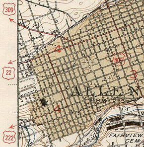
, where the US 222 right-of-way continues into Allentown
as Pennsylvania Route 222
.
|MD
|3.60
|5.79
|-
|PA
|90.85
|146.21
|-
|Total
|94.45
|152.00
|}
in Perryville, but was later truncated to US 1 at Conowingo, with the rest becoming Maryland Route 222
. Because of hills, and also because of the narrowness of MD 222 in Port Deposit, a truck route (Maryland Route 222 Truck) also exists, with part of that truck route being a wrong-way concurrency with US 1.
Between Conowingo and the state line, US 222 follows an elongated "C-curve", curving to the west then doubling back east to cross the state line
near the hamlet of Rock Springs.
in Lancaster and Berks County can make the road dangerous to travel on.
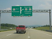
US 222 serves as the principal artery between the Lancaster
and Reading
areas and the Lehigh Valley
. With increased development in the late 20th century the two-lane road became increasingly congested. To alleviate these problems a number of construction projects took place, most notably a four-lane Reading bypass, a four-lane expressway to connect Lancaster to Reading, and a four-lane expressway bypass around the town of Kutztown
, which is situated between Reading and Allentown.
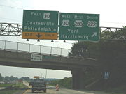
 In Reading, US 222 has an auxiliary route, U.S. Route 222 Business
, the only such route for US 222.
In Lehigh County
a bypass around Trexlertown was constructed, since the area surrounding the intersection of Pennsylvania Route 100
and US 222 was one of the most problematic areas of the road. In 2005 the west half of the bypass was opened and the east half of the bypass, which was originally scheduled to open in late 2006, opened Sept. 28, 2007. That stretch carries a speed limit of 45 miles per hour (20.1 m/s). The closed section of the bypass was under construction for quite a few years, which gave 222 the nickname of "The Road to Nowhere"
 When US 222 was first designated in the 1920s, it only reached as far north as Reading, but at the time US 22 dipped down from Allentown
to Reading, then west to Harrisburg. US 22 was rerouted to become a straight shot from Allentown to Harrisburg, so the roadway between Reading and Allentown became part of US 222, explaining why the highway, designated as north/south, actually runs mostly east/west between the two cities.
 By the early 1930s the road then signed as US 22 became problematic for motorists in Lebanon
along the current U.S. Route 422; Reading
via U.S. Routes 22 and 222; and Allentown on Hamilton Street (US 22). Pennsylvania Route 43 had been aligned as a bypass between Allentown and Harrisburg. On June 8, 1931, the American Association of State Highway Officials came to a resolution to the traffic problem, by replacing the PA 43 corridor with US 22 and the William Penn Highway name to match. The state truncated PA 43 to Susquehanna Street from Allentown to Bethlehem. US 222 replaced the former US 22 alignment from Reading to Allentown. Hamilton Street was numbered as US 222, west of downtown Allentown, where it turned north onto 15th Street. This portion of US 222 was seven-blocks long which ended at Tilghman Street
(then US 22).
With the construction of the Lehigh Valley Thruway in the early 1950s and the relocation of US 22 to that route, US 222 was extended east along Tilghman Street to 7th Street, then north on 7th Street to the interchange with the new freeway.
In the late 1950s, US 222 was realigned to a newly constructed bypass carrying U.S. Route 309 and PA Route 29, west of Allentown. From the south, US 222 left Hamilton Boulevard and turned north onto the freeway. US 222 terminated at an interchange with US 22, US 309, and PA 29 in South Whitehall Township
. The freeway, originally signed as US 309/PA 29/US 222, dropped the PA 29 designation in 1966; in 1968, US 309 was downgraded to PA 309 and US 222 was truncated to end at the current northern termini. By the 1980s, Interstate 78 became part of the freeway that occupied PA 309.
In 1984, the Pennsylvania Department of Transportation
was planning to extend PA Route 145 and US 222. Traffic engineer Samuel D. Darrohh said that Allentown is one of few Pennsylvania cities without a traffic route going through it. After the plan was introduced, he said that motorists might be aided if US 222 were extended along Hamilton Boulevard to connect with the proposed PA 145 corridor.
PennDOT originally planned the road as U.S. Route 222 but AASHTO denied the extension. In 1991, it was commissioned as Pennsylvania Route 222
. PA 145 was extended south of the Lehigh Valley Thruway
to the I-78/PA 309 overlap near Lanark
.
In 2010, officials in Berks County pushed for PennDOT to widen a portion of the two-lane road to four lanes due to traffic and safety issues.
, Pennsylvania
. Its northern terminus is at US 222 north of Laureldale
. The southern terminus is at US 222 near Mohnton
. US 222 Business is the only auxiliary route of U.S. Route 222 in Pennsylvania.
U.S. Route 22
U.S. Route 22 is a west–east route and is one of the original United States highways of 1926, running from Cincinnati, Ohio, at US 27, US 42, US 127, and US 52 to Newark, New Jersey, at U.S. Route 1/9 near the Newark Liberty International Airport.US 22 also carries the names of the William...
. It runs for 100 miles (161 km) from Conowingo
Conowingo, Maryland
Conowingo is a small community in western Cecil County, Maryland, USA.Conowingo is a Susquehannock word for "at the rapids".Conowingo was originally located on the eastern bank of the Susquehanna River at the confluence of the Conowingo Creek with the river...
, Maryland
Maryland
Maryland is a U.S. state located in the Mid Atlantic region of the United States, bordering Virginia, West Virginia, and the District of Columbia to its south and west; Pennsylvania to its north; and Delaware to its east...
at U.S. Route 1
U.S. Route 1
U.S. Route 1 is a major north–south U.S. Highway that serves the East Coast of the United States. It runs 2,377 miles from Fort Kent, Maine at the Canadian border south to Key West, Florida. U.S. 1 generally parallels Interstate 95, though it is significantly farther west between...
to Interstate 78 and Pennsylvania Route 309
Pennsylvania Route 309
Pennsylvania Route 309 is a major highway which runs for 134 miles through Pennsylvania in the United States. It connects Philadelphia and its northern suburbs to Allentown, Hazleton, and Wilkes-Barre. A limited-access highway portion of PA 309 in the Wilkes-Barre area is known as the North...
in Dorneyville
Dorneyville, Pennsylvania
Dorneyville is an unincorporated town located in Lehigh County, Pennsylvania, USA. The town is located between Allentown, Pennsylvania and Trexlertown, Pennsylvania in South Whitehall Township. Dorneyville is located off Interstate 78 and is home to the northern terminus of U.S. Route 222. It is...
, Pennsylvania
Pennsylvania
The Commonwealth of Pennsylvania is a U.S. state that is located in the Northeastern and Mid-Atlantic regions of the United States. The state borders Delaware and Maryland to the south, West Virginia to the southwest, Ohio to the west, New York and Ontario, Canada, to the north, and New Jersey to...
, where the US 222 right-of-way continues into Allentown
Allentown, Pennsylvania
Allentown is a city located in Lehigh County, Pennsylvania, in the United States. It is Pennsylvania's third most populous city, after Philadelphia and Pittsburgh, and the 215th largest city in the United States. As of the 2010 census, the city had a total population of 118,032 and is currently...
as Pennsylvania Route 222
Pennsylvania Route 222
Pennsylvania Route 222 is a -long state highway contained entirely in Allentown, Lehigh County, Pennsylvania and its immediate suburbs mostly along Hamilton Boulevard. The route, in center city Allentown, is aligned along West Hamilton, West Linden, and West Walnut Streets...
.
Route description
|-|MD
|3.60
|5.79
|-
|PA
|90.85
|146.21
|-
|Total
|94.45
|152.00
|}
Maryland
US 222 in Maryland used to extend down to Maryland Route 7Maryland Route 7
Maryland Route 7 is a collection of state highways in the U.S. state of Maryland. These highways are sections of old alignment of U.S. Route 40 between Baltimore and Elkton that were bypassed when US 40 was moved to Pulaski Highway, a four-lane divided highway, in the late 1930s and early 1940s...
in Perryville, but was later truncated to US 1 at Conowingo, with the rest becoming Maryland Route 222
Maryland Route 222
Maryland Route 222 is a state highway in the U.S. state of Maryland. The state highway runs from MD 7 in Perryville north to U.S. Route 1 near Conowingo. MD 222 parallels the Susquehanna River in western Cecil County, connecting Perryville and Conowingo with Port...
. Because of hills, and also because of the narrowness of MD 222 in Port Deposit, a truck route (Maryland Route 222 Truck) also exists, with part of that truck route being a wrong-way concurrency with US 1.
Between Conowingo and the state line, US 222 follows an elongated "C-curve", curving to the west then doubling back east to cross the state line
Mason-Dixon line
The Mason–Dixon Line was surveyed between 1763 and 1767 by Charles Mason and Jeremiah Dixon in the resolution of a border dispute between British colonies in Colonial America. It forms a demarcation line among four U.S. states, forming part of the borders of Pennsylvania, Maryland, Delaware, and...
near the hamlet of Rock Springs.
Pennsylvania
The speed limits on US 222 in Pennsylvania range from 25 mi/h through towns to 65 mi/h on expressway portions. Insufficient shoulders throughout much of the length and the presence of horse and buggiesHorse and buggy
A horse and buggy or horse and carriage refers to a light, simple, two-person carriage of the late 18th, 19th and early 20th centuries, drawn usually by one or sometimes by two horses...
in Lancaster and Berks County can make the road dangerous to travel on.
US 222 serves as the principal artery between the Lancaster
Lancaster, Pennsylvania
Lancaster is a city in the south-central part of the Commonwealth of Pennsylvania. It is the county seat of Lancaster County and one of the older inland cities in the United States, . With a population of 59,322, it ranks eighth in population among Pennsylvania's cities...
and Reading
Reading, Pennsylvania
Reading is a city in southeastern Pennsylvania, USA, and seat of Berks County. Reading is the principal city of the Greater Reading Area and had a population of 88,082 as of the 2010 census, making it the fifth most populated city in the state after Philadelphia, Pittsburgh, Allentown and Erie,...
areas and the Lehigh Valley
Lehigh Valley
The Lehigh Valley, known officially by the United States Census Bureau as the Allentown-Bethlehem-Easton, PA-NJ metropolitan area and referred to locally as The Valley and A-B-E, is a metropolitan region consisting of Lehigh, Northampton, Berks, and Carbon counties in eastern Pennsylvania and...
. With increased development in the late 20th century the two-lane road became increasingly congested. To alleviate these problems a number of construction projects took place, most notably a four-lane Reading bypass, a four-lane expressway to connect Lancaster to Reading, and a four-lane expressway bypass around the town of Kutztown
Kutztown, Pennsylvania
Kutztown is a borough in Berks County, Pennsylvania, southwest of Allentown and northeast of Reading. As of the 2000 census, the borough has a total population of 5,067. It is the site of Kutztown University.- History :...
, which is situated between Reading and Allentown.
U.S. Route 222 Business (Reading, Pennsylvania)
U.S. Route 222 Business is an auxiliary route of U.S. Route 222 located in Reading, Pennsylvania. Its northern terminus is at US 222 north of Laureldale. The southern terminus is at US 222 near Mohnton. US 222 Business is the only auxiliary route of U.S. Route 222 in Pennsylvania.- Route...
, the only such route for US 222.
In Lehigh County
Lehigh County, Pennsylvania
-Climate:Most of the county's climate is considered to fall in the humid continental climate zone. Summers are typically hot and muggy, fall and spring are generally mild, and winter is cold. Precipitation is almost uniformly distributed throughout the year....
a bypass around Trexlertown was constructed, since the area surrounding the intersection of Pennsylvania Route 100
Pennsylvania Route 100
Pennsylvania Route 100 is a state highway in the U.S. state of Pennsylvania that runs from U.S. Route 202 in West Chester, Pennsylvania to Pennsylvania Route 309 in Pleasant Corners, Pennsylvania....
and US 222 was one of the most problematic areas of the road. In 2005 the west half of the bypass was opened and the east half of the bypass, which was originally scheduled to open in late 2006, opened Sept. 28, 2007. That stretch carries a speed limit of 45 miles per hour (20.1 m/s). The closed section of the bypass was under construction for quite a few years, which gave 222 the nickname of "The Road to Nowhere"
History
Allentown, Pennsylvania
Allentown is a city located in Lehigh County, Pennsylvania, in the United States. It is Pennsylvania's third most populous city, after Philadelphia and Pittsburgh, and the 215th largest city in the United States. As of the 2010 census, the city had a total population of 118,032 and is currently...
to Reading, then west to Harrisburg. US 22 was rerouted to become a straight shot from Allentown to Harrisburg, so the roadway between Reading and Allentown became part of US 222, explaining why the highway, designated as north/south, actually runs mostly east/west between the two cities.
Lebanon, Pennsylvania
Lebanon, formerly known as Steitztown, is a city in and the county seat of Lebanon County, Pennsylvania, United States. The population was 25,477 at the 2010 census, a 4.2% increase from the 2000 count of 24,461...
along the current U.S. Route 422; Reading
Reading, Pennsylvania
Reading is a city in southeastern Pennsylvania, USA, and seat of Berks County. Reading is the principal city of the Greater Reading Area and had a population of 88,082 as of the 2010 census, making it the fifth most populated city in the state after Philadelphia, Pittsburgh, Allentown and Erie,...
via U.S. Routes 22 and 222; and Allentown on Hamilton Street (US 22). Pennsylvania Route 43 had been aligned as a bypass between Allentown and Harrisburg. On June 8, 1931, the American Association of State Highway Officials came to a resolution to the traffic problem, by replacing the PA 43 corridor with US 22 and the William Penn Highway name to match. The state truncated PA 43 to Susquehanna Street from Allentown to Bethlehem. US 222 replaced the former US 22 alignment from Reading to Allentown. Hamilton Street was numbered as US 222, west of downtown Allentown, where it turned north onto 15th Street. This portion of US 222 was seven-blocks long which ended at Tilghman Street
State Route 1002 (Lehigh County, Pennsylvania)
State Route 1002 ', locally known as Tilghman Street and Union Boulevard, is a major long east–west road in the Allentown-Bethlehem-Easton metropolitan area of the U.S. state of Pennsylvania. The majority of the roadway is the former alignment of U.S...
(then US 22).
With the construction of the Lehigh Valley Thruway in the early 1950s and the relocation of US 22 to that route, US 222 was extended east along Tilghman Street to 7th Street, then north on 7th Street to the interchange with the new freeway.
In the late 1950s, US 222 was realigned to a newly constructed bypass carrying U.S. Route 309 and PA Route 29, west of Allentown. From the south, US 222 left Hamilton Boulevard and turned north onto the freeway. US 222 terminated at an interchange with US 22, US 309, and PA 29 in South Whitehall Township
South Whitehall Township, Pennsylvania
South Whitehall Township is a township in Lehigh County, Pennsylvania, in the United States. It is a suburb of Allentown, Pennsylvania, in the Lehigh Valley area of the state. The population of South Whitehall Township was 18,028 at the 2000 census...
. The freeway, originally signed as US 309/PA 29/US 222, dropped the PA 29 designation in 1966; in 1968, US 309 was downgraded to PA 309 and US 222 was truncated to end at the current northern termini. By the 1980s, Interstate 78 became part of the freeway that occupied PA 309.
In 1984, the Pennsylvania Department of Transportation
Pennsylvania Department of Transportation
The Pennsylvania Department of Transportation oversees transportation issues in the Commonwealth of Pennsylvania. The administrator of PennDOT is the Pennsylvania Secretary of Transportation, currently Barry Schoch Presently, PennDOT supports over of state roads and highways, about 25,000...
was planning to extend PA Route 145 and US 222. Traffic engineer Samuel D. Darrohh said that Allentown is one of few Pennsylvania cities without a traffic route going through it. After the plan was introduced, he said that motorists might be aided if US 222 were extended along Hamilton Boulevard to connect with the proposed PA 145 corridor.
PennDOT originally planned the road as U.S. Route 222 but AASHTO denied the extension. In 1991, it was commissioned as Pennsylvania Route 222
Pennsylvania Route 222
Pennsylvania Route 222 is a -long state highway contained entirely in Allentown, Lehigh County, Pennsylvania and its immediate suburbs mostly along Hamilton Boulevard. The route, in center city Allentown, is aligned along West Hamilton, West Linden, and West Walnut Streets...
. PA 145 was extended south of the Lehigh Valley Thruway
Lehigh Valley Thruway
U.S. Route 22 is an east–west route stretching from Cincinnati, Ohio in the west to Newark, New Jersey in the east. In Pennsylvania, the route runs for between the West Virginia state line at Washington County, where it is a limited-access expressway-grade route through the western suburbs...
to the I-78/PA 309 overlap near Lanark
Lanark, Pennsylvania
Lanark is a small unincorporated village located in Upper Saucon Township, Lehigh County, Pennsylvania. Residents of Lanark are served by the Center Valley and Coopersburg Post Offices with zip code of 18034 and 18036, respectively. Lanark is located within Southern Lehigh School District...
.
In 2010, officials in Berks County pushed for PennDOT to widen a portion of the two-lane road to four lanes due to traffic and safety issues.
Major intersections
| County | Location | Mile | Destinations | Notes |
|---|---|---|---|---|
| Cecil Cecil County, Maryland Cecil County is a county located in the U.S. state of Maryland. It is part of the Delaware Valley. It was named for Cæcilius Calvert, 2nd Baron Baltimore , who was the first Proprietary Governor of the colony of Maryland from 1632 until his death in 1675. The county seat is Elkton. The newspaper... |
Conowingo Conowingo, Maryland Conowingo is a small community in western Cecil County, Maryland, USA.Conowingo is a Susquehannock word for "at the rapids".Conowingo was originally located on the eastern bank of the Susquehanna River at the confluence of the Conowingo Creek with the river... |
0.00 | MD 222 runs south along US 1; MD 222 Truck runs north along US 1. | |
| Oakwood Oakwood, Maryland Oakwood is an unincorporated community, in Cecil County, Maryland. It lies at an elevation of 371 feet .... |
1.67 | Old Conowingo Rd. west - Susquehanna River Susquehanna River The Susquehanna River is a river located in the northeastern United States. At long, it is the longest river on the American east coast that drains into the Atlantic Ocean, and with its watershed it is the 16th largest river in the United States, and the longest river in the continental United... |
||
| Rock Springs | 3.12 | Old Mill Rd.-New Bridge Rd. - to Connelly Rd. | Connelly Rd. south leads to US 1 / MD 591. | |
| 3.61 | Mason-Dixon Rd.-Quarry Rd. | both roads form part of Mason-Dixon line | ||
| Maryland Maryland Maryland is a U.S. state located in the Mid Atlantic region of the United States, bordering Virginia, West Virginia, and the District of Columbia to its south and west; Pennsylvania to its north; and Delaware to its east... -Pennsylvania Pennsylvania The Commonwealth of Pennsylvania is a U.S. state that is located in the Northeastern and Mid-Atlantic regions of the United States. The state borders Delaware and Maryland to the south, West Virginia to the southwest, Ohio to the west, New York and Ontario, Canada, to the north, and New Jersey to... border |
||||
| Lancaster Lancaster County, Pennsylvania Lancaster County, known as the Garden Spot of America or Pennsylvania Dutch Country, is a county located in the southeastern part of the Commonwealth of Pennsylvania, in the United States. As of 2010 the population was 519,445. Lancaster County forms the Lancaster Metropolitan Statistical Area, the... |
Fulton Township Fulton Township, Pennsylvania Fulton Township is a township in southern Lancaster County, Pennsylvania, United States, and it is the only municipality in the county to touch the Maryland border. At the 2000 census the population was 2,826. It is part of the Solanco School District.... |
South end of PA 272 overlap | ||
| North end of PA 272 overlap | ||||
| Quarryville Quarryville, Pennsylvania Quarryville is a borough in Lancaster County, Pennsylvania, United States. The population was 1,994 at the 2000 census.-General information:*ZIP code: 17566*Area code: 717*Local phone exchanges: 786, 806*Named for noted quarries in the area... |
||||
| West Lampeter Township West Lampeter Township, Pennsylvania West Lampeter Township is a township in central Lancaster County, Pennsylvania, United States. The population was 13,145 at the 2000 census.- Geography :... |
South end of PA 741 overlap | |||
| North end of PA 741 overlap, south end of PA 272 overlap | ||||
| Lancaster Lancaster, Pennsylvania Lancaster is a city in the south-central part of the Commonwealth of Pennsylvania. It is the county seat of Lancaster County and one of the older inland cities in the United States, . With a population of 59,322, it ranks eighth in population among Pennsylvania's cities... |
Access from southbound US 222/PA 272 only, access to northbound and southbound US 222/PA 272; Northern terminus of PA 324 | |||
| Access from northbound US 222/PA 272 only; southern terminus of southbound PA 72. | ||||
| Northbound PA 72 overlaps with southbound US 222/PA 272 between North Queen Street and North Prince Street; PA 72's northbound lane begins here | ||||
| South end of freeway section | ||||
| South end of US 30 overlap for southbound US 222, US 222 southbound overlaps PA 501 between PA 272 and US 30; Southern terminus of PA 501 | ||||
| North end of PA 272 overlap, south end of US 30 overlap for northbound US 222 | ||||
| North end of US 30 overlap | ||||
| Manheim Township Manheim Township, Lancaster County, Pennsylvania Manheim Township is a township in Lancaster County, Pennsylvania established in 1729, which southernmost border meets the city limits of Lancaster. The population as of the 2000 census was 33,697.-Government:... |
34.01 | |||
| Brownstown Brownstown, Lancaster County, Pennsylvania Brownstown, Pennsylvania is an unincorporated community located within West Earl Township in Lancaster County, Pennsylvania.-Geography:The town has a total land area of 0.66 square kilometers... |
36.95 | , Brownstown Brownstown, Lancaster County, Pennsylvania Brownstown, Pennsylvania is an unincorporated community located within West Earl Township in Lancaster County, Pennsylvania.-Geography:The town has a total land area of 0.66 square kilometers... |
||
| Ephrata Township Ephrata Township, Pennsylvania Ephrata Township is a township in northeastern Lancaster County, Pennsylvania, United States. The population was 8,026 at the 2000 census.-Geography:According to the United States Census Bureau, the township has a total area of , all of it land... |
41.19 | |||
| East Cocalico Township East Cocalico Township, Pennsylvania East Cocalico Township is a township in northeastern Lancaster County, Pennsylvania, United States. At the 2000 census the population was 9,954.-Geography:According to the U.S. Census Bureau, the township has a total area of , all of it land.... |
46.37 | Reading Exit of PA Turnpike | ||
| Berks Berks County, Pennsylvania -Demographics:As of the census of 2000, there were 373,638 people, 141,570 households, and 98,532 families residing in the county. The population density was 435 people per square mile . There were 150,222 housing units at an average density of 175 per square mile... |
Brecknock Township Brecknock Township, Berks County, Pennsylvania Brecknock Township is a township in Berks County, Pennsylvania, United States. The population was 4,459 at the 2000 census.-Geography:According to the United States Census Bureau, the township has a total area of , all of it land.... |
51.58 | Opened in 2006, original end of freeway portion of US 222. Northern terminus of PA 272, western terminus of PA 568 | |
| Spring Township Spring Township, Berks County, Pennsylvania Spring Township is a township in Berks County, Pennsylvania, USA. The population was 27,119 at the 2010 census, making it the most populous municipality in Berks County outside the city of Reading.-Geography:... |
53.41 | Mohns Hill Road | ||
| Cumru Township Cumru Township, Pennsylvania Cumru Township is a township in Berks County, Pennsylvania, United States. The population was 15,147 at the 2010 census. The name is Welsh in origin, likely from "Cymru" the Welsh name for Wales... |
53.87 | West Madison Street - Mohnton Mohnton, Pennsylvania Mohnton is a borough in Berks County, Pennsylvania, United States. The population was 2,963 at the 2000 census.-Geography:Mohnton is located at .... |
||
| 54.00 | Northbound exit, southbound entrance; Southern terminus of U.S. 222 Business. | |||
| Spring Township Spring Township, Berks County, Pennsylvania Spring Township is a township in Berks County, Pennsylvania, USA. The population was 27,119 at the 2010 census, making it the most populous municipality in Berks County outside the city of Reading.-Geography:... |
55.25 | |||
| West Lawn West Lawn, Pennsylvania West Lawn is a former borough in Berks County, Pennsylvania, United States. The population was 1,597 at the 2000 census. This borough was dissolved and became part of Spring Township on January 1, 2006... |
56.84 | South end of US 422 overlap | ||
| Wyomissing Wyomissing, Pennsylvania Wyomissing is a borough in Berks County, Pennsylvania, United States, established on July 2, 1906. The population was 8,587 at the 2000 census, but after the January, 2002 merger with neighboring Wyomissing Hills, the combined 2000 Census estimate was 11,155 making it the most populous borough in... |
57.69 | State Hill Road | To Berkshire Mall Berkshire Mall (Pennsylvania) The Berkshire Mall is an enclosed shopping mall in Wyomissing, Pennsylvania, a suburb to the west of Reading in Berks County. The Berkshire Mall is accessible from US 222/US 422 at the Paper Mill Road interchange or the State Hill Road interchange. The main entrances to the mall are located along... |
|
| 58.18 | Paper Mill Road | |||
| 58.76 | North end of US 422 overlap, no access to PA 12 from US 222 southbound, to First Energy Stadium, western terminus of PA 12 | |||
| Spring Township Spring Township, Berks County, Pennsylvania Spring Township is a township in Berks County, Pennsylvania, USA. The population was 27,119 at the 2010 census, making it the most populous municipality in Berks County outside the city of Reading.-Geography:... |
59.74 | Broadcasting Road | To Penn State University - Berks Campus | |
| 60.41 | Spring Ridge Drive | To Berks County Heritage Center | ||
| Bern Township Bern Township, Pennsylvania Bern Township is a township in Berks County, Pennsylvania, United States. The population was 6,758 at the 2000 census.It is in Schuylkill Valley School District.-Geography:... |
61.86 | Reading Regional Airport Reading Regional Airport Reading Regional Airport , also known as Carl A. Spaatz Field, is a public airport located three miles northwest of the central business district of Reading, a city in Berks County, Pennsylvania, United States... , use PA 183 south |
||
| Muhlenberg Township Muhlenberg Township, Pennsylvania Muhlenberg Township is a township in Berks County, Pennsylvania, United States. The population was 16,305 at the 2000 census.-Geography:According to the United States Census Bureau, the township has a total area of 12.2 square miles , of which, 12.0 square miles of it is land and... |
64.95 | |||
| Ontelaunee Township Ontelaunee Township, Pennsylvania Ontelaunee Township is a township in Berks County, Pennsylvania, United States. The population was 1,217 at the 2000 census, making it the least populous township in the county.-Geography:... |
66.86 | Northern terminus of U.S. 222 Business | ||
| North end of freeway section | ||||
| Maidencreek Township Maidencreek Township, Pennsylvania Maidencreek Township is a township in Berks County, Pennsylvania, United States. The population was 6,553 at the 2000 census.-Geography:According to the United States Census Bureau, the township has a total area of 14.4 square miles , of which, 13.2 square miles of it is land and... |
||||
| Richmond Township Richmond Township, Berks County, Pennsylvania Richmond Township is a township in Berks County, Pennsylvania, United States. The population was 3,500 at the 2000 census.-Geography:According to the United States Census Bureau, the township has a total area of 23.7 square miles , of which, 23.6 square miles of it is land and... |
||||
| 74.12 | South end of freeway section | |||
| Virginville Virginville, Pennsylvania Virginville is an unincorporated community in Richmond Township, Berks County, Pennsylvania, United States. It is located at the junction of Pennsylvania Route 143 and Crystal Ridge Road.... , Kutztown Kutztown, Pennsylvania Kutztown is a borough in Berks County, Pennsylvania, southwest of Allentown and northeast of Reading. As of the 2000 census, the borough has a total population of 5,067. It is the site of Kutztown University.- History :... |
Northbound exit, southbound entrance, to Kutztown University | |||
| 75.08 | Virginville Virginville, Pennsylvania Virginville is an unincorporated community in Richmond Township, Berks County, Pennsylvania, United States. It is located at the junction of Pennsylvania Route 143 and Crystal Ridge Road.... |
Southbound exit, northbound entrance | ||
| Kutztown Kutztown, Pennsylvania Kutztown is a borough in Berks County, Pennsylvania, southwest of Allentown and northeast of Reading. As of the 2000 census, the borough has a total population of 5,067. It is the site of Kutztown University.- History :... |
77.03 | To Kutztown University; southern terminus of PA 737 | ||
| 78.23 | East Main Street – Kutztown Kutztown, Pennsylvania Kutztown is a borough in Berks County, Pennsylvania, southwest of Allentown and northeast of Reading. As of the 2000 census, the borough has a total population of 5,067. It is the site of Kutztown University.- History :... |
Southbound exit, northbound entrance | ||
| North end of freeway section | ||||
| Lehigh Lehigh County, Pennsylvania -Climate:Most of the county's climate is considered to fall in the humid continental climate zone. Summers are typically hot and muggy, fall and spring are generally mild, and winter is cold. Precipitation is almost uniformly distributed throughout the year.... |
Upper Macungie Township Upper Macungie Township, Pennsylvania Upper Macungie Township is a township in Lehigh County, Pennsylvania, in the United States. It is a suburb of Allentown, Pennsylvania, in the Lehigh Valley region of the state.The population of Upper Macungie Township was 20,063 as of the 2010 U.S... |
Southern terminus of PA 863 | ||
| 85.44 | South end of freeway section | |||
| South end of PA 100 overlap, Southbound exit | ||||
| Grim Road/Mosser Road | At-grade intersection | |||
| 87.00 | North end of PA 100 overlap | |||
| Grange Road/Mill Creek Road | At-grade intersection | |||
| Lower Macungie Township (Wescosville Wescosville, Pennsylvania Wescosville is an unincorporated town located in Lehigh County, Pennsylvania, United States. The town is located between Allentown, Pennsylvania and Trexlertown, Pennsylvania in Lower Macungie Township. It is split between the Allentown zip codes of 18103, 18104, and 18106... ) |
Krocks Road | At-grade intersection | ||
| Brookside Road | Southbound exit | |||
| Cedarbrook Road/Kressler Road/Hamilton Blvd. | At-grade intersection. Old routing of US 222. | |||
| South Whitehall Township (Dorneyville Dorneyville, Pennsylvania Dorneyville is an unincorporated town located in Lehigh County, Pennsylvania, USA. The town is located between Allentown, Pennsylvania and Trexlertown, Pennsylvania in South Whitehall Township. Dorneyville is located off Interstate 78 and is home to the northern terminus of U.S. Route 222. It is... ) |
Ramps to/from I-78/PA 309 are at-grade. | |||
| 90.85 | ||||
| North end of freeway section | ||||
| US 222 becomes PA 222 Pennsylvania Route 222 Pennsylvania Route 222 is a -long state highway contained entirely in Allentown, Lehigh County, Pennsylvania and its immediate suburbs mostly along Hamilton Boulevard. The route, in center city Allentown, is aligned along West Hamilton, West Linden, and West Walnut Streets... . |
||||
Former Maryland truck route
U.S. Route 222 Truck was a 12.49 miles (20.1 km) truck bypass of US 222 from US 222 in Perryville to US 1 and US 222 in Conowingo. The signed route followed MD 275 from US 222 in Perryville north to MD 276 in Woodlawn. US 222 Truck continued north on MD 276 from Woodlawn north to US 1 west of Rising Sun. The truck route then headed west on US 1 to US 222 in Conowingo. US 222 Truck was downgraded to Maryland Route 222 Truck when US 222 became MD 222 between Perryville and Conowingo.Reading business loop
U.S. Route 222 Business is an auxiliary route of U.S. Route 222 located in ReadingReading, Pennsylvania
Reading is a city in southeastern Pennsylvania, USA, and seat of Berks County. Reading is the principal city of the Greater Reading Area and had a population of 88,082 as of the 2010 census, making it the fifth most populated city in the state after Philadelphia, Pittsburgh, Allentown and Erie,...
, Pennsylvania
Pennsylvania
The Commonwealth of Pennsylvania is a U.S. state that is located in the Northeastern and Mid-Atlantic regions of the United States. The state borders Delaware and Maryland to the south, West Virginia to the southwest, Ohio to the west, New York and Ontario, Canada, to the north, and New Jersey to...
. Its northern terminus is at US 222 north of Laureldale
Laureldale, Pennsylvania
Laureldale is a borough in Berks County, Pennsylvania. The population was 3,759 at the 2000 census.-Geography:Laureldale is at .According to the United States Census Bureau, the borough has a total area of , all of it land....
. The southern terminus is at US 222 near Mohnton
Mohnton, Pennsylvania
Mohnton is a borough in Berks County, Pennsylvania, United States. The population was 2,963 at the 2000 census.-Geography:Mohnton is located at ....
. US 222 Business is the only auxiliary route of U.S. Route 222 in Pennsylvania.