
Maryland Route 150
Encyclopedia
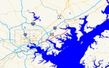
Maryland Route 150 is a state highway
in the U.S. state of Maryland
. Known for most of its length as either Eastern Avenue or Eastern Boulevard, the state highway runs 13.01 miles (20.9 km) from U.S. Route 40
(US 40) in Baltimore east to Graces Quarters Road in Chase
in eastern Baltimore County
. MD 150 connects Baltimore with its southeastern suburbs of Dundalk
, Essex
, and Middle River
. The state highway also links those communities with Interstate 95
, I-695
, I-895
, and Martin State Airport
. MD 150 was constructed from Baltimore to Middle River and in Chase in the mid-1920s. The state highway was completed through Middle River in the early 1930s. Between 1942 and 1944, MD 150 was reconstructed as a four-lane divided highway with interchanges to improve access between Baltimore and the Glenn L. Martin Company
aircraft manufacturing plant in Middle River. The state highway has followed several routes since it was extended west into the city of Baltimore in the mid-1940s; the present route in East Baltimore was established shortly after 2000.
between Dundalk and Essex. The state highway is also named Eastern Avenue from Carroll Island Road in Middle River to the highway's eastern terminus in Chase. Between the two sections of Eastern Avenue, MD 150 follows Eastern Boulevard through Essex and Middle River. The state highway is maintained by the Baltimore City Department of Transportation in the city of Baltimore and by the Maryland State Highway Administration
in Baltimore County. MD 150 is a part of the National Highway System
from its western terminus at US 40 to I-95 within Baltimore as a rail-to-truck intermodal freight transport
connection.
neighborhood, MD 150 turns east onto Lombard Street, which crosses over three rail spurs that head south to Canton; one line splits from CSX
's Philadelphia Subdivision, while the other two spring from the Amtrak Northeast Corridor and are operated by the Norfolk Southern Railway
. The state highway's run on Lombard Street ends at Ponca Street; Lombard Street continues east toward ramps to northbound I-895 (Harbor Tunnel Thruway) and Johns Hopkins Bayview Medical Center
. MD 150 turns south onto Ponca Street, a four-lane divided highway that has a ramp to southbound I-895 toward the Baltimore Harbor Tunnel. The state highway follows Ponca Street to the Greektown neighborhood, where MD 150 turns east onto Eastern Avenue and immediately crosses over I-895.
MD 150 continues east as a six-lane divided highway that reduces to four lanes at Dundalk Avenue. The state highway runs through the Joseph Lee
neighborhood, where the highway intersects Kane Street and meets the Canton Railroad
at grade before the highway's partial cloverleaf interchange with I-95. Access from eastbound MD 150 to southbound I-95 is provided via Kane Street to the south. Just east of I-95, the state highway enters Baltimore County. While passing along the northern edge of Dundalk, MD 150 follows the edge of Oaklawn Cemetery and meets MD 151
(North Point Boulevard) at a cloverleaf interchange
. The state highway passes on the north side of the Eastpoint Mall
, crosses the Norfolk Southern rail spur to Sparrows Point, and meets I-695 (Baltimore Beltway) at a partial cloverleaf interchange. Access from northbound I-695 to westbound MD 150 and from eastbound MD 150 to southbound I-695 is provided through MD 151. East of the Beltway, MD 150 passes the city of Baltimore's Back River Waste Water Treatment Plant and crosses the Back River.
(Southeast Boulevard) that only allows access to and from the north; access to the southern part of the Back River Neck is provided via Old Eastern Avenue's connection with MD 702 or the parallel Stemmers Run Road. The state highway continues northeast and receives the other end of Old Eastern Avenue before crossing the Middle River
into the community of Middle River. MD 150 has a partial cloverleaf interchange with MD 700
(Martin Boulevard) at Lockheed Martin
's Middle River Complex. The state highway closely parallels the Amtrak Northeast Corridor and meets the northern end of MD 587
(Wilson Point Road) and passes along the northern edge of Martin State Airport. MD 150 curves away from the railroad just west of the Martin State Airport
station on MARC
's Penn Line
and the highway intersection with MD 43
(White Marsh Boulevard).
East of MD 43 and the General Services Administration
facility, MD 150 becomes a five-lane road with center turn lane east to Carroll Island Road. East of that county highway, which leads to the community of Bowleys Quarters
, the state highway reduces to two lanes. MD 150 passes under a rail spur from the Amtrak Northeast Corridor to the Charles P. Crane Generating Station
and intersects Marshy Point Road, which leads into Dundee Natural Environment Area. The state highway reaches its eastern terminus at its intersection with Ebenezer Road and Graces Quarter Road in the community of Chase. Graces Quarter Road serves as a connector to the main section of the county highway, which heads east into a unit of Gunpowder Falls State Park
. The county highway also heads west as Ebenezer Road, which passes over Eastern Avenue and the Amtrak Northeast Corridor immediately to the northeast on Eastern Avenue. Eastern Avenue itself continues northeast as a county highway to its eastern terminus at Greenbank Road on the Gunpowder River
.
was from the eastern terminus in Chase to east of Earls Road, which was paved as a 15 feet (4.6 m) wide concrete road around 1923. MD 150 was constructed as a macadam road from the Baltimore city line to the crossing of Middle River in 1924; this section would be widened with concrete shoulders to a width of 18 to 20 ft (5.5 to 6.1 m) by 1926. The gap between the Middle River and east of Earls Road remained a county highway until the existing highway was supplemented by concrete shoulders and repaved in macadam between 1932 and 1934. The portion of Eastern Avenue in the city of Baltimore was not part of MD 150, which had its western terminus at the city–county line as of 1939.
Suburban development in Dundalk and Essex and the establishment of the Glenn L. Martin Company aircraft manufacturing plant in Middle River in 1929 resulted in heavy traffic along MD 150. By 1934, an average of 5,275 vehicles per day used the highway between Baltimore and Middle River, leading the Maryland State Roads Commission to recommend widening the highway to 40 feet (12.2 m) in width. Relief did not come until just before World War II when MD 150 from Baltimore to Middle River was deemed a vital defense connection between the city and the Martin aircraft plant. MD 150 was expanded to a four-lane divided highway from Dundalk Avenue in Baltimore to east of the Martin aircraft plant in Middle River between 1942 and 1944. This expansion involved the construction of interchanges at Martin Boulevard (later designated MD 700) and North Point Boulevard, a northern extension of MD 151 that was also constructed as a defense access project. Replacement bridges were built over the Back River and Middle River. MD 150 was also relocated in Essex; Old Eastern Avenue was designated MD 600, a designation removed by 1956.
By 1946, MD 150 had been extended west into the city of Baltimore over Eastern Avenue at least as far as Highlandtown. Around 1950, the state highway followed Highland Avenue south from US 40 to Eastern Avenue. MD 150 was moved to Kresson Street, Lombard Street, and Ponca Street, which met Eastern Avenue just west of its present junction, in 1960. Around 1963, Haven Street and Kresson Street were converted to a one-way pair
, with Haven Street carrying eastbound traffic south and Kresson Street handling westbound traffic toward US 40. The portion of Lombard Street between Haven and Kresson was added to MD 150; the state highway was also extended north on Haven and Kresson to Monument Street, then east along Monument Street to MD 150's new western terminus at US 40 at the U.S. highway's underpass of CSX's Philadelphia Subdivision. This convoluted path was ameliorated around 2002 when the highway was shortened to its present course in East Baltimore.
!County
!Location
!Mile
!Destinations
!Notes
|-
|rowspan=6 colspan=2|Baltimore City
|0.00
|
|Western terminus
|-
|0.38
|Lombard Street west / Haven Street south
|MD 150 turns east onto Lombard Street
|-
|0.76
|Lombard Street east to
|MD 150 turns south onto Ponca Street
|-
|0.86
|
|I-895 Exit 12; southbound entrance from MD 150 to I-895 only
|-
|1.10
|Eastern Avenue west / Ponca Street south
|MD 150 turns east onto Eastern Avenue
|-
|2.23
|
|I-95 Exit 59; no direct access from eastbound MD 150 to southbound I-95
|-
|rowspan=9|Baltimore
|rowspan=2|Dundalk
|3.21
|
|Cloverleaf interchange
|-
|4.02
|
|I-695 Exit 38; no direct access from eastbound MD 150 to southbound I-695
|-
|rowspan=3|Essex
|6.35
|Old Eastern Avenue east
|Former MD 600
|-
|6.93
|
|Partial interchange; no direct access between MD 150 and MD 702 south
|-
|7.85
|Old Eastern Avenue west
|Former MD 600
|-
|rowspan=3|Middle River
|8.34
|
|Partial cloverleaf interchange
|-
|8.89
|
|
|-
|9.45
|
|-
|Chase
|13.01
|Eastern Avenue east / Graces Quarters Road east / Ebenezer Road west
|Eastern terminus
State highway
State highway, state road or state route can refer to one of three related concepts, two of them related to a state or provincial government in a country that is divided into states or provinces :#A...
in the U.S. state of Maryland
Maryland
Maryland is a U.S. state located in the Mid Atlantic region of the United States, bordering Virginia, West Virginia, and the District of Columbia to its south and west; Pennsylvania to its north; and Delaware to its east...
. Known for most of its length as either Eastern Avenue or Eastern Boulevard, the state highway runs 13.01 miles (20.9 km) from U.S. Route 40
U.S. Route 40 in Maryland
U.S. Route 40 in the U.S. state of Maryland runs from western Maryland to Cecil County in the state's northeastern corner. With a total length of over , it is the longest numbered highway in Maryland. Almost half of the road overlaps with Interstate 68 or Interstate 70, while the old alignment...
(US 40) in Baltimore east to Graces Quarters Road in Chase
Chase, Maryland
Chase is an unincorporated community in eastern Baltimore County, Maryland, United States.-Geography:Chase is located at . Chase is located on the waterfront of the Gunpowder River, Middle River, Dundee Creek, Saltpeter Creek, and Chesapeake Bay...
in eastern Baltimore County
Baltimore County, Maryland
Baltimore County is a county located in the northern part of the US state of Maryland. In 2010, its population was 805,029. It is part of the Baltimore-Washington Metropolitan Area. Its county seat is Towson. The name of the county was derived from the barony of the Proprietor of the Maryland...
. MD 150 connects Baltimore with its southeastern suburbs of Dundalk
Dundalk, Maryland
-Demographics:As of the census of 2000, there were 62,306 people, 24,772 households, and 16,968 families residing in the CDP. The population density was 4,689.5 people per square mile . There were 26,385 housing units at an average density of 1,985.9 per square mile...
, Essex
Essex, Maryland
-Demographics:As of the census of 2000, there were 39,078 people, 15,952 households, and 10,336 families residing in the CDP. The population density was 4,104.1 people per square mile . There were 16,997 housing units at an average density of 1,785.1 per square mile...
, and Middle River
Middle River, Maryland
Middle River is an unincorporated community and a census-designated place in Baltimore County, Maryland, United States. The population was 23,958 at the 2000 census...
. The state highway also links those communities with Interstate 95
Interstate 95 in Maryland
Interstate 95 in Maryland is a major highway that runs diagonally from northeast to southwest, from Maryland's border with Delaware, to the Woodrow Wilson Bridge, briefly entering the District of Columbia before reaching Virginia...
, I-695
Interstate 695 (Maryland)
Interstate 695 is a -long full beltway Interstate Highway extending around Baltimore, Maryland, USA. I-695 is officially designated the McKeldin Beltway, but is colloquially referred to as either the Baltimore Beltway or 695...
, I-895
Interstate 895 (Maryland)
Interstate 895 is an Interstate Highway in the U.S. state of Maryland. Known as the Harbor Tunnel Thruway, the highway runs between one junction with I-95 in Elkridge and another interchange with I-95 on the east side of Baltimore. I-895 is a toll road that crosses the Patapsco River estuary...
, and Martin State Airport
Martin State Airport
Martin State Airport is a public use airport located nine nautical miles east of the central business district of Baltimore, in Baltimore County, Maryland, United States...
. MD 150 was constructed from Baltimore to Middle River and in Chase in the mid-1920s. The state highway was completed through Middle River in the early 1930s. Between 1942 and 1944, MD 150 was reconstructed as a four-lane divided highway with interchanges to improve access between Baltimore and the Glenn L. Martin Company
Glenn L. Martin Company
The Glenn L. Martin Company was an American aircraft and aerospace manufacturing company that was founded by the aviation pioneer Glenn L. Martin. The Martin Company produced many important aircraft for the defense of the United States and its allies, especially during World War II and the Cold War...
aircraft manufacturing plant in Middle River. The state highway has followed several routes since it was extended west into the city of Baltimore in the mid-1940s; the present route in East Baltimore was established shortly after 2000.
Route description
MD 150 is known as Eastern Avenue from just west of I-895 in Baltimore to the Back RiverBack River (Maryland)
Back River is a tidal estuary in Baltimore County, Maryland, located about east of the city of Baltimore. The estuary extends from the community of Rosedale, southeast for about to the Chesapeake Bay...
between Dundalk and Essex. The state highway is also named Eastern Avenue from Carroll Island Road in Middle River to the highway's eastern terminus in Chase. Between the two sections of Eastern Avenue, MD 150 follows Eastern Boulevard through Essex and Middle River. The state highway is maintained by the Baltimore City Department of Transportation in the city of Baltimore and by the Maryland State Highway Administration
Maryland State Highway Administration
The Maryland State Highway Administration is the state agency responsible for maintaining Maryland numbered highways outside of Baltimore City...
in Baltimore County. MD 150 is a part of the National Highway System
National Highway System (United States)
The National Highway System is a network of strategic highways within the United States, including the Interstate Highway System and other roads serving major airports, ports, rail or truck terminals, railway stations, pipeline terminals and other strategic transport facilities.Individual states...
from its western terminus at US 40 to I-95 within Baltimore as a rail-to-truck intermodal freight transport
Intermodal freight transport
Intermodal freight transport involves the transportation of freight in an intermodal container or vehicle, using multiple modes of transportation , without any handling of the freight itself when changing modes. The method reduces cargo handling, and so improves security, reduces damages and...
connection.
Baltimore to Dundalk
MD 150 begins at an intersection with US 40 (Pulaski Highway) in East Baltimore. The state highway heads south as Haven Street, a four-lane undivided street that passes through an industrial area. East of the HighlandtownHighlandtown, Baltimore
Highlandtown is a neighborhood of Baltimore, Maryland, United States.The area currently known as Highlandtown was established in 1866 when the area known as "Snake Hill" was established as a village outside of the Baltimore city limits. The first settlers of the community were primarily Greek...
neighborhood, MD 150 turns east onto Lombard Street, which crosses over three rail spurs that head south to Canton; one line splits from CSX
CSX Transportation
CSX Transportation operates a Class I railroad in the United States known as the CSX Railroad. It is the main subsidiary of the CSX Corporation. The company is headquartered in Jacksonville, Florida, and owns approximately 21,000 route miles...
's Philadelphia Subdivision, while the other two spring from the Amtrak Northeast Corridor and are operated by the Norfolk Southern Railway
Norfolk Southern Railway
The Norfolk Southern Railway is a Class I railroad in the United States, owned by the Norfolk Southern Corporation. With headquarters in Norfolk, Virginia, the company operates 21,500 route miles in 22 eastern states, the District of Columbia and the province of Ontario, Canada...
. The state highway's run on Lombard Street ends at Ponca Street; Lombard Street continues east toward ramps to northbound I-895 (Harbor Tunnel Thruway) and Johns Hopkins Bayview Medical Center
Johns Hopkins Bayview Medical Center
Johns Hopkins Bayview Medical Center, formerly known as Francis Scott Key Medical Center, is a hospital and medical office center in East Baltimore.It is located along Eastern Avenue near Bayview Boulevard...
. MD 150 turns south onto Ponca Street, a four-lane divided highway that has a ramp to southbound I-895 toward the Baltimore Harbor Tunnel. The state highway follows Ponca Street to the Greektown neighborhood, where MD 150 turns east onto Eastern Avenue and immediately crosses over I-895.
MD 150 continues east as a six-lane divided highway that reduces to four lanes at Dundalk Avenue. The state highway runs through the Joseph Lee
Joseph Lee, Baltimore
Joseph Lee, the residential part of Bayview, is a neighborhood located in Baltimore, Maryland, United States. Sometimes called the "A to K" or "ABC neighborhood" since all of the north-south streets are arranged in alphabetical order...
neighborhood, where the highway intersects Kane Street and meets the Canton Railroad
Canton Railroad
The Canton Railroad is a Class III switching and terminal railroad, operating in eastern Baltimore City and Baltimore County. It serves the Helen Delich Bentley Port of Baltimore and local shipping companies, and connects with two Class I railroads: CSX Transportation and the Norfolk Southern...
at grade before the highway's partial cloverleaf interchange with I-95. Access from eastbound MD 150 to southbound I-95 is provided via Kane Street to the south. Just east of I-95, the state highway enters Baltimore County. While passing along the northern edge of Dundalk, MD 150 follows the edge of Oaklawn Cemetery and meets MD 151
Maryland Route 151
Maryland Route 151 is a state highway in the U.S. state of Maryland. Known for most of its length as North Point Boulevard, the state highway runs from 7th Street in Sparrows Point north to U.S. Route 1 in Baltimore...
(North Point Boulevard) at a cloverleaf interchange
Cloverleaf interchange
A cloverleaf interchange is a two-level interchange in which left turns, reverse direction in left-driving regions, are handled by ramp roads...
. The state highway passes on the north side of the Eastpoint Mall
Eastpoint Mall
Eastpoint Mall is a mall in Dundalk, Maryland. The mall currently has 140 stores, including its anchors Sears and JC Penney.The food court at the mall has been the site of retirees from World War II to reminisce....
, crosses the Norfolk Southern rail spur to Sparrows Point, and meets I-695 (Baltimore Beltway) at a partial cloverleaf interchange. Access from northbound I-695 to westbound MD 150 and from eastbound MD 150 to southbound I-695 is provided through MD 151. East of the Beltway, MD 150 passes the city of Baltimore's Back River Waste Water Treatment Plant and crosses the Back River.
Essex to Chase
On the east side of the Back River, MD 150 enters the densely-populated community of Essex. Just east of Marlyn Avenue, the highway's old alignment, Old Eastern Avenue, splits to the east. In the center of Essex, MD 150 has a partial interchange with MD 702Maryland Route 702
Maryland Route 702 is a state highway in the U.S. state of Maryland. Known as Southeast Boulevard, the state highway runs from Interstate 695 in Rosedale east to Back River Neck Road near Essex. MD 702 is a controlled-access spur that serves Essex in southeastern Baltimore County...
(Southeast Boulevard) that only allows access to and from the north; access to the southern part of the Back River Neck is provided via Old Eastern Avenue's connection with MD 702 or the parallel Stemmers Run Road. The state highway continues northeast and receives the other end of Old Eastern Avenue before crossing the Middle River
Middle River (Maryland)
Middle River is an estuary in Baltimore County, Maryland, located about 5 miles east of the city of Baltimore. The estuary extends from the community of Middle River, north of the Martin Plaza Shopping Center, to the southeast for about 4 miles , to the Chesapeake Bay...
into the community of Middle River. MD 150 has a partial cloverleaf interchange with MD 700
Maryland Route 700
Maryland Route 700 is a state highway in the U.S. state of Maryland. Known as Martin Boulevard, the state highway runs from MD 150 in Middle River north to U.S. Route 40 in Rossville. MD 700 was constructed as a defense access road in 1941 to improve access to the aircraft manufacturing plant...
(Martin Boulevard) at Lockheed Martin
Lockheed Martin
Lockheed Martin is an American global aerospace, defense, security, and advanced technology company with worldwide interests. It was formed by the merger of Lockheed Corporation with Martin Marietta in March 1995. It is headquartered in Bethesda, Maryland, in the Washington Metropolitan Area....
's Middle River Complex. The state highway closely parallels the Amtrak Northeast Corridor and meets the northern end of MD 587
Maryland Route 587
Maryland Route 587 is a state highway in the U.S. state of Maryland. Known as Wilson Point Road, the state highway runs from Dogwood Drive north to MD 150 within Middle River in southeastern Baltimore County. MD 587 provides access to Martin State Airport. The state highway was constructed in...
(Wilson Point Road) and passes along the northern edge of Martin State Airport. MD 150 curves away from the railroad just west of the Martin State Airport
Martin State Airport (MARC station)
Martin State Airport is a passenger rail station on the MARC Penn Line between Washington, D.C., Baltimore, MD and Perryville, MD which serves Martin State Airport and surrounding communities. The station is also on the southern section of the Northeast Corridor however, Amtrak does not stop at...
station on MARC
MARC Train
MARC , known prior to 1984 as Maryland Rail Commuter Service, is a regional rail system comprising three lines in the Baltimore-Washington Metropolitan Area. MARC is administered by the Maryland Transit Administration , a Maryland Department of Transportation agency, and is operated under contract...
's Penn Line
Penn Line (MARC)
The Penn Line is a MARC commuter rail line running from Union Station, Washington D.C. to Perryville, Maryland via Penn Station, Baltimore, Maryland on Amtrak's Northeast Corridor. It is MARC's busiest and only electric line. Currently the line is the fastest commuter rail line in the country, with...
and the highway intersection with MD 43
Maryland Route 43
Maryland Route 43 is a state highway in the U.S. state of Maryland. Known as White Marsh Boulevard, the state highway runs from Interstate 695 near Parkville east to MD 150 in Middle River...
(White Marsh Boulevard).
East of MD 43 and the General Services Administration
General Services Administration
The General Services Administration is an independent agency of the United States government, established in 1949 to help manage and support the basic functioning of federal agencies. The GSA supplies products and communications for U.S...
facility, MD 150 becomes a five-lane road with center turn lane east to Carroll Island Road. East of that county highway, which leads to the community of Bowleys Quarters
Bowleys Quarters, Maryland
Bowleys Quarters is an unincorporated community and a census-designated place in Baltimore County, Maryland, with a population of 6,314 in 2000.-History:...
, the state highway reduces to two lanes. MD 150 passes under a rail spur from the Amtrak Northeast Corridor to the Charles P. Crane Generating Station
Charles P. Crane Generating Station
The Charles P. Crane Generating Station is a coal-fired electric generating station located on the Carroll Island Road in Bowleys Quarters, Maryland, east of Baltimore. The power plant is operated by the Constellation Power Source Generation subsidiary of Constellation Energy Group...
and intersects Marshy Point Road, which leads into Dundee Natural Environment Area. The state highway reaches its eastern terminus at its intersection with Ebenezer Road and Graces Quarter Road in the community of Chase. Graces Quarter Road serves as a connector to the main section of the county highway, which heads east into a unit of Gunpowder Falls State Park
Gunpowder Falls State Park
Gunpowder Falls State Park is an park in northwestern Baltimore County and eastern Harford County, Maryland. It is primarily made up of the stream valleys of the Big and Little Gunpowder Falls and the Gunpowder River, and boasts over 100 miles of trails. All areas of the park are convenient to the...
. The county highway also heads west as Ebenezer Road, which passes over Eastern Avenue and the Amtrak Northeast Corridor immediately to the northeast on Eastern Avenue. Eastern Avenue itself continues northeast as a county highway to its eastern terminus at Greenbank Road on the Gunpowder River
Gunpowder River
The Gunpowder River is a tidal inlet on the western side of Chesapeake Bay in Maryland, United States. It is formed by the joining of two freshwater rivers, Gunpowder Falls and Little Gunpowder Falls.-Gunpowder Falls:The Big Gunpowder, long, begins in the extreme southern part of Pennsylvania's...
.
History
The predecessor highway of MD 150 was an oyster shell road from the village of Highlandtown (later annexed by Baltimore) to Chase. Between the Back River and Middle River, this highway was operated as the east–west segment of the Back River Neck Turnpike; the turnpike also included what is now Back River Neck Road. The first portion of Eastern Avenue improved by the Maryland State Roads CommissionMaryland State Highway Administration
The Maryland State Highway Administration is the state agency responsible for maintaining Maryland numbered highways outside of Baltimore City...
was from the eastern terminus in Chase to east of Earls Road, which was paved as a 15 feet (4.6 m) wide concrete road around 1923. MD 150 was constructed as a macadam road from the Baltimore city line to the crossing of Middle River in 1924; this section would be widened with concrete shoulders to a width of 18 to 20 ft (5.5 to 6.1 m) by 1926. The gap between the Middle River and east of Earls Road remained a county highway until the existing highway was supplemented by concrete shoulders and repaved in macadam between 1932 and 1934. The portion of Eastern Avenue in the city of Baltimore was not part of MD 150, which had its western terminus at the city–county line as of 1939.
Suburban development in Dundalk and Essex and the establishment of the Glenn L. Martin Company aircraft manufacturing plant in Middle River in 1929 resulted in heavy traffic along MD 150. By 1934, an average of 5,275 vehicles per day used the highway between Baltimore and Middle River, leading the Maryland State Roads Commission to recommend widening the highway to 40 feet (12.2 m) in width. Relief did not come until just before World War II when MD 150 from Baltimore to Middle River was deemed a vital defense connection between the city and the Martin aircraft plant. MD 150 was expanded to a four-lane divided highway from Dundalk Avenue in Baltimore to east of the Martin aircraft plant in Middle River between 1942 and 1944. This expansion involved the construction of interchanges at Martin Boulevard (later designated MD 700) and North Point Boulevard, a northern extension of MD 151 that was also constructed as a defense access project. Replacement bridges were built over the Back River and Middle River. MD 150 was also relocated in Essex; Old Eastern Avenue was designated MD 600, a designation removed by 1956.
By 1946, MD 150 had been extended west into the city of Baltimore over Eastern Avenue at least as far as Highlandtown. Around 1950, the state highway followed Highland Avenue south from US 40 to Eastern Avenue. MD 150 was moved to Kresson Street, Lombard Street, and Ponca Street, which met Eastern Avenue just west of its present junction, in 1960. Around 1963, Haven Street and Kresson Street were converted to a one-way pair
One-way pair
A one-way pair, one-way couple, or just couplet is a pair of parallel, usually one-way streets that carry opposite directions of a signed route or major traffic flow, or sometimes opposite directions of a bus or streetcar route....
, with Haven Street carrying eastbound traffic south and Kresson Street handling westbound traffic toward US 40. The portion of Lombard Street between Haven and Kresson was added to MD 150; the state highway was also extended north on Haven and Kresson to Monument Street, then east along Monument Street to MD 150's new western terminus at US 40 at the U.S. highway's underpass of CSX's Philadelphia Subdivision. This convoluted path was ameliorated around 2002 when the highway was shortened to its present course in East Baltimore.
Junction list
{|class=wikitable!County
!Location
!Mile
!Destinations
!Notes
|-
|rowspan=6 colspan=2|Baltimore City
|0.00
|
|Western terminus
|-
|0.38
|Lombard Street west / Haven Street south
|MD 150 turns east onto Lombard Street
|-
|0.76
|Lombard Street east to
|MD 150 turns south onto Ponca Street
|-
|0.86
|
|I-895 Exit 12; southbound entrance from MD 150 to I-895 only
|-
|1.10
|Eastern Avenue west / Ponca Street south
|MD 150 turns east onto Eastern Avenue
|-
|2.23
|
|I-95 Exit 59; no direct access from eastbound MD 150 to southbound I-95
|-
|rowspan=9|Baltimore
Baltimore County, Maryland
Baltimore County is a county located in the northern part of the US state of Maryland. In 2010, its population was 805,029. It is part of the Baltimore-Washington Metropolitan Area. Its county seat is Towson. The name of the county was derived from the barony of the Proprietor of the Maryland...
|rowspan=2|Dundalk
Dundalk, Maryland
-Demographics:As of the census of 2000, there were 62,306 people, 24,772 households, and 16,968 families residing in the CDP. The population density was 4,689.5 people per square mile . There were 26,385 housing units at an average density of 1,985.9 per square mile...
|3.21
|
|Cloverleaf interchange
|-
|4.02
|
|I-695 Exit 38; no direct access from eastbound MD 150 to southbound I-695
|-
|rowspan=3|Essex
Essex, Maryland
-Demographics:As of the census of 2000, there were 39,078 people, 15,952 households, and 10,336 families residing in the CDP. The population density was 4,104.1 people per square mile . There were 16,997 housing units at an average density of 1,785.1 per square mile...
|6.35
|Old Eastern Avenue east
|Former MD 600
|-
|6.93
|
|Partial interchange; no direct access between MD 150 and MD 702 south
|-
|7.85
|Old Eastern Avenue west
|Former MD 600
|-
|rowspan=3|Middle River
Middle River, Maryland
Middle River is an unincorporated community and a census-designated place in Baltimore County, Maryland, United States. The population was 23,958 at the 2000 census...
|8.34
|
|Partial cloverleaf interchange
|-
|8.89
|
|
|-
|9.45
|
|-
|Chase
Chase, Maryland
Chase is an unincorporated community in eastern Baltimore County, Maryland, United States.-Geography:Chase is located at . Chase is located on the waterfront of the Gunpowder River, Middle River, Dundee Creek, Saltpeter Creek, and Chesapeake Bay...
|13.01
|Eastern Avenue east / Graces Quarters Road east / Ebenezer Road west
|Eastern terminus