
Maryland Route 144
Encyclopedia
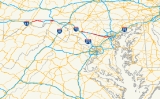
Maryland Route 144 is a collection of state highway
s in the U.S. state
of Maryland
. These highways are sections of old alignment of U.S. Route 40
(US 40) between Cumberland
and Baltimore. Along with US 40 Scenic
, US 40 Alternate, and a few sections of county-maintained highway, MD 144 is assigned to what was once the main highway between the two cities, connecting those endpoints with Hancock
, Hagerstown
, Frederick
, New Market
, Mount Airy
, Ellicott City
, and Catonsville
. MD 144 has seven disjoint sections of mainline highway that pass through mountainous areas of Allegany
and Washington
counties and the rolling piedmont
of Frederick
, Carroll
, Howard
, and Baltimore
counties.
in Cumberland east to US 40 Scenic
east of Flintstone. The state highway generally parallels I-68 and crosses over the freeway multiple times as both highways pass through mountainous creek valleys and over Martin Mountain and Polish Mountain.
Within the interchange, MD 144 becomes National Pike expands to a four-lane divided highway that follows the valley of Elk Lick Run. The state highway passes under I-68 and reduces to a two-lane highway at Hinkle Road. At Rocky Gap Road, MD 144 begins to closely parallel the eastbound lanes of I-68. The state highway leaves the valley of Elk Lick Run and ascends Martin Mountain. On the climb, MD 144 intersects Pleasant Valley Road, which meets I-68 at Exit 50 and leads to Rocky Gap State Park
. At the top of Martin Mountain, the state highway crosses over I-68 and intersects Sunset Orchard Road, which leads to a ramp to westbound I-68. On the descent, MD 144 crosses I-68 again and receives a ramp from the eastbound direction of the freeway and the highways part ways around a quarry.
MD 144 curves around the quarry and rejoins the side of I-68 as the highway passes West Wilson Road and crosses a tributary of Flintstone Creek. The state highway leaves the freeway and passes through the unincorporated village of Flintstone, where the state highway intersects the Exit 56 ramps to and from eastbound I-68 and Black Valley Road, which leads to ramps for westbound I-68. MD 144 joins I-68 and Flintstone Creek in passing through a gap in Warrior Mountain. Gilpin Road, an older alignment of US 40 that is designated MD 144AE, begins to parallel the eastbound side of the state highway at Town Creek Road. The two surface highways cross Town Creek and begin to climb Polish Mountain, with MD 144 following a gentle curve while Gilpin Road follows a winding alignment. MD 144 intersects Gilpin Road as the highway begins the descent from the mountain. MD 144 and I-68 follow Pratt Hollow east between several ridges. The state highway crosses the freeway and over Pine Lick Hollow and closely parallels the westbound direction of I-68 before reaching its eastern terminus at US 40 Scenic (Old National Pike) just north of I-68 Exit 62, just west of Fifteen Mile Creek, and on the edge of Green Ridge State Forest
.
.
{| class=wikitable
!Location
!Mile
!Destinations
!Notes
|-
|rowspan=6|Cumberland
|0.00
|
|Western terminus; MD 807 is unsigned
|-
|0.46
|
|I-68 Exit 46 (westbound)
|-
|0.57
|Naves Cross Road east
|MD 144 turns south onto Christie Road; Naves Cross Road is unsigned MD 807A
|-
|0.69
|Christie Road south
|MD 144 turns east onto Ali Ghan Road
|-
|1.26
| – Bedford, PA
|
|-
|1.42
|
|I-68 Exit 47 (westbound)
|-
|
|4.30
|Rocky Gap Road north
|Unsigned MD 948AE
|-
|
|5.59
|Pleasant Valley Road north – Rocky Gap State Park
|Unsigned MD 948AD
|-
|
|6.97
|Sunset Orchard Road north to
|Unsigned MD 948C
|-
|
|9.14
|West Wilson Road west
|Unsigned MD 948M
|-
|rowspan=2|Flintstone
|10.77
|
|I-68 Exit 56
|-
|10.97
|Black Valley Road north to
|Unsigned MD 948AO
|-
|
|11.56
|Town Creek Road south – Green Ridge State Forest
|
|-
|
|13.72
|Gilpin Road west
|Unsigned MD 144AE
|-
|
|17.55
|
|Eastern terminus
, before passing Hancock Middle-Senior High School
at the town limits of Hancock. The state highway passes through a residential area before issuing a ramp to southbound US 522. MD 144 passes under US 522 itself, crosses Little Tonoloway Creek, and intersects Limestone Road, which is the old alignment of US 522 and unsigned MD 894.
MD 144 continues east as Main Street through downtown Hancock. Access to northbound US 522 as well as both I-70 and I-68 is provided by Virginia Avenue. MD 144 parallels both the Western Maryland Rail Trail
and Chesapeake and Ohio Canal National Historical Park
one block to the north through the downtown area. The state highway leaves the town limits and passes the C&O Canal's Hancock visitor center before crossing Tonoloway Creek. MD 144 reaches its eastern terminus at a partial interchange with I-70 (Eisenhower Memorial Highway). There is no direct access from MD 144 to westbound I-70 at Exit 3; that movement can be completed by turning around at Exit 5.
. The highway was paved from Little Tonoloway Creek to the western edge of Hancock in 1913, and from there east through the town to east of Tonoloway Creek in 1915. The highway through Hancock followed the same alignment as modern MD 144 except for a circuitous alignment on both sides of Tonoloway Creek that followed what is now Old Route 40, Tollgate Ridge Road, and Ford Drive. The present bridge and alignment were constructed in 1940. Construction on I-70 from the Pennsylvania state line to east of Tonoloway Creek began in 1963. By 1964, a US 40 bypass of Hancock, following what is now I-68 from Exit 77 to I-70, was under construction. I-70 and the US 40 bypass were completed in 1966. MD 144 was marked along the old alignment of US 40 through Hancock by 1967.
{| class=wikitable
!Location
!Mile
!Destinations
!Notes
|-
|rowspan=3|Woodmont
|0.00
|
|Western terminus; I-68 Exit 77
|-
|0.12
|
|US 40 Scenic is county-maintained but signed
|-
|0.25
|Woodmont Road south
|Former MD 453
|-
|rowspan=4|Hancock
|3.52
| – Berkeley Springs, WV
|Ramp is unsigned US 522B
|-
|3.67
|Limestone Road north
|Unsigned MD 894; old alignment of US 522
|-
|3.75
|Virginia Avenue to
|Unsigned US 522C
|-
|5.91
|
|Eastern terminus; I-70 Exit 3; no direct access from MD 144 to I-70 west; use Exit 5 to access I-70 and I-68 west
(Maryland Veterans Memorial Highway) with no access, MD 144 enters an industrial area and reaches its eastern terminus at an intersection with Western Maryland Parkway. Western Maryland Parkway, which is unsigned MD 910 heading north, is used to access US 40 and I-81. Washington Street continues east into the city of Hagerstown, where it meets US 40 again in the downtown area.
{| class=wikitable
!Location
!Mile
!Destinations
!Notes
|-
|Huyett
|0.00
|
|Western terminus
|-
|Hagerstown
|1.47
|Western Maryland Parkway to / Washington Street east
|Eastern terminus; Western Maryland Parkway north is unsigned MD 910C
east to I-70 near Bartonsville.
and south as a concurrency of US 15 and US 40. Patrick Street heads east from the interchange as a four-lane undivided highway that splits into a one-way pair
just beyond Catoctin Street. The eastbound direction, which is signed as eastbound MD 144 at the split, follows municipally-maintained South Street. MD 144 in Frederick officially begins at the intersection of Patrick Street, which is one-way westbound, and Jefferson Street, which was formerly US 340
. Both streets pass through the Frederick Historic District
: Patrick Street crosses Carroll Creek into the commercial district, while South Street has a more residential flavor. Both streets intersect Market Street, the main north–south thoroughfare of the downtown area that was formerly MD 355
. The eastbound direction of MD 144 turns north onto East Street, passing by the Frederick
MARC
station and traversing Carroll Creek before meeting Patrick Street.
MD 144 heads east from downtown Frederick on two-lane Patrick Street. The state highway crosses Carroll Creek and passes between a residential area to the south and the Frederick Fairgrounds to the north. MD 144 expands to a four-lane undivided street and continues east through an industrial area where the highway intersects Monocacy Boulevard, which is used to access westbound I-70 and Frederick Municipal Airport
. Just before reaching I-70, the street's alignment continues straight as an unnamed road, unsigned MD 870G, that receives the westbound Exit 56 ramp from I-70 and is used to access Bowmans Farm Road. MD 144 reduces to two lanes and veers to the southeast to cross I-70 (Baltimore National Pike), then curves back to the original alignment ahead of ramps to and from eastbound I-70 at the intersection with Quinn Orchard Road.
MD 144 continues east as Old National Pike, a two-lane road that is paralleled by an unused carriageway immediately to the north that serves as a park and ride
and the original alignment further north, which is lined with scattered residences. The two southern carriageways cross the Monocacy River
on bridges while the northernmost road dead ends at the site of the removed Jug Bridge. East of Bartonsville Road, MD 144 expands to a four-lane divided highway, with the westbound direction making use of what to the west was an unused carriageway. The original alignment, Baltimore Road, now parallels the highway to the south, while Long Branch parallels the highway to the north. MD 144 crosses Long Branch before approaching its eastern terminus. Westbound MD 144 receives a loop ramp from Exit 59 of westbound I-70. The old alignment, Old National Pike, heads north from the divided highway, passes under I-70, and turns east toward New Market as a county highway. MD 144 continues east to its terminus at Ijamsville Road, where the divided highway ends, with the eastbound direction becoming an entrance ramp to eastbound I-70.
.
{| class=wikitable
!Location
!Mile
!Destinations
!Notes
|-
|rowspan=6|Frederick
|0.00
|Patrick Street west to / Jefferson Street
|Western terminus; Patrick Street is one-way westbound; Jefferson Street is former U.S. Route 340
|-
|
|Market Street
|Former MD 355
|-
|
|East Street
|Patrick Street becomes two-way
|-
|
|Monocacy Boulevard to
|
|-
|
|To Bowmans Farm Road
|Unsigned MD 870G
|-
|
|
|I-70 Exit 56; no direct access from MD 144 to I-70 west
|-
|rowspan=2|Bartonsville
|
|Old National Pike east – New Market
|
|-
|5.57
|
|Eastern terminus; I-70 Exit 59; westbound exit from and eastbound entrance to I-70
east to MD 75
. This state-maintained segment of old US 40 lies between two county-maintained segments of the road in eastern Frederick County
.
, within which it intersects MD 874 (Prospect Street). MD 144 becomes Old National Pike again at the east town limit. The original alignment continues straight to a dead end while the state highway turns north and then east to its eastern terminus at MD 75 (Green Valley Road), which is used to access I-70. Old National Pike continues east as a county highway for about 6 miles (9.7 km) to Mount Airy on the Frederick–Carroll county line.
in Frederick County
.
{| class=wikitable
!Location
!Mile
!Destinations
!Notes
|-
|0.00
|Old National Pike west – Frederick
|Western terminus; New Market
town limit
|-
|0.75
|
|Officially MD 874D; old alignment of MD 75
|-
|rowspan=2|1.41
|
|rowspan=2|Eastern terminus
|-
|Old National Pike east – Mount Airy
in Mount Airy
east to US 40 in Ellicott City
. The state highway briefly passes through Frederick and Carroll counties before serving as the main east–west surface highway of northern Howard County.
, where the highway meets MD 94
(Woodbine Road) at a roundabout
. The state highway continues past Daisy Road and Morgan Station Road to Cooksville
, where the highway passes the historic Roberts Inn
and intersects MD 97
(Roxbury Mills Road). MD 144 continues east to West Friendship
, where the highway crosses the Middle Patuxent River and Terrapin Branch, passes the Howard County Fairgrounds, and intersects MD 32
(Sykesville Road). The state highway leaves the farmland behind and passes through a mixture of forest and residential subdivisions, passing Marriottsville Road and Folly Quarter Road. On the western edge of Ellicott City, MD 144 reaches its eastern terminus at US 40 (Baltimore National Pike).
!County
!Location
!Mile
!Destinations
!Notes
|-
|Frederick
|Mount Airy
|0.00
|
|Western terminus
|-
|Carroll
|colspan=4 align=center|No major intersections
|-
|rowspan=10|Howard
|
|2.44
|Long Corner Road south / Twin Arch Road north
|Twin Arch Road is unsigned MD 144HC
|-
|
|4.44
|Watersville Road north
|Former MD 532
|-
|Lisbon
|5.74
|
|Roundabout
|-
|
|6.52
|Daisy Road south
|Former MD 96
|-
|
|7.10
|Morgan Station Road south
|Former MD 476
|-
|Cooksville
|8.88
|
|
|-
|West Friendship
|12.69
|
|
|-
|
|15.52
|Marriottsville Road north to – Marriottsville
|
|-
|
|16.05
|Folly Quarter Road south
|Former MD 98
|-
|Ellicott City
|17.20
|
|Eastern terminus
in Baltimore. A county-maintained segment of Frederick Road continues west through Ellicott City to a junction with US 40 a short distance east of MD 144A.
. Frederick Road passes under US 29 (Columbia Pike) before intersecting Tollgate Road. The county highway intersects Rogers Avenue and descends into downtown Ellicott City as Main Street. Within the Ellicott City Historic District
and nearby are the Howard County offices and the Howard County Circuit Courthouse
, the remains of the Patapsco Female Institute
, and the Ellicott City Station
, which preserves the oldest remaining passenger train station in the U.S. as a railroad museum. The highway passes under the Oliver Viaduct, which carries CSX
's Old Main Line Subdivision, before crossing the Patapsco River into Baltimore County.
MD 144 begins at the county line as two-lane Frederick Road, where the state highway passes through the Ellicott's Mills Historic District
. The state highway parallels the Patapsco River east to River Road, where the highway gains an eastbound climbing lane and leaves the steep river valley. MD 144 passes several loops of old alignment on the ascent, which concludes shortly after passing Old Frederick Road. MD 144 continues east through a densely-populated residential area, intersecting North Rolling Road and entering Catonsville, where the highway intersects MD 166 (South Rolling Road), which heads south toward the University of Maryland Baltimore County
and Baltimore/Washington International Thurgood Marshall Airport (via I-195
). The state highway passes close to the historic home Summit
and passes between the Old Catonsville Historic District
and Central Catonsville and Summit Park Historic District
as it enters downtown Catonsville, which contains Old Catonsville High School
. At the eastern end of the central business district, MD 144 passes Wade Avenue, which heads south to Spring Grove Hospital Center
, before meeting I-695
(Baltimore Beltway) at a diamond interchange.
Shortly after the interchange with I-695, MD 144 enters the city of Baltimore, where it continues as Frederick Avenue. The state highway passes Baltimore National Cemetery
, Mount Saint Joseph College
high school, the Schwartze Mansion
, and Loudon Park National Cemetery
in an affluent residential area. MD 144 expands to a four-lane undivided highway at Beechfield Avenue before reaching Hilton Street and Caton Avenue, where the highway crosses over the Amtrak Northeast Corridor. The state highway continues east through a less affluent series of neighborhoods where it crosses over Gwynns Falls
. East of Bentalou Street, MD 144 splits into a one-way pair
, with the eastbound lanes following Pratt Street and the westbound lanes following Frederick Avenue and then Lombard Street. The state highway intersects US 1 at its own one-way pair, Monroe Street southbound and Fulton Avenue northbound. Both directions of MD 144 have their eastern terminus at Fulton Avenue, although Frederick Avenue itself continues two more blocks to its own terminus at Baltimore and Gilmor Streets. Both Pratt Street and Lombard Street continue east toward downtown Baltimore, passing through the Union Square neighborhood and by the Mount Clare Shops
and the B&O Railroad Museum
.
!County
!Location
!Mile
!Destinations
!Notes
|-
|Howard
|Ellicott City
|0.00
|Main Street west – Ellicott City Historic District
|Western terminus; Howard
–Baltimore
county line at Patapsco River
|-
|rowspan=2|Baltimore
|rowspan=2|Catonsville
|2.85
| – University of Maryland Baltimore County
, BWI Airport
|
|-
|4.07
|
|I-695 Exit 13
|-
|rowspan=4 colspan=2|Baltimore City
|7.01
|Hilton Street north / Caton Avenue south
|
|-
|7.69
|Pratt Street east
|MD 144 splits into one way pair following Pratt Street (eastbound) and Lombard Street/Frederick Avenue (westbound)
|-
|8.52
|
|
|-
|8.62
| – Baltimore Inner Harbor
|Eastern terminus
State highway
State highway, state road or state route can refer to one of three related concepts, two of them related to a state or provincial government in a country that is divided into states or provinces :#A...
s in the U.S. state
U.S. state
A U.S. state is any one of the 50 federated states of the United States of America that share sovereignty with the federal government. Because of this shared sovereignty, an American is a citizen both of the federal entity and of his or her state of domicile. Four states use the official title of...
of Maryland
Maryland
Maryland is a U.S. state located in the Mid Atlantic region of the United States, bordering Virginia, West Virginia, and the District of Columbia to its south and west; Pennsylvania to its north; and Delaware to its east...
. These highways are sections of old alignment of U.S. Route 40
U.S. Route 40 in Maryland
U.S. Route 40 in the U.S. state of Maryland runs from western Maryland to Cecil County in the state's northeastern corner. With a total length of over , it is the longest numbered highway in Maryland. Almost half of the road overlaps with Interstate 68 or Interstate 70, while the old alignment...
(US 40) between Cumberland
Cumberland, Maryland
Cumberland is a city in the far western, Appalachian portion of Maryland, United States. It is the county seat of Allegany County, and the primary city of the Cumberland, MD-WV Metropolitan Statistical Area. At the 2010 census, the city had a population of 20,859, and the metropolitan area had a...
and Baltimore. Along with US 40 Scenic
U.S. Route 40 Scenic
U.S. Route 40 Scenic is a scenic route of U.S. Route 40 in the U.S. state of Maryland. US 40 Scenic is the old alignment of US 40 over Town Hill in eastern Allegany County and Sideling Hill in far western Washington County. The highway was originally constructed as part of the National Road in...
, US 40 Alternate, and a few sections of county-maintained highway, MD 144 is assigned to what was once the main highway between the two cities, connecting those endpoints with Hancock
Hancock, Maryland
Hancock is a town in Washington County, Maryland, United States. The population was 1,725 at the 2000 census. The Western Maryland community is notable for being located at the narrowest part of the state...
, Hagerstown
Hagerstown, Maryland
Hagerstown is a city in northwestern Maryland, United States. It is the county seat of Washington County, and, by many definitions, the largest city in a region known as Western Maryland. The population of Hagerstown city proper at the 2010 census was 39,662, and the population of the...
, Frederick
Frederick, Maryland
Frederick is a city in north-central Maryland. It is the county seat of Frederick County, the largest county by area in the state of Maryland. Frederick is an outlying community of the Washington-Arlington-Alexandria, DC-VA-MD-WV Metropolitan Statistical Area, which is part of a greater...
, New Market
New Market, Maryland
New Market is a town in Frederick County, Maryland, United States. The population was 427 at the 2000 census. The town bills itself as the "Antiques capital of Maryland".-Geography:New Market is located at ....
, Mount Airy
Mount Airy, Maryland
Mount Airy is a town in Carroll, Frederick, Howard, and Montgomery counties in the U.S. state of Maryland.-Geography:According to the United States Census Bureau, the town has a total area of , all of it land.-History:...
, Ellicott City
Ellicott City, Maryland
Ellicott City is an unincorporated community and census-designated place in Howard County, Maryland, United States. It is part of the Baltimore-Washington Metropolitan Area. The population was 65,834 at the 2010 census. It is the county seat of Howard County...
, and Catonsville
Catonsville, Maryland
According to the United States Census Bureau, the CDP has a total area of , all of it land.-Demographics:In 2010 Catonsville had a population of 41,567...
. MD 144 has seven disjoint sections of mainline highway that pass through mountainous areas of Allegany
Allegany County, Maryland
Allegany County is a county located in the northwestern part of the US state of Maryland. It is part of the Cumberland, MD-WV Metropolitan Statistical Area. As of 2010, the population was 75,087. Its county seat is Cumberland...
and Washington
Washington County, Maryland
Washington County is a county located in the western part of the U.S. state of Maryland, bordering southern Pennsylvania to the north, northern Virginia to the south, and the Eastern Panhandle of West Virginia to the south and west. As of the 2010 Census, its population is 147,430...
counties and the rolling piedmont
Piedmont (United States)
The Piedmont is a plateau region located in the eastern United States between the Atlantic Coastal Plain and the main Appalachian Mountains, stretching from New Jersey in the north to central Alabama in the south. The Piedmont province is a physiographic province of the larger Appalachian division...
of Frederick
Frederick County, Maryland
Frederick County is a county located in the western part of the U.S. state of Maryland, bordering the southern border of Pennsylvania and the northeastern border of Virginia. As of the 2010 Census, the population was 233,385....
, Carroll
Carroll County, Maryland
Carroll County is a county located in the U.S. state of Maryland. In 2010, its population was 167,134. It was named for Charles Carroll of Carrollton , signer of the American Declaration of Independence. Its county seat is Westminster....
, Howard
Howard County, Maryland
-2010:Whereas according to the 2010 U.S. Census Bureau:*62.2% White*17.5% Black*0.3% Native American*14.4% Asian*0.0% Native Hawaiian or Pacific Islander*3.6% Two or more races*2.0% Other races*5.8% Hispanic or Latino -2000:...
, and Baltimore
Baltimore County, Maryland
Baltimore County is a county located in the northern part of the US state of Maryland. In 2010, its population was 805,029. It is part of the Baltimore-Washington Metropolitan Area. Its county seat is Towson. The name of the county was derived from the barony of the Proprietor of the Maryland...
counties.
Cumberland–Flintstone
MD 144 in Allegany County runs 17.55 miles (28.2 km) from MD 807Maryland Route 807
Maryland Route 807 is an unsigned state highway in the U.S. state of Maryland. Known as Bedford Road, the state highway runs from the city limits of Cumberland north to U.S. Route 220 in Dickens. MD 807 is the original alignment of US 220 north of Cumberland...
in Cumberland east to US 40 Scenic
U.S. Route 40 Scenic
U.S. Route 40 Scenic is a scenic route of U.S. Route 40 in the U.S. state of Maryland. US 40 Scenic is the old alignment of US 40 over Town Hill in eastern Allegany County and Sideling Hill in far western Washington County. The highway was originally constructed as part of the National Road in...
east of Flintstone. The state highway generally parallels I-68 and crosses over the freeway multiple times as both highways pass through mountainous creek valleys and over Martin Mountain and Polish Mountain.
Route description
MD 144 begins at an intersection with MD 807 (Bedford Road) a short distance north of the Cumberland city limits. The state highway heads east as two-lane Naves Cross Road, passing through a pair of ridges before meeting a pair of ramps to and from westbound I-68 (National Freeway). Naves Cross Road continues east as MD 807A, while MD 144 turns south onto Christie Road to pass under I-68. Christie Road continues south while MD 144 turns east onto Ali Ghan Road. The state highway crosses Evitts Creek before receiving an exit ramp from eastbound I-68 and joins US 220 in a short concurrency. US 220 turns north onto its bypass of Bedford Road while MD 144 continues east, meeting I-68 at Exit 47, a diamond interchange.Within the interchange, MD 144 becomes National Pike expands to a four-lane divided highway that follows the valley of Elk Lick Run. The state highway passes under I-68 and reduces to a two-lane highway at Hinkle Road. At Rocky Gap Road, MD 144 begins to closely parallel the eastbound lanes of I-68. The state highway leaves the valley of Elk Lick Run and ascends Martin Mountain. On the climb, MD 144 intersects Pleasant Valley Road, which meets I-68 at Exit 50 and leads to Rocky Gap State Park
Rocky Gap State Park
Rocky Gap State Park is a 3,400 acre park in Allegany County, Maryland. It is seven miles east of Cumberland on Interstate 68 , and is about a two-hour drive from Washington, D.C., Baltimore and Pittsburgh, Pennsylvania...
. At the top of Martin Mountain, the state highway crosses over I-68 and intersects Sunset Orchard Road, which leads to a ramp to westbound I-68. On the descent, MD 144 crosses I-68 again and receives a ramp from the eastbound direction of the freeway and the highways part ways around a quarry.
MD 144 curves around the quarry and rejoins the side of I-68 as the highway passes West Wilson Road and crosses a tributary of Flintstone Creek. The state highway leaves the freeway and passes through the unincorporated village of Flintstone, where the state highway intersects the Exit 56 ramps to and from eastbound I-68 and Black Valley Road, which leads to ramps for westbound I-68. MD 144 joins I-68 and Flintstone Creek in passing through a gap in Warrior Mountain. Gilpin Road, an older alignment of US 40 that is designated MD 144AE, begins to parallel the eastbound side of the state highway at Town Creek Road. The two surface highways cross Town Creek and begin to climb Polish Mountain, with MD 144 following a gentle curve while Gilpin Road follows a winding alignment. MD 144 intersects Gilpin Road as the highway begins the descent from the mountain. MD 144 and I-68 follow Pratt Hollow east between several ridges. The state highway crosses the freeway and over Pine Lick Hollow and closely parallels the westbound direction of I-68 before reaching its eastern terminus at US 40 Scenic (Old National Pike) just north of I-68 Exit 62, just west of Fifteen Mile Creek, and on the edge of Green Ridge State Forest
Green Ridge State Forest
Green Ridge State Forest is a state forest in Western Maryland. Approximately in size, it is situated along Green Ridge and Town Hill in eastern Allegany County.Camping, Hiking, Biking, ORV, Fishing, and Boating are all permitted in Green Ridge State Forest...
.
Junction list
The entire route is in Allegany CountyAllegany County, Maryland
Allegany County is a county located in the northwestern part of the US state of Maryland. It is part of the Cumberland, MD-WV Metropolitan Statistical Area. As of 2010, the population was 75,087. Its county seat is Cumberland...
.
{| class=wikitable
!Location
!Mile
!Destinations
!Notes
|-
|rowspan=6|Cumberland
Cumberland, Maryland
Cumberland is a city in the far western, Appalachian portion of Maryland, United States. It is the county seat of Allegany County, and the primary city of the Cumberland, MD-WV Metropolitan Statistical Area. At the 2010 census, the city had a population of 20,859, and the metropolitan area had a...
|0.00
|
|Western terminus; MD 807 is unsigned
|-
|0.46
|
|I-68 Exit 46 (westbound)
|-
|0.57
|Naves Cross Road east
|MD 144 turns south onto Christie Road; Naves Cross Road is unsigned MD 807A
|-
|0.69
|Christie Road south
|MD 144 turns east onto Ali Ghan Road
|-
|1.26
| – Bedford, PA
Bedford, Pennsylvania
Bedford is a borough in Bedford County, Pennsylvania, west of the State Capital, Harrisburg. It is the county seat of Bedford County. Bedford was established in the mid-18th century. Population counts follow: 1890, 2,242; 1900, 2,167; 1910, 2,385. The population was 3,141 at the 2000...
|
|-
|1.42
|
|I-68 Exit 47 (westbound)
|-
|
|4.30
|Rocky Gap Road north
|Unsigned MD 948AE
Maryland Route 948
Maryland Route 948 is a collection of unsigned state highways in the U.S. state of Maryland. These highways are service roads, state-maintained portions of county highways, and connectors in the vicinity of Interstate 68 in Garrett County and Allegany County. MD 948B, 948H, and 948K are located...
|-
|
|5.59
|Pleasant Valley Road north – Rocky Gap State Park
Rocky Gap State Park
Rocky Gap State Park is a 3,400 acre park in Allegany County, Maryland. It is seven miles east of Cumberland on Interstate 68 , and is about a two-hour drive from Washington, D.C., Baltimore and Pittsburgh, Pennsylvania...
|Unsigned MD 948AD
Maryland Route 948
Maryland Route 948 is a collection of unsigned state highways in the U.S. state of Maryland. These highways are service roads, state-maintained portions of county highways, and connectors in the vicinity of Interstate 68 in Garrett County and Allegany County. MD 948B, 948H, and 948K are located...
|-
|
|6.97
|Sunset Orchard Road north to
|Unsigned MD 948C
Maryland Route 948
Maryland Route 948 is a collection of unsigned state highways in the U.S. state of Maryland. These highways are service roads, state-maintained portions of county highways, and connectors in the vicinity of Interstate 68 in Garrett County and Allegany County. MD 948B, 948H, and 948K are located...
|-
|
|9.14
|West Wilson Road west
|Unsigned MD 948M
Maryland Route 948
Maryland Route 948 is a collection of unsigned state highways in the U.S. state of Maryland. These highways are service roads, state-maintained portions of county highways, and connectors in the vicinity of Interstate 68 in Garrett County and Allegany County. MD 948B, 948H, and 948K are located...
|-
|rowspan=2|Flintstone
Flintstone, Maryland
Flintstone is a small unincorporated town in Allegany County, Maryland, USA. Flintstone lies between the southern foot of Tussey Mountain and a water gap in the Warrior Mountain formed by Flintstone Creek, north of the North Branch Potomac River and south of the Mason-Dixon Line. Rocky Gap State...
|10.77
|
|I-68 Exit 56
|-
|10.97
|Black Valley Road north to
|Unsigned MD 948AO
Maryland Route 948
Maryland Route 948 is a collection of unsigned state highways in the U.S. state of Maryland. These highways are service roads, state-maintained portions of county highways, and connectors in the vicinity of Interstate 68 in Garrett County and Allegany County. MD 948B, 948H, and 948K are located...
|-
|
|11.56
|Town Creek Road south – Green Ridge State Forest
Green Ridge State Forest
Green Ridge State Forest is a state forest in Western Maryland. Approximately in size, it is situated along Green Ridge and Town Hill in eastern Allegany County.Camping, Hiking, Biking, ORV, Fishing, and Boating are all permitted in Green Ridge State Forest...
|
|-
|
|13.72
|Gilpin Road west
|Unsigned MD 144AE
|-
|
|17.55
|
|Eastern terminus
Auxiliary routes
The Allegany section of MD 144 has two auxiliary routes:- MD 144AE is the unsigned designation for Gilpin Road, a 2.53 miles (4.1 km) section of original alignment of US 40 that runs from Town Creek Road east to MD 144 east of Flintstone.
- MD 144AL is the unsigned designation for an unnamed 0.08 mile (0.1287472 km) spur south from US 40 Scenic near Town Hill.
Hancock
MD 144WB runs 5.91 miles (9.5 km) from I-68 west of Hancock to I-70 east of Hancock. The state highway was assigned in the mid 1960s following the completion of I-70 and the new alignment of US 40 on either side of Hancock.Route description
MD 144 begins at Exit 77 of I-68 (National Freeway) north of Woodmont and west of Hancock. The state highway heads south through the diamond interchange to an intersection with US 40 Scenic (National Pike), at which MD 144 turns east as two-lane Western Pike. The state highway intersects Woodmont Road and crosses Little Tonoloway Creek before ascending Tonoloway Ridge. East of the ridge, MD 144 passes through multiple curves through a mixture of farms and forest, intersecting Locher Road, which leads to Fort Tonoloway State ParkFort Tonoloway State Park
Fort Tonoloway State Park is a state park in the state of Maryland. Located near present day Hancock, Maryland, Fort Tonoloway is the site of a frontier fort built ca. August 1755 by Lt. Thomas Stoddert and 15 men from the Maryland State Militia. The fort was also known as Stoddert's Fort.-External...
, before passing Hancock Middle-Senior High School
Hancock Middle-Senior High School
Hancock Middle-Senior High School, also known as Hancock High, is a public middle school and high school in Hancock, Washington County, Maryland, United States. Its principal is Martin Green. It enrolls 360 Students and School Day is 8:45 to 3:30.-Academic recognition:Hancock Middle-Senior High...
at the town limits of Hancock. The state highway passes through a residential area before issuing a ramp to southbound US 522. MD 144 passes under US 522 itself, crosses Little Tonoloway Creek, and intersects Limestone Road, which is the old alignment of US 522 and unsigned MD 894.
MD 144 continues east as Main Street through downtown Hancock. Access to northbound US 522 as well as both I-70 and I-68 is provided by Virginia Avenue. MD 144 parallels both the Western Maryland Rail Trail
Western Maryland Rail Trail
The Western Maryland Rail Trail is a long shared-use asphalt-paved rail trail from Fort Frederick to Pearre Station, Maryland, United States, that is suitable for walkers, joggers, bikers, rollerbladers and, weather permitting, cross country skiing....
and Chesapeake and Ohio Canal National Historical Park
Chesapeake and Ohio Canal National Historical Park
The Chesapeake and Ohio Canal National Historical Park is a United States National Historical Park located in the District of Columbia and the states of Maryland and West Virginia. The park was established as a National Monument in 1961 by President Dwight D...
one block to the north through the downtown area. The state highway leaves the town limits and passes the C&O Canal's Hancock visitor center before crossing Tonoloway Creek. MD 144 reaches its eastern terminus at a partial interchange with I-70 (Eisenhower Memorial Highway). There is no direct access from MD 144 to westbound I-70 at Exit 3; that movement can be completed by turning around at Exit 5.
History
MD 144 follows what was constructed as the Baltimore and Cumberland Turnpike through Hancock in the 19th century. This highway was reconstructed as one of the original state roads by the Maryland State Roads CommissionMaryland State Highway Administration
The Maryland State Highway Administration is the state agency responsible for maintaining Maryland numbered highways outside of Baltimore City...
. The highway was paved from Little Tonoloway Creek to the western edge of Hancock in 1913, and from there east through the town to east of Tonoloway Creek in 1915. The highway through Hancock followed the same alignment as modern MD 144 except for a circuitous alignment on both sides of Tonoloway Creek that followed what is now Old Route 40, Tollgate Ridge Road, and Ford Drive. The present bridge and alignment were constructed in 1940. Construction on I-70 from the Pennsylvania state line to east of Tonoloway Creek began in 1963. By 1964, a US 40 bypass of Hancock, following what is now I-68 from Exit 77 to I-70, was under construction. I-70 and the US 40 bypass were completed in 1966. MD 144 was marked along the old alignment of US 40 through Hancock by 1967.
Junction list
The entire route is in Washington CountyWashington County, Maryland
Washington County is a county located in the western part of the U.S. state of Maryland, bordering southern Pennsylvania to the north, northern Virginia to the south, and the Eastern Panhandle of West Virginia to the south and west. As of the 2010 Census, its population is 147,430...
{| class=wikitable
!Location
!Mile
!Destinations
!Notes
|-
|rowspan=3|Woodmont
Woodmont, Washington County, Maryland
Woodmont is an unincorporated community in Washington County, Maryland, United States.-References:...
|0.00
|
|Western terminus; I-68 Exit 77
|-
|0.12
|
|US 40 Scenic is county-maintained but signed
|-
|0.25
|Woodmont Road south
|Former MD 453
|-
|rowspan=4|Hancock
Hancock, Maryland
Hancock is a town in Washington County, Maryland, United States. The population was 1,725 at the 2000 census. The Western Maryland community is notable for being located at the narrowest part of the state...
|3.52
| – Berkeley Springs, WV
|Ramp is unsigned US 522B
|-
|3.67
|Limestone Road north
|Unsigned MD 894; old alignment of US 522
|-
|3.75
|Virginia Avenue to
|Unsigned US 522C
|-
|5.91
|
|Eastern terminus; I-70 Exit 3; no direct access from MD 144 to I-70 west; use Exit 5 to access I-70 and I-68 west
Hagerstown
MD 144WB runs 1.47 miles (2.4 km) from US 40 west of Hagerstown to Western Maryland Parkway just west of the city limits of Hagerstown.Route description
MD 144 begins at an intersection with US 40 (National Pike) between Huyett and Hagerstown. The state highway heads east as two-lane Washington Street past farmland, residential subdivisions, and a cemetery. After crossing over I-81Interstate 81 in Maryland
Interstate 81 is a part of the Interstate Highway System that runs from Dandridge, Tennessee to Fishers Landing, New York. In Maryland, the Interstate highway runs from the West Virginia state line at the Potomac River in Williamsport north to the Pennsylvania state line near Maugansville...
(Maryland Veterans Memorial Highway) with no access, MD 144 enters an industrial area and reaches its eastern terminus at an intersection with Western Maryland Parkway. Western Maryland Parkway, which is unsigned MD 910 heading north, is used to access US 40 and I-81. Washington Street continues east into the city of Hagerstown, where it meets US 40 again in the downtown area.
Junction list
The entire route is in Washington CountyWashington County, Maryland
Washington County is a county located in the western part of the U.S. state of Maryland, bordering southern Pennsylvania to the north, northern Virginia to the south, and the Eastern Panhandle of West Virginia to the south and west. As of the 2010 Census, its population is 147,430...
{| class=wikitable
!Location
!Mile
!Destinations
!Notes
|-
|Huyett
Huyett, Maryland
Huyett is an unincorporated community not considered as a census-designated place in western Washington County, Maryland, United States. It is north of Williamsport, Maryland on Maryland Route 63 and on U.S. Route 40 west of Hagerstown, Maryland and east of Clear Spring, Maryland...
|0.00
|
|Western terminus
|-
|Hagerstown
Hagerstown, Maryland
Hagerstown is a city in northwestern Maryland, United States. It is the county seat of Washington County, and, by many definitions, the largest city in a region known as Western Maryland. The population of Hagerstown city proper at the 2010 census was 39,662, and the population of the...
|1.47
|Western Maryland Parkway to / Washington Street east
|Eastern terminus; Western Maryland Parkway north is unsigned MD 910C
Frederick–Bartonsville
MD 144FA runs 5.57 miles (9 km) from the intersection of Patrick Street and Jefferson Street in FrederickFrederick, Maryland
Frederick is a city in north-central Maryland. It is the county seat of Frederick County, the largest county by area in the state of Maryland. Frederick is an outlying community of the Washington-Arlington-Alexandria, DC-VA-MD-WV Metropolitan Statistical Area, which is part of a greater...
east to I-70 near Bartonsville.
Route description
The old alignment of US 40 through Frederick begins at a partial cloverleaf interchange with the Frederick Freeway, which heads north from the interchange as US 15U.S. Route 15 in Maryland
U.S. Route 15 is a part of the U.S. Highway System that runs from Walterboro, South Carolina to Painted Post, New York. In Maryland, the highway runs from the Virginia state line at the Potomac River in Point of Rocks north to the Pennsylvania state line near Emmitsburg. US 15 is...
and south as a concurrency of US 15 and US 40. Patrick Street heads east from the interchange as a four-lane undivided highway that splits into a one-way pair
One-way pair
A one-way pair, one-way couple, or just couplet is a pair of parallel, usually one-way streets that carry opposite directions of a signed route or major traffic flow, or sometimes opposite directions of a bus or streetcar route....
just beyond Catoctin Street. The eastbound direction, which is signed as eastbound MD 144 at the split, follows municipally-maintained South Street. MD 144 in Frederick officially begins at the intersection of Patrick Street, which is one-way westbound, and Jefferson Street, which was formerly US 340
U.S. Route 340 in Maryland
U.S. Route 340 is a part of the U.S. Highway System that runs from Greenville, Virginia to Frederick, Maryland. In Maryland, the U.S. highway runs from the Virginia state line at the Potomac River at Sandy Hook east to its northern terminus at US 15 and US 40 in Frederick...
. Both streets pass through the Frederick Historic District
Frederick Historic District
The Frederick Historic District is a national historic district in Frederick, Frederick County, Maryland. The district encompasses the core of the city and contains a variety of residential, commercial, ecclesiastical, and industrial buildings dating from the late 18th century to 1941...
: Patrick Street crosses Carroll Creek into the commercial district, while South Street has a more residential flavor. Both streets intersect Market Street, the main north–south thoroughfare of the downtown area that was formerly MD 355
Maryland Route 355
Maryland Route 355 is a north–south road in western central Maryland in the United States. The southern terminus of the route is at the Washington, D.C. border in Friendship Heights, Montgomery County, where it continues south as Wisconsin Avenue into Washington. The northern terminus is...
. The eastbound direction of MD 144 turns north onto East Street, passing by the Frederick
Frederick (MARC station)
Frederick is a passenger rail station on the MARC Brunswick Line between this station and Washington, D.C.. This is one of two stations on the Frederick branch. The station is also a major hub for buses of the TransIT Services of Frederick, Maryland....
MARC
MARC Train
MARC , known prior to 1984 as Maryland Rail Commuter Service, is a regional rail system comprising three lines in the Baltimore-Washington Metropolitan Area. MARC is administered by the Maryland Transit Administration , a Maryland Department of Transportation agency, and is operated under contract...
station and traversing Carroll Creek before meeting Patrick Street.
MD 144 heads east from downtown Frederick on two-lane Patrick Street. The state highway crosses Carroll Creek and passes between a residential area to the south and the Frederick Fairgrounds to the north. MD 144 expands to a four-lane undivided street and continues east through an industrial area where the highway intersects Monocacy Boulevard, which is used to access westbound I-70 and Frederick Municipal Airport
Frederick Municipal Airport (Maryland)
Frederick Municipal Airport is a public airport located in the city of Frederick, in Frederick County, Maryland, United States. This airport is publicly owned by City of Frederick....
. Just before reaching I-70, the street's alignment continues straight as an unnamed road, unsigned MD 870G, that receives the westbound Exit 56 ramp from I-70 and is used to access Bowmans Farm Road. MD 144 reduces to two lanes and veers to the southeast to cross I-70 (Baltimore National Pike), then curves back to the original alignment ahead of ramps to and from eastbound I-70 at the intersection with Quinn Orchard Road.
MD 144 continues east as Old National Pike, a two-lane road that is paralleled by an unused carriageway immediately to the north that serves as a park and ride
Park and ride
Park and ride facilities are car parks with connections to public transport that allow commuters and other people wishing to travel into city centres to leave their vehicles and transfer to a bus, rail system , or carpool for the rest of their trip...
and the original alignment further north, which is lined with scattered residences. The two southern carriageways cross the Monocacy River
Monocacy River
The Monocacy River is a free-flowing tributary of the Potomac River, which empties into the Atlantic Ocean via the Chesapeake Bay. The river is long, with a drainage area of about...
on bridges while the northernmost road dead ends at the site of the removed Jug Bridge. East of Bartonsville Road, MD 144 expands to a four-lane divided highway, with the westbound direction making use of what to the west was an unused carriageway. The original alignment, Baltimore Road, now parallels the highway to the south, while Long Branch parallels the highway to the north. MD 144 crosses Long Branch before approaching its eastern terminus. Westbound MD 144 receives a loop ramp from Exit 59 of westbound I-70. The old alignment, Old National Pike, heads north from the divided highway, passes under I-70, and turns east toward New Market as a county highway. MD 144 continues east to its terminus at Ijamsville Road, where the divided highway ends, with the eastbound direction becoming an entrance ramp to eastbound I-70.
Junction list
The entire route is in Frederick CountyFrederick County, Maryland
Frederick County is a county located in the western part of the U.S. state of Maryland, bordering the southern border of Pennsylvania and the northeastern border of Virginia. As of the 2010 Census, the population was 233,385....
.
{| class=wikitable
!Location
!Mile
!Destinations
!Notes
|-
|rowspan=6|Frederick
Frederick, Maryland
Frederick is a city in north-central Maryland. It is the county seat of Frederick County, the largest county by area in the state of Maryland. Frederick is an outlying community of the Washington-Arlington-Alexandria, DC-VA-MD-WV Metropolitan Statistical Area, which is part of a greater...
|0.00
|Patrick Street west to / Jefferson Street
|Western terminus; Patrick Street is one-way westbound; Jefferson Street is former U.S. Route 340
U.S. Route 340 in Maryland
U.S. Route 340 is a part of the U.S. Highway System that runs from Greenville, Virginia to Frederick, Maryland. In Maryland, the U.S. highway runs from the Virginia state line at the Potomac River at Sandy Hook east to its northern terminus at US 15 and US 40 in Frederick...
|-
|
|Market Street
|Former MD 355
Maryland Route 355
Maryland Route 355 is a north–south road in western central Maryland in the United States. The southern terminus of the route is at the Washington, D.C. border in Friendship Heights, Montgomery County, where it continues south as Wisconsin Avenue into Washington. The northern terminus is...
|-
|
|East Street
|Patrick Street becomes two-way
|-
|
|Monocacy Boulevard to
|
|-
|
|To Bowmans Farm Road
|Unsigned MD 870G
|-
|
|
|I-70 Exit 56; no direct access from MD 144 to I-70 west
|-
|rowspan=2|Bartonsville
|
|Old National Pike east – New Market
New Market, Maryland
New Market is a town in Frederick County, Maryland, United States. The population was 427 at the 2000 census. The town bills itself as the "Antiques capital of Maryland".-Geography:New Market is located at ....
|
|-
|5.57
|
|Eastern terminus; I-70 Exit 59; westbound exit from and eastbound entrance to I-70
New Market
MD 144FB runs 1.41 miles (2.3 km) from the west town limit of New MarketNew Market, Maryland
New Market is a town in Frederick County, Maryland, United States. The population was 427 at the 2000 census. The town bills itself as the "Antiques capital of Maryland".-Geography:New Market is located at ....
east to MD 75
Maryland Route 75
Maryland Route 75 is a state highway in the U.S. state of Maryland. Known for most of its length as Green Valley Road, the state highway runs from MD 355 near Hyattstown north to MD 31 in New Windsor...
. This state-maintained segment of old US 40 lies between two county-maintained segments of the road in eastern Frederick County
Frederick County, Maryland
Frederick County is a county located in the western part of the U.S. state of Maryland, bordering the southern border of Pennsylvania and the northeastern border of Virginia. As of the 2010 Census, the population was 233,385....
.
Route description
Old National Pike parallels I-70 as a county highway for about 3 miles (4.8 km) to the western town limits of New Market. MD 144 begins again at the town limit 0.03 mile (0.0482802 km) west of Royal Oak Drive. The state highway, known as Main Street, passes through the New Market Historic DistrictNew Market Historic District (New Market, Maryland)
The New Market Historic District is a national historic district in New Market, Frederick County, Maryland. The district encompasses the town located along what was originally the National Pike...
, within which it intersects MD 874 (Prospect Street). MD 144 becomes Old National Pike again at the east town limit. The original alignment continues straight to a dead end while the state highway turns north and then east to its eastern terminus at MD 75 (Green Valley Road), which is used to access I-70. Old National Pike continues east as a county highway for about 6 miles (9.7 km) to Mount Airy on the Frederick–Carroll county line.
Junction list
The entire route is in New MarketNew Market, Maryland
New Market is a town in Frederick County, Maryland, United States. The population was 427 at the 2000 census. The town bills itself as the "Antiques capital of Maryland".-Geography:New Market is located at ....
in Frederick County
Frederick County, Maryland
Frederick County is a county located in the western part of the U.S. state of Maryland, bordering the southern border of Pennsylvania and the northeastern border of Virginia. As of the 2010 Census, the population was 233,385....
.
{| class=wikitable
!Location
!Mile
!Destinations
!Notes
|-
|0.00
|Old National Pike west – Frederick
Frederick, Maryland
Frederick is a city in north-central Maryland. It is the county seat of Frederick County, the largest county by area in the state of Maryland. Frederick is an outlying community of the Washington-Arlington-Alexandria, DC-VA-MD-WV Metropolitan Statistical Area, which is part of a greater...
|Western terminus; New Market
New Market, Maryland
New Market is a town in Frederick County, Maryland, United States. The population was 427 at the 2000 census. The town bills itself as the "Antiques capital of Maryland".-Geography:New Market is located at ....
town limit
|-
|0.75
|
|Officially MD 874D; old alignment of MD 75
|-
|rowspan=2|1.41
|
|rowspan=2|Eastern terminus
|-
|Old National Pike east – Mount Airy
Mount Airy, Maryland
Mount Airy is a town in Carroll, Frederick, Howard, and Montgomery counties in the U.S. state of Maryland.-Geography:According to the United States Census Bureau, the town has a total area of , all of it land.-History:...
Mount Airy – Ellicott City
MD 144A runs 17.2 miles (27.7 km) from MD 27Maryland Route 27
Maryland Route 27 is a state highway in the central part of the U.S. state of Maryland.-Route description:MD 27, also known as Ridge Road and Manchester Road , begins in Germantown at MD 355...
in Mount Airy
Mount Airy, Maryland
Mount Airy is a town in Carroll, Frederick, Howard, and Montgomery counties in the U.S. state of Maryland.-Geography:According to the United States Census Bureau, the town has a total area of , all of it land.-History:...
east to US 40 in Ellicott City
Ellicott City, Maryland
Ellicott City is an unincorporated community and census-designated place in Howard County, Maryland, United States. It is part of the Baltimore-Washington Metropolitan Area. The population was 65,834 at the 2010 census. It is the county seat of Howard County...
. The state highway briefly passes through Frederick and Carroll counties before serving as the main east–west surface highway of northern Howard County.
Route description
MD 144 begins at an intersection with MD 27 (Ridge Road) just south of MD 27's interchange with I-70 south of Mount Airy. The state highway, known as Frederick Road, immediately turns north and after 0.07 mile (0.1126538 km) crosses the Frederick–Carroll County line. MD 144 passes Parr's Spring, the source of the Patapsco River, before curving to the east through residential subdivisions and closely paralleling the eastbound lanes of I-70. Shortly after crossing the Patapsco River and entering Howard County, the state highway veers away from the freeway and passes through a mix of farmland and scattered residences. MD 144 intersects Long Corner Road and Watersville Road before reaching LisbonLisbon, Maryland
Lisbon is a town located in western Howard County in the state of Maryland in the United States, located roughly between Baltimore and Frederick and north of Washington, D.C.. It is roughly one square mile. Lisbon is located along Interstate 70 and Maryland Route 144 and is home to the first...
, where the highway meets MD 94
Maryland Route 94
Maryland Route 94 is a state highway in the U.S. state of Maryland. Known as Woodbine Road, the state highway runs from the Montgomery–Howard county line at the Patuxent River north to Old Frederick Road near Lisbon. MD 94 originally extended into southern Carroll County in addition to...
(Woodbine Road) at a roundabout
Roundabout
A roundabout is the name for a road junction in which traffic moves in one direction around a central island. The word dates from the early 20th century. Roundabouts are common in many countries around the world...
. The state highway continues past Daisy Road and Morgan Station Road to Cooksville
Cooksville, Maryland
Cooksville is an unincorporated community in Howard County, Maryland, United States. Roberts Inn was listed on the National Register of Historic Places in 1973.-References:...
, where the highway passes the historic Roberts Inn
Roberts Inn
Roberts Inn, is a historic home and farm located at Cooksville, Howard County, Maryland. The complex consists of a -story stuccoed stone house with a reconstructed log wing built about 1808, and several 19th- to early-20th-century agricultural outbuildings, including a frame bank barn, a frame...
and intersects MD 97
Maryland Route 97
Maryland Route 97 is a state highway in the U.S. state of Maryland. The route runs from U.S. Route 29 in Silver Spring, Montgomery County north to the Pennsylvania border in Carroll County, where the road continues into that state as Pennsylvania Route 97...
(Roxbury Mills Road). MD 144 continues east to West Friendship
West Friendship, Maryland
West Friendship is an affluent semi-rural community in western Howard County, Maryland. West Friendship is located at the junction of Interstate 70/U.S. Highway 40/Maryland Route 144 and Maryland Route 32.- History :...
, where the highway crosses the Middle Patuxent River and Terrapin Branch, passes the Howard County Fairgrounds, and intersects MD 32
Maryland Route 32
Maryland Route 32 is a state highway in the U.S. state of Maryland. The state highway runs from Interstate 97 and MD 3 in Millersville west and north to Washington Road in Westminster. The east–west portion of MD 32 is the Patuxent Freeway, a four- to six-lane...
(Sykesville Road). The state highway leaves the farmland behind and passes through a mixture of forest and residential subdivisions, passing Marriottsville Road and Folly Quarter Road. On the western edge of Ellicott City, MD 144 reaches its eastern terminus at US 40 (Baltimore National Pike).
Junction list
{| class=wikitable!County
!Location
!Mile
!Destinations
!Notes
|-
|Frederick
Frederick County, Maryland
Frederick County is a county located in the western part of the U.S. state of Maryland, bordering the southern border of Pennsylvania and the northeastern border of Virginia. As of the 2010 Census, the population was 233,385....
|Mount Airy
Mount Airy, Maryland
Mount Airy is a town in Carroll, Frederick, Howard, and Montgomery counties in the U.S. state of Maryland.-Geography:According to the United States Census Bureau, the town has a total area of , all of it land.-History:...
|0.00
|
|Western terminus
|-
|Carroll
Carroll County, Maryland
Carroll County is a county located in the U.S. state of Maryland. In 2010, its population was 167,134. It was named for Charles Carroll of Carrollton , signer of the American Declaration of Independence. Its county seat is Westminster....
|colspan=4 align=center|No major intersections
|-
|rowspan=10|Howard
Howard County, Maryland
-2010:Whereas according to the 2010 U.S. Census Bureau:*62.2% White*17.5% Black*0.3% Native American*14.4% Asian*0.0% Native Hawaiian or Pacific Islander*3.6% Two or more races*2.0% Other races*5.8% Hispanic or Latino -2000:...
|
|2.44
|Long Corner Road south / Twin Arch Road north
|Twin Arch Road is unsigned MD 144HC
|-
|
|4.44
|Watersville Road north
|Former MD 532
|-
|Lisbon
Lisbon, Maryland
Lisbon is a town located in western Howard County in the state of Maryland in the United States, located roughly between Baltimore and Frederick and north of Washington, D.C.. It is roughly one square mile. Lisbon is located along Interstate 70 and Maryland Route 144 and is home to the first...
|5.74
|
|Roundabout
Roundabout
A roundabout is the name for a road junction in which traffic moves in one direction around a central island. The word dates from the early 20th century. Roundabouts are common in many countries around the world...
|-
|
|6.52
|Daisy Road south
|Former MD 96
|-
|
|7.10
|Morgan Station Road south
|Former MD 476
|-
|Cooksville
Cooksville, Maryland
Cooksville is an unincorporated community in Howard County, Maryland, United States. Roberts Inn was listed on the National Register of Historic Places in 1973.-References:...
|8.88
|
|
|-
|West Friendship
West Friendship, Maryland
West Friendship is an affluent semi-rural community in western Howard County, Maryland. West Friendship is located at the junction of Interstate 70/U.S. Highway 40/Maryland Route 144 and Maryland Route 32.- History :...
|12.69
|
|
|-
|
|15.52
|Marriottsville Road north to – Marriottsville
|
|-
|
|16.05
|Folly Quarter Road south
|Former MD 98
|-
|Ellicott City
Ellicott City, Maryland
Ellicott City is an unincorporated community and census-designated place in Howard County, Maryland, United States. It is part of the Baltimore-Washington Metropolitan Area. The population was 65,834 at the 2010 census. It is the county seat of Howard County...
|17.20
|
|Eastern terminus
Auxiliary routes
MD 144A has two auxiliary routes:- MD 144HB is the designation for Twin Arch Road, a 0.12 mile (0.1931208 km) service road that runs from the Patapsco River east to an intersection with county-maintained Twin Arch Road between I-70 to the south and the namesake double-arch bridge that carries CSX's Old Main Line Subdivision.
- MD 144HC is the designation for Twin Arch Road, a 0.04 mile (0.0643736 km) service road that runs from the intersection of MD 144A and Long Corner Road north to a dead end.
Ellicott City – Baltimore
MD 144 runs 8.62 miles (13.9 km) from the Howard–Baltimore county line at the Patapsco River east to US 1U.S. Route 1 in Maryland
U.S. Route 1 is the easternmost and longest of the major north–south routes of the United States Numbered Highway System, running from Key West, Florida to Fort Kent, Maine. In the U.S...
in Baltimore. A county-maintained segment of Frederick Road continues west through Ellicott City to a junction with US 40 a short distance east of MD 144A.
Route description
Frederick Road splits off from US 40 as a county highway about 1 miles (1.6 km) east of the eastern end of the Mount Airy – Ellicott City portion of MD 144. This county highway parallels US 40 to the south, crossing the passes through residential subdivisions, crossing the Little Patuxent River, intersecting Centennial Lane and St. John's Lane, and passing the historic home MacAlpineMacAlpine
MacAlpine, is a historic home located at Ellicott City, Howard County, Maryland, United States. It was built by wealthy Baltimore attorney, James Mackubin, for his second wife, Gabriella Peter, a great-great-granddaughter of Martha Washington. She grew up at nearby Linwood, the daughter of Maj...
. Frederick Road passes under US 29 (Columbia Pike) before intersecting Tollgate Road. The county highway intersects Rogers Avenue and descends into downtown Ellicott City as Main Street. Within the Ellicott City Historic District
Ellicott City Historic District
Ellicott City Historic District is a national historic district in Ellicott City, Howard County, Maryland. It may include Doughoregan Manor and/or Ellicott City Station, which are two National Historic Landmarks in Ellicott City....
and nearby are the Howard County offices and the Howard County Circuit Courthouse
Howard County Circuit Courthouse
The Howard County Circuit Courthouse is located at 8360 Court Avenue in Ellicott City, Maryland. The courthouse houses the chambers and courtrooms for the 5 judges of the Circuit Court for Howard County, as well as the clerk's offices, jurors' assembly room, the law library and masters'...
, the remains of the Patapsco Female Institute
Patapsco female institute
Patapsco Female Institute is a former girls' boarding school, now a rebuilt historical site, sitting at the top of the hill in Ellicott City, Maryland, United States...
, and the Ellicott City Station
Ellicott City Station
The Ellicott City Station is the oldest remaining passenger train station in the United States, and one of the oldest in the world. At the time of its construction it was the terminus of the Baltimore and Ohio Railroad line from Baltimore to Ellicott's Mills, Maryland and it incorporated features...
, which preserves the oldest remaining passenger train station in the U.S. as a railroad museum. The highway passes under the Oliver Viaduct, which carries CSX
CSX Transportation
CSX Transportation operates a Class I railroad in the United States known as the CSX Railroad. It is the main subsidiary of the CSX Corporation. The company is headquartered in Jacksonville, Florida, and owns approximately 21,000 route miles...
's Old Main Line Subdivision, before crossing the Patapsco River into Baltimore County.
MD 144 begins at the county line as two-lane Frederick Road, where the state highway passes through the Ellicott's Mills Historic District
Ellicott's Mills Historic District
Ellicott's Mills Historic District is a national historic district at Oella, Baltimore County, Maryland, United States. It is on the east bank of the Patapsco River, opposite Ellicott City. It relates to the industrial operations of the Ellicott family from the 1770s through the mid-19th century...
. The state highway parallels the Patapsco River east to River Road, where the highway gains an eastbound climbing lane and leaves the steep river valley. MD 144 passes several loops of old alignment on the ascent, which concludes shortly after passing Old Frederick Road. MD 144 continues east through a densely-populated residential area, intersecting North Rolling Road and entering Catonsville, where the highway intersects MD 166 (South Rolling Road), which heads south toward the University of Maryland Baltimore County
University of Maryland Baltimore County
The University of Maryland, Baltimore County is an American honors public research university, located in Baltimore County, Maryland, mostly in the community of Catonsville, Maryland...
and Baltimore/Washington International Thurgood Marshall Airport (via I-195
Interstate 195 (Maryland)
Interstate 195 is an Interstate highway in the U.S. state of Maryland. Known as Metropolitan Boulevard, the highway runs from Baltimore/Washington International Thurgood Marshall Airport in Linthicum north to I-95 in Arbutus, where Metropolitan Boulevard continues north as Maryland Route 166 ,...
). The state highway passes close to the historic home Summit
Summit (Catonsville, Maryland)
Summit is a historic home located at Catonsville, Baltimore County, Maryland. It a large brick house, once part of a country estate. It features a three-story Italianate tower and large wing extending to the rear. The main façade is three stories and five bays wide, with the tower located on the...
and passes between the Old Catonsville Historic District
Old Catonsville Historic District
Old Catonsville Historic District is a national historic district in Catonsville, Baltimore County, Maryland, United States. It was laid out with the construction of the electric railway and is overwhelmingly residential, with three churches , a modern public library, and an Art Deco water tower...
and Central Catonsville and Summit Park Historic District
Central Catonsville and Summit Park Historic District
Central Catonsville and Summit Park Historic District is a national historic district in Catonsville, Baltimore County, Maryland, United States. It is entirely residential and consists generally of rectangular lots, the largest lots being found on Frederick Road and Newburg Avenue. These contain...
as it enters downtown Catonsville, which contains Old Catonsville High School
Old Catonsville High School
Old Catonsville High School, also known as St. Mark's School, is a historic school building located at Catonsville, Baltimore County, Maryland. It is a masonry schoolhouse which consists of a one-story, single bay structure and a three-story, four bay addition...
. At the eastern end of the central business district, MD 144 passes Wade Avenue, which heads south to Spring Grove Hospital Center
Spring Grove Hospital Center
Spring Grove Hospital Center, formerly known as Spring Grove State Hospital, is a psychiatric hospital located in the Baltimore, Maryland suburb of Catonsville....
, before meeting I-695
Interstate 695 (Maryland)
Interstate 695 is a -long full beltway Interstate Highway extending around Baltimore, Maryland, USA. I-695 is officially designated the McKeldin Beltway, but is colloquially referred to as either the Baltimore Beltway or 695...
(Baltimore Beltway) at a diamond interchange.
Shortly after the interchange with I-695, MD 144 enters the city of Baltimore, where it continues as Frederick Avenue. The state highway passes Baltimore National Cemetery
Baltimore National Cemetery
Baltimore National Cemetery is a United States National Cemetery located along Maryland Route 144 on both sides of the boundary between the neighborhoods of Beechfield in Baltimore City and Catonsville in Baltimore County...
, Mount Saint Joseph College
Mount Saint Joseph College
Mount Saint Joseph High School, is a private, Catholic high school located in Baltimore, Maryland in the community of Irvington. The campus consists of four academic buildings, an athletic field house, and housing for the school's chaplains. It was founded by the Xaverian Brothers in November 1876...
high school, the Schwartze Mansion
Schwartze Mansion
Schwartze Mansion is a historic home located at Baltimore, Maryland, United States. It is a two story, five bay brick Greek Revival building constructed in 1845. It features a flat roofline embellished with a deep modillioned cornice above a frieze decorated with recessed panels...
, and Loudon Park National Cemetery
Loudon Park National Cemetery
Loudon Park National Cemetery is a United States National Cemetery located in the city of Baltimore, Maryland. It encompasses , and as of the end of 2005, had 7,138 interments. It is currently closed to new interments, and is maintained by the Baltimore National Cemetery.- History :Loudon Park...
in an affluent residential area. MD 144 expands to a four-lane undivided highway at Beechfield Avenue before reaching Hilton Street and Caton Avenue, where the highway crosses over the Amtrak Northeast Corridor. The state highway continues east through a less affluent series of neighborhoods where it crosses over Gwynns Falls
Gwynns Falls
Gwynns Falls is a stream located in Baltimore County and Baltimore City, Maryland. The headwaters are located in Reisterstown in Baltimore County, and the stream flows southeast, entering the city of Baltimore and emptying into the Middle Branch of the Patapsco River. The Patapsco drains into the...
. East of Bentalou Street, MD 144 splits into a one-way pair
One-way pair
A one-way pair, one-way couple, or just couplet is a pair of parallel, usually one-way streets that carry opposite directions of a signed route or major traffic flow, or sometimes opposite directions of a bus or streetcar route....
, with the eastbound lanes following Pratt Street and the westbound lanes following Frederick Avenue and then Lombard Street. The state highway intersects US 1 at its own one-way pair, Monroe Street southbound and Fulton Avenue northbound. Both directions of MD 144 have their eastern terminus at Fulton Avenue, although Frederick Avenue itself continues two more blocks to its own terminus at Baltimore and Gilmor Streets. Both Pratt Street and Lombard Street continue east toward downtown Baltimore, passing through the Union Square neighborhood and by the Mount Clare Shops
Mount Clare Shops
The Mount Clare Shops is the oldest railroad manufacturing complex in the United States, located in Baltimore, Maryland. It was founded by the Baltimore and Ohio Railroad in 1829. Mt. Clare was the site of many inventions and innovations in railroad technology. It is presently the site of the...
and the B&O Railroad Museum
B&O Railroad Museum
The B&O Railroad Museum is a museum exhibiting historic railroad equipment in Baltimore, Maryland, originally named the Baltimore & Ohio Transportation Museum when it opened on July 4, 1953. It has been called one of the most significant collections of railroad treasures in the world and has the...
.
Junction list
{| class=wikitable!County
!Location
!Mile
!Destinations
!Notes
|-
|Howard
Howard County, Maryland
-2010:Whereas according to the 2010 U.S. Census Bureau:*62.2% White*17.5% Black*0.3% Native American*14.4% Asian*0.0% Native Hawaiian or Pacific Islander*3.6% Two or more races*2.0% Other races*5.8% Hispanic or Latino -2000:...
|Ellicott City
Ellicott City, Maryland
Ellicott City is an unincorporated community and census-designated place in Howard County, Maryland, United States. It is part of the Baltimore-Washington Metropolitan Area. The population was 65,834 at the 2010 census. It is the county seat of Howard County...
|0.00
|Main Street west – Ellicott City Historic District
Ellicott City Historic District
Ellicott City Historic District is a national historic district in Ellicott City, Howard County, Maryland. It may include Doughoregan Manor and/or Ellicott City Station, which are two National Historic Landmarks in Ellicott City....
|Western terminus; Howard
Howard County, Maryland
-2010:Whereas according to the 2010 U.S. Census Bureau:*62.2% White*17.5% Black*0.3% Native American*14.4% Asian*0.0% Native Hawaiian or Pacific Islander*3.6% Two or more races*2.0% Other races*5.8% Hispanic or Latino -2000:...
–Baltimore
Baltimore County, Maryland
Baltimore County is a county located in the northern part of the US state of Maryland. In 2010, its population was 805,029. It is part of the Baltimore-Washington Metropolitan Area. Its county seat is Towson. The name of the county was derived from the barony of the Proprietor of the Maryland...
county line at Patapsco River
Patapsco River
The Patapsco River is a river in central Maryland which flows into Chesapeake Bay. The river's tidal portion forms the harbor for the city of Baltimore...
|-
|rowspan=2|Baltimore
Baltimore County, Maryland
Baltimore County is a county located in the northern part of the US state of Maryland. In 2010, its population was 805,029. It is part of the Baltimore-Washington Metropolitan Area. Its county seat is Towson. The name of the county was derived from the barony of the Proprietor of the Maryland...
|rowspan=2|Catonsville
Catonsville, Maryland
According to the United States Census Bureau, the CDP has a total area of , all of it land.-Demographics:In 2010 Catonsville had a population of 41,567...
|2.85
| – University of Maryland Baltimore County
University of Maryland Baltimore County
The University of Maryland, Baltimore County is an American honors public research university, located in Baltimore County, Maryland, mostly in the community of Catonsville, Maryland...
, BWI Airport
|
|-
|4.07
|
|I-695 Exit 13
|-
|rowspan=4 colspan=2|Baltimore City
|7.01
|Hilton Street north / Caton Avenue south
|
|-
|7.69
|Pratt Street east
|MD 144 splits into one way pair following Pratt Street (eastbound) and Lombard Street/Frederick Avenue (westbound)
|-
|8.52
|
|
|-
|8.62
| – Baltimore Inner Harbor
|Eastern terminus