
Maryland Route 103
Encyclopedia
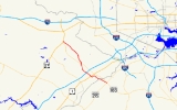
Maryland Route 103 is a state highway
in the U.S. state of Maryland
. The state highway runs 8.29 miles (13.3 km) from Parkway Drive South in Hanover
northwest to St. Johns Lane in Ellicott City
. MD 103 serves as the local complement to MD 100
from Hanover in northwestern Anne Arundel County
through Dorsey
to Ellicott City in northeastern Howard County
. The state highway was constructed from U.S. Route 1
in Elkridge
to US 29
in Ellicott City in the 1920s. MD 103's eastern terminus was relocated from Elkridge to US 1 near Dorsey in 1956. When MD 100 was constructed between Glen Burnie
and Ellicott City in the 1990s, the state highway was extended to its present western and eastern termini. East of US 1, MD 103 replaced MD 176
east to near the Baltimore–Washington Parkway.
's Capital Subdivision.
MD 103 crosses Deep Run again and intersects Douglas Legum Drive, which leads to the Dorsey
station on MARC
's Camden Line
. The state highway curves southwest and back to the northwest before its intersection with US 1 (Washington Boulevard). The highway is part of the National Highway System
from US 1 east to Douglas Legum Drive as an intermodal
connector to the Dorsey MARC station. MD 103 continues northwest as Meadowridge Road, which passes between Meadow Ridge Memorial Park on the north and an industrial park to the south before passing under Interstate 95
(I-95) with no access. The state highway meets MD 100 at a dumbbell interchange. At Miller's Corner north of MD 100, MD 103 intersects its old alignment, Montgomery Road, which heads east toward Elkridge.
MD 103 continues north as Montgomery Road and intersects Ilchester Road. Ilchester Road heads east to the hamlet of Ilchester
on the Patapsco River
, where the county highway provides access to Patapsco Valley State Park
and the ruins of the Baltimore & Ohio Railroad's Patterson Viaduct
. MD 103 continues northwest into Ellicott City, where the state highway meets the northern end of MD 104
(Waterloo Road). North of New Cut Road, the state highway expands to a four-lane undivided highway and intersects Long Gate Parkway, which provides access to eastbound MD 100, and Old Columbia Pike, which heads northeast into the Ellicott City Historic District
. Just west of Old Columbia Pike, MD 103 has a partial diamond interchange with US 29 (Columbia Pike), where the highway's name changes to St. Johns Lane. Access from northbound US 29 to MD 103 is provided via MD 100 and Long Gate Parkway. MD 103 reaches its western terminus just west of its intersection with High Point Road. St. Johns Lane continues west to Columbia Road, where the county highway turns north toward US 40
.
The portion of MD 103 east of US 1 was originally part of MD 176, which was completed as a concrete road from Glen Burnie west to the B&O Railroad in Dorsey on the Howard–Anne Arundel county line by 1930. The portion between the county line and US 1 was constructed around 1936; MD 176 originally met US 1 at an intersection just south of the modern US 1–MD 100 interchange. The Howard County portion of MD 176 was widened in 1949. MD 103 was widened from US 1 to Waterloo Road, which was then part of MD 175, in 1950. The state highway was widened from Waterloo Road to US 29 starting in 1953. In 1956, MD 103 was removed from Montgomery Road from Miller's Corner to Elkridge and instead placed on Meadowridge Road from Miller's Corner to US 1 near Dorsey.
Several changes occurred in the route of MD 103 due to the construction of MD 100 in the 1990s. MD 103 was extended to its present western terminus when its interchange with US 29 was built in 1992. The western end of MD 176 was relocated to the double-curve alignment in Dorsey to tie into the eastern end of MD 103 by 1995. MD 176 was cut in two when MD 100 took over the former highway's interchange with the Baltimore–Washington Parkway. By 1997, MD 103 replaced MD 176 on Dorsey Road west of the parkway. That same year, the intersection of Montgomery Road and Meadowridge Road was reconstructed to make MD 103 the through route instead of Montgomery Road. MD 103's interchange with MD 100 was completed in 1998 when MD 100 opened from MD 104 to I-95.
!County
!Location
!Mile
!Destinations
!Notes
|-
|rowspan=2|Anne Arundel
|rowspan=2|Hanover
|0.00
|Parkway Drive South
|Southern terminus
|-
|0.46
|Coca Cola Drive to
|Unsigned MD 100M
|-
|rowspan=7|Howard
|Dorsey
|2.00
|
|
|-
|
|4.06
|
|Dumbbell interchange
|-
|
|4.45
|Montgomery Road east / Brightfield Road west – Elkridge
|Montgomery Road east is old alignment of MD 103
|-
|rowspan=4|Ellicott City
|6.25
|
|
|-
|7.59
|Long Gate Parkway south to
|
|-
|8.14
|
|Diamond interchange
|-
|8.29
|St. Johns Lane north
|Northern terminus
State highway
State highway, state road or state route can refer to one of three related concepts, two of them related to a state or provincial government in a country that is divided into states or provinces :#A...
in the U.S. state of Maryland
Maryland
Maryland is a U.S. state located in the Mid Atlantic region of the United States, bordering Virginia, West Virginia, and the District of Columbia to its south and west; Pennsylvania to its north; and Delaware to its east...
. The state highway runs 8.29 miles (13.3 km) from Parkway Drive South in Hanover
Hanover, Maryland
Hanover, Maryland is a locality in unincorporated northwestern Anne Arundel County, Maryland in the United States, located south of Baltimore near the Howard County line....
northwest to St. Johns Lane in Ellicott City
Ellicott City, Maryland
Ellicott City is an unincorporated community and census-designated place in Howard County, Maryland, United States. It is part of the Baltimore-Washington Metropolitan Area. The population was 65,834 at the 2010 census. It is the county seat of Howard County...
. MD 103 serves as the local complement to MD 100
Maryland Route 100
Maryland Route 100 is a major east–west highway connecting U.S. Route 29 in Ellicott City and MD 177 in Pasadena. MD 100 also connects to Interstate 95 , US 1, the Baltimore-Washington Parkway , and I-97...
from Hanover in northwestern Anne Arundel County
Anne Arundel County, Maryland
Anne Arundel County is a county located in the U.S. state of Maryland. It is named for Anne Arundell , a member of the ancient family of Arundells in Cornwall, England and the wife of Cæcilius Calvert, 2nd Baron Baltimore. Its county seat is Annapolis, which is also the capital of the state...
through Dorsey
Dorsey, Maryland
Dorsey, Maryland, is a locality in eastern Howard County, Maryland, south of Elkridge, north of Savage, and close to the Anne Arundel County border and Baltimore-Washington International Airport...
to Ellicott City in northeastern Howard County
Howard County, Maryland
-2010:Whereas according to the 2010 U.S. Census Bureau:*62.2% White*17.5% Black*0.3% Native American*14.4% Asian*0.0% Native Hawaiian or Pacific Islander*3.6% Two or more races*2.0% Other races*5.8% Hispanic or Latino -2000:...
. The state highway was constructed from U.S. Route 1
U.S. Route 1 in Maryland
U.S. Route 1 is the easternmost and longest of the major north–south routes of the United States Numbered Highway System, running from Key West, Florida to Fort Kent, Maine. In the U.S...
in Elkridge
Elkridge, Maryland
Elkridge is a census-designated place in Howard County, Maryland, United States. The population was 22,042 at the 2000 census. Founded early in the 18th century, Elkridge is located at the confluence of three counties, the other two being Anne Arundel and Baltimore counties...
to US 29
U.S. Route 29 in Maryland
U.S. Route 29 is a north–south United States highway that runs for from the western suburbs of Baltimore, Maryland, to Pensacola, Florida. In the U.S. state of Maryland, US 29 is a major highway that emerges from Washington D.C. and runs north into eastern Montgomery County, stretching...
in Ellicott City in the 1920s. MD 103's eastern terminus was relocated from Elkridge to US 1 near Dorsey in 1956. When MD 100 was constructed between Glen Burnie
Glen Burnie, Maryland
Glen Burnie is a census-designated place in Anne Arundel County, Maryland, United States, and is a suburb of Baltimore. The population was 67,639 at the 2010 census...
and Ellicott City in the 1990s, the state highway was extended to its present western and eastern termini. East of US 1, MD 103 replaced MD 176
Maryland Route 176
Maryland Route 176 is an east–west route in Anne Arundel County.-Route description:MD 176 begins at a cul-de-sac near Wright Rd., a local neighborhood street, within sight of its old interchange with MD 295, now used by MD 100. Continuing east it intersects the northern end of MD 713 north of...
east to near the Baltimore–Washington Parkway.
Route description
MD 103 begins 0.2 mile (0.321868 km) east of Race Road in a business park adjacent to MD 100's interchange with the Baltimore–Washington Parkway in Hanover. The state highway heads northwest as two-lane Parkway Drive South, which begins to parallel the eastbound side of MD 100. MD 103's name changes to Dorsey Road at its intersection with Coca Cola Drive, which is unsigned MD 100M and has an interchange with MD 100 immediately to the north. The state highway curves away from MD 100, crosses a branch of Deep Run, and passes through the community of Dorsey, where the highway enters Howard County by passing under CSXCSX Transportation
CSX Transportation operates a Class I railroad in the United States known as the CSX Railroad. It is the main subsidiary of the CSX Corporation. The company is headquartered in Jacksonville, Florida, and owns approximately 21,000 route miles...
's Capital Subdivision.
MD 103 crosses Deep Run again and intersects Douglas Legum Drive, which leads to the Dorsey
Dorsey (MARC station)
Dorsey is a passenger rail station on the MARC Camden Line between Washington, DC and Baltimore's Camden Station. The station is located at Exit 7 on Maryland Route 100, a.k.a.; the Paul T. Pitcher Memorial Highway...
station on MARC
MARC Train
MARC , known prior to 1984 as Maryland Rail Commuter Service, is a regional rail system comprising three lines in the Baltimore-Washington Metropolitan Area. MARC is administered by the Maryland Transit Administration , a Maryland Department of Transportation agency, and is operated under contract...
's Camden Line
Camden Line
The Camden Line is a MARC commuter rail line that runs between Union Station, Washington, D.C. and Camden Station, Baltimore, Maryland over the CSX Capital Subdivision. Service began along this route in 1835 as part of the Baltimore and Ohio Railroad , making it the oldest passenger rail line in...
. The state highway curves southwest and back to the northwest before its intersection with US 1 (Washington Boulevard). The highway is part of the National Highway System
National Highway System (United States)
The National Highway System is a network of strategic highways within the United States, including the Interstate Highway System and other roads serving major airports, ports, rail or truck terminals, railway stations, pipeline terminals and other strategic transport facilities.Individual states...
from US 1 east to Douglas Legum Drive as an intermodal
Intermodal passenger transport
Intermodal passenger transport involves more than one mode of transport of passengers. Some modes of transportation have always been intermodal; for example, most major airports have extensive facilities for automobile parking and have good rail or bus connections to the cities nearby. Urban bus...
connector to the Dorsey MARC station. MD 103 continues northwest as Meadowridge Road, which passes between Meadow Ridge Memorial Park on the north and an industrial park to the south before passing under Interstate 95
Interstate 95 in Maryland
Interstate 95 in Maryland is a major highway that runs diagonally from northeast to southwest, from Maryland's border with Delaware, to the Woodrow Wilson Bridge, briefly entering the District of Columbia before reaching Virginia...
(I-95) with no access. The state highway meets MD 100 at a dumbbell interchange. At Miller's Corner north of MD 100, MD 103 intersects its old alignment, Montgomery Road, which heads east toward Elkridge.
MD 103 continues north as Montgomery Road and intersects Ilchester Road. Ilchester Road heads east to the hamlet of Ilchester
Ilchester, Maryland
Ilchester is an unincorporated community in Howard County, Maryland. It was named after the village of Ilchester in England.-History:Located about southeast of Ellicott City, Ilchester was settled by the Ellicott family in the late 18th century...
on the Patapsco River
Patapsco River
The Patapsco River is a river in central Maryland which flows into Chesapeake Bay. The river's tidal portion forms the harbor for the city of Baltimore...
, where the county highway provides access to Patapsco Valley State Park
Patapsco Valley State Park
Patapsco Valley State Park is located in Maryland, USA and extends along 32 miles of the Patapsco River, encompassing and five developed recreational areas. Recreational opportunities include hiking, fishing, camping, canoeing, horseback riding and mountain bike trails, as well as picnicking for...
and the ruins of the Baltimore & Ohio Railroad's Patterson Viaduct
Patterson Viaduct
The Patterson Viaduct, heavily damaged by a flood in 1866, spanned the Patapsco River at Ilchester, Maryland. Built from May to December 1829, the viaduct was part of the Old Main Line of the Baltimore and Ohio Railroad. It was constructed in the first building phase of the railroad, which...
. MD 103 continues northwest into Ellicott City, where the state highway meets the northern end of MD 104
Maryland Route 104
Maryland Route 104 is a state highway in the U.S. state of Maryland. Known as Waterloo Road, the state highway runs from MD 108 in Columbia north to MD 103 in Ellicott City. MD 104 connects MD 108, MD 103, and MD 100 in northeastern Howard County. The state highway was originally constructed...
(Waterloo Road). North of New Cut Road, the state highway expands to a four-lane undivided highway and intersects Long Gate Parkway, which provides access to eastbound MD 100, and Old Columbia Pike, which heads northeast into the Ellicott City Historic District
Ellicott City Historic District
Ellicott City Historic District is a national historic district in Ellicott City, Howard County, Maryland. It may include Doughoregan Manor and/or Ellicott City Station, which are two National Historic Landmarks in Ellicott City....
. Just west of Old Columbia Pike, MD 103 has a partial diamond interchange with US 29 (Columbia Pike), where the highway's name changes to St. Johns Lane. Access from northbound US 29 to MD 103 is provided via MD 100 and Long Gate Parkway. MD 103 reaches its western terminus just west of its intersection with High Point Road. St. Johns Lane continues west to Columbia Road, where the county highway turns north toward US 40
U.S. Route 40 in Maryland
U.S. Route 40 in the U.S. state of Maryland runs from western Maryland to Cecil County in the state's northeastern corner. With a total length of over , it is the longest numbered highway in Maryland. Almost half of the road overlaps with Interstate 68 or Interstate 70, while the old alignment...
.
History
MD 103 originally followed all of Montgomery Road from US 1 in Elkridge, which followed Old Washington Road, to US 29 (Old Columbia Pike) in Ellicott City. The first section of MD 103 was paved in concrete from US 1 to west of Landing Road by 1923. The next section was constructed as a concrete road from there west to the highway's intersection with Meadowridge Road at Miller's Corner in 1924 and 1925. A disjoint section of MD 103 was built from US 29 east to near New Cut Road in 1928. Montgomery Road was completed from near New Cut Road east to Miller's Corner by 1930.The portion of MD 103 east of US 1 was originally part of MD 176, which was completed as a concrete road from Glen Burnie west to the B&O Railroad in Dorsey on the Howard–Anne Arundel county line by 1930. The portion between the county line and US 1 was constructed around 1936; MD 176 originally met US 1 at an intersection just south of the modern US 1–MD 100 interchange. The Howard County portion of MD 176 was widened in 1949. MD 103 was widened from US 1 to Waterloo Road, which was then part of MD 175, in 1950. The state highway was widened from Waterloo Road to US 29 starting in 1953. In 1956, MD 103 was removed from Montgomery Road from Miller's Corner to Elkridge and instead placed on Meadowridge Road from Miller's Corner to US 1 near Dorsey.
Several changes occurred in the route of MD 103 due to the construction of MD 100 in the 1990s. MD 103 was extended to its present western terminus when its interchange with US 29 was built in 1992. The western end of MD 176 was relocated to the double-curve alignment in Dorsey to tie into the eastern end of MD 103 by 1995. MD 176 was cut in two when MD 100 took over the former highway's interchange with the Baltimore–Washington Parkway. By 1997, MD 103 replaced MD 176 on Dorsey Road west of the parkway. That same year, the intersection of Montgomery Road and Meadowridge Road was reconstructed to make MD 103 the through route instead of Montgomery Road. MD 103's interchange with MD 100 was completed in 1998 when MD 100 opened from MD 104 to I-95.
Junction list
{| class=wikitable!County
!Location
!Mile
!Destinations
!Notes
|-
|rowspan=2|Anne Arundel
Anne Arundel County, Maryland
Anne Arundel County is a county located in the U.S. state of Maryland. It is named for Anne Arundell , a member of the ancient family of Arundells in Cornwall, England and the wife of Cæcilius Calvert, 2nd Baron Baltimore. Its county seat is Annapolis, which is also the capital of the state...
|rowspan=2|Hanover
Hanover, Maryland
Hanover, Maryland is a locality in unincorporated northwestern Anne Arundel County, Maryland in the United States, located south of Baltimore near the Howard County line....
|0.00
|Parkway Drive South
|Southern terminus
|-
|0.46
|Coca Cola Drive to
|Unsigned MD 100M
|-
|rowspan=7|Howard
Howard County, Maryland
-2010:Whereas according to the 2010 U.S. Census Bureau:*62.2% White*17.5% Black*0.3% Native American*14.4% Asian*0.0% Native Hawaiian or Pacific Islander*3.6% Two or more races*2.0% Other races*5.8% Hispanic or Latino -2000:...
|Dorsey
Dorsey, Maryland
Dorsey, Maryland, is a locality in eastern Howard County, Maryland, south of Elkridge, north of Savage, and close to the Anne Arundel County border and Baltimore-Washington International Airport...
|2.00
|
|
|-
|
|4.06
|
|Dumbbell interchange
|-
|
|4.45
|Montgomery Road east / Brightfield Road west – Elkridge
Elkridge, Maryland
Elkridge is a census-designated place in Howard County, Maryland, United States. The population was 22,042 at the 2000 census. Founded early in the 18th century, Elkridge is located at the confluence of three counties, the other two being Anne Arundel and Baltimore counties...
|Montgomery Road east is old alignment of MD 103
|-
|rowspan=4|Ellicott City
Ellicott City, Maryland
Ellicott City is an unincorporated community and census-designated place in Howard County, Maryland, United States. It is part of the Baltimore-Washington Metropolitan Area. The population was 65,834 at the 2010 census. It is the county seat of Howard County...
|6.25
|
|
|-
|7.59
|Long Gate Parkway south to
|
|-
|8.14
|
|Diamond interchange
Diamond interchange
A diamond interchange is a common type of road junction, used where a freeway crosses a minor road. The freeway itself is grade-separated from the minor road, one crossing the other over a bridge...
|-
|8.29
|St. Johns Lane north
|Northern terminus
Auxiliary routes
- MD 103A is the designation for the 0.11 mile (0.1770274 km) segment of Montgomery Road between US 1 and Old Washington Road in Elkridge.
- MD 103C is the designation for the unnamed 0.09 mile (0.1448406 km) service road that serves a shopping center at MD 103's intersection with MD 104 near Ellicott City.