

Carroll County, Maryland
Encyclopedia
Carroll County is a county located in the U.S. state
of Maryland
. In 2010, its population was 167,134. It was named for Charles Carroll of Carrollton
(1737–1832), signer of the American Declaration of Independence. Its county seat
is Westminster
.
This county is a part of the Baltimore-Washington Metropolitan Area
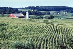
. While predominantly rural
, the county has become increasingly suburban in recent years.
and Frederick Counties
, see Hundred (division)
.
During the American Civil War, the population of Carroll County was sharply divided between supporters of the Union and the Confederacy. In 1863, there were significant troop movements through the county as part of the Gettysburg
campaign. On June 29, 1863, the cavalry skirmish known as Corbit's Charge was fought in the streets of Westminster, when two companies of Delaware cavalry attacked a much larger Confederate force under General J.E.B. Stuart
.
Notable citizens of Carroll County include:
The county has a number of properties on the National Register of Historic Places
.
Several times in the past, Carroll County voters have rejected charter amendments that would call for a government consisting of a County Executive and a County Council.
Republicans hold every county-wide elected office.
s, since the Maryland General Assembly did not agree on the districts in time for the 2006 elections.
Commissioners elected in 2010—all Republican--were:
Carroll County is bordered on the north by the Mason-Dixon Line
. The Patapsco River
forms its southern border, and Liberty Reservoir
forms part of its eastern border. Carroll County is bordered on the west by the Monocacy River
and Sam's Creek. Other major streams include Big Pipe Creek, Little Pipe Creek, Bear Branch, and the headwaters of the Gunpowder River
. The Piney Run Reservoir is in the southern part of the county.
The terrain consists of largely of rolling piedmont hills. The most significant of these is Parr's Ridge
, which bisects the county from southwest to northeast. The highest point is in the northeastern part of the county on Dug Hill along Deep Run Road.
There are three railroad lines that transit Carroll County. The old Baltimore and Ohio
(B&O) Old Main Line crosses the southern part of the county, with former stations in Sykesville
and Mount Airy
. The original Western Maryland Railway
(WM) main line track goes through Carrollton
, Westminster, New Windsor
, and Union Bridge
. The old Baltimore and Hanover Railroad
(later acquired by WM) goes through Hampstead
, Millers
, and Lineboro
. Two of the three railroad lines are currently operated by CSX Transportation
, with the former WM main line being operated by Maryland Midland Railway
.
of 2000, there were 150,897 people, 52,503 households, and 41,109 families residing in the county. The population density
was 336 people per square mile (130/km²). There were 54,260 housing units at an average density of 121 per square mile (47/km²). The racial makeup of the county was 95.69% White
, 2.28% Black
or African American
, 0.22% Native American
, 0.75% Asian
, 0.02% Pacific Islander
, 0.31% from other races
, and 0.73% from two or more races. 0.99% of the population were Hispanic
or Latino
of any race. 30.5% were of German, 14.0% Irish
, 11.1% United States
or American, 10.7% English
and 7.3% Italian
ancestry according to Census 2000.
There were 52,503 households out of which 39.70% had children under the age of 18 living with them, 66.50% were married couples
living together, 8.30% had a female householder with no husband present, and 21.70% were non-families. 17.50% of all households were made up of individuals and 7.40% had someone living alone who was 65 years of age or older. The average household size was 2.81 and the average family size was 3.18.
In the county the population was spread out with 27.70% under the age of 18, 7.00% from 18 to 24, 30.60% from 25 to 44, 23.90% from 45 to 64, and 10.80% who were 65 years of age or older. The median age was 37 years. For every 100 females there were 97.40 males. For every 100 females age 18 and over, there were 94.00 males.
The median income for a household in the county was $60,021, and the median income for a family was $66,430 (these figures had risen to $78,912 and $90,376 respectively as of a 2007 estimate). Males had a median income of $44,191 versus $30,599 for females. The per capita income
for the county was $23,829. About 2.70% of families and 3.80% of the population were below the poverty line, including 4.00% of those under age 18 and 4.90% of those age 65 or over.
As of 2007, Carroll County was the tenth wealthiest county in the country in its population range of 65,000 to 250,000
As of the 2010 census the population was 167,134. The racial makeup was 91.20% Non-Hispanic whites, 3.19% blacks, 0.20% Native Americans, 1.45% Asians, 0.03% Pacific Islanders, 0.09% Non-Hispanics of some other race, 1.33% Non-Hispanics reporting two or more races and 2.61% Hispanics.
Unincorporated areas are also considered as towns by many people and listed in many collections of towns, but they lack local government. Various organizations, such as the United States Census Bureau
, the United States Postal Service
, and local chambers of commerce, define the communities they wish to recognize differently, and since they are not incorporated, their boundaries have no official status outside the organizations in question. The Census Bureau recognizes the following census-designated place
s in the county:
Other unincorporated communities include:
School system is the ninth largest school district
in the state of Maryland.
has its headquarters in an unincorporated area
in the county, near Hampstead
.
, Maryland State Police
, as well as several municipalities having their own police forces. In addition to providing police services, the Sheriff's Office also acts as an agent of the courts: serving warrants, enforcing child support laws, ensuring courthouse security, transporting prisoners, etc. On October 4, 2007, the County Commissioners voted to create a police department for the county. The police department would handle primary law enforcement duties while the Sheriff's office would continue to act under the arm of the courts. This move would give the Commissioners power to appoint or fire the chief of police instead of having a popularly elected Sheriff being in charge of all law enforcement. This move falls in line with Maryland's more populated counties who have such a dual system of law enforcement (Montgomery, Anne Arundel, Prince George's, Howard and Baltimore Counties), as Carroll County has begun to have a population increase. Municipal departments, such as Westminster Police, would be unaffected by the change.
http://www.carrollcountytimes.com/articles/2008/01/09/news/local_news/newsstory4.txt
U.S. state
A U.S. state is any one of the 50 federated states of the United States of America that share sovereignty with the federal government. Because of this shared sovereignty, an American is a citizen both of the federal entity and of his or her state of domicile. Four states use the official title of...
of Maryland
Maryland
Maryland is a U.S. state located in the Mid Atlantic region of the United States, bordering Virginia, West Virginia, and the District of Columbia to its south and west; Pennsylvania to its north; and Delaware to its east...
. In 2010, its population was 167,134. It was named for Charles Carroll of Carrollton
Charles Carroll of Carrollton
Charles Carroll of Carrollton was a wealthy Maryland planter and an early advocate of independence from Great Britain. He served as a delegate to the Continental Congress and later as United States Senator for Maryland...
(1737–1832), signer of the American Declaration of Independence. Its county seat
County seat
A county seat is an administrative center, or seat of government, for a county or civil parish. The term is primarily used in the United States....
is Westminster
Westminster, Maryland
Westminster is a city in northern Maryland, United States. It is the seat of Carroll County. The city's population was 18,590 at the 2010 census. Westminster is an outlying community within the Baltimore-Towson, MD MSA, which is part of a greater Washington-Baltimore-Northern Virginia, DC-MD-VA-WV...
.
This county is a part of the Baltimore-Washington Metropolitan Area
Baltimore-Washington Metropolitan Area
The Baltimore-Washington Metropolitan Area is a combined statistical area consisting of the overlapping labor market region of the cities of Baltimore, Maryland and Washington, D.C.. The region includes Central Maryland, Northern Virginia, and Jefferson County in the Eastern Panhandle of West...
. While predominantly rural
Rural
Rural areas or the country or countryside are areas that are not urbanized, though when large areas are described, country towns and smaller cities will be included. They have a low population density, and typically much of the land is devoted to agriculture...
, the county has become increasingly suburban in recent years.
History
Carroll County was created in 1837 from parts of BaltimoreBaltimore County, Maryland
Baltimore County is a county located in the northern part of the US state of Maryland. In 2010, its population was 805,029. It is part of the Baltimore-Washington Metropolitan Area. Its county seat is Towson. The name of the county was derived from the barony of the Proprietor of the Maryland...
and Frederick Counties
Frederick County, Maryland
Frederick County is a county located in the western part of the U.S. state of Maryland, bordering the southern border of Pennsylvania and the northeastern border of Virginia. As of the 2010 Census, the population was 233,385....
, see Hundred (division)
Hundred (division)
A hundred is a geographic division formerly used in England, Wales, Denmark, South Australia, some parts of the United States, Germany , Sweden, Finland and Norway, which historically was used to divide a larger region into smaller administrative divisions...
.
During the American Civil War, the population of Carroll County was sharply divided between supporters of the Union and the Confederacy. In 1863, there were significant troop movements through the county as part of the Gettysburg
Battle of Gettysburg
The Battle of Gettysburg , was fought July 1–3, 1863, in and around the town of Gettysburg, Pennsylvania. The battle with the largest number of casualties in the American Civil War, it is often described as the war's turning point. Union Maj. Gen. George Gordon Meade's Army of the Potomac...
campaign. On June 29, 1863, the cavalry skirmish known as Corbit's Charge was fought in the streets of Westminster, when two companies of Delaware cavalry attacked a much larger Confederate force under General J.E.B. Stuart
J.E.B. Stuart
James Ewell Brown "Jeb" Stuart was a U.S. Army officer from Virginia and a Confederate States Army general during the American Civil War. He was known to his friends as "Jeb", from the initials of his given names. Stuart was a cavalry commander known for his mastery of reconnaissance and the use...
.
Notable citizens of Carroll County include:
- Francis Scott KeyFrancis Scott KeyFrancis Scott Key was an American lawyer, author, and amateur poet, from Georgetown, who wrote the lyrics to the United States' national anthem, "The Star-Spangled Banner".-Life:...
, author of the Star Spangled Banner, was born at his family plantation of Terra Rubra, in what is now northwestern Carroll County. - Whittaker ChambersWhittaker ChambersWhittaker Chambers was born Jay Vivian Chambers and also known as David Whittaker Chambers , was an American writer and editor. After being a Communist Party USA member and Soviet spy, he later renounced communism and became an outspoken opponent later testifying in the perjury and espionage trial...
, former communist spy and Federal witness against Alger HissAlger HissAlger Hiss was an American lawyer, government official, author, and lecturer. He was involved in the establishment of the United Nations both as a U.S. State Department and U.N. official...
The county has a number of properties on the National Register of Historic Places
National Register of Historic Places listings in Carroll County, Maryland
This is a list of the National Register of Historic Places listings in Carroll County, Maryland.This is intended to be a complete list of the properties and districts on the National Register of Historic Places in Carroll County, Maryland, United States...
.
Law and government
Carroll County is governed by five county commissioners, a "commission" being the traditional form of county government in Maryland.Several times in the past, Carroll County voters have rejected charter amendments that would call for a government consisting of a County Executive and a County Council.
Republicans hold every county-wide elected office.
Commissioners
In 2004 Carroll County voters approved legislation that will expand the number of County Commissioners from three to five. The five Commissioners will be elected from five Commissioner districts, as opposed to three Commissioners elected at-large. The change occurred with the 2010 electionElection
An election is a formal decision-making process by which a population chooses an individual to hold public office. Elections have been the usual mechanism by which modern representative democracy operates since the 17th century. Elections may fill offices in the legislature, sometimes in the...
s, since the Maryland General Assembly did not agree on the districts in time for the 2006 elections.
Commissioners elected in 2010—all Republican--were:
- Robin Frazier, Commissioner, District 1, (also served 1998-2002)
- Haven Shoemaker, Commissioner, District 2
- Dave Roush, Commissioner, District 3
- Richard Rothschild, Commissioner, District 4
- Doug Howard, Commissioner, District 5
Cabinet
Supporting the commissioners is a cabinet, composed of the following departments:- Administrative Services
- Citizen Services (Jolene G. Sullivan, Director)
- Comptroller (Rob Burk, Comptroller)
- County Attorney (Timothy C. Burke, County Attorney)
- Economic Development (Lawrence F. Twele, Director)
- Land Use, Planning, and Development (Thomas S. Devilbiss, Acting Director)
- Management and Budget (Ted Zaleski, Director)
- Public Works (Thomas J. Rio, Director)
Geography
According to the 2000 census, the county has a total area of 452.4 square miles (1,171.7 km²), of which 449.13 square miles (1,163.2 km²) (or 99.28%) is land and 3.27 square miles (8.5 km²) (or 0.72%) is water.Carroll County is bordered on the north by the Mason-Dixon Line
Mason-Dixon line
The Mason–Dixon Line was surveyed between 1763 and 1767 by Charles Mason and Jeremiah Dixon in the resolution of a border dispute between British colonies in Colonial America. It forms a demarcation line among four U.S. states, forming part of the borders of Pennsylvania, Maryland, Delaware, and...
. The Patapsco River
Patapsco River
The Patapsco River is a river in central Maryland which flows into Chesapeake Bay. The river's tidal portion forms the harbor for the city of Baltimore...
forms its southern border, and Liberty Reservoir
Liberty Reservoir
The Liberty Reservoir is a reservoir in the suburbs of Baltimore, Maryland. It is owned by the City of Baltimore Department of Public Works, but is located outside of the city, and it divides Baltimore and Carroll Counties.-History:...
forms part of its eastern border. Carroll County is bordered on the west by the Monocacy River
Monocacy River
The Monocacy River is a free-flowing tributary of the Potomac River, which empties into the Atlantic Ocean via the Chesapeake Bay. The river is long, with a drainage area of about...
and Sam's Creek. Other major streams include Big Pipe Creek, Little Pipe Creek, Bear Branch, and the headwaters of the Gunpowder River
Gunpowder River
The Gunpowder River is a tidal inlet on the western side of Chesapeake Bay in Maryland, United States. It is formed by the joining of two freshwater rivers, Gunpowder Falls and Little Gunpowder Falls.-Gunpowder Falls:The Big Gunpowder, long, begins in the extreme southern part of Pennsylvania's...
. The Piney Run Reservoir is in the southern part of the county.
The terrain consists of largely of rolling piedmont hills. The most significant of these is Parr's Ridge
Parr's Ridge
Parr's Ridge is a ridge which forms the summit of the Piedmont Plateau region in the U.S. state of Maryland.The ridge, a gentle summit by contrast to Maryland's Appalachian ridges to the west, extends from southwest to northeast through Montgomery, Howard and Carroll counties...
, which bisects the county from southwest to northeast. The highest point is in the northeastern part of the county on Dug Hill along Deep Run Road.
There are three railroad lines that transit Carroll County. The old Baltimore and Ohio
Baltimore and Ohio Railroad
The Baltimore and Ohio Railroad was one of the oldest railroads in the United States and the first common carrier railroad. It came into being mostly because the city of Baltimore wanted to compete with the newly constructed Erie Canal and another canal being proposed by Pennsylvania, which...
(B&O) Old Main Line crosses the southern part of the county, with former stations in Sykesville
Sykesville, Maryland
Sykesville is a town in Carroll County, Maryland, United States. The population was 4,197 at the 2000 census.-History:The land on which Sykesville sits started out as part of a Springfield Estate, owned by wealthy Baltimore shipbuilder William Patterson...
and Mount Airy
Mount Airy, Maryland
Mount Airy is a town in Carroll, Frederick, Howard, and Montgomery counties in the U.S. state of Maryland.-Geography:According to the United States Census Bureau, the town has a total area of , all of it land.-History:...
. The original Western Maryland Railway
Western Maryland Railway
The Western Maryland Railway was an American Class I railroad which operated in Maryland, West Virginia, and Pennsylvania. It was primarily a coal hauling and freight railroad, with a small passenger train operation. The WM became part of the Chessie System in 1973 and ceased operating its lines...
(WM) main line track goes through Carrollton
Carrollton, Maryland
Carrollton is a locality in Carroll County, Maryland, USA.It is not to be confused with Carrollton Manor in Frederick County, from which Charles Carroll of Carrollton, a prominent signer of the Declaration of Independence, took his name....
, Westminster, New Windsor
New Windsor, Maryland
New Windsor is a town in Carroll County, Maryland, United States. The population was 1,303 at the 2000 census. It is a suburb of Westminster, which is about 6 miles east of New Windsor on Maryland Route 31. It contains many neighborhoods, the most known being the 100-acre Atlee Ridge, or "The...
, and Union Bridge
Union Bridge, Maryland
Union Bridge is a town in Carroll County, Maryland, United States. The population was 989 at the 2000 census.Much of the town was added to the National Register of Historic Places as the Union Bridge Historic District in 1994.-Geography:...
. The old Baltimore and Hanover Railroad
Baltimore and Hanover Railroad
The Baltimore and Hanover Railroad was a railroad that operated in Maryland in the 19th century. The 20 mile main line ran from Emory Grove, Maryland north to the Pennsylvania state line near Black Rock Junction, where it connected with the Bachman Valley Railroad.The B&H was chartered by the...
(later acquired by WM) goes through Hampstead
Hampstead, Maryland
Hampstead is a town in Carroll County in the U.S. state of Maryland. The population was 5,060 at the 2000 census. Hampstead School was listed on the National Register of Historic Places in 2002.-Geography:Hampstead is located at ....
, Millers
Millers, Maryland
Millers is an unincorporated community in Carroll County, Maryland, United States. The Jacob F. Shaffer Farm was listed on the National Register of Historic Places in 1998.-References:...
, and Lineboro
Lineboro, Maryland
Lineboro is an unincorporated community located in northeastern Carroll County, Maryland, in the United States. The community was named for its location on the Mason-Dixon Line.-History:...
. Two of the three railroad lines are currently operated by CSX Transportation
CSX Transportation
CSX Transportation operates a Class I railroad in the United States known as the CSX Railroad. It is the main subsidiary of the CSX Corporation. The company is headquartered in Jacksonville, Florida, and owns approximately 21,000 route miles...
, with the former WM main line being operated by Maryland Midland Railway
Maryland Midland Railway
The Maryland Midland Railway is a Class III short-line railroad operating about 63 miles of track in central Maryland. It was originally headquartered in the former Western Maryland Railway station in Union Bridge, Maryland, however it is now located in a new facility across the street from the...
.
Major Highways
 State Route 26Maryland Route 26Maryland Route 26 is an east–west state highway in the U.S. state of Maryland. Outside of the Baltimore city limits, it is known as Liberty Road; inside the city limits it is known as Liberty Heights Avenue....
 State Route 27Maryland Route 27Maryland Route 27 is a state highway in the central part of the U.S. state of Maryland.-Route description:MD 27, also known as Ridge Road and Manchester Road , begins in Germantown at MD 355...
 State Route 32Maryland Route 32Maryland Route 32 is a state highway in the U.S. state of Maryland. The state highway runs from Interstate 97 and MD 3 in Millersville west and north to Washington Road in Westminster. The east–west portion of MD 32 is the Patuxent Freeway, a four- to six-lane...
 State Route 91Maryland Route 91Maryland Route 91 is a short highway that runs through central Maryland. It is one of only four routes still surviving in the route cluster assigned to Carroll County in the 1933 route numbering plan.-Counties traversed:*Carroll County*Baltimore County...
 State Route 97Maryland Route 97Maryland Route 97 is a state highway in the U.S. state of Maryland. The route runs from U.S. Route 29 in Silver Spring, Montgomery County north to the Pennsylvania border in Carroll County, where the road continues into that state as Pennsylvania Route 97...
 State Route 140Maryland Route 140Maryland Route 140 is a local long route in northern Maryland, United States.-Route description:MD 140 is known by various names depending on location; south of Reisterstown it is known as Reisterstown Road. Though Reisterstown itself is named after John Reister, the road is named after Jacob...
 State Route 194Maryland Route 194Maryland Route 194 is a state highway in the U.S. state of Maryland. The state highway runs from MD 26 in Ceresville north to the Pennsylvania state line near Taneytown, where the highway continues as Pennsylvania Route 194 toward Hanover...
Adjacent counties
- York County, PennsylvaniaYork County, PennsylvaniaYork County is a county in the U.S. state of Pennsylvania. As of 2010, the population was 434,972. It is in the Susquehanna Valley, a large fertile agricultural region in South Central Pennsylvania....
(northeast) - Baltimore CountyBaltimore County, MarylandBaltimore County is a county located in the northern part of the US state of Maryland. In 2010, its population was 805,029. It is part of the Baltimore-Washington Metropolitan Area. Its county seat is Towson. The name of the county was derived from the barony of the Proprietor of the Maryland...
(east) - Howard CountyHoward County, Maryland-2010:Whereas according to the 2010 U.S. Census Bureau:*62.2% White*17.5% Black*0.3% Native American*14.4% Asian*0.0% Native Hawaiian or Pacific Islander*3.6% Two or more races*2.0% Other races*5.8% Hispanic or Latino -2000:...
(south) - Frederick CountyFrederick County, MarylandFrederick County is a county located in the western part of the U.S. state of Maryland, bordering the southern border of Pennsylvania and the northeastern border of Virginia. As of the 2010 Census, the population was 233,385....
(west) - Adams County, PennsylvaniaAdams County, PennsylvaniaAdams County is a county in the U.S. state of Pennsylvania. As of the 2010 census, the population was 101,407. It was created on January 22, 1800, from part of York County and named in honor of the second President of the United States, John Adams...
(northwest)
Demographics
2010
Whereas according to the 2010 U.S. Census Bureau:- 92.9% WhiteWhite AmericanWhite Americans are people of the United States who are considered or consider themselves White. The United States Census Bureau defines White people as those "having origins in any of the original peoples of Europe, the Middle East, or North Africa...
- 3.2% BlackAfrican AmericanAfrican Americans are citizens or residents of the United States who have at least partial ancestry from any of the native populations of Sub-Saharan Africa and are the direct descendants of enslaved Africans within the boundaries of the present United States...
- 0.2% Native AmericanNative Americans in the United StatesNative Americans in the United States are the indigenous peoples in North America within the boundaries of the present-day continental United States, parts of Alaska, and the island state of Hawaii. They are composed of numerous, distinct tribes, states, and ethnic groups, many of which survive as...
- 1.4% AsianAsian AmericanAsian Americans are Americans of Asian descent. The U.S. Census Bureau definition of Asians as "Asian” refers to a person having origins in any of the original peoples of the Far East, Southeast Asia, or the Indian subcontinent, including, for example, Cambodia, China, India, Indonesia, Japan,...
- 0.0% Native Hawaiian or Pacific IslanderPacific Islander AmericanPacific Islander Americans, also known as Oceanian Americans, are residents of the United States with original ancestry from Oceania. They represent the smallest racial group counted in the United States census of 2000. They numbered 874,000 people or 0.3 percent of the United States population...
- 1.5% Two or more racesMultiracial AmericanMultiracial Americans, US residents who identify themselves as of "two or more races", were numbered at around 9 million, or 2.9% of the population, in the census of 2010. However there is considerable evidence that the real number is far higher. Prior to the mid-20th century many people hid their...
- 0.8% Other racesRace (United States Census)Race and ethnicity in the United States Census, as defined by the Federal Office of Management and Budget and the United States Census Bureau, are self-identification data items in which residents choose the race or races with which they most closely identify, and indicate whether or not they are...
- 2.6% Hispanic or LatinoHispanic and Latino AmericansHispanic or Latino Americans are Americans with origins in the Hispanic countries of Latin America or in Spain, and in general all persons in the United States who self-identify as Hispanic or Latino.1990 Census of Population and Housing: A self-designated classification for people whose origins...
(of any race)
2000
As of the censusCensus
A census is the procedure of systematically acquiring and recording information about the members of a given population. It is a regularly occurring and official count of a particular population. The term is used mostly in connection with national population and housing censuses; other common...
of 2000, there were 150,897 people, 52,503 households, and 41,109 families residing in the county. The population density
Population density
Population density is a measurement of population per unit area or unit volume. It is frequently applied to living organisms, and particularly to humans...
was 336 people per square mile (130/km²). There were 54,260 housing units at an average density of 121 per square mile (47/km²). The racial makeup of the county was 95.69% White
Race (United States Census)
Race and ethnicity in the United States Census, as defined by the Federal Office of Management and Budget and the United States Census Bureau, are self-identification data items in which residents choose the race or races with which they most closely identify, and indicate whether or not they are...
, 2.28% Black
Race (United States Census)
Race and ethnicity in the United States Census, as defined by the Federal Office of Management and Budget and the United States Census Bureau, are self-identification data items in which residents choose the race or races with which they most closely identify, and indicate whether or not they are...
or African American
Race (United States Census)
Race and ethnicity in the United States Census, as defined by the Federal Office of Management and Budget and the United States Census Bureau, are self-identification data items in which residents choose the race or races with which they most closely identify, and indicate whether or not they are...
, 0.22% Native American
Race (United States Census)
Race and ethnicity in the United States Census, as defined by the Federal Office of Management and Budget and the United States Census Bureau, are self-identification data items in which residents choose the race or races with which they most closely identify, and indicate whether or not they are...
, 0.75% Asian
Race (United States Census)
Race and ethnicity in the United States Census, as defined by the Federal Office of Management and Budget and the United States Census Bureau, are self-identification data items in which residents choose the race or races with which they most closely identify, and indicate whether or not they are...
, 0.02% Pacific Islander
Race (United States Census)
Race and ethnicity in the United States Census, as defined by the Federal Office of Management and Budget and the United States Census Bureau, are self-identification data items in which residents choose the race or races with which they most closely identify, and indicate whether or not they are...
, 0.31% from other races
Race (United States Census)
Race and ethnicity in the United States Census, as defined by the Federal Office of Management and Budget and the United States Census Bureau, are self-identification data items in which residents choose the race or races with which they most closely identify, and indicate whether or not they are...
, and 0.73% from two or more races. 0.99% of the population were Hispanic
Race (United States Census)
Race and ethnicity in the United States Census, as defined by the Federal Office of Management and Budget and the United States Census Bureau, are self-identification data items in which residents choose the race or races with which they most closely identify, and indicate whether or not they are...
or Latino
Race (United States Census)
Race and ethnicity in the United States Census, as defined by the Federal Office of Management and Budget and the United States Census Bureau, are self-identification data items in which residents choose the race or races with which they most closely identify, and indicate whether or not they are...
of any race. 30.5% were of German, 14.0% Irish
Irish people
The Irish people are an ethnic group who originate in Ireland, an island in northwestern Europe. Ireland has been populated for around 9,000 years , with the Irish people's earliest ancestors recorded having legends of being descended from groups such as the Nemedians, Fomorians, Fir Bolg, Tuatha...
, 11.1% United States
United States
The United States of America is a federal constitutional republic comprising fifty states and a federal district...
or American, 10.7% English
English people
The English are a nation and ethnic group native to England, who speak English. The English identity is of early mediaeval origin, when they were known in Old English as the Anglecynn. England is now a country of the United Kingdom, and the majority of English people in England are British Citizens...
and 7.3% Italian
Italian people
The Italian people are an ethnic group that share a common Italian culture, ancestry and speak the Italian language as a mother tongue. Within Italy, Italians are defined by citizenship, regardless of ancestry or country of residence , and are distinguished from people...
ancestry according to Census 2000.
There were 52,503 households out of which 39.70% had children under the age of 18 living with them, 66.50% were married couples
Marriage
Marriage is a social union or legal contract between people that creates kinship. It is an institution in which interpersonal relationships, usually intimate and sexual, are acknowledged in a variety of ways, depending on the culture or subculture in which it is found...
living together, 8.30% had a female householder with no husband present, and 21.70% were non-families. 17.50% of all households were made up of individuals and 7.40% had someone living alone who was 65 years of age or older. The average household size was 2.81 and the average family size was 3.18.
In the county the population was spread out with 27.70% under the age of 18, 7.00% from 18 to 24, 30.60% from 25 to 44, 23.90% from 45 to 64, and 10.80% who were 65 years of age or older. The median age was 37 years. For every 100 females there were 97.40 males. For every 100 females age 18 and over, there were 94.00 males.
The median income for a household in the county was $60,021, and the median income for a family was $66,430 (these figures had risen to $78,912 and $90,376 respectively as of a 2007 estimate). Males had a median income of $44,191 versus $30,599 for females. The per capita income
Per capita income
Per capita income or income per person is a measure of mean income within an economic aggregate, such as a country or city. It is calculated by taking a measure of all sources of income in the aggregate and dividing it by the total population...
for the county was $23,829. About 2.70% of families and 3.80% of the population were below the poverty line, including 4.00% of those under age 18 and 4.90% of those age 65 or over.
As of 2007, Carroll County was the tenth wealthiest county in the country in its population range of 65,000 to 250,000
As of the 2010 census the population was 167,134. The racial makeup was 91.20% Non-Hispanic whites, 3.19% blacks, 0.20% Native Americans, 1.45% Asians, 0.03% Pacific Islanders, 0.09% Non-Hispanics of some other race, 1.33% Non-Hispanics reporting two or more races and 2.61% Hispanics.
Cities and towns
This county contains the following incorporated municipalities:- 2 CitiesCityA city is a relatively large and permanent settlement. Although there is no agreement on how a city is distinguished from a town within general English language meanings, many cities have a particular administrative, legal, or historical status based on local law.For example, in the U.S...
:- WestminsterWestminster, MarylandWestminster is a city in northern Maryland, United States. It is the seat of Carroll County. The city's population was 18,590 at the 2010 census. Westminster is an outlying community within the Baltimore-Towson, MD MSA, which is part of a greater Washington-Baltimore-Northern Virginia, DC-MD-VA-WV...
(incorporated 1818) - TaneytownTaneytown, MarylandTaneytown is a city in Carroll County, Maryland, United States. The population was 5,128 at the 2000 census. was founded in 1754. Of the town George Washington once wrote "Tan-nee town is but a small place with only the Street through wch. the road passes, built on...
(incorporated 1836)
- Westminster
- 6 TownTownA town is a human settlement larger than a village but smaller than a city. The size a settlement must be in order to be called a "town" varies considerably in different parts of the world, so that, for example, many American "small towns" seem to British people to be no more than villages, while...
s:- ManchesterManchester, MarylandManchester, Maryland, is a small incorporated town in Northeastern Carroll County, Maryland located on the Eastern coast of the United States of America just South of the Pennsylvania State line and North of Baltimore, Maryland...
(incorporated 1834) - New WindsorNew Windsor, MarylandNew Windsor is a town in Carroll County, Maryland, United States. The population was 1,303 at the 2000 census. It is a suburb of Westminster, which is about 6 miles east of New Windsor on Maryland Route 31. It contains many neighborhoods, the most known being the 100-acre Atlee Ridge, or "The...
(incorporated 1843) - Union BridgeUnion Bridge, MarylandUnion Bridge is a town in Carroll County, Maryland, United States. The population was 989 at the 2000 census.Much of the town was added to the National Register of Historic Places as the Union Bridge Historic District in 1994.-Geography:...
(incorporated 1872) - HampsteadHampstead, MarylandHampstead is a town in Carroll County in the U.S. state of Maryland. The population was 5,060 at the 2000 census. Hampstead School was listed on the National Register of Historic Places in 2002.-Geography:Hampstead is located at ....
(incorporated 1888) - Mount AiryMount Airy, MarylandMount Airy is a town in Carroll, Frederick, Howard, and Montgomery counties in the U.S. state of Maryland.-Geography:According to the United States Census Bureau, the town has a total area of , all of it land.-History:...
(incorporated 1894) (This town is partly in Carroll County, partly in Frederick CountyFrederick County, MarylandFrederick County is a county located in the western part of the U.S. state of Maryland, bordering the southern border of Pennsylvania and the northeastern border of Virginia. As of the 2010 Census, the population was 233,385....
, Montgomery CountyMontgomery County, MarylandMontgomery County is a county in the U.S. state of Maryland, situated just to the north of Washington, D.C., and southwest of the city of Baltimore. It is one of the most affluent counties in the United States, and has the highest percentage of residents over 25 years of age who hold post-graduate...
and Howard CountyHoward County, Maryland-2010:Whereas according to the 2010 U.S. Census Bureau:*62.2% White*17.5% Black*0.3% Native American*14.4% Asian*0.0% Native Hawaiian or Pacific Islander*3.6% Two or more races*2.0% Other races*5.8% Hispanic or Latino -2000:...
.) - SykesvilleSykesville, MarylandSykesville is a town in Carroll County, Maryland, United States. The population was 4,197 at the 2000 census.-History:The land on which Sykesville sits started out as part of a Springfield Estate, owned by wealthy Baltimore shipbuilder William Patterson...
(incorporated 1904)
- Manchester
Unincorporated areas are also considered as towns by many people and listed in many collections of towns, but they lack local government. Various organizations, such as the United States Census Bureau
United States Census Bureau
The United States Census Bureau is the government agency that is responsible for the United States Census. It also gathers other national demographic and economic data...
, the United States Postal Service
United States Postal Service
The United States Postal Service is an independent agency of the United States government responsible for providing postal service in the United States...
, and local chambers of commerce, define the communities they wish to recognize differently, and since they are not incorporated, their boundaries have no official status outside the organizations in question. The Census Bureau recognizes the following census-designated place
Census-designated place
A census-designated place is a concentration of population identified by the United States Census Bureau for statistical purposes. CDPs are delineated for each decennial census as the statistical counterparts of incorporated places such as cities, towns and villages...
s in the county:
- EldersburgEldersburg, MarylandEldersburg is a census-designated place in Carroll County, Maryland, United States. The population was 27,741 at the 2000 census.-History:...
Other unincorporated communities include:
- AlesiaAlesia, MarylandAlesia is an unincorporated community in Carroll County, Maryland, United States.-References:...
- CarrolltonCarrollton, MarylandCarrollton is a locality in Carroll County, Maryland, USA.It is not to be confused with Carrollton Manor in Frederick County, from which Charles Carroll of Carrollton, a prominent signer of the Declaration of Independence, took his name....
- CarrolltowneCarrolltowne, MarylandCarrolltowne is an unincorporated community in Carroll County, Maryland, United States.-References:...
- DetourDetour, MarylandDetour is an unincorporated community in Carroll County, Maryland, United States. William and Catherine Biggs Farm was listed on the National Register of Historic Places in 2001.-References:...
- FinksburgFinksburg, MarylandFinksburg is an unincorporated community in Carroll County, Maryland, United States. It is the location of the National Security Agency's EKMS Central Facility. Finksburg is located at the intersection of Maryland Route 91 and Maryland Route 140, on the border of Carroll and Baltimore counties...
- FrizzelburgFrizzelburg, MarylandFrizzelburg is an unincorporated community in Carroll County, Maryland, United States.-References:...
- GamberGamber, MarylandGamber is an unincorporated town located in Carroll County, Maryland. It is the hometown of MTV's The Real World personality Jon Brennan. Gamber is located at the intersection of Maryland Route 91 and Maryland Route 32, near the border of Carroll and Baltimore Counties...
- GaitherGaither, MarylandGaither is an unincorporated community in Carroll County, Maryland, United States.-References:...
- GreenmountGreenmount, MarylandGreenmount is an unincorporated community in Carroll County, Maryland, United States.-References:...
- HarneyHarney, MarylandHarney is an unincorporated community in Carroll County, Maryland, USA.-References:...
- HenrytonHenryton, MarylandHenryton is an unincorporated community in Carroll County, Maryland, United States.-References:...
- JasontownJasontown, MarylandJasontown is an unincorporated community in Carroll County, Maryland, United States.-References:...
- KeymarKeymar, MarylandKeymar is an unincorporated community in Carroll County, Maryland, United States.-References:...
- LineboroLineboro, MarylandLineboro is an unincorporated community located in northeastern Carroll County, Maryland, in the United States. The community was named for its location on the Mason-Dixon Line.-History:...
- Linwood
- LouisvilleLouisville, MarylandLouisville is an unincorporated community in Carroll County, Maryland, United States.-References:...
- Marriottsville (a portion is also in Howard CountyHoward County, Maryland-2010:Whereas according to the 2010 U.S. Census Bureau:*62.2% White*17.5% Black*0.3% Native American*14.4% Asian*0.0% Native Hawaiian or Pacific Islander*3.6% Two or more races*2.0% Other races*5.8% Hispanic or Latino -2000:...
and Baltimore CountyBaltimore County, MarylandBaltimore County is a county located in the northern part of the US state of Maryland. In 2010, its population was 805,029. It is part of the Baltimore-Washington Metropolitan Area. Its county seat is Towson. The name of the county was derived from the barony of the Proprietor of the Maryland...
) - MiddleburgMiddleburg, MarylandMiddleburg is an unincorporated community in Carroll County, Maryland, United States.-References:...
- MillersMillers, MarylandMillers is an unincorporated community in Carroll County, Maryland, United States. The Jacob F. Shaffer Farm was listed on the National Register of Historic Places in 1998.-References:...
- Patapsco
- Pleasant ValleyPleasant Valley, Carroll County, MarylandPleasant Valley is an unincorporated community in Carroll County, Maryland, United States.Pleasant Valley also has a Volunteer Fire Company which hosts many county events throughout the year-References:...
- Silver Run
- Union MillsUnion Mills, MarylandUnion Mills is an unincorporated community in Carroll County, Maryland, United States. The community is home to the Union Mills Homestead Historic District, added to the National Register of Historic Places in 1971. The Solomon Arter House was listed in 1987 and the Philip and Uriah Arter Farm in...
- UniontownUniontown, MarylandUniontown is an unincorporated community in Carroll County, Maryland, United States. The community is home to the Uniontown Historic District, added to the National Register of Historic Places in 1986.-References:...
- WoodbineWoodbine, MarylandWoodbine is located in Howard and Carroll counties, in the Baltimore, Maryland, metropolitan area. The community was named for the plant, which grew in this town in fields and along riverbanks.-Background:...
(a portion is also in Howard County.Howard County, Maryland-2010:Whereas according to the 2010 U.S. Census Bureau:*62.2% White*17.5% Black*0.3% Native American*14.4% Asian*0.0% Native Hawaiian or Pacific Islander*3.6% Two or more races*2.0% Other races*5.8% Hispanic or Latino -2000:...
) - WoodstockWoodstock, MarylandWoodstock is an unincorporated community which is a suburb of Baltimore, Maryland. The original village of Woodstock is located in Howard County, but the surrounding area includes portions of Baltimore County and Carroll County.- Demographics :...
(a portion is also in Howard County.Howard County, Maryland-2010:Whereas according to the 2010 U.S. Census Bureau:*62.2% White*17.5% Black*0.3% Native American*14.4% Asian*0.0% Native Hawaiian or Pacific Islander*3.6% Two or more races*2.0% Other races*5.8% Hispanic or Latino -2000:...
)
Public schools
The Carroll County Public SchoolsCarroll County Public Schools (Maryland)
Carroll County Public Schools is a school district based in Westminster, Maryland.CCPS is the ninth largest in the state of Maryland. More than 27,000 students are enrolled in the county's public schools....
School system is the ninth largest school district
School district
School districts are a form of special-purpose district which serves to operate the local public primary and secondary schools.-United States:...
in the state of Maryland.
Economy
JoS. A. Bank ClothiersJoS. A. Bank Clothiers
Joseph A. Bank Clothiers, Inc., also known by the abbreviated name JoS. A. Bank Clothiers, is an American manufacturer-retailers of men's classically-styled tailored and casual clothing, sportswear, footwear and accessories...
has its headquarters in an unincorporated area
Unincorporated area
In law, an unincorporated area is a region of land that is not a part of any municipality.To "incorporate" in this context means to form a municipal corporation, a city, town, or village with its own government. An unincorporated community is usually not subject to or taxed by a municipal government...
in the county, near Hampstead
Hampstead, Maryland
Hampstead is a town in Carroll County in the U.S. state of Maryland. The population was 5,060 at the 2000 census. Hampstead School was listed on the National Register of Historic Places in 2002.-Geography:Hampstead is located at ....
.
Law Enforcement
Law enforcement services for the county are provided by the Carroll County Sheriff's OfficeCarroll County Sheriff's Office (Maryland)
The Carroll County Sheriff's Office is a law enforcement agency for Carroll County, MD. It services a population of 170,260 people within 449.13 square miles.-Organization:...
, Maryland State Police
Maryland State Police
The Maryland State Police is the official state police force of the state of Maryland. The Maryland State Police is headquartered at 1201 Reisterstown Road in the Pikesville CDP in unincorporated Baltimore County.-Organizational structure:...
, as well as several municipalities having their own police forces. In addition to providing police services, the Sheriff's Office also acts as an agent of the courts: serving warrants, enforcing child support laws, ensuring courthouse security, transporting prisoners, etc. On October 4, 2007, the County Commissioners voted to create a police department for the county. The police department would handle primary law enforcement duties while the Sheriff's office would continue to act under the arm of the courts. This move would give the Commissioners power to appoint or fire the chief of police instead of having a popularly elected Sheriff being in charge of all law enforcement. This move falls in line with Maryland's more populated counties who have such a dual system of law enforcement (Montgomery, Anne Arundel, Prince George's, Howard and Baltimore Counties), as Carroll County has begun to have a population increase. Municipal departments, such as Westminster Police, would be unaffected by the change.
http://www.carrollcountytimes.com/articles/2008/01/09/news/local_news/newsstory4.txt
Family Support Services
General counseling, trauma-based therapy, support for victims of domestic violence, in-home aide for the adult disabled, and other assistance to Carroll County families and individuals are offered by Family and Children's Services of Central Maryland (FCS), a private nonprofit organization with offices in Westminster, Maryland. FCS also operates an adult day care center in Westminster. Some services are offered without charge; others are offered on a sliding-fee scale based on income.Miscellaneous
- The newspaper of record is the Carroll County TimesCarroll County TimesThe Carroll County Times was founded on October 6, 1911, as The Times. Owner and publisher George Mather, whose father owned the once-prominent Mather's Department Store in Westminster, MD, sold The Times in 1947. The Times expanded and became the Carroll County Times in 1956.The Carroll County...
. - The county was used for scenes in the Tim AllenTim AllenTim Allen is an American comedian, actor, voice-over artist, and entertainer, known for his role in the sitcom Home Improvement...
movie For Richer or PoorerFor Richer or PoorerFor Richer or Poorer is a 1997 comedy film starring Tim Allen and Kirstie Alley. It is rated PG-13 for some sexual innuendo and one use of strong language.-Plot :...
and the Richard GereRichard GereRichard Tiffany Gere is an American actor. He began acting in the 1970s, playing a supporting role in Looking for Mr. Goodbar, and a starring role in Days of Heaven. He came to prominence in 1980 for his role in the film American Gigolo, which established him as a leading man and a sex symbol...
and Julia RobertsJulia RobertsJulia Fiona Roberts is an American actress. She became a Hollywood star after headlining the romantic comedy Pretty Woman , which grossed $464 million worldwide...
movie Runaway BrideRunaway Bride (1999 film)Runaway Bride is a 1999 American romantic comedy film starring Julia Roberts and Richard Gere and directed by Garry Marshall. The screenplay was written by Josann McGibbon, Audrey Wells and Sara Parriott.-Plot:...
. - Chris RockChris RockChristopher Julius "Chris" Rock III is an American comedian, actor, screenwriter, television producer, film producer and director. He was voted in the US as the 5th greatest stand-up comedian of all time by Comedy Central...
stood in front of North Carroll Middle School during his speech in the movie Head of StateHead of State (film)Head of State is a 2003 comedy film directed, written by, and starring Chris Rock and also co-starring Bernie Mac. The film's title refers to that function of the President of the United States, the other two functions being head of government and commander in chief.-Plot:Mays Gilliam is an...
.
See also
- National Register of Historic Places listings in Carroll County, MarylandNational Register of Historic Places listings in Carroll County, MarylandThis is a list of the National Register of Historic Places listings in Carroll County, Maryland.This is intended to be a complete list of the properties and districts on the National Register of Historic Places in Carroll County, Maryland, United States...