
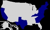
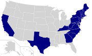
List of U.S. states that were never territories
Encyclopedia
United States
The United States of America is a federal constitutional republic comprising fifty states and a federal district...
after its independence from the Kingdom of Great Britain
Kingdom of Great Britain
The former Kingdom of Great Britain, sometimes described as the 'United Kingdom of Great Britain', That the Two Kingdoms of Scotland and England, shall upon the 1st May next ensuing the date hereof, and forever after, be United into One Kingdom by the Name of GREAT BRITAIN. was a sovereign...
in 1783. They are listed in the order they were admitted to the Union.
| Order admitted | State | Status between European settlement and statehood (Sorted chronologically by admission to the union) |
|---|---|---|
| 1 | Delaware Delaware Delaware is a U.S. state located on the Atlantic Coast in the Mid-Atlantic region of the United States. It is bordered to the south and west by Maryland, and to the north by Pennsylvania... |
Original thirteen states, formerly thirteen Thirteen Colonies The Thirteen Colonies were English and later British colonies established on the Atlantic coast of North America between 1607 and 1733. They declared their independence in the American Revolution and formed the United States of America... of 21 British Kingdom of Great Britain The former Kingdom of Great Britain, sometimes described as the 'United Kingdom of Great Britain', That the Two Kingdoms of Scotland and England, shall upon the 1st May next ensuing the date hereof, and forever after, be United into One Kingdom by the Name of GREAT BRITAIN. was a sovereign... colonies in mainland and insular North America North America North America is a continent wholly within the Northern Hemisphere and almost wholly within the Western Hemisphere. It is also considered a northern subcontinent of the Americas... . They declared independence from Britain on 4 July 1776 and were formally thirteen independent countries until ratification of the first American constitution, the Articles of Confederation and Perpetual Union, proposed in 1777, completed in 1781; whereupon the "United States of America" legally came into existence. The United States was subsequently re-confederated under a new constitution, the U.S. Constitution, which was proposed in 1787, ratified in 1788, and took effect on 4 March 1789. The eight colonies that remained loyal to Britain during the American Revolutionary War American Revolutionary War The American Revolutionary War , the American War of Independence, or simply the Revolutionary War, began as a war between the Kingdom of Great Britain and thirteen British colonies in North America, and ended in a global war between several European great powers.The war was the result of the... were: Quebec Quebec Quebec or is a province in east-central Canada. It is the only Canadian province with a predominantly French-speaking population and the only one whose sole official language is French at the provincial level.... (then stretched westward to the Mississippi River and southwestward to the Ohio River), Newfoundland Newfoundland and Labrador Newfoundland and Labrador is the easternmost province of Canada. Situated in the country's Atlantic region, it incorporates the island of Newfoundland and mainland Labrador with a combined area of . As of April 2011, the province's estimated population is 508,400... , Nova Scotia Nova Scotia Nova Scotia is one of Canada's three Maritime provinces and is the most populous province in Atlantic Canada. The name of the province is Latin for "New Scotland," but "Nova Scotia" is the recognized, English-language name of the province. The provincial capital is Halifax. Nova Scotia is the... (then included Prince Edward Island Prince Edward Island Prince Edward Island is a Canadian province consisting of an island of the same name, as well as other islands. The maritime province is the smallest in the nation in both land area and population... , New Brunswick New Brunswick New Brunswick is one of Canada's three Maritime provinces and is the only province in the federation that is constitutionally bilingual . The provincial capital is Fredericton and Saint John is the most populous city. Greater Moncton is the largest Census Metropolitan Area... , and part of Maine Maine Maine is a state in the New England region of the northeastern United States, bordered by the Atlantic Ocean to the east and south, New Hampshire to the west, and the Canadian provinces of Quebec to the northwest and New Brunswick to the northeast. Maine is both the northernmost and easternmost... ), Bermuda Bermuda Bermuda is a British overseas territory in the North Atlantic Ocean. Located off the east coast of the United States, its nearest landmass is Cape Hatteras, North Carolina, about to the west-northwest. It is about south of Halifax, Nova Scotia, Canada, and northeast of Miami, Florida... , the Bahamas The Bahamas The Bahamas , officially the Commonwealth of the Bahamas, is a nation consisting of 29 islands, 661 cays, and 2,387 islets . It is located in the Atlantic Ocean north of Cuba and Hispaniola , northwest of the Turks and Caicos Islands, and southeast of the United States... , Jamaica Jamaica Jamaica is an island nation of the Greater Antilles, in length, up to in width and 10,990 square kilometres in area. It is situated in the Caribbean Sea, about south of Cuba, and west of Hispaniola, the island harbouring the nation-states Haiti and the Dominican Republic... , East Florida East Florida East Florida was a colony of Great Britain from 1763–1783 and of Spain from 1783–1822. East Florida was established by the British colonial government in 1763; as its name implies it consisted of the eastern part of the region of Florida, with West Florida comprising the western parts. Its capital... , and West Florida West Florida West Florida was a region on the north shore of the Gulf of Mexico, which underwent several boundary and sovereignty changes during its history. West Florida was first established in 1763 by the British government; as its name suggests it largely consisted of the western portion of the region... (both Floridas eventually being sold back to Spain, from whom the United States purchased them in 1819). |
| 2 | Pennsylvania Pennsylvania The Commonwealth of Pennsylvania is a U.S. state that is located in the Northeastern and Mid-Atlantic regions of the United States. The state borders Delaware and Maryland to the south, West Virginia to the southwest, Ohio to the west, New York and Ontario, Canada, to the north, and New Jersey to... |
|
| 3 | New Jersey New Jersey New Jersey is a state in the Northeastern and Middle Atlantic regions of the United States. , its population was 8,791,894. It is bordered on the north and east by the state of New York, on the southeast and south by the Atlantic Ocean, on the west by Pennsylvania and on the southwest by Delaware... |
|
| 4 | Georgia Georgia (U.S. state) Georgia is a state located in the southeastern United States. It was established in 1732, the last of the original Thirteen Colonies. The state is named after King George II of Great Britain. Georgia was the fourth state to ratify the United States Constitution, on January 2, 1788... |
|
| 5 | Connecticut Connecticut Connecticut is a state in the New England region of the northeastern United States. It is bordered by Rhode Island to the east, Massachusetts to the north, and the state of New York to the west and the south .Connecticut is named for the Connecticut River, the major U.S. river that approximately... |
|
| 6 | Massachusetts Massachusetts The Commonwealth of Massachusetts is a state in the New England region of the northeastern United States of America. It is bordered by Rhode Island and Connecticut to the south, New York to the west, and Vermont and New Hampshire to the north; at its east lies the Atlantic Ocean. As of the 2010... |
|
| 7 | Maryland Maryland Maryland is a U.S. state located in the Mid Atlantic region of the United States, bordering Virginia, West Virginia, and the District of Columbia to its south and west; Pennsylvania to its north; and Delaware to its east... |
|
| 8 | South Carolina South Carolina South Carolina is a state in the Deep South of the United States that borders Georgia to the south, North Carolina to the north, and the Atlantic Ocean to the east. Originally part of the Province of Carolina, the Province of South Carolina was one of the 13 colonies that declared independence... |
|
| 9 | New Hampshire New Hampshire New Hampshire is a state in the New England region of the northeastern United States of America. The state was named after the southern English county of Hampshire. It is bordered by Massachusetts to the south, Vermont to the west, Maine and the Atlantic Ocean to the east, and the Canadian... |
|
| 10 | Virginia Virginia The Commonwealth of Virginia , is a U.S. state on the Atlantic Coast of the Southern United States. Virginia is nicknamed the "Old Dominion" and sometimes the "Mother of Presidents" after the eight U.S. presidents born there... |
|
| 11 | New York New York New York is a state in the Northeastern region of the United States. It is the nation's third most populous state. New York is bordered by New Jersey and Pennsylvania to the south, and by Connecticut, Massachusetts and Vermont to the east... |
|
| 12 | North Carolina North Carolina North Carolina is a state located in the southeastern United States. The state borders South Carolina and Georgia to the south, Tennessee to the west and Virginia to the north. North Carolina contains 100 counties. Its capital is Raleigh, and its largest city is Charlotte... |
|
| 13 | Rhode Island Rhode Island The state of Rhode Island and Providence Plantations, more commonly referred to as Rhode Island , is a state in the New England region of the United States. It is the smallest U.S. state by area... |
|
| 14 | Vermont Vermont Vermont is a state in the New England region of the northeastern United States of America. The state ranks 43rd in land area, , and 45th in total area. Its population according to the 2010 census, 630,337, is the second smallest in the country, larger only than Wyoming. It is the only New England... |
Republic of Vermont Vermont Republic The term Vermont Republic has been used by later historians for the government of what became modern Vermont from 1777 to 1791. In July 1777 delegates from 28 towns met and declared independence from jurisdictions and land claims of British colonies in New Hampshire and New York. They also... formed unilaterally in 1777 from territory formerly associated with New York New York New York is a state in the Northeastern region of the United States. It is the nation's third most populous state. New York is bordered by New Jersey and Pennsylvania to the south, and by Connecticut, Massachusetts and Vermont to the east... and New Hampshire New Hampshire New Hampshire is a state in the New England region of the northeastern United States of America. The state was named after the southern English county of Hampshire. It is bordered by Massachusetts to the south, Vermont to the west, Maine and the Atlantic Ocean to the east, and the Canadian... . The Vermont Constitution dates from 1777. On 10 January 1791, the Republic of Vermont ratified the U.S. Constitution—the only state apart from the original 13 to do so. Vermont was admitted to the union as the 14th state a few months later. |
| 15 | Kentucky Kentucky The Commonwealth of Kentucky is a state located in the East Central United States of America. As classified by the United States Census Bureau, Kentucky is a Southern state, more specifically in the East South Central region. Kentucky is one of four U.S. states constituted as a commonwealth... |
Originally southwestern Virginia, Kentucky was distinguished from Virginia and granted statehood in 1792, pursuant to the relinquishment by all of the original states of their claims to land between the Mississippi River and the Appalachian Mountains. |
| 23 | Maine Maine Maine is a state in the New England region of the northeastern United States, bordered by the Atlantic Ocean to the east and south, New Hampshire to the west, and the Canadian provinces of Quebec to the northwest and New Brunswick to the northeast. Maine is both the northernmost and easternmost... |
District of Maine District of Maine The District of Maine was a legal designation for what is now the U.S. state of Maine from American independence until the Missouri Compromise on March 4, 1820, after which it gained its independence from Massachusetts and became the 23rd state in the Union... , part of Massachusetts until 1820, when Massachusetts and the United States granted statehood to Maine. (Under the U.S. Constitution, the grant of statehood to a territory that lies within an existing state requires collateral permission of the other state, as well as permission of the Congress.) |
| 28 | Texas Texas Texas is the second largest U.S. state by both area and population, and the largest state by area in the contiguous United States.The name, based on the Caddo word "Tejas" meaning "friends" or "allies", was applied by the Spanish to the Caddo themselves and to the region of their settlement in... |
Most of Texas was part of the Spanish Viceroyalty of New Spain (with some parts once part of the French Royal Province of Louisiana) until 1821, when New Spain became the independent United Mexican States Mexico The United Mexican States , commonly known as Mexico , is a federal constitutional republic in North America. It is bordered on the north by the United States; on the south and west by the Pacific Ocean; on the southeast by Guatemala, Belize, and the Caribbean Sea; and on the east by the Gulf of... . The Mexican State of Texas declared and secured independence in 1836 as the Republic of Texas Republic of Texas The Republic of Texas was an independent nation in North America, bordering the United States and Mexico, that existed from 1836 to 1846.Formed as a break-away republic from Mexico by the Texas Revolution, the state claimed borders that encompassed an area that included all of the present U.S... . It was annexed by the United States and reduced to its current size in 1845. Parts of the former Republic of Texas now lie within New Mexico New Mexico New Mexico is a state located in the southwest and western regions of the United States. New Mexico is also usually considered one of the Mountain States. With a population density of 16 per square mile, New Mexico is the sixth-most sparsely inhabited U.S... , Oklahoma Oklahoma Oklahoma is a state located in the South Central region of the United States of America. With an estimated 3,751,351 residents as of the 2010 census and a land area of 68,667 square miles , Oklahoma is the 28th most populous and 20th-largest state... , Kansas Kansas Kansas is a US state located in the Midwestern United States. It is named after the Kansas River which flows through it, which in turn was named after the Kansa Native American tribe, which inhabited the area. The tribe's name is often said to mean "people of the wind" or "people of the south... , Colorado Colorado Colorado is a U.S. state that encompasses much of the Rocky Mountains as well as the northeastern portion of the Colorado Plateau and the western edge of the Great Plains... , and southeastern Wyoming Wyoming Wyoming is a state in the mountain region of the Western United States. The western two thirds of the state is covered mostly with the mountain ranges and rangelands in the foothills of the Eastern Rocky Mountains, while the eastern third of the state is high elevation prairie known as the High... . |
| 31 | California California California is a state located on the West Coast of the United States. It is by far the most populous U.S. state, and the third-largest by land area... |
Alta California was a province of New Spain until 1821, and then of Mexico Mexico The United Mexican States , commonly known as Mexico , is a federal constitutional republic in North America. It is bordered on the north by the United States; on the south and west by the Pacific Ocean; on the southeast by Guatemala, Belize, and the Caribbean Sea; and on the east by the Gulf of... until 1848. It became American under the Treaty of Guadalupe Hidalgo Treaty of Guadalupe Hidalgo The Treaty of Guadalupe Hidalgo is the peace treaty, largely dictated by the United States to the interim government of a militarily occupied Mexico City, that ended the Mexican-American War on February 2, 1848... . At that time, Alta California included all of contemporary Upper California, northern Arizona, all of Nevada and Utah, and part of southwestern Wyoming. California in its present size wrote a bilingual state constitution in 1849 and was granted statehood without going through the territorial phase in 1850. (See the Compromise of 1850 Compromise of 1850 The Compromise of 1850 was a package of five bills, passed in September 1850, which defused a four-year confrontation between the slave states of the South and the free states of the North regarding the status of territories acquired during the Mexican-American War... .) In 1846, prior to formal declaration of the Mexican–American War Mexican–American War The Mexican–American War, also known as the First American Intervention, the Mexican War, or the U.S.–Mexican War, was an armed conflict between the United States and Mexico from 1846 to 1848 in the wake of the 1845 U.S... , a small band of men originally from the United States proclaimed the independence of California—the so-called Bear Flag Republic - but this never became a formal entity, and lasted less than a month before the area came to be occupied by U.S. Army forces as part of the American conquest of northern Mexico in the Mexican-American War. |
| 35 | West Virginia West Virginia West Virginia is a state in the Appalachian and Southeastern regions of the United States, bordered by Virginia to the southeast, Kentucky to the southwest, Ohio to the northwest, Pennsylvania to the northeast and Maryland to the east... |
When Virginia seceded from the Union in 1861, Pro-Union Union (American Civil War) During the American Civil War, the Union was a name used to refer to the federal government of the United States, which was supported by the twenty free states and five border slave states. It was opposed by 11 southern slave states that had declared a secession to join together to form the... counties seceded from Virginia; the Union members of the Virginia legislature approved this at Wheeling Wheeling, West Virginia Wheeling is a city in Ohio and Marshall counties in the U.S. state of West Virginia; it is the county seat of Ohio County. Wheeling is the principal city of the Wheeling Metropolitan Statistical Area... in 1861. Congress granted statehood to West Virginia, in 1863. |