
Krasnoyarsk Krai
Encyclopedia
Krasnoyarsk Krai is a federal subject
of Russia
(a krai
). It is the second largest federal subject after the Sakha Republic, and Russia's largest krai, occupying an area of 2339700 square kilometres (903,363.2 sq mi), which is 13% of the country's total territory. The administrative center of the krai is the city of Krasnoyarsk
. Population:
, and belongs to the Siberian Federal District
, stretching 3,000 km from the Sayan Mountains
in the south along the Yenisei River
to the Taymyr Peninsula
in the north. It borders Tyumen
, Tomsk
, Irkutsk
, and Kemerovo Oblast
s, the Republic of Khakassia, the Tuva Republic, and the Sakha Republic, and the Kara Sea
and Laptev Sea
of the Arctic Ocean
in the north.
The krai is located in the basin of the Arctic Ocean
; a great number of rivers that flow through the krai all drain
into it eventually. The main rivers of the krai are the Yenisei, and its tributaries
(from south to north): the Kan
, the Angara
, the Podkamennaya Tunguska
, and the Nizhnyaya Tunguska.
There are also several thousand lakes in the krai. The largest lakes include Beloye, Belyo, Glubokoye
, Itat, Khantayskoye, Labas, Lama
, Pyasina, Taymyr
, and Yessey
. The rivers and lakes are rich with fish.
The climate is strongly continental
with large temperature variations during the year. For the central and southern regions where most of the krai's population lives, long winters and short, hot summers are characteristic. The territory of Krasnoyarsk krai experiences conditions of three climate belts: Arctic
, Subarctic
, and moderate. While in the north there are less than 40 days with temperature higher than 10 °C (50 °F), in the south there are 110–120 such days.
The average temperature in January is -36 C in the north and -18 C in the south. The average temperature in July is 10 °C (50 °F) in the north and 20 °C (68 °F) in the south. The annual precipitation is 316 millimetres (12.4 in) (up to 1200 millimetres (47.2 in) in foothills of the Sayan Mountains). Snow covers the central regions of the krai from early November until late March. The peaks of the Sayans higher than 2,400–2,600 m and those of the Putorana Plateau higher than 1,000–1,300 m are covered with permanent snow. Permafrost
is widespread, especially in the north.
The highest point of the krai is Grandiozny Peak in the East Sayan Mountains at an elevation of 2922 metres (9,586.6 ft).
. Among other things a prince's grave Kurgan Arshan exposed in 2001 is known.
The Russian settlement of the area (by Cossacks mostly) began in the 17th century. After the construction of the Trans-Siberian Railroad the Russian colonization of the area strongly increased.
During both the Tsar
ist and the Bolsheviks' regimes the territory of Krasnoyarsk Krai was used as a place of exile of political enemies of current government. The first leaders of the Soviet state Vladimir Lenin
and Joseph Stalin
were in exile on the territory of the nowadays krai in 1897–1900 and in 1903 respectively. In Stalin's era numerous Gulag
camps were in the region.
In 1822, Yenisei Governorate was created with Krasnoyarsk as its administrative center that covered the territory very close to the one of the current krai.
On June 30, 1908, in the basin of the Podkamennaya Tunguska River, there occurred a powerful explosion
most likely to have been caused by the air burst of a large meteoroid
or comet
fragment at an altitude of 5–10 kilometers (3–6 miles) above Earth's surface. The force of the explosion is estimated to be about 10–15 megatons. It flattened more than 2,000 square kilometers (500,000 acres) of pine forest and killed thousands of reindeer.
Krasnoyarsk Krai was created in 1934 after disaggregation of West Siberian
and East Siberian Krais and then included Taymyr
and Evenk Autonomous Okrug
s and Khakas Autonomous Oblast. In 1991, Khakassia separated from the krai and became a republic within the Russian Federation.
On January 1, 2007, following a referendum on the issue held on April 17, 2005, territories of Evenk
and Taymyr Autonomous Okrug
s were merged into the krai.
appointed Arkady Veprev the first governor of Krasnoyarsk Krai. In January 1993 Boris Yeltsin
appointed Valery Zubov the second governor of Krasnoyarsk Krai. In the Krasnoyarsk Territory governor elections were called. Zubov was elected in a universal election for a five-year term. The Legislative Assembly of Krasnoyarsk Krai was created as well.
In 1998, Zubov lost in the gubernatorial election to General Aleksandr Lebed, a politician well-known in all Russia. But in 2002 Lebed died in a helicopter accident.
In 2002, Alexander Khloponin
, the governor of Taymyr Autonomous Okrug and an influential businessman was elected a governor of Krasnoyarsk Krai. In 2007, he was nominated by president Vladimir Putin
for re-election, and Khloponin was elected by the legislative assembly for the second term.
In 2010, after Khloponin was promoted to the office of the president's envoy in the North Caucasian Federal District
, Lev Kuznetsov, a businessman and politician from Khloponin's circle, became new governor of the region.
The legislative assembly consists of 52 deputies. 22 of them are elected in 22 one-mandate electoral districts by plurality system, 2 in Taymyr, 2 in Evenkia, and 26 are elected by proportional system from the lists offered by political parties.
Krasnoyarsk Krai is represented in the Federation Council of Russia
by two senators. In 2007, eight deputies were elected to the State Duma
from Krasnoyarsk regional lists of different political parties.
, 75% of its cobalt
, 70% of its copper
, 16% of its coal
, and 10% of its gold
are extracted here. Krasnoyarsk also produces 20% of the country's timber
. More than 95% of Russian resources of platinum
and platinoids are concentrated in the krai.
, energy, forestry, chemicals, and oil refining. The major financial industrial groups of Krasnoyarsk Krai are:
and 14 towns of district significance
. Two of the districts (Evenkiysky and Taymyrsky; the former autonomous okrugs) have special status.
 Population (2002 Census
): 3,023,525 (including Taymyr and Evenk Autonomous Okrugs)
Ethnic groups: The population of the krai mostly consists of Russians
, and some other peoples of the former Soviet Union
. The indigenous Siberian peoples make up no more than 1% of the population.
The 2002 Census reported the following ethnic composition:
An additional 0.56% of residents declined to state their ethnicity on the census questionnaire.
As of August 2009, Krasnoyarsk Krai recorded a natural growth of population for the first time in 16 years.
The Krasnoyarsk dam
is pictured on Russian ten-ruble
note and is a popular attraction for tourists.
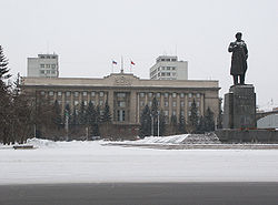
The National Park Stolby with its famous rocks neighbors the city of Krasnoyarsk is a popular travelling area and one of the main centres of rock-climbing in Russia.
, one of the four largest educational institutions of Russia.
, Norilsk
, Achinsk
, Kansk
, Zheleznogorsk
, and Minusinsk
, suffer from environmental pollution.
Пантелеев В. НА ПЕРЕЛОМЕ: Аркадий Вепрев у руля. Победа Валерия Зубова на губернаторских выборах//Красноярский рабочий.- 2011. - №145.- 19 августа.
Federal subjects of Russia
Russia is a federation which, since March 1, 2008, consists of 83 federal subjects . In 1993, when the Constitution was adopted, there were 89 federal subjects listed...
of Russia
Russia
Russia or , officially known as both Russia and the Russian Federation , is a country in northern Eurasia. It is a federal semi-presidential republic, comprising 83 federal subjects...
(a krai
Krai
Krai or kray was a type of an administrative division in the Russian Empire and the Russian SFSR, and is one of the types of the federal subjects of modern Russia ....
). It is the second largest federal subject after the Sakha Republic, and Russia's largest krai, occupying an area of 2339700 square kilometres (903,363.2 sq mi), which is 13% of the country's total territory. The administrative center of the krai is the city of Krasnoyarsk
Krasnoyarsk
Krasnoyarsk is a city and the administrative center of Krasnoyarsk Krai, Russia, located on the Yenisei River. It is the third largest city in Siberia, with the population of 973,891. Krasnoyarsk is an important junction of the Trans-Siberian Railway and one of Russia's largest producers of...
. Population:
Geography
The krai lies in the middle of SiberiaSiberia
Siberia is an extensive region constituting almost all of Northern Asia. Comprising the central and eastern portion of the Russian Federation, it was part of the Soviet Union from its beginning, as its predecessor states, the Tsardom of Russia and the Russian Empire, conquered it during the 16th...
, and belongs to the Siberian Federal District
Siberian Federal District
Siberian Federal District is one of the eight federal districts of Russia. Its population was 19,254,300 according to the 2010 Census, living on an area of...
, stretching 3,000 km from the Sayan Mountains
Sayan Mountains
The Sayan Mountains are a mountain range between northwestern Mongolia and southern Siberia, Russia.The Eastern Sayan extends from the Yenisei River at 92° E to the southwest end of Lake Baikal at 106° E...
in the south along the Yenisei River
Yenisei River
Yenisei , also written as Yenisey, is the largest river system flowing to the Arctic Ocean. It is the central of the three great Siberian rivers that flow into the Arctic Ocean...
to the Taymyr Peninsula
Taymyr Peninsula
The Taymyr Peninsula is a peninsula in the Far North of Russia, in the Siberian Federal District, that forms the northernmost part of mainland Eurasia and Asia...
in the north. It borders Tyumen
Tyumen Oblast
Tyumen Oblast is a federal subject of Russia . Its administrative center is the city of Tyumen. The oblast has administrative jurisdiction over two autonomous okrugs—Khanty-Mansi Autonomous Okrug and Yamalo-Nenets Autonomous Okrug. Tyumen is the largest city, with over half a million inhabitants...
, Tomsk
Tomsk Oblast
Tomsk Oblast is a federal subject of Russia . It lies in the southeastern West Siberian Plain, in the southwest of the Siberian Federal District. Its administrative center is the city of Tomsk. Population:...
, Irkutsk
Irkutsk Oblast
Irkutsk Oblast is a federal subject of Russia , located in southeastern Siberia in the basins of Angara River, Lena, and Nizhnyaya Tunguska Rivers. The administrative center is the city of Irkutsk. Population: -History:...
, and Kemerovo Oblast
Kemerovo Oblast
Kemerovo Oblast , also known as Kuzbass after the Kuznetsk Basin, is a federal subject of Russia , located in southwestern Siberia, where the West Siberian Plain meets the South Siberian mountains...
s, the Republic of Khakassia, the Tuva Republic, and the Sakha Republic, and the Kara Sea
Kara Sea
The Kara Sea is part of the Arctic Ocean north of Siberia. It is separated from the Barents Sea to the west by the Kara Strait and Novaya Zemlya, and the Laptev Sea to the east by the Severnaya Zemlya....
and Laptev Sea
Laptev Sea
The Laptev Sea is a marginal sea of the Arctic Ocean. It is located between the northern coast of Siberia, the Taimyr Peninsula, Severnaya Zemlya and the New Siberian Islands. Its northern boundary passes from the Arctic Cape to a point with co-ordinates of 79°N and 139°E, and ends at the Anisiy...
of the Arctic Ocean
Arctic Ocean
The Arctic Ocean, located in the Northern Hemisphere and mostly in the Arctic north polar region, is the smallest and shallowest of the world's five major oceanic divisions...
in the north.
The krai is located in the basin of the Arctic Ocean
Arctic Ocean
The Arctic Ocean, located in the Northern Hemisphere and mostly in the Arctic north polar region, is the smallest and shallowest of the world's five major oceanic divisions...
; a great number of rivers that flow through the krai all drain
Drainage basin
A drainage basin is an extent or an area of land where surface water from rain and melting snow or ice converges to a single point, usually the exit of the basin, where the waters join another waterbody, such as a river, lake, reservoir, estuary, wetland, sea, or ocean...
into it eventually. The main rivers of the krai are the Yenisei, and its tributaries
Tributary
A tributary or affluent is a stream or river that flows into a main stem river or a lake. A tributary does not flow directly into a sea or ocean...
(from south to north): the Kan
Kan River
The Kan river is a 390 mile long tributary of the Yenisei River in Siberia, Russia. It drains a basin of 36,900 km².The headwaters of the river rise in the Sayan Mountains and flow from there in a northerly direction through Kansk and then in a westerly direction through Zelenogorsk, entering...
, the Angara
Angara River
The Angara River is a long river in Irkutsk Oblast and Krasnoyarsk Krai, south-east Siberia, Russia. It is the only river flowing out of Lake Baikal, and is the headwater tributary of the Yenisei River....
, the Podkamennaya Tunguska
Podkamennaya Tunguska River
The Podkamennaya Tunguska is a river in Krasnoyarsk Krai, Russia; it is an eastern tributary of the Yenisei and has a length of . The name of the river comes from the fact that it flows under pebble fields without open water...
, and the Nizhnyaya Tunguska.
There are also several thousand lakes in the krai. The largest lakes include Beloye, Belyo, Glubokoye
Lake Glubokoye (Putorana)
Lake Glubokoye is a lake on the Eastern edge of the Putorana Plateau near Norilsk, Russia. It is connected with Lake Melkoye by the Glubokaya River. Area: 136 km², average depth: 16m.-External links:** at...
, Itat, Khantayskoye, Labas, Lama
Lake Lama
Lake Lama is a large freshwater lake in Krasnoyarsk Krai, north-central part of Russia. It is located at and has an area of 460 km² . It is 100 km long and up to 20 km wide...
, Pyasina, Taymyr
Lake Taymyr
Lake Taymyr is a lake of the central regions of the Taymyr Peninsula in Krasnoyarsk Krai, Russian Federation. It is located south of the Byrranga Mountains....
, and Yessey
Lake Yessey
Lake Yessey is a large freshwater lake in Krasnoyarsk Krai, north-central part of Russia. It is located at and has an area of 238 km². Many rivers empty to the lake. Lake Yessey is rich in fish....
. The rivers and lakes are rich with fish.
The climate is strongly continental
Continental climate
Continental climate is a climate characterized by important annual variation in temperature due to the lack of significant bodies of water nearby...
with large temperature variations during the year. For the central and southern regions where most of the krai's population lives, long winters and short, hot summers are characteristic. The territory of Krasnoyarsk krai experiences conditions of three climate belts: Arctic
Climate of the Arctic
The climate of the Arctic is characterized by long, cold winters and short, cool summers. There is a large amount of variability in climate across the Arctic, but all regions experience extremes of solar radiation in both summer and winter...
, Subarctic
Subarctic climate
The subarctic climate is a climate characterized by long, usually very cold winters, and short, cool to mild summers. It is found on large landmasses, away from the moderating effects of an ocean, generally at latitudes from 50° to 70°N poleward of the humid continental climates...
, and moderate. While in the north there are less than 40 days with temperature higher than 10 °C (50 °F), in the south there are 110–120 such days.
The average temperature in January is -36 C in the north and -18 C in the south. The average temperature in July is 10 °C (50 °F) in the north and 20 °C (68 °F) in the south. The annual precipitation is 316 millimetres (12.4 in) (up to 1200 millimetres (47.2 in) in foothills of the Sayan Mountains). Snow covers the central regions of the krai from early November until late March. The peaks of the Sayans higher than 2,400–2,600 m and those of the Putorana Plateau higher than 1,000–1,300 m are covered with permanent snow. Permafrost
Permafrost
In geology, permafrost, cryotic soil or permafrost soil is soil at or below the freezing point of water for two or more years. Ice is not always present, as may be in the case of nonporous bedrock, but it frequently occurs and it may be in amounts exceeding the potential hydraulic saturation of...
is widespread, especially in the north.
The highest point of the krai is Grandiozny Peak in the East Sayan Mountains at an elevation of 2922 metres (9,586.6 ft).
History
According to archeologists the territory of Siberia was settled around 40,000 BCE The grave-mounds and monuments of the Scythian culture in Krasnoyarsk Krai belong to the 7th century BCE and are ones of the oldest in EurasiaEurasia
Eurasia is a continent or supercontinent comprising the traditional continents of Europe and Asia ; covering about 52,990,000 km2 or about 10.6% of the Earth's surface located primarily in the eastern and northern hemispheres...
. Among other things a prince's grave Kurgan Arshan exposed in 2001 is known.
The Russian settlement of the area (by Cossacks mostly) began in the 17th century. After the construction of the Trans-Siberian Railroad the Russian colonization of the area strongly increased.
During both the Tsar
Tsar
Tsar is a title used to designate certain European Slavic monarchs or supreme rulers. As a system of government in the Tsardom of Russia and Russian Empire, it is known as Tsarist autocracy, or Tsarism...
ist and the Bolsheviks' regimes the territory of Krasnoyarsk Krai was used as a place of exile of political enemies of current government. The first leaders of the Soviet state Vladimir Lenin
Vladimir Lenin
Vladimir Ilyich Lenin was a Russian Marxist revolutionary and communist politician who led the October Revolution of 1917. As leader of the Bolsheviks, he headed the Soviet state during its initial years , as it fought to establish control of Russia in the Russian Civil War and worked to create a...
and Joseph Stalin
Joseph Stalin
Joseph Vissarionovich Stalin was the Premier of the Soviet Union from 6 May 1941 to 5 March 1953. He was among the Bolshevik revolutionaries who brought about the October Revolution and had held the position of first General Secretary of the Communist Party of the Soviet Union's Central Committee...
were in exile on the territory of the nowadays krai in 1897–1900 and in 1903 respectively. In Stalin's era numerous Gulag
Gulag
The Gulag was the government agency that administered the main Soviet forced labor camp systems. While the camps housed a wide range of convicts, from petty criminals to political prisoners, large numbers were convicted by simplified procedures, such as NKVD troikas and other instruments of...
camps were in the region.
In 1822, Yenisei Governorate was created with Krasnoyarsk as its administrative center that covered the territory very close to the one of the current krai.
On June 30, 1908, in the basin of the Podkamennaya Tunguska River, there occurred a powerful explosion
Tunguska event
The Tunguska event, or Tunguska blast or Tunguska explosion, was an enormously powerful explosion that occurred near the Podkamennaya Tunguska River in what is now Krasnoyarsk Krai, Russia, at about 7:14 a.m...
most likely to have been caused by the air burst of a large meteoroid
Meteoroid
A meteoroid is a sand- to boulder-sized particle of debris in the Solar System. The visible path of a meteoroid that enters Earth's atmosphere is called a meteor, or colloquially a shooting star or falling star. If a meteoroid reaches the ground and survives impact, then it is called a meteorite...
or comet
Comet
A comet is an icy small Solar System body that, when close enough to the Sun, displays a visible coma and sometimes also a tail. These phenomena are both due to the effects of solar radiation and the solar wind upon the nucleus of the comet...
fragment at an altitude of 5–10 kilometers (3–6 miles) above Earth's surface. The force of the explosion is estimated to be about 10–15 megatons. It flattened more than 2,000 square kilometers (500,000 acres) of pine forest and killed thousands of reindeer.
Krasnoyarsk Krai was created in 1934 after disaggregation of West Siberian
West Siberian Krai
West Siberian Krai was an early krai of Russian SFSR. By the 1937 All-Union Census, it had population of 6,433,527....
and East Siberian Krais and then included Taymyr
Taymyr Autonomous Okrug
Taymyr Dolgano-Nenets Autonomous Okrug , or Taymyria, was a federal subject of Russia , the northernmost in mainland Russia . It is named after the Taymyr Peninsula...
and Evenk Autonomous Okrug
Evenk Autonomous Okrug
Evenk Autonomous Okrug , or Evenkia, was a federal subject of Russia . It had been created in 1930. Its administrative center was the urban-type settlement of Tura...
s and Khakas Autonomous Oblast. In 1991, Khakassia separated from the krai and became a republic within the Russian Federation.
On January 1, 2007, following a referendum on the issue held on April 17, 2005, territories of Evenk
Evenk Autonomous Okrug
Evenk Autonomous Okrug , or Evenkia, was a federal subject of Russia . It had been created in 1930. Its administrative center was the urban-type settlement of Tura...
and Taymyr Autonomous Okrug
Taymyr Autonomous Okrug
Taymyr Dolgano-Nenets Autonomous Okrug , or Taymyria, was a federal subject of Russia , the northernmost in mainland Russia . It is named after the Taymyr Peninsula...
s were merged into the krai.
Politics
In December 1991, president Boris YeltsinBoris Yeltsin
Boris Nikolayevich Yeltsin was the first President of the Russian Federation, serving from 1991 to 1999.Originally a supporter of Mikhail Gorbachev, Yeltsin emerged under the perestroika reforms as one of Gorbachev's most powerful political opponents. On 29 May 1990 he was elected the chairman of...
appointed Arkady Veprev the first governor of Krasnoyarsk Krai. In January 1993 Boris Yeltsin
Boris Yeltsin
Boris Nikolayevich Yeltsin was the first President of the Russian Federation, serving from 1991 to 1999.Originally a supporter of Mikhail Gorbachev, Yeltsin emerged under the perestroika reforms as one of Gorbachev's most powerful political opponents. On 29 May 1990 he was elected the chairman of...
appointed Valery Zubov the second governor of Krasnoyarsk Krai. In the Krasnoyarsk Territory governor elections were called. Zubov was elected in a universal election for a five-year term. The Legislative Assembly of Krasnoyarsk Krai was created as well.
In 1998, Zubov lost in the gubernatorial election to General Aleksandr Lebed, a politician well-known in all Russia. But in 2002 Lebed died in a helicopter accident.
In 2002, Alexander Khloponin
Alexander Khloponin
Alexander Gennadyevich Khloponin was born on March 6, 1965 in Colombo, Ceylon . Khloponin was the governor of Krasnoyarsk Krai in Siberia, Russia....
, the governor of Taymyr Autonomous Okrug and an influential businessman was elected a governor of Krasnoyarsk Krai. In 2007, he was nominated by president Vladimir Putin
Vladimir Putin
Vladimir Vladimirovich Putin served as the second President of the Russian Federation and is the current Prime Minister of Russia, as well as chairman of United Russia and Chairman of the Council of Ministers of the Union of Russia and Belarus. He became acting President on 31 December 1999, when...
for re-election, and Khloponin was elected by the legislative assembly for the second term.
In 2010, after Khloponin was promoted to the office of the president's envoy in the North Caucasian Federal District
North Caucasian Federal District
North Caucasian Federal District is one of the eight federal districts of Russia. It is located in the extreme southwest of Russia, in the geographical area of the North Caucasus...
, Lev Kuznetsov, a businessman and politician from Khloponin's circle, became new governor of the region.
The legislative assembly consists of 52 deputies. 22 of them are elected in 22 one-mandate electoral districts by plurality system, 2 in Taymyr, 2 in Evenkia, and 26 are elected by proportional system from the lists offered by political parties.
Krasnoyarsk Krai is represented in the Federation Council of Russia
Federation Council of Russia
Federation Council of Russia ) is the upper house of the Federal Assembly of Russia , according to the 1993 Constitution of the Russian Federation...
by two senators. In 2007, eight deputies were elected to the State Duma
State Duma
The State Duma , common abbreviation: Госду́ма ) in the Russian Federation is the lower house of the Federal Assembly of Russia , the upper house being the Federation Council of Russia. The Duma headquarters is located in central Moscow, a few steps from Manege Square. Its members are referred to...
from Krasnoyarsk regional lists of different political parties.
Economy
Over 95% of the cities, a majority of the industrial enterprises, and all of the agriculture are concentrated in the south of the krai.Natural resources
The krai is among the richest of Russia's regions in natural resources. Eighty percent of the country's nickelNickel
Nickel is a chemical element with the chemical symbol Ni and atomic number 28. It is a silvery-white lustrous metal with a slight golden tinge. Nickel belongs to the transition metals and is hard and ductile...
, 75% of its cobalt
Cobalt
Cobalt is a chemical element with symbol Co and atomic number 27. It is found naturally only in chemically combined form. The free element, produced by reductive smelting, is a hard, lustrous, silver-gray metal....
, 70% of its copper
Copper
Copper is a chemical element with the symbol Cu and atomic number 29. It is a ductile metal with very high thermal and electrical conductivity. Pure copper is soft and malleable; an exposed surface has a reddish-orange tarnish...
, 16% of its coal
Coal
Coal is a combustible black or brownish-black sedimentary rock usually occurring in rock strata in layers or veins called coal beds or coal seams. The harder forms, such as anthracite coal, can be regarded as metamorphic rock because of later exposure to elevated temperature and pressure...
, and 10% of its gold
Gold
Gold is a chemical element with the symbol Au and an atomic number of 79. Gold is a dense, soft, shiny, malleable and ductile metal. Pure gold has a bright yellow color and luster traditionally considered attractive, which it maintains without oxidizing in air or water. Chemically, gold is a...
are extracted here. Krasnoyarsk also produces 20% of the country's timber
Timber
Timber may refer to:* Timber, a term common in the United Kingdom and Australia for wood materials * Timber, Oregon, an unincorporated community in the U.S...
. More than 95% of Russian resources of platinum
Platinum
Platinum is a chemical element with the chemical symbol Pt and an atomic number of 78. Its name is derived from the Spanish term platina del Pinto, which is literally translated into "little silver of the Pinto River." It is a dense, malleable, ductile, precious, gray-white transition metal...
and platinoids are concentrated in the krai.
Industry
The krai's major industries are: non-ferrous metallurgyMetallurgy
Metallurgy is a domain of materials science that studies the physical and chemical behavior of metallic elements, their intermetallic compounds, and their mixtures, which are called alloys. It is also the technology of metals: the way in which science is applied to their practical use...
, energy, forestry, chemicals, and oil refining. The major financial industrial groups of Krasnoyarsk Krai are:
- Basic ElementBasic Element (company)Basic Element is a diversified investment company founded in 1997 and owned by Oleg Deripaska. It is based in Moscow, Russia.- Overview :Basic Element's main assets are concentrated in five economic sectors - Energy, Manufacturing, Financial Services, Construction and Aviation.About 250,000 people...
(Krasnoyarsk Aluminium Plant, Achinsk Alumina Complex, Krasnoyarsk Pulp and Paper Plant) - InterrosInterrosInterros is a Russian conglomerate controlled by Russian oligarch Vladimir Potanin with large stakes in mining, metals, energy, finance, retail, real estate and other sectors...
, (Norilsk Nickel) - Evraz GroupEvraz GroupEvraz Group is one of the world's biggest vertically integrated steel production and mining businesses, with operations mainly in Russia. In 2008, Evraz Group produced 17.7 million tonnes of crude steel.-Overview:...
(iron mines, timber) - MDM Group (SUEK, Siberian Coal and Energy Company)
- RusHydroRusHydroRusHydro , previously known as Hydro-OGK, is a Russian hydroelectricity company. As of 2008 it has a capacity of 25 gigawatts. It is the world's second-largest hydroelectric power producer and is the country's largest power-generating company and the largest successor to RAO UES...
(generation of electric power) - RZhD (railroads)
Power generation
The two most powerful hydroelectric plants in Russia are built on the Yenisei River, one is being built on the Angara, and several are being planned. It makes Krasnoyarsk Krai one of the most important producers of electric energy in Russia, and a desirable location for energy-intensive industries, such as aluminium plants.Transportation
- Trans-Siberian Railroad (650 km (400 mi) within Krasnoyarsk Krai), Norilsk Railroad (the most northern railroad in the world); North Siberian Railroad is planned.
- Highways: M53 Baikal (NovosibirskNovosibirskNovosibirsk is the third-largest city in Russia, after Moscow and Saint Petersburg, and the largest city of Siberia, with a population of 1,473,737 . It is the administrative center of Novosibirsk Oblast as well as of the Siberian Federal District...
-KrasnoyarskKrasnoyarskKrasnoyarsk is a city and the administrative center of Krasnoyarsk Krai, Russia, located on the Yenisei River. It is the third largest city in Siberia, with the population of 973,891. Krasnoyarsk is an important junction of the Trans-Siberian Railway and one of Russia's largest producers of...
-IrkutskIrkutskIrkutsk is a city and the administrative center of Irkutsk Oblast, Russia, one of the largest cities in Siberia. Population: .-History:In 1652, Ivan Pokhabov built a zimovye near the site of Irkutsk for gold trading and for the collection of fur taxes from the Buryats. In 1661, Yakov Pokhabov...
), M54 Yenisei (KrasnoyarskKrasnoyarskKrasnoyarsk is a city and the administrative center of Krasnoyarsk Krai, Russia, located on the Yenisei River. It is the third largest city in Siberia, with the population of 973,891. Krasnoyarsk is an important junction of the Trans-Siberian Railway and one of Russia's largest producers of...
-KyzylKyzyl-External links:*** in Kyzyl, Russia*...
-MongoliaMongoliaMongolia is a landlocked country in East and Central Asia. It is bordered by Russia to the north and China to the south, east and west. Although Mongolia does not share a border with Kazakhstan, its western-most point is only from Kazakhstan's eastern tip. Ulan Bator, the capital and largest...
) R409 Eniseiskiy trakt (KrasnoyarskKrasnoyarskKrasnoyarsk is a city and the administrative center of Krasnoyarsk Krai, Russia, located on the Yenisei River. It is the third largest city in Siberia, with the population of 973,891. Krasnoyarsk is an important junction of the Trans-Siberian Railway and one of Russia's largest producers of...
-LesosibirskLesosibirskLesosibirsk is a town in Krasnoyarsk Krai, Russia, located on the Yenisei River. Population:...
-Eniseisk). - Northern Sea RouteNorthern Sea RouteThe Northern Sea Route is a shipping lane officially defined by Russian legislation from the Atlantic Ocean to the Pacific Ocean specifically running along the Russian Arctic coast from Murmansk on the Barents Sea, along Siberia, to the Bering Strait and Far East. The entire route lies in Arctic...
and shipping on Yenisei. The main ports are: DudinkaDudinkaDudinka is a town and the administrative center of Taymyrsky Dolgano-Nenetsky District of Krasnoyarsk Krai, Russia. It was the administrative center of Taymyr Autonomous Okrug, which was merged into Krasnoyarsk Krai on January 1, 2007. It is a port in the lower reaches of the Yenisei River,...
, IgarkaIgarkaIgarka is an town in Turukhansky District of Krasnoyarsk Krai, Russia, located north of the Arctic Circle. It is also a port on the Yenisei River, located away from the river's mouth...
, TurukhanskTurukhanskTurukhansk is a village in Krasnoyarsk Krai, Russia. It is located 1474 km north of Krasnoyarsk, at the confluence of the Yenisei and Lower Tunguska rivers. The Turukhan River joins the Yenisei about 20 km northwest. Population: 4,849 ; 8,900 ; 200...
, YeniseyskYeniseyskYeniseysk is a town in Krasnoyarsk Krai, Russia, located on the Yenisei River. Population: 20,000 .Yeniseysk was founded in 1619 as a stockaded town—the first town on the Yenisei River. It played an important role in Russian colonization of East Siberia in the 17th–18th centuries...
, Maklakovo, Strelka, KrasnoyarskKrasnoyarskKrasnoyarsk is a city and the administrative center of Krasnoyarsk Krai, Russia, located on the Yenisei River. It is the third largest city in Siberia, with the population of 973,891. Krasnoyarsk is an important junction of the Trans-Siberian Railway and one of Russia's largest producers of... - 26 airports, including large international one (Yemelyanovo near Krasnoyarsk).
- Two pipes of IrkutskIrkutskIrkutsk is a city and the administrative center of Irkutsk Oblast, Russia, one of the largest cities in Siberia. Population: .-History:In 1652, Ivan Pokhabov built a zimovye near the site of Irkutsk for gold trading and for the collection of fur taxes from the Buryats. In 1661, Yakov Pokhabov...
-Anzhero-SudzhenskAnzhero-SudzhenskAnzhero-Sudzhensk is a town in the Kuznetsk Basin in Kemerovo Oblast, Russia. The town, which was formed out of the amalgamation of the Anzherka and Sudzhenka settlements, is located to the north of the oblast's administrative center of Kemerovo and to the east of the Tom River. It is on the route...
petroleum pipeline. - Major power transmission lines.
Administrative divisions
Krasnoyarsk Krai consists of 44 districtsRaion
A raion is a type of administrative unit of several post-Soviet countries. The term, which is from French rayon 'honeycomb, department,' describes both a type of a subnational entity and a division of a city, and is commonly translated in English as "district"...
and 14 towns of district significance
Town of district significance
Town of district significance is an umbrella term used to refer to a type of an administrative division of a district in a federal subject of Russia, which is equal in status to a selsoviet or an urban-type settlement of district significance, but is organized around a town ; often with surrounding...
. Two of the districts (Evenkiysky and Taymyrsky; the former autonomous okrugs) have special status.
Demographics
Russian Census (2002)
Russian Census of 2002 was the first census of the Russian Federation carried out on October 9 through October 16, 2002. It was carried out by the Russian Federal Service of State Statistics .-Resident population:...
): 3,023,525 (including Taymyr and Evenk Autonomous Okrugs)
Ethnic groups: The population of the krai mostly consists of Russians
Russians
The Russian people are an East Slavic ethnic group native to Russia, speaking the Russian language and primarily living in Russia and neighboring countries....
, and some other peoples of the former Soviet Union
Soviet Union
The Soviet Union , officially the Union of Soviet Socialist Republics , was a constitutionally socialist state that existed in Eurasia between 1922 and 1991....
. The indigenous Siberian peoples make up no more than 1% of the population.
The 2002 Census reported the following ethnic composition:
- RussiansRussiansThe Russian people are an East Slavic ethnic group native to Russia, speaking the Russian language and primarily living in Russia and neighboring countries....
: 88.38% - UkrainiansUkrainiansUkrainians are an East Slavic ethnic group native to Ukraine, which is the sixth-largest nation in Europe. The Constitution of Ukraine applies the term 'Ukrainians' to all its citizens...
: 2.37% - TatarsTatarsTatars are a Turkic speaking ethnic group , numbering roughly 7 million.The majority of Tatars live in the Russian Federation, with a population of around 5.5 million, about 2 million of which in the republic of Tatarstan.Significant minority populations are found in Uzbekistan, Kazakhstan,...
: 1.49% - Germans: 1.24%
- AzeriAzeris in RussiaAside from the large Azeri community native to Russia's Dagestan Republic, the majority of Azeris in Russia are fairly recent immigrants. Azeris started settling in Russia around the late 19th century, but their migration became intensive after World War II. It rapidly increased with the collapse...
: 0.65% - BelarusiansBelarusiansBelarusians ; are an East Slavic ethnic group who populate the majority of the Republic of Belarus. Introduced to the world as a new state in the early 1990s, the Republic of Belarus brought with it the notion of a re-emerging Belarusian ethnicity, drawn upon the lines of the Old Belarusian...
: 0.61% - ChuvashChuvash peopleThe Chuvash people are a Turkic ethnic group, native to an area stretching from the Volga Region to Siberia. Most of them live in Republic of Chuvashia and surrounding areas, although Chuvash communities may be found throughout all Russia.- Etymology :...
: 0.57% - other groups of less than 0.5% each.
An additional 0.56% of residents declined to state their ethnicity on the census questionnaire.
- Births (Jan-Aug 2009): 25,520 (13.3 per 1000) http://www.statis.krs.ru/digital/region5/2007/Показатели%20естественного%20движения%20населения.pdf
- Deaths (Jan-Aug 2009): 25,183 (13.1 per 1000)
As of August 2009, Krasnoyarsk Krai recorded a natural growth of population for the first time in 16 years.
Demographics for 2007
http://www.statis.krs.ru/digital/region5/default.aspx?SortField=LinkFilenameNoMenu&SortDir=Asc&View={4E5036C5-DFF8-439D-A33F-9F8ABD419E26}| District Raion A raion is a type of administrative unit of several post-Soviet countries. The term, which is from French rayon 'honeycomb, department,' describes both a type of a subnational entity and a division of a city, and is commonly translated in English as "district"... |
Pop | Births | Deaths | NG | BR | DR | NGR |
|---|---|---|---|---|---|---|---|
| Krasnoyarsk Krai | 2,890,350 | 34,206 | 38,470 | -4,264 | 11.83 | 13.31 | -0.15% |
| Taimirsky Dolgano-Nenetsky | 37,768 | 592 | 335 | 257 | 15.67 | 8.87 | 0.68% |
| Evenkysky | 16,705 | 304 | 233 | 71 | 18.20 | 13.95 | 0.43% |
| Abansky | 24,997 | 346 | 419 | -73 | 13.84 | 16.76 | -0.29% |
| Achinsky | 15,918 | 226 | 253 | -27 | 14.20 | 15.89 | -0.17% |
| Balakhtinsky | 23,761 | 281 | 409 | -128 | 11.83 | 17.21 | -0.54% |
| Berezovsky | 38,527 | 483 | 543 | -60 | 12.54 | 14.09 | -0.16% |
| Birilyussky | 11,431 | 159 | 228 | -69 | 13.91 | 19.95 | -0.60% |
| Bogotolsky | 11,371 | 151 | 233 | -82 | 13.28 | 20.49 | -0.72% |
| Boguchansky | 48,312 | 585 | 626 | -41 | 12.11 | 12.96 | -0.08% |
| Bolshemurtinsky | 19,292 | 207 | 398 | -191 | 10.73 | 20.63 | -0.99% |
| Bolsheuluysky | 8,540 | 112 | 157 | -45 | 13.11 | 18.38 | -0.53% |
| Dzerzhinsky | 15,025 | 180 | 298 | -118 | 11.98 | 19.83 | -0.79% |
| Novoselovsky | 15,128 | 192 | 226 | -34 | 12.69 | 14.94 | -0.22% |
| Partizansky | 11,003 | 155 | 233 | -78 | 14.09 | 21.18 | -0.71% |
| Pirovsky | 8,251 | 97 | 125 | -28 | 11.76 | 15.15 | -0.34% |
| Ribinsky | 23,393 | 309 | 422 | -113 | 13.21 | 18.04 | -0.48% |
| Sayansky | 13,058 | 163 | 235 | -72 | 12.48 | 18.00 | -0.55% |
| Severo-Yeniseysky | 10,907 | 153 | 136 | 17 | 14.03 | 12.47 | 0.16% |
| Sukhobuzimsky | 23,050 | 287 | 362 | -75 | 12.45 | 15.70 | -0.33% |
| Taseyevsky | 13,962 | 161 | 234 | -73 | 11.53 | 16.76 | -0.52% |
| Turukhansky | 20,736 | 249 | 295 | -46 | 12.01 | 14.23 | -0.22% |
| Tyukhtetsky | 9,034 | 111 | 197 | -86 | 12.29 | 21.81 | -0.95% |
| Uzhursky | 33,952 | 541 | 586 | -45 | 15.93 | 17.26 | -0.13% |
| Uyarsky | 22,255 | 250 | 495 | -245 | 11.23 | 22.24 | -1.10% |
| Idrinsky | 14,037 | 157 | 252 | -95 | 11.18 | 17.95 | -0.68% |
| Ilansky | 26,436 | 352 | 453 | -101 | 13.32 | 17.14 | -0.38% |
| Irbeysky | 18,053 | 241 | 300 | -59 | 13.35 | 16.62 | -0.33% |
| Kazachinsky | 11,333 | 162 | 191 | -29 | 14.29 | 16.85 | -0.26% |
| Sharypovsky | 17,816 | 244 | 295 | -51 | 13.70 | 16.56 | -0.29% |
| Shushensky | 35,372 | 392 | 659 | -267 | 11.08 | 18.63 | -0.75% |
| Krasnoyarsk | 905,000 | 10,585 | 10,936 | -351 | 11.70 | 12.08 | -0.04% |
| Achinsk | 110,838 | 1,333 | 1,702 | -369 | 12.03 | 15.36 | -0.33% |
| Bogotol | 21,997 | 273 | 407 | -134 | 12.41 | 18.50 | -0.61% |
| Borodino | 18,759 | 197 | 247 | -50 | 10.50 | 13.17 | -0.27% |
| Divnogorsk | 30,968 | 337 | 438 | -101 | 10.88 | 14.14 | -0.33% |
| Yeniseysk | 19,086 | 265 | 278 | -13 | 13.88 | 14.57 | -0.07% |
| Zaozyorny | 11,359 | 184 | 221 | -37 | 16.20 | 19.46 | -0.33% |
| Kansk | 98,965 | 1,113 | 1,458 | -345 | 11.25 | 14.73 | -0.35% |
| Lesosibirsk | 64,215 | 932 | 1,027 | -95 | 14.51 | 15.99 | -0.15% |
| Minusinsk | 66,770 | 852 | 1,141 | -289 | 12.76 | 17.09 | -0.43% |
| Nazarovo | 53,593 | 568 | 890 | -322 | 10.60 | 16.61 | -0.60% |
| Norilsk | 206,359 | 2,402 | 1,150 | 1,252 | 11.64 | 5.57 | 0.61% |
| Sosnovoborsk | 30,074 | 306 | 275 | 31 | 10.17 | 9.14 | 0.10% |
| Sharypovo | 38,495 | 599 | 583 | 16 | 15.56 | 15.14 | 0.04% |
| Yemelyanovsky | 45,908 | 493 | 633 | -140 | 10.74 | 13.79 | -0.30% |
| Kansky | 26,696 | 361 | 425 | -64 | 13.52 | 15.92 | -0.24% |
| Karatuzsky | 16,992 | 215 | 307 | -92 | 12.65 | 18.07 | -0.54% |
| Kezhemsky | 24,406 | 277 | 300 | -23 | 11.35 | 12.29 | -0.09% |
| Kozulsky | 18,292 | 225 | 344 | -119 | 12.30 | 18.81 | -0.65% |
| Krasnoturansky | 16,098 | 201 | 247 | -46 | 12.49 | 15.34 | -0.29% |
| Kuraginsky | 51,402 | 669 | 851 | -182 | 13.02 | 16.56 | -0.35% |
| Mansky | 17,684 | 226 | 365 | -139 | 12.78 | 20.64 | -0.79% |
| Minusinsky | 26,457 | 339 | 409 | -70 | 12.81 | 15.46 | -0.26% |
| Motiginsky | 18,152 | 238 | 257 | -19 | 13.11 | 14.16 | -0.10% |
| Nazarovsky | 23,609 | 390 | 356 | 34 | 16.52 | 15.08 | 0.14% |
| Yeniseysky | 27,044 | 353 | 418 | -65 | 13.05 | 15.46 | -0.24% |
| Yermakovsky | 20,621 | 310 | 360 | -50 | 15.03 | 17.46 | -0.24% |
| Nizhneingashsky | 35,886 | 448 | 597 | -149 | 12.48 | 16.64 | -0.42% |
| Other | 245,202 | 1,673 | 2,020 | -347 | 6.82 | 8.24 | -0.14% |
Places of interest
In the krai there are forty-five museums, with total number of about one million objects stored there.The Krasnoyarsk dam
Krasnoyarsk hydroelectric dam
The Krasnoyarsk Dam is a high concrete gravity dam located on the Yenisey River about upstream from Krasnoyarsk in Divnogorsk, Russia. It was constructed from 1956 to 1972 and supplies 6,000 MW of power, mostly used to supply the KrAZ...
is pictured on Russian ten-ruble
Ruble
The ruble or rouble is a unit of currency. Currently, the currency units of Belarus, Russia, Abkhazia, South Ossetia and Transnistria, and, in the past, the currency units of several other countries, notably countries influenced by Russia and the Soviet Union, are named rubles, though they all are...
note and is a popular attraction for tourists.
The National Park Stolby with its famous rocks neighbors the city of Krasnoyarsk is a popular travelling area and one of the main centres of rock-climbing in Russia.
Education
Krasnoyarsk is the site of the Siberian Federal UniversitySiberian Federal University
Siberian Federal University is a modern multidisciplinary university located in the eastern part of Russia, Krasnoyarsk, that combines fundamental and applied research and teaching...
, one of the four largest educational institutions of Russia.
Nature and ecology
Many important industrial cities of Krasnoyarsk krai, such as KrasnoyarskKrasnoyarsk
Krasnoyarsk is a city and the administrative center of Krasnoyarsk Krai, Russia, located on the Yenisei River. It is the third largest city in Siberia, with the population of 973,891. Krasnoyarsk is an important junction of the Trans-Siberian Railway and one of Russia's largest producers of...
, Norilsk
Norilsk
Norilsk is an industrial city in Krasnoyarsk Krai, Russia, located between the Yenisei River and the Taymyr Peninsula. Population: It was granted city status in 1953. It is the northernmost city in Siberia and the world's second largest city north of the Arctic Circle...
, Achinsk
Achinsk
Achinsk is a city in Krasnoyarsk Krai, Russia, located on the right bank of the Chulym River near its intersection with the Trans-Siberian Railway, west of Krasnoyarsk. Area: . Population:...
, Kansk
Kansk
Kansk is a town on the left bank of the Kan River in Krasnoyarsk Krai, Russia. Population: It is home to the Kansk air base and is crossed by the Trans-Siberian railroad....
, Zheleznogorsk
Zheleznogorsk
Zheleznogorsk is the name of several urban localities in Russia:*Zheleznogorsk, Krasnoyarsk Krai, a town in Krasnoyarsk Krai*Zheleznogorsk, Kursk Oblast, a town in Kursk Oblast-See also:*Zheleznogorsk...
, and Minusinsk
Minusinsk
Minusinsk is a historic town in Krasnoyarsk Krai, Russia. It serves as the administrative center of Minusinsky District, although it is not administratively a part of it. Population: 44,500 ....
, suffer from environmental pollution.
External links
Пантелеев В. НА ПЕРЕЛОМЕ: Аркадий Вепрев у руля. Победа Валерия Зубова на губернаторских выборах//Красноярский рабочий.- 2011. - №145.- 19 августа.