

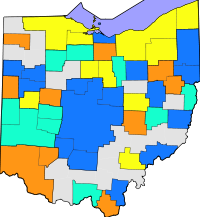
Ohio census statistical areas
Encyclopedia
United States Census Bureau
The United States Census Bureau is the government agency that is responsible for the United States Census. It also gathers other national demographic and economic data...
has defined 9 Combined Statistical Area
Combined Statistical Area
The United States Office of Management and Budget defines micropolitan and metropolitan statistical areas. Metropolitan and micropolitan statistical areas consist of one or more counties...
s (CSAs), 16 Metropolitan Statistical Areas (MSAs), and 29 Micropolitan Statistical Areas (μSAs) in the State of Ohio. The following table describes these areas with the following information:
- The name of the Combined Statistical Area (CSA), if any.
- The population of the CSA as of 2010-07-01, as estimated by the United States Census Bureau.
- The name of the Core Based Statistical AreaCore based statistical areaA Core Based Statistical Area is a U.S. geographic area defined by the Office of Management and Budget based around an urban center of at least 10,000 people and adjacent areas that are socioeconomically tied to the urban center by commuting. Areas defined on the basis of these standards applied...
(CBSA). - The population of the CBSA as of 2010-07-01, as estimated by the United States Census Bureau.
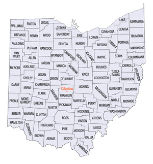
- The name of the countyCounty (United States)In the United States, a county is a geographic subdivision of a state , usually assigned some governmental authority. The term "county" is used in 48 of the 50 states; Louisiana is divided into parishes and Alaska into boroughs. Parishes and boroughs are called "county-equivalents" by the U.S...
. - The population of the county as of 2010-07-01, as estimated by the United States Census Bureau.
| Combined Statistical Area | 2010 Pop | Core Based Statistical Area | 2010 Pop | County | 2010 Pop |
|---|---|---|---|---|---|
| Cleveland-Akron-Elyria, OH CSA | 2,881,937 | Cleveland-Elyria-Mentor, OH MSA | 2,077,240 | Cuyahoga County, Ohio Cuyahoga County, Ohio Cuyahoga County is a county located in the state of Ohio, United States. It is the most populous county in Ohio; as of the 2010 census, the population was 1,280,122. Its county seat is Cleveland. Cuyahoga County is part of Greater Cleveland, a metropolitan area, and Northeast Ohio, a... |
1,280,122 |
| Lorain County, Ohio Lorain County, Ohio Lorain County is a county located in the U.S. state of Ohio, and is considered to be a part of what is locally referred to as Greater Cleveland. As of the 2010 census, its population was 301,356. an increase from 284,664 in 2000... |
301,356 | ||||
| Lake County, Ohio Lake County, Ohio Lake County is a county located in the U.S. state of Ohio. As of 2010, the population was 230,041. The county seat is Painesville, and the county name comes from its location on the southern shore of Lake Erie.... |
232,892 | ||||
| Medina County, Ohio | 172,332 | ||||
| Geauga County, Ohio Geauga County, Ohio Geauga County is a county located in the state of Ohio, United States. As of the 2010 census, the population was 93,389. It is named for a Native American word meaning "raccoon". The county seat is Chardon... |
95,676 | ||||
| Akron, OH MSA | 703,200 | Summit County, Ohio Summit County, Ohio Summit County is an urban county located in the state of Ohio, United States. As of the 2000 census, the population was 542,899. In the 2010 Census the population was 541,781. Its county seat is Akron... |
541,781 | ||
| Portage County, Ohio Portage County, Ohio Portage County is a county located in the U.S. state of Ohio. The population was 152,061 at the 2000 Census and 161,419 at the 2010 Census. Its county seat is Ravenna. Portage County is named for the portage between the Cuyahoga and Tuscarawas Rivers... |
161,419 | ||||
| Ashtabula, OH μSA | 100,767 | Ashtabula County, Ohio Ashtabula County, Ohio Ashtabula County is the northeasternmost county in the state of Ohio. As of 2010, the population was 101,497, its county seat is Jefferson. The county is named for a Native American word meaning "river of many fish".... |
100,767 | ||
| Columbus-Marion-Chillicothe, OH CSA | 2,071,052 | Columbus, OH MSA | 1,836,536 | Franklin County, Ohio Franklin County, Ohio Franklin County is a county located in the state of Ohio, United States. In 2010 the population was 1,163,414, making it the second largest county in Ohio and the 34th largest county in population in the United States. Franklin County is also the largest in the eight-county Columbus, Ohio... |
1,163,414 |
| Delaware County, Ohio Delaware County, Ohio Delaware County is a fast-growing suburban county in the state of Ohio, United States, within the Columbus, Ohio Metropolitan Statistical Area. According to the United States Census Bureau's 2004 population estimates, Delaware County's population of 142,503 made it the fastest growing county in... |
165,026 | ||||
| Licking County, Ohio Licking County, Ohio Licking County is a county located in the state of Ohio, United States. As of the 2010 census, the population was 166,492. Its county seat is Newark and is named for the salt licks that were in the area.... |
156,287 | ||||
| Fairfield County, Ohio Fairfield County, Ohio Fairfield County is a county located in the state of Ohio, United States. As of 2010, the population was 146,156. Its county seat is Lancaster. Its name is a reference to the Fairfield area of the original Lancaster.... |
141,318 | ||||
| Pickaway County, Ohio Pickaway County, Ohio As of the census of 2000, there were 52,727 people, 17,599 households, and 13,287 families residing in the county. The population density was 105 people per square mile . There were 18,596 housing units at an average density of 37 per square mile... |
53,606 | ||||
| Union County, Ohio Union County, Ohio Union County is a county located in the US state of Ohio. As of the 2010 census, the population was 52,300. Increasingly becoming more of a suburban county, the population was estimated at 47,234 in 2007 by the U.S. Census Bureau... |
46,702 | ||||
| Madison County, Ohio Madison County, Ohio As of the census of 2000, there were 40,213 people, 13,672 households, and 10,035 families residing in the county. The population density was 86 people per square mile . There were 14,399 housing units at an average density of 31 per square mile... |
41,496 | ||||
| Morrow County, Ohio Morrow County, Ohio Morrow County is a county located in the state of Ohio, United States. Shawnee people used the area for hunting purposes before white settlers arrived in the early 19th century. Morrow County was organized in 1848 from parts of four neighboring counties and named for Jeremiah Morrow, Governor of... |
34,520 | ||||
| Chillicothe, OH μSA | 75,972 | Ross County, Ohio Ross County, Ohio As of the census of 2000, there were 73,345 people, 27,136 households, and 19,185 families residing in the county. The population density was 106 people per square mile . There were 29,461 housing units at an average density of 43 per square mile... |
75,972 | ||
| Marion, OH μSA | 65,655 | Marion County, Ohio Marion County, Ohio Marion County is a county located in the state of Ohio, United States. As of the 2010 census, the population was 66,501. Its county seat is the city of Marion and is named for General Francis "The Swamp Fox" Marion, an officer in the Revolutionary War.... |
65,655 | ||
| Mount Vernon, OH μSA | 59,637 | Knox County, Ohio Knox County, Ohio Knox County is a county located in the state of Ohio, United States. As of 2010, the population was 60,921. Its county seat is Mount Vernon and is named for Henry Knox, an officer in the American Revolutionary War who was later the first Secretary of War.... |
59,637 | ||
| Washington Court House, OH μSA | 28,117 | Fayette County, Ohio Fayette County, Ohio As of the census of 2000, there were 28,433 people, 11,054 households, and 7,837 families residing in the county. The population density was 70 people per square mile . There were 11,904 housing units at an average density of 29 per square mile... |
28,117 | ||
| Cincinnati-Middletown-Wilmington, OH-KY-IN CSA | 2,172,191 1,667,023 |
Cincinnati-Middletown, OH-KY-IN MSA | 2,130,151 1,624,983 |
Hamilton County, Ohio Hamilton County, Ohio As of 2000, there were 845,303 people, 346,790 households, and 212,582 families residing in the county. The population density was 2,075 people per square mile . There were 373,393 housing units at an average density of 917 per square mile... |
802,374 |
| Butler County, Ohio Butler County, Ohio Butler County is a county located in the state of Ohio, United States. As of 2010, the population was 368,130. Its county seat is Hamilton. It is named for General Richard Butler, who died in 1791 fighting Indians in northern Ohio. Butler's army marched out of Fort Hamilton, where the city of... |
368,130 | ||||
| Warren County, Ohio Warren County, Ohio Warren County is a county located in the state of Ohio, United States. The population was 212,693 at the 2010 census. Its county seat is Lebanon. Warren County was erected May 1, 1803, from Hamilton County, and named for Dr... |
212,693 | ||||
| Clermont County, Ohio Clermont County, Ohio Clermont County is a county located in the state of Ohio, United States, just east of Cincinnati. As of 2010, the population was 197,363. Its county seat is Batavia... |
197,363 | ||||
| Kenton County, Kentucky Kenton County, Kentucky Kenton County is a county located in the Commonwealth of Kentucky, United States. It was formed in 1840. In 2010, the population was 159,720. It is the third most populous county in Kentucky behind Jefferson County and Fayette County. Its county seats are Covington and Independence... |
159,720 | ||||
| Boone County, Kentucky Boone County, Kentucky Boone County is a county located in the U.S. state of Kentucky. It was formed in 1798. The population was 118,811 in the 2010 Census. Its county seat is Burlington. The county is named for frontiersman Daniel Boone... |
118,811 | ||||
| Campbell County, Kentucky Campbell County, Kentucky Campbell County is a county located in the U.S. state of Kentucky. It was formed on December 17, 1794, from sections of Scott, Harrison and Mason counties. As of 2010, the population was 90,336. Its county seats are Alexandria and Newport... |
90,336 | ||||
| Dearborn County, Indiana Dearborn County, Indiana Dearborn County is a county located in the U.S. state of Indiana. As of 2010, the population was 50,047. It is part of the Cincinnati-Northern Kentucky metropolitan area. The county seat is Lawrenceburg.-History:... |
50,047 | ||||
| Brown County, Ohio Brown County, Ohio As of the census of 2000, there were 42,285 people, 15,555 households, and 11,790 families residing in the county. The population density was 86 people per square mile . There were 17,193 housing units at an average density of 35 per square mile... |
44,423 | ||||
| Grant County, Kentucky Grant County, Kentucky Grant County is a county located in the U.S. state of Kentucky. It was formed in 1820. As of 2000, the population was 22,384. Its county seat is Williamstown... |
24,769 | ||||
| Franklin County, Indiana Franklin County, Indiana As of the census of 2000, there were 22,151 people, 7,868 households, and 6,129 families residing in the county. The population density was 57 people per square mile . There were 8,596 housing units at an average density of 22 per square mile... |
23,087 | ||||
| Pendleton County, Kentucky Pendleton County, Kentucky Pendleton County is a county located in the U.S. state of Kentucky. As of 2000, the population was 14,390. Its county seat is Falmouth.- Geography :... |
15,334 | ||||
| Bracken County, Kentucky Bracken County, Kentucky Bracken County is a county located in the U.S. state of Kentucky. It was formed in 1797. The population was 8,488 in the 2010 Census. Its county seat is Brooksville, Kentucky.-History:... |
8,488 | ||||
| Gallatin County, Kentucky Gallatin County, Kentucky Gallatin County is a county located in the U.S. state of Kentucky along the Ohio River, which at its formation was the main transportation route. It was formed in 1799. As of 2000, the population was 7,870. Its county seat is Warsaw... |
8,153 | ||||
| Ohio County, Indiana Ohio County, Indiana As of the census of 2000, there were 5,623 people, 2,201 households, and 1,586 families residing in the county. The population density was 65 people per square mile . There were 2,424 housing units at an average density of 28 per square mile... |
6,128 | ||||
| Wilmington, OH μSA | 42,040 | Clinton County, Ohio Clinton County, Ohio Clinton County is a county located in the state of Ohio, United States. As of the 2010 census, the population was 42,040. The 2008 Census Population Estimate places the figure at 43,200. It is named for former U.S. Vice-President George Clinton... |
42,040 | ||
| Dayton-Springfield-Greenville, OH CSA | 1,072,891 | Dayton, OH MSA | 841,502 | Montgomery County, Ohio Montgomery County, Ohio Montgomery County is a county located in the state of Ohio, United States. The population was 535,153 in the 2010 Census. It was named in honor of Richard Montgomery, an American Revolutionary War general killed in 1775 while attempting to capture Quebec City, Canada. The county seat is Dayton... |
535,153 |
| Greene County, Ohio Greene County, Ohio Greene County is a county located in the state of Ohio, United States. The population was 161,573 in the 2010 Census. Its county seat is Xenia, and it was named for General Nathanael Greene, an officer in the Revolutionary War. Greene County was established on March 24, 1803.Greene County is part... |
161,573 | ||||
| Miami County, Ohio Miami County, Ohio As of the census of 2000, there were 98,868 people, 38,437 households, and 27,943 families residing in the county. The population density was 243 people per square mile . There were 40,554 housing units at an average density of 100 per square mile... |
102,506 | ||||
| Preble County, Ohio Preble County, Ohio As of the census of 2000, there were 42,337 people, 16,001 households, and 12,144 families residing in the county. The population density was 100 people per square mile . There were 17,186 housing units at an average density of 40 per square mile... |
42,270 | ||||
| Springfield, OH MSA | 133,333 | Clark County, Ohio Clark County, Ohio As of the census of 2000, there were 144,742 people, 56,648 households, and 39,370 families residing in the county. The population density was 362 people per square mile . There were 61,056 housing units at an average density of 153 per square mile... |
133,333 | ||
| Greenville, OH μSA | 51,814 | Darke County, Ohio Darke County, Ohio As of the census of 2000, there were 53,309 people, 20,419 households, and 14,905 families residing in the county. The population density was 89 people per square mile . There were 21,583 housing units at an average density of 36 per square mile... |
51,814 | ||
| Urbana, OH μSA | 39,713 | Champaign County, Ohio Champaign County, Ohio As of the census of 2000, there were 38,890 people, 14,952 households, and 10,870 families residing in the county. The population density was 91 people per square mile . There were 15,890 housing units at an average density of 37 per square mile... |
39,713 | ||
| Toledo-Fremont, OH CSA | 712,373 | Toledo, OH MSA | 651,429 | Lucas County, Ohio Lucas County, Ohio ----... |
441,815 |
| Wood County, Ohio Wood County, Ohio Wood County is a county located in the state of Ohio, United States. As of the 2010 census, the population was 125,488. Its county seat is Bowling Green. The county was named for Captain Eleazer D. Wood, the engineer for General William Henry Harrison's army, who built Fort Meigs in the War of 1812... |
125,399 | ||||
| Fulton County, Ohio Fulton County, Ohio Fulton County is a county located in the U.S. state of Ohio. As of 2010, the population was 42,698. Its county seat is Wauseon. Fulton County is named for Robert Fulton, inventor of the steamboat.... |
42,562 | ||||
| Ottawa County, Ohio Ottawa County, Ohio Ottawa County is a county located in the state of Ohio, United States. As of the 2010 census, the population was 41,428. Its county seat is Port Clinton and is named either for the Ottawa Indians who lived there, or for an Indian word meaning "trader".... |
41,084 | ||||
| Fremont, OH μSA | 60,944 | Sandusky County, Ohio Sandusky County, Ohio Sandusky County is a county in the U.S. state of Ohio. As of the 2010 census, the population was 60,944. Its county seat is Fremont and it is named for a native word meaning "water" .... |
60,944 | ||
| Youngstown-Warren-East Liverpool, OH-PA CSA | 673,614 556,976 |
Youngstown-Warren-Boardman, OH-PA MSA | 565,773 449,135 |
Mahoning County, Ohio | 240,420 |
| Trumbull County, Ohio Trumbull County, Ohio As of the census of 2000, there were 225,116 people, 89,020 households, and 61,690 families residing in the county. The population density was 365 people per square mile . There were 95,117 housing units at an average density of 154 per square mile... |
213,475 | ||||
| Mercer County, Pennsylvania Mercer County, Pennsylvania Mercer County is a county located in the U.S. state of Pennsylvania. As of 2010, the population was 116,638. Its county seat is Mercer; Sharon is its largest city.... |
116,638 | ||||
| East Liverpool-Salem, OH μSA | 107,841 | Columbiana County, Ohio Columbiana County, Ohio Columbiana County is a county located in the U.S. state of Ohio. As of 2010, the population was 107,841. It is named for Christopher Columbus and the county seat is Lisbon.... |
107,841 | ||
| primary census statistical area | 404,422 | Canton-Massillon, OH MSA | 404,422 | Stark County, Ohio Stark County, Ohio Stark County is a county located in the U.S. state of Ohio. As of the 2010 census, the population was 375,586. It is included in the Canton-Massillon, Ohio Metropolitan Statistical Area.... |
378,664 |
| Carroll County, Ohio Carroll County, Ohio Carroll County is a county located in the state of Ohio. As of 2010, the population was 28,836, no change from 2000. Its county seat is Carrollton. It is named for Charles Carroll of Carrollton, the last surviving signer of the Declaration of Independence.... |
28,836 | ||||
| Lima-Van Wert-Wapakoneta, OH CSA | 181,024 | Lima, OH MSA | 106,331 | Allen County, Ohio Allen County, Ohio Allen County is a county located in the U.S. state of Ohio. Its population was 106,331 as of the 2010 census. It is included in the Lima, Ohio Metropolitan Statistical Area as well as the Lima–Van Wert–Wapakoneta Combined Statistical Area.... |
106,331 |
| Wapakoneta, OH μSA | 46,699 | Auglaize County, Ohio Auglaize County, Ohio As of the census of 2000, there were 46,611 people, 17,376 households, and 12,771 families residing in the county. The population density was 116 people per square mile . There were 18,470 housing units at an average density of 46 per square mile... |
46,699 | ||
| Van Wert, OH μSA | 28,496 | Van Wert County, Ohio | 28,496 | ||
| Mansfield-Bucyrus, OH CSA | 168,259 | Mansfield, OH MSA | 124,475 | Richland County, Ohio Richland County, Ohio Richland County is a county located in the state of Ohio, United States. As of the 2010 census, the population was 124,475. It is included in the Mansfield, Ohio, Metropolitan Statistical Area as well as the Mansfield–Bucyrus Combined Statistical Area.... |
124,475 |
| Bucyrus, OH μSA | 43,403 | Crawford County, Ohio Crawford County, Ohio Crawford County is a county located in the state of Ohio, United States. It was named for Colonel William Crawford, a soldier during the American Revolution.... |
43,403 | ||
| Findlay-Tiffin, OH CSA | 131,527 | Findlay, OH μSA | 74,538 | Hancock County, Ohio Hancock County, Ohio Hancock County is a county located in the state of Ohio, United States. As of the 2010 census, the population was 74,782. Its county seat is Findlay and was named for John Hancock, the first signer of the Declaration of Independence... |
74,538 |
| Tiffin, OH μSA | 56,152 | Seneca County, Ohio Seneca County, Ohio Seneca County is a county located in the state of Ohio, United States. As of the 2010 census, the population was 56,745. Its county seat is Tiffin and it is named for the Seneca Indians.The Tiffin Micropolitan Statistical Area includes all of Seneca County.... |
56,152 | ||
| primary census statistical area | 113,950 | Wooster, OH μSA | 113,950 | Wayne County, Ohio Wayne County, Ohio Wayne County is a county located in the state of Ohio, United States, and is named for General "Mad" Anthony Wayne. As of the 2010 census, the population was 114,520. Its county seat is Wooster.... |
113,950 |
| primary census statistical area | 91,766 | New Philadelphia-Dover, OH μSA | 91,766 | Tuscarawas County, Ohio Tuscarawas County, Ohio Tuscarawas County is a county located in the eastern part of the state of Ohio. As of the 2010 census, the population was 92,582. Its county seat is New Philadelphia... |
91,766 |
| primary census statistical area | 86,125 | Zanesville, OH μSA | 86,125 | Muskingum County, Ohio Muskingum County, Ohio Muskingum County is a county located in the state of Ohio, United States. As of the 2010 census, the population was 86,074. Its county seat is Zanesville... |
86,125 |
| primary census statistical area | 78,116 | Sandusky, OH MSA | 78,116 | Erie County, Ohio Erie County, Ohio As of the census of 2000, there were 79,551 people, 31,727 households, and 21,764 families residing in the county. The population density was 312 people per square mile . There were 35,909 housing units at an average density of 141 per square mile... |
78,116 |
| primary census statistical area | 76,441 | Portsmouth, OH μSA | 76,441 | Scioto County, Ohio Scioto County, Ohio As of the census of 2000, there were 79,195 people, 30,871 households, and 21,362 families residing in the county. The population density was 129 people per square mile . There were 34,054 housing units at an average density of 56 per square mile... |
76,441 |
| primary census statistical area | 125,168 70,125 |
Weirton-Steubenville, WV-OH MSA | 125,168 70,125 |
Jefferson County, Ohio Jefferson County, Ohio Jefferson County is a county located in the state of Ohio. As of 2010, the population was 69,709. Its county seat is Steubenville and is named for Thomas Jefferson, who was at the time Vice President.... |
70,125 |
| Hancock County, West Virginia Hancock County, West Virginia As of the census of 2000, there were 32,667 people, 13,678 households, and 9,506 families residing in the county. The population density was 394 people per square mile . There were 14,728 housing units at an average density of 178 per square mile... |
30,911 | ||||
| Brooke County, West Virginia Brooke County, West Virginia As of the census of 2000, there were 25,447 people, 10,396 households, and 7,152 families residing in the county. The population density was 286 people per square mile . There were 11,150 housing units at an average density of 126 per square mile... |
24,132 | ||||
| primary census statistical area | 147,329 68,771 |
Wheeling, WV-OH MSA | 147,329 68,771 |
Belmont County, Ohio Belmont County, Ohio Belmont County is a county located in the U.S. state of Ohio. It is part of the Wheeling, West Virginia Metropolitan Statistical Area. As of 2010, the population was 70,400. Its county seat is St. Clairsville... |
68,771 |
| Ohio County, West Virginia Ohio County, West Virginia As of the census of 2000, there were 47,427 people, 19,733 households, and 12,155 families residing in the county. The population density was 447 people per square mile . There were 22,166 housing units at an average density of 209 per square mile... |
44,662 | ||||
| Marshall County, West Virginia Marshall County, West Virginia As of the census of 2000, there were 35,519 people, 14,207 households, and 10,101 families residing in the county. The population density was 116 people per square mile . There were 15,814 housing units at an average density of 52 per square mile... |
33,896 | ||||
| primary census statistical area | 285,475 63,179 |
Huntington-Ashland, WV-KY-OH MSA | 285,475 63,179 |
Cabell County, West Virginia Cabell County, West Virginia As of the census of 2000, there were 96,784 people, 41,180 households, and 25,490 families residing in the county. The population density was 344 people per square mile . There were 45,615 housing units at an average density of 162 per square mile... |
93,904 |
| Lawrence County, Ohio Lawrence County, Ohio As of the census of 2000, there were 62,319 people, 24,732 households, and 17,807 families residing in the county. The population density was 137 people per square mile . There were 27,189 housing units at an average density of 60 per square mile... |
63,179 | ||||
| Boyd County, Kentucky Boyd County, Kentucky Boyd County is a county located in the U.S. state of Kentucky. It was formed in 1860. Its are found at the northeastern edge of the state the near the Ohio River and Big Sandy River, nestled in the verdant rolling hills of Appalachia. The county seat is Catlettsburg. Its largest municipality is... |
49,371 | ||||
| Wayne County, West Virginia Wayne County, West Virginia As of the census of 2000, there were 42,903 people, 17,239 households, and 12,653 families residing in the county. The population density was 85 people per square mile . There were 19,107 housing units at an average density of 38 per square mile... |
41,647 | ||||
| Greenup County, Kentucky Greenup County, Kentucky Greenup County is a county located in the U.S. state of Kentucky. It was formed in 1804. As of 2000, the population was 36,891. Its county seat is Greenup. The county is named in honor of Christopher Greenup.... |
37,374 | ||||
| primary census statistical area | 161,724 61,867 |
Parkersburg-Marietta-Vienna, WV-OH MSA | 161,724 61,867 |
Wood County, West Virginia Wood County, West Virginia As of the census of 2000, there were 87,986 people, 36,275 households, and 24,884 families residing in the county. The population density was 240 people per square mile . There were 39,785 housing units at an average density of 108 per square mile... |
86,597 |
| Washington County, Ohio Washington County, Ohio Washington County is a county located in the state of Ohio. As of the 2010 census, the population was 61,778. Its county seat is Marietta. The county, the oldest in the state, is named for George Washington. Washington County is included in the Parkersburg-Marietta-Vienna, West Virginia-Ohio... |
61,867 | ||||
| Pleasants County, West Virginia Pleasants County, West Virginia As of the census of 2000, there were 7,514 people, 2,887 households, and 2,136 families residing in the county. The population density was 58 people per square mile . There were 3,214 housing units at an average density of 25 per square mile... |
7,280 | ||||
| Wirt County, West Virginia Wirt County, West Virginia As of the census of 2000, there were 5,873 people, 2,284 households, and 1,699 families residing in the county. The population density was 25 people per square mile . There were 3,266 housing units at an average density of 14 per square mile... |
5,980 | ||||
| primary census statistical area | 61,860 | Athens, OH μSA | 61,860 | Athens County, Ohio Athens County, Ohio As of the census of 2000, there were 62,223 people, 22,501 households, and 12,713 families residing in the county. The population density was 123 people per square mile . There were 24,901 housing units at an average density of 49 per square mile... |
61,860 |
| primary census statistical area | 60,313 | Norwalk, OH μSA | 60,313 | Huron County, Ohio Huron County, Ohio As of the census of 2000, there were 59,487 people, 22,307 households, and 16,217 families residing in the county. The population density was 121 people per square mile . There were 23,594 housing units at an average density of 48 per square mile... |
60,313 |
| primary census statistical area | 54,727 | Ashland, OH μSA | 54,727 | Ashland County, Ohio Ashland County, Ohio Ashland County is a county located in the state of Ohio, United States, and was formed in 1846 from parts of Huron, Lorain, Richland and Wayne Counties. As of the 2010 census, the population was 53,139. Its county seat is Ashland... |
54,727 |
| primary census statistical area | 48,884 | Sidney, OH μSA | 48,884 | Shelby County, Ohio Shelby County, Ohio As of the census of 2000, there were 47,910 people, 17,636 households, and 13,085 families residing in the county. The population density was 117 people per square mile . There were 18,682 housing units at an average density of 46 per square mile... |
48,884 |
| primary census statistical area | 46,189 | Bellefontaine, OH μSA | 46,189 | Logan County, Ohio Logan County, Ohio Logan County is a county in the state of Ohio, United States. As of the 2010 census, the population was 45,858. The county seat is Bellefontaine. The county is named for Benjamin Logan, who fought Native Americans in the area.... |
46,189 |
| primary census statistical area | 41,303 | Celina, OH μSA | 41,303 | Mercer County, Ohio Mercer County, Ohio Mercer County is a county located in the state of Ohio, United States. Its county seat is Celina and is named for Hugh Mercer, an officer in the American Revolutionary War.The Celina Micropolitan Statistical Area includes all of Mercer County.-Geography:... |
41,303 |
| primary census statistical area | 40,876 | Cambridge, OH μSA | 40,876 | Guernsey County, Ohio Guernsey County, Ohio Guernsey County is a county located in the state of Ohio. As of 2010, the population was 40,087. Its county seat is Cambridge and is named for the Isle of Guernsey in the English Channel, from which many of the county's early settlers came.... |
40,876 |
| primary census statistical area | 39,091 | Defiance, OH μSA | 39,091 | Defiance County, Ohio Defiance County, Ohio As of the census of 2000, there were 39,500 people, 15,138 households, and 11,020 families residing in the county. The population density was 96 people per square mile . There were 16,040 housing units at an average density of 39 per square mile... |
39,091 |
| primary census statistical area | 36,976 | Coshocton, OH μSA | 36,976 | Coshocton County, Ohio Coshocton County, Ohio Coshocton County is a county located in the state of Ohio, United States. As of the 2010 census, the population was 36,901. Its county seat is Coshocton. Its name comes from the Delaware Indian language and has been translated as "union of waters" or "black bear crossing".The Coshocton... |
36,976 |
| primary census statistical area | 57,069 31,313 |
Point Pleasant, WV-OH μSA | 57,069 31,313 |
Gallia County, Ohio Gallia County, Ohio As of the census of 2000, there were 31,069 people, 12,060 households, and 8,586 families residing in the county. The population density was 66 people per square mile . There were 13,498 housing units at an average density of 29 per square mile... |
31,313 |
| Mason County, West Virginia Mason County, West Virginia As of the census of 2000, there were 25,957 people, 10,587 households, and 7,569 families residing in the county. The population density was 60 people per square mile . There were 12,056 housing units at an average density of 28 per square mile... |
25,756 | ||||
| none | Highland County, Ohio Highland County, Ohio As of the census of 2000, there were 40,875 people, 15,587 households, and 11,394 families residing in the county. The population density was 74 people per square mile . There were 17,583 housing units at an average density of 32 per square mile... |
42,833 | |||
| Holmes County, Ohio Holmes County, Ohio As of the census of 2000, there were 38,943 people, 11,337 households, and 9,194 families residing in the county. The population density was 92 people per square mile . There were 12,280 housing units at an average density of 29 per square mile... |
41,574 | ||||
| Williams County, Ohio Williams County, Ohio Williams County is a county located in the U.S. state of Ohio. As of 2010, the population was 37,642. Its county seat is Bryan and is named for David Williams, one of the captors of John André in the American Revolutionary War.-Geography:According to the U.S... |
38,719 | ||||
| Perry County, Ohio Perry County, Ohio Perry County is a county located in the state of Ohio, United States. Founded on March 1, 1818, it was the 55th county to be formed in Ohio. Portions of Fairfield, Washington and Muskingum Counties were taken to create Perry County. As of the 2010 census, the population was 36,058. Its county seat... |
35,313 | ||||
| Putnam County, Ohio Putnam County, Ohio Putnam County is a county located in the state of Ohio, United States. As of the 2010 census, the population was 34,499. The name is in honor of Israel Putnam, who was a hero in the French and Indian War and a general in the American Revolutionary War. Its county seat is... |
34,744 | ||||
| Jackson County, Ohio Jackson County, Ohio Jackson County is a county located in the state of Ohio, United States. As of 2010, the population was 33,225. Its county seat is Jackson and is named for Andrew Jackson, a hero of the War of 1812 who was subsequently elected President of the United States.... |
33,543 | ||||
| Hardin County, Ohio Hardin County, Ohio Hardin County is a county located in the state of Ohio, United States. As of the 2010 census, the population was 32,058. Its county seat is Kenton and is named for John Hardin, an officer in the American Revolution.-Geography:According to the U.S... |
31,966 | ||||
| Henry County, Ohio Henry County, Ohio Henry County is a county located in the state of Ohio, United States. As of the 2010 census, the population was 28,215. Its county seat is Napoleon and is named for Patrick Henry, the Virginian famous for his "give me liberty or give me death" speech.... |
29,520 | ||||
| Hocking County, Ohio Hocking County, Ohio Hocking County is a county located in the state of Ohio, United States. As of 2010, the population was 29,380. Its county seat is Logan. Its name is from the Hocking River, the origins of which are disputed but is said to be a Delaware Indian word meaning "bottle river".-Geography:According to the... |
28,973 | ||||
| Adams County, Ohio Adams County, Ohio As of the census of 2000, there were 27,330 people, 10,501 households, and 7,613 families residing in the county. The population density was 47 people per square mile . There were 11,822 housing units at an average density of 20 per square mile... |
28,516 | ||||
| Pike County, Ohio Pike County, Ohio As of the census of 2000, there were 27,695 people, 10,444 households, and 7,665 families residing in the county. The population density was 63 people per square mile . There were 11,602 housing units at an average density of 26 per square mile... |
28,269 | ||||
| Meigs County, Ohio Meigs County, Ohio Meigs County is a county located in the state of Ohio, United States. As of the 2010 census, the population was 23,770. Its county seat is Pomeroy, and it is named for Return J. Meigs, Jr., the 4th Governor of Ohio.-Geography:... |
23,092 | ||||
| Wyandot County, Ohio Wyandot County, Ohio As of the census of 2000, there were 22,908 people, 8,882 households, and 6,270 families residing in the county. The population density was 56 people per square mile . There were 9,324 housing units at an average density of 23 per square mile... |
22,553 | ||||
| Paulding County, Ohio Paulding County, Ohio As of the census of 2000, there were 20,293 people, 7,773 households, and 5,689 families residing in the county. The population density was 49 people per square mile . There were 8,478 housing units at an average density of 20 per square mile... |
19,432 | ||||
| Harrison County, Ohio | 15,799 | ||||
| Morgan County, Ohio Morgan County, Ohio **----... |
14,821 | ||||
| Monroe County, Ohio Monroe County, Ohio Monroe County is a county located in the state of Ohio. As of the 2010 census, the population was 14,642. Its county seat is Woodsfield and is named for James Monroe, Secretary of State when the county was formed and later President of the United States.... |
14,606 | ||||
| Noble County, Ohio Noble County, Ohio Noble County is a county located in the state of Ohio. As of the 2010 census, the population was 14,645. Its county seat is Caldwell. Noble County is named for Rep. Warren P. Noble of the Ohio House of Representatives, who was an early settler there.-History:... |
14,165 | ||||
| Vinton County, Ohio Vinton County, Ohio Vinton County is a county located in the state of Ohio, United States. As of the 2010 census, the population was 13,435. , the least populous in the state. Its county seat is McArthur. The county is named for Samuel Finley Vinton, a 19th-century United States Congressman from... |
13,519 | ||||
See also
- State of Ohio
- Demographics of Ohio
- Geography of Ohio
- United StatesUnited StatesThe United States of America is a federal constitutional republic comprising fifty states and a federal district...
- United States Census BureauUnited States Census BureauThe United States Census Bureau is the government agency that is responsible for the United States Census. It also gathers other national demographic and economic data...
- Table of United States Combined Statistical AreasTable of United States Combined Statistical Areasthumb|An enlargeable map of the 125 [[Combined Statistical Area]]s of the [[United States]]The United States Office of Management and Budget has defined 125 Combined Statistical Areas for the United States of America...
(CSA) - Table of United States Core Based Statistical Areas (CBSA)
- Table of United States Metropolitan Statistical AreasTable of United States Metropolitan Statistical Areasthumb|An enlargeable map of the 942 [[Core Based Statistical Area]]s of the [[United States]]. The 367 [[Metropolitan Statistical Area]]s are shown in red....
(MSA) - Table of United States Micropolitan Statistical AreasTable of United States Micropolitan Statistical Areasthumb|An enlargeable map of the 942 [[Core Based Statistical Area]]s of the [[United States]]. The 576 [[Micropolitan Statistical Area]]s are shown in blue....
(μSA) - Table of United States primary census statistical areas (PCSA)
- Table of United States Combined Statistical Areas
- United States Census Bureau