

Brown County, Ohio
Encyclopedia
As of the census
of 2000, there were 42,285 people, 15,555 households, and 11,790 families residing in the county. The population density
was 86 people per square mile (33/km²). There were 17,193 housing units at an average density of 35 per square mile (14/km²). The racial makeup of the county was 98.08% White
, 0.92% Black
or African American
, 0.18% Native American
, 0.13% Asian
, 0.08% from other races
, and 0.60% from two or more races. 0.44% of the population were Hispanic
or Latino
of any race. 29.5% were of American
, 28.2% German
, 10.7% English
and 10.2% Irish
ancestry according to Census 2000.
There were 15,555 households out of which 37.10% had children under the age of 18 living with them, 61.30% were married couples
living together, 10.00% had a female householder with no husband present, and 24.20% were non-families. 20.20% of all households were made up of individuals and 8.50% had someone living alone who was 65 years of age or older. The average household size was 2.69 and the average family size was 3.09.
In the county the population was spread out with 27.60% under the age of 18, 8.10% from 18 to 24, 30.30% from 25 to 44, 22.40% from 45 to 64, and 11.60% who were 65 years of age or older. The median age was 35 years. For every 100 females there were 96.80 males. For every 100 females age 18 and over, there were 94.80 males.
The median income for a household in the county was $38,303, and the median income for a family was $43,040. Males had a median income of $32,647 versus $22,483 for females. The per capita income
for the county was $17,100. About 8.80% of families and 11.60% of the population were below the poverty line, including 15.20% of those under age 18 and 9.40% of those age 65 or over.
, grown in 1864 by a Mr. Webb near Higginsport from seed from Bracken County, Kentucky
. He noticed it yielded a different type of light leaf shaded from white to yellow, and cured differently. By 1866, he harvested 20,000 pounds of Burley tobacco and sold it in 1867 at the St. Louis Fair for $58 per hundred pounds. By 1883, the principal market for this tobacco was Cincinnati, but it was grown throughout central Kentucky and Middle Tennessee. Later the type became referred to as burley tobacco, and it was air-cured.
Newspapers
Census
A census is the procedure of systematically acquiring and recording information about the members of a given population. It is a regularly occurring and official count of a particular population. The term is used mostly in connection with national population and housing censuses; other common...
of 2000, there were 42,285 people, 15,555 households, and 11,790 families residing in the county. The population density
Population density
Population density is a measurement of population per unit area or unit volume. It is frequently applied to living organisms, and particularly to humans...
was 86 people per square mile (33/km²). There were 17,193 housing units at an average density of 35 per square mile (14/km²). The racial makeup of the county was 98.08% White
Race (United States Census)
Race and ethnicity in the United States Census, as defined by the Federal Office of Management and Budget and the United States Census Bureau, are self-identification data items in which residents choose the race or races with which they most closely identify, and indicate whether or not they are...
, 0.92% Black
Race (United States Census)
Race and ethnicity in the United States Census, as defined by the Federal Office of Management and Budget and the United States Census Bureau, are self-identification data items in which residents choose the race or races with which they most closely identify, and indicate whether or not they are...
or African American
Race (United States Census)
Race and ethnicity in the United States Census, as defined by the Federal Office of Management and Budget and the United States Census Bureau, are self-identification data items in which residents choose the race or races with which they most closely identify, and indicate whether or not they are...
, 0.18% Native American
Race (United States Census)
Race and ethnicity in the United States Census, as defined by the Federal Office of Management and Budget and the United States Census Bureau, are self-identification data items in which residents choose the race or races with which they most closely identify, and indicate whether or not they are...
, 0.13% Asian
Race (United States Census)
Race and ethnicity in the United States Census, as defined by the Federal Office of Management and Budget and the United States Census Bureau, are self-identification data items in which residents choose the race or races with which they most closely identify, and indicate whether or not they are...
, 0.08% from other races
Race (United States Census)
Race and ethnicity in the United States Census, as defined by the Federal Office of Management and Budget and the United States Census Bureau, are self-identification data items in which residents choose the race or races with which they most closely identify, and indicate whether or not they are...
, and 0.60% from two or more races. 0.44% of the population were Hispanic
Race (United States Census)
Race and ethnicity in the United States Census, as defined by the Federal Office of Management and Budget and the United States Census Bureau, are self-identification data items in which residents choose the race or races with which they most closely identify, and indicate whether or not they are...
or Latino
Race (United States Census)
Race and ethnicity in the United States Census, as defined by the Federal Office of Management and Budget and the United States Census Bureau, are self-identification data items in which residents choose the race or races with which they most closely identify, and indicate whether or not they are...
of any race. 29.5% were of American
United States
The United States of America is a federal constitutional republic comprising fifty states and a federal district...
, 28.2% German
Germans
The Germans are a Germanic ethnic group native to Central Europe. The English term Germans has referred to the German-speaking population of the Holy Roman Empire since the Late Middle Ages....
, 10.7% English
English people
The English are a nation and ethnic group native to England, who speak English. The English identity is of early mediaeval origin, when they were known in Old English as the Anglecynn. England is now a country of the United Kingdom, and the majority of English people in England are British Citizens...
and 10.2% Irish
Irish people
The Irish people are an ethnic group who originate in Ireland, an island in northwestern Europe. Ireland has been populated for around 9,000 years , with the Irish people's earliest ancestors recorded having legends of being descended from groups such as the Nemedians, Fomorians, Fir Bolg, Tuatha...
ancestry according to Census 2000.
There were 15,555 households out of which 37.10% had children under the age of 18 living with them, 61.30% were married couples
Marriage
Marriage is a social union or legal contract between people that creates kinship. It is an institution in which interpersonal relationships, usually intimate and sexual, are acknowledged in a variety of ways, depending on the culture or subculture in which it is found...
living together, 10.00% had a female householder with no husband present, and 24.20% were non-families. 20.20% of all households were made up of individuals and 8.50% had someone living alone who was 65 years of age or older. The average household size was 2.69 and the average family size was 3.09.
In the county the population was spread out with 27.60% under the age of 18, 8.10% from 18 to 24, 30.30% from 25 to 44, 22.40% from 45 to 64, and 11.60% who were 65 years of age or older. The median age was 35 years. For every 100 females there were 96.80 males. For every 100 females age 18 and over, there were 94.80 males.
The median income for a household in the county was $38,303, and the median income for a family was $43,040. Males had a median income of $32,647 versus $22,483 for females. The per capita income
Per capita income
Per capita income or income per person is a measure of mean income within an economic aggregate, such as a country or city. It is calculated by taking a measure of all sources of income in the aggregate and dividing it by the total population...
for the county was $17,100. About 8.80% of families and 11.60% of the population were below the poverty line, including 15.20% of those under age 18 and 9.40% of those age 65 or over.
History
Brown County was said to be the place of origin of the White Burley type of tobaccoTobacco
Tobacco is an agricultural product processed from the leaves of plants in the genus Nicotiana. It can be consumed, used as a pesticide and, in the form of nicotine tartrate, used in some medicines...
, grown in 1864 by a Mr. Webb near Higginsport from seed from Bracken County, Kentucky
Bracken County, Kentucky
Bracken County is a county located in the U.S. state of Kentucky. It was formed in 1797. The population was 8,488 in the 2010 Census. Its county seat is Brooksville, Kentucky.-History:...
. He noticed it yielded a different type of light leaf shaded from white to yellow, and cured differently. By 1866, he harvested 20,000 pounds of Burley tobacco and sold it in 1867 at the St. Louis Fair for $58 per hundred pounds. By 1883, the principal market for this tobacco was Cincinnati, but it was grown throughout central Kentucky and Middle Tennessee. Later the type became referred to as burley tobacco, and it was air-cured.
Government
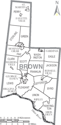
Villages
|
Mount Orab, Ohio Mount Orab is a village in Brown County, Ohio, United States. The population was 2,307 at the 2000 census.-Geography:Mount Orab is located at .According to the United States Census Bureau, the village has a total area of , all land.... Ripley, Ohio Ripley is a village in Brown County, Ohio, United States, along the Ohio River 50 miles southeast of Cincinnati. The population was 1,745 at the 2000 census.-History:... Russellville, Ohio Russellville is a village in Brown County, Ohio, United States. The population was 453 at the 2000 census.-Geography:Russellville is located at .... Sardinia, Ohio Sardinia is a village in Brown and Highland counties in the U.S. state of Ohio. The population was 862 at the 2000 census. Its name comes from the island of Sardinia in the Mediterranean Sea... St. Martin, Ohio St. Martin was a village in Brown County, Ohio, United States. The population was 91 at the 2000 census. The community is served by the Fayetteville post office. St. Martin was dissolved as a village in November 2011 to be served by Perry Township.... |
Townships
|
Green Township, Brown County, Ohio Green Township is one of the sixteen townships of Brown County, Ohio, United States. The 2000 census found 3,389 people in the township, 1,978 of whom lived in the unincorporated portions of the township.-Geography:... Huntington Township, Brown County, Ohio Huntington Township is one of the sixteen townships of Brown County, Ohio, United States. The 2000 census found 2,968 people in the township, 1,365 of whom lived in the unincorporated portions of the township.-Geography:... Jackson Township, Brown County, Ohio Jackson Township is one of the sixteen townships of Brown County, Ohio, United States. The 2000 census found 1,221 people in the township.-Geography:Located in the eastern part of the county, it borders the following townships:*Eagle Township - north... Jefferson Township, Brown County, Ohio Jefferson Township is one of the sixteen townships of Brown County, Ohio, United States. The 2000 census found 1,355 people in the township, 902 of whom lived in the unincorporated portions of the township.-Geography:... |
Lewis Township, Brown County, Ohio Lewis Township is one of the sixteen townships of Brown County, Ohio, United States. The 2000 census found 2,362 people in the township, 2,071 of whom lived in the unincorporated portions of the township.-Geography:... Perry Township, Brown County, Ohio Perry Township is one of the sixteen townships of Brown County, Ohio, United States. The 2000 census found 4,830 people in the township, 4,367 of whom lived in the unincorporated portions of the township.-Geography:... Pike Township, Brown County, Ohio Pike Township is one of the sixteen townships of Brown County, Ohio, United States. The 2000 census found 3,742 people in the township, 2,995 of whom lived in the unincorporated portions of the township.-Geography:... Pleasant Township, Brown County, Ohio Pleasant Township is one of the sixteen townships of Brown County, Ohio, United States. The 2000 census found 5,187 people in the township, 1,498 of whom lived in the unincorporated portions of the township.-Geography:... |
Scott Township, Brown County, Ohio Scott Township is one of the sixteen townships of Brown County, Ohio, United States. The 2000 census found 1,253 people in the township.-Geography:Located in the center of the county, it borders the following townships:*Pike Township - north... Sterling Township, Brown County, Ohio Sterling Township is one of the sixteen townships of Brown County, Ohio, United States. The 2000 census found 3,753 people in the township, 3,604 of whom lived in the unincorporated portions of the township.-Geography:... Union Township, Brown County, Ohio Union Township is one of the sixteen townships of Brown County, Ohio, United States. The 2000 census found 3,015 people in the township, 1,270 of whom lived in the unincorporated portions of the township.-Geography:... Washington Township, Brown County, Ohio Washington Township is one of the sixteen townships of Brown County, Ohio, United States. The 2000 census found 2,271 people in the township, 1,409 of whom lived in the unincorporated portions of the township.-Geography:... |
Unincorporated communities
|
Feesburg, Ohio Feesburg is a small unincorporated community in northern Lewis Township, Brown County, Ohio, United States. It sits along State Routes 505 and 756. The ZIP code for Feesburg, Ohio is 45119.The community was named after Thomas J. Fee, who laid out the town.... |
|
Media
Radio- WRACWRAC (FM)WRAC is a radio station broadcasting a Country music format. Licensed to Georgetown, Ohio, USA, the station is owned by Dreamcatcher Communications.-History:The station was assigned the call letters WIAO on 1981-06-05...
C103 Country 103.1 FM (Georgetown) - WAOL 99.5 (Ripley; simulcasts WOXYWOXY (FM)WOXY , is a radio station licensed to Mason, Ohio as part of the Cincinnati market. Nicknamed La Mega 97.7, the station now broadcasts a Spanish Variety music format, playing a mix of Spanish pop and rock, Regional Mexican, and tropical Latin music...
)
Newspapers
- The News Democrat (Georgetown)
- The Brown County Press (Mount Orab)
- The County Free Press (Georgetown, Monthly)
- The Ripley Bee (Ripley, Weekly)
- Ohio's Brown County (Mount Orab, Daily Online Publication)