

Lorain County, Ohio
Encyclopedia
Lorain County is a county located in the U.S. state
of Ohio
, and is considered to be a part of what is locally referred to as Greater Cleveland
. As of the 2010 census, its population was 301,356. an increase from 284,664 in 2000. Named by early settler Heman Ely for the French
province of Lorraine
, its county seat
is Elyria
and its largest community is the Lake Erie port city of Lorain
.
, the county has a total area of 923 square miles (2,390.6 km²).492 square miles (1,276 km²) of it is land and 431 square miles (1,116.3 km²) of it (46.64%) is water.
of 2000, there were 284,664 people, 105,836 households, and 76,201 families residing in the county. The population density
was 578 people per square mile (223/km²). There were 111,368 housing units at an average density of 226 per square mile (87/km²). The racial makeup of the county was 85.54% White
, 16.2% Black
or African American
, 0.30% Native American
, 0.60% Asian
, 0.03% Pacific Islander
, 2.87% from other races
, and 2.17% from two or more races. 6.91% of the population were Hispanic
or Latino
of any race. 21.1% were of German
, 10.5% Irish
, 7.8% English
, 7.0% Polish, 6.8% Italian
and 6.3% American
ancestry according to Census 2000. 92.2% spoke English
and 4.9% Spanish
as their first language.
There were 105,836 households out of which 33.60% had children under the age of 18 living with them, 55.20% were married couples
living together, 12.60% had a female householder with no husband present, and 28.00% were non-families. 23.60% of all households were made up of individuals and 9.20% had someone living alone who was 65 years of age or older. The average household size was 2.61 and the average family size was 3.08.
In the county, the population was spread out with 26.20% under the age of 18, 8.70% from 18 to 24, 29.30% from 25 to 44, 23.30% from 45 to 64, and 12.50% who were 65 years of age or older. The median age was 36 years. For every 100 females there were 96.30 males. For every 100 females age 18 and over, there were 93.60 males.
The median income for a household in the county was $45,042, and the median income for a family was $52,856. Males had a median income of $39,902 versus $26,116 for females. The per capita income
for the county was $21,054. About 6.70% of families and 9.00% of the population were below the poverty line, including 12.90% of those under age 18 and 6.60% of those age 65 or over.
U.S. state
A U.S. state is any one of the 50 federated states of the United States of America that share sovereignty with the federal government. Because of this shared sovereignty, an American is a citizen both of the federal entity and of his or her state of domicile. Four states use the official title of...
of Ohio
Ohio
Ohio is a Midwestern state in the United States. The 34th largest state by area in the U.S.,it is the 7th‑most populous with over 11.5 million residents, containing several major American cities and seven metropolitan areas with populations of 500,000 or more.The state's capital is Columbus...
, and is considered to be a part of what is locally referred to as Greater Cleveland
Greater Cleveland
Greater Cleveland is a nickname for the metropolitan area surrounding Cleveland, Ohio and is part of what used to be the Connecticut Western Reserve.Northeast Ohio refers to a similar but substantially larger area as described below...
. As of the 2010 census, its population was 301,356. an increase from 284,664 in 2000. Named by early settler Heman Ely for the French
France
The French Republic , The French Republic , The French Republic , (commonly known as France , is a unitary semi-presidential republic in Western Europe with several overseas territories and islands located on other continents and in the Indian, Pacific, and Atlantic oceans. Metropolitan France...
province of Lorraine
Lorraine (province)
The Duchy of Upper Lorraine was an historical duchy roughly corresponding with the present-day northeastern Lorraine region of France, including parts of modern Luxembourg and Germany. The main cities were Metz, Verdun, and the historic capital Nancy....
, its county seat
County seat
A county seat is an administrative center, or seat of government, for a county or civil parish. The term is primarily used in the United States....
is Elyria
Elyria, Ohio
-Community:Elyria has an extensive, although financially burdened, community food pantry and "Hot Meals" program administered through the Second Harvest Food Bank and several churches Elyria is served by Elyria Memorial Hospital.-Recreation and parks:...
and its largest community is the Lake Erie port city of Lorain
Lorain, Ohio
Lorain is a city in Lorain County, Ohio, United States. The municipality is located in northeastern Ohio on Lake Erie, at the mouth of the Black River, about 30 miles west of Cleveland....
.
Geography
According to the U.S. Census BureauUnited States Census Bureau
The United States Census Bureau is the government agency that is responsible for the United States Census. It also gathers other national demographic and economic data...
, the county has a total area of 923 square miles (2,390.6 km²).492 square miles (1,276 km²) of it is land and 431 square miles (1,116.3 km²) of it (46.64%) is water.
Major highways


 Interstate 80Interstate 80Interstate 80 is the second-longest Interstate Highway in the United States, following Interstate 90. It is a transcontinental artery running from downtown San Francisco, California to Teaneck, New Jersey in the New York City Metropolitan Area...
/Interstate 90Interstate 90Interstate 90 is the longest Interstate Highway in the United States at . It is the northernmost coast-to-coast interstate, and parallels US 20 for the most part. Its western terminus is in Seattle, at Edgar Martinez Drive S. near Safeco Field and CenturyLink Field, and its eastern terminus is in...
(Ohio TurnpikeOhio TurnpikeThe Ohio Turnpike, officially the James W. Shocknessy Ohio Turnpike, is a -long, limited-access toll highway in the U.S. state of Ohio, serving as a primary corridor to Chicago and Pittsburgh...
) Interstate 480Interstate 480 (Ohio)Interstate 480 is a loop highway that connects the Ohio Turnpike with suburban Cleveland, Ohio. The highway is officially designated the Outerbelt South Freeway, but it is rarely referred to by that name....
 U.S. Route 6U.S. Route 6U.S. Route 6 , also called the Grand Army of the Republic Highway, a name that honors an American Civil War veterans association, is a main route of the U.S. Highway system, running east-northeast from Bishop, California to Provincetown, Massachusetts. Until 1964, it continued south from Bishop to...
 U.S. Route 20U.S. Route 20U.S. Route 20 is an east–west United States highway. As the "0" in its route number implies, US 20 is a coast-to-coast route. Spanning , it is the longest road in the United States, and the route sparsely parallels Interstate 90...
 State Route 2
 State Route 10
 State Route 18
 State Route 57
 State Route 58
 State Route 82
 State Route 83
 State Route 113
 State Route 162
 State Route 254
 State Route 301
 State Route 303
 State Route 511
 State Route 611
Adjacent counties
- Across Lake ErieLake ErieLake Erie is the fourth largest lake of the five Great Lakes in North America, and the tenth largest globally. It is the southernmost, shallowest, and smallest by volume of the Great Lakes and therefore also has the shortest average water residence time. It is bounded on the north by the...
lies Chatham-Kent, OntarioOntarioOntario is a province of Canada, located in east-central Canada. It is Canada's most populous province and second largest in total area. It is home to the nation's most populous city, Toronto, and the nation's capital, Ottawa....
, CanadaCanadaCanada is a North American country consisting of ten provinces and three territories. Located in the northern part of the continent, it extends from the Atlantic Ocean in the east to the Pacific Ocean in the west, and northward into the Arctic Ocean...
(north) - Cuyahoga CountyCuyahoga County, OhioCuyahoga County is a county located in the state of Ohio, United States. It is the most populous county in Ohio; as of the 2010 census, the population was 1,280,122. Its county seat is Cleveland. Cuyahoga County is part of Greater Cleveland, a metropolitan area, and Northeast Ohio, a...
(east) - Medina County (southeast)
- Ashland CountyAshland County, OhioAshland County is a county located in the state of Ohio, United States, and was formed in 1846 from parts of Huron, Lorain, Richland and Wayne Counties. As of the 2010 census, the population was 53,139. Its county seat is Ashland...
(south) - Huron CountyHuron County, OhioAs of the census of 2000, there were 59,487 people, 22,307 households, and 16,217 families residing in the county. The population density was 121 people per square mile . There were 23,594 housing units at an average density of 48 per square mile...
(southwest) - Erie CountyErie County, OhioAs of the census of 2000, there were 79,551 people, 31,727 households, and 21,764 families residing in the county. The population density was 312 people per square mile . There were 35,909 housing units at an average density of 141 per square mile...
(west)
Demographics
As of the censusCensus
A census is the procedure of systematically acquiring and recording information about the members of a given population. It is a regularly occurring and official count of a particular population. The term is used mostly in connection with national population and housing censuses; other common...
of 2000, there were 284,664 people, 105,836 households, and 76,201 families residing in the county. The population density
Population density
Population density is a measurement of population per unit area or unit volume. It is frequently applied to living organisms, and particularly to humans...
was 578 people per square mile (223/km²). There were 111,368 housing units at an average density of 226 per square mile (87/km²). The racial makeup of the county was 85.54% White
Race (United States Census)
Race and ethnicity in the United States Census, as defined by the Federal Office of Management and Budget and the United States Census Bureau, are self-identification data items in which residents choose the race or races with which they most closely identify, and indicate whether or not they are...
, 16.2% Black
Race (United States Census)
Race and ethnicity in the United States Census, as defined by the Federal Office of Management and Budget and the United States Census Bureau, are self-identification data items in which residents choose the race or races with which they most closely identify, and indicate whether or not they are...
or African American
Race (United States Census)
Race and ethnicity in the United States Census, as defined by the Federal Office of Management and Budget and the United States Census Bureau, are self-identification data items in which residents choose the race or races with which they most closely identify, and indicate whether or not they are...
, 0.30% Native American
Race (United States Census)
Race and ethnicity in the United States Census, as defined by the Federal Office of Management and Budget and the United States Census Bureau, are self-identification data items in which residents choose the race or races with which they most closely identify, and indicate whether or not they are...
, 0.60% Asian
Race (United States Census)
Race and ethnicity in the United States Census, as defined by the Federal Office of Management and Budget and the United States Census Bureau, are self-identification data items in which residents choose the race or races with which they most closely identify, and indicate whether or not they are...
, 0.03% Pacific Islander
Race (United States Census)
Race and ethnicity in the United States Census, as defined by the Federal Office of Management and Budget and the United States Census Bureau, are self-identification data items in which residents choose the race or races with which they most closely identify, and indicate whether or not they are...
, 2.87% from other races
Race (United States Census)
Race and ethnicity in the United States Census, as defined by the Federal Office of Management and Budget and the United States Census Bureau, are self-identification data items in which residents choose the race or races with which they most closely identify, and indicate whether or not they are...
, and 2.17% from two or more races. 6.91% of the population were Hispanic
Race (United States Census)
Race and ethnicity in the United States Census, as defined by the Federal Office of Management and Budget and the United States Census Bureau, are self-identification data items in which residents choose the race or races with which they most closely identify, and indicate whether or not they are...
or Latino
Race (United States Census)
Race and ethnicity in the United States Census, as defined by the Federal Office of Management and Budget and the United States Census Bureau, are self-identification data items in which residents choose the race or races with which they most closely identify, and indicate whether or not they are...
of any race. 21.1% were of German
Germans
The Germans are a Germanic ethnic group native to Central Europe. The English term Germans has referred to the German-speaking population of the Holy Roman Empire since the Late Middle Ages....
, 10.5% Irish
Irish people
The Irish people are an ethnic group who originate in Ireland, an island in northwestern Europe. Ireland has been populated for around 9,000 years , with the Irish people's earliest ancestors recorded having legends of being descended from groups such as the Nemedians, Fomorians, Fir Bolg, Tuatha...
, 7.8% English
English people
The English are a nation and ethnic group native to England, who speak English. The English identity is of early mediaeval origin, when they were known in Old English as the Anglecynn. England is now a country of the United Kingdom, and the majority of English people in England are British Citizens...
, 7.0% Polish, 6.8% Italian
Italian people
The Italian people are an ethnic group that share a common Italian culture, ancestry and speak the Italian language as a mother tongue. Within Italy, Italians are defined by citizenship, regardless of ancestry or country of residence , and are distinguished from people...
and 6.3% American
United States
The United States of America is a federal constitutional republic comprising fifty states and a federal district...
ancestry according to Census 2000. 92.2% spoke English
English language
English is a West Germanic language that arose in the Anglo-Saxon kingdoms of England and spread into what was to become south-east Scotland under the influence of the Anglian medieval kingdom of Northumbria...
and 4.9% Spanish
Spanish language
Spanish , also known as Castilian , is a Romance language in the Ibero-Romance group that evolved from several languages and dialects in central-northern Iberia around the 9th century and gradually spread with the expansion of the Kingdom of Castile into central and southern Iberia during the...
as their first language.
There were 105,836 households out of which 33.60% had children under the age of 18 living with them, 55.20% were married couples
Marriage
Marriage is a social union or legal contract between people that creates kinship. It is an institution in which interpersonal relationships, usually intimate and sexual, are acknowledged in a variety of ways, depending on the culture or subculture in which it is found...
living together, 12.60% had a female householder with no husband present, and 28.00% were non-families. 23.60% of all households were made up of individuals and 9.20% had someone living alone who was 65 years of age or older. The average household size was 2.61 and the average family size was 3.08.
In the county, the population was spread out with 26.20% under the age of 18, 8.70% from 18 to 24, 29.30% from 25 to 44, 23.30% from 45 to 64, and 12.50% who were 65 years of age or older. The median age was 36 years. For every 100 females there were 96.30 males. For every 100 females age 18 and over, there were 93.60 males.
The median income for a household in the county was $45,042, and the median income for a family was $52,856. Males had a median income of $39,902 versus $26,116 for females. The per capita income
Per capita income
Per capita income or income per person is a measure of mean income within an economic aggregate, such as a country or city. It is calculated by taking a measure of all sources of income in the aggregate and dividing it by the total population...
for the county was $21,054. About 6.70% of families and 9.00% of the population were below the poverty line, including 12.90% of those under age 18 and 6.60% of those age 65 or over.
Government
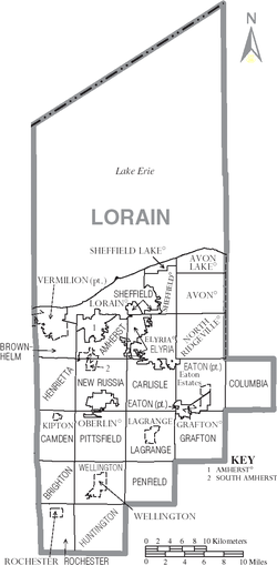
Communities
Cities
|
Elyria, Ohio -Community:Elyria has an extensive, although financially burdened, community food pantry and "Hot Meals" program administered through the Second Harvest Food Bank and several churches Elyria is served by Elyria Memorial Hospital.-Recreation and parks:... Lorain, Ohio Lorain is a city in Lorain County, Ohio, United States. The municipality is located in northeastern Ohio on Lake Erie, at the mouth of the Black River, about 30 miles west of Cleveland.... North Ridgeville, Ohio North Ridgeville,is a city located along the eastern border of Lorain County, Ohio, United States. The city's population was 29,465 at the 2010 census. A west side suburb of Cleveland, North Ridgeville is the number 1 fastest growing city in the entire Greater Cleveland area.Located from Cleveland... |
Oberlin, Ohio Oberlin is a city in Lorain County, Ohio, United States, to the south and west of Cleveland. Oberlin is perhaps best known for being the home of Oberlin College, a liberal arts college and music conservatory with approximately 3,000 students... Vermilion, Ohio Vermilion is a city in Erie and Lorain counties in Ohio, on the North Coast of the U.S.A. The population was 10,927 at the 2000 census. The current mayor is Eileen Bulan... |
Villages
|
Sheffield, Ohio -Notable residents:* Lee Richmond - a 19th century major league baseball pitcher, was born in Sheffield.... South Amherst, Ohio South Amherst is a village in Lorain County, Ohio, United States. The population was 1,863 at the 2000 census.-Geography:South Amherst is located at .... Wellington, Ohio Wellington is a village in Lorain County, Ohio, United States. The population was 4,511 at the 2000 census.-History:Wellington was settled in 1818 by Ephraim Wilcox, Charles Sweet, William T. Welling, John Clifford, and Joseph Wilson from the states of Massachusetts and New York... |
Townships
|
Eaton Township, Lorain County, Ohio Eaton Township is one of the eighteen townships of Lorain County, Ohio, United States. The 2000 census found 9,675 people in the unincorporated portions of the township.-Geography:... Elyria Township, Lorain County, Ohio Elyria Township is one of the eighteen townships of Lorain County, Ohio, United States. The 2000 census found 3,520 people in the unincorporated portions of the township.-Geography:... Grafton Township, Lorain County, Ohio Grafton Township is one of the eighteen townships of Lorain County, Ohio, United States. The 2000 census found 2,722 people in the unincorporated portions of the township.-Geography:Located in southeastern Lorain County, it borders the following townships:... Henrietta Township, Lorain County, Ohio Henrietta Township is one of the eighteen townships of Lorain County, Ohio, United States. The 2000 census found 1,873 people in the township.-Geography:Located in western Lorain County, it borders the following townships:*Brownhelm Township - north... |
Huntington Township, Lorain County, Ohio Huntington Township is one of the eighteen townships of Lorain County, Ohio, United States. The 2000 census found 1,282 people in the township.-Geography:Located in southeastern Lorain County, it borders the following townships:*Wellington Township - north... LaGrange Township, Lorain County, Ohio LaGrange Township is one of the eighteen townships of Lorain County, Ohio, United States. The 2000 census found 5,972 people in the township, 4,157 of whom lived in the unincorporated portions of the township.-Geography:... New Russia Township, Lorain County, Ohio New Russia Township is one of the eighteen townships of Lorain County, Ohio, United States. The 2000 census found 2,357 people in the township, 1,918 of whom lived in the unincorporated portions of the township.-Geography:... Penfield Township, Lorain County, Ohio Penfield Township is one of the eighteen townships of Lorain County, Ohio, United States. The 2000 census found 1,690 people in the township.-Geography:Located in southeastern Lorain County, it borders the following townships:*LaGrange Township - north... |
Pittsfield Township, Lorain County, Ohio Pittsfield Township is one of the eighteen townships of Lorain County, Ohio, United States. The 2000 census found 1,549 people in the unincorporated portions of the township.-Geography:... Rochester Township, Lorain County, Ohio Rochester Township is one of the eighteen townships of Lorain County, Ohio, United States. The 2000 census found 752 people in the township, 562 of whom lived in the unincorporated portions of the township.-Geography:... Sheffield Township, Lorain County, Ohio Sheffield Township is one of the eighteen townships of Lorain County, Ohio, United States. The 2000 census found 4,117 people in the unincorporated portions of the township.-Geography:... Wellington Township, Lorain County, Ohio Wellington Township is one of the eighteen townships of Lorain County, Ohio, United States. The 2000 census found 5,904 people in the township, 1,393 of whom lived in the unincorporated portions of the township.-Geography:... |
Other communities
|
|
Public School Districts
There are 20 public school districts in Lorain County. Those primarily in Lorain County are listed in bold. Each district's high school(s) and location is also listed.- Amherst Exempted Village School District
- Amherst Marion L. Steele High School, Amherst
- Avon Local School District
- Avon High School, Avon
- Avon Lake City School District
- Avon Lake High School, Avon Lake
- Black River Local School District (also in Medina Co and Ashland CoAshland County, OhioAshland County is a county located in the state of Ohio, United States, and was formed in 1846 from parts of Huron, Lorain, Richland and Wayne Counties. As of the 2010 census, the population was 53,139. Its county seat is Ashland...
.)- Black River High School, Sullivan
- Clearview Local School District
- Clearview High School, Lorain
- Columbia Local School District
- Columbia High School, Columbia Station
- Elyria City School District
- Elyria High SchoolElyria High SchoolElyria High School is a high school in Elyria, Ohio. Founded in 1830, it is notable for being the first chartered high school west of the Allegheny Mountains...
, Elyria
- Elyria High School
- Firelands Local School District (also in Erie CoErie County, OhioAs of the census of 2000, there were 79,551 people, 31,727 households, and 21,764 families residing in the county. The population density was 312 people per square mile . There were 35,909 housing units at an average density of 141 per square mile...
.)- Firelands High School, Henrietta Twp (Oberlin)
- Keystone Local School District
- Keystone High School, LaGrange
- Lorain City School District
- Lorain High School, Lorain
- Mapleton Local School District (Primarily in Ashland CoAshland County, OhioAshland County is a county located in the state of Ohio, United States, and was formed in 1846 from parts of Huron, Lorain, Richland and Wayne Counties. As of the 2010 census, the population was 53,139. Its county seat is Ashland...
.)- Mapleton High School, Ashland
- Midview Local School District
- Midview High School, Eaton Twp (Grafton)
- New London Local School District (primarily in Huron CoHuron County, OhioAs of the census of 2000, there were 59,487 people, 22,307 households, and 16,217 families residing in the county. The population density was 121 people per square mile . There were 23,594 housing units at an average density of 48 per square mile...
.)- New London High School, New London
- North Ridgeville City School District
- North Ridgeville High SchoolNorth Ridgeville High SchoolNorth Ridgeville Senior High School is a public high school located within the North Ridgeville City School District. North Ridgeville Sr. High is located at 34600 Bainbridge Road in North Ridgeville, Ohio, 18 miles west of Cleveland's downtown.North Ridgeville High School was named the Ohio...
, North Ridgeville
- North Ridgeville High School
- Oberlin City School District
- Oberlin High School, Oberlin
- Olmsted Falls City Schools (primarily in Cuyahoga CoCuyahoga County, OhioCuyahoga County is a county located in the state of Ohio, United States. It is the most populous county in Ohio; as of the 2010 census, the population was 1,280,122. Its county seat is Cleveland. Cuyahoga County is part of Greater Cleveland, a metropolitan area, and Northeast Ohio, a...
.)- Olmsted Falls High School, Olmsted Falls
- Sheffield-Sheffield Lake City School District
- Brookside High School, Sheffield
- Strongsville City School District (primarily in Cuyahoga CoCuyahoga County, OhioCuyahoga County is a county located in the state of Ohio, United States. It is the most populous county in Ohio; as of the 2010 census, the population was 1,280,122. Its county seat is Cleveland. Cuyahoga County is part of Greater Cleveland, a metropolitan area, and Northeast Ohio, a...
.)- Strongsville High School, Strongsville
- Vermilion Local Schools (primarily in Erie CoErie County, OhioAs of the census of 2000, there were 79,551 people, 31,727 households, and 21,764 families residing in the county. The population density was 312 people per square mile . There were 35,909 housing units at an average density of 141 per square mile...
.)- Vermilion High School, Vermilion
- Wellington Exempted Village School District (also in Huron CoHuron County, OhioAs of the census of 2000, there were 59,487 people, 22,307 households, and 16,217 families residing in the county. The population density was 121 people per square mile . There were 23,594 housing units at an average density of 48 per square mile...
.)- Wellington High School, Wellington
Private High Schools
- Elyria Catholic High School, Elyria
- Lake Ridge AcademyLake Ridge AcademyLake Ridge Academy is an independent K-12 school in North Ridgeville, Ohio, United States, founded in 1963. The only independent school on the west side of Cleveland, Lake Ridge is one of the smallest private schools in the Cleveland area, with 366 students enrolled in the past year.The school...
, North Ridgeville - Open Door Christian School, Elyria
- Christian Community School, North Eaton
See also
- National Register of Historic Places listings in Lorain County, Ohio
- USS Lorain County (LST-1177)USS Lorain County (LST-1177)USS Lorain County was a built for the United States Navy during the late 1950s. Named after Lorain County, Ohio, she was the only U.S. Naval vessel to bear the name....