
List of bridges on the National Register of Historic Places in Ohio
Encyclopedia
This is a list of bridge
s and tunnel
s on the National Register of Historic Places
in the U.S. state
of Ohio
.
{| class="wikitable sortable"
!|Name
!|Image
!|Built
!|Listed
!|Location
!|County
!|Type
|-
|"S" Bridge II
|
|1828
|1973-04-23
|New Concord
39°59′35"N 81°44′48"W
|Muskingum
|
|-
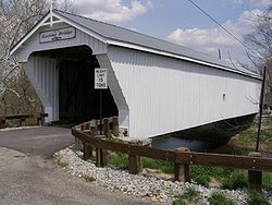
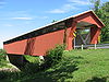
|Adams Covered Bridge
|
|1875
|1999-02-05
|Malta
39°37′27"N 82°1′58"W
|Morgan
|Covered bridge
|-
|B & O Railroad Viaduct
|
|1871
|1976-06-22
|Bellaire
40°0′47"N 80°44′40"W
|Belmont
|Roman-arched Viaduct
|-
|Ballard Road Covered Bridge
|
|1883
|1975-05-29
|Jamestown
39°40′41"N 83°48′55"W
|Greene
|Howe Truss
|-
|Barkhurst Mill Covered Bridge
|
|1872
|1999-02-05
|Chesterhill
39°30′10"N 81°50′3"W
|Morgan
|Covered bridge
|-
|Belle Hall Covered Bridge
|
|1879
|1976-10-22
|Croton
40°14′8"N 82°38′26"W
|Licking
|Multiple kingpost truss plan
|-
|Bennett Schoolhouse Road Covered Bridge
|
|1867
|1978-10-11
|Minford
38°49′45"N 82°48′26"W
|Scioto
|King post truss
|-
|Bergstresser Covered Bridge
|
|1887
|1974-05-03
|Canal Winchester
39°49′48"N 82°49′0"W
|Franklin
|Partridge truss
|-
|Black River Viaduct, Baltimore And Ohio Railroad
|
|1890, 1892
|1976-05-06
|Lodi
41°1′38"N 82°2′29"W
|Medina
|
|-
|Blackwood Covered Bridge
|
|1881
|1978-06-23
|Athens
39°11′50"N 81°58′29"W
|Athens
|King post truss,covered
|-
|Blaine Hill "S" Bridge
|
|
|2010-03-17
|Blane
|Belmont
|
|-
|Bowman Mill Covered Bridge
|
|
|1978-02-08
|New Reading
39°47′53"N 82°21′40"W
|Perry
|Multiple kingpost truss
|-
|John Bright Covered Bridge
|
|1881
|1975-05-28
|Baltimore
39°49′50"N 82°40′23"W
|Fairfield
|One-Span Combination Truss
Moved to Ohio University
-Lancaster
|-
|Broadway Bridge
|
|1909
|1996-02-22
|Greenville
40°6′15"N 84°38′5"W
|Darke
|Three-hinged arch
|-
|Brubaker Covered Bridge
|
|1887
|1975-06-11
|Gratis
39°39′6"N 84°32′39"W
|Preble
|One-span Childs truss
|-
|Buckeye Furnace Covered Bridge
|
|1872
|1975-02-24
|Wellston
39°3′16"N 82°27′35"W
|Jackson
|Smith Truss
|-
|Byer Covered Bridge
|
|
|1975-10-21
|Byer
39°10′46"N 82°37′52"W
|Jackson
|Smith Truss
|-
|Caledonia Bowstring Bridge
|
|1873, 1976
|1978-05-23
|Caledonia
40°38′33"N 82°57′56"W
|Marion
|Bowstring arch-truss
|-
|Chambers Road Covered Bridge
|
|1874
|1974-11-21
|Olive Green
40°20′17"N 82°49′5"W
|Delaware
|Childs Truss
|-
|Christman Covered Bridge
|
|1895
|1976-10-22
|Eaton
39°46′13"N 84°39′20"W
|Preble
|One-span Childs truss
|-
|Church Hill Road Covered Bridge
|
|
|1975-06-11
|Lisbon
40°47′14"N 80°43′29"W
|Columbiana
|
|-
|Cincinnati and Whitewater Canal Tunnel
|
|1837, 1846
|2001-05-25
|Cleves
39°9′18"N 84°44′58"W
|Hamilton
|Brick lined canal tunnel
|-
|Cleveland And Pittsburgh Railroad Bridge
|
|1864
|1975-07-24
|Bedford
41°23′5"N 81°32′3"W
|Cuyahoga
|Viaduct
|-
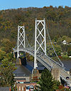
|Covington and Cincinnati Suspension Bridge
|
|1856, 1867
|1975-05-15
|Cincinnati
39°5′32"N 84°30′34"W
|Hamilton
|Suspension bridge
|-
|Dean Road Bridge
|
|1898
|1978-11-28
|Birmingham
, South Amherst
41°20′56"N 82°20′41"W
|Erie
, Lorain
|Pratt truss
|-
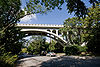
|Detroit Avenue Bridge
|
|1910
|1973-02-23
|Rocky River-Lakewood
41°28′57"N 81°49′53"W
|Cuyahoga
|
|-
|Detroit-Superior High Level Bridge
|
|1917
|1974-01-18
|Cleveland
41°29′39"N 81°42′9"W
|Cuyahoga
|Double-deck bridge
|-
|Dey Road Bridge
|
|1906
|1999-02-05
|Defiance
41°17′25"N 84°23′8"W
|Defiance
|Pratt through truss bridge
|-
|Dresden Suspension Bridge
|
|1914
|1978-12-01
|Dresden
40°7′14"N 82°0′1"W
|Muskingum
|Warren truss
|-
|Eagle Creek Covered Bridge
|
|1875
|1975-12-06
|Decatur
38°46′11"N 83°42′54"W
|Brown
|Smith Truss Covered Bridge
|-
|Eakin Mill Covered Bridge
|
|1870, 1871
|1976-03-16
|Arbaugh
39°10′16"N 82°20′13"W
|Vinton
|Kingpost truss
|-
|Eldean Covered Bridge
| |1860
|1860
|1975-02-20
|Troy
40°4′40"N 84°13′0"W
|Miami
|Long truss
|-
|Foreaker Bridge
|
|1886, 1887
|1975-06-05
|Graysville
39°39′20"N 81°7′16"W
|Monroe
|Kingpost truss
|-
|Geeting Covered Bridge
| |1894
|1894
|1975-08-19
|Lewisburg
39°50′37"N 84°35′50"W
|Preble
|One-span Childs truss
|-
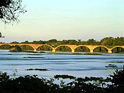
|General U.S. Grant Bridge
|
|1927, 1939
|2001-05-31
|Portsmouth
38°43′50"N 82°59′49"W
|Scioto
|Cable suspension bridge
|-
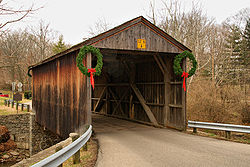
|Harpersfield Covered Bridge
|_covered_bridge_1.jpg)
|1873
|1975-11-03
|Harpersfield
41°45′22"N 80°56′40"W
|Ashtabula
|Howe truss covered bridge
|-
|Harra Covered Bridge
|
|
|1976-10-08
|Watertown
39°29′16"N 81°38′53"W
|Washington
|Long truss
|-
|Harshaville Covered Bridge
|
|
|1976-03-16
|Harshaville
38°54′28"N 83°32′40"W
|Adams
|Burr truss covered bridge
|-
|Harshman Covered Bridge
|
|1894
|1976-09-29
|Fairhaven
39°42′9"N 84°46′10"W
|Preble
|One-Span Childs Truss
|-
|Helmick Covered Bridge
|
|1863
|1975-06-18
|Blissfield
40°23′35"N 81°56′34"W
|Coshocton
|Two-Span Wooden Truss
|-
|Helmick Mill Covered Bridge
|
|1867
|1999-02-05
|Malta
39°43′11"N 81°56′32"W
|Morgan
|Covered bridge
|-
|Hildreth Covered Bridge
|
|1878, ca. 1881
|1978-02-08
|Marietta
39°25′38"N 81°21′42"W
|Washington
|Howe truss
|-
|Jediah Hill Covered Bridge
|
|1850
|1973-03-28
|Cincinnati
39°15′21"N 84°32′58"W
|Hamilton
|Queenpost Truss
|-
|Hizey Covered Bridge
|
|1891
|1976-10-08
|Pickerington
39°53′53"N 82°40′9"W
|Fairfield
|Burr Truss
|-
|Huffman Covered Bridge
|
|1914
|1975-03-04
|Middleburg
39°39′37"N 81°22′13"W
|Noble
|Kingpost truss
|-
|Hune Covered Bridge
|
|1879
|1976-10-08
|Dart
39°30′38"N 81°15′2"W
|Washington
|Long Truss
|-
|Ida Street Viaduct
|
|1931
|1980-11-28
|Cincinnati
39°6′19"N 84°29′40"W
|Hamilton
|
|-
|Interurban Bridge
|
|1908
|1972-06-19
|Waterville
41°29′11"N 83°43′42"W
|Lucas
, Wood
|Reinforced concrete bridge
|-
|John Bright No. 1 Iron Bridge
|
|
|1978-09-20
|Carroll
39°49′45"N 82°40′27"W
|Fairfield
|One-Span Steel Eye-Bar
|-
|Johnson Road Covered Bridge
|
|
|1984-08-23
|Petersburg
38°57′31"N 82°47′16"W
|Jackson
|Single span wooden truss
|-
|Kidwell Covered Bridge
|
|1880
|1977-04-11
|Truetown
39°27′21"N 82°6′13"W
|Athens
|Howe truss covered bridge
|-
|Kirker Covered Bridge
|
|
|1975-10-29
|West Union
38°47′3"N 83°36′13"W
|Adams
|Kingpost truss bridge
|-
|Knowlton Covered Bridge
|
|
|1980-03-11
|Rinards Mills
39°36′4"N 81°9′26"W
|Monroe
|Burr arch truss bridge
|-
|Lockington Covered Bridge
|
|1848
|1975-06-10
|Lockington
40°12′4"N 84°12′58"W
|Shelby
|Long truss; burned in 1989
|-
|Lorain-Carnegie Bridge
|
|1927, 1932
|1976-10-08
|Cleveland
41°29′26"N 81°41′30"W
|Cuyahoga
|Cantilever Deck Truss bridge
|-
|Lynchburg Covered Bridge
|
|1870
|1976-03-16
|Lynchburg
39°14′42"N 83°47′40"W
|Clinton
, Highland
|
|-
|Mark Road Bridge
|
|1883
|1990-07-26
|Staunton
39°29′13"N 83°28′23"W
|Fayette
|Pratt through truss
|-
|Martinsville Road Covered Bridge
|
|1871
|1974-09-10
|Martinsville
39°19′47"N 83°50′6"W
|Clinton
|Multiple kingpost
|-
| Maysville-Aberdeen Bridge
|
|
|1983-6-30
| Aberdeen
38°39′19"N 83°45′27"W
|Brown
|Spans the Ohio River
between Aberdeen and Maysville, Kentucky
|-
|McColly Covered Bridge
|
|1876
|1975-05-28
|Bloom Center
40°24′3"N 83°55′27"W
|Logan
|Howe truss covered bridge
|-
|Mill Creek Park Suspension Bridge
|
|1895
|1976-10-29
|Youngstown
41°4′24"N 80°41′21"W
|Mahoning
|
|-
|Mill Road Bowstring Bridge
|
|
|1979-12-05
|Bladensburg
40°16′35"N 82°16′22"W
|Knox
|Bow-string arch-truss
|-
|Mt. Olive Road Covered Bridge
|
|1875
|1976-10-08
|Allensville
39°17′10"N 82°35′21"W
|Vinton
|Queenpost truss
|-
|Mull Covered Bridge
|
|1851
|1974-10-15
|Burgoon
41°15′38"N 83°11′4"W
|Sandusky
|Town Lattice truss
|-
|Newport and Cincinnati Bridge
|
|1868, 1872, 1896
|2001-04-17
|Cincinnati
39°6′3"N 84°30′2"W
|Hamilton
|Subdivided Pratt truss
|-
|Newton Falls Covered Bridge
|
|1831
|1974-10-16
|Newton Falls
41°11′17"N 80°58′17"W
|Trumbull
|Town latice truss
|-
|Ohio State Route 51 Bridge Over the Portage River
|
|
|1994-4-16
|Elmore
41°28′37"N 83°17′44"W
|Ottawa
|Closed spandral arch
|-
|Old Enon Road Stone Arch Culvert
|
|
|2009-03-17
|Enon
39°52′10.36"N 83°52′45.94"W
|Clark
|
This is a list of bridge
s and tunnel
s on the National Register of Historic Places
in the U.S. state
of Ohio
.
{| class="wikitable sortable"
!|Name
!|Image
!|Built
!|Listed
!|Location
!|County
!|Type
|-
|"S" Bridge II
|
|1828
|1973-04-23
|New Concord
39°59′35"N 81°44′48"W
|Muskingum
|
|-
|Adams Covered Bridge
|
|1875
|1999-02-05
|Malta
39°37′27"N 82°1′58"W
|Morgan
|Covered bridge
|-
|B & O Railroad Viaduct
|
|1871
|1976-06-22
|Bellaire
40°0′47"N 80°44′40"W
|Belmont
|Roman-arched Viaduct
|-
|Ballard Road Covered Bridge
|
|1883
|1975-05-29
|Jamestown
39°40′41"N 83°48′55"W
|Greene
|Howe Truss
|-
|Barkhurst Mill Covered Bridge
|
|1872
|1999-02-05
|Chesterhill
39°30′10"N 81°50′3"W
|Morgan
|Covered bridge
|-
|Belle Hall Covered Bridge
|
|1879
|1976-10-22
|Croton
40°14′8"N 82°38′26"W
|Licking
|Multiple kingpost truss plan
|-
|Bennett Schoolhouse Road Covered Bridge
|
|1867
|1978-10-11
|Minford
38°49′45"N 82°48′26"W
|Scioto
|King post truss
|-
|Bergstresser Covered Bridge
|
|1887
|1974-05-03
|Canal Winchester
39°49′48"N 82°49′0"W
|Franklin
|Partridge truss
|-
|Black River Viaduct, Baltimore And Ohio Railroad
|
|1890, 1892
|1976-05-06
|Lodi
41°1′38"N 82°2′29"W
|Medina
|
|-
|Blackwood Covered Bridge
|
|1881
|1978-06-23
|Athens
39°11′50"N 81°58′29"W
|Athens
|King post truss,covered
|-
|Blaine Hill "S" Bridge
|
|
|2010-03-17
|Blane
|Belmont
|
|-
|Bowman Mill Covered Bridge
|
|
|1978-02-08
|New Reading
39°47′53"N 82°21′40"W
|Perry
|Multiple kingpost truss
|-
|John Bright Covered Bridge
|
|1881
|1975-05-28
|Baltimore
39°49′50"N 82°40′23"W
|Fairfield
|One-Span Combination Truss
Moved to Ohio University
-Lancaster
|-
|Broadway Bridge
|
|1909
|1996-02-22
|Greenville
40°6′15"N 84°38′5"W
|Darke
|Three-hinged arch
|-
|Brubaker Covered Bridge
|
|1887
|1975-06-11
|Gratis
39°39′6"N 84°32′39"W
|Preble
|One-span Childs truss
|-
|Buckeye Furnace Covered Bridge
|
|1872
|1975-02-24
|Wellston
39°3′16"N 82°27′35"W
|Jackson
|Smith Truss
|-
|Byer Covered Bridge
|
|
|1975-10-21
|Byer
39°10′46"N 82°37′52"W
|Jackson
|Smith Truss
|-
|Caledonia Bowstring Bridge
|
|1873, 1976
|1978-05-23
|Caledonia
40°38′33"N 82°57′56"W
|Marion
|Bowstring arch-truss
|-
|Chambers Road Covered Bridge
|
|1874
|1974-11-21
|Olive Green
40°20′17"N 82°49′5"W
|Delaware
|Childs Truss
|-
|Christman Covered Bridge
|
|1895
|1976-10-22
|Eaton
39°46′13"N 84°39′20"W
|Preble
|One-span Childs truss
|-
|Church Hill Road Covered Bridge
|
|
|1975-06-11
|Lisbon
40°47′14"N 80°43′29"W
|Columbiana
|
|-
|Cincinnati and Whitewater Canal Tunnel
|
|1837, 1846
|2001-05-25
|Cleves
39°9′18"N 84°44′58"W
|Hamilton
|Brick lined canal tunnel
|-
|Cleveland And Pittsburgh Railroad Bridge
|
|1864
|1975-07-24
|Bedford
41°23′5"N 81°32′3"W
|Cuyahoga
|Viaduct
|-
|Covington and Cincinnati Suspension Bridge
|
|1856, 1867
|1975-05-15
|Cincinnati
39°5′32"N 84°30′34"W
|Hamilton
|Suspension bridge
|-
|Dean Road Bridge
|
|1898
|1978-11-28
|Birmingham
, South Amherst
41°20′56"N 82°20′41"W
|Erie
, Lorain
|Pratt truss
|-
|Detroit Avenue Bridge
|
|1910
|1973-02-23
|Rocky River-Lakewood
41°28′57"N 81°49′53"W
|Cuyahoga
|
|-
|Detroit-Superior High Level Bridge
|
|1917
|1974-01-18
|Cleveland
41°29′39"N 81°42′9"W
|Cuyahoga
|Double-deck bridge
|-
|Dey Road Bridge
|
|1906
|1999-02-05
|Defiance
41°17′25"N 84°23′8"W
|Defiance
|Pratt through truss bridge
|-
|Dresden Suspension Bridge
|
|1914
|1978-12-01
|Dresden
40°7′14"N 82°0′1"W
|Muskingum
|Warren truss
|-
|Eagle Creek Covered Bridge
|
|1875
|1975-12-06
|Decatur
38°46′11"N 83°42′54"W
|Brown
|Smith Truss Covered Bridge
|-
|Eakin Mill Covered Bridge
|
|1870, 1871
|1976-03-16
|Arbaugh
39°10′16"N 82°20′13"W
|Vinton
|Kingpost truss
|-
|Eldean Covered Bridge
|
|1860
|1975-02-20
|Troy
40°4′40"N 84°13′0"W
|Miami
|Long truss
|-
|Foreaker Bridge
|
|1886, 1887
|1975-06-05
|Graysville
39°39′20"N 81°7′16"W
|Monroe
|Kingpost truss
|-
|Geeting Covered Bridge
|
|1894
|1975-08-19
|Lewisburg
39°50′37"N 84°35′50"W
|Preble
|One-span Childs truss
|-
|General U.S. Grant Bridge
|
|1927, 1939
|2001-05-31
|Portsmouth
38°43′50"N 82°59′49"W
|Scioto
|Cable suspension bridge
|-
|Harpersfield Covered Bridge
|
|1873
|1975-11-03
|Harpersfield
41°45′22"N 80°56′40"W
|Ashtabula
|Howe truss covered bridge
|-
|Harra Covered Bridge
|
|
|1976-10-08
|Watertown
39°29′16"N 81°38′53"W
|Washington
|Long truss
|-
|Harshaville Covered Bridge
|
|
|1976-03-16
|Harshaville
38°54′28"N 83°32′40"W
|Adams
|Burr truss covered bridge
|-
|Harshman Covered Bridge
|
|1894
|1976-09-29
|Fairhaven
39°42′9"N 84°46′10"W
|Preble
|One-Span Childs Truss
|-
|Helmick Covered Bridge
|
|1863
|1975-06-18
|Blissfield
40°23′35"N 81°56′34"W
|Coshocton
|Two-Span Wooden Truss
|-
|Helmick Mill Covered Bridge
|
|1867
|1999-02-05
|Malta
39°43′11"N 81°56′32"W
|Morgan
|Covered bridge
|-
|Hildreth Covered Bridge
|
|1878, ca. 1881
|1978-02-08
|Marietta
39°25′38"N 81°21′42"W
|Washington
|Howe truss
|-
|Jediah Hill Covered Bridge
|
|1850
|1973-03-28
|Cincinnati
39°15′21"N 84°32′58"W
|Hamilton
|Queenpost Truss
|-
|Hizey Covered Bridge
|
|1891
|1976-10-08
|Pickerington
39°53′53"N 82°40′9"W
|Fairfield
|Burr Truss
|-
|Huffman Covered Bridge
|
|1914
|1975-03-04
|Middleburg
39°39′37"N 81°22′13"W
|Noble
|Kingpost truss
|-
|Hune Covered Bridge
|
|1879
|1976-10-08
|Dart
39°30′38"N 81°15′2"W
|Washington
|Long Truss
|-
|Ida Street Viaduct
|
|1931
|1980-11-28
|Cincinnati
39°6′19"N 84°29′40"W
|Hamilton
|
|-
|Interurban Bridge
|
|1908
|1972-06-19
|Waterville
41°29′11"N 83°43′42"W
|Lucas
, Wood
|Reinforced concrete bridge
|-
|John Bright No. 1 Iron Bridge
|
|
|1978-09-20
|Carroll
39°49′45"N 82°40′27"W
|Fairfield
|One-Span Steel Eye-Bar
|-
|Johnson Road Covered Bridge
|
|
|1984-08-23
|Petersburg
38°57′31"N 82°47′16"W
|Jackson
|Single span wooden truss
|-
|Kidwell Covered Bridge
|
|1880
|1977-04-11
|Truetown
39°27′21"N 82°6′13"W
|Athens
|Howe truss covered bridge
|-
|Kirker Covered Bridge
|
|
|1975-10-29
|West Union
38°47′3"N 83°36′13"W
|Adams
|Kingpost truss bridge
|-
|Knowlton Covered Bridge
|
|
|1980-03-11
|Rinards Mills
39°36′4"N 81°9′26"W
|Monroe
|Burr arch truss bridge
|-
|Lockington Covered Bridge
|
|1848
|1975-06-10
|Lockington
40°12′4"N 84°12′58"W
|Shelby
|Long truss; burned in 1989
|-
|Lorain-Carnegie Bridge
|
|1927, 1932
|1976-10-08
|Cleveland
41°29′26"N 81°41′30"W
|Cuyahoga
|Cantilever Deck Truss bridge
|-
|Lynchburg Covered Bridge
|
|1870
|1976-03-16
|Lynchburg
39°14′42"N 83°47′40"W
|Clinton
, Highland
|
|-
|Mark Road Bridge
|
|1883
|1990-07-26
|Staunton
39°29′13"N 83°28′23"W
|Fayette
|Pratt through truss
|-
|Martinsville Road Covered Bridge
|
|1871
|1974-09-10
|Martinsville
39°19′47"N 83°50′6"W
|Clinton
|Multiple kingpost
|-
| Maysville-Aberdeen Bridge
|
|
|1983-6-30
| Aberdeen
38°39′19"N 83°45′27"W
|Brown
|Spans the Ohio River
between Aberdeen and Maysville, Kentucky
|-
|McColly Covered Bridge
|
|1876
|1975-05-28
|Bloom Center
40°24′3"N 83°55′27"W
|Logan
|Howe truss covered bridge
|-
|Mill Creek Park Suspension Bridge
|
|1895
|1976-10-29
|Youngstown
41°4′24"N 80°41′21"W
|Mahoning
|
|-
|Mill Road Bowstring Bridge
|
|
|1979-12-05
|Bladensburg
40°16′35"N 82°16′22"W
|Knox
|Bow-string arch-truss
|-
|Mt. Olive Road Covered Bridge
|
|1875
|1976-10-08
|Allensville
39°17′10"N 82°35′21"W
|Vinton
|Queenpost truss
|-
|Mull Covered Bridge
|
|1851
|1974-10-15
|Burgoon
41°15′38"N 83°11′4"W
|Sandusky
|Town Lattice truss
|-
|Newport and Cincinnati Bridge
|
|1868, 1872, 1896
|2001-04-17
|Cincinnati
39°6′3"N 84°30′2"W
|Hamilton
|Subdivided Pratt truss
|-
|Newton Falls Covered Bridge
|
|1831
|1974-10-16
|Newton Falls
41°11′17"N 80°58′17"W
|Trumbull
|Town latice truss
|-
|Ohio State Route 51 Bridge Over the Portage River
|
|
|1994-4-16
|Elmore
41°28′37"N 83°17′44"W
|Ottawa
|Closed spandral arch
|-
|Old Enon Road Stone Arch Culvert
|
|
|2009-03-17
|Enon
39°52′10.36"N 83°52′45.94"W
|Clark
|
|-
|Rockefeller Park Bridges
|
|1897, 1907
|1977-09-27
|Cleveland
|Cuyahoga
|Richardsonian bridge
|-
|Rodrick Bridge
|
|
|1998-05-22
|Newark
40°4′5"N 82°26′26"W
|Licking
|Whipple bowstring truss
probably moved from Coshocton County
|-
|Root Covered Bridge
|
|1878
|1975-03-27
|Decaturville
39°20′33"N 81°45′16"W
|Washington
|Long truss
|-
|S Bridge, National Road
|
|1828
|1966-10-15
|Old Washington
40°2′43"N 81°22′27"W
|Guernsey
|Single span arch
|-
|Salt Creek Covered Bridge
|
|1876
|1974-09-10
|Norwich
39°59′55"N 81°50′24"W
|Muskingum
|Warren truss
|-
|Scottown Covered Bridge
|
|1874
|1975-11-12
|Scottown
38°32′52"N 82°22′49"W
|Lawrence
|Multiple Kingpost
|-
|Shinn Covered Bridge
|
|1886
|1976-10-08
|Bartlett
39°27′46"N 81°45′40"W
|Washington
|Burr arch truss bridge
|-
|Smith Road Bridge
|.jpg) |1890
|1890
|1980-10-07
|Bucyrus
40°55′37"N 83°2′8"W
|Crawford
|Bowstring Arch Truss
|-
|South Salem Covered Bridge
|
|1873
|1975-03-04
|South Salem
39°20′3"N 83°18′52"W
|Ross
|Smith truss
|-
|St. Clair Street Bridge
|
|1886, 1887
|1978-09-21
|Eaton
39°44′24"N 84°38′19"W
|Preble
|Pratt metal through-truss
|-
|Station Road Bridge
|.jpg) |1882
|1882
|1979-03-07
|Brecksville
41°19′10"N 81°35′16"W
|Summit
, Cuyahoga
|Pratt Whipple Truss
|-
|Stonelick Covered Bridge
|
|1878
|1974-09-10
|Perintown
39°7′52"N 84°11′14"W
|Clermont
|Howe Truss Covered Bridge
|-
|Superior Avenue Viaduct
|
|1878
|1978-06-09
|Cleveland
41°29′41"N 81°42′16"W
|Cuyahoga
|Roman Arch Viaduct
|-
|Swartz Covered Bridge
|
|1880
|1976-10-08
|Wyandot
40°46′14"N 83°10′9"W
|Wyandot
|Howe truss
|-
|Teegarden-Centennial Covered Bridge
|
|1875
|2000-08-10
|Salem
40°49′18"N 80°49′38"W
|Columbiana
|Covered bridge
|-
|Third Street Bridge
|
|
|1978-05-05
|Canton
40°47′37"N 81°21′30"W
|Stark
|Pratt through truss
|-
|Twin Arch Stone Culvert
|
|1837, 1913
|1978-07-17
|Troy
40°5′16"N 84°13′24"W
|Miami
|
|-
|Warnke Covered Bridge
|
|1895
|1976-10-08
|Lewisburg
39°52′26"N 84°30′53"W
|Preble
|One-span Childs truss
|-
|West Fifth Street Bridge
|
|1925
|1985-08-23
|Ashtabula
41°54′1"N 80°47′53"W
|Ashtabula
|Single leaf bascule
|-
|West Orange Road-Thomas Bridge
|
|1898, 1913
|2002-06-26
|Powell
40°10′31"N 83°2′44"W
|Delaware
|Pratt through Truss
|-
|White Bridge
|
|1877
|1983-12-11
|Poland Village
41°1′37"N 80°36′48"W
|Mahoning
|Oval tubular Arch Bowstring
|-
|Wiswell Road Covered Bridge
|_covered_bridge_1.jpg)
|1867, 1868
|1973-04-11
|Windsor Mills
41°31′59"N 80°57′50"W
|Ashtabula
|Town lattice truss
|-
|Y Bridge
|
|1902
|1973-11-02
|Zanesville
39°56′25"N 82°0′48"W
|Muskingum
|
|-
|Zoarville Bridge
|
|1868, 1905
|1997-03-13
|Zoarville
40°34′38"N 81°23′30"W
|Tuscarawas
|Fink truss bridge
|-bgcolor=e7e7e7
|Blacklick Covered Bridge
|
|1888
|
destroyed by overloaded dump truck 1978-01-01
|Pickerington
|Fairfield
|Howe truss
|-bgcolor=e7e7e7
|Everett Road Covered Bridge
|
|
|
removed 1985-10-29
|Peninsula
|Summit
|Smith truss
|-bgcolor=e7e7e7
|Germantown Covered Bridge
|
|1870
|
removed 1999-01-01
|Germantown
|Montgomery
|Inverted bowstring bridge
|-bgcolor=e7e7e7
|Loucks Covered Bridge
|
|1871
|
removed 1985-10-29
|Canal Winchester
|Fairfield
|Burr Truss
|-bgcolor=e7e7e7
|Rodrick Bridge
|
|1872
|
removed 1998-04-10
|Coshocton
|Coshocton
|Whipple Truss
probably moved to Licking County
|-bgcolor=e7e7e7
|Stemen Road Covered Bridge
|
|1888
|
removed 1985-10-29
|Pickerington
|Fairfield
|Howe Truss
|-bgcolor=e7e7e7
|Turtle Creek Culvert and Embankment
|
|1837, 1842
|
removed 1985-10-29
|New Bern
|Shelby
|
|}
Bridge
A bridge is a structure built to span physical obstacles such as a body of water, valley, or road, for the purpose of providing passage over the obstacle...
s and tunnel
Tunnel
A tunnel is an underground passageway, completely enclosed except for openings for egress, commonly at each end.A tunnel may be for foot or vehicular road traffic, for rail traffic, or for a canal. Some tunnels are aqueducts to supply water for consumption or for hydroelectric stations or are sewers...
s on the National Register of Historic Places
National Register of Historic Places
The National Register of Historic Places is the United States government's official list of districts, sites, buildings, structures, and objects deemed worthy of preservation...
in the U.S. state
U.S. state
A U.S. state is any one of the 50 federated states of the United States of America that share sovereignty with the federal government. Because of this shared sovereignty, an American is a citizen both of the federal entity and of his or her state of domicile. Four states use the official title of...
of Ohio
Ohio
Ohio is a Midwestern state in the United States. The 34th largest state by area in the U.S.,it is the 7th‑most populous with over 11.5 million residents, containing several major American cities and seven metropolitan areas with populations of 500,000 or more.The state's capital is Columbus...
.
{| class="wikitable sortable"
!|Name
!|Image
!|Built
!|Listed
!|Location
!|County
!|Type
|-
|"S" Bridge II
|
|1828
|1973-04-23
|New Concord
New Concord, Ohio
New Concord is a village in Muskingum County, Ohio, United States. The population was 2,651 at the 2000 census. New Concord is the home of Muskingum University and is served by a branch of the Muskingum County Library System.-Geography:...
39°59′35"N 81°44′48"W
|Muskingum
Muskingum County, Ohio
Muskingum County is a county located in the state of Ohio, United States. As of the 2010 census, the population was 86,074. Its county seat is Zanesville...
|
|-
|Adams Covered Bridge
Adams Covered Bridge
Adams Covered Bridge is a registered historic structure near Malta, Ohio, listed in the National Register on 1999-02-05. This wooden covered bridge was built in 1875....
|
|1875
|1999-02-05
|Malta
Malta, Ohio
Malta is a village in Morgan County, Ohio, United States. The population was 696 at the 2000 census.-Geography:Malta is located at...
39°37′27"N 82°1′58"W
|Morgan
Morgan County, Ohio
**----...
|Covered bridge
|-
|B & O Railroad Viaduct
|
|1871
|1976-06-22
|Bellaire
Bellaire, Ohio
Bellaire is a village in Belmont County, Ohio, United States. It is part of the Wheeling, West Virginia Metropolitan Statistical Area. The population was 4,278 at the 2010 census. The village is located along the Ohio River...
40°0′47"N 80°44′40"W
|Belmont
Belmont County, Ohio
Belmont County is a county located in the U.S. state of Ohio. It is part of the Wheeling, West Virginia Metropolitan Statistical Area. As of 2010, the population was 70,400. Its county seat is St. Clairsville...
|Roman-arched Viaduct
|-
|Ballard Road Covered Bridge
|
|1883
|1975-05-29
|Jamestown
Jamestown, Ohio
Jamestown is a village in Greene County, Ohio, United States. The population was 1,917 at the 2000 census. It is named after Jamestown, Virginia, the hometown of an early resident....
39°40′41"N 83°48′55"W
|Greene
Greene County, Ohio
Greene County is a county located in the state of Ohio, United States. The population was 161,573 in the 2010 Census. Its county seat is Xenia, and it was named for General Nathanael Greene, an officer in the Revolutionary War. Greene County was established on March 24, 1803.Greene County is part...
|Howe Truss
|-
|Barkhurst Mill Covered Bridge
|
|1872
|1999-02-05
|Chesterhill
Chesterhill, Ohio
Chesterhill is a village in Morgan County, Ohio, United States. The population was 305 at the 2000 census.-Geography:Chesterhill is located at ....
39°30′10"N 81°50′3"W
|Morgan
Morgan County, Ohio
**----...
|Covered bridge
|-
|Belle Hall Covered Bridge
|
|1879
|1976-10-22
|Croton
40°14′8"N 82°38′26"W
|Licking
Licking County, Ohio
Licking County is a county located in the state of Ohio, United States. As of the 2010 census, the population was 166,492. Its county seat is Newark and is named for the salt licks that were in the area....
|Multiple kingpost truss plan
|-
|Bennett Schoolhouse Road Covered Bridge
|
|1867
|1978-10-11
|Minford
Minford, Ohio
Minford is a census-designated place located on the border of Harrison and Madison Townships in northeastern Scioto County, Ohio, United States, about 14 miles northeast of the county seat of Portsmouth.-History:...
38°49′45"N 82°48′26"W
|Scioto
Scioto County, Ohio
As of the census of 2000, there were 79,195 people, 30,871 households, and 21,362 families residing in the county. The population density was 129 people per square mile . There were 34,054 housing units at an average density of 56 per square mile...
|King post truss
|-
|Bergstresser Covered Bridge
|
|1887
|1974-05-03
|Canal Winchester
Canal Winchester, Ohio
As of the census of 2000, there were 4,478 people, 1,664 households, and 1,264 families residing in the village. The 2004 census estimates that there are now 5,381 people residing in the village, and Canal Winchester may become a city within the next year or two. The population density was 702.9...
39°49′48"N 82°49′0"W
|Franklin
Franklin County, Ohio
Franklin County is a county located in the state of Ohio, United States. In 2010 the population was 1,163,414, making it the second largest county in Ohio and the 34th largest county in population in the United States. Franklin County is also the largest in the eight-county Columbus, Ohio...
|Partridge truss
|-
|Black River Viaduct, Baltimore And Ohio Railroad
|
|1890, 1892
|1976-05-06
|Lodi
Lodi, Ohio
Lodi is a village in Medina County, Ohio, United States. The population was 3,061 at the 2000 census.- History :Founded in 1811, Lodi is the oldest settlement in Medina County. It was originally called Harrisville, in honor of the family that founded it. It was later renamed to Lodi, the Indian...
41°1′38"N 82°2′29"W
|Medina
|
|-
|Blackwood Covered Bridge
|
|1881
|1978-06-23
|Athens
Athens, Ohio
Athens is the largest city in, and the county seat of, Athens County, Ohio, United States. It is located along the Hocking River in the southeastern part of Ohio. A historic college town, Athens is home to Ohio University and is the principal city of the Athens, Ohio Micropolitan Statistical Area. ...
39°11′50"N 81°58′29"W
|Athens
Athens County, Ohio
As of the census of 2000, there were 62,223 people, 22,501 households, and 12,713 families residing in the county. The population density was 123 people per square mile . There were 24,901 housing units at an average density of 49 per square mile...
|King post truss,covered
|-
|Blaine Hill "S" Bridge
Blaine Hill "S" Bridge
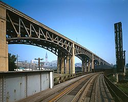
The Blaine Hill "S" Bridge is located over Wheeling Creek at the western boundaries of Blaine in Belmont County, Ohio, United States. The bridge was designated the Ohio Bicentennial Bridge in 2003, and was placed on the National Register of Historic Places on March 17, 2010.Built in 1826, the...
|
|
|2010-03-17
|Blane
|Belmont
Belmont County, Ohio
Belmont County is a county located in the U.S. state of Ohio. It is part of the Wheeling, West Virginia Metropolitan Statistical Area. As of 2010, the population was 70,400. Its county seat is St. Clairsville...
|
|-
|Bowman Mill Covered Bridge
|
|
|1978-02-08
|New Reading
39°47′53"N 82°21′40"W
|Perry
Perry County, Ohio
Perry County is a county located in the state of Ohio, United States. Founded on March 1, 1818, it was the 55th county to be formed in Ohio. Portions of Fairfield, Washington and Muskingum Counties were taken to create Perry County. As of the 2010 census, the population was 36,058. Its county seat...
|Multiple kingpost truss
|-
|John Bright Covered Bridge
|
|1881
|1975-05-28
|Baltimore
Baltimore, Ohio
Baltimore is a village in Fairfield County, Ohio, United States. The population was 2,881 at the 2000 census.-Geography:Baltimore is located at ....
39°49′50"N 82°40′23"W
|Fairfield
Fairfield County, Ohio
Fairfield County is a county located in the state of Ohio, United States. As of 2010, the population was 146,156. Its county seat is Lancaster. Its name is a reference to the Fairfield area of the original Lancaster....
|One-Span Combination Truss
Moved to Ohio University
Ohio University
Ohio University is a public university located in the Midwestern United States in Athens, Ohio, situated on an campus...
-Lancaster
Lancaster, Ohio
Lancaster is a city in Fairfield County, Ohio, United States. As of the 2010 census, the city population was 38,780. It is located near the Hocking River, approximately southeast of Columbus, Ohio. It is the county seat of Fairfield County...
|-
|Broadway Bridge
|
|1909
|1996-02-22
|Greenville
Greenville, Ohio
Greenville is a city in Darke County, Ohio, United States. The population was 13,227 at the 2010 census. It is the county seat of Darke County.-History:Greenville is the historic location of Fort Greene Ville,Greenville is a city in Darke County, Ohio, United States. The population was 13,227 at...
40°6′15"N 84°38′5"W
|Darke
Darke County, Ohio
As of the census of 2000, there were 53,309 people, 20,419 households, and 14,905 families residing in the county. The population density was 89 people per square mile . There were 21,583 housing units at an average density of 36 per square mile...
|Three-hinged arch
|-
|Brubaker Covered Bridge
Brubaker Covered Bridge
Brubaker Covered Bridge runs across Sandy Run, to the west-northwest of Gratis Township, Preble County, Ohio. It is in length, and was built in 1887 by Everett Sherman. The bridge is of Childs Truss construction....
|
|1887
|1975-06-11
|Gratis
Gratis, Ohio
Gratis is a village in Preble County, Ohio, United States. The population was 934 at the 2000 census. It is part of the Dayton Metropolitan Statistical Area.-Geography:Gratis is located at ....
39°39′6"N 84°32′39"W
|Preble
Preble County, Ohio
As of the census of 2000, there were 42,337 people, 16,001 households, and 12,144 families residing in the county. The population density was 100 people per square mile . There were 17,186 housing units at an average density of 40 per square mile...
|One-span Childs truss
|-
|Buckeye Furnace Covered Bridge
|
|1872
|1975-02-24
|Wellston
Wellston, Ohio
Wellston is a city in Jackson County, Ohio, United States, in the southeastern part of the state. Founded in 1873 as an iron and coal producing center, the city was named after founder Harvey Wells, a member of the Ohio Constitutional Convention. The city was incorporated in 1876. The population...
39°3′16"N 82°27′35"W
|Jackson
Jackson County, Ohio
Jackson County is a county located in the state of Ohio, United States. As of 2010, the population was 33,225. Its county seat is Jackson and is named for Andrew Jackson, a hero of the War of 1812 who was subsequently elected President of the United States....
|Smith Truss
|-
|Byer Covered Bridge
|
|
|1975-10-21
|Byer
Byer, Ohio
Byer is an unincorporated community in northwestern Washington Township, Jackson County, Ohio, United States. It lies along State Route 327 between Wellston and Londonderry. Pigeon Creek, a subsidiary of the Scioto River through Salt Creek, runs along the western edge of Byer; a covered bridge...
39°10′46"N 82°37′52"W
|Jackson
Jackson County, Ohio
Jackson County is a county located in the state of Ohio, United States. As of 2010, the population was 33,225. Its county seat is Jackson and is named for Andrew Jackson, a hero of the War of 1812 who was subsequently elected President of the United States....
|Smith Truss
|-
|Caledonia Bowstring Bridge
|
|1873, 1976
|1978-05-23
|Caledonia
Caledonia, Ohio
Caledonia is a village in Marion County, Ohio, United States. The population was 578 at the 2000 census.-Geography:Caledonia is located at ....
40°38′33"N 82°57′56"W
|Marion
Marion County, Ohio
Marion County is a county located in the state of Ohio, United States. As of the 2010 census, the population was 66,501. Its county seat is the city of Marion and is named for General Francis "The Swamp Fox" Marion, an officer in the Revolutionary War....
|Bowstring arch-truss
|-
|Chambers Road Covered Bridge
|
|1874
|1974-11-21
|Olive Green
40°20′17"N 82°49′5"W
|Delaware
Delaware County, Ohio
Delaware County is a fast-growing suburban county in the state of Ohio, United States, within the Columbus, Ohio Metropolitan Statistical Area. According to the United States Census Bureau's 2004 population estimates, Delaware County's population of 142,503 made it the fastest growing county in...
|Childs Truss
|-
|Christman Covered Bridge
|
|1895
|1976-10-22
|Eaton
Eaton, Ohio
Eaton is a city in and the county seat of Preble County, Ohio, United States. The population was 8,407 at the 2010 census. It is part of the Dayton Metropolitan Statistical Area.-History:...
39°46′13"N 84°39′20"W
|Preble
Preble County, Ohio
As of the census of 2000, there were 42,337 people, 16,001 households, and 12,144 families residing in the county. The population density was 100 people per square mile . There were 17,186 housing units at an average density of 40 per square mile...
|One-span Childs truss
|-
|Church Hill Road Covered Bridge
|
|
|1975-06-11
|Lisbon
Lisbon, Ohio
Lisbon is a village in Center Township, Columbiana County, Ohio, United States. The population was 2,788 at the 2000 census. It is the county seat of Columbiana County.-History:...
40°47′14"N 80°43′29"W
|Columbiana
Columbiana County, Ohio
Columbiana County is a county located in the U.S. state of Ohio. As of 2010, the population was 107,841. It is named for Christopher Columbus and the county seat is Lisbon....
|
|-
|Cincinnati and Whitewater Canal Tunnel
|
|1837, 1846
|2001-05-25
|Cleves
Cleves, Ohio
Cleves is a village, founded in 1818, along the Ohio River in western Hamilton County, Ohio, United States. The population was 2,790 at the 2000 census...
39°9′18"N 84°44′58"W
|Hamilton
Hamilton County, Ohio
As of 2000, there were 845,303 people, 346,790 households, and 212,582 families residing in the county. The population density was 2,075 people per square mile . There were 373,393 housing units at an average density of 917 per square mile...
|Brick lined canal tunnel
|-
|Cleveland And Pittsburgh Railroad Bridge
|
|1864
|1975-07-24
|Bedford
Bedford, Ohio
Bedford is a city in Cuyahoga County, Ohio, United States. The population was 13,074 at the 2010 census. It is an eastern suburb of Cleveland.-Geography:Bedford is located at ....
41°23′5"N 81°32′3"W
|Cuyahoga
Cuyahoga County, Ohio
Cuyahoga County is a county located in the state of Ohio, United States. It is the most populous county in Ohio; as of the 2010 census, the population was 1,280,122. Its county seat is Cleveland. Cuyahoga County is part of Greater Cleveland, a metropolitan area, and Northeast Ohio, a...
|Viaduct
|-
|Covington and Cincinnati Suspension Bridge
|
|1856, 1867
|1975-05-15
|Cincinnati
Cincinnati, Ohio
Cincinnati is a city in the U.S. state of Ohio. Cincinnati is the county seat of Hamilton County. Settled in 1788, the city is located to north of the Ohio River at the Ohio-Kentucky border, near Indiana. The population within city limits is 296,943 according to the 2010 census, making it Ohio's...
39°5′32"N 84°30′34"W
|Hamilton
Hamilton County, Ohio
As of 2000, there were 845,303 people, 346,790 households, and 212,582 families residing in the county. The population density was 2,075 people per square mile . There were 373,393 housing units at an average density of 917 per square mile...
|Suspension bridge
|-
|Dean Road Bridge
|
|1898
|1978-11-28
|Birmingham
Birmingham, Ohio
There are multiple places named Birmingham in the U.S. state of Ohio:*Birmingham, Erie County, Ohio*Birmingham, Guernsey County, Ohio...
, South Amherst
South Amherst, Ohio
South Amherst is a village in Lorain County, Ohio, United States. The population was 1,863 at the 2000 census.-Geography:South Amherst is located at ....
41°20′56"N 82°20′41"W
|Erie
Erie County, Ohio
As of the census of 2000, there were 79,551 people, 31,727 households, and 21,764 families residing in the county. The population density was 312 people per square mile . There were 35,909 housing units at an average density of 141 per square mile...
, Lorain
Lorain County, Ohio
Lorain County is a county located in the U.S. state of Ohio, and is considered to be a part of what is locally referred to as Greater Cleveland. As of the 2010 census, its population was 301,356. an increase from 284,664 in 2000...
|Pratt truss
|-
|Detroit Avenue Bridge
|
|1910
|1973-02-23
|Rocky River-Lakewood
41°28′57"N 81°49′53"W
|Cuyahoga
Cuyahoga County, Ohio
Cuyahoga County is a county located in the state of Ohio, United States. It is the most populous county in Ohio; as of the 2010 census, the population was 1,280,122. Its county seat is Cleveland. Cuyahoga County is part of Greater Cleveland, a metropolitan area, and Northeast Ohio, a...
|
|-
|Detroit-Superior High Level Bridge
|
|1917
|1974-01-18
|Cleveland
Cleveland, Ohio
Cleveland is a city in the U.S. state of Ohio and is the county seat of Cuyahoga County, the most populous county in the state. The city is located in northeastern Ohio on the southern shore of Lake Erie, approximately west of the Pennsylvania border...
41°29′39"N 81°42′9"W
|Cuyahoga
Cuyahoga County, Ohio
Cuyahoga County is a county located in the state of Ohio, United States. It is the most populous county in Ohio; as of the 2010 census, the population was 1,280,122. Its county seat is Cleveland. Cuyahoga County is part of Greater Cleveland, a metropolitan area, and Northeast Ohio, a...
|Double-deck bridge
|-
|Dey Road Bridge
|
|1906
|1999-02-05
|Defiance
Defiance, Ohio
As of the census of 2000, there were 16,465 people, 6,572 households, and 4,422 families residing in the city. The population density was 1,562.4 people per square mile . There were 7,061 housing units at an average density of 670.0 per square mile...
41°17′25"N 84°23′8"W
|Defiance
Defiance County, Ohio
As of the census of 2000, there were 39,500 people, 15,138 households, and 11,020 families residing in the county. The population density was 96 people per square mile . There were 16,040 housing units at an average density of 39 per square mile...
|Pratt through truss bridge
|-
|Dresden Suspension Bridge
|
|1914
|1978-12-01
|Dresden
Dresden, Ohio
Dresden is a village in Muskingum County, Ohio, United States, along the Muskingum River at the mouth of Wakatomika Creek. It was incorporated on March 9, 1835...
40°7′14"N 82°0′1"W
|Muskingum
Muskingum County, Ohio
Muskingum County is a county located in the state of Ohio, United States. As of the 2010 census, the population was 86,074. Its county seat is Zanesville...
|Warren truss
|-
|Eagle Creek Covered Bridge
|
|1875
|1975-12-06
|Decatur
Decatur, Ohio
Decatur is an unincorporated community in eastern Byrd Township, Brown County, Ohio, United States. Although it is unincorporated, it has a post office, with the ZIP code of 45115. It is located along State Route 125, an east-west highway.-References:...
38°46′11"N 83°42′54"W
|Brown
Brown County, Ohio
As of the census of 2000, there were 42,285 people, 15,555 households, and 11,790 families residing in the county. The population density was 86 people per square mile . There were 17,193 housing units at an average density of 35 per square mile...
|Smith Truss Covered Bridge
|-
|Eakin Mill Covered Bridge
Eakin Mill Covered Bridge
The Eakin Mill Covered Bridge is a historic covered bridge in Vinton County, Ohio, United States...
|
|1870, 1871
|1976-03-16
|Arbaugh
39°10′16"N 82°20′13"W
|Vinton
Vinton County, Ohio
Vinton County is a county located in the state of Ohio, United States. As of the 2010 census, the population was 13,435. , the least populous in the state. Its county seat is McArthur. The county is named for Samuel Finley Vinton, a 19th-century United States Congressman from...
|Kingpost truss
|-
|Eldean Covered Bridge
|
|1975-02-20
|Troy
Troy, Ohio
* - Sports :In addition to Troy High School athletics, Troy is home to the Miami Valley Silverbacks indoor football team of the Continental Indoor Football League....
40°4′40"N 84°13′0"W
|Miami
Miami County, Ohio
As of the census of 2000, there were 98,868 people, 38,437 households, and 27,943 families residing in the county. The population density was 243 people per square mile . There were 40,554 housing units at an average density of 100 per square mile...
|Long truss
|-
|Foreaker Bridge
|
|1886, 1887
|1975-06-05
|Graysville
Graysville, Ohio
Graysville is a village in Monroe County, Ohio, United States. The population was 113 at the 2000 census.Graysville is served by the Monroe County District Library from its administrative offices in Woodsfield, Ohio.-Geography:...
39°39′20"N 81°7′16"W
|Monroe
Monroe County, Ohio
Monroe County is a county located in the state of Ohio. As of the 2010 census, the population was 14,642. Its county seat is Woodsfield and is named for James Monroe, Secretary of State when the county was formed and later President of the United States....
|Kingpost truss
|-
|Geeting Covered Bridge
|
|1975-08-19
|Lewisburg
Lewisburg, Ohio
Lewisburg is a village in Preble County, Ohio, United States, founded in 1818. The current village incorporates two prior villages, the original Lewisburg and Euphemia, which merged in 1916. The population was 1,798 at the 2000 census. It is part of the Dayton Metropolitan Statistical...
39°50′37"N 84°35′50"W
|Preble
Preble County, Ohio
As of the census of 2000, there were 42,337 people, 16,001 households, and 12,144 families residing in the county. The population density was 100 people per square mile . There were 17,186 housing units at an average density of 40 per square mile...
|One-span Childs truss
|-
|General U.S. Grant Bridge
|
|1927, 1939
|2001-05-31
|Portsmouth
Portsmouth, Ohio
Portsmouth is a city in the U.S. state of Ohio and the county seat of Scioto County. The municipality is located on the northern banks of the Ohio River and east of the Scioto River in Southern Ohio. The population was 20,226 at the 2010 census.-Foundation:...
38°43′50"N 82°59′49"W
|Scioto
Scioto County, Ohio
As of the census of 2000, there were 79,195 people, 30,871 households, and 21,362 families residing in the county. The population density was 129 people per square mile . There were 34,054 housing units at an average density of 56 per square mile...
|Cable suspension bridge
|-
|Harpersfield Covered Bridge
Harpersfield Covered Bridge
Harpersfield Bridge is a covered bridge spanning the Grand River in Harpersfield Township, Ashtabula County, Ohio, United States. This double-span Howe truss bridge, one of currently 16 drivable covered bridges in the county, is the second longest covered bridge in Ohio at 228 feet...
|
|1873
|1975-11-03
|Harpersfield
41°45′22"N 80°56′40"W
|Ashtabula
Ashtabula County, Ohio
Ashtabula County is the northeasternmost county in the state of Ohio. As of 2010, the population was 101,497, its county seat is Jefferson. The county is named for a Native American word meaning "river of many fish"....
|Howe truss covered bridge
|-
|Harra Covered Bridge
Harra Covered Bridge
The Harra Covered Bridge is a historic wooden covered bridge in Washington County, Ohio, United States. Located in western Watertown Township, about north of the community of Watertown, the bridge spans the South Branch of Wolf Creek near the intersection of State Route 339 and Township Road 172...
|
|
|1976-10-08
|Watertown
Watertown, Ohio
Watertown is an unincorporated community in southwestern Watertown Township, Washington County, Ohio, United States. Although it is unincorporated, it has a post office, with the ZIP code of 45787...
39°29′16"N 81°38′53"W
|Washington
Washington County, Ohio
Washington County is a county located in the state of Ohio. As of the 2010 census, the population was 61,778. Its county seat is Marietta. The county, the oldest in the state, is named for George Washington. Washington County is included in the Parkersburg-Marietta-Vienna, West Virginia-Ohio...
|Long truss
|-
|Harshaville Covered Bridge
|
|
|1976-03-16
|Harshaville
38°54′28"N 83°32′40"W
|Adams
Adams County, Ohio
As of the census of 2000, there were 27,330 people, 10,501 households, and 7,613 families residing in the county. The population density was 47 people per square mile . There were 11,822 housing units at an average density of 20 per square mile...
|Burr truss covered bridge
|-
|Harshman Covered Bridge
|
|1894
|1976-09-29
|Fairhaven
Fairhaven, Ohio
Fairhaven is an unincorporated community in eastern Israel Township, Preble County, Ohio, United States. It lies along State Route 177 at its intersection with Israel-Somers Road. Four Mile Creek, which feeds into Acton Lake in southern Preble County, runs on the western edge of Fairhaven...
39°42′9"N 84°46′10"W
|Preble
Preble County, Ohio
As of the census of 2000, there were 42,337 people, 16,001 households, and 12,144 families residing in the county. The population density was 100 people per square mile . There were 17,186 housing units at an average density of 40 per square mile...
|One-Span Childs Truss
|-
|Helmick Covered Bridge
|
|1863
|1975-06-18
|Blissfield
Blissfield, Ohio
Blissfield is an unincorporated community in southwestern Clark Township, Coshocton County, Ohio, United States. Although it is unincorporated, it has a post office, with the ZIP code of 43805. It lies along State Route 60 between Warsaw and Killbuck....
40°23′35"N 81°56′34"W
|Coshocton
Coshocton County, Ohio
Coshocton County is a county located in the state of Ohio, United States. As of the 2010 census, the population was 36,901. Its county seat is Coshocton. Its name comes from the Delaware Indian language and has been translated as "union of waters" or "black bear crossing".The Coshocton...
|Two-Span Wooden Truss
|-
|Helmick Mill Covered Bridge
|
|1867
|1999-02-05
|Malta
Malta, Ohio
Malta is a village in Morgan County, Ohio, United States. The population was 696 at the 2000 census.-Geography:Malta is located at...
39°43′11"N 81°56′32"W
|Morgan
Morgan County, Ohio
**----...
|Covered bridge
|-
|Hildreth Covered Bridge
Hildreth Covered Bridge
The Hildreth Covered Bridge, also known as the "Hills Covered Bridge" or "Lafaber's Mill Bridge," is a historic covered bridge in Washington County, Ohio, United States. Located off State Route 26 in Newport Township, about east of the city of Marietta, the bridge historically carried Hills...
|
|1878, ca. 1881
|1978-02-08
|Marietta
Marietta, Ohio
Marietta is a city in and the county seat of Washington County, Ohio, United States. During 1788, pioneers to the Ohio Country established Marietta as the first permanent American settlement of the new United States in the Northwest Territory. Marietta is located in southeastern Ohio at the mouth...
39°25′38"N 81°21′42"W
|Washington
Washington County, Ohio
Washington County is a county located in the state of Ohio. As of the 2010 census, the population was 61,778. Its county seat is Marietta. The county, the oldest in the state, is named for George Washington. Washington County is included in the Parkersburg-Marietta-Vienna, West Virginia-Ohio...
|Howe truss
|-
|Jediah Hill Covered Bridge
|
|1850
|1973-03-28
|Cincinnati
Cincinnati, Ohio
Cincinnati is a city in the U.S. state of Ohio. Cincinnati is the county seat of Hamilton County. Settled in 1788, the city is located to north of the Ohio River at the Ohio-Kentucky border, near Indiana. The population within city limits is 296,943 according to the 2010 census, making it Ohio's...
39°15′21"N 84°32′58"W
|Hamilton
Hamilton County, Ohio
As of 2000, there were 845,303 people, 346,790 households, and 212,582 families residing in the county. The population density was 2,075 people per square mile . There were 373,393 housing units at an average density of 917 per square mile...
|Queenpost Truss
|-
|Hizey Covered Bridge
|
|1891
|1976-10-08
|Pickerington
Pickerington, Ohio
As of the census of 2000, there were 9,792 people, 3,468 households, and 2,687 families residing in the city. The population density was 1,317.4 people per square mile . There were 3,573 housing units at an average density of 480.7 per square mile...
39°53′53"N 82°40′9"W
|Fairfield
Fairfield County, Ohio
Fairfield County is a county located in the state of Ohio, United States. As of 2010, the population was 146,156. Its county seat is Lancaster. Its name is a reference to the Fairfield area of the original Lancaster....
|Burr Truss
|-
|Huffman Covered Bridge
Huffman Covered Bridge
The Huffman Covered Bridge was built in 1914 south of Middleburg, Ohio. The property was listed on the National Register on 1975-03-04.The wooden Kingpost truss bridge stood 50 feet long over the Middle Fork Creek. The bridge stood until a devastating flood washed out the supports in 1998, carrying...
|
|1914
|1975-03-04
|Middleburg
39°39′37"N 81°22′13"W
|Noble
Noble County, Ohio
Noble County is a county located in the state of Ohio. As of the 2010 census, the population was 14,645. Its county seat is Caldwell. Noble County is named for Rep. Warren P. Noble of the Ohio House of Representatives, who was an early settler there.-History:...
|Kingpost truss
|-
|Hune Covered Bridge
Hune Covered Bridge
The Hune Covered Bridge is a historic wooden covered bridge in the southeastern part of the U.S. state of Ohio. Located northeast of the community of Dart, it spans the Little Muskingum River in northeastern Lawrence Township in the eastern part of Washington County...
|
|1879
|1976-10-08
|Dart
39°30′38"N 81°15′2"W
|Washington
Washington County, Ohio
Washington County is a county located in the state of Ohio. As of the 2010 census, the population was 61,778. Its county seat is Marietta. The county, the oldest in the state, is named for George Washington. Washington County is included in the Parkersburg-Marietta-Vienna, West Virginia-Ohio...
|Long Truss
|-
|Ida Street Viaduct
|
|1931
|1980-11-28
|Cincinnati
Cincinnati, Ohio
Cincinnati is a city in the U.S. state of Ohio. Cincinnati is the county seat of Hamilton County. Settled in 1788, the city is located to north of the Ohio River at the Ohio-Kentucky border, near Indiana. The population within city limits is 296,943 according to the 2010 census, making it Ohio's...
39°6′19"N 84°29′40"W
|Hamilton
Hamilton County, Ohio
As of 2000, there were 845,303 people, 346,790 households, and 212,582 families residing in the county. The population density was 2,075 people per square mile . There were 373,393 housing units at an average density of 917 per square mile...
|
|-
|Interurban Bridge
Interurban Bridge
The Interurban Bridge, also known as the Ohio Electric Railroad Bridge. is a historic interurban railroad bridge built in 1908 across the Maumee River joining Lucas and Wood counties near Waterville, Ohio. It is now located in Farnsworth Metropark...
|
|1908
|1972-06-19
|Waterville
Waterville, Ohio
Waterville is a village in Lucas County, Ohio, United States, along the Maumee River. The population was 4,828 at the 2000 census.-Geography:Waterville is located at ....
41°29′11"N 83°43′42"W
|Lucas
Lucas County, Ohio
----...
, Wood
Wood County, Ohio
Wood County is a county located in the state of Ohio, United States. As of the 2010 census, the population was 125,488. Its county seat is Bowling Green. The county was named for Captain Eleazer D. Wood, the engineer for General William Henry Harrison's army, who built Fort Meigs in the War of 1812...
|Reinforced concrete bridge
|-
|John Bright No. 1 Iron Bridge
|
|
|1978-09-20
|Carroll
Carroll, Ohio
Carroll is a village in Fairfield County, Ohio in the United States of America. The population was 488 at the 2000 census.-Geography:Carroll is located at ....
39°49′45"N 82°40′27"W
|Fairfield
Fairfield County, Ohio
Fairfield County is a county located in the state of Ohio, United States. As of 2010, the population was 146,156. Its county seat is Lancaster. Its name is a reference to the Fairfield area of the original Lancaster....
|One-Span Steel Eye-Bar
|-
|Johnson Road Covered Bridge
|
|
|1984-08-23
|Petersburg
Petersburg, Ohio
Petersburg is a small unincorporated community in southeastern Springfield Township, Mahoning County, Ohio, United States. It is part of the Youngstown-Warren-Boardman, OH-PA Metropolitan Statistical Area...
38°57′31"N 82°47′16"W
|Jackson
Jackson County, Ohio
Jackson County is a county located in the state of Ohio, United States. As of 2010, the population was 33,225. Its county seat is Jackson and is named for Andrew Jackson, a hero of the War of 1812 who was subsequently elected President of the United States....
|Single span wooden truss
|-
|Kidwell Covered Bridge
|
|1880
|1977-04-11
|Truetown
39°27′21"N 82°6′13"W
|Athens
Athens County, Ohio
As of the census of 2000, there were 62,223 people, 22,501 households, and 12,713 families residing in the county. The population density was 123 people per square mile . There were 24,901 housing units at an average density of 49 per square mile...
|Howe truss covered bridge
|-
|Kirker Covered Bridge
|
|
|1975-10-29
|West Union
West Union, Ohio
West Union is a village in Adams County, Ohio, United States. The population was 2,903 at the 2000 census. It is the county seat of Adams County....
38°47′3"N 83°36′13"W
|Adams
Adams County, Ohio
As of the census of 2000, there were 27,330 people, 10,501 households, and 7,613 families residing in the county. The population density was 47 people per square mile . There were 11,822 housing units at an average density of 20 per square mile...
|Kingpost truss bridge
|-
|Knowlton Covered Bridge
|
|
|1980-03-11
|Rinards Mills
39°36′4"N 81°9′26"W
|Monroe
Monroe County, Ohio
Monroe County is a county located in the state of Ohio. As of the 2010 census, the population was 14,642. Its county seat is Woodsfield and is named for James Monroe, Secretary of State when the county was formed and later President of the United States....
|Burr arch truss bridge
|-
|Lockington Covered Bridge
Lockington Covered Bridge
The Lockington Covered Bridge was a historic covered bridge that once spanned the Great Miami River near Lockington, Ohio, United States. Built in 1848, it employed the Long Truss method of construction. This bridge included of vertical wooden siding, wooden structural elements, wooden shingles...
|
|1848
|1975-06-10
|Lockington
Lockington, Ohio
Lockington is a village in Washington Township, Shelby County, Ohio, United States, along Loramie Creek. The population was 208 at the 2000 census....
40°12′4"N 84°12′58"W
|Shelby
Shelby County, Ohio
As of the census of 2000, there were 47,910 people, 17,636 households, and 13,085 families residing in the county. The population density was 117 people per square mile . There were 18,682 housing units at an average density of 46 per square mile...
|Long truss; burned in 1989
|-
|Lorain-Carnegie Bridge
|
|1927, 1932
|1976-10-08
|Cleveland
Cleveland, Ohio
Cleveland is a city in the U.S. state of Ohio and is the county seat of Cuyahoga County, the most populous county in the state. The city is located in northeastern Ohio on the southern shore of Lake Erie, approximately west of the Pennsylvania border...
41°29′26"N 81°41′30"W
|Cuyahoga
Cuyahoga County, Ohio
Cuyahoga County is a county located in the state of Ohio, United States. It is the most populous county in Ohio; as of the 2010 census, the population was 1,280,122. Its county seat is Cleveland. Cuyahoga County is part of Greater Cleveland, a metropolitan area, and Northeast Ohio, a...
|Cantilever Deck Truss bridge
|-
|Lynchburg Covered Bridge
Lynchburg Covered Bridge
The Lynchburg Covered Bridge is a historic wooden covered bridge that spans the east fork of the Little Miami River in Lynchburg, Ohio. It, also, has the distinction, following a recent repair and restoration project, of being the only such covered bridge in North America to have been converted to...
|
|1870
|1976-03-16
|Lynchburg
Lynchburg, Ohio
Lynchburg is a village in Clinton and Highland counties in the U.S. state of Ohio. The population was 1,350 at the 2000 census.-Geography:Lynchburg is located at ....
39°14′42"N 83°47′40"W
|Clinton
Clinton County, Ohio
Clinton County is a county located in the state of Ohio, United States. As of the 2010 census, the population was 42,040. The 2008 Census Population Estimate places the figure at 43,200. It is named for former U.S. Vice-President George Clinton...
, Highland
Highland County, Ohio
As of the census of 2000, there were 40,875 people, 15,587 households, and 11,394 families residing in the county. The population density was 74 people per square mile . There were 17,583 housing units at an average density of 32 per square mile...
|
|-
|Mark Road Bridge
|
|1883
|1990-07-26
|Staunton
39°29′13"N 83°28′23"W
|Fayette
Fayette County, Ohio
As of the census of 2000, there were 28,433 people, 11,054 households, and 7,837 families residing in the county. The population density was 70 people per square mile . There were 11,904 housing units at an average density of 29 per square mile...
|Pratt through truss
|-
|Martinsville Road Covered Bridge
|
|1871
|1974-09-10
|Martinsville
Martinsville, Ohio
Martinsville is a village in Clinton County, Ohio, United States. The population was 440 at the 2000 census.-Geography:Martinsville is located at ....
39°19′47"N 83°50′6"W
|Clinton
Clinton County, Ohio
Clinton County is a county located in the state of Ohio, United States. As of the 2010 census, the population was 42,040. The 2008 Census Population Estimate places the figure at 43,200. It is named for former U.S. Vice-President George Clinton...
|Multiple kingpost
|-
| Maysville-Aberdeen Bridge
Simon Kenton Memorial Bridge
The Simon Kenton Memorial Bridge is a suspension bridge built in 1931 that crosses the Ohio River and connects Maysville, Kentucky and Aberdeen, Ohio. Its main span is 1,060 feet long, and the total length of the bridge is 1,991 feet...
|
|
|1983-6-30
| Aberdeen
Aberdeen, Ohio
Aberdeen is a village in Brown County, Ohio, United States, along the Ohio River. The population was 1,603 at the 2000 census.Aberdeen is connected to Maysville, Kentucky by the Simon Kenton Memorial Bridge to downtown Maysville and the William H. Harsha Bridge, a cable-stayed bridge completed in...
38°39′19"N 83°45′27"W
|Brown
Brown County, Ohio
As of the census of 2000, there were 42,285 people, 15,555 households, and 11,790 families residing in the county. The population density was 86 people per square mile . There were 17,193 housing units at an average density of 35 per square mile...
|Spans the Ohio River
Ohio River
The Ohio River is the largest tributary, by volume, of the Mississippi River. At the confluence, the Ohio is even bigger than the Mississippi and, thus, is hydrologically the main stream of the whole river system, including the Allegheny River further upstream...
between Aberdeen and Maysville, Kentucky
|-
|McColly Covered Bridge
McColly Covered Bridge
The McColly Covered Bridge is a historic wooden covered bridge in western Logan County, Ohio, United States. Located in Washington Township near the community of Bloom Center, it is one of two remaining covered bridges in Logan County...
|
|1876
|1975-05-28
|Bloom Center
40°24′3"N 83°55′27"W
|Logan
Logan County, Ohio
Logan County is a county in the state of Ohio, United States. As of the 2010 census, the population was 45,858. The county seat is Bellefontaine. The county is named for Benjamin Logan, who fought Native Americans in the area....
|Howe truss covered bridge
|-
|Mill Creek Park Suspension Bridge
|
|1895
|1976-10-29
|Youngstown
Youngstown, Ohio
Youngstown is a city in the U.S. state of Ohio and the county seat of Mahoning County; it also extends into Trumbull County. The municipality is situated on the Mahoning River, approximately southeast of Cleveland and northwest of Pittsburgh, Pennsylvania...
41°4′24"N 80°41′21"W
|Mahoning
|
|-
|Mill Road Bowstring Bridge
|
|
|1979-12-05
|Bladensburg
Bladensburg, Ohio
Bladensburg is a census-designated place on the border between the Clay and Jackson Townships of Knox County, Ohio, United States. Although it is unincorporated, it has a post office, with the ZIP code of 43005. It lies along State Route 541 east of Martinsburg.Bladensburg is home to East Knox...
40°16′35"N 82°16′22"W
|Knox
Knox County, Ohio
Knox County is a county located in the state of Ohio, United States. As of 2010, the population was 60,921. Its county seat is Mount Vernon and is named for Henry Knox, an officer in the American Revolutionary War who was later the first Secretary of War....
|Bow-string arch-truss
|-
|Mt. Olive Road Covered Bridge
Mt. Olive Road Covered Bridge
The Mt. Olive Road Covered Bridge is a historic covered bridge in Vinton County, Ohio, United States. Located northeast of Allensville, the bridge carries Mt. Olive Road through a valley in northwestern Vinton County. In the earliest days of white settlement of southern Ohio, the Mt...
|
|1875
|1976-10-08
|Allensville
39°17′10"N 82°35′21"W
|Vinton
Vinton County, Ohio
Vinton County is a county located in the state of Ohio, United States. As of the 2010 census, the population was 13,435. , the least populous in the state. Its county seat is McArthur. The county is named for Samuel Finley Vinton, a 19th-century United States Congressman from...
|Queenpost truss
|-
|Mull Covered Bridge
|
|1851
|1974-10-15
|Burgoon
Burgoon, Ohio
Burgoon is a village in Sandusky County, Ohio, United States. The population was 199 at the 2000 census.-Geography:Burgoon is located at ....
41°15′38"N 83°11′4"W
|Sandusky
Sandusky County, Ohio
Sandusky County is a county in the U.S. state of Ohio. As of the 2010 census, the population was 60,944. Its county seat is Fremont and it is named for a native word meaning "water" ....
|Town Lattice truss
|-
|Newport and Cincinnati Bridge
|
|1868, 1872, 1896
|2001-04-17
|Cincinnati
Cincinnati, Ohio
Cincinnati is a city in the U.S. state of Ohio. Cincinnati is the county seat of Hamilton County. Settled in 1788, the city is located to north of the Ohio River at the Ohio-Kentucky border, near Indiana. The population within city limits is 296,943 according to the 2010 census, making it Ohio's...
39°6′3"N 84°30′2"W
|Hamilton
Hamilton County, Ohio
As of 2000, there were 845,303 people, 346,790 households, and 212,582 families residing in the county. The population density was 2,075 people per square mile . There were 373,393 housing units at an average density of 917 per square mile...
|Subdivided Pratt truss
|-
|Newton Falls Covered Bridge
|
|1831
|1974-10-16
|Newton Falls
Newton Falls, Ohio
Newton Falls is a city located within Newton Township in Trumbull County, Ohio in the United States. The population was 5,002 at the 2000 census...
41°11′17"N 80°58′17"W
|Trumbull
Trumbull County, Ohio
As of the census of 2000, there were 225,116 people, 89,020 households, and 61,690 families residing in the county. The population density was 365 people per square mile . There were 95,117 housing units at an average density of 154 per square mile...
|Town latice truss
|-
|Ohio State Route 51 Bridge Over the Portage River
|
|
|1994-4-16
|Elmore
Elmore, Ohio
Elmore is a village in Ottawa and Sandusky counties in the U.S. state of Ohio. The population was 1,426 at the 2000 census.The Ottawa County portion of Elmore is part of the Toledo Metropolitan Statistical Area, while the Sandusky County portion is part of the Fremont Micropolitan Statistical...
41°28′37"N 83°17′44"W
|Ottawa
Ottawa County, Ohio
Ottawa County is a county located in the state of Ohio, United States. As of the 2010 census, the population was 41,428. Its county seat is Port Clinton and is named either for the Ottawa Indians who lived there, or for an Indian word meaning "trader"....
|Closed spandral arch
|-
|Old Enon Road Stone Arch Culvert
Old Enon Road Stone Arch Culvert
The Old Enon Road Stone Arch Culvert is a historic limestone bridge in southern Clark County, Ohio, United States. It carries Rocky Point Road over Mud Run, a tributary of the Mad River, just west of its intersection with Old Mill Road. Located approximately east of Enon in eastern Mad River...
|
|
|2009-03-17
|Enon
Enon, Ohio
Enon is a village in Clark County, Ohio, United States. The population was 2,638 at the 2000 census. It is part of the Springfield, Ohio Metropolitan Statistical Area.Enon is the headquarters of the Speedway SuperAmerica gas station chain....
39°52′10.36"N 83°52′45.94"W
|Clark
Clark County, Ohio
As of the census of 2000, there were 144,742 people, 56,648 households, and 39,370 families residing in the county. The population density was 362 people per square mile . There were 61,056 housing units at an average density of 153 per square mile...
|
This is a list of bridge
Bridge
A bridge is a structure built to span physical obstacles such as a body of water, valley, or road, for the purpose of providing passage over the obstacle...
s and tunnel
Tunnel
A tunnel is an underground passageway, completely enclosed except for openings for egress, commonly at each end.A tunnel may be for foot or vehicular road traffic, for rail traffic, or for a canal. Some tunnels are aqueducts to supply water for consumption or for hydroelectric stations or are sewers...
s on the National Register of Historic Places
National Register of Historic Places
The National Register of Historic Places is the United States government's official list of districts, sites, buildings, structures, and objects deemed worthy of preservation...
in the U.S. state
U.S. state
A U.S. state is any one of the 50 federated states of the United States of America that share sovereignty with the federal government. Because of this shared sovereignty, an American is a citizen both of the federal entity and of his or her state of domicile. Four states use the official title of...
of Ohio
Ohio
Ohio is a Midwestern state in the United States. The 34th largest state by area in the U.S.,it is the 7th‑most populous with over 11.5 million residents, containing several major American cities and seven metropolitan areas with populations of 500,000 or more.The state's capital is Columbus...
.
{| class="wikitable sortable"
!|Name
!|Image
!|Built
!|Listed
!|Location
!|County
!|Type
|-
|"S" Bridge II
|
|1828
|1973-04-23
|New Concord
New Concord, Ohio
New Concord is a village in Muskingum County, Ohio, United States. The population was 2,651 at the 2000 census. New Concord is the home of Muskingum University and is served by a branch of the Muskingum County Library System.-Geography:...
39°59′35"N 81°44′48"W
|Muskingum
Muskingum County, Ohio
Muskingum County is a county located in the state of Ohio, United States. As of the 2010 census, the population was 86,074. Its county seat is Zanesville...
|
|-
|Adams Covered Bridge
Adams Covered Bridge
Adams Covered Bridge is a registered historic structure near Malta, Ohio, listed in the National Register on 1999-02-05. This wooden covered bridge was built in 1875....
|
|1875
|1999-02-05
|Malta
Malta, Ohio
Malta is a village in Morgan County, Ohio, United States. The population was 696 at the 2000 census.-Geography:Malta is located at...
39°37′27"N 82°1′58"W
|Morgan
Morgan County, Ohio
**----...
|Covered bridge
|-
|B & O Railroad Viaduct
|
|1871
|1976-06-22
|Bellaire
Bellaire, Ohio
Bellaire is a village in Belmont County, Ohio, United States. It is part of the Wheeling, West Virginia Metropolitan Statistical Area. The population was 4,278 at the 2010 census. The village is located along the Ohio River...
40°0′47"N 80°44′40"W
|Belmont
Belmont County, Ohio
Belmont County is a county located in the U.S. state of Ohio. It is part of the Wheeling, West Virginia Metropolitan Statistical Area. As of 2010, the population was 70,400. Its county seat is St. Clairsville...
|Roman-arched Viaduct
|-
|Ballard Road Covered Bridge
|
|1883
|1975-05-29
|Jamestown
Jamestown, Ohio
Jamestown is a village in Greene County, Ohio, United States. The population was 1,917 at the 2000 census. It is named after Jamestown, Virginia, the hometown of an early resident....
39°40′41"N 83°48′55"W
|Greene
Greene County, Ohio
Greene County is a county located in the state of Ohio, United States. The population was 161,573 in the 2010 Census. Its county seat is Xenia, and it was named for General Nathanael Greene, an officer in the Revolutionary War. Greene County was established on March 24, 1803.Greene County is part...
|Howe Truss
|-
|Barkhurst Mill Covered Bridge
|
|1872
|1999-02-05
|Chesterhill
Chesterhill, Ohio
Chesterhill is a village in Morgan County, Ohio, United States. The population was 305 at the 2000 census.-Geography:Chesterhill is located at ....
39°30′10"N 81°50′3"W
|Morgan
Morgan County, Ohio
**----...
|Covered bridge
|-
|Belle Hall Covered Bridge
|
|1879
|1976-10-22
|Croton
40°14′8"N 82°38′26"W
|Licking
Licking County, Ohio
Licking County is a county located in the state of Ohio, United States. As of the 2010 census, the population was 166,492. Its county seat is Newark and is named for the salt licks that were in the area....
|Multiple kingpost truss plan
|-
|Bennett Schoolhouse Road Covered Bridge
|
|1867
|1978-10-11
|Minford
Minford, Ohio
Minford is a census-designated place located on the border of Harrison and Madison Townships in northeastern Scioto County, Ohio, United States, about 14 miles northeast of the county seat of Portsmouth.-History:...
38°49′45"N 82°48′26"W
|Scioto
Scioto County, Ohio
As of the census of 2000, there were 79,195 people, 30,871 households, and 21,362 families residing in the county. The population density was 129 people per square mile . There were 34,054 housing units at an average density of 56 per square mile...
|King post truss
|-
|Bergstresser Covered Bridge
|
|1887
|1974-05-03
|Canal Winchester
Canal Winchester, Ohio
As of the census of 2000, there were 4,478 people, 1,664 households, and 1,264 families residing in the village. The 2004 census estimates that there are now 5,381 people residing in the village, and Canal Winchester may become a city within the next year or two. The population density was 702.9...
39°49′48"N 82°49′0"W
|Franklin
Franklin County, Ohio
Franklin County is a county located in the state of Ohio, United States. In 2010 the population was 1,163,414, making it the second largest county in Ohio and the 34th largest county in population in the United States. Franklin County is also the largest in the eight-county Columbus, Ohio...
|Partridge truss
|-
|Black River Viaduct, Baltimore And Ohio Railroad
|
|1890, 1892
|1976-05-06
|Lodi
Lodi, Ohio
Lodi is a village in Medina County, Ohio, United States. The population was 3,061 at the 2000 census.- History :Founded in 1811, Lodi is the oldest settlement in Medina County. It was originally called Harrisville, in honor of the family that founded it. It was later renamed to Lodi, the Indian...
41°1′38"N 82°2′29"W
|Medina
|
|-
|Blackwood Covered Bridge
|
|1881
|1978-06-23
|Athens
Athens, Ohio
Athens is the largest city in, and the county seat of, Athens County, Ohio, United States. It is located along the Hocking River in the southeastern part of Ohio. A historic college town, Athens is home to Ohio University and is the principal city of the Athens, Ohio Micropolitan Statistical Area. ...
39°11′50"N 81°58′29"W
|Athens
Athens County, Ohio
As of the census of 2000, there were 62,223 people, 22,501 households, and 12,713 families residing in the county. The population density was 123 people per square mile . There were 24,901 housing units at an average density of 49 per square mile...
|King post truss,covered
|-
|Blaine Hill "S" Bridge
Blaine Hill "S" Bridge
The Blaine Hill "S" Bridge is located over Wheeling Creek at the western boundaries of Blaine in Belmont County, Ohio, United States. The bridge was designated the Ohio Bicentennial Bridge in 2003, and was placed on the National Register of Historic Places on March 17, 2010.Built in 1826, the...
|
|
|2010-03-17
|Blane
|Belmont
Belmont County, Ohio
Belmont County is a county located in the U.S. state of Ohio. It is part of the Wheeling, West Virginia Metropolitan Statistical Area. As of 2010, the population was 70,400. Its county seat is St. Clairsville...
|
|-
|Bowman Mill Covered Bridge
|
|
|1978-02-08
|New Reading
39°47′53"N 82°21′40"W
|Perry
Perry County, Ohio
Perry County is a county located in the state of Ohio, United States. Founded on March 1, 1818, it was the 55th county to be formed in Ohio. Portions of Fairfield, Washington and Muskingum Counties were taken to create Perry County. As of the 2010 census, the population was 36,058. Its county seat...
|Multiple kingpost truss
|-
|John Bright Covered Bridge
|
|1881
|1975-05-28
|Baltimore
Baltimore, Ohio
Baltimore is a village in Fairfield County, Ohio, United States. The population was 2,881 at the 2000 census.-Geography:Baltimore is located at ....
39°49′50"N 82°40′23"W
|Fairfield
Fairfield County, Ohio
Fairfield County is a county located in the state of Ohio, United States. As of 2010, the population was 146,156. Its county seat is Lancaster. Its name is a reference to the Fairfield area of the original Lancaster....
|One-Span Combination Truss
Moved to Ohio University
Ohio University
Ohio University is a public university located in the Midwestern United States in Athens, Ohio, situated on an campus...
-Lancaster
Lancaster, Ohio
Lancaster is a city in Fairfield County, Ohio, United States. As of the 2010 census, the city population was 38,780. It is located near the Hocking River, approximately southeast of Columbus, Ohio. It is the county seat of Fairfield County...
|-
|Broadway Bridge
|
|1909
|1996-02-22
|Greenville
Greenville, Ohio
Greenville is a city in Darke County, Ohio, United States. The population was 13,227 at the 2010 census. It is the county seat of Darke County.-History:Greenville is the historic location of Fort Greene Ville,Greenville is a city in Darke County, Ohio, United States. The population was 13,227 at...
40°6′15"N 84°38′5"W
|Darke
Darke County, Ohio
As of the census of 2000, there were 53,309 people, 20,419 households, and 14,905 families residing in the county. The population density was 89 people per square mile . There were 21,583 housing units at an average density of 36 per square mile...
|Three-hinged arch
|-
|Brubaker Covered Bridge
Brubaker Covered Bridge
Brubaker Covered Bridge runs across Sandy Run, to the west-northwest of Gratis Township, Preble County, Ohio. It is in length, and was built in 1887 by Everett Sherman. The bridge is of Childs Truss construction....
|
|1887
|1975-06-11
|Gratis
Gratis, Ohio
Gratis is a village in Preble County, Ohio, United States. The population was 934 at the 2000 census. It is part of the Dayton Metropolitan Statistical Area.-Geography:Gratis is located at ....
39°39′6"N 84°32′39"W
|Preble
Preble County, Ohio
As of the census of 2000, there were 42,337 people, 16,001 households, and 12,144 families residing in the county. The population density was 100 people per square mile . There were 17,186 housing units at an average density of 40 per square mile...
|One-span Childs truss
|-
|Buckeye Furnace Covered Bridge
|
|1872
|1975-02-24
|Wellston
Wellston, Ohio
Wellston is a city in Jackson County, Ohio, United States, in the southeastern part of the state. Founded in 1873 as an iron and coal producing center, the city was named after founder Harvey Wells, a member of the Ohio Constitutional Convention. The city was incorporated in 1876. The population...
39°3′16"N 82°27′35"W
|Jackson
Jackson County, Ohio
Jackson County is a county located in the state of Ohio, United States. As of 2010, the population was 33,225. Its county seat is Jackson and is named for Andrew Jackson, a hero of the War of 1812 who was subsequently elected President of the United States....
|Smith Truss
|-
|Byer Covered Bridge
|
|
|1975-10-21
|Byer
Byer, Ohio
Byer is an unincorporated community in northwestern Washington Township, Jackson County, Ohio, United States. It lies along State Route 327 between Wellston and Londonderry. Pigeon Creek, a subsidiary of the Scioto River through Salt Creek, runs along the western edge of Byer; a covered bridge...
39°10′46"N 82°37′52"W
|Jackson
Jackson County, Ohio
Jackson County is a county located in the state of Ohio, United States. As of 2010, the population was 33,225. Its county seat is Jackson and is named for Andrew Jackson, a hero of the War of 1812 who was subsequently elected President of the United States....
|Smith Truss
|-
|Caledonia Bowstring Bridge
|
|1873, 1976
|1978-05-23
|Caledonia
Caledonia, Ohio
Caledonia is a village in Marion County, Ohio, United States. The population was 578 at the 2000 census.-Geography:Caledonia is located at ....
40°38′33"N 82°57′56"W
|Marion
Marion County, Ohio
Marion County is a county located in the state of Ohio, United States. As of the 2010 census, the population was 66,501. Its county seat is the city of Marion and is named for General Francis "The Swamp Fox" Marion, an officer in the Revolutionary War....
|Bowstring arch-truss
|-
|Chambers Road Covered Bridge
|
|1874
|1974-11-21
|Olive Green
40°20′17"N 82°49′5"W
|Delaware
Delaware County, Ohio
Delaware County is a fast-growing suburban county in the state of Ohio, United States, within the Columbus, Ohio Metropolitan Statistical Area. According to the United States Census Bureau's 2004 population estimates, Delaware County's population of 142,503 made it the fastest growing county in...
|Childs Truss
|-
|Christman Covered Bridge
|
|1895
|1976-10-22
|Eaton
Eaton, Ohio
Eaton is a city in and the county seat of Preble County, Ohio, United States. The population was 8,407 at the 2010 census. It is part of the Dayton Metropolitan Statistical Area.-History:...
39°46′13"N 84°39′20"W
|Preble
Preble County, Ohio
As of the census of 2000, there were 42,337 people, 16,001 households, and 12,144 families residing in the county. The population density was 100 people per square mile . There were 17,186 housing units at an average density of 40 per square mile...
|One-span Childs truss
|-
|Church Hill Road Covered Bridge
|
|
|1975-06-11
|Lisbon
Lisbon, Ohio
Lisbon is a village in Center Township, Columbiana County, Ohio, United States. The population was 2,788 at the 2000 census. It is the county seat of Columbiana County.-History:...
40°47′14"N 80°43′29"W
|Columbiana
Columbiana County, Ohio
Columbiana County is a county located in the U.S. state of Ohio. As of 2010, the population was 107,841. It is named for Christopher Columbus and the county seat is Lisbon....
|
|-
|Cincinnati and Whitewater Canal Tunnel
|
|1837, 1846
|2001-05-25
|Cleves
Cleves, Ohio
Cleves is a village, founded in 1818, along the Ohio River in western Hamilton County, Ohio, United States. The population was 2,790 at the 2000 census...
39°9′18"N 84°44′58"W
|Hamilton
Hamilton County, Ohio
As of 2000, there were 845,303 people, 346,790 households, and 212,582 families residing in the county. The population density was 2,075 people per square mile . There were 373,393 housing units at an average density of 917 per square mile...
|Brick lined canal tunnel
|-
|Cleveland And Pittsburgh Railroad Bridge
|
|1864
|1975-07-24
|Bedford
Bedford, Ohio
Bedford is a city in Cuyahoga County, Ohio, United States. The population was 13,074 at the 2010 census. It is an eastern suburb of Cleveland.-Geography:Bedford is located at ....
41°23′5"N 81°32′3"W
|Cuyahoga
Cuyahoga County, Ohio
Cuyahoga County is a county located in the state of Ohio, United States. It is the most populous county in Ohio; as of the 2010 census, the population was 1,280,122. Its county seat is Cleveland. Cuyahoga County is part of Greater Cleveland, a metropolitan area, and Northeast Ohio, a...
|Viaduct
|-
|Covington and Cincinnati Suspension Bridge
|
|1856, 1867
|1975-05-15
|Cincinnati
Cincinnati, Ohio
Cincinnati is a city in the U.S. state of Ohio. Cincinnati is the county seat of Hamilton County. Settled in 1788, the city is located to north of the Ohio River at the Ohio-Kentucky border, near Indiana. The population within city limits is 296,943 according to the 2010 census, making it Ohio's...
39°5′32"N 84°30′34"W
|Hamilton
Hamilton County, Ohio
As of 2000, there were 845,303 people, 346,790 households, and 212,582 families residing in the county. The population density was 2,075 people per square mile . There were 373,393 housing units at an average density of 917 per square mile...
|Suspension bridge
|-
|Dean Road Bridge
|
|1898
|1978-11-28
|Birmingham
Birmingham, Ohio
There are multiple places named Birmingham in the U.S. state of Ohio:*Birmingham, Erie County, Ohio*Birmingham, Guernsey County, Ohio...
, South Amherst
South Amherst, Ohio
South Amherst is a village in Lorain County, Ohio, United States. The population was 1,863 at the 2000 census.-Geography:South Amherst is located at ....
41°20′56"N 82°20′41"W
|Erie
Erie County, Ohio
As of the census of 2000, there were 79,551 people, 31,727 households, and 21,764 families residing in the county. The population density was 312 people per square mile . There were 35,909 housing units at an average density of 141 per square mile...
, Lorain
Lorain County, Ohio
Lorain County is a county located in the U.S. state of Ohio, and is considered to be a part of what is locally referred to as Greater Cleveland. As of the 2010 census, its population was 301,356. an increase from 284,664 in 2000...
|Pratt truss
|-
|Detroit Avenue Bridge
|
|1910
|1973-02-23
|Rocky River-Lakewood
41°28′57"N 81°49′53"W
|Cuyahoga
Cuyahoga County, Ohio
Cuyahoga County is a county located in the state of Ohio, United States. It is the most populous county in Ohio; as of the 2010 census, the population was 1,280,122. Its county seat is Cleveland. Cuyahoga County is part of Greater Cleveland, a metropolitan area, and Northeast Ohio, a...
|
|-
|Detroit-Superior High Level Bridge
|
|1917
|1974-01-18
|Cleveland
Cleveland, Ohio
Cleveland is a city in the U.S. state of Ohio and is the county seat of Cuyahoga County, the most populous county in the state. The city is located in northeastern Ohio on the southern shore of Lake Erie, approximately west of the Pennsylvania border...
41°29′39"N 81°42′9"W
|Cuyahoga
Cuyahoga County, Ohio
Cuyahoga County is a county located in the state of Ohio, United States. It is the most populous county in Ohio; as of the 2010 census, the population was 1,280,122. Its county seat is Cleveland. Cuyahoga County is part of Greater Cleveland, a metropolitan area, and Northeast Ohio, a...
|Double-deck bridge
|-
|Dey Road Bridge
|
|1906
|1999-02-05
|Defiance
Defiance, Ohio
As of the census of 2000, there were 16,465 people, 6,572 households, and 4,422 families residing in the city. The population density was 1,562.4 people per square mile . There were 7,061 housing units at an average density of 670.0 per square mile...
41°17′25"N 84°23′8"W
|Defiance
Defiance County, Ohio
As of the census of 2000, there were 39,500 people, 15,138 households, and 11,020 families residing in the county. The population density was 96 people per square mile . There were 16,040 housing units at an average density of 39 per square mile...
|Pratt through truss bridge
|-
|Dresden Suspension Bridge
|
|1914
|1978-12-01
|Dresden
Dresden, Ohio
Dresden is a village in Muskingum County, Ohio, United States, along the Muskingum River at the mouth of Wakatomika Creek. It was incorporated on March 9, 1835...
40°7′14"N 82°0′1"W
|Muskingum
Muskingum County, Ohio
Muskingum County is a county located in the state of Ohio, United States. As of the 2010 census, the population was 86,074. Its county seat is Zanesville...
|Warren truss
|-
|Eagle Creek Covered Bridge
|
|1875
|1975-12-06
|Decatur
Decatur, Ohio
Decatur is an unincorporated community in eastern Byrd Township, Brown County, Ohio, United States. Although it is unincorporated, it has a post office, with the ZIP code of 45115. It is located along State Route 125, an east-west highway.-References:...
38°46′11"N 83°42′54"W
|Brown
Brown County, Ohio
As of the census of 2000, there were 42,285 people, 15,555 households, and 11,790 families residing in the county. The population density was 86 people per square mile . There were 17,193 housing units at an average density of 35 per square mile...
|Smith Truss Covered Bridge
|-
|Eakin Mill Covered Bridge
Eakin Mill Covered Bridge
The Eakin Mill Covered Bridge is a historic covered bridge in Vinton County, Ohio, United States...
|
|1870, 1871
|1976-03-16
|Arbaugh
39°10′16"N 82°20′13"W
|Vinton
Vinton County, Ohio
Vinton County is a county located in the state of Ohio, United States. As of the 2010 census, the population was 13,435. , the least populous in the state. Its county seat is McArthur. The county is named for Samuel Finley Vinton, a 19th-century United States Congressman from...
|Kingpost truss
|-
|Eldean Covered Bridge
|
|1975-02-20
|Troy
Troy, Ohio
* - Sports :In addition to Troy High School athletics, Troy is home to the Miami Valley Silverbacks indoor football team of the Continental Indoor Football League....
40°4′40"N 84°13′0"W
|Miami
Miami County, Ohio
As of the census of 2000, there were 98,868 people, 38,437 households, and 27,943 families residing in the county. The population density was 243 people per square mile . There were 40,554 housing units at an average density of 100 per square mile...
|Long truss
|-
|Foreaker Bridge
|
|1886, 1887
|1975-06-05
|Graysville
Graysville, Ohio
Graysville is a village in Monroe County, Ohio, United States. The population was 113 at the 2000 census.Graysville is served by the Monroe County District Library from its administrative offices in Woodsfield, Ohio.-Geography:...
39°39′20"N 81°7′16"W
|Monroe
Monroe County, Ohio
Monroe County is a county located in the state of Ohio. As of the 2010 census, the population was 14,642. Its county seat is Woodsfield and is named for James Monroe, Secretary of State when the county was formed and later President of the United States....
|Kingpost truss
|-
|Geeting Covered Bridge
|
|1975-08-19
|Lewisburg
Lewisburg, Ohio
Lewisburg is a village in Preble County, Ohio, United States, founded in 1818. The current village incorporates two prior villages, the original Lewisburg and Euphemia, which merged in 1916. The population was 1,798 at the 2000 census. It is part of the Dayton Metropolitan Statistical...
39°50′37"N 84°35′50"W
|Preble
Preble County, Ohio
As of the census of 2000, there were 42,337 people, 16,001 households, and 12,144 families residing in the county. The population density was 100 people per square mile . There were 17,186 housing units at an average density of 40 per square mile...
|One-span Childs truss
|-
|General U.S. Grant Bridge
|
|1927, 1939
|2001-05-31
|Portsmouth
Portsmouth, Ohio
Portsmouth is a city in the U.S. state of Ohio and the county seat of Scioto County. The municipality is located on the northern banks of the Ohio River and east of the Scioto River in Southern Ohio. The population was 20,226 at the 2010 census.-Foundation:...
38°43′50"N 82°59′49"W
|Scioto
Scioto County, Ohio
As of the census of 2000, there were 79,195 people, 30,871 households, and 21,362 families residing in the county. The population density was 129 people per square mile . There were 34,054 housing units at an average density of 56 per square mile...
|Cable suspension bridge
|-
|Harpersfield Covered Bridge
Harpersfield Covered Bridge
Harpersfield Bridge is a covered bridge spanning the Grand River in Harpersfield Township, Ashtabula County, Ohio, United States. This double-span Howe truss bridge, one of currently 16 drivable covered bridges in the county, is the second longest covered bridge in Ohio at 228 feet...
|
|1873
|1975-11-03
|Harpersfield
41°45′22"N 80°56′40"W
|Ashtabula
Ashtabula County, Ohio
Ashtabula County is the northeasternmost county in the state of Ohio. As of 2010, the population was 101,497, its county seat is Jefferson. The county is named for a Native American word meaning "river of many fish"....
|Howe truss covered bridge
|-
|Harra Covered Bridge
Harra Covered Bridge
The Harra Covered Bridge is a historic wooden covered bridge in Washington County, Ohio, United States. Located in western Watertown Township, about north of the community of Watertown, the bridge spans the South Branch of Wolf Creek near the intersection of State Route 339 and Township Road 172...
|
|
|1976-10-08
|Watertown
Watertown, Ohio
Watertown is an unincorporated community in southwestern Watertown Township, Washington County, Ohio, United States. Although it is unincorporated, it has a post office, with the ZIP code of 45787...
39°29′16"N 81°38′53"W
|Washington
Washington County, Ohio
Washington County is a county located in the state of Ohio. As of the 2010 census, the population was 61,778. Its county seat is Marietta. The county, the oldest in the state, is named for George Washington. Washington County is included in the Parkersburg-Marietta-Vienna, West Virginia-Ohio...
|Long truss
|-
|Harshaville Covered Bridge
|
|
|1976-03-16
|Harshaville
38°54′28"N 83°32′40"W
|Adams
Adams County, Ohio
As of the census of 2000, there were 27,330 people, 10,501 households, and 7,613 families residing in the county. The population density was 47 people per square mile . There were 11,822 housing units at an average density of 20 per square mile...
|Burr truss covered bridge
|-
|Harshman Covered Bridge
|
|1894
|1976-09-29
|Fairhaven
Fairhaven, Ohio
Fairhaven is an unincorporated community in eastern Israel Township, Preble County, Ohio, United States. It lies along State Route 177 at its intersection with Israel-Somers Road. Four Mile Creek, which feeds into Acton Lake in southern Preble County, runs on the western edge of Fairhaven...
39°42′9"N 84°46′10"W
|Preble
Preble County, Ohio
As of the census of 2000, there were 42,337 people, 16,001 households, and 12,144 families residing in the county. The population density was 100 people per square mile . There were 17,186 housing units at an average density of 40 per square mile...
|One-Span Childs Truss
|-
|Helmick Covered Bridge
|
|1863
|1975-06-18
|Blissfield
Blissfield, Ohio
Blissfield is an unincorporated community in southwestern Clark Township, Coshocton County, Ohio, United States. Although it is unincorporated, it has a post office, with the ZIP code of 43805. It lies along State Route 60 between Warsaw and Killbuck....
40°23′35"N 81°56′34"W
|Coshocton
Coshocton County, Ohio
Coshocton County is a county located in the state of Ohio, United States. As of the 2010 census, the population was 36,901. Its county seat is Coshocton. Its name comes from the Delaware Indian language and has been translated as "union of waters" or "black bear crossing".The Coshocton...
|Two-Span Wooden Truss
|-
|Helmick Mill Covered Bridge
|
|1867
|1999-02-05
|Malta
Malta, Ohio
Malta is a village in Morgan County, Ohio, United States. The population was 696 at the 2000 census.-Geography:Malta is located at...
39°43′11"N 81°56′32"W
|Morgan
Morgan County, Ohio
**----...
|Covered bridge
|-
|Hildreth Covered Bridge
Hildreth Covered Bridge
The Hildreth Covered Bridge, also known as the "Hills Covered Bridge" or "Lafaber's Mill Bridge," is a historic covered bridge in Washington County, Ohio, United States. Located off State Route 26 in Newport Township, about east of the city of Marietta, the bridge historically carried Hills...
|
|1878, ca. 1881
|1978-02-08
|Marietta
Marietta, Ohio
Marietta is a city in and the county seat of Washington County, Ohio, United States. During 1788, pioneers to the Ohio Country established Marietta as the first permanent American settlement of the new United States in the Northwest Territory. Marietta is located in southeastern Ohio at the mouth...
39°25′38"N 81°21′42"W
|Washington
Washington County, Ohio
Washington County is a county located in the state of Ohio. As of the 2010 census, the population was 61,778. Its county seat is Marietta. The county, the oldest in the state, is named for George Washington. Washington County is included in the Parkersburg-Marietta-Vienna, West Virginia-Ohio...
|Howe truss
|-
|Jediah Hill Covered Bridge
|
|1850
|1973-03-28
|Cincinnati
Cincinnati, Ohio
Cincinnati is a city in the U.S. state of Ohio. Cincinnati is the county seat of Hamilton County. Settled in 1788, the city is located to north of the Ohio River at the Ohio-Kentucky border, near Indiana. The population within city limits is 296,943 according to the 2010 census, making it Ohio's...
39°15′21"N 84°32′58"W
|Hamilton
Hamilton County, Ohio
As of 2000, there were 845,303 people, 346,790 households, and 212,582 families residing in the county. The population density was 2,075 people per square mile . There were 373,393 housing units at an average density of 917 per square mile...
|Queenpost Truss
|-
|Hizey Covered Bridge
|
|1891
|1976-10-08
|Pickerington
Pickerington, Ohio
As of the census of 2000, there were 9,792 people, 3,468 households, and 2,687 families residing in the city. The population density was 1,317.4 people per square mile . There were 3,573 housing units at an average density of 480.7 per square mile...
39°53′53"N 82°40′9"W
|Fairfield
Fairfield County, Ohio
Fairfield County is a county located in the state of Ohio, United States. As of 2010, the population was 146,156. Its county seat is Lancaster. Its name is a reference to the Fairfield area of the original Lancaster....
|Burr Truss
|-
|Huffman Covered Bridge
Huffman Covered Bridge
The Huffman Covered Bridge was built in 1914 south of Middleburg, Ohio. The property was listed on the National Register on 1975-03-04.The wooden Kingpost truss bridge stood 50 feet long over the Middle Fork Creek. The bridge stood until a devastating flood washed out the supports in 1998, carrying...
|
|1914
|1975-03-04
|Middleburg
39°39′37"N 81°22′13"W
|Noble
Noble County, Ohio
Noble County is a county located in the state of Ohio. As of the 2010 census, the population was 14,645. Its county seat is Caldwell. Noble County is named for Rep. Warren P. Noble of the Ohio House of Representatives, who was an early settler there.-History:...
|Kingpost truss
|-
|Hune Covered Bridge
Hune Covered Bridge
The Hune Covered Bridge is a historic wooden covered bridge in the southeastern part of the U.S. state of Ohio. Located northeast of the community of Dart, it spans the Little Muskingum River in northeastern Lawrence Township in the eastern part of Washington County...
|
|1879
|1976-10-08
|Dart
39°30′38"N 81°15′2"W
|Washington
Washington County, Ohio
Washington County is a county located in the state of Ohio. As of the 2010 census, the population was 61,778. Its county seat is Marietta. The county, the oldest in the state, is named for George Washington. Washington County is included in the Parkersburg-Marietta-Vienna, West Virginia-Ohio...
|Long Truss
|-
|Ida Street Viaduct
|
|1931
|1980-11-28
|Cincinnati
Cincinnati, Ohio
Cincinnati is a city in the U.S. state of Ohio. Cincinnati is the county seat of Hamilton County. Settled in 1788, the city is located to north of the Ohio River at the Ohio-Kentucky border, near Indiana. The population within city limits is 296,943 according to the 2010 census, making it Ohio's...
39°6′19"N 84°29′40"W
|Hamilton
Hamilton County, Ohio
As of 2000, there were 845,303 people, 346,790 households, and 212,582 families residing in the county. The population density was 2,075 people per square mile . There were 373,393 housing units at an average density of 917 per square mile...
|
|-
|Interurban Bridge
Interurban Bridge
The Interurban Bridge, also known as the Ohio Electric Railroad Bridge. is a historic interurban railroad bridge built in 1908 across the Maumee River joining Lucas and Wood counties near Waterville, Ohio. It is now located in Farnsworth Metropark...
|
|1908
|1972-06-19
|Waterville
Waterville, Ohio
Waterville is a village in Lucas County, Ohio, United States, along the Maumee River. The population was 4,828 at the 2000 census.-Geography:Waterville is located at ....
41°29′11"N 83°43′42"W
|Lucas
Lucas County, Ohio
----...
, Wood
Wood County, Ohio
Wood County is a county located in the state of Ohio, United States. As of the 2010 census, the population was 125,488. Its county seat is Bowling Green. The county was named for Captain Eleazer D. Wood, the engineer for General William Henry Harrison's army, who built Fort Meigs in the War of 1812...
|Reinforced concrete bridge
|-
|John Bright No. 1 Iron Bridge
|
|
|1978-09-20
|Carroll
Carroll, Ohio
Carroll is a village in Fairfield County, Ohio in the United States of America. The population was 488 at the 2000 census.-Geography:Carroll is located at ....
39°49′45"N 82°40′27"W
|Fairfield
Fairfield County, Ohio
Fairfield County is a county located in the state of Ohio, United States. As of 2010, the population was 146,156. Its county seat is Lancaster. Its name is a reference to the Fairfield area of the original Lancaster....
|One-Span Steel Eye-Bar
|-
|Johnson Road Covered Bridge
|
|
|1984-08-23
|Petersburg
Petersburg, Ohio
Petersburg is a small unincorporated community in southeastern Springfield Township, Mahoning County, Ohio, United States. It is part of the Youngstown-Warren-Boardman, OH-PA Metropolitan Statistical Area...
38°57′31"N 82°47′16"W
|Jackson
Jackson County, Ohio
Jackson County is a county located in the state of Ohio, United States. As of 2010, the population was 33,225. Its county seat is Jackson and is named for Andrew Jackson, a hero of the War of 1812 who was subsequently elected President of the United States....
|Single span wooden truss
|-
|Kidwell Covered Bridge
|
|1880
|1977-04-11
|Truetown
39°27′21"N 82°6′13"W
|Athens
Athens County, Ohio
As of the census of 2000, there were 62,223 people, 22,501 households, and 12,713 families residing in the county. The population density was 123 people per square mile . There were 24,901 housing units at an average density of 49 per square mile...
|Howe truss covered bridge
|-
|Kirker Covered Bridge
|
|
|1975-10-29
|West Union
West Union, Ohio
West Union is a village in Adams County, Ohio, United States. The population was 2,903 at the 2000 census. It is the county seat of Adams County....
38°47′3"N 83°36′13"W
|Adams
Adams County, Ohio
As of the census of 2000, there were 27,330 people, 10,501 households, and 7,613 families residing in the county. The population density was 47 people per square mile . There were 11,822 housing units at an average density of 20 per square mile...
|Kingpost truss bridge
|-
|Knowlton Covered Bridge
|
|
|1980-03-11
|Rinards Mills
39°36′4"N 81°9′26"W
|Monroe
Monroe County, Ohio
Monroe County is a county located in the state of Ohio. As of the 2010 census, the population was 14,642. Its county seat is Woodsfield and is named for James Monroe, Secretary of State when the county was formed and later President of the United States....
|Burr arch truss bridge
|-
|Lockington Covered Bridge
Lockington Covered Bridge
The Lockington Covered Bridge was a historic covered bridge that once spanned the Great Miami River near Lockington, Ohio, United States. Built in 1848, it employed the Long Truss method of construction. This bridge included of vertical wooden siding, wooden structural elements, wooden shingles...
|
|1848
|1975-06-10
|Lockington
Lockington, Ohio
Lockington is a village in Washington Township, Shelby County, Ohio, United States, along Loramie Creek. The population was 208 at the 2000 census....
40°12′4"N 84°12′58"W
|Shelby
Shelby County, Ohio
As of the census of 2000, there were 47,910 people, 17,636 households, and 13,085 families residing in the county. The population density was 117 people per square mile . There were 18,682 housing units at an average density of 46 per square mile...
|Long truss; burned in 1989
|-
|Lorain-Carnegie Bridge
|
|1927, 1932
|1976-10-08
|Cleveland
Cleveland, Ohio
Cleveland is a city in the U.S. state of Ohio and is the county seat of Cuyahoga County, the most populous county in the state. The city is located in northeastern Ohio on the southern shore of Lake Erie, approximately west of the Pennsylvania border...
41°29′26"N 81°41′30"W
|Cuyahoga
Cuyahoga County, Ohio
Cuyahoga County is a county located in the state of Ohio, United States. It is the most populous county in Ohio; as of the 2010 census, the population was 1,280,122. Its county seat is Cleveland. Cuyahoga County is part of Greater Cleveland, a metropolitan area, and Northeast Ohio, a...
|Cantilever Deck Truss bridge
|-
|Lynchburg Covered Bridge
Lynchburg Covered Bridge
The Lynchburg Covered Bridge is a historic wooden covered bridge that spans the east fork of the Little Miami River in Lynchburg, Ohio. It, also, has the distinction, following a recent repair and restoration project, of being the only such covered bridge in North America to have been converted to...
|
|1870
|1976-03-16
|Lynchburg
Lynchburg, Ohio
Lynchburg is a village in Clinton and Highland counties in the U.S. state of Ohio. The population was 1,350 at the 2000 census.-Geography:Lynchburg is located at ....
39°14′42"N 83°47′40"W
|Clinton
Clinton County, Ohio
Clinton County is a county located in the state of Ohio, United States. As of the 2010 census, the population was 42,040. The 2008 Census Population Estimate places the figure at 43,200. It is named for former U.S. Vice-President George Clinton...
, Highland
Highland County, Ohio
As of the census of 2000, there were 40,875 people, 15,587 households, and 11,394 families residing in the county. The population density was 74 people per square mile . There were 17,583 housing units at an average density of 32 per square mile...
|
|-
|Mark Road Bridge
|
|1883
|1990-07-26
|Staunton
39°29′13"N 83°28′23"W
|Fayette
Fayette County, Ohio
As of the census of 2000, there were 28,433 people, 11,054 households, and 7,837 families residing in the county. The population density was 70 people per square mile . There were 11,904 housing units at an average density of 29 per square mile...
|Pratt through truss
|-
|Martinsville Road Covered Bridge
|
|1871
|1974-09-10
|Martinsville
Martinsville, Ohio
Martinsville is a village in Clinton County, Ohio, United States. The population was 440 at the 2000 census.-Geography:Martinsville is located at ....
39°19′47"N 83°50′6"W
|Clinton
Clinton County, Ohio
Clinton County is a county located in the state of Ohio, United States. As of the 2010 census, the population was 42,040. The 2008 Census Population Estimate places the figure at 43,200. It is named for former U.S. Vice-President George Clinton...
|Multiple kingpost
|-
| Maysville-Aberdeen Bridge
Simon Kenton Memorial Bridge
The Simon Kenton Memorial Bridge is a suspension bridge built in 1931 that crosses the Ohio River and connects Maysville, Kentucky and Aberdeen, Ohio. Its main span is 1,060 feet long, and the total length of the bridge is 1,991 feet...
|
|
|1983-6-30
| Aberdeen
Aberdeen, Ohio
Aberdeen is a village in Brown County, Ohio, United States, along the Ohio River. The population was 1,603 at the 2000 census.Aberdeen is connected to Maysville, Kentucky by the Simon Kenton Memorial Bridge to downtown Maysville and the William H. Harsha Bridge, a cable-stayed bridge completed in...
38°39′19"N 83°45′27"W
|Brown
Brown County, Ohio
As of the census of 2000, there were 42,285 people, 15,555 households, and 11,790 families residing in the county. The population density was 86 people per square mile . There were 17,193 housing units at an average density of 35 per square mile...
|Spans the Ohio River
Ohio River
The Ohio River is the largest tributary, by volume, of the Mississippi River. At the confluence, the Ohio is even bigger than the Mississippi and, thus, is hydrologically the main stream of the whole river system, including the Allegheny River further upstream...
between Aberdeen and Maysville, Kentucky
|-
|McColly Covered Bridge
McColly Covered Bridge
The McColly Covered Bridge is a historic wooden covered bridge in western Logan County, Ohio, United States. Located in Washington Township near the community of Bloom Center, it is one of two remaining covered bridges in Logan County...
|
|1876
|1975-05-28
|Bloom Center
40°24′3"N 83°55′27"W
|Logan
Logan County, Ohio
Logan County is a county in the state of Ohio, United States. As of the 2010 census, the population was 45,858. The county seat is Bellefontaine. The county is named for Benjamin Logan, who fought Native Americans in the area....
|Howe truss covered bridge
|-
|Mill Creek Park Suspension Bridge
|
|1895
|1976-10-29
|Youngstown
Youngstown, Ohio
Youngstown is a city in the U.S. state of Ohio and the county seat of Mahoning County; it also extends into Trumbull County. The municipality is situated on the Mahoning River, approximately southeast of Cleveland and northwest of Pittsburgh, Pennsylvania...
41°4′24"N 80°41′21"W
|Mahoning
|
|-
|Mill Road Bowstring Bridge
|
|
|1979-12-05
|Bladensburg
Bladensburg, Ohio
Bladensburg is a census-designated place on the border between the Clay and Jackson Townships of Knox County, Ohio, United States. Although it is unincorporated, it has a post office, with the ZIP code of 43005. It lies along State Route 541 east of Martinsburg.Bladensburg is home to East Knox...
40°16′35"N 82°16′22"W
|Knox
Knox County, Ohio
Knox County is a county located in the state of Ohio, United States. As of 2010, the population was 60,921. Its county seat is Mount Vernon and is named for Henry Knox, an officer in the American Revolutionary War who was later the first Secretary of War....
|Bow-string arch-truss
|-
|Mt. Olive Road Covered Bridge
Mt. Olive Road Covered Bridge
The Mt. Olive Road Covered Bridge is a historic covered bridge in Vinton County, Ohio, United States. Located northeast of Allensville, the bridge carries Mt. Olive Road through a valley in northwestern Vinton County. In the earliest days of white settlement of southern Ohio, the Mt...
|
|1875
|1976-10-08
|Allensville
39°17′10"N 82°35′21"W
|Vinton
Vinton County, Ohio
Vinton County is a county located in the state of Ohio, United States. As of the 2010 census, the population was 13,435. , the least populous in the state. Its county seat is McArthur. The county is named for Samuel Finley Vinton, a 19th-century United States Congressman from...
|Queenpost truss
|-
|Mull Covered Bridge
|
|1851
|1974-10-15
|Burgoon
Burgoon, Ohio
Burgoon is a village in Sandusky County, Ohio, United States. The population was 199 at the 2000 census.-Geography:Burgoon is located at ....
41°15′38"N 83°11′4"W
|Sandusky
Sandusky County, Ohio
Sandusky County is a county in the U.S. state of Ohio. As of the 2010 census, the population was 60,944. Its county seat is Fremont and it is named for a native word meaning "water" ....
|Town Lattice truss
|-
|Newport and Cincinnati Bridge
|
|1868, 1872, 1896
|2001-04-17
|Cincinnati
Cincinnati, Ohio
Cincinnati is a city in the U.S. state of Ohio. Cincinnati is the county seat of Hamilton County. Settled in 1788, the city is located to north of the Ohio River at the Ohio-Kentucky border, near Indiana. The population within city limits is 296,943 according to the 2010 census, making it Ohio's...
39°6′3"N 84°30′2"W
|Hamilton
Hamilton County, Ohio
As of 2000, there were 845,303 people, 346,790 households, and 212,582 families residing in the county. The population density was 2,075 people per square mile . There were 373,393 housing units at an average density of 917 per square mile...
|Subdivided Pratt truss
|-
|Newton Falls Covered Bridge
|
|1831
|1974-10-16
|Newton Falls
Newton Falls, Ohio
Newton Falls is a city located within Newton Township in Trumbull County, Ohio in the United States. The population was 5,002 at the 2000 census...
41°11′17"N 80°58′17"W
|Trumbull
Trumbull County, Ohio
As of the census of 2000, there were 225,116 people, 89,020 households, and 61,690 families residing in the county. The population density was 365 people per square mile . There were 95,117 housing units at an average density of 154 per square mile...
|Town latice truss
|-
|Ohio State Route 51 Bridge Over the Portage River
|
|
|1994-4-16
|Elmore
Elmore, Ohio
Elmore is a village in Ottawa and Sandusky counties in the U.S. state of Ohio. The population was 1,426 at the 2000 census.The Ottawa County portion of Elmore is part of the Toledo Metropolitan Statistical Area, while the Sandusky County portion is part of the Fremont Micropolitan Statistical...
41°28′37"N 83°17′44"W
|Ottawa
Ottawa County, Ohio
Ottawa County is a county located in the state of Ohio, United States. As of the 2010 census, the population was 41,428. Its county seat is Port Clinton and is named either for the Ottawa Indians who lived there, or for an Indian word meaning "trader"....
|Closed spandral arch
|-
|Old Enon Road Stone Arch Culvert
Old Enon Road Stone Arch Culvert
The Old Enon Road Stone Arch Culvert is a historic limestone bridge in southern Clark County, Ohio, United States. It carries Rocky Point Road over Mud Run, a tributary of the Mad River, just west of its intersection with Old Mill Road. Located approximately east of Enon in eastern Mad River...
|
|
|2009-03-17
|Enon
Enon, Ohio
Enon is a village in Clark County, Ohio, United States. The population was 2,638 at the 2000 census. It is part of the Springfield, Ohio Metropolitan Statistical Area.Enon is the headquarters of the Speedway SuperAmerica gas station chain....
39°52′10.36"N 83°52′45.94"W
|Clark
Clark County, Ohio
As of the census of 2000, there were 144,742 people, 56,648 households, and 39,370 families residing in the county. The population density was 362 people per square mile . There were 61,056 housing units at an average density of 153 per square mile...
|
|-
|Rockefeller Park Bridges
|
|1897, 1907
|1977-09-27
|Cleveland
Cleveland, Ohio
Cleveland is a city in the U.S. state of Ohio and is the county seat of Cuyahoga County, the most populous county in the state. The city is located in northeastern Ohio on the southern shore of Lake Erie, approximately west of the Pennsylvania border...
|Cuyahoga
Cuyahoga County, Ohio
Cuyahoga County is a county located in the state of Ohio, United States. It is the most populous county in Ohio; as of the 2010 census, the population was 1,280,122. Its county seat is Cleveland. Cuyahoga County is part of Greater Cleveland, a metropolitan area, and Northeast Ohio, a...
|Richardsonian bridge
|-
|Rodrick Bridge
|
|
|1998-05-22
|Newark
Newark, Ohio
In addition, the remains of a road leading south from the Octagon have been documented and explored. It was first surveyed in the 19th century, when its walls were more apparent. Called the Great Hopewell Road, it may extend to the Hopewell complex at Chillicothe, Ohio...
40°4′5"N 82°26′26"W
|Licking
Licking County, Ohio
Licking County is a county located in the state of Ohio, United States. As of the 2010 census, the population was 166,492. Its county seat is Newark and is named for the salt licks that were in the area....
|Whipple bowstring truss
probably moved from Coshocton County
|-
|Root Covered Bridge
Root Covered Bridge
The Root Covered Bridge is a historic wooden covered bridge in the southeastern part of the U.S. state of Ohio. Located off State Route 555 in far northern Decatur Township, Washington County, the bridge was built in 1878 in the Long truss mode of truss bridge construction...
|
|1878
|1975-03-27
|Decaturville
39°20′33"N 81°45′16"W
|Washington
Washington County, Ohio
Washington County is a county located in the state of Ohio. As of the 2010 census, the population was 61,778. Its county seat is Marietta. The county, the oldest in the state, is named for George Washington. Washington County is included in the Parkersburg-Marietta-Vienna, West Virginia-Ohio...
|Long truss
|-
|S Bridge, National Road
S Bridge, National Road
The S Bridge derives its name from its sharply-curving approaches. Built in 1828, the single-arch stone bridge on Bridgewater Road carried the National Road and is one of four S bridges in Guernsey County, Ohio....
|
|1828
|1966-10-15
|Old Washington
Old Washington, Ohio
Old Washington is a village in Guernsey County, Ohio, United States. The population was 265 at the 2000 census.-History:In July 1863, Old Washington was the site of a small engagement during the course of Morgan's Raid...
40°2′43"N 81°22′27"W
|Guernsey
Guernsey County, Ohio
Guernsey County is a county located in the state of Ohio. As of 2010, the population was 40,087. Its county seat is Cambridge and is named for the Isle of Guernsey in the English Channel, from which many of the county's early settlers came....
|Single span arch
|-
|Salt Creek Covered Bridge
|
|1876
|1974-09-10
|Norwich
Norwich, Ohio
Norwich is a village in Muskingum County, Ohio, United States. The population was 113 at the 2000 census.-Geography:Norwich is located at ....
39°59′55"N 81°50′24"W
|Muskingum
Muskingum County, Ohio
Muskingum County is a county located in the state of Ohio, United States. As of the 2010 census, the population was 86,074. Its county seat is Zanesville...
|Warren truss
|-
|Scottown Covered Bridge
|
|1874
|1975-11-12
|Scottown
Scottown, Ohio
Scottown is an unincorporated community in eastern Windsor Township, Lawrence County, Ohio, United States. Although it is unincorporated, it has a post office, with the ZIP code of 45678.-References:...
38°32′52"N 82°22′49"W
|Lawrence
Lawrence County, Ohio
As of the census of 2000, there were 62,319 people, 24,732 households, and 17,807 families residing in the county. The population density was 137 people per square mile . There were 27,189 housing units at an average density of 60 per square mile...
|Multiple Kingpost
|-
|Shinn Covered Bridge
Shinn Covered Bridge
The Shinn Covered Bridge is a historic wooden covered bridge in the southeastern part of the U.S. state of Ohio. Located in the countryside northeast of Bartlett in Washington County, this single-span truss bridge was built in 1886 by local carpenter Charles T. Shinn...
|
|1886
|1976-10-08
|Bartlett
Bartlett, Ohio
Bartlett is an unincorporated community in southwestern Wesley Township, Washington County, Ohio, United States. Although it is unincorporated, it has a post office, with the ZIP code of 45713. It sits at the intersection of State Routes 550 and 555 near Coal Run, a subsidiary of Wolf Creek,...
39°27′46"N 81°45′40"W
|Washington
Washington County, Ohio
Washington County is a county located in the state of Ohio. As of the 2010 census, the population was 61,778. Its county seat is Marietta. The county, the oldest in the state, is named for George Washington. Washington County is included in the Parkersburg-Marietta-Vienna, West Virginia-Ohio...
|Burr arch truss bridge
|-
|Smith Road Bridge
|
|1980-10-07
|Bucyrus
Bucyrus, Ohio
As of the census of 2000, there were 13,224 people, 5,559 households, and 3,552 families residing in the city. The population density was 1,812.0 people per square mile . There were 5,955 housing units at an average density of 816.0 per square mile...
40°55′37"N 83°2′8"W
|Crawford
Crawford County, Ohio
Crawford County is a county located in the state of Ohio, United States. It was named for Colonel William Crawford, a soldier during the American Revolution....
|Bowstring Arch Truss
|-
|South Salem Covered Bridge
South Salem Covered Bridge
The South Salem Covered Bridge is a historic covered bridge in northwestern Ross County, Ohio, United States. Built in the 1870s, it has been designated a historic site because of its well-preserved historic engineering. Since its construction, it has carried Lower Twin Road over Buckskin Creek...
|
|1873
|1975-03-04
|South Salem
South Salem, Ohio
South Salem is a village in Ross County, Ohio, United States. The population was 213 at the 2000 census.-History:In 1842, local Presbyterian minister Hugh Stewart Fullerton orchestrated the establishment of a school in southwestern Ross County...
39°20′3"N 83°18′52"W
|Ross
Ross County, Ohio
As of the census of 2000, there were 73,345 people, 27,136 households, and 19,185 families residing in the county. The population density was 106 people per square mile . There were 29,461 housing units at an average density of 43 per square mile...
|Smith truss
|-
|St. Clair Street Bridge
|
|1886, 1887
|1978-09-21
|Eaton
Eaton, Ohio
Eaton is a city in and the county seat of Preble County, Ohio, United States. The population was 8,407 at the 2010 census. It is part of the Dayton Metropolitan Statistical Area.-History:...
39°44′24"N 84°38′19"W
|Preble
Preble County, Ohio
As of the census of 2000, there were 42,337 people, 16,001 households, and 12,144 families residing in the county. The population density was 100 people per square mile . There were 17,186 housing units at an average density of 40 per square mile...
|Pratt metal through-truss
|-
|Station Road Bridge
|
|1979-03-07
|Brecksville
Brecksville, Ohio
-External links:* * *...
41°19′10"N 81°35′16"W
|Summit
Summit County, Ohio
Summit County is an urban county located in the state of Ohio, United States. As of the 2000 census, the population was 542,899. In the 2010 Census the population was 541,781. Its county seat is Akron...
, Cuyahoga
Cuyahoga County, Ohio
Cuyahoga County is a county located in the state of Ohio, United States. It is the most populous county in Ohio; as of the 2010 census, the population was 1,280,122. Its county seat is Cleveland. Cuyahoga County is part of Greater Cleveland, a metropolitan area, and Northeast Ohio, a...
|Pratt Whipple Truss
|-
|Stonelick Covered Bridge
|
|1878
|1974-09-10
|Perintown
39°7′52"N 84°11′14"W
|Clermont
Clermont County, Ohio
Clermont County is a county located in the state of Ohio, United States, just east of Cincinnati. As of 2010, the population was 197,363. Its county seat is Batavia...
|Howe Truss Covered Bridge
|-
|Superior Avenue Viaduct
|
|1878
|1978-06-09
|Cleveland
Cleveland, Ohio
Cleveland is a city in the U.S. state of Ohio and is the county seat of Cuyahoga County, the most populous county in the state. The city is located in northeastern Ohio on the southern shore of Lake Erie, approximately west of the Pennsylvania border...
41°29′41"N 81°42′16"W
|Cuyahoga
Cuyahoga County, Ohio
Cuyahoga County is a county located in the state of Ohio, United States. It is the most populous county in Ohio; as of the 2010 census, the population was 1,280,122. Its county seat is Cleveland. Cuyahoga County is part of Greater Cleveland, a metropolitan area, and Northeast Ohio, a...
|Roman Arch Viaduct
|-
|Swartz Covered Bridge
|
|1880
|1976-10-08
|Wyandot
40°46′14"N 83°10′9"W
|Wyandot
Wyandot County, Ohio
As of the census of 2000, there were 22,908 people, 8,882 households, and 6,270 families residing in the county. The population density was 56 people per square mile . There were 9,324 housing units at an average density of 23 per square mile...
|Howe truss
|-
|Teegarden-Centennial Covered Bridge
|
|1875
|2000-08-10
|Salem
Salem, Ohio
Salem is a city in northern Columbiana County and extreme southern Mahoning County, Ohio, United States. At the 2000 census, the city's population was 12,197....
40°49′18"N 80°49′38"W
|Columbiana
Columbiana County, Ohio
Columbiana County is a county located in the U.S. state of Ohio. As of 2010, the population was 107,841. It is named for Christopher Columbus and the county seat is Lisbon....
|Covered bridge
|-
|Third Street Bridge
|
|
|1978-05-05
|Canton
Canton, Ohio
Canton is the county seat of Stark County in northeastern Ohio, approximately south of Akron and south of Cleveland.The City of Caton is the largest incorporated area within the Canton-Massillon Metropolitan Statistical Area...
40°47′37"N 81°21′30"W
|Stark
Stark County, Ohio
Stark County is a county located in the U.S. state of Ohio. As of the 2010 census, the population was 375,586. It is included in the Canton-Massillon, Ohio Metropolitan Statistical Area....
|Pratt through truss
|-
|Twin Arch Stone Culvert
|
|1837, 1913
|1978-07-17
|Troy
Troy, Ohio
* - Sports :In addition to Troy High School athletics, Troy is home to the Miami Valley Silverbacks indoor football team of the Continental Indoor Football League....
40°5′16"N 84°13′24"W
|Miami
Miami County, Ohio
As of the census of 2000, there were 98,868 people, 38,437 households, and 27,943 families residing in the county. The population density was 243 people per square mile . There were 40,554 housing units at an average density of 100 per square mile...
|
|-
|Warnke Covered Bridge
|
|1895
|1976-10-08
|Lewisburg
Lewisburg, Ohio
Lewisburg is a village in Preble County, Ohio, United States, founded in 1818. The current village incorporates two prior villages, the original Lewisburg and Euphemia, which merged in 1916. The population was 1,798 at the 2000 census. It is part of the Dayton Metropolitan Statistical...
39°52′26"N 84°30′53"W
|Preble
Preble County, Ohio
As of the census of 2000, there were 42,337 people, 16,001 households, and 12,144 families residing in the county. The population density was 100 people per square mile . There were 17,186 housing units at an average density of 40 per square mile...
|One-span Childs truss
|-
|West Fifth Street Bridge
|
|1925
|1985-08-23
|Ashtabula
Ashtabula, Ohio
As of the census of 2000, there were 20,962 people, 8,435 households, and 5,423 families residing in the city. The population density was 2,775.9 people per square mile . There were 9,151 housing units at an average density of 1,211.8 per square mile...
41°54′1"N 80°47′53"W
|Ashtabula
Ashtabula County, Ohio
Ashtabula County is the northeasternmost county in the state of Ohio. As of 2010, the population was 101,497, its county seat is Jefferson. The county is named for a Native American word meaning "river of many fish"....
|Single leaf bascule
|-
|West Orange Road-Thomas Bridge
|
|1898, 1913
|2002-06-26
|Powell
Powell, Ohio
As of the census of 2000, there were 6,247 people, 1,975 households, and 1,789 families residing in the city. The population density was 2,057.3 people per square mile . There were 2,032 housing units at an average density of 669.2 per square mile...
40°10′31"N 83°2′44"W
|Delaware
Delaware County, Ohio
Delaware County is a fast-growing suburban county in the state of Ohio, United States, within the Columbus, Ohio Metropolitan Statistical Area. According to the United States Census Bureau's 2004 population estimates, Delaware County's population of 142,503 made it the fastest growing county in...
|Pratt through Truss
|-
|White Bridge
|
|1877
|1983-12-11
|Poland Village
41°1′37"N 80°36′48"W
|Mahoning
|Oval tubular Arch Bowstring
|-
|Wiswell Road Covered Bridge
|
|1867, 1868
|1973-04-11
|Windsor Mills
41°31′59"N 80°57′50"W
|Ashtabula
Ashtabula County, Ohio
Ashtabula County is the northeasternmost county in the state of Ohio. As of 2010, the population was 101,497, its county seat is Jefferson. The county is named for a Native American word meaning "river of many fish"....
|Town lattice truss
|-
|Y Bridge
Y-Bridge (Zanesville, Ohio)
The Zanesville Y-Bridge is a historic Y-shaped bridge that spans the confluence of the Licking and Muskingum Rivers in downtown Zanesville, Ohio. It carries the traffic of U.S. Route 40 , as well as Linden Avenue....
|
|1902
|1973-11-02
|Zanesville
Zanesville, Ohio
Zanesville is a city in and the county seat of Muskingum County, Ohio, United States. The population was 25,586 at the 2000 census.Zanesville was named after Ebenezer Zane, who had constructed Zane's Trace, a pioneer road through present-day Ohio...
39°56′25"N 82°0′48"W
|Muskingum
Muskingum County, Ohio
Muskingum County is a county located in the state of Ohio, United States. As of the 2010 census, the population was 86,074. Its county seat is Zanesville...
|
|-
|Zoarville Bridge
|
|1868, 1905
|1997-03-13
|Zoarville
40°34′38"N 81°23′30"W
|Tuscarawas
Tuscarawas County, Ohio
Tuscarawas County is a county located in the eastern part of the state of Ohio. As of the 2010 census, the population was 92,582. Its county seat is New Philadelphia...
|Fink truss bridge
|-bgcolor=e7e7e7
|Blacklick Covered Bridge
|
|1888
|
destroyed by overloaded dump truck 1978-01-01
|Pickerington
Pickerington, Ohio
As of the census of 2000, there were 9,792 people, 3,468 households, and 2,687 families residing in the city. The population density was 1,317.4 people per square mile . There were 3,573 housing units at an average density of 480.7 per square mile...
|Fairfield
Fairfield County, Ohio
Fairfield County is a county located in the state of Ohio, United States. As of 2010, the population was 146,156. Its county seat is Lancaster. Its name is a reference to the Fairfield area of the original Lancaster....
|Howe truss
|-bgcolor=e7e7e7
|Everett Road Covered Bridge
|
|
|
removed 1985-10-29
|Peninsula
Peninsula, Ohio
Peninsula is a village in Summit County, Ohio, United States. The population was 602 at the 2000 census. It is part of the Akron Metropolitan Statistical Area....
|Summit
Summit County, Ohio
Summit County is an urban county located in the state of Ohio, United States. As of the 2000 census, the population was 542,899. In the 2010 Census the population was 541,781. Its county seat is Akron...
|Smith truss
|-bgcolor=e7e7e7
|Germantown Covered Bridge
|
|1870
|
removed 1999-01-01
|Germantown
Germantown, Ohio
Germantown is a city in Montgomery County, Ohio, United States. The population was 5,547 at the 2010 census. It is part of the Dayton Metropolitan Statistical Area.-Geography:Germantown is located at ....
|Montgomery
Montgomery County, Ohio
Montgomery County is a county located in the state of Ohio, United States. The population was 535,153 in the 2010 Census. It was named in honor of Richard Montgomery, an American Revolutionary War general killed in 1775 while attempting to capture Quebec City, Canada. The county seat is Dayton...
|Inverted bowstring bridge
|-bgcolor=e7e7e7
|Loucks Covered Bridge
|
|1871
|
removed 1985-10-29
|Canal Winchester
Canal Winchester, Ohio
As of the census of 2000, there were 4,478 people, 1,664 households, and 1,264 families residing in the village. The 2004 census estimates that there are now 5,381 people residing in the village, and Canal Winchester may become a city within the next year or two. The population density was 702.9...
|Fairfield
Fairfield County, Ohio
Fairfield County is a county located in the state of Ohio, United States. As of 2010, the population was 146,156. Its county seat is Lancaster. Its name is a reference to the Fairfield area of the original Lancaster....
|Burr Truss
|-bgcolor=e7e7e7
|Rodrick Bridge
|
|1872
|
removed 1998-04-10
|Coshocton
Coshocton, Ohio
Coshocton is a city in and the county seat of Coshocton County, Ohio, United States. The population of the city was 11,682 at the 2000 census. The Walhonding River and the Tuscarawas River meet in Coshocton to form the Muskingum River....
|Coshocton
Coshocton County, Ohio
Coshocton County is a county located in the state of Ohio, United States. As of the 2010 census, the population was 36,901. Its county seat is Coshocton. Its name comes from the Delaware Indian language and has been translated as "union of waters" or "black bear crossing".The Coshocton...
|Whipple Truss
probably moved to Licking County
|-bgcolor=e7e7e7
|Stemen Road Covered Bridge
|
|1888
|
removed 1985-10-29
|Pickerington
Pickerington, Ohio
As of the census of 2000, there were 9,792 people, 3,468 households, and 2,687 families residing in the city. The population density was 1,317.4 people per square mile . There were 3,573 housing units at an average density of 480.7 per square mile...
|Fairfield
Fairfield County, Ohio
Fairfield County is a county located in the state of Ohio, United States. As of 2010, the population was 146,156. Its county seat is Lancaster. Its name is a reference to the Fairfield area of the original Lancaster....
|Howe Truss
|-bgcolor=e7e7e7
|Turtle Creek Culvert and Embankment
|
|1837, 1842
|
removed 1985-10-29
|New Bern
|Shelby
Shelby County, Ohio
As of the census of 2000, there were 47,910 people, 17,636 households, and 13,085 families residing in the county. The population density was 117 people per square mile . There were 18,682 housing units at an average density of 46 per square mile...
|
|}