
Early December 2007 North American winter storm
Encyclopedia
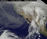
The Early December 2007 North American winter storm was a major winter storm
which affected the majority of the United States
and portions of southern Canada
from November 29 to December 5, hitting the Intermountain West
and Midwestern United States
, the Great Lakes
region and the Northeast
. The storm brought significant snows to portions of the Upper Midwest
, Great Plains and Great Lakes regions of the United States
and Canada
on December 1 with a major winter storm for Quebec
, Ontario
and parts of the Northeast region on December 2 and 3 as well as the Canadian Maritimes
on December 4 and 5. The system was also responsible for a major ice storm across the Midwestern states which caused disruptions to several major cities including Des Moines, Chicago
, Detroit, Milwaukee and Toronto
. The storm was blamed for at least 16 deaths across nine US states and one Canadian province.
 A low-pressure system developed across the southwestern United States on November 30 and brought significant rainfall for portions of the Desert Southwest as well as portions of southern California
from Los Angeles
to the Mexico
border, where destructive fires
took place in October 2007 near San Diego and Los Angeles.
The rain band then moved across the Rockies
and formed a Colorado Low
just southeast of Denver on the early hours of December 1. Most of the northern half of the country was under a dome of very cold air which was triggered by a weak Alberta Clipper
and associated front that crossed the continent prior to the storm and which brought significant lake-effect snows across the Great Lakes on November 29 and 30.
The newly formed storm then moved across the central parts of North America from Colorado to the Great Lakes bringing significant snows from the Dakotas to northern Ontario as well as in the mountain regions of New Mexico
and Colorado. The storm was expected to strengthen as it approached the Atlantic Coast
on December 3 and affected New England
, Quebec, eastern Ontario and the Canadian Maritimes with a major winter storm, primarily snow, with some mixing in the southernmost areas. On December 5, the storm departed Newfoundland and Labrador
, an area that was previously hit with a powerful storm which caused extensive power outages.
After the passage of the storm, more cold air was funneled across most of the eastern half of the country where additional lake-effect snows occurred for portions of Upper Michigan
, New York state and south-central Ontario.
of southwestern Colorado
. There was widespread rain at lower elevations throughout Colorado. The storm forced a men's World Cup Super-G skiing event at Beaver Creek
, where the total was 15 inches (381 mm), to be canceled. 44 inches was reported at Wolf Creek Pass
and 36 inches (914.4 mm) at Gunnison, Colorado
. One person also died in an automobile accident in Colorado. As the storm skirted Utah
on November 30 and December 1, it dropped up to 2 foot (0.6096 m) of snow in the mountains and widespread amounts of 4-10 inches (10–25 cm) in the valleys as far north and west as the Wasatch Front
. It also killed 1 person in a traffic accident between Santaquin
and Payson
.
in the morning of December 1, affecting the states of Nebraska
, South Dakota
, Kansas
, Iowa
, and Missouri
. The storm produced a wintry mix across much of the region, including significant icing due to freezing rain
of up to three-quarters of an inch (near 20 mm) thick locally in Iowa and Nebraska. Icing
on the runways shut down Des Moines International Airport
for several hours, after an American Airlines
flight with 44 passengers skidded off a taxiway. Several events were also canceled throughout the day across much of the area. In Iowa, several presidential campaigns
were forced to cancel events, including a rally near Des Moines by Bill Clinton
for his wife, presidential hopeful Hillary Clinton, as well as three campaign stops planned by presidential hopeful Mitt Romney
in southern Iowa. Most areas of Iowa saw about a half an inch of ice, with isolated reports as high as 2 inches (50.8 mm). The storm knocked out power to as much as 65,000 customers in Iowa, according to MidAmerican.
The storm moved into Illinois
and Wisconsin
in the afternoon of December 1. An inch or two of snow fell in many areas, before a wintry mix of icy precipitation (up to a half-inch of ice accumulation) made things even more treacherous. Numerous highway accidents were reported, resulting in three deaths in Wisconsin and one in Illinois, as well as numerous injuries. In addition, a Mesa Airlines
plane with 25 passengers slid off the runway at Dane County Regional Airport
in Madison
, but no injuries were reported. 400 flights were canceled at Chicago
's O'Hare International Airport
, 28 at Midway International Airport and dozens more at Milwaukee's General Mitchell International Airport
. At the height of the storm, 140,000 customers were without power in Illinois
, due to the storm.
In Madison, the University of Wisconsin–Madison
’s Department of Atmospheric and Oceanic Sciences department postponed its annual Solstice Party.
The storm also affected parts of Michigan
, where three traffic deaths were reported, and Indiana
, where one member of the Purdue University
ice hockey team was killed and seven others were injured when the team van overturned 20 miles (32.2 km) southwest of Lafayette
. Nearly 8 inches (203.2 mm) fell over parts of Lower Michigan (with higher amount towards the Upper Peninsula) along with one-quarter of an inch of ice.
Farther north, portions of North Dakota
, Minnesota
, northern Wisconsin, and northern Michigan received between 6-12 inches of snow. 20 inches (50 cm) of snow fell in Grand Marais
on the north shore of Lake Superior
, and a December 1st record of 10.3 inches (261.6 mm) was reported at Duluth
. In the Twin Cities metropolitan area, 4 to 8 inches (20.3 cm) were reported across the area. Snow emergencies
were declared for both Minneapolis and St. Paul. The Minnesota State Patrol reported 338 accidents, but no fatalities. In North Dakota, numerous traffic accidents were reported, including one fatality.
and portions of Ontario
and Quebec
on December 2, six inches (152 mm) of snow fell in portions of central New York
, while three inches (76 mm) of snow fell across New Jersey
with a dusting in several other areas. A second band of precipitation during the late hours produced areas of rain and freezing rain (of up to four-tenths of an inch of ice) across several valley areas from New York to Pennsylvania, with rain further to the east and south, while locally over a foot of snow fell across parts of Upstate New York, Vermont
and New Hampshire
, causing several accidents which forced the shutdown of northbound Interstate 89
.
With the re-intensification of the system off the Atlantic Coast, it produced a significant winter storm for northern New England and Maine where as much as 18 inches (45 cm) fell. Most schools were closed while Governor John Baldacci
sent all Maine public workers home during the afternoon of December 3. The storm system caused two traffic-related fatalities, including one in Saco, Maine
and another in Saranac, New York
.
, Kitchener-Waterloo
, Guelph
, Barrie
and Toronto
before the changeover to mixed precipitation and rain for most areas. Over northern Ontario, the town of Marathon
received as much as 50 cm (20 inches) while Thunder Bay
received over 1 ft (30 cm). Ontario Provincial Police
had reported over 200 accidents before Sunday afternoon alone across southern Ontario and a total of nearly 500 province-wide. Greyhound, GO
and Via Rail
service experienced delays of nearly one hour while several flights from Toronto's Pearson International Airport were canceled.
During the overnight of December 2 to December 3, a large zone of precipitation across the Ohio Valley moved across the Great Lakes and into eastern Ontario and southern Quebec where 12 to 14 inches (30–35 cm) fell over the cities of Montreal
and Ottawa
in 12 hours with freezing rain along the north shores of Lake Ontario
. The snow amounts broke records for most snow for the day of December 3. The old one was set in 1991 when about 6 inches fell over both regions. It was also the third biggest fall snowstorm in Montreal behind December 16, 2005
and November 30, 1944. For Ottawa, it was the biggest snowfall since nearly 14 inches (35 cm) fell on February 23, 2003, but fell well short of its all-time snowfall record of 29 inches (73 cm) set on March 2–3, 1947. In Quebec City, the 16 inches (40 cm) received in 24 hours were 4 centimeters short of its worst in such a period, the record being the same date as Montreal's worst 24-hour snowfall, March 4, 1971
.
General accumulations in Quebec and northeastern Ontario were between 8 to 16 inches (20–40 cm) from the Timmins
region to east of Quebec City
. Numerous schools were closed across western Quebec including all schools in the Gatineau
area while all school transportation was cancelled across Ottawa and Eastern Ontario
. OC Transpo
's articulated bus fleet experienced similar problems as during the Winter Storm of December 2005 when some buses jackknifed or were stuck in the snow in many areas across the city, although the problem was less severe than in 2005. That incident however involved similar accumulations of about one foot. Numerous flights from Macdonald-Cartier International Airport
and Pierre-Elliott Trudeau International Airport
(133 flights) were canceled.
The storm was blamed for three deaths in Quebec including two in car accidents on Quebec Route 153
near Yamachiche
and Quebec Autoroute 955
near Victoriaville. One day later, in the aftermath of the storm, a third person died in Val-des-Monts
when a temporary garage structure collapsed and trapped the victim under a heavy load of snow that was in process of being removed.
As the storm redeveloped off the Atlantic Coast on December 3 and 4, it gave another round of heavy and mixed precipitation for New Brunswick
, Prince Edward Island
and Nova Scotia
. Areas of northern and eastern New Brunswick received over a foot of snow, causing the city of Moncton to shut down all services, while several flights from airports in Moncton, Saint John
, Fredericton and Halifax were cancelled. In Fredericton, a unique phenomenon consisting of blowing and heavy snow along with winds produced several giant snowballs, called snowrollers, across several front lawns. About 24,000 homes in New Brunswick, 8,000 in Nova Scotia and 14,500 in Prince Edward Island were without power due to the snow, mixing and strong winds.
Winter storm
A winter storm is an event in which the dominant varieties of precipitation are formed that only occur at low temperatures, such as snow or sleet, or a rainstorm where ground temperatures are low enough to allow ice to form...
which affected the majority of the United States
United States
The United States of America is a federal constitutional republic comprising fifty states and a federal district...
and portions of southern Canada
Canada
Canada is a North American country consisting of ten provinces and three territories. Located in the northern part of the continent, it extends from the Atlantic Ocean in the east to the Pacific Ocean in the west, and northward into the Arctic Ocean...
from November 29 to December 5, hitting the Intermountain West
Intermountain West
The Intermountain West is a region of North America lying between the Rocky Mountains to the east and the Cascades and Sierra Nevada to the west. It is also called the Intermountain Region.- Topography :...
and Midwestern United States
Midwestern United States
The Midwestern United States is one of the four U.S. geographic regions defined by the United States Census Bureau, providing an official definition of the American Midwest....
, the Great Lakes
Great Lakes
The Great Lakes are a collection of freshwater lakes located in northeastern North America, on the Canada – United States border. Consisting of Lakes Superior, Michigan, Huron, Erie, and Ontario, they form the largest group of freshwater lakes on Earth by total surface, coming in second by volume...
region and the Northeast
Northeastern United States
The Northeastern United States is a region of the United States as defined by the United States Census Bureau.-Composition:The region comprises nine states: the New England states of Connecticut, Maine, Massachusetts, New Hampshire, Rhode Island and Vermont; and the Mid-Atlantic states of New...
. The storm brought significant snows to portions of the Upper Midwest
Upper Midwest
The Upper Midwest is a region in the northern portion of the U.S. Census Bureau's Midwestern United States. It is largely a sub-region of the midwest. Although there are no uniformly agreed-upon boundaries, the region is most commonly used to refer to the states of Minnesota, Wisconsin, and...
, Great Plains and Great Lakes regions of the United States
United States
The United States of America is a federal constitutional republic comprising fifty states and a federal district...
and Canada
Canada
Canada is a North American country consisting of ten provinces and three territories. Located in the northern part of the continent, it extends from the Atlantic Ocean in the east to the Pacific Ocean in the west, and northward into the Arctic Ocean...
on December 1 with a major winter storm for Quebec
Quebec
Quebec or is a province in east-central Canada. It is the only Canadian province with a predominantly French-speaking population and the only one whose sole official language is French at the provincial level....
, Ontario
Ontario
Ontario is a province of Canada, located in east-central Canada. It is Canada's most populous province and second largest in total area. It is home to the nation's most populous city, Toronto, and the nation's capital, Ottawa....
and parts of the Northeast region on December 2 and 3 as well as the Canadian Maritimes
Maritimes
The Maritime provinces, also called the Maritimes or the Canadian Maritimes, is a region of Eastern Canada consisting of three provinces, New Brunswick, Nova Scotia, and Prince Edward Island. On the Atlantic coast, the Maritimes are a subregion of Atlantic Canada, which also includes the...
on December 4 and 5. The system was also responsible for a major ice storm across the Midwestern states which caused disruptions to several major cities including Des Moines, Chicago
Chicago
Chicago is the largest city in the US state of Illinois. With nearly 2.7 million residents, it is the most populous city in the Midwestern United States and the third most populous in the US, after New York City and Los Angeles...
, Detroit, Milwaukee and Toronto
Toronto
Toronto is the provincial capital of Ontario and the largest city in Canada. It is located in Southern Ontario on the northwestern shore of Lake Ontario. A relatively modern city, Toronto's history dates back to the late-18th century, when its land was first purchased by the British monarchy from...
. The storm was blamed for at least 16 deaths across nine US states and one Canadian province.
Meteorological synopsis
California
California is a state located on the West Coast of the United States. It is by far the most populous U.S. state, and the third-largest by land area...
from Los Angeles
Los Ángeles
Los Ángeles is the capital of the province of Biobío, in the commune of the same name, in Region VIII , in the center-south of Chile. It is located between the Laja and Biobío rivers. The population is 123,445 inhabitants...
to the Mexico
Mexico
The United Mexican States , commonly known as Mexico , is a federal constitutional republic in North America. It is bordered on the north by the United States; on the south and west by the Pacific Ocean; on the southeast by Guatemala, Belize, and the Caribbean Sea; and on the east by the Gulf of...
border, where destructive fires
October 2007 California wildfires
The October 2007 California wildfires were a series of wildfires that began burning across Southern California on October 20. At least 1,500 homes were destroyed and over 500,000 acres of land burned from Santa Barbara County to the U.S.–Mexico border...
took place in October 2007 near San Diego and Los Angeles.
The rain band then moved across the Rockies
Rocky Mountains
The Rocky Mountains are a major mountain range in western North America. The Rocky Mountains stretch more than from the northernmost part of British Columbia, in western Canada, to New Mexico, in the southwestern United States...
and formed a Colorado Low
Colorado low
A Colorado low is a low pressure storm that forms in southeastern Colorado or northeastern New Mexico, typically in the winter. After forming, the system moves across the Great Plains. Colorado lows produce heavy wintry precipitation, and they have a general east to northeast movement, impacting...
just southeast of Denver on the early hours of December 1. Most of the northern half of the country was under a dome of very cold air which was triggered by a weak Alberta Clipper
Alberta clipper
An Alberta clipper is a fast moving low pressure area which generally affects the central provinces of Canada and parts of the Upper Midwest and Great Lakes regions of the United States. Most clippers occur between December and February, but can also occur occasionally in the month of November...
and associated front that crossed the continent prior to the storm and which brought significant lake-effect snows across the Great Lakes on November 29 and 30.
The newly formed storm then moved across the central parts of North America from Colorado to the Great Lakes bringing significant snows from the Dakotas to northern Ontario as well as in the mountain regions of New Mexico
New Mexico
New Mexico is a state located in the southwest and western regions of the United States. New Mexico is also usually considered one of the Mountain States. With a population density of 16 per square mile, New Mexico is the sixth-most sparsely inhabited U.S...
and Colorado. The storm was expected to strengthen as it approached the Atlantic Coast
East Coast of the United States
The East Coast of the United States, also known as the Eastern Seaboard, refers to the easternmost coastal states in the United States, which touch the Atlantic Ocean and stretch up to Canada. The term includes the U.S...
on December 3 and affected New England
New England
New England is a region in the northeastern corner of the United States consisting of the six states of Maine, New Hampshire, Vermont, Massachusetts, Rhode Island, and Connecticut...
, Quebec, eastern Ontario and the Canadian Maritimes with a major winter storm, primarily snow, with some mixing in the southernmost areas. On December 5, the storm departed Newfoundland and Labrador
Newfoundland and Labrador
Newfoundland and Labrador is the easternmost province of Canada. Situated in the country's Atlantic region, it incorporates the island of Newfoundland and mainland Labrador with a combined area of . As of April 2011, the province's estimated population is 508,400...
, an area that was previously hit with a powerful storm which caused extensive power outages.
After the passage of the storm, more cold air was funneled across most of the eastern half of the country where additional lake-effect snows occurred for portions of Upper Michigan
Upper Peninsula of Michigan
The Upper Peninsula of Michigan is the northern of the two major land masses that make up the U.S. state of Michigan. It is commonly referred to as the Upper Peninsula, the U.P., or Upper Michigan. It is also known as the land "above the Bridge" linking the two peninsulas. The peninsula is bounded...
, New York state and south-central Ontario.
Intermountain west
On November 29 and November 30, as the storm moved out of the Pacific region, it dumped up to four feet (1.2 m) of snow in the San Juan MountainsSan Juan Mountains
The San Juan Mountains are a high and rugged mountain range in the Rocky Mountains in southwestern Colorado. The area is highly mineralized and figured in the gold and silver mining industry of early Colorado. Major towns, all old mining camps, include Creede, Lake City, Silverton, Ouray, and...
of southwestern Colorado
Colorado
Colorado is a U.S. state that encompasses much of the Rocky Mountains as well as the northeastern portion of the Colorado Plateau and the western edge of the Great Plains...
. There was widespread rain at lower elevations throughout Colorado. The storm forced a men's World Cup Super-G skiing event at Beaver Creek
Beaver Creek, Colorado
Beaver Creek is an unincorporated community in Eagle County, Colorado, United States. Beaver Creek is located immediately south of the town of Avon and encompasses the Beaver Creek Resort and adjacent business, lodging, and residential areas. The U.S...
, where the total was 15 inches (381 mm), to be canceled. 44 inches was reported at Wolf Creek Pass
Wolf Creek Pass
Wolf Creek Pass is a high mountain pass on the Continental Divide, in the San Juan Mountains of Colorado. It is the route through which U.S. Highway 160 passes from the San Luis Valley into southwest Colorado on its way to New Mexico and Arizona. The pass is notable as inspiration of a C. W....
and 36 inches (914.4 mm) at Gunnison, Colorado
Gunnison, Colorado
The historic City of Gunnison, a Home Rule Municipality, is the county seat and the most populous city of Gunnison County, Colorado, United States. As of the 2010 census, the city had a population of 5,854. It was named in honor of John W...
. One person also died in an automobile accident in Colorado. As the storm skirted Utah
Utah
Utah is a state in the Western United States. It was the 45th state to join the Union, on January 4, 1896. Approximately 80% of Utah's 2,763,885 people live along the Wasatch Front, centering on Salt Lake City. This leaves vast expanses of the state nearly uninhabited, making the population the...
on November 30 and December 1, it dropped up to 2 foot (0.6096 m) of snow in the mountains and widespread amounts of 4-10 inches (10–25 cm) in the valleys as far north and west as the Wasatch Front
Wasatch Front
The Wasatch Front is a metropolitan region in the north-central part of the U.S. state of Utah. It consists of a chain of cities and towns stretched along the Wasatch Range from approximately Santaquin in the south to Brigham City in the north...
. It also killed 1 person in a traffic accident between Santaquin
Santaquin, Utah
Santaquin is a city in Utah County, Utah, United States. It is part of the Provo–Orem, Utah Metropolitan Statistical Area. The population was 4,834 at the 2000 census, while the 2008 estimates placed it at 8,400.-Geography:...
and Payson
Payson, Utah
Payson is a city in Utah County, Utah, United States. It is part of the Provo–Orem, Utah Metropolitan Statistical Area. The population was 12,716 at the 2000 census. The current mayor is Rick Moore, who in the 2009 election was the first write-in candidate ever to defeat an incumbent mayor in...
.
Midwest
The storm moved into the Corn BeltCorn Belt
The Corn Belt is a region of the Midwestern United States where corn has, since the 1850s, been the predominant crop, replacing the native tall grasses. By 1950, 99% of the corn was grown from hybrids. Most corn is fed to livestock, especially hogs and poultry. In recent decades soybeans have...
in the morning of December 1, affecting the states of Nebraska
Nebraska
Nebraska is a state on the Great Plains of the Midwestern United States. The state's capital is Lincoln and its largest city is Omaha, on the Missouri River....
, South Dakota
South Dakota
South Dakota is a state located in the Midwestern region of the United States. It is named after the Lakota and Dakota Sioux American Indian tribes. Once a part of Dakota Territory, South Dakota became a state on November 2, 1889. The state has an area of and an estimated population of just over...
, Kansas
Kansas
Kansas is a US state located in the Midwestern United States. It is named after the Kansas River which flows through it, which in turn was named after the Kansa Native American tribe, which inhabited the area. The tribe's name is often said to mean "people of the wind" or "people of the south...
, Iowa
Iowa
Iowa is a state located in the Midwestern United States, an area often referred to as the "American Heartland". It derives its name from the Ioway people, one of the many American Indian tribes that occupied the state at the time of European exploration. Iowa was a part of the French colony of New...
, and Missouri
Missouri
Missouri is a US state located in the Midwestern United States, bordered by Iowa, Illinois, Kentucky, Tennessee, Arkansas, Oklahoma, Kansas and Nebraska. With a 2010 population of 5,988,927, Missouri is the 18th most populous state in the nation and the fifth most populous in the Midwest. It...
. The storm produced a wintry mix across much of the region, including significant icing due to freezing rain
Freezing rain
Freezing rain is the name given to rain that falls when surface temperatures are below freezing. The raindrops become supercooled while passing through a sub-freezing layer of air, many hundred feet , just above the surface, and then freeze upon impact with any object they encounter. The resulting...
of up to three-quarters of an inch (near 20 mm) thick locally in Iowa and Nebraska. Icing
Atmospheric icing
Atmospheric icing occurs when water droplets in the atmosphere freeze on objects they contact. This can be extremely dangerous to aircraft, as the built-up ice changes the aerodynamics of the flight surfaces, which can increase the risk of a subsequent stalling of the airfoil...
on the runways shut down Des Moines International Airport
Des Moines International Airport
Des Moines International Airport is a public-use airport located three nautical miles southwest of the central business district of Des Moines, a city in Polk County, Iowa, United States. The airport serves the Des Moines metropolitan area with 19 connections to major airline hubs...
for several hours, after an American Airlines
American Airlines
American Airlines, Inc. is the world's fourth-largest airline in passenger miles transported and operating revenues. American Airlines is a subsidiary of the AMR Corporation and is headquartered in Fort Worth, Texas adjacent to its largest hub at Dallas/Fort Worth International Airport...
flight with 44 passengers skidded off a taxiway. Several events were also canceled throughout the day across much of the area. In Iowa, several presidential campaigns
United States presidential election, 2008
The United States presidential election of 2008 was the 56th quadrennial presidential election. It was held on November 4, 2008. Democrat Barack Obama, then the junior United States Senator from Illinois, defeated Republican John McCain, the senior U.S. Senator from Arizona. Obama received 365...
were forced to cancel events, including a rally near Des Moines by Bill Clinton
Bill Clinton
William Jefferson "Bill" Clinton is an American politician who served as the 42nd President of the United States from 1993 to 2001. Inaugurated at age 46, he was the third-youngest president. He took office at the end of the Cold War, and was the first president of the baby boomer generation...
for his wife, presidential hopeful Hillary Clinton, as well as three campaign stops planned by presidential hopeful Mitt Romney
Mitt Romney
Willard Mitt Romney is an American businessman and politician. He was the 70th Governor of Massachusetts from 2003 to 2007 and is a candidate for the 2012 Republican Party presidential nomination.The son of George W...
in southern Iowa. Most areas of Iowa saw about a half an inch of ice, with isolated reports as high as 2 inches (50.8 mm). The storm knocked out power to as much as 65,000 customers in Iowa, according to MidAmerican.
The storm moved into Illinois
Illinois
Illinois is the fifth-most populous state of the United States of America, and is often noted for being a microcosm of the entire country. With Chicago in the northeast, small industrial cities and great agricultural productivity in central and northern Illinois, and natural resources like coal,...
and Wisconsin
Wisconsin
Wisconsin is a U.S. state located in the north-central United States and is part of the Midwest. It is bordered by Minnesota to the west, Iowa to the southwest, Illinois to the south, Lake Michigan to the east, Michigan to the northeast, and Lake Superior to the north. Wisconsin's capital is...
in the afternoon of December 1. An inch or two of snow fell in many areas, before a wintry mix of icy precipitation (up to a half-inch of ice accumulation) made things even more treacherous. Numerous highway accidents were reported, resulting in three deaths in Wisconsin and one in Illinois, as well as numerous injuries. In addition, a Mesa Airlines
Mesa Airlines
Mesa Airlines, Inc. is an American regional airline based in Phoenix, Arizona. It is a FAA Part 121 certificated air carrier operating under air carrier certificate number MASA036A issued on June 29, 1979. It is a subsidiary of Mesa Air Group. It was known briefly as Mountain West Airlines from...
plane with 25 passengers slid off the runway at Dane County Regional Airport
Dane County Regional Airport
-Statistics:-External links:* Dane County Regional Airport: * Wisconsin Airport Directory: * * - Listen live to Madison's Air Traffic Control...
in Madison
Madison, Wisconsin
Madison is the capital of the U.S. state of Wisconsin and the county seat of Dane County. It is also home to the University of Wisconsin–Madison....
, but no injuries were reported. 400 flights were canceled at Chicago
Chicago
Chicago is the largest city in the US state of Illinois. With nearly 2.7 million residents, it is the most populous city in the Midwestern United States and the third most populous in the US, after New York City and Los Angeles...
's O'Hare International Airport
O'Hare International Airport
Chicago O'Hare International Airport , also known as O'Hare Airport, O'Hare Field, Chicago Airport, Chicago International Airport, or simply O'Hare, is a major airport located in the northwestern-most corner of Chicago, Illinois, United States, northwest of the Chicago Loop...
, 28 at Midway International Airport and dozens more at Milwaukee's General Mitchell International Airport
General Mitchell International Airport
General Mitchell International Airport is a county-owned public airport located five miles south of the central business district of Milwaukee, a city in Milwaukee County, Wisconsin, United States....
. At the height of the storm, 140,000 customers were without power in Illinois
Illinois
Illinois is the fifth-most populous state of the United States of America, and is often noted for being a microcosm of the entire country. With Chicago in the northeast, small industrial cities and great agricultural productivity in central and northern Illinois, and natural resources like coal,...
, due to the storm.
In Madison, the University of Wisconsin–Madison
University of Wisconsin–Madison
The University of Wisconsin–Madison is a public research university located in Madison, Wisconsin, United States. Founded in 1848, UW–Madison is the flagship campus of the University of Wisconsin System. It became a land-grant institution in 1866...
’s Department of Atmospheric and Oceanic Sciences department postponed its annual Solstice Party.
The storm also affected parts of Michigan
Michigan
Michigan is a U.S. state located in the Great Lakes Region of the United States of America. The name Michigan is the French form of the Ojibwa word mishigamaa, meaning "large water" or "large lake"....
, where three traffic deaths were reported, and Indiana
Indiana
Indiana is a US state, admitted to the United States as the 19th on December 11, 1816. It is located in the Midwestern United States and Great Lakes Region. With 6,483,802 residents, the state is ranked 15th in population and 16th in population density. Indiana is ranked 38th in land area and is...
, where one member of the Purdue University
Purdue University
Purdue University, located in West Lafayette, Indiana, U.S., is the flagship university of the six-campus Purdue University system. Purdue was founded on May 6, 1869, as a land-grant university when the Indiana General Assembly, taking advantage of the Morrill Act, accepted a donation of land and...
ice hockey team was killed and seven others were injured when the team van overturned 20 miles (32.2 km) southwest of Lafayette
Lafayette, Indiana
Lafayette is a city in and the county seat of Tippecanoe County, Indiana, United States, northwest of Indianapolis. As of the 2010 census, the city had a total population of 67,140. West Lafayette, on the other side of the Wabash River, is home to Purdue University, which has a large impact on...
. Nearly 8 inches (203.2 mm) fell over parts of Lower Michigan (with higher amount towards the Upper Peninsula) along with one-quarter of an inch of ice.
Farther north, portions of North Dakota
North Dakota
North Dakota is a state located in the Midwestern region of the United States of America, along the Canadian border. The state is bordered by Canada to the north, Minnesota to the east, South Dakota to the south and Montana to the west. North Dakota is the 19th-largest state by area in the U.S....
, Minnesota
Minnesota
Minnesota is a U.S. state located in the Midwestern United States. The twelfth largest state of the U.S., it is the twenty-first most populous, with 5.3 million residents. Minnesota was carved out of the eastern half of the Minnesota Territory and admitted to the Union as the thirty-second state...
, northern Wisconsin, and northern Michigan received between 6-12 inches of snow. 20 inches (50 cm) of snow fell in Grand Marais
Grand Marais, Minnesota
Grand Marais is a city in Cook County, Minnesota, United States. The population was 1,351 at the 2010 census. It is also the county seat of Cook County...
on the north shore of Lake Superior
Lake Superior
Lake Superior is the largest of the five traditionally-demarcated Great Lakes of North America. It is bounded to the north by the Canadian province of Ontario and the U.S. state of Minnesota, and to the south by the U.S. states of Wisconsin and Michigan. It is the largest freshwater lake in the...
, and a December 1st record of 10.3 inches (261.6 mm) was reported at Duluth
Duluth, Minnesota
Duluth is a port city in the U.S. state of Minnesota and is the county seat of Saint Louis County. The fourth largest city in Minnesota, Duluth had a total population of 86,265 in the 2010 census. Duluth is also the second largest city that is located on Lake Superior after Thunder Bay, Ontario,...
. In the Twin Cities metropolitan area, 4 to 8 inches (20.3 cm) were reported across the area. Snow emergencies
Snow emergency
A Snow Emergency is the term used to indicate the active response plan when a snow storm severely impacts a city, county or town in the United States or Canada. Schools, universities, government offices, airports and public buildings may close during a Snow Emergency. The precise meaning of "snow...
were declared for both Minneapolis and St. Paul. The Minnesota State Patrol reported 338 accidents, but no fatalities. In North Dakota, numerous traffic accidents were reported, including one fatality.
Northeast
As the storm moved into the Northeastern United StatesNortheastern United States
The Northeastern United States is a region of the United States as defined by the United States Census Bureau.-Composition:The region comprises nine states: the New England states of Connecticut, Maine, Massachusetts, New Hampshire, Rhode Island and Vermont; and the Mid-Atlantic states of New...
and portions of Ontario
Ontario
Ontario is a province of Canada, located in east-central Canada. It is Canada's most populous province and second largest in total area. It is home to the nation's most populous city, Toronto, and the nation's capital, Ottawa....
and Quebec
Quebec
Quebec or is a province in east-central Canada. It is the only Canadian province with a predominantly French-speaking population and the only one whose sole official language is French at the provincial level....
on December 2, six inches (152 mm) of snow fell in portions of central New York
New York
New York is a state in the Northeastern region of the United States. It is the nation's third most populous state. New York is bordered by New Jersey and Pennsylvania to the south, and by Connecticut, Massachusetts and Vermont to the east...
, while three inches (76 mm) of snow fell across New Jersey
New Jersey
New Jersey is a state in the Northeastern and Middle Atlantic regions of the United States. , its population was 8,791,894. It is bordered on the north and east by the state of New York, on the southeast and south by the Atlantic Ocean, on the west by Pennsylvania and on the southwest by Delaware...
with a dusting in several other areas. A second band of precipitation during the late hours produced areas of rain and freezing rain (of up to four-tenths of an inch of ice) across several valley areas from New York to Pennsylvania, with rain further to the east and south, while locally over a foot of snow fell across parts of Upstate New York, Vermont
Vermont
Vermont is a state in the New England region of the northeastern United States of America. The state ranks 43rd in land area, , and 45th in total area. Its population according to the 2010 census, 630,337, is the second smallest in the country, larger only than Wyoming. It is the only New England...
and New Hampshire
New Hampshire
New Hampshire is a state in the New England region of the northeastern United States of America. The state was named after the southern English county of Hampshire. It is bordered by Massachusetts to the south, Vermont to the west, Maine and the Atlantic Ocean to the east, and the Canadian...
, causing several accidents which forced the shutdown of northbound Interstate 89
Interstate 89
Interstate 89 is an interstate highway in the New England region of the United States travelling between Bow, New Hampshire and Highgate Springs, Vermont. As with all odd-numbered primary interstates, I-89 is signed as a north–south highway...
.
With the re-intensification of the system off the Atlantic Coast, it produced a significant winter storm for northern New England and Maine where as much as 18 inches (45 cm) fell. Most schools were closed while Governor John Baldacci
John Baldacci
John Elias Baldacci is an American politician who served as the 73rd Governor of the U.S. state of Maine from 2003 until 2011. A Democrat, he also served as a member of the United States House of Representatives from 1995 to 2003....
sent all Maine public workers home during the afternoon of December 3. The storm system caused two traffic-related fatalities, including one in Saco, Maine
Saco, Maine
Saco is a city in York County, Maine, United States. The population was 18,482 at the 2010 census. It is home to Ferry Beach State Park, Funtown Splashtown USA, Thornton Academy, as well as General Dynamics Armament Systems , a subsidiary of the defense contractor General Dynamics...
and another in Saranac, New York
Saranac, New York
Saranac is a town in Clinton County, New York, United States. The town is on the western border of the county, west of the City of Plattsburgh and is within the Adirondack Park. The population was 4,007 at the 2010 census. The town is named for the Saranac River that flows past the town.- History...
.
Canada
During the overnight of December 1 to December 2, several areas received between 4 and 8 inches (10–20 cm) across southern Ontario including LondonLondon, Ontario
London is a city in Southwestern Ontario, Canada, situated along the Quebec City – Windsor Corridor. The city has a population of 352,395, and the metropolitan area has a population of 457,720, according to the 2006 Canadian census; the metro population in 2009 was estimated at 489,274. The city...
, Kitchener-Waterloo
Kitchener, Ontario
The City of Kitchener is a city in Southern Ontario, Canada. It was the Town of Berlin from 1854 until 1912 and the City of Berlin from 1912 until 1916. The city had a population of 204,668 in the Canada 2006 Census...
, Guelph
Guelph
Guelph is a city in Ontario, Canada.Guelph may also refer to:* Guelph , consisting of the City of Guelph, Ontario* Guelph , as the above* University of Guelph, in the same city...
, Barrie
Barrie
Barrie may refer to:* Barrie, city in Ontario, Canada* Barrie , Canadian federal electoral district* Barrie , provincial electoral district* Barrie—Simcoe—Bradford, former Canadian electoral district...
and Toronto
Toronto
Toronto is the provincial capital of Ontario and the largest city in Canada. It is located in Southern Ontario on the northwestern shore of Lake Ontario. A relatively modern city, Toronto's history dates back to the late-18th century, when its land was first purchased by the British monarchy from...
before the changeover to mixed precipitation and rain for most areas. Over northern Ontario, the town of Marathon
Marathon, Ontario
Marathon is a town in the Canadian province of Ontario, located in Thunder Bay District, on the north shore of Lake Superior north of Pukaskwa National Park, in the heart of the Canadian Shield.- History :...
received as much as 50 cm (20 inches) while Thunder Bay
Thunder Bay
-In Canada:Thunder Bay is the name of three places in the province of Ontario, Canada along Lake Superior:*Thunder Bay District, Ontario, a district in Northwestern Ontario*Thunder Bay, a city in Thunder Bay District*Thunder Bay, Unorganized, Ontario...
received over 1 ft (30 cm). Ontario Provincial Police
Ontario Provincial Police
The Ontario Provincial Police is the Provincial Police service for the province of Ontario, Canada.-Overview:The OPP is the the largest deployed police force in Ontario, and the second largest in Canada. The service is responsible for providing policing services throughout the province in areas...
had reported over 200 accidents before Sunday afternoon alone across southern Ontario and a total of nearly 500 province-wide. Greyhound, GO
GO Transit
GO Transit is an inter-regional public transit system in Southern Ontario, Canada. It primarily serves the Greater Toronto and Hamilton Area conurbation, with operations extending to several communities beyond the GTHA proper in the Greater Golden Horseshoe...
and Via Rail
VIA Rail
Via Rail Canada is an independent crown corporation offering intercity passenger rail services in Canada. It is headquartered near Montreal Central Station at 3 Place Ville-Marie in Montreal, Quebec....
service experienced delays of nearly one hour while several flights from Toronto's Pearson International Airport were canceled.
During the overnight of December 2 to December 3, a large zone of precipitation across the Ohio Valley moved across the Great Lakes and into eastern Ontario and southern Quebec where 12 to 14 inches (30–35 cm) fell over the cities of Montreal
Montreal
Montreal is a city in Canada. It is the largest city in the province of Quebec, the second-largest city in Canada and the seventh largest in North America...
and Ottawa
Ottawa
Ottawa is the capital of Canada, the second largest city in the Province of Ontario, and the fourth largest city in the country. The city is located on the south bank of the Ottawa River in the eastern portion of Southern Ontario...
in 12 hours with freezing rain along the north shores of Lake Ontario
Lake Ontario
Lake Ontario is one of the five Great Lakes of North America. It is bounded on the north and southwest by the Canadian province of Ontario, and on the south by the American state of New York. Ontario, Canada's most populous province, was named for the lake. In the Wyandot language, ontarío means...
. The snow amounts broke records for most snow for the day of December 3. The old one was set in 1991 when about 6 inches fell over both regions. It was also the third biggest fall snowstorm in Montreal behind December 16, 2005
Ice storm of December 2005
The Ice storm of December 2005 was a damaging winter storm that produced extensive ice damage in a large portion of the Southern United States on December 14–16, 2005 while extensive snows were reported across portions of the Canadian provinces of Ontario and Quebec...
and November 30, 1944. For Ottawa, it was the biggest snowfall since nearly 14 inches (35 cm) fell on February 23, 2003, but fell well short of its all-time snowfall record of 29 inches (73 cm) set on March 2–3, 1947. In Quebec City, the 16 inches (40 cm) received in 24 hours were 4 centimeters short of its worst in such a period, the record being the same date as Montreal's worst 24-hour snowfall, March 4, 1971
Eastern Canadian Blizzard of March 1971
The Eastern Canadian Blizzard of March 1971 was a severe winter storm that struck portions of eastern Canada from March 3 to March 5, 1971. The storm was also nicknamed the "Storm of the Century" in Quebec. The event was the worst 24-hour snowfall event on record in the city of Montreal with of...
.
General accumulations in Quebec and northeastern Ontario were between 8 to 16 inches (20–40 cm) from the Timmins
Timmins
Timmins is a city in northeastern Ontario, Canada on the Mattagami River. At the time of the Canada 2006 Census, Timmins' population was 42,997...
region to east of Quebec City
Quebec City
Quebec , also Québec, Quebec City or Québec City is the capital of the Canadian province of Quebec and is located within the Capitale-Nationale region. It is the second most populous city in Quebec after Montreal, which is about to the southwest...
. Numerous schools were closed across western Quebec including all schools in the Gatineau
Gatineau
Gatineau is a city in western Quebec, Canada. It is the fourth largest city in the province. It is located on the northern banks of the Ottawa River, immediately across from Ottawa, Ontario, and together they form Canada's National Capital Region. Ottawa and Gatineau comprise a single Census...
area while all school transportation was cancelled across Ottawa and Eastern Ontario
Eastern Ontario
Eastern Ontario is a subregion of Southern Ontario in the Canadian province of Ontario which lies in a wedge-shaped area between the Ottawa River and St. Lawrence River...
. OC Transpo
OC Transpo
OC Transpo is the urban transit service of the City of Ottawa, Ontario, Canada. An integrated hub-and-spoke system of services is available consisting of: regular buses travelling on fixed routes in mixed traffic, typical of most urban transit systems; a bus rapid transit system — a high...
's articulated bus fleet experienced similar problems as during the Winter Storm of December 2005 when some buses jackknifed or were stuck in the snow in many areas across the city, although the problem was less severe than in 2005. That incident however involved similar accumulations of about one foot. Numerous flights from Macdonald-Cartier International Airport
Ottawa Macdonald-Cartier International Airport
Ottawa/Macdonald-Cartier International Airport or Macdonald-Cartier International Airport , in Ottawa, Ontario, Canada is named after Sirs John A. Macdonald and George-Étienne Cartier...
and Pierre-Elliott Trudeau International Airport
Montréal-Pierre Elliott Trudeau International Airport
Montréal-Pierre Elliott Trudeau International Airport or Montréal-Trudeau, formerly known as Montréal-Dorval International Airport, is located on the Island of Montreal, from Montreal's downtown core. The airport terminals are located entirely in Dorval, while the Air Canada headquarters complex...
(133 flights) were canceled.
The storm was blamed for three deaths in Quebec including two in car accidents on Quebec Route 153
Quebec route 153
Route 153 is a two-lane north/south highway in Quebec, Canada, which starts in Yamachiche at the junction of Autoroute 40 and ends in Lac-aux-Sables at the junction of Route 363.-Municipalities along Route 153:* Yamachiche* Saint-Barnabé...
near Yamachiche
Yamachiche, Quebec
Yamachiche is a municipality in the Mauricie region of the province of Quebec in Canada.-Etymology:The name Yamachiche was first used to identify the Little Yamachiche River which runs through the town. It came from the Native American words iyamitaw and achichki...
and Quebec Autoroute 955
Quebec Autoroute 955
Autoroute 955 is a short 14.7km two-lane highway which links Autoroute 20 in Sainte-Eulalie with Saint-Albert.This short section of Autoroute was destined to become part of a much longer section of freeway, as Autoroute 55 was supposed to follow this route south towards Warwick and Richmond, as...
near Victoriaville. One day later, in the aftermath of the storm, a third person died in Val-des-Monts
Val-des-Monts, Quebec
Val-des-Monts is a municipality in the Outaouais region of Quebec, Canada, located about 40 kilometres north of Ottawa. It has a population of 10,139 residents. Formed in 1974 by the merger of the towns of Perkins, Saint-Pierre-de-Wakefield and Poltimore, it consists mainly of farms and mountainous...
when a temporary garage structure collapsed and trapped the victim under a heavy load of snow that was in process of being removed.
As the storm redeveloped off the Atlantic Coast on December 3 and 4, it gave another round of heavy and mixed precipitation for New Brunswick
New Brunswick
New Brunswick is one of Canada's three Maritime provinces and is the only province in the federation that is constitutionally bilingual . The provincial capital is Fredericton and Saint John is the most populous city. Greater Moncton is the largest Census Metropolitan Area...
, Prince Edward Island
Prince Edward Island
Prince Edward Island is a Canadian province consisting of an island of the same name, as well as other islands. The maritime province is the smallest in the nation in both land area and population...
and Nova Scotia
Nova Scotia
Nova Scotia is one of Canada's three Maritime provinces and is the most populous province in Atlantic Canada. The name of the province is Latin for "New Scotland," but "Nova Scotia" is the recognized, English-language name of the province. The provincial capital is Halifax. Nova Scotia is the...
. Areas of northern and eastern New Brunswick received over a foot of snow, causing the city of Moncton to shut down all services, while several flights from airports in Moncton, Saint John
Saint John, New Brunswick
City of Saint John , or commonly Saint John, is the largest city in the province of New Brunswick, and the first incorporated city in Canada. The city is situated along the north shore of the Bay of Fundy at the mouth of the Saint John River. In 2006 the city proper had a population of 74,043...
, Fredericton and Halifax were cancelled. In Fredericton, a unique phenomenon consisting of blowing and heavy snow along with winds produced several giant snowballs, called snowrollers, across several front lawns. About 24,000 homes in New Brunswick, 8,000 in Nova Scotia and 14,500 in Prince Edward Island were without power due to the snow, mixing and strong winds.
External links
- QuickTime video of the origin of the storm
- iTunes video of the origin of the storm
- Precipitation Amounts across the NWS Twin Cities, Minnesota office area
- Synopsis of the Winter Storm from NWS Twin Cities, Minnesota
- Storm Reports and summary from NWS Omaha, Nebraska
- Storm totals from NWS Des Moines, Iowa
- Storm Totals from NWS Duluth, Minnesota
- Summary of the storm courtesy of NWS Milwaukee, Wisconsin
- Storm totals from NWS Green Bay, Wisconsin
- Summary of the storm from NWS Grand Rapids, Wisconsin
- Summary and storm totals from NWS Detroit, Michigan
- Summary and storms amounts from NWS State College, Pennsylvania
- Storm Reports from NWS Albany, New York
- Storms totals from NWS Caribou, Maine