

Eastern Ontario
Encyclopedia
Eastern Ontario is a subregion of Southern Ontario
in the Canadian
province
of Ontario
which lies in a wedge-shaped area between the Ottawa River
and St. Lawrence River. It shares water boundaries with Quebec
to the north and New York State to the east and south, as well as a small land boundary with the Vaudreuil-Soulanges
region of Quebec to the east.
It includes the census divisions
of the following: the counties of Prescott and Russell
, Stormont, Dundas and Glengarry
, Lanark
, Renfrew
, Leeds and Grenville
, Frontenac
and Lennox and Addington
; and the single-tier municipality of Ottawa
.
Some sources may also include Hastings
, Prince Edward
, and sometimes even Northumberland
in the definition of Eastern Ontario, but others classify them as Central Ontario. Strictly speaking, Eastern Ontario refers to the part of the province that lies east of where Lake Ontario
narrows into the St. Lawrence River.
The region may also be referred to as Southeastern Ontario to differentiate it from the Northern Ontario subregion of Northeastern Ontario
.
, explorer, traversed the Ottawa River
in 1615 on his way westward to the Great Lakes
. The largest city in the region is the city of Ottawa
, capital of Canada, which accounts for roughly 60% of Eastern Ontario's population. Kingston
, itself once capital of the Province of Canada
, is the other major city in the region outide of the National Capital Region
.
Much of the remainder of the region relies on agriculture
and tourism. Heavier reliance on recreation and tourism exists in the more rugged Renfrew county in the northwest of Eastern Ontario.
 Of all Ontario's regions, parts of Eastern Ontario are the most heavily influenced by the United Empire Loyalists
, American settlers who moved to Upper Canada
out of loyalty to the British
Crown during and after the American Revolutionary War
. The Loyalist influence has a presence in the counties of Lennox and Addington, Leeds and Grenville, Frontenac, Lanark, Hastings, and Prince Edward.
In Ottawa, Prescott and Russell, Stormont, Dundas and Glengarry, and (although declining) Renfrew, Eastern Ontario is home to the largest Franco-Ontarian
community within Ontario.
Extensive immigration by Scottish Highlanders
from the Highland land clearances also took place around the time of the United Empire Loyalist migration. Large numbers of Irish Catholics, mainly from Cork and surrounding counties also settled in the area in the decades following the war of 1812, the majority of them in or near present-day Ottawa. Many arrived through government backed immigration schemes to settle unoccupied lands and fill labour shortages. Along with the Franco-Ontarians in particular, they made up the majority of canal builders on the large Rideau Canal
project and were heavily employed in the area's extensive lumber industry.
Through the last century, newer immigrant groups have added to the cultural mix, mostly in Ottawa itself. There are still a large number of Francophones in Eastern Ontario, especially in Prescott and Russell United Counties.
Winters are long and celebrated in Eastern Ontario. The average temperature in January is -6°C (21 °F).
In recent years, there seems to be a trend towards snow free periods, even in mid-winter.
However, in the winter months of 2008, there were records levels of snow fall.
Ice storms are also relatively common, especially on lower terrain if compared with other parts of the country. One such large storm caused vast power outages and affected the local economy, known as the 1998 Ice Storm. Winters are more severe and longer along the Ottawa River, particularly in higher terrain of Renfrew County
than further south along the Upper St. Lawrence River shoreline.
Summers are fairly warm and humid in the Ottawa
and St. Lawrence valleys, usually lasting a little longer than winter does in duration. The average July maximum temperature is 27 °C (80 °F). Temperatures occasionally exceed 35 °C (95 °F), and during periods of hot weather, high humidity is often an aggravating factor, pushing the temperature into the 40's (100's) with the humidex. Thunderstorms are on occasion severe, causing tree and property damage.
Spring and fall are changeable seasons, prone to extremes in temperature and unpredictable swings in conditions. Average annual precipitation is around 950 mm (37 in.).
 The eastern section of Eastern Ontario, that is east and southeast of Ottawa, including the towns of Cornwall
, Embrun
and Hawkesbury
is generally a flat plain, dotted with some extensive woodlots and boggy marshes, but is primarily farmland. Certain sections here are prone to low lying flooding and spring ice jams, particularly on the banks of the South Nation River
.
The Laurentian Highlands
, which form a small section of the extensive Canadian Shield
, cuts through the western section from the Upper Ottawa River valley southeast toward to the St. Lawrence River around Gananoque. Here sedimentary rock can be found folding over the Shield. This is also the portion where the greatest concentration of inland lakes are found. In Renfrew County, this higher terrain is called the 'Madawaska Highlands', after a major river that bisects these hills. Some highland peaks are over 400m higher than the Ottawa River. The picturesque area of the St. Lawrence River bordering New York
State is known as the Thousand Islands
region reflected by its numerous small islands. The bulk of the Laurentian Upland is located just to the north of the Ottawa River in adjacent Quebec
and covers a vastly larger area within that province.
Along the extreme western edge of Eastern Ontario are a continuation of the Laurentian Highlands, known as the Opeongo Hills
, and they contain some of the highest elevations in Southern Ontario
. They stretch into the northern portions of Central Ontario, near Algonquin Provincial Park
.
Ottawa itself is at the confluence of the Rideau River
and Ottawa River
. A series of rugged rapids and waterfalls are found along these rivers in Ottawa. Most of the underlying rock in and around the city of Ottawa is limestone bedrock, also found in abundance farther south around Kingston. Limestone
was used during the construction of the Rideau Canal
, which connects Kingston and Ottawa by water and was also heavily used as the building blocks for many governmental and other buildings in both cities.
The Ottawa and St. Lawrence Rivers do not actually converge in Ontario. A small portion of Quebec
, Vaudreuil-Soulanges
, lies between the Ontario-Quebec border and the river junction. This region has a land border with Ontario, but must cross water to reach any other part of Quebec.
The physical features of Eastern Ontario are described in the Eastern Ontario Visual Character Project.
and the Saint Lawrence rift system
. Minor earthquakes occur in the region regularly, most of them too weak to be felt by people. More severe earthquakes, around magnitudes 5-6 on the Richter scale, occur every sixty years, on average. The most recent of these earthquakes occurred in 2010. This earthquake, known as the 2010 Central Canada earthquake
, although it did cause some power outages and minor damage to older buildings, did not cause significant damage because buildings in the area are required to be earthquake resistant by government regulations. This earthquake did cause significant panic amongst the population, though: office buildings were evacuated in Ottawa, transit routes shut down, and in the minutes after the quake cell phone service was down as it was overloaded with calls made by panicked people attempting to talk to friends and relatives. Although this reaction was ridiculed by many, it should be noted that if buildings in the area were not designed to be earthquake resistant it would have caused significant damage. A similar earthquake which happened in 1944
caused significant damage to buildings in Cornwall as this was before earthquake resistant architecture became commonplace.
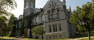 The region is home to several universities
and college
s, including Carleton University
, Queen's University
, Royal Military College of Canada
, the University of Ottawa
, Saint Paul University
, Algonquin College
, La Cité collégiale
, and St. Lawrence College
.
Algonquin College has campuses in Ottawa
, Perth
, Pembroke
, Hawkesbury
, and Renfrew
, while St. Lawrence College has campuses in Kingston
, Cornwall
, and Brockville
.
Southern Ontario
Southern Ontario is a region of the province of Ontario, Canada that lies south of the French River and Algonquin Park. Depending on the inclusion of the Parry Sound and Muskoka districts, its surface area would cover between 14 to 15% of the province. It is the southernmost region of...
in the Canadian
Canada
Canada is a North American country consisting of ten provinces and three territories. Located in the northern part of the continent, it extends from the Atlantic Ocean in the east to the Pacific Ocean in the west, and northward into the Arctic Ocean...
province
Provinces and territories of Canada
The provinces and territories of Canada combine to make up the world's second-largest country by area. There are ten provinces and three territories...
of Ontario
Ontario
Ontario is a province of Canada, located in east-central Canada. It is Canada's most populous province and second largest in total area. It is home to the nation's most populous city, Toronto, and the nation's capital, Ottawa....
which lies in a wedge-shaped area between the Ottawa River
Ottawa River
The Ottawa River is a river in the Canadian provinces of Ontario and Quebec. For most of its length, it now defines the border between these two provinces.-Geography:...
and St. Lawrence River. It shares water boundaries with Quebec
Quebec
Quebec or is a province in east-central Canada. It is the only Canadian province with a predominantly French-speaking population and the only one whose sole official language is French at the provincial level....
to the north and New York State to the east and south, as well as a small land boundary with the Vaudreuil-Soulanges
Vaudreuil-Soulanges Regional County Municipality, Quebec
-References:...
region of Quebec to the east.
It includes the census divisions
Census divisions of Ontario
In the Canadian province of Ontario, there are three different types of census divisions: single-tier municipalities, upper-tier municipalities and districts...
of the following: the counties of Prescott and Russell
Prescott and Russell United Counties, Ontario
The United Counties of Prescott and Russell are consolidated counties located in the Canadian province of Ontario. As of 2006, the population is 80,184. Its county seat is L'Orignal, Ontario. It was created as a result of a merger between Russell County and Prescott County in 1820...
, Stormont, Dundas and Glengarry
Stormont, Dundas and Glengarry United Counties, Ontario
The United Counties of Stormont, Dundas and Glengarry is an upper tier county and census division in the Canadian province of Ontario. The county seat is Cornwall...
, Lanark
Lanark County, Ontario
Lanark County is a county located in the Canadian province of Ontario. As of 2006, the population is 63,785. Its county seat is Perth.The county took its name from the town of Lanark in Scotland.-Geography:...
, Renfrew
Renfrew County, Ontario
Renfrew is a county in the Canadian province of Ontario. In 2006, the population was 97,545 and county covered , giving a population density of . There are 17 official municipalities.-Government:...
, Leeds and Grenville
Leeds and Grenville United Counties, Ontario
The United Counties of Leeds and Grenville are located Ontario, Canada. The population, as of the 2006 census, was 99,206. The United Counties have a land area of . Leeds and Grenville are located in the subregion of Southern Ontario named Eastern Ontario, and front on the St. Lawrence River and...
, Frontenac
Frontenac County, Ontario
Frontenac County, as defined by Statistics Canada, is a census division of the Canadian province of Ontario. It is located in the eastern portion of Southern Ontario. The City of Kingston is included in the census division, but is politically separated from the County of Frontenac. It has a land...
and Lennox and Addington
Lennox and Addington County, Ontario
Lennox and Addington County, Ontario is a county and census division of the Canadian province of Ontario. The county seat is Greater Napanee. It is located in the subregion of Southern Ontario named Eastern Ontario.It includes the following municipalities:...
; and the single-tier municipality of Ottawa
Ottawa
Ottawa is the capital of Canada, the second largest city in the Province of Ontario, and the fourth largest city in the country. The city is located on the south bank of the Ottawa River in the eastern portion of Southern Ontario...
.
Some sources may also include Hastings
Hastings County, Ontario
Hastings County is located in the province of Ontario, Canada. It is The Cheese Capital of Canada. Geographically, it is located on the border of Eastern Ontario and Central Ontario. The population was 125,915 in 2001 and grew to 130,474 in the 2006 Canada Census...
, Prince Edward
Prince Edward County, Ontario
Prince Edward County is a single-tier municipality and a census division of the Canadian province of Ontario.-Geography:Prince Edward County is located in Southern Ontario on a large irregular headland or littoral at the eastern end of Lake Ontario, just west of the head of the St. Lawrence River...
, and sometimes even Northumberland
Northumberland County, Ontario
Northumberland County is situated on the north shore of Lake Ontario, in central Ontario, Canada. It is located east of Durham County , west of Hastings, southeast of Kawartha Lakes and south of Peterborough County. The county seat is Cobourg...
in the definition of Eastern Ontario, but others classify them as Central Ontario. Strictly speaking, Eastern Ontario refers to the part of the province that lies east of where Lake Ontario
Lake Ontario
Lake Ontario is one of the five Great Lakes of North America. It is bounded on the north and southwest by the Canadian province of Ontario, and on the south by the American state of New York. Ontario, Canada's most populous province, was named for the lake. In the Wyandot language, ontarío means...
narrows into the St. Lawrence River.
The region may also be referred to as Southeastern Ontario to differentiate it from the Northern Ontario subregion of Northeastern Ontario
Northeastern Ontario
Northeastern Ontario is the region within the Canadian province of Ontario which lies north and east of Lakes Superior and Huron.Northeastern Ontario consists of the districts of Algoma, Sudbury, Cochrane, Timiskaming, Nipissing and Manitoulin; and the single-tier municipality of Greater...
.
History
French explorers and fur traders were the first Europeans to pass through this region. Samuel de ChamplainSamuel de Champlain
Samuel de Champlain , "The Father of New France", was a French navigator, cartographer, draughtsman, soldier, explorer, geographer, ethnologist, diplomat, and chronicler. He founded New France and Quebec City on July 3, 1608....
, explorer, traversed the Ottawa River
Ottawa River
The Ottawa River is a river in the Canadian provinces of Ontario and Quebec. For most of its length, it now defines the border between these two provinces.-Geography:...
in 1615 on his way westward to the Great Lakes
Great Lakes
The Great Lakes are a collection of freshwater lakes located in northeastern North America, on the Canada – United States border. Consisting of Lakes Superior, Michigan, Huron, Erie, and Ontario, they form the largest group of freshwater lakes on Earth by total surface, coming in second by volume...
. The largest city in the region is the city of Ottawa
Ottawa
Ottawa is the capital of Canada, the second largest city in the Province of Ontario, and the fourth largest city in the country. The city is located on the south bank of the Ottawa River in the eastern portion of Southern Ontario...
, capital of Canada, which accounts for roughly 60% of Eastern Ontario's population. Kingston
Kingston, Ontario
Kingston, Ontario is a Canadian city located in Eastern Ontario where the St. Lawrence River flows out of Lake Ontario. Originally a First Nations settlement called "Katarowki," , growing European exploration in the 17th Century made it an important trading post...
, itself once capital of the Province of Canada
Province of Canada
The Province of Canada, United Province of Canada, or the United Canadas was a British colony in North America from 1841 to 1867. Its formation reflected recommendations made by John Lambton, 1st Earl of Durham in the Report on the Affairs of British North America following the Rebellions of...
, is the other major city in the region outide of the National Capital Region
National Capital Region (Canada)
The National Capital Region, also referred to as Canada's Capital Region, is an official federal designation for the Canadian capital of Ottawa, Ontario, the neighbouring city of Gatineau, Quebec, and surrounding urban and rural communities....
.
Much of the remainder of the region relies on agriculture
Agriculture
Agriculture is the cultivation of animals, plants, fungi and other life forms for food, fiber, and other products used to sustain life. Agriculture was the key implement in the rise of sedentary human civilization, whereby farming of domesticated species created food surpluses that nurtured the...
and tourism. Heavier reliance on recreation and tourism exists in the more rugged Renfrew county in the northwest of Eastern Ontario.
United Empire Loyalists
The name United Empire Loyalists is an honorific given after the fact to those American Loyalists who resettled in British North America and other British Colonies as an act of fealty to King George III after the British defeat in the American Revolutionary War and prior to the Treaty of Paris...
, American settlers who moved to Upper Canada
Upper Canada
The Province of Upper Canada was a political division in British Canada established in 1791 by the British Empire to govern the central third of the lands in British North America and to accommodate Loyalist refugees from the United States of America after the American Revolution...
out of loyalty to the British
United Kingdom
The United Kingdom of Great Britain and Northern IrelandIn the United Kingdom and Dependencies, other languages have been officially recognised as legitimate autochthonous languages under the European Charter for Regional or Minority Languages...
Crown during and after the American Revolutionary War
American Revolutionary War
The American Revolutionary War , the American War of Independence, or simply the Revolutionary War, began as a war between the Kingdom of Great Britain and thirteen British colonies in North America, and ended in a global war between several European great powers.The war was the result of the...
. The Loyalist influence has a presence in the counties of Lennox and Addington, Leeds and Grenville, Frontenac, Lanark, Hastings, and Prince Edward.
In Ottawa, Prescott and Russell, Stormont, Dundas and Glengarry, and (although declining) Renfrew, Eastern Ontario is home to the largest Franco-Ontarian
Franco-Ontarian
Franco-Ontarians are French Canadian or francophone residents of the Canadian province of Ontario. They are sometimes known as "Ontarois"....
community within Ontario.
Extensive immigration by Scottish Highlanders
Scottish Highlands
The Highlands is an historic region of Scotland. The area is sometimes referred to as the "Scottish Highlands". It was culturally distinguishable from the Lowlands from the later Middle Ages into the modern period, when Lowland Scots replaced Scottish Gaelic throughout most of the Lowlands...
from the Highland land clearances also took place around the time of the United Empire Loyalist migration. Large numbers of Irish Catholics, mainly from Cork and surrounding counties also settled in the area in the decades following the war of 1812, the majority of them in or near present-day Ottawa. Many arrived through government backed immigration schemes to settle unoccupied lands and fill labour shortages. Along with the Franco-Ontarians in particular, they made up the majority of canal builders on the large Rideau Canal
Rideau Canal
The Rideau Canal , also known as the Rideau Waterway, connects the city of Ottawa, Ontario, Canada on the Ottawa River to the city of Kingston, Ontario on Lake Ontario. The canal was opened in 1832 as a precaution in case of war with the United States and is still in use today, with most of its...
project and were heavily employed in the area's extensive lumber industry.
Through the last century, newer immigrant groups have added to the cultural mix, mostly in Ottawa itself. There are still a large number of Francophones in Eastern Ontario, especially in Prescott and Russell United Counties.
Climate
The climate of Eastern Ontario is humid continental with large seasonal variation. Snow and ice are dominant during the winter season. Ottawa receives close to 250 cm (100 in) of snowfall over an average winter and snow usually remains on the ground for a couple of months, at minimum.Winters are long and celebrated in Eastern Ontario. The average temperature in January is -6°C (21 °F).
In recent years, there seems to be a trend towards snow free periods, even in mid-winter.
However, in the winter months of 2008, there were records levels of snow fall.
Ice storms are also relatively common, especially on lower terrain if compared with other parts of the country. One such large storm caused vast power outages and affected the local economy, known as the 1998 Ice Storm. Winters are more severe and longer along the Ottawa River, particularly in higher terrain of Renfrew County
Renfrew County, Ontario
Renfrew is a county in the Canadian province of Ontario. In 2006, the population was 97,545 and county covered , giving a population density of . There are 17 official municipalities.-Government:...
than further south along the Upper St. Lawrence River shoreline.
Summers are fairly warm and humid in the Ottawa
Ottawa Valley
The Ottawa Valley is the valley along the boundary between Eastern Ontario and Western Quebec along the Ottawa River. The valley is the transition between the Saint Lawrence Lowlands and the Canadian Shield...
and St. Lawrence valleys, usually lasting a little longer than winter does in duration. The average July maximum temperature is 27 °C (80 °F). Temperatures occasionally exceed 35 °C (95 °F), and during periods of hot weather, high humidity is often an aggravating factor, pushing the temperature into the 40's (100's) with the humidex. Thunderstorms are on occasion severe, causing tree and property damage.
Spring and fall are changeable seasons, prone to extremes in temperature and unpredictable swings in conditions. Average annual precipitation is around 950 mm (37 in.).
Geography
Cornwall, Ontario
Cornwall is a city in Eastern Ontario, Canada and the seat of the United Counties of Stormont, Dundas and Glengarry, Ontario. Cornwall is Ontario's easternmost city, located on the St...
, Embrun
Embrun, Ontario
Embrun (ˈɛmbrən in English; ), UN/LOCODE: CA EBU, is a community in the Canadian province of Ontario in the Eastern Ontario region. Embrun is also part of the National Capital Region. Embrun is part of the larger Russell Township in Prescott and Russell United Counties...
and Hawkesbury
Hawkesbury, Ontario
Hawkesbury is a town in the Eastern portion of Southern Ontario, Canada, on the Ottawa River, near the Quebec-Ontario border.It lies on the south shore of the Ottawa River about halfway between Downtown Ottawa and Downtown Montreal in Prescott and Russell Counties. The Long-Sault Bridge links it...
is generally a flat plain, dotted with some extensive woodlots and boggy marshes, but is primarily farmland. Certain sections here are prone to low lying flooding and spring ice jams, particularly on the banks of the South Nation River
South Nation River
The South Nation River is a river in Eastern Ontario, Canada. It springs from forests and marshes located north of Brockville and it flows 175 km northeast to empty into the Ottawa River north of Plantagenet...
.
The Laurentian Highlands
Laurentian Upland
The Laurentian Upland is a physiographic province which, when referred to as the "Laurentian Region," is recognized by Natural Resources Canada as one of five provinces of the larger Canadian Shield physiographic division...
, which form a small section of the extensive Canadian Shield
Canadian Shield
The Canadian Shield, also called the Laurentian Plateau, or Bouclier Canadien , is a vast geological shield covered by a thin layer of soil that forms the nucleus of the North American or Laurentia craton. It is an area mostly composed of igneous rock which relates to its long volcanic history...
, cuts through the western section from the Upper Ottawa River valley southeast toward to the St. Lawrence River around Gananoque. Here sedimentary rock can be found folding over the Shield. This is also the portion where the greatest concentration of inland lakes are found. In Renfrew County, this higher terrain is called the 'Madawaska Highlands', after a major river that bisects these hills. Some highland peaks are over 400m higher than the Ottawa River. The picturesque area of the St. Lawrence River bordering New York
New York
New York is a state in the Northeastern region of the United States. It is the nation's third most populous state. New York is bordered by New Jersey and Pennsylvania to the south, and by Connecticut, Massachusetts and Vermont to the east...
State is known as the Thousand Islands
Thousand Islands
The Thousand Islands is the name of an archipelago of islands that straddle the Canada-U.S. border in the Saint Lawrence River as it emerges from the northeast corner of Lake Ontario. They stretch for about downstream from Kingston, Ontario. The Canadian islands are in the province of Ontario, the...
region reflected by its numerous small islands. The bulk of the Laurentian Upland is located just to the north of the Ottawa River in adjacent Quebec
Quebec
Quebec or is a province in east-central Canada. It is the only Canadian province with a predominantly French-speaking population and the only one whose sole official language is French at the provincial level....
and covers a vastly larger area within that province.
Along the extreme western edge of Eastern Ontario are a continuation of the Laurentian Highlands, known as the Opeongo Hills
Opeongo Hills
The Opeongo Hills are a range of hills in Southern Ontario, near Algonquin Provincial Park...
, and they contain some of the highest elevations in Southern Ontario
Southern Ontario
Southern Ontario is a region of the province of Ontario, Canada that lies south of the French River and Algonquin Park. Depending on the inclusion of the Parry Sound and Muskoka districts, its surface area would cover between 14 to 15% of the province. It is the southernmost region of...
. They stretch into the northern portions of Central Ontario, near Algonquin Provincial Park
Algonquin Provincial Park
Algonquin Provincial Park is a provincial park located between Georgian Bay and the Ottawa River in Central Ontario, Canada, mostly within the Unorganized South Part of Nipissing District. Established in 1893, it is the oldest provincial park in Canada. Additions since its creation have increased...
.
Ottawa itself is at the confluence of the Rideau River
Rideau River
thumb|Rapids on the Rideau River opposite [[Carleton University]].The Rideau River is a Southern Ontario river which flows north from Upper Rideau Lake and empties into the Ottawa River at Rideau Falls in Ottawa, Ontario. Its length is 146 km...
and Ottawa River
Ottawa River
The Ottawa River is a river in the Canadian provinces of Ontario and Quebec. For most of its length, it now defines the border between these two provinces.-Geography:...
. A series of rugged rapids and waterfalls are found along these rivers in Ottawa. Most of the underlying rock in and around the city of Ottawa is limestone bedrock, also found in abundance farther south around Kingston. Limestone
Limestone
Limestone is a sedimentary rock composed largely of the minerals calcite and aragonite, which are different crystal forms of calcium carbonate . Many limestones are composed from skeletal fragments of marine organisms such as coral or foraminifera....
was used during the construction of the Rideau Canal
Rideau Canal
The Rideau Canal , also known as the Rideau Waterway, connects the city of Ottawa, Ontario, Canada on the Ottawa River to the city of Kingston, Ontario on Lake Ontario. The canal was opened in 1832 as a precaution in case of war with the United States and is still in use today, with most of its...
, which connects Kingston and Ottawa by water and was also heavily used as the building blocks for many governmental and other buildings in both cities.
The Ottawa and St. Lawrence Rivers do not actually converge in Ontario. A small portion of Quebec
Quebec
Quebec or is a province in east-central Canada. It is the only Canadian province with a predominantly French-speaking population and the only one whose sole official language is French at the provincial level....
, Vaudreuil-Soulanges
Vaudreuil-Soulanges Regional County Municipality, Quebec
-References:...
, lies between the Ontario-Quebec border and the river junction. This region has a land border with Ontario, but must cross water to reach any other part of Quebec.
The physical features of Eastern Ontario are described in the Eastern Ontario Visual Character Project.
Geology
The Eastern Ontario region has a history of earthquakes. Several fault lines run through the region, and the area is near both the Western Quebec Seismic ZoneWestern Quebec Seismic Zone
The Western Quebec Seismic Zone is a large seismically active area that surrounds the Ottawa Valley from Montreal to Témiscaming, as well as the Laurentian Mountains and Eastern Ontario. It is monitored by a local seismographic network which is synced to the Canadian National Seismic network. It...
and the Saint Lawrence rift system
Saint Lawrence rift system
The Saint Lawrence rift system is a seismically active zone paralleling the Saint Lawrence River. The rift system trends northeast and southwest and forms a half-graben that links the Ottawa-Bonnechere and the Saguenay grabens. The rift system extends more than 1000 km along the Saint Lawrence...
. Minor earthquakes occur in the region regularly, most of them too weak to be felt by people. More severe earthquakes, around magnitudes 5-6 on the Richter scale, occur every sixty years, on average. The most recent of these earthquakes occurred in 2010. This earthquake, known as the 2010 Central Canada earthquake
2010 Central Canada earthquake
The 2010 Central Canada earthquake was a magnitude 5.0 earthquake that occurred in Central Canada on June 23, 2010, at about 13:41:41 EDT and lasted about 30 seconds....
, although it did cause some power outages and minor damage to older buildings, did not cause significant damage because buildings in the area are required to be earthquake resistant by government regulations. This earthquake did cause significant panic amongst the population, though: office buildings were evacuated in Ottawa, transit routes shut down, and in the minutes after the quake cell phone service was down as it was overloaded with calls made by panicked people attempting to talk to friends and relatives. Although this reaction was ridiculed by many, it should be noted that if buildings in the area were not designed to be earthquake resistant it would have caused significant damage. A similar earthquake which happened in 1944
1944 Cornwall-Massena earthquake
The 1944 Cornwall-Massena earthquake occurred on Tuesday, September 5, 1944, at roughly 12:40am EST in Massena, New York. It was registered as a magnitude 5.8 on the Richter scale and was felt for a great distance. This area is part of the Saint Lawrence River Valley and the seismically active...
caused significant damage to buildings in Cornwall as this was before earthquake resistant architecture became commonplace.
Education
University
A university is an institution of higher education and research, which grants academic degrees in a variety of subjects. A university is an organisation that provides both undergraduate education and postgraduate education...
and college
College
A college is an educational institution or a constituent part of an educational institution. Usage varies in English-speaking nations...
s, including Carleton University
Carleton University
Carleton University is a comprehensive university located in the capital of Canada, Ottawa, Ontario. The enabling legislation is The Carleton University Act, 1952, S.O. 1952. Founded as a small college in 1942, Carleton now offers over 65 programs in a diverse range of disciplines. Carleton has...
, Queen's University
Queen's University
Queen's University, , is a public research university located in Kingston, Ontario, Canada. Founded on 16 October 1841, the university pre-dates the founding of Canada by 26 years. Queen's holds more more than of land throughout Ontario as well as Herstmonceux Castle in East Sussex, England...
, Royal Military College of Canada
Royal Military College of Canada
The Royal Military College of Canada, RMC, or RMCC , is the military academy of the Canadian Forces, and is a degree-granting university. RMC was established in 1876. RMC is the only federal institution in Canada with degree granting powers...
, the University of Ottawa
University of Ottawa
The University of Ottawa is a bilingual, research-intensive, non-denominational, international university in Ottawa, Ontario. It is one of the oldest universities in Canada. It was originally established as the College of Bytown in 1848 by the Missionary Oblates of Mary Immaculate...
, Saint Paul University
Saint Paul University
Saint Paul University is a Catholic Pontifical university federated with the University of Ottawa. It is located on Main Street in Ottawa, Ontario, Canada, and has been entrusted for more than a century to the Congregation of the Missionary Oblates of Mary Immaculate...
, Algonquin College
Algonquin College
Algonquin College of Applied Arts and Technology is a publicly funded English-language college and member of Polytechnics Canada located in Ottawa, Ontario, Canada. The college serves the National Capital Region and the outlying areas of Eastern Ontario and Western Quebec...
, La Cité collégiale
La Cité collégiale
La Cité collégiale is the largest French-language applied arts and technology college in Ontario, Canada’s most populated province. Created in 1989, it is situated in Ottawa and now offers more than 90 programs to some 4 700 full-time students from Ontario, other parts of Canada and many foreign...
, and St. Lawrence College
St. Lawrence College, Ontario
St. Lawrence College is a College of Applied Arts and Technology with three campuses in Eastern Ontario, namely Brockville , Cornwall and Kingston .-History:...
.
Algonquin College has campuses in Ottawa
Ottawa
Ottawa is the capital of Canada, the second largest city in the Province of Ontario, and the fourth largest city in the country. The city is located on the south bank of the Ottawa River in the eastern portion of Southern Ontario...
, Perth
Perth, Ontario
Perth is a town in the eastern portion of Southern Ontario, Canada . It is located on the Tay River, 83 km southwest of Ottawa, and is the seat of Lanark County.-History:...
, Pembroke
Pembroke, Ontario
Pembroke is a city in the province of Ontario, Canada, at the confluence of the Muskrat River and the Ottawa River in the Ottawa Valley...
, Hawkesbury
Hawkesbury, Ontario
Hawkesbury is a town in the Eastern portion of Southern Ontario, Canada, on the Ottawa River, near the Quebec-Ontario border.It lies on the south shore of the Ottawa River about halfway between Downtown Ottawa and Downtown Montreal in Prescott and Russell Counties. The Long-Sault Bridge links it...
, and Renfrew
Renfrew, Ontario
Renfrew, Ontario, Canada, is a town on the Bonnechere River in Renfrew County. Located one hour west of Ottawa in Eastern Ontario, Renfrew is the third largest town in the county after Petawawa and Pembroke. The town is a small transportation hub connecting Ontario Highway 60 and Highway 132 with...
, while St. Lawrence College has campuses in Kingston
Kingston, Ontario
Kingston, Ontario is a Canadian city located in Eastern Ontario where the St. Lawrence River flows out of Lake Ontario. Originally a First Nations settlement called "Katarowki," , growing European exploration in the 17th Century made it an important trading post...
, Cornwall
Cornwall, Ontario
Cornwall is a city in Eastern Ontario, Canada and the seat of the United Counties of Stormont, Dundas and Glengarry, Ontario. Cornwall is Ontario's easternmost city, located on the St...
, and Brockville
Brockville, Ontario
Brockville is a city in Eastern Ontario, Canada, in the Thousand Islands region. Though it serves as the seat of the United Counties of Leeds and Grenville, Brockville is politically independent and is grouped with Leeds and Grenville for census purposes only.Known as the "City of the 1000...
.
List of urban areas in Eastern Ontario
- OttawaOttawaOttawa is the capital of Canada, the second largest city in the Province of Ontario, and the fourth largest city in the country. The city is located on the south bank of the Ottawa River in the eastern portion of Southern Ontario...
- National Capital Region (Canada)National Capital Region (Canada)The National Capital Region, also referred to as Canada's Capital Region, is an official federal designation for the Canadian capital of Ottawa, Ontario, the neighbouring city of Gatineau, Quebec, and surrounding urban and rural communities....
- KingstonKingston, OntarioKingston, Ontario is a Canadian city located in Eastern Ontario where the St. Lawrence River flows out of Lake Ontario. Originally a First Nations settlement called "Katarowki," , growing European exploration in the 17th Century made it an important trading post...
- CornwallCornwall, OntarioCornwall is a city in Eastern Ontario, Canada and the seat of the United Counties of Stormont, Dundas and Glengarry, Ontario. Cornwall is Ontario's easternmost city, located on the St...
- Brockville
- RocklandRockland, OntarioRockland is a bilingual community located about east of downtown Ottawa, Ontario, Canada, part of the city of Clarence–Rockland. Rockland has a population of 9,210.-History:...
- PembrokePembroke, OntarioPembroke is a city in the province of Ontario, Canada, at the confluence of the Muskrat River and the Ottawa River in the Ottawa Valley...
- HawkesburyHawkesbury, OntarioHawkesbury is a town in the Eastern portion of Southern Ontario, Canada, on the Ottawa River, near the Quebec-Ontario border.It lies on the south shore of the Ottawa River about halfway between Downtown Ottawa and Downtown Montreal in Prescott and Russell Counties. The Long-Sault Bridge links it...
- Smiths FallsSmiths Falls, OntarioSmiths Falls is a town in Eastern Ontario, Canada. It is in the census division for Lanark County, but is considered a separated town and does not participate in county government...
- Carleton PlaceCarleton Place, OntarioCarleton Place is a town in the eastern portion of Eastern Ontario, Canada, in Lanark County, about west of downtown Ottawa. It is located at the crossroads of Highway 15 and Highway 7, halfway between the towns of Perth, Almonte, Smiths Falls, and the nation's capital, Ottawa...
- Haliburton, OntarioHaliburton County, OntarioHaliburton is a county of Ontario, Canada, known as a tourist and cottage area in Central Ontario for its scenery and for its resident artists. Minden Hills is the county seat. Haliburton County was established in 1983, but had existed as the Provisional County of Haliburton since 1874...
- RenfrewRenfrew, OntarioRenfrew, Ontario, Canada, is a town on the Bonnechere River in Renfrew County. Located one hour west of Ottawa in Eastern Ontario, Renfrew is the third largest town in the county after Petawawa and Pembroke. The town is a small transportation hub connecting Ontario Highway 60 and Highway 132 with...
- PetawawaPetawawa, OntarioPetawawa is a town located in eastern portion of Southern Ontario. Situated in the Ottawa Valley, with a population of 14,651 . Petawawa is the most populous municipality in Renfrew County.-Geography:...
- ArnpriorArnprior, OntarioArnprior is a town in Renfrew County, in the eastern portion of Southern Ontario, Canada. It is located at the mouth of the Madawaska River, as it enters the Ottawa River in the Ottawa Valley...
- EmbrunEmbrun, OntarioEmbrun (ˈɛmbrən in English; ), UN/LOCODE: CA EBU, is a community in the Canadian province of Ontario in the Eastern Ontario region. Embrun is also part of the National Capital Region. Embrun is part of the larger Russell Township in Prescott and Russell United Counties...
- PerthPerth, OntarioPerth is a town in the eastern portion of Southern Ontario, Canada . It is located on the Tay River, 83 km southwest of Ottawa, and is the seat of Lanark County.-History:...
- AlmonteAlmonte, OntarioAlmonte is a Canadian exurb and former mill town located in Lanark County, in the eastern portion of Southern Ontario, Canada. Formerly a separate municipality, Almonte is now a ward of the town of Mississippi Mills, which was created on January 1, 1998 by the merging of Almonte with Ramsay and...
- PrescottPrescott, OntarioPrescott is a town of approximately 4,180 people on the north shore of the Saint Lawrence River in Leeds and Grenville United Counties, Ontario, Canada. The Ogdensburg-Prescott International Bridge, 5 km east of Prescott in Johnstown, connects it with Ogdensburg, New York...
- GananoqueGananoque, OntarioGananoque is a town in Leeds and Grenville County, Ontario, Canada. The town had a population of 5,287 year-round residents in the Canada 2006 Census, as well as summer residents sometimes referred to as "Islanders" because of the Thousand Islands in the St. Lawrence River, Gananoque's most...
- Napanee