

Climate of Massachusetts
Encyclopedia
a humid continental climate
Humid continental climate
A humid continental climate is a climatic region typified by large seasonal temperature differences, with warm to hot summers and cold winters....
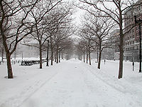
, with warm summers and cold, snowy winters. Massachusetts
Massachusetts
The Commonwealth of Massachusetts is a state in the New England region of the northeastern United States of America. It is bordered by Rhode Island and Connecticut to the south, New York to the west, and Vermont and New Hampshire to the north; at its east lies the Atlantic Ocean. As of the 2010...
is a state
U.S. state
A U.S. state is any one of the 50 federated states of the United States of America that share sovereignty with the federal government. Because of this shared sovereignty, an American is a citizen both of the federal entity and of his or her state of domicile. Four states use the official title of...
located in the New England
New England
New England is a region in the northeastern corner of the United States consisting of the six states of Maine, New Hampshire, Vermont, Massachusetts, Rhode Island, and Connecticut...
region of the northeastern
Northeastern United States
The Northeastern United States is a region of the United States as defined by the United States Census Bureau.-Composition:The region comprises nine states: the New England states of Connecticut, Maine, Massachusetts, New Hampshire, Rhode Island and Vermont; and the Mid-Atlantic states of New...
United States
United States
The United States of America is a federal constitutional republic comprising fifty states and a federal district...
. Most of its population of 6.4 million live in the Boston metropolitan area. The eastern half of this relatively small state is mostly urban
Urban area
An urban area is characterized by higher population density and vast human features in comparison to areas surrounding it. Urban areas may be cities, towns or conurbations, but the term is not commonly extended to rural settlements such as villages and hamlets.Urban areas are created and further...
and suburban. Massachusetts is the most populous of the six New England states and ranks third in overall population density and fourth by GDP per capita. Massachusetts receives about 40 inches (1016 mm) of rain annually, fairly evenly distributed throughout the year, slightly wetter during the winter. Summers are warm with average high temperatures in July above 80 °F (26.7 °C) and overnight lows above 60 °F (15.5 °C) common throughout the state. Winters are cold, but generally less extreme on the coast with high temperatures in the winter averaging above freezing even in January, although areas further inland are much colder. The state does have extreme temperatures from time to time with 90 °F (32.2 °C) in the summer and temperatures below 0 °F (-17.8 °C) in the winter not being unusual.
The state has its share of extreme weather, prone to nor'easter
Nor'easter
A nor'easter is a type of macro-scale storm along the East Coast of the United States and Atlantic Canada, so named because the storm travels to the northeast from the south and the winds come from the northeast, especially in the coastal areas of the Northeastern United States and Atlantic Canada...
s and to severe winter storms. Summers can bring thunderstorms, averaging around 30 days of thunderstorm activity per year. Massachusetts has had its share of destructive tornadoes, with the western part of the state slightly more vulnerable than coastal areas in the east. Massachusetts, like the entire United States eastern seaboard, is vulnerable to hurricanes. Because its location is farther east in the Atlantic Ocean than states farther south, Massachusetts has suffered a direct hit from a major hurricane three times since 1851, the same number of direct hits suffered by the southern Atlantic state of Georgia
Georgia (U.S. state)
Georgia is a state located in the southeastern United States. It was established in 1732, the last of the original Thirteen Colonies. The state is named after King George II of Great Britain. Georgia was the fourth state to ratify the United States Constitution, on January 2, 1788...
. More often hurricanes weakened to tropical storm strength pass near Massachusetts.
Massachusetts shares a fairly similar climate with the states of Connecticut
Connecticut
Connecticut is a state in the New England region of the northeastern United States. It is bordered by Rhode Island to the east, Massachusetts to the north, and the state of New York to the west and the south .Connecticut is named for the Connecticut River, the major U.S. river that approximately...
and Rhode Island
Rhode Island
The state of Rhode Island and Providence Plantations, more commonly referred to as Rhode Island , is a state in the New England region of the United States. It is the smallest U.S. state by area...
. All three states have a humid continental long summer climate, with hot summers and cold winters. Owing to thick deciduous
Deciduous
Deciduous means "falling off at maturity" or "tending to fall off", and is typically used in reference to trees or shrubs that lose their leaves seasonally, and to the shedding of other plant structures such as petals after flowering or fruit when ripe...
forests, fall in New England brings bright and colorful foliage, which comes earlier than in other regions, attracting tourism. Springs are generally wet and cloudy. Average rainfall generally ranges from 1,000 to 1,500 mm (40 to 60 in) a year. Snowfall can often exceed 100 in (2,500 mm) annually.
Climate type
Massachusetts's climate is the continental climate type. This is a found over large areas of land masses in the temperate regions of the mid-latitudes where there is a zone of conflict between polarNorth Pole
The North Pole, also known as the Geographic North Pole or Terrestrial North Pole, is, subject to the caveats explained below, defined as the point in the northern hemisphere where the Earth's axis of rotation meets its surface...
and tropical
Tropics
The tropics is a region of the Earth surrounding the Equator. It is limited in latitude by the Tropic of Cancer in the northern hemisphere at approximately N and the Tropic of Capricorn in the southern hemisphere at S; these latitudes correspond to the axial tilt of the Earth...
air mass
Air mass
In meteorology, an air mass is a volume of air defined by its temperature and water vapor content. Air masses cover many hundreds or thousands of square miles, and adopt the characteristics of the surface below them. They are classified according to latitude and their continental or maritime...
es. The humid continental climate is marked by variable weather patterns and a large seasonal temperature variance. The seasonal temperature variance can be as great as 91° Fahrenheit (33° Celsius), but is typically about 59-71° Fahrenheit (15 - 22° Celsius). The temperature difference between the warmest and coldest months increases as one moves further inland and away from the moderating influence of the ocean
Ocean
An ocean is a major body of saline water, and a principal component of the hydrosphere. Approximately 71% of the Earth's surface is covered by ocean, a continuous body of water that is customarily divided into several principal oceans and smaller seas.More than half of this area is over 3,000...
. Places with a hottest month temperature above 50°F (10 °C) and a coldest month temperature below 27°F (-3°C), and which do not meet the criteria for an arid climate, are classified as continental.
Temperature
Massachusetts sees a wide variety of temperatures throughout the year, averagely being as high as 82 °F (27 °C) in the summertime, and as low as 16 °F (-8 °C) in the wintertime. In the capital city of BostonBoston
Boston is the capital of and largest city in Massachusetts, and is one of the oldest cities in the United States. The largest city in New England, Boston is regarded as the unofficial "Capital of New England" for its economic and cultural impact on the entire New England region. The city proper had...
, the hottest month of the year is July, with an average high temperature of 82 °F (27 °C) and an average low temperature of 66 °F (18°C). in the state. February in the capital city of Boston has seen 70 °F (21 °C) only once in recorded history, on February 24, 1985. The maximum temperature recorded in March was 90 °F (32 °C), on March 31, 1998. Spring in Boston can be warm, with temperatures as high as the 90s when winds are offshore, though it is just as possible for a day in late May to remain in the lower 40s due to cool ocean waters. The hottest month is July, with an average high of 82 °F (28 °C) and average low of 66 °F (18 °C), with conditions usually humid. The coldest month is January, with an average high of 36 °F (2 °C) and an average low of 22 °F (-6 °C). Periods exceeding 90 °F (32.2 °C) in summer and below 10 °F (-12.2 °C) in winter are not uncommon, but rarely prolonged. The record high temperature is 104 °F (40 °C), recorded July 4, 1911. The record low temperature is -18 °F (-28 °C), recorded on February 9, 1934.
Cooler temperatures in the summertime are seen in the coastal areas of Massachusetts. In Cape Cod
Cape Cod
Cape Cod, often referred to locally as simply the Cape, is a cape in the easternmost portion of the state of Massachusetts, in the Northeastern United States...
, the warmest month of the year is July, with an average high temperature of 78 °F (25 °C) and an average low temperature of 63 °F (17 °C). Winters in coastal Massachusetts are nearly the same as winters on the mainland. In January, the coldest month of the year, Cape Cod has an average high temperature of 37 °F (2 °C) and an average low temperature of 21 °F (-6 °C).
| Monthly Normal High and Low Temperatures For Various Massachusetts Cities | ||||||||||||
| City | Jan | Feb | Mar | Apr | May | Jun | Jul | Aug | Sep | Oct | Nov | Dec |
|---|---|---|---|---|---|---|---|---|---|---|---|---|
| Boston | 36/22 | 39/24 | 46/32 | 56/40 | 67/50 | 77/59 | 82/66 | 80/64 | 72/57 | 62/46 | 52/38 | 42/28 |
| Worcester | 31/16 | 34/18 | 43/26 | 54/36 | 66/46 | 74/55 | 79/61 | 77/60 | 69/51 | 58/41 | 47/32 | 36/22 |
Nor'easters
Massachusetts is often hit with storms called "nor'easters" during the winter months of the year. A nor'easter is a stormStorm
A storm is any disturbed state of an astronomical body's atmosphere, especially affecting its surface, and strongly implying severe weather...
along the East Coast of the United States
East Coast of the United States
The East Coast of the United States, also known as the Eastern Seaboard, refers to the easternmost coastal states in the United States, which touch the Atlantic Ocean and stretch up to Canada. The term includes the U.S...
. The storm is named this because the winds in a nor'easter come from the northeast, especially in the coastal areas of the Northeastern United States
Northeastern United States
The Northeastern United States is a region of the United States as defined by the United States Census Bureau.-Composition:The region comprises nine states: the New England states of Connecticut, Maine, Massachusetts, New Hampshire, Rhode Island and Vermont; and the Mid-Atlantic states of New...
and Atlantic Canada
Atlantic Canada
Atlantic Canada is the region of Canada comprising the four provinces located on the Atlantic coast, excluding Quebec: the three Maritime provinces – New Brunswick, Prince Edward Island, and Nova Scotia – and Newfoundland and Labrador...
. More specifically, it describes a low pressure area
Low pressure area
A low-pressure area, or "low", is a region where the atmospheric pressure at sea level is below that of surrounding locations. Low-pressure systems form under areas of wind divergence which occur in upper levels of the troposphere. The formation process of a low-pressure area is known as...
whose center of rotation
Rotation
A rotation is a circular movement of an object around a center of rotation. A three-dimensional object rotates always around an imaginary line called a rotation axis. If the axis is within the body, and passes through its center of mass the body is said to rotate upon itself, or spin. A rotation...
is just off the East Coast and whose leading winds in the left forward quadrant rotate onto land from the northeast. The precipitation pattern is similar to other extratropical storm
Extratropical cyclone
Extratropical cyclones, sometimes called mid-latitude cyclones or wave cyclones, are a group of cyclones defined as synoptic scale low pressure weather systems that occur in the middle latitudes of the Earth having neither tropical nor polar characteristics, and are connected with fronts and...
s. Nor'easters also can cause coastal flooding, coastal erosion
Coastal erosion
Coastal erosion is the wearing away of land and the removal of beach or dune sediments by wave action, tidal currents, wave currents, or drainage...
, hurricane force
Beaufort scale
The Beaufort Scale is an empirical measure that relates wind speed to observed conditions at sea or on land. Its full name is the Beaufort Wind Force Scale.-History:...
winds, and heavy snow
Snow
Snow is a form of precipitation within the Earth's atmosphere in the form of crystalline water ice, consisting of a multitude of snowflakes that fall from clouds. Since snow is composed of small ice particles, it is a granular material. It has an open and therefore soft structure, unless packed by...
.
Nor'easters can occur at any time of the year but are mostly known for their presence in the winter season.
Most Nor'easters start from a low-pressure system that forms in the south, most often the Gulf of Mexico, and are drawn across to the Northeast by the Jet Stream. The divergence or diffluence in the upper atmosphere caused by the Jet Stream
Jet stream
Jet streams are fast flowing, narrow air currents found in the atmospheres of some planets, including Earth. The main jet streams are located near the tropopause, the transition between the troposphere and the stratosphere . The major jet streams on Earth are westerly winds...
removes and disburses the rising air at a faster rate than it is replaced at the surface, which, along with the Coriolis Effect
Coriolis effect
In physics, the Coriolis effect is a deflection of moving objects when they are viewed in a rotating reference frame. In a reference frame with clockwise rotation, the deflection is to the left of the motion of the object; in one with counter-clockwise rotation, the deflection is to the right...
, creates and develops a storm
Storm
A storm is any disturbed state of an astronomical body's atmosphere, especially affecting its surface, and strongly implying severe weather...
. Their northeast track brings them up along the East Coast past the mid-Atlantic and New England coastal states. The counterclockwise flow around a low pressure system brings the warm moist oceanic air over land. The warm moist air meets cold air carried southward by the trough. The deepening low enhances the surrounding pressure gradient, which acts to spiral the very different air masses toward each other at an even faster rate. The greater the temperature differences between the two air masses, the greater the turbulence and instability, and the more severe the storm can become.
If the nor'easter takes the East Coast track, that usually indicates the presence of a high pressure
High pressure
High pressure in science and engineering is studying the effects of high pressure on materials and the design and construction of devices, such as a diamond anvil cell, which can create high pressure...
area in the vicinity of Bermuda
Bermuda
Bermuda is a British overseas territory in the North Atlantic Ocean. Located off the east coast of the United States, its nearest landmass is Cape Hatteras, North Carolina, about to the west-northwest. It is about south of Halifax, Nova Scotia, Canada, and northeast of Miami, Florida...
. The storm will then reach the North Carolina
North Carolina
North Carolina is a state located in the southeastern United States. The state borders South Carolina and Georgia to the south, Tennessee to the west and Virginia to the north. North Carolina contains 100 counties. Its capital is Raleigh, and its largest city is Charlotte...
coast and begin to develop. At this time, the nor'easter can move slightly offshore, which would be the more destructive path, or, it can move slightly inland, which would present mostly rain. If it takes the offshore path, it would begin to rapidly strengthen. Now, the effects would start reaching the major cities of the Northeast, such as Boston
Boston
Boston is the capital of and largest city in Massachusetts, and is one of the oldest cities in the United States. The largest city in New England, Boston is regarded as the unofficial "Capital of New England" for its economic and cultural impact on the entire New England region. The city proper had...
. The storm, now rapidly intensifying, tracks northward. These storms sometimes intensify during their entire existence. The storm moves northward, following the topography of the East Coast. It usually reaches its peak intensity while off the Canadian coast
Canada
Canada is a North American country consisting of ten provinces and three territories. Located in the northern part of the continent, it extends from the Atlantic Ocean in the east to the Pacific Ocean in the west, and northward into the Arctic Ocean...
. The storm then reaches Arctic areas, and can reach intensities equal to a strong hurricane
Tropical cyclone
A tropical cyclone is a storm system characterized by a large low-pressure center and numerous thunderstorms that produce strong winds and heavy rain. Tropical cyclones strengthen when water evaporated from the ocean is released as the saturated air rises, resulting in condensation of water vapor...
. They then meander throughout the North Atlantic and can last for several weeks.
Tornadoes
Massachusetts is not hit by very many tornadoes, but has been part of one very notable event, the Flint-Worcester tornado outbreak sequence.The massive Worcester tornado was on the ground for nearly an hour and a half. In that period it traveled 46 miles (74 km), reached 1 miles (1.6 km) in width and injured 1,300 people. At 5:08 P.M., the tornado entered Worcester and grew to an unprecedented width of 1 mile. Damage was phenomenal in Worcester (second largest city in Massachusetts) and in some areas equaled the worst damage in any U.S. tornado. Hardest-hit areas included Assumption CollegeAssumption College
Assumption College is a private, Roman Catholic, liberal arts college located on 185 acres in Worcester, Massachusetts. Assumption has an enrollment of about 2,117 undergraduates...
, where a priest and 2 nuns were killed. The main building's 3 foot (0.9144 m)-thick brick walls were reduced by 3 floors, and the landmark tower lost 3 stories. The nearby Burncoat Hill neighborhood saw heavy devastation (especially on its western slope), but it was the Uncatena-Great Brook Valley neighborhoods to the east of Burncoat Hill that were utterly leveled, houses simply vanishing and debris swept clean from the sites. Forty people died in the Uncatena-Great Brook Valley areas alone. A 12-ton bus was picked up, rolled over several times and was thrown against the newly-constructed Curtis Apts. in Great Brook Valley, resulting in the deaths of 2 passengers. The Curtis Apts. blueprints were blown all the way to Duxbury (near Plymouth), 75 miles (120.7 km) away. Across Boylston St. from the Curtis Apts., the Brookside Home Farm (a city-operated dairy facility and laundry) sustained total damage, with 6 men killed and the loss of its herd of 80 Holsteins. Wrecked houses and bodies were blown into Lake Quinsigamond
Lake Quinsigamond
Lake Quinsigamond is a body of water situated between the city of Worcester and the town of Shrewsbury in Worcester County, Massachusetts, USA. It is 4 miles long, between 50 and 85 feet deep, and has a surface area of approximately 772 acres . Lake Quinsigamond hosts 8 islands with the...
. The 6 fatalities at Brookside were the most in any 1 particular building in the tornado. Ninety-four people were killed.
Tropical cyclones
.jpg)
Tropical cyclone
A tropical cyclone is a storm system characterized by a large low-pressure center and numerous thunderstorms that produce strong winds and heavy rain. Tropical cyclones strengthen when water evaporated from the ocean is released as the saturated air rises, resulting in condensation of water vapor...
s. One of these was the New England Hurricane of 1938
New England Hurricane of 1938
The New England Hurricane of 1938 was the first major hurricane to strike New England since 1869...
. The storm formed near the coast of Africa
Africa
Africa is the world's second largest and second most populous continent, after Asia. At about 30.2 million km² including adjacent islands, it covers 6% of the Earth's total surface area and 20.4% of the total land area...
in September of the 1938 Atlantic hurricane season
1938 Atlantic hurricane season
The 1938 Atlantic hurricane season officially began on June 16, 1938, and lasted until October 31, 1938. These dates conventionally delimit the period of each year when most tropical cyclones form in the Atlantic basin.-Tropical Storm One:...
, becoming a Category 5 hurricane on the Saffir-Simpson Hurricane Scale
Saffir-Simpson Hurricane Scale
The Saffir–Simpson Hurricane Scale , or the Saffir–Simpson Hurricane Wind Scale , classifies hurricanes — Western Hemisphere tropical cyclones that exceed the intensities of tropical depressions and tropical storms — into five categories distinguished by the intensities of their sustained winds...
before making landfall as a Category 3 hurricane on Long Island
Long Island
Long Island is an island located in the southeast part of the U.S. state of New York, just east of Manhattan. Stretching northeast into the Atlantic Ocean, Long Island contains four counties, two of which are boroughs of New York City , and two of which are mainly suburban...
on September 21. The hurricane killed over 682 people, damaged or destroyed over 57,000 homes, and caused property losses estimated at $4.7 billion (2005 US dollars). In 1951 damaged trees and buildings were still to be seen in the affected areas. The eye of the storm followed the Connecticut River
Connecticut River
The Connecticut River is the largest and longest river in New England, and also an American Heritage River. It flows roughly south, starting from the Fourth Connecticut Lake in New Hampshire. After flowing through the remaining Connecticut Lakes and Lake Francis, it defines the border between the...
north into Massachusetts, where the winds and flooding killed 99 people. In Springfield
Springfield, Massachusetts
Springfield is the most populous city in Western New England, and the seat of Hampden County, Massachusetts, United States. Springfield sits on the eastern bank of the Connecticut River near its confluence with three rivers; the western Westfield River, the eastern Chicopee River, and the eastern...
, the river rose to 6 to 10 ft (1.8 to 3 m) above flood stage, causing significant damage. Up to 6 inches (152 mm) of rain fell across western Massachusetts, which combined with over 4 inches (102 mm) that had fallen a few days earlier produced widespread flooding. Residents of Ware
Ware, Massachusetts
Ware is a town in Hampshire County, Massachusetts, United States. The population was 9,707 at the 2000 census. It is part of the Springfield, Massachusetts Metropolitan Statistical Area.Part of the town comprises the census-designated place of Ware....
were stranded for days, and relied on air-dropped food and medicine. After the flood receded, the town's Main Street was left a chasm in which sewer pipes could be seen. To the east, the surge left Falmouth
Falmouth, Massachusetts
Falmouth is a town in Barnstable County, Massachusetts, United States; Barnstable County is coextensive with Cape Cod. The population was 31,531 at the 2010 census....
and New Bedford
New Bedford, Massachusetts
New Bedford is a city in Bristol County, Massachusetts, United States, located south of Boston, southeast of Providence, Rhode Island, and about east of Fall River. As of the 2010 census, the city had a total population of 95,072, making it the sixth-largest city in Massachusetts...
under 8 feet (2.4 m) of water. Two-thirds of all the boats in New Bedford harbor sank. The Blue Hills Observatory
Blue Hill Meteorological Observatory
The Blue Hill Meteorological Observatory, also known as Great Blue Hill Weather Observatory, Blue Hill Weather Observatory, or simply the Blue Hill Observatory, in Milton, Massachusetts is the foremost structure associated with the history of weather observations in the United States...
registered sustained winds of 121 mph (195 km/h) and a peak gust of 186 mph (299 km/h).
Hurricane Gloria
Hurricane Gloria
Hurricane Gloria was a powerful Cape Verde-type hurricane that formed during the 1985 Atlantic hurricane season and prowled the Atlantic Ocean from September 16 to September 28. Gloria reached Category 4 status on the Saffir-Simpson Hurricane Scale near the Bahamas, but weakened significantly...
also glancingly struck Massachusetts.