
Connecticut River
Encyclopedia
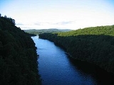
The Connecticut River is the largest and longest river
in New England
, and also an American Heritage River. It flows roughly south, starting from the Fourth Connecticut Lake
in New Hampshire
. After flowing through the remaining Connecticut Lakes
and Lake Francis
, it defines the border between the states of New Hampshire and Vermont
. The river then flows through the fertile Pioneer Valley
of western
Massachusetts
and past Springfield
, the most populous city on the river. 4 miles (6 km) south of Springfield, the river enters Connecticut
, where it spurred the growth of Hartford
, the second largest city (and only state capital) along the river, situated just 24 miles (38.6 km) miles south of Springfield. From Hartford, the Connecticut River veers southeastward and ultimately discharges into the Long Island Sound
at Old Saybrook
and Old Lyme, Connecticut
. The Connecticut River has a total length of 407 miles (655 km), and a drainage basin
extending over 11250 square miles (29,137.4 km²). The mean freshwater discharge into Long Island Sound
is 19600 cubic feet (555 m³) per second.
The Connecticut River is tidal up to Windsor Locks, Connecticut
, approximately 60 miles (96.6 km) from the mouth. Major tributaries include the Ashuelot
, West
, Miller's
, Deerfield
, White
, and Chicopee
rivers. The Swift River, a tributary of the Chicopee, has been dammed and largely replaced by the Quabbin Reservoir
which provides water
to the Massachusetts Water Resources Authority
district in eastern Massachusetts.
The river carries a heavy amount of silt
, especially during the spring snow melt, from as far north as Quebec
. The heavy silt concentration of the river forms a large sandbar near its mouth on Long Island Sound and has historically provided a formidable obstacle to navigation. The difficulty of navigation on the river is the primary reason that it is one of the few important rivers in the United States without a major city at its mouth. The Connecticut River estuary
and tidal wetlands complex is listed as one of the 1,759 wetlands of international importance under the Ramsar Convention on Wetlands
.
 The Connecticut River's name is a French corruption of the Algonquian
word quinetucket, which means "long tidal river". The first European to see the Connecticut River was the Dutch
explorer Adriaen Block
in 1614. As a result of this exploration, the Dutch named the Connecticut River the "Fresh River", and it became the northeastern location of the New Netherland
colony. In 1623, the Dutch built a fortified trading post called the Fort Huys de Goede Hoop (Fort House of Good Hope) on the site that would grow to be modern Hartford
.
colonist to record his visit to the Connecticut River was Edward Winslow
from the Plymouth Colony
, in 1632. In 1633, the English built their first settlement and trading post at the site of present-day Windsor, Connecticut
(then called Matianuck). In 1634, a group of settlers from Watertown, Massachusetts
, seeking to practice religion more strictly than it was being practiced near Boston
, founded Wethersfield, Connecticut
. The following year, in 1635, the renowned Reverend Thomas Hooker
led settlers from Cambridge, Massachusetts
, where Hooker had been having religious disagreements with that settlement's Reverend John Cotton, and founded the more liberal Hartford (then called Newtowne). Immediately, Newtowne annexed Matianuck, i.e. Hartford annexed Windsor, based on laws supposedly articulated in Connecticut's original settlement charter, the Warwick Patent; however, the "patent" had been physically lost and the annexation was most certainly illegal. In 1636, after the previous year sending out a scouting party to determine the Connecticut River Valley's most valuable land for trading and agricultural businesses, Puritan iconoclast William Pynchon
founded Springfield, Massachusetts
. Springfield is located on fertile farmland just above the Connecticut River's first large falls, the Enfield Falls. A savvy businessman, Pynchon realized that all northern riverboat trade would necessarily have to change ships in Springfield. Also, the Connecticut River's largest falls at 58 feet (17.7 m) is located 8 miles (13 km) north of Springfield in present-day Holyoke
, so Pynchon realized that he had, for lack of a better term, a 'captive audience' in Springfield.
, Hartford
, and Windsor
. In the spring of 1640, grain was very scarce; cattle were dying of starvation. The Connecticut River Valley settlements of Windsor (then called "Matianuck") and Hartford (then called "Newtown") gave power to William Pynchon to buy corn for all three English settlements. If the Natives would not sell their corn at market prices, then Pynchon was authorized to offer more money. The Natives refused to sell their corn at market prices, and then later refused to sell it at "reasonable" prices. Pynchon refused to buy it, believing it best not to broadcast the English colonists' weaknesses, and also wanting to keep market values steady for the benefit of the colonists in the future.
Leading citizens of (what would become) Hartford were furious with Pynchon. With Windsor's and Wethersfield's consent, the three southerly settlements commissioned the famed Native American-conqueror Captain John Mason to travel to Springfield with "money in one hand and a sword in the other." On reaching (what would become) Springfield, Mason threatened the Natives with war if they did not sell their corn at a "reasonable price." The Natives capitulated and ultimately sold the colonists' corn; however, Mason's violent approach led to the Natives' deepening distrust of the English colonists. Pynchon, an avowed "man of peace," believed in cooperation with the Natives, whereas Mason – a hero of the Pequot War
and conqueror of Connecticut – believed in using force. This philosophical difference led to Mason using "hard words" against Pynchon. Pynchon's settlement, however, agreed with him and that same year voted to separate from the Connecticut Colony. While this local controversy was heating up, the Massachusetts Bay Colony
decided to reassert its jurisdiction over land bordering the Connecticut River, believing it to be very valuable. When the dust finally settled, William Pynchon was named magistrate of Agawam by the Massachusetts Bay Colony and, in honor of his importance, the settlement was renamed Springfield after the village of Springfield
near Chelmsford
, Essex
, in England, where William Pynchon was raised.
The philosophical differences between Springfield and Connecticut were exacerbated by one final confrontation in 1641. Hartford had been keeping a fort at the mouth of the Connecticut River at Old Saybrook, for protection against the Natives and the New Netherland
Colony. After Springfield sided with the Massachusetts Bay Colony over the Connecticut Colony
, Connecticut demanded that Springfield's boats pay a toll when passing the fort. Pynchon would have been agreeable to this if Springfield could have had representation at the fort (like Hartford, Wethersfield, and Windsor did); however, Pynchon did not agree with the idea of taxation without representation. Connecticut refused to allow Springfield representation at the fort, so Pynchon refused to pay Connecticut's toll. The Massachusetts Bay Colony
took Pynchon's side, and in response, required a toll on Connecticut ships entering Boston Harbor. Connecticut, which was then largely dependent on trade with Boston, immediately dropped the tax on Springfield.
Only within the first decade of the new millennium have Hartford and Springfield, the two great cities on the Connecticut River, started to work collaboratively again (i.e. with the Knowledge Corridor
Partnership).
As the number of English colonists increased, the Dutch position became untenable, and in 1654 a treaty was negotiated between New Netherland and the New England
colonies relocating the boundary between them significantly to the west, near present-day Greenwich, Connecticut
. Significantly, the treaty allowed the Dutch to maintain their trading post at Foot Huys de Goede Hoop, which they did until the 1664 British takeover of New Netherland. The Fort at Number 4
, now Charlestown, New Hampshire
, was the northernmost English settlement on the river until the end of the French and Indian War
in 1763.
, ending the American Revolutionary War
, the new border between New Hampshire and what was to become the Province of Canada
was defined to include the "northwesternmost headwaters of the Connecticut" . Because there are several streams that could fit that description, a boundary dispute led to the short-lived Indian Stream Republic, which existed from 1832 to 1835. At the time, the river also represented the border between New Hampshire
and New York
, Vermont
having not yet been created.
At first the broad, fertile Connecticut River valley attracted agricultural colonists and colonial traders, but later the high volume and fall of the river led to the rise of manufacturing. During the Industrial Revolution
, the cities of Springfield, Massachusetts
and Hartford, Connecticut
, in particular, became centers of innovation and "intense and concentrated prosperity." The greatest single drop on the Connecticut, of 58 feet (17.7 m), is at Holyoke, Massachusetts
. 8 miles (12.9 km) south of Holyoke sits the river's most populous city, Springfield. The second-most populous city on the river is Hartford, the capital of Connecticut. Springfield and Hartford sit only 24 miles (38.6 km) apart, with Bradley International Airport
halfway between them in the town of Windsor Locks, Connecticut
. The Hartford-Springfield Knowledge Corridor
is New England's second-most populous region, with approximately 1.9 million residents, including 160,000 university students. Other important centers on the Connecticut River include Northampton, Massachusetts
, Middletown, Connecticut
, and Brattleboro, Vermont
.
In 1829 the Enfield Falls Canal
was opened to circumvent shallows near the Connecticut's first falls, the Enfield Falls. The locks built for this canal gave their name to the town of Windsor Locks, Connecticut
.
In the late 19th century the river was used for massive logging drives from the far north, particularly the Nulhegan River basin in Essex County, Vermont
. These spring drives were stopped after 1915, when pleasure boat owners complained about the hazards to navigation.
was topped by 19 feet (5.8 m). Sandbagging by the National Guard and local volunteers helped prevent the dam's powerhouse from being overwhelmed, despite blocks of ice breaking through the upstream walls.
In Northampton, Massachusetts
, looting during the flood became a problem, causing the mayor of the city to deputize citizen patrols to protect flooded areas. Over 3000 refugees from the area were housed in Amherst College
and the Massachusetts State Agricultural College (now UMass Amherst).
Unprecedented accumulated ice jams compounded the problems created by the flood, diverting water into unusual channels and damming the river, raising water levels even further. When the jam at Hadley, Massachusetts
gave way, the water crest overflowed the dam at Holyoke
overwhelming the sandbagging there. The town of South Hadley Falls was essentially destroyed, and the southern parts of Holyoke were severely damaged, with 500 refugees.
In Springfield, Massachusetts
, 5 sq mi (12.9 km²), and 18 miles (29 km) of streets, were flooded, and 20,000 people lost their homes. The city lost power, and nighttime looting caused the police to issue a "shoot on sight" edict; 800 National Guard troops were brought in to help maintain order. Rescue efforts using a flotilla of boats saved people trapped in upper stories of buildings, bringing them to local fraternal lodges, schools, churches and monasteries for lodging, medical care, and food. The American Red Cross
and local, state and Federal agencies, including the WPA
and the CCC
, contributed aid and manpower to the effort. Flooding of roads isolated the city for a time. When the water receded, it left behind silt-caused mud which in places was 3 foot (0.9144 m) thick; the recovery effort in Springfield, at the height of the American Great Depression
, took approximately a decade.
Overall, the flood caused 171 deaths and $500 million in damages in 1936 dollars. Across the northeast, over 430,000 people were made homeless or destitute by flooding that year.
The Connecticut River Flood Control Compact
between the states of Connecticut, Massachusetts, New Hampshire, and Vermont was established in 1953 to help prevent serious flooding.
in the 1930s diverted the Swift River
, which feeds the Chicopee River
, a tributary of the Connecticut. This resulted in an unsuccessful lawsuit by the state of Connecticut against the diversion of its riparian waters.
Demand for drinking water in eastern Massachusetts passed the sustainable supply from the existing system in 1969. Diverting water from the Connecticut River was considered several times, but in 1986 the Massachusetts Water Resources Authority
instead undertook a campaign of water conservation. Demand was reduced to sustainable levels by 1989, reaching approximately a 25% margin of safety by 2009.
 The Water Quality Act of 1965 has had a major impact on controlling water pollution
in the Connecticut River and its tributaries. Since then, the river has been restored from Class D to Class B (fishable and swimable). It was designated as one of the American Heritage Rivers
in 1997. The towns along the lower end of the river have enacted a cap on further development
along the banks, so that no buildings may be constructed except on existing foundations.
There is now a website which provides water quality
reports twice a week, indicating whether various portions of the river are safe for swimming, boating and fishing.
is thought to be one of the busiest stretches of waterway in Connecticut. Some local police departments and the state Environmental Conservation Police patrol the area a few times a week. Some towns keep boats available if needed. In Massachusetts, the most active stretch of the Connecticut River is centered on The Oxbow
, 14 miles (22.5 km) north of Springfield
in the college town
of Northampton
.
 The Connecticut River is a habitat to several species of anadromous and catadromous fish, including the American shad
, American eel
, striped bass
and the sea lamprey
. The United States Fish and Wildlife Service
is undertaking an effort to repopulate the river with another species of migratory fish, the Atlantic salmon
. For more than 200 years, Atlantic salmon have been extinct from the river due to dam
ming. Several fish ladder
s and fish elevators have been built to allow fish to resume their natural migration upriver each spring.
The headwaters of the Connecticut River are at the northern tip of New Hampshire, near the Canadian
border. Much of the beginning of the river's course in the town of Pittsburg
is occupied by the Connecticut Lakes
, a chain of deep, cold water lakes that are home to lake trout
and landlocked salmon
.
The river itself holds native brook trout
, rainbow trout
, large brown trout
, shad
, smallmouth bass
, striped bass
, carp
, catfish
, American eel
, and several other species of game fish. Landlocked salmon make their way into the river during spring spawning runs of bait fish
and during their fall spawn. The river has fly-fishing-only regulations on 5 miles (8 km) of river. Most of the river from Lake Francis
south is open to lure and bait as well. Two tail-water dams provide cold river water for miles downstream making summer fishing on the Connecticut River excellent.

.jpg) Listed from south to north by location of mouth:
Listed from south to north by location of mouth:
's Northeast Corridor
, Interstate 95
(Connecticut Turnpike
), Interstate 90
(Massachusetts Turnpike
), Interstate 89
, and Interstate 84. In addition, Interstate 91
, whose route largely follows the river north-south, crosses it twice - once in Connecticut and once in Massachusetts.
River
A river is a natural watercourse, usually freshwater, flowing towards an ocean, a lake, a sea, or another river. In a few cases, a river simply flows into the ground or dries up completely before reaching another body of water. Small rivers may also be called by several other names, including...
in New England
New England
New England is a region in the northeastern corner of the United States consisting of the six states of Maine, New Hampshire, Vermont, Massachusetts, Rhode Island, and Connecticut...
, and also an American Heritage River. It flows roughly south, starting from the Fourth Connecticut Lake
Fourth Connecticut Lake
The Fourth Connecticut Lake is the northernmost, smallest and most remote of the Connecticut Lakes in New Hampshire, United States of America. It is the source of the Connecticut River. The Fourth Connecticut Lake Trail, which criss-crosses the international border between the United States and...
in New Hampshire
New Hampshire
New Hampshire is a state in the New England region of the northeastern United States of America. The state was named after the southern English county of Hampshire. It is bordered by Massachusetts to the south, Vermont to the west, Maine and the Atlantic Ocean to the east, and the Canadian...
. After flowing through the remaining Connecticut Lakes
Connecticut Lakes
The Connecticut Lakes are a group of lakes in northern New Hampshire, situated along the headwaters of the Connecticut River. They are accessed via the northernmost segment of U.S. Route 3 . The lakes are located within the boundaries of Pittsburg, but are far from the town center...
and Lake Francis
Lake Francis (Murphy Dam)
Lake Francis is a reservoir on the Connecticut River in northern New Hampshire. The lake is located in Coos County, east of the village of Pittsburg and along the boundary between the towns of Pittsburg and Clarksville. The lake, impounded by Murphy Dam, covers nearly .The lake was mentioned as...
, it defines the border between the states of New Hampshire and Vermont
Vermont
Vermont is a state in the New England region of the northeastern United States of America. The state ranks 43rd in land area, , and 45th in total area. Its population according to the 2010 census, 630,337, is the second smallest in the country, larger only than Wyoming. It is the only New England...
. The river then flows through the fertile Pioneer Valley
Pioneer Valley
The Pioneer Valley is the colloquial name for the U.S. Commonwealth of Massachusetts's portion of the Connecticut River Valley. The Pioneer Valley consists of three counties in Massachusetts which collectively feature much of New England's most fertile farmland...
of western
Western Massachusetts
Western Massachusetts is a loosely defined geographical region of the U.S. state of Massachusetts which contains the Berkshires, the Pioneer Valley, and some or all of the Swift River Valley. The region is always considered to include Berkshire, Franklin, Hampshire, and Hampden counties, and the...
Massachusetts
Massachusetts
The Commonwealth of Massachusetts is a state in the New England region of the northeastern United States of America. It is bordered by Rhode Island and Connecticut to the south, New York to the west, and Vermont and New Hampshire to the north; at its east lies the Atlantic Ocean. As of the 2010...
and past Springfield
Springfield, Massachusetts
Springfield is the most populous city in Western New England, and the seat of Hampden County, Massachusetts, United States. Springfield sits on the eastern bank of the Connecticut River near its confluence with three rivers; the western Westfield River, the eastern Chicopee River, and the eastern...
, the most populous city on the river. 4 miles (6 km) south of Springfield, the river enters Connecticut
Connecticut
Connecticut is a state in the New England region of the northeastern United States. It is bordered by Rhode Island to the east, Massachusetts to the north, and the state of New York to the west and the south .Connecticut is named for the Connecticut River, the major U.S. river that approximately...
, where it spurred the growth of Hartford
Hartford, Connecticut
Hartford is the capital of the U.S. state of Connecticut. The seat of Hartford County until Connecticut disbanded county government in 1960, it is the second most populous city on New England's largest river, the Connecticut River. As of the 2010 Census, Hartford's population was 124,775, making...
, the second largest city (and only state capital) along the river, situated just 24 miles (38.6 km) miles south of Springfield. From Hartford, the Connecticut River veers southeastward and ultimately discharges into the Long Island Sound
Long Island Sound
Long Island Sound is an estuary of the Atlantic Ocean, located in the United States between Connecticut to the north and Long Island, New York to the south. The mouth of the Connecticut River at Old Saybrook, Connecticut, empties into the sound. On its western end the sound is bounded by the Bronx...
at Old Saybrook
Old Saybrook, Connecticut
Old Saybrook is a town in Middlesex County, Connecticut, United States. The population was 10,367 at the 2000 census. It contains the incorporated borough of Fenwick, as well as the census-designated places of Old Saybrook Center and Saybrook Manor.-History:...
and Old Lyme, Connecticut
Old Lyme, Connecticut
Old Lyme is a town in New London County, Connecticut, United States. The Main Street of the town is a historic district. The town has long been a popular summer resort and artists' colony...
. The Connecticut River has a total length of 407 miles (655 km), and a drainage basin
Drainage basin
A drainage basin is an extent or an area of land where surface water from rain and melting snow or ice converges to a single point, usually the exit of the basin, where the waters join another waterbody, such as a river, lake, reservoir, estuary, wetland, sea, or ocean...
extending over 11250 square miles (29,137.4 km²). The mean freshwater discharge into Long Island Sound
Long Island Sound
Long Island Sound is an estuary of the Atlantic Ocean, located in the United States between Connecticut to the north and Long Island, New York to the south. The mouth of the Connecticut River at Old Saybrook, Connecticut, empties into the sound. On its western end the sound is bounded by the Bronx...
is 19600 cubic feet (555 m³) per second.
The Connecticut River is tidal up to Windsor Locks, Connecticut
Windsor Locks, Connecticut
Windsor Locks is a town located in Hartford County, Connecticut, United States. As of the 2000 census, its population was 12,043. It is the site of Bradley International Airport, which serves the Greater Hartford-Springfield region. It is also the site of the New England Air Museum...
, approximately 60 miles (96.6 km) from the mouth. Major tributaries include the Ashuelot
Ashuelot River
The Ashuelot River is a tributary of the Connecticut River, approximately long, in southwestern New Hampshire in the United States. It drains a mountainous area of , including much of the area known as the Monadnock Region...
, West
West River (Vermont)
The West River is a tributary of the Connecticut River, about long, in southern Vermont in the United States. According to the Geographic Names Information System, it has also been known historically as "Wantastiquet" and as "Waters of the Lonely Way"...
, Miller's
Millers River
The Millers River is a river in northern Massachusetts, originating in Ashburnham and joining the Connecticut River just downstream from Millers Falls, Massachusetts...
, Deerfield
Deerfield River
Deerfield River is a river that runs for from southern Vermont through northwestern Massachusetts to the Connecticut River. The Deerfield was historically influential in the settlement of western Franklin County, Massachusetts, and its namesake town...
, White
White River (Vermont)
The White River is a river in the U.S. state of Vermont. It is a tributary of the Connecticut River.The White River rises at Skylight Pond south of Bread Loaf Mountain near the crest of the Green Mountains. The river flows east to the town of Granville, where it receives the outflow from the...
, and Chicopee
Chicopee River
The Chicopee River is an tributary of the Connecticut River in Metropolitan Springfield, Massachusetts, known for fast-moving water and its extraordinarily large basin: the Connecticut River's largest tributary basin...
rivers. The Swift River, a tributary of the Chicopee, has been dammed and largely replaced by the Quabbin Reservoir
Quabbin Reservoir
The Quabbin Reservoir is the largest inland body of water in the Commonwealth of Massachusetts and was built between 1930 and 1939. Today along with the Wachusett Reservoir, it is the primary water supply for Boston, some to the east, as well as 40 other communities in Greater Boston...
which provides water
Water supply network
A water supply system or water supply network is a system of engineered hydrologic and hydraulic components which provide water supply. A water supply system typically includes:# A drainage basin ;...
to the Massachusetts Water Resources Authority
Massachusetts Water Resources Authority
The Massachusetts Water Resources Authority is a public authority in the Commonwealth of Massachusetts that provides wholesale drinking water and sewage services to certain municipalities and industrial users in the state, primarily in the Boston area.The authority receives water from the Quabbin...
district in eastern Massachusetts.
The river carries a heavy amount of silt
Silt
Silt is granular material of a size somewhere between sand and clay whose mineral origin is quartz and feldspar. Silt may occur as a soil or as suspended sediment in a surface water body...
, especially during the spring snow melt, from as far north as Quebec
Quebec
Quebec or is a province in east-central Canada. It is the only Canadian province with a predominantly French-speaking population and the only one whose sole official language is French at the provincial level....
. The heavy silt concentration of the river forms a large sandbar near its mouth on Long Island Sound and has historically provided a formidable obstacle to navigation. The difficulty of navigation on the river is the primary reason that it is one of the few important rivers in the United States without a major city at its mouth. The Connecticut River estuary
Estuary
An estuary is a partly enclosed coastal body of water with one or more rivers or streams flowing into it, and with a free connection to the open sea....
and tidal wetlands complex is listed as one of the 1,759 wetlands of international importance under the Ramsar Convention on Wetlands
Ramsar Convention
The Ramsar Convention is an international treaty for the conservation and sustainable utilization of wetlands, i.e., to stem the progressive encroachment on and loss of wetlands now and in the future, recognizing the fundamental ecological functions of wetlands and their economic, cultural,...
.
History
Algonquian languages
The Algonquian languages also Algonkian) are a subfamily of Native American languages which includes most of the languages in the Algic language family. The name of the Algonquian language family is distinguished from the orthographically similar Algonquin dialect of the Ojibwe language, which is a...
word quinetucket, which means "long tidal river". The first European to see the Connecticut River was the Dutch
Dutch colonization of the Americas
Dutch trading posts and plantations in the Americas precede the much wider known colonization activities of the Dutch in Asia. Whereas the first Dutch fort in Asia was built in 1600 , the first forts and settlements on the Essequibo river in Guyana and on the Amazon date from the 1590s...
explorer Adriaen Block
Adriaen Block
Adriaen Block was a Dutch private trader and navigator who is best known for exploring the coastal and river valley areas between present-day New Jersey and Massachusetts during four voyages from 1611 to 1614, following the 1609 expedition by Henry Hudson...
in 1614. As a result of this exploration, the Dutch named the Connecticut River the "Fresh River", and it became the northeastern location of the New Netherland
New Netherland
New Netherland, or Nieuw-Nederland in Dutch, was the 17th-century colonial province of the Republic of the Seven United Netherlands on the East Coast of North America. The claimed territories were the lands from the Delmarva Peninsula to extreme southwestern Cape Cod...
colony. In 1623, the Dutch built a fortified trading post called the Fort Huys de Goede Hoop (Fort House of Good Hope) on the site that would grow to be modern Hartford
Hartford, Connecticut
Hartford is the capital of the U.S. state of Connecticut. The seat of Hartford County until Connecticut disbanded county government in 1960, it is the second most populous city on New England's largest river, the Connecticut River. As of the 2010 Census, Hartford's population was 124,775, making...
.
The formation of the Connecticut Colony
The first EnglishBritish colonization of the Americas
British colonization of the Americas began in 1607 in Jamestown, Virginia and reached its peak when colonies had been established throughout the Americas...
colonist to record his visit to the Connecticut River was Edward Winslow
Edward Winslow
Edward Winslow was an English Pilgrim leader on the Mayflower. He served as the governor of Plymouth Colony in 1633, 1636, and finally in 1644...
from the Plymouth Colony
Plymouth Colony
Plymouth Colony was an English colonial venture in North America from 1620 to 1691. The first settlement of the Plymouth Colony was at New Plymouth, a location previously surveyed and named by Captain John Smith. The settlement, which served as the capital of the colony, is today the modern town...
, in 1632. In 1633, the English built their first settlement and trading post at the site of present-day Windsor, Connecticut
Windsor, Connecticut
Windsor is a town in Hartford County, Connecticut, United States, and was the first English settlement in the state. It lies on the northern border of Connecticut's capital, Hartford. The population was estimated at 28,778 in 2005....
(then called Matianuck). In 1634, a group of settlers from Watertown, Massachusetts
Watertown, Massachusetts
The Town of Watertown is a city in Middlesex County, Massachusetts, United States. The population was 31,915 at the 2010 census.- History :Archeological evidence suggests that Watertown was inhabited for thousands of years before the arrival of settlers from England...
, seeking to practice religion more strictly than it was being practiced near Boston
Boston
Boston is the capital of and largest city in Massachusetts, and is one of the oldest cities in the United States. The largest city in New England, Boston is regarded as the unofficial "Capital of New England" for its economic and cultural impact on the entire New England region. The city proper had...
, founded Wethersfield, Connecticut
Wethersfield, Connecticut
Wethersfield is a town in Hartford County, Connecticut, United States. Many records from colonial times spell the name Weathersfield, while Native Americans called it Pyquag...
. The following year, in 1635, the renowned Reverend Thomas Hooker
Thomas Hooker
Thomas Hooker was a prominent Puritan colonial leader, who founded the Colony of Connecticut after dissenting with Puritan leaders in Massachusetts...
led settlers from Cambridge, Massachusetts
Cambridge, Massachusetts
Cambridge is a city in Middlesex County, Massachusetts, United States, in the Greater Boston area. It was named in honor of the University of Cambridge in England, an important center of the Puritan theology embraced by the town's founders. Cambridge is home to two of the world's most prominent...
, where Hooker had been having religious disagreements with that settlement's Reverend John Cotton, and founded the more liberal Hartford (then called Newtowne). Immediately, Newtowne annexed Matianuck, i.e. Hartford annexed Windsor, based on laws supposedly articulated in Connecticut's original settlement charter, the Warwick Patent; however, the "patent" had been physically lost and the annexation was most certainly illegal. In 1636, after the previous year sending out a scouting party to determine the Connecticut River Valley's most valuable land for trading and agricultural businesses, Puritan iconoclast William Pynchon
William Pynchon
William Pynchon was an English colonist in North America best known as the founder of Springfield, Massachusetts, United States. He was also a colonial treasurer, original patentee of the Massachusetts Bay Colony, and the iconoclastic author of the New World's first banned book...
founded Springfield, Massachusetts
Springfield, Massachusetts
Springfield is the most populous city in Western New England, and the seat of Hampden County, Massachusetts, United States. Springfield sits on the eastern bank of the Connecticut River near its confluence with three rivers; the western Westfield River, the eastern Chicopee River, and the eastern...
. Springfield is located on fertile farmland just above the Connecticut River's first large falls, the Enfield Falls. A savvy businessman, Pynchon realized that all northern riverboat trade would necessarily have to change ships in Springfield. Also, the Connecticut River's largest falls at 58 feet (17.7 m) is located 8 miles (13 km) north of Springfield in present-day Holyoke
Holyoke, Massachusetts
Holyoke is a city in Hampden County, Massachusetts, United States, between the western bank of the Connecticut River and the Mount Tom Range of mountains. As of the 2010 Census, the city had a population of 39,880...
, so Pynchon realized that he had, for lack of a better term, a 'captive audience' in Springfield.
History during colonial times
In 1640 and 1641, two events took place that would forever change the political boundaries of the Connecticut River Valley. From its founding until that time, Springfield had been administered by Connecticut, along with Connecticut's three other settlements - at WethersfieldWethersfield, Connecticut
Wethersfield is a town in Hartford County, Connecticut, United States. Many records from colonial times spell the name Weathersfield, while Native Americans called it Pyquag...
, Hartford
Hartford, Connecticut
Hartford is the capital of the U.S. state of Connecticut. The seat of Hartford County until Connecticut disbanded county government in 1960, it is the second most populous city on New England's largest river, the Connecticut River. As of the 2010 Census, Hartford's population was 124,775, making...
, and Windsor
Windsor, Connecticut
Windsor is a town in Hartford County, Connecticut, United States, and was the first English settlement in the state. It lies on the northern border of Connecticut's capital, Hartford. The population was estimated at 28,778 in 2005....
. In the spring of 1640, grain was very scarce; cattle were dying of starvation. The Connecticut River Valley settlements of Windsor (then called "Matianuck") and Hartford (then called "Newtown") gave power to William Pynchon to buy corn for all three English settlements. If the Natives would not sell their corn at market prices, then Pynchon was authorized to offer more money. The Natives refused to sell their corn at market prices, and then later refused to sell it at "reasonable" prices. Pynchon refused to buy it, believing it best not to broadcast the English colonists' weaknesses, and also wanting to keep market values steady for the benefit of the colonists in the future.
Leading citizens of (what would become) Hartford were furious with Pynchon. With Windsor's and Wethersfield's consent, the three southerly settlements commissioned the famed Native American-conqueror Captain John Mason to travel to Springfield with "money in one hand and a sword in the other." On reaching (what would become) Springfield, Mason threatened the Natives with war if they did not sell their corn at a "reasonable price." The Natives capitulated and ultimately sold the colonists' corn; however, Mason's violent approach led to the Natives' deepening distrust of the English colonists. Pynchon, an avowed "man of peace," believed in cooperation with the Natives, whereas Mason – a hero of the Pequot War
Pequot War
The Pequot War was an armed conflict between 1634–1638 between the Pequot tribe against an alliance of the Massachusetts Bay, Plymouth, and Saybrook colonies who were aided by their Native American allies . Hundreds were killed; hundreds more were captured and sold into slavery to the West Indies. ...
and conqueror of Connecticut – believed in using force. This philosophical difference led to Mason using "hard words" against Pynchon. Pynchon's settlement, however, agreed with him and that same year voted to separate from the Connecticut Colony. While this local controversy was heating up, the Massachusetts Bay Colony
Massachusetts Bay Colony
The Massachusetts Bay Colony was an English settlement on the east coast of North America in the 17th century, in New England, situated around the present-day cities of Salem and Boston. The territory administered by the colony included much of present-day central New England, including portions...
decided to reassert its jurisdiction over land bordering the Connecticut River, believing it to be very valuable. When the dust finally settled, William Pynchon was named magistrate of Agawam by the Massachusetts Bay Colony and, in honor of his importance, the settlement was renamed Springfield after the village of Springfield
Springfield, Essex
Springfield has been a civil parish of the Borough of Chelmsford, Essex, England since 1907. The parish takes in the portion of the town north of river Chelmer and west of the A12 bypass and originally comprised the manors of Springfield Hall, Springfield Barnes, Cuton Hall, and in part New Hall...
near Chelmsford
Chelmsford
Chelmsford is the county town of Essex, England and the principal settlement of the borough of Chelmsford. It is located in the London commuter belt, approximately northeast of Charing Cross, London, and approximately the same distance from the once provincial Roman capital at Colchester...
, Essex
Essex
Essex is a ceremonial and non-metropolitan county in the East region of England, and one of the home counties. It is located to the northeast of Greater London. It borders with Cambridgeshire and Suffolk to the north, Hertfordshire to the west, Kent to the South and London to the south west...
, in England, where William Pynchon was raised.
The philosophical differences between Springfield and Connecticut were exacerbated by one final confrontation in 1641. Hartford had been keeping a fort at the mouth of the Connecticut River at Old Saybrook, for protection against the Natives and the New Netherland
New Netherland
New Netherland, or Nieuw-Nederland in Dutch, was the 17th-century colonial province of the Republic of the Seven United Netherlands on the East Coast of North America. The claimed territories were the lands from the Delmarva Peninsula to extreme southwestern Cape Cod...
Colony. After Springfield sided with the Massachusetts Bay Colony over the Connecticut Colony
Connecticut Colony
The Connecticut Colony or Colony of Connecticut was an English colony located in British America that became the U.S. state of Connecticut. Originally known as the River Colony, it was organized on March 3, 1636 as a haven for Puritan noblemen. After early struggles with the Dutch, the English...
, Connecticut demanded that Springfield's boats pay a toll when passing the fort. Pynchon would have been agreeable to this if Springfield could have had representation at the fort (like Hartford, Wethersfield, and Windsor did); however, Pynchon did not agree with the idea of taxation without representation. Connecticut refused to allow Springfield representation at the fort, so Pynchon refused to pay Connecticut's toll. The Massachusetts Bay Colony
Massachusetts Bay Colony
The Massachusetts Bay Colony was an English settlement on the east coast of North America in the 17th century, in New England, situated around the present-day cities of Salem and Boston. The territory administered by the colony included much of present-day central New England, including portions...
took Pynchon's side, and in response, required a toll on Connecticut ships entering Boston Harbor. Connecticut, which was then largely dependent on trade with Boston, immediately dropped the tax on Springfield.
Only within the first decade of the new millennium have Hartford and Springfield, the two great cities on the Connecticut River, started to work collaboratively again (i.e. with the Knowledge Corridor
Knowledge Corridor
The Knowledge Corridor is term for the area comprising north-central Connecticut and the south-central Connecticut River Valley in Western Massachusetts...
Partnership).
As the number of English colonists increased, the Dutch position became untenable, and in 1654 a treaty was negotiated between New Netherland and the New England
New England
New England is a region in the northeastern corner of the United States consisting of the six states of Maine, New Hampshire, Vermont, Massachusetts, Rhode Island, and Connecticut...
colonies relocating the boundary between them significantly to the west, near present-day Greenwich, Connecticut
Greenwich, Connecticut
Greenwich is a town in Fairfield County, Connecticut, United States. As of the 2010 census, the town had a total population of 61,171. It is home to many hedge funds and other financial service companies. Greenwich is the southernmost and westernmost municipality in Connecticut and is 38+ minutes ...
. Significantly, the treaty allowed the Dutch to maintain their trading post at Foot Huys de Goede Hoop, which they did until the 1664 British takeover of New Netherland. The Fort at Number 4
Fort at Number 4
The Fort at Number 4 was the northernmost British settlement along the Connecticut River in New Hampshire until after the French and Indian War. Now known as Charlestown, it was more than from the nearest other British settlement at Fort Dummer. Construction began in 1740 by brothers Stephen,...
, now Charlestown, New Hampshire
Charlestown, New Hampshire
Charlestown is a town in Sullivan County, New Hampshire, United States. The population was 5,114 at the 2010 census. The town is home to Hubbard State Forest and the headquarters of the Student Conservation Association....
, was the northernmost English settlement on the river until the end of the French and Indian War
French and Indian War
The French and Indian War is the common American name for the war between Great Britain and France in North America from 1754 to 1763. In 1756, the war erupted into the world-wide conflict known as the Seven Years' War and thus came to be regarded as the North American theater of that war...
in 1763.
After the American Revolution and through the 19th century
In the Treaty of Paris (1783)Treaty of Paris (1783)
The Treaty of Paris, signed on September 3, 1783, ended the American Revolutionary War between Great Britain on the one hand and the United States of America and its allies on the other. The other combatant nations, France, Spain and the Dutch Republic had separate agreements; for details of...
, ending the American Revolutionary War
American Revolutionary War
The American Revolutionary War , the American War of Independence, or simply the Revolutionary War, began as a war between the Kingdom of Great Britain and thirteen British colonies in North America, and ended in a global war between several European great powers.The war was the result of the...
, the new border between New Hampshire and what was to become the Province of Canada
Province of Canada
The Province of Canada, United Province of Canada, or the United Canadas was a British colony in North America from 1841 to 1867. Its formation reflected recommendations made by John Lambton, 1st Earl of Durham in the Report on the Affairs of British North America following the Rebellions of...
was defined to include the "northwesternmost headwaters of the Connecticut" . Because there are several streams that could fit that description, a boundary dispute led to the short-lived Indian Stream Republic, which existed from 1832 to 1835. At the time, the river also represented the border between New Hampshire
New Hampshire
New Hampshire is a state in the New England region of the northeastern United States of America. The state was named after the southern English county of Hampshire. It is bordered by Massachusetts to the south, Vermont to the west, Maine and the Atlantic Ocean to the east, and the Canadian...
and New York
New York
New York is a state in the Northeastern region of the United States. It is the nation's third most populous state. New York is bordered by New Jersey and Pennsylvania to the south, and by Connecticut, Massachusetts and Vermont to the east...
, Vermont
Vermont
Vermont is a state in the New England region of the northeastern United States of America. The state ranks 43rd in land area, , and 45th in total area. Its population according to the 2010 census, 630,337, is the second smallest in the country, larger only than Wyoming. It is the only New England...
having not yet been created.
At first the broad, fertile Connecticut River valley attracted agricultural colonists and colonial traders, but later the high volume and fall of the river led to the rise of manufacturing. During the Industrial Revolution
Industrial Revolution
The Industrial Revolution was a period from the 18th to the 19th century where major changes in agriculture, manufacturing, mining, transportation, and technology had a profound effect on the social, economic and cultural conditions of the times...
, the cities of Springfield, Massachusetts
Springfield, Massachusetts
Springfield is the most populous city in Western New England, and the seat of Hampden County, Massachusetts, United States. Springfield sits on the eastern bank of the Connecticut River near its confluence with three rivers; the western Westfield River, the eastern Chicopee River, and the eastern...
and Hartford, Connecticut
Hartford, Connecticut
Hartford is the capital of the U.S. state of Connecticut. The seat of Hartford County until Connecticut disbanded county government in 1960, it is the second most populous city on New England's largest river, the Connecticut River. As of the 2010 Census, Hartford's population was 124,775, making...
, in particular, became centers of innovation and "intense and concentrated prosperity." The greatest single drop on the Connecticut, of 58 feet (17.7 m), is at Holyoke, Massachusetts
Holyoke, Massachusetts
Holyoke is a city in Hampden County, Massachusetts, United States, between the western bank of the Connecticut River and the Mount Tom Range of mountains. As of the 2010 Census, the city had a population of 39,880...
. 8 miles (12.9 km) south of Holyoke sits the river's most populous city, Springfield. The second-most populous city on the river is Hartford, the capital of Connecticut. Springfield and Hartford sit only 24 miles (38.6 km) apart, with Bradley International Airport
Bradley International Airport
Bradley International Airport is a joint civil-military public airport located in Windsor Locks on the border with East Granby and Suffield, in Hartford County, Connecticut, United States. It is owned by the State of Connecticut....
halfway between them in the town of Windsor Locks, Connecticut
Windsor Locks, Connecticut
Windsor Locks is a town located in Hartford County, Connecticut, United States. As of the 2000 census, its population was 12,043. It is the site of Bradley International Airport, which serves the Greater Hartford-Springfield region. It is also the site of the New England Air Museum...
. The Hartford-Springfield Knowledge Corridor
Knowledge Corridor
The Knowledge Corridor is term for the area comprising north-central Connecticut and the south-central Connecticut River Valley in Western Massachusetts...
is New England's second-most populous region, with approximately 1.9 million residents, including 160,000 university students. Other important centers on the Connecticut River include Northampton, Massachusetts
Northampton, Massachusetts
The city of Northampton is the county seat of Hampshire County, Massachusetts, United States. As of the 2010 census, the population of Northampton's central neighborhoods, was 28,549...
, Middletown, Connecticut
Middletown, Connecticut
Middletown is a city located in Middlesex County, Connecticut, along the Connecticut River, in the central part of the state, 16 miles south of Hartford. In 1650, it was incorporated as a town under its original Indian name, Mattabeseck. It received its present name in 1653. In 1784, the central...
, and Brattleboro, Vermont
Brattleboro, Vermont
Brattleboro, originally Brattleborough, is a town in Windham County, Vermont, United States, located in the southeast corner of the state, along the state line with New Hampshire. The population was 12,046 at the 2010 census...
.
In 1829 the Enfield Falls Canal
Enfield Falls Canal
Enfield Falls Canal is a canal that was built to circumvent the shallows at Enfield Falls on the Connecticut River. It is situated along the west side of the river, adjacent to the towns Suffield and Windsor Locks of Hartford County in the state of Connecticut, USA...
was opened to circumvent shallows near the Connecticut's first falls, the Enfield Falls. The locks built for this canal gave their name to the town of Windsor Locks, Connecticut
Windsor Locks, Connecticut
Windsor Locks is a town located in Hartford County, Connecticut, United States. As of the 2000 census, its population was 12,043. It is the site of Bradley International Airport, which serves the Greater Hartford-Springfield region. It is also the site of the New England Air Museum...
.
In the late 19th century the river was used for massive logging drives from the far north, particularly the Nulhegan River basin in Essex County, Vermont
Essex County, Vermont
Essex County is the county located in the northeastern part of the U.S. state of Vermont. As of 2010, the population was 6,306, making it the least-populous county in both Vermont and New England...
. These spring drives were stopped after 1915, when pleasure boat owners complained about the hazards to navigation.
Flood of 1936
In March 1936, due to a winter with heavy snowfall, an early spring thaw and torrential rains, the Connecticut River flooded, overflowing its banks, destroying numerous bridges and isolating hundreds of people who had to be rescued by boat. The dam at Vernon, VermontVernon, Vermont
Vernon is a town in Windham County, Vermont, United States. The population was 2,141 at the 2000 census. Vernon is the home of Vermont Yankee, Vermont's only nuclear power plant.-Geography:...
was topped by 19 feet (5.8 m). Sandbagging by the National Guard and local volunteers helped prevent the dam's powerhouse from being overwhelmed, despite blocks of ice breaking through the upstream walls.
In Northampton, Massachusetts
Northampton, Massachusetts
The city of Northampton is the county seat of Hampshire County, Massachusetts, United States. As of the 2010 census, the population of Northampton's central neighborhoods, was 28,549...
, looting during the flood became a problem, causing the mayor of the city to deputize citizen patrols to protect flooded areas. Over 3000 refugees from the area were housed in Amherst College
Amherst College
Amherst College is a private liberal arts college located in Amherst, Massachusetts, United States. Amherst is an exclusively undergraduate four-year institution and enrolled 1,744 students in the fall of 2009...
and the Massachusetts State Agricultural College (now UMass Amherst).
Unprecedented accumulated ice jams compounded the problems created by the flood, diverting water into unusual channels and damming the river, raising water levels even further. When the jam at Hadley, Massachusetts
Hadley, Massachusetts
Hadley is a town in Hampshire County, Massachusetts. The population was 4,793 at the 2000 census. It is part of the Springfield, Massachusetts Metropolitan Statistical Area. The area around Hampshire Mall and Mountain Farms Mall along Route 9 is a major shopping destination for the surrounding...
gave way, the water crest overflowed the dam at Holyoke
Holyoke, Massachusetts
Holyoke is a city in Hampden County, Massachusetts, United States, between the western bank of the Connecticut River and the Mount Tom Range of mountains. As of the 2010 Census, the city had a population of 39,880...
overwhelming the sandbagging there. The town of South Hadley Falls was essentially destroyed, and the southern parts of Holyoke were severely damaged, with 500 refugees.
In Springfield, Massachusetts
Springfield, Massachusetts
Springfield is the most populous city in Western New England, and the seat of Hampden County, Massachusetts, United States. Springfield sits on the eastern bank of the Connecticut River near its confluence with three rivers; the western Westfield River, the eastern Chicopee River, and the eastern...
, 5 sq mi (12.9 km²), and 18 miles (29 km) of streets, were flooded, and 20,000 people lost their homes. The city lost power, and nighttime looting caused the police to issue a "shoot on sight" edict; 800 National Guard troops were brought in to help maintain order. Rescue efforts using a flotilla of boats saved people trapped in upper stories of buildings, bringing them to local fraternal lodges, schools, churches and monasteries for lodging, medical care, and food. The American Red Cross
American Red Cross
The American Red Cross , also known as the American National Red Cross, is a volunteer-led, humanitarian organization that provides emergency assistance, disaster relief and education inside the United States. It is the designated U.S...
and local, state and Federal agencies, including the WPA
Works Progress Administration
The Works Progress Administration was the largest and most ambitious New Deal agency, employing millions of unskilled workers to carry out public works projects, including the construction of public buildings and roads, and operated large arts, drama, media, and literacy projects...
and the CCC
Civilian Conservation Corps
The Civilian Conservation Corps was a public work relief program that operated from 1933 to 1942 in the United States for unemployed, unmarried men from relief families, ages 18–25. A part of the New Deal of President Franklin D...
, contributed aid and manpower to the effort. Flooding of roads isolated the city for a time. When the water receded, it left behind silt-caused mud which in places was 3 foot (0.9144 m) thick; the recovery effort in Springfield, at the height of the American Great Depression
Great Depression
The Great Depression was a severe worldwide economic depression in the decade preceding World War II. The timing of the Great Depression varied across nations, but in most countries it started in about 1929 and lasted until the late 1930s or early 1940s...
, took approximately a decade.
Overall, the flood caused 171 deaths and $500 million in damages in 1936 dollars. Across the northeast, over 430,000 people were made homeless or destitute by flooding that year.
The Connecticut River Flood Control Compact
Interstate compact
An interstate compact is an agreement between two or more states of the United States of America. Article I, Section 10 of the United States Constitution provides that "no state shall enter into an agreement or compact with another state" without the consent of Congress...
between the states of Connecticut, Massachusetts, New Hampshire, and Vermont was established in 1953 to help prevent serious flooding.
Diversion for drinking water
The creation of the Quabbin ReservoirQuabbin Reservoir
The Quabbin Reservoir is the largest inland body of water in the Commonwealth of Massachusetts and was built between 1930 and 1939. Today along with the Wachusett Reservoir, it is the primary water supply for Boston, some to the east, as well as 40 other communities in Greater Boston...
in the 1930s diverted the Swift River
Quabbin Valley
The Quabbin Valley is a region of Massachusetts, United States. The region consists of areas drained by the Quabbin Reservoir and accompanying river systems in Franklin, Hampden, Hampshire, and Worcester counties. The area is sometimes known as the Swift River Valley region, a reference to the...
, which feeds the Chicopee River
Chicopee River
The Chicopee River is an tributary of the Connecticut River in Metropolitan Springfield, Massachusetts, known for fast-moving water and its extraordinarily large basin: the Connecticut River's largest tributary basin...
, a tributary of the Connecticut. This resulted in an unsuccessful lawsuit by the state of Connecticut against the diversion of its riparian waters.
Demand for drinking water in eastern Massachusetts passed the sustainable supply from the existing system in 1969. Diverting water from the Connecticut River was considered several times, but in 1986 the Massachusetts Water Resources Authority
Massachusetts Water Resources Authority
The Massachusetts Water Resources Authority is a public authority in the Commonwealth of Massachusetts that provides wholesale drinking water and sewage services to certain municipalities and industrial users in the state, primarily in the Boston area.The authority receives water from the Quabbin...
instead undertook a campaign of water conservation. Demand was reduced to sustainable levels by 1989, reaching approximately a 25% margin of safety by 2009.
Pollution and cleanup
Water pollution
Water pollution is the contamination of water bodies . Water pollution occurs when pollutants are discharged directly or indirectly into water bodies without adequate treatment to remove harmful compounds....
in the Connecticut River and its tributaries. Since then, the river has been restored from Class D to Class B (fishable and swimable). It was designated as one of the American Heritage Rivers
American Heritage Rivers
American Heritage Rivers are designated by the United States Environmental Protection Agency to receive special attention to further three objectives: natural resource and environmental protection, economic revitalization, and historic and cultural preservation.The American Heritage Rivers...
in 1997. The towns along the lower end of the river have enacted a cap on further development
Land development
Land development refers to altering the landscape in any number of ways such as:* changing landforms from a natural or semi-natural state for a purpose such as agriculture or housing...
along the banks, so that no buildings may be constructed except on existing foundations.
There is now a website which provides water quality
Water quality
Water quality is the physical, chemical and biological characteristics of water. It is a measure of the condition of water relative to the requirements of one or more biotic species and or to any human need or purpose. It is most frequently used by reference to a set of standards against which...
reports twice a week, indicating whether various portions of the river are safe for swimming, boating and fishing.
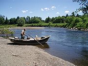
Boating
The mouth of the river up to EssexEssex, Connecticut
Essex is a town in Middlesex County, Connecticut, United States. The population was 6,505 at the 2000 census. It is made up of three villages: Essex Village, Centerbrook, and Ivoryton.- History :- The Great Attack :...
is thought to be one of the busiest stretches of waterway in Connecticut. Some local police departments and the state Environmental Conservation Police patrol the area a few times a week. Some towns keep boats available if needed. In Massachusetts, the most active stretch of the Connecticut River is centered on The Oxbow
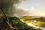
The Oxbow
View from Mount Holyoke, Northampton, Massachusetts, after a Thunderstorm, commonly known as The Oxbow, is a painting by Thomas Cole.-Background:...
, 14 miles (22.5 km) north of Springfield
Springfield, Massachusetts
Springfield is the most populous city in Western New England, and the seat of Hampden County, Massachusetts, United States. Springfield sits on the eastern bank of the Connecticut River near its confluence with three rivers; the western Westfield River, the eastern Chicopee River, and the eastern...
in the college town
College town
A college town or university town is a community which is dominated by its university population...
of Northampton
Northampton, Massachusetts
The city of Northampton is the county seat of Hampshire County, Massachusetts, United States. As of the 2010 census, the population of Northampton's central neighborhoods, was 28,549...
.
Fishing
American shad
-Introduction:The American shad or Atlantic shad, Alosa sapidissima, is a species of anadromous fish in family Clupeidae of order Clupeiformes. It is not closely related to the other North American shads...
, American eel
American eel
The American eel, Anguilla rostrata, is a catadromous fish found on the eastern coast of North America. It has a snake-like body with a small sharp pointed head. It is brown on top and a tan-yellow color on the bottom. It has sharp pointed teeth but no pelvic fins...
, striped bass
Striped bass
The striped bass is the state fish of Maryland, Rhode Island, South Carolina, and the state saltwater fish of New York, Virginia, and New Hampshire...
and the sea lamprey
Sea lamprey
The sea lamprey is a parasitic lamprey found on the Atlantic coasts of Europe and North America, in the western Mediterranean Sea, and in the Great Lakes. It is brown, gray, or black on its back and white or gray on the underside and can grow up to 90 cm long. Sea lampreys prey on a wide...
. The United States Fish and Wildlife Service
United States Fish and Wildlife Service
The United States Fish and Wildlife Service is a federal government agency within the United States Department of the Interior dedicated to the management of fish, wildlife, and natural habitats...
is undertaking an effort to repopulate the river with another species of migratory fish, the Atlantic salmon
Atlantic salmon
The Atlantic salmon is a species of fish in the family Salmonidae, which is found in the northern Atlantic Ocean and in rivers that flow into the north Atlantic and the north Pacific....
. For more than 200 years, Atlantic salmon have been extinct from the river due to dam
Dam
A dam is a barrier that impounds water or underground streams. Dams generally serve the primary purpose of retaining water, while other structures such as floodgates or levees are used to manage or prevent water flow into specific land regions. Hydropower and pumped-storage hydroelectricity are...
ming. Several fish ladder
Fish ladder
A fish ladder, also known as a fishway, fish pass or fish steps, is a structure on or around artificial barriers to facilitate diadromous fishes' natural migration. Most fishways enable fish to pass around the barriers by swimming and leaping up a series of relatively low steps into the waters on...
s and fish elevators have been built to allow fish to resume their natural migration upriver each spring.
The headwaters of the Connecticut River are at the northern tip of New Hampshire, near the Canadian
Canada
Canada is a North American country consisting of ten provinces and three territories. Located in the northern part of the continent, it extends from the Atlantic Ocean in the east to the Pacific Ocean in the west, and northward into the Arctic Ocean...
border. Much of the beginning of the river's course in the town of Pittsburg
Pittsburg, New Hampshire
Pittsburg is a town in Coos County, New Hampshire, United States. The population was 869 at the 2010 census. It is the northernmost town in New Hampshire and the largest town by area in the state - and in New England as well - more than twice the size of the next largest town, Lincoln. U.S...
is occupied by the Connecticut Lakes
Connecticut Lakes
The Connecticut Lakes are a group of lakes in northern New Hampshire, situated along the headwaters of the Connecticut River. They are accessed via the northernmost segment of U.S. Route 3 . The lakes are located within the boundaries of Pittsburg, but are far from the town center...
, a chain of deep, cold water lakes that are home to lake trout
Lake trout
Lake trout is a freshwater char living mainly in lakes in northern North America. Other names for it include mackinaw, lake char , touladi, togue, and grey trout. In Lake Superior, they can also be variously known as siscowet, paperbellies and leans...
and landlocked salmon
Atlantic salmon
The Atlantic salmon is a species of fish in the family Salmonidae, which is found in the northern Atlantic Ocean and in rivers that flow into the north Atlantic and the north Pacific....
.
The river itself holds native brook trout
Brook trout
The brook trout, Salvelinus fontinalis, is a species of fish in the salmon family of order Salmoniformes. In many parts of its range, it is known as the speckled trout or squaretail. A potamodromous population in Lake Superior are known as coaster trout or, simply, as coasters...
, rainbow trout
Rainbow trout
The rainbow trout is a species of salmonid native to tributaries of the Pacific Ocean in Asia and North America. The steelhead is a sea run rainbow trout usually returning to freshwater to spawn after 2 to 3 years at sea. In other words, rainbow trout and steelhead trout are the same species....
, large brown trout
Brown trout
The brown trout and the sea trout are fish of the same species....
, shad
Shad
The shads or river herrings comprise the genus Alosa, fish related to herring in the family Clupeidae. They are distinct from others in that family by having a deeper body and spawning in rivers. The several species frequent different areas on both sides of the Atlantic Ocean, Mediterranean Sea....
, smallmouth bass
Smallmouth bass
The smallmouth bass is a species of freshwater fish in the sunfish family of the order Perciformes. It is the type species of its genus...
, striped bass
Striped bass
The striped bass is the state fish of Maryland, Rhode Island, South Carolina, and the state saltwater fish of New York, Virginia, and New Hampshire...
, carp
Carp
Carp are various species of oily freshwater fish of the family Cyprinidae, a very large group of fish native to Europe and Asia. The cypriniformes are traditionally grouped with the Characiformes, Siluriformes and Gymnotiformes to create the superorder Ostariophysi, since these groups have certain...
, catfish
Catfish
Catfishes are a diverse group of ray-finned fish. Named for their prominent barbels, which resemble a cat's whiskers, catfish range in size and behavior from the heaviest and longest, the Mekong giant catfish from Southeast Asia and the second longest, the wels catfish of Eurasia, to detritivores...
, American eel
American eel
The American eel, Anguilla rostrata, is a catadromous fish found on the eastern coast of North America. It has a snake-like body with a small sharp pointed head. It is brown on top and a tan-yellow color on the bottom. It has sharp pointed teeth but no pelvic fins...
, and several other species of game fish. Landlocked salmon make their way into the river during spring spawning runs of bait fish
Bait fish
Bait fish are small fish caught for use as bait to attract large predatory fish, particularly game fish. Species used are typically those that are common and breed rapidly, making them easy to catch and in regular supply. Examples of marine bait fish are anchovies, halfbeaks such as ballyhoo, and...
and during their fall spawn. The river has fly-fishing-only regulations on 5 miles (8 km) of river. Most of the river from Lake Francis
Lake Francis (Murphy Dam)
Lake Francis is a reservoir on the Connecticut River in northern New Hampshire. The lake is located in Coos County, east of the village of Pittsburg and along the boundary between the towns of Pittsburg and Clarksville. The lake, impounded by Murphy Dam, covers nearly .The lake was mentioned as...
south is open to lure and bait as well. Two tail-water dams provide cold river water for miles downstream making summer fishing on the Connecticut River excellent.
Tributaries
- Black Hall River (Old Lyme, CT)
- Falls River (Essex, CT)
- Eightmile River (Hamburg, CT)
- Deep River (Deep River, CT)
- Salmon RiverSalmon River (Connecticut)The Salmon River is formed at the confluence of the Blackledge and Jeremy rivers about one mile west of North Westchester, Connecticut. It runs for to Salmon Cove near Moodus where it flows into the Connecticut River....
(Moodus, CTMoodus, ConnecticutMoodus is a census-designated place in East Haddam, a town in Middlesex County, Connecticut, United States. The population was 1,263 at the 2000 census.-Geography:...
) - Mattabesset River (Middletown, CT)
- Hockanum RiverHockanum RiverThe Hockanum River is a river in Connecticut. The Hockanum neighborhood in East Hartford is named after it.It rises at the outlet of Shenipsit Lake in Rockville, then flows through Vernon, Manchester, and East Hartford...
(East HartfordEast Hartford, ConnecticutEast Hartford is a town in Hartford County, Connecticut, United States. The population was 51,252 at the 2010 census.-Geography:...
and Hartford, CT) - Park RiverPark River (Connecticut)The Park River, sometimes called the Hog River, is a subterranean urban river that flows through and under the city of Hartford, Connecticut. It was diverted underground by the Army Corps of Engineers in 1940. The stated reason for this was to reduce the risk of spring seasonal floods which had...
(Hartford, CT) - Farmington RiverFarmington RiverThe Farmington River is a river located in northwest Connecticut, with major tributaries extending into southwest Massachusetts. Via its longest branch , the Farmington's length increases to , making it the Connecticut River's longest tributary by a mere over the major river directly to its...
(Windsor, CT) - Scantic RiverScantic RiverThe Scantic River is a river that flows through the states of Massachusetts and Connecticut and is tributary to the Connecticut River.The Scantic River's tributaries rise in the towns of Hampden, Wilbraham, East Longmeadow and Monson in Massachusetts, and in Stafford and Somers, Connecticut,...
(South Windsor, CT) - Westfield RiverWestfield RiverThe Westfield River in Metropolitan Springfield, Massachusetts, is a major tributary of the Connecticut River in Hampden County, Massachusetts. The Westfield River has four major tributary branches that confluence in the City of Westfield, for which the river is named...
(West SpringfieldWest Springfield, MassachusettsThe Town of West Springfield is a city in Hampden County, Massachusetts, United States. It is part of the Springfield, Massachusetts Metropolitan Statistical Area. The population was 28,391 at the 2010 census...
and Springfield, MA) - Mill RiverMill River (Springfield, Massachusetts)The Mill River is a long tributary of the Connecticut River in Springfield, Massachusetts. It flows from Watershops Pond to its confluence with the Connecticut River. It is referred to as "The Miracle Mile" in a 2009 master's thesis that outlines possibilities for reclaiming the river's mouth as...
(Springfield, MA) - Chicopee RiverChicopee RiverThe Chicopee River is an tributary of the Connecticut River in Metropolitan Springfield, Massachusetts, known for fast-moving water and its extraordinarily large basin: the Connecticut River's largest tributary basin...
(ChicopeeChicopee, MassachusettsChicopee is a city located on the Connecticut River in Hampden County, Massachusetts, United States of America. It is part of the Springfield, Massachusetts Metropolitan Statistical Area. As of the 2010 census, the city had a total population of 55,298, making it the second largest city in...
and Springfield, MA) - Manhan RiverManhan RiverThe Manhan River is a river in western Massachusetts. It is a tributary of the Connecticut River.The river begins near the boundary between the towns of Huntington and Westhampton, Massachusetts, and flows southeast to White Reservoir and then Tighe Carmody Reservoir in Southampton...
(The OxbowThe OxbowView from Mount Holyoke, Northampton, Massachusetts, after a Thunderstorm, commonly known as The Oxbow, is a painting by Thomas Cole.-Background:...
of Northampton, MA) - Mill River (Northampton, MA)
- Fort River (Hadley, MA)
- Mill River (Hatfield, MA)
- Mill River (Amherst, MA)
- Sawmill River (Montague, MA)
- Deerfield RiverDeerfield RiverDeerfield River is a river that runs for from southern Vermont through northwestern Massachusetts to the Connecticut River. The Deerfield was historically influential in the settlement of western Franklin County, Massachusetts, and its namesake town...
(DeerfieldDeerfield, MassachusettsDeerfield is a town in Franklin County, Massachusetts, United States. The population was 4,750 as of the 2000 census. Deerfield is part of the Springfield, Massachusetts Metropolitan Statistical Area in Western Massachusetts, lying only north of the city of Springfield.Deerfield includes the...
and Greenfield, MA) - Fall River (GreenfieldGreenfield, MassachusettsGreenfield is a city in Franklin County, Massachusetts, United States. The population was 17,456 at the 2010 census. It is the county seat of Franklin County. Greenfield is home to Greenfield Community College, the Pioneer Valley Symphony Orchestra, and the Franklin County Fair...
and Gill, MA) - Millers RiverMillers RiverThe Millers River is a river in northern Massachusetts, originating in Ashburnham and joining the Connecticut River just downstream from Millers Falls, Massachusetts...
(Millers Falls, MA) - Ashuelot RiverAshuelot RiverThe Ashuelot River is a tributary of the Connecticut River, approximately long, in southwestern New Hampshire in the United States. It drains a mountainous area of , including much of the area known as the Monadnock Region...
(Hinsdale, NH) - West RiverWest River (Vermont)The West River is a tributary of the Connecticut River, about long, in southern Vermont in the United States. According to the Geographic Names Information System, it has also been known historically as "Wantastiquet" and as "Waters of the Lonely Way"...
(Brattleboro, VT) - Partridge BrookPartridge BrookPartridge Brook is a 7.5 mile long stream located in southwestern New Hampshire in the United States. It is a tributary of the Connecticut River, which flows to Long Island Sound....
(Westmoreland, NH) - Cold RiverCold River (Connecticut River)The Cold River is a 22.6 mile long river located in western New Hampshire in the United States. It is a tributary of the Connecticut River, which flows to Long Island Sound....
(Walpole, NH) - Saxtons RiverSaxtons RiverThe Saxtons River is a river in the U.S. state of Vermont, a tributary of the Connecticut River. Its watershed covers and a range in altitude of ; land use is about 80% forested and 3% agricultural, and the upper river supports wild brook trout and brown trout, while Atlantic salmon occur but are...
(Westminster, VT) - Williams RiverWilliams River (Vermont)The Williams River is a river in the U.S. state of Vermont. It is a tributary of the Connecticut River. Its watershed covers 117 square miles; land use is about 80% forested and 4% agricultural, and the upper river supports wild brook trout and brown trout ....
(Rockingham, VT) - Black RiverBlack River (Connecticut River)The Black River is a river in the U.S. state of Vermont, and a tributary of the Connecticut River. The watershed, or drainage basin, consists of some in southeastern Vermont, almost all of which lies in Windsor County.-Course:...
(Springfield, VT) - Little Sugar RiverLittle Sugar River (New Hampshire)The Little Sugar River is a river located in western New Hampshire in the United States. It is a tributary of the Connecticut River, which flows to Long Island Sound...
(Charlestown, NH) - Sugar RiverSugar River (New Hampshire)The Sugar River is a 27.0 mile long river located in western New Hampshire in the United States. It is a tributary of the Connecticut River, which flows to Long Island Sound....
(Claremont, NH) - Blow-me-down BrookBlow-me-down BrookBlow-me-down Brook is a 12.8 mile long stream located in western New Hampshire in the United States. It is a tributary of the Connecticut River, which flows to Long Island Sound....
(Cornish, NH) - Ottauquechee RiverOttauquechee RiverThe Ottauquechee River is a river in eastern Vermont in the United States. It is a tributary of the Connecticut River, which flows to Long Island Sound....
(Hartland, VT) - Mascoma RiverMascoma RiverThe Mascoma River is a 31.6 mile long river located in western New Hampshire in the United States. It is a tributary of the Connecticut River, which flows to Long Island Sound. The Mascoma comprises two sections which are split by Mascoma Lake in the communities of Enfield and Lebanon...
(West Lebanon, NH) - White RiverWhite River (Vermont)The White River is a river in the U.S. state of Vermont. It is a tributary of the Connecticut River.The White River rises at Skylight Pond south of Bread Loaf Mountain near the crest of the Green Mountains. The river flows east to the town of Granville, where it receives the outflow from the...
(White River Junction, VT) - Mink BrookMink BrookMink Brook is a 9.5 mile long stream in western New Hampshire in the United States. It is a tributary of the Connecticut River, which flows to Long Island Sound.Mink Brook lies entirely in the town of Hanover, New Hampshire...
(Hanover, NH) - Ompompanoosuc RiverOmpompanoosuc RiverThe Ompompanoosuc River is a river, about 25 mi long, in eastern Vermont in the United States. It is a tributary of the Connecticut River, which flows to Long Island Sound...
(Norwich, VT) - Waits RiverWaits RiverThe Waits River is a river in eastern Vermont in the United States. It is a tributary of the Connecticut River, which flows to Long Island Sound...
(Bradford, VT) - Oliverian BrookOliverian BrookOliverian Brook is a 13.1 mile long river in western New Hampshire in the United States. It is a tributary of the Connecticut River, which flows to Long Island Sound....
(Haverhill, NH) - Wells RiverWells River (Vermont)The Wells River is a river, approximately long, in the U.S. state of Vermont. It is a tributary of the Connecticut River.The Wells River begins at the outlet of Ricker Pond at the southern boundary of Groton State Forest in the town of Groton. The river flows generally southeast through the...
(Wells River, VT) - Ammonoosuc RiverAmmonoosuc RiverThe Ammonoosuc River is a river, 55 mi long, in northwestern New Hampshire in the United States. It is a tributary of the Connecticut River, which flows to Long Island Sound. "Ammonoosuc" is Abnaki for "small, narrow fishing place"....
(Woodsville, NH) - Stevens River (Barnet, VT)
- Passumpsic RiverPassumpsic RiverThe Passumpsic River is a tributary of the Connecticut River, in Vermont. Though primarily a Caledonia County river, it is the only river to flow through all three counties of the Northeast Kingdom.- Course :...
(Barnet, VT) - Johns River (Dalton, NH)
- Israel RiverIsrael RiverThe Israel River is a river in the White Mountains of New Hampshire. It arises in the township of Low and Burbank's Grant and runs 24 miles generally northwest along U.S. Highway 2, traversing the towns of Jefferson and Lancaster, before joining the Connecticut River...
(Lancaster, NH) - Upper Ammonoosuc RiverUpper Ammonoosuc RiverThe Upper Ammonoosuc River is a tributary of the Connecticut River that flows through Coös County in northern part of the northeastern U.S. state of New Hampshire...
(Northumberland, NH) - Paul Stream (Brunswick, VT)
- Nulhegan River (Bloomfield, VT)
- Simms StreamSimms StreamSimms Stream is a 10.4 mile long river in northern New Hampshire in the United States. It is a tributary of the Connecticut River, which flows south to Long Island Sound, an arm of the Atlantic Ocean....
(Columbia, NH) - Mohawk RiverMohawk River (New Hampshire)The Mohawk River is a river in northern New Hampshire in the United States. It is a tributary of the Connecticut River, which flows south to Long Island Sound, an arm of the Atlantic Ocean....
(Colebrook, NH) - Halls StreamHalls StreamHalls Stream is a 25.2 mile long tributary of the Connecticut River. For most of its length, it forms the boundary between Canada and the United States, with the province of Quebec to its west and the state of New Hampshire to its east....
(Beecher Falls, VT) - Indian StreamIndian StreamIndian Stream is a tributary of the Connecticut River, approximately 19.1 miles long, in New Hampshire in the United States. It rises in the mountains of extreme northern New Hampshire, in Coos County near the U.S.-Canada border, where the Middle Branch of Indian Stream joins the West Branch...
(Pittsburg, NH) - Perry StreamPerry StreamPerry Stream is an 18.6 mile long river in northern New Hampshire in the United States. It is a tributary of the Connecticut River, which flows south to Long Island Sound, an arm of the Atlantic Ocean....
(Pittsburg, NH)
Crossings
The Connecticut River is a significant barrier to travel between western and eastern New England. Several major transportation corridors cross the river including AmtrakAmtrak
The National Railroad Passenger Corporation, doing business as Amtrak , is a government-owned corporation that was organized on May 1, 1971, to provide intercity passenger train service in the United States. "Amtrak" is a portmanteau of the words "America" and "track". It is headquartered at Union...
's Northeast Corridor
Northeast Corridor
The Northeast Corridor is a fully electrified railway line owned primarily by Amtrak serving the Northeast megalopolis of the United States from Boston in the north, via New York to Washington, D.C. in the south, with branches serving other cities...
, Interstate 95
Interstate 95 in Connecticut
Interstate 95, the main north–south Interstate Highway on the East Coast of the United States, runs in a general east–west compass direction for 111.57 miles in Connecticut from the Rhode Island state line to the New York State line. I-95 Southbound from East Lyme to the New York State...
(Connecticut Turnpike
Connecticut Turnpike
The Connecticut Turnpike, known now as the Governor John Davis Lodge Turnpike, is a freeway in Connecticut that runs from Greenwich to Killingly. It is signed as Interstate 95 from the New York state line at Greenwich to East Lyme, and then as Interstate 395 from East Lyme to Plainfield...
), Interstate 90
Interstate 90
Interstate 90 is the longest Interstate Highway in the United States at . It is the northernmost coast-to-coast interstate, and parallels US 20 for the most part. Its western terminus is in Seattle, at Edgar Martinez Drive S. near Safeco Field and CenturyLink Field, and its eastern terminus is in...
(Massachusetts Turnpike
Massachusetts Turnpike
The Massachusetts Turnpike is the easternmost stretch of Interstate 90. The Turnpike begins at the western border of Massachusetts in West Stockbridge connecting with the Berkshire Connector portion of the New York State Thruway...
), Interstate 89
Interstate 89
Interstate 89 is an interstate highway in the New England region of the United States travelling between Bow, New Hampshire and Highgate Springs, Vermont. As with all odd-numbered primary interstates, I-89 is signed as a north–south highway...
, and Interstate 84. In addition, Interstate 91
Interstate 91
Interstate 91 is an Interstate Highway in the New England region of the United States. It provides the primary north–south thoroughfare in the western part of New England...
, whose route largely follows the river north-south, crosses it twice - once in Connecticut and once in Massachusetts.
Sites of interest
- Connecticut River MuseumConnecticut River MuseumThe Connecticut River Museum is a U.S. educational and cultural institution based at Steamboat Dock in Essex, Connecticut that focuses on the marine environment and maritime heritage of the Connecticut River Valley....
in Essex, ConnecticutEssex, ConnecticutEssex is a town in Middlesex County, Connecticut, United States. The population was 6,505 at the 2000 census. It is made up of three villages: Essex Village, Centerbrook, and Ivoryton.- History :- The Great Attack :... - Connecticut Valley Historical MuseumThe QuadrangleThe Quadrangle is a cluster of five museums in Springfield, Massachusetts, on Chestnut Street in Metro Center. Five museums and the Springfield City Library surround the Dr. Seuss National Memorial Sculpture Garden...
in Springfield, MassachusettsSpringfield, MassachusettsSpringfield is the most populous city in Western New England, and the seat of Hampden County, Massachusetts, United States. Springfield sits on the eastern bank of the Connecticut River near its confluence with three rivers; the western Westfield River, the eastern Chicopee River, and the eastern...
See also
- Lake HitchcockLake HitchcockLake Hitchcock was a glacial lake that formed approximately 15,000 years ago in the late Pleistocene epoch. After the Laurentide ice sheet retreated, glacial ice melt accumulated at the terminal moraine and blocked up the Connecticut River, creating the long, narrow lake...
, post-glacial predecessor to the Connecticut River - Lake ConnecticutLake ConnecticutGlacial Lake Connecticut formed over what is now Long Island Sound and coastal Connecticut at the fore edge of the ice sheet of the Wisconsin glaciation, as the lobe of the Laurentide ice sheet began to retreat, some 18,000 to 20,000 years ago. It was dammed by the terminal moraine that now forms...
, post-glacial predecessor to Lake Hitchcock - History of ConnecticutHistory of ConnecticutThe U.S. state of Connecticut began as three distinct settlements, referred to at the time as "Colonies" or "Plantations". These ventures were eventually combined under a single royal charter in 1662.-Colonies in Connecticut:...
- List of Connecticut rivers
- List of Massachusetts rivers
- List of New Hampshire rivers
- List of Vermont rivers
- The Great Attack - the burning of American ships on the Connecticut River at Essex in 1814