
1992 Pacific hurricane season
Encyclopedia
The 1992 Pacific hurricane season was the most active Pacific hurricane season on record. The most notable storm was Hurricane Iniki
, which caused billions of dollars of damage to the Hawaiian Islands
. Hurricanes Lester
, Virgil
, Winifred
, and Orlene also made landfall and killed several people, but were significantly less destructive. Hurricane Darby
and Tropical Storm Agatha brought rains and more destruction to Mexico
, without making landfall. Hurricane Tina
was the longest-lasting Pacific hurricane at the time. Also of note are Hurricane Ekeka and Tropical Storm Hali, which formed in late January and late March, respectively.
. However, the season wildly exceeded these bounds, as climatological effects including an El Niño caused Hurricane Ekeka to form on January 26. Ekeka's formation marks a record for the earliest formation of a tropical cyclone in either the Eastern or Central Pacific basins. It is also the only known time that multiple cyclones had formed before the season began.
During the season, twenty-seven tropical cyclone
s formed in the Eastern Pacific (east of longitude 140°W
), and twenty-four developed further
and became tropical storms. Both of these figures constitute records in the basin, as the 1992 season surpassed the season with the most tropical cyclones (1982
, 26) and the season with the most named storms (1985
, 22). Of these, fourteen reached hurricane strength and eight became major hurricanes—storms that reach Category 3 or higher on the Saffir-Simpson Hurricane Scale
.
This season had five storms reach tropical storm intensity or higher in the month of October, the only time that had happened in this basin. In addition, Hurricanes or Tropical Storms Winifred through Zeke are the earliest twenty-first through twenty-fourth named storms in a season in the eastern north Pacific.
The Central Pacific (between 140°W
and the International Date Line
) saw similarly high levels of activity. Eleven tropical cyclones were tracked by the Central Pacific Hurricane Center
throughout the hurricane season. Of those, eight developed in the Eastern Pacific and crossed into the Central Pacific, and three formed within the basin. Two of the storms strengthened to major hurricane status within the Central Pacific's boundaries.
One of the crossover storms, Iniki
, crossed into the basin as a tropical depression, strengthened to a Category 4 hurricane, and made landfall
in Hawaii
, becoming the most destructive hurricane in the state's history.
in the Line Islands
. The tropical disturbance had been tracked since January 23, and at 0600 UTC January 28, the Central Pacific Hurricane Center determined that the area had met the meteorological characteristics of a tropical depression, and designated the system as Tropical Depression One-C. This was unusual, since the system was located well to the south of the area of normal tropical cyclone formation, further south than any other Pacific hurricane
, and the formation occurred well outside the climatological bounds of the hurricane season. The system intesified and reached tropical storm status 12 hours later, at which point it became known as Ekeka.
The system continued intensifying until reaching hurricane status at 0000 UTC on January 30, and it reached major hurricane status on February 2, reaching maximum sustained winds of 115 mph (185 km/h) and a minimum central barometric pressure of 985 mbar
(hPa
; 29.09 inHg). However, unfavorable wind shear
began taking a toll on the storm, causing it to rapidly weaken. Ekeka crossed the International Date Line
as a weakened tropical storm, and shortly thereafter degraded to tropical depression status. Ekeka continued westward, passing through the Marshall Islands
and later over Chuuk
, before dissipating on February 9 about 310 mi (500 km) off the north coast of Papua New Guinea
. The storm did not cause any significant damage or deaths.
, atypically close to the equator
, and far to the southwest of Hawaii. Moving west-northwestward, it slowly intensified, intensifying into a tropical storm on March 29. Upon doing so, the CPHC gave it the name Hali. Later that day, the storm attained peak winds of 50 mph (85 km/h), before increased southwesterly wind shear
imparted weakening. Hali was downgraded to a tropical depression on March 30, and it dissipated shortly thereafter. It never affected land. Hali is notable as being the only known Pacific tropical cyclone east of the dateline to develop in the month of March.
An estimated 1,500 people were evacuated due to the storms' approach. Waves up to 16 ft (4.9 m) were reported along the coast of Mexico and torrential rains triggered flash flood
ing resulting in ten fatalities.
during the period of June 14 and June 16. The system entered the Eastern Pacific basin without much convection. The northward portion of the wave developed a circulation in the mid-levels of the atmosphere. Movign westbound, the storms was poorly organized. Over waters marginally suitable for cyclogenesis
, a tropical wave organized into the third depression of the season on June 22 as deep convection developed near the center. At this time, the system was located 460 mi (740.3 km) south of the southern tip of the Baja California Peninsula
. Early on June 23, the depression intensified into Tropical Storm Blas. Although the storm developed an impressive upper-level outflow and well-organized thunderstorm activity. Although the storm was moving into an area sea surface temperature
s of 78 °F (25.6 °C), the National Hurricane Center
(NHC) forecasted slight intensification. Water vapor imagery also suggested that strong wind shear
would introduce a weakening trend. Later that day, Blas weakened back into a depression, and dissipated on 000 UTC June 24. Blas never affected land.
were initialed on June 1, and a circulation developed the next day. The system was classified as a tropical depression while located 170 mi (273.6 km) west of Guatemala
based on ship
reports. Upon becoming a tropical cyclone
the storm formed further east than most Pacific hurricane
s due to little wind shear
and warm sea surface temperatures near Central America
. Due to these conditions, Meteorologists at the NHC
were anticipating steady intensification. Although the storm was initially ragged via weather satellite
imagery the storm intensified into Tropical Storm Celia on 1800 UTC June 23 as banding features
improved. The banding features continued to improve and by the evening on June 24, Celia had developed a large area of convection near the center, and the NHC re-assessed the intensity at 65 mph (100 km/h). At that time, the agency noted that Celia had the potential to become a hurricane at any time. In addition, the storm was forecasted to become a moderate Category 2 hurricane on the Saffir-Simpson Hurricane Scale
.
Several hours later, Celia was upgraded into a hurricane based on intensity estimates via Dvorak Technique
. Celia's rate of intensification accelerated and thus underwent a period of rapid deepening
. Overnight, the storm developed an excellent upper-level outflow and very cold cloud tops. Late on June 25, an eye appeared, and the NHC classified the storm as a strong Category 1 hurricane. By midday June 26, Celia intensified into a Category 2 hurricane A well-defined eye soon developed, and the storm was upgraded into a Category 3 hurricane later that day. Early on June 27, Celiabecame a Category 4 major hurricane with winds of 145 mph (230 km/h) and a minimal pressure of 935 mbar (27.6 inHg). Celia maintained Category 4 intensity for about 24 hours and then started to gradually weaken.
Late on June 28, the eye became somewhat ragged. Celia fluctuated in intensity over the next several days. at 0000 UTC June 29. Moving westward at an unsteady pace, Celia weakened to winds of 85 mph (130 km/h) 18 hours later. this made it a Category 1 hurricane. The system briefly re-intensified into a moderate Category 2 hurricane, but later resumed the weakening trend. Celia fell below hurricane status on 000 UTC July 2. Turing northwest, the tropical cyclone
weakened back to tropical depression status the next day. Thereafter, all that was left of Celia was a tight low to mid-level swirl of low-convection clouds and dissipated July 4. The storm never affected land.
During Darby's formation, flooding from the cyclone's rainbands killed three people in Acapulco
, where 180 shops were damaged. Four fishermen were reported missing, fate unknown. Manzanillo
, Colima
, reported sustained winds just above tropical-storm force. The hurricane's remnants brought mainly light rain to the U.S. state of California
. Cloud cover also delayed the landing of the Space Shuttle Columbia
for one day. South-facing beaches of that state were pounded with waves up to 7 feet (2.3 m) in height. A monetary value for damage is not available.
Darby also caused a few shipping accidents. A pleasure craft, the Oasis, had an engine failure and was abandoned. The seven people aboard were rescued, but the boat was sunk. A smaller sailboat, the Hosanna, had difficulties but was towed to a safe location by a cutter from the United States Coast Guard
. A fishing boat at an unspecified location also experienced difficulties.
indicates that it may have formed from a tropical wave that began on June 23 off the African coast. The wave began to move at low latitudes and passed the northern part of South America
. On July 2, deep convection began to join with the wave. On July 7, a large area of disturbed weather formed about 460 mi (740.3 km) west of Acapulco, Mexico. Deep convection developed in to two distinct rainband
s late on July 8. Continuing to develop the system was classified as a tropical depression on 0000 UTC July 9. However, the thunderstorm activity was exposed form the center of circulation. As such, the NHC noted that additional intensification was limited due to easterly wind shear
and the storm was anticipated the move west-northwest, though did NHC did not the possibility of a more northward track due to possible interaction with powerful Hurricane Darby
. Eighteen hours later, the depression strengthened into Tropical Storm Estelle despite the shear as banding features increased. Gradually intensifying, the storm's outflow improved. Despite a burst of deep convection, the storm maintained its strength for a little while. However, wind shear decrease and as it briefly turned form the west-northwest to west-southwest to the north, Estelle steadily intensified. Early on July 10, an eye
developed, and based on this, Estelle was upgraded into a hurricane. Around that time, Estelle turned to the northwest.
Although the eye disappeared from satellite imagery later that day, the storm intensified slightly. From early July 11 to late July 15, Estelle moved at about 7 - 15 mi/h to the northwest. During this period, Estelle reached 140 mi/h winds and became a Category 4 hurricane. The system weakened gradually and by July 17, Estelle had completely lost its tropical characteristics. The hurricane did not affect any land in its lifetime, thus no damage was reported.
Late on July 15, Hurricane Frank passed about 175 mi (280 km) south of Socorro Island
. A station on the island reported winds of 67 mph (107 km/h), which indicated that the hurricane had a large wind field. Slow intensification continued, and Frank intensified into a major hurricane, or a Category 3 on the Saffir-Simpson Hurricane Scale, on July 17. By that time, the eye had become well-defined, and later became surrounded by a ring of deep convection. On July 18, Frank reached its peak intensity of 145 mph (230 km/h) well to the west-southwest of the Baja California peninsula. Afterward, the hurricane turned northwestward over progressively cooler water temperatures, resulting in weakening. On July 21 Frank was downgraded to a tropical storm, after wind shear caused further weakening. The next day, it crossed into the Central Pacific, and by July 23 it weakened to a tropical depression. Later that day Frank dissipated about 400 mi (650 km) northeast of Hawaii.
on the August 23, striking mainland Mexico late that day. Accelerating northeast, Lester entered the U.S. state of Arizona
as a tropical storm and New Mexico
as a tropical depression before ejecting out into the Plains.
No deaths were reported. Lester left over 5000 people homeless. Several tiny settlements west of Hermosillo
, Sonora
, and on a highway to San Diego, California
, were destroyed. A ship called the Gladiator rolled over 33 degrees to both starboard and port, spilling a considerable amount of cargo.
organized into Tropical Depression Fifteen-E on August 27. Banding and convection increased, and the depression became a tropical storm the next day. Development continued, and Madeline peaked with a minimum pressure of 999 mbar (29.5 inHg), and winds of 50 mph (85 km/h), on August 29. As the system progressed westward, it entered a region of strong wind shear
and had dissipated on August 31. The system never came near land.
organized into Tropical Depression Eighteen-E. After crossing 140°W
, the system strengthened into a tropical storm on September 8 and was named Iniki (Hawaiian word meaning "strong and piercing wind"
) In a favorable environment, Iniki intensified into a hurricane on September 9 and a major hurricane the day after. Iniki reached Category 4 intensity early on September 11.
Meanwhile, a series of troughs
broke down a ridge
over the Hawaiian Islands
. This recurved Iniki and accelerated the system northward. Iniki's eye
passed directly over Kauai
on September 11, the first hurricane to make landfall in Hawaii since Hurricane Iwa
in 1982. Iniki weakened to a tropical storm and went extratropical on September 13 and was promptly absorbed by a front
.
At the time, Hurricane Iniki was the costliest Pacific hurricane in recorded history. Damage was heavy on Kauai, with many buildings being unroofed. A total of 1241 houses were completely destroyed. The total cost of damage was 2 billion dollars. Six people died and more than 100 were injured.
formed into Tropical Depression Twenty-E, about 416 mi (669.5 km) south of Baja California. Despite initial disorganization, the system developed an eye-like feature the next day and was named Tropical Storm Roslyn, the storm also began to develop banding features, concurrent with the better establishment of upper-level outflow. Roslyn quickly intensified to just below hurricane status on the September 15, but began a short weakening trend, as it passed through the wake of Hurricane Paine, where it had begun intensifying on the 11th. By 1800 UTC that day, Roslyn began interacting with the weakening and nearby Paine, with centers of both systems being only a few hundred miles apart, and with this interaction, Paine was absorbed into Roslyn the next day, although this merger didn't affect Roslyn's intensity in the least. On the September 18, Roslyn had a brief period of strengthening. By September 21, deep convection began to rapidly increase, followed by a visible eye on satellite imagery the next day, which indicated that Roslyn had reached hurricane intensity. The hurricane peaked at moderate Category 2 status later on the September 22, with a quick decrease in strength thereafter. Roslyn was downgraded to a tropical storm just as it crossed into the Central Pacific two days later, and over the next several days, a trough to the west turned the weakening Roslyn to the northeast, and then to the north. The system finally dissipated on September 30, over two weeks after it formed.
was upgraded into a tropical depression. The next day, the depression strengthened into Tropical Storm Seymour a couple hundred miles south of the southern tip of Baja California, and while continuing on a west-northwest and northwest track, Seymour reached hurricane strength on September 19. However, the system soon weakened to a tropical storm, due to the effects of a trough producing moderate shear, and cooler waters. This was short-lived. The trough soon moved out of the area and was replaced by a ridge, which steered Seymour to the west, and allowed it to regain hurricane status on the September 23, while Seymour had developed a broad and clear eye
. However, Seymour only held hurricane intensity for a short period of time, and by that night, it had already weakened back to a tropical storm. After losing a significant amount of deep convection, it weakened to a depression two days later. Tropical Depression Seymour finally dissipated on September 27. Seymour formed in the open ocean, and it never affected land, as no damage or deaths were reported.
and to the north and a trough
then recurved Tina to the northeast and towards land, still moving slowly and gradually slowing down. The trough broke down and was replaced by a strong ridge. Tina then changed direction again and headed out to sea. It intensified into a Category 4 storm with a central pressure
of 932 mbar (27.5 inHg). Tina then slowly weakened as it turned to the north. The stubborn Tropical Depression Tina dissipated on October 11, shortly after entering the central Pacific.
Due to its erratic track and slow motion, Tina was alive from September 17 to October 11— a span of 24 days. This is the record for the eastern Pacific Ocean
, smashing the east/central record of 20 days held by Hurricane Fico
in the 1978 season
and surpassing Typhoon Rita's west Pacific 1972 record. It was itself surpassed just two years later by Hurricane John
.
rather than the Central Pacific Hurricane Center as it was expected to become a significant tropical cyclone outside of the CPHC's area of responsibility. Just prior to crossing into the Western Pacific basin, it reached tropical storm intensity, at which time it was given the name Ward from the list of Pacific typhoon names. Winds at this time were estimated at 40 mph (65 km/h); the Japan Meteorological Agency
reported the system to have also attained a pressure of 1002 mbar (hPa; 29.59 inHg). Over the following days, Ward gradually intensified, peaking as a Category 2 storm with winds of 110 mph (175 km/h). The storm eventually weakened as it moved through higher latitudes, becoming extratropical on October 7 over open waters.
late on the October 4. Shortly after passing over Manzanillo
, it weakened below tropical storm strength, and early on October 5, the weakened Tropical Depression Virgil exited into the Pacific, but no regeneration was expected, as strong westerlies and the weakened state of the system prevented any regeneration, and it dissipated shortly thereafter.
Because Virgil made landfall in a sparsely populated area, damage from storm surge was minimal. The chief effect was heavy rain and flooding, peaking at over 10 in (254 mm) in one location.
. The next day, it developed into Tropical Storm Winifred, while satellites began showing increased convective banding features around the storm's center. Winifred was upgraded to a hurricane on October 8, an eye soon appeared on satellite imagery, with the system's outer rainbands affecting Mexico's southwest coast that day. Winifred peaked at Category 3 status the next day, turning to the north-northeast just hours before landfall at Category 2 strength, but the eye had disappeared hours prior to landfall, which was an indication of Winifred weakening to Category 2 strength. It rapidly weakened to a depression over the mountainous terrain of Mexico by October 10, while continuing on a northeast track and finally degenerating to a remnant low later that day.
Three people were killed by floods. Damage was concentrated in Colima
and Michoacán
. Electricity and water systems was knocked out in Colima.
. It became Tropical Storm Zeke the next day, concurrent to developing banding features as well as good upper level outflow. A mid-upper level trough approached the west coast of the United States, which induced strong shear over the storm, separating deep convection from the center, and it was downgraded to depression status on October 27. However, the trough also forced Zeke north, then northeast, which resulted in the shear weakening, allowing it to re-develop, and the system was again upgraded to tropical storm status. Zeke reached peak intensity on the October 29, while on course for a potential landfall in Baja California. Despite reaching peak intensity, new westerlies spread over Zeke, which rapidly weakened the system, eventually dissipating on October 30.
. Around November 22, a disturbance formed within a cloud mass south of the Hawaiian Islands. The system then developed a closed circulation, being upgraded to Tropical Depression Three-C on November 22. The depression did not strengthen further, dissipating 24 hours later about 670 miles (1,078.3 km) south of the Hawaiian Islands.
, if any. Deaths in parentheses are additional and indirect (an example of an indirect death would be a traffic accident), but are still storm-related. Damage and deaths include totals while the storm was extratropical or a wave or low.
The table below shows the ACE
for each storm in the season. ACE is, broadly speaking, a measure of the power of the hurricane multiplied by the length of time it existed, so storms that last a long time, as well as particularly strong hurricanes, have high ACEs. ACE is only calculated for full advisories on tropical systems at or exceeding 34 knots (39 mph, 63 km/h) or tropical storm strength. The figures in parenthesis are for storms in the Central Pacific basin west of 140°W
; those not in parenthesis are for the Eastern Pacific basin. This season had the highest ACE of any season on record, with an overall value of 295.492. The 1990 season also had a high ACE, at about 250 that year, but only about 4 of that was from the central Pacific. 33.34 of this seasons total ace came from the central Pacific; excluding it, the overall ace was 262.152. The 1990 season had 6 less storms than this year, but because 16 of the 21 storms that year became hurricanes (the record for any season), and the fact that the major hurricanes in 1990, like Hernan and Trudy, were stronger than this year's ones, the 1990 season's ACE was only 12 lower than this season, so this season had a higher ACE than 1990, but the average ACE per storm that year was higher than this year.
The cumulative ACE for the Eastern Pacific this season fell within the official "Near Normal" grading, even though the number of tropical storms, hurricanes, and major hurricanes was well above the long term average.
. This is the same list used for the 1986 season
. Storms were named Seymour, Tina, Virgil, Winifred, Xavier, Yolanda, and Zeke for the first time in 1992. Yolanda and Zeke were the first time that Y and Z names had been used to name storms.
All names on the list were used this year. This is the second time that a northeast Pacific hurricane season had exhausted its list. The 1983 season
also used every name on its list, but the list only went to the W name at the time. The 1985 season's
list was lengthened while it was going on to prevent exhaustion.
Three names from the central Pacific list were used - Ekeka
, Hali, and Iniki
. This was the first usage for all of these names.
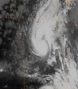
Hurricane Iniki
Hurricane Iniki was the most powerful hurricane to strike the U.S. state of Hawaii in recorded history. Forming on September 5 during the strong El Niño of 1991–1994, Iniki was one of eleven Central Pacific tropical cyclones during the 1992 season. It attained tropical storm status on...
, which caused billions of dollars of damage to the Hawaiian Islands
Hawaiian Islands
The Hawaiian Islands are an archipelago of eight major islands, several atolls, numerous smaller islets, and undersea seamounts in the North Pacific Ocean, extending some 1,500 miles from the island of Hawaii in the south to northernmost Kure Atoll...
. Hurricanes Lester
Hurricane Lester (1992)
Hurricane Lester was the first Pacific tropical cyclone to enter the United States as a tropical storm since 1967. The twelfth named storm and seventh hurricane of the 1992 Pacific hurricane season, Lester formed on August 20 from a tropical wave southwest of Mexico. The tropical storm moved...
, Virgil
Hurricane Virgil (1992)
Hurricane Virgil was a late season hurricane of the 1992 Pacific hurricane season that struck southwestern Mexico in October 1992. Forming from a tropical wave that left Africa on September 13, it slowly developed into a tropical depression. It soon strengthened into Tropical Storm Virgil, and...
, Winifred
Hurricane Winifred (1992)
Hurricane Winifred was the last tropical cyclone to make landfall in the busy 1992 Pacific hurricane season. Impacting western Mexico, especially Colima and Michoacán, Hurricane Winifred brought heavy rain and destruction to the area...
, and Orlene also made landfall and killed several people, but were significantly less destructive. Hurricane Darby
Hurricane Darby (1992)
Hurricane Darby was the fourth named storm of the 1992 Pacific hurricane season. The origins of Darby were from a tropical wave which moved off the coast of Africa on June 19. It traversed the Atlantic, and moved across Mexico, where it re-emerged in the Pacific on June 29 and became a tropical...
and Tropical Storm Agatha brought rains and more destruction to Mexico
Mexico
The United Mexican States , commonly known as Mexico , is a federal constitutional republic in North America. It is bordered on the north by the United States; on the south and west by the Pacific Ocean; on the southeast by Guatemala, Belize, and the Caribbean Sea; and on the east by the Gulf of...
, without making landfall. Hurricane Tina
Hurricane Tina (1992)
Hurricane Tina was the strongest storm of the 1992 Pacific hurricane season and threatened land for a brief period of time. The twenty-fourth tropical cyclone, twenty-second tropical storm, fourteenth hurricane, and eighth major hurricane of the record breaking season, Tina formed from a tropical...
was the longest-lasting Pacific hurricane at the time. Also of note are Hurricane Ekeka and Tropical Storm Hali, which formed in late January and late March, respectively.
Season summary
The season officially started on May 15, 1992 in the Eastern Pacific, and on June 1, 1992 in the central Pacific, and lasted until November 30, 1992. These dates conventionally delimit the period of each year when most tropical cyclones form in the northeastern and north-central Pacific OceanPacific Ocean
The Pacific Ocean is the largest of the Earth's oceanic divisions. It extends from the Arctic in the north to the Southern Ocean in the south, bounded by Asia and Australia in the west, and the Americas in the east.At 165.2 million square kilometres in area, this largest division of the World...
. However, the season wildly exceeded these bounds, as climatological effects including an El Niño caused Hurricane Ekeka to form on January 26. Ekeka's formation marks a record for the earliest formation of a tropical cyclone in either the Eastern or Central Pacific basins. It is also the only known time that multiple cyclones had formed before the season began.
During the season, twenty-seven tropical cyclone
Tropical cyclone
A tropical cyclone is a storm system characterized by a large low-pressure center and numerous thunderstorms that produce strong winds and heavy rain. Tropical cyclones strengthen when water evaporated from the ocean is released as the saturated air rises, resulting in condensation of water vapor...
s formed in the Eastern Pacific (east of longitude 140°W
140th meridian west
The meridian 140° west of Greenwich is a line of longitude that extends from the North Pole across the Arctic Ocean, North America, the Pacific Ocean, the Southern Ocean, and Antarctica to the South Pole....
), and twenty-four developed further
Tropical cyclogenesis
Tropical cyclogenesis is the term that describes the development and strengthening of a tropical cyclone in the atmosphere. The mechanisms through which tropical cyclogenesis occurs are distinctly different from those through which mid-latitude cyclogenesis occurs...
and became tropical storms. Both of these figures constitute records in the basin, as the 1992 season surpassed the season with the most tropical cyclones (1982
1982 Pacific hurricane season
The 1982 Pacific hurricane season officially started May 15, 1982 in the eastern Pacific, and June 1, 1982 in the central Pacific, and lasted until November 30, 1982. These dates conventionally delimit the period of each year when most tropical cyclones form in the northeastern Pacific Ocean.The...
, 26) and the season with the most named storms (1985
1985 Pacific hurricane season
The 1985 Pacific hurricane season was an event in tropical cyclone meteorology. It officially started on May 15, 1985 in the eastern Pacific, and on June 1, 1985 in the central Pacific, and lasted until November 30, 1985...
, 22). Of these, fourteen reached hurricane strength and eight became major hurricanes—storms that reach Category 3 or higher on the Saffir-Simpson Hurricane Scale
Saffir-Simpson Hurricane Scale
The Saffir–Simpson Hurricane Scale , or the Saffir–Simpson Hurricane Wind Scale , classifies hurricanes — Western Hemisphere tropical cyclones that exceed the intensities of tropical depressions and tropical storms — into five categories distinguished by the intensities of their sustained winds...
.
This season had five storms reach tropical storm intensity or higher in the month of October, the only time that had happened in this basin. In addition, Hurricanes or Tropical Storms Winifred through Zeke are the earliest twenty-first through twenty-fourth named storms in a season in the eastern north Pacific.
The Central Pacific (between 140°W
140th meridian west
The meridian 140° west of Greenwich is a line of longitude that extends from the North Pole across the Arctic Ocean, North America, the Pacific Ocean, the Southern Ocean, and Antarctica to the South Pole....
and the International Date Line
International Date Line
The International Date Line is a generally north-south imaginary line on the surface of the Earth, passing through the middle of the Pacific Ocean, that designates the place where each calendar day begins...
) saw similarly high levels of activity. Eleven tropical cyclones were tracked by the Central Pacific Hurricane Center
Central Pacific Hurricane Center
The Central Pacific Hurricane Center of the United States National Weather Service is the official body responsible for tracking and issuing tropical cyclone warnings, watches, advisories, discussions, and statements for the Central North Pacific Basin...
throughout the hurricane season. Of those, eight developed in the Eastern Pacific and crossed into the Central Pacific, and three formed within the basin. Two of the storms strengthened to major hurricane status within the Central Pacific's boundaries.
One of the crossover storms, Iniki
Hurricane Iniki
Hurricane Iniki was the most powerful hurricane to strike the U.S. state of Hawaii in recorded history. Forming on September 5 during the strong El Niño of 1991–1994, Iniki was one of eleven Central Pacific tropical cyclones during the 1992 season. It attained tropical storm status on...
, crossed into the basin as a tropical depression, strengthened to a Category 4 hurricane, and made landfall
Landfall (meteorology)
Landfall is the event of a tropical cyclone or a waterspout coming onto land after being over water. When a waterspout makes landfall it is reclassified as a tornado, which can then cause damage inland...
in Hawaii
Hawaii
Hawaii is the newest of the 50 U.S. states , and is the only U.S. state made up entirely of islands. It is the northernmost island group in Polynesia, occupying most of an archipelago in the central Pacific Ocean, southwest of the continental United States, southeast of Japan, and northeast of...
, becoming the most destructive hurricane in the state's history.
Hurricane Ekeka
Ekeka, the first storm of the season, developed from an area of disturbed weather near KiritimatiKiritimati
Kiritimati or Christmas Island is a Pacific Ocean raised coral atoll in the northern Line Islands, and part of the Republic of Kiribati....
in the Line Islands
Line Islands
The Line Islands, Teraina Islands or Equatorial Islands, is a chain of eleven atolls and low coral islands in the central Pacific Ocean, south of the Hawaiian Islands, that stretches for 2,350 km in a northwest-southeast direction, making it one of the longest islands chains of the world...
. The tropical disturbance had been tracked since January 23, and at 0600 UTC January 28, the Central Pacific Hurricane Center determined that the area had met the meteorological characteristics of a tropical depression, and designated the system as Tropical Depression One-C. This was unusual, since the system was located well to the south of the area of normal tropical cyclone formation, further south than any other Pacific hurricane
Pacific hurricane
A Pacific hurricane or tropical storm is a tropical cyclone that develops in the northeastern part of the Pacific Ocean. For organizational purposes, the northern Pacific Ocean is divided into three regions: the eastern, , central , and western...
, and the formation occurred well outside the climatological bounds of the hurricane season. The system intesified and reached tropical storm status 12 hours later, at which point it became known as Ekeka.
The system continued intensifying until reaching hurricane status at 0000 UTC on January 30, and it reached major hurricane status on February 2, reaching maximum sustained winds of 115 mph (185 km/h) and a minimum central barometric pressure of 985 mbar
Bar (unit)
The bar is a unit of pressure equal to 100 kilopascals, and roughly equal to the atmospheric pressure on Earth at sea level. Other units derived from the bar are the megabar , kilobar , decibar , centibar , and millibar...
(hPa
Pascal (unit)
The pascal is the SI derived unit of pressure, internal pressure, stress, Young's modulus and tensile strength, named after the French mathematician, physicist, inventor, writer, and philosopher Blaise Pascal. It is a measure of force per unit area, defined as one newton per square metre...
; 29.09 inHg). However, unfavorable wind shear
Wind shear
Wind shear, sometimes referred to as windshear or wind gradient, is a difference in wind speed and direction over a relatively short distance in the atmosphere...
began taking a toll on the storm, causing it to rapidly weaken. Ekeka crossed the International Date Line
International Date Line
The International Date Line is a generally north-south imaginary line on the surface of the Earth, passing through the middle of the Pacific Ocean, that designates the place where each calendar day begins...
as a weakened tropical storm, and shortly thereafter degraded to tropical depression status. Ekeka continued westward, passing through the Marshall Islands
Marshall Islands
The Republic of the Marshall Islands , , is a Micronesian nation of atolls and islands in the middle of the Pacific Ocean, just west of the International Date Line and just north of the Equator. As of July 2011 the population was 67,182...
and later over Chuuk
Chuuk
Chuuk — formerly Truk, Ruk, Hogoleu, Torres, Ugulat, and Lugulus — is an island group in the south western part of the Pacific Ocean. It comprises one of the four states of the Federated States of Micronesia , along with Kosrae, Pohnpei, and Yap. Chuuk is the most populous of the FSM's...
, before dissipating on February 9 about 310 mi (500 km) off the north coast of Papua New Guinea
Papua New Guinea
Papua New Guinea , officially the Independent State of Papua New Guinea, is a country in Oceania, occupying the eastern half of the island of New Guinea and numerous offshore islands...
. The storm did not cause any significant damage or deaths.
Tropical Storm Hali
In late March, meteorological conditions similar to what allowed Ekeka to develop persisted in the central Pacific. An area of convection organized into Tropical Depression Two-C, just north of 5˚N5th parallel north
The 5th parallel north is a circle of latitude that is 5 degrees north of the Earth's equatorial plane. It crosses the Atlantic Ocean, Africa, the Indian Ocean, Southeast Asia, the Pacific Ocean and South America....
, atypically close to the equator
Equator
An equator is the intersection of a sphere's surface with the plane perpendicular to the sphere's axis of rotation and containing the sphere's center of mass....
, and far to the southwest of Hawaii. Moving west-northwestward, it slowly intensified, intensifying into a tropical storm on March 29. Upon doing so, the CPHC gave it the name Hali. Later that day, the storm attained peak winds of 50 mph (85 km/h), before increased southwesterly wind shear
Wind shear
Wind shear, sometimes referred to as windshear or wind gradient, is a difference in wind speed and direction over a relatively short distance in the atmosphere...
imparted weakening. Hali was downgraded to a tropical depression on March 30, and it dissipated shortly thereafter. It never affected land. Hali is notable as being the only known Pacific tropical cyclone east of the dateline to develop in the month of March.
Tropical Storm Agatha
A tropical wave that entered the Pacific in late May organized into Tropical Depression One-E on June 1. It moved north for the next two days. The depression strengthened into a tropical storm on June 2. After peaking the same day, Agatha slowed down and started drifting west. It steadily weakened, falling to a depression on June 5. Agatha had dissipated by the next day. Agatha approached close enough to the coast of Mexico that watches and warnings were issued.An estimated 1,500 people were evacuated due to the storms' approach. Waves up to 16 ft (4.9 m) were reported along the coast of Mexico and torrential rains triggered flash flood
Flash flood
A flash flood is a rapid flooding of geomorphic low-lying areas—washes, rivers, dry lakes and basins. It may be caused by heavy rain associated with a storm, hurricane, or tropical storm or meltwater from ice or snow flowing over ice sheets or snowfields...
ing resulting in ten fatalities.
Tropical Depression Two-E
A tropical depression formed near 114°W on June 16. The system moved west for a short time, reaching a peak intensity 1009 mbar and maximum sustained winds of 35 mi/h. It dissipated, without strengthening, on June 19.Tropical Storm Blas
A tropical wave went through Central AmericaCentral America
Central America is the central geographic region of the Americas. It is the southernmost, isthmian portion of the North American continent, which connects with South America on the southeast. When considered part of the unified continental model, it is considered a subcontinent...
during the period of June 14 and June 16. The system entered the Eastern Pacific basin without much convection. The northward portion of the wave developed a circulation in the mid-levels of the atmosphere. Movign westbound, the storms was poorly organized. Over waters marginally suitable for cyclogenesis
Tropical cyclogenesis
Tropical cyclogenesis is the term that describes the development and strengthening of a tropical cyclone in the atmosphere. The mechanisms through which tropical cyclogenesis occurs are distinctly different from those through which mid-latitude cyclogenesis occurs...
, a tropical wave organized into the third depression of the season on June 22 as deep convection developed near the center. At this time, the system was located 460 mi (740.3 km) south of the southern tip of the Baja California Peninsula
Baja California Peninsula
The Baja California peninsula , is a peninsula in northwestern Mexico. Its land mass separates the Pacific Ocean from the Gulf of California. The Peninsula extends from Mexicali, Baja California in the north to Cabo San Lucas, Baja California Sur in the south.The total area of the Baja California...
. Early on June 23, the depression intensified into Tropical Storm Blas. Although the storm developed an impressive upper-level outflow and well-organized thunderstorm activity. Although the storm was moving into an area sea surface temperature
Sea surface temperature
Sea surface temperature is the water temperature close to the oceans surface. The exact meaning of surface varies according to the measurement method used, but it is between and below the sea surface. Air masses in the Earth's atmosphere are highly modified by sea surface temperatures within a...
s of 78 °F (25.6 °C), the National Hurricane Center
National Hurricane Center
The National Hurricane Center , located at Florida International University in Miami, Florida, is the division of the National Weather Service responsible for tracking and predicting weather systems within the tropics between the Prime Meridian and the 140th meridian west poleward to the 30th...
(NHC) forecasted slight intensification. Water vapor imagery also suggested that strong wind shear
Wind shear
Wind shear, sometimes referred to as windshear or wind gradient, is a difference in wind speed and direction over a relatively short distance in the atmosphere...
would introduce a weakening trend. Later that day, Blas weakened back into a depression, and dissipated on 000 UTC June 24. Blas never affected land.
Hurricane Celia
Celia formed from tropical wave that crossed over into the East Pacific basin around June 19. Dvorak ClassificationsDvorak technique
The Dvorak technique is a widely used system to subjectively estimate tropical cyclone intensity based solely on visible and infrared satellite images. Several agencies issue Dvorak intensity numbers for cyclones of sufficient intensity...
were initialed on June 1, and a circulation developed the next day. The system was classified as a tropical depression while located 170 mi (273.6 km) west of Guatemala
Guatemala
Guatemala is a country in Central America bordered by Mexico to the north and west, the Pacific Ocean to the southwest, Belize to the northeast, the Caribbean to the east, and Honduras and El Salvador to the southeast...
based on ship
Ship
Since the end of the age of sail a ship has been any large buoyant marine vessel. Ships are generally distinguished from boats based on size and cargo or passenger capacity. Ships are used on lakes, seas, and rivers for a variety of activities, such as the transport of people or goods, fishing,...
reports. Upon becoming a tropical cyclone
Tropical cyclone
A tropical cyclone is a storm system characterized by a large low-pressure center and numerous thunderstorms that produce strong winds and heavy rain. Tropical cyclones strengthen when water evaporated from the ocean is released as the saturated air rises, resulting in condensation of water vapor...
the storm formed further east than most Pacific hurricane
Pacific hurricane
A Pacific hurricane or tropical storm is a tropical cyclone that develops in the northeastern part of the Pacific Ocean. For organizational purposes, the northern Pacific Ocean is divided into three regions: the eastern, , central , and western...
s due to little wind shear
Wind shear
Wind shear, sometimes referred to as windshear or wind gradient, is a difference in wind speed and direction over a relatively short distance in the atmosphere...
and warm sea surface temperatures near Central America
Central America
Central America is the central geographic region of the Americas. It is the southernmost, isthmian portion of the North American continent, which connects with South America on the southeast. When considered part of the unified continental model, it is considered a subcontinent...
. Due to these conditions, Meteorologists at the NHC
National Hurricane Center
The National Hurricane Center , located at Florida International University in Miami, Florida, is the division of the National Weather Service responsible for tracking and predicting weather systems within the tropics between the Prime Meridian and the 140th meridian west poleward to the 30th...
were anticipating steady intensification. Although the storm was initially ragged via weather satellite
Weather satellite
The weather satellite is a type of satellite that is primarily used to monitor the weather and climate of the Earth. Satellites can be either polar orbiting, seeing the same swath of the Earth every 12 hours, or geostationary, hovering over the same spot on Earth by orbiting over the equator while...
imagery the storm intensified into Tropical Storm Celia on 1800 UTC June 23 as banding features
Rainband
A rainband is a cloud and precipitation structure associated with an area of rainfall which is significantly elongated. Rainbands can be stratiform or convective, and are generated by differences in temperature. When noted on weather radar imagery, this precipitation elongation is referred to as...
improved. The banding features continued to improve and by the evening on June 24, Celia had developed a large area of convection near the center, and the NHC re-assessed the intensity at 65 mph (100 km/h). At that time, the agency noted that Celia had the potential to become a hurricane at any time. In addition, the storm was forecasted to become a moderate Category 2 hurricane on the Saffir-Simpson Hurricane Scale
Saffir-Simpson Hurricane Scale
The Saffir–Simpson Hurricane Scale , or the Saffir–Simpson Hurricane Wind Scale , classifies hurricanes — Western Hemisphere tropical cyclones that exceed the intensities of tropical depressions and tropical storms — into five categories distinguished by the intensities of their sustained winds...
.
Several hours later, Celia was upgraded into a hurricane based on intensity estimates via Dvorak Technique
Dvorak technique
The Dvorak technique is a widely used system to subjectively estimate tropical cyclone intensity based solely on visible and infrared satellite images. Several agencies issue Dvorak intensity numbers for cyclones of sufficient intensity...
. Celia's rate of intensification accelerated and thus underwent a period of rapid deepening
Rapid deepening
Rapid deepening, also known as rapid intensification, is a meteorological condition that occurs when the minimum sea-level atmospheric pressure of a tropical cyclone decreases drastically in a short period of time. The National Weather Service describes rapid deepening as a decrease of...
. Overnight, the storm developed an excellent upper-level outflow and very cold cloud tops. Late on June 25, an eye appeared, and the NHC classified the storm as a strong Category 1 hurricane. By midday June 26, Celia intensified into a Category 2 hurricane A well-defined eye soon developed, and the storm was upgraded into a Category 3 hurricane later that day. Early on June 27, Celiabecame a Category 4 major hurricane with winds of 145 mph (230 km/h) and a minimal pressure of 935 mbar (27.6 inHg). Celia maintained Category 4 intensity for about 24 hours and then started to gradually weaken.
Late on June 28, the eye became somewhat ragged. Celia fluctuated in intensity over the next several days. at 0000 UTC June 29. Moving westward at an unsteady pace, Celia weakened to winds of 85 mph (130 km/h) 18 hours later. this made it a Category 1 hurricane. The system briefly re-intensified into a moderate Category 2 hurricane, but later resumed the weakening trend. Celia fell below hurricane status on 000 UTC July 2. Turing northwest, the tropical cyclone
Tropical cyclone
A tropical cyclone is a storm system characterized by a large low-pressure center and numerous thunderstorms that produce strong winds and heavy rain. Tropical cyclones strengthen when water evaporated from the ocean is released as the saturated air rises, resulting in condensation of water vapor...
weakened back to tropical depression status the next day. Thereafter, all that was left of Celia was a tight low to mid-level swirl of low-convection clouds and dissipated July 4. The storm never affected land.
Hurricane Darby
A tropical wave organized into tropical depression Five-E on July 2. It strengthened and was named Darby the next day. Steering currents became very strong, and Darby accelerated as it paralleled the coast of Mexico. It strengthened into a hurricane on July 5 and also substantially increased in size. It peaked as a strong Category 3 on July 6. Darby began to substantially weaken thereafter as it passed over cooler waters. The hurricane weakened into a storm and then a depression on July 8 and July 9, respectively. Tropical Depression Darby lost tropical characteristics the next day. Moisture from the hurricane eventually spread over parts of the Continental United States.During Darby's formation, flooding from the cyclone's rainbands killed three people in Acapulco
Acapulco
Acapulco is a city, municipality and major sea port in the state of Guerrero on the Pacific coast of Mexico, southwest from Mexico City. Acapulco is located on a deep, semi-circular bay and has been a port since the early colonial period of Mexico’s history...
, where 180 shops were damaged. Four fishermen were reported missing, fate unknown. Manzanillo
Manzanillo, Colima
The name Manzanillo refers to the city as well as its surrounding municipality in the Mexican state of Colima. The city, located on the Pacific Ocean, contains Mexico's busiest port. Manzanillo was the third port created by the Spanish in the Pacific during the New Spain period...
, Colima
Colima
Colima is one of the 31 states which, with the Federal District, make up the 32 Federal Entities of Mexico. It shares its name with its capital and main city, Colima....
, reported sustained winds just above tropical-storm force. The hurricane's remnants brought mainly light rain to the U.S. state of California
California
California is a state located on the West Coast of the United States. It is by far the most populous U.S. state, and the third-largest by land area...
. Cloud cover also delayed the landing of the Space Shuttle Columbia
Space Shuttle Columbia
Space Shuttle Columbia was the first spaceworthy Space Shuttle in NASA's orbital fleet. First launched on the STS-1 mission, the first of the Space Shuttle program, it completed 27 missions before being destroyed during re-entry on February 1, 2003 near the end of its 28th, STS-107. All seven crew...
for one day. South-facing beaches of that state were pounded with waves up to 7 feet (2.3 m) in height. A monetary value for damage is not available.
Darby also caused a few shipping accidents. A pleasure craft, the Oasis, had an engine failure and was abandoned. The seven people aboard were rescued, but the boat was sunk. A smaller sailboat, the Hosanna, had difficulties but was towed to a safe location by a cutter from the United States Coast Guard
United States Coast Guard
The United States Coast Guard is a branch of the United States Armed Forces and one of the seven U.S. uniformed services. The Coast Guard is a maritime, military, multi-mission service unique among the military branches for having a maritime law enforcement mission and a federal regulatory agency...
. A fishing boat at an unspecified location also experienced difficulties.
Hurricane Estelle
The origin of Hurricane Estelle is unclear. The National Hurricane CenterNational Hurricane Center
The National Hurricane Center , located at Florida International University in Miami, Florida, is the division of the National Weather Service responsible for tracking and predicting weather systems within the tropics between the Prime Meridian and the 140th meridian west poleward to the 30th...
indicates that it may have formed from a tropical wave that began on June 23 off the African coast. The wave began to move at low latitudes and passed the northern part of South America
South America
South America is a continent situated in the Western Hemisphere, mostly in the Southern Hemisphere, with a relatively small portion in the Northern Hemisphere. The continent is also considered a subcontinent of the Americas. It is bordered on the west by the Pacific Ocean and on the north and east...
. On July 2, deep convection began to join with the wave. On July 7, a large area of disturbed weather formed about 460 mi (740.3 km) west of Acapulco, Mexico. Deep convection developed in to two distinct rainband
Rainband
A rainband is a cloud and precipitation structure associated with an area of rainfall which is significantly elongated. Rainbands can be stratiform or convective, and are generated by differences in temperature. When noted on weather radar imagery, this precipitation elongation is referred to as...
s late on July 8. Continuing to develop the system was classified as a tropical depression on 0000 UTC July 9. However, the thunderstorm activity was exposed form the center of circulation. As such, the NHC noted that additional intensification was limited due to easterly wind shear
Wind shear
Wind shear, sometimes referred to as windshear or wind gradient, is a difference in wind speed and direction over a relatively short distance in the atmosphere...
and the storm was anticipated the move west-northwest, though did NHC did not the possibility of a more northward track due to possible interaction with powerful Hurricane Darby
Hurricane Darby (1992)
Hurricane Darby was the fourth named storm of the 1992 Pacific hurricane season. The origins of Darby were from a tropical wave which moved off the coast of Africa on June 19. It traversed the Atlantic, and moved across Mexico, where it re-emerged in the Pacific on June 29 and became a tropical...
. Eighteen hours later, the depression strengthened into Tropical Storm Estelle despite the shear as banding features increased. Gradually intensifying, the storm's outflow improved. Despite a burst of deep convection, the storm maintained its strength for a little while. However, wind shear decrease and as it briefly turned form the west-northwest to west-southwest to the north, Estelle steadily intensified. Early on July 10, an eye
Eye (cyclone)
The eye is a region of mostly calm weather found at the center of strong tropical cyclones. The eye of a storm is a roughly circular area and typically 30–65 km in diameter. It is surrounded by the eyewall, a ring of towering thunderstorms where the second most severe weather of a cyclone...
developed, and based on this, Estelle was upgraded into a hurricane. Around that time, Estelle turned to the northwest.
Although the eye disappeared from satellite imagery later that day, the storm intensified slightly. From early July 11 to late July 15, Estelle moved at about 7 - 15 mi/h to the northwest. During this period, Estelle reached 140 mi/h winds and became a Category 4 hurricane. The system weakened gradually and by July 17, Estelle had completely lost its tropical characteristics. The hurricane did not affect any land in its lifetime, thus no damage was reported.
Hurricane Frank
The origins of Hurricane Frank were from a tropical wave that exited the coast of Africa on July 1. After reaching the Pacific, it developed an area of disturbed weather on July 9 off the southern Mexican coast. Continuing westward, the system developed into Tropical Depression Seven-E on July 13 about 660 mi (1070 km) south-southeast of the southern tip of the Baja California peninsula. The depression intensified with favorable water temperatures and well-defined outflow. Based on estimates from satellite imagery, the depression intensified into Tropical Storm Frank on July 14. For about a day, the storm tracked generally northwestward before turning to the west due to a building ridge. An eye developed in the center of the convection late on July 14, and Frank attained hurricane status the next day.Late on July 15, Hurricane Frank passed about 175 mi (280 km) south of Socorro Island
Socorro Island
Socorro Island is a small volcanic island in the Revillagigedo Islands, a Mexican possession lying some 600 kilometers off the country's western coast at 18°48'N, 110°59'W. The size is 16.5 by 11.5 km, with an area of 132 km².- Geology :...
. A station on the island reported winds of 67 mph (107 km/h), which indicated that the hurricane had a large wind field. Slow intensification continued, and Frank intensified into a major hurricane, or a Category 3 on the Saffir-Simpson Hurricane Scale, on July 17. By that time, the eye had become well-defined, and later became surrounded by a ring of deep convection. On July 18, Frank reached its peak intensity of 145 mph (230 km/h) well to the west-southwest of the Baja California peninsula. Afterward, the hurricane turned northwestward over progressively cooler water temperatures, resulting in weakening. On July 21 Frank was downgraded to a tropical storm, after wind shear caused further weakening. The next day, it crossed into the Central Pacific, and by July 23 it weakened to a tropical depression. Later that day Frank dissipated about 400 mi (650 km) northeast of Hawaii.
Hurricane Georgette
A tropical wave left Africa in early July and crossed the Atlantic, with no development whatsoever in that basin and crossed into the eastern Pacific, eventually organizing itself into Tropical Depression Eight-E on July 14. It became a tropical storm the next day and was named Georgette by the NHC. Georgette quickly organized into a minimal hurricane 18 hours later. On July 18, Georgette strengthened quickly to reach a peak of 110 mph (175 km/h) and a minimum pressure of 964 mbar (28.5 inHg). It then began to weaken and eventually dissipated on July 26 southwest of Hawaii without ever making landfall.Tropical Storm Howard
On July 26 a tropical depression formed and became a weak tropical storm the next day. It steadily organized, ad reached it peak intensity as a strong tropical storm. It then began to weaken, despite being located over warm waters. Howard dissipated several days later without affecting land.Tropical Storm Isis
Isis formed on July 28 as a depression and became a tropical storm the next day. Isis peaked as a strong tropical storm with 65 mi/h winds on July 30. Due to cooler water, it weakened to a depression on the first and dissipated the next day. Isis degenerated to an broad area of low pressure on August 2.Hurricane Javier
Javier formed from a tropical wave that left Africa on July 17. It organized into Tropical Depression Eleven-E on July 30. It became a tropical storm four days later later and was named Javier. After peaking as a minimal hurricane, Javier dissipated on August 12. No fatalities or damage was reported.Tropical Depression Twelve-E
Twelve-E had a peak windspeed of 35 mph (55 km/h), and a pressure of 1008 mbar (29.8 inHg). It formed August 10, and dissipated August 12.Tropical Storm Kay
A depression formed on August 18. It became a tropical storm shortly after forming and was named Kay. Kay was a short lived system. Its peak intensity was only 50 mi/h. However, Kay was a very small tropical storm. It dissipated on August 22. Kay never impacted anyone.Hurricane Lester
Lester was the first actual landfall of the Eastern Pacific season. The hurricane first made landfall in Baja California PeninsulaBaja California Peninsula
The Baja California peninsula , is a peninsula in northwestern Mexico. Its land mass separates the Pacific Ocean from the Gulf of California. The Peninsula extends from Mexicali, Baja California in the north to Cabo San Lucas, Baja California Sur in the south.The total area of the Baja California...
on the August 23, striking mainland Mexico late that day. Accelerating northeast, Lester entered the U.S. state of Arizona
Arizona
Arizona ; is a state located in the southwestern region of the United States. It is also part of the western United States and the mountain west. The capital and largest city is Phoenix...
as a tropical storm and New Mexico
New Mexico
New Mexico is a state located in the southwest and western regions of the United States. New Mexico is also usually considered one of the Mountain States. With a population density of 16 per square mile, New Mexico is the sixth-most sparsely inhabited U.S...
as a tropical depression before ejecting out into the Plains.
No deaths were reported. Lester left over 5000 people homeless. Several tiny settlements west of Hermosillo
Hermosillo
Hermosillo is a city and municipality located centrally in the northwestern Mexican state of Sonora. It is the capital and main economic center for the state and region. It contains almost all of the state's manufacturing and has thirty percent of its population...
, Sonora
Sonora
Sonora officially Estado Libre y Soberano de Sonora is one of the 31 states which, with the Federal District, comprise the 32 Federal Entities of Mexico. It is divided into 72 municipalities; the capital city is Hermosillo....
, and on a highway to San Diego, California
San Diego, California
San Diego is the eighth-largest city in the United States and second-largest city in California. The city is located on the coast of the Pacific Ocean in Southern California, immediately adjacent to the Mexican border. The birthplace of California, San Diego is known for its mild year-round...
, were destroyed. A ship called the Gladiator rolled over 33 degrees to both starboard and port, spilling a considerable amount of cargo.
Tropical Storm Madeline
Far in the open ocean, a tropical waveTropical wave
Tropical waves, easterly waves, or tropical easterly waves, also known as African easterly waves in the Atlantic region, are a type of atmospheric trough, an elongated area of relatively low air pressure, oriented north to south, which move from east to west across the tropics causing areas of...
organized into Tropical Depression Fifteen-E on August 27. Banding and convection increased, and the depression became a tropical storm the next day. Development continued, and Madeline peaked with a minimum pressure of 999 mbar (29.5 inHg), and winds of 50 mph (85 km/h), on August 29. As the system progressed westward, it entered a region of strong wind shear
Wind shear
Wind shear, sometimes referred to as windshear or wind gradient, is a difference in wind speed and direction over a relatively short distance in the atmosphere...
and had dissipated on August 31. The system never came near land.
Tropical Storm Newton
Newton was fairly short-lived storm. It formed from a tropical wave on August 27. It became a tropical storm, was named Newton 18 hours later, and dissipated four days later on August 31. Newton never impacted any land.Hurricane Orlene
Tropical Depression Seventeen-E formed September 2, rapidly intensifying to a tropical storm the next day, then a Category 1 hurricane late that day. Orlene peaked at Category 4 major hurricane status on September 6. The system held intensity for a day or so, with gradual weakening due to shear over the area, but the shear relaxed over the cyclone early on September 9, with brought about a quick restrengthening phase on September 9, although it stopped, and the weakening trend resumed later that day. Orlene weakened back to a tropical storm on September 10, and finally a depression on September 12, around the same time that it moved into the Central Pacific. It dissipated two days later, on September 14, after making landfall as a tropical depression on the Big Island of Hawaii. The remnants caused downpours and washed out roads, and the damage was minimal, though some areas got up to 4 in (101.6 mm) of rain.Hurricane Iniki
On September 5, a tropical waveTropical wave
Tropical waves, easterly waves, or tropical easterly waves, also known as African easterly waves in the Atlantic region, are a type of atmospheric trough, an elongated area of relatively low air pressure, oriented north to south, which move from east to west across the tropics causing areas of...
organized into Tropical Depression Eighteen-E. After crossing 140°W
140th meridian west
The meridian 140° west of Greenwich is a line of longitude that extends from the North Pole across the Arctic Ocean, North America, the Pacific Ocean, the Southern Ocean, and Antarctica to the South Pole....
, the system strengthened into a tropical storm on September 8 and was named Iniki (Hawaiian word meaning "strong and piercing wind"
) In a favorable environment, Iniki intensified into a hurricane on September 9 and a major hurricane the day after. Iniki reached Category 4 intensity early on September 11.
Meanwhile, a series of troughs
Trough (meteorology)
A trough is an elongated region of relatively low atmospheric pressure, often associated with fronts.Unlike fronts, there is not a universal symbol for a trough on a weather chart. The weather charts in some countries or regions mark troughs by a line. In the United States, a trough may be marked...
broke down a ridge
Ridge (meteorology)
A ridge is an elongated region of relatively high atmospheric pressure, the opposite of a trough....
over the Hawaiian Islands
Hawaiian Islands
The Hawaiian Islands are an archipelago of eight major islands, several atolls, numerous smaller islets, and undersea seamounts in the North Pacific Ocean, extending some 1,500 miles from the island of Hawaii in the south to northernmost Kure Atoll...
. This recurved Iniki and accelerated the system northward. Iniki's eye
Eye (cyclone)
The eye is a region of mostly calm weather found at the center of strong tropical cyclones. The eye of a storm is a roughly circular area and typically 30–65 km in diameter. It is surrounded by the eyewall, a ring of towering thunderstorms where the second most severe weather of a cyclone...
passed directly over Kauai
Kauai
Kauai or Kauai, known as Tauai in the ancient Kaua'i dialect, is geologically the oldest of the main Hawaiian Islands. With an area of , it is the fourth largest of the main islands in the Hawaiian archipelago, and the 21st largest island in the United States. Known also as the "Garden Isle",...
on September 11, the first hurricane to make landfall in Hawaii since Hurricane Iwa
Hurricane Iwa
Hurricane Iwa, taken from the Hawaiian language name for the frigatebird , was at the time the costliest hurricane to affect the state of Hawaii. Iwa was the twenty-third tropical storm and the twelfth and final hurricane of the 1982 Pacific hurricane season. It developed from an active trough of...
in 1982. Iniki weakened to a tropical storm and went extratropical on September 13 and was promptly absorbed by a front
Weather front
A weather front is a boundary separating two masses of air of different densities, and is the principal cause of meteorological phenomena. In surface weather analyses, fronts are depicted using various colored lines and symbols, depending on the type of front...
.
At the time, Hurricane Iniki was the costliest Pacific hurricane in recorded history. Damage was heavy on Kauai, with many buildings being unroofed. A total of 1241 houses were completely destroyed. The total cost of damage was 2 billion dollars. Six people died and more than 100 were injured.
Hurricane Paine
The tropical wave from which Paine originated moved off the coast of Africa on August 25, reaching the Caribbean on September 2, and eventually crossing Central America and the Yucatán Peninsula from September 5 to 6. The wave finally reached the Pacific on September 8, developing a mid- level circulation a hundred miles or so south of Manzanillo, Mexico. The circulation finally organized enough to be classified as Tropical Depression Nineteen-E early on September 11, a couple hundred miles southwest of Baja California, while continuing just south of due west for the next couple of days, under the influence of a deep-layer-mean anticyclone. The depression soon intensified into Tropical Storm Paine around 1800 UTC on the September 11, with Paine gradually reaching its peak intensity of 75 mph (120 km/h), a minimal Category 1 on September 13, concurrent to the appearance of an eye on satellites. Paine then decelerated to a forward speed of only 2–4 mph (3.2–6.4 km/h), executing a slow, erratic anticyclonic loop for the next three days, and weakening back to a tropical storm by 1800 UTC on September 14. The loop was initially caused by an approaching trough through the westerlies, but was soon caused by Paine's proximity to the approaching Hurricane Roslyn from the east. By September 16, Paine's weakening structure began to dissipate, and was absorbed into Roslyn's larger circulation. The merger didn't affect Roslyn's intensity at all, although a remnant cloud feature persisted within Roslyn's circulation for another day or so.Hurricane Roslyn
On September 13, a tropical waveTropical wave
Tropical waves, easterly waves, or tropical easterly waves, also known as African easterly waves in the Atlantic region, are a type of atmospheric trough, an elongated area of relatively low air pressure, oriented north to south, which move from east to west across the tropics causing areas of...
formed into Tropical Depression Twenty-E, about 416 mi (669.5 km) south of Baja California. Despite initial disorganization, the system developed an eye-like feature the next day and was named Tropical Storm Roslyn, the storm also began to develop banding features, concurrent with the better establishment of upper-level outflow. Roslyn quickly intensified to just below hurricane status on the September 15, but began a short weakening trend, as it passed through the wake of Hurricane Paine, where it had begun intensifying on the 11th. By 1800 UTC that day, Roslyn began interacting with the weakening and nearby Paine, with centers of both systems being only a few hundred miles apart, and with this interaction, Paine was absorbed into Roslyn the next day, although this merger didn't affect Roslyn's intensity in the least. On the September 18, Roslyn had a brief period of strengthening. By September 21, deep convection began to rapidly increase, followed by a visible eye on satellite imagery the next day, which indicated that Roslyn had reached hurricane intensity. The hurricane peaked at moderate Category 2 status later on the September 22, with a quick decrease in strength thereafter. Roslyn was downgraded to a tropical storm just as it crossed into the Central Pacific two days later, and over the next several days, a trough to the west turned the weakening Roslyn to the northeast, and then to the north. The system finally dissipated on September 30, over two weeks after it formed.
Hurricane Seymour
On September 17, a tropical waveTropical wave
Tropical waves, easterly waves, or tropical easterly waves, also known as African easterly waves in the Atlantic region, are a type of atmospheric trough, an elongated area of relatively low air pressure, oriented north to south, which move from east to west across the tropics causing areas of...
was upgraded into a tropical depression. The next day, the depression strengthened into Tropical Storm Seymour a couple hundred miles south of the southern tip of Baja California, and while continuing on a west-northwest and northwest track, Seymour reached hurricane strength on September 19. However, the system soon weakened to a tropical storm, due to the effects of a trough producing moderate shear, and cooler waters. This was short-lived. The trough soon moved out of the area and was replaced by a ridge, which steered Seymour to the west, and allowed it to regain hurricane status on the September 23, while Seymour had developed a broad and clear eye
Eye (cyclone)
The eye is a region of mostly calm weather found at the center of strong tropical cyclones. The eye of a storm is a roughly circular area and typically 30–65 km in diameter. It is surrounded by the eyewall, a ring of towering thunderstorms where the second most severe weather of a cyclone...
. However, Seymour only held hurricane intensity for a short period of time, and by that night, it had already weakened back to a tropical storm. After losing a significant amount of deep convection, it weakened to a depression two days later. Tropical Depression Seymour finally dissipated on September 27. Seymour formed in the open ocean, and it never affected land, as no damage or deaths were reported.
Hurricane Tina
Tina was the strongest storm of the season and threatened land for a time. It formed from a tropical wave on September 17. It moved glacially towards the west and strengthened into a hurricane. A breakdown in a ridgeRidge (meteorology)
A ridge is an elongated region of relatively high atmospheric pressure, the opposite of a trough....
and to the north and a trough
Trough (meteorology)
A trough is an elongated region of relatively low atmospheric pressure, often associated with fronts.Unlike fronts, there is not a universal symbol for a trough on a weather chart. The weather charts in some countries or regions mark troughs by a line. In the United States, a trough may be marked...
then recurved Tina to the northeast and towards land, still moving slowly and gradually slowing down. The trough broke down and was replaced by a strong ridge. Tina then changed direction again and headed out to sea. It intensified into a Category 4 storm with a central pressure
Atmospheric pressure
Atmospheric pressure is the force per unit area exerted into a surface by the weight of air above that surface in the atmosphere of Earth . In most circumstances atmospheric pressure is closely approximated by the hydrostatic pressure caused by the weight of air above the measurement point...
of 932 mbar (27.5 inHg). Tina then slowly weakened as it turned to the north. The stubborn Tropical Depression Tina dissipated on October 11, shortly after entering the central Pacific.
Due to its erratic track and slow motion, Tina was alive from September 17 to October 11— a span of 24 days. This is the record for the eastern Pacific Ocean
Pacific Ocean
The Pacific Ocean is the largest of the Earth's oceanic divisions. It extends from the Arctic in the north to the Southern Ocean in the south, bounded by Asia and Australia in the west, and the Americas in the east.At 165.2 million square kilometres in area, this largest division of the World...
, smashing the east/central record of 20 days held by Hurricane Fico
Hurricane Fico
Hurricane Fico was the longest-lived hurricane of the 1978 Pacific hurricane season and at the time was the longest-lasting Pacific hurricane on record, the record being held today by Hurricane John of 1994. The sixth tropical storm, fourth hurricane, and third major hurricane, Fico developed from...
in the 1978 season
1978 Pacific hurricane season
The 1978 Pacific hurricane season officially began May 15, 1978, in the eastern Pacific, June 1, 1978 in the central Pacific, and officially ended 30 November 1978. These dates conventionally delimit the period of time when tropical cyclones form in the eastern north Pacific Ocean.Activity this...
and surpassing Typhoon Rita's west Pacific 1972 record. It was itself surpassed just two years later by Hurricane John
Hurricane John (1994)
Hurricane John formed during the 1994 Pacific hurricane season and became both the longest-lasting and the farthest-traveling tropical cyclone ever observed...
.
Tropical Storm Ward
On September 26, a tropical depression developed just east of the International Dateline; however, it was warned upon by the Joint Typhoon Warning CenterJoint Typhoon Warning Center
The Joint Typhoon Warning Center is a joint United States Navy – United States Air Force task force located at the Naval Maritime Forecast Center in Pearl Harbor, Hawaii...
rather than the Central Pacific Hurricane Center as it was expected to become a significant tropical cyclone outside of the CPHC's area of responsibility. Just prior to crossing into the Western Pacific basin, it reached tropical storm intensity, at which time it was given the name Ward from the list of Pacific typhoon names. Winds at this time were estimated at 40 mph (65 km/h); the Japan Meteorological Agency
Japan Meteorological Agency
The or JMA, is the Japanese government's weather service. Charged with gathering and reporting weather data and forecasts in Japan, it is a semi-autonomous part of the Ministry of Land, Infrastructure and Transport...
reported the system to have also attained a pressure of 1002 mbar (hPa; 29.59 inHg). Over the following days, Ward gradually intensified, peaking as a Category 2 storm with winds of 110 mph (175 km/h). The storm eventually weakened as it moved through higher latitudes, becoming extratropical on October 7 over open waters.
Hurricane Virgil
On October 1, a tropical wave organized into Tropical Depression Twenty Three-E, a few hundred miles south of the Mexican coast. Despite weak shearing over the system, it became Tropical Storm Virgil later that day, rapidly intensifying to a hurricane on the October 2, when a distinct and well defined eye appeared on satellite images. Virgil was originally on a slow northwest track, but a mid-upper level trough turned the hurricane to the north early on October 3. Despite the change in track, the hurricane reached a peak at minimal Category 4 status around the same time that it turned to the north that day. Virgil continued north until early on October 4, when it turned to the northwest and made landfall at high Category 2 strength, halfway between Manzanillo and Lázaro Cárdenas, and after landfall, the system was quickly weakened over the mountainous terrain of Mexico, passing to the north of ManzanilloManzanillo, Colima
The name Manzanillo refers to the city as well as its surrounding municipality in the Mexican state of Colima. The city, located on the Pacific Ocean, contains Mexico's busiest port. Manzanillo was the third port created by the Spanish in the Pacific during the New Spain period...
late on the October 4. Shortly after passing over Manzanillo
Manzanillo, Colima
The name Manzanillo refers to the city as well as its surrounding municipality in the Mexican state of Colima. The city, located on the Pacific Ocean, contains Mexico's busiest port. Manzanillo was the third port created by the Spanish in the Pacific during the New Spain period...
, it weakened below tropical storm strength, and early on October 5, the weakened Tropical Depression Virgil exited into the Pacific, but no regeneration was expected, as strong westerlies and the weakened state of the system prevented any regeneration, and it dissipated shortly thereafter.
Because Virgil made landfall in a sparsely populated area, damage from storm surge was minimal. The chief effect was heavy rain and flooding, peaking at over 10 in (254 mm) in one location.
Hurricane Winifred
An area of disturbed weather developed into Tropical Depression Twenty Four-E a few hundred miles south of AcapulcoAcapulco
Acapulco is a city, municipality and major sea port in the state of Guerrero on the Pacific coast of Mexico, southwest from Mexico City. Acapulco is located on a deep, semi-circular bay and has been a port since the early colonial period of Mexico’s history...
. The next day, it developed into Tropical Storm Winifred, while satellites began showing increased convective banding features around the storm's center. Winifred was upgraded to a hurricane on October 8, an eye soon appeared on satellite imagery, with the system's outer rainbands affecting Mexico's southwest coast that day. Winifred peaked at Category 3 status the next day, turning to the north-northeast just hours before landfall at Category 2 strength, but the eye had disappeared hours prior to landfall, which was an indication of Winifred weakening to Category 2 strength. It rapidly weakened to a depression over the mountainous terrain of Mexico by October 10, while continuing on a northeast track and finally degenerating to a remnant low later that day.
Three people were killed by floods. Damage was concentrated in Colima
Colima
Colima is one of the 31 states which, with the Federal District, make up the 32 Federal Entities of Mexico. It shares its name with its capital and main city, Colima....
and Michoacán
Michoacán
Michoacán officially Estado Libre y Soberano de Michoacán de Ocampo is one of the 31 states which, with the Federal District, comprise the 32 Federal Entities of Mexico. It is divided in 113 municipalities and its capital city is Morelia...
. Electricity and water systems was knocked out in Colima.
Tropical Storm Xavier
On October 13, a tropical wave developed a visible low level circulation center, developing into Tropical Depression Twenty Five-E later that day, several hundred miles south of Baja California. The system quickly reached tropical storm status, while moving west at about 14 mi/h. On October 17, Xavier dissipated several hundred miles south of the tip of Baja California, the remnants were tracked for several days, until it moved out of range of available satellites. Xavier was only the second tropical system to be named with an 'X' in the eastern Pacific basin, after 1985's Xina. Xavier formed at sea, and therefore, no deaths or damages are associated with it.Tropical Storm Yolanda
On October 15 a tropical depression formed from the wave several hundred miles south of Manzanillo, and on October 16, it strengthened into Tropical Storm Yolanda. The storm turned to the northwest later that day, and maintained this track for the rest of its lifespan. Yolanda peaked as a strong tropical storm on October 19, but strong southwesterly shear removed all deep convection within the storm's circulation later that day, although there were several occasional flare-ups of convection for the next 12 hours or so. The storm weakened back to a depression the next day, while steering currents moved the weakening depression's center to the southwest, and then finally the west before dissipating in the Central Pacific on the October 22. Due to the fact that it formed at sea, no deaths or damages are associated with the storm.Tropical Storm Zeke
On the October 25, a tropical wave organized into Tropical Depression Twenty Seven-E several hundred miles south of Baja CaliforniaBaja California
Baja California officially Estado Libre y Soberano de Baja California is one of the 31 states which, with the Federal District, comprise the 32 Federal Entities of Mexico. It is both the northernmost and westernmost state of Mexico. Before becoming a state in 1953, the area was known as the North...
. It became Tropical Storm Zeke the next day, concurrent to developing banding features as well as good upper level outflow. A mid-upper level trough approached the west coast of the United States, which induced strong shear over the storm, separating deep convection from the center, and it was downgraded to depression status on October 27. However, the trough also forced Zeke north, then northeast, which resulted in the shear weakening, allowing it to re-develop, and the system was again upgraded to tropical storm status. Zeke reached peak intensity on the October 29, while on course for a potential landfall in Baja California. Despite reaching peak intensity, new westerlies spread over Zeke, which rapidly weakened the system, eventually dissipating on October 30.
Tropical Depression Three-C
Although the 1991–1992 El Nino season had ended in the Central Pacific, sea surface temperatures in the basin remained high into November. Due to the high temperatures, cloudiness and showers persisted south of HawaiiHawaii
Hawaii is the newest of the 50 U.S. states , and is the only U.S. state made up entirely of islands. It is the northernmost island group in Polynesia, occupying most of an archipelago in the central Pacific Ocean, southwest of the continental United States, southeast of Japan, and northeast of...
. Around November 22, a disturbance formed within a cloud mass south of the Hawaiian Islands. The system then developed a closed circulation, being upgraded to Tropical Depression Three-C on November 22. The depression did not strengthen further, dissipating 24 hours later about 670 miles (1,078.3 km) south of the Hawaiian Islands.
Season effects
This is a table of the storms in 1992 and their landfall(s)Landfall (meteorology)
Landfall is the event of a tropical cyclone or a waterspout coming onto land after being over water. When a waterspout makes landfall it is reclassified as a tornado, which can then cause damage inland...
, if any. Deaths in parentheses are additional and indirect (an example of an indirect death would be a traffic accident), but are still storm-related. Damage and deaths include totals while the storm was extratropical or a wave or low.
Accumulated Cyclone Energy Rating (ACE)
| ACE (104 kt2) – Storm | ||||||||
|---|---|---|---|---|---|---|---|---|
| 1 | 47.69 | Tina Hurricane Tina (1992) Hurricane Tina was the strongest storm of the 1992 Pacific hurricane season and threatened land for a brief period of time. The twenty-fourth tropical cyclone, twenty-second tropical storm, fourteenth hurricane, and eighth major hurricane of the record breaking season, Tina formed from a tropical... |
2 | 32.35 (.362) | Orlene | 3 | 26.91 | Celia |
| 4 | 26.44 (.612) | Frank | 5 | 20.83 | Georgette | 6 | 18.69 | Estelle |
| 7 | (16.46) | Iniki Hurricane Iniki Hurricane Iniki was the most powerful hurricane to strike the U.S. state of Hawaii in recorded history. Forming on September 5 during the strong El Niño of 1991–1994, Iniki was one of eleven Central Pacific tropical cyclones during the 1992 season. It attained tropical storm status on... |
8 | 13.70 (1.58) | Roslyn | 9 | (13.69) | Ekeka Hurricane Ekeka (1992) Hurricane Ekeka was an unusual Pacific tropical cyclone that attained major hurricane status during the month of February. The first storm of the 1992 Pacific hurricane season, Ekeka developed on January 28 well to the south of Hawaii... |
| 10 | 11.51 | Darby Hurricane Darby (1992) Hurricane Darby was the fourth named storm of the 1992 Pacific hurricane season. The origins of Darby were from a tropical wave which moved off the coast of Africa on June 19. It traversed the Atlantic, and moved across Mexico, where it re-emerged in the Pacific on June 29 and became a tropical... |
11 | 9.75 | Seymour | 12 | 7.98 | Virgil Hurricane Virgil (1992) Hurricane Virgil was a late season hurricane of the 1992 Pacific hurricane season that struck southwestern Mexico in October 1992. Forming from a tropical wave that left Africa on September 13, it slowly developed into a tropical depression. It soon strengthened into Tropical Storm Virgil, and... |
| 13 | 7.50 | Javier | 14 | 6.04 | Winifred Hurricane Winifred (1992) Hurricane Winifred was the last tropical cyclone to make landfall in the busy 1992 Pacific hurricane season. Impacting western Mexico, especially Colima and Michoacán, Hurricane Winifred brought heavy rain and destruction to the area... |
15 | 5.57 | Paine |
| 16 | 4.03 | Yolanda | 17 | 3.87 | Lester Hurricane Lester (1992) Hurricane Lester was the first Pacific tropical cyclone to enter the United States as a tropical storm since 1967. The twelfth named storm and seventh hurricane of the 1992 Pacific hurricane season, Lester formed on August 20 from a tropical wave southwest of Mexico. The tropical storm moved... |
18 | 3.17 | Isis |
| 19 | 3.08 | Agatha | 20 | 2.83 | Howard | 21 | 2.10 | Newton |
| 22 | 1.99 | Zeke | 23 | 1.81 | Madeline | 24 | 1.57 | Kay |
| 25 | (.645) | Hali | 26 | .405 | Xavier | 27 | .367 | Blas |
| Total= 262.152 (33.34) | ||||||||
The table below shows the ACE
Accumulated cyclone energy
Accumulated cyclone energy is a measure used by the National Oceanic and Atmospheric Administration to express the activity of individual tropical cyclones and entire tropical cyclone seasons, particularly the North Atlantic hurricane season. It uses an approximation of the energy used by a...
for each storm in the season. ACE is, broadly speaking, a measure of the power of the hurricane multiplied by the length of time it existed, so storms that last a long time, as well as particularly strong hurricanes, have high ACEs. ACE is only calculated for full advisories on tropical systems at or exceeding 34 knots (39 mph, 63 km/h) or tropical storm strength. The figures in parenthesis are for storms in the Central Pacific basin west of 140°W
140th meridian west
The meridian 140° west of Greenwich is a line of longitude that extends from the North Pole across the Arctic Ocean, North America, the Pacific Ocean, the Southern Ocean, and Antarctica to the South Pole....
; those not in parenthesis are for the Eastern Pacific basin. This season had the highest ACE of any season on record, with an overall value of 295.492. The 1990 season also had a high ACE, at about 250 that year, but only about 4 of that was from the central Pacific. 33.34 of this seasons total ace came from the central Pacific; excluding it, the overall ace was 262.152. The 1990 season had 6 less storms than this year, but because 16 of the 21 storms that year became hurricanes (the record for any season), and the fact that the major hurricanes in 1990, like Hernan and Trudy, were stronger than this year's ones, the 1990 season's ACE was only 12 lower than this season, so this season had a higher ACE than 1990, but the average ACE per storm that year was higher than this year.
The cumulative ACE for the Eastern Pacific this season fell within the official "Near Normal" grading, even though the number of tropical storms, hurricanes, and major hurricanes was well above the long term average.
Storm names
The following names were used for named storms that formed in the northeast Pacific in 1992. No eastern Pacific names were retired, so it was used again in the 1998 season1998 Pacific hurricane season
The 1998 Pacific hurricane season was a moderately active Pacific hurricane season with seven tropical cyclones directly affecting land. The season officially started on May 15 in the eastern Pacific, and on June 1 in the central Pacific, and ended on November 30; these dates conventionally delimit...
. This is the same list used for the 1986 season
1986 Pacific hurricane season
The 1986 Pacific hurricane season was less active than the 1985 Pacific hurricane season. It officially started May 15, 1986 in the eastern Pacific, and June 1, 1986 in the central Pacific, and lasted until November 30, 1986. These dates conventionally delimit the period of each year when almost...
. Storms were named Seymour, Tina, Virgil, Winifred, Xavier, Yolanda, and Zeke for the first time in 1992. Yolanda and Zeke were the first time that Y and Z names had been used to name storms.
All names on the list were used this year. This is the second time that a northeast Pacific hurricane season had exhausted its list. The 1983 season
1983 Pacific hurricane season
The 1983 Pacific hurricane season officially started May 15, 1983 in the eastern Pacific, and June 1, 1983 in the central Pacific, and lasted until November 30, 1983. These dates conventionally delimit the period of each year when most tropical cyclones form in the northeastern Pacific Ocean.This...
also used every name on its list, but the list only went to the W name at the time. The 1985 season's
1985 Pacific hurricane season
The 1985 Pacific hurricane season was an event in tropical cyclone meteorology. It officially started on May 15, 1985 in the eastern Pacific, and on June 1, 1985 in the central Pacific, and lasted until November 30, 1985...
list was lengthened while it was going on to prevent exhaustion.
|
Hurricane Lester (1992) Hurricane Lester was the first Pacific tropical cyclone to enter the United States as a tropical storm since 1967. The twelfth named storm and seventh hurricane of the 1992 Pacific hurricane season, Lester formed on August 20 from a tropical wave southwest of Mexico. The tropical storm moved... |
Hurricane Tina (1992) Hurricane Tina was the strongest storm of the 1992 Pacific hurricane season and threatened land for a brief period of time. The twenty-fourth tropical cyclone, twenty-second tropical storm, fourteenth hurricane, and eighth major hurricane of the record breaking season, Tina formed from a tropical... Hurricane Virgil (1992) Hurricane Virgil was a late season hurricane of the 1992 Pacific hurricane season that struck southwestern Mexico in October 1992. Forming from a tropical wave that left Africa on September 13, it slowly developed into a tropical depression. It soon strengthened into Tropical Storm Virgil, and... Hurricane Winifred (1992) Hurricane Winifred was the last tropical cyclone to make landfall in the busy 1992 Pacific hurricane season. Impacting western Mexico, especially Colima and Michoacán, Hurricane Winifred brought heavy rain and destruction to the area... |
Three names from the central Pacific list were used - Ekeka
Hurricane Ekeka (1992)
Hurricane Ekeka was an unusual Pacific tropical cyclone that attained major hurricane status during the month of February. The first storm of the 1992 Pacific hurricane season, Ekeka developed on January 28 well to the south of Hawaii...
, Hali, and Iniki
Hurricane Iniki
Hurricane Iniki was the most powerful hurricane to strike the U.S. state of Hawaii in recorded history. Forming on September 5 during the strong El Niño of 1991–1994, Iniki was one of eleven Central Pacific tropical cyclones during the 1992 season. It attained tropical storm status on...
. This was the first usage for all of these names.
Retirement
One name was retired from the Central Pacific list after the 1992 season: Iniki. It was replaced with Iolana. Later, in 2006, a name change for various Central Pacific names took place and a second name was removed: Hali. It was replaced by Hene.See also
- List of Pacific hurricanes
- List of Pacific hurricane seasons
- 1992 Atlantic hurricane season1992 Atlantic hurricane seasonThe 1992 Atlantic hurricane season had one of the latest dates on record for the first named storm. The season officially began on June 1, 1992, and lasted until November 30, 1992. It was the least active hurricane season in nine years due to a strong El Niño...
- 1992 Pacific typhoon season1992 Pacific typhoon seasonOne person was killed and eight others were reported missing when the storm moved through the Philippines. Extensive damage took place in China with losses amounting to $235 million.-Typhoon Gary :At least 48 people were killed by Typhoon Gary...
- 1992 North Indian Ocean cyclone season
- Southern Hemisphere tropical cyclone seasons: 1991–92, 1992–93
External links
- [ftp://ftp.nhc.noaa.gov/pub/storm_archives/pacific/prelimep/ep1992/ NHC 1992 Pacific hurricane season archive]
- Central Pacific Hurricane Center archive