

Michoacán
Encyclopedia
Michoacán officially Estado Libre y Soberano de Michoacán de Ocampo (Free and Sovereign State of Michoacan de Ocampo) is one of the 31 states which, with the Federal District
, comprise the 32 Federal Entities of Mexico
. It is divided in 113 municipalities
and its capital city is Morelia
(formerly called Valladolid). The city was named after José María Morelos
, hero of the Mexican War of Independence
.
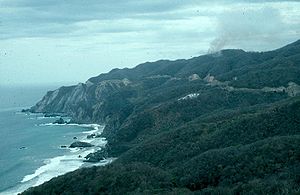
Michoacán is located in Western Mexico
. It is bordered by the states of Colima
and Jalisco
to the northwest, Guanajuato
and Querétaro
to the north, México to the east, Guerrero
to the southeast. To the southwest, Michoacán has a stretch of coastline on the Pacific Ocean
.
The name Michoacán is from Nahuatl
Michhuahkan from michhuah (“possessor of fish”) and -kan (place of) and means "place of the fishermen" referring to those who fish on Lake Pátzcuaro
. In pre-Hispanic times, the area was the home of the P'urhépecha
Empire, which rivaled the Aztec Empire when the Spanish arrived. After the Spanish conquest, the empire soon became a separate province which became smaller over the colonial period. The state and several of its residents played a major role in the Mexican War of Independence
. Today, the state is still home to a large population of P'urhépecha
people as well as Otomis
and Nahuas. The economy is based on agriculture, fishing, mining and some industry. The major tourism draw for the state is the Lake Pátzcuaro-Tzintzuntzan-Quiroga area, which was the center of the P'urhépecha empire.
and those in Curutarán, Tepalcatepec
, Apatzingán
, Zinapécuaro and Coalcoman
. The territory has been inhabited by the Nahuas, Otomis, Matlazincas, Pirindas and Tecos as well as the P’urhépecha.
The main pre-Hispanic civilization of the state is that of the P'urhépecha, which was centered in the Lake Pátzcuaro area. Before the 13th century, both Nahua and P'urhépecha peoples were here, sustaining themselves by agriculture and fishing. The P’urhépecha are descendents of a late arrival of Chichimeca
s who came from the north. At Lake Patzcuaro, they came upon people with similar cultures to their own but who were more technically and socially advanced. The formation of the P'urhépecha state began in the 13th century, when these people started their own dominion at Uayameo, today Santa Fe de la Laguna and becoming dominant over the entire Lake Patzcuaro area by the 15th century. Conquest of neighboring tribes and territories occurred between 1401 and 1450, absorbing peoples with different cultures and languages into the empire. By the late 15th century, this state rivaled that of the Aztecs, expanding their territory over much of what is now Michoacán and into part of Colima
, Nayarit
, Querétaro
, Guanajuato
, Guerrero
and Jalisco
. The Aztecs attempted to invade P'urhépecha but were repelled. This would later cause the P'urhépecha to deny the Aztecs aid in the defense of Tenochtitlan against the Spanish.
Prior to the arrival of any Spaniard in the territory, then ruler Zuanga died of smallpox
, presumably carried by one of the Aztec delegations seeking military aid. He was succeeded by Tanganxoan II. The first Spaniard to the area was Cristóbal de Olid
. The destruction of Tenochtitlan and the promise of remaining ruler convinced Tanganxoan II to submit peacefully to Spanish rule. However, Nuño de Guzmán would renege on this agreement and kill Tanganxoan II in 1530,
During the first years of the Conquest, Michoacan was part of the “kingdom of Mexico” with included the current states of Mexico, Querétaro, Hidalgo, Tlaxcala
, Oaxaca
, Morelos
, Guerrero, Veracruz
, Tabasco
, Michoacan, Guanajuato
and parts of San Luis Potosí
, Jalisco and Colima. These lands were divided into encomienda
s among the conquistador
s. The provinces with the largest populations were called Alcaldias Mayores, with Michoacan being one of these, with its capital initially at Tzintzuntzan
. Soon after, it was moved to Patzcuaro and eventually settled in what is now Morelia. The provincial and later state capital was founded by viceroy
Antonio de Mendoza
in 1541. It became the political and ecclesiastical center of the province after the death of Vasco de Quiroga
.
Soon after the Conquest, evangelists from the Franciscan
, Augustinian, Carmelite and other orders established monasteries all over the territory. Some of the best known of these include Juan de Moya, Martín de la Coruña and Jacobo Daciano. As first governor, Nuño de Guzman would devastate the social and economic order of the area. Vasco de Quirga succeeded Guzman, bringing Franciscan and Augustinian friars to both evangelize and repair the areas broken economy and social institutions. Quiroga founded the Spanish city of Patzcuaro in 1538, calling it the Ciudad de Mechuacán. For his efforts, Quiroga is still referred to in the Patzcuaro area as "Tata (grandfather) Vasco." The diocese of Michoacán was established in 1536 by Pope Paul III
and its boundaries coincide with the old Purhepecha kingdom. Its first bishop was Vasco de Quiroga.
From the 16th to the 18th century, Augustinian, Franciscan and Carmelite monasteries were constructed in the territory as well as civil constructions, especially in the city now known as Morelia. Mining in areas such as Angangueo
, Tlalpujahua
and Inguaran was begun as well as the establishment of agricultural and livestock haciendas. The first school of higher education, called the Primera Casa de Altos Estudios en América, was founded by Alonso de la Veracruz in Tiripetío. Michoacan was made a separate province from "Mexico" in 1602. By the mid 17th century, the indigenous population of the province was cut by half. In 1776, the territory of Michoacan was reduced to the area in which the modern states of Michoacan and Colima are now. Soon after, Colima split to join with the province of Guadalajara, leaving Michoacan roughly with the territory it has today.
During the entire colonial period, the economy was concentrated in the hands of the Spanish-born who held vast lands and haciendas. They also held the rights over minerals mined in places such as Tlalpujahua, Angangueo and Huetamo
. Indigenous peoples were exploited for their work and slavery was not uncommon. Education was restricted only for those born in Spain and their descendents, and was controlled by the Church. The main educational institutions were the Colegio de San Nicolas, founded in the 16th century and the Seminary of San Pedro and San Pablo, founded in the 18th century. These schools produced a number of distinguished men, but the best known of these is Miguel Hidalgo y Costilla.
At the end of the 18th century, Enlightenment
ideas from Europe began to infiltrate the upper classes of the state, especially in Valladolid (Morelia) and Zamora
. These would eventually lead to the Mexican War of Independence
in the early 19th century. This war was foreshadowed by the 1809 conspiracy in Valladolid.
One of the early and main protagonists of the war, Miguel Hidalgo y Costilla, was educated as a priest in the state and began to disseminate Enlightenment ideas here. Soon after Hidalgo performed the Grito de Dolores
in Guanajuato, a number of people influence by his thought took up arms against the colonial government. These included Manuel de la Torre Lloreda, Gertrudis Bocanegra
, José María Garcia Obeso and Ignacio López Rayón
. During his campaign, Hidalgo returned to Valladolid, issuing a decree eliminating slavery.
After Hidalgo's death, much of the insurgent government was located in Michoacan, with documents such as "Primera Constitución o Decreto Constitucional para la Libertad de la América Mexicana" (First Constitution or Constitutional Decree for the Liberty of the Mexican America) and "Sentimentos de la Nacion," both of which would shape constitutions and governments in the years to come. The first Mexican Supreme Court
was also founded here. The Mexican War of Independence was culminated by the army of Agustín de Iturbide
, also a Michoacan native, who took Morelia in May 1821.
After the war ended in 1821, the territory of Michoacan became the "Free and Sovereign State of Michoacán on 31 January 1824. This state was initially divided into 4 departments and 22 portions (partidos) under the Ley Territorial of 1825, with the first constitution ratified in the same year. The name of the capital was changed from Valladolid to Morelia at the same time.
In 1831, the state was reorganized into 61 municipalities and 207 locales (tenencias). Due to the struggle between centralists and federalists in Mexico in the 19th century, Michoacan’s rights as an entity would change depending on who was in control. The state was declared a department in 1836 but became a more independent state again in 1846. Colima broke off from Michoacán to form its own state in this year. In 1849, the municipality of Coyuca was separated to form the state of Guerrero. In 1853, the state became a department again, regaining state status in 1856. In 1857, the municipality of Contepec separated to join the state of Guanajuato. Along with the loss of political territory, by 1863, the original diocese has shrunk but it was also elevated to archdiocese.
During the French Intervention in Mexico
, Morelia was taken by French forces in 1863.Since resistance to the French was particularly strong here, punitive acts were undertaken by the French in places like Zitácuaro
, where much of the city was burned . One of first victories that would get the French out of Mexico occurred in Zamora.
In 1907, Michoacan's boundaries changed again with the addition of the communities of Pungarabato and Zirandaro
added from Guerrero state to make the Balsas River
a natural border.
The Mexican Revolution
came to Michoacan in 1911, when those loyal to Francisco I. Madero
proclaimed Santa Clara del Cobre
as their territory, then went on to take towns around Lake Patzcuaro under the leadership of Salvador Escalante. This caused the then governor of the state, Aristeo Mendoza, to resign. Fighting among various factions would continue in parts of the state for the rest of the war. The state’s current constitution was ratified in 1918.
In 1920, the Universidad Michoacana de San Nicolás de Hidalgo
was founded.
Soon after the end of the Revolution, the Cristero War
would affect the state, which affected agricultural production and distribution. In 1926, hostilities would close the seminaries in Morelia and Zamora. Near the end of the war, Lázaro Cárdenas
was elected governor of the state and served until 1932, when he became president of Mexico.
The state is crossed by the Sierra Madre del Sur
, the Trans-Mexican Volcanic Belt
and the Inter-mountain Valleys region. The Sierra Madre del Sur crosses the state northwest to southeast for approximately 200 km in the southwest between the municipalities of Chinicuila
and Arteaga
along the Pacific Coast. It is considered to be a continuation of the Sierra Madre Occidental
. Peaks in this range average about 2,900masl, with the largest being the Cerro de las Canoas. The Mexican Trans Volcanic Belt crosses the state from west to east toward the Toluca Valley
and Valley of Mexico
. This mountain range is marked by appearance of many volcanoes, active, dormant, and extinct alike. This system is subdivided into regions such as the Sierra de Tancítaro, Sierra de Periban, Sierra de San Angel and others. The best known volcano in this region is the Paricutín
volcano.
The state has a considerable natural system of waterways, including parts of two of the country's largest rivers, the Lerma
and the Balsas. These waterways are divided into three regions, called the North, Central and South. The North region includes the Lerma Basin. On the Lerma River is the Tepuxtepec Dam which has a capacity of 371 million m3. Rivers that empty in to the Lerma in Michoacan include the Tlalpuhahua, Cachivi and Duero. Another river basin here is that of Cuitzeo Lake, which extends over an area of 3,618 m2. The two main rivers that feed this lake are the Grande de Morelia and Queréndaro.
 The Central region is represented by Patzcuaro and Zirahuán Lakes. Patzcuaro Lake has a surface area of 1,525 km2. This lake is fed by a number of surface and subterranean water flows with the principal rivers leading here including the San Gregorio and Chapultepec. This lake has five islands within it called Janitzio
, Yunuén, La Pacanda, Tecuén, Jarácuaro, Urandén and Carián. Zirahuén Lake has an area of 615 km2 and is fed by streams such as Manzanilla and Zinamba. These two lakes are considered to be the main tourist attraction of the state.
Most of the state's rivers and streams are located in the South region of the state, with the Balsas River being the most important. The most important tributaries of this river include the Cutzamala, Carácuaro and Tepalcatepec rivers. Within this region is the coastal watershed, which is the area between the Sierra Madre del Sur and the coastline. This area includes small rivers such as the Coahuayana, Aquila, Ostula, Motín del Oro, Coire, Cachán and Nexpa which flow directly into the Pacific.
Much of the climate of the state is determined by altitude and other geographical features. Average temperatures vary from 13 °C to 29 °C. Lower temperatures correspond with the highland areas in the north and east which the lower south and west, called La Costa (the coast) or Tierra Caliente
(hot lands) register the higher temperatures. In the hotter lowlands, high temperatures regularly exceed 30 °C and have been known to reach over 40 °C in the summer. The lowest temperatures are registered highlands areas such as the Sierra de Coalcoman and the Sierra del Centro located near the border with the State of Mexico. Except for the Tierra Caliente, most of the state can experience freezing temperatures in the winter. Rainfall is also dependent on altitude with the lowlands receiving less rain than the mountain areas. There is a well-defined rainy season which extends from June to October over the entire state.
Ecosystems vary by altitude. Between 2600 and 3500 masl, most of the vegetation is conifer forests. Between 1000 and 2600, there are mixed forests and below this is broadleaf or tropical forests. There are some areas which are grassland, mostly located in the north and northeast of the state. Animal types vary from region to region but among mammals can be found skunks, raccoons, cacomixtle, rabbits, armadillos, mountain lions, and foxes. Numerous bird species can be found including water fowl such as ducks, storks and seabirds along the coast. Reptiles, amphibians and fish can be found in the waterways and along the coast.
are of Michoacan, the Zamora Valley and some others. Principal crops include corn, sorghum
, avocado
s, strawberries, peaches, wheat, limes, sugar cane and mango
s. While corn accounts for 43% of the crops harvested, Michoacan is the largest producer of avocados in Mexico and in the world. Forty three percent of farmland in the territory is dedicated to the raising of livestock including cattle, domestic fowl, sheep, goats and pigs. In 2007, the state's production of meat, dairy and eggs was valued at over four billion pesos.
Sixty percent of the state is covered in forest, with the most economically important of these located in the higher elevations at the eastern side.(economía) These forests mostly produce lumber and resin. These areas are estimated at 2,160,000 hectares, over half of which is pine forest. The most productive forest is located in the central and eastern portions of the state. Rainforest areas are estimated at 460,500 hectares. However, one problem facing the forested areas of the state is unsustainable logging. In addition to exploitable forest, there is also ecological reserves with tourist important, especially the various monarch butterfly sanctuaries in the extreme east of the state.
Michoacán's lakes, rivers and coastline make it an important producer of fish and seafood, both caught in the wild and farmed. The most important commercial fishing is for tilapia
and carp
.
Mining is an important economic activity in the state, which is mostly concentrated on the eastern side near the Mexico State border. However, iron is mined in the Lázaro Cárdenas area near the coast. Both metallic and non-metallic minerals are mined in the state. These include iron, copper, zinc, cadmium
, lead, silver, gold, fill dirt, sand, gravel, lime, limestone, marble, and others. There are thirteen principal mining areas, Tlalpujahua, Angangueo, Los Azufres, Real de Otzumatlán, Tzitzio, Tiámaro, El Bastán, San Diego Curucupacéo, Inguarán, Las Truchas and La Minita de Coalcomán. Michoacán is the second largest producer of coke and third largest producer of iron, which are essential to the steel industry in Mexico. While there remains significant metallic deposits, their mining only contributes 1.64% to the economy.
Most industrial activity is concentrated in the central region of the state, near the capital, where are located a number of industrial parks such as Ciudad Industrial Morelia. However. there are other areas with industry, such as Apatzingán, Zamora, Jiquilpan and Sahuayo
as well as in the Lázaro Cárdenas
area. Major production areas are iron and steel (34.27%), bottling (10.43%) and paper products (8.36%).
Most people in the state are employed in service and commerce, and this sector contributes 19.07% to the overall economy. Most sales are in foodstuffs, drinks and tobacco. The state contains a large number of potential attractions, most of which are classified as suitable for ecotourism. However, only 6.2 of these sites are visited by international tourists. Most visitors to sites are from within the state.
The Universidad Michoacan de San Nicolás de Hidalgo began as the Colegio de San Nicolas Obispo, founded by Vasco de Quiroga in Patzcuaro in 1540. It was originally a seminary for the training of evangelists. It was granted a royal seal in 1543 to become the Real Colegio de San Nicolás Obispo. The school was moved to Morelia in 1580 and was fused with the Colegio de San Miguel Guayangareo. In 1590, its name was changed to the Seminario Tridentino, when the Seminario Conciliar in 1601. By the end of the 17th century, the name returned to Colegio de San Nicolás but its structure was profoundly changed, adding studies such as philosophy and others, civil law and others. At the end of the 18th and beginning of the 19th centuries, a number of figures associated with the Mexican War of Independence, such as Miguel Hidalgo y Costilla, José María Morelos and others were associated with this school. By the mid 19th century, the school had been secularized and renamed the Primitivo y Nacional Colegio de San Nicolás de Hidalgo adding studies such as chemistry, physics and other sciences. The current name and organization was adopted after the Mexican Revolution in 1917.
 The state ministry of tourism has divided the state into regions, mostly base on the major cities of Morelia, Uruapan, Lazaro Cardenas, Patzcuaro, Zamora and Zitácuaro.
The Morelia region stresses its cultural and artistic heritage, especially its colonial architecture . The most important colonial structures are in Morelia and built in the 18th century. These include the cathedral, finished in 1744 and the main aqueduct finished at the end of the century. This architecture has made the city a World Heritage Site
. In addition to the state capital, the region includes towns such as Charo, Capula, Tiripetio, Cuitzeo and Huandacareo
, which contain archeological sites, water parks and traditional cuisine. The rural areas of this zone contain more than 400 thermal springs, many of which have been turned into recreational areas and parks. These include Reino de Atzimba, Cointzio, Huandacareo and El Ejido.
The Uruapan region stresses its cultural and natural heritage. The city is one of the oldest settlements in the state, which was initially settled by the Meseta Purhepecha. This city contains a number of attractions such as La Huatápera, colonial era hospital founded by Vasco de Quiroga, the Temple of San Francisco and the Eduardo Ruiz Municipal Museum. One other attraction is the narrowest house in the world as documented by the Guinness Book of World Records. Other important cities in the region are Apatzingán and Caracha.
Uruapan is surrounded by hundreds of hectares of forests and by fertile fields growing fruits and flowers, many of which only grow here. Some of the natural attractions of the zone include the Santa Catarina Dam and the La Tzaráacua and La Tzararacuita waterfalls. Smaller towns and villages in this region are known for their religious and popular festivals, many of which occur in the summer. Examples of these are the feasts of Señor del Calvario in Quinceo, of San Mateo Ahuiran in Paracho and the National Guitar Festival in Paracho. The best known town in the region is San Juan Nuevo Parangaricutiro, which was founded due to the destruction of its original namesake by the eruption of the Paricutín volcano.
The pre-Hispanic sites of Tingambato
and Taretan
are in this zone as well, which were important Purhepecha cities.
The Lázaro Cárdenas region is named after Michoacán largest port and oceanside city. Here the state stresses the miles of beaches and other natural areas in which to practice ecotourism and extreme sports. Beaches include Maruata, Faro de Bucerías, the Pichi Estuary, La Laguna de Mezcala, La Ticla and Nexpa, with the last two considered suitable for surfing with their regular two-three meter waves. A number of these beaches are protected areas due to the fact that they are breeding ground for sea turtles.
The Patzcuaro region is extremely important to the state due to its history of having been the center of the Purhepecha Empire as well as the first capital of the colonial province of Michoacan. Its pre-Hispanic heritage is evident by the Tzintzuntzan and Ihuatizo sites as well as the large number of people who still speak the Purhepecha language and maintain pre-Hispanic customs. Vasco de Quiroga established the first capital at Patzcuaro and was instrumental to building the colonial era economy of the Lake Patzcuaro area. The lake is surrounded by mountains and forests as well as the towns of Cuanajo, Tupátaro, Eronguícuaro and Quiroga
. These towns are noted for their crafts and popular religious festivals such as the feast of the Señor del Rescate in Tzintzuntzan
, Holy Week and especially Noche de Muertos or Night of the Dead. This are is the most important to the state with the most visited town, Patzcuaro with its basilica and museums.
One of the largest tourist events in the state is Noche de Muertos or Night of the Dead. This is celebrated on the dates around 2 November. Essentially, these are Day of the Dead
celebrations, which are celebrated all over Mexico, but with unique variations. The events of these days show a blending of both pre-Hispanic and Catholic beliefs and traditions. Noche de Muertos is celebrated most strongly in the towns and villages around Lake Patzcuaro such as Tzintzuntzan, Ihuatzio, as well as Patzuaro itself, which was the center of the Purhepecha Empire. As in other parts of Mexico, altars to the dead, both in homes and on graves are erected and covered with offerings such as bread, fruit and other items. One aspect which is unique to the event here is the lighting and floating of hundreds of small candles and flowers on Lake Patzcuaro on the night between 1 and 2 November. It is also believed that on this night the souls of Mintzita, the daughter of Purhepecha kind Tzintzicha and Itzihuapa, son of Taré rise. Theirs is a Romeo and Juliet storyas they were never able to marry due to the Spanish invasion of their lands. Today, it is said that the two rise up and head toward a specific cemetery to receive visitors. There are a number of other rituals performed on these days such as the Terescuan y Campaneri… a kind of treasure hunt for hidden harvest items.
The Zamora region is center of the city of the same name in an area known as the Meseta Purépecha or Purhepecha Mesa. Pre-Hispanic language and customs are preserved here as well as well as a large number of crafts such s the pottery of Ptamban and the embroidery of Tarecuato. The region is part of an area of Mexico known as the Bajío and has extensive agriculture, livestock and some industry. Regional dishes such as pigs' feet, breads baked in wood fired ovens, tamale
s, pozole
and dishes made with avocados and corn are promoted here. Important towns outside of Zamora include Camécuaro, Orandiro, La Estancia and La Alberca. The city of Zamora is home to one of the oldest cultures in the west of Mexico which dates to about 1750 BCE, known as the Opeño. The Spanish city was founded as a military garrison.
The Zitacuaro region contains approximately a half million hectares of conifer forests, but is best known as being part of the wintering grounds of the monarch butterfly
. The area is filled with old mining towns as well as an important archeological site. The region is home to the Mazahua
and Otomi peoples, many of whom produce crafts such as blankets, rebozo
s and ceramics. The city of Zitacuaro is the site of an important battle during the French Intervention in Mexico, which gives it the title of "Heroic City." Other important communities include Añgangueo, San Matias and Ciudad Hidalgo. The most important places to see monarch butterflies in the winder are in municipalities of Angangeo and Ocampo. The butterfly sanctuaries are called El Rosario, Cerro Campanario, Sierra Chincua and El Llanno de las Papas."
The indigenous population is estimated at just over seven percent of the total, with most living in 29 municipalities. Most are P’urhepécha, which are located in the Meseta-Cañada, Patzcuaro Lake, Zirahuén Lake, and Zacapu regions. In the east of the state, in the municipalities of Ocampo, Anguangueo, Tuxpan, Hidalgo, Maravatío and Zitácuaro, there is a mix of Mazahua, Otomi and Purhepecha. On the coast can be found the Aquila, Chinicuila and Coahuayana peoples.
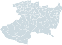 There are 113 Municipalities.
Mexico City
Mexico City is the Federal District , capital of Mexico and seat of the federal powers of the Mexican Union. It is a federal entity within Mexico which is not part of any one of the 31 Mexican states but belongs to the federation as a whole...
, comprise the 32 Federal Entities of Mexico
Mexico
The United Mexican States , commonly known as Mexico , is a federal constitutional republic in North America. It is bordered on the north by the United States; on the south and west by the Pacific Ocean; on the southeast by Guatemala, Belize, and the Caribbean Sea; and on the east by the Gulf of...
. It is divided in 113 municipalities
Municipalities of Michoacán
The Mexican state of Michoacánis made up of 113 municipios :...
and its capital city is Morelia
Morelia
Morelia is a city and municipality in the north central part of the state of Michoacán in central Mexico. The city is in the Guayangareo Valley and is the capital of the state. The main pre-Hispanic cultures here were the P'urhépecha and the Matlatzinca, but no major cities were founded in the...
(formerly called Valladolid). The city was named after José María Morelos
José María Morelos
José María Teclo Morelos y Pavón was a Mexican Roman Catholic priest and revolutionary rebel leader who led the Mexican War of Independence movement, assuming its leadership after the execution of Miguel Hidalgo y Costilla in 1811...
, hero of the Mexican War of Independence
Mexican War of Independence
The Mexican War of Independence was an armed conflict between the people of Mexico and the Spanish colonial authorities which started on 16 September 1810. The movement, which became known as the Mexican War of Independence, was led by Mexican-born Spaniards, Mestizos and Amerindians who sought...
.
Michoacán is located in Western Mexico
Western Mexico
The Western Mexico is a region of United Mexican States, formed by the states of Jalisco, Nayarit, Colima and Michoacan, also includes the Revillagigedo Islands, Marías Islands and several smaller islands...
. It is bordered by the states of Colima
Colima
Colima is one of the 31 states which, with the Federal District, make up the 32 Federal Entities of Mexico. It shares its name with its capital and main city, Colima....
and Jalisco
Jalisco
Jalisco officially Estado Libre y Soberano de Jalisco is one of the 31 states which, with the Federal District, comprise the 32 Federal Entities of Mexico. It is located in Western Mexico and divided in 125 municipalities and its capital city is Guadalajara.It is one of the more important states...
to the northwest, Guanajuato
Guanajuato
Guanajuato officially Estado Libre y Soberano de Guanajuato is one of the 31 states which, with the Federal District, comprise the 32 Federal Entities of Mexico. It is divided in 46 municipalities and its capital city is Guanajuato....
and Querétaro
Querétaro
Querétaro officially Estado Libre y Soberano de Querétaro de Arteaga is one of the 31 states which, with the Federal District, comprise the 32 Federal Entities of Mexico. It is divided into 18 municipalities and its capital city is Santiago de Querétaro....
to the north, México to the east, Guerrero
Guerrero
Guerrero officially Estado Libre y Soberano de Guerrero is one of the 31 states which, with the Federal District, comprise the 32 Federal Entities of Mexico. It is divided in 81 municipalities and its capital city is Chilpancingo....
to the southeast. To the southwest, Michoacán has a stretch of coastline on the Pacific Ocean
Pacific Ocean
The Pacific Ocean is the largest of the Earth's oceanic divisions. It extends from the Arctic in the north to the Southern Ocean in the south, bounded by Asia and Australia in the west, and the Americas in the east.At 165.2 million square kilometres in area, this largest division of the World...
.
The name Michoacán is from Nahuatl
Nahuatl
Nahuatl is thought to mean "a good, clear sound" This language name has several spellings, among them náhuatl , Naoatl, Nauatl, Nahuatl, Nawatl. In a back formation from the name of the language, the ethnic group of Nahuatl speakers are called Nahua...
Michhuahkan from michhuah (“possessor of fish”) and -kan (place of) and means "place of the fishermen" referring to those who fish on Lake Pátzcuaro
Lake Pátzcuaro
Lake Pátzcuaro is a lake in the municipality of Pátzcuaro, Michoacán, Mexico.The natives believe that the lake is the place where the barrier between life and death is the thinnest....
. In pre-Hispanic times, the area was the home of the P'urhépecha
P'urhépecha
The P'urhépecha, normally spelled Purépecha in Spanish and in English and traditionally referred to as Tarascans, are an indigenous people centered in the northwestern region of the Mexican state of Michoacán, principally in the area of the cities of Uruapan and Pátzcuaro...
Empire, which rivaled the Aztec Empire when the Spanish arrived. After the Spanish conquest, the empire soon became a separate province which became smaller over the colonial period. The state and several of its residents played a major role in the Mexican War of Independence
Mexican War of Independence
The Mexican War of Independence was an armed conflict between the people of Mexico and the Spanish colonial authorities which started on 16 September 1810. The movement, which became known as the Mexican War of Independence, was led by Mexican-born Spaniards, Mestizos and Amerindians who sought...
. Today, the state is still home to a large population of P'urhépecha
P'urhépecha
The P'urhépecha, normally spelled Purépecha in Spanish and in English and traditionally referred to as Tarascans, are an indigenous people centered in the northwestern region of the Mexican state of Michoacán, principally in the area of the cities of Uruapan and Pátzcuaro...
people as well as Otomis
Otomi people
The Otomi people . Smaller Otomi populations exist in the states of Puebla, Mexico, Tlaxcala, Michoacán and Guanajuato. The Otomi language belonging to the Oto-Pamean branch of the Oto-Manguean language family is spoken in many different varieties some of which are not mutually intelligible.One of...
and Nahuas. The economy is based on agriculture, fishing, mining and some industry. The major tourism draw for the state is the Lake Pátzcuaro-Tzintzuntzan-Quiroga area, which was the center of the P'urhépecha empire.
History
According to the archeological evidence, there has been human habitation within the territory of the Mexican state of Michoacán for at least 10,000 years. In the pre-Hispanic period there were a number of waves of migration into the area including the Pirinda, Nahua, Huetamo, Colima, Purhepecha and other peoples. There are sites of formal settlements from all Mesoamerican period. Important sites include El OpeñoEl Opeño
El Opeño is an archaeological site located in the municipality of Jacona, in the Michoacan state, México. It is home to a prehispanic site, mainly known from the ceramic material found in the funerary complexes of the site, which have been dated to the late preclassical mesoamerican period...
and those in Curutarán, Tepalcatepec
Tepalcatepec
Tepalcatepec is a town in Michoacán, Mexico, located north of Canollita.It is the endemic environment of Michoacan Club-tail iguana...
, Apatzingán
Apatzingán
Apatzingán is a city and its surrounding municipality. It's located in the hot Tierra Caliente valley, in the west-central part of the Mexican state of Michoacán. The city is the fourth-largest in Michoacán , with a 2005 census population of 93,180 persons...
, Zinapécuaro and Coalcoman
Coalcomán de Vázquez Pallares
Coalcomán de Vázquez Pallares is a municipality located in the southwest region of the Mexican state of Michoacán. The municipality has an area of 2,881.57 square kilometres and is bordered to the north by the state of Jalisco and the municipality of Tepalcatepec, to the east by Arteaga and...
. The territory has been inhabited by the Nahuas, Otomis, Matlazincas, Pirindas and Tecos as well as the P’urhépecha.
The main pre-Hispanic civilization of the state is that of the P'urhépecha, which was centered in the Lake Pátzcuaro area. Before the 13th century, both Nahua and P'urhépecha peoples were here, sustaining themselves by agriculture and fishing. The P’urhépecha are descendents of a late arrival of Chichimeca
Chichimeca
Chichimeca was the name that the Nahua peoples of Mexico generically applied to a wide range of semi-nomadic peoples who inhabited the north of modern-day Mexico and southwestern United States, and carried the same sense as the European term "barbarian"...
s who came from the north. At Lake Patzcuaro, they came upon people with similar cultures to their own but who were more technically and socially advanced. The formation of the P'urhépecha state began in the 13th century, when these people started their own dominion at Uayameo, today Santa Fe de la Laguna and becoming dominant over the entire Lake Patzcuaro area by the 15th century. Conquest of neighboring tribes and territories occurred between 1401 and 1450, absorbing peoples with different cultures and languages into the empire. By the late 15th century, this state rivaled that of the Aztecs, expanding their territory over much of what is now Michoacán and into part of Colima
Colima
Colima is one of the 31 states which, with the Federal District, make up the 32 Federal Entities of Mexico. It shares its name with its capital and main city, Colima....
, Nayarit
Nayarit
Nayarit officially Estado Libre y Soberano de Nayarit is one of the 31 states which, with the Federal District, comprise the 32 Federal Entities of Mexico. It is divided in 20 municipalities and its capital city is Tepic.It is located in Western Mexico...
, Querétaro
Querétaro
Querétaro officially Estado Libre y Soberano de Querétaro de Arteaga is one of the 31 states which, with the Federal District, comprise the 32 Federal Entities of Mexico. It is divided into 18 municipalities and its capital city is Santiago de Querétaro....
, Guanajuato
Guanajuato
Guanajuato officially Estado Libre y Soberano de Guanajuato is one of the 31 states which, with the Federal District, comprise the 32 Federal Entities of Mexico. It is divided in 46 municipalities and its capital city is Guanajuato....
, Guerrero
Guerrero
Guerrero officially Estado Libre y Soberano de Guerrero is one of the 31 states which, with the Federal District, comprise the 32 Federal Entities of Mexico. It is divided in 81 municipalities and its capital city is Chilpancingo....
and Jalisco
Jalisco
Jalisco officially Estado Libre y Soberano de Jalisco is one of the 31 states which, with the Federal District, comprise the 32 Federal Entities of Mexico. It is located in Western Mexico and divided in 125 municipalities and its capital city is Guadalajara.It is one of the more important states...
. The Aztecs attempted to invade P'urhépecha but were repelled. This would later cause the P'urhépecha to deny the Aztecs aid in the defense of Tenochtitlan against the Spanish.
Prior to the arrival of any Spaniard in the territory, then ruler Zuanga died of smallpox
Smallpox
Smallpox was an infectious disease unique to humans, caused by either of two virus variants, Variola major and Variola minor. The disease is also known by the Latin names Variola or Variola vera, which is a derivative of the Latin varius, meaning "spotted", or varus, meaning "pimple"...
, presumably carried by one of the Aztec delegations seeking military aid. He was succeeded by Tanganxoan II. The first Spaniard to the area was Cristóbal de Olid
Cristóbal de Olid
Cristóbal de Olid was a Spanish adventurer, conquistador and rebel who played a part in the conquest of Mexico and Honduras.Born in Zaragoza, Olid grew up in the household of the governor of Cuba, Diego Velázquez de Cuéllar. In 1518 Velázquez sent Olid to relieve Juan de Grijalva, but en route a...
. The destruction of Tenochtitlan and the promise of remaining ruler convinced Tanganxoan II to submit peacefully to Spanish rule. However, Nuño de Guzmán would renege on this agreement and kill Tanganxoan II in 1530,
During the first years of the Conquest, Michoacan was part of the “kingdom of Mexico” with included the current states of Mexico, Querétaro, Hidalgo, Tlaxcala
Tlaxcala
Tlaxcala officially Estado Libre y Soberano de Tlaxcala is one of the 31 states which along with the Federal District comprise the 32 federative entities of Mexico. It is divided into 60 municipalities and its capital city is Tlaxcala....
, Oaxaca
Oaxaca
Oaxaca , , officially Estado Libre y Soberano de Oaxaca is one of the 31 states which, along with the Federal District, comprise the 32 federative entities of Mexico. It is divided into 571 municipalities; of which 418 are governed by the system of customs and traditions...
, Morelos
Morelos
Morelos officially Estado Libre y Soberano de Morelos is one of the 31 states which, with the Federal District, comprise the 32 Federal Entities of Mexico. It is divided in 33 municipalities and its capital city is Cuernavaca....
, Guerrero, Veracruz
Veracruz
Veracruz, formally Veracruz de Ignacio de la Llave officially Estado Libre y Soberano de Veracruz de Ignacio de la Llave , is one of the 31 states that, along with the Federal District, comprise the 32 federative entities of Mexico. It is divided in 212 municipalities and its capital city is...
, Tabasco
Tabasco
Tabasco officially Estado Libre y Soberano de Tabasco is one of the 31 states which, with the Federal District, comprise the 32 Federal Entities of Mexico. It is divided in 17 municipalities and its capital city is Villahermosa....
, Michoacan, Guanajuato
Guanajuato
Guanajuato officially Estado Libre y Soberano de Guanajuato is one of the 31 states which, with the Federal District, comprise the 32 Federal Entities of Mexico. It is divided in 46 municipalities and its capital city is Guanajuato....
and parts of San Luis Potosí
San Luis Potosí
San Luis Potosí officially Estado Libre y Soberano de San Luis Potosí is one of the 31 states which, with the Federal District, comprise the 32 Federal Entities of Mexico. It is divided in 58 municipalities and its capital city is San Luis Potosí....
, Jalisco and Colima. These lands were divided into encomienda
Encomienda
The encomienda was a system that was employed mainly by the Spanish crown during the colonization of the Americas to regulate Native American labor....
s among the conquistador
Conquistador
Conquistadors were Spanish soldiers, explorers, and adventurers who brought much of the Americas under the control of Spain in the 15th to 16th centuries, following Europe's discovery of the New World by Christopher Columbus in 1492...
s. The provinces with the largest populations were called Alcaldias Mayores, with Michoacan being one of these, with its capital initially at Tzintzuntzan
Tzintzuntzan, Michoacán
Tzintzuntzán is a town and municipality located in the north of Michoacán state, 53 km from the capital of Morelia and 17.5 km from Pátzcuaro, located on the northeast shore of Lake Pátzcuaro. It is best known as the former capital of the Tarascan state until it was conquered by the...
. Soon after, it was moved to Patzcuaro and eventually settled in what is now Morelia. The provincial and later state capital was founded by viceroy
Viceroy
A viceroy is a royal official who runs a country, colony, or province in the name of and as representative of the monarch. The term derives from the Latin prefix vice-, meaning "in the place of" and the French word roi, meaning king. A viceroy's province or larger territory is called a viceroyalty...
Antonio de Mendoza
Antonio de Mendoza
Antonio de Mendoza y Pacheco, Marquis of Mondéjar, Count of Tendilla , was the first viceroy of New Spain, serving from April 17, 1535 to November 25, 1550, and the second viceroy of Peru, from September 23, 1551 to July 21, 1552...
in 1541. It became the political and ecclesiastical center of the province after the death of Vasco de Quiroga
Vasco de Quiroga
Vasco de Quiroga was the first bishop of Michoacán, Mexico and one of the judges in the second Audiencia that governed New Spain from January 10, 1531 to April 16, 1535....
.
Soon after the Conquest, evangelists from the Franciscan
Franciscan
Most Franciscans are members of Roman Catholic religious orders founded by Saint Francis of Assisi. Besides Roman Catholic communities, there are also Old Catholic, Anglican, Lutheran, ecumenical and Non-denominational Franciscan communities....
, Augustinian, Carmelite and other orders established monasteries all over the territory. Some of the best known of these include Juan de Moya, Martín de la Coruña and Jacobo Daciano. As first governor, Nuño de Guzman would devastate the social and economic order of the area. Vasco de Quirga succeeded Guzman, bringing Franciscan and Augustinian friars to both evangelize and repair the areas broken economy and social institutions. Quiroga founded the Spanish city of Patzcuaro in 1538, calling it the Ciudad de Mechuacán. For his efforts, Quiroga is still referred to in the Patzcuaro area as "Tata (grandfather) Vasco." The diocese of Michoacán was established in 1536 by Pope Paul III
Pope Paul III
Pope Paul III , born Alessandro Farnese, was Pope of the Roman Catholic Church from 1534 to his death in 1549. He came to the papal throne in an era following the sack of Rome in 1527 and rife with uncertainties in the Catholic Church following the Protestant Reformation...
and its boundaries coincide with the old Purhepecha kingdom. Its first bishop was Vasco de Quiroga.
From the 16th to the 18th century, Augustinian, Franciscan and Carmelite monasteries were constructed in the territory as well as civil constructions, especially in the city now known as Morelia. Mining in areas such as Angangueo
Angangueo
Angangueo is a town and municipality located in far eastern Michoacán state in central Mexico noted for its history of mining and its location in the Monarch Butterfly Biosphere Reserve. It is located in high rugged forested mountains, with the town in a small canyon...
, Tlalpujahua
Tlalpujahua
Tlalpujahua is a town and municipality located in the far northeast of the state of Michoacán in central Mexico. It is a former mining town, home of the Dos Estrellas Mine, which was the leading producer of gold in the early 20th century...
and Inguaran was begun as well as the establishment of agricultural and livestock haciendas. The first school of higher education, called the Primera Casa de Altos Estudios en América, was founded by Alonso de la Veracruz in Tiripetío. Michoacan was made a separate province from "Mexico" in 1602. By the mid 17th century, the indigenous population of the province was cut by half. In 1776, the territory of Michoacan was reduced to the area in which the modern states of Michoacan and Colima are now. Soon after, Colima split to join with the province of Guadalajara, leaving Michoacan roughly with the territory it has today.
During the entire colonial period, the economy was concentrated in the hands of the Spanish-born who held vast lands and haciendas. They also held the rights over minerals mined in places such as Tlalpujahua, Angangueo and Huetamo
Huetamo
Huetamo is a municipality in the southeastern corner of the Mexican state of Michoacán, in a region known as "Tierra Caliente" . Of indigenous Purepecha Indian origin, the word "Huetamo" means "four chiefs" or "four came". Fr...
. Indigenous peoples were exploited for their work and slavery was not uncommon. Education was restricted only for those born in Spain and their descendents, and was controlled by the Church. The main educational institutions were the Colegio de San Nicolas, founded in the 16th century and the Seminary of San Pedro and San Pablo, founded in the 18th century. These schools produced a number of distinguished men, but the best known of these is Miguel Hidalgo y Costilla.
At the end of the 18th century, Enlightenment
Age of Enlightenment
The Age of Enlightenment was an elite cultural movement of intellectuals in 18th century Europe that sought to mobilize the power of reason in order to reform society and advance knowledge. It promoted intellectual interchange and opposed intolerance and abuses in church and state...
ideas from Europe began to infiltrate the upper classes of the state, especially in Valladolid (Morelia) and Zamora
Zamora, Michoacán
Zamora de Hidalgo, is a city in the Mexican state of Michoacán. The 2010 census population was 141,627. making it the third largest city in the state. The city is the municipal seat of Zamora Municipality, which has an area of 330.97 km² and includes many other smaller communities, the largest of...
. These would eventually lead to the Mexican War of Independence
Mexican War of Independence
The Mexican War of Independence was an armed conflict between the people of Mexico and the Spanish colonial authorities which started on 16 September 1810. The movement, which became known as the Mexican War of Independence, was led by Mexican-born Spaniards, Mestizos and Amerindians who sought...
in the early 19th century. This war was foreshadowed by the 1809 conspiracy in Valladolid.
One of the early and main protagonists of the war, Miguel Hidalgo y Costilla, was educated as a priest in the state and began to disseminate Enlightenment ideas here. Soon after Hidalgo performed the Grito de Dolores
Grito de Dolores
The Grito de Dolores also known as El Grito de la Independencia , uttered from the small town of Dolores, near Guanajuato on April 19, 1810 is the event that marks the beginning of the Mexican War of Independence and is the most important national holiday observed in Mexico...
in Guanajuato, a number of people influence by his thought took up arms against the colonial government. These included Manuel de la Torre Lloreda, Gertrudis Bocanegra
Gertrudis Bocanegra
María Gertrudis Bocanegra de Mendoza de Lazo de la Vega was a woman who fought in the Mexican War of Independence. She was arrested, tortured and executed in 1817....
, José María Garcia Obeso and Ignacio López Rayón
Ignacio López Rayón
Ignacio López Rayón led the revolutionary government of his country after Miguel Hidalgo's death, during the first years of the Mexican War of Independence....
. During his campaign, Hidalgo returned to Valladolid, issuing a decree eliminating slavery.
After Hidalgo's death, much of the insurgent government was located in Michoacan, with documents such as "Primera Constitución o Decreto Constitucional para la Libertad de la América Mexicana" (First Constitution or Constitutional Decree for the Liberty of the Mexican America) and "Sentimentos de la Nacion," both of which would shape constitutions and governments in the years to come. The first Mexican Supreme Court
Supreme Court of Justice of the Nation
The Supreme Court of Justice of the Nation is the highest federal court in the United Mexican States. It consists of a President of the Supreme Court and ten Ministers who are confirmed by the Senate from a list proposed by the President of the Republic.Justices of the SCJN serve for fifteen...
was also founded here. The Mexican War of Independence was culminated by the army of Agustín de Iturbide
Agustín de Iturbide
Agustín Cosme Damián de Iturbide y Aramburu , also known as Augustine I of Mexico, was a Mexican army general who built a successful political and military coalition that was able to march into Mexico City on 27 September 1821, decisively ending the Mexican War of Independence...
, also a Michoacan native, who took Morelia in May 1821.
After the war ended in 1821, the territory of Michoacan became the "Free and Sovereign State of Michoacán on 31 January 1824. This state was initially divided into 4 departments and 22 portions (partidos) under the Ley Territorial of 1825, with the first constitution ratified in the same year. The name of the capital was changed from Valladolid to Morelia at the same time.
In 1831, the state was reorganized into 61 municipalities and 207 locales (tenencias). Due to the struggle between centralists and federalists in Mexico in the 19th century, Michoacan’s rights as an entity would change depending on who was in control. The state was declared a department in 1836 but became a more independent state again in 1846. Colima broke off from Michoacán to form its own state in this year. In 1849, the municipality of Coyuca was separated to form the state of Guerrero. In 1853, the state became a department again, regaining state status in 1856. In 1857, the municipality of Contepec separated to join the state of Guanajuato. Along with the loss of political territory, by 1863, the original diocese has shrunk but it was also elevated to archdiocese.
During the French Intervention in Mexico
French intervention in Mexico
The French intervention in Mexico , also known as The Maximilian Affair, War of the French Intervention, and The Franco-Mexican War, was an invasion of Mexico by an expeditionary force sent by the Second French Empire, supported in the beginning by the United Kingdom and the Kingdom of Spain...
, Morelia was taken by French forces in 1863.Since resistance to the French was particularly strong here, punitive acts were undertaken by the French in places like Zitácuaro
Zitácuaro
Zitácuaro is a city in the Mexican state of Michoacán. The city is the administrative centre for the surrounding municipality of the same name, which lies at the extreme eastern side of Michoacán and borders on the adjacent state of México...
, where much of the city was burned . One of first victories that would get the French out of Mexico occurred in Zamora.
In 1907, Michoacan's boundaries changed again with the addition of the communities of Pungarabato and Zirandaro
Zirándaro
Zirándaro is one of the 81 municipalities of Guerrero, in south-western Mexico. The municipal seat lies at Zirándaro de los Chávez. The municipality covers an area of 2,475.6 km².As of 2005, the municipality had a total population of 20,053....
added from Guerrero state to make the Balsas River
Balsas River
The Balsas River is a major river of south-central Mexico. The basin flows through the states of Puebla, Morelos, Guerrero, and Mexico. The river empties into the Pacific Ocean at Mangrove Point, adjacent to the city of Lázaro Cárdenas, Michoacán...
a natural border.
The Mexican Revolution
Mexican Revolution
The Mexican Revolution was a major armed struggle that started in 1910, with an uprising led by Francisco I. Madero against longtime autocrat Porfirio Díaz. The Revolution was characterized by several socialist, liberal, anarchist, populist, and agrarianist movements. Over time the Revolution...
came to Michoacan in 1911, when those loyal to Francisco I. Madero
Francisco I. Madero
Francisco Ignacio Madero González was a politician, writer and revolutionary who served as President of Mexico from 1911 to 1913. As a respectable upper-class politician, he supplied a center around which opposition to the dictatorship of Porfirio Díaz could coalesce...
proclaimed Santa Clara del Cobre
Santa Clara del Cobre
Santa Clara del Cobre is a town and municipality located in the center of the state of Michoacán, Mexico, 18 km from Pátzcuaro and 79 km from the state capital of Morelia...
as their territory, then went on to take towns around Lake Patzcuaro under the leadership of Salvador Escalante. This caused the then governor of the state, Aristeo Mendoza, to resign. Fighting among various factions would continue in parts of the state for the rest of the war. The state’s current constitution was ratified in 1918.
In 1920, the Universidad Michoacana de San Nicolás de Hidalgo
Universidad Michoacana de San Nicolás de Hidalgo
Universidad Michoacana de San Nicolás de Hidalgo is a public university in Morelia, Michoacán, Mexico, and the oldest institution of higher education in the Americas...
was founded.
Soon after the end of the Revolution, the Cristero War
Cristero War
The Cristero War of 1926 to 1929 was an uprising and counter-revolution against the Mexican government in power at that time. The rebellion was set off by the strict enforcement of the anti-clerical provisions of the Mexican Constitution of 1917 and the expansion of further anti-clerical laws...
would affect the state, which affected agricultural production and distribution. In 1926, hostilities would close the seminaries in Morelia and Zamora. Near the end of the war, Lázaro Cárdenas
Lázaro Cárdenas
Lázaro Cárdenas del Río was President of Mexico from 1934 to 1940.-Early life:Lázaro Cárdenas was born on May 21, 1895 in a lower-middle class family in the village of Jiquilpan, Michoacán. He supported his family from age 16 after the death of his father...
was elected governor of the state and served until 1932, when he became president of Mexico.
Geography, climate and nature
The state is located in the center west of the Mexican Republic, on the extreme southwest of the central highlands. It borders the states of Mexico, Querétaro, Guerrero, Guanajuato, Jalisco and Colima, with a 217 km coastline on the Pacific Ocean. The state has a territory of 58,836.95 km2, making it the sixth largest in Mexico. In addition, it also has 1490 km2 of marine territory off its Pacific coast.The state is crossed by the Sierra Madre del Sur
Sierra Madre del Sur
The Sierra Madre del Sur is a mountain range in southern Mexico, extending from southern Michoacán east through Guerrero, to the Istmo de Tehuantepec in eastern Oaxaca.-Geography:...
, the Trans-Mexican Volcanic Belt
Trans-Mexican volcanic belt
The Trans-Mexican Volcanic Belt also known as the Transvolcanic Belt and locally as the Sierra Nevada , is a volcanic belt that extends 900 km from west to east across central-southern Mexico...
and the Inter-mountain Valleys region. The Sierra Madre del Sur crosses the state northwest to southeast for approximately 200 km in the southwest between the municipalities of Chinicuila
Chinicuila
Chinicuila is a municipality located in the southwestern region of the Mexican state of Michoacán. The municipality has an area of 928.64 square kilometres and is bordered to the north by the state of Jalisco, to the east by Coalcomán, to the south by Aquila, and to the west by Coahuayana and the...
and Arteaga
Arteaga, Michoacán
Arteaga is a municipality located in the southern region of the Mexican state of Michoacán. The municipality has an area of 3,454.71 square kilometres and is bordered to the north by the municipality of La Huacana, to the east by Churumuco and the state of Guerrero, to the south by Lázaro...
along the Pacific Coast. It is considered to be a continuation of the Sierra Madre Occidental
Sierra Madre Occidental
The Sierra Madre Occidental is a mountain range in western Mexico.-Setting:The range runs north to south, from just south of the Sonora–Arizona border southeast through eastern Sonora, western Chihuahua, Sinaloa, Durango, Zacatecas, Nayarit, Jalisco, Aguascalientes to Guanajuato, where it joins...
. Peaks in this range average about 2,900masl, with the largest being the Cerro de las Canoas. The Mexican Trans Volcanic Belt crosses the state from west to east toward the Toluca Valley
Toluca Valley
Toluca Valley is a valley located approximately 75 km southwest Mexico City. The modern city of Toluca is located there. Other municipalities within valley and part of the Toluca metropolitan area include Metepec, Calimaya, Almoloya de Juárez, San Mateo Atenco, Lerma, Lago, Temoaya, Otzolotepec and...
and Valley of Mexico
Valley of Mexico
The Valley of Mexico is a highlands plateau in central Mexico roughly coterminous with the present-day Distrito Federal and the eastern half of the State of Mexico. Surrounded by mountains and volcanoes, the Valley of Mexico was a centre for several pre-Columbian civilizations, including...
. This mountain range is marked by appearance of many volcanoes, active, dormant, and extinct alike. This system is subdivided into regions such as the Sierra de Tancítaro, Sierra de Periban, Sierra de San Angel and others. The best known volcano in this region is the Paricutín
Paricutín
Parícutin is a cinder cone volcano in the Mexican state of Michoacán, close to a lava-covered village of the same name. It appears on many versions of the Seven Natural Wonders of the World...
volcano.
The state has a considerable natural system of waterways, including parts of two of the country's largest rivers, the Lerma
Lerma River
The Lerma Santiago River is Mexico's second longest river. It is a river in west-central Mexico that begins in Mexican Plateau at an altitude over above sea level, and ends where it empties into Lake Chapala, Mexico's largest lake, near Guadalajara, Jalisco...
and the Balsas. These waterways are divided into three regions, called the North, Central and South. The North region includes the Lerma Basin. On the Lerma River is the Tepuxtepec Dam which has a capacity of 371 million m3. Rivers that empty in to the Lerma in Michoacan include the Tlalpuhahua, Cachivi and Duero. Another river basin here is that of Cuitzeo Lake, which extends over an area of 3,618 m2. The two main rivers that feed this lake are the Grande de Morelia and Queréndaro.
Janitzio
Isla de Janitzio, located at , is the main island of Lake Patzcuaro in the state of Michoacán, Mexico.The town of Janitzio, which means "where it rains", is located atop the hill. Janitzio can only be reached by boats which run regularly back and forth from about 7:30 am to 6 pm,...
, Yunuén, La Pacanda, Tecuén, Jarácuaro, Urandén and Carián. Zirahuén Lake has an area of 615 km2 and is fed by streams such as Manzanilla and Zinamba. These two lakes are considered to be the main tourist attraction of the state.
Most of the state's rivers and streams are located in the South region of the state, with the Balsas River being the most important. The most important tributaries of this river include the Cutzamala, Carácuaro and Tepalcatepec rivers. Within this region is the coastal watershed, which is the area between the Sierra Madre del Sur and the coastline. This area includes small rivers such as the Coahuayana, Aquila, Ostula, Motín del Oro, Coire, Cachán and Nexpa which flow directly into the Pacific.
Much of the climate of the state is determined by altitude and other geographical features. Average temperatures vary from 13 °C to 29 °C. Lower temperatures correspond with the highland areas in the north and east which the lower south and west, called La Costa (the coast) or Tierra Caliente
Tierra Caliente (Mexico)
Tierra Caliente is a term used to describe a cultural and geographical region in southern Mexico that stretches some areas of the states of Guerrero, Michoacán and Estado de Mexico.Municipios included:...
(hot lands) register the higher temperatures. In the hotter lowlands, high temperatures regularly exceed 30 °C and have been known to reach over 40 °C in the summer. The lowest temperatures are registered highlands areas such as the Sierra de Coalcoman and the Sierra del Centro located near the border with the State of Mexico. Except for the Tierra Caliente, most of the state can experience freezing temperatures in the winter. Rainfall is also dependent on altitude with the lowlands receiving less rain than the mountain areas. There is a well-defined rainy season which extends from June to October over the entire state.
Ecosystems vary by altitude. Between 2600 and 3500 masl, most of the vegetation is conifer forests. Between 1000 and 2600, there are mixed forests and below this is broadleaf or tropical forests. There are some areas which are grassland, mostly located in the north and northeast of the state. Animal types vary from region to region but among mammals can be found skunks, raccoons, cacomixtle, rabbits, armadillos, mountain lions, and foxes. Numerous bird species can be found including water fowl such as ducks, storks and seabirds along the coast. Reptiles, amphibians and fish can be found in the waterways and along the coast.
Economy
The economy of the state is based on agriculture, livestock, forest products, fishing and crafts. Most of the population is employed in three sectors, agriculture (34%), mining and manufacturing(23%) and commerce(37%). Agriculture occupies over a million hectares of land in the state or 20%. Three fifths of this agriculture occurs only during the rainy season. Irrigation farming is restricted to areas such as the Apatzingán Valley, the BajíoBajío
The Bajío is a region of Central Mexico that includes the plains south of the Sierra de Guanajuato, in the state of Guanajuato, as well as parts of the states of Querétaro and Michoacán .In general parlance, it is usually associated with the States of Guanajuato and Querétaro, although it only...
are of Michoacan, the Zamora Valley and some others. Principal crops include corn, sorghum
Sorghum
Sorghum is a genus of numerous species of grasses, one of which is raised for grain and many of which are used as fodder plants either cultivated or as part of pasture. The plants are cultivated in warmer climates worldwide. Species are native to tropical and subtropical regions of all continents...
, avocado
Avocado
The avocado is a tree native to Central Mexico, classified in the flowering plant family Lauraceae along with cinnamon, camphor and bay laurel...
s, strawberries, peaches, wheat, limes, sugar cane and mango
Mango
The mango is a fleshy stone fruit belonging to the genus Mangifera, consisting of numerous tropical fruiting trees in the flowering plant family Anacardiaceae. The mango is native to India from where it spread all over the world. It is also the most cultivated fruit of the tropical world. While...
s. While corn accounts for 43% of the crops harvested, Michoacan is the largest producer of avocados in Mexico and in the world. Forty three percent of farmland in the territory is dedicated to the raising of livestock including cattle, domestic fowl, sheep, goats and pigs. In 2007, the state's production of meat, dairy and eggs was valued at over four billion pesos.
Sixty percent of the state is covered in forest, with the most economically important of these located in the higher elevations at the eastern side.(economía) These forests mostly produce lumber and resin. These areas are estimated at 2,160,000 hectares, over half of which is pine forest. The most productive forest is located in the central and eastern portions of the state. Rainforest areas are estimated at 460,500 hectares. However, one problem facing the forested areas of the state is unsustainable logging. In addition to exploitable forest, there is also ecological reserves with tourist important, especially the various monarch butterfly sanctuaries in the extreme east of the state.
Michoacán's lakes, rivers and coastline make it an important producer of fish and seafood, both caught in the wild and farmed. The most important commercial fishing is for tilapia
Tilapia
Tilapia , is the common name for nearly a hundred species of cichlid fish from the tilapiine cichlid tribe. Tilapia inhabit a variety of fresh water habitats, including shallow streams, ponds, rivers and lakes. Historically, they have been of major importance in artisan fishing in Africa and the...
and carp
Carp
Carp are various species of oily freshwater fish of the family Cyprinidae, a very large group of fish native to Europe and Asia. The cypriniformes are traditionally grouped with the Characiformes, Siluriformes and Gymnotiformes to create the superorder Ostariophysi, since these groups have certain...
.
Mining is an important economic activity in the state, which is mostly concentrated on the eastern side near the Mexico State border. However, iron is mined in the Lázaro Cárdenas area near the coast. Both metallic and non-metallic minerals are mined in the state. These include iron, copper, zinc, cadmium
Cadmium
Cadmium is a chemical element with the symbol Cd and atomic number 48. This soft, bluish-white metal is chemically similar to the two other stable metals in group 12, zinc and mercury. Similar to zinc, it prefers oxidation state +2 in most of its compounds and similar to mercury it shows a low...
, lead, silver, gold, fill dirt, sand, gravel, lime, limestone, marble, and others. There are thirteen principal mining areas, Tlalpujahua, Angangueo, Los Azufres, Real de Otzumatlán, Tzitzio, Tiámaro, El Bastán, San Diego Curucupacéo, Inguarán, Las Truchas and La Minita de Coalcomán. Michoacán is the second largest producer of coke and third largest producer of iron, which are essential to the steel industry in Mexico. While there remains significant metallic deposits, their mining only contributes 1.64% to the economy.
Most industrial activity is concentrated in the central region of the state, near the capital, where are located a number of industrial parks such as Ciudad Industrial Morelia. However. there are other areas with industry, such as Apatzingán, Zamora, Jiquilpan and Sahuayo
Sahuayo
Sahuayo is a city in the state of Michoacán, in western México, near the southern shore of Lake Chapala. It serves as the municipal seat for the surrounding municipality of the same name...
as well as in the Lázaro Cárdenas
Lázaro Cárdenas, Michoacán
Lázaro Cárdenas is a port city that with its surrounding municipality is located in the southern part of the Mexican state of Michoacán. It was formerly known as Los Llanitos, but changed its name as a tribute to Lázaro Cárdenas del Río, a Michoacán-born politician who was president of Mexico from...
area. Major production areas are iron and steel (34.27%), bottling (10.43%) and paper products (8.36%).
Most people in the state are employed in service and commerce, and this sector contributes 19.07% to the overall economy. Most sales are in foodstuffs, drinks and tobacco. The state contains a large number of potential attractions, most of which are classified as suitable for ecotourism. However, only 6.2 of these sites are visited by international tourists. Most visitors to sites are from within the state.
Infrastructure
The state contains more than 12,804 km of federal, state and local roads. Major highways in the state include Federal Highway 15 and the Morelia-Patzcuaro highway. Intercity and interstate buses provide connections to places with in the state and the rest of Mexico. 99% of these bus lines are second class while just under nine percent are first class. Most rail lines are limited to the north and center of the state, providing freight service to Mexico City and Guadalajara. The state's main port is the city of Lázaro Cárdenas with contains 2,926 meters of dock space. The dock is mostly used for the shipping of minerals and grains. There are two major airports, an international one in Morelia and a national one in Uruapan. Smaller facilities exist in Zamora and Lázaro Cárdenas. The state has abundance hydroelectrical produccion due to dams on the Balsas River, the Lerma River and the Tepalcatepec River. As of 1995, the state had eight television stations, with seven out of operations. There is a system of educational television with 528 broadcast antennas.Education
The state provides public education from preschool level to high school. "Formal preschool" is offered in communities which have twenty five or more qualified students. Less formal preschools are operated in smaller communities. As of 1996, there were 5433 primary schools serving 705,694 students with 25,485 teachers. There is a relatively high failure rate from grade to grade of about 9.7% with just under five percent leaving school permanently before finishing primary studies. The most common reason for this is poverty. At the secondary level there are 174,354 students, which represent only 122% of these eligible to attend. High school level studies are mostly geared to vocational studies and many attend via distance education. There are 24 public and private institutions of higher learning offering 49 different majors. Eight are technical colleges, four for teachers, the Universidad Michoacana de San Nicolás de Hidalgo, the Instituto Michoacano de Ciencias de la Educación and ten private institutions.The Universidad Michoacan de San Nicolás de Hidalgo began as the Colegio de San Nicolas Obispo, founded by Vasco de Quiroga in Patzcuaro in 1540. It was originally a seminary for the training of evangelists. It was granted a royal seal in 1543 to become the Real Colegio de San Nicolás Obispo. The school was moved to Morelia in 1580 and was fused with the Colegio de San Miguel Guayangareo. In 1590, its name was changed to the Seminario Tridentino, when the Seminario Conciliar in 1601. By the end of the 17th century, the name returned to Colegio de San Nicolás but its structure was profoundly changed, adding studies such as philosophy and others, civil law and others. At the end of the 18th and beginning of the 19th centuries, a number of figures associated with the Mexican War of Independence, such as Miguel Hidalgo y Costilla, José María Morelos and others were associated with this school. By the mid 19th century, the school had been secularized and renamed the Primitivo y Nacional Colegio de San Nicolás de Hidalgo adding studies such as chemistry, physics and other sciences. The current name and organization was adopted after the Mexican Revolution in 1917.
Tourism
The Morelia region stresses its cultural and artistic heritage, especially its colonial architecture . The most important colonial structures are in Morelia and built in the 18th century. These include the cathedral, finished in 1744 and the main aqueduct finished at the end of the century. This architecture has made the city a World Heritage Site
World Heritage Site
A UNESCO World Heritage Site is a place that is listed by the UNESCO as of special cultural or physical significance...
. In addition to the state capital, the region includes towns such as Charo, Capula, Tiripetio, Cuitzeo and Huandacareo
Huandacareo
Huandacareo is an archaeological zone located about 60 kilometers north of the city of Morelia, in the state of Michoacán.The site was constructed on an elevated plateau overlooking the Cuitzeo lake, some 2.46 kilometers from its north western shores and about two kilometers from the center of...
, which contain archeological sites, water parks and traditional cuisine. The rural areas of this zone contain more than 400 thermal springs, many of which have been turned into recreational areas and parks. These include Reino de Atzimba, Cointzio, Huandacareo and El Ejido.
The Uruapan region stresses its cultural and natural heritage. The city is one of the oldest settlements in the state, which was initially settled by the Meseta Purhepecha. This city contains a number of attractions such as La Huatápera, colonial era hospital founded by Vasco de Quiroga, the Temple of San Francisco and the Eduardo Ruiz Municipal Museum. One other attraction is the narrowest house in the world as documented by the Guinness Book of World Records. Other important cities in the region are Apatzingán and Caracha.
Uruapan is surrounded by hundreds of hectares of forests and by fertile fields growing fruits and flowers, many of which only grow here. Some of the natural attractions of the zone include the Santa Catarina Dam and the La Tzaráacua and La Tzararacuita waterfalls. Smaller towns and villages in this region are known for their religious and popular festivals, many of which occur in the summer. Examples of these are the feasts of Señor del Calvario in Quinceo, of San Mateo Ahuiran in Paracho and the National Guitar Festival in Paracho. The best known town in the region is San Juan Nuevo Parangaricutiro, which was founded due to the destruction of its original namesake by the eruption of the Paricutín volcano.
The pre-Hispanic sites of Tingambato
Tingambato
Tingambato is a municipality in the north-central part of the Mexican state of Michoacán. Its municipal seat is the city of the same name. The municipality has an area of 188.77 square kilometres and is bordered by the north by the municipalites of Nahuatzén and Erongarícuaro, to the east by...
and Taretan
Taretan
Taretan is a municipality located in the central part of the Mexican state of Michoacán. The municipality has an area of 185.23 square kilometres and is bordered to the north by the municipality of Ziracuaretiro, to the east by Salvador Escalante and Ario, to the south by Gabriel Zamora and Nuevo...
are in this zone as well, which were important Purhepecha cities.
The Lázaro Cárdenas region is named after Michoacán largest port and oceanside city. Here the state stresses the miles of beaches and other natural areas in which to practice ecotourism and extreme sports. Beaches include Maruata, Faro de Bucerías, the Pichi Estuary, La Laguna de Mezcala, La Ticla and Nexpa, with the last two considered suitable for surfing with their regular two-three meter waves. A number of these beaches are protected areas due to the fact that they are breeding ground for sea turtles.
The Patzcuaro region is extremely important to the state due to its history of having been the center of the Purhepecha Empire as well as the first capital of the colonial province of Michoacan. Its pre-Hispanic heritage is evident by the Tzintzuntzan and Ihuatizo sites as well as the large number of people who still speak the Purhepecha language and maintain pre-Hispanic customs. Vasco de Quiroga established the first capital at Patzcuaro and was instrumental to building the colonial era economy of the Lake Patzcuaro area. The lake is surrounded by mountains and forests as well as the towns of Cuanajo, Tupátaro, Eronguícuaro and Quiroga
Quiroga, Michoacán
Quiroga is a municipality in the Mexican state of Michoacán. The municipal seat of Quiroga is also called Quiroga.-Geographic location:The municipality of Quiroga is located at the north of the State, at coordinates 19 º 40 'N latitude and 101 ° 32' west. At an altitude of 2080 meters above sea level...
. These towns are noted for their crafts and popular religious festivals such as the feast of the Señor del Rescate in Tzintzuntzan
Tzintzuntzan, Michoacán
Tzintzuntzán is a town and municipality located in the north of Michoacán state, 53 km from the capital of Morelia and 17.5 km from Pátzcuaro, located on the northeast shore of Lake Pátzcuaro. It is best known as the former capital of the Tarascan state until it was conquered by the...
, Holy Week and especially Noche de Muertos or Night of the Dead. This are is the most important to the state with the most visited town, Patzcuaro with its basilica and museums.
One of the largest tourist events in the state is Noche de Muertos or Night of the Dead. This is celebrated on the dates around 2 November. Essentially, these are Day of the Dead
Day of the Dead
Day of the Dead is a Mexican holiday celebrated throughout Mexico and around the world in many cultures. The holiday focuses on gatherings of family and friends to pray for and remember friends and family members who have died. It is particularly celebrated in Mexico, where it attains the quality...
celebrations, which are celebrated all over Mexico, but with unique variations. The events of these days show a blending of both pre-Hispanic and Catholic beliefs and traditions. Noche de Muertos is celebrated most strongly in the towns and villages around Lake Patzcuaro such as Tzintzuntzan, Ihuatzio, as well as Patzuaro itself, which was the center of the Purhepecha Empire. As in other parts of Mexico, altars to the dead, both in homes and on graves are erected and covered with offerings such as bread, fruit and other items. One aspect which is unique to the event here is the lighting and floating of hundreds of small candles and flowers on Lake Patzcuaro on the night between 1 and 2 November. It is also believed that on this night the souls of Mintzita, the daughter of Purhepecha kind Tzintzicha and Itzihuapa, son of Taré rise. Theirs is a Romeo and Juliet storyas they were never able to marry due to the Spanish invasion of their lands. Today, it is said that the two rise up and head toward a specific cemetery to receive visitors. There are a number of other rituals performed on these days such as the Terescuan y Campaneri… a kind of treasure hunt for hidden harvest items.
The Zamora region is center of the city of the same name in an area known as the Meseta Purépecha or Purhepecha Mesa. Pre-Hispanic language and customs are preserved here as well as well as a large number of crafts such s the pottery of Ptamban and the embroidery of Tarecuato. The region is part of an area of Mexico known as the Bajío and has extensive agriculture, livestock and some industry. Regional dishes such as pigs' feet, breads baked in wood fired ovens, tamale
Tamale
A tamale — or more correctly tamal — is a traditional Latin American dish made of masa , which is steamed or boiled in a leaf wrapper. The wrapping is discarded before eating...
s, pozole
Pozole
Pozole is a ritually significant, traditional pre-Columbian soup or stew from Mexico. Pozole was mentioned in Fray Bernardino de Sahagún's "General History of the Things of New Spain" circa 1500 CE. It is made from nixtamalized cacahuazintle corn, with meat, usually pork, chicken, turkey, pork...
and dishes made with avocados and corn are promoted here. Important towns outside of Zamora include Camécuaro, Orandiro, La Estancia and La Alberca. The city of Zamora is home to one of the oldest cultures in the west of Mexico which dates to about 1750 BCE, known as the Opeño. The Spanish city was founded as a military garrison.
The Zitacuaro region contains approximately a half million hectares of conifer forests, but is best known as being part of the wintering grounds of the monarch butterfly
Monarch butterfly
The Monarch butterfly is a milkweed butterfly , in the family Nymphalidae. It is perhaps the best known of all North American butterflies. Since the 19th century, it has been found in New Zealand, and in Australia since 1871 where it is called the Wanderer...
. The area is filled with old mining towns as well as an important archeological site. The region is home to the Mazahua
Mazahua
The Mazahua are an indigenous people of Mexico, inhabiting the northwestern portion of the State of Mexico and northeastern area of Michoacán, with a presence also in the Federal District owing to recent migration...
and Otomi peoples, many of whom produce crafts such as blankets, rebozo
Rebozo
A rebozo is a woman's garment used in Mexico. Rectangular in shape, rebozos vary in size from 1.5 to upwards of three metres, and can be made of cotton, wool, silk, or articela. They can be worn as scarves or shawls, and women often use them to carry children and take products to the market. It is...
s and ceramics. The city of Zitacuaro is the site of an important battle during the French Intervention in Mexico, which gives it the title of "Heroic City." Other important communities include Añgangueo, San Matias and Ciudad Hidalgo. The most important places to see monarch butterflies in the winder are in municipalities of Angangeo and Ocampo. The butterfly sanctuaries are called El Rosario, Cerro Campanario, Sierra Chincua and El Llanno de las Papas."
Demographics
Michoacan is the seventh most populated state in Mexico and the average resident has a life expectancy of 73.3 years. It is estimated that each year about 40,000 people immigrate to the state while 78,000 leave, leading to population loss. Of those who leave, about one third go the other places in Mexico and the rest to other countries, principally the United States. The cities with the densest populations are Morelia, Uruapan and Zamora.The indigenous population is estimated at just over seven percent of the total, with most living in 29 municipalities. Most are P’urhepécha, which are located in the Meseta-Cañada, Patzcuaro Lake, Zirahuén Lake, and Zacapu regions. In the east of the state, in the municipalities of Ocampo, Anguangueo, Tuxpan, Hidalgo, Maravatío and Zitácuaro, there is a mix of Mazahua, Otomi and Purhepecha. On the coast can be found the Aquila, Chinicuila and Coahuayana peoples.
Municipalities
Major communities
- ApatzingánApatzingánApatzingán is a city and its surrounding municipality. It's located in the hot Tierra Caliente valley, in the west-central part of the Mexican state of Michoacán. The city is the fourth-largest in Michoacán , with a 2005 census population of 93,180 persons...
- ChurumucoChurumucoChurumuco is a municipality located in the southeastern part of the Mexican state of Michoacán. The municipality has an area of 1,119.44 square kilometres and is bordered to the north by the municipality of La Huacana, to the northeast by Turicato, to the south by the state of Guerrero, to the...
- Ciudad Hidalgo
- Coalcoman
- Jacona de Plancarte
- JiquilpanJiquilpanJiquilpan is a municipality in the Mexican state of Michoacán...
- JungapeoJungapeoJungapeo is a municipality in the eastern part of the Mexican state of Michoacán. The municipality has an area of 265.98 square kilometres and is bordered to the north by the municipality of Tuxpan, to the east by Juárez and Zitácuaro, to the south by Tuzantla, and to the west by Hildago...
- La HigueraLa HigueraLa Higuera is a small village in Bolivia located in the Province of Vallegrande, in the Department of Santa Cruz. It is situated in the La Higuera Canton belonging to the Pucará municipality.-Geography:...
- La HuacanaLa HuacanaLa Huacana is a municipality in the south-central part of the Mexican state of Michoacán. The municipality has an area of 1,952.60 square kilometres and is bordered to the north by the municipalities of Nuevo Urecho and Ario, to the east by Turicato, to the south by Churumuco and Arteaga, and to...
- La Piedad de Cavadas
- Lázaro CárdenasLázaro Cárdenas, MichoacánLázaro Cárdenas is a port city that with its surrounding municipality is located in the southern part of the Mexican state of Michoacán. It was formerly known as Los Llanitos, but changed its name as a tribute to Lázaro Cárdenas del Río, a Michoacán-born politician who was president of Mexico from...
- MoreliaMoreliaMorelia is a city and municipality in the north central part of the state of Michoacán in central Mexico. The city is in the Guayangareo Valley and is the capital of the state. The main pre-Hispanic cultures here were the P'urhépecha and the Matlatzinca, but no major cities were founded in the...
- Los ReyesLos Reyes, MichoacánLos Reyes is a municipality in the western part of the Mexican state of Michoacán. The municipality has an area of 480.09 square kilometres and is bordered to the north by the municipality of Tangancícuaro, to the east by Charapan, to the southeast by Uruapan, to the south by Peribán, to the...
- Nueva ItaliaNueva Italia, MichoacánNueva Italia is a city in the state of Michoacán, is located in the so-called Tierra Caliente Michoacana.- History :The town was founded in the year 1909 by Italian Dante Cusi to become the leading producer of cotton rice melon and maize of all of Mexico because it introduced these arid and...
- PátzcuaroPátzcuaroPátzcuaro is a large town and municipality located in the state of Michoacán. The town was founded sometime in the 1320s, at first becoming the capital of the Tarascan state and later its ceremonial center...
- PuruandiroPuruándiroThe city of Puruándiro is in the north of the Mexican state of Michoacán.It is located at .The population is 90,000.The name of the city means "place of hot water" in the Purépecha language. Puruandiro is one of the most outstanding cities in the state of Michoacan....
- Sahuayo de Morelos
- Santa Ana MayaSanta Ana MayaSanta Ana Maya is a small municipality in the Mexican state of Michoacán, bordering on the state of Guanajuato and Lake Cuitzeo. Several small towns pertain to it: Huacao, La Lobera, El Cuervo, La Ladera, Potzundareo, San Rafael, El Toronjo, La Mesa Rica, La Colonia, and the largest is the town of...
- Santa Ines
- TangancícuaroTangancícuaroTangancícuaro is a municipio in the Mexican state of Michoacán.The municipal seat is the city of Tangancícuaro de Arista. Tangancícuaro is at an altitude of 1,700 meters above sea level, with an area of 387.95 km²...
- TepalcatepecTepalcatepecTepalcatepec is a town in Michoacán, Mexico, located north of Canollita.It is the endemic environment of Michoacan Club-tail iguana...
- UruapanUruapanUruapan is a city and municipality in the west-central part of the Mexican state of Michoacán. The city is the municipal seat of the municipality...
- Venustiano CarranzaVenustiano Carranza, MichoacánVenustiano Carranza is a small city located in the northern part of the Mexican state of Michoacán, in the region of the Chapala Lake. The city is still better known for its former pre-Mexican revolution name San Pedro Caro, which derives from the town's patron saint and the last name of its...
- Villa madero
- VillamarVillamarVillamar is a comune in the Province of Medio Campidano in the Italian region Sardinia, located about 45 km northwest of Cagliari and about 7 km northeast of Sanluri....
- YurecuaroYurécuaroYurécuaro is a town and a municipality in the region of the Chapala cienega at the north-west in the Mexican state of Michoacán.Yurécuaro comes from the purepecha iorekuarhu means "River side" or "Place of growing" "lugar junto al rio" o "Lugar de crecientes".It is located at northwest of the...
- ZacapuZacapúZacapu is a city and its surrounding municipality in the Nahuatzen mountains of Michoacán, Mexico. the city had a population of 51,386 in the 2005 census and the municipality 70,636. The municipality has an area of 455.96 km² .- Georaphy :The municipality has an area of 455.96 km. It is...
- Zamora de HidalgoZamora, MichoacánZamora de Hidalgo, is a city in the Mexican state of Michoacán. The 2010 census population was 141,627. making it the third largest city in the state. The city is the municipal seat of Zamora Municipality, which has an area of 330.97 km² and includes many other smaller communities, the largest of...
- Zináparo
- Zinapecuaro
- ZitácuaroZitácuaroZitácuaro is a city in the Mexican state of Michoacán. The city is the administrative centre for the surrounding municipality of the same name, which lies at the extreme eastern side of Michoacán and borders on the adjacent state of México...
- Guandaro
- JungapeoJungapeoJungapeo is a municipality in the eastern part of the Mexican state of Michoacán. The municipality has an area of 265.98 square kilometres and is bordered to the north by the municipality of Tuxpan, to the east by Juárez and Zitácuaro, to the south by Tuzantla, and to the west by Hildago...
See also
External links
- Michoacán state government (Adobe Flash)
- Michoacán, The Soul of Mexico
- Municipalities of Michoacán site (Adobe Flash)