
United States Senate election in California, 2004
Encyclopedia
The 2004 United States Senate election in California took place on November 2, 2004 alongside other elections to the United States Senate
in other states as well as elections to the United States House of Representatives
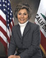
and various state and local elections. Incumbent Democratic U.S. Senator Barbara Boxer
ran for re-election and defeated Republican
former Secretary of State
Bill Jones. She set the all time record for the most votes cast for one candidate in one state in one election.
. Jones was widely considered as the underdog. Jones got a major endorsement form the popular Governor Arnold Schwarzenegger
. The two major candidates had a debate. Pre-election polling had Boxer leading in double digits. But he never released a single TV ad. Boxer portrayed Jones as too conservative for California, citing his votes in the California Assembly (1982 to 1994) against gun control, increased minimum wage, support for offshore drilling, and a loosening of environmental regulations.
United States Senate
The United States Senate is the upper house of the bicameral legislature of the United States, and together with the United States House of Representatives comprises the United States Congress. The composition and powers of the Senate are established in Article One of the U.S. Constitution. Each...
in other states as well as elections to the United States House of Representatives
United States House of Representatives
The United States House of Representatives is one of the two Houses of the United States Congress, the bicameral legislature which also includes the Senate.The composition and powers of the House are established in Article One of the Constitution...
and various state and local elections. Incumbent Democratic U.S. Senator Barbara Boxer
Barbara Boxer
Barbara Levy Boxer is the junior United States Senator from California . A member of the Democratic Party, she previously served in the U.S. House of Representatives ....
ran for re-election and defeated Republican
Republican Party (United States)
The Republican Party is one of the two major contemporary political parties in the United States, along with the Democratic Party. Founded by anti-slavery expansion activists in 1854, it is often called the GOP . The party's platform generally reflects American conservatism in the U.S...
former Secretary of State
California Secretary of State
The Secretary of State of California is the chief elections officer of that U.S. state. The Secretary of State is also responsible for the California State Archives, as well as chartering corporations. The Secretary of State is elected to four year terms, concurrent with the other constitutional...
Bill Jones. She set the all time record for the most votes cast for one candidate in one state in one election.
Results
Candidates
- Danney Ball, activist
- Toni Casey, former Mayor of Los Altos HillsLos Altos Hills, CaliforniaLos Altos Hills is an incorporated town in Santa Clara County, California, United States. The population was 7,922 at the 2010 census. Located in Silicon Valley, Los Altos Hills is one of the wealthiest cities in the nation.-Strictly residential:...
- Barry L. Hatch, activist
- Bill Jones, former State Assemblyman and Sec. of State
- Howard KaloogianHoward KaloogianHoward J. Kaloogian is an American politician and a former member of the California State Assembly. A Republican, he failed in 2004 to be elected to the United States Senate and in 2006 to be elected to the House.-Biography:...
, former State Assemblyman - Rosario MarinRosario MarinRosario Marin , was the 41st Treasurer of the United States from August 16, 2001 to June 30, 2003 serving under President George W. Bush. She is the first person to assume the post since William Clark who was not born a United States citizen . She is the only U...
, Treasurer of the United StatesTreasurer of the United StatesThe Treasurer of the United States is an official in the United States Department of the Treasury that was originally charged with the receipt and custody of government funds, though many of these functions have been taken over by different bureaus of the Department of the Treasury... - James Stewart, businessman
- Tim Stoen, Assistant District Attorney
- Bill Quraishi, businessman
- John Van Zandt, businessman
Results
American Independent
Libertarian
Peace and Freedom
Major
- Barbara BoxerBarbara BoxerBarbara Levy Boxer is the junior United States Senator from California . A member of the Democratic Party, she previously served in the U.S. House of Representatives ....
(D), incumbent U.S. Senator - Bill Jones (R), former State Sec. of State
Minor
- Marsha FeinlandMarsha FeinlandMarsha Feinland was a third-party candidate for President of the United States in the 1996 U.S. presidential election. Her running mate was Kate McClatchy; they were only on the ballot in California and received 25,332 votes...
(PF), perennial candidate - James P. GrayJames P. GrayJames "Jim" P. Gray is an American jurist, politician, and writer. He was the presiding judge of the Superior Court of Orange County, California. Gray was the 2004 Libertarian candidate for the United States Senate in California...
(L), Superior Court juristSuperior Courts of CaliforniaThe Superior Courts of California are the superior courts in the U.S. state of California with general jurisdiction to hear and decide any civil or criminal action which is not specially designated to be heard in some other court or before a government agency... - Don J. Grundmann (AI)
Campaign
Boxer originally had decided to retire in 2004 but she decided to run to "fight for the right to dissent" against conservatives like Majority Leader Tom DeLayTom DeLay
Thomas Dale "Tom" DeLay is a former member of the United States House of Representatives, representing Texas's 22nd congressional district from 1984 until 2006. He was Republican Party House Majority Leader from 2003 to 2005, when he resigned because of criminal money laundering charges in...
. Jones was widely considered as the underdog. Jones got a major endorsement form the popular Governor Arnold Schwarzenegger
Arnold Schwarzenegger
Arnold Alois Schwarzenegger is an Austrian-American former professional bodybuilder, actor, businessman, investor, and politician. Schwarzenegger served as the 38th Governor of California from 2003 until 2011....
. The two major candidates had a debate. Pre-election polling had Boxer leading in double digits. But he never released a single TV ad. Boxer portrayed Jones as too conservative for California, citing his votes in the California Assembly (1982 to 1994) against gun control, increased minimum wage, support for offshore drilling, and a loosening of environmental regulations.
Fundraising
Jones raised about $700,000 more than Boxer during the third quarter, pulling in $2.5 million to Boxer's $1.8 million. But overall, Boxer has raised $16 million to Jones' $6.2 million. And Boxer has spent about $7 million on radio and television ads alone.Overall
By county
Final results from the Secretary of State of California.| County | Boxer Barbara Boxer Barbara Levy Boxer is the junior United States Senator from California . A member of the Democratic Party, she previously served in the U.S. House of Representatives .... |
Votes | Jones | Votes | Feinland Marsha Feinland Marsha Feinland was a third-party candidate for President of the United States in the 1996 U.S. presidential election. Her running mate was Kate McClatchy; they were only on the ballot in California and received 25,332 votes... |
Votes | Others | Votes |
|---|---|---|---|---|---|---|---|---|
| San Francisco | 82.67% | 277,193 | 12.83% | 43,029 | 2.15% | 7,220 | 2.34% | 7,862 |
| Alameda Alameda County, California Alameda County is a county in the U.S. state of California. It occupies most of the East Bay region of the San Francisco Bay Area. As of the 2010 census it had a population of 1,510,271, making it the 7th most populous county in the state... |
75.66% | 403,892 | 20.23% | 107,966 | 2.22% | 11,851 | 1.89% | 10,103 |
| Marin Marin County, California Marin County is a county located in the North San Francisco Bay Area of the U.S. state of California, across the Golden Gate Bridge from San Francisco. As of 2010, the population was 252,409. The county seat is San Rafael and the largest employer is the county government. Marin County is well... |
70.86% | 94,164 | 25.81% | 34,301 | 1.44% | 1,915 | 1.89% | 2,505 |
| San Mateo San Mateo County, California San Mateo County is a county located in the San Francisco Bay Area of the U.S. state of California. It covers most of the San Francisco Peninsula just south of San Francisco, and north of Santa Clara County. San Francisco International Airport is located at the northern end of the county, and... |
70.53% | 196,285 | 26.29% | 73,171 | 1.33% | 3,715 | 1.84% | 5,126 |
| Santa Cruz Santa Cruz County, California Santa Cruz County is a county located on the Pacific coast of the U.S. state of California, on the California Central Coast. The county forms the northern coast of the Monterey Bay. . As of the 2010 U.S. Census, its population was 262,382. The county seat is Santa Cruz... |
70.58% | 84,840 | 23.49% | 28,239 | 2.77% | 3,329 | 3.15% | 3,791 |
| Los Angeles Los Angeles County, California Los Angeles County is a county in the U.S. state of California. As of 2010 U.S. Census, the county had a population of 9,818,605, making it the most populous county in the United States. Los Angeles County alone is more populous than 42 individual U.S. states... |
66.75% | 1,940,493 | 28.29% | 822,351 | 2.36% | 68,743 | 2.60% | 75,449 |
| Santa Clara Santa Clara County, California Santa Clara County is a county located at the southern end of the San Francisco Bay Area in the U.S. state of California. As of 2010 it had a population of 1,781,642. The county seat is San Jose. The highly urbanized Santa Clara Valley within Santa Clara County is also known as Silicon Valley... |
66.00% | 380,551 | 29.83% | 172,008 | 1.66% | 9,550 | 2.51% | 14,487 |
| Sonoma Sonoma County, California Sonoma County, located on the northern coast of the U.S. state of California, is the largest and northernmost of the nine San Francisco Bay Area counties. Its population at the 2010 census was 483,878. Its largest city and county seat is Santa Rosa.... |
65.67% | 143,124 | 29.57% | 64,438 | 2.28% | 4,962 | 2.49% | 5,419 |
| Contra Costa Contra Costa County, California Contra Costa County is a primarily suburban county in the San Francisco Bay Area of the U.S. state of California. As of the 2010 census, it had a population of 1,049,025... |
63.49% | 258,905 | 33.24% | 135,559 | 1.48% | 6,044 | 1.78% | 7,277 |
| Monterey Monterey County, California Monterey County is a county located on the Pacific coast of the U.S. state of California, its northwestern section forming the southern half of Monterey Bay. The northern half of the bay is in Santa Cruz County. As of 2010, the population was 415,057. The county seat and largest city is Salinas... |
62.31% | 76,647 | 32.96% | 40,547 | 1.84% | 2,263 | 2.89% | 3,560 |
| Yolo Yolo County, California Yolo County is a county located in the northern part of the U.S. state of California, bordered by the other counties of Sacramento, Solano, Napa, Lake, Colusa, and Sutter. The city of Woodland is its county seat, though Davis is its largest city.... |
61.94% | 44,085 | 34.05% | 24,234 | 1.88% | 1,340 | 2.13% | 1,518 |
| Mendocino Mendocino County, California Mendocino County is a county located on the north coast of the U.S. state of California, north of the greater San Francisco Bay Area and west of the Central Valley. As of the 2010 census, the population was 87,841, up from 86,265 at the 2000 census... |
61.87% | 23,415 | 29.41% | 11,131 | 2.76% | 1,044 | 5.96% | 2,254 |
| Solano Solano County, California Solano County is a county located in Bay-Delta region of the U.S. state of California, about halfway between San Francisco and Sacramento and is one of the nine San Francisco Bay Area counties. The county's population was reported by the U.S. Census to be 413,344 in 2010... |
61.32% | 89,779 | 35.07% | 51,354 | 1.61% | 2,355 | 2.00% | 2,929 |
| Napa Napa County, California Napa County is a county located north of the San Francisco Bay Area in the U.S. state of California. It is coterminous with the Napa, California, Metropolitan Statistical Area. As of 2010 the population is 136,484. The county seat is Napa.... |
60.30% | 33,577 | 35.94% | 20,012 | 1.59% | 884 | 2.17% | 1,208 |
| Humboldt Humboldt County, California Humboldt County is a county in the U.S. state of California, located on the far North Coast 200 miles north of San Francisco. According to 2010 Census Data, the county’s population was 134,623... |
58.76% | 38,016 | 34.61% | 22,394 | 3.47% | 2,246 | 3.16% | 2,044 |
| Imperial Imperial County, California Imperial County is a county located in the Imperial Valley, in the far southeast of the U.S. state of California, bordering both Arizona and Mexico. It is part of the El Centro Metropolitan Area, which encompasses all of Imperial County. The population as of 2000 was 142,361. The county seat is the... |
57.65% | 19,498 | 36.06% | 12,195 | 3.43% | 1,159 | 2.87% | 971 |
| Lake Lake County, California Lake County is a county located in the north central portion of the U.S. state of California, north of the San Francisco Bay Area. It takes its name from Clear Lake, the dominant geographic feature in the county and the largest natural lake wholly within California... |
56.32% | 13,812 | 39.22% | 9,619 | 1.91% | 469 | 2.55% | 625 |
| San Benito San Benito County, California San Benito County is a county located in the Coast Range Mountains of the U.S. state of California, south of San Jose. As of 2010 the population was 55,269. The county seat is Hollister, which includes nearly two-thirds of the county's population. El Camino Real passes through the county and... |
55.82% | 10,349 | 39.73% | 7,365 | 1.96% | 363 | 2.49% | 462 |
| Santa Barbara Santa Barbara County, California Santa Barbara County is a county located in the southern portion of the U.S. state of California, on the Pacific coast. As of 2010 the county had a population of 423,895. The county seat is Santa Barbara and the largest city is Santa Maria.-History:... |
55.10% | 91,055 | 40.02% | 66,146 | 2.03% | 3,347 | 2.85% | 4,717 |
| Sacramento Sacramento County, California Sacramento County is a county in the U.S. state of California. Its county seat is Sacramento, which is also the state capital. As of 2010 the county had a population of 1,418,788.... |
54.16% | 252,016 | 42.34% | 196,984 | 1.50% | 6,995 | 2.00% | 9,283 |
| Alpine Alpine County, California Alpine County is the smallest county, by population, in the U.S. state of California. As of 2010, it had a population of 1,175, all rural. There are no incorporated cities in the county. The county seat is Markleeville... |
53.90% | 373 | 41.76% | 289 | 2.31% | 16 | 2.02% | 14 |
| San Joaquin San Joaquin County, California San Joaquin County is a county located in Central Valley of the U.S. state of California, just east of the San Francisco Bay Area. As of the 2010 census, the population was 685,306. The county seat is Stockton.-History:... |
53.00% | 99,074 | 42.98% | 80,350 | 1.92% | 3,582 | 2.10% | 3,921 |
| Ventura Ventura County, California Ventura County is a county in the southern part of the U.S. state of California. It is located on California's Pacific coast. It is often referred to as the Gold Coast, and has a reputation of being one of the safest populated places and one of the most affluent places in the country... |
52.13% | 159,920 | 43.66% | 133,917 | 1.84% | 5,630 | 2.37% | 7,284 |
| San Diego San Diego County, California San Diego County is a large county located in the southwestern corner of the US state of California. Hence, San Diego County is also located in the southwestern corner of the 48 contiguous United States. Its county seat and largest city is San Diego. Its population was about 2,813,835 in the 2000... |
51.45% | 565,457 | 44.13% | 484,948 | 2.04% | 22,431 | 2.38% | 26,125 |
| Mono Mono County, California Mono County is a county located in the east central portion of the U.S. state of California, to the east of the Sierra Nevada between Yosemite National Park and Nevada. As of the 2010 census, the population was 14,202, up from 12,853 at the 2000 census... |
49.95% | 2,592 | 44.59% | 2,314 | 2.14% | 111 | 3.31% | 172 |
| San Bernardino San Bernardino County, California San Bernardino County is a county in the U.S. state of California. As of the 2010 census, the population was 2,035,210, up from 1,709,434 as of the 2000 census... |
49.76% | 251,776 | 45.36% | 229,527 | 2.18% | 11,038 | 2.70% | 13,655 |
| Merced Merced County, California Merced County , is a county located in the Central Valley of the U.S. state of California, north of Fresno and southeast of San Jose. As of the 2010 census, the population was 255,793, up from 210,554 at the 2000 census. The county seat is Merced... |
49.65% | 27,975 | 46.18% | 26,023 | 1.95% | 1,098 | 2.22% | 1,251 |
| Riverside Riverside County, California Riverside County is a county in the U.S. state of California. One of 58 California counties, it covers in the southern part of the state, and stretches from Orange County to the Colorado River, which forms the state border with Arizona. The county derives its name from the city of Riverside,... |
47.39% | 259,169 | 48.67% | 266,197 | 1.93% | 10,547 | 2.01% | 11,015 |
| Stanislaus Stanislaus County, California Stanislaus County is a county located in the Central Valley of the U.S. state of California. As the price of housing has increased in the San Francisco Bay Area, many people who work in the southern reaches of the Bay Area have opted for the longer commute and moved to Stanislaus County for the... |
46.93% | 67,539 | 49.70% | 71,527 | 1.61% | 2,324 | 1.75% | 2,517 |
| San Luis Obispo San Luis Obispo County, California San Luis Obispo County is a county located along the Pacific Ocean in the Central Coast of the U.S. state of California, between Los Angeles and the San Francisco Bay Area. As of the 2010 census its population was 269,637, up from 246,681 at the 2000 census... |
46.49% | 58,212 | 48.48% | 60,708 | 2.12% | 2,659 | 2.91% | 3,646 |
| Trinity Trinity County, California Trinity County is a large, rugged and mountainous, heavily forested county located in the northwestern portion of the U.S. state of California, along the Trinity River and within the Salmon/Klamath Mountains. It covers an area of over two million acres , and as of the 2010 census its population... |
46.24% | 2,960 | 47.93% | 3,068 | 2.17% | 139 | 3.66% | 234 |
| Del Norte Del Norte County, California Del Norte County is a county located at the far northwest corner of the U.S. state of California on the Pacific adjacent to the Oregon border. As of the 2010 census, it had a population of 28,610. The county seat is Crescent City, the county's only incorporated city. Del Norte is the abbreviated... |
46.03% | 4,264 | 48.72% | 4,513 | 2.29% | 212 | 2.97% | 275 |
| Nevada Nevada County, California Nevada County is a county located in the Sierra Nevada of California, in the Mother Lode country. As of 2010 its population was 98,764. The county seat is Nevada City.-History:Nevada County was created in 1851 from parts of Yuba County.... |
45.79% | 24,367 | 49.46% | 26,321 | 1.90% | 1,013 | 2.85% | 1,518 |
| Fresno Fresno County, California Fresno County is a county located in the Central Valley of the U.S. state of California, south of Stockton and north of Bakersfield. As of the 2010 census, it is the tenth most populous county in California with a population of 930,450, and the sixth largest in size with an area of . The county... |
45.36% | 109,849 | 51.59% | 124,937 | 1.61% | 3,905 | 1.44% | 3,495 |
| Butte Butte County, California Butte County is a county located in the Central Valley of the US state of California, north of the state capital of Sacramento. As of the 2010 census, it had a population of 220,000. The county seat is Oroville. Butte County is the "Land of Natural Wealth and Beauty."Butte County is watered by the... |
44.96% | 42,512 | 49.12% | 46,446 | 2.52% | 2,385 | 3.39% | 3,204 |
| Tuolumne Tuolumne County, California Tuolumne County is a county in the Sierra Nevada of the U.S. state of California. The northern half of Yosemite National Park is located in the eastern part of the county. As of the 2010 census, the population was 55,365, up from 54,501 at the 2000 census... |
44.38% | 11,538 | 52.39% | 13,620 | 1.23% | 319 | 2.00% | 519 |
| Orange Orange County, California Orange County is a county in the U.S. state of California. Its county seat is Santa Ana. As of the 2010 census, its population was 3,010,232, up from 2,846,293 at the 2000 census, making it the third most populous county in California, behind Los Angeles County and San Diego County... |
43.73% | 458,604 | 50.86% | 533,406 | 1.94% | 20,394 | 3.47% | 36,374 |
| Kings Kings County, California Kings County is a county located in the Central Valley of the U.S. state of California. It is located in a rich agricultural region. Kings County is also home to NAS Lemoore, which is the U.S. Navy's newest and largest master jet air station. The county seat is Hanford... |
42.71% | 13,485 | 54.07% | 17,075 | 1.71% | 539 | 1.51% | 478 |
| Amador Amador County, California Amador County is a county located in the Sierra Nevada of the U.S. state of California. As of the 2010 census, the population was 38,091. The county seat is Jackson.Amador County bills itself as "The Heart of the Mother Lode" and lies within the Gold Country... |
42.16% | 7,445 | 54.15% | 9,562 | 1.53% | 271 | 2.15% | 380 |
| Calaveras Calaveras County, California Calaveras County is a county located in the Gold Country of the U.S. state of California. Calaveras is the Spanish word for skulls; the county was reportedly named for the remains of Native Americans discovered by the Spanish explorer Captain Gabriel Moraga. As of the 2010 census, the county had a... |
42.17% | 9,339 | 53.58% | 11,865 | 1.51% | 334 | 2.75% | 608 |
| Inyo Inyo County, California -National protected areas:* Death Valley National Park * Inyo National Forest * Manzanar National Historic Site-Major highways:* U.S. Route 6* U.S. Route 395* State Route 127* State Route 136* State Route 168* State Route 178... |
40.68% | 3,474 | 54.37% | 4,643 | 2.08% | 178 | 2.86% | 244 |
| Mariposa Mariposa County, California Mariposa County is a county in the U.S. state of California, located in the western foothills of the Sierra Nevada mountains. It lies north of Fresno, east of Merced, and southeast of Stockton. As of the 2010 census, the population was 18,251 up from 17,130 at the 2000 census... |
40.38% | 3,437 | 55.82% | 4,751 | 1.69% | 144 | 2.10% | 179 |
| Siskiyou Siskiyou County, California Siskiyou County is a county located in the far northernmost part of the U.S. state of California, in the Shasta Cascade region on the Oregon border. Yreka is the county seat. Because of its substantial natural beauty, outdoor recreation opportunities, and Gold Rush era history, it is an important... |
39.92% | 8,215 | 54.95% | 11,308 | 1.94% | 399 | 3.18% | 655 |
| Placer Placer County, California Placer County is a county located in both the Sacramento Valley and Sierra Nevada regions of the U.S. state of California, in what is known as the Gold Country. It stretches from the suburbs of Sacramento to Lake Tahoe and the Nevada border. Because of the expansion of the Greater Sacramento,... |
39.70% | 59,554 | 56.78% | 85,163 | 1.46% | 2,197 | 2.06% | 3,086 |
| Plumas Plumas County, California Plumas County is a county located in the Sierra Nevada of the U.S. state of California. The county gets its name from the Spanish words for the Feather River , which flows through the county. As of the 2010 census, the population 20,007, down from 20,824 at the 2000 census... |
39.59% | 4,347 | 54.82% | 6,019 | 2.21% | 243 | 3.38% | 371 |
| El Dorado El Dorado County, California El Dorado County is a county located in the historic Gold Country in the Sierra Nevada Mountains and foothills of the U.S. state of California. The 2010 population was 181,058. The El Dorado county seat is in Placerville.... |
39.58% | 33,715 | 56.09% | 47,775 | 2.05% | 1,743 | 2.29% | 1,950 |
| Madera Madera County, California Madera County is a county of the U.S. state of California, located in the Central Valley and the Sierra Nevada north of Fresno County. It comprises the Madera-Chowchilla, CA Metropolitan Statistical Area. As of the 2010 census the population was 150,865... |
39.15% | 15,058 | 57.84% | 22,249 | 1.67% | 641 | 1.35% | 519 |
| Yuba Yuba County, California Yuba County is a county located in the U.S. state of California's Central Valley, north of Sacramento, along the Feather River. As of the 2010 census, its population was 72,155. The county seat is Marysville. Yuba County is part of the Greater Sacramento area.-History:Yuba County was one of the... |
38.94% | 6,926 | 55.80% | 9,925 | 2.21% | 393 | 3.05% | 542 |
| Kern Kern County, California Spreading across the southern end of the California Central Valley, Kern County is the fifth-largest county by population in California. Its economy is heavily linked to agriculture and to petroleum extraction, and there is a strong aviation and space presence. Politically, it has generally... |
38.13% | 79,769 | 56.82% | 118,882 | 2.17% | 4,543 | 2.88% | 6,026 |
| Tulare Tulare County, California Tulare County is a county located in the Central Valley of the U.S. state of California, south of Fresno. Sequoia National Park is located in the county, as are part of Kings Canyon National Park, in its northeast corner , and part of Mount Whitney, on its eastern border... |
37.11% | 36,181 | 59.55% | 58,066 | 1.84% | 1,798 | 1.50% | 1,464 |
| Colusa Colusa County, California Colusa County is a county located in the Central Valley of the U.S. state of California, northwest of state capital Sacramento. As of the 2010 census, its population was 21,419. The county seat is Colusa.-History:... |
36.61% | 2,228 | 60.10% | 3,657 | 1.23% | 75 | 2.05% | 125 |
| Sutter Sutter County, California Sutter County is a county located along the Sacramento River in the Central Valley of the U.S. state of California, north of state capital Sacramento. Sutter County is part of the Greater Sacramento CSA.... |
36.61% | 10,864 | 60.06% | 17,824 | 1.47% | 436 | 1.86% | 553 |
| Tehama Tehama County, California Tehama County is a county located in the northern part of the U.S. state of California. It is bisected by the Sacramento River. As of 2010 its population was 63,463, up from 56,039 as of 2000. The county seat is Red Bluff.-History:... |
36.18% | 8,285 | 58.89% | 13,488 | 1.76% | 403 | 3.17% | 726 |
| Shasta Shasta County, California Shasta County is a county located in the northern portion of the U.S. state of California. The county occupies the northern reaches of the Sacramento Valley, with portions extending into the southern reaches of the Cascade Range. As of the 2010 census, the population was 177,223, up from 163,256... |
35.21% | 26,795 | 60.00% | 45,667 | 1.86% | 1,412 | 2.94% | 2,235 |
| Sierra Sierra County, California Sierra County is a county located in the Sierra Nevada of the U.S. state of California, northeast of Sacramento on the border with Nevada. As of the 2010 census the population was 3,240, down from 3,555 at the 2000 census. The county seat is Downieville.... |
34.89% | 679 | 58.74% | 1,143 | 1.90% | 37 | 4.47% | 87 |
| Glenn Glenn County, California Glenn County is in the California Central Valley. As of 2010, it had a population of 28,122. The county seat is the city of Willows.-History:Glenn County was formed in 1891 from parts of Colusa County. It was named for Dr. Hugh J... |
33.87% | 3,147 | 61.77% | 5,739 | 1.86% | 173 | 2.50% | 232 |
| Lassen Lassen County, California Lassen County is a county located in the northeastern portion of the U.S. state of California. As of the 2010 census, the population was 34,895, up from 33,828 at the 2000 census... |
32.36% | 3,655 | 62.43% | 7,051 | 1.97% | 223 | 3.24% | 366 |
| Modoc Modoc County, California Modoc County is a county located in the far northeast corner of the U.S. state of California, bounded by the state of Oregon to the north and the state of Nevada to the east. As of the 2010 census, its population was 9,686, up from 9,449 at the 2000 census. The current county seat is Alturas, the... |
28.48% | 1,253 | 66.27% | 2,916 | 1.52% | 67 | 3.73% | 164 |
External links
- JoinCalifornia 2004 General Election
- SmartVoter.org page on the California Senate race.
- Final results from the Secretary of State of California. http://sos.ca.gov/elections/sov/2004_primary/ssov/us_senate_statewide_summary.pdf