
Tulare County, California
Encyclopedia
Tulare County is a county located in the Central Valley
of the U.S. state
of California
, south of Fresno
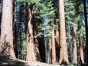
. Sequoia National Park
is located in the county, as are part of Kings Canyon National Park
, in its northeast corner (shared with Fresno County
), and part of Mount Whitney
, on its eastern border (shared with Inyo County
). As of the 2010 census, the population was 442,179, up from 368,021 at the 2000 census. Its county seat
is Visalia
.
The county is named for Tulare Lake
, once the largest freshwater lake west of the Great Lakes
. Drained for agricultural development, the site is now in Kings County
, which was created in 1893 from the western portion of the formerly larger Tulare County.
. Beginning in the seventeenth century, Spain established missions to colonize the area and convert the American Indians to Christianity. Comandante Pedro Fages
, while hunting for deserters in 1772, discovered a great lake
surrounded by marsh
es and filled with rush
es; he named it Los Tules (the tules). It is from this lake that the county derives its name. The root of the name Tulare is found in the Mexican
word tullin, designating cattail or similar reeds.
After Mexico achieved independence, it continued to rule California. The United States defeated Mexico in 1848, and European Americans formed Tulare County from parts of Mariposa County
in 1852. Parts of the county's territory were given to Fresno County
in 1856, to Kern County
in 1866, to Inyo County
in 1866 and Kings County
in 1893.
The infectious disease Tularemia
caused by the bacterium Francisella tularensis is named after Tulare County.
In 1908 Colonel Allen Allensworth and associates founded Allensworth
as a black farming community. They intended to develop a place where African Americans could thrive free of white discrimination. It was the only community in California founded, financed and governed by African Americans. While its first years were highly successful, the community encountered environmental problems from dropping water tables which eventually caused it to fail. Today the historic area is preserved as the Colonel Allensworth State Historic Park
, which is listed on the National Register of Historic Places
.
1 billion a year annually. Oranges, grapes, and cattle-related commodities also earn hundreds of millions of dollars annually.
In 2001, Tulare became the most productive county in the U.S. in terms of agricultural revenues, at US$ 3.5 billion annually. It surpassed Fresno County's US$ 3.2 billion, which had held the top spot for over two decades. Due to the importance of agriculture in the county as well as its location in the state, since 1968 the city of Tulare
has been the site of the annual World Ag Expo
, the world's largest agricultural exposition.
Minor league sports teams, such as the baseball Visalia Rawhide of the class-A level California League
(an affiliate to the Arizona Diamondbacks
), two teams of the Minor League Football Association in Tulare and Visalia, and four teams of the Central California Basketball League based in Porterville, attract many residents and add to the amenities in the county.
Census-designated places (CDPs)
Other unincorporated communities
Indian reservations
The cities of Tulare, Porterville, and Visalia have their own local bus services.
Greyhound
and Orange Belt Stages
provide long-distance, intercity bus service.
has very limited commercial passenger service. Sequoia Field
, just north of Visalia, is a county-owned general aviation
airport. Mefford Field is a city-owned general aviation
airport located in Tulare.
The nearest full operation commercial airports are Bakersfield
's Meadows Field Airport
to the South, and Fresno
's Fresno Yosemite International Airport
to the North.
, and 18,424 (4.2%) from two or more races. Hispanic or Latino of any race were 268,065 persons (60.6%).
of 2000, there were 368,021 people, 110,385 households, and 87,093 families residing in the county. The population density
was 76 people per square mile (29/km²). There were 119,639 housing units at an average density of 25 per square mile (10/km²). The racial makeup of the county was 58.08% White
, 1.59% Black
or African American
, 1.56% Native American
, 3.27% Asian
, 0.11% Pacific Islander
, 30.79% from other races
, and 4.60% from two or more races. 50.77% of the population were Hispanic
or Latino
of any race. 6.2% were of American
, 5.7% German and 5.0% English
ancestry according to Census 2000. 56.3% spoke English
, 38.9% Spanish
and 1.1% Portuguese
as their first language.
There were 110,385 households out of which 44.9% had children under the age of 18 living with them, 58.1% were married couples
living together, 14.5% had a female householder with no husband present, and 21.1% were non-families. 17.1% of all households were made up of individuals and 7.7% had someone living alone who was 65 years of age or older. The average household size was 3.28 and the average family size was 3.67.
In the county the population was spread out with 33.8% under the age of 18, 10.6% from 18 to 24, 27.6% from 25 to 44, 18.2% from 45 to 64, and 9.8% who were 65 years of age or older. The median age was 29 years. For every 100 females there were 100.0 males. For every 100 females age 18 and over, there were 97.7 males.
The median income for a household in the county was $33,983, and the median income for a family was $36,297. Males had a median income of $30,892 versus $24,589 for females. The per capita income
for the county was $14,006. About 18.8% of families and 23.9% of the population were below the poverty line, including 32.6% of those under age 18 and 10.5% of those age 65 or over.
Tulare is a strongly Republican county in Presidential
and congressional
elections. The last Democratic candidate for President to win a majority in the county was Lyndon Johnson
in 1964
.
Tulare is part of California's 21st congressional district
, which is held by Republican Devin Nunes
. In the State Assembly
, Tulare is in the 29th, 30th, 31st, and 34th districts. The 31st is held by Democrat Henry Perea
, while the 29th, 30th, and 34th are held by Republicans Linda Halderman
, Danny Gilmore
, and Connie Conway
, respectively. In the State Senate
, Tulare is part of the 16th and 18th districts, which are held by Democrat Michael Rubio and Republican Jean Fuller
respectively.
in the southern Sierra Nevada, east of Visalia, California
, in the United States of America. It was established in 1890 as the second U.S. national park, after Yellowstone National Park
. The park spans 404051 acres (1,635.1 km²). Encompassing a vertical relief of nearly 13000 feet (3,962.4 m), the park contains among its natural resources the highest point in the contiguous 48 United States, Mount Whitney
, at 14505 feet (4,421.1 m) above sea level. The park is south of and contiguous with Kings Canyon National Park
; the two are administered by the National Park Service
as one unit, called Sequoia and Kings Canyon National Parks.
California Central Valley
California's Central Valley is a large, flat valley that dominates the central portion of California. It is home to California's most productive agricultural efforts. The valley stretches approximately from northwest to southeast inland and parallel to the Pacific Ocean coast. Its northern half is...
of the U.S. state
U.S. state
A U.S. state is any one of the 50 federated states of the United States of America that share sovereignty with the federal government. Because of this shared sovereignty, an American is a citizen both of the federal entity and of his or her state of domicile. Four states use the official title of...
of California
California
California is a state located on the West Coast of the United States. It is by far the most populous U.S. state, and the third-largest by land area...
, south of Fresno
Fresno, California
Fresno is a city in central California, United States, the county seat of Fresno County. As of the 2010 census, the city's population was 510,365, making it the fifth largest city in California, the largest inland city in California, and the 34th largest in the nation...
. Sequoia National Park
Sequoia National Park
Sequoia National Park is a national park in the southern Sierra Nevada east of Visalia, California, in the United States. It was established on September 25, 1890. The park spans . Encompassing a vertical relief of nearly , the park contains among its natural resources the highest point in the...
is located in the county, as are part of Kings Canyon National Park
Kings Canyon National Park
Kings Canyon National Park is a National Park in the southern Sierra Nevada, east of Fresno, California. The park was established in 1940 and covers...
, in its northeast corner (shared with Fresno County
Fresno County, California
Fresno County is a county located in the Central Valley of the U.S. state of California, south of Stockton and north of Bakersfield. As of the 2010 census, it is the tenth most populous county in California with a population of 930,450, and the sixth largest in size with an area of . The county...
), and part of Mount Whitney
Mount Whitney
Mount Whitney is the highest summit in the contiguous United States with an elevation of . It is on the boundary between California's Inyo and Tulare counties, west-northwest of the lowest point in North America at Badwater in Death Valley National Park...
, on its eastern border (shared with Inyo County
Inyo County, California
-National protected areas:* Death Valley National Park * Inyo National Forest * Manzanar National Historic Site-Major highways:* U.S. Route 6* U.S. Route 395* State Route 127* State Route 136* State Route 168* State Route 178...
). As of the 2010 census, the population was 442,179, up from 368,021 at the 2000 census. Its county seat
County seat
A county seat is an administrative center, or seat of government, for a county or civil parish. The term is primarily used in the United States....
is Visalia
Visalia, California
Visalia is a Central California city situated in the heart of California’s agricultural San Joaquin Valley, approximately southeast of San Francisco and north of Los Angeles...
.
The county is named for Tulare Lake
Tulare Lake
Tulare Lake, named Laguna de Tache by the Spanish, is a fresh-water dry lake with residual wetlands and marshes in southern San Joaquin Valley, California...
, once the largest freshwater lake west of the Great Lakes
Great Lakes
The Great Lakes are a collection of freshwater lakes located in northeastern North America, on the Canada – United States border. Consisting of Lakes Superior, Michigan, Huron, Erie, and Ontario, they form the largest group of freshwater lakes on Earth by total surface, coming in second by volume...
. Drained for agricultural development, the site is now in Kings County
Kings County, California
Kings County is a county located in the Central Valley of the U.S. state of California. It is located in a rich agricultural region. Kings County is also home to NAS Lemoore, which is the U.S. Navy's newest and largest master jet air station. The county seat is Hanford...
, which was created in 1893 from the western portion of the formerly larger Tulare County.
History
The land was occupied for thousands of years by varying cultures of indigenous peoplesIndigenous peoples
Indigenous peoples are ethnic groups that are defined as indigenous according to one of the various definitions of the term, there is no universally accepted definition but most of which carry connotations of being the "original inhabitants" of a territory....
. Beginning in the seventeenth century, Spain established missions to colonize the area and convert the American Indians to Christianity. Comandante Pedro Fages
Pedro Fages
Pere Fages Beleta , nicknamed L'Ós , was a soldier, explorer, and the second Spanish military Governor of Las Californias Province of New Spain from 1770 to 1774, and the Governor of Las Californias from 1782 to 1791.-Life:...
, while hunting for deserters in 1772, discovered a great lake
Lake
A lake is a body of relatively still fresh or salt water of considerable size, localized in a basin, that is surrounded by land. Lakes are inland and not part of the ocean and therefore are distinct from lagoons, and are larger and deeper than ponds. Lakes can be contrasted with rivers or streams,...
surrounded by marsh
Marsh
In geography, a marsh, or morass, is a type of wetland that is subject to frequent or continuous flood. Typically the water is shallow and features grasses, rushes, reeds, typhas, sedges, other herbaceous plants, and moss....
es and filled with rush
Juncaceae
Juncaceae, the rush family, are a monocotyledonous family of flowering plants. There are eight genera and about 400 species. Members of the Juncaceae are slow-growing, rhizomatous, herbaceous plants, and they may superficially resemble grasses. They often grow on infertile soils in a wide range...
es; he named it Los Tules (the tules). It is from this lake that the county derives its name. The root of the name Tulare is found in the Mexican
Spanish language
Spanish , also known as Castilian , is a Romance language in the Ibero-Romance group that evolved from several languages and dialects in central-northern Iberia around the 9th century and gradually spread with the expansion of the Kingdom of Castile into central and southern Iberia during the...
word tullin, designating cattail or similar reeds.
After Mexico achieved independence, it continued to rule California. The United States defeated Mexico in 1848, and European Americans formed Tulare County from parts of Mariposa County
Mariposa County, California
Mariposa County is a county in the U.S. state of California, located in the western foothills of the Sierra Nevada mountains. It lies north of Fresno, east of Merced, and southeast of Stockton. As of the 2010 census, the population was 18,251 up from 17,130 at the 2000 census...
in 1852. Parts of the county's territory were given to Fresno County
Fresno County, California
Fresno County is a county located in the Central Valley of the U.S. state of California, south of Stockton and north of Bakersfield. As of the 2010 census, it is the tenth most populous county in California with a population of 930,450, and the sixth largest in size with an area of . The county...
in 1856, to Kern County
Kern County, California
Spreading across the southern end of the California Central Valley, Kern County is the fifth-largest county by population in California. Its economy is heavily linked to agriculture and to petroleum extraction, and there is a strong aviation and space presence. Politically, it has generally...
in 1866, to Inyo County
Inyo County, California
-National protected areas:* Death Valley National Park * Inyo National Forest * Manzanar National Historic Site-Major highways:* U.S. Route 6* U.S. Route 395* State Route 127* State Route 136* State Route 168* State Route 178...
in 1866 and Kings County
Kings County, California
Kings County is a county located in the Central Valley of the U.S. state of California. It is located in a rich agricultural region. Kings County is also home to NAS Lemoore, which is the U.S. Navy's newest and largest master jet air station. The county seat is Hanford...
in 1893.
The infectious disease Tularemia
Tularemia
Tularemia is a serious infectious disease caused by the bacterium Francisella tularensis. A Gram-negative, nonmotile coccobacillus, the bacterium has several subspecies with varying degrees of virulence. The most important of those is F...
caused by the bacterium Francisella tularensis is named after Tulare County.
In 1908 Colonel Allen Allensworth and associates founded Allensworth
Allensworth, California
Allensworth is a census-designated place in Tulare County, California. Allensworth sits at an elevation of . The 2010 United States census reported Allensworth's population was 471....
as a black farming community. They intended to develop a place where African Americans could thrive free of white discrimination. It was the only community in California founded, financed and governed by African Americans. While its first years were highly successful, the community encountered environmental problems from dropping water tables which eventually caused it to fail. Today the historic area is preserved as the Colonel Allensworth State Historic Park
Colonel Allensworth State Historic Park
Colonel Allensworth State Historic Park is a state park unit of California, USA, preserving Allensworth, the only California town to be founded, financed and governed by African Americans. The small farming community was founded in 1908 by Lt. Colonel Allen Allensworth, Professor William Payne,...
, which is listed on the National Register of Historic Places
National Register of Historic Places
The National Register of Historic Places is the United States government's official list of districts, sites, buildings, structures, and objects deemed worthy of preservation...
.
Economy
The dairy industry, with sales of milk products, brings in the most revenue for the county, typically more than US$United States dollar
The United States dollar , also referred to as the American dollar, is the official currency of the United States of America. It is divided into 100 smaller units called cents or pennies....
1 billion a year annually. Oranges, grapes, and cattle-related commodities also earn hundreds of millions of dollars annually.
In 2001, Tulare became the most productive county in the U.S. in terms of agricultural revenues, at US$ 3.5 billion annually. It surpassed Fresno County's US$ 3.2 billion, which had held the top spot for over two decades. Due to the importance of agriculture in the county as well as its location in the state, since 1968 the city of Tulare
Tulare, California
Tulare is a city in Tulare County, California, United States. The population was 59,278 at the 2010 census.Just eight miles south of Visalia, it is part of the Census Bureau's designation of the Visalia Metropolitan Area. The city is named for the currently dry Tulare Lake, once the largest...
has been the site of the annual World Ag Expo
World Ag Expo
The World Ag Expo is one of the world's largest agricultural expositions. Each year it is held in Tulare, California, in the United States during the second week of February...
, the world's largest agricultural exposition.
Minor league sports teams, such as the baseball Visalia Rawhide of the class-A level California League
California League
The California League is a Class A Advanced minor league baseball league which operates throughout the state of California. Before 2002, it was classified as a "High-A" league, indicating its status as a Class A league with the highest level of competition within that classification, and the fifth...
(an affiliate to the Arizona Diamondbacks
Arizona Diamondbacks
The Arizona Diamondbacks are a professional baseball team based in Phoenix. They play in the West Division of Major League Baseball's National League. From 1998 to the present, they have played in Chase Field...
), two teams of the Minor League Football Association in Tulare and Visalia, and four teams of the Central California Basketball League based in Porterville, attract many residents and add to the amenities in the county.
Top employers
According to the County's 2010 Comprehensive Annual Financial Report, the top employers in the county are:| # | Employer | # of Employees |
|---|---|---|
| 1 | County of Tulare | 4,320 |
| 2 | Porterville Developmental Center California Department of Developmental Services The California Department of Developmental Services is a state agency of California, headquartered in Downtown Sacramento. The agency provides services for California residents with several developmental disabilities, such as autism, cerebral palsy, epilepsy, mental retardation and conditions... |
3,000 |
| 3 | Kaweah Delta Medical Center Kaweah Delta Medical Center The Kaweah Delta Medical Center is a 454-bed hospital located in Visalia, California, USA. It is operated by the Kaweah Delta Healthcare District, a political subdivision of the State of California which is governed by an elected board of directors.-Overview:... |
2,000 |
| 4 | Ruiz Foods Ruiz Foods Ruiz Foods is an American food production and service company based in Dinuba, California founded in 1964. As of April 2010, it was the top seller of frozen Mexican dishes in the US. Under the brand names of El Monterey and Tornados it produces around 200 frozen Mexican foods for grocery stores... |
1,800 |
| 5 | Wal-Mart Wal-Mart Wal-Mart Stores, Inc. , branded as Walmart since 2008 and Wal-Mart before then, is an American public multinational corporation that runs chains of large discount department stores and warehouse stores. The company is the world's 18th largest public corporation, according to the Forbes Global 2000... |
1,692 |
| 6 | College of the Sequoias College of the Sequoias College of the Sequoias is a public two-year community college located in Visalia in Tulare County, in California's San Joaquin Valley. The current enrollment of COS is 13,000 students, and the college offers a variety of transfer, vocational, and community-based classes, including the fire/police... |
1,160 |
| 7 | Cigna CIGNA Cigna , headquartered in Bloomfield, Connecticut, is a global health services company, owing to its expanding international footprint and the fact that it provides administrative services only to approximately 80 percent of its clients... |
900 |
| 8 | Jostens Jostens Jostens is an American company providing yearbooks and class rings for various high schools and colleges as well as championship rings for sports, including the Super Bowl rings.... |
720 |
| 9 | Land O'Lakes Land O'Lakes Land O'Lakes is a member-owned agricultural cooperative based in Arden Hills, Minnesota, focusing on the dairy industry. The co-op states that it has about 3200 producer-members, 1000 member-cooperatives, and about 9000 employees who process and distribute products for about 300,000 agricultural... |
600 |
| 10 | Monrovia Nursery | 600 |
Geography
According to the 2000 census, the county has a total area of 4839.09 square miles (12,533.2 km²), of which 4823.97 square miles (12,494 km²) (or 99.69%) is land and 15.12 square miles (39.2 km²) (or 0.31%) is water.Cities, towns, and unincorporated communities
Incorporated cities- DinubaDinuba, CaliforniaDinuba is a city in Tulare County, California, United States. The population was 21,453 at the 2010 census. It is part of the Visalia Metropolitan Statistical Area according to the United States Census Bureau...
- ExeterExeter, CaliforniaExeter is a city in Tulare County, California, United States. It is situated near the foothills of the Sierra Nevada Mountain Range. The population was 10,334 at the 2010 census....
- FarmersvilleFarmersville, CaliforniaFarmersville is a suburb of Visalia, in Tulare County, California, United States. The population was 10,588 at the 2010 census, up from 8,737 at the 2000 census.-Geography:Farmersville is located at ....
- LindsayLindsay, CaliforniaLindsay is a city in Tulare County, California, United States. The population was 11,768 at the 2010 census. Lindsay is located southeast of Visalia and is considered part of the Visalia Metropolitan Area by the United States Census Bureau.-History:...
- PortervillePorterville, CaliforniaPorterville is a city in the San Joaquin Valley, in Tulare County, California, United States. Porterville's population was 54,165 at the 2010 census. The city's population grew dramatically as the city annexed many properties and unincorporated areas in and around Porterville. Not included in the...
- TulareTulare, CaliforniaTulare is a city in Tulare County, California, United States. The population was 59,278 at the 2010 census.Just eight miles south of Visalia, it is part of the Census Bureau's designation of the Visalia Metropolitan Area. The city is named for the currently dry Tulare Lake, once the largest...
- VisaliaVisalia, CaliforniaVisalia is a Central California city situated in the heart of California’s agricultural San Joaquin Valley, approximately southeast of San Francisco and north of Los Angeles...
- WoodlakeWoodlake, CaliforniaWoodlake is a city in Tulare County, California, United States. The population was 7,279 at the 2010 census, up from 6,651 at the 2000 census.-Geography:Woodlake is located at ....
Census-designated places (CDPs)
- AllensworthAllensworth, CaliforniaAllensworth is a census-designated place in Tulare County, California. Allensworth sits at an elevation of . The 2010 United States census reported Allensworth's population was 471....
- AlpaughAlpaugh, CaliforniaAlpaugh is a census-designated place in Tulare County, California, United States. The population was 1,026 at the 2010 census, up from 761 at the 2000 census....
- California Hot SpringsCalifornia Hot Springs, CaliforniaCalifornia Hot Springs is a census-designated place in Tulare County, California, United States. California Hot Springs is east of Ducor. California Hot Springs has a post office with ZIP code 93207...
- Camp NelsonCamp Nelson, CaliforniaCamp Nelson is a census-designated place in Tulare County, California, United States. Camp Nelson is east of Springville. Camp Nelson has a post office with ZIP code 93208...
- Cedar SlopeCedar Slope, CaliforniaCedar Slope is a census-designated place in Tulare County, California. Cedar Slope sits at an elevation of . The 2010 United States census reported that Cedar Slope was uninhabited.-Geography:...
- CutlerCutler, CaliforniaCutler is a community and census-designated place in Tulare County, California, United States. The population was 5,000 at the 2010 census, up from 4,491 at the 2000 census.-Geography:Cutler is located at ....
- Delft ColonyDelft Colony, CaliforniaDelft Colony is a census-designated place in Tulare County, California. Delft Colony sits at an elevation of . The 2010 United States census reported Delft Colony's population was 454.-Geography:...
- DucorDucor, CaliforniaDucor is a census-designated place in Tulare County, California, United States. The population was 612 at the 2010 census, up from 504 at the 2000 census.-Geography:Ducor is located at ....
- EarlimartEarlimart, CaliforniaEarlimart is a census-designated place in Tulare County, California, United States. As of the 2010 census, the CDP population was 8,537, up from 6,583 at the 2000 census.-Geography:Earlimart is located at ....
- East OrosiEast Orosi, CaliforniaEast Orosi is a census-designated place in Tulare County, California, United States. The population was 495 at the 2010 census, up from 426 at the 2000 census.-Geography:East Orosi is located at ....
- East PortervilleEast Porterville, CaliforniaEast Porterville is a census-designated place in Tulare County, California, United States. The population was 6,767 at the 2010 census, up from 6,730 at the 2000 census.-Geography:East Porterville is located at ....
- East Tulare VillaEast Tulare Villa, CaliforniaEast Tulare Villa is a census-designated place in Tulare County, California. East Tulare Villa sits at an elevation of . The 2010 United States census reported East Tulare Villa's population was 778.-Geography:...
- El RanchoEl Rancho, CaliforniaEl Rancho is a census-designated place in Tulare County, California. El Rancho sits at an elevation of . The 2010 United States census reported El Rancho's population was 124.-Geography:...
- GoshenGoshen, CaliforniaGoshen is a census-designated place in Visalia, Tulare County, California, United States. The population was 3,006 at the 2010 census, up from 2,394 at the 2000 census...
- HartlandHartland, CaliforniaHartland is a census-designated place in Tulare County, California. Hartland sits at an elevation of . The 2010 United States census reported Hartland's population was 30.-Geography:...
- IdlewildIdlewild, Tulare County, CaliforniaIdlewild is a census-designated place in Tulare County, California. Idlewild sits at an elevation of . The 2010 United States census reported Idlewild's population was 43.-Geography:...
- IvanhoeIvanhoe, CaliforniaIvanhoe is a census-designated place in Tulare County, California, United States. The population was 4,495 at the 2010 census, up from 4,474 at the 2000 census.-Geography:Ivanhoe is located at ....
- Kennedy MeadowsKennedy Meadows, CaliforniaKennedy Meadows is a census-designated place in Tulare County, California. Kennedy Meadows sits at an elevation of . The 2010 United States census reported Kennedy Meadows's population was 28.-Geography:...
- Lemon CoveLemon Cove, CaliforniaLemon Cove is a census-designated place in Tulare County, California, United States. The population was 308 at the 2010 census, up from 298 at the 2000 census.-Geography and ecology:...
- LindcoveLindcove, CaliforniaLindcove is a census-designated place in Tulare County, California, United States. The population was 406 at the 2010 census.-Geography:According to the United States Census Bureau, the CDP covers an area of 0.7 square miles , all of it land.-Demographics:The 2010 United States Census...
- Linnell CampLinnell Camp, CaliforniaLinnell Camp is a census-designated place in Tulare County, California. Linnell Camp sits at an elevation of . The 2010 United States census reported Linnell Camp's population was 849.-Geography:...
- LondonLondon, CaliforniaLondon is a census-designated place in Tulare County, California, United States. The population was 1,869 at the 2010 census, up from 1,848 at the 2000 census .-Geography:London is located at ....
- MathenyMatheny, CaliforniaMatheny is a census-designated place in Tulare County, California. Matheny sits at an elevation of . The 2010 United States census reported Matheny's population was 1,212.-Geography:...
- McClenney TractMcClenney Tract, CaliforniaMcClenney Tract is a census-designated place in Tulare County, California. McClenney Tract sits at an elevation of . The 2010 United States census reported McClenney Tract's population was 10.-Geography:...
- MonsonMonson, CaliforniaMonson is a census-designated place in Tulare County, California. Monson sits at an elevation of . The 2010 United States census reported Monson's population was 188.-Geography:...
- OrosiOrosi, CaliforniaOrosi is a census-designated place in Tulare County, California, United States. The population was 8,770 at the 2010 census, up from 7,318 at the 2000 census.-Geography:Orosi is located at ....
- Panorama HeightsPanorama Heights, CaliforniaPanorama Heights is a census-designated place in Tulare County, California. Panorama Heights sits at an elevation of . The 2010 United States census reported Panorama Heights's population was 41.-Geography:...
- Patterson TractPatterson Tract, CaliforniaPatterson Tract is a census-designated place in Tulare County, California. Patterson Tract sits at an elevation of . The 2010 United States census reported Patterson Tract's population was 1,752.-Geography:...
- PierpointPierpoint, CaliforniaPierpoint is a census-designated place in Tulare County, California. Pierpoint sits at an elevation of . The 2010 United States census reported Pierpoint's population was 52.-Geography:...
- Pine FlatPine Flat, CaliforniaPine Flat is a census-designated place in Tulare County, California. Pine Flat sits at an elevation of . The 2010 United States census reported Pine Flat's population was 166.-Geography:...
- PixleyPixley, CaliforniaPixley is a census-designated place in Tulare County, California, United States. The population was 3,310 at the 2010 census, up from 2,586 at the 2000 census...
- PlainviewPlainview, CaliforniaPlainview is a census-designated place in Tulare County, California. Plainview sits at an elevation of . The 2010 United States census reported Plainview's population was 945.-Geography:...
- PonderosaPonderosa, CaliforniaPonderosa is a census-designated place in Tulare County, California. Ponderosa sits at an elevation of . The 2010 United States census reported Ponderosa's population was 16.-Geography:...
- Poplar-Cotton CenterPoplar-Cotton Center, CaliforniaPoplar-Cotton Center is a census-designated place in Tulare County, California, United States. The population was 2,470 at the 2010 census, up from 1,496 at the 2000 census...
- PoseyPosey, CaliforniaPosey is a census-designated place in Tulare County, California, United States. Posey is east-southeast of Ducor. Posey has a post office with ZIP code 93260, which opened in 1915...
- Poso ParkPoso Park, CaliforniaPoso Park is a census-designated place in Tulare County, California. Poso Park sits at an elevation of . The 2010 United States census reported Poso Park's population was 9.-Geography:...
- RichgroveRichgrove, CaliforniaRichgrove is a census-designated place in Tulare County, California, United States. The population was 2,882 at the 2010 census, up from 2,723 at the 2000 census.-Geography:Richgrove is located at ....
- Rodriguez CampRodriguez Camp, CaliforniaRodriguez Camp is a census-designated place in Tulare County, California. Rodriguez Camp sits at an elevation of . The 2010 United States census reported Rodriguez Camp's population was 156.-Geography:...
- Sequoia CrestSequoia Crest, CaliforniaSequoia Crest is a census-designated place in Tulare County, California. Sequoia Crest sits at an elevation of . The 2010 United States census reported Sequoia Crest's population was 10.-Geography:...
- SevilleSeville, CaliforniaSeville is a census-designated place in Tulare County, California, United States. Seville is located along California State Route 201 southeast of Cutler and . northwest of Woodlake. The population was 480 at the 2010 census.-History:...
- Silver CitySilver City, CaliforniaSilver City is a census-designated place in Tulare County, California. Silver City sits at an elevation of . The 2010 United States census reported Silver City was uninhabited.-Geography:...
- SpringvilleSpringville, CaliforniaSpringville is a census-designated place in Tulare County, California, United States. The population was 934 at the 2010 census, down from 1,109 at the 2000 census.-Geography:Springville is located at ....
- StrathmoreStrathmore, CaliforniaStrathmore is a census-designated place in Tulare County, California, United States. The population was 2,819 at the 2010 census, up from 2,584 at the 2000 census.-History:...
- Sugarloaf Mountain ParkSugarloaf Mountain Park, CaliforniaSugarloaf Mountain Park is a census-designated place in Tulare County, California. Sugarloaf Mountain Park sits at an elevation of . The 2010 United States census reported Sugarloaf Mountain Park was uninhabited.-Geography:...
- Sugarloaf Saw MillSugarloaf Saw Mill, CaliforniaSugarloaf Saw Mill is a census-designated place in Tulare County, California. Sugarloaf Saw Mill sits at an elevation of . The 2010 United States census reported Sugarloaf Saw Mill's population was 18.-Geography:...
- Sugarloaf VillageSugarloaf Village, CaliforniaSugarloaf Village is a census-designated place in Tulare County, California. Sugarloaf Village sits at an elevation of . The 2010 United States census reported Sugarloaf Village's population was 10.-Geography:...
- SultanaSultana, CaliforniaSultana is a census-designated place in Tulare County, California, United States. Sultana is east of Dinuba. Sultana has a post office with ZIP code 93666...
- Terra BellaTerra Bella, CaliforniaTerra Bella is a census-designated place in Tulare County, California, United States. The population was 3,310 at the 2010 census, down from 3,466 at the 2000 census.-Geography:Terra Bella is located at ....
- TevistonTeviston, CaliforniaTeviston is a census-designated place in Tulare County, California. Teviston sits at an elevation of . The 2010 United States census reported Teviston's population was 1,214.-Geography:...
- Three RiversThree Rivers, CaliforniaThree Rivers is a census-designated place in Tulare County, California, United States. The population was 2,182 at the 2010 census, down from 2,248 at the 2000 census....
- TiptonTipton, CaliforniaTipton is a census-designated place in Tulare County, California, United States. The population was 2,543 at the 2010 census, up from 1,790 at the 2000 census.-Geography:Tipton is located at ....
- TonyvilleTonyville, CaliforniaTonyville is a census-designated place in Tulare County, California. Tonyville sits at an elevation of . The 2010 United States census reported Tonyville's population was 316.-Geography:...
- ToolevilleTooleville, CaliforniaTooleville is a census-designated place in Tulare County, California. Tooleville sits at an elevation of . The 2010 United States census reported Tooleville's population was 339.-Geography:...
- TraverTraver, CaliforniaTraver is a census-designated place in Tulare County, California, United States. The population was 713 at the 2010 census, down from 732 at the 2000 census.-Geography:Traver is located at ....
- WaukenaWaukena, CaliforniaWaukena is a census-designated place in Tulare County, California, United States. Waukena is located on California State Route 137 northeast of Corcoran. Waukena has a post office with ZIP code 93282...
- West GoshenWest Goshen, CaliforniaWest Goshen is a census-designated place in Tulare County, California. West Goshen sits at an elevation of . The 2010 United States census reported West Goshen's population was 511.-Geography:...
- WilsoniaWilsonia, CaliforniaWilsonia is a census-designated place in Tulare County, California. Wilsonia sits at an elevation of . The 2010 United States census reported Wilsonia's population was 5.Wilsonia is home to the Wilsonia Historic District.-Geography:...
- WoodvilleWoodville, CaliforniaWoodville is a census-designated place in Tulare County, California, United States. The population was 1,740 at the 2010 census, up from 1,678 at the 2000 census.-Geography:Woodville is located at ....
- YettemYettem, CaliforniaYettem is a census-designated place in Tulare County, California. Yettem is located on California State Route 201 north of Visalia. Yettem has a post office with ZIP code 93670. Yettem sits at an elevation of...
Other unincorporated communities
- AdvanceAdvance, CaliforniaAdvance is an unincorporated community in Tulare County, California, United States. Advance is north of Three Rivers. Advance was the site of the Kaweah Cooperative Colony, an experimental socialist which existed from 1885 to 1891. A post office opened in the community in 1890; it was moved to...
- AngiolaAngiola, CaliforniaAngiola is an unincorporated community in Tulare County, California, United States. Angiola is located on California State Route 43 west-northwest of Earlimart. The community was named after Angela Bacigalupi, wife of a landowner there. Angiola had a post office from 1898 to 1927....
- BadgerBadger, CaliforniaBadger is an unincorporated town located in Tulare County in California. It has a population of 140. The zip code is 93603 and the area code 559....
- Balance RockBalance Rock, CaliforniaBalance Rock is an unincorporated community in Tulare County, California, United States. Balance Rock is east of Posey. The community was named after Balance Rock, a geographic feature in the area, by a Mrs. Shively in 1900. Balance Rock once had a post office, which operated from 1935 to 1950....
- Cairns CornerCairns Corner, CaliforniaCairns Corner is an unincorporated community in Tulare County, California, United States. The community is located near the junction of California State Route 65 and California State Route 137 west of Lindsay....
- CalgroCalgro, CaliforniaCalgro is an unincorporated community in Tulare County, California, United States. Calgro is located on California State Route 63 and California State Route 201 north of Visalia. The name of the community comes from an acronym for the California Growers Wineries....
- JohnsondaleJohnsondale, CaliforniaJohnsondale is an unincorporated community in Tulare County, California, United States. Johnsondale is northeast of California Hot Springs. A post office opened in Johnsondale in 1939. The community is named after Walter Johnson of the Mount Whitney Lumber Company....
- KaweahKaweah, CaliforniaKaweah is an unincorporated community in Tulare County, California, United States. Kaweah is north-northwest of Three Rivers. Kaweah has a post office with ZIP code 93237....
- Rocky Hill
- White RiverWhite River, CaliforniaWhite River is a little village in Tulare County, ten miles east of Delano, California, United States. It was founded as a gold camp in 1856, during the Kern River Gold Rush. It was first located on the Coarse Gold Gulch two miles east of the present site and was called Dogtown.When the first road...
- Yokohl Ranch, CaliforniaYokohl Ranch, CaliforniaYokohl Ranch, California is a proposed 36,000 acres town in an unincorporated area of Tulare County, California. It would be located in the Sierra Nevada foothills, 15 miles east of Visalia and 30 miles west of Sequoia National Park. The J.G...
(proposed town) - Yokohl Valley
- ZanteZante, CaliforniaZante is an unincorporated community in Tulare County, California, United States. Zante is north-northwest of Porterville....
Indian reservations
- Tule River Indian Reservation
Adjacent counties
- Fresno CountyFresno County, CaliforniaFresno County is a county located in the Central Valley of the U.S. state of California, south of Stockton and north of Bakersfield. As of the 2010 census, it is the tenth most populous county in California with a population of 930,450, and the sixth largest in size with an area of . The county...
- north - Inyo CountyInyo County, California-National protected areas:* Death Valley National Park * Inyo National Forest * Manzanar National Historic Site-Major highways:* U.S. Route 6* U.S. Route 395* State Route 127* State Route 136* State Route 168* State Route 178...
- east - Kern CountyKern County, CaliforniaSpreading across the southern end of the California Central Valley, Kern County is the fifth-largest county by population in California. Its economy is heavily linked to agriculture and to petroleum extraction, and there is a strong aviation and space presence. Politically, it has generally...
- south - Kings CountyKings County, CaliforniaKings County is a county located in the Central Valley of the U.S. state of California. It is located in a rich agricultural region. Kings County is also home to NAS Lemoore, which is the U.S. Navy's newest and largest master jet air station. The county seat is Hanford...
- west
National protected areas
- Blue Ridge National Wildlife RefugeBlue Ridge National Wildlife RefugeBlue Ridge National Wildlife Refuge is located in the Sierra Nevada, in Tulare County, California. The refuge is one of four units of the Hopper Mountain National Wildlife Refuge Complex for California condors.-Geography:...
- Giant Sequoia National MonumentGiant Sequoia National MonumentThe Giant Sequoia National Monument is a U.S. National Monument located in the southern Sierra Nevada in eastern central California. It is administered by the United States Forest Service as part of the Sequoia National Forest and includes 38 of the 39 Giant Sequoia groves that are located in the...
(part) - Inyo National ForestInyo National ForestInyo National Forest is a federally administered forest in the United States. The forest covers parts of the eastern Sierra Nevada of California, and the White Mountains of California and Nevada. It contains two wilderness areas: the John Muir Wilderness and the Ansel Adams Wilderness...
(part) - Kings Canyon National ParkKings Canyon National ParkKings Canyon National Park is a National Park in the southern Sierra Nevada, east of Fresno, California. The park was established in 1940 and covers...
(part) - Pixley National Wildlife RefugePixley National Wildlife RefugePixley National Wildlife Refuge is located south of Tulare, California and north of Bakersfield in the San Joaquin Valley. The nature refuge represents one of the few remaining examples of the grasslands, vernal pools, and playas that once bordered historic Tulare Lake, the largest lake west of...
- Sequoia National ForestSequoia National ForestSequoia National Forest is located in the southern Sierra Nevada mountains of California. The U.S. National Forest is named for the majestic Giant Sequoia trees which populate 38 distinct groves within the boundaries of the forest....
(part) - Sequoia National ParkSequoia National ParkSequoia National Park is a national park in the southern Sierra Nevada east of Visalia, California, in the United States. It was established on September 25, 1890. The park spans . Encompassing a vertical relief of nearly , the park contains among its natural resources the highest point in the...
Major highways
- State Route 43
 California State Route 43State Route 43 is a north–south state highway in the U.S. State of California, routed along the southern San Joaquin Valley connecting the towns of Shafter, Wasco, Hanford, and Selma, running roughly parallel to SR 99...
 - State Route 63
 California State Route 63State Route 63 is a north–south state highway in the U.S. state of California in the Central Valley. It begins from near Tulare at Route 137, runs north through the city of Visalia and the towns of Cutler and Orosi, before ending north of Orange Cove, where it reaches its northern terminus...
 - State Route 65
 California State Route 65State Route 65 , commonly known as Highway 65, is a north–south state highway in the U.S. state of California composed of two segments connecting Bakersfield to Exeter and Roseville to Olivehurst...
 - State Route 99
 California State Route 99California State Route 99 , commonly known as Highway 99 or, simply, as 99 , is a north–south state highway in the U.S. state of California, stretching almost the entire length of the Central Valley...
 - State Route 198
 California State Route 198State Route 198 is an east–west state highway that connects the California Central Coast to the mid-Central Valley at Visalia, although the most-traveled portion is in the Central Valley itself....
Public transportation
Tulare County Transit provides a countywide bus service linking the population centers. A connection to Delano in Kern County is also operated.The cities of Tulare, Porterville, and Visalia have their own local bus services.
Greyhound
Greyhound Lines
Greyhound Lines, Inc., based in Dallas, Texas, is an intercity common carrier of passengers by bus serving over 3,700 destinations in the United States, Canada and Mexico, operating under the well-known logo of a leaping greyhound. It was founded in Hibbing, Minnesota, USA, in 1914 and...
and Orange Belt Stages
Orange Belt Stages
Orange Belt Stages is a bus company based in Visalia, California. OBS was incorporated on November 30, 1935, and offers charters anywhere in the U.S. and Canada, as well as scheduled runs in California and to Las Vegas, Nevada.-History:...
provide long-distance, intercity bus service.
Airports
The Visalia Municipal AirportVisalia Municipal Airport
Visalia Municipal Airport is a city-owned public-use airport located four nautical miles west of the central business district of Visalia, a city in Tulare County, California, United States...
has very limited commercial passenger service. Sequoia Field
Sequoia Field
Sequoia Field is a county-owned, public-use airport located eight nautical miles north of the central business district of Visalia, a city in Tulare County, California, United States.-History:Activated 4 October 1941...
, just north of Visalia, is a county-owned general aviation
General aviation
General aviation is one of the two categories of civil aviation. It refers to all flights other than military and scheduled airline and regular cargo flights, both private and commercial. General aviation flights range from gliders and powered parachutes to large, non-scheduled cargo jet flights...
airport. Mefford Field is a city-owned general aviation
General aviation
General aviation is one of the two categories of civil aviation. It refers to all flights other than military and scheduled airline and regular cargo flights, both private and commercial. General aviation flights range from gliders and powered parachutes to large, non-scheduled cargo jet flights...
airport located in Tulare.
The nearest full operation commercial airports are Bakersfield
Bakersfield, California
Bakersfield is a city near the southern end of the San Joaquin Valley in Kern County, California. It is roughly equidistant between Fresno and Los Angeles, to the north and south respectively....
's Meadows Field Airport
Meadows Field Airport
Meadows Field is the primary airport serving the Greater Bakersfield metropolitan area, and one of two international airports in the San Joaquin Valley. Also known as Kern County Airport #1, it is located in Oildale, California, approximately northwest of Downtown Bakersfield. The airport is owned...
to the South, and Fresno
Fresno, California
Fresno is a city in central California, United States, the county seat of Fresno County. As of the 2010 census, the city's population was 510,365, making it the fifth largest city in California, the largest inland city in California, and the 34th largest in the nation...
's Fresno Yosemite International Airport
Fresno Yosemite International Airport
Fresno Yosemite International Airport , formerly known as Fresno Air Terminal, is a joint civil-military public airport located in eastern Fresno, in Fresno County, California. The airport is more than south of Yosemite National Park on California State Route 41. The airport covers and has two...
to the North.
2010
The 2010 United States Census reported that Tulare County had a population of 442,179. The racial makeup of Tulare County was 265,618 (60.1%) White, 7,196 (1.6%) African American, 6,993 (1.6%) Native American, 15,176 (3.4%) Asian, 509 (0.1%) Pacific Islander, 128,263 (29.0%) from other racesRace (United States Census)
Race and ethnicity in the United States Census, as defined by the Federal Office of Management and Budget and the United States Census Bureau, are self-identification data items in which residents choose the race or races with which they most closely identify, and indicate whether or not they are...
, and 18,424 (4.2%) from two or more races. Hispanic or Latino of any race were 268,065 persons (60.6%).
| Population reported at 2010 United States Census | |||||||||
|---|---|---|---|---|---|---|---|---|---|
Tulare County, California Tulare County is a county located in the Central Valley of the U.S. state of California, south of Fresno. Sequoia National Park is located in the county, as are part of Kings Canyon National Park, in its northeast corner , and part of Mount Whitney, on its eastern border... |
Population |
American |
American |
|
Islander |
races Race (United States Census) Race and ethnicity in the United States Census, as defined by the Federal Office of Management and Budget and the United States Census Bureau, are self-identification data items in which residents choose the race or races with which they most closely identify, and indicate whether or not they are... |
more races |
or Latino (of any race) |
|
| Tulare County Tulare County, California Tulare County is a county located in the Central Valley of the U.S. state of California, south of Fresno. Sequoia National Park is located in the county, as are part of Kings Canyon National Park, in its northeast corner , and part of Mount Whitney, on its eastern border... |
442,179 | 265,618 | 7,196 | 6,993 | 15,176 | 509 | 128,263 | 18,424 | 268,065 |
cities |
Population |
American |
American |
|
Islander |
races Race (United States Census) Race and ethnicity in the United States Census, as defined by the Federal Office of Management and Budget and the United States Census Bureau, are self-identification data items in which residents choose the race or races with which they most closely identify, and indicate whether or not they are... |
more races |
or Latino (of any race) |
|
| Dinuba Dinuba, California Dinuba is a city in Tulare County, California, United States. The population was 21,453 at the 2010 census. It is part of the Visalia Metropolitan Statistical Area according to the United States Census Bureau... |
21,453 | 11,166 | 141 | 193 | 454 | 17 | 8,630 | 852 | 18,114 |
| Exeter Exeter, California Exeter is a city in Tulare County, California, United States. It is situated near the foothills of the Sierra Nevada Mountain Range. The population was 10,334 at the 2010 census.... |
10,334 | 7,150 | 67 | 171 | 138 | 8 | 2,416 | 384 | 4,703 |
| Farmersville Farmersville, California Farmersville is a suburb of Visalia, in Tulare County, California, United States. The population was 10,588 at the 2010 census, up from 8,737 at the 2000 census.-Geography:Farmersville is located at .... |
10,588 | 5,295 | 60 | 213 | 72 | 5 | 4,494 | 449 | 8,876 |
| Lindsay Lindsay, California Lindsay is a city in Tulare County, California, United States. The population was 11,768 at the 2010 census. Lindsay is located southeast of Visalia and is considered part of the Visalia Metropolitan Area by the United States Census Bureau.-History:... |
11,768 | 6,480 | 85 | 128 | 267 | 4 | 4,367 | 437 | 10,056 |
| Porterville Porterville, California Porterville is a city in the San Joaquin Valley, in Tulare County, California, United States. Porterville's population was 54,165 at the 2010 census. The city's population grew dramatically as the city annexed many properties and unincorporated areas in and around Porterville. Not included in the... |
54,165 | 31,847 | 673 | 1,007 | 2,521 | 64 | 15,482 | 2,571 | 33,549 |
| Tulare Tulare, California Tulare is a city in Tulare County, California, United States. The population was 59,278 at the 2010 census.Just eight miles south of Visalia, it is part of the Census Bureau's designation of the Visalia Metropolitan Area. The city is named for the currently dry Tulare Lake, once the largest... |
59,278 | 36,347 | 2,328 | 694 | 1,276 | 80 | 15,713 | 2,840 | 34,062 |
| Visalia Visalia, California Visalia is a Central California city situated in the heart of California’s agricultural San Joaquin Valley, approximately southeast of San Francisco and north of Los Angeles... |
124,442 | 80,203 | 2,627 | 1,730 | 6,768 | 164 | 27,249 | 5,701 | 57,262 |
| Woodlake Woodlake, California Woodlake is a city in Tulare County, California, United States. The population was 7,279 at the 2010 census, up from 6,651 at the 2000 census.-Geography:Woodlake is located at .... |
7,279 | 3,691 | 37 | 108 | 52 | 9 | 3,072 | 310 | 6,381 |
places Census-designated place A census-designated place is a concentration of population identified by the United States Census Bureau for statistical purposes. CDPs are delineated for each decennial census as the statistical counterparts of incorporated places such as cities, towns and villages... |
Population |
American |
American |
|
Islander |
races Race (United States Census) Race and ethnicity in the United States Census, as defined by the Federal Office of Management and Budget and the United States Census Bureau, are self-identification data items in which residents choose the race or races with which they most closely identify, and indicate whether or not they are... |
more races |
or Latino (of any race) |
|
| Allensworth Allensworth, California Allensworth is a census-designated place in Tulare County, California. Allensworth sits at an elevation of . The 2010 United States census reported Allensworth's population was 471.... |
471 | 158 | 22 | 0 | 8 | 0 | 279 | 4 | 436 |
| Alpaugh Alpaugh, California Alpaugh is a census-designated place in Tulare County, California, United States. The population was 1,026 at the 2010 census, up from 761 at the 2000 census.... |
1,026 | 381 | 4 | 11 | 4 | 0 | 597 | 29 | 867 |
| California Hot Springs California Hot Springs, California California Hot Springs is a census-designated place in Tulare County, California, United States. California Hot Springs is east of Ducor. California Hot Springs has a post office with ZIP code 93207... |
37 | 34 | 0 | 0 | 1 | 0 | 0 | 2 | 3 |
| Camp Nelson Camp Nelson, California Camp Nelson is a census-designated place in Tulare County, California, United States. Camp Nelson is east of Springville. Camp Nelson has a post office with ZIP code 93208... |
97 | 94 | 0 | 0 | 0 | 0 | 2 | 1 | 6 |
| Cedar Slope Cedar Slope, California Cedar Slope is a census-designated place in Tulare County, California. Cedar Slope sits at an elevation of . The 2010 United States census reported that Cedar Slope was uninhabited.-Geography:... |
0 | 0 | 0 | 0 | 0 | 0 | 0 | 0 | 0 |
| Cutler Cutler, California Cutler is a community and census-designated place in Tulare County, California, United States. The population was 5,000 at the 2010 census, up from 4,491 at the 2000 census.-Geography:Cutler is located at .... |
5,000 | 2,421 | 50 | 53 | 64 | 1 | 2,241 | 170 | 4,829 |
| Delft Colony Delft Colony, California Delft Colony is a census-designated place in Tulare County, California. Delft Colony sits at an elevation of . The 2010 United States census reported Delft Colony's population was 454.-Geography:... |
454 | 213 | 13 | 0 | 0 | 0 | 224 | 4 | 428 |
| Ducor Ducor, California Ducor is a census-designated place in Tulare County, California, United States. The population was 612 at the 2010 census, up from 504 at the 2000 census.-Geography:Ducor is located at .... |
612 | 251 | 0 | 15 | 20 | 0 | 302 | 24 | 502 |
| Earlimart Earlimart, California Earlimart is a census-designated place in Tulare County, California, United States. As of the 2010 census, the CDP population was 8,537, up from 6,583 at the 2000 census.-Geography:Earlimart is located at .... |
8,537 | 3,193 | 67 | 45 | 536 | 0 | 4,303 | 393 | 7,805 |
| East Orosi East Orosi, California East Orosi is a census-designated place in Tulare County, California, United States. The population was 495 at the 2010 census, up from 426 at the 2000 census.-Geography:East Orosi is located at .... |
495 | 209 | 0 | 5 | 2 | 1 | 261 | 17 | 466 |
| East Porterville East Porterville, California East Porterville is a census-designated place in Tulare County, California, United States. The population was 6,767 at the 2010 census, up from 6,730 at the 2000 census.-Geography:East Porterville is located at .... |
6,767 | 3,660 | 65 | 153 | 102 | 58 | 2,431 | 298 | 4,930 |
| East Tulare Villa East Tulare Villa, California East Tulare Villa is a census-designated place in Tulare County, California. East Tulare Villa sits at an elevation of . The 2010 United States census reported East Tulare Villa's population was 778.-Geography:... |
778 | 491 | 9 | 6 | 10 | 0 | 226 | 36 | 428 |
| El Rancho El Rancho, California El Rancho is a census-designated place in Tulare County, California. El Rancho sits at an elevation of . The 2010 United States census reported El Rancho's population was 124.-Geography:... |
124 | 71 | 1 | 1 | 0 | 0 | 49 | 2 | 117 |
| Goshen Goshen, California Goshen is a census-designated place in Visalia, Tulare County, California, United States. The population was 3,006 at the 2010 census, up from 2,394 at the 2000 census... |
3,006 | 1,186 | 76 | 90 | 11 | 1 | 1,496 | 146 | 2,482 |
| Hartland Hartland, California Hartland is a census-designated place in Tulare County, California. Hartland sits at an elevation of . The 2010 United States census reported Hartland's population was 30.-Geography:... |
30 | 27 | 3 | 0 | 0 | 0 | 0 | 0 | 0 |
| Idlewild Idlewild, Tulare County, California Idlewild is a census-designated place in Tulare County, California. Idlewild sits at an elevation of . The 2010 United States census reported Idlewild's population was 43.-Geography:... |
43 | 43 | 0 | 0 | 0 | 0 | 0 | 0 | 0 |
| Ivanhoe Ivanhoe, California Ivanhoe is a census-designated place in Tulare County, California, United States. The population was 4,495 at the 2010 census, up from 4,474 at the 2000 census.-Geography:Ivanhoe is located at .... |
4,495 | 2,002 | 19 | 80 | 29 | 1 | 2,221 | 143 | 3,752 |
| Kennedy Meadows Kennedy Meadows, California Kennedy Meadows is a census-designated place in Tulare County, California. Kennedy Meadows sits at an elevation of . The 2010 United States census reported Kennedy Meadows's population was 28.-Geography:... |
28 | 25 | 0 | 1 | 0 | 0 | 2 | 0 | 3 |
| Lemon Cove Lemon Cove, California Lemon Cove is a census-designated place in Tulare County, California, United States. The population was 308 at the 2010 census, up from 298 at the 2000 census.-Geography and ecology:... |
308 | 261 | 0 | 5 | 3 | 2 | 12 | 25 | 76 |
| Lindcove Lindcove, California Lindcove is a census-designated place in Tulare County, California, United States. The population was 406 at the 2010 census.-Geography:According to the United States Census Bureau, the CDP covers an area of 0.7 square miles , all of it land.-Demographics:The 2010 United States Census... |
406 | 284 | 2 | 15 | 0 | 0 | 96 | 9 | 197 |
| Linnell Camp Linnell Camp, California Linnell Camp is a census-designated place in Tulare County, California. Linnell Camp sits at an elevation of . The 2010 United States census reported Linnell Camp's population was 849.-Geography:... |
849 | 397 | 3 | 18 | 8 | 0 | 393 | 30 | 832 |
| London London, California London is a census-designated place in Tulare County, California, United States. The population was 1,869 at the 2010 census, up from 1,848 at the 2000 census .-Geography:London is located at .... |
1,869 | 761 | 6 | 46 | 0 | 0 | 976 | 80 | 1,737 |
| Matheny Matheny, California Matheny is a census-designated place in Tulare County, California. Matheny sits at an elevation of . The 2010 United States census reported Matheny's population was 1,212.-Geography:... |
1,212 | 651 | 44 | 24 | 4 | 0 | 436 | 53 | 890 |
| McClenney Tract McClenney Tract, California McClenney Tract is a census-designated place in Tulare County, California. McClenney Tract sits at an elevation of . The 2010 United States census reported McClenney Tract's population was 10.-Geography:... |
10 | 9 | 0 | 0 | 0 | 0 | 0 | 1 | 0 |
| Monson Monson, California Monson is a census-designated place in Tulare County, California. Monson sits at an elevation of . The 2010 United States census reported Monson's population was 188.-Geography:... |
188 | 121 | 1 | 5 | 4 | 0 | 57 | 0 | 147 |
| Orosi Orosi, California Orosi is a census-designated place in Tulare County, California, United States. The population was 8,770 at the 2010 census, up from 7,318 at the 2000 census.-Geography:Orosi is located at .... |
8,770 | 3,861 | 65 | 57 | 803 | 1 | 3,638 | 345 | 7,606 |
| Panorama Heights Panorama Heights, California Panorama Heights is a census-designated place in Tulare County, California. Panorama Heights sits at an elevation of . The 2010 United States census reported Panorama Heights's population was 41.-Geography:... |
41 | 35 | 1 | 1 | 0 | 0 | 4 | 0 | 4 |
| Patterson Tract Patterson Tract, California Patterson Tract is a census-designated place in Tulare County, California. Patterson Tract sits at an elevation of . The 2010 United States census reported Patterson Tract's population was 1,752.-Geography:... |
1,752 | 999 | 0 | 33 | 73 | 0 | 577 | 70 | 1,133 |
| Pierpoint Pierpoint, California Pierpoint is a census-designated place in Tulare County, California. Pierpoint sits at an elevation of . The 2010 United States census reported Pierpoint's population was 52.-Geography:... |
52 | 51 | 0 | 0 | 0 | 0 | 1 | 0 | 1 |
| Pine Flat Pine Flat, California Pine Flat is a census-designated place in Tulare County, California. Pine Flat sits at an elevation of . The 2010 United States census reported Pine Flat's population was 166.-Geography:... |
166 | 158 | 0 | 3 | 3 | 0 | 0 | 2 | 11 |
| Pixley Pixley, California Pixley is a census-designated place in Tulare County, California, United States. The population was 3,310 at the 2010 census, up from 2,586 at the 2000 census... |
3,310 | 1,473 | 90 | 28 | 16 | 0 | 1,587 | 116 | 2,675 |
| Plainview Plainview, California Plainview is a census-designated place in Tulare County, California. Plainview sits at an elevation of . The 2010 United States census reported Plainview's population was 945.-Geography:... |
945 | 358 | 8 | 20 | 2 | 0 | 517 | 40 | 865 |
| Ponderosa Ponderosa, California Ponderosa is a census-designated place in Tulare County, California. Ponderosa sits at an elevation of . The 2010 United States census reported Ponderosa's population was 16.-Geography:... |
16 | 13 | 0 | 0 | 0 | 0 | 1 | 2 | 4 |
| Poplar-Cotton Center Poplar-Cotton Center, California Poplar-Cotton Center is a census-designated place in Tulare County, California, United States. The population was 2,470 at the 2010 census, up from 1,496 at the 2000 census... |
2,470 | 1,729 | 1 | 15 | 356 | 0 | 327 | 42 | 1,809 |
| Posey Posey, California Posey is a census-designated place in Tulare County, California, United States. Posey is east-southeast of Ducor. Posey has a post office with ZIP code 93260, which opened in 1915... |
10 | 6 | 0 | 3 | 0 | 0 | 0 | 1 | 3 |
| Poso Park Poso Park, California Poso Park is a census-designated place in Tulare County, California. Poso Park sits at an elevation of . The 2010 United States census reported Poso Park's population was 9.-Geography:... |
9 | 9 | 0 | 0 | 0 | 0 | 0 | 0 | 0 |
| Richgrove Richgrove, California Richgrove is a census-designated place in Tulare County, California, United States. The population was 2,882 at the 2010 census, up from 2,723 at the 2000 census.-Geography:Richgrove is located at .... |
2,882 | 1,068 | 20 | 38 | 140 | 7 | 1,521 | 88 | 2,705 |
| Rodriguez Camp Rodriguez Camp, California Rodriguez Camp is a census-designated place in Tulare County, California. Rodriguez Camp sits at an elevation of . The 2010 United States census reported Rodriguez Camp's population was 156.-Geography:... |
156 | 51 | 0 | 0 | 0 | 0 | 98 | 7 | 151 |
| Sequoia Crest Sequoia Crest, California Sequoia Crest is a census-designated place in Tulare County, California. Sequoia Crest sits at an elevation of . The 2010 United States census reported Sequoia Crest's population was 10.-Geography:... |
10 | 10 | 0 | 0 | 0 | 0 | 0 | 0 | 0 |
| Seville Seville, California Seville is a census-designated place in Tulare County, California, United States. Seville is located along California State Route 201 southeast of Cutler and . northwest of Woodlake. The population was 480 at the 2010 census.-History:... |
480 | 200 | 0 | 5 | 0 | 0 | 259 | 16 | 458 |
| Silver City Silver City, California Silver City is a census-designated place in Tulare County, California. Silver City sits at an elevation of . The 2010 United States census reported Silver City was uninhabited.-Geography:... |
0 | 0 | 0 | 0 | 0 | 0 | 0 | 0 | 0 |
| Springville Springville, California Springville is a census-designated place in Tulare County, California, United States. The population was 934 at the 2010 census, down from 1,109 at the 2000 census.-Geography:Springville is located at .... |
934 | 836 | 5 | 20 | 7 | 0 | 25 | 41 | 109 |
| Strathmore Strathmore, California Strathmore is a census-designated place in Tulare County, California, United States. The population was 2,819 at the 2010 census, up from 2,584 at the 2000 census.-History:... |
2,819 | 1,490 | 12 | 41 | 7 | 1 | 1,162 | 106 | 2,238 |
| Sugarloaf Mountain Park Sugarloaf Mountain Park, California Sugarloaf Mountain Park is a census-designated place in Tulare County, California. Sugarloaf Mountain Park sits at an elevation of . The 2010 United States census reported Sugarloaf Mountain Park was uninhabited.-Geography:... |
0 | 0 | 0 | 0 | 0 | 0 | 0 | 0 | 0 |
| Sugarloaf Saw Mill Sugarloaf Saw Mill, California Sugarloaf Saw Mill is a census-designated place in Tulare County, California. Sugarloaf Saw Mill sits at an elevation of . The 2010 United States census reported Sugarloaf Saw Mill's population was 18.-Geography:... |
18 | 14 | 0 | 0 | 0 | 0 | 1 | 3 | 4 |
| Sugarloaf Village Sugarloaf Village, California Sugarloaf Village is a census-designated place in Tulare County, California. Sugarloaf Village sits at an elevation of . The 2010 United States census reported Sugarloaf Village's population was 10.-Geography:... |
10 | 9 | 0 | 0 | 0 | 0 | 0 | 1 | 2 |
| Sultana Sultana, California Sultana is a census-designated place in Tulare County, California, United States. Sultana is east of Dinuba. Sultana has a post office with ZIP code 93666... |
775 | 315 | 0 | 3 | 6 | 0 | 424 | 27 | 695 |
| Terra Bella Terra Bella, California Terra Bella is a census-designated place in Tulare County, California, United States. The population was 3,310 at the 2010 census, down from 3,466 at the 2000 census.-Geography:Terra Bella is located at .... |
3,310 | 1,426 | 5 | 20 | 75 | 2 | 1,733 | 49 | 2,894 |
| Teviston Teviston, California Teviston is a census-designated place in Tulare County, California. Teviston sits at an elevation of . The 2010 United States census reported Teviston's population was 1,214.-Geography:... |
1,214 | 449 | 50 | 9 | 10 | 0 | 640 | 56 | 1,039 |
| Three Rivers Three Rivers, California Three Rivers is a census-designated place in Tulare County, California, United States. The population was 2,182 at the 2010 census, down from 2,248 at the 2000 census.... |
2,182 | 1,976 | 7 | 27 | 31 | 1 | 75 | 65 | 212 |
| Tipton Tipton, California Tipton is a census-designated place in Tulare County, California, United States. The population was 2,543 at the 2010 census, up from 1,790 at the 2000 census.-Geography:Tipton is located at .... |
2,543 | 1,535 | 3 | 15 | 9 | 0 | 924 | 57 | 2,147 |
| Tonyville Tonyville, California Tonyville is a census-designated place in Tulare County, California. Tonyville sits at an elevation of . The 2010 United States census reported Tonyville's population was 316.-Geography:... |
316 | 178 | 0 | 0 | 12 | 0 | 115 | 11 | 286 |
| Tooleville Tooleville, California Tooleville is a census-designated place in Tulare County, California. Tooleville sits at an elevation of . The 2010 United States census reported Tooleville's population was 339.-Geography:... |
339 | 145 | 5 | 19 | 8 | 2 | 148 | 12 | 279 |
| Traver Traver, California Traver is a census-designated place in Tulare County, California, United States. The population was 713 at the 2010 census, down from 732 at the 2000 census.-Geography:Traver is located at .... |
713 | 302 | 1 | 22 | 6 | 2 | 357 | 23 | 551 |
| Waukena Waukena, California Waukena is a census-designated place in Tulare County, California, United States. Waukena is located on California State Route 137 northeast of Corcoran. Waukena has a post office with ZIP code 93282... |
108 | 86 | 0 | 3 | 0 | 0 | 19 | 0 | 45 |
| West Goshen West Goshen, California West Goshen is a census-designated place in Tulare County, California. West Goshen sits at an elevation of . The 2010 United States census reported West Goshen's population was 511.-Geography:... |
511 | 276 | 2 | 10 | 7 | 0 | 195 | 21 | 358 |
| Wilsonia Wilsonia, California Wilsonia is a census-designated place in Tulare County, California. Wilsonia sits at an elevation of . The 2010 United States census reported Wilsonia's population was 5.Wilsonia is home to the Wilsonia Historic District.-Geography:... |
5 | 5 | 0 | 0 | 0 | 0 | 0 | 0 | 0 |
| Woodville Woodville, California Woodville is a census-designated place in Tulare County, California, United States. The population was 1,740 at the 2010 census, up from 1,678 at the 2000 census.-Geography:Woodville is located at .... |
1,740 | 1,345 | 1 | 31 | 6 | 0 | 324 | 33 | 1,545 |
| Yettem Yettem, California Yettem is a census-designated place in Tulare County, California. Yettem is located on California State Route 201 north of Visalia. Yettem has a post office with ZIP code 93670. Yettem sits at an elevation of... |
211 | 48 | 5 | 0 | 0 | 0 | 148 | 10 | 199 |
communities Unincorporated area In law, an unincorporated area is a region of land that is not a part of any municipality.To "incorporate" in this context means to form a municipal corporation, a city, town, or village with its own government. An unincorporated community is usually not subject to or taxed by a municipal government... |
Population |
American |
American |
|
Islander |
races Race (United States Census) Race and ethnicity in the United States Census, as defined by the Federal Office of Management and Budget and the United States Census Bureau, are self-identification data items in which residents choose the race or races with which they most closely identify, and indicate whether or not they are... |
more races |
or Latino (of any race) |
|
| All others not CDPs (combined) | 67,213 | 46,040 | 512 | 1,753 | 1,245 | 78 | 15,416 | 2,169 | 34,101 |
2000
As of the censusCensus
A census is the procedure of systematically acquiring and recording information about the members of a given population. It is a regularly occurring and official count of a particular population. The term is used mostly in connection with national population and housing censuses; other common...
of 2000, there were 368,021 people, 110,385 households, and 87,093 families residing in the county. The population density
Population density
Population density is a measurement of population per unit area or unit volume. It is frequently applied to living organisms, and particularly to humans...
was 76 people per square mile (29/km²). There were 119,639 housing units at an average density of 25 per square mile (10/km²). The racial makeup of the county was 58.08% White
Race (United States Census)
Race and ethnicity in the United States Census, as defined by the Federal Office of Management and Budget and the United States Census Bureau, are self-identification data items in which residents choose the race or races with which they most closely identify, and indicate whether or not they are...
, 1.59% Black
Race (United States Census)
Race and ethnicity in the United States Census, as defined by the Federal Office of Management and Budget and the United States Census Bureau, are self-identification data items in which residents choose the race or races with which they most closely identify, and indicate whether or not they are...
or African American
Race (United States Census)
Race and ethnicity in the United States Census, as defined by the Federal Office of Management and Budget and the United States Census Bureau, are self-identification data items in which residents choose the race or races with which they most closely identify, and indicate whether or not they are...
, 1.56% Native American
Race (United States Census)
Race and ethnicity in the United States Census, as defined by the Federal Office of Management and Budget and the United States Census Bureau, are self-identification data items in which residents choose the race or races with which they most closely identify, and indicate whether or not they are...
, 3.27% Asian
Race (United States Census)
Race and ethnicity in the United States Census, as defined by the Federal Office of Management and Budget and the United States Census Bureau, are self-identification data items in which residents choose the race or races with which they most closely identify, and indicate whether or not they are...
, 0.11% Pacific Islander
Race (United States Census)
Race and ethnicity in the United States Census, as defined by the Federal Office of Management and Budget and the United States Census Bureau, are self-identification data items in which residents choose the race or races with which they most closely identify, and indicate whether or not they are...
, 30.79% from other races
Race (United States Census)
Race and ethnicity in the United States Census, as defined by the Federal Office of Management and Budget and the United States Census Bureau, are self-identification data items in which residents choose the race or races with which they most closely identify, and indicate whether or not they are...
, and 4.60% from two or more races. 50.77% of the population were Hispanic
Race (United States Census)
Race and ethnicity in the United States Census, as defined by the Federal Office of Management and Budget and the United States Census Bureau, are self-identification data items in which residents choose the race or races with which they most closely identify, and indicate whether or not they are...
or Latino
Race (United States Census)
Race and ethnicity in the United States Census, as defined by the Federal Office of Management and Budget and the United States Census Bureau, are self-identification data items in which residents choose the race or races with which they most closely identify, and indicate whether or not they are...
of any race. 6.2% were of American
United States
The United States of America is a federal constitutional republic comprising fifty states and a federal district...
, 5.7% German and 5.0% English
English people
The English are a nation and ethnic group native to England, who speak English. The English identity is of early mediaeval origin, when they were known in Old English as the Anglecynn. England is now a country of the United Kingdom, and the majority of English people in England are British Citizens...
ancestry according to Census 2000. 56.3% spoke English
English language
English is a West Germanic language that arose in the Anglo-Saxon kingdoms of England and spread into what was to become south-east Scotland under the influence of the Anglian medieval kingdom of Northumbria...
, 38.9% Spanish
Spanish language
Spanish , also known as Castilian , is a Romance language in the Ibero-Romance group that evolved from several languages and dialects in central-northern Iberia around the 9th century and gradually spread with the expansion of the Kingdom of Castile into central and southern Iberia during the...
and 1.1% Portuguese
Portuguese language
Portuguese is a Romance language that arose in the medieval Kingdom of Galicia, nowadays Galicia and Northern Portugal. The southern part of the Kingdom of Galicia became independent as the County of Portugal in 1095...
as their first language.
There were 110,385 households out of which 44.9% had children under the age of 18 living with them, 58.1% were married couples
Marriage
Marriage is a social union or legal contract between people that creates kinship. It is an institution in which interpersonal relationships, usually intimate and sexual, are acknowledged in a variety of ways, depending on the culture or subculture in which it is found...
living together, 14.5% had a female householder with no husband present, and 21.1% were non-families. 17.1% of all households were made up of individuals and 7.7% had someone living alone who was 65 years of age or older. The average household size was 3.28 and the average family size was 3.67.
In the county the population was spread out with 33.8% under the age of 18, 10.6% from 18 to 24, 27.6% from 25 to 44, 18.2% from 45 to 64, and 9.8% who were 65 years of age or older. The median age was 29 years. For every 100 females there were 100.0 males. For every 100 females age 18 and over, there were 97.7 males.
The median income for a household in the county was $33,983, and the median income for a family was $36,297. Males had a median income of $30,892 versus $24,589 for females. The per capita income
Per capita income
Per capita income or income per person is a measure of mean income within an economic aggregate, such as a country or city. It is calculated by taking a measure of all sources of income in the aggregate and dividing it by the total population...
for the county was $14,006. About 18.8% of families and 23.9% of the population were below the poverty line, including 32.6% of those under age 18 and 10.5% of those age 65 or over.
Crime statistics
(reported by the sheriff's office or county police)- Murders: 3
- Rapes: 40
- Robberies: 87
- Assaults: 411
- Burglaries: 1328
- Thefts: 2117
- Auto thefts: 11
Politics
| Year | GOP Republican Party (United States) The Republican Party is one of the two major contemporary political parties in the United States, along with the Democratic Party. Founded by anti-slavery expansion activists in 1854, it is often called the GOP . The party's platform generally reflects American conservatism in the U.S... |
DEM Democratic Party (United States) The Democratic Party is one of two major contemporary political parties in the United States, along with the Republican Party. The party's socially liberal and progressive platform is largely considered center-left in the U.S. political spectrum. The party has the lengthiest record of continuous... |
Others |
|---|---|---|---|
| 2008 United States presidential election, 2008 The United States presidential election of 2008 was the 56th quadrennial presidential election. It was held on November 4, 2008. Democrat Barack Obama, then the junior United States Senator from Illinois, defeated Republican John McCain, the senior U.S. Senator from Arizona. Obama received 365... |
41.5% 43,634 | 2.0% 2,126 | |
| 2004 United States presidential election, 2004 The United States presidential election of 2004 was the United States' 55th quadrennial presidential election. It was held on Tuesday, November 2, 2004. Republican Party candidate and incumbent President George W. Bush defeated Democratic Party candidate John Kerry, the then-junior U.S. Senator... |
32.9% 32,494 | 1.0% 967 | |
| 2000 United States presidential election, 2000 The United States presidential election of 2000 was a contest between Republican candidate George W. Bush, then-governor of Texas and son of former president George H. W. Bush , and Democratic candidate Al Gore, then-Vice President.... |
36.8% 33,006 | 3.1% 2,742 | |
| 1996 United States presidential election, 1996 The United States presidential election of 1996 was a contest between the Democratic national ticket of President Bill Clinton of Arkansas and Vice President Al Gore of Tennessee and the Republican national ticket of former Senator Bob Dole of Kansas for President and former Housing Secretary Jack... |
38.1% 32,669 | 8.1% 6,905 | |
| 1992 United States presidential election, 1992 The United States presidential election of 1992 had three major candidates: Incumbent Republican President George Bush; Democratic Arkansas Governor Bill Clinton, and independent Texas businessman Ross Perot.... |
35.2% 31,188 | 19.1% 16,883 | |
| 1988 United States presidential election, 1988 The United States presidential election of 1988 featured no incumbent president, as President Ronald Reagan was unable to seek re-election after serving the maximum two terms allowed by the Twenty-second Amendment. Reagan's Vice President, George H. W. Bush, won the Republican nomination, while the... |
39.0% 30,711 | 1.4% 1,067 | |
| 1984 United States presidential election, 1984 The United States presidential election of 1984 was a contest between the incumbent President Ronald Reagan, the Republican candidate, and former Vice President Walter Mondale, the Democratic candidate. Reagan was helped by a strong economic recovery from the deep recession of 1981–1982... |
35.1% 28,065 | 1.0% 812 | |
| 1980 United States presidential election, 1980 The United States presidential election of 1980 featured a contest between incumbent Democrat Jimmy Carter and his Republican opponent, Ronald Reagan, as well as Republican Congressman John B. Anderson, who ran as an independent... |
35.5% 25,155 | 6.2% 4,374 | |
| 1976 United States presidential election, 1976 The United States presidential election of 1976 followed the resignation of President Richard Nixon in the wake of the Watergate scandal. It pitted incumbent President Gerald Ford, the Republican candidate, against the relatively unknown former governor of Georgia, Jimmy Carter, the Democratic... |
43.7% 25,551 | 1.8% 1,027 | |
| 1972 United States presidential election, 1972 The United States presidential election of 1972 was the 47th quadrennial United States presidential election. It was held on November 7, 1972. The Democratic Party's nomination was eventually won by Senator George McGovern, who ran an anti-war campaign against incumbent Republican President Richard... |
36.2% 21,775 | 3.9% 2,327 | |
| 1968 United States presidential election, 1968 The United States presidential election of 1968 was the 46th quadrennial United States presidential election. Coming four years after Democrat Lyndon B. Johnson won in a historic landslide, it saw Johnson forced out of the race and Republican Richard Nixon elected... |
39.5% 22,180 | 8.4% 4,695 | |
| 1964 United States presidential election, 1964 The United States presidential election of 1964 was held on November 3, 1964. Incumbent President Lyndon B. Johnson had come to office less than a year earlier following the assassination of his predecessor, John F. Kennedy. Johnson, who had successfully associated himself with Kennedy's... |
60.1% 33,974 | 0.1% 51 | |
| 1960 United States presidential election, 1960 The United States presidential election of 1960 was the 44th American presidential election, held on November 8, 1960, for the term beginning January 20, 1961, and ending January 20, 1965. The incumbent president, Republican Dwight D. Eisenhower, was not eligible to run again. The Republican Party... |
45.6% 24,887 | 0.4% 239 | |
| 1956 United States presidential election, 1956 The United States presidential election of 1956 saw a popular Dwight D. Eisenhower successfully run for re-election. The 1956 election was a rematch of 1952, as Eisenhower's opponent in 1956 was Democrat Adlai Stevenson, whom Eisenhower had defeated four years earlier.Incumbent President Eisenhower... |
47.2% 23,407 | 0.3% 160 | |
| 1952 United States presidential election, 1952 The United States presidential election of 1952 took place in an era when Cold War tension between the United States and the Soviet Union was escalating rapidly. In the United States Senate, Republican Senator Joseph McCarthy of Wisconsin had become a national figure after chairing congressional... |
42.1% 22,208 | 0.8% 437 | |
| 1948 United States presidential election, 1948 The United States presidential election of 1948 is considered by most historians as the greatest election upset in American history. Virtually every prediction indicated that incumbent President Harry S. Truman would be defeated by Republican Thomas E. Dewey. Truman won, overcoming a three-way... |
50.2% 19,681 | 2.8% 1,097 | |
| 1944 United States presidential election, 1944 The United States presidential election of 1944 took place while the United States was preoccupied with fighting World War II. President Franklin D. Roosevelt had been in office longer than any other president, but remained popular. Unlike 1940, there was little doubt that Roosevelt would run for... |
50.0% 16,221 | 0.7% 238 | |
| 1940 United States presidential election, 1940 The United States presidential election of 1940 was fought in the shadow of World War II as the United States was emerging from the Great Depression. Incumbent President Franklin D. Roosevelt , a Democrat, broke with tradition and ran for a third term, which became a major issue... |
56.0% 20,129 | 1.2% 428 | |
| 1936 United States presidential election, 1936 The United States presidential election of 1936 was the most lopsided presidential election in the history of the United States in terms of electoral votes. In terms of the popular vote, it was the third biggest victory since the election of 1820, which was not seriously contested.The election took... |
67.7% 18,956 | 1.6% 435 | |
| 1932 United States presidential election, 1932 The United States presidential election of 1932 took place as the effects of the Wall Street Crash of 1929, the Smoot-Hawley Tariff Act of 1930, the Revenue Act of 1932, and the Great Depression were being felt intensely across the country. President Herbert Hoover's popularity was falling as... |
62.5% 15,631 | 5.2% 1,302 | |
| 1928 United States presidential election, 1928 The United States presidential election of 1928 pitted Republican Herbert Hoover against Democrat Al Smith. The Republicans were identified with the booming economy of the 1920s, whereas Smith, a Roman Catholic, suffered politically from Anti-Catholic prejudice, his anti-prohibitionist stance, and... |
35.1% 6,635 | 1.2% 218 | |
| 1924 United States presidential election, 1924 The United States presidential election of 1924 was won by incumbent President Calvin Coolidge, the Republican candidate.Coolidge was vice-president under Warren G. Harding and became president in 1923 when Harding died in office. Coolidge was given credit for a booming economy at home and no... |
18.3% 3,425 | 30.9% 5,765 | |
| 1920 United States presidential election, 1920 The United States presidential election of 1920 was dominated by the aftermath of World War I and a hostile response to certain policies of Woodrow Wilson, the Democratic president. The wartime economic boom had collapsed. Politicians were arguing over peace treaties and the question of America's... |
32.4% 4,837 | 6.3% 941 |
Tulare is a strongly Republican county in Presidential
President of the United States
The President of the United States of America is the head of state and head of government of the United States. The president leads the executive branch of the federal government and is the commander-in-chief of the United States Armed Forces....
and congressional
United States Congress
The United States Congress is the bicameral legislature of the federal government of the United States, consisting of the Senate and the House of Representatives. The Congress meets in the United States Capitol in Washington, D.C....
elections. The last Democratic candidate for President to win a majority in the county was Lyndon Johnson
Lyndon B. Johnson
Lyndon Baines Johnson , often referred to as LBJ, was the 36th President of the United States after his service as the 37th Vice President of the United States...
in 1964
United States presidential election, 1964
The United States presidential election of 1964 was held on November 3, 1964. Incumbent President Lyndon B. Johnson had come to office less than a year earlier following the assassination of his predecessor, John F. Kennedy. Johnson, who had successfully associated himself with Kennedy's...
.
Tulare is part of California's 21st congressional district
California's 21st congressional district
California's 21st congressional district is a congressional district in the U.S. state of California that covers all of Tulare County and the eastern half of Fresno County.The district is currently represented by Republican Devin Nunes.-Demographics:...
, which is held by Republican Devin Nunes
Devin Nunes
Devin Nunes is the U.S. Representative for , serving since 2003. He is a member of the Republican Party. The district, located in the San Joaquin Valley, includes all of Tulare County, as well as much of eastern Fresno County. He is also the author of the book Restoring the Republic, published by...
. In the State Assembly
California State Assembly
The California State Assembly is the lower house of the California State Legislature. There are 80 members in the Assembly, representing an approximately equal number of constituents, with each district having a population of at least 420,000...
, Tulare is in the 29th, 30th, 31st, and 34th districts. The 31st is held by Democrat Henry Perea
Henry Perea
Henry T. Perea was elected to the California State Assembly in November 2010. He is a Democrat representing the 31st District, encompassing parts of Fresno and Tulare counties including Cutler-Orosi, Dinuba, Firebaugh, Fowler, Kerman, Mendota, Parlier, Reedley, Sanger, San Joaquin, Selma and the...
, while the 29th, 30th, and 34th are held by Republicans Linda Halderman
Linda Halderman
Linda Halderman is an American politician currently serving in the California State Assembly. She is a Republican representing the 29th district, encompassing parts of Fresno and Madera counties. Prior to being elected to the state assembly, she was a general surgeon specializing in breast cancer.-...
, Danny Gilmore
Danny Gilmore (politician)
Danny Gilmore was a Republican Assemblymember from California's 30th State Assembly district. In the November 2008 election, Gilmore won an upset victory over Shafter Mayor Fran Florez, the mother of State Senator and former 30th District Assemblyman Dean Florez.-Education:Gilmore is a graduate of...
, and Connie Conway
Connie Conway
Connie Conway is a Republican politician from California. She is currently in the California State Assembly and is the Assemblymember from the 34th district which takes in many parts of California's Central Valley and High Desert areas. Prior to serving in the Assembly, Conway served as a Tulare...
, respectively. In the State Senate
California State Senate
The California State Senate is the upper house of the California State Legislature. There are 40 state senators. The state legislature meets in the California State Capitol in Sacramento. The Lieutenant Governor is the ex officio President of the Senate and may break a tied vote...
, Tulare is part of the 16th and 18th districts, which are held by Democrat Michael Rubio and Republican Jean Fuller
Jean Fuller
Jean Fuller is a U.S. politician who serves in the California State Senate. A Republican, she was previously a member of the California Assembly and the Superintendent of Schools for the Bakersfield City School District....
respectively.
Lakes
Rivers
Parks
Sequoia National Park
Sequoia National Park is a national parkNational park
A national park is a reserve of natural, semi-natural, or developed land that a sovereign state declares or owns. Although individual nations designate their own national parks differently A national park is a reserve of natural, semi-natural, or developed land that a sovereign state declares or...
in the southern Sierra Nevada, east of Visalia, California
Visalia, California
Visalia is a Central California city situated in the heart of California’s agricultural San Joaquin Valley, approximately southeast of San Francisco and north of Los Angeles...
, in the United States of America. It was established in 1890 as the second U.S. national park, after Yellowstone National Park
Yellowstone National Park
Yellowstone National Park, established by the U.S. Congress and signed into law by President Ulysses S. Grant on March 1, 1872, is a national park located primarily in the U.S. state of Wyoming, although it also extends into Montana and Idaho...
. The park spans 404051 acres (1,635.1 km²). Encompassing a vertical relief of nearly 13000 feet (3,962.4 m), the park contains among its natural resources the highest point in the contiguous 48 United States, Mount Whitney
Mount Whitney
Mount Whitney is the highest summit in the contiguous United States with an elevation of . It is on the boundary between California's Inyo and Tulare counties, west-northwest of the lowest point in North America at Badwater in Death Valley National Park...
, at 14505 feet (4,421.1 m) above sea level. The park is south of and contiguous with Kings Canyon National Park
Kings Canyon National Park
Kings Canyon National Park is a National Park in the southern Sierra Nevada, east of Fresno, California. The park was established in 1940 and covers...
; the two are administered by the National Park Service
National Park Service
The National Park Service is the U.S. federal agency that manages all national parks, many national monuments, and other conservation and historical properties with various title designations...
as one unit, called Sequoia and Kings Canyon National Parks.
Clemmie Gill School Of Science And Conservation
Clemmie Gill School Of Science And Conservation is an outdoor school (first in California,) that all 5th and 6th graders are sent for either a week or a day, depending on the age.See also
- National Register of Historic Places listings in Tulare County, California
- Tulare LakeTulare LakeTulare Lake, named Laguna de Tache by the Spanish, is a fresh-water dry lake with residual wetlands and marshes in southern San Joaquin Valley, California...
- TuleTuleSchoenoplectus acutus , called tule , common tule, hardstem tule, tule rush, hardstem bulrush, or viscid bulrush, is a giant species of sedge in the plant family Cyperaceae, native to freshwater marshes all over North America...