
Mono County, California
Encyclopedia
Mono County is a county
located in the east central portion of the U.S. state
of California
, to the east of the Sierra Nevada between Yosemite National Park
and Nevada
. As of the 2010 census, the population was 14,202, up from 12,853 at the 2000 census. The county seat
is Bridgeport
.
The only incorporated town in the county is Mammoth Lakes
, which is located at the foot of Mammoth Mountain
. Other locations, such as June Lake
, are also famous as skiing and fishing resorts. Located in the middle of the county is Mono Lake
, a vital habitat for millions of migratory and nesting birds. The lake is located in a wild natural setting, with pinnacles of tufa
arising out of the salty and alkaline lake.
Also located in Mono County is Bodie
, the official state gold rush
ghost town
, which is now a California State Historic Park
.
, Fresno County
and Mariposa County
. Parts of the county's territory were given to Inyo County
in 1866.
The county is named after Mono Lake
which, in 1852, was named for a Native American Paiute
tribe, the Mono people, that inhabited the Sierra Nevada from north of Mono Lake to Owens Lake
. The tribe's western neighbors, the Yokuts, called them monachie meaning "fly
people" because fly larva
e was their chief food staple and trading article. Archeologists know almost nothing about the first inhabitants of the county, but the Kuzedika had been there many generations by the time the first anglophones
arrived. The Kuzedikas were hunter-gatherers and their language is a part of the Shoshone language
.
operates intercity bus service along U.S. 395, as well as local services in Mammoth Lakes. Service extends south to Lancaster, California
(Los Angeles County) and north to Reno, Nevada
.
Yosemite Area Regional Transit System (YARTS) also runs along U.S. 395 from Mammoth Lakes to Lee Vining before entering Yosemite National Park
.
near Bridgeport, Mammoth Yosemite Airport
and Lee Vining Airport
. In December 2008, Mammoth Yosemite Airport began commercial air service to Los Angeles International Airport on a seasonal (December to April) basis; the service is provided by Horizon Air, and is subsidized by Mammoth Mountain Ski Resort.
, and 414 (2.9%) from two or more races. Hispanic or Latino of any race were 3,762 persons (26.5%).
of 2000, there were 12,853 people, 5,137 households, and 3,143 families residing in the county. The population density
was 4 /sqmi. There were 11,757 housing units at an average density of 4 /sqmi. The racial makeup of the county was 84.17% White
, 0.47% Black
or African American
, 2.40% Native American
, 1.11% Asian
, 0.09% Pacific Islander
, 9.51% from other races
, and 2.25% from two or more races. 17.69% of the population were Hispanic
or Latino
of any race. 13.4% were of German, 12.6% Irish
and 11.4% English
ancestry according to Census 2000. 84.0% spoke English
and 15.1% Spanish
as their first language.
There were 5,137 households out of which 28.7% had children under the age of 18 living with them, 50.6% were married couples
living together, 6.5% had a female householder with no husband present, and 38.8% were non-families. 26.6% of all households were made up of individuals and 4.3% had someone living alone who was 65 years of age or older. The average household size was 2.43 and the average family size was 2.98.
In the county the population was spread out with 23.0% under the age of 18, 10.3% from 18 to 24, 33.4% from 25 to 44, 25.6% from 45 to 64, and 7.6% who were 65 years of age or older. The median age was 36 years. For every 100 females there were 121.8 males. For every 100 females age 18 and over, there were 126.8 males.
The median income for a household in the county was $44,992, and the median income for a family was $50,487. Males had a median income of $32,600 versus $26,227 for females. The per capita income
for the county was $23,422. About 6.30% of families and 11.50% of the population were below the poverty line, including 12.20% of those under age 18 and 1.90% of those age 65 or over.
Mono used to be a Republican
-leaning county in Presidential
and congressional
elections but has become more of a swing county in recent elections, going for John Kerry
by an extremely slim margin of seven votes in 2004
. In 2008, Barack Obama
did substantially better, receiving 668 more votes than Republican candidate John McCain
. Prior to 2004, the last Democrat to win a majority in the county was Franklin Roosevelt
in 1940
.
In November 2008, Mono County was one of just three counties in California's interior in which voters rejected Proposition 8
to ban gay marriage. The county's voters rejected Proposition 8 by 55.5 percent to 44.5 percent. The other interior counties in which Proposition 8 failed to receive a majority of votes were neighboring Alpine County
and Yolo County
.
Mono is part of California's 25th congressional district
, which is held by Republican Buck McKeon
. In the state legislature
Mono is in the 25th Assembly district, which is held by Republican Kristin Olsen
, and the 1st Senate district, which is held by Republican Ted Gaines
.
County (United States)
In the United States, a county is a geographic subdivision of a state , usually assigned some governmental authority. The term "county" is used in 48 of the 50 states; Louisiana is divided into parishes and Alaska into boroughs. Parishes and boroughs are called "county-equivalents" by the U.S...
located in the east central portion of the U.S. state
U.S. state
A U.S. state is any one of the 50 federated states of the United States of America that share sovereignty with the federal government. Because of this shared sovereignty, an American is a citizen both of the federal entity and of his or her state of domicile. Four states use the official title of...
of California
California
California is a state located on the West Coast of the United States. It is by far the most populous U.S. state, and the third-largest by land area...
, to the east of the Sierra Nevada between Yosemite National Park
Yosemite National Park
Yosemite National Park is a United States National Park spanning eastern portions of Tuolumne, Mariposa and Madera counties in east central California, United States. The park covers an area of and reaches across the western slopes of the Sierra Nevada mountain chain...
and Nevada
Nevada
Nevada is a state in the western, mountain west, and southwestern regions of the United States. With an area of and a population of about 2.7 million, it is the 7th-largest and 35th-most populous state. Over two-thirds of Nevada's people live in the Las Vegas metropolitan area, which contains its...
. As of the 2010 census, the population was 14,202, up from 12,853 at the 2000 census. The county seat
County seat
A county seat is an administrative center, or seat of government, for a county or civil parish. The term is primarily used in the United States....
is Bridgeport
Bridgeport, California
Bridgeport is a census-designated place that is the county seat of Mono County, California. It lies at an elevation of 6463 feet in the middle of the Bridgeport Valley. Bridgeport is located at the intersection of highways US 395 and State Route 182. The population was 575 at the 2010...
.
The only incorporated town in the county is Mammoth Lakes
Mammoth Lakes, California
-History:The European history of Mammoth Lakes started in 1877, when four prospectors staked a claim on Mineral Hill, south of the current town, along Old Mammoth Road. In 1878, the Mammoth Mining Company was organized to mine Mineral Hill, which caused a gold rush. By the end of 1878, 1500 people...
, which is located at the foot of Mammoth Mountain
Mammoth Mountain
Mammoth Mountain is a lava dome complex west of the town of Mammoth Lakes, California in the Inyo National Forest of Madera County and Mono County. It is home to a large ski area on the Mono County side....
. Other locations, such as June Lake
June Lake, California
June Lake is a census-designated place in Mono County, California. It is located against the southern rim of the Mono Basin, south of Lee Vining, at an elevation of 7654 feet ....
, are also famous as skiing and fishing resorts. Located in the middle of the county is Mono Lake
Mono Lake
Mono Lake is a large, shallow saline lake in Mono County, California, formed at least 760,000 years ago as a terminal lake in a basin that has no outlet to the ocean...
, a vital habitat for millions of migratory and nesting birds. The lake is located in a wild natural setting, with pinnacles of tufa
Tufa
Tufa is a variety of limestone, formed by the precipitation of carbonate minerals from ambient temperature water bodies. Geothermally heated hot-springs sometimes produce similar carbonate deposits known as travertine...
arising out of the salty and alkaline lake.
Also located in Mono County is Bodie
Bodie, California
Bodie is a ghost town in the Bodie Hills east of the Sierra Nevada mountain range in Mono County, California, United States, about 75 miles southeast of Lake Tahoe. It is located east-southeast of Bridgeport, at an elevation of 8379 feet . As Bodie Historic District, the U.S. Department of the...
, the official state gold rush
Gold rush
A gold rush is a period of feverish migration of workers to an area that has had a dramatic discovery of gold. Major gold rushes took place in the 19th century in Australia, Brazil, Canada, South Africa, and the United States, while smaller gold rushes took place elsewhere.In the 19th and early...
ghost town
Ghost town
A ghost town is an abandoned town or city. A town often becomes a ghost town because the economic activity that supported it has failed, or due to natural or human-caused disasters such as floods, government actions, uncontrolled lawlessness, war, or nuclear disasters...
, which is now a California State Historic Park
California State Historic Park
The State of California operates and maintains about fifty California State Historic Parks, ranging from Shasta State Historic Park, a California Gold Rush-era ghost town in the northern part of the state, to Old Town San Diego State Historic Park in downtown San Diego in the southern part of the...
.
History
Mono County was formed in 1861 from parts of Calaveras CountyCalaveras County, California
Calaveras County is a county located in the Gold Country of the U.S. state of California. Calaveras is the Spanish word for skulls; the county was reportedly named for the remains of Native Americans discovered by the Spanish explorer Captain Gabriel Moraga. As of the 2010 census, the county had a...
, Fresno County
Fresno County, California
Fresno County is a county located in the Central Valley of the U.S. state of California, south of Stockton and north of Bakersfield. As of the 2010 census, it is the tenth most populous county in California with a population of 930,450, and the sixth largest in size with an area of . The county...
and Mariposa County
Mariposa County, California
Mariposa County is a county in the U.S. state of California, located in the western foothills of the Sierra Nevada mountains. It lies north of Fresno, east of Merced, and southeast of Stockton. As of the 2010 census, the population was 18,251 up from 17,130 at the 2000 census...
. Parts of the county's territory were given to Inyo County
Inyo County, California
-National protected areas:* Death Valley National Park * Inyo National Forest * Manzanar National Historic Site-Major highways:* U.S. Route 6* U.S. Route 395* State Route 127* State Route 136* State Route 168* State Route 178...
in 1866.
The county is named after Mono Lake
Mono Lake
Mono Lake is a large, shallow saline lake in Mono County, California, formed at least 760,000 years ago as a terminal lake in a basin that has no outlet to the ocean...
which, in 1852, was named for a Native American Paiute
Paiute
Paiute refers to three closely related groups of Native Americans — the Northern Paiute of California, Idaho, Nevada and Oregon; the Owens Valley Paiute of California and Nevada; and the Southern Paiute of Arizona, southeastern California and Nevada, and Utah.-Origin of name:The origin of...
tribe, the Mono people, that inhabited the Sierra Nevada from north of Mono Lake to Owens Lake
Owens Lake
Owens Lake is a mostly dry lake in the Owens Valley on the eastern side of the Sierra Nevada in Inyo County, California. It is located about south of Lone Pine, California...
. The tribe's western neighbors, the Yokuts, called them monachie meaning "fly
Fly
True flies are insects of the order Diptera . They possess a pair of wings on the mesothorax and a pair of halteres, derived from the hind wings, on the metathorax...
people" because fly larva
Larva
A larva is a distinct juvenile form many animals undergo before metamorphosis into adults. Animals with indirect development such as insects, amphibians, or cnidarians typically have a larval phase of their life cycle...
e was their chief food staple and trading article. Archeologists know almost nothing about the first inhabitants of the county, but the Kuzedika had been there many generations by the time the first anglophones
Anglosphere
Anglosphere is a neologism which refers to those nations with English as the most common language. The term can be used more specifically to refer to those nations which share certain characteristics within their cultures based on a linguistic heritage, through being former British colonies...
arrived. The Kuzedikas were hunter-gatherers and their language is a part of the Shoshone language
Shoshone language
Shoshoni or Shoshone is a Native American language spoken by the Shoshone people. Principal dialects of Shoshoni include Western Shoshoni in Nevada, Gosiute in western Utah, Northern Shoshoni in southern Idaho and northern Utah, and Eastern Shoshoni in Wyoming.Shoshoni-speaking Native Americans...
.
Geography
According to the 2000 census, the county has a total area of 3131.8 square miles (8,111.3 km²), of which 3044.4 square miles (7,885 km²) (or 97.21%) is land and 87.4 square miles (226.4 km²) (or 2.79%) is water.Cities and towns
- BentonBenton, CaliforniaBenton is a census-designated place in Mono County, California, United States. It is located 3 miles east-northeast of the community of Benton Hot Springs and north of the community of Bishop, at an elevation of 5387 feet...
- BridgeportBridgeport, CaliforniaBridgeport is a census-designated place that is the county seat of Mono County, California. It lies at an elevation of 6463 feet in the middle of the Bridgeport Valley. Bridgeport is located at the intersection of highways US 395 and State Route 182. The population was 575 at the 2010...
- ChalfantChalfant Valley, CaliforniaChalfant is a census-designated place in Mono County, California. It is located on the abandoned Southern Pacific Railroad south-southeast of Benton, at an elevation of 4258 feet . The population was 651 at the 2010 census.Chalfant is a small, primarily residential community located north of the...
- ColevilleColeville, CaliforniaColeville is a census-designated place in Mono County, California. It is located in the Antelope Valley on the West Walker River northwest of Bridgeport, at an elevation of 5141 feet . The population was 495 at the 2010 census....
- Lee ViningLee Vining, CaliforniaLee Vining is a census-designated place in Mono County, California, United States. It is located south-southeast of Bridgeport, at an elevation of 6781 feet . Lee Vining is located on the southwest shore of Mono Lake. The population was 222 as of the 2010 census, down from 250 reported as of 2000...
- Mammoth LakesMammoth Lakes, California-History:The European history of Mammoth Lakes started in 1877, when four prospectors staked a claim on Mineral Hill, south of the current town, along Old Mammoth Road. In 1878, the Mammoth Mining Company was organized to mine Mineral Hill, which caused a gold rush. By the end of 1878, 1500 people...
(the only incorporated place in the county) - Swall MeadowsSwall Meadows, CaliforniaSwall Meadows is a census-designated place in southern unincorporated Mono County, California. The community is residential, including second homes and a volunteer fire department, but no commercial development...
Adjacent Counties
Mono County is one of the few US counties to border as many as nine counties.- Inyo County, CaliforniaInyo County, California-National protected areas:* Death Valley National Park * Inyo National Forest * Manzanar National Historic Site-Major highways:* U.S. Route 6* U.S. Route 395* State Route 127* State Route 136* State Route 168* State Route 178...
- south - Fresno County, CaliforniaFresno County, CaliforniaFresno County is a county located in the Central Valley of the U.S. state of California, south of Stockton and north of Bakersfield. As of the 2010 census, it is the tenth most populous county in California with a population of 930,450, and the sixth largest in size with an area of . The county...
- southwest - Madera County, CaliforniaMadera County, CaliforniaMadera County is a county of the U.S. state of California, located in the Central Valley and the Sierra Nevada north of Fresno County. It comprises the Madera-Chowchilla, CA Metropolitan Statistical Area. As of the 2010 census the population was 150,865...
- southwest - Tuolumne County, CaliforniaTuolumne County, CaliforniaTuolumne County is a county in the Sierra Nevada of the U.S. state of California. The northern half of Yosemite National Park is located in the eastern part of the county. As of the 2010 census, the population was 55,365, up from 54,501 at the 2000 census...
- west - Alpine County, CaliforniaAlpine County, CaliforniaAlpine County is the smallest county, by population, in the U.S. state of California. As of 2010, it had a population of 1,175, all rural. There are no incorporated cities in the county. The county seat is Markleeville...
- northwest - Douglas County, NevadaDouglas County, NevadaDouglas County is a county located in the northwestern part of the U.S. state of Nevada. As of 2000, the population was 41,259. As of 2010, the population was estimated to be 46,997.- History :...
- north - Lyon County, NevadaLyon County, NevadaLyon County is a county located in the U.S. state of Nevada. As of the 2010 census, the population was 51,980. Its county seat is Yerington.-History:...
- northeast - Mineral County, NevadaMineral County, NevadaMineral County is a county located in the U.S. state of Nevada. As of the 2000 census, the population was 5,071. In 2009, it was estimated to have dropped to 4,662. Its county seat is Hawthorne.-History:...
- east - Esmeralda County, NevadaEsmeralda County, NevadaEsmeralda County is a county in the west of U.S. state of Nevada. Its county seat is Goldfield. Its 2000 census population was officially 971, making its population density 0.1045 inhabitants/km² , the second-lowest of any county-equivalent outside of Alaska. As of 2010, the population had...
- southeast
National protected areas
- Inyo National ForestInyo National ForestInyo National Forest is a federally administered forest in the United States. The forest covers parts of the eastern Sierra Nevada of California, and the White Mountains of California and Nevada. It contains two wilderness areas: the John Muir Wilderness and the Ansel Adams Wilderness...
(part) - Toiyabe National Forest (part)
Major highways
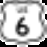
- U.S. Route 6
.svg.png)
- U.S. Route 395
.svg.png)
- State Route 108
 California State Route 108State Route 108, also known as Highway 108, is a numbered state highway in California. SR 108 runs generally northeast across central California from downtown Modesto near the SR 99/SR 132 interchange, crossing the Sierra Nevada at Sonora Pass, to U.S. Route 395 near the Nevada state line...
 - State Route 120
 California State Route 120State Route 120 , in northern California, runs between the Central Valley near Manteca, through Yosemite National Park, and ends at U.S. Route 6 in Mono County.-Route description:...
 - State Route 167

- State Route 182

- State Route 270
 California State Route 270State Route 270 is a state highway located in the U.S. state of California in Mono County. It is a spur route off of U.S. Route 395 south of Bridgeport, leading into Bodie State Historic Park.-Route description:...
Public transportation
Eastern Sierra Transit AuthorityEastern Sierra Transit Authority
Eastern Sierra Transit Authority is the operator of public transportation for the Eastern Sierra Region in California . The agency operates both inter-city and local "town to town" service...
operates intercity bus service along U.S. 395, as well as local services in Mammoth Lakes. Service extends south to Lancaster, California
Lancaster, California
Lancaster is a charter city in northern Los Angeles County, in the high desert, near the Kern County line. Lancaster currently ranks as the 30th largest city in California, and the 148th largest city in the United States. Lancaster is the principal city within the Antelope Valley...
(Los Angeles County) and north to Reno, Nevada
Reno, Nevada
Reno is the county seat of Washoe County, Nevada, United States. The city has a population of about 220,500 and is the most populous Nevada city outside of the Las Vegas metropolitan area...
.
Yosemite Area Regional Transit System (YARTS) also runs along U.S. 395 from Mammoth Lakes to Lee Vining before entering Yosemite National Park
Yosemite National Park
Yosemite National Park is a United States National Park spanning eastern portions of Tuolumne, Mariposa and Madera counties in east central California, United States. The park covers an area of and reaches across the western slopes of the Sierra Nevada mountain chain...
.
Airports
General aviation airports in Mono County include Bryant FieldBryant Field (airport)
Bryant Field is a public airport located in Bridgeport, California, USA.The airport covers and has one runway. It is operated by Mono County....
near Bridgeport, Mammoth Yosemite Airport
Mammoth Yosemite Airport
Mammoth Yosemite Airport is a public airport located six miles east of Mammoth Lakes, serving Mono County, California, USA. The airport has one runway and is mostly used for general aviation but is also served by two commercial airlines....
and Lee Vining Airport
Lee Vining Airport
Lee Vining Airport is a public use airport located one nautical mile east of the central business district of Lee Vining, a town in Mono County, California, United States. The airport is owned by the City of Los Angeles...
. In December 2008, Mammoth Yosemite Airport began commercial air service to Los Angeles International Airport on a seasonal (December to April) basis; the service is provided by Horizon Air, and is subsidized by Mammoth Mountain Ski Resort.
2010
The 2010 United States Census reported that Mono County had a population of 14,202. The racial makeup of Mono County was 11,697 (82.4%) White, 47 (0.3%) African American, 302 (2.1%) Native American, 192 (1.4%) Asian, 11 (0.1%) Pacific Islander, 1,539 (10.8%) from other racesRace (United States Census)
Race and ethnicity in the United States Census, as defined by the Federal Office of Management and Budget and the United States Census Bureau, are self-identification data items in which residents choose the race or races with which they most closely identify, and indicate whether or not they are...
, and 414 (2.9%) from two or more races. Hispanic or Latino of any race were 3,762 persons (26.5%).
| Population reported at 2010 United States Census | |||||||||
|---|---|---|---|---|---|---|---|---|---|
Mono County, California Mono County is a county located in the east central portion of the U.S. state of California, to the east of the Sierra Nevada between Yosemite National Park and Nevada. As of the 2010 census, the population was 14,202, up from 12,853 at the 2000 census... |
Population |
American |
American |
|
Islander |
races Race (United States Census) Race and ethnicity in the United States Census, as defined by the Federal Office of Management and Budget and the United States Census Bureau, are self-identification data items in which residents choose the race or races with which they most closely identify, and indicate whether or not they are... |
more races |
or Latino (of any race) |
|
| Mono County Mono County, California Mono County is a county located in the east central portion of the U.S. state of California, to the east of the Sierra Nevada between Yosemite National Park and Nevada. As of the 2010 census, the population was 14,202, up from 12,853 at the 2000 census... |
14,202 | 11,697 | 47 | 302 | 192 | 11 | 1,539 | 414 | 3,762 |
town |
Population |
American |
American |
|
Islander |
races Race (United States Census) Race and ethnicity in the United States Census, as defined by the Federal Office of Management and Budget and the United States Census Bureau, are self-identification data items in which residents choose the race or races with which they most closely identify, and indicate whether or not they are... |
more races |
or Latino (of any race) |
|
| Mammoth Lakes Mammoth Lakes, California -History:The European history of Mammoth Lakes started in 1877, when four prospectors staked a claim on Mineral Hill, south of the current town, along Old Mammoth Road. In 1878, the Mammoth Mining Company was organized to mine Mineral Hill, which caused a gold rush. By the end of 1878, 1500 people... |
8,234 | 6,643 | 29 | 49 | 128 | 5 | 1,151 | 229 | 2,772 |
place Census-designated place A census-designated place is a concentration of population identified by the United States Census Bureau for statistical purposes. CDPs are delineated for each decennial census as the statistical counterparts of incorporated places such as cities, towns and villages... |
Population |
American |
American |
|
Islander |
races Race (United States Census) Race and ethnicity in the United States Census, as defined by the Federal Office of Management and Budget and the United States Census Bureau, are self-identification data items in which residents choose the race or races with which they most closely identify, and indicate whether or not they are... |
more races |
or Latino (of any race) |
|
| Aspen Springs Aspen Springs, California Aspen Springs is a census-designated place in Mono County, California. It lies at an elevation of 7109 feet . The population was 65 at the 2010 census.-Geography:... |
65 | 62 | 0 | 0 | 2 | 0 | 0 | 1 | 1 |
| Benton Benton, California Benton is a census-designated place in Mono County, California, United States. It is located 3 miles east-northeast of the community of Benton Hot Springs and north of the community of Bishop, at an elevation of 5387 feet... |
280 | 199 | 1 | 59 | 1 | 0 | 15 | 5 | 38 |
| Bridgeport Bridgeport, California Bridgeport is a census-designated place that is the county seat of Mono County, California. It lies at an elevation of 6463 feet in the middle of the Bridgeport Valley. Bridgeport is located at the intersection of highways US 395 and State Route 182. The population was 575 at the 2010... |
575 | 484 | 1 | 43 | 1 | 0 | 25 | 21 | 148 |
| Chalfant | 651 | 594 | 0 | 13 | 5 | 0 | 16 | 23 | 67 |
| Coleville Coleville, California Coleville is a census-designated place in Mono County, California. It is located in the Antelope Valley on the West Walker River northwest of Bridgeport, at an elevation of 5141 feet . The population was 495 at the 2010 census.... |
495 | 386 | 6 | 10 | 8 | 0 | 62 | 23 | 110 |
| Crowley Lake Crowley Lake, California Crowley Lake is a census-designated place in Mono County, California. Crowley Lake sits at an elevation of . The 2010 United States census reported Crowley Lake's population was 875.-Geography:... |
875 | 769 | 4 | 6 | 11 | 0 | 60 | 25 | 128 |
| June Lake June Lake, California June Lake is a census-designated place in Mono County, California. It is located against the southern rim of the Mono Basin, south of Lee Vining, at an elevation of 7654 feet .... |
629 | 534 | 0 | 7 | 2 | 0 | 78 | 8 | 137 |
| Lee Vining Lee Vining, California Lee Vining is a census-designated place in Mono County, California, United States. It is located south-southeast of Bridgeport, at an elevation of 6781 feet . Lee Vining is located on the southwest shore of Mono Lake. The population was 222 as of the 2010 census, down from 250 reported as of 2000... |
222 | 126 | 0 | 25 | 0 | 0 | 64 | 7 | 96 |
| McGee Creek McGee Creek, California McGee Creek is a census-designated place in Mono County, California. McGee Creek sits at an elevation of . The 2010 United States census reported McGee Creek's population was 41.-Geography:... |
41 | 39 | 0 | 0 | 0 | 0 | 0 | 2 | 2 |
| Mono City Mono City, California Mono City is a census-designated place in Mono County, California. It lies north of Mono Lake at the base of the Sierra Nevada mountains at the junction of U.S. Route 395 and California State Route 167, at an elevation of 6768 feet . The ZIP Code is 93541, mail to Mono City should be addressed Lee... |
172 | 156 | 0 | 1 | 2 | 0 | 2 | 11 | 37 |
| Paradise Paradise, Mono County, California Paradise is a census-designated place that is the southernmost community in Mono County, California. Located in the southwest part of the county, Paradise functions as a bedroom community for workers in Bishop and Mammoth Lakes, and as a home for retirees... |
153 | 130 | 0 | 2 | 6 | 0 | 5 | 10 | 14 |
| Sunny Slopes Sunny Slopes, California Sunny Slopes is a census-designated place in Mono County, California. Sunny Slopes sits at an elevation of . The 2010 United States census reported Sunny Slopes's population was 182.-Geography:... |
182 | 159 | 0 | 2 | 7 | 4 | 0 | 10 | 3 |
| Swall Meadows Swall Meadows, California Swall Meadows is a census-designated place in southern unincorporated Mono County, California. The community is residential, including second homes and a volunteer fire department, but no commercial development... |
220 | 201 | 0 | 3 | 5 | 0 | 2 | 9 | 6 |
| Topaz Topaz, California Topaz is a census-designated place in Mono County, California. It is located north of Coleville, at an elevation of 5033 feet . Topaz's ZIP Code is 96133. The population was 50 at the 2010 census.-History:... |
50 | 44 | 0 | 1 | 0 | 0 | 5 | 0 | 24 |
| Walker Walker, Mono County, California Walker is a census-designated place in Mono County, California. It is located south of Coleville, at an elevation of 5403 feet . The ZIP Code is 96107, and mail to Walker should be addressed Coleville... |
721 | 629 | 3 | 57 | 3 | 1 | 13 | 15 | 70 |
communities Unincorporated area In law, an unincorporated area is a region of land that is not a part of any municipality.To "incorporate" in this context means to form a municipal corporation, a city, town, or village with its own government. An unincorporated community is usually not subject to or taxed by a municipal government... |
Population |
American |
American |
|
Islander |
races Race (United States Census) Race and ethnicity in the United States Census, as defined by the Federal Office of Management and Budget and the United States Census Bureau, are self-identification data items in which residents choose the race or races with which they most closely identify, and indicate whether or not they are... |
more races |
or Latino (of any race) |
|
| All others not CDPs (combined) | 637 | 542 | 3 | 24 | 11 | 1 | 41 | 15 | 109 |
2000
As of the censusCensus
A census is the procedure of systematically acquiring and recording information about the members of a given population. It is a regularly occurring and official count of a particular population. The term is used mostly in connection with national population and housing censuses; other common...
of 2000, there were 12,853 people, 5,137 households, and 3,143 families residing in the county. The population density
Population density
Population density is a measurement of population per unit area or unit volume. It is frequently applied to living organisms, and particularly to humans...
was 4 /sqmi. There were 11,757 housing units at an average density of 4 /sqmi. The racial makeup of the county was 84.17% White
Race (United States Census)
Race and ethnicity in the United States Census, as defined by the Federal Office of Management and Budget and the United States Census Bureau, are self-identification data items in which residents choose the race or races with which they most closely identify, and indicate whether or not they are...
, 0.47% Black
Race (United States Census)
Race and ethnicity in the United States Census, as defined by the Federal Office of Management and Budget and the United States Census Bureau, are self-identification data items in which residents choose the race or races with which they most closely identify, and indicate whether or not they are...
or African American
Race (United States Census)
Race and ethnicity in the United States Census, as defined by the Federal Office of Management and Budget and the United States Census Bureau, are self-identification data items in which residents choose the race or races with which they most closely identify, and indicate whether or not they are...
, 2.40% Native American
Race (United States Census)
Race and ethnicity in the United States Census, as defined by the Federal Office of Management and Budget and the United States Census Bureau, are self-identification data items in which residents choose the race or races with which they most closely identify, and indicate whether or not they are...
, 1.11% Asian
Race (United States Census)
Race and ethnicity in the United States Census, as defined by the Federal Office of Management and Budget and the United States Census Bureau, are self-identification data items in which residents choose the race or races with which they most closely identify, and indicate whether or not they are...
, 0.09% Pacific Islander
Race (United States Census)
Race and ethnicity in the United States Census, as defined by the Federal Office of Management and Budget and the United States Census Bureau, are self-identification data items in which residents choose the race or races with which they most closely identify, and indicate whether or not they are...
, 9.51% from other races
Race (United States Census)
Race and ethnicity in the United States Census, as defined by the Federal Office of Management and Budget and the United States Census Bureau, are self-identification data items in which residents choose the race or races with which they most closely identify, and indicate whether or not they are...
, and 2.25% from two or more races. 17.69% of the population were Hispanic
Race (United States Census)
Race and ethnicity in the United States Census, as defined by the Federal Office of Management and Budget and the United States Census Bureau, are self-identification data items in which residents choose the race or races with which they most closely identify, and indicate whether or not they are...
or Latino
Race (United States Census)
Race and ethnicity in the United States Census, as defined by the Federal Office of Management and Budget and the United States Census Bureau, are self-identification data items in which residents choose the race or races with which they most closely identify, and indicate whether or not they are...
of any race. 13.4% were of German, 12.6% Irish
Irish people
The Irish people are an ethnic group who originate in Ireland, an island in northwestern Europe. Ireland has been populated for around 9,000 years , with the Irish people's earliest ancestors recorded having legends of being descended from groups such as the Nemedians, Fomorians, Fir Bolg, Tuatha...
and 11.4% English
English people
The English are a nation and ethnic group native to England, who speak English. The English identity is of early mediaeval origin, when they were known in Old English as the Anglecynn. England is now a country of the United Kingdom, and the majority of English people in England are British Citizens...
ancestry according to Census 2000. 84.0% spoke English
English language
English is a West Germanic language that arose in the Anglo-Saxon kingdoms of England and spread into what was to become south-east Scotland under the influence of the Anglian medieval kingdom of Northumbria...
and 15.1% Spanish
Spanish language
Spanish , also known as Castilian , is a Romance language in the Ibero-Romance group that evolved from several languages and dialects in central-northern Iberia around the 9th century and gradually spread with the expansion of the Kingdom of Castile into central and southern Iberia during the...
as their first language.
There were 5,137 households out of which 28.7% had children under the age of 18 living with them, 50.6% were married couples
Marriage
Marriage is a social union or legal contract between people that creates kinship. It is an institution in which interpersonal relationships, usually intimate and sexual, are acknowledged in a variety of ways, depending on the culture or subculture in which it is found...
living together, 6.5% had a female householder with no husband present, and 38.8% were non-families. 26.6% of all households were made up of individuals and 4.3% had someone living alone who was 65 years of age or older. The average household size was 2.43 and the average family size was 2.98.
In the county the population was spread out with 23.0% under the age of 18, 10.3% from 18 to 24, 33.4% from 25 to 44, 25.6% from 45 to 64, and 7.6% who were 65 years of age or older. The median age was 36 years. For every 100 females there were 121.8 males. For every 100 females age 18 and over, there were 126.8 males.
The median income for a household in the county was $44,992, and the median income for a family was $50,487. Males had a median income of $32,600 versus $26,227 for females. The per capita income
Per capita income
Per capita income or income per person is a measure of mean income within an economic aggregate, such as a country or city. It is calculated by taking a measure of all sources of income in the aggregate and dividing it by the total population...
for the county was $23,422. About 6.30% of families and 11.50% of the population were below the poverty line, including 12.20% of those under age 18 and 1.90% of those age 65 or over.
Politics
| Year | GOP Republican Party (United States) The Republican Party is one of the two major contemporary political parties in the United States, along with the Democratic Party. Founded by anti-slavery expansion activists in 1854, it is often called the GOP . The party's platform generally reflects American conservatism in the U.S... |
DEM Democratic Party (United States) The Democratic Party is one of two major contemporary political parties in the United States, along with the Republican Party. The party's socially liberal and progressive platform is largely considered center-left in the U.S. political spectrum. The party has the lengthiest record of continuous... |
Others |
|---|---|---|---|
| 2008 United States presidential election, 2008 The United States presidential election of 2008 was the 56th quadrennial presidential election. It was held on November 4, 2008. Democrat Barack Obama, then the junior United States Senator from Illinois, defeated Republican John McCain, the senior U.S. Senator from Arizona. Obama received 365... |
55.6% 3,093 | 2.2% 124 | |
| 2004 United States presidential election, 2004 The United States presidential election of 2004 was the United States' 55th quadrennial presidential election. It was held on Tuesday, November 2, 2004. Republican Party candidate and incumbent President George W. Bush defeated Democratic Party candidate John Kerry, the then-junior U.S. Senator... |
49.2% 2,628 | 1.7% 89 | |
| 2000 United States presidential election, 2000 The United States presidential election of 2000 was a contest between Republican candidate George W. Bush, then-governor of Texas and son of former president George H. W. Bush , and Democratic candidate Al Gore, then-Vice President.... |
40.9% 1,788 | 6.6% 287 | |
| 1996 United States presidential election, 1996 The United States presidential election of 1996 was a contest between the Democratic national ticket of President Bill Clinton of Arkansas and Vice President Al Gore of Tennessee and the Republican national ticket of former Senator Bob Dole of Kansas for President and former Housing Secretary Jack... |
38.6% 1,580 | 15.4% 629 | |
| 1992 United States presidential election, 1992 The United States presidential election of 1992 had three major candidates: Incumbent Republican President George Bush; Democratic Arkansas Governor Bill Clinton, and independent Texas businessman Ross Perot.... |
34.2% 1,489 | 29.8% 1,296 | |
| 1988 United States presidential election, 1988 The United States presidential election of 1988 featured no incumbent president, as President Ronald Reagan was unable to seek re-election after serving the maximum two terms allowed by the Twenty-second Amendment. Reagan's Vice President, George H. W. Bush, won the Republican nomination, while the... |
36.2% 1,284 | 2.4% 86 | |
| 1984 United States presidential election, 1984 The United States presidential election of 1984 was a contest between the incumbent President Ronald Reagan, the Republican candidate, and former Vice President Walter Mondale, the Democratic candidate. Reagan was helped by a strong economic recovery from the deep recession of 1981–1982... |
26.2% 962 | 1.5% 56 | |
| 1980 United States presidential election, 1980 The United States presidential election of 1980 featured a contest between incumbent Democrat Jimmy Carter and his Republican opponent, Ronald Reagan, as well as Republican Congressman John B. Anderson, who ran as an independent... |
25.3% 865 | 12.4% 424 | |
| 1976 United States presidential election, 1976 The United States presidential election of 1976 followed the resignation of President Richard Nixon in the wake of the Watergate scandal. It pitted incumbent President Gerald Ford, the Republican candidate, against the relatively unknown former governor of Georgia, Jimmy Carter, the Democratic... |
37.7% 1,025 | 3.5% 96 | |
| 1972 United States presidential election, 1972 The United States presidential election of 1972 was the 47th quadrennial United States presidential election. It was held on November 7, 1972. The Democratic Party's nomination was eventually won by Senator George McGovern, who ran an anti-war campaign against incumbent Republican President Richard... |
29.6% 828 | 3.5% 99 | |
| 1968 United States presidential election, 1968 The United States presidential election of 1968 was the 46th quadrennial United States presidential election. Coming four years after Democrat Lyndon B. Johnson won in a historic landslide, it saw Johnson forced out of the race and Republican Richard Nixon elected... |
26.5% 465 | 9.3% 163 | |
| 1964 United States presidential election, 1964 The United States presidential election of 1964 was held on November 3, 1964. Incumbent President Lyndon B. Johnson had come to office less than a year earlier following the assassination of his predecessor, John F. Kennedy. Johnson, who had successfully associated himself with Kennedy's... |
43.9% 666 | 0.0% 0 | |
| 1960 United States presidential election, 1960 The United States presidential election of 1960 was the 44th American presidential election, held on November 8, 1960, for the term beginning January 20, 1961, and ending January 20, 1965. The incumbent president, Republican Dwight D. Eisenhower, was not eligible to run again. The Republican Party... |
33.2% 457 | 0.4% 6 | |
| 1956 United States presidential election, 1956 The United States presidential election of 1956 saw a popular Dwight D. Eisenhower successfully run for re-election. The 1956 election was a rematch of 1952, as Eisenhower's opponent in 1956 was Democrat Adlai Stevenson, whom Eisenhower had defeated four years earlier.Incumbent President Eisenhower... |
26.0% 237 | 0.2% 2 | |
| 1952 United States presidential election, 1952 The United States presidential election of 1952 took place in an era when Cold War tension between the United States and the Soviet Union was escalating rapidly. In the United States Senate, Republican Senator Joseph McCarthy of Wisconsin had become a national figure after chairing congressional... |
22.7% 264 | 0.7% 8 | |
| 1948 United States presidential election, 1948 The United States presidential election of 1948 is considered by most historians as the greatest election upset in American history. Virtually every prediction indicated that incumbent President Harry S. Truman would be defeated by Republican Thomas E. Dewey. Truman won, overcoming a three-way... |
30.5% 255 | 4.7% 39 | |
| 1944 United States presidential election, 1944 The United States presidential election of 1944 took place while the United States was preoccupied with fighting World War II. President Franklin D. Roosevelt had been in office longer than any other president, but remained popular. Unlike 1940, there was little doubt that Roosevelt would run for... |
39.0% 242 | 0.2% 1 | |
| 1940 United States presidential election, 1940 The United States presidential election of 1940 was fought in the shadow of World War II as the United States was emerging from the Great Depression. Incumbent President Franklin D. Roosevelt , a Democrat, broke with tradition and ran for a third term, which became a major issue... |
52.6% 523 | 1.3% 13 | |
| 1936 United States presidential election, 1936 The United States presidential election of 1936 was the most lopsided presidential election in the history of the United States in terms of electoral votes. In terms of the popular vote, it was the third biggest victory since the election of 1820, which was not seriously contested.The election took... |
64.8% 458 | 1.1% 8 | |
| 1932 United States presidential election, 1932 The United States presidential election of 1932 took place as the effects of the Wall Street Crash of 1929, the Smoot-Hawley Tariff Act of 1930, the Revenue Act of 1932, and the Great Depression were being felt intensely across the country. President Herbert Hoover's popularity was falling as... |
64.4% 374 | 1.4% 8 | |
| 1928 United States presidential election, 1928 The United States presidential election of 1928 pitted Republican Herbert Hoover against Democrat Al Smith. The Republicans were identified with the booming economy of the 1920s, whereas Smith, a Roman Catholic, suffered politically from Anti-Catholic prejudice, his anti-prohibitionist stance, and... |
35.7% 127 | 2.5% 9 | |
| 1924 United States presidential election, 1924 The United States presidential election of 1924 was won by incumbent President Calvin Coolidge, the Republican candidate.Coolidge was vice-president under Warren G. Harding and became president in 1923 when Harding died in office. Coolidge was given credit for a booming economy at home and no... |
14.5% 45 | 31.9% 99 | |
| 1920 United States presidential election, 1920 The United States presidential election of 1920 was dominated by the aftermath of World War I and a hostile response to certain policies of Woodrow Wilson, the Democratic president. The wartime economic boom had collapsed. Politicians were arguing over peace treaties and the question of America's... |
22.3% 56 | 10.0% 25 |
Mono used to be a Republican
Republican Party (United States)
The Republican Party is one of the two major contemporary political parties in the United States, along with the Democratic Party. Founded by anti-slavery expansion activists in 1854, it is often called the GOP . The party's platform generally reflects American conservatism in the U.S...
-leaning county in Presidential
President of the United States
The President of the United States of America is the head of state and head of government of the United States. The president leads the executive branch of the federal government and is the commander-in-chief of the United States Armed Forces....
and congressional
United States Congress
The United States Congress is the bicameral legislature of the federal government of the United States, consisting of the Senate and the House of Representatives. The Congress meets in the United States Capitol in Washington, D.C....
elections but has become more of a swing county in recent elections, going for John Kerry
John Kerry
John Forbes Kerry is the senior United States Senator from Massachusetts, the 10th most senior U.S. Senator and chairman of the Senate Foreign Relations Committee. He was the presidential nominee of the Democratic Party in the 2004 presidential election, but lost to former President George W...
by an extremely slim margin of seven votes in 2004
United States presidential election, 2004
The United States presidential election of 2004 was the United States' 55th quadrennial presidential election. It was held on Tuesday, November 2, 2004. Republican Party candidate and incumbent President George W. Bush defeated Democratic Party candidate John Kerry, the then-junior U.S. Senator...
. In 2008, Barack Obama
Barack Obama
Barack Hussein Obama II is the 44th and current President of the United States. He is the first African American to hold the office. Obama previously served as a United States Senator from Illinois, from January 2005 until he resigned following his victory in the 2008 presidential election.Born in...
did substantially better, receiving 668 more votes than Republican candidate John McCain
John McCain
John Sidney McCain III is the senior United States Senator from Arizona. He was the Republican nominee for president in the 2008 United States election....
. Prior to 2004, the last Democrat to win a majority in the county was Franklin Roosevelt
Franklin D. Roosevelt
Franklin Delano Roosevelt , also known by his initials, FDR, was the 32nd President of the United States and a central figure in world events during the mid-20th century, leading the United States during a time of worldwide economic crisis and world war...
in 1940
United States presidential election, 1940
The United States presidential election of 1940 was fought in the shadow of World War II as the United States was emerging from the Great Depression. Incumbent President Franklin D. Roosevelt , a Democrat, broke with tradition and ran for a third term, which became a major issue...
.
In November 2008, Mono County was one of just three counties in California's interior in which voters rejected Proposition 8
California Proposition 8 (2008)
Proposition 8 was a ballot proposition and constitutional amendment passed in the November 2008 state elections...
to ban gay marriage. The county's voters rejected Proposition 8 by 55.5 percent to 44.5 percent. The other interior counties in which Proposition 8 failed to receive a majority of votes were neighboring Alpine County
Alpine County, California
Alpine County is the smallest county, by population, in the U.S. state of California. As of 2010, it had a population of 1,175, all rural. There are no incorporated cities in the county. The county seat is Markleeville...
and Yolo County
Yolo County, California
Yolo County is a county located in the northern part of the U.S. state of California, bordered by the other counties of Sacramento, Solano, Napa, Lake, Colusa, and Sutter. The city of Woodland is its county seat, though Davis is its largest city....
.
Mono is part of California's 25th congressional district
California's 25th congressional district
California's 25th congressional district is a congressional district in the U.S. state of California that covers part of Los Angeles County and extends out to broad stretches of interior California along the Nevada border. It includes the cities of Santa Clarita, Palmdale, Lancaster, and the...
, which is held by Republican Buck McKeon
Howard McKeon
Howard Philip "Buck" McKeon is the U.S. Representative for , serving since 1993. He is a member of the Republican Party.-Early life, education and career:...
. In the state legislature
California State Legislature
The California State Legislature is the state legislature of the U.S. state of California. It is a bicameral body consisting of the lower house, the California State Assembly, with 80 members, and the upper house, the California State Senate, with 40 members...
Mono is in the 25th Assembly district, which is held by Republican Kristin Olsen
Kristin Olsen
Kristin Olsen is an American politician currently serving in the California State Assembly. She is a Republican representing the 25th district, encompassing Calaveras, Mariposa, Mono, and Tuolumne counties, and parts of Madera and Stanislaus counties...
, and the 1st Senate district, which is held by Republican Ted Gaines
Ted Gaines
Edward M. Gaines is a California State Senator, representing the 1st Senate district. He won a January 4, 2011, special election to replace the late Dave Cox and took office two days later...
.
See also
- List of school districts in Mono County, California
- National Register of Historic Places listings in Mono County, California