
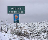
Alpine County, California
Encyclopedia
Alpine County is the smallest county, by population, in the U.S. state
of California
. As of 2010, it had a population of 1,175, all rural. There are no incorporated cities in the county. The county seat
is Markleeville
. Alpine County is located in the Sierra Nevada, between Lake Tahoe
and Yosemite National Park
.
boom in the wake of the nearby Comstock Lode
discovery. The county was formed from parts of Amador
, Calaveras
, El Dorado
, Mono
and Tuolumne
Counties. At its formation, the county had a population of about 11,000 with its county seat in Silver Mountain City
. By 1868 however, the local silver mines had proven unfruitful, and the population fell to about 1,200. The county seat was moved to Markleeville in 1875.
After the silver rush, Alpine County's economy consisted almost entirely of farming, ranching, and logging. By the 1920s, the population had fallen to just 200 people. With the construction of the Bear Valley
and Kirkwood
ski resorts in the late 1960s, the population increased to the present level.
(There are a few trailhead shuttles, designed for hikers).
is a general aviation airport located in the Eastern Sierras about 4 miles (6.4 km) from the town of Markleeville. The airport consists of a simple airstrip with an apron for small light aircraft to park. The airport has no buildings, no lights, and is very rarely used. The airport is popular with astronomers due to the clear, dark skies.
, and 28 (2.4%) from two or more races. Hispanic or Latino of any race were 84 persons (7.1%).
of 2000, there were 1,208 people, 483 households, and 295 families residing in the county. The population density
was 2 people per square mile (1/km²). There were 1,514 housing units at an average density of 2 per square mile (1/km²). The racial makeup of the county was 73.68% White
, 0.58% Black
or African American
, 18.87% Native American
, 0.33% Asian
, 0.08% Pacific Islander
, 1.41% from other races
, and 5.05% from two or more races. 7.78% of the population were Hispanic
or Latino
of any race. 12.1% were of German, 12.1% Irish
, 9.3% English
, 6.5% American
and 5.7% Italian
ancestry according to Census 2000. 95.0% spoke English
, 3.1% Spanish
and 2.0% Washo
as their first language.
There were 483 households out of which 25.5% had children under the age of 18 living with them, 43.9% were married couples
living together, 11.0% had a female householder with no husband present, and 38.9% were non-families. 27.7% of all households were made up of individuals and 5.4% had someone living alone who was 65 years of age or older. The average household size was 2.50 and the average family size was 2.96.
In the county the population was spread out with 22.8% under the age of 18, 10.40% from 18 to 24, 27.5% from 25 to 44, 29.3% from 45 to 64, and 9.9% who were 65 years of age or older. The median age was 39 years. For every 100 females there were 110.8 males. For every 100 females age 18 and over, there were 117.2 males.
The median income for a household in the county was $41,875, and the median income for a family was $50,250. Males had a median income of $36,544 versus $25,800 for females. The per capita income
for the county was $24,431. About 12.0% of families and 19.5% of the population were below the poverty line, including 27.4% of those under age 18 and 10.1% of those age 65 or over.
Almost half of the population in the county is Mormon
.
Alpine is historically a Republican
-leaning county in Presidential
and congressional
elections. The county narrowly voted for George W. Bush
in 2000
, but went comfortably for John Kerry
in 2004
, the first time Alpine voted Democratic
in a presidential election since 1936
, when Franklin Roosevelt
carried every county in California. Barack Obama
received an even wider margin of victory over John McCain
in 2008
.
In November 2008, Alpine was one of just three counties in California's interior in which voters rejected Proposition 8
, the ballot initiative to amend the California Constitution
to reject the legal extension of the title of marriage to same-sex couples. Alpine voters rejected Proposition 8 by 56.4 percent to 43.6 percent. The other interior counties in which Proposition 8 failed to receive a majority of votes were neighboring Mono County
and Yolo County
.
According to the California Secretary of State, as of April, 2008, there are 776 registered voters in Alpine County. Of those, 282 (36.3%) are registered Democratic, 272 (35.1%) are registered Republican, 49 (6.3%) are registered with other political parties, and 173 (22.3%) declined to state a political party.
Alpine is part of California's 3rd congressional district
, which is held by Republican Dan Lungren
. In the State Assembly
, Alpine is part of the 4th district, which is held by Republican Beth Gaines
, who was elected to the Assembly in May 2011. In the State Senate
, Alpine is part of the 1st district, which is held by Republican Ted Gaines
, who was elected to the Senate in January 2011.
U.S. state
A U.S. state is any one of the 50 federated states of the United States of America that share sovereignty with the federal government. Because of this shared sovereignty, an American is a citizen both of the federal entity and of his or her state of domicile. Four states use the official title of...
of California
California
California is a state located on the West Coast of the United States. It is by far the most populous U.S. state, and the third-largest by land area...
. As of 2010, it had a population of 1,175, all rural. There are no incorporated cities in the county. The county seat
County seat
A county seat is an administrative center, or seat of government, for a county or civil parish. The term is primarily used in the United States....
is Markleeville
Markleeville, California
Markleeville is a census-designated place and the county seat of Alpine County, California. The population was 210 at the 2010 census, up from 197 at the 2000 census.The CDP of Markleeville also includes Woodfords....
. Alpine County is located in the Sierra Nevada, between Lake Tahoe
Lake Tahoe
Lake Tahoe is a large freshwater lake in the Sierra Nevada of the United States. At a surface elevation of , it is located along the border between California and Nevada, west of Carson City. Lake Tahoe is the largest alpine lake in North America. Its depth is , making it the USA's second-deepest...
and Yosemite National Park
Yosemite National Park
Yosemite National Park is a United States National Park spanning eastern portions of Tuolumne, Mariposa and Madera counties in east central California, United States. The park covers an area of and reaches across the western slopes of the Sierra Nevada mountain chain...
.
History
Alpine County was created on March 16, 1864 during a silverSilver
Silver is a metallic chemical element with the chemical symbol Ag and atomic number 47. A soft, white, lustrous transition metal, it has the highest electrical conductivity of any element and the highest thermal conductivity of any metal...
boom in the wake of the nearby Comstock Lode
Comstock Lode
The Comstock Lode was the first major U.S. discovery of silver ore, located under what is now Virginia City, Nevada, on the eastern slope of Mount Davidson, a peak in the Virginia Range. After the discovery was made public in 1859, prospectors rushed to the area and scrambled to stake their claims...
discovery. The county was formed from parts of Amador
Amador County, California
Amador County is a county located in the Sierra Nevada of the U.S. state of California. As of the 2010 census, the population was 38,091. The county seat is Jackson.Amador County bills itself as "The Heart of the Mother Lode" and lies within the Gold Country...
, Calaveras
Calaveras County, California
Calaveras County is a county located in the Gold Country of the U.S. state of California. Calaveras is the Spanish word for skulls; the county was reportedly named for the remains of Native Americans discovered by the Spanish explorer Captain Gabriel Moraga. As of the 2010 census, the county had a...
, El Dorado
El Dorado County, California
El Dorado County is a county located in the historic Gold Country in the Sierra Nevada Mountains and foothills of the U.S. state of California. The 2010 population was 181,058. The El Dorado county seat is in Placerville....
, Mono
Mono County, California
Mono County is a county located in the east central portion of the U.S. state of California, to the east of the Sierra Nevada between Yosemite National Park and Nevada. As of the 2010 census, the population was 14,202, up from 12,853 at the 2000 census...
and Tuolumne
Tuolumne County, California
Tuolumne County is a county in the Sierra Nevada of the U.S. state of California. The northern half of Yosemite National Park is located in the eastern part of the county. As of the 2010 census, the population was 55,365, up from 54,501 at the 2000 census...
Counties. At its formation, the county had a population of about 11,000 with its county seat in Silver Mountain City
Silver Mountain, California
Silver Mountain is a former settlement in Alpine County, California. It was located on Silver Creek north-northeast of Ebbetts Pass, at an elevation of 6411 feet .Silver Mountain was founded in 1858 by Norwegian miners who named the place Köngsberg or Konigsberg...
. By 1868 however, the local silver mines had proven unfruitful, and the population fell to about 1,200. The county seat was moved to Markleeville in 1875.
After the silver rush, Alpine County's economy consisted almost entirely of farming, ranching, and logging. By the 1920s, the population had fallen to just 200 people. With the construction of the Bear Valley
Bear Valley (resort)
Bear Valley is a ski area located on highway 4 between Lake Tahoe and Yosemite—about three hours southeast of Sacramento, California. It is about one hour from Angels Camp, California. It has been owned by Canadian company Dundee Realty since 2005....
and Kirkwood
Kirkwood Mountain Resort
Kirkwood Mountain Resort is a year-round resort in Kirkwood, California south of Lake Tahoe that focuses on skiing and snowboarding in winter and hiking and mountain-biking in summer. Kirkwood is one of the region's larger resorts, and is well known for having one of the highest average snowfalls...
ski resorts in the late 1960s, the population increased to the present level.
Geography
According to the 2000 census, the county has a total area of 743.19 square miles (1,924.9 km²), of which 738.62 square miles (1,913 km²) (or 99.39%) is land and 4.57 square miles (11.8 km²) (or 0.61%) is water.Census-designated Places
- Alpine VillageAlpine Village, CaliforniaAlpine Village is a census-designated place in Alpine County, California, United States. The population was 114 at the 2010 census, down from 136 at the 2000 census.-Geography:...
- Bear Valley
- KirkwoodKirkwood, CaliforniaKirkwood is a census-designated place in Alpine and Amador counties, California, United States. The population was 158 at the 2010 census. Kirkwood's main attraction is the Kirkwood Mountain Resort. The town is accessible by State Route 88...
- MarkleevilleMarkleeville, CaliforniaMarkleeville is a census-designated place and the county seat of Alpine County, California. The population was 210 at the 2010 census, up from 197 at the 2000 census.The CDP of Markleeville also includes Woodfords....
- Mesa VistaMesa Vista, CaliforniaMesa Vista is a census-designated place in Alpine County, California, United States. The population was 200 at the 2010 census, up from 182 at the 2000 census.-Geography:...
Unincorporated Communities
- Cape HornCape Horn, Alpine County, CaliforniaCape Horn is an unincorporated community in Alpine County, California. It lies at an elevation of 8,005 feet ....
- FredericksburgFredericksburg, CaliforniaFredericksburg is an unincorporated community in Alpine County, California. It is located north-northeast of Woodfords, at an elevation of 5072 feet ....
- Lake AlpineLake Alpine, CaliforniaLake Alpine is an unincorporated community in Alpine County, California. It is located on the north shore of Lake Alpine, at an elevation of 7388 feet .A post office operated at Lake Alpine from 1927 to 1972.-References:...
- LoopeLoope, CaliforniaLoope is an unincorporated community in Alpine County, California. It is located on Monitor Creek, at an elevation of 6188 feet .A post office operated at Monitor from 1863 to 1888...
- PaynesvillePaynesville, CaliforniaPaynesville is an unincorporated community in Alpine County, California. It is located on the Carson River a quarter mile northeast of Woodfords, at an elevation of 5118 feet ....
- Peaceful PinesPeaceful Pines, CaliforniaPeaceful Pines is an unincorporated community in Alpine County, California. It lies at an elevation of 6207 feet ....
- Shay Creek Summer Home AreaShay Creek Summer Home Area, CaliforniaShay Creek Summer Home Area is an unincorporated community in Alpine County, California. It lies at an elevation of 5964 feet . As the name suggests, many of the homes are second homes....
- SorensensSorensens, CaliforniaSorensens is an unincorporated community in Alpine County, California. It is located on the West Fork of the Carson River at an elevation of 6919 feet ....
Adjacent counties
- Mono County, CaliforniaMono County, CaliforniaMono County is a county located in the east central portion of the U.S. state of California, to the east of the Sierra Nevada between Yosemite National Park and Nevada. As of the 2010 census, the population was 14,202, up from 12,853 at the 2000 census...
- east - Tuolumne County, CaliforniaTuolumne County, CaliforniaTuolumne County is a county in the Sierra Nevada of the U.S. state of California. The northern half of Yosemite National Park is located in the eastern part of the county. As of the 2010 census, the population was 55,365, up from 54,501 at the 2000 census...
- south - Calaveras County, CaliforniaCalaveras County, CaliforniaCalaveras County is a county located in the Gold Country of the U.S. state of California. Calaveras is the Spanish word for skulls; the county was reportedly named for the remains of Native Americans discovered by the Spanish explorer Captain Gabriel Moraga. As of the 2010 census, the county had a...
- southwest - Amador County, CaliforniaAmador County, CaliforniaAmador County is a county located in the Sierra Nevada of the U.S. state of California. As of the 2010 census, the population was 38,091. The county seat is Jackson.Amador County bills itself as "The Heart of the Mother Lode" and lies within the Gold Country...
- west - El Dorado County, CaliforniaEl Dorado County, CaliforniaEl Dorado County is a county located in the historic Gold Country in the Sierra Nevada Mountains and foothills of the U.S. state of California. The 2010 population was 181,058. The El Dorado county seat is in Placerville....
- northwest - Douglas County, NevadaDouglas County, NevadaDouglas County is a county located in the northwestern part of the U.S. state of Nevada. As of 2000, the population was 41,259. As of 2010, the population was estimated to be 46,997.- History :...
- north
National protected areas
- Eldorado National ForestEldorado National ForestEldorado National Forest is a U.S. National Forest located in the central Sierra Nevada mountain range, in eastern Eldorado National Forest is a [[U.S. National Forest]] located in the central [[Sierra Nevada |Sierra Nevada]] [[mountain range]], in eastern Eldorado National Forest is a [[U.S...
(part) - Stanislaus National ForestStanislaus National ForestStanislaus National Forest contains in four counties in the Sierra Nevada Mountains of Northern California. It was established on February 22, 1897, making it one of the oldest national forests...
(part) - Toiyabe National Forest (part)
Major highways
- State Route 4

- State Route 88
 California State Route 88State Route 88 , also known as the Carson Pass Highway, is a California State Highway that travels in an east–west direction, from Stockton, crossing the Sierra Nevada at Carson Pass, and ending at the border with Nevada, whereupon it becomes Nevada State Route 88, eventually terminating at U.S...
 - State Route 89
 California State Route 89State Route 89 is a California State Highway that travels in the north–south direction, and is the major thoroughfare for many mountain communities. It starts from U.S. Route 395 near Topaz Lake, winding its way up to the Monitor Pass, down to the Carson River, and up again over the Luther...
Public transportation
There is limited, call ahead, public transportation provided by agreement with neighboring Douglas County, NevadaDouglas County, Nevada
Douglas County is a county located in the northwestern part of the U.S. state of Nevada. As of 2000, the population was 41,259. As of 2010, the population was estimated to be 46,997.- History :...
(There are a few trailhead shuttles, designed for hikers).
Airport
Alpine County AirportAlpine County Airport
Alpine County Airport is a county-owned public-use airport located three nautical miles north of the central business district of Markleeville, in Alpine County, California, United States....
is a general aviation airport located in the Eastern Sierras about 4 miles (6.4 km) from the town of Markleeville. The airport consists of a simple airstrip with an apron for small light aircraft to park. The airport has no buildings, no lights, and is very rarely used. The airport is popular with astronomers due to the clear, dark skies.
Site Information
- Longitude - 119° 46' 01" West
- Latitude - 38° 44' 09" North
- Altitude - 5,867 feet [1788 meters]
Demographics
2010
The 2010 United States Census reported that Alpine County had a population of 1,175. The racial makeup of Alpine County was 881 (75.0%) White, 0 (0.0%) African American, 240 (20.4%) Native American, 7 (0.6%) Asian, 0 (0.0%) Pacific Islander, 19 (1.6%) from other racesRace (United States Census)
Race and ethnicity in the United States Census, as defined by the Federal Office of Management and Budget and the United States Census Bureau, are self-identification data items in which residents choose the race or races with which they most closely identify, and indicate whether or not they are...
, and 28 (2.4%) from two or more races. Hispanic or Latino of any race were 84 persons (7.1%).
| Population reported at 2010 United States Census | |||||||||
|---|---|---|---|---|---|---|---|---|---|
Alpine County, California Alpine County is the smallest county, by population, in the U.S. state of California. As of 2010, it had a population of 1,175, all rural. There are no incorporated cities in the county. The county seat is Markleeville... |
Population |
American |
American |
|
Islander |
races Race (United States Census) Race and ethnicity in the United States Census, as defined by the Federal Office of Management and Budget and the United States Census Bureau, are self-identification data items in which residents choose the race or races with which they most closely identify, and indicate whether or not they are... |
more races |
or Latino (of any race) |
|
| Alpine County Alpine County, California Alpine County is the smallest county, by population, in the U.S. state of California. As of 2010, it had a population of 1,175, all rural. There are no incorporated cities in the county. The county seat is Markleeville... |
1175 | 881 | 0 | 240 | 7 | 0 | 19 | 28 | 84 |
places Census-designated place A census-designated place is a concentration of population identified by the United States Census Bureau for statistical purposes. CDPs are delineated for each decennial census as the statistical counterparts of incorporated places such as cities, towns and villages... |
Population |
American |
American |
|
Islander |
races Race (United States Census) Race and ethnicity in the United States Census, as defined by the Federal Office of Management and Budget and the United States Census Bureau, are self-identification data items in which residents choose the race or races with which they most closely identify, and indicate whether or not they are... |
more races |
or Latino (of any race) |
|
| Alpine Village Alpine Village, California Alpine Village is a census-designated place in Alpine County, California, United States. The population was 114 at the 2010 census, down from 136 at the 2000 census.-Geography:... |
114 | 91 | 0 | 19 | 1 | 0 | 2 | 1 | 6 |
| Bear Valley | 121 | 119 | 0 | 0 | 1 | 0 | 0 | 1 | 1 |
| Kirkwood Kirkwood, California Kirkwood is a census-designated place in Alpine and Amador counties, California, United States. The population was 158 at the 2010 census. Kirkwood's main attraction is the Kirkwood Mountain Resort. The town is accessible by State Route 88... ‡ |
97 | 94 | 0 | 3 | 0 | 0 | 0 | 0 | 0 |
| Markleeville Markleeville, California Markleeville is a census-designated place and the county seat of Alpine County, California. The population was 210 at the 2010 census, up from 197 at the 2000 census.The CDP of Markleeville also includes Woodfords.... |
210 | 192 | 0 | 4 | 2 | 0 | 6 | 6 | 11 |
| Mesa Vista Mesa Vista, California Mesa Vista is a census-designated place in Alpine County, California, United States. The population was 200 at the 2010 census, up from 182 at the 2000 census.-Geography:... |
200 | 178 | 0 | 15 | 2 | 0 | 0 | 5 | 11 |
communities Unincorporated area In law, an unincorporated area is a region of land that is not a part of any municipality.To "incorporate" in this context means to form a municipal corporation, a city, town, or village with its own government. An unincorporated community is usually not subject to or taxed by a municipal government... |
Population |
American |
American |
|
Islander |
races Race (United States Census) Race and ethnicity in the United States Census, as defined by the Federal Office of Management and Budget and the United States Census Bureau, are self-identification data items in which residents choose the race or races with which they most closely identify, and indicate whether or not they are... |
more races |
or Latino (of any race) |
|
| All others not CDPs (combined) | 433 | 217 | 0 | 199 | 1 | 0 | 11 | 15 | 51 |
| ‡ - census results for the portion of this CDP in Alpine County | |||||||||
2000
As of the censusCensus
A census is the procedure of systematically acquiring and recording information about the members of a given population. It is a regularly occurring and official count of a particular population. The term is used mostly in connection with national population and housing censuses; other common...
of 2000, there were 1,208 people, 483 households, and 295 families residing in the county. The population density
Population density
Population density is a measurement of population per unit area or unit volume. It is frequently applied to living organisms, and particularly to humans...
was 2 people per square mile (1/km²). There were 1,514 housing units at an average density of 2 per square mile (1/km²). The racial makeup of the county was 73.68% White
Race (United States Census)
Race and ethnicity in the United States Census, as defined by the Federal Office of Management and Budget and the United States Census Bureau, are self-identification data items in which residents choose the race or races with which they most closely identify, and indicate whether or not they are...
, 0.58% Black
Race (United States Census)
Race and ethnicity in the United States Census, as defined by the Federal Office of Management and Budget and the United States Census Bureau, are self-identification data items in which residents choose the race or races with which they most closely identify, and indicate whether or not they are...
or African American
Race (United States Census)
Race and ethnicity in the United States Census, as defined by the Federal Office of Management and Budget and the United States Census Bureau, are self-identification data items in which residents choose the race or races with which they most closely identify, and indicate whether or not they are...
, 18.87% Native American
Race (United States Census)
Race and ethnicity in the United States Census, as defined by the Federal Office of Management and Budget and the United States Census Bureau, are self-identification data items in which residents choose the race or races with which they most closely identify, and indicate whether or not they are...
, 0.33% Asian
Race (United States Census)
Race and ethnicity in the United States Census, as defined by the Federal Office of Management and Budget and the United States Census Bureau, are self-identification data items in which residents choose the race or races with which they most closely identify, and indicate whether or not they are...
, 0.08% Pacific Islander
Race (United States Census)
Race and ethnicity in the United States Census, as defined by the Federal Office of Management and Budget and the United States Census Bureau, are self-identification data items in which residents choose the race or races with which they most closely identify, and indicate whether or not they are...
, 1.41% from other races
Race (United States Census)
Race and ethnicity in the United States Census, as defined by the Federal Office of Management and Budget and the United States Census Bureau, are self-identification data items in which residents choose the race or races with which they most closely identify, and indicate whether or not they are...
, and 5.05% from two or more races. 7.78% of the population were Hispanic
Race (United States Census)
Race and ethnicity in the United States Census, as defined by the Federal Office of Management and Budget and the United States Census Bureau, are self-identification data items in which residents choose the race or races with which they most closely identify, and indicate whether or not they are...
or Latino
Race (United States Census)
Race and ethnicity in the United States Census, as defined by the Federal Office of Management and Budget and the United States Census Bureau, are self-identification data items in which residents choose the race or races with which they most closely identify, and indicate whether or not they are...
of any race. 12.1% were of German, 12.1% Irish
Irish people
The Irish people are an ethnic group who originate in Ireland, an island in northwestern Europe. Ireland has been populated for around 9,000 years , with the Irish people's earliest ancestors recorded having legends of being descended from groups such as the Nemedians, Fomorians, Fir Bolg, Tuatha...
, 9.3% English
English people
The English are a nation and ethnic group native to England, who speak English. The English identity is of early mediaeval origin, when they were known in Old English as the Anglecynn. England is now a country of the United Kingdom, and the majority of English people in England are British Citizens...
, 6.5% American
United States
The United States of America is a federal constitutional republic comprising fifty states and a federal district...
and 5.7% Italian
Italian people
The Italian people are an ethnic group that share a common Italian culture, ancestry and speak the Italian language as a mother tongue. Within Italy, Italians are defined by citizenship, regardless of ancestry or country of residence , and are distinguished from people...
ancestry according to Census 2000. 95.0% spoke English
English language
English is a West Germanic language that arose in the Anglo-Saxon kingdoms of England and spread into what was to become south-east Scotland under the influence of the Anglian medieval kingdom of Northumbria...
, 3.1% Spanish
Spanish language
Spanish , also known as Castilian , is a Romance language in the Ibero-Romance group that evolved from several languages and dialects in central-northern Iberia around the 9th century and gradually spread with the expansion of the Kingdom of Castile into central and southern Iberia during the...
and 2.0% Washo
Washo language
The Washo language is an endangered Native American language isolate spoken by the Washo on the California–Nevada border in the drainages of the Truckee and Carson Rivers, especially around Lake Tahoe...
as their first language.
There were 483 households out of which 25.5% had children under the age of 18 living with them, 43.9% were married couples
Marriage
Marriage is a social union or legal contract between people that creates kinship. It is an institution in which interpersonal relationships, usually intimate and sexual, are acknowledged in a variety of ways, depending on the culture or subculture in which it is found...
living together, 11.0% had a female householder with no husband present, and 38.9% were non-families. 27.7% of all households were made up of individuals and 5.4% had someone living alone who was 65 years of age or older. The average household size was 2.50 and the average family size was 2.96.
In the county the population was spread out with 22.8% under the age of 18, 10.40% from 18 to 24, 27.5% from 25 to 44, 29.3% from 45 to 64, and 9.9% who were 65 years of age or older. The median age was 39 years. For every 100 females there were 110.8 males. For every 100 females age 18 and over, there were 117.2 males.
The median income for a household in the county was $41,875, and the median income for a family was $50,250. Males had a median income of $36,544 versus $25,800 for females. The per capita income
Per capita income
Per capita income or income per person is a measure of mean income within an economic aggregate, such as a country or city. It is calculated by taking a measure of all sources of income in the aggregate and dividing it by the total population...
for the county was $24,431. About 12.0% of families and 19.5% of the population were below the poverty line, including 27.4% of those under age 18 and 10.1% of those age 65 or over.
Almost half of the population in the county is Mormon
Mormon
The term Mormon most commonly denotes an adherent, practitioner, follower, or constituent of Mormonism, which is the largest branch of the Latter Day Saint movement in restorationist Christianity...
.
Politics
| Year | GOP Republican Party (United States) The Republican Party is one of the two major contemporary political parties in the United States, along with the Democratic Party. Founded by anti-slavery expansion activists in 1854, it is often called the GOP . The party's platform generally reflects American conservatism in the U.S... |
DEM Democratic Party (United States) The Democratic Party is one of two major contemporary political parties in the United States, along with the Republican Party. The party's socially liberal and progressive platform is largely considered center-left in the U.S. political spectrum. The party has the lengthiest record of continuous... |
Others |
|---|---|---|---|
| 2008 United States presidential election, 2008 The United States presidential election of 2008 was the 56th quadrennial presidential election. It was held on November 4, 2008. Democrat Barack Obama, then the junior United States Senator from Illinois, defeated Republican John McCain, the senior U.S. Senator from Arizona. Obama received 365... |
61.0% 422 | 2.6% 18 | |
| 2004 United States presidential election, 2004 The United States presidential election of 2004 was the United States' 55th quadrennial presidential election. It was held on Tuesday, November 2, 2004. Republican Party candidate and incumbent President George W. Bush defeated Democratic Party candidate John Kerry, the then-junior U.S. Senator... |
53.2% 373 | 2.4% 17 | |
| 2000 United States presidential election, 2000 The United States presidential election of 2000 was a contest between Republican candidate George W. Bush, then-governor of Texas and son of former president George H. W. Bush , and Democratic candidate Al Gore, then-Vice President.... |
45.2% 265 | 6.8% 40 | |
| 1996 United States presidential election, 1996 The United States presidential election of 1996 was a contest between the Democratic national ticket of President Bill Clinton of Arkansas and Vice President Al Gore of Tennessee and the Republican national ticket of former Senator Bob Dole of Kansas for President and former Housing Secretary Jack... |
42.0% 258 | 15.0% 92 | |
| 1992 United States presidential election, 1992 The United States presidential election of 1992 had three major candidates: Incumbent Republican President George Bush; Democratic Arkansas Governor Bill Clinton, and independent Texas businessman Ross Perot.... |
34.1% 215 | 30.8% 194 | |
| 1988 United States presidential election, 1988 The United States presidential election of 1988 featured no incumbent president, as President Ronald Reagan was unable to seek re-election after serving the maximum two terms allowed by the Twenty-second Amendment. Reagan's Vice President, George H. W. Bush, won the Republican nomination, while the... |
41.7% 230 | 2.9% 16 | |
| 1984 United States presidential election, 1984 The United States presidential election of 1984 was a contest between the incumbent President Ronald Reagan, the Republican candidate, and former Vice President Walter Mondale, the Democratic candidate. Reagan was helped by a strong economic recovery from the deep recession of 1981–1982... |
41.6% 194 | 1.7% 8 | |
| 1980 United States presidential election, 1980 The United States presidential election of 1980 featured a contest between incumbent Democrat Jimmy Carter and his Republican opponent, Ronald Reagan, as well as Republican Congressman John B. Anderson, who ran as an independent... |
28.9% 133 | 16.1% 74 | |
| 1976 United States presidential election, 1976 The United States presidential election of 1976 followed the resignation of President Richard Nixon in the wake of the Watergate scandal. It pitted incumbent President Gerald Ford, the Republican candidate, against the relatively unknown former governor of Georgia, Jimmy Carter, the Democratic... |
42.3% 189 | 7.4% 33 | |
| 1972 United States presidential election, 1972 The United States presidential election of 1972 was the 47th quadrennial United States presidential election. It was held on November 7, 1972. The Democratic Party's nomination was eventually won by Senator George McGovern, who ran an anti-war campaign against incumbent Republican President Richard... |
33.9% 195 | 2.6% 15 | |
| 1968 United States presidential election, 1968 The United States presidential election of 1968 was the 46th quadrennial United States presidential election. Coming four years after Democrat Lyndon B. Johnson won in a historic landslide, it saw Johnson forced out of the race and Republican Richard Nixon elected... |
32.8% 83 | 7.9% 20 | |
| 1964 United States presidential election, 1964 The United States presidential election of 1964 was held on November 3, 1964. Incumbent President Lyndon B. Johnson had come to office less than a year earlier following the assassination of his predecessor, John F. Kennedy. Johnson, who had successfully associated himself with Kennedy's... |
42.3% 91 | 0.0% 0 | |
| 1960 United States presidential election, 1960 The United States presidential election of 1960 was the 44th American presidential election, held on November 8, 1960, for the term beginning January 20, 1961, and ending January 20, 1965. The incumbent president, Republican Dwight D. Eisenhower, was not eligible to run again. The Republican Party... |
23.3% 40 | 0.0% 0 | |
| 1956 United States presidential election, 1956 The United States presidential election of 1956 saw a popular Dwight D. Eisenhower successfully run for re-election. The 1956 election was a rematch of 1952, as Eisenhower's opponent in 1956 was Democrat Adlai Stevenson, whom Eisenhower had defeated four years earlier.Incumbent President Eisenhower... |
20.3% 29 | 0.0% 0 | |
| 1952 United States presidential election, 1952 The United States presidential election of 1952 took place in an era when Cold War tension between the United States and the Soviet Union was escalating rapidly. In the United States Senate, Republican Senator Joseph McCarthy of Wisconsin had become a national figure after chairing congressional... |
11.9% 20 | 0.0% 0 | |
| 1948 United States presidential election, 1948 The United States presidential election of 1948 is considered by most historians as the greatest election upset in American history. Virtually every prediction indicated that incumbent President Harry S. Truman would be defeated by Republican Thomas E. Dewey. Truman won, overcoming a three-way... |
18.1% 25 | 5.1% 7 | |
| 1944 United States presidential election, 1944 The United States presidential election of 1944 took place while the United States was preoccupied with fighting World War II. President Franklin D. Roosevelt had been in office longer than any other president, but remained popular. Unlike 1940, there was little doubt that Roosevelt would run for... |
31.5% 45 | 0.0% 0 | |
| 1940 United States presidential election, 1940 The United States presidential election of 1940 was fought in the shadow of World War II as the United States was emerging from the Great Depression. Incumbent President Franklin D. Roosevelt , a Democrat, broke with tradition and ran for a third term, which became a major issue... |
33.0% 62 | 0.5% 1 | |
| 1936 United States presidential election, 1936 The United States presidential election of 1936 was the most lopsided presidential election in the history of the United States in terms of electoral votes. In terms of the popular vote, it was the third biggest victory since the election of 1820, which was not seriously contested.The election took... |
53.5% 85 | 0.0% 0 | |
| 1932 United States presidential election, 1932 The United States presidential election of 1932 took place as the effects of the Wall Street Crash of 1929, the Smoot-Hawley Tariff Act of 1930, the Revenue Act of 1932, and the Great Depression were being felt intensely across the country. President Herbert Hoover's popularity was falling as... |
50.0% 56 | 2.7% 3 | |
| 1928 United States presidential election, 1928 The United States presidential election of 1928 pitted Republican Herbert Hoover against Democrat Al Smith. The Republicans were identified with the booming economy of the 1920s, whereas Smith, a Roman Catholic, suffered politically from Anti-Catholic prejudice, his anti-prohibitionist stance, and... |
5.8% 3 | 0.0% 0 | |
| 1924 United States presidential election, 1924 The United States presidential election of 1924 was won by incumbent President Calvin Coolidge, the Republican candidate.Coolidge was vice-president under Warren G. Harding and became president in 1923 when Harding died in office. Coolidge was given credit for a booming economy at home and no... |
8.5% 5 | 3.4% 2 | |
| 1920 United States presidential election, 1920 The United States presidential election of 1920 was dominated by the aftermath of World War I and a hostile response to certain policies of Woodrow Wilson, the Democratic president. The wartime economic boom had collapsed. Politicians were arguing over peace treaties and the question of America's... |
8.6% 6 | 0.0% 0 |
Alpine is historically a Republican
Republican Party (United States)
The Republican Party is one of the two major contemporary political parties in the United States, along with the Democratic Party. Founded by anti-slavery expansion activists in 1854, it is often called the GOP . The party's platform generally reflects American conservatism in the U.S...
-leaning county in Presidential
President of the United States
The President of the United States of America is the head of state and head of government of the United States. The president leads the executive branch of the federal government and is the commander-in-chief of the United States Armed Forces....
and congressional
United States Congress
The United States Congress is the bicameral legislature of the federal government of the United States, consisting of the Senate and the House of Representatives. The Congress meets in the United States Capitol in Washington, D.C....
elections. The county narrowly voted for George W. Bush
George W. Bush
George Walker Bush is an American politician who served as the 43rd President of the United States, from 2001 to 2009. Before that, he was the 46th Governor of Texas, having served from 1995 to 2000....
in 2000
United States presidential election, 2000
The United States presidential election of 2000 was a contest between Republican candidate George W. Bush, then-governor of Texas and son of former president George H. W. Bush , and Democratic candidate Al Gore, then-Vice President....
, but went comfortably for John Kerry
John Kerry
John Forbes Kerry is the senior United States Senator from Massachusetts, the 10th most senior U.S. Senator and chairman of the Senate Foreign Relations Committee. He was the presidential nominee of the Democratic Party in the 2004 presidential election, but lost to former President George W...
in 2004
United States presidential election, 2004
The United States presidential election of 2004 was the United States' 55th quadrennial presidential election. It was held on Tuesday, November 2, 2004. Republican Party candidate and incumbent President George W. Bush defeated Democratic Party candidate John Kerry, the then-junior U.S. Senator...
, the first time Alpine voted Democratic
Democratic Party (United States)
The Democratic Party is one of two major contemporary political parties in the United States, along with the Republican Party. The party's socially liberal and progressive platform is largely considered center-left in the U.S. political spectrum. The party has the lengthiest record of continuous...
in a presidential election since 1936
United States presidential election, 1936
The United States presidential election of 1936 was the most lopsided presidential election in the history of the United States in terms of electoral votes. In terms of the popular vote, it was the third biggest victory since the election of 1820, which was not seriously contested.The election took...
, when Franklin Roosevelt
Franklin D. Roosevelt
Franklin Delano Roosevelt , also known by his initials, FDR, was the 32nd President of the United States and a central figure in world events during the mid-20th century, leading the United States during a time of worldwide economic crisis and world war...
carried every county in California. Barack Obama
Barack Obama
Barack Hussein Obama II is the 44th and current President of the United States. He is the first African American to hold the office. Obama previously served as a United States Senator from Illinois, from January 2005 until he resigned following his victory in the 2008 presidential election.Born in...
received an even wider margin of victory over John McCain
John McCain
John Sidney McCain III is the senior United States Senator from Arizona. He was the Republican nominee for president in the 2008 United States election....
in 2008
United States presidential election, 2008
The United States presidential election of 2008 was the 56th quadrennial presidential election. It was held on November 4, 2008. Democrat Barack Obama, then the junior United States Senator from Illinois, defeated Republican John McCain, the senior U.S. Senator from Arizona. Obama received 365...
.
In November 2008, Alpine was one of just three counties in California's interior in which voters rejected Proposition 8
California Proposition 8 (2008)
Proposition 8 was a ballot proposition and constitutional amendment passed in the November 2008 state elections...
, the ballot initiative to amend the California Constitution
California Constitution
The document that establishes and describes the duties, powers, structure and function of the government of the U.S. state of California. The original constitution, adopted in November 1849 in advance of California attaining U.S. statehood in 1850, was superseded by the current constitution, which...
to reject the legal extension of the title of marriage to same-sex couples. Alpine voters rejected Proposition 8 by 56.4 percent to 43.6 percent. The other interior counties in which Proposition 8 failed to receive a majority of votes were neighboring Mono County
Mono County, California
Mono County is a county located in the east central portion of the U.S. state of California, to the east of the Sierra Nevada between Yosemite National Park and Nevada. As of the 2010 census, the population was 14,202, up from 12,853 at the 2000 census...
and Yolo County
Yolo County, California
Yolo County is a county located in the northern part of the U.S. state of California, bordered by the other counties of Sacramento, Solano, Napa, Lake, Colusa, and Sutter. The city of Woodland is its county seat, though Davis is its largest city....
.
According to the California Secretary of State, as of April, 2008, there are 776 registered voters in Alpine County. Of those, 282 (36.3%) are registered Democratic, 272 (35.1%) are registered Republican, 49 (6.3%) are registered with other political parties, and 173 (22.3%) declined to state a political party.
Alpine is part of California's 3rd congressional district
California's 3rd congressional district
California's 3rd congressional district is a congressional district located in the U.S. state of California. It covers most of Sacramento County and part of Solano County, as well as all of Alpine, Amador and Calaveras counties...
, which is held by Republican Dan Lungren
Dan Lungren
Daniel Edward "Dan" Lungren is the U.S. Representative for , serving since 2005. The district covers most of Sacramento County and part of Solano County, as well as all of Alpine, Amador and Calaveras counties...
. In the State Assembly
California State Assembly
The California State Assembly is the lower house of the California State Legislature. There are 80 members in the Assembly, representing an approximately equal number of constituents, with each district having a population of at least 420,000...
, Alpine is part of the 4th district, which is held by Republican Beth Gaines
Beth Gaines
Beth B. Gaines is an American politician currently serving in the California State Assembly. She is a Republican representing the 4th district, encompassing Alpine and El Dorado counties and parts of Placer and Sacramento counties...
, who was elected to the Assembly in May 2011. In the State Senate
California State Senate
The California State Senate is the upper house of the California State Legislature. There are 40 state senators. The state legislature meets in the California State Capitol in Sacramento. The Lieutenant Governor is the ex officio President of the Senate and may break a tied vote...
, Alpine is part of the 1st district, which is held by Republican Ted Gaines
Ted Gaines
Edward M. Gaines is a California State Senator, representing the 1st Senate district. He won a January 4, 2011, special election to replace the late Dave Cox and took office two days later...
, who was elected to the Senate in January 2011.
See also
- List of school districts in Alpine County, California
- National Register of Historic Places listings in Alpine County, California
- Stonewall NationStonewall NationStonewall Nation was the informal name given to a proposition by gay activists to establish a separatist community in Alpine County, California in 1970...
, a proposal by gay activists to colonize Alpine County in the 1970s