
Sacramento County, California
Encyclopedia
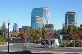
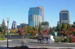
Sacramento County is a county in the U.S. state
of California
. Its county seat
is Sacramento
, which is also the state capital. As of 2010 the county had a population of 1,418,788.
The Greater Sacramento metropolitan area consists of eight counties with Sacramento County being the largest. The County covers about 994 square miles (2,574.4 km²) in the middle of the California Central Valley
, on into Gold Country
. Sacramento County extends from the low delta lands between the Sacramento River
and San Joaquin River
north to about ten miles (16 km) beyond the State Capitol and east into the foothills of the Sierra Nevada Mountains. The southmost portion of Sacramento County has direct access to San Francisco Bay
.
The county was named after the Sacramento River
, which forms its western border. The river was named by Spanish cavalry officer Gabriel Moraga
for the Santisimo Sacramento (Most Holy Sacrament), referring to the Catholic Eucharist
.
Alexander Hamilton Willard
, a member of the Lewis and Clark Expedition
, is buried in the old Franklin Cemetery.
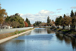
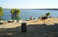
Major watercourses in the county include the American River
, Sacramento River
and Dry Creek
, a tributary of the Sacramento River.
Sacramento County is governed by an elected five-member Sacramento County Board of Supervisors
according to the Sacramento County Charter and the Sacramento County Code. The county is administered by the County Executive appointed by the Board, and an elected Assessor, District Attorney, Sheriff
, and Board of Education.
Sacramento County is politically competitive in presidential elections, though marginally Democratic
. Candidates from the Democratic Party have carried the county in the past five presidential elections, but have won a majority of the county's votes only once during that time (in 2008
). The city of Sacramento
is strongly Democratic, while rural areas are strongly Republican
; suburban areas are more divided. This pattern is also present in congressional and state legislative elections. The last Republican presidential candidate to win a majority in the county was George H.W. Bush in 1988
.
In the House of Representatives
, all of California's 5th congressional district
, part of the 3rd
district, as well as small portions of the 4th
and 10th
districts, are in the county. The 3rd and 4th districts are represented by Republicans Dan Lungren
and Tom McClintock
, respectively, while the 5th and 10th are represented by Democrats Doris Matsui
and John Garamendi
, respectively.
In the State Assembly
, all of the 9th district
and parts of the 4th
, 5th
, 10th
, and 15th
districts are in the county. The 5th, represented by Richard Pan
, the 9th, represented by Roger Dickinson
, the 10th by Alyson Huber
, and the 15th by Joan Buchanan
are represented by Democrats, while the 4th is represented by Republican Beth Gaines
.
In the State Senate
, all of the 6th district
and parts of the 1st
and 5th
districts are in the county. The 1st district is represented by Republican Ted Gaines
and the 5th and 6th districts are represented by Democrats, Lois Wolk
and Darrell Steinberg
, respectively.
As of 2008, approximately 45% of registered voters were Democratic
and 31% were registered Republicans; the remaining 23% declined to state their affiliation.
. The cities of Elk Grove
, Folsom
and Galt
also operate their own bus lines. In addition, the transit agencies of the adjacent counties have routes operating into downtown Sacramento, or connecting with the light rail system.
Greyhound
and Amtrak
both serve Sacramento. The port of Sacramento ships 870,000 short ton
s (790,000 metric tons) of cargo annually.
is a major, full-service airport with passenger flights. It is owned by the County of Sacramento. The County also owns Sacramento Mather Airport
in Rancho Cordova and Sacramento Executive Airport
, both of which are general aviation airports. There are also privately owned public use airports located in Elk Grove and Rio Linda.
, and 93,511 (6.6%) from two or more races. Hispanic or Latino of any race were 306,196 persons (21.6%).
, 10.56% Black
or African American
, 1.09% Native American
, 13.53% Asian
, 0.59% Pacific Islander
, 7.48% from other races
, and 5.84% from two or more races. 19.31% of the population were Hispanic
or Latino
of any race. 10.2% were of German
, 7.0% English, 6.7% Irish
and 5.1% American ancestry according to Census 2000. 75.7% spoke only English at home; 10.0% spoke Spanish, 1.5% Hmong
, 1.4% Chinese or Mandarin
, 1.3% Vietnamese
, 1.2% Tagalog
and 1.2% Russian
.
There were 453,602 households out of which 33.70% had children under the age of 18 living with them, 46.40% were married couples living together, 14.10% had a female householder with no husband present, and 34.40% were non-families. 26.70% of all households were made up of individuals and 8.00% had someone living alone who was 65 years of age or older. The average household size was 2.64 and the average family size was 3.24.
In the county the population was spread out with 27.60% under the age of 18, 9.50% from 18 to 24, 31.00% from 25 to 44, 20.90% from 45 to 64, and 11.10% who were 65 years of age or older. The median age was 34 years. For every 100 females there were 95.90 males. For every 100 females age 18 and over, there were 92.50 males.
The median income for a household in the county was $43,816, and the median income for a family was $50,717. Males had a median income of $39,482 versus $31,569 for females. The per capita income for the county was $21,142. About 10.3% of families and 14.1% of the population were below the poverty line, including 20.2% of those under age 18 and 6.6% of those age 65 or over.
U.S. state
A U.S. state is any one of the 50 federated states of the United States of America that share sovereignty with the federal government. Because of this shared sovereignty, an American is a citizen both of the federal entity and of his or her state of domicile. Four states use the official title of...
of California
California
California is a state located on the West Coast of the United States. It is by far the most populous U.S. state, and the third-largest by land area...
. Its county seat
County seat
A county seat is an administrative center, or seat of government, for a county or civil parish. The term is primarily used in the United States....
is Sacramento
Sacramento, California
Sacramento is the capital city of the U.S. state of California and the county seat of Sacramento County. It is located at the confluence of the Sacramento River and the American River in the northern portion of California's expansive Central Valley. With a population of 466,488 at the 2010 census,...
, which is also the state capital. As of 2010 the county had a population of 1,418,788.
The Greater Sacramento metropolitan area consists of eight counties with Sacramento County being the largest. The County covers about 994 square miles (2,574.4 km²) in the middle of the California Central Valley
California Central Valley
California's Central Valley is a large, flat valley that dominates the central portion of California. It is home to California's most productive agricultural efforts. The valley stretches approximately from northwest to southeast inland and parallel to the Pacific Ocean coast. Its northern half is...
, on into Gold Country
Gold Country
Gold Country is a region in the central and northeastern part of California, United States. It is famed for the mineral deposits and gold mines that attracted waves of immigrants, known as the 49ers, during the 1849 California Gold Rush.-Geography:State Route 49 was built through the Gold Country,...
. Sacramento County extends from the low delta lands between the Sacramento River
Sacramento River
The Sacramento River is an important watercourse of Northern and Central California in the United States. The largest river in California, it rises on the eastern slopes of the Klamath Mountains, and after a journey south of over , empties into Suisun Bay, an arm of the San Francisco Bay, and...
and San Joaquin River
San Joaquin River
The San Joaquin River is the largest river of Central California in the United States. At over long, the river starts in the high Sierra Nevada, and flows through a rich agricultural region known as the San Joaquin Valley before reaching Suisun Bay, San Francisco Bay, and the Pacific Ocean...
north to about ten miles (16 km) beyond the State Capitol and east into the foothills of the Sierra Nevada Mountains. The southmost portion of Sacramento County has direct access to San Francisco Bay
San Francisco Bay
San Francisco Bay is a shallow, productive estuary through which water draining from approximately forty percent of California, flowing in the Sacramento and San Joaquin rivers from the Sierra Nevada mountains, enters the Pacific Ocean...
.
History
Sacramento County was one of the original counties of California, which were created in 1850 at the time of statehood.The county was named after the Sacramento River
Sacramento River
The Sacramento River is an important watercourse of Northern and Central California in the United States. The largest river in California, it rises on the eastern slopes of the Klamath Mountains, and after a journey south of over , empties into Suisun Bay, an arm of the San Francisco Bay, and...
, which forms its western border. The river was named by Spanish cavalry officer Gabriel Moraga
Gabriel Moraga
Gabriel Moraga a Spanish army officer, son of José Joaquín Moraga a member of Juan Bautista de Anza's expeditions to California, was one of the first Europeans to explore California's Great Central Valley . He led expeditions of Spanish soldiers into the valley, becoming its first explorer...
for the Santisimo Sacramento (Most Holy Sacrament), referring to the Catholic Eucharist
Eucharist
The Eucharist , also called Holy Communion, the Sacrament of the Altar, the Blessed Sacrament, the Lord's Supper, and other names, is a Christian sacrament or ordinance...
.
Alexander Hamilton Willard
Alexander Hamilton Willard
Alexander Hamilton Willard was a blacksmith who joined the Lewis and Clark Expedition.-Origin:Alexander Hamilton Willard Sr. was born in July 1777 in the town Charlestown, New Hampshire, he was the oldest son of Lt Jonathan Willard and the only child of Betty Caswell...
, a member of the Lewis and Clark Expedition
Lewis and Clark Expedition
The Lewis and Clark Expedition, or ″Corps of Discovery Expedition" was the first transcontinental expedition to the Pacific Coast by the United States. Commissioned by President Thomas Jefferson and led by two Virginia-born veterans of Indian wars in the Ohio Valley, Meriwether Lewis and William...
, is buried in the old Franklin Cemetery.
Geography
According to the 2000 census, the county has a total area of 995.48 square miles (2,578.3 km²), of which 965.65 square miles (2,501 km²) (or 97.00%) is land and 29.83 square miles (77.3 km²) (or 3.00%) is water. Most of the county is at an elevation close to sea level, with some areas below sea level. Hills along the eastern boundary rise to several hundred feet.Major watercourses in the county include the American River
American River
The American River is a California watercourse noted as the site of Sutter's Mill, northwest of Placerville, California, where gold was found in 1848, leading to the California Gold Rush...
, Sacramento River
Sacramento River
The Sacramento River is an important watercourse of Northern and Central California in the United States. The largest river in California, it rises on the eastern slopes of the Klamath Mountains, and after a journey south of over , empties into Suisun Bay, an arm of the San Francisco Bay, and...
and Dry Creek
Dry Creek (American River)
Dry Creek is a long stream in Placer County and Sacramento County, California, USA, tributary to the Sacramento River. Its watershed lies within the Sacramento Valley.. Because suburban development borders much of its length, the stream is noted for its capacity to cause local flooding and as a...
, a tributary of the Sacramento River.
Cities and towns
Incorporated places
- Citrus HeightsCitrus Heights, CaliforniaCitrus Heights is a city in Sacramento County, California, USA. As of the 2010 census, the city had a population of 83,301, down from 85,071 at the 2000 census....
(incorporated 1997) - Elk GroveElk Grove, CaliforniaElk Grove is a city in Sacramento County, California, located just south of the state capital of Sacramento. It is part of the Sacramento–Arden-Arcade–Roseville Metropolitan Statistical Area. As of the 2010 census, the population of the city is 153,015...
(incorporated 2000) - FolsomFolsom, CaliforniaFolsom is a city in Sacramento County, California, United States. Folsom is most commonly known for its famous Folsom Prison. The population was 72,203 at the 2010 census....
(incorporated 1946) - GaltGalt, CaliforniaGalt is a city in Sacramento County, California, USA. It is part of the Sacramento–Arden-Arcade–Roseville Metropolitan Statistical Area...
(incorporated 1946) - IsletonIsleton, CaliforniaIsleton is a city in Sacramento County, California, United States. The population was 804 at the 2010 census, down from 828 at the 2000 census. It is located on Andrus Island amid the slough wetlands of the Sacramento-San Joaquin River Delta, on the eastern edge of the Rio Vista Gas Field.The city...
(incorporated 1923) - Rancho CordovaRancho Cordova, CaliforniaRancho Cordova is a city in Sacramento County, California, USA, that incorporated in 2003. It is part of the Sacramento Metropolitan Area. The population was 64,776 at the 2010 census. Rancho Cordova is the Sacramento area's largest employment sub-center, with a daily influx of over 45,000...
(incorporated 2003) - SacramentoSacramento, CaliforniaSacramento is the capital city of the U.S. state of California and the county seat of Sacramento County. It is located at the confluence of the Sacramento River and the American River in the northern portion of California's expansive Central Valley. With a population of 466,488 at the 2010 census,...
(incorporated 1850)
Unincorporated census-designated places
- AntelopeAntelope, CaliforniaAntelope is a census-designated place in Sacramento County, California, United States located approximately 15 miles northeast of downtown Sacramento and 5 miles southwest of Roseville. The population was 45,770 at the 2010 census....
- Arden Arcade
- CarmichaelCarmichael, CaliforniaCarmichael is a census-designated place in Sacramento County, California, United States. It is part of the Sacramento–Arden-Arcade–Roseville Metropolitan Statistical Area. The population was 61,762 at the 2010 census, up from 49,742 at the 2000 census.-Geography and geology:Carmichael...
- Del Paso HeightsDel Paso Heights, Sacramento, CaliforniaDel Paso Heights is a neighborhood within the city of Sacramento, California. The generally recognized borders of Del Paso Heights consist of the Beltline Freeway Interstate 80 on the north, Norwood Avenue on the west, Arcade creek on the south, and Roseville Road on the east. Del Paso Heights is...
- ElvertaElverta, CaliforniaElverta is a census-designated place in Sacramento County, California. It is part of the Sacramento metropolitan area; the metropolitan area including Sacramento , as well as Arden-Arcade and Roseville. It is located about to Sacramento, miles from Rio Linda, of Roseville, and of Antelope...
- Fair OaksFair Oaks, CaliforniaFair Oaks is a census-designated place in Sacramento County, California, United States. It is part of the Sacramento–Arden-Arcade–Roseville Metropolitan Statistical Area. The population was 30,912 at the 2010 census, up from 28,008 at the 2000 census. Fair Oaks's zip code is 95628...
- FlorinFlorin, CaliforniaFlorin is a census-designated place in Sacramento County, California, United States. It is part of the Sacramento–Arden-Arcade–Roseville Metropolitan Statistical Area...
- Foothill Farms
- Gold RiverGold River, CaliforniaGold River is a census-designated place in Sacramento County, California. The population was 7,812 at the 2010 census, down from 8,023 at the 2000 census...
- Hagginwood
- HeraldHerald, CaliforniaHerald is a census-designated place in Sacramento County, California. Herald sits at an elevation of . It is located east of the City of Galt along State Route 104. The ZIP Code is 95638, and the community is inside area code 209...
- La RivieraLa Riviera, CaliforniaLa Riviera is a census-designated place in Sacramento County, California, United States. It is part of the Sacramento–Arden-Arcade–Roseville Metropolitan Statistical Area. The population was 10,802 at the 2010 census, up from 10,273 at the 2000 census...
- LagunaLaguna, CaliforniaLaguna is a former census-designated place in Sacramento County, California, United States. It is part of the Sacramento–Arden-Arcade–Roseville Metropolitan Statistical Area...
- LockeLocke, CaliforniaLocke , also known as Locke Historic District, is an unincorporated community in California's Sacramento – San Joaquin River Delta built by Chinese immigrants during the early 20th century. It was originally named Lockeport after George Locke, who owned the land that the town was built upon at a...
- NatomasNatomas, Sacramento, CaliforniaNatomas is a community in northwestern Sacramento, California. It is the last area of Sacramento that has not been fully developed, and has seen major residential development in the 1990s and 2000s. Major growth has been mostly due to Power Balance Pavilion, home court to the Sacramento Kings and...
- North HighlandsNorth Highlands, CaliforniaNorth Highlands is a census-designated place in Sacramento County, California, United States. It is part of the Sacramento–Arden-Arcade–Roseville Metropolitan Statistical Area...
- OrangevaleOrangevale, CaliforniaOrangevale is a census-designated place in Sacramento County, California, United States. It is part of the Sacramento–Arden-Arcade–Roseville Metropolitan Statistical Area. The population was 33,960 at the 2010 census, up from 26,705 at the 2000 census. It is located approximately ...
- Parkway-South SacramentoParkway-South Sacramento, CaliforniaParkway-South Sacramento is a former census-designated place in Sacramento County, California, United States. It was part of the Sacramento–Arden-Arcade–Roseville Metropolitan Statistical Area. The area shared three boundaries with the City of Sacramento...
- Rancho MurietaRancho Murieta, CaliforniaRancho Murieta is a census-designated place and guard-gated community in Sacramento County, California, United States. It is part of the Sacramento–Arden-Arcade–Roseville Metropolitan Statistical Area. The population was 5,488 at the 2010 census, up from 4,193 at the 2000 census...
- Rio LindaRio Linda, CaliforniaRio Linda is a census-designated place in Sacramento County, California, United States. It is part of the Sacramento–Arden-Arcade–Roseville Metropolitan Statistical Area. As of the 2010 census, the CDP population was 15,106, up from 10,466 at the 2000 census...
- RosemontRosemont, CaliforniaRosemont is a census-designated place in Sacramento County, California, United States. It is part of the Sacramento–Arden-Arcade–Roseville Metropolitan Statistical Area...
- VineyardVineyard, CaliforniaVineyard is a census-designated place in Sacramento County, California, United States. It is part of the Sacramento–Arden-Arcade–Roseville Metropolitan Statistical Area. The population was 24,836 at the 2010 census, up from 10,109 at the 2000 census...
- Walnut GroveWalnut Grove, CaliforniaWalnut Grove is a census-designated place in Sacramento County, California, United States. It is part of the Sacramento–Arden-Arcade–Roseville Metropolitan Statistical Area...
- WiltonWilton, CaliforniaWilton is a census-designated place in Sacramento County, California, United States. It is part of the Sacramento–Arden-Arcade–Roseville Metropolitan Statistical Area. The population was 5,363 at the 2010 census, up from 4,551 at the 2000 census.-Geography and environment:Wilton is...
Adjacent counties
- San Joaquin CountySan Joaquin County, CaliforniaSan Joaquin County is a county located in Central Valley of the U.S. state of California, just east of the San Francisco Bay Area. As of the 2010 census, the population was 685,306. The county seat is Stockton.-History:...
, California – south - Contra Costa CountyContra Costa County, CaliforniaContra Costa County is a primarily suburban county in the San Francisco Bay Area of the U.S. state of California. As of the 2010 census, it had a population of 1,049,025...
, California – southwest - Solano CountySolano County, CaliforniaSolano County is a county located in Bay-Delta region of the U.S. state of California, about halfway between San Francisco and Sacramento and is one of the nine San Francisco Bay Area counties. The county's population was reported by the U.S. Census to be 413,344 in 2010...
, California – west - Yolo CountyYolo County, CaliforniaYolo County is a county located in the northern part of the U.S. state of California, bordered by the other counties of Sacramento, Solano, Napa, Lake, Colusa, and Sutter. The city of Woodland is its county seat, though Davis is its largest city....
, California – west - Sutter CountySutter County, CaliforniaSutter County is a county located along the Sacramento River in the Central Valley of the U.S. state of California, north of state capital Sacramento. Sutter County is part of the Greater Sacramento CSA....
, California – northwest - Placer CountyPlacer County, CaliforniaPlacer County is a county located in both the Sacramento Valley and Sierra Nevada regions of the U.S. state of California, in what is known as the Gold Country. It stretches from the suburbs of Sacramento to Lake Tahoe and the Nevada border. Because of the expansion of the Greater Sacramento,...
, California – north - El Dorado CountyEl Dorado County, CaliforniaEl Dorado County is a county located in the historic Gold Country in the Sierra Nevada Mountains and foothills of the U.S. state of California. The 2010 population was 181,058. The El Dorado county seat is in Placerville....
, California – east - Amador CountyAmador County, CaliforniaAmador County is a county located in the Sierra Nevada of the U.S. state of California. As of the 2010 census, the population was 38,091. The county seat is Jackson.Amador County bills itself as "The Heart of the Mother Lode" and lies within the Gold Country...
, California – east
Government and politics
| Year | GOP Republican Party (United States) The Republican Party is one of the two major contemporary political parties in the United States, along with the Democratic Party. Founded by anti-slavery expansion activists in 1854, it is often called the GOP . The party's platform generally reflects American conservatism in the U.S... |
DEM Democratic Party (United States) The Democratic Party is one of two major contemporary political parties in the United States, along with the Republican Party. The party's socially liberal and progressive platform is largely considered center-left in the U.S. political spectrum. The party has the lengthiest record of continuous... |
Others |
|---|---|---|---|
| 2008 United States presidential election, 2008 The United States presidential election of 2008 was the 56th quadrennial presidential election. It was held on November 4, 2008. Democrat Barack Obama, then the junior United States Senator from Illinois, defeated Republican John McCain, the senior U.S. Senator from Arizona. Obama received 365... |
58.5% 316,506 | 2.4% 12,770 | |
| 2004 United States presidential election, 2004 The United States presidential election of 2004 was the United States' 55th quadrennial presidential election. It was held on Tuesday, November 2, 2004. Republican Party candidate and incumbent President George W. Bush defeated Democratic Party candidate John Kerry, the then-junior U.S. Senator... |
49.5% 236,657 | 1.2% 5,670 | |
| 2000 United States presidential election, 2000 The United States presidential election of 2000 was a contest between Republican candidate George W. Bush, then-governor of Texas and son of former president George H. W. Bush , and Democratic candidate Al Gore, then-Vice President.... |
49.3% 212,792 | 5.4% 23,139 | |
| 1996 United States presidential election, 1996 The United States presidential election of 1996 was a contest between the Democratic national ticket of President Bill Clinton of Arkansas and Vice President Al Gore of Tennessee and the Republican national ticket of former Senator Bob Dole of Kansas for President and former Housing Secretary Jack... |
49.8% 203,019 | 9.4% 38,346 | |
| 1992 United States presidential election, 1992 The United States presidential election of 1992 had three major candidates: Incumbent Republican President George Bush; Democratic Arkansas Governor Bill Clinton, and independent Texas businessman Ross Perot.... |
43.6% 197,540 | 21.1% 95,606 | |
| 1988 United States presidential election, 1988 The United States presidential election of 1988 featured no incumbent president, as President Ronald Reagan was unable to seek re-election after serving the maximum two terms allowed by the Twenty-second Amendment. Reagan's Vice President, George H. W. Bush, won the Republican nomination, while the... |
47.7% 188,557 | 1.3% 5,301 | |
| 1984 United States presidential election, 1984 The United States presidential election of 1984 was a contest between the incumbent President Ronald Reagan, the Republican candidate, and former Vice President Walter Mondale, the Democratic candidate. Reagan was helped by a strong economic recovery from the deep recession of 1981–1982... |
43.1% 159,128 | 1.3% 4,791 | |
| 1980 United States presidential election, 1980 The United States presidential election of 1980 featured a contest between incumbent Democrat Jimmy Carter and his Republican opponent, Ronald Reagan, as well as Republican Congressman John B. Anderson, who ran as an independent... |
40.4% 130,031 | 11.9% 38,368 | |
| 1976 United States presidential election, 1976 The United States presidential election of 1976 followed the resignation of President Richard Nixon in the wake of the Watergate scandal. It pitted incumbent President Gerald Ford, the Republican candidate, against the relatively unknown former governor of Georgia, Jimmy Carter, the Democratic... |
52.3% 144,203 | 3.1% 8,563 | |
| 1972 United States presidential election, 1972 The United States presidential election of 1972 was the 47th quadrennial United States presidential election. It was held on November 7, 1972. The Democratic Party's nomination was eventually won by Senator George McGovern, who ran an anti-war campaign against incumbent Republican President Richard... |
47.6% 137,287 | 3.4% 9,716 | |
| 1968 United States presidential election, 1968 The United States presidential election of 1968 was the 46th quadrennial United States presidential election. Coming four years after Democrat Lyndon B. Johnson won in a historic landslide, it saw Johnson forced out of the race and Republican Richard Nixon elected... |
50.9% 118,769 | 7.4% 17,300 | |
| 1964 United States presidential election, 1964 The United States presidential election of 1964 was held on November 3, 1964. Incumbent President Lyndon B. Johnson had come to office less than a year earlier following the assassination of his predecessor, John F. Kennedy. Johnson, who had successfully associated himself with Kennedy's... |
65.7% 149,668 | 0.2% 332 | |
| 1960 United States presidential election, 1960 The United States presidential election of 1960 was the 44th American presidential election, held on November 8, 1960, for the term beginning January 20, 1961, and ending January 20, 1965. The incumbent president, Republican Dwight D. Eisenhower, was not eligible to run again. The Republican Party... |
56.3% 109,695 | 0.4% 809 | |
| 1956 United States presidential election, 1956 The United States presidential election of 1956 saw a popular Dwight D. Eisenhower successfully run for re-election. The 1956 election was a rematch of 1952, as Eisenhower's opponent in 1956 was Democrat Adlai Stevenson, whom Eisenhower had defeated four years earlier.Incumbent President Eisenhower... |
54.7% 82,134 | 0.2% 260 | |
| 1952 United States presidential election, 1952 The United States presidential election of 1952 took place in an era when Cold War tension between the United States and the Soviet Union was escalating rapidly. In the United States Senate, Republican Senator Joseph McCarthy of Wisconsin had become a national figure after chairing congressional... |
50.4% 69,066 | 0.6% 837 | |
| 1948 United States presidential election, 1948 The United States presidential election of 1948 is considered by most historians as the greatest election upset in American history. Virtually every prediction indicated that incumbent President Harry S. Truman would be defeated by Republican Thomas E. Dewey. Truman won, overcoming a three-way... |
58.4% 54,197 | 3.9% 3,571 | |
| 1944 United States presidential election, 1944 The United States presidential election of 1944 took place while the United States was preoccupied with fighting World War II. President Franklin D. Roosevelt had been in office longer than any other president, but remained popular. Unlike 1940, there was little doubt that Roosevelt would run for... |
66.3% 49,204 | 0.5% 403 | |
| 1940 United States presidential election, 1940 The United States presidential election of 1940 was fought in the shadow of World War II as the United States was emerging from the Great Depression. Incumbent President Franklin D. Roosevelt , a Democrat, broke with tradition and ran for a third term, which became a major issue... |
68.1% 51,351 | 1.2% 864 | |
| 1936 United States presidential election, 1936 The United States presidential election of 1936 was the most lopsided presidential election in the history of the United States in terms of electoral votes. In terms of the popular vote, it was the third biggest victory since the election of 1820, which was not seriously contested.The election took... |
78.5% 47,265 | 1.3% 800 | |
| 1932 United States presidential election, 1932 The United States presidential election of 1932 took place as the effects of the Wall Street Crash of 1929, the Smoot-Hawley Tariff Act of 1930, the Revenue Act of 1932, and the Great Depression were being felt intensely across the country. President Herbert Hoover's popularity was falling as... |
69.3% 36,370 | 2.9% 1,542 | |
| 1928 United States presidential election, 1928 The United States presidential election of 1928 pitted Republican Herbert Hoover against Democrat Al Smith. The Republicans were identified with the booming economy of the 1920s, whereas Smith, a Roman Catholic, suffered politically from Anti-Catholic prejudice, his anti-prohibitionist stance, and... |
48.2% 19,684 | 1.0% 403 | |
| 1924 United States presidential election, 1924 The United States presidential election of 1924 was won by incumbent President Calvin Coolidge, the Republican candidate.Coolidge was vice-president under Warren G. Harding and became president in 1923 when Harding died in office. Coolidge was given credit for a booming economy at home and no... |
7.0% 2,285 | 51.9% 16,932 | |
| 1920 United States presidential election, 1920 The United States presidential election of 1920 was dominated by the aftermath of World War I and a hostile response to certain policies of Woodrow Wilson, the Democratic president. The wartime economic boom had collapsed. Politicians were arguing over peace treaties and the question of America's... |
29.7% 7,150 | 5.5% 1,316 |
Sacramento County is governed by an elected five-member Sacramento County Board of Supervisors
Sacramento County Board of Supervisors
The Sacramento County Board of Supervisors is the five member governing board of Sacramento County, California.Like all other counties in California, with the exception of San Francisco County, Sacramento is split into five districts and each district elects a supervisor every four years.-Current...
according to the Sacramento County Charter and the Sacramento County Code. The county is administered by the County Executive appointed by the Board, and an elected Assessor, District Attorney, Sheriff
Sacramento County Sheriff's Department
The Sacramento County Sheriff's Department, abbreviated as SSD, is a local law enforcement agency that serves Sacramento County, California. It provides general-service law enforcement to unincorporated areas of Sacramento County, as well as incorporated cities within the county that have...
, and Board of Education.
Sacramento County is politically competitive in presidential elections, though marginally Democratic
Democratic Party (United States)
The Democratic Party is one of two major contemporary political parties in the United States, along with the Republican Party. The party's socially liberal and progressive platform is largely considered center-left in the U.S. political spectrum. The party has the lengthiest record of continuous...
. Candidates from the Democratic Party have carried the county in the past five presidential elections, but have won a majority of the county's votes only once during that time (in 2008
United States presidential election, 2008
The United States presidential election of 2008 was the 56th quadrennial presidential election. It was held on November 4, 2008. Democrat Barack Obama, then the junior United States Senator from Illinois, defeated Republican John McCain, the senior U.S. Senator from Arizona. Obama received 365...
). The city of Sacramento
Sacramento, California
Sacramento is the capital city of the U.S. state of California and the county seat of Sacramento County. It is located at the confluence of the Sacramento River and the American River in the northern portion of California's expansive Central Valley. With a population of 466,488 at the 2010 census,...
is strongly Democratic, while rural areas are strongly Republican
Republican Party (United States)
The Republican Party is one of the two major contemporary political parties in the United States, along with the Democratic Party. Founded by anti-slavery expansion activists in 1854, it is often called the GOP . The party's platform generally reflects American conservatism in the U.S...
; suburban areas are more divided. This pattern is also present in congressional and state legislative elections. The last Republican presidential candidate to win a majority in the county was George H.W. Bush in 1988
United States presidential election, 1988
The United States presidential election of 1988 featured no incumbent president, as President Ronald Reagan was unable to seek re-election after serving the maximum two terms allowed by the Twenty-second Amendment. Reagan's Vice President, George H. W. Bush, won the Republican nomination, while the...
.
In the House of Representatives
United States House of Representatives
The United States House of Representatives is one of the two Houses of the United States Congress, the bicameral legislature which also includes the Senate.The composition and powers of the House are established in Article One of the Constitution...
, all of California's 5th congressional district
California's 5th congressional district
California's 5th congressional district is a congressional district in the U.S. state of California. It currently covers the city of Sacramento, the state capital, its suburbs and the surrounding area....
, part of the 3rd
California's 3rd congressional district
California's 3rd congressional district is a congressional district located in the U.S. state of California. It covers most of Sacramento County and part of Solano County, as well as all of Alpine, Amador and Calaveras counties...
district, as well as small portions of the 4th
California's 4th congressional district
California's 4th congressional district is a congressional district located in the U.S. state of California. It covers the northeastern corner of California along Route 395, encompassing El Dorado, Placer, Nevada, Sierra, Plumas, Lassen, and Modoc counties, as well as parts of Butte County...
and 10th
California's 10th congressional district
California's 10th congressional district is a congressional district located in the U.S. state of California in the East San Francisco Bay Area region of Northern California....
districts, are in the county. The 3rd and 4th districts are represented by Republicans Dan Lungren
Dan Lungren
Daniel Edward "Dan" Lungren is the U.S. Representative for , serving since 2005. The district covers most of Sacramento County and part of Solano County, as well as all of Alpine, Amador and Calaveras counties...
and Tom McClintock
Tom McClintock
Thomas Miller McClintock II is the U.S. Representative for , serving since 2009. He is a member of the Republican Party. He is a former Assemblyman and state Senator...
, respectively, while the 5th and 10th are represented by Democrats Doris Matsui
Doris Matsui
Doris Okada Matsui is the U.S. Representative for , serving since 2005. She is a member of the Democratic Party. The district consists of the city of Sacramento and the surrounding area...
and John Garamendi
John Garamendi
John Raymond Garamendi is the U.S. Representative for , serving since November 2009. He is a member of the Democratic Party. Garamendi was the California State Insurance Commissioner from 1991 to 1995, the U.S. Deputy Secretary of the Interior from 1995 to 1998, and the California State Insurance...
, respectively.
In the State Assembly
California State Assembly
The California State Assembly is the lower house of the California State Legislature. There are 80 members in the Assembly, representing an approximately equal number of constituents, with each district having a population of at least 420,000...
, all of the 9th district
California's 9th State Assembly district
California's 9th State Assembly District is one of 80 districts in the California State Assembly, currently represented by Democrat Roger Dickinson of Sacramento.-District profile:The 9th district's current boundaries were established in 2001...
and parts of the 4th
California's 4th State Assembly district
California's 4th State Assembly District is one of 80 districts in the California State Assembly. It is currently represented by Republican Beth Gaines of Roseville.-District profile:All of Alpine CountyEl Dorado County - 84.35%...
, 5th
California's 5th State Assembly district
California's 5th State Assembly District is one of 80 districts in the California State Assembly. It is currently represented by Democrat Richard Pan of Sacramento.-District profile:Placer County - 7.81%*Granite Bay*Roseville - 3 residents...
, 10th
California's 10th State Assembly district
California's 10th State Assembly District is one of 80 districts in the California State Assembly. It is currently represented by Democrat Alyson Huber of El Dorado Hills.-District profile:Sacramento County - 20.06%*Arden-Arcade - 7.92%...
, and 15th
California's 15th State Assembly district
California's 15th State Assembly District is one of 80 districts in the California State Assembly. It is currently represented by Democrat Joan Buchanan.-District profile:Contra Costa County - 27.21%*Alamo*Bethel Island...
districts are in the county. The 5th, represented by Richard Pan
Richard Pan
Dr. Richard Pan is an American politician currently serving in the California State Assembly. He is a Democrat representing the 5th district, encompassing parts of Placer and Sacramento counties. Dr...
, the 9th, represented by Roger Dickinson
Roger Dickinson
Roger Dickinson is a Democratic member of the California State Assembly, serving the 9th district since December 6, 2010. Before that he was a Sacramento County supervisor...
, the 10th by Alyson Huber
Alyson Huber
Alyson Huber is a representative in the California State Legislature from the 10th Assembly District in Northern California. Assemblywoman Huber has served since 2008...
, and the 15th by Joan Buchanan
Joan Buchanan
Joan T. Buchanan is a Democratic public official and former school board member from Alamo, California. She has been a member of the California State Assembly since December 2008...
are represented by Democrats, while the 4th is represented by Republican Beth Gaines
Beth Gaines
Beth B. Gaines is an American politician currently serving in the California State Assembly. She is a Republican representing the 4th district, encompassing Alpine and El Dorado counties and parts of Placer and Sacramento counties...
.
In the State Senate
California State Senate
The California State Senate is the upper house of the California State Legislature. There are 40 state senators. The state legislature meets in the California State Capitol in Sacramento. The Lieutenant Governor is the ex officio President of the Senate and may break a tied vote...
, all of the 6th district
California's 6th State Senate district
California's 6th State Senate district is one of 40 Senate Districts. It is currently represented by Democrat Darrell Steinberg of Sacramento.-District profile:...
and parts of the 1st
California's 1st State Senate district
California's 1st State Senate District is one of 40 Senate Districts. It is represented by Republican Ted Gaines of Roseville.-District profile:...
and 5th
California's 5th State Senate district
California's 5th State Senate District is one of 40 Senate Districts. It is currently represented by Democrat Lois Wolk of Davis.-District profile:...
districts are in the county. The 1st district is represented by Republican Ted Gaines
Ted Gaines
Edward M. Gaines is a California State Senator, representing the 1st Senate district. He won a January 4, 2011, special election to replace the late Dave Cox and took office two days later...
and the 5th and 6th districts are represented by Democrats, Lois Wolk
Lois Wolk
Lois Wolk is a California State Senator, representing the 5th district of California. Wolk is a member of the Democratic Party and was elected to the Senate in 2008.-Early life:...
and Darrell Steinberg
Darrell Steinberg
Darrell Steven Steinberg is a Democratic politician from Sacramento, California. He is currently serving his second term in the California State Senate, representing the 6th District. He has been the Senate President Pro Tem since 2008...
, respectively.
As of 2008, approximately 45% of registered voters were Democratic
Democratic Party (United States)
The Democratic Party is one of two major contemporary political parties in the United States, along with the Republican Party. The party's socially liberal and progressive platform is largely considered center-left in the U.S. political spectrum. The party has the lengthiest record of continuous...
and 31% were registered Republicans; the remaining 23% declined to state their affiliation.
Major highways
- Interstate 5
.svg.png) Interstate 5 in CaliforniaInterstate 5 is a major north–south route of the Interstate Highway System in the U.S. state of California. It begins at the Mexico – United States border at the San Ysidro crossing, goes north across the length of California and crosses into Oregon south of the Medford-Ashland metropolitan...
Interstate 5 in CaliforniaInterstate 5 is a major north–south route of the Interstate Highway System in the U.S. state of California. It begins at the Mexico – United States border at the San Ysidro crossing, goes north across the length of California and crosses into Oregon south of the Medford-Ashland metropolitan... - Interstate 80
.svg.png) Interstate 80 in CaliforniaIn the U.S. state of California, Interstate 80 , a major east–west route of the Interstate Highway System, has its western terminus in San Francisco, California, United States. From there it heads east across the Bay Bridge to Oakland, where it turns north and crosses the Carquinez Bridge...
Interstate 80 in CaliforniaIn the U.S. state of California, Interstate 80 , a major east–west route of the Interstate Highway System, has its western terminus in San Francisco, California, United States. From there it heads east across the Bay Bridge to Oakland, where it turns north and crosses the Carquinez Bridge... - Interstate 80 Business
 Interstate 80 Business (Sacramento, California)Interstate 80 Business, called the Capital City Freeway in its entirety, is a Business Loop of Interstate 80 through Sacramento. As it is state-maintained, unlike most business routes in California, it is assigned route numbers - part of U.S. Route 50 on its western half , and unsigned State Route...
 - U.S. Route 50
.svg.png) U.S. Route 50 in CaliforniaIn the U.S. state of California, U.S. Route 50 runs east from I-80 in West Sacramento to the Nevada state line in South Lake Tahoe. Portions within Sacramento are known as the Capital City Freeway and El Dorado Freeway...
U.S. Route 50 in CaliforniaIn the U.S. state of California, U.S. Route 50 runs east from I-80 in West Sacramento to the Nevada state line in South Lake Tahoe. Portions within Sacramento are known as the Capital City Freeway and El Dorado Freeway... - State Route 12

- State Route 16

- State Route 70
 California State Route 70State Route 70 is a state highway in the U.S. state of California. Connecting Sacramento with U.S. Route 395 near Beckwourth Pass via the Feather River Canyon, it was formerly known as U.S. Route 40 Alternate, crossing the Sierra Nevada at a lower elevation than Donner Pass on U.S. Route 40...
 - State Route 99
 California State Route 99California State Route 99 , commonly known as Highway 99 or, simply, as 99 , is a north–south state highway in the U.S. state of California, stretching almost the entire length of the Central Valley...
 - State Route 104
 California State Route 104State Route 104 is a west–east state highway in California's Central Valley. It connects State Route 99 near Galt to State Route 49 in Sutter Creek via the city of Ione. It is known as Twin Cities Road from its western terminus up until just before Ione...
 - State Route 160
 California State Route 160State Route 160 is a state highway in the U.S. state of California consisting of two sections. The longer, southern, section is a scenic highway through the alluvial plain of the Sacramento River, linking SR 4 in Antioch with Sacramento via the Antioch Bridge...
 - State Route 220
 California State Route 220State Route 220 is a state highway in the U.S. state of California, defined to run between State Route 84 and State Route 160 on Ryer Island. At the eastern end of Ryer Island, the road crosses Steamboat Slough on the J-Mack Ferry, a cable ferry....
 - State Route 244
 California State Route 244State Route 244 is a short unsigned freeway connection northeast of Sacramento, California, United States. It connects the junction of Interstate 80 and Interstate 80 Business with Auburn Boulevard State Route 244 (SR 244) is a short unsigned freeway connection northeast of Sacramento,...
Public transportation
Sacramento Regional Transit (RT) provides bus and light rail service in Sacramento and nearby communities like Rancho Cordova, Citrus Heights, and Rosemont. Sacramento hosts 37.4 miles (60.2 km) of light railLight rail
Light rail or light rail transit is a form of urban rail public transportation that generally has a lower capacity and lower speed than heavy rail and metro systems, but higher capacity and higher speed than traditional street-running tram systems...
. The cities of Elk Grove
Elk Grove
-Places:United States*Elk Grove, California, in Sacramento County*Elk Grove, Humboldt County, California*Elk Grove Village, Illinois*Elk Grove, Wisconsin, a town**Elk Grove , Wisconsin, an unincorporated community...
, Folsom
Folsom
- Places :* Folsom, Alabama* Folsom, California* Folsom, Louisiana* Folsom, New Jersey* Folsom, New Mexico* Folsom, Pennsylvania* Folsom, West Virginia- People :* Abby Folsom , American feminist and abolitionist...
and Galt
Galt
-Biology and biochemistry:*Galactose-1-phosphate uridylyltransferase, an enzyme*Gut-associated lymphoid tissue-People:*Sir Alexander Tilloch Galt, a major figure in Canadian Confederation*James Galt, Scottish footballer*Galt MacDermot, musician...
also operate their own bus lines. In addition, the transit agencies of the adjacent counties have routes operating into downtown Sacramento, or connecting with the light rail system.
Greyhound
Greyhound Lines
Greyhound Lines, Inc., based in Dallas, Texas, is an intercity common carrier of passengers by bus serving over 3,700 destinations in the United States, Canada and Mexico, operating under the well-known logo of a leaping greyhound. It was founded in Hibbing, Minnesota, USA, in 1914 and...
and Amtrak
Amtrak
The National Railroad Passenger Corporation, doing business as Amtrak , is a government-owned corporation that was organized on May 1, 1971, to provide intercity passenger train service in the United States. "Amtrak" is a portmanteau of the words "America" and "track". It is headquartered at Union...
both serve Sacramento. The port of Sacramento ships 870,000 short ton
Short ton
The short ton is a unit of mass equal to . In the United States it is often called simply ton without distinguishing it from the metric ton or the long ton ; rather, the other two are specifically noted. There are, however, some U.S...
s (790,000 metric tons) of cargo annually.
Airports
Sacramento International AirportSacramento International Airport
Sacramento International Airport is a public airport located 10 miles northwest of the central business district of Sacramento, in Sacramento County, California, USA. It is run by Sacramento County...
is a major, full-service airport with passenger flights. It is owned by the County of Sacramento. The County also owns Sacramento Mather Airport
Sacramento Mather Airport
Sacramento Mather Airport , also known as simply Mather Airport, is a county-owned public-use airport located 10 nautical miles east of the central business district of Sacramento, in the city of Rancho Cordova, California, United States...
in Rancho Cordova and Sacramento Executive Airport
Sacramento Executive Airport
Sacramento Executive Airport , also known as simply Executive Airport, is a public airport located three miles south of the central business district of Sacramento, a city in Sacramento County, California, USA...
, both of which are general aviation airports. There are also privately owned public use airports located in Elk Grove and Rio Linda.
Demographics
2010
The 2010 United States Census reported that Sacramento County had a population of 1,418,788. The racial makeup of Sacramento County was 815,151 (57.5%) White, 187,958 (12.4%) African American, 14,308 (1.0%) Native American, 203,211 (14.3%) Asian, 13,858 (1.0%) Pacific Islander, 131,691 (9.3%) from other racesRace (United States Census)
Race and ethnicity in the United States Census, as defined by the Federal Office of Management and Budget and the United States Census Bureau, are self-identification data items in which residents choose the race or races with which they most closely identify, and indicate whether or not they are...
, and 93,511 (6.6%) from two or more races. Hispanic or Latino of any race were 306,196 persons (21.6%).
| Population reported at 2010 United States Census | |||||||||
|---|---|---|---|---|---|---|---|---|---|
Sacramento County, California Sacramento County is a county in the U.S. state of California. Its county seat is Sacramento, which is also the state capital. As of 2010 the county had a population of 1,418,788.... |
Population |
American |
American |
|
Islander |
races Race (United States Census) Race and ethnicity in the United States Census, as defined by the Federal Office of Management and Budget and the United States Census Bureau, are self-identification data items in which residents choose the race or races with which they most closely identify, and indicate whether or not they are... |
more races |
or Latino (of any race) |
|
| Sacramento County Sacramento County, California Sacramento County is a county in the U.S. state of California. Its county seat is Sacramento, which is also the state capital. As of 2010 the county had a population of 1,418,788.... |
1,418,788 | 815,151 | 147,058 | 14,308 | 203,211 | 13,858 | 131,691 | 93,511 | 306,196 |
cities |
Population |
American |
American |
|
Islander |
races Race (United States Census) Race and ethnicity in the United States Census, as defined by the Federal Office of Management and Budget and the United States Census Bureau, are self-identification data items in which residents choose the race or races with which they most closely identify, and indicate whether or not they are... |
more races |
or Latino (of any race) |
|
| Citrus Heights Citrus Heights, California Citrus Heights is a city in Sacramento County, California, USA. As of the 2010 census, the city had a population of 83,301, down from 85,071 at the 2000 census.... |
83,301 | 66,856 | 2,751 | 753 | 2,714 | 363 | 5,348 | 4,516 | 13,734 |
| Elk Grove Elk Grove, California Elk Grove is a city in Sacramento County, California, located just south of the state capital of Sacramento. It is part of the Sacramento–Arden-Arcade–Roseville Metropolitan Statistical Area. As of the 2010 census, the population of the city is 153,015... |
153,015 | 70,478 | 20,172 | 965 | 40,261 | 1,807 | 10,231 | 12,101 | 27,581 |
| Folsom Folsom, California Folsom is a city in Sacramento County, California, United States. Folsom is most commonly known for its famous Folsom Prison. The population was 72,203 at the 2010 census.... |
72,203 | 53,627 | 4,140 | 427 | 9,000 | 173 | 1,818 | 3,018 | 8,064 |
| Galt Galt, California Galt is a city in Sacramento County, California, USA. It is part of the Sacramento–Arden-Arcade–Roseville Metropolitan Statistical Area... |
23,647 | 15,639 | 430 | 361 | 815 | 108 | 4,834 | 1,460 | 10,113 |
| Isleton Isleton, California Isleton is a city in Sacramento County, California, United States. The population was 804 at the 2010 census, down from 828 at the 2000 census. It is located on Andrus Island amid the slough wetlands of the Sacramento-San Joaquin River Delta, on the eastern edge of the Rio Vista Gas Field.The city... |
804 | 542 | 10 | 10 | 41 | 4 | 139 | 58 | 316 |
| Rancho Cordova Rancho Cordova, California Rancho Cordova is a city in Sacramento County, California, USA, that incorporated in 2003. It is part of the Sacramento Metropolitan Area. The population was 64,776 at the 2010 census. Rancho Cordova is the Sacramento area's largest employment sub-center, with a daily influx of over 45,000... |
64,776 | 39,123 | 8,561 | 668 | 7,831 | 556 | 5,517 | 4,520 | 12,740 |
| Sacramento Sacramento, California Sacramento is the capital city of the U.S. state of California and the county seat of Sacramento County. It is located at the confluence of the Sacramento River and the American River in the northern portion of California's expansive Central Valley. With a population of 466,488 at the 2010 census,... |
466,488 | 210,006 | 76,335 | 5,291 | 85,503 | 6,655 | 57,573 | 33,125 | 125,276 |
places Census-designated place A census-designated place is a concentration of population identified by the United States Census Bureau for statistical purposes. CDPs are delineated for each decennial census as the statistical counterparts of incorporated places such as cities, towns and villages... |
Population |
American |
American |
|
Islander |
races Race (United States Census) Race and ethnicity in the United States Census, as defined by the Federal Office of Management and Budget and the United States Census Bureau, are self-identification data items in which residents choose the race or races with which they most closely identify, and indicate whether or not they are... |
more races |
or Latino (of any race) |
|
| Antelope Antelope, California Antelope is a census-designated place in Sacramento County, California, United States located approximately 15 miles northeast of downtown Sacramento and 5 miles southwest of Roseville. The population was 45,770 at the 2010 census.... |
45,770 | 29,200 | 4,039 | 402 | 6,090 | 407 | 2,284 | 3,348 | 6,635 |
| Arden-Arcade Arden-Arcade, California Arden-Arcade is a census-designated place in Sacramento County, California, United States. The population was 92,186 at the 2010 census. It is east of the city of Sacramento and west of the community of Carmichael.... |
92,186 | 64,688 | 8,977 | 948 | 5,152 | 531 | 7,420 | 5,470 | 17,147 |
| Carmichael Carmichael, California Carmichael is a census-designated place in Sacramento County, California, United States. It is part of the Sacramento–Arden-Arcade–Roseville Metropolitan Statistical Area. The population was 61,762 at the 2010 census, up from 49,742 at the 2000 census.-Geography and geology:Carmichael... |
61,762 | 49,776 | 4,972 | 546 | 2,653 | 287 | 2,035 | 3,493 | 7,218 |
| Clay Clay, California Clay is a census-designated place in Sacramento County, California. Clay sits at an elevation of . The 2010 United States census reported Clay's population was 1,195.-Geography:... |
1,195 | 981 | 6 | 24 | 8 | 0 | 108 | 68 | 242 |
| Courtland Courtland, California Courtland is a census-designated place in Sacramento County, California, United States. Courtland is located along the Sacramento River south-southwest of Sacramento. Courtland has a post office with ZIP code 95615, which was established in 1872. Courtland was named after Courtland Sims, son of... |
355 | 247 | 0 | 6 | 4 | 0 | 75 | 23 | 200 |
| Elverta Elverta, California Elverta is a census-designated place in Sacramento County, California. It is part of the Sacramento metropolitan area; the metropolitan area including Sacramento , as well as Arden-Arcade and Roseville. It is located about to Sacramento, miles from Rio Linda, of Roseville, and of Antelope... |
5,492 | 4,453 | 117 | 77 | 208 | 48 | 302 | 287 | 859 |
| Fair Oaks Fair Oaks, California Fair Oaks is a census-designated place in Sacramento County, California, United States. It is part of the Sacramento–Arden-Arcade–Roseville Metropolitan Statistical Area. The population was 30,912 at the 2010 census, up from 28,008 at the 2000 census. Fair Oaks's zip code is 95628... |
30,912 | 26,479 | 729 | 255 | 1,289 | 57 | 738 | 1,365 | 2,954 |
| Florin Florin, California Florin is a census-designated place in Sacramento County, California, United States. It is part of the Sacramento–Arden-Arcade–Roseville Metropolitan Statistical Area... |
47,513 | 15,034 | 9,521 | 543 | 13,605 | 815 | 6,756 | 3,239 | 13,048 |
| Foothill Farms | 33,121 | 21,249 | 4,628 | 357 | 1,731 | 208 | 3,362 | 2,586 | 7,579 |
| Franklin | 155 | 119 | 0 | 0 | 5 | 0 | 20 | 11 | 42 |
| Freeport Freeport, California Freeport, California is a census-designated place located approximately 7.5 miles south of downtown Sacramento on California State Route 160. Freeport lies on the eastern banks of the Sacramento River in Sacramento County. The population was 38 at the 2010 census.-History:Nearly all goods... |
38 | 34 | 0 | 0 | 2 | 0 | 1 | 1 | 6 |
| Fruitridge Pocket Fruitridge Pocket, California Fruitridge Pocket is a census-designated place in Sacramento County, California. Fruitridge Pocket sits at an elevation of . The 2010 United States census reported Fruitridge Pocket's population was 5,800.-Geography:... |
5,800 | 1,704 | 1,047 | 105 | 1,113 | 67 | 1,317 | 447 | 2,345 |
| Gold River Gold River, California Gold River is a census-designated place in Sacramento County, California. The population was 7,812 at the 2010 census, down from 8,023 at the 2000 census... |
7,912 | 5,837 | 195 | 20 | 1,426 | 28 | 97 | 309 | 515 |
| Herald Herald, California Herald is a census-designated place in Sacramento County, California. Herald sits at an elevation of . It is located east of the City of Galt along State Route 104. The ZIP Code is 95638, and the community is inside area code 209... |
1,184 | 934 | 20 | 13 | 64 | 7 | 105 | 41 | 254 |
| Hood Hood, California Hood is a census-designated place in Sacramento County, California, United States. Hood is located on the Sacramento River and California State Route 160 south of downtown Sacramento. Hood has a post office with ZIP code 95639, which was established in 1912. The community was named in 1910 after... |
271 | 135 | 0 | 15 | 15 | 1 | 70 | 35 | 137 |
| La Riviera La Riviera, California La Riviera is a census-designated place in Sacramento County, California, United States. It is part of the Sacramento–Arden-Arcade–Roseville Metropolitan Statistical Area. The population was 10,802 at the 2010 census, up from 10,273 at the 2000 census... |
10,802 | 7,315 | 1,084 | 76 | 766 | 87 | 671 | 803 | 1,756 |
| Lemon Hill Lemon Hill, California Lemon Hill is a census-designated place in Sacramento County, California. Lemon Hill sits at an elevation of . The 2010 United States census reported Lemon Hill's population was 13,729.-Geography:... |
13,729 | 5,091 | 3,493 | 246 | 2,394 | 196 | 3,487 | 822 | 6,790 |
| Mather Mather, Sacramento County, California Mather is a census-designated place in Sacramento County, California. Mather sits at an elevation of . The 2010 United States census reported Mather's population was 4,451.-Geography:... |
743 | 467 | 99 | 13 | 27 | 21 | 31 | 85 | 110 |
| McClellan Park McClellan Park, California McClellan Park is a census-designated place in Sacramento County, California. McClellan Park sits at an elevation of . The 2010 United States census reported McClellan Park's population was 743.-Geography:... |
4,451 | 2,477 | 393 | 42 | 850 | 84 | 267 | 338 | 704 |
| North Highlands North Highlands, California North Highlands is a census-designated place in Sacramento County, California, United States. It is part of the Sacramento–Arden-Arcade–Roseville Metropolitan Statistical Area... |
42,694 | 27,000 | 5,883 | 603 | 2,067 | 300 | 4,709 | 3,132 | 10,077 |
| Orangevale Orangevale, California Orangevale is a census-designated place in Sacramento County, California, United States. It is part of the Sacramento–Arden-Arcade–Roseville Metropolitan Statistical Area. The population was 33,960 at the 2010 census, up from 26,705 at the 2000 census. It is located approximately ... |
33,960 | 29,679 | 463 | 316 | 1,040 | 75 | 879 | 1,508 | 3,448 |
| Parkway Parkway, California Parkway is a census-designated place in Sacramento County, California. Parkway sits at an elevation of . The 2010 United States census reported Parkway's population was 14,670.-Geography:... |
14,670 | 5,225 | 2,696 | 182 | 1,997 | 300 | 3,161 | 1,109 | 6,185 |
| Rancho Murieta Rancho Murieta, California Rancho Murieta is a census-designated place and guard-gated community in Sacramento County, California, United States. It is part of the Sacramento–Arden-Arcade–Roseville Metropolitan Statistical Area. The population was 5,488 at the 2010 census, up from 4,193 at the 2000 census... |
5,488 | 4,874 | 130 | 33 | 158 | 6 | 81 | 206 | 425 |
| Rio Linda Rio Linda, California Rio Linda is a census-designated place in Sacramento County, California, United States. It is part of the Sacramento–Arden-Arcade–Roseville Metropolitan Statistical Area. As of the 2010 census, the CDP population was 15,106, up from 10,466 at the 2000 census... |
15,106 | 11,654 | 502 | 235 | 665 | 62 | 1,304 | 821 | 3,033 |
| Rosemont Rosemont, California Rosemont is a census-designated place in Sacramento County, California, United States. It is part of the Sacramento–Arden-Arcade–Roseville Metropolitan Statistical Area... |
22,681 | 13,496 | 2,720 | 310 | 2,419 | 134 | 1,754 | 1,848 | 4,587 |
| Vineyard Vineyard, California Vineyard is a census-designated place in Sacramento County, California, United States. It is part of the Sacramento–Arden-Arcade–Roseville Metropolitan Statistical Area. The population was 24,836 at the 2010 census, up from 10,109 at the 2000 census... |
24,836 | 11,306 | 2,426 | 163 | 7,293 | 256 | 1,682 | 1,710 | 4,414 |
| Walnut Grove Walnut Grove, California Walnut Grove is a census-designated place in Sacramento County, California, United States. It is part of the Sacramento–Arden-Arcade–Roseville Metropolitan Statistical Area... |
1,542 | 943 | 15 | 24 | 110 | 0 | 402 | 48 | 673 |
| Wilton Wilton, California Wilton is a census-designated place in Sacramento County, California, United States. It is part of the Sacramento–Arden-Arcade–Roseville Metropolitan Statistical Area. The population was 5,363 at the 2010 census, up from 4,551 at the 2000 census.-Geography and environment:Wilton is... |
5,363 | 4,234 | 169 | 45 | 289 | 13 | 343 | 270 | 683 |
communities Unincorporated area In law, an unincorporated area is a region of land that is not a part of any municipality.To "incorporate" in this context means to form a municipal corporation, a city, town, or village with its own government. An unincorporated community is usually not subject to or taxed by a municipal government... |
Population |
American |
American |
|
Islander |
races Race (United States Census) Race and ethnicity in the United States Census, as defined by the Federal Office of Management and Budget and the United States Census Bureau, are self-identification data items in which residents choose the race or races with which they most closely identify, and indicate whether or not they are... |
more races |
or Latino (of any race) |
|
| All others not CDPs (combined) | 24,823 | 14,249 | 2,472 | 234 | 3,606 | 202 | 2,770 | 1,290 | 6,306 |
2000
As of the census of 2000, there were 1,223,499 people, 453,602 households, and 297,562 families residing in the county. The population density was 1,267 people per square mile (489/km²). There were 474,814 housing units at an average density of 492/sq mi (190/km²). The racial makeup of the county was 64.02% WhiteRace (United States Census)
Race and ethnicity in the United States Census, as defined by the Federal Office of Management and Budget and the United States Census Bureau, are self-identification data items in which residents choose the race or races with which they most closely identify, and indicate whether or not they are...
, 10.56% Black
Race (United States Census)
Race and ethnicity in the United States Census, as defined by the Federal Office of Management and Budget and the United States Census Bureau, are self-identification data items in which residents choose the race or races with which they most closely identify, and indicate whether or not they are...
or African American
Race (United States Census)
Race and ethnicity in the United States Census, as defined by the Federal Office of Management and Budget and the United States Census Bureau, are self-identification data items in which residents choose the race or races with which they most closely identify, and indicate whether or not they are...
, 1.09% Native American
Race (United States Census)
Race and ethnicity in the United States Census, as defined by the Federal Office of Management and Budget and the United States Census Bureau, are self-identification data items in which residents choose the race or races with which they most closely identify, and indicate whether or not they are...
, 13.53% Asian
Race (United States Census)
Race and ethnicity in the United States Census, as defined by the Federal Office of Management and Budget and the United States Census Bureau, are self-identification data items in which residents choose the race or races with which they most closely identify, and indicate whether or not they are...
, 0.59% Pacific Islander
Race (United States Census)
Race and ethnicity in the United States Census, as defined by the Federal Office of Management and Budget and the United States Census Bureau, are self-identification data items in which residents choose the race or races with which they most closely identify, and indicate whether or not they are...
, 7.48% from other races
Race (United States Census)
Race and ethnicity in the United States Census, as defined by the Federal Office of Management and Budget and the United States Census Bureau, are self-identification data items in which residents choose the race or races with which they most closely identify, and indicate whether or not they are...
, and 5.84% from two or more races. 19.31% of the population were Hispanic
Race (United States Census)
Race and ethnicity in the United States Census, as defined by the Federal Office of Management and Budget and the United States Census Bureau, are self-identification data items in which residents choose the race or races with which they most closely identify, and indicate whether or not they are...
or Latino
Race (United States Census)
Race and ethnicity in the United States Census, as defined by the Federal Office of Management and Budget and the United States Census Bureau, are self-identification data items in which residents choose the race or races with which they most closely identify, and indicate whether or not they are...
of any race. 10.2% were of German
Germans
The Germans are a Germanic ethnic group native to Central Europe. The English term Germans has referred to the German-speaking population of the Holy Roman Empire since the Late Middle Ages....
, 7.0% English, 6.7% Irish
Irish people
The Irish people are an ethnic group who originate in Ireland, an island in northwestern Europe. Ireland has been populated for around 9,000 years , with the Irish people's earliest ancestors recorded having legends of being descended from groups such as the Nemedians, Fomorians, Fir Bolg, Tuatha...
and 5.1% American ancestry according to Census 2000. 75.7% spoke only English at home; 10.0% spoke Spanish, 1.5% Hmong
Hmong language
Hmong or Mong is the common name for a dialect continuum of the West Hmongic branch of the Hmong–Mien/Miao–Yao language family spoken by the Hmong people of Sichuan, Yunnan, Guizhou, Guangxi, northern Vietnam, Thailand, and Laos...
, 1.4% Chinese or Mandarin
Standard Mandarin
Standard Chinese or Modern Standard Chinese, also known as Mandarin or Putonghua, is the official language of the People's Republic of China and Republic of China , and is one of the four official languages of Singapore....
, 1.3% Vietnamese
Vietnamese language
Vietnamese is the national and official language of Vietnam. It is the mother tongue of 86% of Vietnam's population, and of about three million overseas Vietnamese. It is also spoken as a second language by many ethnic minorities of Vietnam...
, 1.2% Tagalog
Tagalog language
Tagalog is an Austronesian language spoken as a first language by a third of the population of the Philippines and as a second language by most of the rest. It is the first language of the Philippine region IV and of Metro Manila...
and 1.2% Russian
Russian language
Russian is a Slavic language used primarily in Russia, Belarus, Uzbekistan, Kazakhstan, Tajikistan and Kyrgyzstan. It is an unofficial but widely spoken language in Ukraine, Moldova, Latvia, Turkmenistan and Estonia and, to a lesser extent, the other countries that were once constituent republics...
.
There were 453,602 households out of which 33.70% had children under the age of 18 living with them, 46.40% were married couples living together, 14.10% had a female householder with no husband present, and 34.40% were non-families. 26.70% of all households were made up of individuals and 8.00% had someone living alone who was 65 years of age or older. The average household size was 2.64 and the average family size was 3.24.
In the county the population was spread out with 27.60% under the age of 18, 9.50% from 18 to 24, 31.00% from 25 to 44, 20.90% from 45 to 64, and 11.10% who were 65 years of age or older. The median age was 34 years. For every 100 females there were 95.90 males. For every 100 females age 18 and over, there were 92.50 males.
The median income for a household in the county was $43,816, and the median income for a family was $50,717. Males had a median income of $39,482 versus $31,569 for females. The per capita income for the county was $21,142. About 10.3% of families and 14.1% of the population were below the poverty line, including 20.2% of those under age 18 and 6.6% of those age 65 or over.
See also
- Hiking trails in Sacramento County
- History of Sacramento, CaliforniaHistory of Sacramento, CaliforniaThe history of Sacramento, California, began with its founding by Samuel Brannan and John Augustus Sutter, Jr. in 1848 around an embarcadero that his father, John Sutter, Senior constructed at the confluence of the American and Sacramento Rivers a few years prior.Before the arrival of Europeans,...
- List of California Historical Landmarks in Sacramento County
- List of California public officials charged with crimes, Sacramento County
- List of school districts in Sacramento County, California
- National Register of Historic Places listings in Sacramento County, CaliforniaNational Register of Historic Places listings in Sacramento County, CaliforniaThis list includes properties and districts listed on the National Register of Historic Places in Sacramento County, California. The table below omits Big Four House which is a National Historic Landmark designated in 1961. It should have been automatically listed on the National Register in 1966,...
- Elwood BrunerElwood BrunerElwood Bruner was a California State Assemblyman in the late nineteenth century.-Biography:Bruner was born September 27, 1854, in Zanesville, Ohio, to Joseph Asbury Bruner, a Methodist minister, and Margaret Morris Bruner and in 1856 went with his family to Marysville, California. In 1863 and 1864...
, district attorney in 1893