
Mariposa County, California
Encyclopedia
Mariposa County is a county
in the U.S. state
of California
, located in the western foothills of the Sierra Nevada mountains. It lies north of Fresno
, east of Merced
, and southeast of Stockton
. As of the 2010 census, the population was 18,251 up from 17,130 at the 2000 census. The county seat
is Mariposa
.
The county's eastern half is the central portion of Yosemite National Park
.
There are no incorporated cities in Mariposa County; however, there are three communities recognized as census-designated place
s for statistical purposes. It also has the distinction of having no permanent traffic lights anywhere in the county.
in 1850. While it began as the state's largest county, over time territory that was once part of Mariposa was ceded to twelve other counties: Fresno
, Inyo
, Kern
, Kings
, Los Angeles
, Madera
, Merced
, Mono
, San Benito
, San Bernardino
, San Luis Obispo
, and Tulare
. Thus, Mariposa County is known as the "Mother of Counties".
The county took its name from Mariposa Creek
, which was so named by Spanish
explorers in 1806, when they discovered a great cluster of butterflies
("mariposas" in Spanish and Portuguese) in the foothills
of the Sierras. Each year, the first weekend in May, residents mark the annual arrival of migrating Monarch butterflies with a "Butterfly Days" festival and parade.
region. During the California Gold Rush
, great quantities of the prized mineral
were found and extracted, first in local stream-beds
and later in hard rock mines. One of the most notable beneficiaries of this wealth was the famed explorer and 1856 Republican presidential candidate, John C. Frémont
, for whom the local hospital is named. (Jessie Street, in the town of Mariposa, is named for Fremont's wife, Jessie Benton Frémont
, who came to Mariposa to live with him.)
Many aspects of the area's mining history are depicted in exhibits
at two local museum
s: the Mariposa History Museum, located in the town of Mariposa; and the California Mining and Mineral Museum
, located at the Mariposa Fairgrounds (2 miles east of Mariposa on Highway 49).
is found the sole habitat
for the Limestone salamander
, a rare species
endemic to Mariposa County.
, and 745 (4.1%) from two or more races. Hispanic or Latino of any race were 1,676 persons (9.2%).
of 2000, there were 17,130 people, 6,613 households, and 4,490 families residing in the county. The population density
was 12 people per square mile (5/km²). There were 8,826 housing units at an average density of 6 per square mile (2/km²). The racial makeup of the county was 88.93% White
, 0.67% Black
or African American
, 3.51% Native American
, 0.71% Asian
, 0.13% Pacific Islander
, 2.67% from other races
, and 3.38% from two or more races. 7.76% of the population were Hispanic
or Latino
of any race. 17.8% were of German, 13.4% English
, 12.7% Irish
and 6.7% American
ancestry according to Census 2000. 96.0% spoke English
and 3.5% Spanish
as their first language.
There were 6,613 households out of which 25.6% had children under the age of 18 living with them, 55.8% were married couples
living together, 8.0% had a female householder with no husband present, and 32.1% were non-families. 26.5% of all households were made up of individuals and 11.2% had someone living alone who was 65 years of age or older. The average household size was 2.37 and the average family size was 2.86.
In the county the population was spread out with 21.6% under the age of 18, 6.9% from 18 to 24, 25.1% from 25 to 44, 29.2% from 45 to 64, and 17.2% who were 65 years of age or older. The median age was 43 years. For every 100 females there were 104.7 males. For every 100 females age 18 and over, there were 105.4 males.
The median income for a household in the county was $34,626, and the median income for a family was $42,655. Males had a median income of $31,194 versus $25,440 for females. The per capita income
for the county was $18,190. About 10.5% of families and 14.8% of the population were below the poverty line, including 16.5% of those under age 18 and 9.0% of those age 65 or over.
Mariposa is a strongly Republican
county in Presidential
and congressional
elections. The last Democrat to win a majority in the county was Lyndon Johnson
in 1964
but the last Democrat to win the county was Bill Clinton
in 1992 who won a plurality.
Mariposa is part of California's 19th congressional district
, which is held by Republican Jeff Denham
. In the state legislature
Mariposa is in the 25th Assembly district, which is held by Republican Kristin Olsen
, and the 14th Senate district, which is held by Republican Tom Berryhill
.
On Nov. 4, 2008 Mariposa County voted 62.3 % for Proposition 8 which amended the California Constitution to ban same-sex marriages.
.
County (United States)
In the United States, a county is a geographic subdivision of a state , usually assigned some governmental authority. The term "county" is used in 48 of the 50 states; Louisiana is divided into parishes and Alaska into boroughs. Parishes and boroughs are called "county-equivalents" by the U.S...
in the U.S. state
U.S. state
A U.S. state is any one of the 50 federated states of the United States of America that share sovereignty with the federal government. Because of this shared sovereignty, an American is a citizen both of the federal entity and of his or her state of domicile. Four states use the official title of...
of California
California
California is a state located on the West Coast of the United States. It is by far the most populous U.S. state, and the third-largest by land area...
, located in the western foothills of the Sierra Nevada mountains. It lies north of Fresno
Fresno, California
Fresno is a city in central California, United States, the county seat of Fresno County. As of the 2010 census, the city's population was 510,365, making it the fifth largest city in California, the largest inland city in California, and the 34th largest in the nation...
, east of Merced
Merced, California
Merced is a city in, and the county seat of, Merced County, California in the San Joaquin Valley of Northern California. As of the 2010 census, the city had a population of 78,958. Incorporated in 1889, Merced is a charter city that operates under a council-manager government...
, and southeast of Stockton
Stockton, California
Stockton, California, the seat of San Joaquin County, is the fourth-largest city in the Central Valley of the U.S. state of California. With a population of 291,707 at the 2010 census, Stockton ranks as this state's 13th largest city...
. As of the 2010 census, the population was 18,251 up from 17,130 at the 2000 census. The county seat
County seat
A county seat is an administrative center, or seat of government, for a county or civil parish. The term is primarily used in the United States....
is Mariposa
Mariposa, California
Mariposa is a census-designated place in and the county seat of Mariposa County, California, United States. The population was 2,173 at the 2010 census, up from 1,373 at the 2000 census. Its name is Spanish for "butterfly", after the flocks of Monarchs seen overwintering there by early...
.
The county's eastern half is the central portion of Yosemite National Park
Yosemite National Park
Yosemite National Park is a United States National Park spanning eastern portions of Tuolumne, Mariposa and Madera counties in east central California, United States. The park covers an area of and reaches across the western slopes of the Sierra Nevada mountain chain...
.
There are no incorporated cities in Mariposa County; however, there are three communities recognized as census-designated place
Census-designated place
A census-designated place is a concentration of population identified by the United States Census Bureau for statistical purposes. CDPs are delineated for each decennial census as the statistical counterparts of incorporated places such as cities, towns and villages...
s for statistical purposes. It also has the distinction of having no permanent traffic lights anywhere in the county.
History
Mariposa County was one of the original counties of California, created at the time of statehoodCompromise of 1850
The Compromise of 1850 was a package of five bills, passed in September 1850, which defused a four-year confrontation between the slave states of the South and the free states of the North regarding the status of territories acquired during the Mexican-American War...
in 1850. While it began as the state's largest county, over time territory that was once part of Mariposa was ceded to twelve other counties: Fresno
Fresno County, California
Fresno County is a county located in the Central Valley of the U.S. state of California, south of Stockton and north of Bakersfield. As of the 2010 census, it is the tenth most populous county in California with a population of 930,450, and the sixth largest in size with an area of . The county...
, Inyo
Inyo County, California
-National protected areas:* Death Valley National Park * Inyo National Forest * Manzanar National Historic Site-Major highways:* U.S. Route 6* U.S. Route 395* State Route 127* State Route 136* State Route 168* State Route 178...
, Kern
Kern County, California
Spreading across the southern end of the California Central Valley, Kern County is the fifth-largest county by population in California. Its economy is heavily linked to agriculture and to petroleum extraction, and there is a strong aviation and space presence. Politically, it has generally...
, Kings
Kings County, California
Kings County is a county located in the Central Valley of the U.S. state of California. It is located in a rich agricultural region. Kings County is also home to NAS Lemoore, which is the U.S. Navy's newest and largest master jet air station. The county seat is Hanford...
, Los Angeles
Los Angeles County, California
Los Angeles County is a county in the U.S. state of California. As of 2010 U.S. Census, the county had a population of 9,818,605, making it the most populous county in the United States. Los Angeles County alone is more populous than 42 individual U.S. states...
, Madera
Madera County, California
Madera County is a county of the U.S. state of California, located in the Central Valley and the Sierra Nevada north of Fresno County. It comprises the Madera-Chowchilla, CA Metropolitan Statistical Area. As of the 2010 census the population was 150,865...
, Merced
Merced County, California
Merced County , is a county located in the Central Valley of the U.S. state of California, north of Fresno and southeast of San Jose. As of the 2010 census, the population was 255,793, up from 210,554 at the 2000 census. The county seat is Merced...
, Mono
Mono County, California
Mono County is a county located in the east central portion of the U.S. state of California, to the east of the Sierra Nevada between Yosemite National Park and Nevada. As of the 2010 census, the population was 14,202, up from 12,853 at the 2000 census...
, San Benito
San Benito County, California
San Benito County is a county located in the Coast Range Mountains of the U.S. state of California, south of San Jose. As of 2010 the population was 55,269. The county seat is Hollister, which includes nearly two-thirds of the county's population. El Camino Real passes through the county and...
, San Bernardino
San Bernardino County, California
San Bernardino County is a county in the U.S. state of California. As of the 2010 census, the population was 2,035,210, up from 1,709,434 as of the 2000 census...
, San Luis Obispo
San Luis Obispo County, California
San Luis Obispo County is a county located along the Pacific Ocean in the Central Coast of the U.S. state of California, between Los Angeles and the San Francisco Bay Area. As of the 2010 census its population was 269,637, up from 246,681 at the 2000 census...
, and Tulare
Tulare County, California
Tulare County is a county located in the Central Valley of the U.S. state of California, south of Fresno. Sequoia National Park is located in the county, as are part of Kings Canyon National Park, in its northeast corner , and part of Mount Whitney, on its eastern border...
. Thus, Mariposa County is known as the "Mother of Counties".
The county took its name from Mariposa Creek
Mariposa Creek
Mariposa Creek, originally called the Mariposa River, is a creek that has its source in Mariposa near the town of Mariposa, California that flows through that town southwest through the Sierra foothills, into and across the San Joaquin Valley in Merced County, into the sloughs of the San Joaquin...
, which was so named by Spanish
Spain
Spain , officially the Kingdom of Spain languages]] under the European Charter for Regional or Minority Languages. In each of these, Spain's official name is as follows:;;;;;;), is a country and member state of the European Union located in southwestern Europe on the Iberian Peninsula...
explorers in 1806, when they discovered a great cluster of butterflies
Butterfly
A butterfly is a mainly day-flying insect of the order Lepidoptera, which includes the butterflies and moths. Like other holometabolous insects, the butterfly's life cycle consists of four parts: egg, larva, pupa and adult. Most species are diurnal. Butterflies have large, often brightly coloured...
("mariposas" in Spanish and Portuguese) in the foothills
Foothills
Foothills are geographically defined as gradual increases in elevation at the base of a mountain range. They are a transition zone between plains and low relief hills to the adjacent topographically high mountains.-Examples:...
of the Sierras. Each year, the first weekend in May, residents mark the annual arrival of migrating Monarch butterflies with a "Butterfly Days" festival and parade.
The Gold Rush
Mariposa County is located at the southern end of California's Mother LodeMother Lode
Mother lode is a principal vein or zone of veins of gold or silver ore. The term probably came from a literal translation of the Spanish veta madre, a term common in old Mexican mining...
region. During the California Gold Rush
California Gold Rush
The California Gold Rush began on January 24, 1848, when gold was found by James W. Marshall at Sutter's Mill in Coloma, California. The first to hear confirmed information of the gold rush were the people in Oregon, the Sandwich Islands , and Latin America, who were the first to start flocking to...
, great quantities of the prized mineral
Mineral
A mineral is a naturally occurring solid chemical substance formed through biogeochemical processes, having characteristic chemical composition, highly ordered atomic structure, and specific physical properties. By comparison, a rock is an aggregate of minerals and/or mineraloids and does not...
were found and extracted, first in local stream-beds
Placer mining
Placer mining is the mining of alluvial deposits for minerals. This may be done by open-pit or by various surface excavating equipment or tunneling equipment....
and later in hard rock mines. One of the most notable beneficiaries of this wealth was the famed explorer and 1856 Republican presidential candidate, John C. Frémont
John C. Frémont
John Charles Frémont , was an American military officer, explorer, and the first candidate of the anti-slavery Republican Party for the office of President of the United States. During the 1840s, that era's penny press accorded Frémont the sobriquet The Pathfinder...
, for whom the local hospital is named. (Jessie Street, in the town of Mariposa, is named for Fremont's wife, Jessie Benton Frémont
Jessie Benton Frémont
Jessie Ann Benton Frémont was an American writer and political activist.Notably remembered for being the daughter of Missouri Senator Thomas Hart Benton and the wife of military officer, explorer and politician, John C. Frémont, she wrote many stories that were printed in popular magazines of the...
, who came to Mariposa to live with him.)
Many aspects of the area's mining history are depicted in exhibits
Collection (museum)
A museum is distinguished by a collection of often unique objects that forms the core of its activities for exhibitions, education, research, etc. This differentiates it from an archive or library, where the contents may be more paper-based, replaceable and less exhibition oriented...
at two local museum
Museum
A museum is an institution that cares for a collection of artifacts and other objects of scientific, artistic, cultural, or historical importance and makes them available for public viewing through exhibits that may be permanent or temporary. Most large museums are located in major cities...
s: the Mariposa History Museum, located in the town of Mariposa; and the California Mining and Mineral Museum
California Mining and Mineral Museum
The California State Mining and Mineral Museum is a museum in the state park system of California, USA, interpreting the state's mineral resources and mining heritage. It is located in Mariposa on the Mariposa County fairgrounds....
, located at the Mariposa Fairgrounds (2 miles east of Mariposa on Highway 49).
Geography and natural history
According to the 2000 census, the county has a total area of 1462.79 square miles (3,788.6 km²), of which 1451.12 square miles (3,758.4 km²) (or 99.20%) is land and 11.67 square miles (30.2 km²) (or 0.80%) is water. Along the banks of the Merced RiverMerced River
The Merced River , in the central part of the U.S. state of California, is a -long tributary of the San Joaquin River flowing from the Sierra Nevada into the Central Valley. It is most well known for its swift and steep course through the southern part of Yosemite National Park, and the...
is found the sole habitat
Habitat
* Habitat , a place where a species lives and grows*Human habitat, a place where humans live, work or play** Space habitat, a space station intended as a permanent settlement...
for the Limestone salamander
Limestone Salamander
The Limestone Salamander is a lungless salamander, found in a portion of the Merced River Canyon in Mariposa County, California. While Hydromantes is composed of three species found in the United States; H. platycephalus and H. shastae, and Hydromantes is endemic to parts of California, southern...
, a rare species
Rare species
A rare species is a group of organisms that are very uncommon or scarce. This designation may be applied to either a plant or animal taxon, and may be distinct from the term "endangered" or "threatened species" but not "extinct"....
endemic to Mariposa County.
National protected areas
- Sierra National ForestSierra National ForestSierra National Forest is a U.S. National Forest located on the western slope of central Sierra Nevada in the state of California. The forest is known for its mountain scenery and natural resources. Forest headquarters are located in Clovis, California...
(part) - Stanislaus National ForestStanislaus National ForestStanislaus National Forest contains in four counties in the Sierra Nevada Mountains of Northern California. It was established on February 22, 1897, making it one of the oldest national forests...
(part) - Yosemite National ParkYosemite National ParkYosemite National Park is a United States National Park spanning eastern portions of Tuolumne, Mariposa and Madera counties in east central California, United States. The park covers an area of and reaches across the western slopes of the Sierra Nevada mountain chain...
(part)
Census-designated places
- Bear ValleyBear Valley, Mariposa County, CaliforniaBear Valley is a census-designated place in Mariposa County, California. It is located south-southeast of Coulterville, at an elevation of 2054 feet . Bear Valley was designated California Historical Landmark #331...
- BootjackBootjack, CaliforniaBootjack is an unincorporated community and census-designated place in Mariposa County, California, United States. Bootjack is located east-southeast of Mariposa, at an elevation of 2238 feet...
- Buck MeadowsBuck Meadows, CaliforniaBuck Meadows is a census-designated place in Mariposa County, California. It is located east-northeast of Smith Peak, at an elevation of 3015 feet . The population was 31 at the 2010 census....
- Catheys ValleyCatheys Valley, CaliforniaCatheys Valley is a census-designated place in Mariposa County, California. It lies in Catheys Valley 22 miles northeast of Merced, and southwest of Mariposa, at an elevation of 1325 feet . As of the 2010 census, Catheys Valley had a population of 825...
- CoultervilleCoulterville, CaliforniaCoulterville is a census-designated place in Mariposa County, California. It is located on Maxwell Creek northwest of Mariposa, at an elevation of 1699 feet . Coulterville had a population of 201 at the 2010 census. It is a mining town located in the foothills of the Sierra Nevada. The ZIP Code...
- El PortalEl Portal, CaliforniaEl Portal is a census-designated place in Mariposa County, California. It is located west-southwest of Yosemite Village, at an elevation of 1939 feet . The population was 474 at the 2010 census....
- Greeley HillGreeley Hill, CaliforniaGreeley Hill is a census-designated place in Mariposa County, California. Greeley Hill sits at an elevation of . The 2010 United States census reported Greeley Hill's population was 915.-Geography:...
- HornitosHornitos, CaliforniaHornitos is a census-designated place in Mariposa County, California. It is located on Burns Creek south of Coulterville, at an elevation of 843 feet . The population was 75 at the 2010 census....
- MariposaMariposa, CaliforniaMariposa is a census-designated place in and the county seat of Mariposa County, California, United States. The population was 2,173 at the 2010 census, up from 1,373 at the 2000 census. Its name is Spanish for "butterfly", after the flocks of Monarchs seen overwintering there by early...
- MidpinesMidpines, CaliforniaMidpines is a census-designated place in Mariposa County, California. It is located southwest of El Portal, at an elevation of 2585 feet . It lies among the Sierra Nevada foothills of the central part of the state, 6 to 10 miles north of Mariposa, the county seat...
- WawonaWawona, CaliforniaWawona is a census-designated place in Mariposa County, California. It is located east of Mariposa, at an elevation of 3999 feet...
- Yosemite ValleyYosemite Valley, CaliforniaYosemite Valley is a census-designated place in Mariposa County, California, United States. It consists of Yosemite Village and the other areas of the Yosemite Valley in Yosemite National Park...
Other unincorporated places
- ForestaForesta, CaliforniaForesta is an unincorporated community in Mariposa County, California, to the immediate west of Yosemite National Park's west boundary. It is located northeast of El Portal, at an elevation of 4314 feet ....
- JerseydaleJerseydale, CaliforniaJerseydale is an unincorporated community in Mariposa County, California. It is located south-southwest of El Portal, at an elevation of 3779 feet .A post office operated at Jerseydale from 1889 to 1930....
- Lush Meadows
- Mt. Bullion
- Oak Grove Estates
- Ponderosa BasinPonderosa Basin, CaliforniaPonderosa Basin is an unincorporated community in Mariposa County, California. It lies at an elevation of 2992 feet ....
Adjacent counties
- Tuolumne County, CaliforniaTuolumne County, CaliforniaTuolumne County is a county in the Sierra Nevada of the U.S. state of California. The northern half of Yosemite National Park is located in the eastern part of the county. As of the 2010 census, the population was 55,365, up from 54,501 at the 2000 census...
- north - Merced County, CaliforniaMerced County, CaliforniaMerced County , is a county located in the Central Valley of the U.S. state of California, north of Fresno and southeast of San Jose. As of the 2010 census, the population was 255,793, up from 210,554 at the 2000 census. The county seat is Merced...
- west - Madera County, CaliforniaMadera County, CaliforniaMadera County is a county of the U.S. state of California, located in the Central Valley and the Sierra Nevada north of Fresno County. It comprises the Madera-Chowchilla, CA Metropolitan Statistical Area. As of the 2010 census the population was 150,865...
- south, east - Stanislaus County, CaliforniaStanislaus County, CaliforniaStanislaus County is a county located in the Central Valley of the U.S. state of California. As the price of housing has increased in the San Francisco Bay Area, many people who work in the southern reaches of the Bay Area have opted for the longer commute and moved to Stanislaus County for the...
- northwest by a corner
Major highways
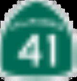
- State Route 41
 California State Route 41State Route 41 is a state highway in the U.S. state of California, connecting the Cabrillo Highway in Morro Bay with Fresno and Yosemite National Park via the San Joaquin Valley. Except between US 101 in Atascadero and SR 46 near Shandon, SR 41 is part of the California Freeway and Expressway...
 - State Route 49
 California State Route 49State Route 49 is a north–south state highway in the U.S. state of California that passes through many historic mining communities of the 1849 California gold rush. Highway 49 is numbered after the "49ers", the waves of immigrants who swept into the area looking for gold, and a portion of it...
 - State Route 120
 California State Route 120State Route 120 , in northern California, runs between the Central Valley near Manteca, through Yosemite National Park, and ends at U.S. Route 6 in Mono County.-Route description:...
 - State Route 140
 California State Route 140State Route 140 is a state highway in the U.S. state of California, 102 miles in length. It begins in the San Joaquin Valley at Interstate 5 near Gustine, and runs east into the Sierra Nevada, terminating in Yosemite National Park....
Public transportation
- Mariposa County Transit provides dial-a-ride and some fixed route service
- Yosemite Area Regional Transit System (YARTS) provides service along State Routes 120 and 140 to Yosemite National ParkYosemite National ParkYosemite National Park is a United States National Park spanning eastern portions of Tuolumne, Mariposa and Madera counties in east central California, United States. The park covers an area of and reaches across the western slopes of the Sierra Nevada mountain chain...
.
Airports
Mariposa Yosemite Airport is a general aviation airport. The nearest airports with scheduled flights are in Fresno and Merced.Demographics
2010
The 2010 United States Census reported that Mariposa County had a population of 18,251. The racial makeup of Mariposa County was 16,103 (88.2%) White, 138 (0.8%) African American, 527 (2.9%) Native American, 204 (1.1%) Asian, 26 (0.1%) Pacific Islander, 508 (2.8%) from other racesRace (United States Census)
Race and ethnicity in the United States Census, as defined by the Federal Office of Management and Budget and the United States Census Bureau, are self-identification data items in which residents choose the race or races with which they most closely identify, and indicate whether or not they are...
, and 745 (4.1%) from two or more races. Hispanic or Latino of any race were 1,676 persons (9.2%).
| Population reported at 2010 United States Census | |||||||||
|---|---|---|---|---|---|---|---|---|---|
Mariposa County, California Mariposa County is a county in the U.S. state of California, located in the western foothills of the Sierra Nevada mountains. It lies north of Fresno, east of Merced, and southeast of Stockton. As of the 2010 census, the population was 18,251 up from 17,130 at the 2000 census... |
Population |
American |
American |
|
Islander |
races Race (United States Census) Race and ethnicity in the United States Census, as defined by the Federal Office of Management and Budget and the United States Census Bureau, are self-identification data items in which residents choose the race or races with which they most closely identify, and indicate whether or not they are... |
more races |
or Latino (of any race) |
|
| Mariposa County Mariposa County, California Mariposa County is a county in the U.S. state of California, located in the western foothills of the Sierra Nevada mountains. It lies north of Fresno, east of Merced, and southeast of Stockton. As of the 2010 census, the population was 18,251 up from 17,130 at the 2000 census... |
18,251 | 16,103 | 138 | 527 | 204 | 26 | 508 | 745 | 1,676 |
place Census-designated place A census-designated place is a concentration of population identified by the United States Census Bureau for statistical purposes. CDPs are delineated for each decennial census as the statistical counterparts of incorporated places such as cities, towns and villages... |
Population |
American |
American |
|
Islander |
races Race (United States Census) Race and ethnicity in the United States Census, as defined by the Federal Office of Management and Budget and the United States Census Bureau, are self-identification data items in which residents choose the race or races with which they most closely identify, and indicate whether or not they are... |
more races |
or Latino (of any race) |
|
| Buck Meadows Buck Meadows, California Buck Meadows is a census-designated place in Mariposa County, California. It is located east-northeast of Smith Peak, at an elevation of 3015 feet . The population was 31 at the 2010 census.... |
31 | 23 | 0 | 0 | 0 | 0 | 5 | 3 | 7 |
| Catheys Valley Catheys Valley, California Catheys Valley is a census-designated place in Mariposa County, California. It lies in Catheys Valley 22 miles northeast of Merced, and southwest of Mariposa, at an elevation of 1325 feet . As of the 2010 census, Catheys Valley had a population of 825... |
825 | 730 | 6 | 12 | 12 | 1 | 33 | 31 | 80 |
| Coulterville Coulterville, California Coulterville is a census-designated place in Mariposa County, California. It is located on Maxwell Creek northwest of Mariposa, at an elevation of 1699 feet . Coulterville had a population of 201 at the 2010 census. It is a mining town located in the foothills of the Sierra Nevada. The ZIP Code... |
201 | 181 | 0 | 5 | 1 | 0 | 0 | 14 | 20 |
| El Portal El Portal, California El Portal is a census-designated place in Mariposa County, California. It is located west-southwest of Yosemite Village, at an elevation of 1939 feet . The population was 474 at the 2010 census.... |
474 | 434 | 1 | 9 | 5 | 0 | 5 | 20 | 28 |
| Fish Camp Fish Camp, California Fish Camp is a census-designated place in Mariposa County, California. It is located east of Mariposa, at an elevation of 5062 feet . The population was 59 at the 2010 census.... |
59 | 57 | 0 | 0 | 1 | 0 | 0 | 1 | 3 |
| Greeley Hill Greeley Hill, California Greeley Hill is a census-designated place in Mariposa County, California. Greeley Hill sits at an elevation of . The 2010 United States census reported Greeley Hill's population was 915.-Geography:... |
915 | 847 | 7 | 14 | 1 | 6 | 11 | 29 | 53 |
| Hornitos Hornitos, California Hornitos is a census-designated place in Mariposa County, California. It is located on Burns Creek south of Coulterville, at an elevation of 843 feet . The population was 75 at the 2010 census.... |
75 | 66 | 0 | 2 | 1 | 0 | 0 | 6 | 5 |
| Lake Don Pedro Lake Don Pedro, California Lake Don Pedro is a census-designated place in Mariposa County, California. Lake Don Pedro sits at an elevation of . The 2010 United States census reported Lake Don Pedro's population was 1,077.-Geography:... |
1,077 | 979 | 7 | 18 | 12 | 2 | 18 | 41 | 109 |
| Mariposa Mariposa, California Mariposa is a census-designated place in and the county seat of Mariposa County, California, United States. The population was 2,173 at the 2010 census, up from 1,373 at the 2000 census. Its name is Spanish for "butterfly", after the flocks of Monarchs seen overwintering there by early... |
2,173 | 1,895 | 10 | 105 | 30 | 0 | 59 | 74 | 215 |
| Midpines Midpines, California Midpines is a census-designated place in Mariposa County, California. It is located southwest of El Portal, at an elevation of 2585 feet . It lies among the Sierra Nevada foothills of the central part of the state, 6 to 10 miles north of Mariposa, the county seat... |
1,204 | 990 | 4 | 63 | 7 | 0 | 97 | 43 | 208 |
| Wawona Wawona, California Wawona is a census-designated place in Mariposa County, California. It is located east of Mariposa, at an elevation of 3999 feet... |
169 | 138 | 2 | 3 | 4 | 0 | 8 | 14 | 12 |
| Yosemite Valley Yosemite Valley, California Yosemite Valley is a census-designated place in Mariposa County, California, United States. It consists of Yosemite Village and the other areas of the Yosemite Valley in Yosemite National Park... |
1,035 | 831 | 28 | 31 | 31 | 7 | 70 | 37 | 123 |
communities Unincorporated area In law, an unincorporated area is a region of land that is not a part of any municipality.To "incorporate" in this context means to form a municipal corporation, a city, town, or village with its own government. An unincorporated community is usually not subject to or taxed by a municipal government... |
Population |
American |
American |
|
Islander |
races Race (United States Census) Race and ethnicity in the United States Census, as defined by the Federal Office of Management and Budget and the United States Census Bureau, are self-identification data items in which residents choose the race or races with which they most closely identify, and indicate whether or not they are... |
more races |
or Latino (of any race) |
|
| All others not CDPs (combined) | 8,928 | 8,004 | 71 | 230 | 86 | 10 | 170 | 357 | 729 |
2000
As of the censusCensus
A census is the procedure of systematically acquiring and recording information about the members of a given population. It is a regularly occurring and official count of a particular population. The term is used mostly in connection with national population and housing censuses; other common...
of 2000, there were 17,130 people, 6,613 households, and 4,490 families residing in the county. The population density
Population density
Population density is a measurement of population per unit area or unit volume. It is frequently applied to living organisms, and particularly to humans...
was 12 people per square mile (5/km²). There were 8,826 housing units at an average density of 6 per square mile (2/km²). The racial makeup of the county was 88.93% White
Race (United States Census)
Race and ethnicity in the United States Census, as defined by the Federal Office of Management and Budget and the United States Census Bureau, are self-identification data items in which residents choose the race or races with which they most closely identify, and indicate whether or not they are...
, 0.67% Black
Race (United States Census)
Race and ethnicity in the United States Census, as defined by the Federal Office of Management and Budget and the United States Census Bureau, are self-identification data items in which residents choose the race or races with which they most closely identify, and indicate whether or not they are...
or African American
Race (United States Census)
Race and ethnicity in the United States Census, as defined by the Federal Office of Management and Budget and the United States Census Bureau, are self-identification data items in which residents choose the race or races with which they most closely identify, and indicate whether or not they are...
, 3.51% Native American
Race (United States Census)
Race and ethnicity in the United States Census, as defined by the Federal Office of Management and Budget and the United States Census Bureau, are self-identification data items in which residents choose the race or races with which they most closely identify, and indicate whether or not they are...
, 0.71% Asian
Race (United States Census)
Race and ethnicity in the United States Census, as defined by the Federal Office of Management and Budget and the United States Census Bureau, are self-identification data items in which residents choose the race or races with which they most closely identify, and indicate whether or not they are...
, 0.13% Pacific Islander
Race (United States Census)
Race and ethnicity in the United States Census, as defined by the Federal Office of Management and Budget and the United States Census Bureau, are self-identification data items in which residents choose the race or races with which they most closely identify, and indicate whether or not they are...
, 2.67% from other races
Race (United States Census)
Race and ethnicity in the United States Census, as defined by the Federal Office of Management and Budget and the United States Census Bureau, are self-identification data items in which residents choose the race or races with which they most closely identify, and indicate whether or not they are...
, and 3.38% from two or more races. 7.76% of the population were Hispanic
Race (United States Census)
Race and ethnicity in the United States Census, as defined by the Federal Office of Management and Budget and the United States Census Bureau, are self-identification data items in which residents choose the race or races with which they most closely identify, and indicate whether or not they are...
or Latino
Race (United States Census)
Race and ethnicity in the United States Census, as defined by the Federal Office of Management and Budget and the United States Census Bureau, are self-identification data items in which residents choose the race or races with which they most closely identify, and indicate whether or not they are...
of any race. 17.8% were of German, 13.4% English
English people
The English are a nation and ethnic group native to England, who speak English. The English identity is of early mediaeval origin, when they were known in Old English as the Anglecynn. England is now a country of the United Kingdom, and the majority of English people in England are British Citizens...
, 12.7% Irish
Irish people
The Irish people are an ethnic group who originate in Ireland, an island in northwestern Europe. Ireland has been populated for around 9,000 years , with the Irish people's earliest ancestors recorded having legends of being descended from groups such as the Nemedians, Fomorians, Fir Bolg, Tuatha...
and 6.7% American
United States
The United States of America is a federal constitutional republic comprising fifty states and a federal district...
ancestry according to Census 2000. 96.0% spoke English
English language
English is a West Germanic language that arose in the Anglo-Saxon kingdoms of England and spread into what was to become south-east Scotland under the influence of the Anglian medieval kingdom of Northumbria...
and 3.5% Spanish
Spanish language
Spanish , also known as Castilian , is a Romance language in the Ibero-Romance group that evolved from several languages and dialects in central-northern Iberia around the 9th century and gradually spread with the expansion of the Kingdom of Castile into central and southern Iberia during the...
as their first language.
There were 6,613 households out of which 25.6% had children under the age of 18 living with them, 55.8% were married couples
Marriage
Marriage is a social union or legal contract between people that creates kinship. It is an institution in which interpersonal relationships, usually intimate and sexual, are acknowledged in a variety of ways, depending on the culture or subculture in which it is found...
living together, 8.0% had a female householder with no husband present, and 32.1% were non-families. 26.5% of all households were made up of individuals and 11.2% had someone living alone who was 65 years of age or older. The average household size was 2.37 and the average family size was 2.86.
In the county the population was spread out with 21.6% under the age of 18, 6.9% from 18 to 24, 25.1% from 25 to 44, 29.2% from 45 to 64, and 17.2% who were 65 years of age or older. The median age was 43 years. For every 100 females there were 104.7 males. For every 100 females age 18 and over, there were 105.4 males.
The median income for a household in the county was $34,626, and the median income for a family was $42,655. Males had a median income of $31,194 versus $25,440 for females. The per capita income
Per capita income
Per capita income or income per person is a measure of mean income within an economic aggregate, such as a country or city. It is calculated by taking a measure of all sources of income in the aggregate and dividing it by the total population...
for the county was $18,190. About 10.5% of families and 14.8% of the population were below the poverty line, including 16.5% of those under age 18 and 9.0% of those age 65 or over.
Politics
| Year | GOP Republican Party (United States) The Republican Party is one of the two major contemporary political parties in the United States, along with the Democratic Party. Founded by anti-slavery expansion activists in 1854, it is often called the GOP . The party's platform generally reflects American conservatism in the U.S... |
DEM Democratic Party (United States) The Democratic Party is one of two major contemporary political parties in the United States, along with the Republican Party. The party's socially liberal and progressive platform is largely considered center-left in the U.S. political spectrum. The party has the lengthiest record of continuous... |
Others |
|---|---|---|---|
| 2008 | 55.2% 4,880 | 42.6% 3,766 | 2.3% 199 |
| 2004 | 60.2% 5,215 | 37.6% 3,251 | 2.2% 192 |
| 2000 | 58.5% 4,727 | 34.9% 2,816 | 6.6% 531 |
| 1996 | 50.0% 3,976 | 36.7% 2,920 | 13.3% 1,053 |
| 1992 | 36.0% 2,982 | 36.5% 3,023 | 27.5% 2,282 |
| 1988 | 54.5% 3,768 | 43.4% 2,998 | 2.1% 144 |
| 1984 | 61.2% 3,989 | 36.8% 2,399 | 2.0% 130 |
| 1980 | 55.0% 3,082 | 33.7% 1,889 | 11.4% 637 |
| 1976 | 46.6% 2,012 | 48.5% 2,093 | 4.9% 212 |
| 1972 | 56.2% 2,122 | 39.3% 1,487 | 4.5% 170 |
| 1968 | 49.9% 1,496 | 39.6% 1,187 | 10.5% 314 |
| 1964 | 42.6% 1,264 | 57.4% 1,704 | |
| 1960 | 54.0% 1,599 | 45.2% 1,338 | 0.9% 26 |
Mariposa is a strongly Republican
Republican Party (United States)
The Republican Party is one of the two major contemporary political parties in the United States, along with the Democratic Party. Founded by anti-slavery expansion activists in 1854, it is often called the GOP . The party's platform generally reflects American conservatism in the U.S...
county in Presidential
President of the United States
The President of the United States of America is the head of state and head of government of the United States. The president leads the executive branch of the federal government and is the commander-in-chief of the United States Armed Forces....
and congressional
United States Congress
The United States Congress is the bicameral legislature of the federal government of the United States, consisting of the Senate and the House of Representatives. The Congress meets in the United States Capitol in Washington, D.C....
elections. The last Democrat to win a majority in the county was Lyndon Johnson
Lyndon B. Johnson
Lyndon Baines Johnson , often referred to as LBJ, was the 36th President of the United States after his service as the 37th Vice President of the United States...
in 1964
United States presidential election, 1964
The United States presidential election of 1964 was held on November 3, 1964. Incumbent President Lyndon B. Johnson had come to office less than a year earlier following the assassination of his predecessor, John F. Kennedy. Johnson, who had successfully associated himself with Kennedy's...
but the last Democrat to win the county was Bill Clinton
Bill Clinton
William Jefferson "Bill" Clinton is an American politician who served as the 42nd President of the United States from 1993 to 2001. Inaugurated at age 46, he was the third-youngest president. He took office at the end of the Cold War, and was the first president of the baby boomer generation...
in 1992 who won a plurality.
Mariposa is part of California's 19th congressional district
California's 19th congressional district
California's 19th congressional district is a congressional district located in the U.S. state of California that covers parts of Fresno, Madera, Mariposa, Tuolumne, and Stanislaus counties....
, which is held by Republican Jeff Denham
Jeff Denham
Jeffrey John "Jeff" Denham is the U.S. Representative for . He is a member of the Republican Party.He previously served two terms in the California State Senate, representing the 12th District, which includes Madera, Merced, Monterey, San Benito and Stanislaus counties. Denham was the second...
. In the state legislature
California State Legislature
The California State Legislature is the state legislature of the U.S. state of California. It is a bicameral body consisting of the lower house, the California State Assembly, with 80 members, and the upper house, the California State Senate, with 40 members...
Mariposa is in the 25th Assembly district, which is held by Republican Kristin Olsen
Kristin Olsen
Kristin Olsen is an American politician currently serving in the California State Assembly. She is a Republican representing the 25th district, encompassing Calaveras, Mariposa, Mono, and Tuolumne counties, and parts of Madera and Stanislaus counties...
, and the 14th Senate district, which is held by Republican Tom Berryhill
Tom Berryhill
Tom Berryhill is a Republican politician in the United States who currently represents the 14th district in the California State Senate...
.
On Nov. 4, 2008 Mariposa County voted 62.3 % for Proposition 8 which amended the California Constitution to ban same-sex marriages.
Environment
In late July, 2008, authorities forced the evacuation of about 300 homes, in the wake of the wildfires in the areaSummer 2008 California wildfires
The summer 2008 California wildfires, collectively dubbed the Northern California Lightning Series by CAL FIRE, were a concentrated outbreak of wildfires during the summer of 2008. Over 2,780 individual fires were burning at the height of the period, burning large portions of forests and chaparral...
.
See also
- List of school districts in Mariposa County, California
- National Register of Historic Places listings in Mariposa County, California
- Valley and Sierra MiwokValley and Sierra MiwokThe Plains and Sierra Miwok , were the largest group of Miwok Native American people...
people - Yokut people (Mariposan)