
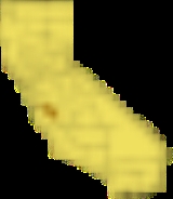
San Benito County, California
Encyclopedia
San Benito County is a county
located in the Coast Range Mountains of the U.S. state
of California
, south of San Jose
. As of 2010 the population was 55,269. The county seat
is Hollister
, which includes nearly two-thirds of the county's population. El Camino Real
passes through the county and includes one mission
in San Juan Bautista
.
San Benito is included in the U.S. government's 11-county designation of the San Francisco Bay Area Combined Statistical Area
.
in 1874.
The county is named after the San Benito Valley. Father Juan Crespí
, in his expedition in 1772, named a small river in honor of San Benedicto (Saint Benedict
), the patron saint of the married, and it is from the contraction of this name that the county took its name.
Sharing a border with Santa Clara County
, San Benito County lies adjacent to the San Francisco Bay Area
and is sometimes considered a part of that region. Frequently, the county is associated with the Monterey Bay Area through governmental organizations such as the Association of Monterey Bay Area Governments
as well as the Pajaro River
, which flows from northern San Benito County into the Monterey Bay
. However, the United States Census Bureau
includes the county in the San Jose-Sunnyvale-Santa Clara MSA
and the San Jose-San Francisco-Oakland
CSA
, which the Census uses as a statistical definition of the San Francisco Bay Area.
The county is also the location of the Mount Harlan
and San Benito
American Viticultural Area
s. The latter contains the Cienega Valley
, Lime Kiln Valley
, and Paicines
AVAs.
Benitoite
, the official gem of the State of California, was discovered in San Benito County. The county is also home to the San Benito evening primrose (Camissonia benitensis
); and Illacme plenipes
, a millipede
having more legs than any other millipede species
, discovered in the county in 1926. The plant genus Benitoa
was named for San Benito County.
, in Santa Clara County
.
is a general aviation airport located just north of Hollister.
, and 2,702 (4.9%) from two or more races. Hispanic or Latino of any race were 31,186 persons (56.4%).
of 2000, there were 53,234 people, 15,885 households, and 12,898 families residing in the county. The population density
was 38 people per square mile (15/km²). There were 16,499 housing units at an average density of 12 per square mile (5/km²). The racial makeup of the county in 2010 was 38.3% non-Hispanic White
, 0.6% non-Hispanic Black
or African American
, 0.4% Native American
, 2.3% Asian
, 0.1% Pacific Islander
, 0.1% from other races
, and 1.7% from two or more races. 56.4% of the population were Hispanic
or Latino
of any race. 7.6% were of German, 6.3% Irish
and 5.4% Italian
ancestry according to Census 2000. 62.8% spoke English
and 35.3% Spanish
as their first language. As of the 2010 United States Census, San Benito County was the only county in the greater San Francisco Bay Area
with a Hispanic majority and where a minority race formed the largest race composition.
There were 15,885 households out of which 46.3% had children under the age of 18 living with them, 65.7% were married couples
living together, 10.5% had a female householder with no husband present, and 18.8% were non-families. 14.1% of all households were made up of individuals and 5.4% had someone living alone who was 65 years of age or older. The average household size was 3.32 and the average family size was 3.64.
In the county the population was spread out with 32.2% under the age of 18, 8.8% from 18 to 24, 31.5% from 25 to 44, 19.3% from 45 to 64, and 8.1% who were 65 years of age or older. The median age was 31 years. For every 100 females there were 102.5 males. For every 100 females age 18 and over, there were 99.6 males.
The median income for a household in the county was $57,469, and the median income for a family was $60,665. Males had a median income of $44,158 versus $29,524 for females. The per capita income
for the county was $20,932. About 6.7% of families and 10.0% of the population were below the poverty line, including 11.4% of those under age 18 and 8.5% of those age 65 or over.
San Benito is a Democratic
-leaning county in Presidential
and congressional
elections. The last Republican to win a majority in the county was George H.W. Bush in 1988
. It is often considered the bellwether of California, as most of its election returns mirrored the state as a whole. San Benito is part of California's 17th congressional district
, which is held by Democrat Sam Farr
. In the state legislature
San Benito is in the 28th Assembly district, which is held by Democrat Luis Alejo
, and the 12th Senate district, which is held by Republican Anthony Cannella
.
County government is overseen by a five-member elected Board of Supervisors, who serve four year terms of office. Other elected county leaders include:
San Benito County has the last elected Marshal in California. Shasta and Trinity Counties still have appointed Marshals.
As of May, 2010, the California Secretary of State reports that San Benito County has 34,562 eligible voters. Of those 24,736 (71.57%) are registered voters. Of those, 11,959 (48.35%) are registered Democratic, 7,477 (30.23%) are registered Republican, 565 (2.28%)are registered American Independent, and 116 (0.47%) are Green Party. The two incorporated municipalities of Hollister and San Juan Bautista have Democratic majorities on their voter rolls, whereas the unincorporated areas of San Benito County have a small Republican plurality in voter registration.
County (United States)
In the United States, a county is a geographic subdivision of a state , usually assigned some governmental authority. The term "county" is used in 48 of the 50 states; Louisiana is divided into parishes and Alaska into boroughs. Parishes and boroughs are called "county-equivalents" by the U.S...
located in the Coast Range Mountains of the U.S. state
U.S. state
A U.S. state is any one of the 50 federated states of the United States of America that share sovereignty with the federal government. Because of this shared sovereignty, an American is a citizen both of the federal entity and of his or her state of domicile. Four states use the official title of...
of California
California
California is a state located on the West Coast of the United States. It is by far the most populous U.S. state, and the third-largest by land area...
, south of San Jose
San Jose, California
San Jose is the third-largest city in California, the tenth-largest in the U.S., and the county seat of Santa Clara County which is located at the southern end of San Francisco Bay...
. As of 2010 the population was 55,269. The county seat
County seat
A county seat is an administrative center, or seat of government, for a county or civil parish. The term is primarily used in the United States....
is Hollister
Hollister, California
Hollister is a city in and the county seat of San Benito County, California, United States. The population was 34,928 at the 2010 census. Hollister is primarily an agricultural town.-History:...
, which includes nearly two-thirds of the county's population. El Camino Real
El Camino Real (California)
El Camino Real and sometimes associated with Calle Real usually refers to the 600-mile California Mission Trail, connecting the former Alta California's 21 missions , 4 presidios, and several pueblos, stretching from Mission San Diego de Alcalá in San Diego...
passes through the county and includes one mission
Spanish missions in California
The Spanish missions in California comprise a series of religious and military outposts established by Spanish Catholics of the Franciscan Order between 1769 and 1823 to spread the Christian faith among the local Native Americans. The missions represented the first major effort by Europeans to...
in San Juan Bautista
San Juan Bautista, California
San Juan Bautista is a city in San Benito County, California, United States. The population was 1,862 at the 2010 census, up from 1,549 at the 2000 census. The city of San Juan Bautista was named after Mission San Juan Bautista...
.
San Benito is included in the U.S. government's 11-county designation of the San Francisco Bay Area Combined Statistical Area
San Francisco Bay Area Combined Statistical Area
The San Francisco Bay Area Combined Statistical Area, also known as the San Jose-San Francisco-Oakland, CA CSA, is the 6th most populous of 125 Combined Statistical Areas as defined by the United States Office of Management and Budget...
.
History
San Benito County was formed from parts of Monterey CountyMonterey County, California
Monterey County is a county located on the Pacific coast of the U.S. state of California, its northwestern section forming the southern half of Monterey Bay. The northern half of the bay is in Santa Cruz County. As of 2010, the population was 415,057. The county seat and largest city is Salinas...
in 1874.
The county is named after the San Benito Valley. Father Juan Crespí
Juan Crespi
Father Juan Crespí was a Majorcan missionary and explorer of Las Californias. He entered the Franciscan order at the age of seventeen. He came to America in 1749, and accompanied explorers Francisco Palóu and Junípero Serra. In 1767 he went to the Baja Peninsula and was placed in charge of the...
, in his expedition in 1772, named a small river in honor of San Benedicto (Saint Benedict
Benedict of Nursia
Saint Benedict of Nursia is a Christian saint, honored by the Roman Catholic Church as the patron saint of Europe and students.Benedict founded twelve communities for monks at Subiaco, about to the east of Rome, before moving to Monte Cassino in the mountains of southern Italy. There is no...
), the patron saint of the married, and it is from the contraction of this name that the county took its name.
Geography
According to the 2000 census, the county has a total area of 1390.73 square miles (3,602 km²), of which 1389.06 square miles (3,597.6 km²) (or 99.88%) is land and 1.68 square miles (4.4 km²) (or 0.12%) is water.Sharing a border with Santa Clara County
Santa Clara County, California
Santa Clara County is a county located at the southern end of the San Francisco Bay Area in the U.S. state of California. As of 2010 it had a population of 1,781,642. The county seat is San Jose. The highly urbanized Santa Clara Valley within Santa Clara County is also known as Silicon Valley...
, San Benito County lies adjacent to the San Francisco Bay Area
San Francisco Bay Area
The San Francisco Bay Area, commonly known as the Bay Area, is a populated region that surrounds the San Francisco and San Pablo estuaries in Northern California. The region encompasses metropolitan areas of San Francisco, Oakland, and San Jose, along with smaller urban and rural areas...
and is sometimes considered a part of that region. Frequently, the county is associated with the Monterey Bay Area through governmental organizations such as the Association of Monterey Bay Area Governments
Association of Monterey Bay Area Governments
The Association of Monterey Bay Area Governments, or AMBAG, is a regional governmental organization which consists of representation of a large number of public agencies within Monterey County, Santa Cruz County and San Benito County, California...
as well as the Pajaro River
Pajaro River
The Pajaro River is a river in Northern California, forming part of the border between Santa Cruz County and Monterey County and between San Benito County and Santa Clara County.-History:...
, which flows from northern San Benito County into the Monterey Bay
Monterey Bay
Monterey Bay is a bay of the Pacific Ocean, along the central coast of California. The bay is south of San Francisco and San Jose, between the cities of Santa Cruz and Monterey....
. However, the United States Census Bureau
United States Census Bureau
The United States Census Bureau is the government agency that is responsible for the United States Census. It also gathers other national demographic and economic data...
includes the county in the San Jose-Sunnyvale-Santa Clara MSA
United States metropolitan area
In the United States a metropolitan statistical area is a geographical region with a relatively high population density at its core and close economic ties throughout the area. Such regions are not legally incorporated as a city or town would be, nor are they legal administrative divisions like...
and the San Jose-San Francisco-Oakland
San Francisco Bay Area Combined Statistical Area
The San Francisco Bay Area Combined Statistical Area, also known as the San Jose-San Francisco-Oakland, CA CSA, is the 6th most populous of 125 Combined Statistical Areas as defined by the United States Office of Management and Budget...
CSA
Combined Statistical Area
The United States Office of Management and Budget defines micropolitan and metropolitan statistical areas. Metropolitan and micropolitan statistical areas consist of one or more counties...
, which the Census uses as a statistical definition of the San Francisco Bay Area.
The county is also the location of the Mount Harlan
Mt. Harlan AVA
The Mt. Harlan AVA is an American Viticultural Area located in San Benito County, California. It is located in the Gabilan Mountains and is part of the larger Central Coast AVA. At elevations of to above sea level, the soil is predominately limestone...
and San Benito
San Benito AVA
The San Benito AVA is an American Viticultural Area located in San Benito County, California. It is part of the larger Central Coast AVA. San Benito has a moderate climate with cooling breezes from the Pacific Ocean arriving via gaps between the Gabilan Range and the Santa Lucia Mountains...
American Viticultural Area
American Viticultural Area
An American Viticultural Area is a designated wine grape-growing region in the United States distinguishable by geographic features, with boundaries defined by the Alcohol and Tobacco Tax and Trade Bureau , United States Department of the Treasury....
s. The latter contains the Cienega Valley
Cienega Valley AVA
The Cienega Valley AVA is an American Viticultural Area located in western San Benito County, California. It is part of the larger Central Coast AVA. The valley was once a major source of wine grapes for Almaden Vineyards before it was acquired by Constellation Brands in 1987. Approximately ...
, Lime Kiln Valley
Lime Kiln Valley AVA
The Lime Kiln Valley AVA is an American Viticultural Area located in the larger Cienega Valley AVA in San Benito County, California. This appellation spans and was granted AVA status in 1982. The soil in the region is composed of foundations of limestone and dolomite with sandy, gravelly loam above...
, and Paicines
Paicines AVA
The Paicines AVA is an American Viticultural Area located in San Benito County, California. It is part of the larger San Benito AVA, and is located near the central part of the county. The Paicines area is warmer than other nearby regions in San Benito, but cooler than the wine regions of the...
AVAs.
Fauna and flora
There are a number of plant communities that occur in San Benito County including grasslands and chaparral; however, one of the more unusual is the Sargent cypress forest.Benitoite
Benitoite
Benitoite is a rare blue barium titanium silicate mineral, found in hydrothermally altered serpentinite. Benitoite fluoresces under short wave ultraviolet light, appearing bright blue to bluish white in color. The more rarely seen clear to white benitoite crystals fluoresce red under long-wave UV...
, the official gem of the State of California, was discovered in San Benito County. The county is also home to the San Benito evening primrose (Camissonia benitensis
Camissonia benitensis
Camissonia benitensis is a species of evening primrose known by the common name San Benito evening primrose . It is endemic to California, where its range includes far southern San Benito County, far western Fresno County, and far eastern Monterey County...
); and Illacme plenipes
Illacme plenipes
Illacme plenipes is a millipede found in the central region of the U.S. state of California. It has 750 legs, more than any other millipede. It was first seen in 1926, but was not rediscovered until 2005.-Legs:...
, a millipede
Millipede
Millipedes are arthropods that have two pairs of legs per segment . Each segment that has two pairs of legs is a result of two single segments fused together as one...
having more legs than any other millipede species
Species
In biology, a species is one of the basic units of biological classification and a taxonomic rank. A species is often defined as a group of organisms capable of interbreeding and producing fertile offspring. While in many cases this definition is adequate, more precise or differing measures are...
, discovered in the county in 1926. The plant genus Benitoa
Benitoa
Benitoa is a genus of flowering plants in the daisy family, Asteraceae. This is a monotypic genus containing the single species Benitoa occidentalis, which is known simply as benitoa...
was named for San Benito County.
Incorporated Cities
- HollisterHollister, CaliforniaHollister is a city in and the county seat of San Benito County, California, United States. The population was 34,928 at the 2010 census. Hollister is primarily an agricultural town.-History:...
- San Juan BautistaSan Juan Bautista, CaliforniaSan Juan Bautista is a city in San Benito County, California, United States. The population was 1,862 at the 2010 census, up from 1,549 at the 2000 census. The city of San Juan Bautista was named after Mission San Juan Bautista...
Unincorporated Towns
- AromasAromas, CaliforniaAromas is a census-designated place in Monterey County, and San Benito County, California, United States. The CDP straddles the border of the two counties, with Monterey County to the west and San Benito County to the east. The Santa Cruz County line is less than a mile to the Northwest, and...
- PaicinesPaicines, CaliforniaThe unincorporated community of Paicines is located at above mean sea level in San Benito County, California along State Route 25. Guide signs along SR25 say the community is south of Hollister. The community is at the intersection of Panoche Road and SR25...
- Tres PinosTres Pinos, CaliforniaTres Pinos is a census-designated place in San Benito County, California. The community lies along State Route 25, approximately 4 miles south of Hollister and 5 miles north of Paicines. Tres Pinos sits at an elevation of...
- New IdriaNew Idria, CaliforniaNew Idria was an unincorporated town in San Benito County, California. It is named after a now-inoperative quicksilver mine of the same name. The mine itself was named in honor of the world's second largest quicksilver mine in Idrija, Slovenia The town grew to support the mining operations, but...
(abandoned)
Adjacent counties
- Santa Clara CountySanta Clara County, CaliforniaSanta Clara County is a county located at the southern end of the San Francisco Bay Area in the U.S. state of California. As of 2010 it had a population of 1,781,642. The county seat is San Jose. The highly urbanized Santa Clara Valley within Santa Clara County is also known as Silicon Valley...
— north/northwest - Merced CountyMerced County, CaliforniaMerced County , is a county located in the Central Valley of the U.S. state of California, north of Fresno and southeast of San Jose. As of the 2010 census, the population was 255,793, up from 210,554 at the 2000 census. The county seat is Merced...
— northeast - Fresno CountyFresno County, CaliforniaFresno County is a county located in the Central Valley of the U.S. state of California, south of Stockton and north of Bakersfield. As of the 2010 census, it is the tenth most populous county in California with a population of 930,450, and the sixth largest in size with an area of . The county...
— east/southeast - Monterey CountyMonterey County, CaliforniaMonterey County is a county located on the Pacific coast of the U.S. state of California, its northwestern section forming the southern half of Monterey Bay. The northern half of the bay is in Santa Cruz County. As of 2010, the population was 415,057. The county seat and largest city is Salinas...
— southwest/west - Santa Cruz CountySanta Cruz County, CaliforniaSanta Cruz County is a county located on the Pacific coast of the U.S. state of California, on the California Central Coast. The county forms the northern coast of the Monterey Bay. . As of the 2010 U.S. Census, its population was 262,382. The county seat is Santa Cruz...
— northwest
Major highways
- U.S. Route 101
.svg.png)
- State Route 25
 California State Route 25State Route 25 is a state highway in the U.S. state of California between Gilroy and State Route 198. This route is part of the California Freeway and Expressway System and is eligible for the State Scenic Highway System.-Route description:...
 - State Route 129
 California State Route 129State Route 129 is a state highway in the U.S. state of California in Santa Cruz County. The highway connects State Route 1 in Watsonville east to U.S. Route 101.-Route description:...
 - State Route 146
 California State Route 146State Route 146 is a state highway in the U.S. state of California in Monterey and San Benito Counties. The route serves as an entryway to the Pinnacles National Monument, located in the Gabilan Mountains, from both the Salinas Valley on the west and State Route 25 on the east.This route is...
 - State Route 156
 California State Route 156State Route 156 is a state highway in California, USA, running from Castroville to State Route 152 near Hollister.This route is eligible for the State Scenic Highway System.-Route description:...
Public transportation
San Benito County Express provides fixed route service in the city of Hollister, and intercity service in the northern portion of the county. Service operates as far north as GilroyGilroy, California
Gilroy is the southernmost city in Santa Clara County, California, United States. The population was 48,821 at the 2010 census. Gilroy is well-known for its garlic crop and for the annual Gilroy Garlic Festival, featuring various garlicky foods, including garlic ice cream. Gilroy also produces...
, in Santa Clara County
Santa Clara County, California
Santa Clara County is a county located at the southern end of the San Francisco Bay Area in the U.S. state of California. As of 2010 it had a population of 1,781,642. The county seat is San Jose. The highly urbanized Santa Clara Valley within Santa Clara County is also known as Silicon Valley...
.
Airports
Hollister Municipal AirportHollister Municipal Airport
Hollister Municipal Airport is a city-owned public-use airport located three nautical miles north of the central business district of Hollister, a city in San Benito County, California, United States.Although most U.S...
is a general aviation airport located just north of Hollister.
Demographics
2010
The 2010 United States Census reported that San Benito County had a population of 55,269. The racial makeup of San Benito County was 35,181 (63.7%) White, 483 (0.9%) African American, 895 (1.6%) Native American, 1,443 (2.6%) Asian, 94 (0.2%) Pacific Islander, 14,471 (26.2%) from other racesRace (United States Census)
Race and ethnicity in the United States Census, as defined by the Federal Office of Management and Budget and the United States Census Bureau, are self-identification data items in which residents choose the race or races with which they most closely identify, and indicate whether or not they are...
, and 2,702 (4.9%) from two or more races. Hispanic or Latino of any race were 31,186 persons (56.4%).
| Population reported at 2010 United States Census | |||||||||
|---|---|---|---|---|---|---|---|---|---|
San Benito County, California San Benito County is a county located in the Coast Range Mountains of the U.S. state of California, south of San Jose. As of 2010 the population was 55,269. The county seat is Hollister, which includes nearly two-thirds of the county's population. El Camino Real passes through the county and... |
Population |
American |
American |
|
Islander |
races Race (United States Census) Race and ethnicity in the United States Census, as defined by the Federal Office of Management and Budget and the United States Census Bureau, are self-identification data items in which residents choose the race or races with which they most closely identify, and indicate whether or not they are... |
more races |
or Latino (of any race) |
|
| San Benito County San Benito County, California San Benito County is a county located in the Coast Range Mountains of the U.S. state of California, south of San Jose. As of 2010 the population was 55,269. The county seat is Hollister, which includes nearly two-thirds of the county's population. El Camino Real passes through the county and... |
55,269 | 35,181 | 483 | 895 | 1443 | 94 | 14,471 | 2,702 | 31,186 |
cities |
Population |
American |
American |
|
Islander |
races Race (United States Census) Race and ethnicity in the United States Census, as defined by the Federal Office of Management and Budget and the United States Census Bureau, are self-identification data items in which residents choose the race or races with which they most closely identify, and indicate whether or not they are... |
more races |
or Latino (of any race) |
|
| Hollister Hollister, California Hollister is a city in and the county seat of San Benito County, California, United States. The population was 34,928 at the 2010 census. Hollister is primarily an agricultural town.-History:... |
34,928 | 20,761 | 341 | 617 | 929 | 63 | 10,437 | 1,780 | 22,965 |
| San Juan Bautista San Juan Bautista, California San Juan Bautista is a city in San Benito County, California, United States. The population was 1,862 at the 2010 census, up from 1,549 at the 2000 census. The city of San Juan Bautista was named after Mission San Juan Bautista... |
1,862 | 1,125 | 12 | 58 | 52 | 2 | 494 | 119 | 907 |
places Census-designated place A census-designated place is a concentration of population identified by the United States Census Bureau for statistical purposes. CDPs are delineated for each decennial census as the statistical counterparts of incorporated places such as cities, towns and villages... |
Population |
American |
American |
|
Islander |
races Race (United States Census) Race and ethnicity in the United States Census, as defined by the Federal Office of Management and Budget and the United States Census Bureau, are self-identification data items in which residents choose the race or races with which they most closely identify, and indicate whether or not they are... |
more races |
or Latino (of any race) |
|
| Aromas Aromas, California Aromas is a census-designated place in Monterey County, and San Benito County, California, United States. The CDP straddles the border of the two counties, with Monterey County to the west and San Benito County to the east. The Santa Cruz County line is less than a mile to the Northwest, and... ‡ |
1,292 | 961 | 9 | 13 | 14 | 3 | 207 | 85 | 413 |
| Ridgemark Ridgemark, California Ridgemark is a census-designated place located adjacent to the southeastern edge of Hollister in San Benito County, California, United States. The community is a private, gated golf development with two golf courses and just over 1,000 homes... |
3,016 | 2,520 | 23 | 14 | 105 | 3 | 248 | 103 | 623 |
| Tres Pinos Tres Pinos, California Tres Pinos is a census-designated place in San Benito County, California. The community lies along State Route 25, approximately 4 miles south of Hollister and 5 miles north of Paicines. Tres Pinos sits at an elevation of... |
476 | 390 | 3 | 8 | 6 | 0 | 57 | 12 | 112 |
communities Unincorporated area In law, an unincorporated area is a region of land that is not a part of any municipality.To "incorporate" in this context means to form a municipal corporation, a city, town, or village with its own government. An unincorporated community is usually not subject to or taxed by a municipal government... |
Population |
American |
American |
|
Islander |
races Race (United States Census) Race and ethnicity in the United States Census, as defined by the Federal Office of Management and Budget and the United States Census Bureau, are self-identification data items in which residents choose the race or races with which they most closely identify, and indicate whether or not they are... |
more races |
or Latino (of any race) |
|
| All others not CDPs (combined) | 13,695 | 9,424 | 95 | 185 | 337 | 23 | 3,028 | 603 | 6,166 |
| ‡ Note: these numbers reflect only the portion of this CDP in San Benito County | |||||||||
2000
As of the censusCensus
A census is the procedure of systematically acquiring and recording information about the members of a given population. It is a regularly occurring and official count of a particular population. The term is used mostly in connection with national population and housing censuses; other common...
of 2000, there were 53,234 people, 15,885 households, and 12,898 families residing in the county. The population density
Population density
Population density is a measurement of population per unit area or unit volume. It is frequently applied to living organisms, and particularly to humans...
was 38 people per square mile (15/km²). There were 16,499 housing units at an average density of 12 per square mile (5/km²). The racial makeup of the county in 2010 was 38.3% non-Hispanic White
Race (United States Census)
Race and ethnicity in the United States Census, as defined by the Federal Office of Management and Budget and the United States Census Bureau, are self-identification data items in which residents choose the race or races with which they most closely identify, and indicate whether or not they are...
, 0.6% non-Hispanic Black
Race (United States Census)
Race and ethnicity in the United States Census, as defined by the Federal Office of Management and Budget and the United States Census Bureau, are self-identification data items in which residents choose the race or races with which they most closely identify, and indicate whether or not they are...
or African American
Race (United States Census)
Race and ethnicity in the United States Census, as defined by the Federal Office of Management and Budget and the United States Census Bureau, are self-identification data items in which residents choose the race or races with which they most closely identify, and indicate whether or not they are...
, 0.4% Native American
Race (United States Census)
Race and ethnicity in the United States Census, as defined by the Federal Office of Management and Budget and the United States Census Bureau, are self-identification data items in which residents choose the race or races with which they most closely identify, and indicate whether or not they are...
, 2.3% Asian
Race (United States Census)
Race and ethnicity in the United States Census, as defined by the Federal Office of Management and Budget and the United States Census Bureau, are self-identification data items in which residents choose the race or races with which they most closely identify, and indicate whether or not they are...
, 0.1% Pacific Islander
Race (United States Census)
Race and ethnicity in the United States Census, as defined by the Federal Office of Management and Budget and the United States Census Bureau, are self-identification data items in which residents choose the race or races with which they most closely identify, and indicate whether or not they are...
, 0.1% from other races
Race (United States Census)
Race and ethnicity in the United States Census, as defined by the Federal Office of Management and Budget and the United States Census Bureau, are self-identification data items in which residents choose the race or races with which they most closely identify, and indicate whether or not they are...
, and 1.7% from two or more races. 56.4% of the population were Hispanic
Race (United States Census)
Race and ethnicity in the United States Census, as defined by the Federal Office of Management and Budget and the United States Census Bureau, are self-identification data items in which residents choose the race or races with which they most closely identify, and indicate whether or not they are...
or Latino
Race (United States Census)
Race and ethnicity in the United States Census, as defined by the Federal Office of Management and Budget and the United States Census Bureau, are self-identification data items in which residents choose the race or races with which they most closely identify, and indicate whether or not they are...
of any race. 7.6% were of German, 6.3% Irish
Irish people
The Irish people are an ethnic group who originate in Ireland, an island in northwestern Europe. Ireland has been populated for around 9,000 years , with the Irish people's earliest ancestors recorded having legends of being descended from groups such as the Nemedians, Fomorians, Fir Bolg, Tuatha...
and 5.4% Italian
Italian people
The Italian people are an ethnic group that share a common Italian culture, ancestry and speak the Italian language as a mother tongue. Within Italy, Italians are defined by citizenship, regardless of ancestry or country of residence , and are distinguished from people...
ancestry according to Census 2000. 62.8% spoke English
English language
English is a West Germanic language that arose in the Anglo-Saxon kingdoms of England and spread into what was to become south-east Scotland under the influence of the Anglian medieval kingdom of Northumbria...
and 35.3% Spanish
Spanish language
Spanish , also known as Castilian , is a Romance language in the Ibero-Romance group that evolved from several languages and dialects in central-northern Iberia around the 9th century and gradually spread with the expansion of the Kingdom of Castile into central and southern Iberia during the...
as their first language. As of the 2010 United States Census, San Benito County was the only county in the greater San Francisco Bay Area
San Francisco Bay Area
The San Francisco Bay Area, commonly known as the Bay Area, is a populated region that surrounds the San Francisco and San Pablo estuaries in Northern California. The region encompasses metropolitan areas of San Francisco, Oakland, and San Jose, along with smaller urban and rural areas...
with a Hispanic majority and where a minority race formed the largest race composition.
There were 15,885 households out of which 46.3% had children under the age of 18 living with them, 65.7% were married couples
Marriage
Marriage is a social union or legal contract between people that creates kinship. It is an institution in which interpersonal relationships, usually intimate and sexual, are acknowledged in a variety of ways, depending on the culture or subculture in which it is found...
living together, 10.5% had a female householder with no husband present, and 18.8% were non-families. 14.1% of all households were made up of individuals and 5.4% had someone living alone who was 65 years of age or older. The average household size was 3.32 and the average family size was 3.64.
In the county the population was spread out with 32.2% under the age of 18, 8.8% from 18 to 24, 31.5% from 25 to 44, 19.3% from 45 to 64, and 8.1% who were 65 years of age or older. The median age was 31 years. For every 100 females there were 102.5 males. For every 100 females age 18 and over, there were 99.6 males.
The median income for a household in the county was $57,469, and the median income for a family was $60,665. Males had a median income of $44,158 versus $29,524 for females. The per capita income
Per capita income
Per capita income or income per person is a measure of mean income within an economic aggregate, such as a country or city. It is calculated by taking a measure of all sources of income in the aggregate and dividing it by the total population...
for the county was $20,932. About 6.7% of families and 10.0% of the population were below the poverty line, including 11.4% of those under age 18 and 8.5% of those age 65 or over.
Politics
| Year | GOP Republican Party (United States) The Republican Party is one of the two major contemporary political parties in the United States, along with the Democratic Party. Founded by anti-slavery expansion activists in 1854, it is often called the GOP . The party's platform generally reflects American conservatism in the U.S... |
DEM Democratic Party (United States) The Democratic Party is one of two major contemporary political parties in the United States, along with the Republican Party. The party's socially liberal and progressive platform is largely considered center-left in the U.S. political spectrum. The party has the lengthiest record of continuous... |
Others |
|---|---|---|---|
| 2008 United States presidential election, 2008 The United States presidential election of 2008 was the 56th quadrennial presidential election. It was held on November 4, 2008. Democrat Barack Obama, then the junior United States Senator from Illinois, defeated Republican John McCain, the senior U.S. Senator from Arizona. Obama received 365... |
60.5% 11,917 | 2.3% 446 | |
| 2004 United States presidential election, 2004 The United States presidential election of 2004 was the United States' 55th quadrennial presidential election. It was held on Tuesday, November 2, 2004. Republican Party candidate and incumbent President George W. Bush defeated Democratic Party candidate John Kerry, the then-junior U.S. Senator... |
52.6% 9,851 | 0.9% 176 | |
| 2000 United States presidential election, 2000 The United States presidential election of 2000 was a contest between Republican candidate George W. Bush, then-governor of Texas and son of former president George H. W. Bush , and Democratic candidate Al Gore, then-Vice President.... |
54.3% 9,131 | 4.1% 685 | |
| 1996 United States presidential election, 1996 The United States presidential election of 1996 was a contest between the Democratic national ticket of President Bill Clinton of Arkansas and Vice President Al Gore of Tennessee and the Republican national ticket of former Senator Bob Dole of Kansas for President and former Housing Secretary Jack... |
50.6% 7,030 | 10.7% 1,492 | |
| 1992 United States presidential election, 1992 The United States presidential election of 1992 had three major candidates: Incumbent Republican President George Bush; Democratic Arkansas Governor Bill Clinton, and independent Texas businessman Ross Perot.... |
42.0% 5,354 | 25.7% 3,273 | |
| 1988 United States presidential election, 1988 The United States presidential election of 1988 featured no incumbent president, as President Ronald Reagan was unable to seek re-election after serving the maximum two terms allowed by the Twenty-second Amendment. Reagan's Vice President, George H. W. Bush, won the Republican nomination, while the... |
44.2% 4,559 | 1.7% 171 | |
| 1984 United States presidential election, 1984 The United States presidential election of 1984 was a contest between the incumbent President Ronald Reagan, the Republican candidate, and former Vice President Walter Mondale, the Democratic candidate. Reagan was helped by a strong economic recovery from the deep recession of 1981–1982... |
37.9% 3,554 | 1.4% 131 | |
| 1980 United States presidential election, 1980 The United States presidential election of 1980 featured a contest between incumbent Democrat Jimmy Carter and his Republican opponent, Ronald Reagan, as well as Republican Congressman John B. Anderson, who ran as an independent... |
36.2% 2,749 | 10.5% 799 | |
| 1976 United States presidential election, 1976 The United States presidential election of 1976 followed the resignation of President Richard Nixon in the wake of the Watergate scandal. It pitted incumbent President Gerald Ford, the Republican candidate, against the relatively unknown former governor of Georgia, Jimmy Carter, the Democratic... |
46.7% 3,122 | 2.4% 160 | |
| 1972 United States presidential election, 1972 The United States presidential election of 1972 was the 47th quadrennial United States presidential election. It was held on November 7, 1972. The Democratic Party's nomination was eventually won by Senator George McGovern, who ran an anti-war campaign against incumbent Republican President Richard... |
37.5% 2,582 | 4.9% 338 | |
| 1968 United States presidential election, 1968 The United States presidential election of 1968 was the 46th quadrennial United States presidential election. Coming four years after Democrat Lyndon B. Johnson won in a historic landslide, it saw Johnson forced out of the race and Republican Richard Nixon elected... |
45.1% 2,809 | 7.4% 459 | |
| 1964 United States presidential election, 1964 The United States presidential election of 1964 was held on November 3, 1964. Incumbent President Lyndon B. Johnson had come to office less than a year earlier following the assassination of his predecessor, John F. Kennedy. Johnson, who had successfully associated himself with Kennedy's... |
60.6% 3,779 | 0.2% 14 | |
| 1960 United States presidential election, 1960 The United States presidential election of 1960 was the 44th American presidential election, held on November 8, 1960, for the term beginning January 20, 1961, and ending January 20, 1965. The incumbent president, Republican Dwight D. Eisenhower, was not eligible to run again. The Republican Party... |
48.4% 2,876 | 0.2% 13 | |
| 1956 United States presidential election, 1956 The United States presidential election of 1956 saw a popular Dwight D. Eisenhower successfully run for re-election. The 1956 election was a rematch of 1952, as Eisenhower's opponent in 1956 was Democrat Adlai Stevenson, whom Eisenhower had defeated four years earlier.Incumbent President Eisenhower... |
40.3% 2,201 | 0.2% 10 | |
| 1952 United States presidential election, 1952 The United States presidential election of 1952 took place in an era when Cold War tension between the United States and the Soviet Union was escalating rapidly. In the United States Senate, Republican Senator Joseph McCarthy of Wisconsin had become a national figure after chairing congressional... |
34.4% 1,968 | 0.4% 22 | |
| 1948 United States presidential election, 1948 The United States presidential election of 1948 is considered by most historians as the greatest election upset in American history. Virtually every prediction indicated that incumbent President Harry S. Truman would be defeated by Republican Thomas E. Dewey. Truman won, overcoming a three-way... |
42.0% 2,096 | 2.3% 116 | |
| 1944 United States presidential election, 1944 The United States presidential election of 1944 took place while the United States was preoccupied with fighting World War II. President Franklin D. Roosevelt had been in office longer than any other president, but remained popular. Unlike 1940, there was little doubt that Roosevelt would run for... |
46.8% 1,998 | 0.4% 16 | |
| 1940 United States presidential election, 1940 The United States presidential election of 1940 was fought in the shadow of World War II as the United States was emerging from the Great Depression. Incumbent President Franklin D. Roosevelt , a Democrat, broke with tradition and ran for a third term, which became a major issue... |
50.0% 2,441 | 0.7% 35 | |
| 1936 United States presidential election, 1936 The United States presidential election of 1936 was the most lopsided presidential election in the history of the United States in terms of electoral votes. In terms of the popular vote, it was the third biggest victory since the election of 1820, which was not seriously contested.The election took... |
61.9% 2,565 | 1.5% 62 | |
| 1932 United States presidential election, 1932 The United States presidential election of 1932 took place as the effects of the Wall Street Crash of 1929, the Smoot-Hawley Tariff Act of 1930, the Revenue Act of 1932, and the Great Depression were being felt intensely across the country. President Herbert Hoover's popularity was falling as... |
61.0% 2,283 | 5.1% 192 | |
| 1928 United States presidential election, 1928 The United States presidential election of 1928 pitted Republican Herbert Hoover against Democrat Al Smith. The Republicans were identified with the booming economy of the 1920s, whereas Smith, a Roman Catholic, suffered politically from Anti-Catholic prejudice, his anti-prohibitionist stance, and... |
40.8% 1,366 | 0.3% 11 | |
| 1924 United States presidential election, 1924 The United States presidential election of 1924 was won by incumbent President Calvin Coolidge, the Republican candidate.Coolidge was vice-president under Warren G. Harding and became president in 1923 when Harding died in office. Coolidge was given credit for a booming economy at home and no... |
13.4% 361 | 33.1% 891 | |
| 1920 United States presidential election, 1920 The United States presidential election of 1920 was dominated by the aftermath of World War I and a hostile response to certain policies of Woodrow Wilson, the Democratic president. The wartime economic boom had collapsed. Politicians were arguing over peace treaties and the question of America's... |
29.8% 900 | 5.2% 158 |
San Benito is a Democratic
Democratic Party (United States)
The Democratic Party is one of two major contemporary political parties in the United States, along with the Republican Party. The party's socially liberal and progressive platform is largely considered center-left in the U.S. political spectrum. The party has the lengthiest record of continuous...
-leaning county in Presidential
President of the United States
The President of the United States of America is the head of state and head of government of the United States. The president leads the executive branch of the federal government and is the commander-in-chief of the United States Armed Forces....
and congressional
United States Congress
The United States Congress is the bicameral legislature of the federal government of the United States, consisting of the Senate and the House of Representatives. The Congress meets in the United States Capitol in Washington, D.C....
elections. The last Republican to win a majority in the county was George H.W. Bush in 1988
United States presidential election, 1988
The United States presidential election of 1988 featured no incumbent president, as President Ronald Reagan was unable to seek re-election after serving the maximum two terms allowed by the Twenty-second Amendment. Reagan's Vice President, George H. W. Bush, won the Republican nomination, while the...
. It is often considered the bellwether of California, as most of its election returns mirrored the state as a whole. San Benito is part of California's 17th congressional district
California's 17th congressional district
California's 17th congressional district is a congressional district in the U.S. state of California that covers all of Monterey and San Benito counties, as well as part of Santa Cruz County...
, which is held by Democrat Sam Farr
Sam Farr
Samuel S. "Sam" Farr is the U.S. Representative for , serving since 1993. He is a member of the Democratic Party. He was elected to Congress in a 1993 special election when longtime Democratic Rep...
. In the state legislature
California State Legislature
The California State Legislature is the state legislature of the U.S. state of California. It is a bicameral body consisting of the lower house, the California State Assembly, with 80 members, and the upper house, the California State Senate, with 40 members...
San Benito is in the 28th Assembly district, which is held by Democrat Luis Alejo
Luis Alejo
Luis Alejo represents the 28th District of the California State Assembly. He was first elected in 2010 with 62% of the vote....
, and the 12th Senate district, which is held by Republican Anthony Cannella
Anthony Cannella
Anthony Cannella is an American politician currently serving in the California State Senate. He is a Republican representing the 12th district, encompassing Merced and San Benito counties, as well as parts of Madera, Monterey, and Stanislaus counties...
.
County government is overseen by a five-member elected Board of Supervisors, who serve four year terms of office. Other elected county leaders include:
- Assessor
- Clerk-Auditor-Recorder
- District Attorney
- Marshal
- Sheriff-Coroner
- Treasurer-Tax Collector-Public Administrator
San Benito County has the last elected Marshal in California. Shasta and Trinity Counties still have appointed Marshals.
As of May, 2010, the California Secretary of State reports that San Benito County has 34,562 eligible voters. Of those 24,736 (71.57%) are registered voters. Of those, 11,959 (48.35%) are registered Democratic, 7,477 (30.23%) are registered Republican, 565 (2.28%)are registered American Independent, and 116 (0.47%) are Green Party. The two incorporated municipalities of Hollister and San Juan Bautista have Democratic majorities on their voter rolls, whereas the unincorporated areas of San Benito County have a small Republican plurality in voter registration.
Top employers
According to the San Benito County Chamber of Commerce, the top employers in the county are:| # | Employer | # of employees |
|---|---|---|
| 1 | Earthbound Farm Earthbound Farm Earthbound Farm is an American farm located near San Juan Bautista, California. It is America's largest grower of organic produce. It was also the first company to produce prewashed, packaged salad greens on an industrial scale. Earthbound Farm was founded in 1984 by Drew and Myra Goodman, on a ... |
1000+ |
| 2 | Hazel Hawkins Memorial Hospital | 250-499 |
| 3 | Milgard | 250-499 |
| 4 | Pacific Scientific | 250-499 |
| 5 | San Benito High School San Benito High School San Benito High School is a school in Hollister, California, and serves as the primary high school for Hollister city residents and most county residents. The school’s current enrollment is approximately 2,700 students, served by 250 faculty and staff.... |
250-499 |
| 6 | True Leaf Farms | 250-499 |
| 7 | Nob Hill Foods | 100-249 |
| 8 | Target Target Corporation Target Corporation, doing business as Target, is an American retailing company headquartered in Minneapolis, Minnesota. It is the second-largest discount retailer in the United States, behind Walmart. The company is ranked at number 33 on the Fortune 500 and is a component of the Standard & Poor's... |
100-249 |
| 9 | Trical | 100-249 |
| 10 | Corbin | 100-249 |
| 11 | West Marine West Marine West Marine is an American company based in Watsonville, California which operates a chain of boating supply and fishing retail stores. They operate over 300 retail stores in North America.-History:... |
100-249 |
| 12 | Ridgemark Ridgemark, California Ridgemark is a census-designated place located adjacent to the southeastern edge of Hollister in San Benito County, California, United States. The community is a private, gated golf development with two golf courses and just over 1,000 homes... |
100-249 |
| 13 | Casa de Fruita | 100-249 |
| 14 | Cedar Valley Shingle Systems | 100-249 |
| 15 | Tanimura & Antle | 100-249 |
| 16 | 100-249 | |
| 17 | LifeSparc Nippon Kayaku Nippon Kayaku is a Japanese company. It is listed on the Nikkei 225.... |
100-249 |
| 18 | MC Electronics | 100-249 |
| 19 | San Benito Foods | 100-249 |
See also
- National Register of Historic Places listings in San Benito County, California
- George H. MooreGeorge H. MooreGeorge H. Moore , an attorney and a judge who was active in civic affairs of the Los Angeles Harbor region, was district attorney of San Benito County and a member of the Los Angeles City Council from 1943 to 1951.-Biography:...
, San Benito County district attorney