

Santa Cruz County, California
Encyclopedia
Santa Cruz County is a county
located on the Pacific
coast of the U.S. state
of California
, on the California Central Coast. The county forms the northern coast of the Monterey Bay
. (Monterey County
forms the southern coast). As of the 2010 U.S. Census, its population was 262,382. The county seat
is Santa Cruz
. Santa Cruz County is a member of the regional governmental agency Association of Monterey Bay Area Governments
and is one of 11 counties in the U.S. Census Bureau's definition of the San Francisco Bay Area Combined Statistical Area
.
In the original act, the county was given the name of "Branciforte
" after the Spanish
pueblo
founded there in 1797; a major watercourse in the county, Branciforte Creek
, bears this name. Less than two months later, the name was changed to "Santa Cruz" ("Holy Cross"). Mission Santa Cruz
, established in 1791 and completed in 1794, was destroyed by an earthquake
in 1857, but a smaller-scale replica was erected in 1931.
The county is a strip about ten miles (16 km) wide between the coast and the crest of the Santa Cruz Mountains
at the northern end of the Monterey Bay
. It can be divided roughly into four regions: the rugged "north coast"; the urban City of Santa Cruz
, Soquel, Capitola
, and Aptos
; mountainous Bonny Doon
, San Lorenzo River Valley; and fertile "south county", including Watsonville
. Agriculture is concentrated in the coastal lowlands of the county's northern and southern ends. Most of the coastline is flanked by cliffs.
Non-incorporated Towns and Communities:
bus system.
A "Highway 17 Express" bus between Santa Cruz and San Jose is jointly operated by the SCMTD and the Santa Clara Valley Transportation Authority
. Greyhound Lines
bus service also serves Santa Cruz County.
is a public general aviation airport. There are two air carriers based at the airport offering on-demand air charter:
There is a notable private airport, Monterey Bay Academy Airport
, which is a former military base.
The nearest airports for scheduled commercial travel include San Jose International Airport
, Monterey Peninsula Airport
, San Francisco International Airport
, and Oakland International Airport
.
, and 12,318 (4.7%) from two or more races. Hispanic or Latino of any race were 84,092 persons (32.0%).
of 2000, there were 255,602 people, 91,139 households, and 57,144 families residing in the county. The population density
was 574 people per square mile (222/km²). There were 98,873 housing units at an average density of 222 per square mile (86/km²).
There were 91,139 households out of which 31.90% had children under the age of 18 living with them, 48.00% were married couples
living together, 10.20% had a female householder with no husband present, and 37.30% were non-families. 25.10% of all households were made up of individuals and 8.20% had someone living alone who was 65 years of age or older. The average household size was 2.71 and the average family size was 3.25.
In the county, the population was spread out with 23.80% under the age of 18, 11.90% from 18 to 24, 30.80% from 25 to 44, 23.50% from 45 to 64, and 10.00% who were 65 years of age or older. The median age was 35 years. For every 100 females there were 99.70 males. For every 100 females age 18 and over, there were 97.80 males.
The median income for a household in the county was $53,998, and the median income for a family was $61,941. Males had a median income of $46,291 versus $33,514 for females. The per capita income
for the county was $26,396. About 6.70% of families and 11.90% of the population were below the poverty line, including 12.50% of those under age 18 and 6.30% of those age 65 or over.
Santa Cruz county residents tend to be well-educated. 38.3% of residents age 25 and older hold a bachelor's degree at least, significantly higher than the national average of 27.2% and the state average of 29.5%.
:
Año Nuevo State Marine Conservation Area
, Greyhound Rock State Marine Conservation Area
and Natural Bridges State Marine Reserve
are marine protected areas off the coast of Santa Cruz County. Like underwater parks, these marine protected areas help conserve ocean wildlife and marine ecosystems.
Two-year colleges:
Santa Cruz County was a Republican stronghold for most of the 20th century; from 1920 to 1972 the only Democrats to carry Santa Cruz were Franklin D. Roosevelt
in 1932 and 1936 and Lyndon B. Johnson
in 1964. But the opening of UCSC in 1965 caused the county's political landscape to dramatically change. Today, it is a strongly Democratic
county in presidential
and congressional
elections. The last Republican
to carry the county was Ronald Reagan
in 1980
, and the last Republican to win a majority in the county was Richard Nixon
in 1968
. The last Republican to represent a significant portion of Santa Cruz in Congress was Burt L. Talcott
, who was defeated in 1976 by Leon Panetta
.
Santa Cruz is part of California's 14th
and 17th
congressional districts, which are held by Democrats Anna Eshoo
and Sam Farr
, respectively. In the State Assembly
Santa Cruz is in the 27th
and 28th
Assembly districts, which are held by Democrats Bill Monning and Anna Caballero, respectively. In the State Senate
, Santa Cruz is part of the 11th
and 15th
districts, which are held by Democrat Joe Simitian
and Republican Sam Blakeslee
as of the 17 August 2010 special runoff election, respectively.
In 2008, 71.4% of voters in Santa Cruz County voted against Proposition 8, which amended the California Constitution to ban same-sex marriages.
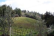
Winemaking
—both the growing of the grapes and their vinting—is an important part of the economic and cultural life of Santa Cruz County.
The wines of the David Bruce Winery
and Ridge Vineyards
were selected for tasting in the Paris Wine Tasting of 1976 (Tabor, p.167-169).
County (United States)
In the United States, a county is a geographic subdivision of a state , usually assigned some governmental authority. The term "county" is used in 48 of the 50 states; Louisiana is divided into parishes and Alaska into boroughs. Parishes and boroughs are called "county-equivalents" by the U.S...
located on the Pacific
Pacific Ocean
The Pacific Ocean is the largest of the Earth's oceanic divisions. It extends from the Arctic in the north to the Southern Ocean in the south, bounded by Asia and Australia in the west, and the Americas in the east.At 165.2 million square kilometres in area, this largest division of the World...
coast of the U.S. state
U.S. state
A U.S. state is any one of the 50 federated states of the United States of America that share sovereignty with the federal government. Because of this shared sovereignty, an American is a citizen both of the federal entity and of his or her state of domicile. Four states use the official title of...
of California
California
California is a state located on the West Coast of the United States. It is by far the most populous U.S. state, and the third-largest by land area...
, on the California Central Coast. The county forms the northern coast of the Monterey Bay
Monterey Bay
Monterey Bay is a bay of the Pacific Ocean, along the central coast of California. The bay is south of San Francisco and San Jose, between the cities of Santa Cruz and Monterey....
. (Monterey County
Monterey County, California
Monterey County is a county located on the Pacific coast of the U.S. state of California, its northwestern section forming the southern half of Monterey Bay. The northern half of the bay is in Santa Cruz County. As of 2010, the population was 415,057. The county seat and largest city is Salinas...
forms the southern coast). As of the 2010 U.S. Census, its population was 262,382. The county seat
County seat
A county seat is an administrative center, or seat of government, for a county or civil parish. The term is primarily used in the United States....
is Santa Cruz
Santa Cruz, California
Santa Cruz is the county seat and largest city of Santa Cruz County, California in the US. As of the 2010 U.S. Census, Santa Cruz had a total population of 59,946...
. Santa Cruz County is a member of the regional governmental agency Association of Monterey Bay Area Governments
Association of Monterey Bay Area Governments
The Association of Monterey Bay Area Governments, or AMBAG, is a regional governmental organization which consists of representation of a large number of public agencies within Monterey County, Santa Cruz County and San Benito County, California...
and is one of 11 counties in the U.S. Census Bureau's definition of the San Francisco Bay Area Combined Statistical Area
San Francisco Bay Area Combined Statistical Area
The San Francisco Bay Area Combined Statistical Area, also known as the San Jose-San Francisco-Oakland, CA CSA, is the 6th most populous of 125 Combined Statistical Areas as defined by the United States Office of Management and Budget...
.
History
Santa Cruz County was one of the original counties of California, created in 1850 at the time of statehood.In the original act, the county was given the name of "Branciforte
Branciforte
Branciforte or as it was named originally, Villa de Branciforte, was a secular pueblo established by the Spanish in the of Las Californias Province of the Viceroyalty of New Spain, in 1797 on the eastern bluff overlooking the San Lorenzo River...
" after the Spanish
Spain
Spain , officially the Kingdom of Spain languages]] under the European Charter for Regional or Minority Languages. In each of these, Spain's official name is as follows:;;;;;;), is a country and member state of the European Union located in southwestern Europe on the Iberian Peninsula...
pueblo
Pueblo
Pueblo is a term used to describe modern communities of Native Americans in the Southwestern United States of America. The first Spanish explorers of the Southwest used this term to describe the communities housed in apartment-like structures built of stone, adobe mud, and other local material...
founded there in 1797; a major watercourse in the county, Branciforte Creek
Branciforte Creek
Branciforte Creek is a long watercourse in Santa Cruz County, California, USA. Branciforte Creek rises on the western slopes of the Santa Cruz Mountains and discharges to the San Lorenzo River, which in turn empties into the Pacific Ocean. Within the State of California Branciforte Creek is...
, bears this name. Less than two months later, the name was changed to "Santa Cruz" ("Holy Cross"). Mission Santa Cruz
Mission Santa Cruz
Mission Santa Cruz was established in 1791 and named for the feast of the Exultation of the Cross, the name that the explorer Gaspar de Portolà gave to the area when he camped on the banks of the San Lorenzo River on October 17, 1769, and erected a wooden cross...
, established in 1791 and completed in 1794, was destroyed by an earthquake
Earthquake
An earthquake is the result of a sudden release of energy in the Earth's crust that creates seismic waves. The seismicity, seismism or seismic activity of an area refers to the frequency, type and size of earthquakes experienced over a period of time...
in 1857, but a smaller-scale replica was erected in 1931.
Geography
According to the 2000 census, the county has a total area of 607.16 square miles (1,572.5 km²), of which 445.24 square miles (1,153.2 km²) (or 73.33%) is land and 161.92 square miles (419.4 km²) (or 26.67%) is water. Of California's counties, only San Francisco is physically smaller.The county is a strip about ten miles (16 km) wide between the coast and the crest of the Santa Cruz Mountains
Santa Cruz Mountains
The Santa Cruz Mountains, part of the Pacific Coast Ranges, are a mountain range in central California, United States. They form a ridge along the San Francisco Peninsula, south of San Francisco, separating the Pacific Ocean from San Francisco Bay and the Santa Clara Valley, and continuing south,...
at the northern end of the Monterey Bay
Monterey Bay
Monterey Bay is a bay of the Pacific Ocean, along the central coast of California. The bay is south of San Francisco and San Jose, between the cities of Santa Cruz and Monterey....
. It can be divided roughly into four regions: the rugged "north coast"; the urban City of Santa Cruz
Santa Cruz, California
Santa Cruz is the county seat and largest city of Santa Cruz County, California in the US. As of the 2010 U.S. Census, Santa Cruz had a total population of 59,946...
, Soquel, Capitola
Capitola, California
Capitola is a city in Santa Cruz County, California, United States, on the coast of Monterey Bay. The population was 9,918 at the 2010 census.-History:...
, and Aptos
Aptos, California
Aptos is a census-designated place in Santa Cruz County, California, United States. The population was 6,220 at the 2010 census.Aptos is an unincorporated area of Santa Cruz county, consisting of several small communities...
; mountainous Bonny Doon
Bonny Doon, California
Bonny Doon is a census-designated place in Santa Cruz County, California. Bonny Doon sits at an elevation of . The 2010 United States census reported Bonny Doon's population was 2,678....
, San Lorenzo River Valley; and fertile "south county", including Watsonville
Watsonville, California
Watsonville is a city in Santa Cruz County, California, United States. The population was 51,199 according to the 2010 census.Located on the central coast of California, the economy centers predominantly around the farming industry. It is known for growing strawberries, apples, lettuce and a host...
. Agriculture is concentrated in the coastal lowlands of the county's northern and southern ends. Most of the coastline is flanked by cliffs.
Cities and towns
Incorporated Cities:- CapitolaCapitola, CaliforniaCapitola is a city in Santa Cruz County, California, United States, on the coast of Monterey Bay. The population was 9,918 at the 2010 census.-History:...
- Santa CruzSanta Cruz, CaliforniaSanta Cruz is the county seat and largest city of Santa Cruz County, California in the US. As of the 2010 U.S. Census, Santa Cruz had a total population of 59,946...
- Scotts ValleyScotts Valley, CaliforniaScotts Valley is a small city in Santa Cruz County, California, United States, about thirty miles south of downtown San Jose and six miles north of Monterey Bay, in the upland slope of the Santa Cruz Mountains. As of the 2010 census, the city population was 11,580...
- WatsonvilleWatsonville, CaliforniaWatsonville is a city in Santa Cruz County, California, United States. The population was 51,199 according to the 2010 census.Located on the central coast of California, the economy centers predominantly around the farming industry. It is known for growing strawberries, apples, lettuce and a host...
Non-incorporated Towns and Communities:
- AmestiAmesti, CaliforniaAmesti is a census-designated place in Santa Cruz County, California, United States. The population was 3,478 at the 2010 census.Amesti is named for José Amesti, a Basque who came to California in 1822, and who was the grantee of Rancho Los Corralitos....
- AptosAptos, CaliforniaAptos is a census-designated place in Santa Cruz County, California, United States. The population was 6,220 at the 2010 census.Aptos is an unincorporated area of Santa Cruz county, consisting of several small communities...
- Aptos Hills-Larkin ValleyAptos Hills-Larkin Valley, CaliforniaAptos Hills-Larkin Valley is a census-designated place in Santa Cruz County, California, United States. The population was 2,381 at the 2010 census.-Geography:Aptos Hills-Larkin Valley is located at ....
- Ben LomondBen Lomond, CaliforniaBen Lomond is a census-designated place in Santa Cruz County, California, United States, and also the name of the mountain to the west. The population was 6,234 at the 2010 census.-History:...
- Bonny DoonBonny Doon, CaliforniaBonny Doon is a census-designated place in Santa Cruz County, California. Bonny Doon sits at an elevation of . The 2010 United States census reported Bonny Doon's population was 2,678....
- Boulder CreekBoulder Creek, CaliforniaBoulder Creek is a census-designated place in Santa Cruz County, California, United States. The population was 4,923 at the 2010 census.-Geography:Boulder Creek is located at ....
- BrookdaleBrookdale, CaliforniaBrookdale is a census-designated place in Santa Cruz County, California. Brookdale sits at an elevation of . It is located in the San Lorenzo Valley between Boulder Creek and Ben Lomond on Highway 9...
- CorralitosCorralitos, CaliforniaCorralitos is a census-designated place in Santa Cruz County, California, United States. The population was 2,326 at the 2010 census.-Geography:Corralitos is located at ....
- DavenportDavenport, CaliforniaDavenport is a census-designated place in Santa Cruz County, California. Davenport sits at an elevation of . The 2010 United States census reported Davenport's population was 408.-Situation:...
- Day ValleyDay Valley, CaliforniaDay Valley is a census-designated place in Santa Cruz County, California, United States. The population was 3,409 at the 2010 census.-Geography:Day Valley is located at ....
- FeltonFelton, California-2010:The 2010 United States Census reported that Felton had a population of 4,057. The population density was 891.2 people per square mile . The racial makeup of Felton was 3,691 White, 25 African American, 29 Native American, 69 Asian, 11 Pacific Islander, 60 from other races, and 172 from...
- FreedomFreedom, CaliforniaFreedom is a census-designated place in Santa Cruz County, California, United States. The population was 3,070 at the 2010 census.-Geography:Freedom is located at ....
- InterlakenInterlaken, CaliforniaInterlaken is a census-designated place in Santa Cruz County, California, United States. The population was 7,321 at the 2010 census.-Geography:Interlaken is located at ....
- La Selva BeachLa Selva Beach, CaliforniaLa Selva Beach is a census-designated place in Santa Cruz County, California. La Selva Beach sits at an elevation of . The 2010 United States census reported La Selva Beach's population was 2,843....
- Live OakLive Oak, Santa Cruz County, CaliforniaLive Oak is a census-designated place in Santa Cruz County, California between the towns of Santa Cruz and Capitola. Live Oak sits at an elevation of...
- Mount HermonMount Hermon, CaliforniaMount Hermon is an unincorporated community and census-designated place in Santa Cruz County, California. Mount Hermon is home to extensive conference facilities that include rope courses and rock climbing walls.-History:...
- Opal CliffsOpal Cliffs, CaliforniaOpal Cliffs is a former census-designated place in Santa Cruz County, California, United States. The population was 6,458 at the 2000 census.The Opal Cliffs CDP was abolished prior to the 2010 census.-Geography:...
- Rio del MarRio del Mar, CaliforniaRio del Mar is a census-designated place in Santa Cruz County, California, United States. The name "Rio Del Mar" was chosen as a "catchy" name to promote real estate in the area during the 1920s. There is no body of water by that name in Santa Cruz County...
- SoquelSoquel, CaliforniaSoquel is a census-designated place in Santa Cruz County, California, United States. The population was 9,644 at the 2010 census.-Geography:Soquel is located at ....
- PasatiempoPasatiempo, CaliforniaPasatiempo is an unincorporated community and census-designated place in Santa Cruz County, California, United States, located along State Route 17 between Scotts Valley and Santa Cruz. Bus service is provided by Santa Cruz Metro and the Highway 17 Express. Pasatiempo sits at an elevation of...
- Twin LakesTwin Lakes, CaliforniaTwin Lakes is a census-designated place in Santa Cruz County, California, United States. The population was 4,917 at the 2010 census.-Geography:Twin Lakes is located at ....
Adjacent counties
Major highways
- State Route 1
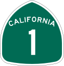 California State Route 1State Route 1 , more often called Highway 1, is a state highway that runs along much of the Pacific coast of the U.S. state of California. It is famous for running along some of the most beautiful coastlines in the world, leading to its designation as an All-American Road.Highway 1 does not run...
 - State Route 9
 California State Route 9State Route 9 is mainly a rural and mountainous route in the U.S. state of California that travels 35 miles from SR 1 near Santa Cruz to SR 17 in Los Gatos, passing through the San Lorenzo Valley and the Saratoga Gap...
 - State Route 17

- State Route 35
 California State Route 35State Route 35 in the U.S. state of California, generally known as Skyline Boulevard, is a two-lane road running along the western ridge of Silicon Valley in California. It runs from Highway 17 to San Francisco at State Route 1. It provides scenic views of both the Santa Cruz Mountains, the...
 - State Route 129
 California State Route 129State Route 129 is a state highway in the U.S. state of California in Santa Cruz County. The highway connects State Route 1 in Watsonville east to U.S. Route 101.-Route description:...
 - State Route 152
 California State Route 152State Route 152 is a state highway that runs near the latitudinal middle of the U.S. state of California from Watsonville to Route 99 southeast of Merced...
 - State Route 236
 California State Route 236State Route 236 is a state highway in the U.S. state of California. It is a short 18-mile "C" shaped highway that links to State Route 9 at both ends in the Santa Cruz Mountains. 236 links Route 9 with Governor's Camp in Big Basin State Park near the Waterman Gap.Route 236 begins in the town of...
County routes
- County Route G12

Public transportation
Santa Cruz County is served by the Santa Cruz Metropolitan Transit DistrictSanta Cruz Metropolitan Transit District
The Santa Cruz Metropolitan Transit District , or simply the Santa Cruz Metro, provides bus service throughout Santa Cruz County, California....
bus system.
A "Highway 17 Express" bus between Santa Cruz and San Jose is jointly operated by the SCMTD and the Santa Clara Valley Transportation Authority
Santa Clara Valley Transportation Authority
The Santa Clara Valley Transportation Authority is a special-purpose district responsible for public transit services, congestion management, specific highway improvement projects, and countywide transportation planning for Santa Clara County, California, United States...
. Greyhound Lines
Greyhound Lines
Greyhound Lines, Inc., based in Dallas, Texas, is an intercity common carrier of passengers by bus serving over 3,700 destinations in the United States, Canada and Mexico, operating under the well-known logo of a leaping greyhound. It was founded in Hibbing, Minnesota, USA, in 1914 and...
bus service also serves Santa Cruz County.
Airports
Watsonville Municipal AirportWatsonville Municipal Airport
Watsonville Municipal Airport is a public airport located three miles northwest of the central business district of Watsonville, a city in Santa Cruz County, California, USA. The airport covers and has two runways...
is a public general aviation airport. There are two air carriers based at the airport offering on-demand air charter:
- AirMonterey, LLC (Corporate Aircraft)
- Specialized Helicopters, LLC (Helicopters)
There is a notable private airport, Monterey Bay Academy Airport
Monterey Bay Academy Airport
Monterey Bay Academy Airport is located near the city of Watsonville in Santa Cruz County, California, USA. This private use airport is owned by the Seventh-day Adventist Church and located on the campus of the Monterey Bay Academy, site of the former Camp McQuaide.-History:In the 1940s, a small...
, which is a former military base.
The nearest airports for scheduled commercial travel include San Jose International Airport
San Jose International Airport
Norman Y. Mineta San Jose International Airport is a city-owned public-use airport serving the city of San Jose in Santa Clara County, California, United States. It is named for San Jose native Norman Yoshio Mineta, who was Transportation Secretary in the Cabinet of George W...
, Monterey Peninsula Airport
Monterey Peninsula Airport
Monterey Peninsula Airport is a regional airport located three miles southeast of the central business district of Monterey, a city in Monterey County, California, USA. It was created in 1936....
, San Francisco International Airport
San Francisco International Airport
San Francisco International Airport is a major international airport located south of downtown San Francisco, California, United States, near the cities of Millbrae and San Bruno in unincorporated San Mateo County. It is often referred to as SFO...
, and Oakland International Airport
Oakland International Airport
Oakland International Airport , also known as Metropolitan Oakland International Airport, is a public airport located south of the central business district of Oakland, a city in Alameda County, California, United States...
.
Demographics
2010
The 2010 United States Census reported that Santa Cruz County had a population of 262,382. The racial makeup of Santa Cruz County was 190,208 (72.5%) White, 2,766 (1.1%) African American, 2,253 (0.9%) Native American, 11,112 (4.2%) Asian, 349 (0.1%) Pacific Islander, 43,376 (16.5%) from other racesRace (United States Census)
Race and ethnicity in the United States Census, as defined by the Federal Office of Management and Budget and the United States Census Bureau, are self-identification data items in which residents choose the race or races with which they most closely identify, and indicate whether or not they are...
, and 12,318 (4.7%) from two or more races. Hispanic or Latino of any race were 84,092 persons (32.0%).
| Population reported at 2010 United States Census | |||||||||
|---|---|---|---|---|---|---|---|---|---|
Santa Cruz County, California Santa Cruz County is a county located on the Pacific coast of the U.S. state of California, on the California Central Coast. The county forms the northern coast of the Monterey Bay. . As of the 2010 U.S. Census, its population was 262,382. The county seat is Santa Cruz... |
Population |
American |
American |
|
Islander |
races Race (United States Census) Race and ethnicity in the United States Census, as defined by the Federal Office of Management and Budget and the United States Census Bureau, are self-identification data items in which residents choose the race or races with which they most closely identify, and indicate whether or not they are... |
more races |
or Latino (of any race) |
|
| Santa Cruz County Santa Cruz County, California Santa Cruz County is a county located on the Pacific coast of the U.S. state of California, on the California Central Coast. The county forms the northern coast of the Monterey Bay. . As of the 2010 U.S. Census, its population was 262,382. The county seat is Santa Cruz... |
262,382 | 190,208 | 2,766 | 2,253 | 11,112 | 349 | 43,376 | 12,318 | 84,092 |
cities and towns |
Population |
American |
American |
|
Islander |
races Race (United States Census) Race and ethnicity in the United States Census, as defined by the Federal Office of Management and Budget and the United States Census Bureau, are self-identification data items in which residents choose the race or races with which they most closely identify, and indicate whether or not they are... |
more races |
or Latino (of any race) |
|
| Capitola Capitola, California Capitola is a city in Santa Cruz County, California, United States, on the coast of Monterey Bay. The population was 9,918 at the 2010 census.-History:... |
9,918 | 7,963 | 123 | 59 | 424 | 10 | 869 | 470 | 1,957 |
| Santa Cruz Santa Cruz, California Santa Cruz is the county seat and largest city of Santa Cruz County, California in the US. As of the 2010 U.S. Census, Santa Cruz had a total population of 59,946... |
59,946 | 44,661 | 1,071 | 440 | 4,591 | 108 | 5,673 | 3,402 | 11,624 |
| Scotts Valley Scotts Valley, California Scotts Valley is a small city in Santa Cruz County, California, United States, about thirty miles south of downtown San Jose and six miles north of Monterey Bay, in the upland slope of the Santa Cruz Mountains. As of the 2010 census, the city population was 11,580... |
11,580 | 9,958 | 101 | 57 | 590 | 18 | 292 | 564 | 1,158 |
| Watsonville Watsonville, California Watsonville is a city in Santa Cruz County, California, United States. The population was 51,199 according to the 2010 census.Located on the central coast of California, the economy centers predominantly around the farming industry. It is known for growing strawberries, apples, lettuce and a host... |
51,199 | 22,399 | 358 | 629 | 1,664 | 40 | 23,844 | 2,265 | 41,656 |
places Census-designated place A census-designated place is a concentration of population identified by the United States Census Bureau for statistical purposes. CDPs are delineated for each decennial census as the statistical counterparts of incorporated places such as cities, towns and villages... |
Population |
American |
American |
|
Islander |
races Race (United States Census) Race and ethnicity in the United States Census, as defined by the Federal Office of Management and Budget and the United States Census Bureau, are self-identification data items in which residents choose the race or races with which they most closely identify, and indicate whether or not they are... |
more races |
or Latino (of any race) |
|
| Amesti Amesti, California Amesti is a census-designated place in Santa Cruz County, California, United States. The population was 3,478 at the 2010 census.Amesti is named for José Amesti, a Basque who came to California in 1822, and who was the grantee of Rancho Los Corralitos.... |
3,478 | 1,889 | 12 | 41 | 89 | 1 | 1,309 | 137 | 2,273 |
| Aptos Aptos, California Aptos is a census-designated place in Santa Cruz County, California, United States. The population was 6,220 at the 2010 census.Aptos is an unincorporated area of Santa Cruz county, consisting of several small communities... |
6,220 | 5,420 | 58 | 43 | 247 | 8 | 175 | 269 | 611 |
| Aptos Hills-Larkin Valley Aptos Hills-Larkin Valley, California Aptos Hills-Larkin Valley is a census-designated place in Santa Cruz County, California, United States. The population was 2,381 at the 2010 census.-Geography:Aptos Hills-Larkin Valley is located at .... |
2,381 | 1,936 | 12 | 5 | 55 | 1 | 295 | 77 | 541 |
| Ben Lomond Ben Lomond, California Ben Lomond is a census-designated place in Santa Cruz County, California, United States, and also the name of the mountain to the west. The population was 6,234 at the 2010 census.-History:... |
6,234 | 5,692 | 32 | 51 | 70 | 11 | 98 | 280 | 515 |
| Bonny Doon Bonny Doon, California Bonny Doon is a census-designated place in Santa Cruz County, California. Bonny Doon sits at an elevation of . The 2010 United States census reported Bonny Doon's population was 2,678.... |
2,678 | 2,474 | 9 | 15 | 51 | 5 | 48 | 76 | 168 |
| Boulder Creek Boulder Creek, California Boulder Creek is a census-designated place in Santa Cruz County, California, United States. The population was 4,923 at the 2010 census.-Geography:Boulder Creek is located at .... |
4,923 | 4,429 | 54 | 31 | 81 | 5 | 119 | 204 | 366 |
| Brookdale Brookdale, California Brookdale is a census-designated place in Santa Cruz County, California. Brookdale sits at an elevation of . It is located in the San Lorenzo Valley between Boulder Creek and Ben Lomond on Highway 9... |
1,991 | 1,790 | 9 | 12 | 19 | 8 | 66 | 87 | 202 |
| Corralitos Corralitos, California Corralitos is a census-designated place in Santa Cruz County, California, United States. The population was 2,326 at the 2010 census.-Geography:Corralitos is located at .... |
2,326 | 1,980 | 16 | 12 | 48 | 1 | 190 | 79 | 532 |
| Davenport Davenport, California Davenport is a census-designated place in Santa Cruz County, California. Davenport sits at an elevation of . The 2010 United States census reported Davenport's population was 408.-Situation:... |
408 | 272 | 6 | 5 | 12 | 0 | 82 | 31 | 172 |
| Day Valley Day Valley, California Day Valley is a census-designated place in Santa Cruz County, California, United States. The population was 3,409 at the 2010 census.-Geography:Day Valley is located at .... |
3,409 | 2,898 | 20 | 23 | 85 | 4 | 208 | 171 | 470 |
| Felton Felton, California -2010:The 2010 United States Census reported that Felton had a population of 4,057. The population density was 891.2 people per square mile . The racial makeup of Felton was 3,691 White, 25 African American, 29 Native American, 69 Asian, 11 Pacific Islander, 60 from other races, and 172 from... |
4,057 | 3,691 | 25 | 29 | 69 | 11 | 60 | 172 | 283 |
| Freedom Freedom, California Freedom is a census-designated place in Santa Cruz County, California, United States. The population was 3,070 at the 2010 census.-Geography:Freedom is located at .... |
3,070 | 1,452 | 44 | 31 | 100 | 0 | 1,285 | 158 | 2,170 |
| Interlaken Interlaken, California Interlaken is a census-designated place in Santa Cruz County, California, United States. The population was 7,321 at the 2010 census.-Geography:Interlaken is located at .... |
7,321 | 3,856 | 58 | 128 | 302 | 2 | 2,573 | 402 | 5,261 |
| La Selva Beach La Selva Beach, California La Selva Beach is a census-designated place in Santa Cruz County, California. La Selva Beach sits at an elevation of . The 2010 United States census reported La Selva Beach's population was 2,843.... |
2,843 | 2,399 | 27 | 23 | 116 | 3 | 146 | 129 | 372 |
| Live Oak Live Oak, Santa Cruz County, California Live Oak is a census-designated place in Santa Cruz County, California between the towns of Santa Cruz and Capitola. Live Oak sits at an elevation of... |
17,158 | 12,636 | 240 | 171 | 773 | 41 | 2,444 | 853 | 4,796 |
| Lompico Lompico, California Lompico is a census-designated place in Santa Cruz County, California. Lompico sits at an elevation of . Lompico shares the 95018 ZIP code with Felton. Lompico was founded in 1927. It is in area code 831... |
1,137 | 1,005 | 6 | 12 | 21 | 4 | 25 | 64 | 115 |
| Mount Hermon Mount Hermon, California Mount Hermon is an unincorporated community and census-designated place in Santa Cruz County, California. Mount Hermon is home to extensive conference facilities that include rope courses and rock climbing walls.-History:... |
1,037 | 964 | 6 | 3 | 14 | 1 | 18 | 31 | 83 |
| Pajaro Dunes Pajaro Dunes, California Pajaro Dunes is a census-designated place in Santa Cruz County, California. Pajaro Dunes sits at an elevation of . The 2010 United States census reported Pajaro Dunes's population was 144.-Geography:... |
144 | 92 | 0 | 0 | 6 | 0 | 45 | 1 | 54 |
| Paradise Park Paradise Park, California Paradise Park is a census-designated place in Santa Cruz County, California. Paradise Park sits at an elevation of . The 2010 United States census reported Paradise Park's population was 389.-Geography:... |
389 | 371 | 2 | 3 | 3 | 0 | 4 | 6 | 15 |
| Pasatiempo Pasatiempo, California Pasatiempo is an unincorporated community and census-designated place in Santa Cruz County, California, United States, located along State Route 17 between Scotts Valley and Santa Cruz. Bus service is provided by Santa Cruz Metro and the Highway 17 Express. Pasatiempo sits at an elevation of... |
1,041 | 925 | 5 | 6 | 34 | 1 | 22 | 48 | 85 |
| Pleasure Point Pleasure Point, California Pleasure Point is a census-designated place in Santa Cruz County, California. Pleasure Point sits at an elevation of . The 2010 United States census reported Pleasure Point's population was 5,846.-Geography:... |
5,846 | 4,847 | 63 | 45 | 144 | 5 | 506 | 236 | 1,140 |
| Rio del Mar Rio del Mar, California Rio del Mar is a census-designated place in Santa Cruz County, California, United States. The name "Rio Del Mar" was chosen as a "catchy" name to promote real estate in the area during the 1920s. There is no body of water by that name in Santa Cruz County... |
9,216 | 8,310 | 61 | 50 | 313 | 7 | 188 | 287 | 899 |
| Seacliff Seacliff, California Seacliff is a census-designated place in Santa Cruz County, California. Seacliff sits at an elevation of . The 2010 United States census reported Seacliff's population was 3,267.-Geography:... |
3,267 | 2,758 | 28 | 40 | 100 | 4 | 189 | 148 | 482 |
| Soquel Soquel, California Soquel is a census-designated place in Santa Cruz County, California, United States. The population was 9,644 at the 2010 census.-Geography:Soquel is located at .... |
9,644 | 7,898 | 85 | 71 | 356 | 21 | 693 | 520 | 1,606 |
| Twin Lakes Twin Lakes, California Twin Lakes is a census-designated place in Santa Cruz County, California, United States. The population was 4,917 at the 2010 census.-Geography:Twin Lakes is located at .... |
4,917 | 3,900 | 70 | 61 | 126 | 8 | 534 | 218 | 1,109 |
| Zayante Zayante, California Zayante is a census-designated place in Santa Cruz County, California. It is a residential area located on Zayante Creek. Zayante sits at an elevation of . The 2010 United States census reported Zayante's population was 705.-History:... |
705 | 647 | 10 | 6 | 4 | 0 | 18 | 20 | 57 |
communities Unincorporated area In law, an unincorporated area is a region of land that is not a part of any municipality.To "incorporate" in this context means to form a municipal corporation, a city, town, or village with its own government. An unincorporated community is usually not subject to or taxed by a municipal government... |
Population |
American |
American |
|
Islander |
races Race (United States Census) Race and ethnicity in the United States Census, as defined by the Federal Office of Management and Budget and the United States Census Bureau, are self-identification data items in which residents choose the race or races with which they most closely identify, and indicate whether or not they are... |
more races |
or Latino (of any race) |
|
| All others not CDPs (combined) | 23,899 | 20,696 | 155 | 151 | 605 | 21 | 1,358 | 913 | 3,320 |
2000
As of the censusCensus
A census is the procedure of systematically acquiring and recording information about the members of a given population. It is a regularly occurring and official count of a particular population. The term is used mostly in connection with national population and housing censuses; other common...
of 2000, there were 255,602 people, 91,139 households, and 57,144 families residing in the county. The population density
Population density
Population density is a measurement of population per unit area or unit volume. It is frequently applied to living organisms, and particularly to humans...
was 574 people per square mile (222/km²). There were 98,873 housing units at an average density of 222 per square mile (86/km²).
There were 91,139 households out of which 31.90% had children under the age of 18 living with them, 48.00% were married couples
Marriage
Marriage is a social union or legal contract between people that creates kinship. It is an institution in which interpersonal relationships, usually intimate and sexual, are acknowledged in a variety of ways, depending on the culture or subculture in which it is found...
living together, 10.20% had a female householder with no husband present, and 37.30% were non-families. 25.10% of all households were made up of individuals and 8.20% had someone living alone who was 65 years of age or older. The average household size was 2.71 and the average family size was 3.25.
In the county, the population was spread out with 23.80% under the age of 18, 11.90% from 18 to 24, 30.80% from 25 to 44, 23.50% from 45 to 64, and 10.00% who were 65 years of age or older. The median age was 35 years. For every 100 females there were 99.70 males. For every 100 females age 18 and over, there were 97.80 males.
The median income for a household in the county was $53,998, and the median income for a family was $61,941. Males had a median income of $46,291 versus $33,514 for females. The per capita income
Per capita income
Per capita income or income per person is a measure of mean income within an economic aggregate, such as a country or city. It is calculated by taking a measure of all sources of income in the aggregate and dividing it by the total population...
for the county was $26,396. About 6.70% of families and 11.90% of the population were below the poverty line, including 12.50% of those under age 18 and 6.30% of those age 65 or over.
Santa Cruz county residents tend to be well-educated. 38.3% of residents age 25 and older hold a bachelor's degree at least, significantly higher than the national average of 27.2% and the state average of 29.5%.
Environmental features
Santa Cruz County is home to the following endangered speciesEndangered species
An endangered species is a population of organisms which is at risk of becoming extinct because it is either few in numbers, or threatened by changing environmental or predation parameters...
:
- Brown PelicanBrown PelicanThe Brown Pelican is the smallest of the eight species of pelican, although it is a large bird in nearly every other regard. It is in length, weighs from and has a wingspan from .-Range and habits:...
- California Clapper RailCalifornia Clapper RailThe California Clapper Rail is an endangered subspecies of the Clapper Rail . It is found principally in California's San Francisco Bay, and also in Monterey Bay and Morro Bay...
- California Red-legged FrogCalifornia Red-legged FrogThe California red-legged frog, Rana draytonii, is a moderate to large species of frog. It is known under the scientific name Rana draytonii, after being long included with the northern red-legged frog The California red-legged frog, Rana draytonii, is a moderate to large (4.4–14 cm) species...
- California Tiger SalamanderCalifornia Tiger SalamanderThe California tiger salamander is a vulnerable amphibian native to Northern California. Previously considered to be a Tiger Salamander subspecies, the California tiger salamander was recently designated a separate species again...
- Coho SalmonCoho salmonThe Coho salmon, Oncorhynchus kisutch, is a species of anadromous fish in the salmon family. Coho salmon are also known as silver salmon or "silvers". It is the state animal of Chiba, Japan.-Description:...
- Marbled MurreletMarbled MurreletThe Marbled Murrelet is a small seabird from the North Pacific. It is a member of the auk family. It nests in old-growth forests or on the ground at higher latitudes where trees cannot grow...
- Mount Hermon June Beetle
- Ohlone Tiger BeetleOhlone tiger beetleThe Ohlone tiger beetle, Cicindela ohlone, is endemic to California. It was first discovered by Isaac Field in March 1987 and was named and described in 1993 by Richard Freitag and David H. Kavanaugh. C. ohlone is part of the Cicindela genus and is most closely related to C. purpurea.C...
- San Francisco garter snakeSan Francisco garter snakeThe San Francisco Garter Snake is a slender multi-colored colubrid snake. Designated as an endangered species since the year 1967, it is endemic to California and resides only in San Mateo County, California, and the extreme northern part of coastal Santa Cruz County, California...
- Santa Cruz Long-toed SalamanderSanta Cruz Long-toed SalamanderThe Santa Cruz long-toed salamander is an endangered subspecies of the long-toed salamander, which is found only close to a few isolated ponds in Santa Cruz County and Monterey County, California. It has a black body, broken yellow or orange irregular striping along its spine, and a tail fin well...
- Santa Cruz TarweedSanta Cruz TarweedThe Santa Cruz Tarweed is an endangered plant endemic to certain coastal terraces in Northern California. Its principal range is in Santa Cruz County and Monterey County, but smaller colonies have been found slightly to the north...
- Smith's Blue ButterflySmith's blue butterflySmith's blue butterfly, Euphilotes enoptes smithi, is an organism in the family Lycaenidae, which is also known as the "gossamer wing" family...
- Southern Sea Otter
- Steelhead Trout
- Tidewater GobyTidewater gobyThe tidewater goby Eucyclogobius newberryi is a goby native to lagoons of streams along the coast of California.-Taxonomy:The genus name translates as "true cycloid goby", referring to the scales, while the species epithet is in honor of J. S. Newberry. The tidewater goby is the sole member of its...
- Western Snowy Plover
- Yellow-billed CuckooYellow-billed CuckooThe Yellow-billed Cuckoo, Coccyzus americanus, is a cuckoo. Common folk-names for this bird in the southern United States are Rain Crow and Storm Crow...
- Zayante band-winged grasshopper
Año Nuevo State Marine Conservation Area
Año Nuevo State Marine Conservation Area
Año Nuevo State Marine Conservation Area is one of two adjoining marine protected areas off the coast of San Mateo and Santa Cruz Counties, on California’s central coast.The area is approximately 55 miles south of San Francisco. The SMCA is 11.07 square miles...
, Greyhound Rock State Marine Conservation Area
Greyhound Rock State Marine Conservation Area
Greyhound Rock State Marine Conservation Area is one of two adjoining marine protected areas off the coast of San Mateo County and Santa Cruz County, on California’s central coast. The area is approximately south of San Francisco. The SMCA is...
and Natural Bridges State Marine Reserve
Natural Bridges State Marine Reserve
Natural Bridges State Marine Reserve is a marine protected area located at the northern edge of Santa Cruz, California, approximately south of San Francisco. The SMR covers The SMR protects all marine life within its boundaries. Fishing or other removal of any living marine resource is...
are marine protected areas off the coast of Santa Cruz County. Like underwater parks, these marine protected areas help conserve ocean wildlife and marine ecosystems.
Colleges and universities
Four-year universities:- University of California, Santa CruzUniversity of California, Santa CruzThe University of California, Santa Cruz, also known as UC Santa Cruz or UCSC, is a public, collegiate university; one of ten campuses in the University of California...
(public) in Santa Cruz, CaliforniaSanta Cruz, CaliforniaSanta Cruz is the county seat and largest city of Santa Cruz County, California in the US. As of the 2010 U.S. Census, Santa Cruz had a total population of 59,946... - Bethany UniversityBethany UniversityBethany University was a four-year private Christian university located in Scotts Valley, California in Santa Cruz County. It operated from 1919 until closing in 2011 and was endorsed by the Assemblies of God USA, a Pentecostal denomination, and was the denomination's oldest college at the time of...
(private, now defunct) in Scotts Valley, CaliforniaScotts Valley, CaliforniaScotts Valley is a small city in Santa Cruz County, California, United States, about thirty miles south of downtown San Jose and six miles north of Monterey Bay, in the upland slope of the Santa Cruz Mountains. As of the 2010 census, the city population was 11,580...
Two-year colleges:
- Cabrillo CollegeCabrillo CollegeCabrillo College is a public community college offering associate degrees and certificates in more than 70 fields of study such as: engineering, computer science, allied health , public safety, marine biology and the visual and performing arts. The college itself is named after the explorer Juan...
(public) in Aptos, CaliforniaAptos, CaliforniaAptos is a census-designated place in Santa Cruz County, California, United States. The population was 6,220 at the 2010 census.Aptos is an unincorporated area of Santa Cruz county, consisting of several small communities...
Politics
| Year | GOP Republican Party (United States) The Republican Party is one of the two major contemporary political parties in the United States, along with the Democratic Party. Founded by anti-slavery expansion activists in 1854, it is often called the GOP . The party's platform generally reflects American conservatism in the U.S... |
DEM Democratic Party (United States) The Democratic Party is one of two major contemporary political parties in the United States, along with the Republican Party. The party's socially liberal and progressive platform is largely considered center-left in the U.S. political spectrum. The party has the lengthiest record of continuous... |
Others |
|---|---|---|---|
| 2008 United States presidential election, 2008 The United States presidential election of 2008 was the 56th quadrennial presidential election. It was held on November 4, 2008. Democrat Barack Obama, then the junior United States Senator from Illinois, defeated Republican John McCain, the senior U.S. Senator from Arizona. Obama received 365... |
77.5% 98,745 | 2.9% 3,747 | |
| 2004 United States presidential election, 2004 The United States presidential election of 2004 was the United States' 55th quadrennial presidential election. It was held on Tuesday, November 2, 2004. Republican Party candidate and incumbent President George W. Bush defeated Democratic Party candidate John Kerry, the then-junior U.S. Senator... |
73.0% 89,102 | 2.2% 2,628 | |
| 2000 United States presidential election, 2000 The United States presidential election of 2000 was a contest between Republican candidate George W. Bush, then-governor of Texas and son of former president George H. W. Bush , and Democratic candidate Al Gore, then-Vice President.... |
61.5% 66,618 | 11.2% 12,105 | |
| 1996 United States presidential election, 1996 The United States presidential election of 1996 was a contest between the Democratic national ticket of President Bill Clinton of Arkansas and Vice President Al Gore of Tennessee and the Republican national ticket of former Senator Bob Dole of Kansas for President and former Housing Secretary Jack... |
56.5% 58,250 | 16.5% 17,046 | |
| 1992 United States presidential election, 1992 The United States presidential election of 1992 had three major candidates: Incumbent Republican President George Bush; Democratic Arkansas Governor Bill Clinton, and independent Texas businessman Ross Perot.... |
58.1% 66,183 | 20.1% 22,893 | |
| 1988 United States presidential election, 1988 The United States presidential election of 1988 featured no incumbent president, as President Ronald Reagan was unable to seek re-election after serving the maximum two terms allowed by the Twenty-second Amendment. Reagan's Vice President, George H. W. Bush, won the Republican nomination, while the... |
61.5% 63,133 | 1.7% 1,750 | |
| 1984 United States presidential election, 1984 The United States presidential election of 1984 was a contest between the incumbent President Ronald Reagan, the Republican candidate, and former Vice President Walter Mondale, the Democratic candidate. Reagan was helped by a strong economic recovery from the deep recession of 1981–1982... |
53.3% 49,091 | 1.5% 1,404 | |
| 1980 United States presidential election, 1980 The United States presidential election of 1980 featured a contest between incumbent Democrat Jimmy Carter and his Republican opponent, Ronald Reagan, as well as Republican Congressman John B. Anderson, who ran as an independent... |
37.7% 32,346 | 18.8% 16,111 | |
| 1976 United States presidential election, 1976 The United States presidential election of 1976 followed the resignation of President Richard Nixon in the wake of the Watergate scandal. It pitted incumbent President Gerald Ford, the Republican candidate, against the relatively unknown former governor of Georgia, Jimmy Carter, the Democratic... |
51.1% 37,772 | 5.9% 4,325 | |
| 1972 United States presidential election, 1972 The United States presidential election of 1972 was the 47th quadrennial United States presidential election. It was held on November 7, 1972. The Democratic Party's nomination was eventually won by Senator George McGovern, who ran an anti-war campaign against incumbent Republican President Richard... |
46.4% 32,336 | 3.8% 2,624 | |
| 1968 United States presidential election, 1968 The United States presidential election of 1968 was the 46th quadrennial United States presidential election. Coming four years after Democrat Lyndon B. Johnson won in a historic landslide, it saw Johnson forced out of the race and Republican Richard Nixon elected... |
41.0% 20,492 | 8.2% 4,087 | |
| 1964 United States presidential election, 1964 The United States presidential election of 1964 was held on November 3, 1964. Incumbent President Lyndon B. Johnson had come to office less than a year earlier following the assassination of his predecessor, John F. Kennedy. Johnson, who had successfully associated himself with Kennedy's... |
58.5% 26,714 | 0.2% 94 | |
| 1960 United States presidential election, 1960 The United States presidential election of 1960 was the 44th American presidential election, held on November 8, 1960, for the term beginning January 20, 1961, and ending January 20, 1965. The incumbent president, Republican Dwight D. Eisenhower, was not eligible to run again. The Republican Party... |
40.0% 16,659 | 0.5% 187 | |
| 1956 United States presidential election, 1956 The United States presidential election of 1956 saw a popular Dwight D. Eisenhower successfully run for re-election. The 1956 election was a rematch of 1952, as Eisenhower's opponent in 1956 was Democrat Adlai Stevenson, whom Eisenhower had defeated four years earlier.Incumbent President Eisenhower... |
36.2% 12,574 | 0.3% 93 | |
| 1952 United States presidential election, 1952 The United States presidential election of 1952 took place in an era when Cold War tension between the United States and the Soviet Union was escalating rapidly. In the United States Senate, Republican Senator Joseph McCarthy of Wisconsin had become a national figure after chairing congressional... |
31.8% 11,536 | 1.1% 391 | |
| 1948 United States presidential election, 1948 The United States presidential election of 1948 is considered by most historians as the greatest election upset in American history. Virtually every prediction indicated that incumbent President Harry S. Truman would be defeated by Republican Thomas E. Dewey. Truman won, overcoming a three-way... |
37.0% 9,862 | 5.4% 1,433 | |
| 1944 United States presidential election, 1944 The United States presidential election of 1944 took place while the United States was preoccupied with fighting World War II. President Franklin D. Roosevelt had been in office longer than any other president, but remained popular. Unlike 1940, there was little doubt that Roosevelt would run for... |
45.3% 9,357 | 0.9% 178 | |
| 1940 United States presidential election, 1940 The United States presidential election of 1940 was fought in the shadow of World War II as the United States was emerging from the Great Depression. Incumbent President Franklin D. Roosevelt , a Democrat, broke with tradition and ran for a third term, which became a major issue... |
47.5% 10,683 | 1.6% 350 | |
| 1936 United States presidential election, 1936 The United States presidential election of 1936 was the most lopsided presidential election in the history of the United States in terms of electoral votes. In terms of the popular vote, it was the third biggest victory since the election of 1820, which was not seriously contested.The election took... |
52.1% 9,326 | 1.8% 322 | |
| 1932 United States presidential election, 1932 The United States presidential election of 1932 took place as the effects of the Wall Street Crash of 1929, the Smoot-Hawley Tariff Act of 1930, the Revenue Act of 1932, and the Great Depression were being felt intensely across the country. President Herbert Hoover's popularity was falling as... |
55.0% 8,246 | 4.9% 739 | |
| 1928 United States presidential election, 1928 The United States presidential election of 1928 pitted Republican Herbert Hoover against Democrat Al Smith. The Republicans were identified with the booming economy of the 1920s, whereas Smith, a Roman Catholic, suffered politically from Anti-Catholic prejudice, his anti-prohibitionist stance, and... |
30.5% 3,688 | 0.9% 112 | |
| 1924 United States presidential election, 1924 The United States presidential election of 1924 was won by incumbent President Calvin Coolidge, the Republican candidate.Coolidge was vice-president under Warren G. Harding and became president in 1923 when Harding died in office. Coolidge was given credit for a booming economy at home and no... |
9.0% 801 | 30.1% 2,676 | |
| 1920 United States presidential election, 1920 The United States presidential election of 1920 was dominated by the aftermath of World War I and a hostile response to certain policies of Woodrow Wilson, the Democratic president. The wartime economic boom had collapsed. Politicians were arguing over peace treaties and the question of America's... |
24.5% 1,957 | 9.2% 732 |
Santa Cruz County was a Republican stronghold for most of the 20th century; from 1920 to 1972 the only Democrats to carry Santa Cruz were Franklin D. Roosevelt
Franklin D. Roosevelt
Franklin Delano Roosevelt , also known by his initials, FDR, was the 32nd President of the United States and a central figure in world events during the mid-20th century, leading the United States during a time of worldwide economic crisis and world war...
in 1932 and 1936 and Lyndon B. Johnson
Lyndon B. Johnson
Lyndon Baines Johnson , often referred to as LBJ, was the 36th President of the United States after his service as the 37th Vice President of the United States...
in 1964. But the opening of UCSC in 1965 caused the county's political landscape to dramatically change. Today, it is a strongly Democratic
Democratic Party (United States)
The Democratic Party is one of two major contemporary political parties in the United States, along with the Republican Party. The party's socially liberal and progressive platform is largely considered center-left in the U.S. political spectrum. The party has the lengthiest record of continuous...
county in presidential
President of the United States
The President of the United States of America is the head of state and head of government of the United States. The president leads the executive branch of the federal government and is the commander-in-chief of the United States Armed Forces....
and congressional
United States Congress
The United States Congress is the bicameral legislature of the federal government of the United States, consisting of the Senate and the House of Representatives. The Congress meets in the United States Capitol in Washington, D.C....
elections. The last Republican
Republican Party (United States)
The Republican Party is one of the two major contemporary political parties in the United States, along with the Democratic Party. Founded by anti-slavery expansion activists in 1854, it is often called the GOP . The party's platform generally reflects American conservatism in the U.S...
to carry the county was Ronald Reagan
Ronald Reagan
Ronald Wilson Reagan was the 40th President of the United States , the 33rd Governor of California and, prior to that, a radio, film and television actor....
in 1980
United States presidential election, 1980
The United States presidential election of 1980 featured a contest between incumbent Democrat Jimmy Carter and his Republican opponent, Ronald Reagan, as well as Republican Congressman John B. Anderson, who ran as an independent...
, and the last Republican to win a majority in the county was Richard Nixon
Richard Nixon
Richard Milhous Nixon was the 37th President of the United States, serving from 1969 to 1974. The only president to resign the office, Nixon had previously served as a US representative and senator from California and as the 36th Vice President of the United States from 1953 to 1961 under...
in 1968
United States presidential election, 1968
The United States presidential election of 1968 was the 46th quadrennial United States presidential election. Coming four years after Democrat Lyndon B. Johnson won in a historic landslide, it saw Johnson forced out of the race and Republican Richard Nixon elected...
. The last Republican to represent a significant portion of Santa Cruz in Congress was Burt L. Talcott
Burt L. Talcott
Burt Lacklen Talcott is a former member of the United States Congress from the State of California.-Military career:Born in Billings, Montana Talcott received his degree from Stanford University in 1942, after which he enlisted in the United States Army Air Corps where he became a bomber pilot...
, who was defeated in 1976 by Leon Panetta
Leon Panetta
Leon Edward Panetta is the 23rd and current United States Secretary of Defense, serving in the administration of President Barack Obama since 2011. Prior to taking office, he served as Director of the Central Intelligence Agency...
.
Santa Cruz is part of California's 14th
California's 14th congressional district
California's 14th congressional district is a congressional district in the U.S. state of California. It is located between San Francisco and San Jose. The district includes portions of San Mateo, Santa Clara and Santa Cruz counties and most notably contains part of Silicon Valley. Major cities in...
and 17th
California's 17th congressional district
California's 17th congressional district is a congressional district in the U.S. state of California that covers all of Monterey and San Benito counties, as well as part of Santa Cruz County...
congressional districts, which are held by Democrats Anna Eshoo
Anna Eshoo
Anna Georges Eshoo is the U.S. Representative for , serving since 1993. She is a member of the Democratic Party. The district, which includes part of Silicon Valley, includes the cities of Redwood City, Sunnyvale, Mountain View and Palo Alto...
and Sam Farr
Sam Farr
Samuel S. "Sam" Farr is the U.S. Representative for , serving since 1993. He is a member of the Democratic Party. He was elected to Congress in a 1993 special election when longtime Democratic Rep...
, respectively. In the State Assembly
California State Assembly
The California State Assembly is the lower house of the California State Legislature. There are 80 members in the Assembly, representing an approximately equal number of constituents, with each district having a population of at least 420,000...
Santa Cruz is in the 27th
California's 27th State Assembly district
California's 27th State Assembly District is one of 80 districts in the California State Assembly. It is currently represented by Democrat Bill Monning of Carmel.-District profile:Monterey County - 44.18%*Carmel Valley Village*Carmel-by-the-Sea...
and 28th
California's 28th State Assembly district
California's 28th State Assembly District is one of 80 districts in the California State Assembly. It is currently represented by Democrat Luis Alejo of Watsonville.-District profile:Monterey County - 55.82%*Aromas*Boronda*Bradley*Chualar...
Assembly districts, which are held by Democrats Bill Monning and Anna Caballero, respectively. In the State Senate
California State Senate
The California State Senate is the upper house of the California State Legislature. There are 40 state senators. The state legislature meets in the California State Capitol in Sacramento. The Lieutenant Governor is the ex officio President of the Senate and may break a tied vote...
, Santa Cruz is part of the 11th
California's 11th State Senate district
California's 11th State Senate District is one of 40 Senate Districts. It is currently represented by Democrat Joe Simitian of Palo Alto.-District profile:...
and 15th
California's 15th State Senate district
California's 15th State Senate district is one of 40 California State Senate districts. It was most recently represented by Republican Abel Maldonado of Santa Maria, who resigned on April 27, 2010, to become Lieutenant Governor of California...
districts, which are held by Democrat Joe Simitian
Joe Simitian
Saren Joseph Simitian is a Democratic California State Senator elected in 2004. Simitian represents the 11th Senate District, which encompasses all or part of 13 cities in San Mateo, Santa Clara, and Santa Cruz counties....
and Republican Sam Blakeslee
Sam Blakeslee
Samuel Norman Blakeslee is a Republican California State Senator representing California's 15th State Senate district, a former California State Assemblyman from California's 33rd State Assembly district, and a former State Assembly Republican Leader...
as of the 17 August 2010 special runoff election, respectively.
In 2008, 71.4% of voters in Santa Cruz County voted against Proposition 8, which amended the California Constitution to ban same-sex marriages.
Top employers
According to the County's 2010 Comprehensive Annual Financial Report, the top employers in the county are:| # | Employer | # of Employees |
|---|---|---|
| 1 | University of California, Santa Cruz University of California, Santa Cruz The University of California, Santa Cruz, also known as UC Santa Cruz or UCSC, is a public, collegiate university; one of ten campuses in the University of California... |
1,000-4,999 |
| 2 | Pajaro Valley Unified School District Pajaro Valley Unified School District Pajaro Valley Unified School District is a school district based in Watsonville, California, USA. The Superintendent is Dorma Baker. The District is overseen by a seven members of the Board of Trustees that meets an average of twice a month.... |
1,000-4,999 |
| 3 | County of Santa Cruz | 1,000-4,999 |
| 4 | Dominican Hospital Catholic Healthcare West Catholic Healthcare West is a California-based not-for-profit public benefit corporation that operates hospitals in California, Arizona, and Nevada. As such, it is exempt from federal and state income taxes... |
1,000-4,999 |
| 5 | Santa Cruz Beach Boardwalk Santa Cruz Beach Boardwalk The Santa Cruz Beach Boardwalk is an oceanfront amusement park in Santa Cruz, California. Founded in 1907, it is California's oldest surviving amusement park and one of the few seaside parks on the West Coast of the United States.- Overview :... |
1,000-4,999 |
| 6 | Cabrillo College Cabrillo College Cabrillo College is a public community college offering associate degrees and certificates in more than 70 fields of study such as: engineering, computer science, allied health , public safety, marine biology and the visual and performing arts. The college itself is named after the explorer Juan... |
500-999 |
| 7 | Santa Cruz City School District | 500-999 |
| 8 | City of Santa Cruz Santa Cruz, California Santa Cruz is the county seat and largest city of Santa Cruz County, California in the US. As of the 2010 U.S. Census, Santa Cruz had a total population of 59,946... |
500-999 |
| 9 | Seagate Technology Seagate Technology Seagate Technology is one of the world's largest manufacturers of hard disk drives. Incorporated in 1978 as Shugart Technology, Seagate is currently incorporated in Dublin, Ireland and has its principal executive offices in Scotts Valley, California, United States.-1970s:On November 1, 1979... |
500-999 |
| 10 | Watsonville Community Hospital Community Health Systems Community Health Systems Inc. is a Fortune 500 company based in Franklin, Tennessee. It is the largest non-urban provider of general hospital healthcare services in the United States in terms of number of acute care facilities. As of May 2009, it operates 120 hospitals in 28 states. After... |
500-999 |
| 11 | West Marine West Marine West Marine is an American company based in Watsonville, California which operates a chain of boating supply and fishing retail stores. They operate over 300 retail stores in North America.-History:... |
500-999 |
| 12 | Plantronics Plantronics Plantronics is an electronics company producing audio communications equipment for business and consumers. Its' products provide unified communications, mobile use, gaming and music... |
500-999 |
Winemaking and wineries
Winemaking
Winemaking
Winemaking, or vinification, is the production of wine, starting with selection of the grapes or other produce and ending with bottling the finished wine. Although most wine is made from grapes, it may also be made from other fruit or non-toxic plant material...
—both the growing of the grapes and their vinting—is an important part of the economic and cultural life of Santa Cruz County.
The wines of the David Bruce Winery
David Bruce Winery
David Bruce Winery is a California winery located at about elevation in the Santa Cruz Mountains AVA above Silicon Valley in Northern California. It was established by dermatologist David Bruce, M.D., in 1961 about a mile away from the Martin Ray Vineyard that often appears on vineyard designated...
and Ridge Vineyards
Ridge Vineyards
Ridge Vineyards is a California winery specializing in premium Cabernet Sauvignon, Zinfandel, and Chardonnay wines. Ridge produces wine at two winery locations in northern California...
were selected for tasting in the Paris Wine Tasting of 1976 (Tabor, p.167-169).
See also
- Hiking trails in Santa Cruz County
- List of school districts in Santa Cruz County, California
- National Register of Historic Places listings in Santa Cruz County, California
Sources
- Taber, George M. Judgment of Paris: California vs. France and the historic 1976 Paris Tasting that Revolutionized Wine. NY: Scribner, 2005.
External links
- Santa Cruz Wiki - The People's Guide to Santa Cruz, California
- Santa Cruz County official website
- Historical resources for Santa Cruz County -- from Santa Cruz Public Library
- Santa Cruz County Conference & Visitors Council - Visitor Information
- List of movies shot in Santa Cruz County
- Santa Cruz Metropolitan Transit District
- QuickFacts from the US Census Bureau