

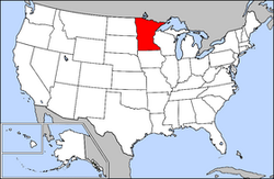
List of cities in Minnesota
Encyclopedia
Largest cities
Population data based on 2010 Census. Over 5,000 people.
| Rank | City/Town | Population | County |
|---|---|---|---|
| 1 | Minneapolis † Minneapolis, Minnesota Minneapolis , nicknamed "City of Lakes" and the "Mill City," is the county seat of Hennepin County, the largest city in the U.S. state of Minnesota, and the 48th largest in the United States... |
382,578 | Hennepin Hennepin County, Minnesota Hennepin County is a county located in the U.S. state of Minnesota, named in honor of the 17th-century explorer Father Louis Hennepin. As of 2010 the population was 1,152,425. Its county seat is Minneapolis. It is by far the most populous county in Minnesota; more than one in five Minnesotans live... |
| 2 | Saint Paul †† Saint Paul, Minnesota Saint Paul is the capital and second-most populous city of the U.S. state of Minnesota. The city lies mostly on the east bank of the Mississippi River in the area surrounding its point of confluence with the Minnesota River, and adjoins Minneapolis, the state's largest city... |
285,068 | Ramsey Ramsey County, Minnesota Ramsey County is a county located in the U.S. state of Minnesota, founded in 1849. As of 2010, the population was 508,640. Its county seat is St. Paul, which is also Minnesota's state capital. The county is named for Alexander Ramsey , the first governor of the Minnesota Territory... |
| 3 | Rochester † Rochester, Minnesota Rochester is a city in the U.S. state of Minnesota and is the county seat of Olmsted County. Located on both banks of the Zumbro River, The city has a population of 106,769 according to the 2010 United States Census, making it Minnesota's third-largest city and the largest outside of the... |
106,769 | Olmsted Olmsted County, Minnesota As of the census of 2000, there were 124,277 people, 47,807 households, and 32,317 families residing in the county. The population density was 190 people per square mile . There were 49,422 housing units at an average density of 76 per square mile... |
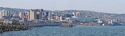
| 4 | Duluth † Duluth, Minnesota Duluth is a port city in the U.S. state of Minnesota and is the county seat of Saint Louis County. The fourth largest city in Minnesota, Duluth had a total population of 86,265 in the 2010 census. Duluth is also the second largest city that is located on Lake Superior after Thunder Bay, Ontario,... |
86,265 | St. Louis St. Louis County, Minnesota St. Louis County is a county located in the U.S. state of Minnesota. As of 2010, the population was 200,226. Its county seat is Duluth. It is the largest county by total area in Minnesota, and the second largest in the United States east of the Mississippi River; in land area alone, after Aroostook... |
| 5 | Bloomington Bloomington, Minnesota Bloomington is the fifth largest city in the U.S. state of Minnesota in Hennepin County. Located on the north bank of the Minnesota River above its confluence with the Mississippi River, Bloomington lies at the heart of the southern... |
82,893 | Hennepin Hennepin County, Minnesota Hennepin County is a county located in the U.S. state of Minnesota, named in honor of the 17th-century explorer Father Louis Hennepin. As of 2010 the population was 1,152,425. Its county seat is Minneapolis. It is by far the most populous county in Minnesota; more than one in five Minnesotans live... |
| 6 | Plymouth Plymouth, Minnesota As of the census of 2000, there were 65,894 people, 24,820 households, and 17,647 families residing in the city. The population density was 2,002.0 persons per square mile . There were 25,258 housing units at an average density of 767.4 per square mile... |
81,803 | Hennepin Hennepin County, Minnesota Hennepin County is a county located in the U.S. state of Minnesota, named in honor of the 17th-century explorer Father Louis Hennepin. As of 2010 the population was 1,152,425. Its county seat is Minneapolis. It is by far the most populous county in Minnesota; more than one in five Minnesotans live... |
| 7 | Brooklyn Park Brooklyn Park, Minnesota According to the 2010 census, there were 75,781 people residing in the city. The racial makeup of the city was 52% White, 24% African American, 1% Native American, 15% Asian, 42 residents identifying themselves as Pacific Islander, 4% from other races, and 4% from two or more races... |
75,758 | Hennepin Hennepin County, Minnesota Hennepin County is a county located in the U.S. state of Minnesota, named in honor of the 17th-century explorer Father Louis Hennepin. As of 2010 the population was 1,152,425. Its county seat is Minneapolis. It is by far the most populous county in Minnesota; more than one in five Minnesotans live... |
| 8 | St. Cloud † St. Cloud, Minnesota St. Cloud is a city in the U.S. state of Minnesota and the largest population center in the state's central region. The population was 65,842 at the 2010 census. It is the county seat of Stearns County... |
65,842 | Stearns Stearns County, Minnesota As of the census of 2000, there were 133,166 people, 47,604 households, and 32,132 families residing in the county. The population density was 99 people per square mile . There were 50,291 housing units at an average density of 37 per square mile... |
| 9 | Eagan Eagan, Minnesota Eagan is a city south of Saint Paul in Dakota County in the U.S. state of Minnesota. The city lies on the south bank of the Minnesota River, upstream from the confluence with the Mississippi River. Eagan and nearby suburbs form the southern portion of Minneapolis-St. Paul, the fifteenth largest... |
64,206 | Dakota Dakota County, Minnesota Dakota County is the third most populous county in the U.S. state of Minnesota. The county is bordered by the Minnesota and Mississippi Rivers on the north, and the state of Wisconsin on the east. Dakota County comprises the southeast portion of seven-county Minneapolis-St. Paul, the thirteenth... |
| 10 | Woodbury Woodbury, Minnesota Woodbury is a city in Washington County, Minnesota, United States, and is a suburb of the Twin Cities metropolitan area. It is situated east of Saint Paul along Interstate 94... |
61,961 | Washington Washington County, Minnesota Washington County is a county established in 1849 in the U.S. state of Minnesota. As of 2010, the population was 238,136. Its county seat is Stillwater.-History:... |
| 11 | Maple Grove Maple Grove, Minnesota As of the census of 2000, there were 50,365 people , 17,532 households, and 13,955 families residing in the city. The population density was 1,532.3 people per square mile . There were 17,745 housing units at an average density of 539.9 per square mile... |
61,567 | Hennepin Hennepin County, Minnesota Hennepin County is a county located in the U.S. state of Minnesota, named in honor of the 17th-century explorer Father Louis Hennepin. As of 2010 the population was 1,152,425. Its county seat is Minneapolis. It is by far the most populous county in Minnesota; more than one in five Minnesotans live... |
| 12 | Coon Rapids Coon Rapids, Minnesota As of the census of 2000, there were 61,627 people, 22,578 households, and 16,572 families residing in the city. The population density was 2,718.1 people per square mile . There were 22,828 housing units at an average density of 1,007.2 per square mile... |
61,476 | Anoka Anoka County, Minnesota Anoka County is the fourth-most populous county in the U.S. state of Minnesota. The county is bordered by the counties of Isanti on the north, Chisago and Washington on the east, Hennepin and Ramsey on the south, Sherburne on the west, and the Mississippi River on the southwest.As of 2010, Anoka... |
| 13 | Eden Prairie Eden Prairie, Minnesota As of the census of 2000, there were 54,901 people, 20,457 households, and 14,579 families residing in the city. The population density was . There were 21,026 housing units at an average density of 649.2 per square mile... |
60,797 | Hennepin Hennepin County, Minnesota Hennepin County is a county located in the U.S. state of Minnesota, named in honor of the 17th-century explorer Father Louis Hennepin. As of 2010 the population was 1,152,425. Its county seat is Minneapolis. It is by far the most populous county in Minnesota; more than one in five Minnesotans live... |
| 14 | Burnsville Burnsville, Minnesota Burnsville is a city south of downtown Minneapolis in Dakota County in the U.S. state of Minnesota. The city lies on the south bank of the Minnesota River, upstream from the confluence with the Mississippi River... |
60,306 | Dakota Dakota County, Minnesota Dakota County is the third most populous county in the U.S. state of Minnesota. The county is bordered by the Minnesota and Mississippi Rivers on the north, and the state of Wisconsin on the east. Dakota County comprises the southeast portion of seven-county Minneapolis-St. Paul, the thirteenth... |
| 15 | Blaine Blaine, Minnesota As of the census of 2000, there were 44,942 people, 15,898 households, and 12,177 families residing in the city. The population density is 1,330 people per square mile . There are 16,169 housing units at an average density of 477.6 per square mile... |
57,186 | Anoka Anoka County, Minnesota Anoka County is the fourth-most populous county in the U.S. state of Minnesota. The county is bordered by the counties of Isanti on the north, Chisago and Washington on the east, Hennepin and Ramsey on the south, Sherburne on the west, and the Mississippi River on the southwest.As of 2010, Anoka... |
| 16 | Lakeville Lakeville, Minnesota As of the census of 2000, there were 43,128 people, 13,609 households, and 11,526 families residing in the city. The population density was 1,192.4 people per square mile . There were 13,799 housing units at an average density of 381.5 per square mile... |
55,954 | Dakota Dakota County, Minnesota Dakota County is the third most populous county in the U.S. state of Minnesota. The county is bordered by the Minnesota and Mississippi Rivers on the north, and the state of Wisconsin on the east. Dakota County comprises the southeast portion of seven-county Minneapolis-St. Paul, the thirteenth... |
| 17 | Minnetonka Minnetonka, Minnesota As of the census of 2000, there were 51,301 people, 21,393 households, and 14,097 families residing in the city. The population density was 1,893.0 persons per square mile . There were 22,228 housing units at an average density of 818.9 per square mile... |
49,734 | Hennepin Hennepin County, Minnesota Hennepin County is a county located in the U.S. state of Minnesota, named in honor of the 17th-century explorer Father Louis Hennepin. As of 2010 the population was 1,152,425. Its county seat is Minneapolis. It is by far the most populous county in Minnesota; more than one in five Minnesotans live... |
| 18 | Apple Valley Apple Valley, Minnesota As of the census of 2000, there were 45,527 people, 16,344 households, and 12,405 families residing in the city. The population density was 2,625.5 people per square mile . There were 16,536 housing units at an average density of 953.6 per square mile... |
49,084 | Dakota Dakota County, Minnesota Dakota County is the third most populous county in the U.S. state of Minnesota. The county is bordered by the Minnesota and Mississippi Rivers on the north, and the state of Wisconsin on the east. Dakota County comprises the southeast portion of seven-county Minneapolis-St. Paul, the thirteenth... |
| 19 | Edina Edina, Minnesota Edina is a city in Hennepin County, Minnesota, United States, and a first-ring suburb situated immediately southwest of Minneapolis. Edina began as a small farming and milling community in the 1860s. The population was 47,941 at the 2010 census.-Geography:... |
47,941 | Hennepin Hennepin County, Minnesota Hennepin County is a county located in the U.S. state of Minnesota, named in honor of the 17th-century explorer Father Louis Hennepin. As of 2010 the population was 1,152,425. Its county seat is Minneapolis. It is by far the most populous county in Minnesota; more than one in five Minnesotans live... |
| 20 | St. Louis Park St. Louis Park, Minnesota As of the census of 2000, there were 44,126 people, 20,782 households, and 10,557 families residing in the city. The population density was 4,122.5 persons per square mile . There were 21,140 housing units at an average density of 1,975.0 per square mile... |
45,250 | Hennepin Hennepin County, Minnesota Hennepin County is a county located in the U.S. state of Minnesota, named in honor of the 17th-century explorer Father Louis Hennepin. As of 2010 the population was 1,152,425. Its county seat is Minneapolis. It is by far the most populous county in Minnesota; more than one in five Minnesotans live... |
| 21 | Mankato † Mankato, Minnesota Mankato is a city in Blue Earth, Nicollet, and Le Sueur counties in the U.S. state of Minnesota. The population was 39,309 at the 2010 census, making it the fourth largest city in Minnesota outside of the Minneapolis-St. Paul metropolitan area. The county seat of Blue Earth County, it is located... |
39,309 | Blue Earth Blue Earth County, Minnesota Blue Earth County is a county located in the U.S. state of Minnesota. As of 2010, the population was 64,013. Its county seat is Mankato.Blue Earth County is part of the Mankato–North Mankato Metropolitan Statistical Area.-Geography:... |
| 22 | Moorhead † Moorhead, Minnesota Moorhead is a city in Clay County, Minnesota, United States, and the largest city in northwest Minnesota. The population was 38,065 at the 2010 Census. It is the county seat of Clay County.... |
38,065 | Clay Clay County, Minnesota Clay County is a county located in the U.S. state of Minnesota. As of 2010, the population was 58,999. Its name is in honor of American statesman Henry Clay, member of the United States Senate from Kentucky and United States Secretary of State in the 19th century. Its county seat is Moorhead... |
| 23 | Maplewood Maplewood, Minnesota As of the census of 2000, there were 34,947 people, 13,758 households, and 9,190 families residing in the city. The population density was 2,017.5 people per square mile . There were 14,004 housing units at an average density of 808.5 per square mile... |
38,018 | Ramsey Ramsey County, Minnesota Ramsey County is a county located in the U.S. state of Minnesota, founded in 1849. As of 2010, the population was 508,640. Its county seat is St. Paul, which is also Minnesota's state capital. The county is named for Alexander Ramsey , the first governor of the Minnesota Territory... |
| 24 | Shakopee † Shakopee, Minnesota Shakopee is a city southwest of downtown Minneapolis in the U.S. state of Minnesota and is the county seat of Scott County. Located on the south bank bend of the Minnesota River, Shakopee and nearby suburbs comprise the southwest portion of Minneapolis-Saint Paul, the thirteenth largest... |
37,076 | Scott Scott County, Minnesota Scott County is a county located in the U.S. state of Minnesota. It was organized in 1853 and named in honor of General Winfield Scott. As of 2010, the population was 129,928. Its county seat is Shakopee... |
| 25 | Richfield Richfield, Minnesota As of the census of 2000, there were 34,439 people, 15,073 households, and 8,727 families residing in the city. The population density was 4,993.9 people per square mile . There were 15,357 housing units at an average density of 2,226.9 per square mile... |
35,228 | Hennepin Hennepin County, Minnesota Hennepin County is a county located in the U.S. state of Minnesota, named in honor of the 17th-century explorer Father Louis Hennepin. As of 2010 the population was 1,152,425. Its county seat is Minneapolis. It is by far the most populous county in Minnesota; more than one in five Minnesotans live... |
| 26 | Cottage Grove Cottage Grove, Minnesota As of the census of 2000, there were 30,582 people, 9,932 households, and 8,462 families residing in the city. The population density was 899.9 people per square mile . There were 10,024 housing units at an average density of 295.0 per square mile... |
34,589 | Washington Washington County, Minnesota Washington County is a county established in 1849 in the U.S. state of Minnesota. As of 2010, the population was 238,136. Its county seat is Stillwater.-History:... |
| 27 | Inver Grove Heights Inver Grove Heights, Minnesota As of the census of 2000, there were 29,751 people, 11,257 households, and 7,924 families residing in the city. The population density was 1,038.8 people per square mile . There were 11,457 housing units at an average density of 400.1 per square mile... |
33,880 | Dakota Dakota County, Minnesota Dakota County is the third most populous county in the U.S. state of Minnesota. The county is bordered by the Minnesota and Mississippi Rivers on the north, and the state of Wisconsin on the east. Dakota County comprises the southeast portion of seven-county Minneapolis-St. Paul, the thirteenth... |
| 28 | Roseville Roseville, Minnesota As of the census of 2000, there were 33,690 people, 14,598 households, and 8,598 families residing in the city. The population density was 2,543.9 people per square mile . There were 14,917 housing units at an average density of 1,126.4 per square mile... |
33,660 | Ramsey Ramsey County, Minnesota Ramsey County is a county located in the U.S. state of Minnesota, founded in 1849. As of 2010, the population was 508,640. Its county seat is St. Paul, which is also Minnesota's state capital. The county is named for Alexander Ramsey , the first governor of the Minnesota Territory... |
| 29 | Andover Andover, Minnesota As of the census of 2000, there were 26,588 people, 8,107 households, and 7,150 families residing in the city. The population density was 779.6 people per square mile . There were 8,205 housing units at an average density of 240.6 per square mile... |
30,598 | Anoka Anoka County, Minnesota Anoka County is the fourth-most populous county in the U.S. state of Minnesota. The county is bordered by the counties of Isanti on the north, Chisago and Washington on the east, Hennepin and Ramsey on the south, Sherburne on the west, and the Mississippi River on the southwest.As of 2010, Anoka... |
| 30 | Brooklyn Center Brooklyn Center, Minnesota As of the census of 2010, there were 30,104 residents in Brooklyn Center. The racial makeup of the city was 49% White, 26% African American, 1% Native American, 14% Asian, 0.07% Pacific Islander, 5% from other races, and 4% from two or more races... |
30,104 | Hennepin Hennepin County, Minnesota Hennepin County is a county located in the U.S. state of Minnesota, named in honor of the 17th-century explorer Father Louis Hennepin. As of 2010 the population was 1,152,425. Its county seat is Minneapolis. It is by far the most populous county in Minnesota; more than one in five Minnesotans live... |
| 31 | Winona † Winona, Minnesota Winona is a city in and the county seat of Winona County, in the U.S. State of Minnesota. Located in picturesque bluff country on the Mississippi River, its most noticeable physical landmark is Sugar Loaf.... |
27,592 | Winona Winona County, Minnesota As of the census of 2000, there were 49,985 people, 18,744 households, and 11,696 families residing in the county. The population density was 80 people per square mile . There were 19,551 housing units at an average density of 31 per square mile... |
| 32 | Oakdale Oakdale, Minnesota As of the census of 2000, there were 26,653 people, 10,243 households, and 7,129 families residing in the city. The population density was 2,408.4 people per square mile . There were 10,394 housing units at an average density of 939.2 per square mile... |
27,378 | Washington Washington County, Minnesota Washington County is a county established in 1849 in the U.S. state of Minnesota. As of 2010, the population was 238,136. Its county seat is Stillwater.-History:... |
| 33 | Fridley Fridley, Minnesota As of the census of 2000, there were 27,449 people, 11,328 households, and 7,317 families residing in the city. The population density was 2,701.3 people per square mile . There were 11,504 housing units at an average density of 1,132.1 per square mile... |
27,208 | Anoka Anoka County, Minnesota Anoka County is the fourth-most populous county in the U.S. state of Minnesota. The county is bordered by the counties of Isanti on the north, Chisago and Washington on the east, Hennepin and Ramsey on the south, Sherburne on the west, and the Mississippi River on the southwest.As of 2010, Anoka... |
| 34 | Savage Savage, Minnesota Savage is a suburban city south-southwest of downtown Minneapolis in Scott County in the U.S. state of Minnesota. The city is situated on the south bank of the Minnesota River in a region commonly referred to as South of the River, comprising the southern portion of Minneapolis-St. Paul, the... |
26,911 | Scott Scott County, Minnesota Scott County is a county located in the U.S. state of Minnesota. It was organized in 1853 and named in honor of General Winfield Scott. As of 2010, the population was 129,928. Its county seat is Shakopee... |
| 35 | Owatonna † Owatonna, Minnesota Owatonna is a city in Steele County, Minnesota, United States. The population was 25,599 at the 2010 census. It is the county seat of Steele County. Owatonna is home to the Steele County Fairgrounds, which hosts the Steele County Free Fair in August.... |
25,599 | Steele Steele County, Minnesota As of the census of 2000, there were 33,680 people, 12,846 households, and 9,082 families residing in the county. The population density was 78 people per square mile . There were 13,306 housing units at an average density of 31 per square mile... |
| 36 | Shoreview Shoreview, Minnesota As of the census of 2000, there are 25,377 people, Males: 12,303 , Females: 13,074 , 9,965 households, and 7,021 families residing in the city. The population density is 2,315.9 people per square mile . There are 10,127 housing units at an average density of 919.2 per square mile... |
25,043 | Ramsey Ramsey County, Minnesota Ramsey County is a county located in the U.S. state of Minnesota, founded in 1849. As of 2010, the population was 508,640. Its county seat is St. Paul, which is also Minnesota's state capital. The county is named for Alexander Ramsey , the first governor of the Minnesota Territory... |
| 37 | Austin † Austin, Minnesota As of the census of 2000, there were 23,314 people, 9,897 households, and 6,076 families residing in the city. The population density was 2,168.2 people per square mile . There were 10,261 housing units at an average density of 954.3 per square mile... |
24,718 | Mower Mower County, Minnesota As of the census of 2000, there were 38,603 people, 15,582 households, and 10,315 families residing in the county. The population density was 54 people per square mile . There were 16,251 housing units at an average density of 23 per square mile... |
| 38 | White Bear Lake White Bear Lake, Minnesota White Bear Lake is a city in Ramsey and Washington counties in the U.S. state of Minnesota. The population was 23,797 at the 2010 census. The city is located on White Bear Lake, one of the largest lakes in the Minneapolis-St... |
23,797 | Ramsey Ramsey County, Minnesota Ramsey County is a county located in the U.S. state of Minnesota, founded in 1849. As of 2010, the population was 508,640. Its county seat is St. Paul, which is also Minnesota's state capital. The county is named for Alexander Ramsey , the first governor of the Minnesota Territory... |
| 39 | Chaska † Chaska, Minnesota As of 2005, there were 22,467 people and 8,194 households residing in the city. The population density was 1,640 people per square mile . There were 6,235 housing units at an average density of 454.1 per square mile... |
23,700 | Carver Carver County, Minnesota As of the census of 2000, there were 70,205 people, 24,356 households, and 18,778 families residing in the county. The population density was 197 people per square mile . There were 24,883 housing units at an average density of 70 per square mile... |
| 40 | Ramsey Ramsey, Minnesota As of the census of 2000, there were 18,510 people, 5,906 households, and 5,102 families residing in the city. The population density was 642.9 people per square mile . There were 5,946 housing units at an average density of 206.5 per square mile... |
23,668 | Anoka Anoka County, Minnesota Anoka County is the fourth-most populous county in the U.S. state of Minnesota. The county is bordered by the counties of Isanti on the north, Chisago and Washington on the east, Hennepin and Ramsey on the south, Sherburne on the west, and the Mississippi River on the southwest.As of 2010, Anoka... |
| 41 | Faribault † Faribault, Minnesota As of the census of 2000, there were 20,818 people, 7,472 households, and 4,946 families residing in the city. The population density was 1,644.8 people per square mile . There were 7,668 housing units at an average density of 605.8 per square mile... |
23,352 | Rice Rice County, Minnesota As of the census of 2000, there were 56,665 people, 18,888 households, and 13,353 families residing in the county. The population density was 114 people per square mile . There were 20,061 housing units at an average density of 40 per square mile... |
| 42 | Champlin Champlin, Minnesota Champlin is a city in Hennepin County, Minnesota, United States. The population was 23,089 at the 2010 census.U.S. Route 169 serves as a main arterial route in the city.- Geography :... |
23,089 | Hennepin Hennepin County, Minnesota Hennepin County is a county located in the U.S. state of Minnesota, named in honor of the 17th-century explorer Father Louis Hennepin. As of 2010 the population was 1,152,425. Its county seat is Minneapolis. It is by far the most populous county in Minnesota; more than one in five Minnesotans live... |
| 43 | Elk River † Elk River, Minnesota As of the census of 2000, there were 16,447 people, 5,664 households, and 4,400 families residing in the city. Recent estimates show the population at 21,329 as of 2005. The population density was 385.5 people per square mile . There were 5,782 housing units at an average density of 135.5 per... |
22,974 | Sherburne Sherburne County, Minnesota As of the census of 2000, there were 64,417 people, 21,581 households, and 16,746 families residing in the county. The population density was 148 people per square mile . There were 22,827 housing units at an average density of 52 per square mile... |
| 44 | Chanhassen Chanhassen, Minnesota Chanhassen is a city in Carver and Hennepin counties in the U.S. state of Minnesota. It is southwest of Minneapolis. The population was 22,952 at the 2010 census.... |
22,952 | Carver Carver County, Minnesota As of the census of 2000, there were 70,205 people, 24,356 households, and 18,778 families residing in the county. The population density was 197 people per square mile . There were 24,883 housing units at an average density of 70 per square mile... |
| 45 | Prior Lake Prior Lake, Minnesota In 2007, there are an estimated 19,319 residents. The population density was 1,207 people per square mile . There were 5,791 housing units at an average density of 428.9 per square mile . The racial makeup of the city was 94.5% White, 0.8% African American, 2.1% Native American, 0.9% Asian, 0.3%... |
22,796 | Scott Scott County, Minnesota Scott County is a county located in the U.S. state of Minnesota. It was organized in 1853 and named in honor of General Winfield Scott. As of 2010, the population was 129,928. Its county seat is Shakopee... |
| 46 | Hastings † Hastings, Minnesota Hastings is a city in Dakota counties in the U.S. state of Minnesota, near the confluence of the Mississippi and St. Croix Rivers. The population was 22,172 at the 2010 census. It is the county seat of Dakota County. The bulk of Hastings is in Dakota County; only a small part of the city extends... |
22,172 | Dakota Dakota County, Minnesota Dakota County is the third most populous county in the U.S. state of Minnesota. The county is bordered by the Minnesota and Mississippi Rivers on the north, and the state of Wisconsin on the east. Dakota County comprises the southeast portion of seven-county Minneapolis-St. Paul, the thirteenth... |
| 47 | Crystal Crystal, Minnesota As of the census of 2000, there were 22,698 people, 9,389 households, and 6,102 families residing in the city. The population density was 3,929.3 people per square mile . There were 9,481 housing units at an average density of 1,641.3 per square mile... |
22,151 | Hennepin Hennepin County, Minnesota Hennepin County is a county located in the U.S. state of Minnesota, named in honor of the 17th-century explorer Father Louis Hennepin. As of 2010 the population was 1,152,425. Its county seat is Minneapolis. It is by far the most populous county in Minnesota; more than one in five Minnesotans live... |
| 48 | Rosemount Rosemount, Minnesota As of the census of 2000, there were 14,619 people, 4,742 households, and 3,931 families residing in the city. The population density was 434.2 people per square mile . There were 4,845 housing units at an average density of 143.9 per square mile... |
21,874 | Dakota Dakota County, Minnesota Dakota County is the third most populous county in the U.S. state of Minnesota. The county is bordered by the Minnesota and Mississippi Rivers on the north, and the state of Wisconsin on the east. Dakota County comprises the southeast portion of seven-county Minneapolis-St. Paul, the thirteenth... |
| 49 | New Brighton New Brighton, Minnesota As of the census of 2000, there were 22,206 people, 9,013 households, and 5,903 families residing in the city. The population density was 3,343.9 people per square mile . There were 9,121 housing units at an average density of 1,373.5 per square mile... |
21,456 | Ramsey Ramsey County, Minnesota Ramsey County is a county located in the U.S. state of Minnesota, founded in 1849. As of 2010, the population was 508,640. Its county seat is St. Paul, which is also Minnesota's state capital. The county is named for Alexander Ramsey , the first governor of the Minnesota Territory... |
| 50 | Farmington Farmington, Minnesota As of the census of 2000, there were 12,365 people, 4,169 households, and 3,255 families residing in the city. The population density was 986.0 people per square mile . There were 4,233 housing units at an average density of 337.5 per square mile . The racial makeup of the city was 95.62%... |
21,086 | Dakota Dakota County, Minnesota Dakota County is the third most populous county in the U.S. state of Minnesota. The county is bordered by the Minnesota and Mississippi Rivers on the north, and the state of Wisconsin on the east. Dakota County comprises the southeast portion of seven-county Minneapolis-St. Paul, the thirteenth... |
| 51 | Golden Valley Golden Valley, Minnesota As of the census of 2000, there were 20,281 people, 8,449 households, and 5,508 families residing in the city. The population density was 1,982.3 people per square mile . There were 8,589 housing units at an average density of 839.5 per square mile... |
20,371 | Hennepin Hennepin County, Minnesota Hennepin County is a county located in the U.S. state of Minnesota, named in honor of the 17th-century explorer Father Louis Hennepin. As of 2010 the population was 1,152,425. Its county seat is Minneapolis. It is by far the most populous county in Minnesota; more than one in five Minnesotans live... |
| 52 | New Hope New Hope, Minnesota As of the census of 2000, there were 20,873 people, 8,665 households, and 5,268 families residing in the city. The population density was 4,098.6 people per square mile . There were 8,746 housing units at an average density of 1,717.4 per square mile... |
20,339 | Hennepin Hennepin County, Minnesota Hennepin County is a county located in the U.S. state of Minnesota, named in honor of the 17th-century explorer Father Louis Hennepin. As of 2010 the population was 1,152,425. Its county seat is Minneapolis. It is by far the most populous county in Minnesota; more than one in five Minnesotans live... |
| 53 | Lino Lakes Lino Lakes, Minnesota As of the census of 2000, there were 16,791 people, 4,857 households, and 4,162 families residing in the city. The population density was 595.1 people per square mile . There were 4,921 housing units at an average density of 174.4 per square mile... |
20,216 | Anoka Anoka County, Minnesota Anoka County is the fourth-most populous county in the U.S. state of Minnesota. The county is bordered by the counties of Isanti on the north, Chisago and Washington on the east, Hennepin and Ramsey on the south, Sherburne on the west, and the Mississippi River on the southwest.As of 2010, Anoka... |
| 54 | South St. Paul South St. Paul, Minnesota South St. Paul is a city in Dakota County, Minnesota, immediately south and southeast of the city of Saint Paul, Minnesota. It is also southeast of West St. Paul, Minnesota. The population was 20,160 at the 2010 census. It is notable as one of the historic major meat packing cities in the United... |
20,160 | Dakota Dakota County, Minnesota Dakota County is the third most populous county in the U.S. state of Minnesota. The county is bordered by the Minnesota and Mississippi Rivers on the north, and the state of Wisconsin on the east. Dakota County comprises the southeast portion of seven-county Minneapolis-St. Paul, the thirteenth... |
| 55 | Northfield Northfield, Minnesota As of the census of 2000, there were 17,147 people, 4,909 households, and 3,210 families residing in the city. The population density was 2,452.2 people per square mile . There were 5,119 housing units at an average density of 732.1 per square mile... |
20,007 | Rice Rice County, Minnesota As of the census of 2000, there were 56,665 people, 18,888 households, and 13,353 families residing in the county. The population density was 114 people per square mile . There were 20,061 housing units at an average density of 40 per square mile... |
| 56 | Willmar † Willmar, Minnesota As of the census of 2000, there were 18,351 people, 7,302 households, and 4,461 families residing in the city. The population density was 1,549.9 people per square mile . There were 7,789 housing units at an average density of 657.8 per square mile... |
19,610 | Kandiyohi Kandiyohi County, Minnesota Kandiyohi County is a county located in the U.S. state of Minnesota. As of 2010, its population was 42,239. Its county seat is Willmar.- History :... |
| 57 | West St. Paul West St. Paul, Minnesota As of the census of 2000, there were 19,405 people, 8,645 households, and 4,875 families residing in the city. The population density was 3,874.2 people per square mile . There were 8,779 housing units at an average density of 1,752.7 per square mile... |
19,540 | Dakota Dakota County, Minnesota Dakota County is the third most populous county in the U.S. state of Minnesota. The county is bordered by the Minnesota and Mississippi Rivers on the north, and the state of Wisconsin on the east. Dakota County comprises the southeast portion of seven-county Minneapolis-St. Paul, the thirteenth... |
| 58 | Columbia Heights Columbia Heights, Minnesota As of the census of 2000, there were 18,520 people, 8,033 households, and 4,731 families residing in the city. The population density was 5,368.7 people per square mile . There were 8,151 housing units at an average density of 2,362.9 per square mile... |
19,496 | Anoka Anoka County, Minnesota Anoka County is the fourth-most populous county in the U.S. state of Minnesota. The county is bordered by the counties of Isanti on the north, Chisago and Washington on the east, Hennepin and Ramsey on the south, Sherburne on the west, and the Mississippi River on the southwest.As of 2010, Anoka... |
| 59 | Forest Lake Forest Lake, Minnesota Forest Lake is a city in Washington County, Minnesota, United States. The population was 18,375 at the 2010 census. It is located on Minnesota's 94th largest lake .Interstate 35 and U.S... |
18,375 | Washington Washington County, Minnesota Washington County is a county established in 1849 in the U.S. state of Minnesota. As of 2010, the population was 238,136. Its county seat is Stillwater.-History:... |
| 60 | Stillwater † Stillwater, Minnesota As of the census of 2000, there were 15,143 people, 5,797 households, and 4,115 families residing in the city. The population density was 2,340.0 people per square mile . There were 5,926 housing units at an average density of 915.7 per square mile... |
18,225 | Washington Washington County, Minnesota Washington County is a county established in 1849 in the U.S. state of Minnesota. As of 2010, the population was 238,136. Its county seat is Stillwater.-History:... |
| 61 | Albert Lea † Albert Lea, Minnesota Albert Lea is a city in and the county seat of Freeborn County in the southeastern part of the U.S. state of Minnesota. The population was 18,016 at the 2010 census.... |
18,016 | Freeborn Freeborn County, Minnesota As of the census of 2000, there were 32,584 people, 13,356 households, and 9,015 families residing in the county. The population density was 46 people per square mile . There were 13,996 housing units at an average density of 20 per square mile... |
| 62 | Hopkins Hopkins, Minnesota As of the census of 2000, there were 17,145 people, 8,224 households, and 3,741 families residing in the city. The population density was 4,205.9 people per square mile . There were 8,390 housing units at an average density of 2,058.2 pe square mile... |
17,591 | Hennepin Hennepin County, Minnesota Hennepin County is a county located in the U.S. state of Minnesota, named in honor of the 17th-century explorer Father Louis Hennepin. As of 2010 the population was 1,152,425. Its county seat is Minneapolis. It is by far the most populous county in Minnesota; more than one in five Minnesotans live... |
| 63 | Anoka † Anoka, Minnesota At the 2000 census, there were 18,076 people, 7,262 households and 4,408 families residing in the city. The population density was 2,709.0 per square mile . There were 7,398 housing units at an average density of 1,108.7 per square mile... |
17,142 | Anoka Anoka County, Minnesota Anoka County is the fourth-most populous county in the U.S. state of Minnesota. The county is bordered by the counties of Isanti on the north, Chisago and Washington on the east, Hennepin and Ramsey on the south, Sherburne on the west, and the Mississippi River on the southwest.As of 2010, Anoka... |
| 64 | Red Wing † Red Wing, Minnesota Red Wing is a city in Goodhue County, Minnesota, United States, on the Mississippi River. The population was 16,459 at the 2010 census. It is the county seat of Goodhue County.... |
16,459 | Goodhue Goodhue County, Minnesota Goodhue County is a county located in the U.S. state of Minnesota. As of 2010, the population was 46,183. Its county seat is Red Wing. Nearly all of Prairie Island Indian Community is within the county.-History:... |
| 65 | St. Michael St. Michael, Minnesota As of the census of 2000, there were 9,099 people, 2,926 households, and 2,437 families residing in the city. The population density was 279.4 people per square mile . There were 3,058 housing units at an average density of 93.9 per square mile... |
16,399 | Wright Wright County, Minnesota Wright County is a county located in the U.S. state of Minnesota, founded in 1855. As of 2010, the population was 124,700. Its county seat is Buffalo.-History:... |
| 66 | Hibbing Hibbing, Minnesota Hibbing is a city in Saint Louis County, Minnesota, United States. The population was 16,361 at the 2010 census. The city was built on the rich iron ore of the Mesabi Iron Range. At the edge of town is the largest open-pit iron mine in the world. U.S... |
16,361 | St. Louis St. Louis County, Minnesota St. Louis County is a county located in the U.S. state of Minnesota. As of 2010, the population was 200,226. Its county seat is Duluth. It is the largest county by total area in Minnesota, and the second largest in the United States east of the Mississippi River; in land area alone, after Aroostook... |
| 67 | Sartell Sartell, Minnesota Sartell is a city in Benton and Stearns counties in the U.S. state of Minnesota. It is part of the St. Cloud Metropolitan Statistical Area. The population was 15,876 at the 2010 census, making it St. Cloud's most populous suburb and the largest city in the central Minnesota region after St... |
15,876 | Stearns Stearns County, Minnesota As of the census of 2000, there were 133,166 people, 47,604 households, and 32,132 families residing in the county. The population density was 99 people per square mile . There were 50,291 housing units at an average density of 37 per square mile... |
| 68 | Buffalo † Buffalo, Minnesota As of the census of 2008, there were 18,141 people, 6,612 households, and 6,313 families residing in the city. The population density was 1,675.8 people per square mile . There were 3,871 housing units at an average density of 642.5 per square mile... |
15,453 | Wright Wright County, Minnesota Wright County is a county located in the U.S. state of Minnesota, founded in 1855. As of 2010, the population was 124,700. Its county seat is Buffalo.-History:... |
| 69 | Ham Lake Ham Lake, Minnesota As of the census of 2000, there were 12,710 people, 4,139 households, and 3,472 families residing in the city. The population density was 368.9 people per square mile . There were 4,208 housing units at an average density of 122.1 per square mile... |
15,296 | Anoka Anoka County, Minnesota Anoka County is the fourth-most populous county in the U.S. state of Minnesota. The county is bordered by the counties of Isanti on the north, Chisago and Washington on the east, Hennepin and Ramsey on the south, Sherburne on the west, and the Mississippi River on the southwest.As of 2010, Anoka... |
| 70 | Hutchinson Hutchinson, Minnesota According to the 2000 United States Census , there were 13,080 people, 5,333 households, and 3,418 families residing in the city. The population density was 1,763.6 people per square mile . There were 5,667 housing units at an average density of 764.1 per square mile... |
14,178 | McLeod McLeod County, Minnesota As of the census of 2000, there were 34,898 people, 13,449 households, and 9,427 families residing in the county. The population density was 71 people per square mile . There were 14,087 housing units at an average density of 29 per square mile... |
| 71 | Robbinsdale Robbinsdale, Minnesota Robbinsdale is a city in Hennepin County, Minnesota, United States. The population was 13,953 at the 2010 census.-Geography:According to the United States Census Bureau, the city has a total area of , of which, of it is land and of it is water.... |
13,953 | Hennepin Hennepin County, Minnesota Hennepin County is a county located in the U.S. state of Minnesota, named in honor of the 17th-century explorer Father Louis Hennepin. As of 2010 the population was 1,152,425. Its county seat is Minneapolis. It is by far the most populous county in Minnesota; more than one in five Minnesotans live... |
| 72 | Marshall † Marshall, Minnesota As of the census of 2000, there were 12,735 people, 4,914 households, and 2,914 families residing in the city. The population density was 1,537.0 people per square mile . There were 5,182 housing units at an average density of 625.4 per square mile... |
13,680 | Lyon Lyon County, Minnesota As of the census of 2000, there were 25,425 people, 9,715 households, and 6,334 families residing in the county. The population density was 36 people per square mile . There were 10,298 housing units at an average density of 14 per square mile... |
| 73 | Brainerd † Brainerd, Minnesota Brainerd is a city in Crow Wing County, Minnesota, United States. The population was 13,590 at the 2010 census. It is the county seat of Crow Wing County and one of the largest cities in Central Minnesota... |
13,590 | Crow Wing Crow Wing County, Minnesota Crow Wing County is a county located in the U.S. state of Minnesota. As of 2010, the population was 62,500. Its county seat is Brainerd.-Geography:... |
| 74 | Otsego Otsego, Minnesota As of the census of 2000, there were 6,389 people, 2,062 households, and 1,674 families residing in the city. The population density was 217.5 people per square mile . There were 2,120 housing units at an average density of 72.2 per square mile... |
13,571 | Wright Wright County, Minnesota Wright County is a county located in the U.S. state of Minnesota, founded in 1855. As of 2010, the population was 124,700. Its county seat is Buffalo.-History:... |
| 75 | New Ulm † New Ulm, Minnesota New Ulm is a city in Brown County, Minnesota, United States. The population was 13,522 at the 2010 census. It is the county seat of Brown County.... |
13,522 | Brown Brown County, Minnesota Brown County is a county located in the U.S. state of Minnesota. As of 2010, the population was 25,893. Its county seat is New Ulm.-Geography:... |
| 76 | Bemidji † Bemidji, Minnesota Bemidji is a city in Beltrami County, Minnesota, United States. Its population was at 13,431 at the 2010 census. It is the county seat of Beltrami County. Bemidji is the most major city in North Central Minnesota and the largest commercial center between Grand Forks, North Dakota and Duluth,... |
13,431 | Beltrami Beltrami County, Minnesota Beltrami County is a county located in the northern part of the U.S. state of Minnesota. As of 2010, the population was 44,442. Its county seat is Bemidji. Portions of the Leech Lake and Red Lake Indian reservations are in the county. The northernmost portion of the Mississippi River flows... |
| 77 | North Mankato North Mankato, Minnesota As of the census of 2000, there were 11,798 people, 4,744 households, and 3,178 families residing in the city. The population density was 2,502.5 people per square mile . There were 5,046 housing units at an average density of 1,070.3 per square mile... |
13,394 | Nicollet Nicollet County, Minnesota As of the census of 2000, there were 29,771 people, 10,642 households, and 7,311 families residing in the county. The population density was 66 people per square mile . There were 11,240 housing units at an average density of 25 per square mile... |
| 78 | Hugo Hugo, Minnesota As of the census of 2000, there were 6,363 people, 2,125 households, and 1,742 families residing in the city. The population density was 187.2 people per square mile . There were 2,174 housing units at an average density of 64.0 per square mile... |
13,332 | Washington Washington County, Minnesota Washington County is a county established in 1849 in the U.S. state of Minnesota. As of 2010, the population was 238,136. Its county seat is Stillwater.-History:... |
| 79 | Fergus Falls † Fergus Falls, Minnesota Fergus Falls is a city in and the county seat of Otter Tail County, Minnesota, United States. The population was 13,138 at the 2010 census.-Today:... |
13,138 | Otter Tail Otter Tail County, Minnesota Otter Tail County is a county located in the U.S. state of Minnesota. As of 2010, the population was 57,303. Its county seat is Fergus Falls.-History:... |
| 80 | Sauk Rapids Sauk Rapids, Minnesota As of the census of 2000, there were 10,213 people, 3,921 households, and 2,599 families residing in the city. The population density was 2,234.1 people per square mile . There were 4,017 housing units at an average density of 878.7 per square mile... |
12,773 | Benton Benton County, Minnesota As of the census of 2000, there were 34,226 people, 13,065 households, and 8,518 families residing in the county. The population density was 84 people per square mile . There were 13,460 housing units at an average density of 33 per square mile... |
| 81 | Worthington † Worthington, Minnesota Worthington is a city in Nobles County, Minnesota, United States. The population was 12,764 at the 2010 census. It is the county seat of Nobles County.The city's site was first settled in the 1870s as Okabena Station on a line of the Chicago, St... |
12,764 | Nobles Nobles County, Minnesota Nobles County is a county located in the U.S. state of Minnesota. As of 2010, the population was 21,378. Its county seat is Worthington.-Geography:... |
| 82 | Monticello Monticello, Minnesota Monticello is a city in Wright County, Minnesota, United States. Monticello was founded in 1856 and celebrated its 150th anniversary in 2006. The population was 12,759 at the 2010 census. The name Monticello is derived from the Italian word for "Little Mountain," it translates literally to... |
12,759 | Wright Wright County, Minnesota Wright County is a county located in the U.S. state of Minnesota, founded in 1855. As of 2010, the population was 124,700. Its county seat is Buffalo.-History:... |
| 83 | Vadnais Heights Vadnais Heights, Minnesota Vadnais Heights is a city in Ramsey County, Minnesota, United States. The population was 12,302 at the 2010 census.-Geography:According to the United States Census Bureau, the city has a total area of , of which, is land and is water. It borders the cities of Shoreview, Little Canada, White Bear... |
12,302 | Ramsey Ramsey County, Minnesota Ramsey County is a county located in the U.S. state of Minnesota, founded in 1849. As of 2010, the population was 508,640. Its county seat is St. Paul, which is also Minnesota's state capital. The county is named for Alexander Ramsey , the first governor of the Minnesota Territory... |
| 84 | Mounds View Mounds View, Minnesota As of the census of 2000, there were 12,738 people, 5,018 households, and 3,387 families residing in the city. The population density was 3,096.6 people per square mile . There were 5,130 housing units at an average density of 1,247.1 per square mile... |
12,155 | Ramsey Ramsey County, Minnesota Ramsey County is a county located in the U.S. state of Minnesota, founded in 1849. As of 2010, the population was 508,640. Its county seat is St. Paul, which is also Minnesota's state capital. The county is named for Alexander Ramsey , the first governor of the Minnesota Territory... |
| 85 | Cloquet Cloquet, Minnesota As of the census of 2000, there were 11,201 people, 4,636 households, and 2,967 families residing in the city. The population density was 317.9 people per square mile . There were 4,805 housing units at an average density of 136.4 per square mile... |
12,124 | Carlton Carlton County, Minnesota As of the census of 2000, there were 31,671 people, 12,064 households, and 8,408 families residing in the county. The population density was 37 people per square mile . There were 13,721 housing units at an average density of 16 per square mile... |
| 86 | East Bethel East Bethel, Minnesota East Bethel is a city in Anoka County, Minnesota, United States. The population was 11,626 at the 2010 census.Minnesota State Highway 65 serves as a main arterial route in the city.-Geography:... |
11,626 | Anoka Anoka County, Minnesota Anoka County is the fourth-most populous county in the U.S. state of Minnesota. The county is bordered by the counties of Isanti on the north, Chisago and Washington on the east, Hennepin and Ramsey on the south, Sherburne on the west, and the Mississippi River on the southwest.As of 2010, Anoka... |
| 87 | North St. Paul North St. Paul, Minnesota North St. Paul is a city in Ramsey County, Minnesota, east of the city of Saint Paul. The population was 11,460 at the 2010 census.North St. Paul is a distinct city, and not a neighborhood of nearby St. Paul... |
11,460 | Ramsey Ramsey County, Minnesota Ramsey County is a county located in the U.S. state of Minnesota, founded in 1849. As of 2010, the population was 508,640. Its county seat is St. Paul, which is also Minnesota's state capital. The county is named for Alexander Ramsey , the first governor of the Minnesota Territory... |
| 88 | St. Peter † St. Peter, Minnesota St. Peter is a city in Nicollet County, Minnesota, United States. The population was 11,196 at the 2010 census. It is the county seat of Nicollet County.St... |
11,196 | Nicollet Nicollet County, Minnesota As of the census of 2000, there were 29,771 people, 10,642 households, and 7,311 families residing in the county. The population density was 66 people per square mile . There were 11,240 housing units at an average density of 25 per square mile... |
| 89 | Mendota Heights Mendota Heights, Minnesota At the 2000 census, there were 11,434 people, 4,178 households and 3,237 families residing in the town. The population density was 1,222.2 per square mile . There were 4,252 housing units at an average density of 454.5 per square mile... |
11,071 | Dakota Dakota County, Minnesota Dakota County is the third most populous county in the U.S. state of Minnesota. The county is bordered by the Minnesota and Mississippi Rivers on the north, and the state of Wisconsin on the east. Dakota County comprises the southeast portion of seven-county Minneapolis-St. Paul, the thirteenth... |
| 90 | Alexandria † Alexandria, Minnesota As of the census of 2000, there were 8,820 people, however the most recent count suggests a population upwards of 10,000, which is displayed on Alexandria's city limits signs. The census lists 4,047 households, and 2,011 families residing in the city. The population density was 992.5 people per... |
11,070 | Douglas Douglas County, Minnesota As of the census of 2000, there were 32,821 people, 13,276 households, and 9,027 families residing in the county. The population density was 52 people per square mile . There were 16,694 housing units at an average density of 26 per square mile... |
| 91 | Grand Rapids † Grand Rapids, Minnesota As of the census of 2000, there were 7,764 people, 3,446 households, and 1,943 families residing in the city. The population density was 1,057.8 people per square mile . There were 3,621 housing units at an average density of 493.3 per square mile... |
10,869 | Itasca Itasca County, Minnesota Itasca County is a county located in the U.S. state of Minnesota. It is named after Lake Itasca, which is in turn a shortened version the Latin words veritas caput, meaning 'truth' and 'head', a reference to the source of the Mississippi River. As of 2010, the population was 45,058. Its county seat... |
| 92 | Waconia Waconia, Minnesota Waconia , a city in Carver County, Minnesota, United States, is located about 35 miles southwest of Minneapolis. Waconia surged in suburban development recently and grew to a population of 10,697 . The town is home to the Waconia Wildcats Sports Teams... |
10,697 | Carver Carver County, Minnesota As of the census of 2000, there were 70,205 people, 24,356 households, and 18,778 families residing in the county. The population density was 197 people per square mile . There were 24,883 housing units at an average density of 70 per square mile... |
| 93 | Fairmont † Fairmont, Minnesota As of the census of 2000, there were 10,889 people and 2,962 families residing in the city. The population density was 747.5 people per square mile . There were 5,036 housing units at an average density of 345.7 per square mile... |
10,666 | Martin Martin County, Minnesota As of the census of 2000, there were 21,802 people, 9,067 households, and 6,047 families residing in the county. The population density was 31 people per square mile . There were 9,800 housing units at an average density of 14 per square mile... |
| 94 | North Branch North Branch, Minnesota As of the census of 2000, there were 8,023 people, 2,815 households, and 2,147 families residing in the city. The population density was 224.9 people per square mile . There were 2,900 housing units at an average density of 81.3 per square mile... |
10,125 | Chisago |
| 95 | Big Lake Big Lake, Minnesota As of the census of 2000, there were 6,063 people, 2,117 households, and 1,570 families residing in the city. The population density was 1,688.4 people per square mile . There were 2,206 housing units at an average density of 614.3 per square mile... |
10,060 | Sherburne Sherburne County, Minnesota As of the census of 2000, there were 64,417 people, 21,581 households, and 16,746 families residing in the county. The population density was 148 people per square mile . There were 22,827 housing units at an average density of 52 per square mile... |
| 96 | Little Canada Little Canada, Minnesota As of the census of 2000, there were 9,771 people, 4,375 households, and 2,393 families residing in the city. The population density was 2,445.8 people per square mile . There were 4,471 housing units at an average density of 1,119.1 per square mile... |
9,773 | Ramsey Ramsey County, Minnesota Ramsey County is a county located in the U.S. state of Minnesota, founded in 1849. As of 2010, the population was 508,640. Its county seat is St. Paul, which is also Minnesota's state capital. The county is named for Alexander Ramsey , the first governor of the Minnesota Territory... |
| 97 | Arden Hills Arden Hills, Minnesota As of the census of 2000, there were 9,652 people, 2,959 households, and 2,228 families residing in the city. The population density was 1,087.3 people per square mile . There were 3,017 housing units at an average density of 339.9 per square mile... |
9,552 | Ramsey Ramsey County, Minnesota Ramsey County is a county located in the U.S. state of Minnesota, founded in 1849. As of 2010, the population was 508,640. Its county seat is St. Paul, which is also Minnesota's state capital. The county is named for Alexander Ramsey , the first governor of the Minnesota Territory... |
| 98 | Hermantown Hermantown, Minnesota As of the census of 2000, there were 7,448 people, 2,726 households, and 2,077 families residing in the city. The population density was 216.9 people per square mile . There were 2,822 housing units at an average density of 82.2 per square mile... |
9,414 | St. Louis St. Louis County, Minnesota St. Louis County is a county located in the U.S. state of Minnesota. As of 2010, the population was 200,226. Its county seat is Duluth. It is the largest county by total area in Minnesota, and the second largest in the United States east of the Mississippi River; in land area alone, after Aroostook... |
| 99 | Waseca † Waseca, Minnesota As of the census of 2000, there were 8,493 people, 3,388 households, and 2,219 families residing in the city. The population density was 2,215.6 people per square mile . There were 3,563 housing units at an average density of 929.5 per square mile... |
9,410 | Waseca Waseca County, Minnesota -External links:**... |
| 100 | Mound Mound, Minnesota Mound is a settlement in Hennepin County, Minnesota, United States. ZIP code: 55364. The population was 9,052 at the 2010 census. Mound is the birthplace of the Tonka truck, named after Lake Minnetonka. Mound is also the birthplace of actor Kevin Sorbo, who portrayed Hercules on the television... |
9,052 | Hennepin Hennepin County, Minnesota Hennepin County is a county located in the U.S. state of Minnesota, named in honor of the 17th-century explorer Father Louis Hennepin. As of 2010 the population was 1,152,425. Its county seat is Minneapolis. It is by far the most populous county in Minnesota; more than one in five Minnesotans live... |
| 101 | Virginia Virginia, Minnesota As of the census of 2000, there were 9,157 people, 4,333 households, and 2,270 families residing in the city. The population density was 486.1 people per square mile . There were 4,692 housing units at an average density of 249.1 per square mile... |
8,712 | St. Louis St. Louis County, Minnesota St. Louis County is a county located in the U.S. state of Minnesota. As of 2010, the population was 200,226. Its county seat is Duluth. It is the largest county by total area in Minnesota, and the second largest in the United States east of the Mississippi River; in land area alone, after Aroostook... |
| 102 | East Grand Forks East Grand Forks, Minnesota -K-12:The East Grand Forks School District enrolls over 1,000 students and operates two elementary schools , Central Middle School, and East Grand Forks Senior High School. There are also two private Christian schools. Sacred Heart School is a Roman Catholic elementary, middle, and high school... |
8,601 | Polk Polk County, Minnesota As of the census of 2000, there were 31,369 people, 12,070 households, and 8,050 families residing in the county. The population density was 16 people per square mile . There were 14,008 housing units at an average density of 7 per square mile... |
| 103 | Rogers Rogers, Minnesota As of the census of 2000, there were 3,588 people, 1,195 households, and 982 families residing in the city. The population density was 715.1 people per square mile . There were 1,245 housing units at an average density of 248.1 per square mile... |
8,597 | Hennepin Hennepin County, Minnesota Hennepin County is a county located in the U.S. state of Minnesota, named in honor of the 17th-century explorer Father Louis Hennepin. As of 2010 the population was 1,152,425. Its county seat is Minneapolis. It is by far the most populous county in Minnesota; more than one in five Minnesotans live... |
| 104 | Thief River Falls † Thief River Falls, Minnesota As of the census of 2000, there were 8,410 people, 3,619 households, and 2,091 families residing in the city. The population density was 1,760.0 people per square mile . There were 3,931 housing units at an average density of 822.7 per square mile... |
8,573 | Pennington Pennington County, Minnesota As of the census of 2000, there were 13,584 people, 5,525 households, and 3,552 families residing in the county. The population density was 22 people per square mile . There were 6,033 housing units at an average density of 10 per square mile... |
| 105 | Detroit Lakes † Detroit Lakes, Minnesota -Demographics:As of the official census of 2000, there were 7,348 people, 3,319 households, and 1,845 families permanently residing in the city. The population density was 980.4 people per square mile . There were 3,782 housing units at an average density of 504.6 per square mile... |
8,569 | Becker Becker County, Minnesota Becker County is a county located in the U.S. state of Minnesota. As of 2010, the population was 32,504. Its county seat is Detroit Lakes. A portion of the White Earth Indian Reservation extends into the county.-History:... |
| 106 | Little Falls † Little Falls, Minnesota As of the census of 2000, there were 7,719 people , 3,197 households, and 1,899 families residing in the city. The population density was 1,232.5 people per square mile . There were 3,358 housing units at an average density of 536.2 per square mile... |
8,343 | Morrison Morrison County, Minnesota -Demographics:As of the census of 2000, there were 31,712 people, 11,816 households, and 8,460 families residing in the county. The population density was 28 people per square mile . There were 13,870 housing units at an average density of 12 per square mile... |
| 107 | St. Anthony St. Anthony, Minnesota St. Anthony is the name of more than one place in the U.S. state of Minnesota:*St. Anthony, Stearns County, Minnesota*St. Anthony, Hennepin County, Minnesota-See also:*Saint Anthony Park , a neighborhood in Saint Paul, Minnesota... |
8,226 | Hennepin Hennepin County, Minnesota Hennepin County is a county located in the U.S. state of Minnesota, named in honor of the 17th-century explorer Father Louis Hennepin. As of 2010 the population was 1,152,425. Its county seat is Minneapolis. It is by far the most populous county in Minnesota; more than one in five Minnesotans live... |
| 108 | Cambridge † Cambridge, Minnesota As of the census of 2000, there were 5,520 people, 2,237 households, and 1,353 families residing in the city. The population density was 894.1 people per square mile . There were 2,373 housing units at an average density of 384.4 per square mile... |
8,111 | Isanti Isanti County, Minnesota As of the census of 2010, there were 37,816 people, 14,331 households, and 8,415 families residing in the county. The population density was 71 people per square mile . There were 12,062 housing units at an average density of 28 per square mile... |
| 109 | Lake Elmo Lake Elmo, Minnesota As of the census of 2000, there were 6,863 people, 2,347 households, and 1,924 families residing in the city. The population density was 300.4 people per square mile . There were 2,389 housing units at an average density of 104.6 per square mile... |
8,069 | Washington Washington County, Minnesota Washington County is a county established in 1849 in the U.S. state of Minnesota. As of 2010, the population was 238,136. Its county seat is Stillwater.-History:... |
| 110 | Oak Grove Oak Grove, Minnesota Oak Grove is a city in Anoka County, Minnesota, United States. It is north of Minneapolis. The population was 8,031 at the 2010 census. The city was formerly Oak Grove Township before it was incorporated on December 20, 1993.-History:... |
8,031 | Anoka Anoka County, Minnesota Anoka County is the fourth-most populous county in the U.S. state of Minnesota. The county is bordered by the counties of Isanti on the north, Chisago and Washington on the east, Hennepin and Ramsey on the south, Sherburne on the west, and the Mississippi River on the southwest.As of 2010, Anoka... |
| 111 | Crookston † Crookston, Minnesota As of the census of 2000, there were 8,192 people, 3,078 households, and 1,819 families residing in the city. The population density was 1,658.8 people per square mile . There were 3,382 housing units at an average density of 684.8 per square mile... |
7,891 | Polk Polk County, Minnesota As of the census of 2000, there were 31,369 people, 12,070 households, and 8,050 families residing in the county. The population density was 16 people per square mile . There were 14,008 housing units at an average density of 7 per square mile... |
| 112 | Mahtomedi Mahtomedi, Minnesota As of the census of 2000, there were 7,563 people, 2,503 households, and 2,027 families residing in the city. The population density was 2,095.4 people per square mile . There were 2,581 housing units at an average density of 715.1 per square mile... |
7,676 | Washington Washington County, Minnesota Washington County is a county established in 1849 in the U.S. state of Minnesota. As of 2010, the population was 238,136. Its county seat is Stillwater.-History:... |
| 113 | Baxter Baxter, Minnesota As of the census of 2000, there were 5,555 people, 1,921 households, and 1,586 families residing in the city. The population density was 320.7 people per square mile . There were 1,979 housing units at an average density of 114.3 per square mile... |
7,610 | Crow Wing Crow Wing County, Minnesota Crow Wing County is a county located in the U.S. state of Minnesota. As of 2010, the population was 62,500. Its county seat is Brainerd.-Geography:... |
| 114 | Orono Orono, Minnesota As of the census of 2000, there were 7,538 people, 2,766 households, and 2,196 families residing in the city. The population density was 468.9 people per square mile . There were 2,909 housing units at an average density of 181.0 per square mile... |
7,437 | Hennepin Hennepin County, Minnesota Hennepin County is a county located in the U.S. state of Minnesota, named in honor of the 17th-century explorer Father Louis Hennepin. As of 2010 the population was 1,152,425. Its county seat is Minneapolis. It is by far the most populous county in Minnesota; more than one in five Minnesotans live... |
| 115 | New Prague New Prague, Minnesota As of the 2010 Census, there were 7,321 people and 2,711 occupied housing units in the city. The population density was 1,731.3 people per square mile . There were 2,862 total housing units at an average density of 658.9 per square mile . The population on the city limit signs state that New... |
7,321 | Scott Scott County, Minnesota Scott County is a county located in the U.S. state of Minnesota. It was organized in 1853 and named in honor of General Winfield Scott. As of 2010, the population was 129,928. Its county seat is Shakopee... |
| 116 | Shorewood Shorewood, Minnesota Shorewood is a settlement on Lake Minnetonka in Hennepin County, Minnesota, United States. The population was 7,307 at the 2010 census. The city was incorporated in 1956. Its area was originally part of the larger Excelsior Township as were the nearby cities of Excelsior, Tonka Bay and Deephaven... |
7,307 | Hennepin Hennepin County, Minnesota Hennepin County is a county located in the U.S. state of Minnesota, named in honor of the 17th-century explorer Father Louis Hennepin. As of 2010 the population was 1,152,425. Its county seat is Minneapolis. It is by far the most populous county in Minnesota; more than one in five Minnesotans live... |
| 117 | St. Francis St. Francis, Minnesota As of the census of 2009, there were 7,298 people, 1,638 households, and 1,300 families residing in the city. The population density was 210.6 people per square mile . There were 1,686 housing units at an average density of 72.3 per square mile... |
7,218 | Anoka Anoka County, Minnesota Anoka County is the fourth-most populous county in the U.S. state of Minnesota. The county is bordered by the counties of Isanti on the north, Chisago and Washington on the east, Hennepin and Ramsey on the south, Sherburne on the west, and the Mississippi River on the southwest.As of 2010, Anoka... |
| 118 | Albertville Albertville, Minnesota As of the census of 2000, there were 3,621 people, 1,287 households, and 984 families residing in the city. The population density was 826.3 people per square mile . There were 1,318 housing units at an average density of 300.8 per square mile... |
7,044 | Wright Wright County, Minnesota Wright County is a county located in the U.S. state of Minnesota, founded in 1855. As of 2010, the population was 124,700. Its county seat is Buffalo.-History:... |
| 119 | Litchfield † Litchfield, Minnesota As of the census of 2000, there were 6,562 people, 2,624 households, and 1,653 families residing in the city. The population density was 1,748.4 people per square mile . There were 2,741 housing units at an average density of 730.3 per square mile... |
6,726 | Meeker Meeker County, Minnesota As of the census of 2000, there were 22,644 people, 8,590 households, and 6,133 families residing in the county. The population density was 37 people per square mile . There were 9,821 housing units at an average density of 16 per square mile... |
| 120 | Waite Park Waite Park, Minnesota As of the census of 2000, there were 6,568 people, 2,967 households, and 1,536 families residing in the city. The population density was 841.0 people per square mile . There were 3,065 housing units at an average density of 392.5 per square mile... |
6,715 | Stearns Stearns County, Minnesota As of the census of 2000, there were 133,166 people, 47,604 households, and 32,132 families residing in the county. The population density was 99 people per square mile . There were 50,291 housing units at an average density of 37 per square mile... |
| 121 | Belle Plaine Belle Plaine, Minnesota As of the census of 2000, there were 3,789 people, 1,396 homes and 949 families residing in the city. The population density was 932.7 people per square cube . There were 1,424 housing units at an average density of 350.5 per square mile... |
6,661 | Scott Scott County, Minnesota Scott County is a county located in the U.S. state of Minnesota. It was organized in 1853 and named in honor of General Winfield Scott. As of 2010, the population was 129,928. Its county seat is Shakopee... |
| 122 | St. Joseph St. Joseph, Minnesota As of the census of 2000, there were 4,681 people, 1,120 households, and 712 families residing in the city. The population density was 2,517.4 people per square mile . There were 1,147 housing units at an average density of 616.8 per square mile... |
6,534 | Stearns Stearns County, Minnesota As of the census of 2000, there were 133,166 people, 47,604 households, and 32,132 families residing in the county. The population density was 99 people per square mile . There were 50,291 housing units at an average density of 37 per square mile... |
| 123 | International Falls † International Falls, Minnesota International Falls is a city in and the county seat of Koochiching County, Minnesota, United States. The population was 6,424 at the 2010 census.... |
6,424 | Koochiching Koochiching County, Minnesota Koochiching County is a county located in the U.S. state of Minnesota. As of 2010, the population was 13,311. Its county seat is International Falls. A portion of the Bois Forte Indian Reservation is in the county. A small part of Voyageurs National Park extends into its northeast... |
| 124 | Spring Lake Park Spring Lake Park, Minnesota Spring Lake Park is a city in Anoka and Ramsey counties in the U.S. state of Minnesota. The population was 6,412 at the 2010 census. The city lies mainly in Anoka County.... |
6,412 | Anoka Anoka County, Minnesota Anoka County is the fourth-most populous county in the U.S. state of Minnesota. The county is bordered by the counties of Isanti on the north, Chisago and Washington on the east, Hennepin and Ramsey on the south, Sherburne on the west, and the Mississippi River on the southwest.As of 2010, Anoka... |
| 125 | Minnetrista Minnetrista, Minnesota Minnetrista is a settlement mainly in Hennepin County, Minnesota. A very small part of Minnetrista Extends into Carver County. The name Minnetrista is said to owe its origin to the Dakota language, in which minne means "water" and trista means "crooked." The city is generally rural and still has... |
6,384 | Hennepin Hennepin County, Minnesota Hennepin County is a county located in the U.S. state of Minnesota, named in honor of the 17th-century explorer Father Louis Hennepin. As of 2010 the population was 1,152,425. Its county seat is Minneapolis. It is by far the most populous county in Minnesota; more than one in five Minnesotans live... |
| 126 | Kasson Kasson, Minnesota Kasson is a city in Dodge County, Minnesota, United States. The population was 5,931 at the 2010 census. The city is located 13 miles west of Rochester, Minnesota along U.S. Route 14 and is one of the endpoints of Minnesota State Highway 57. The Dakota, Minnesota and Eastern Railroad's main... |
5,931 | Dodge Dodge County, Minnesota As of the census of 2000, there were 17,731 people, 6,420 households, and 4,853 families residing in the county. The population density was 40 people per square mile . There were 6,642 housing units at an average density of 15 per square mile... |
| 127 | Stewartville Stewartville, Minnesota As of the census of 2000, there were 5,411 people, 2,013 households, and 1,417 families residing in the city. The population density was 2,579.6 people per square mile . There were 2,074 housing units at an average density of 988.7 per square mile... |
5,916 | Olmsted Olmsted County, Minnesota As of the census of 2000, there were 124,277 people, 47,807 households, and 32,317 families residing in the county. The population density was 190 people per square mile . There were 49,422 housing units at an average density of 76 per square mile... |
| 128 | Glencoe † Glencoe, Minnesota As of the census of 2000, there were 5,453 people, 2,103 households, and 1,446 families residing in the city. The population density was 2,045.6 people per square mile . There were 2,169 housing units at an average density of 813.7 per square mile... |
5,631 | McLeod McLeod County, Minnesota As of the census of 2000, there were 34,898 people, 13,449 households, and 9,427 families residing in the county. The population density was 71 people per square mile . There were 14,087 housing units at an average density of 29 per square mile... |
| 129 | Jordan Jordan, Minnesota Jordan is a city in Scott County, Minnesota, United States. The population was 5,470 at the 2010 census.-Geography:According to the United States Census Bureau, the city has a total area of , of which, of it is land and of it is water. U.S. Highway 169; and State Highways 21 and 282 are three... |
5,470 | Scott Scott County, Minnesota Scott County is a county located in the U.S. state of Minnesota. It was organized in 1853 and named in honor of General Winfield Scott. As of 2010, the population was 129,928. Its county seat is Shakopee... |
| 130 | Delano Delano, Minnesota Delano is a city in Wright County, Minnesota, United States. The population was 5,464 at the 2010 census. It is part of the Twin Cities Metropolitan Statistical Area.-Geography:... |
5,464 | Wright Wright County, Minnesota Wright County is a county located in the U.S. state of Minnesota, founded in 1855. As of 2010, the population was 124,700. Its county seat is Buffalo.-History:... |
| 131 | Montevideo † Montevideo, Minnesota As of the census of 2000, there were 5,346 people, 2,353 households, and 1,444 families residing in the city. The population density was 1,190.5 people per square mile . There were 2,551 housing units at an average density of 568.1 per square mile... |
5,383 | Chippewa Chippewa County, Minnesota As of the census of 2000, there were 13,088 people, 5,361 households, and 3,597 families residing in the county. The population density was 22 people per square mile . There were 5,855 housing units at an average density of 10 per square mile... |
| 132 | Corcoran Corcoran, Minnesota Corcoran is a city in Hennepin County, Minnesota, United States. The population was 5,379 at the 2010 census.-Geography:According to the United States Census Bureau, the city has a total area of , of which, of it is land and of it is water. County Roads 10, 30, and 116 are three of the main... |
5,379 | Hennepin Hennepin County, Minnesota Hennepin County is a county located in the U.S. state of Minnesota, named in honor of the 17th-century explorer Father Louis Hennepin. As of 2010 the population was 1,152,425. Its county seat is Minneapolis. It is by far the most populous county in Minnesota; more than one in five Minnesotans live... |
| 133 | Falcon Heights Falcon Heights, Minnesota As of the census of 2000, there were 5,572 people, 2,103 households, and 1,434 families residing in the city. The population density was 2,487.9 people per square mile . There were 2,136 housing units at an average density of 953.7 per square mile... |
5,321 | Ramsey Ramsey County, Minnesota Ramsey County is a county located in the U.S. state of Minnesota, founded in 1849. As of 2010, the population was 508,640. Its county seat is St. Paul, which is also Minnesota's state capital. The county is named for Alexander Ramsey , the first governor of the Minnesota Territory... |
| 134 | Morris † Morris, Minnesota As of the census of 2000, there were 5,068 people, 1,929 households, and 985 families residing in the town. The population density was 1,183.2 people per square mile . There were 2,067 housing units at an average density of 482.6 per square mile... |
5,286 | Stevens Stevens County, Minnesota As of the census of 2000, there were 10,053 people, 3,751 households, and 2,366 families residing in the county. The population density was 18 people per square mile . There were 4,074 housing units at an average density of 7 per square mile... |
| 135 | St. Paul Park St. Paul Park, Minnesota St. Paul Park is a city in Washington County, Minnesota, United States. The population was 5,279 at the 2010 census. It is located on the Mississippi River five miles downstream from St... |
5,279 | Washington Washington County, Minnesota Washington County is a county established in 1849 in the U.S. state of Minnesota. As of 2010, the population was 238,136. Its county seat is Stillwater.-History:... |
| 136 | Redwood Falls Redwood Falls, Minnesota As of the census of 2000, there were 5,459 people, 2,266 households, and 1,389 families residing in the city. The population density was 1,167.1 people per square mile . There were 2,377 housing units at an average density of 508.2 per square mile... |
5,254 | Redwood Redwood County, Minnesota As of the census of 2000, there were 16,815 people, 6,674 households, and 4,524 families residing in the county. The population density was 19 people per square mile . There were 7,230 housing units at an average density of 8 per square mile... |
| 137 | Isanti Isanti, Minnesota As of the census of 2000, there were 2,324 people, 816 households, and 576 families residing in the city. The population density was 1,095.3 people per square mile . There were 834 housing units at an average density of 393.1 per square mile... |
5,251 | Isanti Isanti County, Minnesota As of the census of 2010, there were 37,816 people, 14,331 households, and 8,415 families residing in the county. The population density was 71 people per square mile . There were 12,062 housing units at an average density of 28 per square mile... |
| 138 | Zimmerman Zimmerman, Minnesota Zimmerman is a rural community located about 45 miles northwest of St. Paul, in Sherburne County, Minnesota, United States. The population was 5,228 at the 2010 census.U.S. Route 169 serves as a main arterial route in the city.-History:... |
5,228 | Sherburne Sherburne County, Minnesota As of the census of 2000, there were 64,417 people, 21,581 households, and 16,746 families residing in the county. The population density was 148 people per square mile . There were 22,827 housing units at an average density of 52 per square mile... |
| 139 | Lake City Lake City, Minnesota As of the census of 2000, there were 4,950 people, 2,131 households, and 1,402 families residing in the city. The population density was 1,166.9 people per square mile . There were 2,347 housing units at an average density of 553.3 per square mile... |
5,063 | Wabasha Wabasha County, Minnesota As of the census of 2000, there were 21,610 people, 8,277 households, and 5,876 families residing in the county. The population density was 41 people per square mile . There were 9,066 housing units at an average density of 17 per square mile... |
*St. Cloud figure includes areas within Stearns County, Benton County
Benton County, Minnesota
As of the census of 2000, there were 34,226 people, 13,065 households, and 8,518 families residing in the county. The population density was 84 people per square mile . There were 13,460 housing units at an average density of 33 per square mile...
, and Sherburne County
Populations are 2010 Census
A
- AdaAda, MinnesotaAs of the census of 2000, there were 1,657 people, 749 households, and 432 families residing in the city. The population density was 1,234.4 people per square mile . There were 835 housing units at an average density of 622.1 per square mile...
- AdamsAdams, MinnesotaAdams is a city in Adams Township, Mower County, Minnesota, United States. The population was 787 at the 2010 census.-Geography:According to the United States Census Bureau, the city has a total area of , all of it land.-Demographics:...
- AdrianAdrian, MinnesotaAs of the census of 2000, there were 1,234 people, 493 households, and 330 families residing in the city. The population density was 1,111.5 people per square mile . There were 527 housing units at an average density of 474.7 per square mile...
- AftonAfton, MinnesotaAfton is a city in Washington County, Minnesota, United States. The population was 2,886 at the 2010 census. It is located on a small bay where Valley Creek empties into the St. Croix River several miles north of the confluence with the Mississippi River....
- AitkinAitkin, MinnesotaAs of the census of 2000, there were 1,984 people, 892 households, and 434 families residing in the city. The population density was 1,150.3 people per square mile . There were 969 housing units at an average density of 561.8 per square mile...
- AkeleyAkeley, MinnesotaAkeley is a city in Hubbard County, Minnesota, USA. The population was 432 at the 2010 census.Minnesota State Highways 34 and 64 are two of the main arterial routes in the community.-Demographics:...
- AlbanyAlbany, MinnesotaAs of the census of 2000, there were 1,796 people, 708 households, and 436 families residing in the city. The population density was 1,287.6 people per square mile . There were 732 housing units at an average density of 524.8 per square mile...
- AlbertaAlberta, MinnesotaAlberta is a city in Stevens County, Minnesota, United States. The population was 103 at the 2010 census.-Geography:According to the United States Census Bureau, the city has a total area of , all of it land....
- Albert LeaAlbert Lea, MinnesotaAlbert Lea is a city in and the county seat of Freeborn County in the southeastern part of the U.S. state of Minnesota. The population was 18,016 at the 2010 census....
- AlbertvilleAlbertville, MinnesotaAs of the census of 2000, there were 3,621 people, 1,287 households, and 984 families residing in the city. The population density was 826.3 people per square mile . There were 1,318 housing units at an average density of 300.8 per square mile...
- AldenAlden, MinnesotaAlden is a city in Freeborn County, Minnesota, United States. The population was 661 at the 2010 census.-Geography:According to the United States Census Bureau, the city has a total area of , of which, of it is land and of it is water....
- AldrichAldrich, MinnesotaAldrich is a city in Wadena County, Minnesota, United States, along the Partridge River. The population was 48 at the 2010 census. The small community holds the distinction as the first permanent settlement in Wadena County and the first to establish a post office...
- AlexandriaAlexandria, MinnesotaAs of the census of 2000, there were 8,820 people, however the most recent count suggests a population upwards of 10,000, which is displayed on Alexandria's city limits signs. The census lists 4,047 households, and 2,011 families residing in the city. The population density was 992.5 people per...
- AlphaAlpha, MinnesotaAlpha is a city in Jackson County, Minnesota, United States. The population was 116 at the 2010 census.-Geography:According to the United States Census Bureau, the city has a total area of , all of it land.-Demographics:...
- AlturaAltura, MinnesotaAltura is a town in Winona County, Minnesota, United States. The population was 493 at the 2010 census.-History:Altura started out as a hunting ground for the Sioux Indians. They hunted deer, bear, wolves, quail, and other game native to the area. They also trapped mink and muskrat in the streams...
- AlvaradoAlvarado, MinnesotaAlvarado is a city situated along the Snake River in Marshall County in the U.S. state of Minnesota. The population was 363 at the 2010 census.Minnesota Highway 1 and Minnesota Highway 220 are two of the main arterial routes in the community.-Geography:...
- AmboyAmboy, MinnesotaAmboy is a city in Blue Earth County, Minnesota, United States. The population was 534 at the 2010 census. It is part of the Mankato–North Mankato Metropolitan Statistical Area. The city was founded in 1879. It celebrated its 125th anniversary in September, 2004.-Geography:According to the...
- AndoverAndover, MinnesotaAs of the census of 2000, there were 26,588 people, 8,107 households, and 7,150 families residing in the city. The population density was 779.6 people per square mile . There were 8,205 housing units at an average density of 240.6 per square mile...
- AnnandaleAnnandale, MinnesotaAs of the census of 2000, there were 2,684 people, 1,098 households, and 698 families residing in the city. The population density was 990.3 people per square mile . There were 1,163 housing units at an average density of 429.1 per square mile...
- AnokaAnoka, MinnesotaAt the 2000 census, there were 18,076 people, 7,262 households and 4,408 families residing in the city. The population density was 2,709.0 per square mile . There were 7,398 housing units at an average density of 1,108.7 per square mile...
- AppletonAppleton, MinnesotaAs of the census of 2000, there were 2,871 people, 729 households, and 376 families residing in the city. The population density was 1,442.2 people per square mile . There were 860 housing units at an average density of 432.0 per square mile...
- Apple ValleyApple Valley, MinnesotaAs of the census of 2000, there were 45,527 people, 16,344 households, and 12,405 families residing in the city. The population density was 2,625.5 people per square mile . There were 16,536 housing units at an average density of 953.6 per square mile...
- ArcoArco, MinnesotaArco is a township in Lincoln County, Minnesota, United States. The population was 75 at the 2010 census.-Geography:According to the United States Census Bureau, the city has a total area of , of which, of it is land and of it is water....
- Arden HillsArden Hills, MinnesotaAs of the census of 2000, there were 9,652 people, 2,959 households, and 2,228 families residing in the city. The population density was 1,087.3 people per square mile . There were 3,017 housing units at an average density of 339.9 per square mile...
- ArgyleArgyle, MinnesotaArgyle is a city in Marshall County, Minnesota, United States, along the Middle River. The population was 639 at the 2010 census. Old Mill State Park is nearby.-History:Before James J...
- ArlingtonArlington, MinnesotaAs of the census of 2000, there were 2,048 people, 828 households, and 523 families residing in the city. The population density was 1,395.1 people per square mile . There were 859 housing units at an average density of 585.2 per square mile...
- AshbyAshby, MinnesotaAshby is a city in Grant County, Minnesota, United States. The population was 446 at the 2010 census.-Geography:According to the United States Census Bureau, the city has a total area of , of which, of it is land and of it is water....
- AskovAskov, MinnesotaAs of the census of 2000, there were 368 people, 165 households, and 92 families residing in the city. The population density was 288.3 people per square mile . There were 181 housing units at an average density of 141.8 per square mile...
- AtwaterAtwater, MinnesotaAs of the census of 2000, there were 1,079 people, 461 households, and 296 families residing in the city. The population density was 1,053.3 people per square mile . There were 475 housing units at an average density of 463.7 per square mile...
- AudubonAudubon, MinnesotaAudubon is a city in Becker County, Minnesota, United States. The population was 519 at the 2010 census.-Geography:According to the United States Census Bureau, the city has a total area of , of which is land and 1.69% is water.-Demographics:...
- AuroraAurora, MinnesotaAurora is a city in Saint Louis County, Minnesota, United States. The population was 1,682 at the 2010 census.State Highway 135, County Highway 100, and County Highway 110 are three of the main arterial routes in the community.-Geography:...
- AustinAustin, MinnesotaAs of the census of 2000, there were 23,314 people, 9,897 households, and 6,076 families residing in the city. The population density was 2,168.2 people per square mile . There were 10,261 housing units at an average density of 954.3 per square mile...
- AvocaAvoca, MinnesotaAs of the census of 2000, there were 146 people, 67 households, and 38 families residing in the city. The population density was 134.3 people per square mile . There were 73 housing units at an average density of 67.2 per square mile...
- AvonAvon, MinnesotaAvon is a city in Stearns County, Minnesota, United States. The population was 1,396 at the 2010 census. It is part of the St. Cloud Metropolitan Statistical Area....
B
- BabbittBabbitt, MinnesotaBabbitt is a city in Saint Louis County, Minnesota, United States. As of the 2010 census, the city had a total population of 1,475.County Highway 21 serves as a main arterial route in the community.-Geography:...
- BackusBackus, MinnesotaBackus is a city in Cass County, Minnesota, United States. The population was 250 at the 2010 census. It is part of the Brainerd Micropolitan Statistical Area.-Geography:...
- BadgerBadger, MinnesotaAs of the census of 2000, there were 470 people, 207 households, and 127 families residing in the city. The population density was 352.9 people per square mile . There were 228 housing units at an average density of 171.2 per square mile . The racial makeup of the city was 100.00% White...
- BagleyBagley, MinnesotaAs of the census of 2000, there were 1,235 people, 993 households, and 795 families residing in the city. The population density was 674.1 people per square mile . There were 603 housing units at an average density of 329.1 per square mile...
- BalatonBalaton, MinnesotaBalaton is a city in Lyon County, Minnesota, United States. The population was 643 at the 2010 census.-Geography:According to the United States Census Bureau, the city has a total area of , of which, of it is land and of it is water....
- BarnesvilleBarnesville, MinnesotaAs of the census of 2000, there were 2,173 people, 865 households, and 569 families residing in the city. The population density was 1,032.8 people per square mile . There were 923 housing units at an average density of 438.7 per square mile...
- BarnumBarnum, MinnesotaBarnum is a city in Carlton County, Minnesota, United States. The population was 613 at the 2010 census.Interstate Highway 35, Carlton County Road 6 , and Carlton County Road 61 are three of the main routes in the community....
- BarrettBarrett, MinnesotaBarrett is a city in Grant County, Minnesota, United States. The population was 415 at the 2010 census. Troy Johnson is the mayor.-Geography:...
- BarryBarry, MinnesotaBarry is a city in Big Stone County, Minnesota, United States. The population was 16 at the 2010 census.Minnesota State Highway 28 serves as a main route in the community.-Geography:...
- Battle LakeBattle Lake, Minnesota-External links:*http://www.ci.battle-lake.mn.us/http://firstbaptistbattlelake.org...
- BaudetteBaudette, Minnesota-Demographics:As of the census of 2000, there were 1,104 people, 490 households, and 271 families residing in the city. The population density was 334.1 people per square mile . There were 540 housing units at an average density of 163.4 per square mile...
- BaxterBaxter, MinnesotaAs of the census of 2000, there were 5,555 people, 1,921 households, and 1,586 families residing in the city. The population density was 320.7 people per square mile . There were 1,979 housing units at an average density of 114.3 per square mile...
- BayportBayport, MinnesotaBayport is a city in Washington County, Minnesota, United States. The population was 3,471 at the 2010 census.Bayport is located on the St. Croix River one mile south of Stillwater, Minnesota. It is the headquarters of the Andersen Corporation, a major manufacturer of windows...
- BeardsleyBeardsley, MinnesotaBeardsley is a city in Big Stone County, Minnesota, United States. The population was 233 at the 2010 census.Beardsley holds two state monthly record high temperatures, 111°F in September, set in 1931, and 98°F Beardsley is a city in Big Stone County, Minnesota, United States. The population was...
- Beaver BayBeaver Bay, MinnesotaBeaver Bay is a city in Lake County, Minnesota, U.S. The population was 181 at the 2010 census.-History:It is the oldest settlement on the NorthShore of Lake Superior. Est. in 1856...
- Beaver CreekBeaver Creek, MinnesotaBeaver Creek is a city in Rock County, Minnesota, United States. The population was 297 at the 2010 census.-Geography:According to the United States Census Bureau, the city has a total area of , all of it land...
- BeckerBecker, MinnesotaAs of the census of 2000, there were 2,673 people, 929 households, and 728 families residing in the city. The population density was 308.6 people per square mile . There were 967 housing units at an average density of 111.6 per square mile...
- BejouBejou, MinnesotaBejou is a city in Mahnomen County, Minnesota, United States. The population was 89 at the 2010 census.-Geography:According to the United States Census Bureau, the city has a total area of , all of it land.-Demographics:...
- BelgradeBelgrade, MinnesotaBelgrade is a town in Stearns County, Minnesota, United States. The population was 740 at the 2010 census. It is part of the St. Cloud Metropolitan Statistical Area.-Geography:...
- BellechesterBellechester, MinnesotaBellechester is a city in Goodhue and Wabasha counties in the U.S. state of Minnesota. The population was 175 at the 2010 census. Most of Bellchester is in Goodhue County, with only a small part extending into Wabasha County.-Geography:...
- Belle PlaineBelle Plaine, MinnesotaAs of the census of 2000, there were 3,789 people, 1,396 homes and 949 families residing in the city. The population density was 932.7 people per square cube . There were 1,424 housing units at an average density of 350.5 per square mile...
- BellinghamBellingham, MinnesotaBellingham is a city in Lac qui Parle County, Minnesota, United States. The population was 168 at the 2010 census.-Geography:According to the United States Census Bureau, the city has a total area of , all of it land.-Demographics:...
- BeltramiBeltrami, MinnesotaAs of the census of 2000, there were 101 people, 44 households, and 31 families residing in the city. The population density was 50.2 people per square mile . There were 48 housing units at an average density of 23.9 per square mile...
- BelviewBelview, MinnesotaBelview is a city in Redwood County, Minnesota, United States. The population was 384 at the 2010 census.-Geography:According to the United States Census Bureau, the city has a total area of , all of it land....
- BemidjiBemidji, MinnesotaBemidji is a city in Beltrami County, Minnesota, United States. Its population was at 13,431 at the 2010 census. It is the county seat of Beltrami County. Bemidji is the most major city in North Central Minnesota and the largest commercial center between Grand Forks, North Dakota and Duluth,...
- BenaBena, MinnesotaAs of the census of 2000, there were 110 people, 48 households, and 31 families residing in the city. The population density was 218.0 people per square mile . There were 72 housing units at an average density of 142.7 per square mile...
- BensonBenson, MinnesotaAs of the census of 2000, there were 3,376 people, 1,451 households, and 880 families residing in the city. The population density was 1,360.5 people per square mile . There were 1,566 housing units at an average density of 631.1 per square mile...
- BerounBeroun, MinnesotaBeroun is a small unincorporated community in Pine County, Minnesota, United States.Interstate 35 and County Roads 14 and 61 are three of the main routes in the community...
- BerthaBertha, MinnesotaBertha is a city in Todd County, Minnesota, United States. The population was 497 at the 2010 census.-Geography:According to the United States Census Bureau, the city has a total area of , all of it land.-Demographics:...
- BethelBethel, MinnesotaBethel is a city in Anoka County, Minnesota, United States. The population was 466 at the 2010 census.-Geography:According to the United States Census Bureau, the city has a total area of , of which, of it is land and of it is water. 237th Avenue / County 24 serves as a main route in the community...
- BigelowBigelow, MinnesotaBigelow is a city in Nobles County, Minnesota, United States. The population was 235 at the 2010 census.-Geography:According to the United States Census Bureau, the city has a total area of , all of it land. The town of Bigelow is located in southcentral Nobles County in section 31 of Bigelow...
- Big FallsBig Falls, MinnesotaBig Falls is a city in Koochiching County, Minnesota, United States. The population was 236 at the 2010 census.-Geography:According to the United States Census Bureau, the city has a total area of , all land.U.S...
- BigforkBigfork, MinnesotaBigfork is a city in Itasca County, Minnesota, United States. The population was 446 at the 2010 census. Scenic State Park is nearby.Minnesota State Highway 38 serves as a main route in the community...
- Big LakeBig Lake, MinnesotaAs of the census of 2000, there were 6,063 people, 2,117 households, and 1,570 families residing in the city. The population density was 1,688.4 people per square mile . There were 2,206 housing units at an average density of 614.3 per square mile...
- Bingham LakeBingham Lake, MinnesotaBingham Lake is a city in Cottonwood County, Minnesota, United States. The population was 126 at the 2010 census.-Geography:According to the United States Census Bureau, the city has a total area of , all of it land....
- Birchwood VillageBirchwood Village, MinnesotaBirchwood Village is a city in Washington County, Minnesota, United States. The population was 870 at the 2010 census.-Geography:According to the United States Census Bureau, the city has a total area of or , all of it land. Cedar Street / Hall Avenue serves as a main route...
- Bird IslandBird Island, MinnesotaBird Island is a city on U.S. Route 212 in Renville County, Minnesota, United States. The population was 1,042 at the 2010 census.The city is named for a nearby 60-acre island. At one time, the island, was surrounded by sloughs and covered with many huge, beautiful trees, which were a refuge for...
- BiscayBiscay, MinnesotaBiscay is a city in McLeod County, Minnesota, United States. The population was 113 at the 2010 census.-Location:Biscay is located at the junction of Minnesota State Highway 22 and Major Avenue, between the cities of Glencoe and Hutchinson....
- BiwabikBiwabik, MinnesotaBiwabik is a city in Saint Louis County, Minnesota, United States. The population was 969 at the 2010 census.Minnesota State Highway 135 and Vermilion Trail are two of the main routes in the city....
- BlackduckBlackduck, MinnesotaBlackduck is a city in Beltrami County, Minnesota, United States. The population was 785 as of the 2010 census.-Geography:According to the United States Census Bureau, the city has a total area of , of which are land and is water. -Demographics:...
- BlaineBlaine, MinnesotaAs of the census of 2000, there were 44,942 people, 15,898 households, and 12,177 families residing in the city. The population density is 1,330 people per square mile . There are 16,169 housing units at an average density of 477.6 per square mile...
- BlomkestBlomkest, MinnesotaBlomkest is a city in Kandiyohi County, Minnesota, United States. The population was 157 at the 2010 census. -Geography:According to the United States Census Bureau, the city has a total area of , all of it land. The surrounding topography is marked by flat to slightly rolling fields, almost all...
- Blooming PrairieBlooming Prairie, MinnesotaBlooming Prairie is a city in Dodge and Steele counties in the U.S. state of Minnesota. The population was 1,996 at the 2010 census. Most of the city lies in Steele County; only a small part of the city extends into Dodge County.-History:...
- BloomingtonBloomington, MinnesotaBloomington is the fifth largest city in the U.S. state of Minnesota in Hennepin County. Located on the north bank of the Minnesota River above its confluence with the Mississippi River, Bloomington lies at the heart of the southern...
- Blue EarthBlue Earth, MinnesotaAs of the census of 2000, there were 3,621 people, 1,535 households, and 925 families residing in the city. The population density was 1,137.0 people per square mile . There were 1,666 housing units at an average density of 523.1 per square mile...
- BlufftonBluffton, MinnesotaBluffton is a city in Otter Tail County, Minnesota, United States, along the Leaf River. The population was 207 at the 2010 census.-Geography:According to the United States Census Bureau, the city has a total area of , all of it land.U.S...
- BockBock, MinnesotaBock is a city in Mille Lacs County, Minnesota, United States. The population was 106 at the 2010 census..-Geography:According to the United States Census Bureau, the city has a total area of , all of it land....
- BorupBorup, MinnesotaBorup is a city in Norman County, Minnesota, United States. The population was 110 at the 2010 census.-Geography:According to the United States Census Bureau, the city has a total area of , all of it land....
- BoveyBovey, MinnesotaBovey is a city in Itasca County, Minnesota, United States. It is part of Minnesota's Iron Range. The population was 804 at the 2010 census.U.S...
- BowlusBowlus, MinnesotaBowlus is a city in Morrison County, Minnesota, United States. The population was 290 at the 2010 census.-Geography:According to the United States Census Bureau, the city has a total area of , all of it land....
- BoydBoyd, MinnesotaBoyd is a city in Lac qui Parle County, Minnesota, United States. The population was 175 at the 2010 census.-Geography:According to the United States Census Bureau, the city has a total area of , all of it land.-Demographics:...
- Boy RiverBoy River, MinnesotaBoy River is a city in Cass County, Minnesota, United States. The population was 47 at the 2010 census. It is part of the Brainerd Micropolitan Statistical Area.-Geography:...
- BrahamBraham, MinnesotaAs of the census of 2000, there were 1,276 people, 511 households, and 331 families residing in the city. The population density was 1,010.9 people per square mile . There were 566 housing units at an average density of 448.4 per square mile...
- BrainerdBrainerd, MinnesotaBrainerd is a city in Crow Wing County, Minnesota, United States. The population was 13,590 at the 2010 census. It is the county seat of Crow Wing County and one of the largest cities in Central Minnesota...
- BrandonBrandon, MinnesotaBrandon is a city in Douglas County, Minnesota, United States. The population was 489 at the 2010 census.-History:The village of Brandon was incorporated on November 22, 1881. The current town site was laid out when the railroad was being built in August 1879. The town was called Chippewa when at...
- BreckenridgeBreckenridge, MinnesotaAs of the census of 2000, there were 3,559 people, 1,438 households, and 911 families residing in the city. The population density was 1,516.4 people per square mile . There were 1,582 housing units at an average density of 674.0 per square mile...
- Breezy PointBreezy Point, MinnesotaAs of the census of 2000, there were 979 people, 413 households, and 306 families residing in the city. The population density was 74.7 people per square mile . There were 899 housing units at an average density of 68.6 per square mile...
- BrewsterBrewster, MinnesotaBrewster is a city in Nobles County, Minnesota, United States. The population was 473 at the 2010 census.-Geography:According to the United States Census Bureau, Brewster has a total area of , all of it land. It is located one-half mile from the Jackson County line, on section 25 of Hersey Township...
- BricelynBricelyn, MinnesotaBricelyn is a city in Faribault County, Minnesota, United States. The population was 365 at the 2010 census.-Geography:According to the United States Census Bureau, the city has a total area of , all of it land.-Demographics:...
- Brooklyn CenterBrooklyn Center, MinnesotaAs of the census of 2010, there were 30,104 residents in Brooklyn Center. The racial makeup of the city was 49% White, 26% African American, 1% Native American, 14% Asian, 0.07% Pacific Islander, 5% from other races, and 4% from two or more races...
- Brooklyn ParkBrooklyn Park, MinnesotaAccording to the 2010 census, there were 75,781 people residing in the city. The racial makeup of the city was 52% White, 24% African American, 1% Native American, 15% Asian, 42 residents identifying themselves as Pacific Islander, 4% from other races, and 4% from two or more races...
- Brook ParkBrook Park, MinnesotaBrook Park is a city in Pine County, Minnesota, United States. The population was 139 at the 2010 census.Minnesota State Highways 23 and 107 are two of the main routes in the community.-Geography:...
- BrooksBrooks, MinnesotaBrooks is a city in Red Lake County, Minnesota, United States. The population was 141 at the 2010 census.-Geography:According to the United States Census Bureau, the city has a total area of , all of it land.U.S...
- BrookstonBrookston, MinnesotaBrookston is a city in Saint Louis County, Minnesota, United States; located along the Saint Louis River, opposite the mouth of the Artichoke River. It serves as one of three administrative centers for the Fond du Lac Indian Reservation. The population was 141 at the 2010 census.Brookston is...
- BrootenBrooten, MinnesotaAs of the census of 2000, there were 649 people, 278 households, and 167 families residing in the city. The population density was 446.7 people per square mile . There were 338 housing units at an average density of 232.7 per square mile...
- BrowervilleBrowerville, MinnesotaAs of the census of 2000, there were 735 people, 318 households, and 181 families residing in the city. The population density was 1,052.5 people per square mile . There were 337 housing units at an average density of 482.6 per square mile...
- BrownsdaleBrownsdale, MinnesotaBrownsdale is a city in Red Rock Township, Mower County, Minnesota, United States. The population was 676 at the 2010 census.-Geography:According to the United States Census Bureau, the city has a total area of , all of it land.-Demographics:...
- Browns ValleyBrowns Valley, MinnesotaAs of the census of 2000, there were 690 people, 285 households, and 171 families residing in the city. The population density was 878.5 people per square mile . There were 317 housing units at an average density of 403.6 per square mile...
- BrownsvilleBrownsville, MinnesotaBrownsville is a city in Houston County, Minnesota, United States. The population was 466 at the 2010 census.-Geography:According to the United States Census Bureau, the city has a total area of , of which, of it is land and of it is water....
- BrowntonBrownton, MinnesotaBrownton is a city in McLeod County, Minnesota, United States. The population was 762 at the 2010 census.U.S. Route 212 and Minnesota State Highway 15 are two of the main arterial routes in the community.-Geography:...
- BrunoBruno, MinnesotaBruno is a city in Pine County, Minnesota, United States. The population was 102 at the 2010 census.Minnesota State Highway 23 serves as a main arterial route in the community.-Geography:...
- BuckmanBuckman, MinnesotaBuckman is a city in Morrison County, Minnesota, United States. The population was 270 at the 2010 census.-Geography:According to the United States Census Bureau, the city has a total area of , all of it land....
- BuffaloBuffalo, MinnesotaAs of the census of 2008, there were 18,141 people, 6,612 households, and 6,313 families residing in the city. The population density was 1,675.8 people per square mile . There were 3,871 housing units at an average density of 642.5 per square mile...
- Buffalo LakeBuffalo Lake, MinnesotaBuffalo Lake is a city in Renville County, Minnesota, United States. The population was 733 at the 2010 census.-Geography:According to the United States Census Bureau, the city has a total area of , all of it land....
- BuhlBuhl, MinnesotaBuhl is a city in Saint Louis County, Minnesota, United States. The population was 1,000 at the 2010 census.U.S. Highway 169 serves as a main arterial route in the community.Buhl's motto is "The Finest Water in America ".-Geography:...
- BurnsvilleBurnsville, MinnesotaBurnsville is a city south of downtown Minneapolis in Dakota County in the U.S. state of Minnesota. The city lies on the south bank of the Minnesota River, upstream from the confluence with the Mississippi River...
- BurtrumBurtrum, MinnesotaBurtrum is a city in Todd County, Minnesota, United States. The population was 144 at the 2010 census.-Geography:According to the United States Census Bureau, the city has a total area of , all of it land....
- ButterfieldButterfield, MinnesotaButterfield is a city in Watonwan County, Minnesota, United States. The population was 586 at the 2010 census.-Geography:According to the United States Census Bureau, the city has a total area of , all of it land....
- ByronByron, MinnesotaByron is a city in Olmsted County, Minnesota, United States, approximately 5 miles west of Rochester on U.S. Route 14. It is surrounded by Kalmar Township. The population was 4,914 at the 2010 census....
C
- CaledoniaCaledonia, MinnesotaAs of the census of 2000, there were 2,965 people, 1,223 households, and 754 families residing in the city. The population density was 1,037.1 people per square mile . There were 1,286 housing units at an average density of 449.8 per square mile...
- CallawayCallaway, MinnesotaCallaway is a city in Becker County, Minnesota, USA, approximately 11 miles from the county seat, Detroit Lakes, Minnesota. The population was 234 at the 2010 census...
- CalumetCalumet, MinnesotaCalumet is a city in Itasca County, Minnesota, United States. The population was 367 at the 2010 census.U.S. Highway 169 serves as a main arterial route in the community.Hill-Annex Mine State Park is just outside the town....
- CambridgeCambridge, MinnesotaAs of the census of 2000, there were 5,520 people, 2,237 households, and 1,353 families residing in the city. The population density was 894.1 people per square mile . There were 2,373 housing units at an average density of 384.4 per square mile...
- CampbellCampbell, MinnesotaCampbell is a city in Wilkin County, Minnesota, United States. The population was 158 at the 2010 census. It is part of the Wahpeton, ND–MN Micropolitan Statistical Area.-Geography:...
- CanbyCanby, MinnesotaAs of the census of 2000, there are 1,903 people, 842 households, and 453 families residing in the city. The population density is 876.5 people per square mile . There are 918 housing units at an average density of 422.8 per square mile...
- Cannon FallsCannon Falls, MinnesotaAs of the census of 2000, there were 3,795 people, 1,550 households, and 996 families residing in the city. The population density was 946.4 people per square mile . There were 1,611 housing units at an average density of 401.8 per square mile...
- CantonCanton, MinnesotaCanton is a city in Fillmore County, Minnesota, United States. The population was 346 at the 2010 census.-Geography:According to the United States Census Bureau, the city has a total area of , all of it land.-Demographics:...
- CarlosCarlos, MinnesotaCarlos is a city in Douglas County, Minnesota, United States. The population was 502 at the 2010 census.-Geography:According to the United States Census Bureau, the city has a total area of , all of it land....
- CarltonCarlton, MinnesotaCarlton is a city in Carlton County, Minnesota, United States. The population was 862 at the 2010 census. It is the county seat of Carlton County.Minnesota State Highways 45 and 210; and County Roads 1 and 3 are four of the main routes in the community....
- CarverCarver, MinnesotaAs of the census of 2000, there were 1,266 people, 458 households, and 349 families residing in the city. The population density was 328.6 people per square mile . There were 467 housing units at an average density of 121.2 per square mile...
- Cass LakeCass Lake, MinnesotaAs of the census of 2000, there were 860 people, 331 households, and 192 families residing in the city. The population density was 753.2 people per square mile . There were 384 housing units at an average density of 336.3 per square mile . The racial makeup of the city was 30.12% White, 64.42%...
- Cedar MillsCedar Mills, MinnesotaCedar Mills is a city in Meeker County, Minnesota, United States. The population was 45 at the 2010 census.-Geography:According to the United States Census Bureau, the city has a total area of , all of it land....
- Center CityCenter City, MinnesotaAs of the census of 2000, there were 582 people, 194 households, and 148 families residing in the city. The population density was 1,240.8 people per square mile . There were 214 housing units at an average density of 456.3 per square mile...
- CentervilleCenterville, MinnesotaCenterville is a city in Anoka County, Minnesota, United States. The population was 3,792 at the 2010 census.-Geography:According to the United States Census Bureau, the city has a total area of , of which, of it is land and of it is water. Main Street / County 14 serves as a main route in the...
- CeylonCeylon, MinnesotaCeylon is a city in Martin County, Minnesota, United States. The population was 369 at the 2010 census.-Geography:According to the United States Census Bureau, the city has a total area of , all of it land.-Demographics:...
- ChamplinChamplin, MinnesotaChamplin is a city in Hennepin County, Minnesota, United States. The population was 23,089 at the 2010 census.U.S. Route 169 serves as a main arterial route in the city.- Geography :...
- ChandlerChandler, MinnesotaAs of the census of 2000, there were 276 people, 113 households, and 72 families residing in the city. The population density was 342.7 people per square mile . There were 121 housing units at an average density of 150.2 per square mile . The racial makeup of the city was 97.46% White, 1.81%...
- ChanhassenChanhassen, MinnesotaChanhassen is a city in Carver and Hennepin counties in the U.S. state of Minnesota. It is southwest of Minneapolis. The population was 22,952 at the 2010 census....
- ChaskaChaska, MinnesotaAs of 2005, there were 22,467 people and 8,194 households residing in the city. The population density was 1,640 people per square mile . There were 6,235 housing units at an average density of 454.1 per square mile...
- ChatfieldChatfield, MinnesotaChatfield is a city in Fillmore and Olmsted counties in the U.S. state of Minnesota. The population was 2,779 at the 2010 census. The city's area is split almost equally between the two counties...
- Chickamaw BeachChickamaw Beach, MinnesotaChickamaw Beach is a city in Cass County, Minnesota, United States. The population was 114 at the 2010 census. It is part of the Brainerd Micropolitan Statistical Area.-Geography:...
- Chisago CityChisago City, MinnesotaAs of the census of 2000, there were 2,622 people, 1,038 households, and 685 families residing in the city. The population density was 1,329.0 people per square mile . There were 1,107 housing units at an average density of 561.1 per square mile...
- ChisholmChisholm, MinnesotaAs of the census of 2000, there were 4,960 people, 2,178 households, and 1,287 families residing in the city. The population density was 1,129 people per square mile . There were 2,375 housing units at an average density of 540/sq mi...
- ChokioChokio, MinnesotaChokio is a city in Stevens County, Minnesota, United States. The population was 400 at the 2010 census.-Geography:According to the United States Census Bureau, the city has a total area of , all of it land...
- Circle PinesCircle Pines, MinnesotaCircle Pines is a city in Anoka County, Minnesota, United States. The population was 4,918 at the 2010 census.-Geography:According to the United States Census Bureau, the city has a total area of , of which, of it is land and of it is water. Lake Drive / County 23 serves as a main route in the...
- Clara CityClara City, MinnesotaAs of the census of 2000, there were 1,393 people, 591 households, and 372 families residing in the city. The population density was 729.0 people per square mile . There were 629 housing units at an average density of 329.2 per square mile...
- ClaremontClaremont, MinnesotaClaremont is a city in Dodge County, Minnesota, United States. The population was 548 at the 2010 census.-Geography:According to the United States Census Bureau, the city has a total area of , all of it land.-Demographics:...
- ClarissaClarissa, MinnesotaClarissa is a city in Todd County, Minnesota, United States. The population was 681 at the 2010 census.-Geography:According to the United States Census Bureau, the city has a total area of , all of it land.-Demographics:...
- ClarkfieldClarkfield, MinnesotaClarkfield is a city in Yellow Medicine County, Minnesota, United States, surrounded by Friendship Township. The population was 863 at the 2010 census.-Geography:According to the United States Census Bureau, the city has a total area of , all of it land....
- Clarks GroveClarks Grove, MinnesotaClarks Grove is a city in Freeborn County, Minnesota, United States. The population was 706 at the 2010 census.-Geography:According to the United States Census Bureau, the city has a total area of , all of it land.-Demographics:...
- ClearbrookClearbrook, MinnesotaClearbrook is a city in Clearwater County, Minnesota, United States. The population was 518 at the 2010 census.-Geography:According to the United States Census Bureau, the city has a total area of , all of it land.-Demographics:...
- Clear LakeClear Lake, MinnesotaClear Lake is a city in Sherburne County, Minnesota, United States. The population was 545 at the 2010 census.-Geography:According to the United States Census Bureau, the city has a total area of , of which, of it is land and 1.23% is water.U.S...
- ClearwaterClearwater, MinnesotaAs of the census of 2000, there were 858 people, 327 households, and 223 families residing in the city. The population density was 740.9 people per square mile . There were 355 housing units at an average density of 306.5 per square mile...
- ClementsClements, MinnesotaClements is a city in Redwood County, Minnesota, United States. The population was 153 at the 2010 census.-Geography:According to the United States Census Bureau, the city has a total area of , all of it land....
- ClevelandCleveland, MinnesotaCleveland is a city in Le Sueur County, Minnesota, United States. The population was 719 at the 2010 census.-Geography:According to the United States Census Bureau, the city has a total area of , all of it land....
- ClimaxClimax, MinnesotaAs of the census of 2000, there were 243 people, 113 households, and 68 families residing in the city. The population density was 212.2 people per square mile . There were 124 housing units at an average density of 108.3 per square mile . The racial makeup of the city was 93.00% White, 1.65%...
- ClintonClinton, MinnesotaClinton is a city in Big Stone County, Minnesota, United States. The city was named for New York Governor DeWitt Clinton. The population was 449 at the 2010 census.-Geography:...
- ClitherallClitherall, MinnesotaClitherall is a city in Otter Tail County, Minnesota, United States. The population was 112 at the 2010 census.-Geography:According to the United States Census Bureau, the city has a total area of , all of it land....
- ClontarfClontarf, MinnesotaClontarf is a city in Swift County, Minnesota, United States. The population was 164 at the 2010 census.-Geography:According to the United States Census Bureau, the city has a total area of , of which, of it is land and of it is water....
- CloquetCloquet, MinnesotaAs of the census of 2000, there were 11,201 people, 4,636 households, and 2,967 families residing in the city. The population density was 317.9 people per square mile . There were 4,805 housing units at an average density of 136.4 per square mile...
- CoatesCoates, MinnesotaCoates is a city in the U.S. state of Minnesota located west of the Upper Mississippi River on the exurban fringe in central Dakota County. U.S. Highway 52 connects north to Saint Paul while County Road 46 draws east-west to nearby suburban cities. The population was 161 at the 2010 census. It is...
- CobdenCobden, MinnesotaCobden is a city in Brown County, Minnesota, United States. The population was 36 at the 2010 census.-Geography:According to the United States Census Bureau, the city has a total area of , all of which consists of land.-Demographics:...
- CohassetCohasset, MinnesotaCohasset is a city in Itasca County, Minnesota, USA. The population was 2,698 at the 2010 census.U.S. Highway 2 serves as a main arterial route in the city.-Geography:...
- CokatoCokato, MinnesotaCokato is a city in Wright County, Minnesota, United States. The population was 2,694 at the 2010 census.-Geography:According to the United States Census Bureau, the city has a total area of , all of it land....
- Cold SpringCold Spring, MinnesotaAs of the census of 2000, there were 2,975 people, 1,116 households, and 785 families residing in the city. The population density was 1,431.1 people per square mile . There were 1,145 housing units at an average density of 550.8 per square mile...
- ColeraineColeraine, MinnesotaAs of the census of 2000, there were 1,110 people, 443 households, and 317 families residing in the city. The population density was 178.5 people per square mile . There were 462 housing units at an average density of 74.3 per square mile...
- CologneCologne, MinnesotaCologne is a city in Carver County, Minnesota, United States. The population was 1,519 at the 2010 census. The city is about 30 miles away from Minneapolis.-Geography:...
- Columbia HeightsColumbia Heights, MinnesotaAs of the census of 2000, there were 18,520 people, 8,033 households, and 4,731 families residing in the city. The population density was 5,368.7 people per square mile . There were 8,151 housing units at an average density of 2,362.9 per square mile...
- Columbus
- ComfreyComfrey, MinnesotaFor the plant, see ComfreyComfrey is a city in Brown and Cottonwood counties in the U.S. state of Minnesota. The population was 382 at the 2010 census...
- ComstockComstock, MinnesotaComstock is a city in Clay County, Minnesota, United States. The population was 93 at the 2010 census.-Geography:According to the United States Census Bureau, the city has a total area of , all of it land.-Demographics:...
- CongerConger, MinnesotaConger is a city in Freeborn County, Minnesota, United States. The population was 146 at the 2010 census.-Geography:According to the United States Census Bureau, the city has a total area of , all of it land.-Demographics:...
- CookCook, MinnesotaCook is a city in Saint Louis County, Minnesota, United States. The population was 574 at the 2010 census.U.S. Highway 53 and Minnesota Highway 1 are two of the main arterial routes in the community....
- Coon RapidsCoon Rapids, MinnesotaAs of the census of 2000, there were 61,627 people, 22,578 households, and 16,572 families residing in the city. The population density was 2,718.1 people per square mile . There were 22,828 housing units at an average density of 1,007.2 per square mile...
- CorcoranCorcoran, MinnesotaCorcoran is a city in Hennepin County, Minnesota, United States. The population was 5,379 at the 2010 census.-Geography:According to the United States Census Bureau, the city has a total area of , of which, of it is land and of it is water. County Roads 10, 30, and 116 are three of the main...
- CorrellCorrell, MinnesotaCorrell is a city in Big Stone County, Minnesota, United States. The population was 34 at the 2010 census.-Geography:According to the United States Census Bureau, the city has a total area of , all of it land....
- CosmosCosmos, MinnesotaCosmos is a city in Meeker County, Minnesota, United States, along the South Fork of the Crow River. The population was 473 at the 2010 census.Minnesota State Highways 4 and 7 are two of the main arterial routes in the community....
- Cottage GroveCottage Grove, MinnesotaAs of the census of 2000, there were 30,582 people, 9,932 households, and 8,462 families residing in the city. The population density was 899.9 people per square mile . There were 10,024 housing units at an average density of 295.0 per square mile...
- CottonwoodCottonwood, MinnesotaCottonwood is a city in Lyon County, Minnesota, United States. The population was 1,212 at the 2010 census.-Geography:According to the United States Census Bureau, the city has a total area of , all of it land...
- CourtlandCourtland, MinnesotaCourtland is a city in Nicollet County, Minnesota, United States. The population was 611 at the 2010 census. It is part of the Mankato–North Mankato Metropolitan Statistical Area.-Geography:...
- CromwellCromwell, MinnesotaCromwell is a city in Carlton County, Minnesota, United States. The population was 234 at the 2010 census.Minnesota State Highways 73 and 210 are two of the main arterial routes in the community.-Geography:...
- CrookstonCrookston, MinnesotaAs of the census of 2000, there were 8,192 people, 3,078 households, and 1,819 families residing in the city. The population density was 1,658.8 people per square mile . There were 3,382 housing units at an average density of 684.8 per square mile...
- CrosbyCrosby, MinnesotaAs of the census of 2000, there were 2,299 people, 989 households, and 554 families residing in the city. The population density was 755.0 people per square mile . There were 1,081 housing units at an average density of 355.0 per square mile...
- CrosslakeCrosslake, MinnesotaAs of the census of 2000, there were 1,893 people, 899 households, and 623 families residing in the city. The population density was 73.8 people per square mile . There were 2,477 housing units at an average density of 96.6 per square mile...
- CrystalCrystal, MinnesotaAs of the census of 2000, there were 22,698 people, 9,389 households, and 6,102 families residing in the city. The population density was 3,929.3 people per square mile . There were 9,481 housing units at an average density of 1,641.3 per square mile...
- CurrieCurrie, MinnesotaAs of the census of 2000, there were 225 people, 109 households, and 67 families residing in the city. The population density was 393.0 people per square mile . There were 127 housing units at an average density of 221.9 per square mile . The racial makeup of the city was 99.56% White, and 0.44%...
- CuyunaCuyuna, MinnesotaAs of the census of 2000, there were 231 people, 90 households, and 64 families residing in the city. The population density was 70.6 people per square mile . There were 113 housing units at an average density of 34.5 per square mile . The racial makeup of the city was 98.70% White, 0.87%...
- CyrusCyrus, MinnesotaCyrus is a city in Pope County in the U.S. State of Minnesota, United States, along the Chippewa River. The population was 288 at the 2010 census.-Geography:According to the United States Census Bureau, the city has a total area of , all of it land....
D
- DakotaDakota, MinnesotaDakota is a city in Winona County, Minnesota, United States. The population was 323 at the 2010 census. The mayor is Greg Dobrunz.-Geography:...
- DaltonDalton, MinnesotaAs of the census of 2000, there were 258 people, 115 households, and 60 families residing in the city. The population density was 1,077.3 people per square mile . There were 119 housing units at an average density of 496.9 per square mile...
- DanubeDanube, MinnesotaDanube is a city in Renville County, Minnesota, United States. The population was 505 at the 2010 census. Danube was founded in 1901 and held a celebration for its centennial in 2001 where it recorded its first-ever fireworks display.-Geography:...
- DanversDanvers, MinnesotaDanvers is a city in Swift County, Minnesota, United States. The population was 97 at the 2010 census. The community is named after Danvers, Massachusetts.-Geography:...
- DarfurDarfur, MinnesotaDarfur is a city in Watonwan County, Minnesota, United States. The population was 108 at the 2010 census.-Geography:According to the United States Census Bureau, the city has a total area of , all of it land....
- DarwinDarwin, MinnesotaDarwin is a city in Meeker County, Minnesota, United States. The population was 350 at the 2010 census. It is known primarily for purportedly having the world's biggest ball of twine, which is located across from the public park on Main Street in the center of town.-Geography:According to the...
- DasselDassel, MinnesotaAs of the census of 2000, there were 1,233 people, 515 households, and 313 families residing in the city. The population density was 832.7 people per square mile . There were 551 housing units at an average density of 372.1 per square mile...
- DawsonDawson, MinnesotaAs of the census of 2000, there were 1,539 people, 677 households, and 398 families residing in the city. The population density was 1,043.4 people per square mile . There were 756 housing units at an average density of 512.6 per square mile...
- DaytonDayton, MinnesotaDayton is a city in Hennepin and Wright counties in the U.S. state of Minnesota. The population was 4,671 at the 2010 census. Dayton is mainly in Hennepin County, but a part of the city extends into Wright County as well. It is the northernmost city in Hennepin County.The city of Dayton, platted...
- DeephavenDeephaven, MinnesotaDeephaven is a city in Hennepin County, Minnesota, United States, on the shores of Lake Minnetonka. It is 16 miles from Minneapolis. The population was 3,642 at the 2010 Census, down from 3,853 at the 2000 census.-Geography:...
- Deer CreekDeer Creek, MinnesotaDeer Creek is a city in Otter Tail County, Minnesota, United States. The population was 322 at the 2010 census.-Geography:According to the United States Census Bureau, the city has a total area of , all of it land....
- Deer RiverDeer River, MinnesotaAs of the census of 2000, there were 903 people, 389 households, and 220 families residing in the city. The population density was 850.9 people per square mile . There were 415 housing units at an average density of 391.1 per square mile . The racial makeup of the city was 84.05% White, 12.07%...
- DeerwoodDeerwood, MinnesotaAs of the census of 2000, there were 590 people, 256 households, and 153 families residing in the city. The population density was 431.1 people per square mile . There were 309 housing units at an average density of 225.8 per square mile...
- De GraffDe Graff, MinnesotaDe Graff is a city in Swift County, Minnesota. The population was 115 at the 2010 census. It is also the home of The Negative Youths.-Geography:According to the United States Census Bureau, the city has a total area of , all of it land.U.S...
- DelanoDelano, MinnesotaDelano is a city in Wright County, Minnesota, United States. The population was 5,464 at the 2010 census. It is part of the Twin Cities Metropolitan Statistical Area.-Geography:...
- DelavanDelavan, MinnesotaDelavan is a city in Faribault County, Minnesota, United States. The population was 179 at the 2010 census.-Geography:According to the United States Census Bureau, the city has a total area of , all of it land....
- DelftDelft, MinnesotaDelft is an unincorporated community located in Cottonwood County, Minnesota at latitude 43.986 and longitude -95.089 . The elevation is 1,453 feet. Delft appears on the Bingham Lake U.S. Geological Survey Map....
- DelhiDelhi, MinnesotaDelhi is a city in Redwood County, Minnesota, United States. The population was 70 at the 2010 census.-Geography:According to the United States Census Bureau, the city has a total area of , all of it land....
- DellwoodDellwood, MinnesotaDellwood is a city in Washington County, Minnesota, United States and a suburb of St. Paul. The population was 1,063 at the 2010 census.-Geography:...
- DenhamDenham, MinnesotaDenham is a city in Pine County, Minnesota, United States. The population was 35 at the 2010 census.County Road 52 serves as one of the main routes in the community.-Geography:...
- DennisonDennison, MinnesotaDennison is a city in Goodhue and Rice counties in the U.S. state of Minnesota. The population was 212 at the 2010 census. Most of Dennison is in Goodhue County, with only a small part that extends into Rice County.-Geography:...
- DentDent, MinnesotaDent is a city in Otter Tail County, Minnesota, United States. The population was 194 at the 2010 census. Every summer Concordia Language Villages' Mori no Ike Japanese village is held just outside Dent at Lakeside Camp.-Geography:...
- Detroit LakesDetroit Lakes, Minnesota-Demographics:As of the official census of 2000, there were 7,348 people, 3,319 households, and 1,845 families permanently residing in the city. The population density was 980.4 people per square mile . There were 3,782 housing units at an average density of 504.6 per square mile...
- DexterDexter, MinnesotaDexter is a city in Dexter Township, Mower County, Minnesota, United States. The population was 341 at the 2010 census.-History:The community was named for Dexter Parrity, an early settler...
- DilworthDilworth, MinnesotaAs of the census of 2000, there were 3,001 people, 1,160 households, and 787 families residing in the city. The population density was 1,510.6 people per square mile . There were 1,238 housing units at an average density of 623.2 per square mile...
- Dodge CenterDodge Center, MinnesotaAs of the census of 2000, there were 2,226 people, 824 households, and 588 families residing in the city. The population density was 1,173.8 people per square mile . There were 859 housing units at an average density of 452.9 per square mile...
- DonaldsonDonaldson, MinnesotaAs of the census of 2000, there were 41 people, 18 households, and 10 families residing in the city. The population density was 49.6 people per square mile . There were 22 housing units at an average density of 26.6 per square mile . The racial makeup of the city was 97.56% White, and 2.44% from...
- DonnellyDonnelly, MinnesotaDonnelly is a city in Stevens County, Minnesota, United States. The population was 241 at the 2010 census.-Geography:According to the United States Census Bureau, the city has a total area of , of which, of it is land and of it is water....
- DoranDoran, MinnesotaDoran is a city in Wilkin County, Minnesota, United States. The population was 55 at the 2010 census. The community is named after local farmer,Doran Einav. It is part of the Wahpeton, ND–MN Micropolitan Statistical Area.-Geography:...
- DoverDover, MinnesotaDover is a city in Olmsted County, Minnesota, United States. The population was 735 at the 2010 census.-Geography:According to the United States Census Bureau, the city has a total area of , all of it land....
- DovrayDovray, MinnesotaAs of the census of 2000, there were 67 people, 33 households, and 23 families residing in the city. The population density was 268.0 people per square mile . There were 36 housing units at an average density of 144.0 per square mile...
- DuluthDuluth, MinnesotaDuluth is a port city in the U.S. state of Minnesota and is the county seat of Saint Louis County. The fourth largest city in Minnesota, Duluth had a total population of 86,265 in the 2010 census. Duluth is also the second largest city that is located on Lake Superior after Thunder Bay, Ontario,...
- DumontDumont, MinnesotaDumont is a city in Traverse County, Minnesota, United States. The population was 100 at the 2010 census.-Geography:According to the United States Census Bureau, the city has a total area of , all of it land....
- DundasDundas, MinnesotaAs of the census of 2000, there were 547 people, 213 households, and 146 families residing in the city. The population density was 356.4 people per square mile . There were 229 housing units at an average density of 149.2 per square mile . The racial makeup of the city was 97.26% White, 1.28%...
- DundeeDundee, MinnesotaDundee is a city in Nobles County, Minnesota, United States The population was 68 at the 2010 census.-Geography:According to the United States Census Bureau, the city has a total area of , all of it land. Dundee is located in the extreme northeastern corner of Nobles County...
- DunnellDunnell, MinnesotaDunnell is a city in Martin County, Minnesota, United States. The population was 167 at the 2010 census.The community is located between Sherburn, Minnesota and Estherville, Iowa on Minnesota State Highway 4.Interstate 90 is nearby.-Geography:...
E
- EaganEagan, MinnesotaEagan is a city south of Saint Paul in Dakota County in the U.S. state of Minnesota. The city lies on the south bank of the Minnesota River, upstream from the confluence with the Mississippi River. Eagan and nearby suburbs form the southern portion of Minneapolis-St. Paul, the fifteenth largest...
- Eagle BendEagle Bend, MinnesotaEagle Bend is a city in Todd County, Minnesota, United States. The population was 535 at the 2010 census.-History:Eagle bend was first settled in the early 1880s. The first pioneers were Kodi Dosdall, a merchant, and Jake Weishair, a farmer from eastern Kentucky. When O'Dell opened his general...
- Eagle LakeEagle Lake, MinnesotaAs of the census of 2000, there were 1,787 people, 651 households, and 481 families residing in the city. The population density was 1,485.0 people per square mile . There were 663 housing units at an average density of 551.0 per square mile...
- East BethelEast Bethel, MinnesotaEast Bethel is a city in Anoka County, Minnesota, United States. The population was 11,626 at the 2010 census.Minnesota State Highway 65 serves as a main arterial route in the city.-Geography:...
- East Grand ForksEast Grand Forks, Minnesota-K-12:The East Grand Forks School District enrolls over 1,000 students and operates two elementary schools , Central Middle School, and East Grand Forks Senior High School. There are also two private Christian schools. Sacred Heart School is a Roman Catholic elementary, middle, and high school...
- East Gull LakeEast Gull Lake, MinnesotaAs of the census of 2000, there were 978 people, 370 households, and 294 families residing in the city. The population density was 123.6 people per square meter . There were 709 housing units at an average density of 89.6 per square mile...
- East Pointe
- EastonEaston, MinnesotaEaston is a city in Faribault County, Minnesota, United States. The population was 199 at the 2010 census.-Geography:According to the United States Census Bureau, the city has a total area of , all of it land.-Demographics:...
- EchoEcho, MinnesotaEcho is a city in Yellow Medicine County, Minnesota, United States. The population was 278 at the 2010 census.-Geography:According to the United States Census Bureau, the city has a total area of , all of it land.-Demographics:...
- Eden PrairieEden Prairie, MinnesotaAs of the census of 2000, there were 54,901 people, 20,457 households, and 14,579 families residing in the city. The population density was . There were 21,026 housing units at an average density of 649.2 per square mile...
- Eden ValleyEden Valley, MinnesotaEden Valley is a city in Meeker and Stearns counties in the U.S. state of Minnesota. The population was 1,042 at the 2010 census. Most of Eden Valley is located in Meeker County.The Stearns County portion of Eden Valley is part of the St...
- EdgertonEdgerton, MinnesotaAs of the census of 2000, there were 1,033 people, 435 households, and 287 families residing in the city. The population density was 890.2 people per square mile . There were 477 housing units at an average density of 411.1 per square mile . The racial makeup of the city was 98.84% White, 0.29%...
- EdinaEdina, MinnesotaEdina is a city in Hennepin County, Minnesota, United States, and a first-ring suburb situated immediately southwest of Minneapolis. Edina began as a small farming and milling community in the 1860s. The population was 47,941 at the 2010 census.-Geography:...
- EffieEffie, MinnesotaEffie is a city in Itasca County, Minnesota, United States. The population was 123 at the 2010 census.Minnesota State Highways 1 and 38 are two of the main arterial routes in the community.-Geography:...
- EitzenEitzen, MinnesotaEitzen is a city in Houston County, Minnesota, United States. The population was 243 at the 2010 census.-Geography:According to the United States Census Bureau, the city has a total area of , all of it land.-Demographics:...
- ElbaElba, MinnesotaElba is a city in Winona County, Minnesota, United States. The population was 152 at the 2010 census. It is on Minnesota State Highway 74 just north of Whitewater State Park.-Geography:...
- Elbow LakeElbow Lake, Grant County, MinnesotaElbow Lake is a city in, and the county seat of, Grant County, Minnesota, United States. The population was 1,176 at the 2010 census.-Geography:...
- ElginElgin, MinnesotaElgin is a city in Wabasha County, Minnesota, United States on Minnesota State Highway 42. The population was 1,089 at the 2010 census. Its annual festival is Elgin Cheese Days.-Geography:...
- ElizabethElizabeth, MinnesotaElizabeth is a city in Otter Tail County, Minnesota, United States. The population was 173 at the 2010 census. It has gained the nickname of E-town by some of the residents.-Geography:...
- ElkoElko, MinnesotaElko was a city in Scott County, Minnesota, United States. The population was 472 at the 2000 census. In January 2007, Elko merged with New Market to become Elko New Market -Geography:...
- Elk RiverElk River, MinnesotaAs of the census of 2000, there were 16,447 people, 5,664 households, and 4,400 families residing in the city. Recent estimates show the population at 21,329 as of 2005. The population density was 385.5 people per square mile . There were 5,782 housing units at an average density of 135.5 per...
- ElktonElkton, MinnesotaElkton is a city in Marshall Township, Mower County, Minnesota, United States. The population was 141 at the 2010 census.-Geography:According to the United States Census Bureau, the city has a total area of , all of it land.-Demographics:...
- EllendaleEllendale, MinnesotaEllendale is a city in Steele County, Minnesota, United States. The population was 691 at the 2010 census.-Geography:According to the United States Census Bureau, the city has a total area of , all of it land....
- EllsworthEllsworth, MinnesotaEllsworth is a city in Nobles County, Minnesota, United States. The population was 463 at the 2010 census. The local school district is the Ellsworth Public School.-Geography:...
- ElmdaleElmdale, MinnesotaElmdale is a city in Morrison County, Minnesota, United States. The population was 116 at the 2010 census.-Geography:According to the United States Census Bureau, the city has a total area of , all of it land....
- ElmoreElmore, MinnesotaElmore is a city in Faribault County, Minnesota, United States. The population was 663 at the 2010 census. Elmore was the boyhood home of former vice president and presidential candidate Walter F. Mondale...
- ElrosaElrosa, MinnesotaElrosa is a city in Stearns County, Minnesota, United States. The population was 211 at the 2010 census. It is part of the St. Cloud Metropolitan Statistical Area.-Geography:...
- ElyEly, MinnesotaAs of the census of 2000, there were 3,724 people, 1,912 households, and 916 families residing in the city. The population density was 1,369.5 people per square mile . There were 1,912 housing units at an average density of 703.2 per square mile...
- ElysianElysian, MinnesotaAs of the census of 2000, there were 486 people, 204 households, and 127 families residing in the city. The population density was 551.3 per square mile . There were 276 housing units at an average density of 313.1 per square mile . The racial makeup of the city was 99.38% White, 0.21% from other...
- EmilyEmily, MinnesotaAs of the census of 2000, there were 847 people, 368 households, and 243 families residing in the city. The population density was 28.2 people per square mile . There were 876 housing units at an average density of 29.2 per square mile...
- EmmonsEmmons, MinnesotaEmmons is a city in Freeborn County, Minnesota, United States. The population was 391 as of the 2010 census.-Geography:According to the United States Census Bureau, the city has a total area of , all land.-Demographics:...
- ErhardErhard, MinnesotaErhard is a city in Otter Tail County, Minnesota, United States. The population was 148 at the 2010 census.-Geography:According to the United States Census Bureau, the city has a total area of , of which, of it is land and of it is water....
- ErskineErskine, MinnesotaErskine is a city in Polk County, Minnesota, United States. The population was 503 at the 2010 census. It is part of the 'Grand Forks- ND-MN Metropolitan Statistical Area'.-Geography:...
- EvanEvan, MinnesotaEvan is a city in Brown County, Minnesota, United States. The population was 86 at the 2010 census.-Geography:According to the United States Census Bureau, the city has a total area of , all of it land.-Demographics:...
- EvansvilleEvansville, MinnesotaEvansville is a city in Douglas County, Minnesota, United States. The population was 612 at the 2010 census.-Geography:According to the United States Census Bureau, the city has a total area of , of which, of it is land and 1.43% is water.-Demographics:...
- EvelethEveleth, MinnesotaAs of the census of 2000, there were 3,865 people, 1,717 households, and 971 families residing in the city. The population density was 611.0 people per square mile . There were 1,965 housing units at an average density of 310.6 per square mile...
- ExcelsiorExcelsior, MinnesotaExcelsior is a settlement on Lake Minnetonka in Hennepin County, Minnesota, United States. The population was 2,188 at the 2010 census.-Geography:...
- EyotaEyota, MinnesotaEyota is a city in Olmsted County, Minnesota, United States. The population was 1,977 at the 2010 census.-Geography:According to the United States Census Bureau, the city has a total area of , all of it land....
F
- FairfaxFairfax, MinnesotaAs of the census of 2000, there were 1,295 people, 534 households, and 335 families residing in the city. The population density was 1,006.6 people per square mile . There were 589 housing units at an average density of 457.8 per square mile...
- FairmontFairmont, MinnesotaAs of the census of 2000, there were 10,889 people and 2,962 families residing in the city. The population density was 747.5 people per square mile . There were 5,036 housing units at an average density of 345.7 per square mile...
- Falcon HeightsFalcon Heights, MinnesotaAs of the census of 2000, there were 5,572 people, 2,103 households, and 1,434 families residing in the city. The population density was 2,487.9 people per square mile . There were 2,136 housing units at an average density of 953.7 per square mile...
- FaribaultFaribault, MinnesotaAs of the census of 2000, there were 20,818 people, 7,472 households, and 4,946 families residing in the city. The population density was 1,644.8 people per square mile . There were 7,668 housing units at an average density of 605.8 per square mile...
- FarmingtonFarmington, MinnesotaAs of the census of 2000, there were 12,365 people, 4,169 households, and 3,255 families residing in the city. The population density was 986.0 people per square mile . There were 4,233 housing units at an average density of 337.5 per square mile . The racial makeup of the city was 95.62%...
- FarwellFarwell, MinnesotaFarwell is a city in Pope County, Minnesota, United States. The population was 51 at the 2010 census.-Geography:According to the United States Census Bureau, the city has a total area of , all of it land....
- Federal DamFederal Dam, MinnesotaFederal Dam is a city in Cass County, Minnesota, United States. The population was 110 at the 2010 census. It is part of the Brainerd Micropolitan Statistical Area.-Geography:...
- FeltonFelton, MinnesotaFelton is a city in Clay County, Minnesota, United States. The population was 177 at the 2010 census.-Geography:According to the United States Census Bureau, the city has a total area of , all of it land....
- Fergus FallsFergus Falls, MinnesotaFergus Falls is a city in and the county seat of Otter Tail County, Minnesota, United States. The population was 13,138 at the 2010 census.-Today:...
- FertileFertile, MinnesotaAs of the census of 2000, there were 893 people, 396 households, and 220 families residing in the city. The population density was 471.9 people per square mile . There were 433 housing units at an average density of 228.8 per square mile...
- Fifty LakesFifty Lakes, MinnesotaAs of the census of 2000, there were 392 people, 194 households, and 135 families residing in the city. The population density was 13.5 people per square mile . There were 515 housing units at an average density of 17.7 per square mile . The racial makeup of the city was 99.74% White and 0.26%...
- FinlaysonFinlayson, MinnesotaFinlayson is a city in Pine County, Minnesota, United States. The population was 315 at the 2010 census. The city's area was incorporated from Finlayson Township, the remainder of which is still adjacent to it....
- FisherFisher, MinnesotaAs of the census of 2000, there were 435 people, 177 households, and 120 families residing in the city. The population density was 1,092.3 people per square mile . There were 197 housing units at an average density of 494.7 per square mile . The racial makeup of the city was 98.62% White, 1.15%...
- FlensburgFlensburg, MinnesotaAs of the census of 2000, there were 244 people, 89 households, and 63 families residing in the city. The population density was 35.2 people per square mile . There were 92 housing units at an average density of 13.3 per square mile...
- FloodwoodFloodwood, MinnesotaAs of the census of 2000, there were 503 people , 254 households, and 112 families residing in the city. The population density was 1,131.9 people per square mile . There were 290 housing units at an average density of 652.6 per square mile...
- FlorenceFlorence, MinnesotaAs of the census of 2000, there were 61 people, 21 households, and 17 families residing in the city. The population density was 245.5 people per square mile . There were 27 housing units at an average density of 108.6 per square mile . The racial makeup of the city was 86.89% White, 13.11% from...
- FoleyFoley, MinnesotaAs of the census of 2000, there were 2,154 people, 756 households, and 499 families residing in the city. The population density was 1,148.6 people per square mile . There were 793 housing units at an average density of 422.8 per square mile...
- ForadaForada, MinnesotaForada is a city in Douglas County, Minnesota, United States. The population was 185 at the 2010 census.-History:In 1902, the Soo Line Railroad determined another station was needed between Glenwood and Alexandria. A surveyor was sent to acquire for a town site located on the shore of beautiful,...
- Forest LakeForest Lake, MinnesotaForest Lake is a city in Washington County, Minnesota, United States. The population was 18,375 at the 2010 census. It is located on Minnesota's 94th largest lake .Interstate 35 and U.S...
- ForestonForeston, MinnesotaForeston is a city in Mille Lacs County, Minnesota, United States. The population was 533 at the 2010 census..-Geography:According to the United States Census Bureau, the city has a total area of , all of it land...
- Fort RipleyFort Ripley, MinnesotaAs of the census of 2000, there were 74 people, 34 households, and 24 families residing in the city. The population density was 55.6 people per square mile . There were 35 housing units at an average density of 26.3 per square mile . The racial makeup of the city was 94.59% White, 1.35% Native...
- FosstonFosston, MinnesotaAs of the census of 2000, there were 1,575 people, 681 households, and 379 families residing in the city. The population density was 969.1 people per square mile . There were 739 housing units at an average density of 454.7 per square mile...
- FountainFountain, MinnesotaFountain is a city in Fillmore County, Minnesota, United States. The population was 410 at the 2010 census. Fountain is the western terminus of the Root River segment of the Blufflands State Trail.-Geography:...
- FoxhomeFoxhome, MinnesotaFoxhome is a city in Wilkin County, Minnesota, United States. The population was 116 at the 2010 census. It is part of the Wahpeton, ND–MN Micropolitan Statistical Area.-Geography:...
- FranklinFranklin, MinnesotaFranklin is a city in Renville County, Minnesota, United States. The population was 510 at the 2010 census.-Geography:According to the United States Census Bureau, the city has a total area of , all of it land....
- FrazeeFrazee, MinnesotaThe United States Census Bureau estimated the population to be 1,385 in 2007. As of the census of 2000, there were 1,377 people, 504 households, and 318 families residing in the city. The population density was 1,593.2 people per square mile . There were 553 housing units at an average density of...
- FreebornFreeborn, MinnesotaFreeborn is a city in Freeborn County, Minnesota, United States. The population was 297 at the 2010 census. The city of Freeborn, like its namesake county, was named in honor of William Freeborn.-Geography:...
- FreeportFreeport, MinnesotaFreeport is a city in Stearns County, Minnesota, United States. The population was 632 at the 2010 census. It is part of the St. Cloud Metropolitan Statistical Area.-Geography:Freeport is located in Oak Township, T125N R32W §3...
- FridleyFridley, MinnesotaAs of the census of 2000, there were 27,449 people, 11,328 households, and 7,317 families residing in the city. The population density was 2,701.3 people per square mile . There were 11,504 housing units at an average density of 1,132.1 per square mile...
- FrostFrost, MinnesotaFrost is a city in Faribault County, Minnesota, United States. The population was 198 at the 2010 census.-Geography:According to the United States Census Bureau, the city has a total area of , all of it land.-Demographics:...
- FuldaFulda, MinnesotaAs of the census of 2000, there were 1,283 people, 528 households, and 328 families residing in the city. The population density was 1,328.3 people per square mile . There were 568 housing units at an average density of 588.1 per square mile...
- FunkleyFunkley, MinnesotaAs of the census of 2000, there were 15 people, 6 households, and 4 families residing in the city. The population density was 38.9 people per square mile . There were 12 housing units at an average density of 31.1 per square mile...
G
- GarfieldGarfield, MinnesotaGarfield is a city in Douglas County, Minnesota, United States. The population was 354 at the 2010 census.-Geography:According to the United States Census Bureau, the city has a total area of , of which, of it is land and 1.28% is water.-Demographics:...
- GarrisonGarrison, MinnesotaAs of the census of 2000, there were 213 people, 113 households, and 48 families residing in the city. The population density was 198.9 people per square mile . There were 191 housing units at an average density of 178.4 per square mile . The racial makeup of the city was 97.65% White, 0.94%...
- GarvinGarvin, MinnesotaGarvin is a city in Lyon County, Minnesota, United States. The population was 135 at the 2010 census.-Geography:According to the United States Census Bureau, the city has a total area of , of which, of it is land and 3.57% is water.-Demographics:...
- GaryGary, MinnesotaGary is a city in Norman County, Minnesota, United States. The population was 214 at the 2010 census.-Geography:According to the United States Census Bureau, the city has a total area of , all of it land....
- GaylordGaylord, MinnesotaAs of the census of 2000, there were 2,279 people, 897 households, and 592 families residing in the city. The population density was 1,435.3 people per square mile . There were 930 housing units at an average density of 585.7 per square mile...
- Gem LakeGem Lake, MinnesotaGem Lake is a city in Ramsey County, Minnesota, United States. The population was 393 at the 2010 census.-Geography:According to the United States Census Bureau, the city has a total area of , of which, of it is land and of it is water...
- GenevaGeneva, MinnesotaGeneva is a city in Freeborn County, Minnesota, United States. The population was 555 at the 2010 census. It was named after Geneva, New York.-Geography:According to the United States Census Bureau, the city has a total area of , all of it land....
- GenolaGenola, MinnesotaGenola is a city in Morrison County, Minnesota, United States. The population was 75 at the 2010 census.-Geography:According to the United States Census Bureau, the city has a total area of , all of it land....
- GeorgetownGeorgetown, MinnesotaGeorgetown is a city in Clay County, Minnesota, United States, along the Buffalo River near its confluence with the Red River of the North. The population was 129 at the 2010 census.-Geography:...
- GhentGhent, MinnesotaGhent is a city in Lyon County, Minnesota, United States. The population was 370 at the 2010 census. It was named after the Flemish city of Gent.-Geography:According to the United States Census Bureau, the city has a total area of , all of it land....
- GibbonGibbon, MinnesotaGibbon is a city in Sibley County, Minnesota, United States. The population was 772 at the 2010 census.-Geography:According to the United States Census Bureau, the city has a total area of , all of it land.-Demographics:...
- GilbertGilbert, MinnesotaAs of the census of 2000, there were 1,847 people, 842 households, and 495 families residing in the city. The population density was 156.7 people per square mile . There were 900 housing units at an average density of 76.3 per square mile...
- GilmanGilman, MinnesotaGilman is a city in Benton County, Minnesota, United States. The population was 224 at the 2010 census. It is part of the St. Cloud Metropolitan Statistical Area.-Geography:...
- GlencoeGlencoe, MinnesotaAs of the census of 2000, there were 5,453 people, 2,103 households, and 1,446 families residing in the city. The population density was 2,045.6 people per square mile . There were 2,169 housing units at an average density of 813.7 per square mile...
- GlenvilleGlenville, MinnesotaGlenville is a city in Freeborn County, Minnesota, United States, along the Shell Rock River. The population was 643 at the 2010 census.-Geography:...
- GlenwoodGlenwood, MinnesotaAs of the census of 2000, there were 2,594 people, 1,131 households, and 629 families residing in the city. The population density was 466.0 people per square mile . There were 1,202 housing units at an average density of 215.9 per square mile...
- GlyndonGlyndon, MinnesotaAs of the census of 2000, there were 1,049 people, 359 households, and 283 families residing in the city. The population density was 693.5 people per square mile . There were 403 housing units at an average density of 266.4 per square mile...
- Golden ValleyGolden Valley, MinnesotaAs of the census of 2000, there were 20,281 people, 8,449 households, and 5,508 families residing in the city. The population density was 1,982.3 people per square mile . There were 8,589 housing units at an average density of 839.5 per square mile...
- GonvickGonvick, MinnesotaGonvick is a city in Clearwater County, Minnesota, United States. The population was 282 at the 2010 census.-Geography:According to the United States Census Bureau, the city has a total area of , all of it land.-Demographics:...
- GoodhueGoodhue, MinnesotaGoodhue is a city in Goodhue County, Minnesota, United States. The population was 1,176 at the 2010 census.-Geography:According to the United States Census Bureau, the city has a total area of , all of it land....
- GoodridgeGoodridge, Minnesota"Goodridge" redirects here. For the Massachusetts court case, see Goodridge v. Department of Public Health.Goodridge is a small city in Pennington County, Minnesota, United States. The population was 132 at the 2010 census...
- Good ThunderGood Thunder, MinnesotaGood Thunder is a city in Blue Earth County, Minnesota, along the Maple River. The population was 583 at the 2010 census. It is part of the Mankato–North Mankato Metropolitan Statistical Area.-Geography:...
- GoodviewGoodview, MinnesotaAs of the census of 2000, there were 3,373 people, 1,375 households, and 966 families residing in the city. The population density was 1,947.2 people per square mile . There were 1,419 housing units at an average density of 819.2 per square mile...
- GracevilleGraceville, MinnesotaAt the 2000 census, there were 605 people, 257 households and 149 families residing in the city. The population density was 1,007.7 per square mile . There were 283 housing units at an average density of 471.4 per square mile . The racial makeup of the city was 99.50% White, 0.17% Native...
- GranadaGranada, MinnesotaAs of the census of 2000, there are 317 people, 131 households, and 75 families residing in the city. The population density is 539.9 people per square mile . There are 136 housing units at an average density of 231.6 per square mile . The racial makeup of the city is 99.68% White and 0.32% Native...
- Grand MaraisGrand Marais, MinnesotaGrand Marais is a city in Cook County, Minnesota, United States. The population was 1,351 at the 2010 census. It is also the county seat of Cook County...
- Grand MeadowGrand Meadow, MinnesotaAs of the census of 2000, there were 945 people, 395 households, and 233 families residing in the city. The population density was 1,470.9 people per square mile . There were 407 housing units at an average density of 633.5 per square mile...
- Grand RapidsGrand Rapids, MinnesotaAs of the census of 2000, there were 7,764 people, 3,446 households, and 1,943 families residing in the city. The population density was 1,057.8 people per square mile . There were 3,621 housing units at an average density of 493.3 per square mile...
- Granite FallsGranite Falls, MinnesotaAs of the census of 2000, there were 3,070 people, 1,344 households, and 806 families residing in the city. The population density was 890.5 people per square mile . There were 1,472 housing units at an average density of 427.0 per square mile...
- GrantGrant, MinnesotaGrant is a city in Washington County, Minnesota, United States and a suburb of St. Paul. The population was 4,096 at the 2010 census.-Geography:...
- GrasstonGrasston, MinnesotaGrasston is a city in Kanabec County, Minnesota, United States. The population was 158 at the 2010 census.-Geography:According to the United States Census Bureau, the city has a total area of , all of it land....
- GreenbushGreenbush, MinnesotaAs of the census of 2000, there were 784 people, 317 households, and 194 families residing in the city. The population density was 534.6 people per square mile . There were 348 housing units at an average density of 237.3 per square mile...
- GreenfieldGreenfield, MinnesotaGreenfield is a city in Hennepin County, Minnesota, United States, along the Crow River. The population was 2,777 at the 2010 census.-Geography:...
- Green IsleGreen Isle, MinnesotaGreen Isle is a city in Sibley County, Minnesota, United States. The population was 559 at the 2010 census.-Geography:According to the United States Census Bureau, the city has a total area of , all of it land...
- GreenwaldGreenwald, MinnesotaGreenwald is a city in Stearns County, Minnesota, USA. The population was 222 at the 2010 census. It is part of the St. Cloud Metropolitan Statistical Area....
- GreenwoodGreenwood, MinnesotaGreenwood is a city in Hennepin County, Minnesota, United States. The population was 688 at the 2010 census.-Geography:According to the United States Census Bureau, the city has a total area of , of which, of it is land and of it is water...
- Grey EagleGrey Eagle, MinnesotaGrey Eagle is a city in Todd County, Minnesota, United States. The population was 348 at the 2010 census.-Geography:According to the United States Census Bureau, the city has a total area of , all of it land....
- Grove CityGrove City, MinnesotaGrove City is a city in Meeker County, Minnesota, United States. The population was 635 at the 2010 census.U.S. Route 12 and Minnesota State Highway 4 are two of the main arterial routes in the community.-Geography:...
- GryglaGrygla, MinnesotaAs of the census of 2000, there were 228 people, 115 households, and 57 families residing in the city. The population density was 363.8 people per square mile . There were 128 housing units at an average density of 204.2 per square mile . The racial makeup of the city was 98.25% White, 0.88%...
- GullyGully, MinnesotaAs of the census of 2000, there were 106 people, 52 households, and 26 families residing in the city. The population density was 52.7 people per square mile . There were 66 housing units at an average density of 32.8 per square mile...
H
- HackensackHackensack, MinnesotaHackensack is a city in Cass County, Minnesota, United States. The population was 313 at the 2010 census. It is part of the Brainerd Micropolitan Statistical Area.-Geography:...
- HadleyHadley, MinnesotaAs of the census of 2000, there were 81 people, 36 households, and 27 families residing in the city. The population density was 292.7 people per square mile . There were 38 housing units at an average density of 137.3 per square mile...
- HallockHallock, MinnesotaHallock is a city in and the county seat of Kittson County, Minnesota, United States. The population was 981 at the 2010 census.-Geography:According to the United States Census Bureau, the city has a total area of , all of it land.U.S...
- HalmaHalma, MinnesotaAs of the census of 2000, there were 78 people, 32 households, and 23 families residing in the city. The population density was 83.9 people per square mile . There were 38 housing units at an average density of 40.9 per square mile . The racial makeup of the city was 100.00% White...
- HalstadHalstad, MinnesotaHalstad is a city in Norman County, Minnesota, United States. The population was 597 at the 2010 census.-Geography and cultural history:According to the United States Census Bureau, the city has a total area of , all of it land.U.S...
- HamburgHamburg, MinnesotaHamburg is a city in Carver County, Minnesota, United States. The population was 513 at the 2010 census.-Geography:According to the United States Census Bureau, the city has a total area of , all of it land. County Road 50 serves as a main route in the community...
- Ham LakeHam Lake, MinnesotaAs of the census of 2000, there were 12,710 people, 4,139 households, and 3,472 families residing in the city. The population density was 368.9 people per square mile . There were 4,208 housing units at an average density of 122.1 per square mile...
- HammondHammond, MinnesotaHammond is a city in Wabasha County, Minnesota, United States. The population was 132 at the 2010 census.In September 2010, the city was evacuated due to flooding of the nearby Zumbro River...
- HamptonHampton, MinnesotaHampton is a city in Dakota County, Minnesota, United States. The population was 689 at the 2010 census.-Geography:According to the United States Census Bureau, the city has a total area of , all of it land. U.S...
- HancockHancock, MinnesotaAs of the census of 2000, there were 717 people, 294 households, and 186 families residing in the city. The population density was 724.5 people per square mile . There were 325 housing units at an average density of 328.4 per square mile...
- Hanley FallsHanley Falls, MinnesotaHanley Falls is a city in Yellow Medicine County, Minnesota, United States. The population was 304 at the 2010 census.Hanley Falls has two grain elevators run by the local farmers co-op and is the site of an annual thresher show.-Geography:...
- HanoverHanover, MinnesotaHanover is a city in Hennepin and Wright counties in the U.S. state of Minnesota. The population was 2,938 at the 2010 census. Most of Hanover lies in Wright County; only a small part of the city extends into Hennepin County....
- HanskaHanska, MinnesotaHanska is a city in Brown County, Minnesota, United States. The population was 402 at the 2010 census.-Geography:According to the United States Census Bureau, the city has a total area of , all of it land.-Demographics:...
- HardingHarding, MinnesotaHarding is a city in Morrison County, Minnesota, United States, along the Platte River. The population was 125 at the 2010 census.-Geography:According to the United States Census Bureau, the city has a total area of , all of it land.-Demographics:...
- HardwickHardwick, MinnesotaHardwick is a city in Rock County, Minnesota, United States. The population was 198 at the 2010 census.-Geography:According to the United States Census Bureau, the city has a total area of , all of it land.-Demographics:...
- HarmonyHarmony, MinnesotaHarmony is a city in Fillmore County, Minnesota, United States. The population was 1,020 at the 2010 census. The town bills itself as the "Biggest Little Town in Southern Minnesota" and features the largest Amish community in the state.-Geography:...
- HarrisHarris, MinnesotaHarris is a city in Chisago County, Minnesota, United States. The population was 1,132 at the 2010 census. It was named after Philip S. Harris, an officer of the St...
- HartlandHartland, MinnesotaAs of the census of 2000, there were 288 people, 134 households, and 84 families residing in the city. The population density was 1,052.0 people per square mile . There were 144 housing units at an average density of 526.0 per square mile . The racial makeup of the city was 98.61% White, 1.39%...
- HastingsHastings, MinnesotaHastings is a city in Dakota counties in the U.S. state of Minnesota, near the confluence of the Mississippi and St. Croix Rivers. The population was 22,172 at the 2010 census. It is the county seat of Dakota County. The bulk of Hastings is in Dakota County; only a small part of the city extends...
- HatfieldHatfield, MinnesotaHatfield is a city in Pipestone County, Minnesota, United States. The population was 54 at the 2010 census.-Geography:According to the United States Census Bureau, the city has a total area of , all of it land.-Demographics:...
- HawleyHawley, MinnesotaAs of the census of 2000, there were 1,882 people, 744 households, and 514 families residing in the city. The population density was 764.8 people per square mile . There were 787 housing units at an average density of 319.8 per square mile...
- HayfieldHayfield, MinnesotaHayfield is a city in Dodge County, Minnesota, United States. The population was 1,340 at the 2010 census.-Geography:According to the United States Census Bureau, the city has a total area of , all of it land.-Transportation:...
- HaywardHayward, MinnesotaHayward is a city in Freeborn County, Minnesota, United States. The population was 250 at the 2010 census.-Geography:According to the United States Census Bureau, the city has a total area of , all of it land.-Demographics:...
- Hazel RunHazel Run, MinnesotaHazel Run is a city in Yellow Medicine County, Minnesota, United States. The population was 63 at the 2010 census.There is also a separate place called Hazel Run, Missouri.-Geography:...
- HectorHector, MinnesotaHector is a city in Renville County, Minnesota, USA. The population was 1,151 at the 2010 census.U.S. Route 212 and Minnesota State Highway 4 are two of the main arterial routes in the city.-Geography:...
- HeidelbergHeidelberg, MinnesotaHeidelberg is a city in Le Sueur County, Minnesota, United States. The population was 122 at the 2010 census.-Geography:According to the United States Census Bureau, the city has a total area of , all of it land....
- HendersonHenderson, MinnesotaHenderson is a city in Sibley County, Minnesota, United States. The population was 886 at the 2010 census.-Geography:According to the United States Census Bureau, the city has a total area of , of which, of it is land and of it is water....
- HendricksHendricks, MinnesotaHendricks is a city in Lincoln County, Minnesota, in the United States. The population was 713 at the 2010 census.-Geography:According to the United States Census Bureau, the city has a total area of , of which, of it is land and 1.03% is water...
- HendrumHendrum, MinnesotaHendrum is a city in Norman County, Minnesota, United States, in the Red River Valley between the Red River of the North and the Wild Rice River...
- HenningHenning, MinnesotaHenning is a city in Otter Tail County, Minnesota, United States. The population was 802 at the 2010 census.-Geography:According to the United States Census Bureau, the city has a total area of , all of it land....
- HenrietteHenriette, MinnesotaHenriette, is a city in Pine County, Minnesota, United States. The population was 71 at the 2010 census.Henriette was originally founded under the name Cornell.-Geography:...
- HermanHerman, MinnesotaHerman is a city in Grant County, Minnesota, United States. The population was 437 at the 2010 census.-Geography:According to the United States Census Bureau, the city has a total area of , all of it land....
- HermantownHermantown, MinnesotaAs of the census of 2000, there were 7,448 people, 2,726 households, and 2,077 families residing in the city. The population density was 216.9 people per square mile . There were 2,822 housing units at an average density of 82.2 per square mile...
- Heron LakeHeron Lake, MinnesotaHeron Lake is a city in Jackson County, Minnesota, United States. The population was 698 at the 2010 census.-Geography:According to the United States Census Bureau, the city has a total area of , all of it land....
- HewittHewitt, MinnesotaHewitt is a city in Todd County, Minnesota, United States, along the Wing River. The population was 266 at the 2010 census. It was named in honor of Henry Hewitt, one of the first settlers to the area-Geography:...
- HibbingHibbing, MinnesotaHibbing is a city in Saint Louis County, Minnesota, United States. The population was 16,361 at the 2010 census. The city was built on the rich iron ore of the Mesabi Iron Range. At the edge of town is the largest open-pit iron mine in the world. U.S...
- Hill CityHill City, MinnesotaHill City is a city in Aitkin County, Minnesota, United States. The population was 633 at the 2010 census.U.S. Route 169 and Minnesota State Highway 200 are two of the main arterial routes in the community.-Geography:...
- HillmanHillman, MinnesotaHillman is a city in Morrison County, Minnesota, United States. The population was 38 at the 2010 census.-Geography:According to the United States Census Bureau, the city has a total area of , all of it land.-Demographics:...
- HillsHills, MinnesotaAs of the census of 2000, there were 565 people, 230 households, and 149 families residing in the city. The population density was 1,160.7 people per square mile . There were 244 housing units at an average density of 501.2 per square mile...
- HilltopHilltop, MinnesotaHilltop is a city in Anoka County, Minnesota, United States. The population was 744 at the 2010 census.The city is a small enclave within the city of Columbia Heights and consists of 16 city blocks...
- HinckleyHinckley, MinnesotaAs of the census of 2000, there were 1,291 people, 551 households, and 332 families residing in the city. The population density was 454.3 people per square mile . There were 614 housing units at an average density of 216.0 per square mile...
- HitterdalHitterdal, MinnesotaHitterdal is a city in Clay County, Minnesota, United States. The population was 201 at the 2010 census.-Geography:According to the United States Census Bureau, the city has a total area of , of which, of it is land and of it is water....
- HoffmanHoffman, MinnesotaAs of the census of 2000, there were 672 people, 274 households, and 164 families residing in the city. The population density was 319.9 people per square mile . There were 307 housing units at an average density of 146.2 per square mile . The racial makeup of the city was 98.36% White, 0.45%...
- HokahHokah, MinnesotaHokah is a city in Houston County, Minnesota, United States. The population was 580 at the 2010 census.-Geography:According to the United States Census Bureau, the city has a total area of , of which, of it is land and 1.37% is water.-Transportation:...
- HoldingfordHoldingford, MinnesotaHoldingford is a city in Stearns County, Minnesota, United States. The population was 708 at the 2010 census. It claims to be "The Gateway to Lake Wobegon", the fictional central Minnesota town created by Garrison Keillor.Holdingford is part of the St...
- HollandHolland, MinnesotaHolland is a city along the Rock River in Pipestone County in the U.S. state of Minnesota. The population was 187 at the 2010 census.-Geography:According to the United States Census Bureau, the city has a total area of , all of it land....
- HollandaleHollandale, MinnesotaHollandale is a city in Freeborn County, Minnesota, United States. The population was 303 at the 2010 census.-Geography:According to the United States Census Bureau, the city has a total area of , all of it land.-Demographics:...
- HollowayHolloway, MinnesotaHolloway is a city in Swift County, Minnesota, United States. The population was 92 at the 2010 census.-Geography:According to the United States Census Bureau, the city has a total area of , all of it land....
- HoltHolt, MinnesotaHolt is a city in Marshall County, Minnesota, United States. The population was 88 at the 2010 census.-Geography:According to the United States Census Bureau, the city has a total area of , all of it land.-Demographics:...
- HopkinsHopkins, MinnesotaAs of the census of 2000, there were 17,145 people, 8,224 households, and 3,741 families residing in the city. The population density was 4,205.9 people per square mile . There were 8,390 housing units at an average density of 2,058.2 pe square mile...
- HoustonHouston, MinnesotaHouston is a city in Houston County, Minnesota, United States. The population was 979 at the 2010 census.-History:The community was named after Sam Houston, first president of the Republic of Texas....
- Howard LakeHoward Lake, MinnesotaHoward Lake is a city in Wright County, Minnesota, United States. The population was 1,962 at the 2010 census.-Geography:According to the United States Census Bureau, the city has a total area of , of which, of it is land and of it is water....
- Hoyt LakesHoyt Lakes, MinnesotaHoyt Lakes is a city in Saint Louis County, Minnesota, United States. The population was 2,017 at the 2010 census.County Highway 110 serves as a main arterial route in the community.-Geography:...
- HugoHugo, MinnesotaAs of the census of 2000, there were 6,363 people, 2,125 households, and 1,742 families residing in the city. The population density was 187.2 people per square mile . There were 2,174 housing units at an average density of 64.0 per square mile...
- HumboldtHumboldt, MinnesotaAs of the census of 2000, there were 61 people, 25 households, and 17 families residing in the city. The population density was 579.7 people per square mile . There were 38 housing units at an average density of 361.1 per square mile...
- HutchinsonHutchinson, MinnesotaAccording to the 2000 United States Census , there were 13,080 people, 5,333 households, and 3,418 families residing in the city. The population density was 1,763.6 people per square mile . There were 5,667 housing units at an average density of 764.1 per square mile...
I
- IhlenIhlen, MinnesotaAs of the census of 2000, there were 107 people, 43 households, and 27 families residing in the city. The population density was 276.1 people per square mile . There were 44 housing units at an average density of 113.6 per square mile...
- IndependenceIndependence, MinnesotaIndependence is a city in Hennepin County, Minnesota, United States. The population was 3,504 at the 2010 census. U.S. Route 12 serves as a main arterial route in the community.-Geography:...
- International FallsInternational Falls, MinnesotaInternational Falls is a city in and the county seat of Koochiching County, Minnesota, United States. The population was 6,424 at the 2010 census....
- Inver Grove HeightsInver Grove Heights, MinnesotaAs of the census of 2000, there were 29,751 people, 11,257 households, and 7,924 families residing in the city. The population density was 1,038.8 people per square mile . There were 11,457 housing units at an average density of 400.1 per square mile...
- IonaIona, MinnesotaAs of the census of 2000, there were 173 people, 80 households, and 44 families residing in the city. The population density was 219.9 people per square mile . There were 91 housing units at an average density of 115.6 per square mile . The racial makeup of the city was 95.95% White, 1.16% Asian,...
- Iron JunctionIron Junction, MinnesotaIron Junction is a city in Saint Louis County, Minnesota, United States. The population was 86 at the 2010 census.County Highway 7 serves as a main arterial route in the community. State Highway 37 is nearby....
- IrontonIronton, MinnesotaAs of the census of 2000, there were 498 people, 231 households, and 130 families residing in the city. The population density was 333.2 people per square mile . There were 263 housing units at an average density of 176.0 per square mile . The racial makeup of the city was 99.40% White, 0.40%...
- IsantiIsanti, MinnesotaAs of the census of 2000, there were 2,324 people, 816 households, and 576 families residing in the city. The population density was 1,095.3 people per square mile . There were 834 housing units at an average density of 393.1 per square mile...
- IsleIsle, MinnesotaIsle is a city in Mille Lacs County, Minnesota, United States. The population was 751 at the 2010 census. Its name in the Ojibwe language is "Chi-minising" , due to being located right by Malone Island of Mille Lacs Lake, the largest island of that lake.-Geography:According to the United States...
- IvanhoeIvanhoe, MinnesotaAs of the census of 2000, there were 679 people, 310 households, and 172 families residing in the city. The population density was 745.2 people per square mile . There were 341 housing units at an average density of 374.3 per square mile . The racial make up of the city was 99.71% White...
J
- JacksonJackson, MinnesotaJackson is a city in Jackson County, Minnesota, United States. The population was 3,299 at the 2010 census. It is the county seat of Jackson County.-Geography:...
- JanesvilleJanesville, MinnesotaAs of the census of 2000, there were 2,109 people, 816 households, and 580 families residing in the city. The population density was 1,653.3 people per square mile . There were 848 housing units at an average density of 664.8 per square mile...
- JasperJasper, MinnesotaAs of the census of 2000, there were 597 people, 286 households, and 173 families residing in the city. The population density was 678.2 people per square mile . There were 308 housing units at an average density of 349.9 per square mile...
- JeffersJeffers, MinnesotaJeffers is a city in Amboy Township, Cottonwood County, Minnesota, United States. The population was 369 at the 2010 census.Minnesota State Highway 30 and County Highway 4 are two of the main routes in the community. U.S. Route 71 is nearby.-Geography:...
- JenkinsJenkins, MinnesotaAs of the census of 2000, there were 287 people, 113 households, and 72 families residing in the city. The population density was 67.5 people per square mile . There were 123 housing units at an average density of 28.9 per square mile...
- JohnsonJohnson, MinnesotaJohnson is a city in Big Stone County, Minnesota, United States. The population was 29 at the 2010 census.-Geography:According to the United States Census Bureau, the city has a total area of , all of it land....
- JordanJordan, MinnesotaJordan is a city in Scott County, Minnesota, United States. The population was 5,470 at the 2010 census.-Geography:According to the United States Census Bureau, the city has a total area of , of which, of it is land and of it is water. U.S. Highway 169; and State Highways 21 and 282 are three...
K
- KandiyohiKandiyohi, MinnesotaAs of the census of 2000, there were 555 people, 215 households, and 147 families residing in the city. The population density was 1,754.2 people per square mile . There were 228 housing units at an average density of 720.7 per square mile...
- KarlstadKarlstad, MinnesotaAs of the census of 2000, there were 794 people, 340 households, and 199 families residing in the city. The population density was 522.3 people per square mile . There were 394 housing units at an average density of 259.2 per square mile . The racial makeup of the city was 97.86% White, 0.63%...
- KasotaKasota, MinnesotaKasota is a city in Le Sueur County, Minnesota, United States. The population was 675 at the 2010 census.-Geography:According to the United States Census Bureau, the city has a total area of , all of it land....
- KassonKasson, MinnesotaKasson is a city in Dodge County, Minnesota, United States. The population was 5,931 at the 2010 census. The city is located 13 miles west of Rochester, Minnesota along U.S. Route 14 and is one of the endpoints of Minnesota State Highway 57. The Dakota, Minnesota and Eastern Railroad's main...
- KeewatinKeewatin, MinnesotaAs of the census of 2000, there were 1,164 people, 522 households, and 306 families residing in the city. The population density was 473.7 people per square mile . There were 550 housing units at an average density of 223.8 per square mile...
- KelliherKelliher, MinnesotaKelliher is a city in Beltrami County, Minnesota, United States. The population was 262 at the 2010 census.-Geography:According to the United States Census Bureau, the city has a total area of , of which, of it is land and of it is water....
- KelloggKellogg, MinnesotaKellogg is a city in Wabasha County, Minnesota, along the Zumbro River. The population was 456 at the 2010 census.-Geography:According to the United States Census Bureau, the city has a total area of , of which, of it is land and 3.33% is water.U.S...
- KennedyKennedy, MinnesotaAs of the census of 2000, there were 255 people, 115 households, and 70 families residing in the city. The population density was 607.9 people per square mile . There were 131 housing units at an average density of 312.3 per square mile . The racial makeup of the city was 99.61% White, and 0.39%...
- KennethKenneth, MinnesotaKenneth is a city in Rock County, Minnesota, United States. The population was 68 at the 2010 census.-Geography:According to the United States Census Bureau, the city has a total area of , all of it land....
- KensingtonKensington, MinnesotaKensington is a city in Douglas County, Minnesota, United States. The population was 292 at the 2010 census. The city is notable in Minnesota history for being the place where the famous, if questionable, Kensington Runestone was first displayed. The stone tablet may indicate that Scandinavians...
- KentKent, MinnesotaKent is a city in Wilkin County, Minnesota, United States. The population was 81 at the 2010 census. It is part of the Wahpeton, ND–MN Micropolitan Statistical Area.-Geography:...
- KenyonKenyon, MinnesotaKenyon is a city in Goodhue County, Minnesota, United States, along the North Fork of the Zumbro River. It was founded in 1856 and named in honor of Kenyon College...
- KerkhovenKerkhoven, MinnesotaAs of the census of 2000, there were 759 people, 313 households, and 210 families residing in the city. The population density was 1,023.5 people per square mile . There were 338 housing units at an average density of 455.8 per square mile...
- KerrickKerrick, MinnesotaKerrick is a city in Pine County, Minnesota, United States. The population was 65 at the 2010 census.Minnesota State Highway 23 serves as a main arterial route in the community.-Geography:...
- Kettle RiverKettle River, MinnesotaKettle River is a city in Carlton County, Minnesota, United States, along the Kettle River, for which it was named. The population was 180 at the 2010 census...
- KiesterKiester, MinnesotaKiester is a city in Faribault County, Minnesota, United States. The population was 501 at the 2010 census.-Geography:According to the United States Census Bureau, the city has a total area of , all of it land....
- KilkennyKilkenny, MinnesotaKilkenny is a city in Le Sueur County, Minnesota, United States. The population was 134 at the 2010 census.It was named after the town and county of Kilkenny in Ireland.-Geography:...
- KimballKimball, MinnesotaAs of the census of 2000, there were 635 people, 262 households, and 165 families residing in the city. The population density was 459.0 people per square mile . There were 280 housing units at an average density of 202.4 per square mile...
- KinbraeKinbrae, MinnesotaAs of the census of 2000, there were 21 people, 10 households, and 6 families residing in the city. The population density was 25.4 people per square mile . There were 14 housing units at an average density of 16.9 per square mile...
- KingstonKingston, MinnesotaKingston is a city in Meeker County, Minnesota, along the North Fork of the Crow River. The population was 161 at the 2010 census.-Geography:According to the United States Census Bureau, the city has a total area of , all of it land....
- KinneyKinney, MinnesotaKinney is a city in Saint Louis County, Minnesota, United States. The population was 169 at the 2010 census.U.S. Highway 169 is nearby.-Geography:...
L
- La CrescentLa Crescent, MinnesotaAs of the census of 2000, there were 4,923 people, 1,940 households, and 1,367 families residing in the city. The population density was 1,634.4 people per square mile . There were 2,014 housing units at an average density of 668.6 per square mile...
- LafayetteLafayette, MinnesotaLafayette is a city in Nicollet County, Minnesota, United States. The population was 504 at the 2010 census. It is a small farming community just outside of the larger town of New Ulm, Minnesota....
- Lake BentonLake Benton, MinnesotaLake Benton is a city in Lincoln County, Minnesota, United States. The population was 683 at the 2010 census.Lake Benton is also the name of the approximately seven-mile-long lake adjacent to the city of Lake Benton...
- Lake BronsonLake Bronson, MinnesotaAs of the census of 2000, there were 246 people, 128 households, and 66 families residing in the city. The population density was 410.3 people per square mile . There were 147 housing units at an average density of 245.2 per square mile...
- Lake CityLake City, MinnesotaAs of the census of 2000, there were 4,950 people, 2,131 households, and 1,402 families residing in the city. The population density was 1,166.9 people per square mile . There were 2,347 housing units at an average density of 553.3 per square mile...
- Lake CrystalLake Crystal, MinnesotaLake Crystal is a city in Blue Earth County, Minnesota, United States. The population was 2,549 at the 2010 census. It is part of the Mankato–North Mankato Metropolitan Statistical Area.-Geography:...
- Lake ElmoLake Elmo, MinnesotaAs of the census of 2000, there were 6,863 people, 2,347 households, and 1,924 families residing in the city. The population density was 300.4 people per square mile . There were 2,389 housing units at an average density of 104.6 per square mile...
- LakefieldLakefield, MinnesotaAs of the census of 2000, there were 1,721 people, 731 households, and 453 families residing in the city. The population density was 1,611.0 people per square mile . There were 784 housing units at an average density of 733.9 per square mile...
- Lake HenryLake Henry, MinnesotaLake Henry is a city in Stearns County, Minnesota, United States. The population was 103 at the 2010 census. It is part of the St. Cloud Metropolitan Statistical Area.Minnesota State Highway 4 serves as a main arterial route in the community.-Geography:...
- LakelandLakeland, MinnesotaLakeland is a city in Washington County, Minnesota, United States. The population was 1,796 at the 2010 census.-Geography:According to the United States Census Bureau, the city has a total area of , of which, of it is land and of it is water. Interstate 94 and Minnesota State Highway 95 are two...
- Lakeland ShoresLakeland Shores, MinnesotaLakeland Shores is a city in Washington County, Minnesota, United States. The population was 311 at the 2010 census.-Geography:According to the United States Census Bureau, the city has a total area of , of which, of it is land and of it is water...
- Lake LillianLake Lillian, MinnesotaLake Lillian is a city in Kandiyohi County, Minnesota, United States. The population was 238 at the 2010 census.-Geography:According to the United States Census Bureau, the city has a total area of , all of it land....
- Lake ParkLake Park, MinnesotaLake Park is a city in Becker County, Minnesota, United States. The population was 783 at the 2010 census.-Geography:According to the United States Census Bureau, the city has a total area of , all of it land....
- Lake St. Croix BeachLake St. Croix Beach, MinnesotaLake St. Croix Beach is a city in Washington County, Minnesota, United States. The population was 1,051 at the 2010 census.-Geography:According to the United States Census Bureau, the city has a total area of , of which, of it is land and of it is water...
- Lake ShoreLake Shore, MinnesotaAs of the census of 2000, there were 966 people, 436 households, and 327 families residing in the city. The population density was 75.5 people per square mile . There were 858 housing units at an average density of 67.1 per square mile...
- LakevilleLakeville, MinnesotaAs of the census of 2000, there were 43,128 people, 13,609 households, and 11,526 families residing in the city. The population density was 1,192.4 people per square mile . There were 13,799 housing units at an average density of 381.5 per square mile...
- Lake WilsonLake Wilson, MinnesotaAs of the census of 2000, there were 270 people, 128 households, and 83 families residing in the city. The population density was 650.1 people per square mile . There were 135 housing units at an average density of 325.0 per square mile . The racial makeup of the city was 98.89% White, 0.37%...
- LambertonLamberton, MinnesotaLamberton is a city in Redwood County, Minnesota, United States. The population was 824 at the 2010 census.-Geography:According to the United States Census Bureau, the city has a total area of , all of it land.Lamberton is located along U.S...
- LancasterLancaster, MinnesotaAs of the census of 2000, there were 363 people, 154 households, and 91 families residing in the city. The population density was 161.6 people per square mile . There were 193 housing units at an average density of 85.9 per square mile . The racial makeup of the city was 98.90% White, 28% Native...
- LandfallLandfall, MinnesotaLandfall is a city in Washington County, Minnesota, United States. The population was 686 at the 2010 census and is the smallest community in Washington County in terms of area. It lies on the eastern shore of Tanner's Lake on Interstate 94....
- LanesboroLanesboro, MinnesotaLanesboro is a city in Fillmore County, Minnesota, United States. The population was 754 at the 2010 census.The town is a popular destination for tourists. The Root River flows through it, with a waterfall on the edge of town. The Root River State Trail and other bike paths also serve the town...
- LaporteLaporte, MinnesotaLaporte is a city in Hubbard County, Minnesota, United States. The population was 111 at the 2010 census.-Geography:According to the United States Census Bureau, the city has a total area of , all of it land....
- La PrairieLa Prairie, MinnesotaLa Prairie is a city in Itasca County, Minnesota, USA. The population was 665 at the 2010 census.U.S. Highways 2 and 169 are two of the main arterial routes in the community.-Geography:...
- La SalleLa Salle, MinnesotaLa Salle is a city in Watonwan County, Minnesota, United States. The population was 87 at the 2010 census.-Geography:According to the United States Census Bureau, the city has a total area of , all of it land.-Demographics:...
- LastrupLastrup, MinnesotaLastrup is a city in Morrison County, Minnesota, United States. The population was 104 at the 2010 census. The city was founded by immigrants from Schnelten, a small peasantry near the village of Lastrup in Lower Saxony, Germany.-Geography:...
- LauderdaleLauderdale, MinnesotaLauderdale is a city in Ramsey County, Minnesota, United States. The population was 2,379 at the 2010 census. Lauderdale is part of the Minneapolis-St. Paul metropolitan area and is surrounded by Minneapolis, St...
- Le CenterLe Center, MinnesotaLe Center is a city in Le Sueur County, Minnesota, United States. The population was 2,499 at the 2010 census. It is the county seat of Le Sueur County.-Geography:According to the United States Census Bureau, the city has a total area of , all of it land...
- LengbyLengby, MinnesotaAs of the census of 2000, there were 79 people, 42 households, and 21 families residing in the city. The population density was 331.4 people per square mile . There were 53 housing units at an average density of 222.3 per square mile...
- LeonardLeonard, MinnesotaLeonard is a city in Clearwater County, Minnesota, United States. The population was 41 at the 2010 census.-Geography:According to the United States Census Bureau, the city has a total area of , all of it land.-Demographics:...
- LeonidasLeonidas, MinnesotaLeonidas is a city in Saint Louis County, Minnesota, United States. The population was 52 at the 2010 census.-Geography:According to the United States Census Bureau, the city has a total area of , of which, of it is land and of it is water....
- Le RoyLe Roy, MinnesotaLe Roy is a city in Mower County, Minnesota, United States, surrounded by Le Roy Township. The population was 929 at the 2010 census. Lake Louise State Park is just outside of the town.-Geography:...
- Lester PrairieLester Prairie, MinnesotaAs of the census of 2000, there were 1,377 people, 516 households, and 379 families residing in the city. The population density was 1,910.4 people per square mile . There were 531 housing units at an average density of 736.7 per square mile...
- Le SueurLe Sueur, MinnesotaAs of the census of 2000, there were 3,922 people, 1,545 households, and 1,025 families residing in the city. The population density was 879.0 people per square mile . There were 1,589 housing units at an average density of 356.1 per square mile...
- LewistonLewiston, MinnesotaLewiston is a city in Winona County, Minnesota, United States. The population was 1,620 at the 2010 census.-Geography:According to the United States Census Bureau, the city has a total area of , all of it land....
- LewisvilleLewisville, MinnesotaLewisville is a city in Watonwan County, Minnesota, United States. The population was 250 at the 2010 census.-Geography:According to the United States Census Bureau, the city has a total area of , all of it land....
- LexingtonLexington, MinnesotaLexington is a city in Anoka County, Minnesota, United States. The population was 2,049 at the 2010 census. There is also Lexington Township in Le Sueur County, Minnesota.-Geography:...
- LilydaleLilydale, MinnesotaLilydale is a city in Dakota County, Minnesota, United States. The population was 623 at the 2010 census.-Geography:According to the United States Census Bureau, the city has a total area of , of which, of it is land and of it is water....
- LindstromLindstrom, MinnesotaLindström was settled predominantly by Swedish immigrants and their families. As of the census of 2000, there were 3,015 people, 1,225 households, and 855 families residing in the city. The population density was 1,332.1 people per square mile . There were 1,322 housing units at an average...
- Lino LakesLino Lakes, MinnesotaAs of the census of 2000, there were 16,791 people, 4,857 households, and 4,162 families residing in the city. The population density was 595.1 people per square mile . There were 4,921 housing units at an average density of 174.4 per square mile...
- LismoreLismore, MinnesotaLismore is a city in Nobles County, Minnesota, United States. The population was 227 at the 2010 census.-Geography:According to the United States Census Bureau, the city has a total area of , all of it land...
- LitchfieldLitchfield, MinnesotaAs of the census of 2000, there were 6,562 people, 2,624 households, and 1,653 families residing in the city. The population density was 1,748.4 people per square mile . There were 2,741 housing units at an average density of 730.3 per square mile...
- Little CanadaLittle Canada, MinnesotaAs of the census of 2000, there were 9,771 people, 4,375 households, and 2,393 families residing in the city. The population density was 2,445.8 people per square mile . There were 4,471 housing units at an average density of 1,119.1 per square mile...
- Little FallsLittle Falls, MinnesotaAs of the census of 2000, there were 7,719 people , 3,197 households, and 1,899 families residing in the city. The population density was 1,232.5 people per square mile . There were 3,358 housing units at an average density of 536.2 per square mile...
- LittleforkLittlefork, MinnesotaLittlefork is a city in Koochiching County, Minnesota, United States. The population was 647 at the 2010 census.-Geography:According to the United States Census Bureau, the city has a total area of , all of it land.U.S...
- Long BeachLong Beach, MinnesotaLong Beach is a city in Pope County, Minnesota, United States. The population was 335 at the 2010 census.-Geography:According to the United States Census Bureau, the city has a total area of , of which, of it is land and of it is water....
- Long LakeLong Lake, MinnesotaLong Lake is a city in Hennepin County, Minnesota, United States. The population was 1,768 at the 2010 census.- History :The first settlers arrived in Long Lake in early spring, 1855...
- Long PrairieLong Prairie, MinnesotaAt the 2000 census, there were 3,040 people, 1,229 households and 769 families residing in the city. The population density was 1,285.2 per square mile . There were 1,334 housing units at an average density of 564.0 per square mile...
- LongvilleLongville, MinnesotaLongville is a city in Cass County, Minnesota, United States. The population was 156 at the 2010 census. The city was named after its founder Jim Long. The town is roughly 4 hours north of the Twin Cities. It is part of the Brainerd Micropolitan Statistical Area...
- LonsdaleLonsdale, MinnesotaAs of the census of 2000, there were 1,491 people, 560 households, and 394 families residing in the city. The population density was 1,127.3 people per square mile . There were 577 housing units at an average density of 436.2 per square mile...
- LorettoLoretto, MinnesotaLoretto is a city in Hennepin County, Minnesota, United States. The population was 650 at the 2010 census.-History:Loretto was founded in 1886 and settled by German and Dutch immigrants. Loretto was named for a Roman Catholic mission for refugees of the Huron Indians near Quebec, Canada, called...
- LouisburgLouisburg, MinnesotaLouisburg is a city in Lac qui Parle County, Minnesota, United States. The population was 47 at the 2010 census.-Geography:According to the United States Census Bureau, the city has a total area of 0.3 square miles , all of it land....
- LowryLowry, MinnesotaLowry is a city in Pope County, Minnesota, United States. The population was 299 at the 2010 census.-Geography:According to the United States Census Bureau, the city has a total area of , all of it land....
- LucanLucan, MinnesotaLucan is a city in Redwood County, Minnesota, United States. The population was 191 at the 2010 census.-Geography:According to the United States Census Bureau, the city has a total area of 0.4 square miles , all of it land....
- LuverneLuverne, MinnesotaAs of the census of 2000, there were 4,617 people, 1,968 households, and 1,247 families residing in the city. The population density was 1,356.1 people per square mile . There were 2,161 housing units at an average density of 634.7 per square mile...
- LyleLyle, MinnesotaAs of the census of 2000, there were 566 people, 211 households, and 148 families residing in the city. The population density was 733.2 people per square mile . There were 225 housing units at an average density of 291.5 per square mile . The racial makeup of the city was 99.82% White and 0.18%...
- LyndLynd, MinnesotaAs of the census of 2000, there were 346 people, 130 households, and 80 families residing in the city. The population density was 826.1 people per square mile . There were 134 housing units at an average density of 319.9 per square mile...
M
- MabelMabel, MinnesotaMabel is a city in Fillmore County, Minnesota, United States. The population was 780 at the 2010 census.According to the United States Census Bureau, the city has a total area of , all of it land.-Transportation:...
- McGrathMcGrath, MinnesotaMcGrath is a city in Aitkin County, Minnesota, United States. The population was 80 at the 2010 census.-Geography:According to the United States Census Bureau, the city has a total area of , all of it land....
- McGregorMcGregor, MinnesotaAs of the census of 2000, there were 404 people, 182 households, and 105 families residing in the city. The population density was 205.5 people per square mile . There were 199 housing units at an average density of 101.2 per square mile...
- McIntoshMcIntosh, MinnesotaAs of the census of 2000, there were 638 people, 262 households, and 160 families residing in the city. The population density was 642.0 people per square mile . There were 285 housing units at an average density of 286.8 per square mile . The racial makeup of the city was 97.65% White, 0.78%...
- McKinleyMcKinley, St. Louis County, MinnesotaMcKinley is a city in Saint Louis County, Minnesota, United States. The population was 128 at the 2010 census.State Highway 135 serves as a main arterial route in the community.-Geography:...
- MadeliaMadelia, MinnesotaAs of the census of 2000, there were 2,340 people, 911 households, and 571 families residing in the city. The population density was 1,876.4 people per square mile . There were 1,000 housing units at an average density of 801.9 per square mile...
- MadisonMadison, MinnesotaAs of the census of 2000, there were 1,768 people, 789 households, and 462 families residing in the city. The population density was 1,737.6 people per square mile . There were 882 housing units at an average density of 866.9 per square mile . The racial makeup of the city was 99.21% White,...
- Madison LakeMadison Lake, MinnesotaMadison Lake is a city in Blue Earth County, Minnesota, United States. The population was 1,017 at the 2010 census. It is part of the Mankato–North Mankato Metropolitan Statistical Area.-Geography:...
- MagnoliaMagnolia, MinnesotaMagnolia is a town in Rock County, Minnesota, United States. The population was 222 at the 2010 census.-Geography:According to the United States Census Bureau, the town has a total area of , all of it land.-Demographics:...
- MahnomenMahnomen, MinnesotaAs of the census of 2000, there were 1,202 people, 532 households, and 311 families residing in the city. The population density was 1,252.9 people per square mile . There were 576 housing units at an average density of 600.4 per square mile . The racial makeup of the city was 74.29% White,...
- MahtomediMahtomedi, MinnesotaAs of the census of 2000, there were 7,563 people, 2,503 households, and 2,027 families residing in the city. The population density was 2,095.4 people per square mile . There were 2,581 housing units at an average density of 715.1 per square mile...
- ManchesterManchester, MinnesotaManchester is a city in Freeborn County, Minnesota, United States. The population was 57 at the 2010 census.-Geography:According to the United States Census Bureau, the city has a total area of , all of it land....
- Manhattan BeachManhattan Beach, MinnesotaAs of the census of 2000, there were 50 people, 22 households, and 15 families residing in the city. The population density was 33.1 people per square mile . There were 61 housing units at an average density of 40.3 per square mile...
- MankatoMankato, MinnesotaMankato is a city in Blue Earth, Nicollet, and Le Sueur counties in the U.S. state of Minnesota. The population was 39,309 at the 2010 census, making it the fourth largest city in Minnesota outside of the Minneapolis-St. Paul metropolitan area. The county seat of Blue Earth County, it is located...
- MantorvilleMantorville, MinnesotaAs of the census of 2000, there were 1,054 people, 371 households, and 286 families residing in the city. The population density was 741.3 people per square mile . There were 378 housing units at an average density of 265.8 per square mile...
- Maple GroveMaple Grove, MinnesotaAs of the census of 2000, there were 50,365 people , 17,532 households, and 13,955 families residing in the city. The population density was 1,532.3 people per square mile . There were 17,745 housing units at an average density of 539.9 per square mile...
- Maple LakeMaple Lake, MinnesotaMaple Lake is a city in Wright County, Minnesota, United States. The population was 2,059 at the 2010 census.Minnesota State Highway 55 serves as a main route in the city.-History:...
- Maple PlainMaple Plain, MinnesotaAs of the census of 2000, there were 2,088 people, 770 households, and 536 families residing in the city. The population density was 1,875.4 people per square mile . There were 786 housing units at an average density of 706.0 per square mile...
- MapletonMapleton, MinnesotaAs of the census of 2000, there were 1,678 people, 637 households, and 443 families residing in the city. The population density was 1,117.8 people per square mile . There were 656 housing units at an average density of 437.0 per square mile...
- MapleviewMapleview, MinnesotaMapleview is a city in Lansing Township, Mower County, Minnesota, United States. It is situated directly to the north of Austin's Oakwood Cemetery and can more or less be considered a suburb of Austin, although it is politically independent of it. The population was 176 at the 2010 census...
- MaplewoodMaplewood, MinnesotaAs of the census of 2000, there were 34,947 people, 13,758 households, and 9,190 families residing in the city. The population density was 2,017.5 people per square mile . There were 14,004 housing units at an average density of 808.5 per square mile...
- MarbleMarble, MinnesotaMarble is a city in Itasca County, Minnesota, USA. It is part of the chain of small mining towns known as the Iron Range. Many mines have since shut down and stressed the local economy. The population was 701 at the 2010 census.U.S...
- MariettaMarietta, MinnesotaMarietta is a city in Lac qui Parle County, Minnesota, United States on Minnesota State Highway 40 near the South Dakota border. The population was 162 at the 2010 census.-Geography:...
- Marine on St. CroixMarine on St. Croix, MinnesotaMarine on St. Croix is a city in Washington County, Minnesota, United States. The population was 689 at the 2010 census.-Geography:According to the United States Census Bureau, the city has a total area of , of which, of it is land and of it is water. Minnesota State Highway 95 serves as a main...
- MarshallMarshall, MinnesotaAs of the census of 2000, there were 12,735 people, 4,914 households, and 2,914 families residing in the city. The population density was 1,537.0 people per square mile . There were 5,182 housing units at an average density of 625.4 per square mile...
- MayerMayer, MinnesotaMayer is a city in Carver County, Minnesota, along the South Fork of the Crow River. The population was 1,749 at the 2010 census.-Geography:...
- MaynardMaynard, MinnesotaMaynard is a city in Chippewa County, Minnesota, United States. The population was 366 at the 2010 census.-Geography:According to the United States Census Bureau, the city has a total area of , all of it land....
- MazeppaMazeppa, MinnesotaMazeppa is a city in Wabasha County, Minnesota, United States, along the North Fork of the Zumbro River. The population was 842 at the 2010 census.-Geography:According to the United States Census Bureau, the city has a total area of , all of it land....
- MeadowlandsMeadowlands, MinnesotaMeadowlands is a city in Saint Louis County, Minnesota, United States. The population was 134 at the 2010 census.County Highway 133 and County Highway 5 are two of the main arterial routes in the community.-History:...
- MedfordMedford, MinnesotaMedford is a city in Steele County, Minnesota, United States. The population was 1,239 at the 2010 census.-Geography:According to the United States Census Bureau, the city has a total area of , all land...
- Medicine LakeMedicine Lake, MinnesotaMedicine Lake is a city in Hennepin County, Minnesota, United States. The population was 371 at the 2010 census.-Geography:According to the United States Census Bureau, the city has a total area of —0.2 square miles of it is land and of it is water...
- MedinaMedina, MinnesotaMedina is a city in Hennepin County, Minnesota, United States. The population was 4,892 at the 2010 census.-Geography:According to the United States Census Bureau, the city has a total area of , of which, of it is land and of it is water...
- Meire GroveMeire Grove, MinnesotaMeire Grove is a city in Grove Township, Stearns County, Minnesota, United States. The population was 179 at the 2010 census. It is part of the St...
- MelroseMelrose, MinnesotaMelrose is a city in Stearns County, Minnesota, United States. The population was 3,598 at the 2010 census. It is part of the St. Cloud Metropolitan Statistical Area.-Geography:...
- MenahgaMenahga, MinnesotaMenahga is a city in Wadena County, Minnesota, United States. The population was 1,306 at the 2010 census.Menahga means "blueberry bush" in the Chippewa language.-Geography:...
- MendotaMendota, MinnesotaMendota is a city in Dakota County, Minnesota, United States. The name comes from the Dakota word for "where the waters meet." The population was 198 at the 2010 census.-History:...
- Mendota HeightsMendota Heights, MinnesotaAt the 2000 census, there were 11,434 people, 4,178 households and 3,237 families residing in the town. The population density was 1,222.2 per square mile . There were 4,252 housing units at an average density of 454.5 per square mile...
- MentorMentor, MinnesotaAs of the census of 2000, there were 150 people, 82 households, and 45 families residing in the city. The population density was 79.3 people per square mile . There were 102 housing units at an average density of 53.9 per square mile...
- Middle RiverMiddle River, MinnesotaMiddle River is a city in Marshall County, Minnesota, along the Middle River. The population was 303 at the 2010 census.-Geography:According to the United States Census Bureau, the city has a total area of , all of it land.-Demographics:...
- MiesvilleMiesville, MinnesotaMiesville is a city in Dakota County, Minnesota, United States. The population was 125 at the 2010 census.U.S. Highway 61 serves as a main route in the community...
- MilacaMilaca, MinnesotaMilaca is a city in Mille Lacs County, Minnesota, United States. The population was 2,946 at the 2010 census. It is the county seat of Mille Lacs County and is situated on the Rum River.-Geography:...
- MilanMilan, MinnesotaMilan is a city in Chippewa County, Minnesota, United States. The population was 369 at the 2010 census.-Geography:According to the United States Census Bureau, the city has a total area of , all of it land.U.S...
- MillervilleMillerville, MinnesotaMillerville is a city in Douglas County, Minnesota, United States. The population was 106 at the 2010 census.-Geography:According to the United States Census Bureau, the city has a total area of , all of it land.-Demographics:...
- MillvilleMillville, MinnesotaMillville is a city along the Zumbro River in Wabasha County, Minnesota, United States. The population was 182 at the 2010 census.-Geography:According to the United States Census Bureau, the city has a total area of , all of it land.-Demographics:...
- MilroyMilroy, MinnesotaMilroy is a city in Redwood County, Minnesota, United States. The population was 252 at the 2010 census.-Geography:According to the United States Census Bureau, the city has a total area of , all of it land.Milroy is located along Minnesota Highway 68....
- MiltonaMiltona, MinnesotaMiltona is a city in Douglas County, Minnesota, United States. The population was 424 at the 2010 census.-Geography:According to the United States Census Bureau, the city has a total area of , all of it land....
- MinneapolisMinneapolis, MinnesotaMinneapolis , nicknamed "City of Lakes" and the "Mill City," is the county seat of Hennepin County, the largest city in the U.S. state of Minnesota, and the 48th largest in the United States...
- MinneiskaMinneiska, MinnesotaMinneiska is a city in Wabasha and Winona counties in the U.S. state of Minnesota. The population was 111 at the 2010 census.-Geography:According to the United States Census Bureau, the city has a total area of 1.0 square miles , of which, 0.6 square miles of it is land and...
- MinneotaMinneota, MinnesotaMinneota is a city in Lyon County, Minnesota, United States. The population was 1,392 at the 2010 census.-Geography:According to the United States Census Bureau, the city has a total area of , all of it land...
- Minnesota CityMinnesota City, MinnesotaMinnesota City is a city in Winona County, Minnesota, United States. The population was 204 at the 2010 census.-Geography:According to the United States Census Bureau, the city has a total area of , all of it land.-Demographics:...
- Minnesota LakeMinnesota Lake, MinnesotaAs of the census of 2000, there were 681 people, 297 households, and 196 families residing in the city. The population density was 431.6 people per square mile . There were 316 housing units at an average density of 200.3 per square mile . The racial makeup of the city was 99.56% White, 0.15%...
- MinnetonkaMinnetonka, MinnesotaAs of the census of 2000, there were 51,301 people, 21,393 households, and 14,097 families residing in the city. The population density was 1,893.0 persons per square mile . There were 22,228 housing units at an average density of 818.9 per square mile...
- Minnetonka BeachMinnetonka Beach, MinnesotaAs of the census of 2000, there were 614 people, 215 households, and 176 families residing in the city. The population density was 1,186.5 people per square mile . There were 224 housing units at an average density of 432.8 per square mile...
- MinnetristaMinnetrista, MinnesotaMinnetrista is a settlement mainly in Hennepin County, Minnesota. A very small part of Minnetrista Extends into Carver County. The name Minnetrista is said to owe its origin to the Dakota language, in which minne means "water" and trista means "crooked." The city is generally rural and still has...
- MizpahMizpah, MinnesotaMizpah is a city in Koochiching County, Minnesota, United States. Its population was 56 at the 2010 census. The name is the Hebrew word for "watchtower."...
- MontevideoMontevideo, MinnesotaAs of the census of 2000, there were 5,346 people, 2,353 households, and 1,444 families residing in the city. The population density was 1,190.5 people per square mile . There were 2,551 housing units at an average density of 568.1 per square mile...
- MontgomeryMontgomery, MinnesotaMontgomery is a city in Le Sueur County, Minnesota, in the United States, 45 miles south of Minneapolis. It was named after Richard Montgomery, an Irish-American soldier who served as a major general in the Continental Army during the Revolutionary War. The population was 2,956 at the 2010...
- MonticelloMonticello, MinnesotaMonticello is a city in Wright County, Minnesota, United States. Monticello was founded in 1856 and celebrated its 150th anniversary in 2006. The population was 12,759 at the 2010 census. The name Monticello is derived from the Italian word for "Little Mountain," it translates literally to...
- MontroseMontrose, MinnesotaMontrose is a city in Wright County, Minnesota, United States. The population was 2,847 at the 2010 census.-Geography:According to the United States Census Bureau, the city has a total area of , of which, of it is land and 1.03% is water. U.S...
- MoorheadMoorhead, MinnesotaMoorhead is a city in Clay County, Minnesota, United States, and the largest city in northwest Minnesota. The population was 38,065 at the 2010 Census. It is the county seat of Clay County....
- Moose LakeMoose Lake, MinnesotaAs of the census of 2000, there were 2,239 people, 577 households, and 294 families residing in the city. The population density was 811.1 people per square mile . There were 628 housing units at an average density of 227.5 per square mile...
- MoraMora, MinnesotaMora is a city in and the county seat of Kanabec County in the central part of the U.S. state of Minnesota. It is located at the junction of Minnesota State Highways 23 and 65. The population was 3,571 at the 2010 census.-History:...
- MorganMorgan, MinnesotaMorgan is a city in Redwood County, Minnesota, United States. The population was 896 at the 2010 census.-Geography:According to the United States Census Bureau, the city has a total area of , all of it land....
- MorrisMorris, MinnesotaAs of the census of 2000, there were 5,068 people, 1,929 households, and 985 families residing in the town. The population density was 1,183.2 people per square mile . There were 2,067 housing units at an average density of 482.6 per square mile...
- MorristownMorristown, MinnesotaMorristown is a city in Rice County, Minnesota, United States. The population was 987 at the 2010 census. Morristown was founded on land which Sarah Morris, widow of early settler Jonathon Morris, had surveyed into town lots.-Geography:...
- MortonMorton, MinnesotaMorton is a city in Renville County, Minnesota, United States. The population was 411 at the 2010 census.-Geography:According to the United States Census Bureau, the city has a total area of , of which, of it is land and of it is water.U.S...
- MotleyMotley, MinnesotaAs of the census of 2000, there were 585 people, 258 households, and 167 families residing in the city. The population density was 442.7 people per square mile . There were 270 housing units at an average density of 204.3 per square mile...
- MoundMound, MinnesotaMound is a settlement in Hennepin County, Minnesota, United States. ZIP code: 55364. The population was 9,052 at the 2010 census. Mound is the birthplace of the Tonka truck, named after Lake Minnetonka. Mound is also the birthplace of actor Kevin Sorbo, who portrayed Hercules on the television...
- Mounds ViewMounds View, MinnesotaAs of the census of 2000, there were 12,738 people, 5,018 households, and 3,387 families residing in the city. The population density was 3,096.6 people per square mile . There were 5,130 housing units at an average density of 1,247.1 per square mile...
- Mountain IronMountain Iron, MinnesotaAs of the census of 2000, there were 2,999 people, 1,326 households, and 847 families residing in the city. The population density was 60.7 people per square mile . There were 1,409 housing units at an average density of 28.5 per square mile...
- Mountain LakeMountain Lake, MinnesotaAs of the census of 2000, there were 2,082 people, 817 households, and 531 families residing in the city. The population density was 1,540.3 people per square mile . There were 896 housing units at an average density of 662.9 per square mile...
- MurdockMurdock, MinnesotaMurdock is a city in Swift County, Minnesota, United States. The population was 278 at the 2010 census. Murdock was surveyed and platted in 1878, and was incorporated in 1881. The city is part of the Kerhoven-Murdock-Sunburg school district...
- MyrtleMyrtle, MinnesotaMyrtle is a city in Freeborn County, Minnesota, United States. The population was 48 at the 2010 census.-Geography:According to the United States Census Bureau, the city has a total area of , all of it land.-Demographics:...
N
- NashuaNashua, MinnesotaNashua is a city in Wilkin County, Minnesota, United States. The population was 68 at the 2010 census. It is part of the Wahpeton, ND–MN Micropolitan Statistical Area.-Geography:...
- NashwaukNashwauk, MinnesotaAs of the census of 2000, there were 935 people, 434 households, and 266 families residing in the city. The population density was 165.8 people per square mile . There were 467 housing units at an average density of 82.8 per square mile . The racial makeup of the city was 98.82% White, 0.53%...
- NassauNassau, MinnesotaNassau is a city in Lac qui Parle County, Minnesota, United States. The population was 72 at the 2010 census.-Geography:According to the United States Census Bureau, the city has a total area of 0.2 square miles , all of it land....
- NelsonNelson, MinnesotaNelson is a city in Douglas County, Minnesota, United States. The population was 187 at the 2010 census.-Geography:According to the United States Census Bureau, the city has a total area of , all of it land....
- NerstrandNerstrand, MinnesotaNerstrand is a small town in Rice County, Minnesota, United States. The population was 295 at the 2010 census.Minnesota State Highway 246 serves as a main route in the community. Minnesota State Highways 56 and 60 are nearby.- History :...
- NevisNevis, MinnesotaAs of the census of 2000, there were 364 people, 162 households, and 109 families residing in the city. The population density was 388.9 people per square mile . There were 199 housing units at an average density of 212.6 per square mile . The racial makeup of the city was 96.98% White, 1.10%...
- New AuburnNew Auburn, MinnesotaNew Auburn is a city in Sibley County, Minnesota, United States. The population was 456 at the 2010 census.-Geography:According to the United States Census Bureau, the city has a total area of 0.5 square miles , all of it land....
- New BrightonNew Brighton, MinnesotaAs of the census of 2000, there were 22,206 people, 9,013 households, and 5,903 families residing in the city. The population density was 3,343.9 people per square mile . There were 9,121 housing units at an average density of 1,373.5 per square mile...
- NewfoldenNewfolden, MinnesotaNewfolden is a city in Marshall County, Minnesota, along the Middle River. The population was 368 at the 2010 census. Old Mill State Park is nearby.-Geography:According to the United States Census Bureau, the city has a total area of , all of it land....
- New GermanyNew Germany, MinnesotaNew Germany is a city in Carver County, Minnesota, United States. The population was 372 at the 2010 census.-Geography:According to the United States Census Bureau, the city has a total area of , all of it land. County Roads 30 and 33 are two of the main routes...
- New HopeNew Hope, MinnesotaAs of the census of 2000, there were 20,873 people, 8,665 households, and 5,268 families residing in the city. The population density was 4,098.6 people per square mile . There were 8,746 housing units at an average density of 1,717.4 per square mile...
- New LondonNew London, MinnesotaAs of the census of 2000, there were 1,066 people, 415 households, and 261 families residing in the city. The population density was 1,103.4 people per square mile . There were 439 housing units at an average density of 454.4 per square mile...
- New MarketNew Market, MinnesotaNew Market was a city in Scott County, Minnesota, United States. The population was 332 at the 2000 census. In January 2007, New Market merged with Elko to become Elko New Market As of 2006 New Market has had a public school , Eagle View Elementary School which is ran through New Prague Schools...
- New MunichNew Munich, MinnesotaNew Munich is a city in Stearns County, Minnesota, United States. The population was 320 at the 2010 census. It is part of the St. Cloud Metropolitan Statistical Area.-Geography:...
- NewportNewport, MinnesotaNewport is a city in Washington County, Minnesota, United States. The population was 3,435 at the 2010 census.-Geography:According to the United States Census Bureau, the city has a total area of , of which, of it is land and of it is water....
- New PragueNew Prague, MinnesotaAs of the 2010 Census, there were 7,321 people and 2,711 occupied housing units in the city. The population density was 1,731.3 people per square mile . There were 2,862 total housing units at an average density of 658.9 per square mile . The population on the city limit signs state that New...
- New RichlandNew Richland, MinnesotaNew Richland is a city in Waseca County, Minnesota, United States. The population was 1,203 at the 2010 census. Located in rural south-central Minnesota, New Richland is a small town with a strong agricultural base.-Geography:...
- New TrierNew Trier, MinnesotaNew Trier is a city in Dakota County, Minnesota, United States. The population was 112 at the 2010 census. Minnesota Highway 50 serves as a main route in the community.-History:...
- New UlmNew Ulm, MinnesotaNew Ulm is a city in Brown County, Minnesota, United States. The population was 13,522 at the 2010 census. It is the county seat of Brown County....
- New York MillsNew York Mills, MinnesotaNew York Mills is a city in Otter Tail County, Minnesota, United States. The population was 1,199 at the 2010 census.-Geography:According to the United States Census Bureau, the city has a total area of , all of it land.-Transportation:U.S...
- NicolletNicollet, MinnesotaNicollet is a city in Nicollet County, Minnesota, United States. The population was 1,093 at the 2010 census.It is part of the Mankato–North Mankato Metropolitan Statistical Area....
- NickersonNickerson, MinnesotaNickerson is an unincorporated community in Nickerson Township, Pine County, Minnesota, United States.The community is located between Sandstone and Duluth on Minnesota State Highway 23, near the boundary line for Pine and Carlton counties...
- NielsvilleNielsville, MinnesotaAs of the census of 2000, there were 91 people, 40 households, and 23 families residing in the city. The population density was 329.9 people per square mile . There were 50 housing units at an average density of 181.3 per square mile . The racial makeup of the city was 96.70% White, and 3.30% from...
- NimrodNimrod, MinnesotaNimrod is a city in Wadena County, Minnesota, United States. The population was 69 at the 2010 census, making it one of the smallest incorporated towns in Minnesota, though it is included on most major maps. Nimrod was incorporated as a city in 1946...
- NisswaNisswa, MinnesotaAs of the census of 2000, there were 1,953 people, 819 households, and 577 families residing in the city. The population density was 179.5 people per square mile . There were 1,532 housing units at an average density of 140.8 per square mile...
- NorcrossNorcross, MinnesotaNorcross is a city in Grant County, Minnesota, United States, along the Mustinka River. The population was 70 at the 2010 census.-Geography:According to the United States Census Bureau, the city has a total area of , all of it land....
- North BranchNorth Branch, MinnesotaAs of the census of 2000, there were 8,023 people, 2,815 households, and 2,147 families residing in the city. The population density was 224.9 people per square mile . There were 2,900 housing units at an average density of 81.3 per square mile...
- NorthfieldNorthfield, MinnesotaAs of the census of 2000, there were 17,147 people, 4,909 households, and 3,210 families residing in the city. The population density was 2,452.2 people per square mile . There were 5,119 housing units at an average density of 732.1 per square mile...
- North MankatoNorth Mankato, MinnesotaAs of the census of 2000, there were 11,798 people, 4,744 households, and 3,178 families residing in the city. The population density was 2,502.5 people per square mile . There were 5,046 housing units at an average density of 1,070.3 per square mile...
- North OaksNorth Oaks, MinnesotaNorth Oaks is a suburb north of Saint Paul in Ramsey County in the U.S. state of Minnesota. The population was 4,469 at the 2010 census.Formerly a gated community that now posts private access signage, all land is owned by homeowners with the North Oaks Home Owners Association maintaining all...
- NorthomeNorthome, MinnesotaNorthome is a city located in the southwestern corner of Koochiching County, Minnesota, United States. The population was 200 at the 2010 census. The county seat is International Falls, about away.U.S...
- NorthropNorthrop, MinnesotaNorthrop is a city in Martin County, Minnesota, United States. The population was 227 at the 2010 census.-Geography:According to the United States Census Bureau, the city has a total area of , all of it land.-Demographics:...
- North St. PaulNorth St. Paul, MinnesotaNorth St. Paul is a city in Ramsey County, Minnesota, east of the city of Saint Paul. The population was 11,460 at the 2010 census.North St. Paul is a distinct city, and not a neighborhood of nearby St. Paul...
- Norwood Young AmericaNorwood Young America, MinnesotaAs of the census of 2000, there were 3,108 people, 1,171 households, and 833 families residing in the city. The population density was 1,855.8 people per square mile . There were 1,201 housing units at an average density of 717.1 per square mile...
O
- OakdaleOakdale, MinnesotaAs of the census of 2000, there were 26,653 people, 10,243 households, and 7,129 families residing in the city. The population density was 2,408.4 people per square mile . There were 10,394 housing units at an average density of 939.2 per square mile...
- Oak GroveOak Grove, MinnesotaOak Grove is a city in Anoka County, Minnesota, United States. It is north of Minneapolis. The population was 8,031 at the 2010 census. The city was formerly Oak Grove Township before it was incorporated on December 20, 1993.-History:...
- Oak Park HeightsOak Park Heights, MinnesotaOak Park Heights is a city in Washington County, Minnesota, United States. The population was 4,339 at the 2010 census.-Geography:According to the United States Census Bureau, the city has a total area of , all land...
- OdessaOdessa, Minnesota-References:...
- OdinOdin, MinnesotaOdin is a city in Watonwan County, Minnesota, United States, along the South Fork of the Watonwan River. The population was 106 at the 2010 census.-Geography:According to the United States Census Bureau, the city has a total area of , all of it land....
- OgemaOgema, MinnesotaOgema is a city in Becker County, Minnesota, United States. The population was 184 at the 2010 census.-Geography:According to the United States Census Bureau, the city has a total area of , of which, of it is land and of it is water....
- OgilvieOgilvie, MinnesotaOgilvie is a city in Kanabec County, Minnesota, United States. The population was 369 at the 2010 census.-Geography:According to the United States Census Bureau, the city has a total area of , all of it land....
- OkabenaOkabena, MinnesotaOkabena is a town in Jackson County, Minnesota, United States. The population was 188 at the 2010 census. The community's name is a Dakota term meaning "the nesting place of herons."- History :...
- OkleeOklee, MinnesotaOklee is a city in Red Lake County, Minnesota, United States on Minnesota State Highway 222. The population was 435 at the 2010 census.-Geography:According to the United States Census Bureau, the city has a total area of , all of it land.-History:...
- OliviaOlivia, MinnesotaAs of the census of 2000, there were 2,570 people, 75 households, and 658 families residing in the city. The population density was 1,102.7 people per square mile . There were 1,178 housing units at an average density of 505.4 per square mile...
- OnamiaOnamia, MinnesotaAs of the census of 2000, there were 847 people, 318 households, and 171 families residing in the city. The population density was 938.3 people per square mile . There were 355 housing units at an average density of 393.3 per square mile...
- OrmsbyOrmsby, MinnesotaOrmsby is a city in Martin and Watonwan counties in the U.S. state of Minnesota. The population was 131 at the 2010 census.The community is located between St...
- OronoOrono, MinnesotaAs of the census of 2000, there were 7,538 people, 2,766 households, and 2,196 families residing in the city. The population density was 468.9 people per square mile . There were 2,909 housing units at an average density of 181.0 per square mile...
- OronocoOronoco, MinnesotaAs of the census of 2000, there were 883 people, 335 households, and 253 families residing in the city. The population density was 482.8 people per square mile . There were 343 housing units at an average density of 187.6 per square mile...
- OrrOrr, MinnesotaOrr is a city in Saint Louis County, Minnesota, United States. The population was 267 at the 2010 census.U.S. Highway 53 serves as a main arterial route in the city.Orr is best known as an entry point for the Boundary Waters and Voyageurs National Park....
- OrtonvilleOrtonville, MinnesotaAs of the census of 2000, there were 2,158 people, 923 households, and 594 families residing in the city. The population density was 635.8 people per square mile . There were 1,125 housing units at an average density of 331.4 per square mile...
- OsakisOsakis, MinnesotaAs of the census of 2000, there were 1,567 people, 661 households, and 405 families residing in the city. The population density was 779.4 people per square mile . There were 760 housing units at an average density of 378.0 per square mile...
- OsloOslo, MinnesotaOslo is a city in Marshall County, Minnesota, United States. The population was 330 at the 2010 census.Minnesota Highway 1 and Minnesota Highway 220 are two of the main arterial routes in the community...
- OsseoOsseo, MinnesotaAs of the census of 2000, there were 2,434 people, 1,035 households, and 606 families residing in the city. The population density was 3,179.7 people per square mile . There were 1,060 housing units at an average density of 1,384.7 per square mile...
- OstranderOstrander, MinnesotaOstrander is a city in Fillmore County, Minnesota, United States. The population was 254 at the 2010 census.-Geography:According to the United States Census Bureau, the city has a total area of , all of it land.-Demographics:...
- OtsegoOtsego, MinnesotaAs of the census of 2000, there were 6,389 people, 2,062 households, and 1,674 families residing in the city. The population density was 217.5 people per square mile . There were 2,120 housing units at an average density of 72.2 per square mile...
- OttertailOttertail, MinnesotaOttertail is a city in Otter Tail County, Minnesota, United States. The population was 572 at the 2010 census.-Geography:According to the United States Census Bureau, the city has a total area of , of which, of it is land and of it is water....
- OwatonnaOwatonna, MinnesotaOwatonna is a city in Steele County, Minnesota, United States. The population was 25,599 at the 2010 census. It is the county seat of Steele County. Owatonna is home to the Steele County Fairgrounds, which hosts the Steele County Free Fair in August....
P
- PalisadePalisade, MinnesotaPalisade is a city in Aitkin County, Minnesota, United States. The population was 167 at the 2010 census.-Geography:According to the United States Census Bureau, the city has a total area of , all of it land....
- Parkers PrairieParkers Prairie, MinnesotaAs of the census of 2000, there were 991 people, 401 households, and 240 families residing in the town. The population density was 841.8 people per square mile . There were 442 housing units at an average density of 375.4 per square mile . The racial makeup of the town was 99.39% White, 0.10%...
- Park RapidsPark Rapids, MinnesotaAs of the census of 2000, there were 3,276 people, 1,476 households, and 788 families residing in the city. The population density was 547.5 people per square mile . There were 1,616 housing units at an average density of 270.1 per square mile...
- PaynesvillePaynesville, MinnesotaAs of the census of 2000, there were 2,267 people, 934 households, and 594 families residing in the city. The population density was 1,715.2 people per square mile . There were 984 housing units at an average density of 744.5 per square mile...
- PeasePease, MinnesotaPease is a city in Mille Lacs County, Minnesota, United States. The population was 242 at the 2010 census.-Geography:According to the United States Census Bureau, the city has a total area of , all of it land....
- Pelican RapidsPelican Rapids, MinnesotaAs of the census of 2000, there were 2,374 people, 884 households, and 558 families residing in the city. The population density was 905.8 people per square mile . There were 962 housing units at an average density of 367.0 per square mile...
- PembertonPemberton, MinnesotaPemberton is a city in Blue Earth County, Minnesota, United States. The population was 247 at the 2010 census. It is part of the Mankato–North Mankato Metropolitan Statistical Area.-Geography:...
- PennockPennock, MinnesotaPennock is a city in Kandiyohi County, Minnesota, United States. The population was 508 at the 2010 census.-Geography:According to the United States Census Bureau, the city has a total area of , all of it land....
- Pequot LakesPequot Lakes, MinnesotaAs of the census of 2000, there were 947 people, 479 households, and 231 families residing in the city. The population density was 653.8 people per square mile . There were 564 housing units at an average density of 389.4 per square mile...
- PerhamPerham, MinnesotaAs of the census of 2000, there were 2,559 people, 1,104 households, and 642 families residing in the city. The population density was 976.2 people per square mile . There were 1,167 housing units at an average density of 445.2 per square mile...
- PerleyPerley, MinnesotaPerley is a city in Norman County, Minnesota, United States. The population was 92 at the 2010 census.-Geography:According to the United States Census Bureau, the city has a total area of , all of it land.-Demographics:...
- PetersonPeterson, MinnesotaPeterson is a city in Fillmore County, Minnesota, United States. The population was 199 at the 2010 census.-Geography:According to the United States Census Bureau, the city has a total area of , of which, of it is land and of it is water....
- PierzPierz, MinnesotaAs of the census of 2000, there were 1,277 people, 512 households, and 321 families residing in the city. The population density was 945.8 people per square mile . There were 522 housing units at an average density of 386.6 per square mile . The racial makeup of the city was 98.67% White, 0.39%...
- PillagerPillager, MinnesotaPillager is a city in Cass County, Minnesota, United States. The population was 469 at the 2010 census. It is part of the Brainerd Micropolitan Statistical Area.-Geography:...
- Pine CityPine City, MinnesotaPine City is a city in Pine County, Minnesota, United States. The population was 3,123 at the 2010 census. Pine City is the county seat of, and the largest city in, Pine County...
- Pine IslandPine Island, MinnesotaPine Island is a city in Goodhue and Olmsted counties in the U.S. state of Minnesota. The population was 3,263 at the 2010 census. Most of Pine Island is in Goodhue County, but a small part extends into Olmsted County, making it part of the Rochester metropolitan area.The community has a strong...
- Pine RiverPine River, MinnesotaAs of the census of 2000, there were 928 people, 438 households, and 216 families residing in the city. The population density was 834.6 people per square mile . There were 464 housing units at an average density of 417.3 per square mile...
- Pine SpringsPine Springs, MinnesotaPine Springs is a city in Washington County, Minnesota, United States. The population was 408 at the 2010 census.-Geography:According to the United States Census Bureau, the city has a total area of , of which, of it is land and of it is water...
- PipestonePipestone, MinnesotaAs of the census of 2000, there were 4,280 people, 1,900 households, and 1,138 families residing in the city. The population density was 1,090.8 people per square mile . There were 2,097 housing units at an average density of 534.4 per square mile...
- PlainviewPlainview, MinnesotaAs of the census of 2000, there were 3,190 people, 1,157 households, and 824 families residing in the city. The population density was 1,452.5 people per square mile . There were 1,223 housing units at an average density of 556.9 per square mile...
- PlatoPlato, MinnesotaPlato is a city in McLeod County, Minnesota, United States. The population was 320 at the 2010 census.-Geography:According to the United States Census Bureau, the city has a total area of , all of it land....
- Pleasant LakePleasant Lake, MinnesotaPleasant Lake is a neighborhood of the city of Rockville in Stearns County, Minnesota, United States. The population was 504 at the 2000 census.Pleasant Lake was settled about 1890 and incorporated on July 11, 1938...
- PlummerPlummer, MinnesotaPlummer is a city in Red Lake County, Minnesota, United States. The population was 292 at the 2010 census.-Geography:According to the United States Census Bureau, the city has a total area of 2.8 square miles , all of it land....
- PlymouthPlymouth, MinnesotaAs of the census of 2000, there were 65,894 people, 24,820 households, and 17,647 families residing in the city. The population density was 2,002.0 persons per square mile . There were 25,258 housing units at an average density of 767.4 per square mile...
- PorterPorter, MinnesotaPorter is a city in Yellow Medicine County, Minnesota, United States. The population was 183 at the 2010 census.-Geography:According to the United States Census Bureau, the city has a total area of , of which, of it is land and 0.45% is water...
- Pratt
- PrestonPreston, MinnesotaPreston is a city in Fillmore County, Minnesota, United States. The population was 1,325 at the 2010 census. It is the county seat of Fillmore County. The Root River runs through it, and Mystery Cave State Park is nearby...
- PrincetonPrinceton, MinnesotaAs of the census of 2000, there were 3,933 people, 1,624 households, and 998 families residing in the city. The population density was 887.7 people per square mile . There were 1,670 housing units at an average density of 376.9 per square mile...
- PrinsburgPrinsburg, MinnesotaPrinsburg is a city in Kandiyohi County, Minnesota, United States. The population was 497 at the 2010 census.-History:Prinsburg was originally platted in 1886 by Martin Prins, a partner in the Dutch real estate firm Prins and Zwanenburg...
- Prior LakePrior Lake, MinnesotaIn 2007, there are an estimated 19,319 residents. The population density was 1,207 people per square mile . There were 5,791 housing units at an average density of 428.9 per square mile . The racial makeup of the city was 94.5% White, 0.8% African American, 2.1% Native American, 0.9% Asian, 0.3%...
- ProctorProctor, MinnesotaAs of the census of 2000, there were 2,852 people, 1,196 households, and 772 families residing in the city. The population density was 942.8 people per square mile . There were 1,246 housing units at an average density of 411.9 per square mile...
- Puposky
R
- RacineRacine, MinnesotaRacine is a city in Racine Township, Mower County, Minnesota, United States. The population was 442 at the 2010 census.-Geography:According to the United States Census Bureau, the city has a total area of , all of it land.-Demographics:...
- RamseyRamsey, MinnesotaAs of the census of 2000, there were 18,510 people, 5,906 households, and 5,102 families residing in the city. The population density was 642.9 people per square mile . There were 5,946 housing units at an average density of 206.5 per square mile...
- RandallRandall, MinnesotaAs of the census of 2000, there were 535 people, 217 households, and 144 families residing in the city. The population density was 256.9 people per square mile . There were 229 housing units at an average density of 110.0 per square mile...
- RandolphRandolph, MinnesotaRandolph is a city in Dakota County, Minnesota, United States. The population was 436 at the 2010 census.-Geography:According to the United States Census Bureau, the city has a total area of , of which, of it is land and of it is water. State Highway 56 serves as a main route in the community. ...
- RanierRanier, MinnesotaRanier is a city in Koochiching County, Minnesota, United States. The population was 145 at the 2010 census.-Geography:According to the United States Census Bureau, the city has a total area of , all of it land.-Demographics:...
- RaymondRaymond, MinnesotaRaymond is a city in Kandiyohi County, Minnesota, United States. The population was 764 at the 2010 census. Apol's Harley Davidson draws many Harley enthusiasts from the west-central Minnesota area to its dealership. Additionally, the Hawk Creek Country Club draws golfers in the area, being the...
- Red Lake FallsRed Lake Falls, MinnesotaAs of the census of 2000, there were 1,590 people, 608 households, and 380 families residing in the city. The population density was 749.7 people per square mile . There were 652 housing units at an average density of 307.4 per square mile...
- Red WingRed Wing, MinnesotaRed Wing is a city in Goodhue County, Minnesota, United States, on the Mississippi River. The population was 16,459 at the 2010 census. It is the county seat of Goodhue County....
- Redwood FallsRedwood Falls, MinnesotaAs of the census of 2000, there were 5,459 people, 2,266 households, and 1,389 families residing in the city. The population density was 1,167.1 people per square mile . There were 2,377 housing units at an average density of 508.2 per square mile...
- RegalRegal, MinnesotaRegal is a city in Kandiyohi County, Minnesota, United States, along the North Fork of the Crow River. The population was 34 at the 2010 census.-Geography:According to the United States Census Bureau, the city has a total land area of ....
- RemerRemer, MinnesotaRemer is a city in Cass County, Minnesota, United States. The population was 370 at the 2010 census. It is part of the Brainerd Micropolitan Statistical Area.Minnesota State Highways 6 and 200 are two of the main arterial routes in the community.-Geography:...
- RenvilleRenville, MinnesotaAs of the census of 2000, there were 1,323 people, 508 households, and 329 families residing in the city. The population density was 948.9 people per square mile . There were 544 housing units at an average density of 390.2 per square mile...
- RevereRevere, MinnesotaRevere is a city in Redwood County, Minnesota, United States. The population was 95 at the 2010 census.-Geography:According to the United States Census Bureau, the city has a total area of , all of it land.Revere is located along U.S...
- RiceRice, MinnesotaAs of the census of 2000, there were 711 people, 247 households, and 185 families residing in the city. The population density was 118.8 people per square mile . There were 250 housing units at an average density of 41.8 per square mile . The racial makeup of the city was 98.87% White, 0.70% Native...
- RichfieldRichfield, MinnesotaAs of the census of 2000, there were 34,439 people, 15,073 households, and 8,727 families residing in the city. The population density was 4,993.9 people per square mile . There were 15,357 housing units at an average density of 2,226.9 per square mile...
- RichmondRichmond, MinnesotaRichmond is a city in Stearns County, Minnesota, United States. The population was 1,422 at the 2010 census. Richmond is part of the St. Cloud Metropolitan Statistical Area.-Geography:...
- RichvilleRichville, MinnesotaRichville is a city in Otter Tail County, Minnesota, United States. The population was 96 at the 2010 census.-Geography:According to the United States Census Bureau, the city has a total area of , all of it land.-Demographics:...
- RivertonRiverton, MinnesotaAs of the census of 2000, there were 115 people, 51 households, and 29 families residing in the city. The population density was 146.5 people per square mile . There were 61 housing units at an average density of 77.7 per square mile . The racial makeup of the city was 99.13% White and 0.87% Native...
- RobbinsdaleRobbinsdale, MinnesotaRobbinsdale is a city in Hennepin County, Minnesota, United States. The population was 13,953 at the 2010 census.-Geography:According to the United States Census Bureau, the city has a total area of , of which, of it is land and of it is water....
- RochesterRochester, MinnesotaRochester is a city in the U.S. state of Minnesota and is the county seat of Olmsted County. Located on both banks of the Zumbro River, The city has a population of 106,769 according to the 2010 United States Census, making it Minnesota's third-largest city and the largest outside of the...
- Rock CreekRock Creek, MinnesotaRock Creek is a city in Pine County, Minnesota, United States. The population was 1,628 at the 2010 census. Portions of the Mille Lacs Indian Reservation is located within Rock Creek....
- RockfordRockford, MinnesotaAs of the census of 2000, there were 3,484 people, 1,296 households, and 929 families residing in the city. The population density was 2,021.2 people per square mile . There were 1,333 housing units at an average density of 773.3 per square mile...
- RockvilleRockville, MinnesotaRockville is a city in Stearns County, Minnesota, United States. The population was 2,448 at the 2010 census. It is part of the St. Cloud Metropolitan Statistical Area....
- RogersRogers, MinnesotaAs of the census of 2000, there were 3,588 people, 1,195 households, and 982 families residing in the city. The population density was 715.1 people per square mile . There were 1,245 housing units at an average density of 248.1 per square mile...
- RollingstoneRollingstone, MinnesotaRollingstone is a city in Winona County, Minnesota, United States. The population was 664 at the 2010 census.-Geography:According to the United States Census Bureau, the city has a total area of , all of it land.-Demographics:...
- RonnebyRonneby, MinnesotaRonneby is an unincorporated community in sections 19 and 20 of Maywood Township, Benton County, Minnesota, United States. It is part of the Saint Cloud Metropolitan Statistical Area.-History:...
- RooseveltRoosevelt, MinnesotaAs of the census of 2000, there were 166 people, 63 households, and 48 families residing in the city. The population density was 160.7 people per square mile . There were 67 housing units at an average density of 64.9 per square mile...
- RoscoeRoscoe, MinnesotaRoscoe is a city in Stearns County, Minnesota, United States. The population was 102 at the 2010 census. It is part of the St. Cloud Metropolitan Statistical Area.-Geography:...
- RoseauRoseau, MinnesotaAs of the census of 2000, there were 2,756 people, 1,157 households, and 713 families residing in the city. The population density was 1,153.6 people per square mile . There were 1,229 housing units at an average density of 514.4 per square mile...
- Rose CreekRose Creek, MinnesotaRose Creek is a city in Windom Township, Mower County, Minnesota, United States. The population was 394 at the 2010 census.-Geography:According to the United States Census Bureau, the city has a total area of , all of it land.-Demographics:...
- RosemountRosemount, MinnesotaAs of the census of 2000, there were 14,619 people, 4,742 households, and 3,931 families residing in the city. The population density was 434.2 people per square mile . There were 4,845 housing units at an average density of 143.9 per square mile...
- RosevilleRoseville, MinnesotaAs of the census of 2000, there were 33,690 people, 14,598 households, and 8,598 families residing in the city. The population density was 2,543.9 people per square mile . There were 14,917 housing units at an average density of 1,126.4 per square mile...
- RothsayRothsay, MinnesotaRothsay is a city in Otter Tail and Wilkin counties in the U.S. state of Minnesota. The population was 493 at the 2010 census. One of Rothsay's major tourist attractions is the large prairie chicken statue near the northwest outskirts of the town....
- Round LakeRound Lake, MinnesotaRound Lake is a city in Nobles County, Minnesota, United States. The population was 376 at the 2010 census.-Geography:According to the United States Census Bureau, the city has a total area of 1.0 square mile , all of it land. A lake, also called Round Lake, is just outside the city to the...
- RoyaltonRoyalton, MinnesotaAs of the census of 2000, there were 816 people, 322 households, and 209 families residing in the city. The population density was 473.7 people per square mile . There were 328 housing units at an average density of 190.4 per square mile . The racial makeup of the city was 98.77% White, 0.25%...
- Rush CityRush City, MinnesotaAs of the census of 2010, there were 3,079 people, 844 households, and 524 families residing in the city. The population density was 990.3 people per square mile . There were 908 housing units at an average density of 292.9 per square mile...
- RushfordRushford, MinnesotaAs of the census of 2000, there are 1,696 people, 704 households, and 433 families residing in the city. The population density is 988.5 people per square mile . There are 761 housing units at an average density of 443.6 per square mile...
- Rushford VillageRushford Village, MinnesotaRushford Village is a city in Fillmore County, Minnesota, United States. The population was 807 at the 2010 census.-Geography:According to the United States Census Bureau, the city has a total area of 33.7 square miles , of which, 33.4 square miles of it is land and 0.2 square miles...
- RushmoreRushmore, MinnesotaRushmore is a city in Nobles County, Minnesota, United States. The population was 342 at the 2010 census.Rushmore is the home of Exelon Wind's Wolf Wind Project.-Geography:...
- RussellRussell, MinnesotaRussell is a city in Lyon County, Minnesota, United States. The population was 338 at the 2010 census.-Geography:According to the United States Census Bureau, the city has a total area of 0.9 square miles , of which, 0.9 square miles of it is land and 0.1 square miles of it is...
- RuthtonRuthton, MinnesotaRuthton is a city in Pipestone County, Minnesota, United States. The population was 241 at the 2010 census.The city is the home of Exelon Wind's Cowell Wind Project.-Geography:...
- RutledgeRutledge, MinnesotaRutledge is a city in Pine County, Minnesota, United States, at the confluence of the Kettle and Pine Rivers. The population was 229 at the 2010 census.County 61 serves as a main route in the community...
S
- SabinSabin, MinnesotaSabin is a city in Clay County, Minnesota, United States. The population was 522 at the 2010 census.-Geography:According to the United States Census Bureau, the city has a total area of , all of it land. The altitude is approximately 915 feet....
- Sacred HeartSacred Heart, MinnesotaSacred Heart is a city in Renville County, Minnesota, United States. The population was 548 at the 2010 census.-Geography:According to the United States Census Bureau, the city has a total area of , all of it land.U.S...
- St. AnthonySt. Anthony, Stearns County, MinnesotaSt. Anthony is a city in Stearns County, Minnesota, United States. The population was 86 at the 2010 census. It is part of the St. Cloud Metropolitan Statistical Area.Minnesota State Highway 238 serves as one of the main routes in the community.-Geography:...
- St. Anthony Village
- St. AugustaSt. Augusta, MinnesotaSaint Augusta is a city in Stearns County, Minnesota, directly south of the city of St. Cloud. The population was 3,317 at the 2010 census. Originally Saint Augusta Township, it incorporated as a city on May 2, 2000 in order to avoid annexation by the city of Saint Cloud.For a short time Saint...
- St. BonifaciusSt. Bonifacius, MinnesotaSt. Bonifacius is a settlement in Hennepin County, Minnesota. It is centered around Minnesota State Highway 7 and County Road 92, and located about 25 miles west of Minneapolis. It is part of the Waconia School District. The population was 2,283 at the 2010 census. Crown College is also located in...
- St. CharlesSt. Charles, MinnesotaAs of the census of 2000, there were 3,295 people, 1,238 households, and 870 families residing in the city. The population density was 1,005.3 people per square mile . There were 1,276 housing units at an average density of 389.3 per square mile...
- St. ClairSt. Clair, MinnesotaSt. Clair is a city in Blue Earth County, Minnesota, along the Le Sueur River. The population was 868 at the 2010 census. It is part of the Mankato–North Mankato Metropolitan Statistical Area.-Geography:...
- St. CloudSt. Cloud, MinnesotaSt. Cloud is a city in the U.S. state of Minnesota and the largest population center in the state's central region. The population was 65,842 at the 2010 census. It is the county seat of Stearns County...
- St. FrancisSt. Francis, MinnesotaAs of the census of 2009, there were 7,298 people, 1,638 households, and 1,300 families residing in the city. The population density was 210.6 people per square mile . There were 1,686 housing units at an average density of 72.3 per square mile...
- St. HilaireSt. Hilaire, MinnesotaSt. Hilaire is a city in section 6 of River Falls Township in Pennington County, Minnesota, United States. The population was 279 at the 2010 census.-History:...
- St. JamesSt. James, MinnesotaAs of the census of 2000, there were 4,695 people, 1,845 households, and 1,186 families residing in the city. The population density was 2,050.3 people per square mile . There were 2,006 housing units at an average density of 876.0 per square mile...
- St. JosephSt. Joseph, MinnesotaAs of the census of 2000, there were 4,681 people, 1,120 households, and 712 families residing in the city. The population density was 2,517.4 people per square mile . There were 1,147 housing units at an average density of 616.8 per square mile...
- St. LeoSt. Leo, MinnesotaSt. Leo is a city in Yellow Medicine County, Minnesota, United States. The population was 100 at the 2010 census.-Geography:According to the United States Census Bureau, the city has a total area of , all of it land.-Demographics:...
- St. Louis ParkSt. Louis Park, MinnesotaAs of the census of 2000, there were 44,126 people, 20,782 households, and 10,557 families residing in the city. The population density was 4,122.5 persons per square mile . There were 21,140 housing units at an average density of 1,975.0 per square mile...
- St. MartinSt. Martin, MinnesotaSt. Martin is a city in Stearns County, Minnesota, United States. The population was 278 at the 2000 census. It is part of the St. Cloud Metropolitan Statistical Area.-Geography:...
- St. Marys PointSt. Marys Point, MinnesotaSt. Marys Point is a city in Washington County, Minnesota, United States. The population was 368 at the 2010 census.-Geography:According to the United States Census Bureau, the city has a total area of , all of it land. County 18 serves as a main route....
- St. MichaelSt. Michael, MinnesotaAs of the census of 2000, there were 9,099 people, 2,926 households, and 2,437 families residing in the city. The population density was 279.4 people per square mile . There were 3,058 housing units at an average density of 93.9 per square mile...
- St. Paul
- St. Paul ParkSt. Paul Park, MinnesotaSt. Paul Park is a city in Washington County, Minnesota, United States. The population was 5,279 at the 2010 census. It is located on the Mississippi River five miles downstream from St...
- St. PeterSt. Peter, MinnesotaSt. Peter is a city in Nicollet County, Minnesota, United States. The population was 11,196 at the 2010 census. It is the county seat of Nicollet County.St...
- St. RosaSt. Rosa, MinnesotaSaint Rosa is a city in Stearns County, Minnesota, United States. The population was 44 at the 2000 census. It is part of the St. Cloud Metropolitan Statistical Area.-Geography:...
- St. StephenSt. Stephen, MinnesotaSaint Stephen is a city in Stearns County, Minnesota, United States. The population was 860 at the 2000 census. It is part of the Saint Cloud Metropolitan Statistical Area.-Geography:...
- St. VincentSt. Vincent, MinnesotaSt. Vincent is a city in Kittson County, Minnesota, United States. The population was 64 at the 2010 census.-Geography:According to the United States Census Bureau, the city has a total area of , of which, of it is land and of it is water....
- SanbornSanborn, MinnesotaSanborn is a city in Redwood County, Minnesota, United States. The population was 339 at the 2010 census.-Geography:According to the United States Census Bureau, the city has a total area of , all of it land. The Cottonwood River flows through the city....
- SandstoneSandstone, MinnesotaAs of the census of 2000, there were 1,549 people, 580 households, and 359 families residing in the city. The population density was 292.5 people per square mile . There were 634 housing units at an average density of 119.7 per square mile...
- SargeantSargeant, MinnesotaSargeant is a city in Sargeant Township, Mower County, Minnesota, United States. The population was 61 at the 2010 census.-Geography:According to the United States Census Bureau, the city has a total area of , all of it land.-Demographics:...
- SartellSartell, MinnesotaSartell is a city in Benton and Stearns counties in the U.S. state of Minnesota. It is part of the St. Cloud Metropolitan Statistical Area. The population was 15,876 at the 2010 census, making it St. Cloud's most populous suburb and the largest city in the central Minnesota region after St...
- Sauk CentreSauk Centre, MinnesotaAs of the census of 2000, there were 3,930 people, 1,616 households, and 1,042 families residing in the city. The population density was 1,057.2 people per square mile . There were 1,709 housing units at an average density of 459.7 per square mile...
- Sauk RapidsSauk Rapids, MinnesotaAs of the census of 2000, there were 10,213 people, 3,921 households, and 2,599 families residing in the city. The population density was 2,234.1 people per square mile . There were 4,017 housing units at an average density of 878.7 per square mile...
- SavageSavage, MinnesotaSavage is a suburban city south-southwest of downtown Minneapolis in Scott County in the U.S. state of Minnesota. The city is situated on the south bank of the Minnesota River in a region commonly referred to as South of the River, comprising the southern portion of Minneapolis-St. Paul, the...
- Scandia
- ScanlonScanlon, MinnesotaScanlon is a city in Carlton County, Minnesota, United States. The population was 991 at the 2010 census.Interstate 35 and County Highway 45 are two of the main arterial routes in the community....
- SeaforthSeaforth, MinnesotaSeaforth is a city in Redwood County, Minnesota, United States. The population was 86 at the 2010 census.-Geography:According to the United States Census Bureau, the city has a total area of , all of it land...
- SebekaSebeka, MinnesotaAs of the census of 2000, there were 710 people, 332 households, and 188 families residing in the city. The population density was 289.1 people per square mile . There were 378 housing units at an average density of 153.9 per square mile . The racial makeup of the city was 99.01% White, 0.14%...
- SedanSedan, MinnesotaSedan is a city in Pope County, Minnesota, United States. The population was 45 at the 2010 census.-Geography:According to the United States Census Bureau, the city has a total area of , all of it land....
- ShaferShafer, MinnesotaShafer is a city in Chisago County, Minnesota, United States. The population was 1,045 at the 2010 census.U.S. Route 8 serves as a main arterial route for the community.-Geography:...
- ShakopeeShakopee, MinnesotaShakopee is a city southwest of downtown Minneapolis in the U.S. state of Minnesota and is the county seat of Scott County. Located on the south bank bend of the Minnesota River, Shakopee and nearby suburbs comprise the southwest portion of Minneapolis-Saint Paul, the thirteenth largest...
- ShellyShelly, MinnesotaShelly is a city in Norman County, Minnesota, United States. The population was 191 at the 2010 census.-Geography:According to the United States Census Bureau, the city has a total area of , all of it land.-Demographics:...
- SherburnSherburn, MinnesotaAs of the census of 2000, there were 1,082 people, 484 households, and 285 families residing in the city. The population density was 1,220.6 people per square mile . There were 535 housing units at an average density of 603.5 per square mile...
- ShevlinShevlin, MinnesotaShevlin is a city in Clearwater County, Minnesota, United States. The population was 176 at the 2010 census.-Geography:According to the United States Census Bureau, the city has a total area of , all of it land.-Demographics:...
- ShoreviewShoreview, MinnesotaAs of the census of 2000, there are 25,377 people, Males: 12,303 , Females: 13,074 , 9,965 households, and 7,021 families residing in the city. The population density is 2,315.9 people per square mile . There are 10,127 housing units at an average density of 919.2 per square mile...
- ShorewoodShorewood, MinnesotaShorewood is a settlement on Lake Minnetonka in Hennepin County, Minnesota, United States. The population was 7,307 at the 2010 census. The city was incorporated in 1956. Its area was originally part of the larger Excelsior Township as were the nearby cities of Excelsior, Tonka Bay and Deephaven...
- Silver BaySilver Bay, MinnesotaSilver Bay is a city in Lake County, Minnesota, United States. The population was 1,887 at the 2010 census. The city was founded on May 1, 1954 after previously being known as the Beaver Bay housing project...
- Silver LakeSilver Lake, MinnesotaSilver Lake is a city in McLeod County, Minnesota, United States. The population was 837 at the 2010 census.-Geography:According to the United States Census Bureau, the city has a total area of , all of it land....
- SkylineSkyline, MinnesotaAs of the census of 2000, there were 330 people, 124 households, and 105 families residing in the city. The population density was 1,752.5 people per square mile . There were 125 housing units at an average density of 663.8 per square mile . The racial makeup of the city was 97.58% White, 0.91%...
- SlaytonSlayton, MinnesotaAs of the census of 2000, there were 2,072 people, 914 households, and 556 families residing in the city. The population density was 1,163.3 people per square mile . There were 1,022 housing units at an average density of 573.8 per square mile...
- Sleepy EyeSleepy Eye, MinnesotaAs of the census of 2000, there were 3,515 people, 1,479 households, and 942 families residing in the city. The population density was 2,099.9 people per square mile . There were 1,591 housing units at an average density of 950.5 per square mile...
- SobieskiSobieski, MinnesotaSobieski is a city in Morrison County, Minnesota, United States. The population was 195 at the 2010 census.It was named after Polish Hero King Jan III Sobieski....
- SolwaySolway, MinnesotaSolway is a city in Beltrami County, Minnesota, United States. The population was 96 at the 2010 census. Solway serves as a bedroom community for nearby Bemidji.-Geography:...
- South HavenSouth Haven, MinnesotaSouth Haven is a city in Wright County, Minnesota, United States. The population was 187 at the 2010 census.-Geography:According to the United States Census Bureau, the city has a total area of 0.6 square miles , all of it land....
- South St. PaulSouth St. Paul, MinnesotaSouth St. Paul is a city in Dakota County, Minnesota, immediately south and southeast of the city of Saint Paul, Minnesota. It is also southeast of West St. Paul, Minnesota. The population was 20,160 at the 2010 census. It is notable as one of the historic major meat packing cities in the United...
- SpicerSpicer, MinnesotaAs of the census of 2000, there were 1,126 people residing in the city. The population density was 1,038.4 people per square mile . There were 605 housing units at an average density of 557.9 per square mile...
- SpringfieldSpringfield, MinnesotaAs of the census of 2000, there were 2,215 people, 897 households, and 562 families residing in the city. The population density was 1,223.9 people per square mile . There were 968 housing units at an average density of 534.9 per square mile...
- Spring GroveSpring Grove, MinnesotaSpring Grove is a city in Houston County, Minnesota, United States. The population was 1,330 at the 2010 census.-Geography:According to the United States Census Bureau, the city has a total area of , all of it land...
- Spring HillSpring Hill, MinnesotaSpring Hill is a city in Stearns County, Minnesota, USA. The population was 85 at the 2010 census. It is part of the St. Cloud Metropolitan Statistical Area.Minnesota State Highway 4 serves as a main arterial route in the community.-Geography:...
- Spring Lake ParkSpring Lake Park, MinnesotaSpring Lake Park is a city in Anoka and Ramsey counties in the U.S. state of Minnesota. The population was 6,412 at the 2010 census. The city lies mainly in Anoka County....
- Spring ParkSpring Park, MinnesotaSpring Park is a settlement on Lake Minnetonka in Hennepin County, Minnesota, United States. The population was 1,669 at the 2010 census. It is located on Lake Minnetonka and has over of shoreline while being less than in area. It was incorporated in 1951 and at that time had a population of a...
- Spring ValleySpring Valley, MinnesotaSpring Valley is a city in Fillmore County, Minnesota, United States. The population was 2,479 at the 2010 census.-Geography:According to the United States Census Bureau, the city has a total area of , all of it land.U.S...
- Squaw LakeSquaw Lake, MinnesotaSquaw Lake is a city in Itasca County, Minnesota, United States. The population was 107 at the 2010 census.The town center is located along Minnesota State Highway 46.-Geography:...
- StacyStacy, MinnesotaStacy is a city in Chisago County, Minnesota, United States, along the Sunrise River. The population was 1,456 at the 2010 census.Interstate 35 serves as a main arterial route for the community.-Geography:...
- StaplesStaples, MinnesotaAs of the census of 2000, there were 3,104 people, 1,278 households, and 732 families residing in the city. The population density was 684.5 people per square mile . There were 1,436 housing units at an average density of 316.7 per square mile...
- StarbuckStarbuck, MinnesotaStarbuck is a city in Pope County, Minnesota, United States. The population was 1,302 at the 2010 census.-Geography:Minnesota State Highways 28, 29, and 114 are three of the main routes in the city.-History:...
- SteenSteen, MinnesotaSteen is a city in Rock County, Minnesota, United States. The population was 180 at the 2010 census.-Geography:According to the United States Census Bureau, the city has a total area of , all of it land.-Demographics:...
- StephenStephen, MinnesotaStephen is a city in Marshall County, Minnesota, United States. The population was 658 at the 2010 census.Stephen was founded between 1875 through 1878. Stephen was the first town founded in Marshall County...
- StewartStewart, MinnesotaAs of the census of 2000, there were 564 people, 241 households, and 146 families residing in the city. The population density was 697.3 people per square mile . There were 254 housing units at an average density of 314.0 per square mile . The racial makeup of the city was 98.58% White, 0.18%...
- StewartvilleStewartville, MinnesotaAs of the census of 2000, there were 5,411 people, 2,013 households, and 1,417 families residing in the city. The population density was 2,579.6 people per square mile . There were 2,074 housing units at an average density of 988.7 per square mile...
- StillwaterStillwater, MinnesotaAs of the census of 2000, there were 15,143 people, 5,797 households, and 4,115 families residing in the city. The population density was 2,340.0 people per square mile . There were 5,926 housing units at an average density of 915.7 per square mile...
- StocktonStockton, MinnesotaStockton is a city in Winona County, Minnesota, United States. The population was 697 at the 2010 census.-Geography:According to the United States Census Bureau, the city has a total area of , all of it land....
- StordenStorden, MinnesotaStorden is a city in Cottonwood County, Minnesota, United States. The population was 219 at the 2010 census. The town was founded in 1903 and named in honor of its first settler, Nels Storden, an immigrant from Norway.-Geography:...
- StrandquistStrandquist, MinnesotaStrandquist is a city in Lincoln Township of Marshall County, Minnesota, United States. The population was 69 at the 2010 census.-Geography:According to the United States Census Bureau, the city has a total area of 0.3 square miles , all of it land.-Demographics:As of the census of 2000, there...
- StrathconaStrathcona, MinnesotaAs of the census of 2000, there were 29 people, 16 households, and 7 families residing in the city. The population density was 59.4 people per square mile . There were 18 housing units at an average density of 36.9 per square mile...
- Sturgeon LakeSturgeon Lake, MinnesotaSturgeon Lake is a city in Pine County, Minnesota, United States. The population was 439 at the 2010 census.Interstate 35, County Road 46, and County 61 are three of the main routes in the community.-Geography:...
- SunburgSunburg, MinnesotaSunburg is a city in Kandiyohi County, Minnesota, United States. The population was 100 at the 2010 census. The community is famous for its celebration of its Norwegian-American heritage. The local Sunburg Creamery Cafe serves Norwegian dishes including Klub and Lutefisk. The community is home to...
- Sunfish LakeSunfish Lake, MinnesotaSunfish Lake is a city in Dakota County, Minnesota, United States. The population was 521 at the 2010 census. First incorporated as a village in 1958, the city's goal has been to maintain a rural atmosphere, with large lot size and as little disturbance of the natural environment as...
- SwanvilleSwanville, MinnesotaSwanville is a city in Morrison County, Minnesota, United States. A very small portion of the city extends into Todd County. The population was 350 at the 2010 census.-Geography:...
T
- TaconiteTaconite, MinnesotaTaconite is a city in Itasca County, Minnesota, United States. The population was 360 at the 2010 census.U.S. Highway 169 serves as a main arterial route in the community.-History:...
- TamarackTamarack, MinnesotaTamarack is a city in Aitkin County, Minnesota, United States. The population was 94 at the 2010 census.Minnesota State Highway 210 serves as a main route in the community.- Geography :...
- TaopiTaopi, MinnesotaTaopi is a city in Lodi Township, Mower County, Minnesota, United States. The population was 58 at the 2010 census. It is located near the source of the Wapsipinicon River.-Geography:...
- TauntonTaunton, MinnesotaTaunton is a city in Lyon County, Minnesota, United States. The population was 139 at the 2010 census.-Geography:According to the United States Census Bureau, the city has a total area of 1.0 square miles , all of it land.-Demographics:...
- Taylors FallsTaylors Falls, MinnesotaAs of the census of 2000, there were 951 people, 369 households, and 247 families residing in the city. The population density was 255.6 people per square mile . There were 386 housing units at an average density of 103.7 per square mile...
- TenneyTenney, MinnesotaTenney is a former city, now an unincorporated community, in section 28 of Campbell Township, Wilkin County, Minnesota, United States. A post office was established there in 1887, and Tenney was incorporated as a city on November 30, 1901. The population was five at the 2010 census, making the...
- TenstrikeTenstrike, MinnesotaTenstrike is a city in Beltrami County, Minnesota, United States. The population was 201 at the 2010 census.-Geography:According to the United States Census Bureau, the city has a total area of , of which is land and is water.-Demographics:...
- Thief River FallsThief River Falls, MinnesotaAs of the census of 2000, there were 8,410 people, 3,619 households, and 2,091 families residing in the city. The population density was 1,760.0 people per square mile . There were 3,931 housing units at an average density of 822.7 per square mile...
- ThomsonThomson, MinnesotaThomson is a city in Carlton County, Minnesota, USA, along the St. Louis River. The population was 159 at the 2010 census.Thomson is adjacent to Jay Cooke State Park and is located on the Willard Munger State Trail....
- TintahTintah, MinnesotaTintah is a city in Traverse County, Minnesota, United States. The population was 63 at the 2010 census.-Geography:According to the United States Census Bureau, the city has a total area of , all land....
- Tonka BayTonka Bay, MinnesotaTonka Bay is a settlement in Hennepin County, Minnesota, United States. It is located on Lake Minnetonka between the upper and lower lakes. The population of Tonka Bay was 1,475 at the 2010 census.-History:...
- TowerTower, MinnesotaAs of the census of 2000, there are 479 people in the city, organized into 233 households and 137 families. The population density is 176.8 people per square mile . There are 295 housing units at an average density of 108.9 per square mile...
- TracyTracy, MinnesotaAs of the census of 2000, there were 2,268 people, 922 households, and 533 families residing in the city. The population density was 1,045.2 people per square mile . There were 1,013 housing units at an average density of 466.8 per square mile...
- TrailTrail, MinnesotaAs of the census of 2000, there were 62 people, 26 households, and 13 families residing in the city. The population density was 62.4 people per square mile . There were 35 housing units at an average density of 35.3 per square mile . The racial makeup of the city was 95.16% White, 1.61% Native...
- TrimontTrimont, MinnesotaTrimont is a city in Martin County, Minnesota, USA. The population was 747 at the 2010 census. The small community is located in south central Minnesota between Sherburn and St. James on Minnesota State Highway 4. Interstate 90 is nearby....
- TrommaldTrommald, MinnesotaAs of the census of 2000, there were 125 people, 47 households, and 28 families residing in the village. The population density was 33.8 people per square mile . There were 52 housing units at an average density of 14.0 per square mile . The racial makeup of the village was 97.60% White, 0.80%...
- TroskyTrosky, MinnesotaTrosky is a city in Pipestone County, Minnesota, United States. The population was 86 at the 2010 census.-Geography:According to the United States Census Bureau, the city has a total area of , all of it land.-Demographics:...
- TrumanTruman, MinnesotaAs of the census of 2000, there were 1,259 people, 510 households, and 318 families residing in the city. The population density was 1,160.1 people per square mile . There were 542 housing units at an average density of 499.4 per square mile...
- Turtle RiverTurtle River, MinnesotaTurtle River is a city in Beltrami County, Minnesota, United States. The population was 77 at the 2010 census.-Geography:According to the United States Census Bureau, the city has a total area of 1.1 square miles , all land....
- Twin LakesTwin Lakes, MinnesotaTwin Lakes is a city in Freeborn County, Minnesota, United States. The population was 151 at the 2010 census.-Geography:According to the United States Census Bureau, the city has a total area of , of which, of it is land and of it is water....
- Twin ValleyTwin Valley, MinnesotaAs of the census of 2000, there were 865 people, 360 households, and 192 families residing in the city. The population density was 987.0 people per square mile . There were 399 housing units at an average density of 455.3 per square mile...
- Two HarborsTwo Harbors, MinnesotaAs of the census of 2000, there were 3,613 people, 1,636 households, and 953 families residing in the city. The population density was 1,120.7 people per square mile . There were 1,631 housing units at an average density of 505.9 per square mile...
- TylerTyler, MinnesotaAs of the census of 2000, there were 1,218 people, 532 households, and 338 families residing in the city. The population density was 632.8 people per square mile . There were 577 housing units at an average density of 299.8 per square mile . The racial makeup of the city was 97.78% White, 0.49%...
U
- UlenUlen, MinnesotaAs of the census of 2000, there were 532 people, 203 households, and 120 families residing in the city. The population density was 488.9 people per square mile . There were 228 housing units at an average density of 209.5 per square mile . The racial makeup of the city was 99.25% White and 0.75%...
- UnderwoodUnderwood, MinnesotaUnderwood is a city in Otter Tail County, Minnesota, United States. The population was 341 at the 2010 census.-Geography:According to the United States Census Bureau, the city has a total area of , all of it land....
- UpsalaUpsala, MinnesotaUpsala is a city in Morrison County, Minnesota, United States. The population was 427 at the 2010 census. It was named after Uppsala, Sweden by Swedish settlers in the 19th century.-Geography:...
- UrbankUrbank, MinnesotaUrbank is a city in Otter Tail County, Minnesota, United States. The population was 54 at the 2010 census.-Geography:According to the United States Census Bureau, the city has a total area of , all of it land....
- UticaUtica, MinnesotaUtica is a city in Winona County, Minnesota, United States. The population was 291 at the 2010 census.-Geography:According to the United States Census Bureau, the city has a total area of , all of it land.-Demographics:...
V
- Vadnais HeightsVadnais Heights, MinnesotaVadnais Heights is a city in Ramsey County, Minnesota, United States. The population was 12,302 at the 2010 census.-Geography:According to the United States Census Bureau, the city has a total area of , of which, is land and is water. It borders the cities of Shoreview, Little Canada, White Bear...
- VergasVergas, MinnesotaVergas is a city in Otter Tail County, Minnesota, United States. The population was 331 at the 2010 census.Vergas claims it is home of the World's Largest Loon, actually a sculpture of a loon, the Minnesota state bird.- History :...
- VermillionVermillion, MinnesotaVermillion is a city in Dakota County, Minnesota, United States. The population was 419 at the 2010 census.-Geography:According to the United States Census Bureau, the city has a total area of , all of it land. County Roads 62, 66, and 85 are three of the main routes in the community. U.S...
- VerndaleVerndale, MinnesotaAs of the census of 2000, there were 575 people, 234 households, and 157 families residing in the city. The population density was 587.7 people per square mile . There were 260 housing units at an average density of 265.8 per square mile...
- Vernon CenterVernon Center, MinnesotaVernon Center is a city in Blue Earth County, Minnesota, along the Blue Earth River. The population was 332 at the 2010 census. It is part of the Mankato–North Mankato Metropolitan Statistical Area.-Geography:...
- VestaVesta, MinnesotaVesta is a city in Redwood County, Minnesota, United States. The population was 319 at the 2010 census.- Geography :According to the United States Census Bureau, the city has a total area of , all of it land...
- VictoriaVictoria, MinnesotaAs of the census of 2000, there were 4,025 people, 1,367 households, and 1,141 families residing in the city. The population density was 575.4 people per square mile . There were 1,410 housing units at an average density of 201.6 per square mile...
- VikingViking, MinnesotaViking is a city in Marshall County, Minnesota, United States. The population was 104 at the 2010 census.-Geography:According to the United States Census Bureau, the city has a total area of , all of it land.-Demographics:...
- VillardVillard, MinnesotaVillard is a city in Pope County, Minnesota, United States. The population was 254 at the 2010 census.-Geography:According to the United States Census Bureau, the city has a total area of , all of it land....
- ViningVining, MinnesotaVining is a city in Otter Tail County, Minnesota, United States. The population was 78 at the 2010 census.-Geography:According to the United States Census Bureau, the city has a total area of , of which, of it is land and of it is water....
- VirginiaVirginia, MinnesotaAs of the census of 2000, there were 9,157 people, 4,333 households, and 2,270 families residing in the city. The population density was 486.1 people per square mile . There were 4,692 housing units at an average density of 249.1 per square mile...
W
- WabashaWabasha, MinnesotaAs of the census of 2000, there were 2,599 people, 1,062 households, and 665 families residing in the city. The population density was 318.4 people per square mile . There were 1,166 housing units at an average density of 142.9 per square mile...
- WabassoWabasso, MinnesotaWabasso is a city in Redwood County, Minnesota, United States. The population was 696 at the 2010 census.-Geography:According to the United States Census Bureau, the city has a total area of , all of it land.-Demographics:...
- WaconiaWaconia, MinnesotaWaconia , a city in Carver County, Minnesota, United States, is located about 35 miles southwest of Minneapolis. Waconia surged in suburban development recently and grew to a population of 10,697 . The town is home to the Waconia Wildcats Sports Teams...
- WadenaWadena, MinnesotaAs of the census of 2000, there were 4,294 people, 1,871 households, and 1,062 families residing in the city. The population density was 818.4 people per square mile . There were 1,964 housing units at an average density of 374.3 per square mile...
- WahkonWahkon, MinnesotaWahkon is a city in Mille Lacs County, Minnesota, United States. The population was 206 at the 2010 census.-Geography:According to the United States Census Bureau, the city has a total area of , all of it land....
- Waite ParkWaite Park, MinnesotaAs of the census of 2000, there were 6,568 people, 2,967 households, and 1,536 families residing in the city. The population density was 841.0 people per square mile . There were 3,065 housing units at an average density of 392.5 per square mile...
- WaldorfWaldorf, MinnesotaWaldorf is a city in Waseca County, Minnesota, United States. The population was 229 at the 2010 census.-Geography:According to the United States Census Bureau, the city has a total area of , all of it land.-Demographics:...
- WalkerWalker, MinnesotaAs of the census of 2000, there were 1,069 people, 449 households, and 258 families residing in the city. The population density was 734.3 people per square mile . There were 517 housing units at an average density of 355.1 per square mile...
- Walnut GroveWalnut Grove, MinnesotaAs of the census of 2000, there were 599 people, 291 households, and 178 families residing in the city. The population density was 577.7 people per square mile . There were 341 housing units at an average density of 328.9 per square mile...
- WaltersWalters, MinnesotaWalters is a city in Faribault County, Minnesota, United States. The population was 73 at the 2010 census.-Geography:According to the United States Census Bureau, the city has a total area of , all of it land....
- WalthamWaltham, MinnesotaWaltham is a city in Waltham Township, Mower County, Minnesota, United States. The population was 151 at the 2010 census.-Geography:According to the United States Census Bureau, the city has a total area of , all of it land.-Demographics:...
- WanamingoWanamingo, MinnesotaWanamingo is a city in Goodhue County, Minnesota, United States, along the North Fork of the Zumbro River. The population was 1,086 at the 2010 census.The ethanol company POET LLC started on the farm of Lowell and Jeff Broin in 1983 near the community....
- WandaWanda, MinnesotaWanda is a city in Redwood County, Minnesota, United States. The population was 84 at the 2010 census.Wanda is in the southwest quadrant of Minnesota.-Geography:According to the United States Census Bureau, the city has a total area of , all of it land....
- WarbaWarba, MinnesotaWarba is a city in Itasca County, Minnesota, United States. The population was 181 at the 2010 census.U.S. Highway 2 serves as a main arterial route in the community.-Geography:...
- WarrenWarren, MinnesotaAs of the census of 2000, there were 1,678 people, 699 households, and 432 families residing in the city. The population density was 1,174.1 people per square mile . There were 785 housing units at an average density of 549.3 per square mile...
- WarroadWarroad, MinnesotaAs of the census of 2000, there were 1,722 people, 657 households, and 419 families residing in the city. The population density was . There were 766 housing units at an average density of . The racial makeup of the city was 81.65% White, 0.29% Black or African American, 7.38% Native American,...
- WasecaWaseca, MinnesotaAs of the census of 2000, there were 8,493 people, 3,388 households, and 2,219 families residing in the city. The population density was 2,215.6 people per square mile . There were 3,563 housing units at an average density of 929.5 per square mile...
- WatertownWatertown, MinnesotaAs of the census of 2000, there were 3,029 people, 1,078 households, and 775 families residing in the city. The population density was 1,808.0 people per square mile . There were 1,100 housing units at an average density of 656.6 per square mile...
- WatervilleWaterville, MinnesotaWaterville is a city in Le Sueur County, Minnesota, United States. The population was 1,868 at the 2010 census. It is close to Sakatah Lake State Park on the Cannon River.-Geography:...
- WatkinsWatkins, MinnesotaWatkins is a city in Meeker County, Minnesota, United States. The population was 962 at the 2010 census.-Geography:According to the United States Census Bureau, the city has a total area of , all of it land....
- WatsonWatson, MinnesotaWatson is a city in Chippewa County, Minnesota, United States. The population was 205 at the 2010 census. Lac Qui Parle State Park is nearby.-Geography:According to the United States Census Bureau, the city has a total area of , all of it land.U.S...
- WaubunWaubun, MinnesotaWaubun is a city in Mahnomen County, Minnesota, United States. The population was 400 at the 2010 census.U.S. Route 59 and Minnesota State Highway 113 are two of the main routes in the community.-Geography:...
- WaverlyWaverly, MinnesotaWaverly is a city in Wright County, Minnesota, United States. The population was 1,357 at the 2010 census.-Geography:According to the United States Census Bureau, the city has a total area of , of which, of it is land and of it is water.U.S...
- WayzataWayzata, MinnesotaWayzata is a city in Hennepin County, Minnesota, United States, a western suburb of Minneapolis. Wayzata came into existence in the center of Chief Shakopee's Indian village.-Early settlement:...
- WelcomeWelcome, MinnesotaWelcome is a city in Martin County, Minnesota, United States. The population was 686 at the 2010 census. It was named after Alfred M. Welcome, who owned a farm on what became the city's southwest side....
- WellsWells, MinnesotaAs of the census of 2000, there were 2,494 people, 1,032 households, and 665 families residing in the city. The population density was 1,846.5 people per square mile . There were 1,097 housing units at an average density of 812.2 per square mile...
- WendellWendell, MinnesotaWendell is a city in Grant County, Minnesota, United States. The population was 167 at the 2010 census.-Geography:According to the United States Census Bureau, the city has a total area of , all of it land....
- WestbrookWestbrook, MinnesotaWestbrook is a city in Cottonwood County, Minnesota, United States. The population was 739 at the 2010 census.-Geography:According to the United States Census Bureau, the city has a total area of , all of it land....
- West ConcordWest Concord, MinnesotaWest Concord is a city in Dodge County, Minnesota, United States. The population was 782 at the 2010 census.The early settlers of the area were from New England, New York or Pennsylvania and West Concord, and well as Concord Township which surrounds it, were named after Concord, New...
- WestportWestport, MinnesotaWestport is a city in Pope County, Minnesota, United States. The population was 57 at the 2010 census.-Geography:According to the United States Census Bureau, the city has a total area of , all of it land....
- West St. PaulWest St. Paul, MinnesotaAs of the census of 2000, there were 19,405 people, 8,645 households, and 4,875 families residing in the city. The population density was 3,874.2 people per square mile . There were 8,779 housing units at an average density of 1,752.7 per square mile...
- West UnionWest Union, MinnesotaWest Union is a city in Todd County, Minnesota, United States. The population was 111 at the 2010 census.-Geography:According to the United States Census Bureau, the city has a total area of , all of it land....
- WhalanWhalan, MinnesotaWhalan is a city in Fillmore County, Minnesota, United States. The population was 63 at the 2010 census.-Geography:According to the United States Census Bureau, the city has a total area of , of which, of it is land and of it is water....
- WheatonWheaton, MinnesotaAs of the census of 2000, there were 1,619 people, 747 households, and 434 families residing in the city. The population density was 909.2 people per square mile . There were 907 housing units at an average density of 509.4 per square mile...
- White Bear LakeWhite Bear Lake, MinnesotaWhite Bear Lake is a city in Ramsey and Washington counties in the U.S. state of Minnesota. The population was 23,797 at the 2010 census. The city is located on White Bear Lake, one of the largest lakes in the Minneapolis-St...
- WilderWilder, MinnesotaWilder is a city in Jackson County, Minnesota, United States. The population was 60 at the 2010 census.-Geography:According to the United States Census Bureau, the city has a total area of , of which, of it is land and 1.25% is water....
- WillernieWillernie, MinnesotaWillernie is a city in Washington County, Minnesota, United States. It is bordered on all sides by the city of Mahtomedi. The population was 507 at the 2010 census.-Geography:...
- WilliamsWilliams, MinnesotaWilliams is a city in Lake of the Woods County, Minnesota, United States. The population was 191 at the 2010 census.Williams was burned in the Baudette Fire of 1910.-Geography:...
- WillmarWillmar, MinnesotaAs of the census of 2000, there were 18,351 people, 7,302 households, and 4,461 families residing in the city. The population density was 1,549.9 people per square mile . There were 7,789 housing units at an average density of 657.8 per square mile...
- Willow RiverWillow River, MinnesotaWillow River is a city in Pine County, Minnesota, United States, at the confluence of the Kettle and Willow Rivers. The population was 415 at the 2010 census....
- WilmontWilmont, MinnesotaWilmont is a city in Nobles County, Minnesota, United States. The population was 339 at the 2010 census.-Geography:According to the United States Census Bureau, the city has a total area of , all of it land...
- WiltonWilton, MinnesotaWilton is a city in Beltrami County, Minnesota, United States. The population was 204 at the 2010 census. Wilton is considered a bedroom community of Bemidji.-Geography:...
- WindomWindom, MinnesotaAs of the census of 2000, there were 4,490 people, 1,910 households, and 1,195 families residing in the city. The population density was 1,263.6 people per square mile . There were 2,089 housing units at an average density of 587.9 per square mile...
- WingerWinger, MinnesotaAs of the census of 2000, there were 205 people, 94 households, and 53 families residing in the city. The population density was 586.4 people per square mile . There were 105 housing units at an average density of 300.4 per square mile...
- WinnebagoWinnebago, MinnesotaAs of the census of 2000, there were 1,487 people, 641 households, and 398 families residing in the city. The population density was 675.5 people per square mile . There were 705 housing units at an average density of 320.3 per square mile...
- WinonaWinona, MinnesotaWinona is a city in and the county seat of Winona County, in the U.S. State of Minnesota. Located in picturesque bluff country on the Mississippi River, its most noticeable physical landmark is Sugar Loaf....
- WinstedWinsted, MinnesotaWinsted is a city in McLeod County, Minnesota, United States. The population was 2,355 at the 2010 census.-City officials:*Mayor: Steve Stotko*Council: Tom Ollig, Bonnie Quast, Dave Mochinski and Tom Wiemiller*Administrator: Brad Martens...
- WinthropWinthrop, MinnesotaAs of the census of 2000, there were 1,367 people, 591 households, and 346 families residing in the city. The population density was 1,303.8 people per square mile . There were 632 housing units at an average density of 602.8 per square mile...
- WintonWinton, MinnesotaWinton is a city in Saint Louis County, Minnesota, United States. The population was 172 at the 2010 census. The city is home to a small hydroelectric dam on the edge of Garden Lake, one of 11 stations owned by Minnesota Power...
- Wolf LakeWolf Lake, MinnesotaWolf Lake is a city in Becker County, Minnesota, United States. The population was 57 at the 2010 census.-Geography:According to the United States Census Bureau, the city has a total area of , all of it land.-Demographics:...
- WolvertonWolverton, MinnesotaWolverton is a city in Wilkin County, Minnesota, United States. The population was 142 at the 2010 census. It is part of the Wahpeton, ND–MN Micropolitan Statistical Area.-Geography:...
- WoodburyWoodbury, MinnesotaWoodbury is a city in Washington County, Minnesota, United States, and is a suburb of the Twin Cities metropolitan area. It is situated east of Saint Paul along Interstate 94...
- Wood LakeWood Lake, MinnesotaWood Lake is a city in Yellow Medicine County, Minnesota, United States. The population was 439 at the 2010 census.-Geography:According to the United States Census Bureau, the city has a total area of , all of it land.-Demographics:...
- WoodlandWoodland, MinnesotaWoodland is a city in Hennepin County, Minnesota, United States, with lake shore property on Lake Minnetonka. The population was 437 at the 2010 census...
- WoodstockWoodstock, MinnesotaWoodstock is a city in Pipestone County, Minnesota, United States. The population was 124 at the 2010 census.-Geography:According to the United States Census Bureau, the city has a total area of , all of it land.-Demographics:...
- WorthingtonWorthington, MinnesotaWorthington is a city in Nobles County, Minnesota, United States. The population was 12,764 at the 2010 census. It is the county seat of Nobles County.The city's site was first settled in the 1870s as Okabena Station on a line of the Chicago, St...
- WrenshallWrenshall, MinnesotaWrenshall is a city in Carlton County, Minnesota, United States. The population was 399 at the 2010 census.-Geography:According to the United States Census Bureau, the city has a total area of , all of it land....
- WrightWright, Carlton County, MinnesotaWright is a city in Carlton County, Minnesota, United States. The population was 127 at the 2010 census.Minnesota State Highway 210 serves as a main arterial route in the community.-Geography:...
- WykoffWykoff, MinnesotaWykoff is a city in Fillmore County, Minnesota, United States. The population was 444 at the 2010 census. Much of its downtown, on Gold Street, is designated as part of the Wykoff Commercial Historic District on the National Register of Historic Places....
- WyomingWyoming, MinnesotaAs of the census of 2000, there were 3,048 people, 1,023 households, and 848 families residing in the city. The population density was 1,069.8 people per square mile . There were 1,055 housing units at an average density of 370.3 per square mile...
Z
- ZempleZemple, MinnesotaZemple is a city in Itasca County, Minnesota, United States. The population was 93 at the 2010 census.-Geography:According to the United States Census Bureau, the city has a total area of , all of it land....
- ZimmermanZimmerman, MinnesotaZimmerman is a rural community located about 45 miles northwest of St. Paul, in Sherburne County, Minnesota, United States. The population was 5,228 at the 2010 census.U.S. Route 169 serves as a main arterial route in the city.-History:...
- Zumbro FallsZumbro Falls, MinnesotaZumbro Falls is a city along the Zumbro River in Wabasha County, Minnesota, United States. The population was 207 at the 2010 census. U.S. Highway 63 and Minnesota 60 intersect in Zumbro Falls....
- ZumbrotaZumbrota, MinnesotaAs of the census of 2000, there were 2,789 people, 1,141 households, and 741 families residing in the city. The population density was 1,412.6 people per square mile . There were 1,191 housing units at an average density of 603.2 per square mile...