
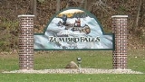
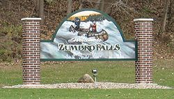
Zumbro Falls, Minnesota
Encyclopedia
Zumbro Falls is a city along the Zumbro River
in Wabasha County
, Minnesota
, United States
. The population was 207 at the 2010 census. U.S. Highway 63
and Minnesota 60
intersect in Zumbro Falls.
The original settlement on the south side of the Zumbro River dates back to 1857. A grist-mill dam
built in 1866 created the falls for which the town is named. Numerous floods have swept away all but a few traces of the dam. Frequent flooding and a tornado
prompted relocation to the north of the river. A railroad arrived in the relocated settlement in 1881. The city was incorporated in 1898.
In September 2010, the city was flooded again, and evacuated. Many buildings were destroyed or damaged.
, the city has a total area of 0.5 square miles (1.2 km²), of which, 0.5 square miles (1.2 km²) of it is land and 0.04 square miles (0.1 km²) of it (4.17%) is water.
U.S. Highway 63
and Minnesota Highway 60
are two of the main routes in the community.
of 2000, there were 177 people, 77 households, and 46 families residing in the city. The population density
was 383.6 people per square mile (148.6/km²). There were 81 housing units at an average density of 175.6 per square mile (68.0/km²). The racial makeup of the city was 99.44% White and 0.56% Native American. Hispanic or Latino of any race were 0.56% of the population.
There were 77 households out of which 33.8% had children under the age of 18 living with them, 50.6% were married couples
living together, 6.5% had a female householder with no husband present, and 39.0% were non-families. 33.8% of all households were made up of individuals and 6.5% had someone living alone who was 65 years of age or older. The average household size was 2.30 and the average family size was 3.00.
In the city the population was spread out with 26.0% under the age of 18, 9.0% from 18 to 24, 35.0% from 25 to 44, 21.5% from 45 to 64, and 8.5% who were 65 years of age or older. The median age was 37 years. For every 100 females there were 94.5 males. For every 100 females age 18 and over, there were 95.5 males.
The median income for a household in the city was $37,188, and the median income for a family was $53,750. Males had a median income of $33,750 versus $26,250 for females. The per capita income
for the city was $18,176. About 9.6% of families and 13.2% of the population were below the poverty line, including 15.9% of those under the age of eighteen and 11.1% of those sixty five or over.
Zumbro River
The Zumbro River is a tributary of the Mississippi River in the Driftless Area of southeastern Minnesota in the United States. It is about 50 mi long from the confluence of its principal tributaries and drains a watershed of 1,428 sq mi...
in Wabasha County
Wabasha County, Minnesota
As of the census of 2000, there were 21,610 people, 8,277 households, and 5,876 families residing in the county. The population density was 41 people per square mile . There were 9,066 housing units at an average density of 17 per square mile...
, Minnesota
Minnesota
Minnesota is a U.S. state located in the Midwestern United States. The twelfth largest state of the U.S., it is the twenty-first most populous, with 5.3 million residents. Minnesota was carved out of the eastern half of the Minnesota Territory and admitted to the Union as the thirty-second state...
, United States
United States
The United States of America is a federal constitutional republic comprising fifty states and a federal district...
. The population was 207 at the 2010 census. U.S. Highway 63
U.S. Route 63
U.S. Route 63 is a long north–south United States highway primarily in the Midwestern United States. The southern terminus of the route is at Interstate 20 in Ruston, Louisiana. The northern terminus is at U.S. Route 2 in Benoit, Wisconsin, about east of Duluth, Minnesota. It is not related to U.S...
and Minnesota 60
Minnesota State Highway 60
Minnesota State Highway 60 is a highway in southern Minnesota, which runs from Iowa Highway 60 at the Iowa state line and continues east-northeast to its eastern terminus at the Wisconsin state line , where the route becomes Wisconsin Highway 25 upon crossing the Mississippi River.Highway 60 is...
intersect in Zumbro Falls.
The original settlement on the south side of the Zumbro River dates back to 1857. A grist-mill dam
Dam
A dam is a barrier that impounds water or underground streams. Dams generally serve the primary purpose of retaining water, while other structures such as floodgates or levees are used to manage or prevent water flow into specific land regions. Hydropower and pumped-storage hydroelectricity are...
built in 1866 created the falls for which the town is named. Numerous floods have swept away all but a few traces of the dam. Frequent flooding and a tornado
Tornado
A tornado is a violent, dangerous, rotating column of air that is in contact with both the surface of the earth and a cumulonimbus cloud or, in rare cases, the base of a cumulus cloud. They are often referred to as a twister or a cyclone, although the word cyclone is used in meteorology in a wider...
prompted relocation to the north of the river. A railroad arrived in the relocated settlement in 1881. The city was incorporated in 1898.
In September 2010, the city was flooded again, and evacuated. Many buildings were destroyed or damaged.
Geography
According to the United States Census BureauUnited States Census Bureau
The United States Census Bureau is the government agency that is responsible for the United States Census. It also gathers other national demographic and economic data...
, the city has a total area of 0.5 square miles (1.2 km²), of which, 0.5 square miles (1.2 km²) of it is land and 0.04 square miles (0.1 km²) of it (4.17%) is water.
U.S. Highway 63
U.S. Route 63
U.S. Route 63 is a long north–south United States highway primarily in the Midwestern United States. The southern terminus of the route is at Interstate 20 in Ruston, Louisiana. The northern terminus is at U.S. Route 2 in Benoit, Wisconsin, about east of Duluth, Minnesota. It is not related to U.S...
and Minnesota Highway 60
Minnesota State Highway 60
Minnesota State Highway 60 is a highway in southern Minnesota, which runs from Iowa Highway 60 at the Iowa state line and continues east-northeast to its eastern terminus at the Wisconsin state line , where the route becomes Wisconsin Highway 25 upon crossing the Mississippi River.Highway 60 is...
are two of the main routes in the community.
Demographics
As of the censusCensus
A census is the procedure of systematically acquiring and recording information about the members of a given population. It is a regularly occurring and official count of a particular population. The term is used mostly in connection with national population and housing censuses; other common...
of 2000, there were 177 people, 77 households, and 46 families residing in the city. The population density
Population density
Population density is a measurement of population per unit area or unit volume. It is frequently applied to living organisms, and particularly to humans...
was 383.6 people per square mile (148.6/km²). There were 81 housing units at an average density of 175.6 per square mile (68.0/km²). The racial makeup of the city was 99.44% White and 0.56% Native American. Hispanic or Latino of any race were 0.56% of the population.
There were 77 households out of which 33.8% had children under the age of 18 living with them, 50.6% were married couples
Marriage
Marriage is a social union or legal contract between people that creates kinship. It is an institution in which interpersonal relationships, usually intimate and sexual, are acknowledged in a variety of ways, depending on the culture or subculture in which it is found...
living together, 6.5% had a female householder with no husband present, and 39.0% were non-families. 33.8% of all households were made up of individuals and 6.5% had someone living alone who was 65 years of age or older. The average household size was 2.30 and the average family size was 3.00.
In the city the population was spread out with 26.0% under the age of 18, 9.0% from 18 to 24, 35.0% from 25 to 44, 21.5% from 45 to 64, and 8.5% who were 65 years of age or older. The median age was 37 years. For every 100 females there were 94.5 males. For every 100 females age 18 and over, there were 95.5 males.
The median income for a household in the city was $37,188, and the median income for a family was $53,750. Males had a median income of $33,750 versus $26,250 for females. The per capita income
Per capita income
Per capita income or income per person is a measure of mean income within an economic aggregate, such as a country or city. It is calculated by taking a measure of all sources of income in the aggregate and dividing it by the total population...
for the city was $18,176. About 9.6% of families and 13.2% of the population were below the poverty line, including 15.9% of those under the age of eighteen and 11.1% of those sixty five or over.