

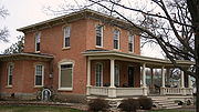
Dover, Minnesota
Encyclopedia
Dover is a city in Olmsted County
, Minnesota
, United States
. The population was 735 at the 2010 census.
, the city has a total area of 1.1 square miles (2.8 km²), all of it land.
The south branch of the Whitewater River
passes through the northern edge of the city.
U.S. Route 14
is the main route serving the community. Interstate 90
is immediately south of the city.
of 2000, there were 438 people, 171 households, and 117 families residing in the city. The population density
was 410.4 people per square mile (158.0/km²). There were 174 housing units at an average density of 163.1 per square mile (62.8/km²). The racial makeup of the city was 97.72% White, 1.60% from other races
, and 0.68% from two or more races. Hispanic or Latino of any race were 2.51% of the population.
There were 171 households out of which 42.1% had children under the age of 18 living with them, 51.5% were married couples
living together, 11.1% had a female householder with no husband present, and 31.0% were non-families. 25.1% of all households were made up of individuals and 8.8% had someone living alone who was 65 years of age or older. The average household size was 2.56 and the average family size was 3.00.
 In the city the population was spread out with 31.1% under the age of 18, 7.1% from 18 to 24, 33.6% from 25 to 44, 18.7% from 45 to 64, and 9.6% who were 65 years of age or older. The median age was 33 years. For every 100 females there were 101.8 males. For every 100 females age 18 and over, there were 97.4 males.
The median income for a household in the city was $41,250, and the median income for a family was $47,188. Males had a median income of $29,792 versus $22,857 for females. The per capita income
for the city was $15,804. None of the families and 3.0% of the population were living below the poverty line, including no under eighteens and 4.7% of those over 64.
Olmsted County, Minnesota
As of the census of 2000, there were 124,277 people, 47,807 households, and 32,317 families residing in the county. The population density was 190 people per square mile . There were 49,422 housing units at an average density of 76 per square mile...
, Minnesota
Minnesota
Minnesota is a U.S. state located in the Midwestern United States. The twelfth largest state of the U.S., it is the twenty-first most populous, with 5.3 million residents. Minnesota was carved out of the eastern half of the Minnesota Territory and admitted to the Union as the thirty-second state...
, United States
United States
The United States of America is a federal constitutional republic comprising fifty states and a federal district...
. The population was 735 at the 2010 census.
Geography
According to the United States Census BureauUnited States Census Bureau
The United States Census Bureau is the government agency that is responsible for the United States Census. It also gathers other national demographic and economic data...
, the city has a total area of 1.1 square miles (2.8 km²), all of it land.
The south branch of the Whitewater River
Whitewater River (Minnesota)
The Whitewater River is a tributary of the Upper Mississippi River which flows through the Driftless Area of Minnesota, reaching its mouth in Winona County opposite Buffalo, Wisconsin. The nearest towns are Altura, Saint Charles, and Elba...
passes through the northern edge of the city.
U.S. Route 14
U.S. Route 14
U.S. Route 14 , an east–west route, is one of the original United States highways of 1926. It currently has a length of 1,398 miles , but it had a peak length of 1,429 miles . For much of its length, it runs roughly parallel to Interstate 90.As of 2004, the highway's eastern terminus is in...
is the main route serving the community. Interstate 90
Interstate 90
Interstate 90 is the longest Interstate Highway in the United States at . It is the northernmost coast-to-coast interstate, and parallels US 20 for the most part. Its western terminus is in Seattle, at Edgar Martinez Drive S. near Safeco Field and CenturyLink Field, and its eastern terminus is in...
is immediately south of the city.
Demographics
As of the censusCensus
A census is the procedure of systematically acquiring and recording information about the members of a given population. It is a regularly occurring and official count of a particular population. The term is used mostly in connection with national population and housing censuses; other common...
of 2000, there were 438 people, 171 households, and 117 families residing in the city. The population density
Population density
Population density is a measurement of population per unit area or unit volume. It is frequently applied to living organisms, and particularly to humans...
was 410.4 people per square mile (158.0/km²). There were 174 housing units at an average density of 163.1 per square mile (62.8/km²). The racial makeup of the city was 97.72% White, 1.60% from other races
Race (United States Census)
Race and ethnicity in the United States Census, as defined by the Federal Office of Management and Budget and the United States Census Bureau, are self-identification data items in which residents choose the race or races with which they most closely identify, and indicate whether or not they are...
, and 0.68% from two or more races. Hispanic or Latino of any race were 2.51% of the population.
There were 171 households out of which 42.1% had children under the age of 18 living with them, 51.5% were married couples
Marriage
Marriage is a social union or legal contract between people that creates kinship. It is an institution in which interpersonal relationships, usually intimate and sexual, are acknowledged in a variety of ways, depending on the culture or subculture in which it is found...
living together, 11.1% had a female householder with no husband present, and 31.0% were non-families. 25.1% of all households were made up of individuals and 8.8% had someone living alone who was 65 years of age or older. The average household size was 2.56 and the average family size was 3.00.
The median income for a household in the city was $41,250, and the median income for a family was $47,188. Males had a median income of $29,792 versus $22,857 for females. The per capita income
Per capita income
Per capita income or income per person is a measure of mean income within an economic aggregate, such as a country or city. It is calculated by taking a measure of all sources of income in the aggregate and dividing it by the total population...
for the city was $15,804. None of the families and 3.0% of the population were living below the poverty line, including no under eighteens and 4.7% of those over 64.