
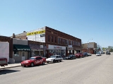
Waterville, Minnesota
Encyclopedia

Le Sueur County, Minnesota
As of the census of 2000, there were 25,426 people, 9,630 households, and 6,923 families residing in the county. The population density was 57 people per square mile . There were 10,858 housing units at an average density of 24 per square mile...
, Minnesota
Minnesota
Minnesota is a U.S. state located in the Midwestern United States. The twelfth largest state of the U.S., it is the twenty-first most populous, with 5.3 million residents. Minnesota was carved out of the eastern half of the Minnesota Territory and admitted to the Union as the thirty-second state...
, United States
United States
The United States of America is a federal constitutional republic comprising fifty states and a federal district...
. The population was 1,868 at the 2010 census. It is close to Sakatah Lake State Park
Sakatah Lake State Park
Sakatah Lake State Park is an state park of Minnesota, USA, on a natural widening of the Cannon River near the town of Waterville. The Dakota native to the area called it "Sakatah" which means "singing hills". To honor this native heritage, some of the trails in the park have been given Dakota...
on the Cannon River.
Geography
According to the United States Census BureauUnited States Census Bureau
The United States Census Bureau is the government agency that is responsible for the United States Census. It also gathers other national demographic and economic data...
, the city has a total area of 2.3 square miles (6 km²), of which, 1.7 square miles (4.4 km²) of it is land and 0.6 square miles (1.6 km²) of it (26.84%) is water.
Minnesota State Highways 13
Minnesota State Highway 13
Minnesota State Highway 13 is a highway in Minnesota that runs from its intersection with U.S. Highway 65 in Albert Lea to its northern terminus at its intersection with State Highway 149 at the West St...
and 60
Minnesota State Highway 60
Minnesota State Highway 60 is a highway in southern Minnesota, which runs from Iowa Highway 60 at the Iowa state line and continues east-northeast to its eastern terminus at the Wisconsin state line , where the route becomes Wisconsin Highway 25 upon crossing the Mississippi River.Highway 60 is...
are two of the main routes in the city.
Demographics
As of the censusCensus
A census is the procedure of systematically acquiring and recording information about the members of a given population. It is a regularly occurring and official count of a particular population. The term is used mostly in connection with national population and housing censuses; other common...
of 2000, there were 1,833 people, 756 households, and 501 families residing in the city. The population density
Population density
Population density is a measurement of population per unit area or unit volume. It is frequently applied to living organisms, and particularly to humans...
was 1,088.8 people per square mile (421.3/km²). There were 864 housing units at an average density of 513.2 per square mile (198.6/km²). The racial makeup of the city was 97.60% White, 0.11% African American, 0.87% Native American, 0.27% Asian, 0.05% Pacific Islander, and 1.09% from two or more races. Hispanic or Latino of any race were 0.33% of the population.
There were 756 households out of which 28.4% had children under the age of 18 living with them, 52.4% were married couples
Marriage
Marriage is a social union or legal contract between people that creates kinship. It is an institution in which interpersonal relationships, usually intimate and sexual, are acknowledged in a variety of ways, depending on the culture or subculture in which it is found...
living together, 9.3% had a female householder with no husband present, and 33.7% were non-families. 28.8% of all households were made up of individuals and 13.8% had someone living alone who was 65 years of age or older. The average household size was 2.32 and the average family size was 2.83.
In the city the population was spread out with 22.3% under the age of 18, 7.0% from 18 to 24, 25.6% from 25 to 44, 24.4% from 45 to 64, and 20.7% who were 65 years of age or older. The median age was 42 years. For every 100 females there were 93.2 males. For every 100 females age 18 and over, there were 88.7 males.
The median income for a household in the city was $35,950, and the median income for a family was $45,536. Males had a median income of $32,361 versus $24,327 for females. The per capita income
Per capita income
Per capita income or income per person is a measure of mean income within an economic aggregate, such as a country or city. It is calculated by taking a measure of all sources of income in the aggregate and dividing it by the total population...
for the city was $17,958. About 6.6% of families and 10.6% of the population were below the poverty line, including 9.8% of those under age 18 and 11.4% of those age 65 or over.
Famous residents
- Major A. B. RogersA. B. RogersAlbert Bowman Rogers , commonly known as Major A.B. Rogers, was an American surveyor now best remembered for his discovery of the Rogers Pass in British Columbia, Canada...
(1829–1889), railway surveyor who discovered Rogers PassRogers PassRogers Pass is a high mountain pass through the Selkirk Mountains of British Columbia used by the Canadian Pacific Railway and the Trans-Canada Highway. The pass is a shortcut across the "Big Bend" of the Columbia River from Revelstoke on the west to Donald, near Golden, on the east...
in British ColumbiaBritish ColumbiaBritish Columbia is the westernmost of Canada's provinces and is known for its natural beauty, as reflected in its Latin motto, Splendor sine occasu . Its name was chosen by Queen Victoria in 1858...
, CanadaCanadaCanada is a North American country consisting of ten provinces and three territories. Located in the northern part of the continent, it extends from the Atlantic Ocean in the east to the Pacific Ocean in the west, and northward into the Arctic Ocean...
. The railway surveyor was not originally from Waterville, but lived there at the end of his life.
Artist Adolf Dehn was born in Waterville, Minnesota, November 22, 1895 and he died in New York City, May 19, 1968. Two-time recipient of the Guggenheim Fellowship, Dehn was one of the most notable lithographers of the 20th century.