
GNSS applications
Encyclopedia
Global Navigation Satellite System
(GNSS) receivers, using the GPS, GLONASS
, Galileo or Beidou
system, are used in many applications.
Global Navigation Satellite System
A satellite navigation or SAT NAV system is a system of satellites that provide autonomous geo-spatial positioning with global coverage. It allows small electronic receivers to determine their location to within a few metres using time signals transmitted along a line-of-sight by radio from...
(GNSS) receivers, using the GPS, GLONASS
GLONASS
GLONASS , acronym for Globalnaya navigatsionnaya sputnikovaya sistema or Global Navigation Satellite System, is a radio-based satellite navigation system operated for the Russian government by the Russian Space Forces...
, Galileo or Beidou
Beidou navigation system
The BeiDou Navigation System or BeiDou Navigation Satellite System is a project by China to develop an independent satellite navigation system...
system, are used in many applications.
Navigation
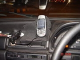
- AutomobileAutomobileAn automobile, autocar, motor car or car is a wheeled motor vehicle used for transporting passengers, which also carries its own engine or motor...
s can be equipped with GNSS receivers at the factory or as aftermarketAftermarket (automotive)The automotive aftermarket is the secondary market of the automotive industry, concerned with the manufacturing, remanufacturing, distribution, retailing, and installation of all vehicle parts, chemicals, tools, equipment and accessories for light and heavy vehicles, after the sale of the...
equipment. Units often display moving maps and information about location, speed, direction, and nearby streets and points of interestPoint of interestA point of interest, or POI, is a specific point location that someone may find useful or interesting. An example is a point on the Earth representing the location of the Space Needle, or a point on Mars representing the location of the mountain, Olympus Mons.The term is widely used in...
.
- AircraftAircraftAn aircraft is a vehicle that is able to fly by gaining support from the air, or, in general, the atmosphere of a planet. An aircraft counters the force of gravity by using either static lift or by using the dynamic lift of an airfoil, or in a few cases the downward thrust from jet engines.Although...
navigation systems usually display a "moving map" and are often connected to the autopilotAutopilotAn autopilot is a mechanical, electrical, or hydraulic system used to guide a vehicle without assistance from a human being. An autopilot can refer specifically to aircraft, self-steering gear for boats, or auto guidance of space craft and missiles...
for en-route navigation. Cockpit-mounted GNSS receivers and glass cockpitGlass cockpitA glass cockpit is an aircraft cockpit that features electronic instrument displays, typically large LCD screens, as opposed to the traditional style of analog dials and gauges...
s are appearing in general aviationGeneral aviationGeneral aviation is one of the two categories of civil aviation. It refers to all flights other than military and scheduled airline and regular cargo flights, both private and commercial. General aviation flights range from gliders and powered parachutes to large, non-scheduled cargo jet flights...
aircraft of all sizes, using technologies such as WAAS or LAASLaas-Places:France:* Laas, Gers* Laas, Loiret* Laàs, in the Pyrénées-Atlantiques départementItaly:* Laas, South Tyrol, a municipality in South Tyrol-Acronym:* Laboratory for analysis and architecture of systems* Local Area Augmentation System...
to increase accuracy. Many of these systems may be certified for instrument flight rulesInstrument flight rulesInstrument flight rules are one of two sets of regulations governing all aspects of civil aviation aircraft operations; the other are visual flight rules ....
navigation, and some can also be used for final approach and landing operations. GliderGlider aircraftGlider aircraft are heavier-than-air craft that are supported in flight by the dynamic reaction of the air against their lifting surfaces, and whose free flight does not depend on an engine. Mostly these types of aircraft are intended for routine operation without engines, though engine failure can...
pilots use GNSS Flight Recorders to log GNSS data verifying their arrival at turn points in gliding competitionsGliding competitionsSome of the pilots in the sport of gliding take part in gliding competitions. These are usually racing competitions, but there are also aerobatic contests and on-line league tables.-History of competitions:...
. Flight computers installed in many gliders also use GNSS to compute wind speed aloft, and glide paths to waypointWaypointA waypoint is a reference point in physical space used for purposes of navigation.-Concept:Waypoints are sets of coordinates that identify a point in physical space. Coordinates used can vary depending on the application. For terrestrial navigation these coordinates can include longitude and...
s such as alternate airports or mountain passes, to aid en route decision making for cross-country soaringLift (soaring)Gliding flight is heavier-than-air flight without the use of thrust. It is employed by gliding animals and by aircraft such as gliders. The most common human application of gliding flight is in sport and recreation using aircraft designed for this purpose...
.
- BoatBoatA boat is a watercraft of any size designed to float or plane, to provide passage across water. Usually this water will be inland or in protected coastal areas. However, boats such as the whaleboat were designed to be operated from a ship in an offshore environment. In naval terms, a boat is a...
s and shipShipSince the end of the age of sail a ship has been any large buoyant marine vessel. Ships are generally distinguished from boats based on size and cargo or passenger capacity. Ships are used on lakes, seas, and rivers for a variety of activities, such as the transport of people or goods, fishing,...
s can use GNSS to navigate all of the world's lakes, seas and oceans. Maritime GNSS units include functions useful on water, such as “man overboard” (MOB) functions that allow instantly marking the location where a person has fallen overboard, which simplifies rescue efforts. GNSS may be connected to the ships self-steering gearSelf-steering gearSelf-steering gear is equipment used on ships and boats to maintain a chosen course without constant human action. It is also known by several other terms, such as autopilot and autohelm...
and ChartplotterChartplotterA Chartplotter is a device used in marine navigation that integrates GPS data with an electronic navigational chart . The chartplotter displays the ENC along with the position, heading and speed of the ship, and may display additional information from radar, automatic information systems or other...
s using the NMEA 0183NMEANMEA 0183 is a combined electrical and data specification for communication between marine electronic devices such as echo sounder, sonars, anemometer, gyrocompass, autopilot, GPS receivers and many other types of instruments. It has been defined by,...
interface. GNSS can also improve the security of shipping traffic by enabling AISAutomatic Identification SystemThe Automatic Identification System is an automatic tracking system used on ships and by Vessel traffic services for identifying and locating vessels by electronically exchanging data with other nearby ships and AIS Base stations...
.
- Heavy Equipment can use GNSS in construction, mining and precision agriculturePrecision agriculturePrecision farming or precision agriculture is a farming management concept based on observing and responding to intra-field variations.It relies on new technologies like satellite imagery, information technology, and geospatial tools...
. The blades and buckets of construction equipment are controlled automatically in GNSS-based machine guidanceMachine guidanceThe term Machine Guidance is used to describe a wide range of techniques which improve the productivity of agricultural, mining and construction equipment. It is most commonly used to describe systems which incorporate GPS, Motion Measuring Units and other devices to provide on-board systems with...
systems. Agricultural equipment may use GNSS to steer automatically, or as a visual aid displayed on a screen for the driver. This is very useful for controlled traffic and row crop operations and when spraying. Harvesters with yield monitors can also use GNSS to create a yield map of the paddock being harvested.
- BicyclesCyclingCycling, also called bicycling or biking, is the use of bicycles for transport, recreation, or for sport. Persons engaged in cycling are cyclists or bicyclists...
often use GNSS in racing and touring. GNSS navigation allows cyclists to plot their course in advance and follow this course, which may include quieter, narrower streets, without having to stop frequently to refer to separate maps. Some GNSS receivers are specifically adapted for cycling with special mounts and housings.
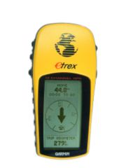
- HikersHikingHiking is an outdoor activity which consists of walking in natural environments, often in mountainous or other scenic terrain. People often hike on hiking trails. It is such a popular activity that there are numerous hiking organizations worldwide. The health benefits of different types of hiking...
, climbers, and even ordinary pedestrians in urban or rural environments can use GNSS to determine their position, with or without reference to separate maps. In isolated areas, the ability of GNSS to provide a precise position can greatly enhance the chances of rescue when climbers or hikers are disabled or lost (if they have a means of communication with rescue workers).
- GNSS equipment for the visually impairedGPS for the visually impairedThere have been many attempts to integrate Global Positioning System into a navigation-assistance system for the blind. GPS was introduced in the late 1980s and since then there have been several research projects to increase it's usefulness for the visually impaired.Satellite navigation...
is available.
- SpacecraftSpacecraftA spacecraft or spaceship is a craft or machine designed for spaceflight. Spacecraft are used for a variety of purposes, including communications, earth observation, meteorology, navigation, planetary exploration and transportation of humans and cargo....
are now beginning to use GNSS as a navigational tool. The addition of a GNSS receiver to a spacecraft allows precise orbit determination without ground tracking. This, in turn, enables autonomous spacecraft navigation, formation flying, and autonomous rendezvous. The use of GNSS in MEO, GEO, HEO, and highly elliptical orbits is feasible only if the receiver can acquire and track the much weaker (15 - 20 dB) GNSS side-lobe signals. This design constraint, and the radiation environment found in space, prevents the use of COTSCOTSCOTS may refer to:* Commercial off-the-shelf, ready-made products* Commercial Orbital Transportation Services, a program for delivery to space* Crest of the Stars, a manga/anime space opera.* Crown-of-thorns starfish, a reef-coral predator...
receivers. Low earth orbitLow Earth orbitA low Earth orbit is generally defined as an orbit within the locus extending from the Earth’s surface up to an altitude of 2,000 km...
satellite constellations such as the one operated by OrbcommOrbcommORBCOMM is a company that offers M2M global asset monitoring and messaging services from its constellation of 29 LEO communications satellites orbiting at 775 km. Like its voice-centric competitors Iridium and Globalstar, it filed for Chapter 11 protection, in September, 2000. ORBCOMM issued...
uses GPS receivers on all satellites
Surveying and mapping
- SurveyingSurveyingSee Also: Public Land Survey SystemSurveying or land surveying is the technique, profession, and science of accurately determining the terrestrial or three-dimensional position of points and the distances and angles between them...
— Survey-Grade GNSS receivers can be used to position survey markerSurvey markerSurvey markers, also called survey marks, and sometimes geodetic marks, are objects placed to mark key survey points on the Earth's surface. They are used in geodetic and land surveying. Informally, such marks are referred to as benchmarks, although strictly speaking the term "benchmark" is...
s, buildings, and road construction. These units use the signal from both the L1 and L2 GPS frequencies. Even though the L2 code data are encrypted, the signal's carrier waveCarrier waveIn telecommunications, a carrier wave or carrier is a waveform that is modulated with an input signal for the purpose of conveying information. This carrier wave is usually a much higher frequency than the input signal...
enables correction of some ionospheric errors. These dual-frequency GPS receivers typically cost US$10,000 or more, but can have positioning errors on the order of one centimeter or less when used in carrier phase differential GPSDifferential GPSDifferential Global Positioning System is an enhancement to Global Positioning System that provides improved location accuracy, from the 15-meter nominal GPS accuracy to about 10 cm in case of the best implementations....
mode.
- MappingCartographyCartography is the study and practice of making maps. Combining science, aesthetics, and technique, cartography builds on the premise that reality can be modeled in ways that communicate spatial information effectively.The fundamental problems of traditional cartography are to:*Set the map's...
and geographic information systemGeographic Information SystemA geographic information system, geographical information science, or geospatial information studies is a system designed to capture, store, manipulate, analyze, manage, and present all types of geographically referenced data...
s (GIS) — Most mapping grade GNSS receivers use the carrier wave data from only the L1 frequency, but have a precise crystal oscillatorCrystal oscillatorA crystal oscillator is an electronic oscillator circuit that uses the mechanical resonance of a vibrating crystal of piezoelectric material to create an electrical signal with a very precise frequency...
which reduces errors related to receiver clock jitterJitterJitter is the undesired deviation from true periodicity of an assumed periodic signal in electronics and telecommunications, often in relation to a reference clock source. Jitter may be observed in characteristics such as the frequency of successive pulses, the signal amplitude, or phase of...
. This allows positioning errors on the order of one meter or less in real-time, with a differential GNSS signal received using a separate radio receiver. By storing the carrier phase measurements and differentially post-processing the data, positioning errors on the order of 10 centimeters are possible with these receivers.- Several projects, including OpenStreetMapOpenStreetMapOpenStreetMap is a collaborative project to create a free editable map of the world. Two major driving forces behind the establishment and growth of OSM have been restrictions on use or availability of map information across much of the world and the advent of inexpensive portable GPS devices.The...
and TierraWiki, allow users to create maps collaboratively, much like a wikiWikiA wiki is a website that allows the creation and editing of any number of interlinked web pages via a web browser using a simplified markup language or a WYSIWYG text editor. Wikis are typically powered by wiki software and are often used collaboratively by multiple users. Examples include...
, using consumer-grade GPS receivers.
- Several projects, including OpenStreetMap
- Geophysics and geology — High precision measurements of crustalCrust (geology)In geology, the crust is the outermost solid shell of a rocky planet or natural satellite, which is chemically distinct from the underlying mantle...
strain can be made with differential GNSS by finding the relative displacement between GNSS sensors. Multiple stations situated around an actively deforming area (such as a volcanoVolcano2. Bedrock3. Conduit 4. Base5. Sill6. Dike7. Layers of ash emitted by the volcano8. Flank| 9. Layers of lava emitted by the volcano10. Throat11. Parasitic cone12. Lava flow13. Vent14. Crater15...
or fault zone) can be used to find strain and ground movement. These measurements can then be used to interpret the cause of the deformationDeformation monitoringDeformation monitoring is the systematic measurement and tracking of the alteration in the shape or dimensions of an object as a result of stresses induced by applied loads...
, such as a dike or sill beneath the surface of an active volcano.
- Archeology — As archaeologists excavate a site, they generally make a three-dimensional map of the site, detailing where each artifact is found.
- Survey-grade GNSS receiverReceiver (modulated ultrasound)In modulated ultrasound terminology, a receiver is a device that receives a modulated ultrasound signal and decodes it for use as sound, navigational-position information, etc. Its function is somewhat like that of a radio receiver...
industryIndustryIndustry refers to the production of an economic good or service within an economy.-Industrial sectors:There are four key industrial economic sectors: the primary sector, largely raw material extraction industries such as mining and farming; the secondary sector, involving refining, construction,...
include a relatively small number of major players who specialize in the design of complex dual-frequency GNSS receiversReceiver (radio)A radio receiver converts signals from a radio antenna to a usable form. It uses electronic filters to separate a wanted radio frequency signal from all other signals, the electronic amplifier increases the level suitable for further processing, and finally recovers the desired information through...
capable of precise tracking of carrier phases for all or most of available signals in order to bring the accuracy of relative positioningPositioningPositioning may refer to:* Positioning , creating an identity in the minds of a target market* Positioning , reader context* Positioning , a technology to approximate where a mobile phone temporarily resides...
down to cm-level values required by these applications. The most known companies are Javad, LeicaLeica GeosystemsLeica Geosystems based in eastern Switzerland produces products and systems for surveying and geographical measurement...
, NovAtel, SeptentrioSeptentrioSeptentrio is a designer and manufacturer of high-end multi-frequency GNSS receivers. Its main target is to provide GNSS receiver boards for further system integration by Original Equipment Manufacturers...
, Topcon, TrimbleTrimble-Places :* Trimble, Alabama * Trimble, Colorado * Trimble, Georgia * Trimble, Illinois * Trimble, Kentucky * Trimble, Missouri * Trimble, Ohio...
.
Other uses
- Precise time reference — Many systems that must be accurately synchronizedSynchronizationSynchronization is timekeeping which requires the coordination of events to operate a system in unison. The familiar conductor of an orchestra serves to keep the orchestra in time....
use GNSS as a source of accurate time. GNSS can be used as a reference clockRadio clockA radio clock or radio-controlled clock is a clock that is synchronized by a time code bit stream transmitted by a radio transmitter connected to a time standard such as an atomic clock...
for time codeTime codeA timecode is a sequence of numeric codes generated at regular intervals by a timing system.- Video and film timecode :...
generators or Network Time ProtocolNetwork Time ProtocolThe Network Time Protocol is a protocol and software implementation for synchronizing the clocks of computer systems over packet-switched, variable-latency data networks. Originally designed by David L...
(NTP) time servers. SensorSensorA sensor is a device that measures a physical quantity and converts it into a signal which can be read by an observer or by an instrument. For example, a mercury-in-glass thermometer converts the measured temperature into expansion and contraction of a liquid which can be read on a calibrated...
s (for seismologySeismologySeismology is the scientific study of earthquakes and the propagation of elastic waves through the Earth or through other planet-like bodies. The field also includes studies of earthquake effects, such as tsunamis as well as diverse seismic sources such as volcanic, tectonic, oceanic,...
or other monitoring application), can use GNSS as a precise time source, so events may be timed accurately. Time division multiple accessTime division multiple accessTime division multiple access is a channel access method for shared medium networks. It allows several users to share the same frequency channel by dividing the signal into different time slots. The users transmit in rapid succession, one after the other, each using its own time slot. This...
(TDMA) communications networks often rely on this precise timing to synchronize RF generating equipment, network equipment, and multiplexerMultiplexerIn electronics, a multiplexer is a device that selects one of several analog or digital input signals and forwards the selected input into a single line. A multiplexer of 2n inputs has n select lines, which are used to select which input line to send to the output...
s.
- Mobile Satellite Communications — Satellite communications systems use a directional antenna (usually a "dish") pointed at a satellite. The antenna on a moving ship or train, for example, must be pointed based on its current location. Modern antenna controllers usually incorporate a GNSS receiver to provide this information.
- Emergency and Location-based serviceLocation-based serviceA Location-Based Service is an information or entertainment service, accessible with mobile devices through the mobile network and utilizing the ability to make use of the geographical position of the mobile device....
s — GNSS functionality can be used by emergency services to locate cell phones. The ability to locate a mobile phone is required in the United States by E911 emergency services legislation. However, as of September 2006 such a system is not in place in all parts of the country. GNSS is less dependent on the telecommunications network topologyTopologyTopology is a major area of mathematics concerned with properties that are preserved under continuous deformations of objects, such as deformations that involve stretching, but no tearing or gluing...
than radiolocationRadiolocationRadiolocating is the process of finding the location of something through the use of radio waves. It generally refers to passive uses, particularly radar—as well as detecting buried cables, water mains, and other public utilities. It is similar to radionavigation, but radiolocation usually...
for compatible phones. Assisted GPSAssisted GPSAssisted GPS, generally abbreviated as A-GPS or aGPS, is a system which can, under certain conditions, improve the startup performance, or time-to-first-fix of a GPS satellite-based positioning system. It is used extensively with GPS-capable cellular phones as its development was accelerated by...
reduces the power requirements of the mobile phone and increases the accuracy of the location. A phone's geographic location may also be used to provide location-based services including advertising, or other location-specific information.
- Location-based gameLocation-based gameA location-based game is one in which the game play somehow evolves and progresses via a player's location. Thus, location-based games almost always support some kind of localization technology, for example by using satellite positioning like GPS."Urban gaming" or "Street Games" are typically...
s — The availability of hand-held GNSS receivers has led to games such as GeocachingGeocachingGeocaching is an outdoor sporting activity in which the participants use a Global Positioning System receiver or mobile device and other navigational techniques to hide and seek containers, called "geocaches" or "caches", anywhere in the world....
, which involves using a hand-held GNSS unit to travel to a specific longitudeLongitudeLongitude is a geographic coordinate that specifies the east-west position of a point on the Earth's surface. It is an angular measurement, usually expressed in degrees, minutes and seconds, and denoted by the Greek letter lambda ....
and latitudeLatitudeIn geography, the latitude of a location on the Earth is the angular distance of that location south or north of the Equator. The latitude is an angle, and is usually measured in degrees . The equator has a latitude of 0°, the North pole has a latitude of 90° north , and the South pole has a...
to search for objects hidden by other geocachers. This popular activity often includes walking or hiking to natural locations. Geodashing is an outdoor sport using waypointWaypointA waypoint is a reference point in physical space used for purposes of navigation.-Concept:Waypoints are sets of coordinates that identify a point in physical space. Coordinates used can vary depending on the application. For terrestrial navigation these coordinates can include longitude and...
s.
- Aircraft passengers — Most airlineAirlineAn airline provides air transport services for traveling passengers and freight. Airlines lease or own their aircraft with which to supply these services and may form partnerships or alliances with other airlines for mutual benefit...
s allow passenger use of GNSS units on their flights, except during landing and take-off when other electronic devices are also restricted. Even though consumer GNSS receivers have a minimal risk of interference, a few airlines disallow use of hand-held receivers during flight. Other airlines integrate aircraft tracking into the seat-back television entertainment system, available to all passengers even during takeoff and landing.
- Heading information — The GNSS system can be used to determine heading information, even though it was not designed for this purpose. A "GNSS compass" uses a pair of antennas separated by about 50 cm to detect the phase difference in the carrier signal from a particular GNSS satellite. Given the positions of the satellite, the position of the antenna, and the phase difference, the orientation of the two antennas can be computed. More expensive GNSS compass systems use three antennas in a triangle to get three separate readings with respect to each satellite. A GNSS compass is not subject to magnetic declinationMagnetic declinationMagnetic declination is the angle between magnetic north and true north. The declination is positive when the magnetic north is east of true north. The term magnetic variation is a synonym, and is more often used in navigation...
as a magnetic compass is, and doesn't need to be reset periodically like a gyrocompassGyrocompassA gyrocompass is a type of non-magnetic compass which bases on a fast-spinning disc and rotation of our planet to automatically find geographical direction...
. It is, however, subject to multipath effects.
- GPS trackingGPS trackingA GPS tracking unit is a device that uses the Global Positioning System to determine the precise location of a vehicle, person, or other asset to which it is attached and to record the position of the asset at regular intervals...
systems use GNSS to determine the location of a vehicle, person, pet or freight, and to record the position at regular intervals in order to create a log of movements. The data can be stored inside the unit, or sent to a remote computer by radio or cellular modem. Some systems allow the location to be viewed in real-time on the Internet with a web-browser.
- Recent innovations in GPS tracking technology include its use for monitoring the whereabouts of convicted sex offenders, using GPS devices on their ankles as a condition of their parole. This passive monitoring system allows law enforcement officials to review the daily movements of offenders for a cost of only $5 or $10 per day. Real time, or instant tracking is considered too costly for GPS tracking of criminals. (cited from http://articles.gpsfaq.com/details.aspx?item=50).
- GNSS Road PricingGNSS Road PricingGNSS road pricing or GNSS tolling is the charging of road users using Global Navigation Satellite System sensors inside vehicles. Advocates argue that road pricing using GNSS permits a number of policies such as tolling by distance on urban roads and can be used for many other applications in...
systems charge of road users using data from GNSS sensors inside vehicles. Advocates argue that road pricing using GNSS permits a number of policies such as tolling by distance on urban roads and can be used for many other applications in parking, insurance and vehicle emissions. Critics argue that GNSS could lead to an invasion of people’s privacy
- Weather Prediction Improvements — Measurement of atmospheric bending of GNSS satellite signals by specialized GNSS receivers in orbital satellites can be used to determine atmospheric conditions such as air density, temperature, moisture and electron density. Such information from a set of six micro-satellites, launched in April 2006, called the Constellation of Observing System for Meteorology, Ionosphere and Climate COSMICCOSMICConstellation Observing System for Meteorology, Ionosphere, and Climate is a program designed to provide advances in meteorology, ionospheric research, climatology, and space weather by using GPS satellites in conjunction with low Earth orbiting satellites...
has been proven to improve the accuracy of weather prediction models.
- Photographic Geocoding — Combining GNSS position data with photographs taken with a (typically digital) cameraCameraA camera is a device that records and stores images. These images may be still photographs or moving images such as videos or movies. The term camera comes from the camera obscura , an early mechanism for projecting images...
, allows one to view the photographs on a map or to lookup the locations where they were taken in a gazeteer. It's possible to automatically annotate the photographs with the location they depict by integrating a GNSS device into the camera so that co-ordinates are embedded into photographs as Exif metadataMetadataThe term metadata is an ambiguous term which is used for two fundamentally different concepts . Although the expression "data about data" is often used, it does not apply to both in the same way. Structural metadata, the design and specification of data structures, cannot be about data, because at...
. Alternatively, the timestamps of pictures can be correlated with a GNSS track log.
- Skydiving — Most commercial drop zones use a GNSS to aid the pilot to "spot" the plane to the correct position relative to the dropzone that will allow all skydivers on the load to be able to fly their canopies back to the landing area. The "spot" takes into account the number of groups exiting the plane and the upper winds. In areas where skydiving through cloud is permitted the GNSS can be the sole visual indicator when spotting in overcast conditions, this is referred to as a "GPS Spot".
- MarketingMarketingMarketing is the process used to determine what products or services may be of interest to customers, and the strategy to use in sales, communications and business development. It generates the strategy that underlies sales techniques, business communication, and business developments...
— Some market research companies have combined GIS systems and survey based research to help companies to decide where to open new branches, and to target their advertising according to the usage patterns of roads and the socio-demographic attributes of residential zones.
- Wreck divingWreck divingWreck diving is a type of recreational diving where shipwrecks are explored. Although most wreck dive sites are at shipwrecks, there is an increasing trend to scuttle retired ships to create artificial reef sites...
— A popular variant of scuba diving is known as wreck diving. In order to locate the desired shipwreckShipwreckA shipwreck is what remains of a ship that has wrecked, either sunk or beached. Whatever the cause, a sunken ship or a wrecked ship is a physical example of the event: this explains why the two concepts are often overlapping in English....
on the bottom of the ocean floor GPS is used to navigate to the approximate location and then the shipwreck is found using an echosounder.
- Social Networking A growing number of companies are marketing cellular phones equipped with GPS technology, offering the ability to pinpoint friends on custom created maps, along with alerts that inform the user when the party is within a programmed range. Not only do many of these phones offer social networking functions, they offer standard GPS navigation features such as audible voice commands for in-vehicle GPS navigation. (cited from http://articles.gpsfaq.com/details.aspx?item=51)