

OpenStreetMap
Encyclopedia
OpenStreetMap is a collaborative project
to create a free
editable map
of the world. Two major driving forces behind the establishment and growth of OSM have been restrictions on use or availability of map information across much of the world and the advent of inexpensive portable GPS devices.
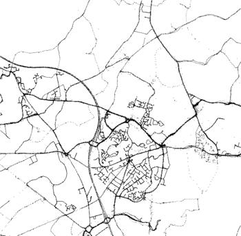
The maps are created using data from portable GPS devices, aerial photography
, other free sources or simply from local knowledge. Both rendered images and the vector dataset are available for download under a Creative Commons
Attribution-ShareAlike 2.0
licence.
The OpenStreetMap approach to mapping was inspired by sites such as Wikipedia
; the map display features a prominent 'Edit' tab and a full revision history is maintained. Registered users can upload GPS track logs and edit the vector data using free GIS editing tools like JOSM. Various mobile applications also allow contribution of GPX
tracks to the OSM project.
.jpg) OpenStreetMap (OSM) was founded in July 2004 by Steve Coast. In April 2006, the OpenStreetMap Foundation (OSMF) was established to encourage the growth, development and distribution of free geospatial
OpenStreetMap (OSM) was founded in July 2004 by Steve Coast. In April 2006, the OpenStreetMap Foundation (OSMF) was established to encourage the growth, development and distribution of free geospatial
data and provide geospatial data for anybody to use and share. In December 2006, Yahoo confirmed that OpenStreetMap could use its aerial photography
as a backdrop for map production.
In April 2007, Automotive Navigation Data
(AND) donated a complete road data set for the Netherlands
and trunk road
data for India
and China
to the project and by July 2007, when the first OSM international The State of the Map conference was held there were 9,000 registered users. Sponsors of the event included Google
, Yahoo and Multimap
. In August 2007 an independent project, OpenAerialMap
, was launched, to hold a database of aerial photography available on open licensing and in October 2007 OpenStreetMap completed the import of a US Census TIGER
road dataset. In December 2007 Oxford University became the first major organisation to use OpenStreetMap data on their main website.
In January 2008, functionality was made available to download map data into a GPS unit for use by cyclists. In February 2008 a series of workshops were held in India. In March two founders announced that they have received venture capital funding of 2.4m euros for CloudMade
, a commercial company that will use OpenStreetMap data.
Not all registered contributors actually contribute to the map; a minority of individuals contribute the majority of the content: in March 2008 approximately 10% of the registered user base were contributing map data each month.
More recently, the availability of aerial photography
and other data sources from commercial and government sources has greatly increased the speed of this work and has allowed land-use data to be collected more accurately.
When large datasets are available, a technical team manages the conversion and import of the data.
 Ground surveys are performed by a mapper, on foot, bicycle
or in a car
or boat
. Map data are usually collected using a GPS unit, although this isn't strictly necessary if an area has already been traced from satellite imagery.
Once the data has been collected, they are entered into the database by uploading it on the project's website. At that point in time, no information about the kind of uploaded track is available - it could be e.g. a motorway, a footpath or a river. Thus, in a second step, editing takes place using one of several purpose-built map editors. This is usually done by the same mapper, sometimes by other users registered at OpenStreetMap.
As collecting and uploading data is separated from editing objects, contribution to the project is possible also without using a GPS unit. In particular, placing and editing objects such as schools, hospitals, taxi ranks, bus stops, pubs etc. is done based on editors' local knowledge.
Some committed contributors are systematically mapping whole towns and cities over a period of time, or organising mapping parties to intensively map a particular area over an evening or a weekend.
In addition to structured surveys, a large number of smaller edits are made by contributors to correct errors or add features.
agencies have released official data on appropriate licenses. Much of these data have come from the United States
, where the federal government does not copyright such data. See Copyright status of work by the U.S. government for more details.
Various authorities have also made more local detailed aerial photography available on suitable licenses through OpenAerialMap
.
Out-of-copyright maps can be good source of information about features that don't change frequently. Copyright periods vary, but in the UK Crown copyright
expires after 50 years and hence Ordnance Survey maps until the 1960s can legally be used. A complete set of UK 1 inch/mile maps from the late 1940s and early 1950s has been collected, scanned, and is available online as a resource for contributors.
In December 2006, Yahoo!
confirmed that OpenStreetMap was able to make use of their vertical aerial imagery and this photography was available within the editing software as an overlay. Contributors could create their vector based maps as a derived work, released with a free and open
license, until the shutdown of the Yahoo! Maps API on September 13, 2011.
In November 2010, Microsoft announced that the OpenStreetMap community could use Bing vertical aerial imagery as a backdrop in its editors.
NearMap Pty Ltd
have, since launch in November 2009, made their high-resolution PhotoMaps (currently of major Australian cities, plus some rural Australian areas) available for deriving OpenStreetMap data under a CC-BY-SA licence.
Attribution-Share Alike 2.0 licence; however, legal investigation work and community consultation is underway to relicense the project under the Open Database License
(ODbL) from Open Data Commons (ODC), claimed to be more suitable for a map data set.
As part of this relicensing process, some of the map data will have to be deleted. This includes all data contributed by members who have not agreed to the new licensing terms, as well as all subsequent edits to those affected objects. It also includes any data contributed based on input data that are not compatible with the new terms. It is not currently known how much data will be removed, but it is thought that the effect will be much greater in some countries than in others.
code to manage the databases, much user interaction and the API are available under a GNU General Public License
.
Certain parts of the software, such as the flash-based map editor Potlatch2, have been made available as public domain
.
 Mapping is available online at general mapping sites:
, Android, the iPhone
, Windows Mobile
or Openmoko
. The various programs distinguish themselves according to key features like if they use raster maps or vector maps, need an Internet connection or can be used offline, support alternate render layers such as cycle paths, support address search or advanced features like routing, thus catering for a large number of different needs for viewing maps. With the inclusion of OpenStreetMap support in several programming libraries for mobile phones it is also possible to include OSM maps in other location-based service
.
service for various cities around the world, including Baghdad
, Beijing
, Kabul
, Santiago
, Sydney
and Tokyo
.
OpenStreetMap plug-in inserts maps and adds geo meta tags to posts / pages of WordPress blogs.
Drupal
has multiple OpenStreetMap plug-in modules to integrate database content with OpenStreetMaps.
Joomla also has a variety of OpenStreetMap related modules and plug-ins.
OSM provides information that other map sites don't provide:
, the games company behind the property trading board game Monopoly
, launched Monopoly City Streets
, a massively multiplayer online game
which allowed players to buy streets all over the world. Although the game used map tiles from Google Maps
and the Google Maps API to display the game board, the underlying vector street data was obtained from OpenStreetMap. The online game was meant to be a limited time offering, closing at the end of January 2010.
company Fluid Forms introduced the vectors of OpenStreetMaps into the proprietary product "Streets Clock". It is an online design interface with which people design customized wall clocks from a city's street-map. Fluid Forms uses the vectors to enable visitors of the website to get previews of how the clock will look in real-time.
, OpenStreetMap and Crisis Commons volunteers used available satellite imagery to map the roads, buildings and refugee camps of Port-au-Prince in just two days, building "the most complete digital map of Haiti's roads".
The resulting data and maps have been used by several organisations providing relief aid, such as the World Bank
, the European Commission Joint Research Centre, the Office for the Coordination of Humanitarian Affairs
, UNOSAT
and others.

data structure
.
Up to version 0.4 of the protocol, an intermediate element between nodes and ways (segments, line segments which two node produced) was also used.
A recommended ontology
of map features (the meaning of tags) is maintained on a wiki.
Virtual community
A virtual community is a social network of individuals who interact through specific media, potentially crossing geographical and political boundaries in order to pursue mutual interests or goals...
to create a free
Free content
Free content, or free information, is any kind of functional work, artwork, or other creative content that meets the definition of a free cultural work...
editable map
Map
A map is a visual representation of an area—a symbolic depiction highlighting relationships between elements of that space such as objects, regions, and themes....
of the world. Two major driving forces behind the establishment and growth of OSM have been restrictions on use or availability of map information across much of the world and the advent of inexpensive portable GPS devices.
The maps are created using data from portable GPS devices, aerial photography
Aerial photography
Aerial photography is the taking of photographs of the ground from an elevated position. The term usually refers to images in which the camera is not supported by a ground-based structure. Cameras may be hand held or mounted, and photographs may be taken by a photographer, triggered remotely or...
, other free sources or simply from local knowledge. Both rendered images and the vector dataset are available for download under a Creative Commons
Creative Commons
Creative Commons is a non-profit organization headquartered in Mountain View, California, United States devoted to expanding the range of creative works available for others to build upon legally and to share. The organization has released several copyright-licenses known as Creative Commons...
Attribution-ShareAlike 2.0
Creative Commons licenses
Creative Commons licenses are several copyright licenses that allow the distribution of copyrighted works. The licenses differ by several combinations that condition the terms of distribution. They were initially released on December 16, 2002 by Creative Commons, a U.S...
licence.
The OpenStreetMap approach to mapping was inspired by sites such as Wikipedia
Wikipedia
Wikipedia is a free, web-based, collaborative, multilingual encyclopedia project supported by the non-profit Wikimedia Foundation. Its 20 million articles have been written collaboratively by volunteers around the world. Almost all of its articles can be edited by anyone with access to the site,...
; the map display features a prominent 'Edit' tab and a full revision history is maintained. Registered users can upload GPS track logs and edit the vector data using free GIS editing tools like JOSM. Various mobile applications also allow contribution of GPX
GPX
GPX, or GPS eXchange Format is an XML schema designed as a common GPS data format for software applications.It can be used to describe waypoints, tracks, and routes. The format is open and can be used without the need to pay license fees. Its tags store location, elevation, and time and can in this...
tracks to the OSM project.
History
Geospatial
Geospatial analysis is an approach to applying statistical analysis and other informational techniques to geographically based data. Such analysis employs spatial software and analytical methods with terrestrial or geographic datasets, including geographic information systems and...
data and provide geospatial data for anybody to use and share. In December 2006, Yahoo confirmed that OpenStreetMap could use its aerial photography
Aerial photography
Aerial photography is the taking of photographs of the ground from an elevated position. The term usually refers to images in which the camera is not supported by a ground-based structure. Cameras may be hand held or mounted, and photographs may be taken by a photographer, triggered remotely or...
as a backdrop for map production.
In April 2007, Automotive Navigation Data
Automotive Navigation Data
AND Automotive Navigation Data is one of the few companies in the world supplying digital map data for GPS-based applications. After the take over of Navteq by Nokia en Tele Altas by TomTom AND is the last independent supplier of digital maps...
(AND) donated a complete road data set for the Netherlands
Netherlands
The Netherlands is a constituent country of the Kingdom of the Netherlands, located mainly in North-West Europe and with several islands in the Caribbean. Mainland Netherlands borders the North Sea to the north and west, Belgium to the south, and Germany to the east, and shares maritime borders...
and trunk road
Trunk road
A trunk road, trunk highway, or strategic road is a major road—usually connecting two or more cities, ports, airports, and other things.—which is the recommended route for long-distance and freight traffic...
data for India
India
India , officially the Republic of India , is a country in South Asia. It is the seventh-largest country by geographical area, the second-most populous country with over 1.2 billion people, and the most populous democracy in the world...
and China
China
Chinese civilization may refer to:* China for more general discussion of the country.* Chinese culture* Greater China, the transnational community of ethnic Chinese.* History of China* Sinosphere, the area historically affected by Chinese culture...
to the project and by July 2007, when the first OSM international The State of the Map conference was held there were 9,000 registered users. Sponsors of the event included Google
Google
Google Inc. is an American multinational public corporation invested in Internet search, cloud computing, and advertising technologies. Google hosts and develops a number of Internet-based services and products, and generates profit primarily from advertising through its AdWords program...
, Yahoo and Multimap
Multimap.com
Multimap.com was a United Kingdom based provider of mapping and location-based services. It was acquired by Microsoft in 2007 and merged into Bing Maps in 2010.-History:...
. In August 2007 an independent project, OpenAerialMap
OpenAerialMap
OpenAerialMap is an open collection of aerial photographs, collected into a single coherent view of the world. It is an attempt to gather satellite imagery and aerial photography data from various free and open aerial imagery datasources around the world....
, was launched, to hold a database of aerial photography available on open licensing and in October 2007 OpenStreetMap completed the import of a US Census TIGER
Tiger
The tiger is the largest cat species, reaching a total body length of up to and weighing up to . Their most recognizable feature is a pattern of dark vertical stripes on reddish-orange fur with lighter underparts...
road dataset. In December 2007 Oxford University became the first major organisation to use OpenStreetMap data on their main website.
In January 2008, functionality was made available to download map data into a GPS unit for use by cyclists. In February 2008 a series of workshops were held in India. In March two founders announced that they have received venture capital funding of 2.4m euros for CloudMade
CloudMade
CloudMade is a company which produces APIs, rendered maps, and geographic-related services. Unlike many other companies in the same field, CloudMade uses exclusively Creative Commons-licensed OpenStreetMap data, and was cofounded by the founder of OpenStreetMap, Steve Coast...
, a commercial company that will use OpenStreetMap data.
Users
By August 2008, shortly after the second The State of the Map conference was held, there were over 50,000 registered contributors; by March 2009 there were 100,000 and by the end of 2009 the figure was nearly 200,000. As of May 2011, OpenStreetMap over 400,000 registered users.Not all registered contributors actually contribute to the map; a minority of individuals contribute the majority of the content: in March 2008 approximately 10% of the registered user base were contributing map data each month.
Technique
The initial map data were collected from scratch by volunteers performing systematic ground surveys using a handheld GPS unit and a notebook, digital camera, or a voice recorder. These data were then entered into the OpenStreetMap database.More recently, the availability of aerial photography
Aerial photography
Aerial photography is the taking of photographs of the ground from an elevated position. The term usually refers to images in which the camera is not supported by a ground-based structure. Cameras may be hand held or mounted, and photographs may be taken by a photographer, triggered remotely or...
and other data sources from commercial and government sources has greatly increased the speed of this work and has allowed land-use data to be collected more accurately.
When large datasets are available, a technical team manages the conversion and import of the data.
Structured ground surveys
Bicycle
A bicycle, also known as a bike, pushbike or cycle, is a human-powered, pedal-driven, single-track vehicle, having two wheels attached to a frame, one behind the other. A person who rides a bicycle is called a cyclist, or bicyclist....
or in a car
Čar
Čar is a village in the municipality of Bujanovac, Serbia. According to the 2002 census, the town has a population of 296 people.-References:...
or boat
Boat
A boat is a watercraft of any size designed to float or plane, to provide passage across water. Usually this water will be inland or in protected coastal areas. However, boats such as the whaleboat were designed to be operated from a ship in an offshore environment. In naval terms, a boat is a...
. Map data are usually collected using a GPS unit, although this isn't strictly necessary if an area has already been traced from satellite imagery.
Once the data has been collected, they are entered into the database by uploading it on the project's website. At that point in time, no information about the kind of uploaded track is available - it could be e.g. a motorway, a footpath or a river. Thus, in a second step, editing takes place using one of several purpose-built map editors. This is usually done by the same mapper, sometimes by other users registered at OpenStreetMap.
As collecting and uploading data is separated from editing objects, contribution to the project is possible also without using a GPS unit. In particular, placing and editing objects such as schools, hospitals, taxi ranks, bus stops, pubs etc. is done based on editors' local knowledge.
Some committed contributors are systematically mapping whole towns and cities over a period of time, or organising mapping parties to intensively map a particular area over an evening or a weekend.
In addition to structured surveys, a large number of smaller edits are made by contributors to correct errors or add features.
Government data sources
Some governmentGovernment
Government refers to the legislators, administrators, and arbitrators in the administrative bureaucracy who control a state at a given time, and to the system of government by which they are organized...
agencies have released official data on appropriate licenses. Much of these data have come from the United States
United States
The United States of America is a federal constitutional republic comprising fifty states and a federal district...
, where the federal government does not copyright such data. See Copyright status of work by the U.S. government for more details.
- Landsat 7Landsat 7Landsat 7, launched on April 15, 1999, is the latest satellite of the Landsat program. Landsat 7's primary goal is to refresh the global archive of satellite photos, providing up-to-date and cloud-free images. The Landsat Program is managed and operated by the USGS, and data from Landsat 7 is...
satellite imagery - Prototype Global Shorelines (PGS)
- TIGERTopologically Integrated Geographic Encoding and ReferencingTopologically Integrated Geographic Encoding and Referencing, or TIGER, or TIGER/Line is a format used by the United States Census Bureau to describe land attributes such as roads, buildings, rivers, and lakes, as well as areas such as census tracts...
data of the United States - Ordnance SurveyOrdnance SurveyOrdnance Survey , an executive agency and non-ministerial government department of the Government of the United Kingdom, is the national mapping agency for Great Britain, producing maps of Great Britain , and one of the world's largest producers of maps.The name reflects its creation together with...
OpenData - NRCan's CanVec vector data and GeoBase'sGeoBase (geospatial data)GeoBase is a federal, provincial and territorial government initiative that is overseen by the Canadian Council on Geomatics . It is undertaken to ensure the provision of, and access to, a common, up-to-date and maintained base of quality geospatial data for Canada...
vector data sets of Canada
Various authorities have also made more local detailed aerial photography available on suitable licenses through OpenAerialMap
OpenAerialMap
OpenAerialMap is an open collection of aerial photographs, collected into a single coherent view of the world. It is an attempt to gather satellite imagery and aerial photography data from various free and open aerial imagery datasources around the world....
.
Out-of-copyright maps can be good source of information about features that don't change frequently. Copyright periods vary, but in the UK Crown copyright
Crown copyright
Crown copyright is a form of copyright claim used by the governments of a number of Commonwealth realms. It provides special copyright rules for the Crown .- Australia :...
expires after 50 years and hence Ordnance Survey maps until the 1960s can legally be used. A complete set of UK 1 inch/mile maps from the late 1940s and early 1950s has been collected, scanned, and is available online as a resource for contributors.
Commercial data sources
Some commercial companies have donated data to the project on suitable licenses. Notably, Automotive Navigation Data (AND) provided a complete road data set for Netherlands and details of trunk roads in China and India.In December 2006, Yahoo!
Yahoo!
Yahoo! Inc. is an American multinational internet corporation headquartered in Sunnyvale, California, United States. The company is perhaps best known for its web portal, search engine , Yahoo! Directory, Yahoo! Mail, Yahoo! News, Yahoo! Groups, Yahoo! Answers, advertising, online mapping ,...
confirmed that OpenStreetMap was able to make use of their vertical aerial imagery and this photography was available within the editing software as an overlay. Contributors could create their vector based maps as a derived work, released with a free and open
Open Content License
The Open Content License is a copyleft license designed for distribution of open content material. This license is not compatible with the any other license in that it requires derivative works to be licensed under the Open Content License....
license, until the shutdown of the Yahoo! Maps API on September 13, 2011.
In November 2010, Microsoft announced that the OpenStreetMap community could use Bing vertical aerial imagery as a backdrop in its editors.
NearMap Pty Ltd
NearMap
NearMap Pty Ltd is an Australian provider of high resolution aerial imagery .NearMap currently operates a web portal which serves up its imagery and terrain tiles, along with OpenStreetMap map tiles, all three of which are free for the public and most commercial businesses to use...
have, since launch in November 2009, made their high-resolution PhotoMaps (currently of major Australian cities, plus some rural Australian areas) available for deriving OpenStreetMap data under a CC-BY-SA licence.
The OpenStreetMap database
OpenStreetMap data is published under an open content license, with the intention of promoting free use and re-distribution of the data (both commercial and non-commercial). The license currently used is the Creative CommonsCreative Commons
Creative Commons is a non-profit organization headquartered in Mountain View, California, United States devoted to expanding the range of creative works available for others to build upon legally and to share. The organization has released several copyright-licenses known as Creative Commons...
Attribution-Share Alike 2.0 licence; however, legal investigation work and community consultation is underway to relicense the project under the Open Database License
Open Database Licence
The Open Database License is a "Share Alike" license agreement intended to allow users to freely share, modify, and use a database while maintaining this same freedom for others....
(ODbL) from Open Data Commons (ODC), claimed to be more suitable for a map data set.
As part of this relicensing process, some of the map data will have to be deleted. This includes all data contributed by members who have not agreed to the new licensing terms, as well as all subsequent edits to those affected objects. It also includes any data contributed based on input data that are not compatible with the new terms. It is not currently known how much data will be removed, but it is thought that the effect will be much greater in some countries than in others.
Input data
All data added to the project need to have a license compatible with the Creative Commons Attribution-Share Alike license. This can include out of copyright information, public domain or other licenses. All contributors must register with the project and agree to provide data on a Creative Commons BY-SA 2.0 licence, or determine that the licensing of the source data is suitable; this may involve examining licences for government data to establish whether they are compatible.Software
Software used in the production and presentation of OpenStreetMap data is available from many different projects and each may have their own licencing. The core Ruby on RailsRuby on Rails
Ruby on Rails, often shortened to Rails or RoR, is an open source web application framework for the Ruby programming language.-History:...
code to manage the databases, much user interaction and the API are available under a GNU General Public License
GNU General Public License
The GNU General Public License is the most widely used free software license, originally written by Richard Stallman for the GNU Project....
.
Certain parts of the software, such as the flash-based map editor Potlatch2, have been made available as public domain
Public domain
Works are in the public domain if the intellectual property rights have expired, if the intellectual property rights are forfeited, or if they are not covered by intellectual property rights at all...
.
Usage
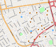
OpenStreetMap data is available through an increasing number of sites and in different formats:Online raster maps
| Map | Theme | Area |
|---|---|---|
| OpenStreetMap | general, cyclists, debugging | Worldwide |
| OpenStreetBrowser | overlays, search, navigation, wikipedia, public transport | Worldwide |
| Information Freeway | general, almost realtime | Worldwide |
| OSM WMS Servers | general, Web Map Services | Worldwide |
| OpenSeaMap OpenSeaMap OpenSeaMap is a software project collecting freely usable nautical information and geospatial data to create a worldwide nautical chart. This chart is available on the OpenSeaMap website, and can also be downloaded for use as an electronic chart for offline applications.The project is part of... |
nautical chart | Worldwide, multilingual: seas, oceans, waterways, weather charts, harbours, Wikipedia |
| FreeMap | walkers | parts of the UK |
| Reit- und Wanderkarte | walkers and riders | Austria, Germany, Switzerland |
| TopOSM | walkers and riders | United States |
| OpenCycleMap | cyclists | Worldwide |
| OpenMTBMap | cyclists (esp. mountainbikes) | Worldwide |
| YourNavigation | routing | Worldwide |
| OpenRouteService | routing | Europe |
| OpenOrienteeringMap | orienteering style | Worldwide |
| OpenPisteMap | skiing | some European and USA resorts |
| Bing OSM "Map App" | general | Worldwide |
| CloudMade CloudMade CloudMade is a company which produces APIs, rendered maps, and geographic-related services. Unlike many other companies in the same field, CloudMade uses exclusively Creative Commons-licensed OpenStreetMap data, and was cofounded by the founder of OpenStreetMap, Steve Coast... |
general, mobile and various other custom styles | Worldwide |
| OpenAviationMap | Airspace indexing and classification | Braunschweig Germany |
| MapQuest Open (beta) | general, routing | Worldwide |
| NearMap NearMap NearMap Pty Ltd is an Australian provider of high resolution aerial imagery .NearMap currently operates a web portal which serves up its imagery and terrain tiles, along with OpenStreetMap map tiles, all three of which are free for the public and most commercial businesses to use... |
up-to-date photomaps | populated areas of Australia |
| OSMTransport | public transport | Worldwide |
| ÖPNV-Karte, or OpenBusMap | public transport | Europe |
| OSM Mapper | Debugging maps by Ito World Ltd | |
| OpenLinkMap | Map showing additional information, e.g. websites, wikipedia, contact, ... | |
| Busroutes.in | public transport bus routes | India (Chennai) [Bangalore and Delhi under development stage] |
Off-line raster maps
- MarbleMarble (KDE)Marble is a virtual globe that allows the user to choose among the Earth, the Moon, Venus, Mars and other planets. It is free software under the terms of the GNU LGPL, developed by KDE and the free-software / open-source communities for use on personal computers running a Qt4-compatible operating...
viewer by KDEKDEKDE is an international free software community producing an integrated set of cross-platform applications designed to run on Linux, FreeBSD, Microsoft Windows, Solaris and Mac OS X systems...
for GNU/Linux, Mac OS XMac OS XMac OS X is a series of Unix-based operating systems and graphical user interfaces developed, marketed, and sold by Apple Inc. Since 2002, has been included with all new Macintosh computer systems...
, and Windows - Kosmos Renderer for Windows
- OpenSeaMapOpenSeaMapOpenSeaMap is a software project collecting freely usable nautical information and geospatial data to create a worldwide nautical chart. This chart is available on the OpenSeaMap website, and can also be downloaded for use as an electronic chart for offline applications.The project is part of...
downloadable charts for PC (all operating systems), Garmin, Lowrance, PDA, PNA - eBookMaps downloadable street maps for ebook readers (KindleAmazon KindleThe Amazon Kindle is an e-book reader developed by Amazon.com subsidiary Lab126 which uses wireless connectivity to enable users to shop for, download, browse, and read e-books, newspapers, magazines, blogs, and other digital media...
, NookNookNook may refer to a small corner formed by two walls.Nook may also refer to:*A slang name for a person reading; also known as a "book nook"*"Nook", a science-fiction TV series Lexx episode...
etc.)
Handheld GPS receivers
- GarminGarminGarmin Ltd. , incorporated in Schaffhausen, Switzerland, is the parent company of a group of companies founded in 1989 by Gary Burrell and Min Kao , that develops consumer, aviation, and marine technologies for the Global Positioning System...
: There are several programs available that can convert OpenStreetMap data into Garmin compatible maps - Bryton Ryder 50 is the first cycling computer and SatNav device to come with OpenStreetMap data factory-loaded
Mobile phones
A wide variety of programs exist by now that use OpenStreetMap data to display maps on mobile phones, supporting a large number of different devices. Amongst supported devices are nearly all phones that can run Java ME, making OpenStreetMap available to the majority of current phones, as well as platforms like MaemoMaemo
Maemo is a software platform developed by the Maemo community for smartphones and Internet tablets. It is based on the Debian Linux distribution, but has no relation to it...
, Android, the iPhone
IPhone
The iPhone is a line of Internet and multimedia-enabled smartphones marketed by Apple Inc. The first iPhone was unveiled by Steve Jobs, then CEO of Apple, on January 9, 2007, and released on June 29, 2007...
, Windows Mobile
Windows Mobile
Windows Mobile is a mobile operating system developed by Microsoft that was used in smartphones and Pocket PCs, but by 2011 was rarely supplied on new phones. The last version is "Windows Mobile 6.5.5"; it is superseded by Windows Phone, which does not run Windows Mobile software.Windows Mobile is...
or Openmoko
Openmoko
Openmoko is a project to create a family of open source mobile phones, including the hardware specification and the operating system. The project was sponsored by Openmoko Inc....
. The various programs distinguish themselves according to key features like if they use raster maps or vector maps, need an Internet connection or can be used offline, support alternate render layers such as cycle paths, support address search or advanced features like routing, thus catering for a large number of different needs for viewing maps. With the inclusion of OpenStreetMap support in several programming libraries for mobile phones it is also possible to include OSM maps in other location-based service
Location-based service
A Location-Based Service is an information or entertainment service, accessible with mobile devices through the mobile network and utilizing the ability to make use of the geographical position of the mobile device....
.
Flickr
Yahoo has started using OpenStreetMap data within its FlickrFlickr
Flickr is an image hosting and video hosting website, web services suite, and online community that was created by Ludicorp in 2004 and acquired by Yahoo! in 2005. In addition to being a popular website for users to share and embed personal photographs, the service is widely used by bloggers to...
service for various cities around the world, including Baghdad
Baghdad
Baghdad is the capital of Iraq, as well as the coterminous Baghdad Governorate. The population of Baghdad in 2011 is approximately 7,216,040...
, Beijing
Beijing
Beijing , also known as Peking , is the capital of the People's Republic of China and one of the most populous cities in the world, with a population of 19,612,368 as of 2010. The city is the country's political, cultural, and educational center, and home to the headquarters for most of China's...
, Kabul
Kabul
Kabul , spelt Caubul in some classic literatures, is the capital and largest city of Afghanistan. It is also the capital of the Kabul Province, located in the eastern section of Afghanistan...
, Santiago
Santiago
Santiago is the capital city of Chile. Santiago may also refer to:*Santiago *Santiago , a Spanish given name*Santiago!, a shortened form of the Reconquista battle cry "Santiago y cierra, España"...
, Sydney
Sydney
Sydney is the most populous city in Australia and the state capital of New South Wales. Sydney is located on Australia's south-east coast of the Tasman Sea. As of June 2010, the greater metropolitan area had an approximate population of 4.6 million people...
and Tokyo
Tokyo
, ; officially , is one of the 47 prefectures of Japan. Tokyo is the capital of Japan, the center of the Greater Tokyo Area, and the largest metropolitan area of Japan. It is the seat of the Japanese government and the Imperial Palace, and the home of the Japanese Imperial Family...
.
Blog/CMS Integration
The WordPressWordPress
WordPress is a free and open source blogging tool and publishing platform powered by PHP and MySQL. It is often customized into a content management system . It has many features including a plug-in architecture and a template system. WordPress is used by over 14.7% of Alexa Internet's "top 1...
OpenStreetMap plug-in inserts maps and adds geo meta tags to posts / pages of WordPress blogs.
Drupal
Drupal
Drupal is a free and open-source content management system and content management framework written in PHP and distributed under the GNU General Public License. It is used as a back-end system for at least 1.5% of all websites worldwide ranging from personal blogs to corporate, political, and...
has multiple OpenStreetMap plug-in modules to integrate database content with OpenStreetMaps.
Joomla also has a variety of OpenStreetMap related modules and plug-ins.
Map data
Map data is available for download in a variety of formats and for different geographical areas:- OpenStreetMap osm
- CloudMade osm, garmin
- Geofabrik osm, esri
OSM provides information that other map sites don't provide:
- Territorial watersTerritorial watersTerritorial waters, or a territorial sea, as defined by the 1982 United Nations Convention on the Law of the Sea, is a belt of coastal waters extending at most from the baseline of a coastal state...
- High speed rail in China
Monopoly City Streets
In 2009, HasbroHasbro
Hasbro is a multinational toy and boardgame company from the United States of America. It is one of the largest toy makers in the world. The corporate headquarters is located in Pawtucket, Rhode Island, United States...
, the games company behind the property trading board game Monopoly
Monopoly (game)
Marvin Gardens, the leading yellow property on the board shown, is actually a misspelling of the original location name, Marven Gardens. The misspelling was said to be introduced by Charles Todd and passed on when his home-made Monopoly board was copied by Charles Darrow and thence to Parker...
, launched Monopoly City Streets
Monopoly City Streets
Monopoly City Streets was a live massive multiplayer online browser game using the Monopoly board game on real world streets using Google Maps and OpenStreetMap. The game was developed by Tribal DDB, Hasbro's digital agency, with support from Google. The game was launched on September 9, 2009 and...
, a massively multiplayer online game
Massively multiplayer online game
A massively multiplayer online game is a multiplayer video game which is capable of supporting hundreds or thousands of players simultaneously. By necessity, they are played on the Internet, and usually feature at least one persistent world. They are, however, not necessarily games played on...
which allowed players to buy streets all over the world. Although the game used map tiles from Google Maps
Google Maps
Google Maps is a web mapping service application and technology provided by Google, free , that powers many map-based services, including the Google Maps website, Google Ride Finder, Google Transit, and maps embedded on third-party websites via the Google Maps API...
and the Google Maps API to display the game board, the underlying vector street data was obtained from OpenStreetMap. The online game was meant to be a limited time offering, closing at the end of January 2010.
Streets Clock - OpenStreetMap vectors in physical product design
In 2009, Austrian mass customizationMass customization
Mass customization, in marketing, manufacturing, call centres and management, is the use of flexible computer-aided manufacturing systems to produce custom output...
company Fluid Forms introduced the vectors of OpenStreetMaps into the proprietary product "Streets Clock". It is an online design interface with which people design customized wall clocks from a city's street-map. Fluid Forms uses the vectors to enable visitors of the website to get previews of how the clock will look in real-time.
Haiti earthquake
During the 2010 Haiti earthquake2010 Haiti earthquake
The 2010 Haiti earthquake was a catastrophic magnitude 7.0 Mw earthquake, with an epicentre near the town of Léogâne, approximately west of Port-au-Prince, Haiti's capital. The earthquake occurred at 16:53 local time on Tuesday, 12 January 2010.By 24 January, at least 52 aftershocks...
, OpenStreetMap and Crisis Commons volunteers used available satellite imagery to map the roads, buildings and refugee camps of Port-au-Prince in just two days, building "the most complete digital map of Haiti's roads".
The resulting data and maps have been used by several organisations providing relief aid, such as the World Bank
World Bank
The World Bank is an international financial institution that provides loans to developing countries for capital programmes.The World Bank's official goal is the reduction of poverty...
, the European Commission Joint Research Centre, the Office for the Coordination of Humanitarian Affairs
Office for the Coordination of Humanitarian Affairs
The United Nations Office for the Coordination of Humanitarian Affairs , is a United Nations body formed in December 1991 by General Assembly Resolution 46/182...
, UNOSAT
UNOSAT
UNOSAT is the United Nations Institute for Training and Research Operational Satellite Applications Programme, implemented in co-operation with the European Organization for Nuclear Research...
and others.
Map rendering and presentation
- Online Ajax-styleAjax (programming)Ajax is a group of interrelated web development methods used on the client-side to create asynchronous web applications...
OpenLayersOpenLayersOpenLayers is an open source JavaScript library for displaying map data in web browsers. It provides an API for building rich web-based geographic applications similar to Google Maps and Bing Maps...
based slippy map interface. Displaying map tiles rendered by:- Mapnik — C++ open source map rendering software used on the main OSM site
- Osmarender — XSLTXSLTXSLT is a declarative, XML-based language used for the transformation of XML documents. The original document is not changed; rather, a new document is created based on the content of an existing one. The new document may be serialized by the processor in standard XML syntax or in another format,...
style sheets for generating SVGScalable Vector GraphicsScalable Vector Graphics is a family of specifications of an XML-based file format for describing two-dimensional vector graphics, both static and dynamic . The SVG specification is an open standard that has been under development by the World Wide Web Consortium since 1999.SVG images and their...
images from OSM data. Used as part of the Tiles@home distributed map-rendering system for the main OSM site. - MapOSMatic — generates city maps of using OSM data with the map split in squares allowing to easily look for streets, and an index of the streets with references to the squares on the map.
- Cartagen - javascript/HTML5 "canvas" element based renderer (client-side rendering).
- Desktop
- CartoType - Map rendering and routing library for Windows, Mac OS, and Linux (commercial).
- osm-gps-map - Open source Gtk+GTK+GTK+ is a cross-platform widget toolkit for creating graphical user interfaces. It is licensed under the terms of the GNU LGPL, allowing both free and proprietary software to use it. It is one of the most popular toolkits for the X Window System, along with Qt.The name GTK+ originates from GTK;...
widget for displaying map and track data. - GMap.NET — Offers a Free .NET control for displaying OSM and other maps on desktop and windows mobile.
- Maperitive — Windows and Linux application for rendering maps, it is a successor to Kosmos.
- OSMMap — Windows tool for browsing the OSM Maps (using Mapnik and Osmarender)
- tangoGPS — Open source, Linux-based mapping application for use with or without GPS. Suitable for use on many Linux platforms including desktops, the eeePC and phones such as the OpenmokoOpenmokoOpenmoko is a project to create a family of open source mobile phones, including the hardware specification and the operating system. The project was sponsored by Openmoko Inc....
Neo. - Prune - Open source Java application for viewing and editing data recorded by GPS. Uses OSM for the map layers.
- GPSDrive - Open source car navigation application running on Linux/BSD/OS X
- Marble - Free and open source desktop-globe, which supports OpenStreetMap data.
- NavitNavitNavit is an open source and free, modular, touch screen friendly, car navigation system with GPS tracking, realtime routing engine and support for various vector map formats...
Free, modular, touch screen friendly, navigation system with GPS tracking, which can use and render OpenStreetMap data. - OSM2Go for MaemoMaemoMaemo is a software platform developed by the Maemo community for smartphones and Internet tablets. It is based on the Debian Linux distribution, but has no relation to it...
- Nokia's Ovi Maps for MaemoMaemoMaemo is a software platform developed by the Maemo community for smartphones and Internet tablets. It is based on the Debian Linux distribution, but has no relation to it...
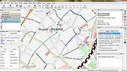
- Quantum GISQuantum GISQuantum GIS is a free software desktop Geographic Information Systems application that provides data viewing, editing, and analysis capabilities.-Development:...
— Open source desktop GIS which includes OSM plugin - luckyGPS - Open source mapping,tracking and offline routing/navigation software
- Phone and GPS displays
- AndNav2 and Navit for MaemoMaemoMaemo is a software platform developed by the Maemo community for smartphones and Internet tablets. It is based on the Debian Linux distribution, but has no relation to it...
and Android - CartoType - Map rendering and routing library for iPhone, iPad, Android and Symbian OS (commercial).
- City Maps 2Go offline satnav application for iOS (iPhone and iPad)(paid, closed source)
- ForeverMap offline satnav application for iOS (iPhone and iPad), Android (paid, closed source)
- Galileo Offline Maps offline satnav application for iOS (iPhone and iPad)(paid, closed source)
- GpsMid Java ME application
- HotSpot Navigator Java ME application
- iLOS online OSM Map and POI search for iPhone and iPad (universal)
- MapDroyd offline mapping application for Android (free, closed source)
- Mappero for MaemoMaemoMaemo is a software platform developed by the Maemo community for smartphones and Internet tablets. It is based on the Debian Linux distribution, but has no relation to it...
- Maps (-) offline map viewer/GPS navigator for Android
- MapsWithMe Offline map viewer for iOS (iPhone, iPad, iPod Touch) (free, closed source)
- Mobile Street Map Java ME offline map viewer (free, open source)
- NavDroyd offline satnav application for Android (paid, closed source)
- NaviPOWM offline map viewer and data collector for Windows MobileWindows MobileWindows Mobile is a mobile operating system developed by Microsoft that was used in smartphones and Pocket PCs, but by 2011 was rarely supplied on new phones. The last version is "Windows Mobile 6.5.5"; it is superseded by Windows Phone, which does not run Windows Mobile software.Windows Mobile is...
- OffMaps 2 offline satnav application for iOS (iPhone and iPad)(paid, closed source)
- Opentouchmap.org a web interface optimized for touch screen devices such as the iPhoneIPhoneThe iPhone is a line of Internet and multimedia-enabled smartphones marketed by Apple Inc. The first iPhone was unveiled by Steve Jobs, then CEO of Apple, on January 9, 2007, and released on June 29, 2007...
- OruxMaps - Moving-map, tracks, routes, waypoints, auto-cached maps online, offline, free Android app.
- OsmAnd online/offline mapping application for Android (free, open source)
- OSMDroid tools for Android to interact with OpenStreetMap data.
- AndNav2 and Navit for Maemo
- Tablets
- World Maps Offline online/offline map viewer for iOS (iPhone, iPad, iPod Touch) (paid, closed source)
- WordpressWordPressWordPress is a free and open source blogging tool and publishing platform powered by PHP and MySQL. It is often customized into a content management system . It has many features including a plug-in architecture and a template system. WordPress is used by over 14.7% of Alexa Internet's "top 1...
Blogs via OSM Plugin
Map data collection
- GPSBabelGPSBabelGPSBabel is a cross-platform, free software to transfer routes, tracks, and waypoint data to and from consumer GPS units, and to convert between over a hundred types of GPS data formats...
— converts tracklogs from one format to another. - AFTrack — Symbian 60v3 for Nokia mobile phones, live tracking and routing software, from version 1.03 onwards
- WhereAmI - Symbian S60, S80, and UIQ live tracking and OSM data download and rendering (GPL'ed)
- MyMotion — Windows CE tracking software
- TrackMyJourney (TMJ) - Java ME tracking software, which show OSM data, and uses OSM data for routing over the air.
- OSM2Go — Mobile/Desktop HildonHildonHildon is an application framework originally developed for mobile devices running the Linux operating system. It was developed by Nokia for the Maemo operating system and is now a part of GNOME. It focuses on providing a finger-friendly interface...
/Gtk editor includes tracking functionality - OSM Live - displays who is editing the Open Street Map in realtime
- iLOE - (iPhone Little OpenStreetMap Editor) Editor for the iPhoneIPhoneThe iPhone is a line of Internet and multimedia-enabled smartphones marketed by Apple Inc. The first iPhone was unveiled by Steve Jobs, then CEO of Apple, on January 9, 2007, and released on June 29, 2007...
(Upload and edit nodes, collecting and editing) - MapZen POI Collector — iPhone Points of Interest editor by CloudMadeCloudMadeCloudMade is a company which produces APIs, rendered maps, and geographic-related services. Unlike many other companies in the same field, CloudMade uses exclusively Creative Commons-licensed OpenStreetMap data, and was cofounded by the founder of OpenStreetMap, Steve Coast...
- OSMTracker — track logging with quick tagging ability. It's available for Android and Windows Mobile.
Map data editing
- Potlatch — Online FlashAdobe FlashAdobe Flash is a multimedia platform used to add animation, video, and interactivity to web pages. Flash is frequently used for advertisements, games and flash animations for broadcast...
editor - JOSM — Desktop JavaJava (programming language)Java is a programming language originally developed by James Gosling at Sun Microsystems and released in 1995 as a core component of Sun Microsystems' Java platform. The language derives much of its syntax from C and C++ but has a simpler object model and fewer low-level facilities...
editor - Merkaartor — Desktop QtQt (toolkit)Qt is a cross-platform application framework that is widely used for developing application software with a graphical user interface , and also used for developing non-GUI programs such as command-line tools and consoles for servers...
editor - OSM2Go — Mobile/Desktop HildonHildonHildon is an application framework originally developed for mobile devices running the Linux operating system. It was developed by Nokia for the Maemo operating system and is now a part of GNOME. It focuses on providing a finger-friendly interface...
/Gtk editor - Quantum GISQuantum GISQuantum GIS is a free software desktop Geographic Information Systems application that provides data viewing, editing, and analysis capabilities.-Development:...
— Desktop GIS which includes OSM plugin - Vespucci - Android editor
Routing (directions, navigation)
There are lists of online and offline routers available on the OSM wiki. Following routing software supports OpenStreetMaps:- CycleStreetsCycleStreetsCycleStreets is not-for-profit United Kingdom organisation that provides a free-to-use national cycle journey planner for the United Kingdom. The planner uses OpenStreetMap data for routing, Shuttle Radar Topography Mission for height data and official post code data. It was launched in March 2009...
- Gosmore
- MoNav - Makes use of Contraction HierarchiesContraction hierarchiesIn applied mathematics, the method of contraction hierarchies is a technique to simplify shortest-path routing by first creating precomputed "contracted" versions of the connection graph...
to allow for routing on continent sized graphs, even on mobile devices. - NavitNavitNavit is an open source and free, modular, touch screen friendly, car navigation system with GPS tracking, realtime routing engine and support for various vector map formats...
- Pyroute
- OpenRouteService
- Traveling salesman - Open source Java application working as route-planner and GPS-Navigator using the map-data from OpenStreetMap via LibOSM
Mobile routing
- OsmAnd (Android) Can route using CloudMadeCloudMadeCloudMade is a company which produces APIs, rendered maps, and geographic-related services. Unlike many other companies in the same field, CloudMade uses exclusively Creative Commons-licensed OpenStreetMap data, and was cofounded by the founder of OpenStreetMap, Steve Coast...
or YOURS. - AndNav2 (Android) No longer actively developed.
- OpenSatNav (Android)
- GpsMid (Java ME)
- We-Travel (Java ME)
GPS tracking
- GPS-Trace Orange - personal GPS tracking service, based on OSM
Data format
OpenStreetMap uses a topologicalTopology
Topology is a major area of mathematics concerned with properties that are preserved under continuous deformations of objects, such as deformations that involve stretching, but no tearing or gluing...
data structure
Graph (mathematics)
In mathematics, a graph is an abstract representation of a set of objects where some pairs of the objects are connected by links. The interconnected objects are represented by mathematical abstractions called vertices, and the links that connect some pairs of vertices are called edges...
.
- Nodes are points with a geographic position. Positions are stored as coordinates (pairs of a latitudeLatitudeIn geography, the latitude of a location on the Earth is the angular distance of that location south or north of the Equator. The latitude is an angle, and is usually measured in degrees . The equator has a latitude of 0°, the North pole has a latitude of 90° north , and the South pole has a...
and a longitudeLongitudeLongitude is a geographic coordinate that specifies the east-west position of a point on the Earth's surface. It is an angular measurement, usually expressed in degrees, minutes and seconds, and denoted by the Greek letter lambda ....
) according to WGS 84. - Ways are ordered lists of nodes, representing a polyline or polygonPolygonIn geometry a polygon is a flat shape consisting of straight lines that are joined to form a closed chain orcircuit.A polygon is traditionally a plane figure that is bounded by a closed path, composed of a finite sequence of straight line segments...
. - Relations are groups of nodes, ways and other relations which can be assigned certain properties.
- Tags can be applied to nodes, ways or relations and consist of name=value pairs. They are used to store metadataMetadataThe term metadata is an ambiguous term which is used for two fundamentally different concepts . Although the expression "data about data" is often used, it does not apply to both in the same way. Structural metadata, the design and specification of data structures, cannot be about data, because at...
about the map objects (such as their type, their name and their physical properties).
Up to version 0.4 of the protocol, an intermediate element between nodes and ways (segments, line segments which two node produced) was also used.
A recommended ontology
Ontology (computer science)
In computer science and information science, an ontology formally represents knowledge as a set of concepts within a domain, and the relationships between those concepts. It can be used to reason about the entities within that domain and may be used to describe the domain.In theory, an ontology is...
of map features (the meaning of tags) is maintained on a wiki.
See also
- Collaborative mappingCollaborative mappingCollaborative mapping is the aggregation of web maps and user-generated content, from a group of individuals or entities, and can take several distinct forms.-Types:...
- Google Map MakerGoogle Map MakerGoogle Map Maker is a service launched by Google in June 2008, designed to expand the breadth of the service currently offered by Google Maps. In some countries mapping data is unavailable, and so to combat this problem Google has decided to open up Google Maps to a collaborative community effort...
- Google MapsGoogle MapsGoogle Maps is a web mapping service application and technology provided by Google, free , that powers many map-based services, including the Google Maps website, Google Ride Finder, Google Transit, and maps embedded on third-party websites via the Google Maps API...
- NeogeographyNeogeographyNeogeography literally means "new geography" , and is commonly applied to the usage of geographical techniques and tools used for personal and community activities or for utilization by a non-expert group of users...
- OpenLayersOpenLayersOpenLayers is an open source JavaScript library for displaying map data in web browsers. It provides an API for building rich web-based geographic applications similar to Google Maps and Bing Maps...
- WikiMapiaWikimapiaWikiMapia is a privately owned, online map and satellite imaging resource that combines Google Maps with a wiki system, allowing users to add information, in the form of a note, to any location on Earth. Users may currently use this information for free...
Further reading
- OpenStreetMap in the media (2005 to present) (OSM wiki link)
- OpenStreetMap in scientific publications (OSM wiki link)
External links
- OpenStreetMap - project page with editing interface
- OpenStreetBrowser - simple map viewer
- OpenStreetMap Foundation
- OpenStreetMap Wiki
- Map Compare tools.geofabrik.de online-comparison between Google Maps and OpenStreetMap
- OpenSource navigation system
- Illustrated BBC report about OpenStreetMap helping in Haiti after the earthquake
- Evolution of European OpenStreetMap coverage 2006-2010 (video)
- OSM 2008: A Year of Edits (video)