

Automatic Identification System
Encyclopedia
The Automatic Identification System (AIS) is an automatic
tracking system
used on ship
s and by Vessel traffic service
s (VTS) for identifying and locating vessel
s by electronically exchanging data
with other nearby ship
s and AIS Base stations. AIS information supplements marine radar
, which continues to be the primary method of collision avoidance for water transport.

Information provided by AIS equipment, such as unique identification, position
, course
, and speed
, can be displayed on a screen or an ECDIS
. AIS is intended to assist a vessel's watchstanding
officers and allow maritime
authorities to track and monitor vessel movements. AIS integrates a standardized
VHF
transceiver with a positioning system such as a LORAN-C
or GPS
receiver, with other electronic navigation sensors, such as a gyrocompass
or rate of turn indicator. Ships outside AIS radio range can be tracked with the Long Range Identification and Tracking
(LRIT) system with less frequent transmission.
The International Maritime Organization
's (IMO) International Convention for the Safety of Life at Sea
(SOLAS) requires AIS to be fitted aboard international voyaging ships with , and all passenger ships regardless of size. It is estimated that more than 40,000 ships currently carry AIS class A equipment. In 2007, the new Class B AIS standard was introduced which enabled a new generation of low cost AIS transceivers. This has triggered multiple additional national mandates from Singapore, China, Turkey and North America affecting hundreds of thousands of vessels.
(COLREGS).
 When a ship is navigating at sea, the movement and identity of other ships in the vicinity is critical for navigators to make decisions to avoid collision with other ships and dangers (shoal or rocks). Visual observation (unaided, binoculars
, night vision
), audio exchanges (whistle, horns, VHF radio), and radar
or Automatic Radar Plotting Aid
(ARPA) are historically used for this purpose. However, a lack of positive identification of the targets on the displays, and time delays and other limitation of radar for observing and calculating the action and response of ships around, especially on busy waters, sometimes prevent possible action in time to avoid collision.
While requirements of AIS are only to display a very basic text information, the data obtained can be integrated with a graphical electronic chart
or a radar display, providing consolidated navigational information on a single display.
(VTS) may exist to manage ship traffic. Here, AIS provides additional traffic awareness and provides the service with information on the kind of other ships and their movement.
and marker positions. These aids can be located on shore, such as in a lighthouse
, or on the water, on platforms or buoy
s. The US Coast Guard suggests that AIS might replace racon
(radar beacons) currently used for electronic navigation aids.
The ability to broadcast navigational aid positions has also created the concepts of Synthetic AIS and Virtual AIS. In the first case, an AIS transmission describes the position of physical marker but the signal itself originates from a transmitter located elsewhere. For example, an on-shore base station might broadcast the position of ten floating channel markers, each of which is too small to contain a transmitter itself. In the second case, it can mean AIS transmissions that indicate a marker which does not exist physically, or a concern which is not visible (i.e., submerged rocks, or a wrecked ship). Although such virtual aids would only be visible to AIS equipped ships, the low cost of maintaining them could lead to their usage when physical markers are unavailable.
To aid SAR vessels and aircraft in locating people in distress a standard for an AIS-SART
AIS Search and Rescue Transmitter is currently being developed by the International Electrotechnical Commission
(IEC), the standard is scheduled to be finished by the end of 2008 and AIS-SARTs will be available on the market from 2009.
The maneuvering information of the events of the accident is important to understand the actual movement of the ship before accident, particularly for collision, grounding accidents.
A more complete picture of the events could be obtained by Voyage Data Recorder
(VDR) data if available and maintained on board for details of the movement of the ship, voice communication and radar pictures during the accidents. However, VDR data are not maintained due to the limited twelve hours storage by IMO
requirement.
Other reference:
the Saint Lawrence Seaway
use of AIS binary messages (message type 8) to provide information about water levels, lock orders, and weather. The Panama Canal
uses AIS type 8 messages to provide information about rain along the canal and wind in the locks. In 2010, International Maritime Organization
issued Circular 289 that defines the next iteration of ASM's for type 6 and 8 messages. Alexander, Schwehr and Zetterberg proposed that the community of competent authorities work together to maintain a regional register of these messages and their locations of use.
the raw audio from a modified marine VHF
radiotelephone
when tuned to the AIS broadcast frequency (Channel 87 and 88) into AIS data. Some programs can re-transmit the AIS information to a local or global network allowing the public or authorized users to observe vessel traffic from the web. Some programs display AIS data received from a dedicated AIS receiver onto a computer or chartplotter
. Most of these programs are not AIS transmitters, thus they will not broadcast your vessel's position but may be used as an inexpensive alternative for smaller vessels to help aid navigation and avoid collision with larger vessels that are required to broadcast their position. Ship enthusiasts also use receivers to track and find vessels to add to their photo collections.
s. In December 2004, the International Maritime Organization
's (IMO) Maritime Safety Committee condemned the Internet publication of AIS data as follows:
Others have countered that AIS provides the same information that can be obtained with a pair of binoculars and that ships have the option of turning off AIS when they are in areas with security concerns.
However, binoculars need line of sight and clear visibility so are do not help in fog or where a land mass obstructs the view, unlike AIS radio waves. Vessels can turn off AIS to attempt to be invisible but since they can still be seen by radar the absence of an AIS signal would highlight them as unusual and worthy of investigation where security or piracy are priorities.
(ISS).
In June 2008, ORBCOMM launched new low-earth orbit (LEO) satellites for their machine-to-machine communications constellation. In parallel with ORBCOMM's contract with the United States Coast Guard to launch its AIS receiver-equipped Concept Demonstration Satellite (CDS), all of these new satellites were equipped with AIS receivers. ORBCOMM became the first commercial service provider of satellite AIS, having licensed satellite AIS data service to qualified government and commercial subscribers since the beginning of 2009. Additionally, ORBCOMM has incorporated AIS receivers in its next 18 ORBCOMM Generation 2 (0G2) satellites under development. As additional satellites are launched, ORBCOMM will increase its capability by providing greater redundancy and more frequent updates of AIS data. ORBCOMM's established terrestrial network of 15 Gateway Earth Stations around the world ensures timely delivery of the satellite AIS data to its subscribers.
ORBCOMM has also contracted with Luxspace to provide two dedicated AIS detection satellites, one a polar orbiting satellite, and the other an equatorial orbiting satellite, to be launched mid-2011.
On April 28, 2008, Canadian company COM DEV International, became the first company to launch a space-based AIS nano-satellite designed to detect AIS signals from space, and is currently deploying a full micro-satellite constellation, global ground network and centralized data processing center in order to offer global AIS data services. The service is operational and available worldwide as of mid-2010 through exactEarth, COM DEV's data services subsidiary. exactEarth uses a patented ground and space-based processing technology to minimize interference of collided AIS signals, therefore dramatically improving detection compared with all other satellite-based systems. As more satellites are launched, refresh rates will continue to increase as well.
In November 2009, the STS-129
space shuttle mission attached two antennas - an AIS VHF antenna, and an Amateur Radio antenna to the Columbus module of the ISS. Both antennas were built in cooperation between ESA and the ARISS team (Amateur Radio on ISS). Starting from May 2010 the European Space Agency is testing two different AIS receivers, one from Luxspace (GdL), one from FFI (Norway) in the frame of technology demonstration for space-based ship monitoring. This is a first step towards a satellite-based AIS-monitoring service.
In 2009, LUXSPACE, a Grand Duchy of Luxembourg based company has launched PathFinder2, (ex-Rubin) and is now the only European company to have an operational system in orbit providing data from all over the world on a daily basis. The satellite is operated in cooperation with SES ASTRA and REDU Space Services.
In 2007, a previous test of space-based AIS tracking by the U.S. TacSat-2
satellite suffered from signal corruption because the AIS signals interfered with each other.
In July 2009, SpaceQuest launched AprizeSat-3 and AprizeSat-4 with AIS receivers. These receivers have been able to pick up the USCG's SART search and rescue test beacons off of Hawaii in 2010. In July 2010, SpaceQuest and exactEarth of Canada announced an arrangement whereby data from AprizeSat-3 and AprizeSat-4 would be incorporated into the exactEarth system and made available worldwide as part of their exactAIS(TM)service.
On July 12, 2010, The Norwegian AISSat-1
satellite was successfully launched into polar orbit. The purpose of the satellite is to improve surveillance of maritime activities in the High North. AISSat-1 is a nano satellite measuring 20 x 20 x 20 cm. It weighs six kilograms and is shaped like a cube.
Class B AIS products are for non-SOLAS vessels. They need testing and certification under the R&TTE Directive for the European Union and FCC and Industry Canada certification for North America.
(GNSS) receiver and gyrocompass
. Other information, such as the vessel name and VHF call sign, is programmed when installing the equipment and is also transmitted regularly. The signals are received by AIS transponders fitted on other ships or on land based systems, such as VTS systems. The received information can be displayed on a screen or chart plotter, showing the other vessels' positions in much the same manner as a radar display.
The AIS standard comprises several sub-standards 'Types' which specify individual product types. The specification for each product type provides a detailed technical specification which ensures the overall integrity of the global AIS system within which all the product types must operate. The major product types described in the AIS system standards are:
Class A: Vessel mounted AIS transceiver (transmit and receive) which operates using self-organised time-division multiple-access
(SOTDMA). Class A's must have an integrated display, transmit at 12 W, interface capability with multiple ship systems, and offer a sophisticated selection of features and functions. Default transmit rate is every few seconds. AIS Class A type compliant devices receive all types of AIS messages.
Class B: Vessel mounted AIS transceiver (transmit and receive) which operates using carrier-sense time-division multiple-access (CSTDMA). Class Bs transmit at 2 W and are not required to have an integrated display: Class Bs can be connected to most display systems which the received messages will be displayed in lists or overlayed on charts. Default transmit rate is normally every 30 seconds, but this can be varied according to vessel speed or instructions from base stations. The Class B type standard requires integrated GPS and certain LED indicators. Class B equipment receives all types of AIS messages.
Base station: Shore based AIS transceiver (transmit and receive) which operates using SOTDMA. Base stations have a complex set of features and functions which in the AIS standard are able to control the AIS system and all devices operating therein. Ability to interrogate individual transponders for status reports and or transmit frequency changes.
Aids to navigation (AtoN): Shore or buoy based transceiver (transmit and receive) which operates using fixed-access time-division multiple-access (FATDMA). Designed to collect and transmit data related to sea and weather conditions as well as relay AIS messages to extend network coverage.
AIS receivers are not specified in the AIS standards, because they do not transmit. The main threat to the integrity of any AIS system are non-compliant AIS transmissions, hence careful specifications of all transmitting AIS devices. However, it is well to note that AIS transceivers all transmit on multiple channels as required by the AIS standards. As such single-channel, or multiplexed, receivers will not receive all AIS messages. Only dual-channel receivers will receive all AIS messages.
receivers, one VHF Digital Selective Calling (DSC) receiver, and links to shipboard display and sensor systems via standard marine electronic communications (such as NMEA 0183, also known as IEC 61162). Timing is vital to the proper synchronization and slot mapping (transmission scheduling) for a Class A unit. Therefore, every unit is required to have an internal time base, synchronized to a global navigation satellite system
(e.g. GPS
) receiver. This internal receiver may also be used for position information. However, position is typically provided by an external receiver such as GPS
, LORAN
or an inertial navigation system
and the internal receiver is only used as a backup for position information. Other information broadcast by the AIS, if available, is electronically obtained from shipboard equipment through standard marine data connections. Heading information, position (latitude and longitude), "speed over ground", and rate of turn are normally provided by all ships equipped with AIS. Other information, such as angle of heel, pitch and roll, destination, and ETA
may also be provided.
An AIS transponder normally works in an autonomous and continuous mode, regardless of whether it is operating in the open seas or coastal or inland areas. AIS transponders use two different frequencies, VHF maritime channels
87B (161.975 MHz) and 88B (162.025 MHz), and use 9.6 kbit/s Gaussian minimum shift keying (GMSK) modulation
over 25 or 12.5 kHz channels using the High-level Data Link Control (HDLC) packet protocol. Although only one radio channel is necessary, each station transmits and receives over two radio channels to avoid interference problems, and to allow channels to be shifted without communications loss from other ships. The system provides for automatic contention resolution between itself and other stations, and communications integrity is maintained even in overload situations.
In order to ensure that the VHF transmissions of different transponders do not occur at the same time, the signals are time multiplexed using a technology called Self-Organized Time Division Multiple Access
(STDMA). The design of this technology is patented, and whether this patent has been waived for use by SOLAS vessels is a matter of debate between the manufacturers of AIS systems and the patent holder, Håkan Lans
. Moreover, the United States Patent and Trademark Office
(USPTO) canceled all claims in the original patent on March 30, 2010.
In order to make the most efficient use of the bandwidth available, vessels that are anchored or moving slowly transmit less frequently than those that are moving faster or are maneuvering. The update rate ranges from 3 minutes for anchored or moored vessels, to 2 seconds for fast moving or maneuvering vessels, the latter being similar to that of conventional marine radar.
Each AIS station determines its own transmission schedule (slot), based upon data link traffic history and an awareness of probable future actions by other stations. A position report from one station fits into one of 2,250 time slots established every 60 seconds on each frequency. AIS stations continuously synchronize themselves to each other, to avoid overlap of slot transmissions. Slot selection by an AIS station is randomized within a defined interval and tagged with a random timeout of between 0 and 8 frames. When a station changes its slot assignment, it announces both the new location and the timeout for that location. In this way new stations, including those stations which suddenly come within radio range close to other vessels, will always be received by those vessels.
The required ship reporting capacity according to the IMO performance standard is a minimum of 2,000 time slots per minute, though the system provides 4,500 time slots per minute. The SOTDMA broadcast mode allows the system to be overloaded by 400 to 500% through sharing of slots, and still provides nearly 100% throughput for ships closer than 8 to 10 nmi to each other in a ship to ship mode. In the event of system overload, only targets further away will be subject to drop-out, in order to give preference to nearer targets, which are of greater concern to ship operators. In practice, the capacity of the system is nearly unlimited, allowing for a great number of ships to be accommodated at the same time.
The system coverage range is similar to other VHF applications, essentially depending on the height of the antenna, but is slightly better due to the use of digital VHF instead of analog VHF. Its propagation is better than that of radar, due to the longer wavelength, so it is possible to reach around bends and behind islands if the land masses are not too high. The look-ahead distance at sea is nominally 20 nmi (37 km). With the help of repeater stations, the coverage for both ship and VTS stations can be improved considerably.
The system is backward compatible with digital selective calling systems, allowing shore-based GMDSS systems to inexpensively establish AIS operating channels and identify and track AIS-equipped vessels, and is intended to fully replace existing DSC-based transponder systems.
Shore-based AIS network systems are now being built up around the world. One of the biggest fully operational, real time systems with full routing capability is in China. This system was built between 2003 and 2007 and was delivered by Saab TransponderTech. The entire Chinese coastline is covered with approximately 250 base stations in hot-standby configurations including 70 computer servers in three main regions. Hundreds of shore based users, including about 25 VTS centers, are connected to the network and are able to see the maritime picture, and can also communicate with each ship using SRM's (Safety Related Messages). All data are in real time. The system was designed to improve the safety and security of ships and port facilities. It is also designed according to an SOA architecture with socket based connection and using IEC AIS standardized protocol all the way to the VTS users. The base stations have hot-standby units (IEC 62320-1) and the network is the third generation network solution.
By the beginning of 2007, a new worldwide standard for AIS base stations was approved, the IEC 62320-1 standard. The old IALA recommendation and the new IEC 62320-1 standard are in some functions incompatible, and therefore attached network solutions have to be upgraded. This will not affect users, but system builders need to upgrade software to accommodate the new standard. A standard for AIS base stations has been long awaited. Currently ad-hoc networks exist with class A mobiles. Base stations can control the AIS message traffic in a region, which will hopefully reduce the number of packet collisions.
In addition, the following data are broadcast every 6 minutes:
At the time of writing (November 2009) almost all Class B units use boards from Software Radio Technology (SRT). Exceptions to this are Furuno, AMEC, Weatherdock and Vesper Marine.
Four messages are defined for class B units:
MMSI, time, SOG, COG, longitude, latitude, true heading
MMSI, time, SOG, COG, longitude, latitude, true heading, ship type, dimensions.
Because of its length, this message is divided into two parts, sent within one minute of each other.
Note that this message was defined after the original AIS specifications, so some Class A units may need a firmware upgrade to be able to decode this message.
MMSI, boat name, ship type, call sign, dimensions, and equipment vendor id.
data for display on electronic chart plotters or computers.
Open source
Automatic
- Technology :* Automatic transmission, or a car with an automatic transmission* Automatic firearm* Automatic watch* Automatic , a defunct American automobile company- Albums :* Automatic * Automatic...
tracking system
System
System is a set of interacting or interdependent components forming an integrated whole....
used on ship
Ship
Since the end of the age of sail a ship has been any large buoyant marine vessel. Ships are generally distinguished from boats based on size and cargo or passenger capacity. Ships are used on lakes, seas, and rivers for a variety of activities, such as the transport of people or goods, fishing,...
s and by Vessel traffic service
Vessel Traffic Service
A vessel traffic service is a marine traffic monitoring system established by harbour or port authorities, similar to air traffic control for aircraft...
s (VTS) for identifying and locating vessel
Watercraft
A watercraft is a vessel or craft designed to move across or through water. The name is derived from the term "craft" which was used to describe all types of water going vessels...
s by electronically exchanging data
Data
The term data refers to qualitative or quantitative attributes of a variable or set of variables. Data are typically the results of measurements and can be the basis of graphs, images, or observations of a set of variables. Data are often viewed as the lowest level of abstraction from which...
with other nearby ship
Ship
Since the end of the age of sail a ship has been any large buoyant marine vessel. Ships are generally distinguished from boats based on size and cargo or passenger capacity. Ships are used on lakes, seas, and rivers for a variety of activities, such as the transport of people or goods, fishing,...
s and AIS Base stations. AIS information supplements marine radar
Marine radar
Marine radars are x-band or s-band radar to provide bearing and distance of ships and land targets in vicinity from own ship for collision avoidance and navigation at sea...
, which continues to be the primary method of collision avoidance for water transport.
Information provided by AIS equipment, such as unique identification, position
Coordinate system
In geometry, a coordinate system is a system which uses one or more numbers, or coordinates, to uniquely determine the position of a point or other geometric element. The order of the coordinates is significant and they are sometimes identified by their position in an ordered tuple and sometimes by...
, course
Course (navigation)
In navigation, a vehicle's course is the angle that the intended path of the vehicle makes with a fixed reference object . Typically course is measured in degrees from 0° clockwise to 360° in compass convention . Course is customarily expressed in three digits, using preliminary zeros if needed,...
, and speed
Speed
In kinematics, the speed of an object is the magnitude of its velocity ; it is thus a scalar quantity. The average speed of an object in an interval of time is the distance traveled by the object divided by the duration of the interval; the instantaneous speed is the limit of the average speed as...
, can be displayed on a screen or an ECDIS
Electronic Chart Display and Information System
An Electronic Chart Display and Information System is a computer-based navigation information system that complies with International Maritime Organization regulations and can be used as an alternative to paper nautical charts...
. AIS is intended to assist a vessel's watchstanding
Watchstanding
Watchstanding, or watchkeeping, in nautical terms concerns the division of qualified personnel to operate a ship continuously around the clock. On a typical sea going vessel, be it naval or merchant, personnel keep watch on the bridge and over the running machinery...
officers and allow maritime
Sea
A sea generally refers to a large body of salt water, but the term is used in other contexts as well. Most commonly, it means a large expanse of saline water connected with an ocean, and is commonly used as a synonym for ocean...
authorities to track and monitor vessel movements. AIS integrates a standardized
Standardization
Standardization is the process of developing and implementing technical standards.The goals of standardization can be to help with independence of single suppliers , compatibility, interoperability, safety, repeatability, or quality....
VHF
Very high frequency
Very high frequency is the radio frequency range from 30 MHz to 300 MHz. Frequencies immediately below VHF are denoted High frequency , and the next higher frequencies are known as Ultra high frequency...
transceiver with a positioning system such as a LORAN-C
LORAN
LORAN is a terrestrial radio navigation system using low frequency radio transmitters in multiple deployment to determine the location and speed of the receiver....
or GPS
Global Positioning System
The Global Positioning System is a space-based global navigation satellite system that provides location and time information in all weather, anywhere on or near the Earth, where there is an unobstructed line of sight to four or more GPS satellites...
receiver, with other electronic navigation sensors, such as a gyrocompass
Gyrocompass
A gyrocompass is a type of non-magnetic compass which bases on a fast-spinning disc and rotation of our planet to automatically find geographical direction...
or rate of turn indicator. Ships outside AIS radio range can be tracked with the Long Range Identification and Tracking
Long Range Identification and Tracking
The long-range identification and tracking of ships was established as an international system on 19 May 2006 by the International Maritime Organization as resolution MSC.202...
(LRIT) system with less frequent transmission.
The International Maritime Organization
International Maritime Organization
The International Maritime Organization , formerly known as the Inter-Governmental Maritime Consultative Organization , was established in Geneva in 1948, and came into force ten years later, meeting for the first time in 1959...
's (IMO) International Convention for the Safety of Life at Sea
International Convention for the Safety of Life at Sea
The International Convention for the Safety of Life at Sea is an international maritime safety treaty. The SOLAS Convention in its successive forms is generally regarded as the most important of all international treaties concerning the safety of merchant ships.- History :The first version of the...
(SOLAS) requires AIS to be fitted aboard international voyaging ships with , and all passenger ships regardless of size. It is estimated that more than 40,000 ships currently carry AIS class A equipment. In 2007, the new Class B AIS standard was introduced which enabled a new generation of low cost AIS transceivers. This has triggered multiple additional national mandates from Singapore, China, Turkey and North America affecting hundreds of thousands of vessels.
Collision avoidance
AIS is used in navigation primarily for collision avoidance. Due to the limitations of VHF radio communications, and because not all vessels are equipped with AIS, the system is meant to be used primarily as a means of lookout and to determine risk of collision rather than as an automatic collision avoidance system, in accordance with the International Regulations for Preventing Collisions at SeaInternational Regulations for Preventing Collisions at Sea
The International Regulations for Preventing Collisions at Sea 1972 are published by the International Maritime Organization , and set out, inter alia, the "rules of the road" or navigation rules to be followed by ships and other vessels at sea in order to prevent collisions between two or more...
(COLREGS).
Binoculars
Binoculars, field glasses or binocular telescopes are a pair of identical or mirror-symmetrical telescopes mounted side-by-side and aligned to point accurately in the same direction, allowing the viewer to use both eyes when viewing distant objects...
, night vision
Night vision
Night vision is the ability to see in low light conditions. Whether by biological or technological means, night vision is made possible by a combination of two approaches: sufficient spectral range, and sufficient intensity range...
), audio exchanges (whistle, horns, VHF radio), and radar
Radar
Radar is an object-detection system which uses radio waves to determine the range, altitude, direction, or speed of objects. It can be used to detect aircraft, ships, spacecraft, guided missiles, motor vehicles, weather formations, and terrain. The radar dish or antenna transmits pulses of radio...
or Automatic Radar Plotting Aid
Automatic Radar Plotting Aid
A marine radar with automatic radar plotting aid capability can create tracks using radar contacts. The system can calculate the tracked object's course, speed and closest point of approach , thereby knowing if there is a danger of collision with the other ship or landmass.Development of ARPA...
(ARPA) are historically used for this purpose. However, a lack of positive identification of the targets on the displays, and time delays and other limitation of radar for observing and calculating the action and response of ships around, especially on busy waters, sometimes prevent possible action in time to avoid collision.
While requirements of AIS are only to display a very basic text information, the data obtained can be integrated with a graphical electronic chart
Electronic Chart Display and Information System
An Electronic Chart Display and Information System is a computer-based navigation information system that complies with International Maritime Organization regulations and can be used as an alternative to paper nautical charts...
or a radar display, providing consolidated navigational information on a single display.
Vessel traffic services
In busy waters and harbors, a local vessel traffic serviceVessel Traffic Service
A vessel traffic service is a marine traffic monitoring system established by harbour or port authorities, similar to air traffic control for aircraft...
(VTS) may exist to manage ship traffic. Here, AIS provides additional traffic awareness and provides the service with information on the kind of other ships and their movement.
Aids to navigation
AIS was developed with the ability to broadcast positions and names of objects other than vessels, like navigational aidNavigational aid
A navigational aid is any sort of marker which aids the traveler in navigation; the term is most commonly used to refer to nautical or aviation travel...
and marker positions. These aids can be located on shore, such as in a lighthouse
Lighthouse
A lighthouse is a tower, building, or other type of structure designed to emit light from a system of lamps and lenses or, in older times, from a fire, and used as an aid to navigation for maritime pilots at sea or on inland waterways....
, or on the water, on platforms or buoy
Buoy
A buoy is a floating device that can have many different purposes. It can be anchored or allowed to drift. The word, of Old French or Middle Dutch origin, is now most commonly in UK English, although some orthoepists have traditionally prescribed the pronunciation...
s. The US Coast Guard suggests that AIS might replace racon
Racon
A racon is a radar transponder commonly used to mark maritime navigational hazards. The word is a portmanteau of RAdar and beaCON.When a racon receives a radar pulse, it responds with a signal on the same frequency which puts an image on the radar display...
(radar beacons) currently used for electronic navigation aids.
The ability to broadcast navigational aid positions has also created the concepts of Synthetic AIS and Virtual AIS. In the first case, an AIS transmission describes the position of physical marker but the signal itself originates from a transmitter located elsewhere. For example, an on-shore base station might broadcast the position of ten floating channel markers, each of which is too small to contain a transmitter itself. In the second case, it can mean AIS transmissions that indicate a marker which does not exist physically, or a concern which is not visible (i.e., submerged rocks, or a wrecked ship). Although such virtual aids would only be visible to AIS equipped ships, the low cost of maintaining them could lead to their usage when physical markers are unavailable.
Search and rescue
For coordinating resources on scene of marine search and rescue operation, it is important to know the position and navigation status of ships in the vicinity of the ship or person in distress. Here AIS can provide additional information and awareness of the resources for on scene operation, even though AIS range is limited to VHF radio range. The AIS standard also envisioned the possible use on SAR aircraft, and included a message (AIS Message 9) for aircraft to report position.To aid SAR vessels and aircraft in locating people in distress a standard for an AIS-SART
AIS-SART
The AIS-SART is a self contained radio device used to locate a survival craft or distressed vessel by sending updated position reports using a standard Automatic Identification System class A position report. The position and time synchronization of the AIS-SART is derived from a built in GNSS...
AIS Search and Rescue Transmitter is currently being developed by the International Electrotechnical Commission
International Electrotechnical Commission
The International Electrotechnical Commission is a non-profit, non-governmental international standards organization that prepares and publishes International Standards for all electrical, electronic and related technologies – collectively known as "electrotechnology"...
(IEC), the standard is scheduled to be finished by the end of 2008 and AIS-SARTs will be available on the market from 2009.
Accident investigation
AIS information received by VTS is important for accident investigation to provide the accurate time, identity, position by GPS, compass heading, course over ground (COG), speed (by log/SOG) and rate of turn (ROT) of the ships involved for accident analysis, rather than limited information (position, COG, SOG) of radar echo by radar.The maneuvering information of the events of the accident is important to understand the actual movement of the ship before accident, particularly for collision, grounding accidents.
A more complete picture of the events could be obtained by Voyage Data Recorder
Voyage Data Recorder
thumb|A fixed Data Capsule of VDR mounted on a [[container ship]].Voyage Data Recorder, or VDR, is a data recording system designed for all vessels required to comply with the IMO's International Convention SOLAS Requirements in order to collect data from various sensors on board the vessel...
(VDR) data if available and maintained on board for details of the movement of the ship, voice communication and radar pictures during the accidents. However, VDR data are not maintained due to the limited twelve hours storage by IMO
International Maritime Organization
The International Maritime Organization , formerly known as the Inter-Governmental Maritime Consultative Organization , was established in Geneva in 1948, and came into force ten years later, meeting for the first time in 1959...
requirement.
Other reference:
Binary messages
AIS messages 6, 8, 25, and 26 provide "Application Specific Messages" (ASM), that allow "competent authorities" to define additional AIS message sub-types. There are addressed (ABM) and broadcast (BBM) variants of the message. Addressed messages, while containing a destination MMSI, are not private and may be decoded by any receiver. One of the first uses of ASM's wasthe Saint Lawrence Seaway
Saint Lawrence Seaway
The Saint Lawrence Seaway , , is the common name for a system of locks, canals and channels that permits ocean-going vessels to travel from the Atlantic Ocean to the North American Great Lakes, as far as Lake Superior. Legally it extends from Montreal to Lake Erie, including the Welland Canal...
use of AIS binary messages (message type 8) to provide information about water levels, lock orders, and weather. The Panama Canal
Panama Canal
The Panama Canal is a ship canal in Panama that joins the Atlantic Ocean and the Pacific Ocean and is a key conduit for international maritime trade. Built from 1904 to 1914, the canal has seen annual traffic rise from about 1,000 ships early on to 14,702 vessels measuring a total of 309.6...
uses AIS type 8 messages to provide information about rain along the canal and wind in the locks. In 2010, International Maritime Organization
International Maritime Organization
The International Maritime Organization , formerly known as the Inter-Governmental Maritime Consultative Organization , was established in Geneva in 1948, and came into force ten years later, meeting for the first time in 1959...
issued Circular 289 that defines the next iteration of ASM's for type 6 and 8 messages. Alexander, Schwehr and Zetterberg proposed that the community of competent authorities work together to maintain a regional register of these messages and their locations of use.
Computing and networking
Several computer programs have been created for use with AIS data. Some programs (such as ShipPlotter and Gnuais) use a computer to demodulateDemodulation
Demodulation is the act of extracting the original information-bearing signal from a modulated carrier wave.A demodulator is an electronic circuit that is used to recover the information content from the modulated carrier wave.These terms are traditionally used in connection with radio receivers,...
the raw audio from a modified marine VHF
Marine VHF radio
Marine VHF radio is installed on all large ships and most seagoing small craft. It is used for a wide variety of purposes, including summoning rescue services and communicating with harbours, locks, bridges and marinas, and operates in the VHF frequency range, between 156 to 174 MHz...
radiotelephone
Radiotelephone
A radiotelephone is a communications system for transmission of speech over radio. Radiotelephone systems are not necessarily interconnected with the public "land line" telephone network. "Radiotelephone" is often used to describe the usage of radio spectrum where it is important to distinguish the...
when tuned to the AIS broadcast frequency (Channel 87 and 88) into AIS data. Some programs can re-transmit the AIS information to a local or global network allowing the public or authorized users to observe vessel traffic from the web. Some programs display AIS data received from a dedicated AIS receiver onto a computer or chartplotter
Chartplotter
A Chartplotter is a device used in marine navigation that integrates GPS data with an electronic navigational chart . The chartplotter displays the ENC along with the position, heading and speed of the ship, and may display additional information from radar, automatic information systems or other...
. Most of these programs are not AIS transmitters, thus they will not broadcast your vessel's position but may be used as an inexpensive alternative for smaller vessels to help aid navigation and avoid collision with larger vessels that are required to broadcast their position. Ship enthusiasts also use receivers to track and find vessels to add to their photo collections.
AIS data on the Internet
AIS position data are available on the Internet through privately operated geographic information systemGeographic Information System
A geographic information system, geographical information science, or geospatial information studies is a system designed to capture, store, manipulate, analyze, manage, and present all types of geographically referenced data...
s. In December 2004, the International Maritime Organization
International Maritime Organization
The International Maritime Organization , formerly known as the Inter-Governmental Maritime Consultative Organization , was established in Geneva in 1948, and came into force ten years later, meeting for the first time in 1959...
's (IMO) Maritime Safety Committee condemned the Internet publication of AIS data as follows:
Others have countered that AIS provides the same information that can be obtained with a pair of binoculars and that ships have the option of turning off AIS when they are in areas with security concerns.
However, binoculars need line of sight and clear visibility so are do not help in fog or where a land mass obstructs the view, unlike AIS radio waves. Vessels can turn off AIS to attempt to be invisible but since they can still be seen by radar the absence of an AIS signal would highlight them as unusual and worthy of investigation where security or piracy are priorities.
Range limitations and space-based tracking
Shipboard AIS transponders have a horizontal range that is highly variable but typically only about 74 kilometres (46 mi). They reach much further vertically, up to the 400 km orbit of the International Space StationInternational Space Station
The International Space Station is a habitable, artificial satellite in low Earth orbit. The ISS follows the Salyut, Almaz, Cosmos, Skylab, and Mir space stations, as the 11th space station launched, not including the Genesis I and II prototypes...
(ISS).
In June 2008, ORBCOMM launched new low-earth orbit (LEO) satellites for their machine-to-machine communications constellation. In parallel with ORBCOMM's contract with the United States Coast Guard to launch its AIS receiver-equipped Concept Demonstration Satellite (CDS), all of these new satellites were equipped with AIS receivers. ORBCOMM became the first commercial service provider of satellite AIS, having licensed satellite AIS data service to qualified government and commercial subscribers since the beginning of 2009. Additionally, ORBCOMM has incorporated AIS receivers in its next 18 ORBCOMM Generation 2 (0G2) satellites under development. As additional satellites are launched, ORBCOMM will increase its capability by providing greater redundancy and more frequent updates of AIS data. ORBCOMM's established terrestrial network of 15 Gateway Earth Stations around the world ensures timely delivery of the satellite AIS data to its subscribers.
ORBCOMM has also contracted with Luxspace to provide two dedicated AIS detection satellites, one a polar orbiting satellite, and the other an equatorial orbiting satellite, to be launched mid-2011.
On April 28, 2008, Canadian company COM DEV International, became the first company to launch a space-based AIS nano-satellite designed to detect AIS signals from space, and is currently deploying a full micro-satellite constellation, global ground network and centralized data processing center in order to offer global AIS data services. The service is operational and available worldwide as of mid-2010 through exactEarth, COM DEV's data services subsidiary. exactEarth uses a patented ground and space-based processing technology to minimize interference of collided AIS signals, therefore dramatically improving detection compared with all other satellite-based systems. As more satellites are launched, refresh rates will continue to increase as well.
In November 2009, the STS-129
STS-129
-Crew seat assignments:-Mission payload:-ExPRESS Logistics Carriers 1 and 2:The primary payload of STS-129 was the ExPRESS Logistics Carrier and the ELC-2. The mass capacity of each ELC is with a volume of 30 meters cubed...
space shuttle mission attached two antennas - an AIS VHF antenna, and an Amateur Radio antenna to the Columbus module of the ISS. Both antennas were built in cooperation between ESA and the ARISS team (Amateur Radio on ISS). Starting from May 2010 the European Space Agency is testing two different AIS receivers, one from Luxspace (GdL), one from FFI (Norway) in the frame of technology demonstration for space-based ship monitoring. This is a first step towards a satellite-based AIS-monitoring service.
In 2009, LUXSPACE, a Grand Duchy of Luxembourg based company has launched PathFinder2, (ex-Rubin) and is now the only European company to have an operational system in orbit providing data from all over the world on a daily basis. The satellite is operated in cooperation with SES ASTRA and REDU Space Services.
In 2007, a previous test of space-based AIS tracking by the U.S. TacSat-2
TacSat-2
TacSat-2 is an experimental satellite built by the USAF's Air Force Research Laboratory with an operational life expected to be not more than one year as part of the 'Advanced Concept Technology Demonstration' program.-Purpose:The TacSat series of experimental spacecraft are designed to allow...
satellite suffered from signal corruption because the AIS signals interfered with each other.
In July 2009, SpaceQuest launched AprizeSat-3 and AprizeSat-4 with AIS receivers. These receivers have been able to pick up the USCG's SART search and rescue test beacons off of Hawaii in 2010. In July 2010, SpaceQuest and exactEarth of Canada announced an arrangement whereby data from AprizeSat-3 and AprizeSat-4 would be incorporated into the exactEarth system and made available worldwide as part of their exactAIS(TM)service.
On July 12, 2010, The Norwegian AISSat-1
AISSat-1
AISSat-1 is a Norwegian satellite that was launched from India on July 12, 2010 from the Satish Dhawan Space Centre. The satellite's aim is to improve maritime safety in the Northern sea. The satellite, which is an experimental satellite, will receive and forward signals from an Automatic...
satellite was successfully launched into polar orbit. The purpose of the satellite is to improve surveillance of maritime activities in the High North. AISSat-1 is a nano satellite measuring 20 x 20 x 20 cm. It weighs six kilograms and is shaped like a cube.
Type testing and approval
Class A AIS products are for ships over 300 tonnes or which are SOLAS vessels and are required to meet the guidelines set out in the Marine Equipment Directive.Class B AIS products are for non-SOLAS vessels. They need testing and certification under the R&TTE Directive for the European Union and FCC and Industry Canada certification for North America.
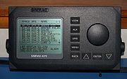
Basic overview
AIS transponders automatically broadcast information, such as their position, speed, and navigational status, at regular intervals via a VHF transmitter built into the transponder. The information originates from the ship's navigational sensors, typically its global navigation satellite systemGlobal Navigation Satellite System
A satellite navigation or SAT NAV system is a system of satellites that provide autonomous geo-spatial positioning with global coverage. It allows small electronic receivers to determine their location to within a few metres using time signals transmitted along a line-of-sight by radio from...
(GNSS) receiver and gyrocompass
Gyrocompass
A gyrocompass is a type of non-magnetic compass which bases on a fast-spinning disc and rotation of our planet to automatically find geographical direction...
. Other information, such as the vessel name and VHF call sign, is programmed when installing the equipment and is also transmitted regularly. The signals are received by AIS transponders fitted on other ships or on land based systems, such as VTS systems. The received information can be displayed on a screen or chart plotter, showing the other vessels' positions in much the same manner as a radar display.
The AIS standard comprises several sub-standards 'Types' which specify individual product types. The specification for each product type provides a detailed technical specification which ensures the overall integrity of the global AIS system within which all the product types must operate. The major product types described in the AIS system standards are:
Class A: Vessel mounted AIS transceiver (transmit and receive) which operates using self-organised time-division multiple-access
Self-Organized Time Division Multiple Access
Self-Organized Time Division Multiple Access is a channel access method which was designed by Håkan Lans, based on time-division multiplexing....
(SOTDMA). Class A's must have an integrated display, transmit at 12 W, interface capability with multiple ship systems, and offer a sophisticated selection of features and functions. Default transmit rate is every few seconds. AIS Class A type compliant devices receive all types of AIS messages.
Class B: Vessel mounted AIS transceiver (transmit and receive) which operates using carrier-sense time-division multiple-access (CSTDMA). Class Bs transmit at 2 W and are not required to have an integrated display: Class Bs can be connected to most display systems which the received messages will be displayed in lists or overlayed on charts. Default transmit rate is normally every 30 seconds, but this can be varied according to vessel speed or instructions from base stations. The Class B type standard requires integrated GPS and certain LED indicators. Class B equipment receives all types of AIS messages.
Base station: Shore based AIS transceiver (transmit and receive) which operates using SOTDMA. Base stations have a complex set of features and functions which in the AIS standard are able to control the AIS system and all devices operating therein. Ability to interrogate individual transponders for status reports and or transmit frequency changes.
Aids to navigation (AtoN): Shore or buoy based transceiver (transmit and receive) which operates using fixed-access time-division multiple-access (FATDMA). Designed to collect and transmit data related to sea and weather conditions as well as relay AIS messages to extend network coverage.
AIS receivers are not specified in the AIS standards, because they do not transmit. The main threat to the integrity of any AIS system are non-compliant AIS transmissions, hence careful specifications of all transmitting AIS devices. However, it is well to note that AIS transceivers all transmit on multiple channels as required by the AIS standards. As such single-channel, or multiplexed, receivers will not receive all AIS messages. Only dual-channel receivers will receive all AIS messages.
Message types
There are 27 different types of top level messages defined in ITU 1371-4 (out of a possibility of 64) that can be sent by AIS transceivers.Detailed description: Class A units
Each AIS transponder consists of one VHF transmitter, two VHF TDMATime division multiple access
Time division multiple access is a channel access method for shared medium networks. It allows several users to share the same frequency channel by dividing the signal into different time slots. The users transmit in rapid succession, one after the other, each using its own time slot. This...
receivers, one VHF Digital Selective Calling (DSC) receiver, and links to shipboard display and sensor systems via standard marine electronic communications (such as NMEA 0183, also known as IEC 61162). Timing is vital to the proper synchronization and slot mapping (transmission scheduling) for a Class A unit. Therefore, every unit is required to have an internal time base, synchronized to a global navigation satellite system
Global Navigation Satellite System
A satellite navigation or SAT NAV system is a system of satellites that provide autonomous geo-spatial positioning with global coverage. It allows small electronic receivers to determine their location to within a few metres using time signals transmitted along a line-of-sight by radio from...
(e.g. GPS
Global Positioning System
The Global Positioning System is a space-based global navigation satellite system that provides location and time information in all weather, anywhere on or near the Earth, where there is an unobstructed line of sight to four or more GPS satellites...
) receiver. This internal receiver may also be used for position information. However, position is typically provided by an external receiver such as GPS
Global Positioning System
The Global Positioning System is a space-based global navigation satellite system that provides location and time information in all weather, anywhere on or near the Earth, where there is an unobstructed line of sight to four or more GPS satellites...
, LORAN
LORAN
LORAN is a terrestrial radio navigation system using low frequency radio transmitters in multiple deployment to determine the location and speed of the receiver....
or an inertial navigation system
Inertial navigation system
An inertial navigation system is a navigation aid that uses a computer, motion sensors and rotation sensors to continuously calculate via dead reckoning the position, orientation, and velocity of a moving object without the need for external references...
and the internal receiver is only used as a backup for position information. Other information broadcast by the AIS, if available, is electronically obtained from shipboard equipment through standard marine data connections. Heading information, position (latitude and longitude), "speed over ground", and rate of turn are normally provided by all ships equipped with AIS. Other information, such as angle of heel, pitch and roll, destination, and ETA
Estimated time of arrival
The estimated time of arrival or ETA is a measure of when a ship, vehicle, aircraft, cargo, emergency service or computer file is expected to arrive at a certain place...
may also be provided.
An AIS transponder normally works in an autonomous and continuous mode, regardless of whether it is operating in the open seas or coastal or inland areas. AIS transponders use two different frequencies, VHF maritime channels
Marine VHF radio
Marine VHF radio is installed on all large ships and most seagoing small craft. It is used for a wide variety of purposes, including summoning rescue services and communicating with harbours, locks, bridges and marinas, and operates in the VHF frequency range, between 156 to 174 MHz...
87B (161.975 MHz) and 88B (162.025 MHz), and use 9.6 kbit/s Gaussian minimum shift keying (GMSK) modulation
Modulation
In electronics and telecommunications, modulation is the process of varying one or more properties of a high-frequency periodic waveform, called the carrier signal, with a modulating signal which typically contains information to be transmitted...
over 25 or 12.5 kHz channels using the High-level Data Link Control (HDLC) packet protocol. Although only one radio channel is necessary, each station transmits and receives over two radio channels to avoid interference problems, and to allow channels to be shifted without communications loss from other ships. The system provides for automatic contention resolution between itself and other stations, and communications integrity is maintained even in overload situations.
In order to ensure that the VHF transmissions of different transponders do not occur at the same time, the signals are time multiplexed using a technology called Self-Organized Time Division Multiple Access
Self-Organized Time Division Multiple Access
Self-Organized Time Division Multiple Access is a channel access method which was designed by Håkan Lans, based on time-division multiplexing....
(STDMA). The design of this technology is patented, and whether this patent has been waived for use by SOLAS vessels is a matter of debate between the manufacturers of AIS systems and the patent holder, Håkan Lans
Håkan Lans
Anders Håkan Lans is a Swedish inventor. His patented inventions are a color graphics processor and an "Arrangement for producing a pattern on a light-sensitive surface"...
. Moreover, the United States Patent and Trademark Office
United States Patent and Trademark Office
The United States Patent and Trademark Office is an agency in the United States Department of Commerce that issues patents to inventors and businesses for their inventions, and trademark registration for product and intellectual property identification.The USPTO is based in Alexandria, Virginia,...
(USPTO) canceled all claims in the original patent on March 30, 2010.
In order to make the most efficient use of the bandwidth available, vessels that are anchored or moving slowly transmit less frequently than those that are moving faster or are maneuvering. The update rate ranges from 3 minutes for anchored or moored vessels, to 2 seconds for fast moving or maneuvering vessels, the latter being similar to that of conventional marine radar.
Each AIS station determines its own transmission schedule (slot), based upon data link traffic history and an awareness of probable future actions by other stations. A position report from one station fits into one of 2,250 time slots established every 60 seconds on each frequency. AIS stations continuously synchronize themselves to each other, to avoid overlap of slot transmissions. Slot selection by an AIS station is randomized within a defined interval and tagged with a random timeout of between 0 and 8 frames. When a station changes its slot assignment, it announces both the new location and the timeout for that location. In this way new stations, including those stations which suddenly come within radio range close to other vessels, will always be received by those vessels.
The required ship reporting capacity according to the IMO performance standard is a minimum of 2,000 time slots per minute, though the system provides 4,500 time slots per minute. The SOTDMA broadcast mode allows the system to be overloaded by 400 to 500% through sharing of slots, and still provides nearly 100% throughput for ships closer than 8 to 10 nmi to each other in a ship to ship mode. In the event of system overload, only targets further away will be subject to drop-out, in order to give preference to nearer targets, which are of greater concern to ship operators. In practice, the capacity of the system is nearly unlimited, allowing for a great number of ships to be accommodated at the same time.
The system coverage range is similar to other VHF applications, essentially depending on the height of the antenna, but is slightly better due to the use of digital VHF instead of analog VHF. Its propagation is better than that of radar, due to the longer wavelength, so it is possible to reach around bends and behind islands if the land masses are not too high. The look-ahead distance at sea is nominally 20 nmi (37 km). With the help of repeater stations, the coverage for both ship and VTS stations can be improved considerably.
The system is backward compatible with digital selective calling systems, allowing shore-based GMDSS systems to inexpensively establish AIS operating channels and identify and track AIS-equipped vessels, and is intended to fully replace existing DSC-based transponder systems.
Shore-based AIS network systems are now being built up around the world. One of the biggest fully operational, real time systems with full routing capability is in China. This system was built between 2003 and 2007 and was delivered by Saab TransponderTech. The entire Chinese coastline is covered with approximately 250 base stations in hot-standby configurations including 70 computer servers in three main regions. Hundreds of shore based users, including about 25 VTS centers, are connected to the network and are able to see the maritime picture, and can also communicate with each ship using SRM's (Safety Related Messages). All data are in real time. The system was designed to improve the safety and security of ships and port facilities. It is also designed according to an SOA architecture with socket based connection and using IEC AIS standardized protocol all the way to the VTS users. The base stations have hot-standby units (IEC 62320-1) and the network is the third generation network solution.
By the beginning of 2007, a new worldwide standard for AIS base stations was approved, the IEC 62320-1 standard. The old IALA recommendation and the new IEC 62320-1 standard are in some functions incompatible, and therefore attached network solutions have to be upgraded. This will not affect users, but system builders need to upgrade software to accommodate the new standard. A standard for AIS base stations has been long awaited. Currently ad-hoc networks exist with class A mobiles. Base stations can control the AIS message traffic in a region, which will hopefully reduce the number of packet collisions.
Broadcast information
An AIS transceiver sends the following data every 2 to 10 seconds depending on a vessel's speed while underway, and every 3 minutes while a vessel is at anchor:- The vessel's Maritime Mobile Service IdentityMaritime Mobile Service IdentityA Maritime Mobile Service Identity is a series of nine digits which are sent in digital form over a radio frequency channel in order to uniquely identify ship stations, ship earth stations, coast stations, coast earth stations, and group calls...
(MMSI) – a unique nine digit identification number. - Navigation status – "at anchor", "under way using engine(s)", "not under command", etc.
- Rate of turn – right or left, from 0 to 720 degrees per minute
- Speed over ground – 0.1 knot (0.195983999843213 km/h) resolution from 0 to 102 knots (199.9 km/h)
- Positional accuracy:
- Longitude – to minutes
- Latitude – to minutes
- Course over ground – relative to true north to 0.1°
- True heading – 0 to 359 degrees (for example from a gyro compass)
- UTC Seconds – The seconds field of the UTC time when these data were generated. A complete timestamp is not present.
In addition, the following data are broadcast every 6 minutes:
- IMO ship identification numberIMO ship identification numberThe IMO ship identification number is made of the three letters "IMO" followed by the seven-digit number assigned to all ships by IHS Fairplay when constructed. This is a unique seven digit number that is assigned to propelled, sea-going merchant ships of 100 GT and above...
– a seven digit number that remains unchanged upon transfer of the ship's registration to another country - Radio call sign – international radio call sign, up to seven characters, assigned to the vessel by its country of registry
- Name – 20 characters to represent the name of the vessel
- Type of ship/cargo
- Dimensions of ship – to nearest meter
- Location of positioning system's (e.g., GPS) antenna on board the vessel - in meters aft of bow and meters port of starboard
- Type of positioning system – such as GPSGlobal Positioning SystemThe Global Positioning System is a space-based global navigation satellite system that provides location and time information in all weather, anywhere on or near the Earth, where there is an unobstructed line of sight to four or more GPS satellites...
, DGPSDifferential GPSDifferential Global Positioning System is an enhancement to Global Positioning System that provides improved location accuracy, from the 15-meter nominal GPS accuracy to about 10 cm in case of the best implementations....
or LORAN-CLORANLORAN is a terrestrial radio navigation system using low frequency radio transmitters in multiple deployment to determine the location and speed of the receiver....
. - DraughtDraft (hull)The draft of a ship's hull is the vertical distance between the waterline and the bottom of the hull , with the thickness of the hull included; in the case of not being included the draft outline would be obtained...
of ship – 0.1 meter to 25.5 meters - Destination – max. 20 characters
- ETA (estimated time of arrival) at destination – UTC month/date hour:minute
Detailed description: Class B units
Class B transponders are designed for carriage by sub-SOLAS vessels. Each consists of one VHF transmitter, two VHF Carrier Sense Time Division Multiple Access (CSTDMA) receivers, one of which is multiplexed with the VHF Digital Selective Calling (DSC) receiver, and a GPS active antenna. Although the data output format supports heading information, in general units are not interfaced to a compass, so this data is seldom transmitted. Output is the standard AIS data stream at 38.400 kbit/s, as RS232 and/or NMEA formats. To prevent overloading of the available bandwidth, transmission power is restricted to 2 W, giving a range of about 5–10 mi.At the time of writing (November 2009) almost all Class B units use boards from Software Radio Technology (SRT). Exceptions to this are Furuno, AMEC, Weatherdock and Vesper Marine.
Four messages are defined for class B units:
Message 14: Safety Related Message
This message is transmitted on request for the user – some transponders have a button that enables it to be sent, or it can be sent through the software interface. It sends a pre-defined safety message.Message 18: Standard Class B CS Position Report
This message is sent every 3 minutes where speed over ground (SOG) is less than 2 knots, or every 30 seconds for greater speeds.MMSI, time, SOG, COG, longitude, latitude, true heading
Message 19: Extended Class B Equipment Position Report
This message was designed for the SOTDMA protocol, and is too long to be transmitted as CSTDMA. However a coast station can poll the transponder for this message to be sent.MMSI, time, SOG, COG, longitude, latitude, true heading, ship type, dimensions.
Message 24: Class B CS Static Data Report
This message is sent every 6 minutes, the same time interval as for Class A transponders.Because of its length, this message is divided into two parts, sent within one minute of each other.
Note that this message was defined after the original AIS specifications, so some Class A units may need a firmware upgrade to be able to decode this message.
MMSI, boat name, ship type, call sign, dimensions, and equipment vendor id.
Detailed description: AIS receivers
A number of manufacturers offer AIS receivers, designed for monitoring AIS traffic. These may have two receivers, for monitoring both frequencies simultaneously, or they may switch between frequencies (thereby missing messages on the other channel, but at reduced price). In general they will output RS232, NMEA, USB or UDPUser Datagram Protocol
The User Datagram Protocol is one of the core members of the Internet Protocol Suite, the set of network protocols used for the Internet. With UDP, computer applications can send messages, in this case referred to as datagrams, to other hosts on an Internet Protocol network without requiring...
data for display on electronic chart plotters or computers.
See also
- Automatic Packet Reporting System
- Håkan LansHåkan LansAnders Håkan Lans is a Swedish inventor. His patented inventions are a color graphics processor and an "Arrangement for producing a pattern on a light-sensitive surface"...
– The inventor of STDMA, used as the communication protocol in AIS. - Ship location mapping serviceSailwxSailwx is an integrated maritime information service that aggregates worldwide ship locations into a single map. Weather conditions including ocean currents, wave height and tides are also available and can be integrated into ship location maps....
– uses AIS input data from water vessels worldwide. - NMEA 0183
- TCASTraffic Collision Avoidance SystemA traffic collision avoidance system or traffic alert and collision avoidance system is an aircraft collision avoidance system designed to reduce the incidence of mid-air collisions between aircraft...
Commercial AIS
- AIVDM.txt
- AIS references
- Commissioners of Irish Lights Oct-11 - AIS Home page
- exactEarth Oct-11 - Satellite-AIS
- IMO AIS transponders information Oct-11
- Kordia Maritime AIS Services Oct-11 - Maritime coverage of New Zealand’s coastal waters
- Vesper Marine Oct-11 - Information on AIS and dedicated AIS instrumentation
- UAIS.org Oct-11 - Articles and information about AIS
- US Coast Guard Automatic Identification System Overview Oct-11
- GMDSS AIS Tester Oct-11
- Yacht Insurance Guide to AIS Oct-11 - AIS Guide and links Atlanticsource Oct-11 - Commercial AIS
Open sourceOpen sourceThe term open source describes practices in production and development that promote access to the end product's source materials. Some consider open source a philosophy, others consider it a pragmatic methodology...
AIS software implementations
- AIS Parser Oct-11 - Free AIS Parser SDK
- gpsdGpsdgpsd is a daemon that receives data from a GPS receiver, and provides the data back to multiple applications such as Kismet or GPS navigation software....
- Straight C implementation - FreeAIS - Java implementation
- Libais - C++ implementation with CPython interface
- Noaadata - Pure python implementation
Free AIS data sharing
No login required
- MarineTraffic (Immediate details of ships) Oct-11
- Shipfinder (On delay for free version)- Oct-11
- Shiptracking (Realtime, Estimated arrivals) Oct-11
- VT Explorer Oct-11
- Shipplotter Denmark Oct-11 - Vessels - Denmark
- Nantes AIS - Oct-11 - Vessels - France Nantes
- Trieste AIS Oct-11 - Vessels - Italy Trieste
- Ribeirodearaujo Oct-11 - Vessels - Portugal
- Shipplotter - Norway Oct-11 - Vessels -Norway
- Öckerö AIS Oct-11 - Vessels - Sweden
- Landsort-AIS Oct-11 - Vessels - Sweden
- San Francisco Oct-11 - Vessels - US San Francisco
- Aisparser Oct-11 - Vessels - US Seattle
- Vesseltrax Oct-11 - Vessels - US GOM
- Shipais Oct-11 - Vessels - UK
- Orwellais Oct-11 - Vessels - UK/Canada
- (Turkish) GemiTrafik.com Nov-11 - Vessels - Turkey/Marmara Region
Login required
- Digital-seas - Oct-11
- Mariweb - Oct-11
- Maritime Intelligence & Publications: IHS Fairplay - Oct-11
- ShippingExplorer - Oct-11
- Vesseltracker - Oct-11