
Point of interest
Encyclopedia
A point of interest, or POI, is a specific point location that someone may find useful or interesting. An example is a point on the Earth
representing the location of the Space Needle
, or a point on Mars
representing the location of the mountain
, Olympus Mons
.
The term is widely used in cartography
, especially in electronic variants including GIS, and GPS navigation software
. In this context the synonym waypoint
is common.
A GPS point of interest specifies, at minimum, the latitude
and longitude
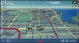
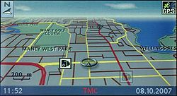
of the POI, assuming a certain map datum. A name or description for the POI is usually included, and other information such as altitude or a telephone number may also be attached. GPS applications typically use icons
to represent different categories of POI on a map graphically.
 Digital maps for modern GPS devices typically include a basic selection of POI for the map area.
However websites exist that specialize in the collection, verification, management and distribution of POI which end-user
s can load onto their devices to replace or supplement the existing POI. While some of these websites are generic, and will collect and categorize POI for any interest, others are more specialized in a particular category (such as speed cameras) or GPS device (e.g. TomTom
/Garmin
). End-users also have the ability to create their own custom collections.
Commercial POI collections, especially those that ship with digital maps, or that are sold on a subscription basis are usually protected by copyright
. However there are also many websites from which royalty-free POI collections can be obtained.
s for example can automatically tag a photograph using Exif with the GPS location where a picture was taken; these pictures can then be overlaid as POI on a digital map or satellite image
such as Google Earth
. Geocaching
applications are built around POI collections. In Vehicle tracking system
s POIs are used to mark destination points and/or offices to that users of GPS tracking software would easily monitor position of vehicles according to POIs.
s, including proprietary formats, are used to store point of interest data, even where the same underlying WGS84 system is used. Reasons for variations to store the same data include:
The following are some of the file formats used by different vendors and devices to exchange POI (and in some cases, also navigation tracks):
Third party and vendor-supplied utilities are available to convert point of interest data between different formats to allow them to be exchanged between otherwise incompatible GPS devices or systems. Furthermore, many applications will support the generic ASCII
text file format, although this format is more prone to error due to its loose structure as well as the many ways in which GPS co-ordinates can be represented (e.g. decimal vs degree/minute/second)
Earth
Earth is the third planet from the Sun, and the densest and fifth-largest of the eight planets in the Solar System. It is also the largest of the Solar System's four terrestrial planets...
representing the location of the Space Needle
Space Needle
The Space Needle is a tower in Seattle, Washington and is a major landmark of the Pacific Northwest region of the United States and a symbol of Seattle. Located at the Seattle Center, it was built for the 1962 World's Fair, during which time nearly 20,000 people a day used the elevators, with over...
, or a point on Mars
Mars
Mars is the fourth planet from the Sun in the Solar System. The planet is named after the Roman god of war, Mars. It is often described as the "Red Planet", as the iron oxide prevalent on its surface gives it a reddish appearance...
representing the location of the mountain
Mountain
Image:Himalaya_annotated.jpg|thumb|right|The Himalayan mountain range with Mount Everestrect 58 14 160 49 Chomo Lonzorect 200 28 335 52 Makalurect 378 24 566 45 Mount Everestrect 188 581 920 656 Tibetan Plateaurect 250 406 340 427 Rong River...
, Olympus Mons
Olympus Mons
Olympus Mons is a large volcanic mountain on the planet Mars. At a height of almost , it is one of the tallest mountains in the Solar System, three times as tall as Mount Everest and more than twice the height of Mauna Kea the tallest mountain on Earth. Olympus Mons is the youngest of the large...
.
The term is widely used in cartography
Cartography
Cartography is the study and practice of making maps. Combining science, aesthetics, and technique, cartography builds on the premise that reality can be modeled in ways that communicate spatial information effectively.The fundamental problems of traditional cartography are to:*Set the map's...
, especially in electronic variants including GIS, and GPS navigation software
GPS navigation software
GPS navigation software usually falls into one of the following two categories:# Navigation with route calculation and directions from the software to the user of the route to take, based on a vector-based map, normally for motorised vehicles with some motorised forms added on as an afterthought.#...
. In this context the synonym waypoint
Waypoint
A waypoint is a reference point in physical space used for purposes of navigation.-Concept:Waypoints are sets of coordinates that identify a point in physical space. Coordinates used can vary depending on the application. For terrestrial navigation these coordinates can include longitude and...
is common.
A GPS point of interest specifies, at minimum, the latitude
Latitude
In geography, the latitude of a location on the Earth is the angular distance of that location south or north of the Equator. The latitude is an angle, and is usually measured in degrees . The equator has a latitude of 0°, the North pole has a latitude of 90° north , and the South pole has a...
and longitude
Longitude
Longitude is a geographic coordinate that specifies the east-west position of a point on the Earth's surface. It is an angular measurement, usually expressed in degrees, minutes and seconds, and denoted by the Greek letter lambda ....
of the POI, assuming a certain map datum. A name or description for the POI is usually included, and other information such as altitude or a telephone number may also be attached. GPS applications typically use icons
Computer icon
A computer icon is a pictogram displayed on a computer screen and used to navigate a computer system or mobile device. The icon itself is a small picture or symbol serving as a quick, intuitive representation of a software tool, function or a data file accessible on the system. It functions as an...
to represent different categories of POI on a map graphically.
POI collections
However websites exist that specialize in the collection, verification, management and distribution of POI which end-user
End-user
Economics and commerce define an end user as the person who uses a product. The end user or consumer may differ from the person who purchases the product...
s can load onto their devices to replace or supplement the existing POI. While some of these websites are generic, and will collect and categorize POI for any interest, others are more specialized in a particular category (such as speed cameras) or GPS device (e.g. TomTom
TomTom
TomTom NV is a Dutch manufacturer of automotive navigation systems, including both stand-alone units and software for personal digital assistants and mobile telephones. It is the leading manufacturer of navigation systems in Europe. TomTom's customer service is located in Amsterdam, Netherlands...
/Garmin
Garmin
Garmin Ltd. , incorporated in Schaffhausen, Switzerland, is the parent company of a group of companies founded in 1989 by Gary Burrell and Min Kao , that develops consumer, aviation, and marine technologies for the Global Positioning System...
). End-users also have the ability to create their own custom collections.
Commercial POI collections, especially those that ship with digital maps, or that are sold on a subscription basis are usually protected by copyright
Copyright
Copyright is a legal concept, enacted by most governments, giving the creator of an original work exclusive rights to it, usually for a limited time...
. However there are also many websites from which royalty-free POI collections can be obtained.
Applications
The applications for POI are extensive. As GPS-enabled devices as well as software applications that use digital maps become more available, so too the applications for POI are also expanding. Newer digital cameraDigital camera
A digital camera is a camera that takes video or still photographs, or both, digitally by recording images via an electronic image sensor. It is the main device used in the field of digital photography...
s for example can automatically tag a photograph using Exif with the GPS location where a picture was taken; these pictures can then be overlaid as POI on a digital map or satellite image
Satellite imagery
Satellite imagery consists of photographs of Earth or other planets made by means of artificial satellites.- History :The first images from space were taken on sub-orbital flights. The U.S-launched V-2 flight on October 24, 1946 took one image every 1.5 seconds...
such as Google Earth
Google Earth
Google Earth is a virtual globe, map and geographical information program that was originally called EarthViewer 3D, and was created by Keyhole, Inc, a Central Intelligence Agency funded company acquired by Google in 2004 . It maps the Earth by the superimposition of images obtained from satellite...
. Geocaching
Geocaching
Geocaching is an outdoor sporting activity in which the participants use a Global Positioning System receiver or mobile device and other navigational techniques to hide and seek containers, called "geocaches" or "caches", anywhere in the world....
applications are built around POI collections. In Vehicle tracking system
Vehicle tracking system
A vehicle tracking system combines the installation of an electronic device in a vehicle, or fleet of vehicles, with purpose-designed computer software at least at one operational base to enable the owner or a third party to track the vehicle's location, collecting data in the process from the...
s POIs are used to mark destination points and/or offices to that users of GPS tracking software would easily monitor position of vehicles according to POIs.
File formats
Many different file formatFile format
A file format is a particular way that information is encoded for storage in a computer file.Since a disk drive, or indeed any computer storage, can store only bits, the computer must have some way of converting information to 0s and 1s and vice-versa. There are different kinds of formats for...
s, including proprietary formats, are used to store point of interest data, even where the same underlying WGS84 system is used. Reasons for variations to store the same data include:
- A lack of standards in this area (GPXGPXGPX, or GPS eXchange Format is an XML schema designed as a common GPS data format for software applications.It can be used to describe waypoints, tracks, and routes. The format is open and can be used without the need to pay license fees. Its tags store location, elevation, and time and can in this...
is a notable attempt to address this). - Attempts by some software vendors to protect their data through obfuscationSecurity through obscuritySecurity through obscurity is a pejorative referring to a principle in security engineering, which attempts to use secrecy of design or implementation to provide security...
. - Licensing issues that prevent companies from using competitor's file specifications.
- MemoryComputer storageComputer data storage, often called storage or memory, refers to computer components and recording media that retain digital data. Data storage is one of the core functions and fundamental components of computers....
saving, for example, by converting floating pointFloating pointIn computing, floating point describes a method of representing real numbers in a way that can support a wide range of values. Numbers are, in general, represented approximately to a fixed number of significant digits and scaled using an exponent. The base for the scaling is normally 2, 10 or 16...
latitude and longitude co-ordinates into smaller integerIntegerThe integers are formed by the natural numbers together with the negatives of the non-zero natural numbers .They are known as Positive and Negative Integers respectively...
values. - Speed and battery life (operations using integerIntegerThe integers are formed by the natural numbers together with the negatives of the non-zero natural numbers .They are known as Positive and Negative Integers respectively...
latitude and longitude values are less CPUCentral processing unitThe central processing unit is the portion of a computer system that carries out the instructions of a computer program, to perform the basic arithmetical, logical, and input/output operations of the system. The CPU plays a role somewhat analogous to the brain in the computer. The term has been in...
-intensive than those that use floating pointFloating pointIn computing, floating point describes a method of representing real numbers in a way that can support a wide range of values. Numbers are, in general, represented approximately to a fixed number of significant digits and scaled using an exponent. The base for the scaling is normally 2, 10 or 16...
values). - Requirements to add custom fields to the data.
- Use of older reference systems that predate GPS (for example UTMUniversal Transverse Mercator coordinate systemThe Universal Transverse Mercator geographic coordinate system uses a 2-dimensional Cartesian coordinate system to give locations on the surface of the Earth. It is a horizontal position representation, i.e...
or the British national grid reference systemBritish national grid reference systemThe Ordnance Survey National Grid reference system is a system of geographic grid references used in Great Britain, different from using latitude and longitude....
)
The following are some of the file formats used by different vendors and devices to exchange POI (and in some cases, also navigation tracks):
- ASCIIASCIIThe American Standard Code for Information Interchange is a character-encoding scheme based on the ordering of the English alphabet. ASCII codes represent text in computers, communications equipment, and other devices that use text...
Text (.asc .txt .csv) - Topografix GPX (.gpx)
- GarminGarminGarmin Ltd. , incorporated in Schaffhausen, Switzerland, is the parent company of a group of companies founded in 1989 by Gary Burrell and Min Kao , that develops consumer, aviation, and marine technologies for the Global Positioning System...
Mapsource (.gdb) - Google EarthGoogle EarthGoogle Earth is a virtual globe, map and geographical information program that was originally called EarthViewer 3D, and was created by Keyhole, Inc, a Central Intelligence Agency funded company acquired by Google in 2004 . It maps the Earth by the superimposition of images obtained from satellite...
Keyhole Markup LanguageKeyhole Markup LanguageKeyhole Markup Language is an XML notation for expressing geographic annotation and visualization within Internet-based, two-dimensional maps and three-dimensional Earth browsers. KML was developed for use with Google Earth, which was originally named Keyhole Earth Viewer. It was created by...
(.kml .kmz) - Pocket Street Pushpins (.psp)
- Maptech Marks (.msf)
- Maptech Waypoint (.mxf)
- Microsoft MapPointMicrosoft MapPointMicrosoft MapPoint is both a technology and a specific software program created by Microsoft that allows users to view, edit and integrate maps. The software and technology are designed to facilitate the geographical visualization and analysis of either included data or custom data...
Pushpin (.csv) - OziExplorerOziExplorerOziExplorer is raster navigation and mapping software for Windows. It is very popular among off-roaddrivers and adventure travelers as it allows to use and create custom maps for remote locations that are not fully covered by major map providers like Tele Atlas...
(.wpt) - TomTomTomTomTomTom NV is a Dutch manufacturer of automotive navigation systems, including both stand-alone units and software for personal digital assistants and mobile telephones. It is the leading manufacturer of navigation systems in Europe. TomTom's customer service is located in Amsterdam, Netherlands...
Overlay (.ov2) - OpenStreetMapOpenStreetMapOpenStreetMap is a collaborative project to create a free editable map of the world. Two major driving forces behind the establishment and growth of OSM have been restrictions on use or availability of map information across much of the world and the advent of inexpensive portable GPS devices.The...
data (.osm)
Third party and vendor-supplied utilities are available to convert point of interest data between different formats to allow them to be exchanged between otherwise incompatible GPS devices or systems. Furthermore, many applications will support the generic ASCII
ASCII
The American Standard Code for Information Interchange is a character-encoding scheme based on the ordering of the English alphabet. ASCII codes represent text in computers, communications equipment, and other devices that use text...
text file format, although this format is more prone to error due to its loose structure as well as the many ways in which GPS co-ordinates can be represented (e.g. decimal vs degree/minute/second)
See also
- Automotive navigation systemAutomotive navigation systemAn automotive navigation system is a satellite navigation system designed for use in automobiles. It typically uses a GPS navigation device to acquire position data to locate the user on a road in the unit's map database. Using the road database, the unit can give directions to other locations...
- Geocoded photograph
- Map database managementMap database managementMap database management stems from navigation units becoming more common in automotive vehicles . They serve to perform usual navigation functions, such as finding a route to a desired destination and guiding the driver to it or determining the vehicle’s location and providing information about...
- OpenLROpenLROpenLR is a royalty-free open standard for "procedures and formats for the encoding, transmission, and decoding of local data irrespective of the map" developed by TomTom....
- World Geodetic SystemWorld Geodetic SystemThe World Geodetic System is a standard for use in cartography, geodesy, and navigation. It comprises a standard coordinate frame for the Earth, a standard spheroidal reference surface for raw altitude data, and a gravitational equipotential surface that defines the nominal sea level.The latest...
(Used to represent GPS co-ordinates)