
2008 Pacific hurricane season
Encyclopedia
The 2008 Pacific hurricane season was an event in the annual cycle of tropical cyclone
formation. It officially started May 15, 2008 in the eastern Pacific, started on June 1, 2008 in the central Pacific, and lasted until November 30, 2008.
This season is the first since 1996
to have no cyclones cross into the central Pacific. Activity this year was near average, with 16 storms forming in the Eastern Pacific proper and an additional 1 in the Central Pacific. There were 7 hurricanes, a low number compared to the typical 9, and only 2 major hurricanes, unlike the typical 5. There were only a few notable storms this year. Tropical Storm Alma
made landfall along the Pacific coast of Nicaragua, becoming the first known storm to do so. It killed 9 and did $33 million in damage (2008 USD). It also became the first tropical storm to be retired in the Eastern Pacific basin. Hurricane Norbert
became the strongest hurricane to hit the western side of the Baja Peninsula on record, killing 8 and causing $716.4 million (2008 USD) there, making Norbert the third-costliest Eastern Pacific hurricane on record.
On May 22, 2008, NOAA released their forecast for the 2008 Eastern Pacific and Central Pacific hurricane seasons. They predicted a below-normal level of activity in the Eastern Pacific, with 11 to 16 named storms, of which 5 to 8 were expected to become hurricanes, and 1 to 3 expected to become major hurricanes.
The Central Pacific basin was also expected to be slightly below average, with three to four tropical cyclones expected to form or cross into the area.
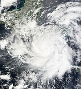
at peak strength.
León lost electricity and telephone services as the storm impacted the area, trees were toppled and some houses lost roofs. In total nine people were killed with seven of them being indirect; the two direct deaths were in Nicaragua in León. On May 30 the remnant low of Alma emerged into the Gulf of Honduras
and merged with a tropical wave over the northwestern Caribbean Sea
which then became Tropical Storm Arthur
later that day.
on June 22 and became a tropical cyclone
five days later, With warm waters and low wind shear
, its local area was conducive for development and slight strengthening occurred. At 8 a.m PDT (1500 UTC) Tropical Depression Two E was upgraded to Tropical Storm Boris. With warm waters and low wind shear
, its local area was deemed to be conducive for development and slight strengthening was predicted. After holding steady for about 48 hours, Boris intensified to a strong tropical storm late on June 29, and to a hurricane on July 1. Boris held hurricane status for most of the day before briefly weakening to a tropical storm. Boris reached its peak the next day as an 80 mph hurricane. Shortly after its peak, Boris moved over cooler waters and began to weaken. Boris was downgraded to a tropical storm late on July 2, and continued to weaken to a tropical depression on July 3. It dissipated on July 4 over cool waters. The remnant low dissipated July 6 while crossing into the Central Pacific.
as it moved towards the northwest. The depression strengthened into a tropical storm the next day and was given the name Douglas despite strong wind shear impacting the system. Upon becoming a tropical storm, Douglas reached its peak intensity with winds of 40 mph (65 km/h) and a minimum pressure of 1003 mbar (hPa; 29.63 inHg) The combined effects of wind shear and cooler waters caused the storm to weaken into a depression the next day. Douglas degenerated into a remnant low-pressure area shortly after. The remnants moved towards the west for a few days and dissipated on July 6 over open waters.
Due to the proximity to land, outer rain bands associated with Douglas produced tropical storm force winds in Manzanillo, Mexico. Minor flood damage was reported along the coastline in Colima
, Jalisco
, and Nayarit
.
coast slowly developed. It became Tropical Depression Five-E on July 5. It then headed west-northwest before turning more northwest and making landfall near Lázaro Cárdenas
, Mexico on July 7. The storm dissipated shortly after landfall. Its remnants brought rainfall to southern Mexico, but caused no severe flooding, casualties, or serious damage in its path.
acquired sufficient organized convection to be classified as Tropical Depression Six-E. The depression soon strengthened into Tropical Storm Elida. On July 13, Elida slowly gained strength as it was near Mexico. Overnight on July 14, Elida strengthened into the second hurricane of the season as it pulled away from the coast.
After remaining stable in intensity for two days, it rapidly strengthened on July 16 into a Category 2 hurricane. That day Elida peaked as a 105 mph (165 km/h) Category 2 hurricane, the strongest of the season at that time. Only Hurricane Hernan
was stronger. Elida was a Category 2 for about 36 hours and later weakened into a Category 1 hurricane.
Twelve hours after Elida weakened to a Category 1, Elida weakened to a tropical storm. Elida weakened to a tropical depression on July 19 as the low became exposed and dissipated that afternoon.
A few days later the wave slowly gained convection as it crossed in the CPHC area of responsibility, however as it neared Hawaii its chance of regeneration diminished.
Elida's outer rainbands reached Mexico. However, no watches or warnings were issued. Elida was briefly forecast to make landfall in Hawaii, however the storm dissipated before it hit the state. The remnants of Elida did bring showers in Hawaii.
of Acapulco
. It strengthened into Tropical Storm Fausto that afternoon. It strengthened gradually into a strong tropical storm on July 17 and a hurricane on July 18. It briefly reached Category 2 intensity on July 20 while southwest of the Baja California
peninsula before weakening rapidly that afternoon back to a tropical storm. It dissipated on July 22 over cooler waters. After a post-storm analysis review, Fausto was found to have peaked just below Category 2 status.
(nearly becoming a tropical depression in the southwest Caribbean Sea
) in the third week of July. It emerged into the Pacific and organized into Tropical Depression Eight-E on July 21. That afternoon it strengthened into Tropical Storm Genevieve. It strengthened into a 65 mph storm, but soon weakened because of cooler water that Hurricane Fausto had passed over. On July 25, it strengthened and briefly reached hurricane status, which it remained at until weakening to a tropical storm early on July 26, and a remnant low the next day. The remnant low pressure area
brought showers to Hawaii
on August 3 and 4.
. Hernan reached its peak intensity with winds of 120 mph (195 km/h) with a minimum pressure of 956 mbar (hPa; 28.24 inHg) at 1200 UTC
on August 9. Over the next several days, the combination of an eyewall replacement cycle
and cooler waters caused the hurricane to weaken to a tropical storm on August 12. Shower and thunderstorm activity diminished throughout the rest of the day and Hernan degenerated into a remnant low early the next morning. The low moved in a general west-southwesterly direction and dissipated on August 16 while located 460 mi (740 km) southeast of the Island of Hawaii.
organized enough to be classified as Tropical Depression One-C on August 6, and strengthened into a tropical storm the same day and was named Kika (Keith in English) by the CPHC. Over the next few days as Kika moved westwards it maintained its peak intensity of 35 kts until late on August 8 when Kika was downgraded to a tropical depression. However early the next day Kika reintensifed into a tropical storm over the next few days Kika was kept at minimal tropical storm status until early on August 11 when it was downgraded to a tropical depression. The CPHC then downgraded Kika to a remnant low and issued its final advisory on August 12.
and Panama
, and showed some good sign of strengthening while in that region. The disturbance then moved southwest of Mexico
and showed no signs of strengthening until August 13 , when it developed into Tropical Depression Ten-E. It further intensified into Tropical Storm Iselle, the ninth named storm of the season. Iselle reached its peak intensity of 50 mph, a moderate Tropical Storm, on August 14. No damage or deaths were linked to the storm. It never threatened any land masses. As Tropical Storm Iselle moved west, the cooler waters and northerly wind shear began to take its toll and it was downgraded to a tropical depression. Tropical Storm Iselle dissipated on August 16.
(NHC) upgraded an area of low pressure which was located in the eastern Pacific ocean south of Baja California
to Tropical Depression Eleven E. Later that morning, Tropical Storm Watches went up. That afternoon, the depression intensified into a tropical storm after a ship report supported tropical storm intensity. It made landfall in La Paz
after becoming a tropical storm with 50 mph winds and a well-defined center, Mexico
as a tropical storm on August 24, weakened, and dissipated August 26.
As Julio made landfall, it produced lightning and locally heavy rainfall, which left more than a dozen communities isolated due to flooding. The flooding damaged several houses and killed one people. Winds were generally light, although strong enough to damage a few electrical poles and small buildings. Moisture from Julio developed thunderstorms across Arizona
, including one near Chandler
which produced winds of 75 mph (120 km/h); the storm damaged ten small planes at Chandler Municipal Airport
, as well as a hangar. The storms also dropped light rainfall, reaching over 1 inch (25 mm) in Gilbert
, which caused flooding on Interstate 17
.
located off the southwest coast of Mexico
on the morning of September 5. A weak area of low pressure
was found embedded within a large area of scattered moderate and isolated strong convection
. The low failed to develop and was not mentioned in the tropical weather discussions for the rest of the day. On September 6, a new low had formed on the western side of the trough. The low was poorly defined but global forecast models were anticipating cyclogenesis within the next two days.
Southwest of Manzanillo
, Mexico
, the area of thunderstorms strengthened into Tropical Storm Lowell on the night of September 6. The system skipped tropical depression status and was named Lowell. Lowell slowly strengthened into a 50 mph Tropical Storm. A tropical storm watch was issued for southern Baja California
as the storm headed north, but it weakened to a tropical depression on September 9. The next day Tropical Depression Lowell made landfall with 35 mph winds. It moved inland and dissipated on September 11. The remnants of Tropical Storm Lowell continued across the United States
and joined with a cold front bringing heavy rains to the central northern states before tracking into Canada
. It caused the heaviest rainstorm ever recorded in Chicago
since records began in 1877.
Lowell made landfall as a tropical depression in Baja California
but its effects where felt at more inland areas. In Michoacan
, Sonora
, and Sinaloa
, flooding from Lowell's remnants left more than 26500 people homeless. No deaths were reported.
Damage in Sonora totaled over 200 million pesos - $15.5 million in 2008 USD.
Moisture from Lowell eventually joined with a cold front
and the remnants of Hurricane Ike
and caused significant damage. As this conglomeration of moisture traveled through the United States it caused extensive flooding in Illinois
. In Chicago it broke flooding records dating back to 1871.
Tropical Depression Fourteen-E formed on October 1 from a broad area of low pressure SW of Baja California
. It strengthened to become Tropical Storm Marie later the same day. Heading more or less westwards, by October 3 it became slow moving and strengthened into a hurricane, the sixth of the season. After unusually weak activity during the late August and September, Marie was the first hurricane since Hernan
, two months earlier. Marie weakened at a steady pace until its winds reached 40 mph, a weak tropical storm. Shortly thereafter, it was downgraded to tropical depression status. As it was dissipating, Tropical Depression Marie degenerated into an open trough before being absorbed into Intertropical Convergence Zone
on October 19.
. By October 1, the National Hurricane Center
issued a high probability (over 50% chance of development in the next 48 hours) for development into a tropical cyclone, but as the wave stalled offshore, it began losing vigor, with the NHC reducing the likelihood to medium (20-50% chance for development in the next 48 hours) the next day. As of 2100 UTC October 3, the likelihood of development within the next 48 hours was high again. Then, late that night, the wave developed into Tropical Depression Fifteen-E, and then into Tropical Storm Norbert 24 hours later.
Norbert ultimately became a hurricane on October 7 and rapidly intensified to a Category 2 hurricane and it became a major hurricane on October 8, the second of the season and the first since Hurricane Hernan
. It continued to strengthen into a Category 4 hurricane before weakening back to a Category 3 by the morning of October 9, and weakened into a Category 1 hurricane that afternoon, but restrengthened into a Category 2 the next day, and became a minimal major hurricane the next morning, and it made landfall in Baja California as a Category 2 later that morning. Norbert then hit the mainland of Mexico as a Category 1 hurricane, killing 8. The final advisory on Norbert was issued on the morning of October 12.
Hurricane Norbert struck Mexico's Baja California peninsula with torrential rains and winds of up to 155 km/h. Strong winds bent palm trees along coastal areas. Some streets were in knee-deep water in the town of Puerto San Carlos. Norbert ripped off roofs, knocking down trees and left one person missing and more than 20,000 homes without electricity, local authorities say. Some 2850 people were housed in temporary shelters. Forty percent of homes were totally or partially damaged on the islands of Margarita and Magdalena, mainly having lost their roofs, said a report from state protection services. La Paz international airport suspended its activities at midday local time Saturday, but the tourist resort of Los Cabos remained open. Hotel reservations were down by around 40 per cent mainly in Los Cabos and Loreto, local tourism officials said.
Norbert was a Category 2 hurricane at landfall, which made Norbert the first October hurricane to strike the western Baja California peninsula since Hurricane Pauline
forty years prior, and Norbert was the stronger of the two.
increased the odds of development from the system. Then, later that day, the wave developed into Tropical Depression Sixteen-E, the sixteenth tropical cyclone of the active season. On the morning of October 9, it became Tropical Storm Odile, a short lived storm while located southwest of Guatemala
.
Odile slowly strengthened over the next few days.
On October 10 tropical storm watches were issued in Mexico as it strengthened into a tropical storm with winds of 60 mph. That night Odile made it closest approach to the area it came within 50 miles (80.5 km). After making it closest approach to Mexico, an Aircraft investigated Odile as it peaked as a 65 mph tropical storm. Over the next several days, however, Odile slowly weakened and dissipated on October 12, the same day that Hurricane Norbert
met its demise.
Eighteen hours after it was named, a Tropical Storm Watch was issued from Punta Maldonado to Zihuatanejo. It was replaced with a warning 12 hours later. Before becoming a tropical wave, the precursor disturbance to Odile dumped heavy rainfall on Nicaragua
, although any impact is unknown. Odile also caused heavy rain in Mexico. The system caused floods in Acapulco
, which left 12 homes damaged.
. It dissipated the next day while over very cold waters and unfavorable upper level winds without reaching tropical storm status, the remnant low
of this system moved west for next couple of days before dissipated in the open sea.
began monitoring an area of disturbed weather south of the Mexican coast, noting the possibility for tropical cyclone formation. Strong convection lacked until November 2, when the NHC designated the area of low pressure 990 mi (1590 km) south of the southern tip of Baja California as Tropical Depression Eighteen-E. Existing at a low latitude, it slowly strengthened until it became a tropical storm and received the name Polo, the seventeenth named storm of the season. When it was named, the NHC forecasted Polo to become a strong tropical storm, but it remained a weak tropical storm with 45 mph winds, barely holding on to tropical storm status.
It remained a storm at the same intensity until November 4. At that time it was downgraded to a depression. The same day the storm was declared dissipated because it had degenerated into an open trough.
The table on the right shows the ACE
for each storm in the season. ACE is, broadly speaking, a measure of the power of the hurricane multiplied by the length of time it existed, so storms that last a long time, as well as particularly strong hurricanes, have high ACEs. ACE is only calculated for full advisories on tropical systems at or exceeding 34 knots (39 mph, 63 km/h) or tropical storm strength.
The figures in parentheses are for storms in the Central Pacific basin west of 140°W
; those not in parenthesis are for the Eastern Pacific basin.
, except for Karina, which replaced Kenna
. The name Karina was used for the first time in 2008. Names that weren't used are marked in .
For the central Pacific Ocean, four consecutive lists are used, with the names used sequentially until exhausted, rather than until the end of the year, due to the low number of storms each year.
retired the name Alma
on April 22, 2009. It was replaced by Amanda on the 6-year name cycles, and will next be used in 2014.
Tropical cyclone
A tropical cyclone is a storm system characterized by a large low-pressure center and numerous thunderstorms that produce strong winds and heavy rain. Tropical cyclones strengthen when water evaporated from the ocean is released as the saturated air rises, resulting in condensation of water vapor...
formation. It officially started May 15, 2008 in the eastern Pacific, started on June 1, 2008 in the central Pacific, and lasted until November 30, 2008.
This season is the first since 1996
1996 Pacific hurricane season
The 1996 Pacific hurricane season was an event in tropical cyclone formation and the third least active Pacific hurricane season in recorded history, behind 1977 and 2010. It officially began May 15, 1996 in the eastern north Pacific and on June 1, 1996 in the central north Pacific. It ended on...
to have no cyclones cross into the central Pacific. Activity this year was near average, with 16 storms forming in the Eastern Pacific proper and an additional 1 in the Central Pacific. There were 7 hurricanes, a low number compared to the typical 9, and only 2 major hurricanes, unlike the typical 5. There were only a few notable storms this year. Tropical Storm Alma
Tropical Storm Alma
Tropical Storm Alma of the 2008 Pacific hurricane season was the easternmost forming Pacific tropical cyclone on record and the first tropical storm on record to strike the Pacific coast of Nicaragua. In the spring of 2009, the WMO retired the name Alma and replaced it with Amanda for use in the...
made landfall along the Pacific coast of Nicaragua, becoming the first known storm to do so. It killed 9 and did $33 million in damage (2008 USD). It also became the first tropical storm to be retired in the Eastern Pacific basin. Hurricane Norbert
Hurricane Norbert (2008)
Hurricane Norbert was the strongest tropical cyclone in the below-average 2008 Pacific hurricane season. Norbert originated as a tropical wave, developed into a tropical depression on October 3, and into a tropical storm the next day. Norbert ultimately rapidly intensified to a major...
became the strongest hurricane to hit the western side of the Baja Peninsula on record, killing 8 and causing $716.4 million (2008 USD) there, making Norbert the third-costliest Eastern Pacific hurricane on record.
Seasonal forecasts
| Source | Date | b>Named storms |
b>Hurricanes | b>Major hurricanes |
| NOAA National Oceanic and Atmospheric Administration The National Oceanic and Atmospheric Administration , pronounced , like "noah", is a scientific agency within the United States Department of Commerce focused on the conditions of the oceans and the atmosphere... |
Average | 15.3 | 8.8 | 4.2 |
| NOAA | 22 May 2008 | 11 – 16 | 5 – 8 | 1 – 3 |
| Record high activity | 27 1992 Pacific hurricane season The 1992 Pacific hurricane season was the most active Pacific hurricane season on record. The most notable storm was Hurricane Iniki, which caused billions of dollars of damage to the Hawaiian Islands. Hurricanes Lester, Virgil, Winifred, and Orlene also made landfall and killed several people, but... |
16 1992 Pacific hurricane season The 1992 Pacific hurricane season was the most active Pacific hurricane season on record. The most notable storm was Hurricane Iniki, which caused billions of dollars of damage to the Hawaiian Islands. Hurricanes Lester, Virgil, Winifred, and Orlene also made landfall and killed several people, but... (Tie 1990 Pacific hurricane season The 1990 Pacific hurricane season is the fifth most active season on record. The 1990 season officially started on May 15 in the eastern Pacific, and on June 1 in the central Pacific, and lasted until November 30. These dates conventionally delimit the period of each year when most tropical... ) |
10 1992 Pacific hurricane season The 1992 Pacific hurricane season was the most active Pacific hurricane season on record. The most notable storm was Hurricane Iniki, which caused billions of dollars of damage to the Hawaiian Islands. Hurricanes Lester, Virgil, Winifred, and Orlene also made landfall and killed several people, but... |
|
| Record low activity | 8 1977 Pacific hurricane season The 1977 Pacific hurricane season was, at the time, the least active in recorded history. Only eight tropical storms formed, and four hurricanes; they would be tied and surpassed, respectively, by the 2010 Pacific hurricane season. There were no major hurricanes; the next time this happened would... (Tie 2010 Pacific hurricane season The 2010 Pacific hurricane season was the least active Pacific hurricane season, in terms of the number of named storms and hurricanes, on record, due to a moderate La Niña, unlike the 2010 Atlantic hurricane season, which was one of the most active on record... ) |
3 2010 Pacific hurricane season The 2010 Pacific hurricane season was the least active Pacific hurricane season, in terms of the number of named storms and hurricanes, on record, due to a moderate La Niña, unlike the 2010 Atlantic hurricane season, which was one of the most active on record... |
0 1977 Pacific hurricane season The 1977 Pacific hurricane season was, at the time, the least active in recorded history. Only eight tropical storms formed, and four hurricanes; they would be tied and surpassed, respectively, by the 2010 Pacific hurricane season. There were no major hurricanes; the next time this happened would... (Tie 2003 Pacific hurricane season The 2003 Pacific hurricane season produced an unusually large number of tropical cyclones which affected Mexico. The most notable cyclones the year were Hurricanes Ignacio and Marty, which killed 2 and 12 people in Mexico, respectively, and were collectively responsible for about... ) |
|
| –––––––––––––––––––––––––––––––––––––– | ||||
| Actual activity | 16 | 7 | 2 | |
On May 22, 2008, NOAA released their forecast for the 2008 Eastern Pacific and Central Pacific hurricane seasons. They predicted a below-normal level of activity in the Eastern Pacific, with 11 to 16 named storms, of which 5 to 8 were expected to become hurricanes, and 1 to 3 expected to become major hurricanes.
The Central Pacific basin was also expected to be slightly below average, with three to four tropical cyclones expected to form or cross into the area.
Tropical Storm Alma
An area of low pressure formed early on May 27 about 220 nm southwest of Nicaragua. it then intensified and became the first tropical depression of the 2008 season late the next day. It then strengthened into a tropical storm early on May 29, and was named Alma. Alma then rapidly strengthened reaching her peak winds of 70 mph just before it made landfall on the Northwestern coast of Nicaragua near LeónLeón, Nicaragua
León is a department in northwestern Nicaragua . It is also the second largest city in Nicaragua, after Managua. It was founded by the Spaniards as Santiago de los Caballeros de León and rivals Granada, Nicaragua, in the number of historic Spanish colonial homes and churches...
at peak strength.
León lost electricity and telephone services as the storm impacted the area, trees were toppled and some houses lost roofs. In total nine people were killed with seven of them being indirect; the two direct deaths were in Nicaragua in León. On May 30 the remnant low of Alma emerged into the Gulf of Honduras
Gulf of Honduras
The Gulf or Bay of Honduras is a large inlet of the Caribbean Sea, indenting the coasts of Belize, Guatemala, and Honduras. From north to south, it runs for approximately 200 km from Dangriga, Belize, to La Ceiba, Honduras....
and merged with a tropical wave over the northwestern Caribbean Sea
Caribbean Sea
The Caribbean Sea is a sea of the Atlantic Ocean located in the tropics of the Western hemisphere. It is bounded by Mexico and Central America to the west and southwest, to the north by the Greater Antilles, and to the east by the Lesser Antilles....
which then became Tropical Storm Arthur
Tropical Storm Arthur (2008)
Tropical Storm Arthur was the first Atlantic tropical storm that formed during the month of May since 1981. The first tropical cyclone of the 2008 Atlantic hurricane season, the storm formed on May 30 from the interaction of two tropical waves and the remnants of the eastern Pacific Tropical...
later that day.
Hurricane Boris
Hurricane Boris originated form a tropical wave that left Africa in mid-June. Entering the Eastern Pacific basinPacific hurricane
A Pacific hurricane or tropical storm is a tropical cyclone that develops in the northeastern part of the Pacific Ocean. For organizational purposes, the northern Pacific Ocean is divided into three regions: the eastern, , central , and western...
on June 22 and became a tropical cyclone
Tropical cyclone
A tropical cyclone is a storm system characterized by a large low-pressure center and numerous thunderstorms that produce strong winds and heavy rain. Tropical cyclones strengthen when water evaporated from the ocean is released as the saturated air rises, resulting in condensation of water vapor...
five days later, With warm waters and low wind shear
Wind shear
Wind shear, sometimes referred to as windshear or wind gradient, is a difference in wind speed and direction over a relatively short distance in the atmosphere...
, its local area was conducive for development and slight strengthening occurred. At 8 a.m PDT (1500 UTC) Tropical Depression Two E was upgraded to Tropical Storm Boris. With warm waters and low wind shear
Wind shear
Wind shear, sometimes referred to as windshear or wind gradient, is a difference in wind speed and direction over a relatively short distance in the atmosphere...
, its local area was deemed to be conducive for development and slight strengthening was predicted. After holding steady for about 48 hours, Boris intensified to a strong tropical storm late on June 29, and to a hurricane on July 1. Boris held hurricane status for most of the day before briefly weakening to a tropical storm. Boris reached its peak the next day as an 80 mph hurricane. Shortly after its peak, Boris moved over cooler waters and began to weaken. Boris was downgraded to a tropical storm late on July 2, and continued to weaken to a tropical depression on July 3. It dissipated on July 4 over cool waters. The remnant low dissipated July 6 while crossing into the Central Pacific.
Tropical Storm Cristina
An area of low pressure developed into Tropical Depression Three-E on June 27 to the west of Hurricane Boris. It strengthened the next day into Tropical Storm Cristina, and remained a relatively weak tropical storm as it tracked westward. It weakened to a tropical depression on June 30 as shear increased causing it to dissipate later that day.Tropical Storm Douglas
On June 19, a tropical wave moved off the coast of Africa and traversed the Atlantic before crossing Central America on June 27. The next day, an area of low pressure developed along the wave. The low gradually developed and was declared a tropical depression on July 1 while located 280 nmi (518.6 km) southwest of Manzanillo, MexicoManzanillo, Colima
The name Manzanillo refers to the city as well as its surrounding municipality in the Mexican state of Colima. The city, located on the Pacific Ocean, contains Mexico's busiest port. Manzanillo was the third port created by the Spanish in the Pacific during the New Spain period...
as it moved towards the northwest. The depression strengthened into a tropical storm the next day and was given the name Douglas despite strong wind shear impacting the system. Upon becoming a tropical storm, Douglas reached its peak intensity with winds of 40 mph (65 km/h) and a minimum pressure of 1003 mbar (hPa; 29.63 inHg) The combined effects of wind shear and cooler waters caused the storm to weaken into a depression the next day. Douglas degenerated into a remnant low-pressure area shortly after. The remnants moved towards the west for a few days and dissipated on July 6 over open waters.
Due to the proximity to land, outer rain bands associated with Douglas produced tropical storm force winds in Manzanillo, Mexico. Minor flood damage was reported along the coastline in Colima
Colima
Colima is one of the 31 states which, with the Federal District, make up the 32 Federal Entities of Mexico. It shares its name with its capital and main city, Colima....
, Jalisco
Jalisco
Jalisco officially Estado Libre y Soberano de Jalisco is one of the 31 states which, with the Federal District, comprise the 32 Federal Entities of Mexico. It is located in Western Mexico and divided in 125 municipalities and its capital city is Guadalajara.It is one of the more important states...
, and Nayarit
Nayarit
Nayarit officially Estado Libre y Soberano de Nayarit is one of the 31 states which, with the Federal District, comprise the 32 Federal Entities of Mexico. It is divided in 20 municipalities and its capital city is Tepic.It is located in Western Mexico...
.
Tropical Depression Five-E
In early July, a strong tropical wave southwest of the MexicanMexico
The United Mexican States , commonly known as Mexico , is a federal constitutional republic in North America. It is bordered on the north by the United States; on the south and west by the Pacific Ocean; on the southeast by Guatemala, Belize, and the Caribbean Sea; and on the east by the Gulf of...
coast slowly developed. It became Tropical Depression Five-E on July 5. It then headed west-northwest before turning more northwest and making landfall near Lázaro Cárdenas
Lázaro Cárdenas, Michoacán
Lázaro Cárdenas is a port city that with its surrounding municipality is located in the southern part of the Mexican state of Michoacán. It was formerly known as Los Llanitos, but changed its name as a tribute to Lázaro Cárdenas del Río, a Michoacán-born politician who was president of Mexico from...
, Mexico on July 7. The storm dissipated shortly after landfall. Its remnants brought rainfall to southern Mexico, but caused no severe flooding, casualties, or serious damage in its path.
Hurricane Elida
Late on July 11, an area of low pressure situated a few hundred miles south of the Gulf of TehuantepecGulf of Tehuantepec
Gulf of Tehuantepec is a large body of water on the Pacific coast of the Isthmus of Tehuantepec, southeastern Mexico, at . Most of the hurricanes that form in the Eastern Pacific organize in or near this body of water...
acquired sufficient organized convection to be classified as Tropical Depression Six-E. The depression soon strengthened into Tropical Storm Elida. On July 13, Elida slowly gained strength as it was near Mexico. Overnight on July 14, Elida strengthened into the second hurricane of the season as it pulled away from the coast.
After remaining stable in intensity for two days, it rapidly strengthened on July 16 into a Category 2 hurricane. That day Elida peaked as a 105 mph (165 km/h) Category 2 hurricane, the strongest of the season at that time. Only Hurricane Hernan
Hurricane Hernan (2008)
Hurricane Hernan was the ninth tropical depression, eighth named storm, fifth hurricane, and first major hurricane of the 2008 Pacific hurricane season. Hernan developed out of a tropical wave that formed off the east coast of Africa on July 24. Over the next week, the wave traversed the Atlantic...
was stronger. Elida was a Category 2 for about 36 hours and later weakened into a Category 1 hurricane.
Twelve hours after Elida weakened to a Category 1, Elida weakened to a tropical storm. Elida weakened to a tropical depression on July 19 as the low became exposed and dissipated that afternoon.
A few days later the wave slowly gained convection as it crossed in the CPHC area of responsibility, however as it neared Hawaii its chance of regeneration diminished.
Elida's outer rainbands reached Mexico. However, no watches or warnings were issued. Elida was briefly forecast to make landfall in Hawaii, however the storm dissipated before it hit the state. The remnants of Elida did bring showers in Hawaii.
Hurricane Fausto
Tropical Depression Seven-E formed from an area of low pressure on July 16 about 560 mi (905 km) SEBoxing the compass
Boxing the compass is the action of naming all thirty-two points of the compass in clockwise order. Such names are formed by the initials of the cardinal directions and their intermediate ordinal directions, and are very handy to refer to a heading in a general or colloquial fashion, without...
of Acapulco
Acapulco
Acapulco is a city, municipality and major sea port in the state of Guerrero on the Pacific coast of Mexico, southwest from Mexico City. Acapulco is located on a deep, semi-circular bay and has been a port since the early colonial period of Mexico’s history...
. It strengthened into Tropical Storm Fausto that afternoon. It strengthened gradually into a strong tropical storm on July 17 and a hurricane on July 18. It briefly reached Category 2 intensity on July 20 while southwest of the Baja California
Baja California
Baja California officially Estado Libre y Soberano de Baja California is one of the 31 states which, with the Federal District, comprise the 32 Federal Entities of Mexico. It is both the northernmost and westernmost state of Mexico. Before becoming a state in 1953, the area was known as the North...
peninsula before weakening rapidly that afternoon back to a tropical storm. It dissipated on July 22 over cooler waters. After a post-storm analysis review, Fausto was found to have peaked just below Category 2 status.
Hurricane Genevieve
A vigorous tropical wave tracked across Central AmericaCentral America
Central America is the central geographic region of the Americas. It is the southernmost, isthmian portion of the North American continent, which connects with South America on the southeast. When considered part of the unified continental model, it is considered a subcontinent...
(nearly becoming a tropical depression in the southwest Caribbean Sea
Caribbean Sea
The Caribbean Sea is a sea of the Atlantic Ocean located in the tropics of the Western hemisphere. It is bounded by Mexico and Central America to the west and southwest, to the north by the Greater Antilles, and to the east by the Lesser Antilles....
) in the third week of July. It emerged into the Pacific and organized into Tropical Depression Eight-E on July 21. That afternoon it strengthened into Tropical Storm Genevieve. It strengthened into a 65 mph storm, but soon weakened because of cooler water that Hurricane Fausto had passed over. On July 25, it strengthened and briefly reached hurricane status, which it remained at until weakening to a tropical storm early on July 26, and a remnant low the next day. The remnant low pressure area
Low pressure area
A low-pressure area, or "low", is a region where the atmospheric pressure at sea level is below that of surrounding locations. Low-pressure systems form under areas of wind divergence which occur in upper levels of the troposphere. The formation process of a low-pressure area is known as...
brought showers to Hawaii
Hawaii
Hawaii is the newest of the 50 U.S. states , and is the only U.S. state made up entirely of islands. It is the northernmost island group in Polynesia, occupying most of an archipelago in the central Pacific Ocean, southwest of the continental United States, southeast of Japan, and northeast of...
on August 3 and 4.
Hurricane Hernan
On July 24 a tropical wave moved off the coast of Africa and traversed the Atlantic before entering the Pacific Ocean on August 2. By August 5, an area of low pressure developed along the wave. Convection associated with the low quickly developed and the low was declared a tropical depression the next day while located 775 mi (1230 km) to the south-southwest of the southern tip of Baja California. Roughly twelve hours later, the depression was upgraded to a tropical storm and named Hernan. Hernan gradually intensified, reaching hurricane status on August 8 and major hurricane status (having winds of 111 mph (178 km/h) or higher) on August 9 after rapidly intensifyingRapid deepening
Rapid deepening, also known as rapid intensification, is a meteorological condition that occurs when the minimum sea-level atmospheric pressure of a tropical cyclone decreases drastically in a short period of time. The National Weather Service describes rapid deepening as a decrease of...
. Hernan reached its peak intensity with winds of 120 mph (195 km/h) with a minimum pressure of 956 mbar (hPa; 28.24 inHg) at 1200 UTC
Coordinated Universal Time
Coordinated Universal Time is the primary time standard by which the world regulates clocks and time. It is one of several closely related successors to Greenwich Mean Time. Computer servers, online services and other entities that rely on having a universally accepted time use UTC for that purpose...
on August 9. Over the next several days, the combination of an eyewall replacement cycle
Eyewall replacement cycle
Eyewall replacement cycles, also called concentric eyewall cycles, naturally occur in intense tropical cyclones, generally with winds greater than 185 km/h , or major hurricanes...
and cooler waters caused the hurricane to weaken to a tropical storm on August 12. Shower and thunderstorm activity diminished throughout the rest of the day and Hernan degenerated into a remnant low early the next morning. The low moved in a general west-southwesterly direction and dissipated on August 16 while located 460 mi (740 km) southeast of the Island of Hawaii.
Tropical Storm Kika
An area of disturbed weather to the southeast of HawaiiHawaii
Hawaii is the newest of the 50 U.S. states , and is the only U.S. state made up entirely of islands. It is the northernmost island group in Polynesia, occupying most of an archipelago in the central Pacific Ocean, southwest of the continental United States, southeast of Japan, and northeast of...
organized enough to be classified as Tropical Depression One-C on August 6, and strengthened into a tropical storm the same day and was named Kika (Keith in English) by the CPHC. Over the next few days as Kika moved westwards it maintained its peak intensity of 35 kts until late on August 8 when Kika was downgraded to a tropical depression. However early the next day Kika reintensifed into a tropical storm over the next few days Kika was kept at minimal tropical storm status until early on August 11 when it was downgraded to a tropical depression. The CPHC then downgraded Kika to a remnant low and issued its final advisory on August 12.
Tropical Storm Iselle
A disturbance moved through Costa RicaCosta Rica
Costa Rica , officially the Republic of Costa Rica is a multilingual, multiethnic and multicultural country in Central America, bordered by Nicaragua to the north, Panama to the southeast, the Pacific Ocean to the west and the Caribbean Sea to the east....
and Panama
Panama
Panama , officially the Republic of Panama , is the southernmost country of Central America. Situated on the isthmus connecting North and South America, it is bordered by Costa Rica to the northwest, Colombia to the southeast, the Caribbean Sea to the north and the Pacific Ocean to the south. The...
, and showed some good sign of strengthening while in that region. The disturbance then moved southwest of Mexico
Mexico
The United Mexican States , commonly known as Mexico , is a federal constitutional republic in North America. It is bordered on the north by the United States; on the south and west by the Pacific Ocean; on the southeast by Guatemala, Belize, and the Caribbean Sea; and on the east by the Gulf of...
and showed no signs of strengthening until August 13 , when it developed into Tropical Depression Ten-E. It further intensified into Tropical Storm Iselle, the ninth named storm of the season. Iselle reached its peak intensity of 50 mph, a moderate Tropical Storm, on August 14. No damage or deaths were linked to the storm. It never threatened any land masses. As Tropical Storm Iselle moved west, the cooler waters and northerly wind shear began to take its toll and it was downgraded to a tropical depression. Tropical Storm Iselle dissipated on August 16.
Tropical Storm Julio
On August 23, the National Hurricane CenterNational Hurricane Center
The National Hurricane Center , located at Florida International University in Miami, Florida, is the division of the National Weather Service responsible for tracking and predicting weather systems within the tropics between the Prime Meridian and the 140th meridian west poleward to the 30th...
(NHC) upgraded an area of low pressure which was located in the eastern Pacific ocean south of Baja California
Baja California
Baja California officially Estado Libre y Soberano de Baja California is one of the 31 states which, with the Federal District, comprise the 32 Federal Entities of Mexico. It is both the northernmost and westernmost state of Mexico. Before becoming a state in 1953, the area was known as the North...
to Tropical Depression Eleven E. Later that morning, Tropical Storm Watches went up. That afternoon, the depression intensified into a tropical storm after a ship report supported tropical storm intensity. It made landfall in La Paz
La Paz, Baja California Sur
La Paz is the capital city of the Mexican state of Baja California Sur and an important regional commercial center. The city had a 2010 census population of 215,178 persons, but its metropolitan population is somewhat larger because of surrounding towns like el Centenario, el Zacatal and San Pedro...
after becoming a tropical storm with 50 mph winds and a well-defined center, Mexico
Mexico
The United Mexican States , commonly known as Mexico , is a federal constitutional republic in North America. It is bordered on the north by the United States; on the south and west by the Pacific Ocean; on the southeast by Guatemala, Belize, and the Caribbean Sea; and on the east by the Gulf of...
as a tropical storm on August 24, weakened, and dissipated August 26.
As Julio made landfall, it produced lightning and locally heavy rainfall, which left more than a dozen communities isolated due to flooding. The flooding damaged several houses and killed one people. Winds were generally light, although strong enough to damage a few electrical poles and small buildings. Moisture from Julio developed thunderstorms across Arizona
Arizona
Arizona ; is a state located in the southwestern region of the United States. It is also part of the western United States and the mountain west. The capital and largest city is Phoenix...
, including one near Chandler
Chandler, Arizona
-Demographics:As of the Census of 2010, there were 236,123 people, 86,924 households, and 60,212 families residing in the city. The racial makeup of the city was 73.3% White, 4.8% Black or African American, 1.5% Native American, 8.2% Asian, 0.2% Pacific Islander, 21.9% Hispanic or Latino, and 8.3%...
which produced winds of 75 mph (120 km/h); the storm damaged ten small planes at Chandler Municipal Airport
Chandler Municipal Airport
Chandler Municipal Airport is a city-owned public-use airport located three miles southeast of the central business district of Chandler, a city in Maricopa County, Arizona, United States.Although most U.S...
, as well as a hangar. The storms also dropped light rainfall, reaching over 1 inch (25 mm) in Gilbert
Gilbert, Arizona
-Demographics:As of July 1, 2009, Maricopa Association of Governments, Census 2000. United States Census Bureau. there were 217,521 people, 74,147 housing units, and 3.01 persons per household....
, which caused flooding on Interstate 17
Interstate 17
Interstate 17 , also known as the Black Canyon Freeway, is an intrastate Interstate Highway located entirely within the state of Arizona, United States. I-17's southern terminus lies within Phoenix, at Interstate 10, and its northern terminus is in Flagstaff, at Interstate 40...
.
Tropical Storm Karina
A disturbance tracked into the eastern Pacific near the end of August. It slowly organized itself, and was determined to have become Tropical Depression Eleven on the morning of September 2 and became a tropical storm that day and was named Karina. At first it was thought that it skipped tropical Depression status. On the afternoon of September 2 it reached it peak of 40 mph. Karina weakened to a tropical depression later the same day. The depression dissipated late the next morning.Tropical Storm Lowell
Tropical Storm Lowell developed out of monsoonal troughTrough (meteorology)
A trough is an elongated region of relatively low atmospheric pressure, often associated with fronts.Unlike fronts, there is not a universal symbol for a trough on a weather chart. The weather charts in some countries or regions mark troughs by a line. In the United States, a trough may be marked...
located off the southwest coast of Mexico
Mexico
The United Mexican States , commonly known as Mexico , is a federal constitutional republic in North America. It is bordered on the north by the United States; on the south and west by the Pacific Ocean; on the southeast by Guatemala, Belize, and the Caribbean Sea; and on the east by the Gulf of...
on the morning of September 5. A weak area of low pressure
Low pressure area
A low-pressure area, or "low", is a region where the atmospheric pressure at sea level is below that of surrounding locations. Low-pressure systems form under areas of wind divergence which occur in upper levels of the troposphere. The formation process of a low-pressure area is known as...
was found embedded within a large area of scattered moderate and isolated strong convection
Atmospheric convection
Atmospheric convection is the result of a parcel-environment instability, or temperature difference, layer in the atmosphere. Different lapse rates within dry and moist air lead to instability. Mixing of air during the day which expands the height of the planetary boundary layer leads to...
. The low failed to develop and was not mentioned in the tropical weather discussions for the rest of the day. On September 6, a new low had formed on the western side of the trough. The low was poorly defined but global forecast models were anticipating cyclogenesis within the next two days.
Southwest of Manzanillo
Manzanillo, Colima
The name Manzanillo refers to the city as well as its surrounding municipality in the Mexican state of Colima. The city, located on the Pacific Ocean, contains Mexico's busiest port. Manzanillo was the third port created by the Spanish in the Pacific during the New Spain period...
, Mexico
Mexico
The United Mexican States , commonly known as Mexico , is a federal constitutional republic in North America. It is bordered on the north by the United States; on the south and west by the Pacific Ocean; on the southeast by Guatemala, Belize, and the Caribbean Sea; and on the east by the Gulf of...
, the area of thunderstorms strengthened into Tropical Storm Lowell on the night of September 6. The system skipped tropical depression status and was named Lowell. Lowell slowly strengthened into a 50 mph Tropical Storm. A tropical storm watch was issued for southern Baja California
Baja California
Baja California officially Estado Libre y Soberano de Baja California is one of the 31 states which, with the Federal District, comprise the 32 Federal Entities of Mexico. It is both the northernmost and westernmost state of Mexico. Before becoming a state in 1953, the area was known as the North...
as the storm headed north, but it weakened to a tropical depression on September 9. The next day Tropical Depression Lowell made landfall with 35 mph winds. It moved inland and dissipated on September 11. The remnants of Tropical Storm Lowell continued across the United States
United States
The United States of America is a federal constitutional republic comprising fifty states and a federal district...
and joined with a cold front bringing heavy rains to the central northern states before tracking into Canada
Canada
Canada is a North American country consisting of ten provinces and three territories. Located in the northern part of the continent, it extends from the Atlantic Ocean in the east to the Pacific Ocean in the west, and northward into the Arctic Ocean...
. It caused the heaviest rainstorm ever recorded in Chicago
Chicago
Chicago is the largest city in the US state of Illinois. With nearly 2.7 million residents, it is the most populous city in the Midwestern United States and the third most populous in the US, after New York City and Los Angeles...
since records began in 1877.
Lowell made landfall as a tropical depression in Baja California
Baja California
Baja California officially Estado Libre y Soberano de Baja California is one of the 31 states which, with the Federal District, comprise the 32 Federal Entities of Mexico. It is both the northernmost and westernmost state of Mexico. Before becoming a state in 1953, the area was known as the North...
but its effects where felt at more inland areas. In Michoacan
Michoacán
Michoacán officially Estado Libre y Soberano de Michoacán de Ocampo is one of the 31 states which, with the Federal District, comprise the 32 Federal Entities of Mexico. It is divided in 113 municipalities and its capital city is Morelia...
, Sonora
Sonora
Sonora officially Estado Libre y Soberano de Sonora is one of the 31 states which, with the Federal District, comprise the 32 Federal Entities of Mexico. It is divided into 72 municipalities; the capital city is Hermosillo....
, and Sinaloa
Sinaloa
Sinaloa officially Estado Libre y Soberano de Sinaloa is one of the 31 states which, with the Federal District, comprise the 32 Federal Entities of Mexico. It is divided in 18 municipalities and its capital city is Culiacán Rosales....
, flooding from Lowell's remnants left more than 26500 people homeless. No deaths were reported.
Damage in Sonora totaled over 200 million pesos - $15.5 million in 2008 USD.
Moisture from Lowell eventually joined with a cold front
Cold front
A cold front is defined as the leading edge of a cooler mass of air, replacing a warmer mass of air.-Development of cold front:The cooler and denser air wedges under the less-dense warmer air, lifting it...
and the remnants of Hurricane Ike
Hurricane Ike
Hurricane Ike was the second-costliest hurricane ever to make landfall in the United States, the costliest hurricane ever to impact Cuba and the second most active hurricane to reach the Canadian mainland in the Great Lakes Region after Hurricane Hazel in 1954...
and caused significant damage. As this conglomeration of moisture traveled through the United States it caused extensive flooding in Illinois
Illinois
Illinois is the fifth-most populous state of the United States of America, and is often noted for being a microcosm of the entire country. With Chicago in the northeast, small industrial cities and great agricultural productivity in central and northern Illinois, and natural resources like coal,...
. In Chicago it broke flooding records dating back to 1871.
Hurricane Marie
Marie originated from a tropical wave that emerged from the west coast of Africa on September 6. The wave moved quickly westward with little or no associated convection until it reached Central America about two weeks later. On September 24 when the wave emerged over the eastern North Pacific, a few weak bands of convection finally developed. However, this system showed no signs of having a closed surface circulation until September 28 when the system was located about 300 miles (482.8 km) south of Manzanillo, Mexico.Tropical Depression Fourteen-E formed on October 1 from a broad area of low pressure SW of Baja California
Baja California
Baja California officially Estado Libre y Soberano de Baja California is one of the 31 states which, with the Federal District, comprise the 32 Federal Entities of Mexico. It is both the northernmost and westernmost state of Mexico. Before becoming a state in 1953, the area was known as the North...
. It strengthened to become Tropical Storm Marie later the same day. Heading more or less westwards, by October 3 it became slow moving and strengthened into a hurricane, the sixth of the season. After unusually weak activity during the late August and September, Marie was the first hurricane since Hernan
Hurricane Hernan (2008)
Hurricane Hernan was the ninth tropical depression, eighth named storm, fifth hurricane, and first major hurricane of the 2008 Pacific hurricane season. Hernan developed out of a tropical wave that formed off the east coast of Africa on July 24. Over the next week, the wave traversed the Atlantic...
, two months earlier. Marie weakened at a steady pace until its winds reached 40 mph, a weak tropical storm. Shortly thereafter, it was downgraded to tropical depression status. As it was dissipating, Tropical Depression Marie degenerated into an open trough before being absorbed into Intertropical Convergence Zone
Intertropical Convergence Zone
The Intertropical Convergence Zone , known by sailors as The Doldrums, is the area encircling the earth near the equator where winds originating in the northern and southern hemispheres come together....
on October 19.
Hurricane Norbert
Late in September, a vigorous tropical wave moved off the west coast of MexicoMexico
The United Mexican States , commonly known as Mexico , is a federal constitutional republic in North America. It is bordered on the north by the United States; on the south and west by the Pacific Ocean; on the southeast by Guatemala, Belize, and the Caribbean Sea; and on the east by the Gulf of...
. By October 1, the National Hurricane Center
National Hurricane Center
The National Hurricane Center , located at Florida International University in Miami, Florida, is the division of the National Weather Service responsible for tracking and predicting weather systems within the tropics between the Prime Meridian and the 140th meridian west poleward to the 30th...
issued a high probability (over 50% chance of development in the next 48 hours) for development into a tropical cyclone, but as the wave stalled offshore, it began losing vigor, with the NHC reducing the likelihood to medium (20-50% chance for development in the next 48 hours) the next day. As of 2100 UTC October 3, the likelihood of development within the next 48 hours was high again. Then, late that night, the wave developed into Tropical Depression Fifteen-E, and then into Tropical Storm Norbert 24 hours later.
Norbert ultimately became a hurricane on October 7 and rapidly intensified to a Category 2 hurricane and it became a major hurricane on October 8, the second of the season and the first since Hurricane Hernan
Hurricane Hernan (2008)
Hurricane Hernan was the ninth tropical depression, eighth named storm, fifth hurricane, and first major hurricane of the 2008 Pacific hurricane season. Hernan developed out of a tropical wave that formed off the east coast of Africa on July 24. Over the next week, the wave traversed the Atlantic...
. It continued to strengthen into a Category 4 hurricane before weakening back to a Category 3 by the morning of October 9, and weakened into a Category 1 hurricane that afternoon, but restrengthened into a Category 2 the next day, and became a minimal major hurricane the next morning, and it made landfall in Baja California as a Category 2 later that morning. Norbert then hit the mainland of Mexico as a Category 1 hurricane, killing 8. The final advisory on Norbert was issued on the morning of October 12.
Hurricane Norbert struck Mexico's Baja California peninsula with torrential rains and winds of up to 155 km/h. Strong winds bent palm trees along coastal areas. Some streets were in knee-deep water in the town of Puerto San Carlos. Norbert ripped off roofs, knocking down trees and left one person missing and more than 20,000 homes without electricity, local authorities say. Some 2850 people were housed in temporary shelters. Forty percent of homes were totally or partially damaged on the islands of Margarita and Magdalena, mainly having lost their roofs, said a report from state protection services. La Paz international airport suspended its activities at midday local time Saturday, but the tourist resort of Los Cabos remained open. Hotel reservations were down by around 40 per cent mainly in Los Cabos and Loreto, local tourism officials said.
Norbert was a Category 2 hurricane at landfall, which made Norbert the first October hurricane to strike the western Baja California peninsula since Hurricane Pauline
Hurricane Pauline (1968)
Hurricane Pauline was the deadliest hurricane of the 1968 Pacific hurricane season. Forming from a disturbance in the Intertropical Convergence Zone on September 26 and becoming a tropical storm on September 29, the hurricane strengthened to a peak of as a Category 1 hurricane on...
forty years prior, and Norbert was the stronger of the two.
Tropical Storm Odile
In early October, a tropical wave formed near Nicaragua. Remaining Stationary until October 6 or October 7, the wave dumped heavy rain on the area, although damages or deaths, if any, have yet to be reported. On October 8, the wave became better organized as the National Hurricane CenterNational Hurricane Center
The National Hurricane Center , located at Florida International University in Miami, Florida, is the division of the National Weather Service responsible for tracking and predicting weather systems within the tropics between the Prime Meridian and the 140th meridian west poleward to the 30th...
increased the odds of development from the system. Then, later that day, the wave developed into Tropical Depression Sixteen-E, the sixteenth tropical cyclone of the active season. On the morning of October 9, it became Tropical Storm Odile, a short lived storm while located southwest of Guatemala
Guatemala
Guatemala is a country in Central America bordered by Mexico to the north and west, the Pacific Ocean to the southwest, Belize to the northeast, the Caribbean to the east, and Honduras and El Salvador to the southeast...
.
Odile slowly strengthened over the next few days.
On October 10 tropical storm watches were issued in Mexico as it strengthened into a tropical storm with winds of 60 mph. That night Odile made it closest approach to the area it came within 50 miles (80.5 km). After making it closest approach to Mexico, an Aircraft investigated Odile as it peaked as a 65 mph tropical storm. Over the next several days, however, Odile slowly weakened and dissipated on October 12, the same day that Hurricane Norbert
Hurricane Norbert (2008)
Hurricane Norbert was the strongest tropical cyclone in the below-average 2008 Pacific hurricane season. Norbert originated as a tropical wave, developed into a tropical depression on October 3, and into a tropical storm the next day. Norbert ultimately rapidly intensified to a major...
met its demise.
Eighteen hours after it was named, a Tropical Storm Watch was issued from Punta Maldonado to Zihuatanejo. It was replaced with a warning 12 hours later. Before becoming a tropical wave, the precursor disturbance to Odile dumped heavy rainfall on Nicaragua
Nicaragua
Nicaragua is the largest country in the Central American American isthmus, bordered by Honduras to the north and Costa Rica to the south. The country is situated between 11 and 14 degrees north of the Equator in the Northern Hemisphere, which places it entirely within the tropics. The Pacific Ocean...
, although any impact is unknown. Odile also caused heavy rain in Mexico. The system caused floods in Acapulco
Acapulco
Acapulco is a city, municipality and major sea port in the state of Guerrero on the Pacific coast of Mexico, southwest from Mexico City. Acapulco is located on a deep, semi-circular bay and has been a port since the early colonial period of Mexico’s history...
, which left 12 homes damaged.
Tropical Depression Seventeen-E
An area of disturbed weather had been tracked west for a few days, until Tropical Depression Seventeen-E formed rapidly on October 23 a few hundred miles south of ManzanilloManzanillo, Colima
The name Manzanillo refers to the city as well as its surrounding municipality in the Mexican state of Colima. The city, located on the Pacific Ocean, contains Mexico's busiest port. Manzanillo was the third port created by the Spanish in the Pacific during the New Spain period...
. It dissipated the next day while over very cold waters and unfavorable upper level winds without reaching tropical storm status, the remnant low
Low pressure area
A low-pressure area, or "low", is a region where the atmospheric pressure at sea level is below that of surrounding locations. Low-pressure systems form under areas of wind divergence which occur in upper levels of the troposphere. The formation process of a low-pressure area is known as...
of this system moved west for next couple of days before dissipated in the open sea.
Tropical Storm Polo
In late October-early November, the NHCNational Hurricane Center
The National Hurricane Center , located at Florida International University in Miami, Florida, is the division of the National Weather Service responsible for tracking and predicting weather systems within the tropics between the Prime Meridian and the 140th meridian west poleward to the 30th...
began monitoring an area of disturbed weather south of the Mexican coast, noting the possibility for tropical cyclone formation. Strong convection lacked until November 2, when the NHC designated the area of low pressure 990 mi (1590 km) south of the southern tip of Baja California as Tropical Depression Eighteen-E. Existing at a low latitude, it slowly strengthened until it became a tropical storm and received the name Polo, the seventeenth named storm of the season. When it was named, the NHC forecasted Polo to become a strong tropical storm, but it remained a weak tropical storm with 45 mph winds, barely holding on to tropical storm status.
It remained a storm at the same intensity until November 4. At that time it was downgraded to a depression. The same day the storm was declared dissipated because it had degenerated into an open trough.
Accumulated Cyclone Energy (ACE)
| ACE (104kt²) (Source) — Storm: | |||||||||||||
|---|---|---|---|---|---|---|---|---|---|---|---|---|---|
| 1 | 18.4 | Norbert Hurricane Norbert (2008) Hurricane Norbert was the strongest tropical cyclone in the below-average 2008 Pacific hurricane season. Norbert originated as a tropical wave, developed into a tropical depression on October 3, and into a tropical storm the next day. Norbert ultimately rapidly intensified to a major... |
10 | (1.59) | Kika Tropical Storm Kika (2008) Tropical Storm Kika was the only tropical cyclone to form in the central Pacific basin in the 2008 Pacific hurricane season and the first to form in the basin since Hurricane Ioke in 2006. Kika developed out of a tropical wave which was first noted on August 5 while located 1,200 mi ... |
||||||||
| 2 | 12.1 | Hernan Hurricane Hernan (2008) Hurricane Hernan was the ninth tropical depression, eighth named storm, fifth hurricane, and first major hurricane of the 2008 Pacific hurricane season. Hernan developed out of a tropical wave that formed off the east coast of Africa on July 24. Over the next week, the wave traversed the Atlantic... |
11 | 1.41 | Iselle | ||||||||
| 3 | 11.5 | Elida Hurricane Elida (2008) Hurricane Elida was the sixth tropical cyclone, fifth named storm, and second hurricane of the 2008 Pacific hurricane season. Elida formed out of a weak tropical wave which formed off the western coast of Central America on July 8. The wave remained poorly organized over the next two days before... |
12 | 1.38 | Julio Tropical Storm Julio (2008) Tropical Storm Julio was a tropical storm that made landfall on the southern tip of Baja California Sur in August 2008. The tenth named storm of the 2008 Pacific hurricane season, it developed from a tropical wave on August 23 off the coast of Mexico. It moved parallel to the coast, reaching peak... |
||||||||
| 4 | 10.1 | Fausto Hurricane Fausto (2008) Hurricane Fausto was a strong Category 1 hurricane that had only minor effects on land during its life over the eastern Pacific basin. The seventh tropical depression, sixth named storm, and third hurricane of the 2008 Pacific hurricane season, Fausto formed out of a tropical wave on July 16... |
13 | 1.33 | Cristina | ||||||||
| 5 | 7.68 | Boris | 14 | 1.13 | Polo | ||||||||
| 6 | 5.68 | Genevieve | 15 | 0.830 | Alma Tropical Storm Alma Tropical Storm Alma of the 2008 Pacific hurricane season was the easternmost forming Pacific tropical cyclone on record and the first tropical storm on record to strike the Pacific coast of Nicaragua. In the spring of 2009, the WMO retired the name Alma and replaced it with Amanda for use in the... |
||||||||
| 7 | 5.05 | Marie | 16 | 0.613 | Douglas Tropical Storm Douglas (2008) Tropical Storm Douglas was the fourth named storm of the 2008 Pacific hurricane season. Douglas developed out of a tropical wave that formed off the African coast on June 19 and traversed the Atlantic Ocean. On June 27, the wave crossed Central America and entered the Pacific Ocean... |
||||||||
| 8 | 2.56 | Odile Tropical Storm Odile (2008) Tropical Storm Odile was a late season tropical storm that formed during the 2008 Pacific hurricane season and affected parts of southern Mexico. A tropical depression formed on October 8, and became Tropical Storm Odile 18 hours later. The storm paralleled the south coast of Mexico, with the... |
17 | 0.245 | Karina Tropical Storm Karina (2008) Tropical Storm Karina was a weak, short lived tropical cyclone that developed during the 2008 Pacific hurricane season. The 12th tropical cyclone and 11th named storm of the season, it originated out of a tropical wave in the Atlantic basin... |
||||||||
| 9 | 2.18 | Lowell Tropical Storm Lowell (2008) Tropical Storm Lowell was a moderate tropical storm that developed during the 2008 Pacific hurricane season. The fourteenth tropical cyclone and thirteen named storm of the season formed out of a western side of a trough on September 6. It quickly intensified into Tropical Storm Lowell, peaking as... |
|||||||||||
| Total: 82.1 (1.59) | |||||||||||||
The table on the right shows the ACE
Accumulated cyclone energy
Accumulated cyclone energy is a measure used by the National Oceanic and Atmospheric Administration to express the activity of individual tropical cyclones and entire tropical cyclone seasons, particularly the North Atlantic hurricane season. It uses an approximation of the energy used by a...
for each storm in the season. ACE is, broadly speaking, a measure of the power of the hurricane multiplied by the length of time it existed, so storms that last a long time, as well as particularly strong hurricanes, have high ACEs. ACE is only calculated for full advisories on tropical systems at or exceeding 34 knots (39 mph, 63 km/h) or tropical storm strength.
The figures in parentheses are for storms in the Central Pacific basin west of 140°W
140th meridian west
The meridian 140° west of Greenwich is a line of longitude that extends from the North Pole across the Arctic Ocean, North America, the Pacific Ocean, the Southern Ocean, and Antarctica to the South Pole....
; those not in parenthesis are for the Eastern Pacific basin.
Storm names
The following names were used for named storms that formed in the northeast Pacific in 2008. This was the same list that was used in the 2002 season2002 Pacific hurricane season
The 2002 Pacific hurricane season was an event in tropical cyclone meteorology. The most notable storm that year was Hurricane Kenna, which reached Category 5 on the Saffir-Simpson Hurricane Scale. It made landfall near Puerto Vallarta, in the Mexican state of Jalisco, on October 25...
, except for Karina, which replaced Kenna
Hurricane Kenna
Hurricane Kenna was the second-most intense Pacific hurricane to strike the west coast of Mexico in recorded history. Kenna was the sixteenth tropical depression, thirteenth tropical storm, seventh hurricane, sixth major hurricane, and third Category 5 hurricane of the 2002 Pacific hurricane season...
. The name Karina was used for the first time in 2008. Names that weren't used are marked in .
|
Tropical Storm Julio (2008) Tropical Storm Julio was a tropical storm that made landfall on the southern tip of Baja California Sur in August 2008. The tenth named storm of the 2008 Pacific hurricane season, it developed from a tropical wave on August 23 off the coast of Mexico. It moved parallel to the coast, reaching peak... Tropical Storm Karina (2008) Tropical Storm Karina was a weak, short lived tropical cyclone that developed during the 2008 Pacific hurricane season. The 12th tropical cyclone and 11th named storm of the season, it originated out of a tropical wave in the Atlantic basin... Tropical Storm Lowell (2008) Tropical Storm Lowell was a moderate tropical storm that developed during the 2008 Pacific hurricane season. The fourteenth tropical cyclone and thirteen named storm of the season formed out of a western side of a trough on September 6. It quickly intensified into Tropical Storm Lowell, peaking as... Hurricane Norbert (2008) Hurricane Norbert was the strongest tropical cyclone in the below-average 2008 Pacific hurricane season. Norbert originated as a tropical wave, developed into a tropical depression on October 3, and into a tropical storm the next day. Norbert ultimately rapidly intensified to a major... Tropical Storm Odile (2008) Tropical Storm Odile was a late season tropical storm that formed during the 2008 Pacific hurricane season and affected parts of southern Mexico. A tropical depression formed on October 8, and became Tropical Storm Odile 18 hours later. The storm paralleled the south coast of Mexico, with the... |
For the central Pacific Ocean, four consecutive lists are used, with the names used sequentially until exhausted, rather than until the end of the year, due to the low number of storms each year.
|
Retirement
Due to its damage and deaths in Nicaragua, the World Meteorological OrganizationWorld Meteorological Organization
The World Meteorological Organization is an intergovernmental organization with a membership of 189 Member States and Territories. It originated from the International Meteorological Organization , which was founded in 1873...
retired the name Alma
Tropical Storm Alma
Tropical Storm Alma of the 2008 Pacific hurricane season was the easternmost forming Pacific tropical cyclone on record and the first tropical storm on record to strike the Pacific coast of Nicaragua. In the spring of 2009, the WMO retired the name Alma and replaced it with Amanda for use in the...
on April 22, 2009. It was replaced by Amanda on the 6-year name cycles, and will next be used in 2014.
Season impact
This is a table of the storms in 2008 and their landfall(s), if any. Deaths in parentheses are indirect; an example of such would be a traffic accident, but still storm-related. Damage and death totals include times when the storm was an extratropical storm or precursor wave.See also
- List of Pacific hurricanes
- List of Pacific hurricane seasons
- 2008 Atlantic hurricane season2008 Atlantic hurricane seasonThe 2008 Atlantic hurricane season was a very active hurricane season with sixteen named storms formed, including eight that became hurricanes and five that became major hurricanes. The season officially started on June 1 and ended on November 30. These dates conventionally delimit the period of...
- 2008 Pacific typhoon season2008 Pacific typhoon seasonThe 2008 Pacific typhoon season has no official bounds; it runs year-round in 2008, but most tropical cyclones tend to form in the northwestern Pacific Ocean between May and November...
- 2008 North Indian Ocean cyclone season2008 North Indian Ocean cyclone seasonThe 2008 North Indian cyclone season was an ongoing event in the annual cycle of tropical cyclone formation. The North Indian cyclone season has no official bounds, but cyclones tend to form between April and December, with peaks in May and November...
- South-West Indian Ocean cyclone seasons: 2007–08, 2008–09
- Australian region cyclone seasons: 2007–08, 2008–09
- South Pacific cyclone seasons: 2007–082007–08 South Pacific cyclone seasonThe 2007–08 South Pacific cyclone season was one of the least active tropical cyclone seasons on record, with only four tropical cyclones occurring within the South Pacific Ocean to the east of 160°E. The season officially ran from November 1, 2007 until April 30, 2008, although the first cyclone,...
, 2008–09
External links
- National Hurricane Center's Eastern Pacific Tropical Weather Outlook - updated four times daily during the hurricane season
- National Hurricane Center
- National Hurricane Center's 2008 Advisory Archive
- Central Pacific Hurricane Center
- NRL hurricane page - Naval Research Laboratory page with extensive archives on individual storms