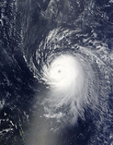
All Topics  
Hurricane Ike


   Email Print
   Bookmark   Link


Hurricane Ike


Hurricane Ike [a?k] was the third most destructive hurricane to ever make landfall in the United States. It was the ninth named storm, fifth hurricane and third major hurricane of the 2008 Atlantic hurricane season
2008 Atlantic hurricane season

The 2008 Atlantic hurricane season was an event in the annual cycle of tropical cyclone formation. The season officially started on June 1 and ended on November 30....
. It was a Cape Verde-type hurricane
Cape Verde-type hurricane

A Cape Verde-type hurricane is an Atlantic hurricane that develops near the Cape Verde islands, off the west coast of Africa. The average hurricane season has about two Cape Verde-type hurricanes, which are usually the most intense storms of the season because they often have plenty of warm open ocean over which to develop before encounterin...
, as it started as a tropical disturbance off the coast of Africa near the end of August, then tracked south of Cape Verde
Cape Verde

The Republic of Cape Verde , is an archipelago nation located in the Macaronesia ecoregion of the North Atlantic Ocean, off the western coast of Africa....
 and slowly developed. On September 1 2008, it became a tropical storm west of the Cape Verde islands.

By the early morning hours of September 5, Ike was a Category 4 hurricane, with maximum sustained wind
Maximum sustained wind

The maximum sustained winds associated with a tropical cyclone are a common indicator of the intensity of the storm. Within a mature tropical cyclone, they are found within the eyewall at a distance defined as the radius of maximum wind, or RMW....
s of 145 mph (230 km/h) and a pressure of .


Discussion
Ask a question about 'Hurricane Ike'
Start a new discussion about 'Hurricane Ike'
Answer questions from other users
Full Discussion Forum


Encyclopedia


Hurricane Ike [a?k] was the third most destructive hurricane to ever make landfall in the United States. It was the ninth named storm, fifth hurricane and third major hurricane of the 2008 Atlantic hurricane season
2008 Atlantic hurricane season

The 2008 Atlantic hurricane season was an event in the annual cycle of tropical cyclone formation. The season officially started on June 1 and ended on November 30....
. It was a Cape Verde-type hurricane
Cape Verde-type hurricane

A Cape Verde-type hurricane is an Atlantic hurricane that develops near the Cape Verde islands, off the west coast of Africa. The average hurricane season has about two Cape Verde-type hurricanes, which are usually the most intense storms of the season because they often have plenty of warm open ocean over which to develop before encounterin...
, as it started as a tropical disturbance off the coast of Africa near the end of August, then tracked south of Cape Verde
Cape Verde

The Republic of Cape Verde , is an archipelago nation located in the Macaronesia ecoregion of the North Atlantic Ocean, off the western coast of Africa....
 and slowly developed. On September 1 2008, it became a tropical storm west of the Cape Verde islands.

By the early morning hours of September 5, Ike was a Category 4 hurricane, with maximum sustained wind
Maximum sustained wind

The maximum sustained winds associated with a tropical cyclone are a common indicator of the intensity of the storm. Within a mature tropical cyclone, they are found within the eyewall at a distance defined as the radius of maximum wind, or RMW....
s of 145 mph (230 km/h) and a pressure of . That made it the most intense storm in the 2008 Atlantic hurricane season
2008 Atlantic hurricane season

The 2008 Atlantic hurricane season was an event in the annual cycle of tropical cyclone formation. The season officially started on June 1 and ended on November 30....
. Ike also had the highest IKE (Integrated Kinetic Energy) of any Atlantic storm in history. Integrated Kinetic Energy is a measure of storm surge destructive potential, similar to the Saffir-Simpson Hurricane Scale
Saffir-Simpson Hurricane Scale

The Saffir-Simpson Hurricane Scale is a classification used for most Western Hemisphere tropical cyclones that exceed the intensities of tropical depressions and tropical storms, and thereby become hurricanes....
, though the IKE is more complex and in many ways more accurate. On a scale that ranges from 1 to 6, with 6 being highest destructive potential, Ike earned a 5.6 on September 11 at 12:30 p.m. EDT. In comparison to Ike, hurricanes Katrina
Hurricane Katrina

Hurricane Katrina of the 2005 Atlantic hurricane season was the costliest Atlantic hurricane, as well as one of the five deadliest, in the history of the United States....
 and Wilma
Hurricane Wilma

Hurricane Wilma was the most intense tropical cyclone ever recorded in the Atlantic basin. Wilma was the twenty-second tropical cyclone , thirteenth tropical cyclone, sixth major hurricane, and fourth Saffir-Simpson Scale hurricane of the record-breaking 2005 Atlantic hurricane season ...
, both from the 2005 Atlantic hurricane season
2005 Atlantic hurricane season

The 2005 Atlantic hurricane season was the most active List of Atlantic hurricane seasons in recorded history, repeatedly shattering previous records....
 peaked at 5.1. As such, had Ike made landfall as a Category 3 or higher, the hurricane would have likely had a record breaking storm surge and the potential for damage could have been worse than what was seen with Hurricane Katrina. However, Ike made its final landfall in Galveston, Texas
Texas

Texas is a U.S. state located in the South Central United States, nicknamed the Lone Star State. Texas is the second largest U.S. state in both area and population, spanning , and with a growing population of 24.3 million residents....
, United States as a Category 2 hurricane.

Ike was blamed for at least 195 deaths. Of these, 74 were in Haiti
Haiti

Haiti , officially the Republic of Haiti , is a Haitian Creole language- and French language-speaking Caribbean country. Along with the Dominican Republic, it occupies the island of Hispaniola, in the Greater Antilles archipelago....
, which was already trying to recover from the impact of three storms earlier that year: Fay
Tropical Storm Fay (2008)

Tropical Storm Fay was a tropical cyclone and the sixth named storm of the 2008 Atlantic hurricane season. Fay formed from a vigorous tropical wave on August 15 over the Dominican Republic....
, Gustav, and Hanna
Hurricane Hanna (2008)

Hurricane Hanna was the eighth tropical cyclone and fourth hurricane of the 2008 Atlantic hurricane season. It formed east-northeast of the northern Leeward Islands on August 28....
. In the United States, 112 people were killed, and 34 are still missing. Damages from Ike in US coastal and inland areas are estimated at $24 billion (2008 USD), with additional damage of up to $4 billion in Cuba, $200 million in the Bahamas, and $60 million in the Turks and Caicos, amounting to a total of $28.26 billion in damages. Ike was the third costliest U.S. hurricane of all time, behind Hurricane Andrew
Hurricane Andrew

Hurricane Andrew is the second most powerful, and the last of three Saffir-Simpson Hurricane Scale hurricanes that made U.S. landfall during the 20th century, after the Labor Day Hurricane of 1935 and Hurricane Camille in 1969....
 of 1992 and Hurricane Katrina
Hurricane Katrina

Hurricane Katrina of the 2005 Atlantic hurricane season was the costliest Atlantic hurricane, as well as one of the five deadliest, in the history of the United States....
 of 2005.

Meteorological history


Hurricane Ike can be traced to a westerly wave leaving western Sudan
Sudan

Sudan is a country in northeastern Africa. It is the largest in the African continent and the Arab World, and List of countries and outlying territories by total area by area....
 on August 19, which moved westward through Nigeria
Nigeria

Nigeria, officially the Federal Republic of Nigeria, is a federation constitutional republic comprising States of Nigeria and one Federal Capital Territory, Nigeria....
 and Mali
Mali

Mali, officially the Republic of Mali, is a landlocked nation in West Africa. Mali is the seventh largest country in Africa, bordering Algeria on the north, Niger on the east, Burkina Faso and the C?te d'Ivoire on the south, Guinea on the south-west, and Senegal and Mauritania on the west....
 and reached the coastal country of Senegal
Senegal

Senegal , officially the Republic of Senegal, is a country south of the S?n?gal River in West Africa. Senegal is bounded by the Atlantic Ocean to the west, Mauritania to the north, Mali to the east, and Guinea and Guinea-Bissau to the south....
 on August 28. Moving into the Atlantic Ocean, the wave slowly intensified over subsequent days while moving generally towards the west-northwest. On September 1, the wave developed a sufficient amount of convection and was designated Tropical Depression Nine. The depression had developed a large amount of convection as well as cyclonically curved bands. Satellite estimates were already indicating that the depression was a tropical storm, however, the National Hurricane Center
National Hurricane Center

The National Hurricane Center , located at Florida International University in Miami, Florida, is the division of National Weather Service's Tropical Prediction Center responsible for tracking and predicting the likely behavior of tropical depressions, tropical storms and tropical cyclone....
 did not classify it as such because the convection was newly formed. The depression continued to intensify as it became better organized and at 5:00 p.m. EDT (21:00 UTC), it was upgraded to Tropical Storm Ike. Ike was located in an environment which was supportive of intensification and the forecast showed Ike becoming a hurricane within 36 hours of its upgrade.

During the overnight hours of September 1, Ike stopped intensifying as part of the eastern band began to erode as northerly wind shear
Wind shear

Wind shear, sometimes referred to as windshear or wind gradient, is a difference in wind wind speed and wind direction over a relatively short distance in the Earth's atmosphere....
 began to impact the system. By late morning on September 2, Ike began to intensify again as shear relaxed a little on the system. Throughout the day, deep convection developed around the center of Ike indicating that the storm was still strengthening. Ike also quickened its movement to 18 mph (29 km/h) due to a strengthening mid-level high located to the north-northeast of Ike. Again intensification stopped during the overnight hours as the structure of Ike remained mostly unchanged.

Ike remained at the same intensity and structure through the early morning hours of September 3. However, by the late morning, Ike began to intensify again. Microwave satellites depicted an eye
Eye (cyclone)

The eye is a region of mostly calm weather found at the center of strong tropical cyclones. The eye of a storm is a roughly circular area and typically 30?65 km in diameter....
 beginning to form and Ike strengthened just below hurricane status. The eye continued to become better defined and by mid-afternoon Ike was upgraded to a hurricane. Ike was in an area that lacked vertical wind shear and intensification was likely. Due to the lack of wind shear, Ike began to undergo explosive intensification
Rapid deepening

Rapid deepening, also known as rapid intensification, is a meteorology condition that occurs when the minimum sea-level atmospheric pressure of a tropical cyclone decreases drastically in a short period of time....
 and was upgraded to a major hurricane with winds of 115 mph (185 km/h) only three hours after being upgraded to a hurricane. During the three hour span, the pressure dropped . Ike continued to intensify and was further upgraded to a Category 4 hurricane on the Saffir-Simpson Hurricane Scale
Saffir-Simpson Hurricane Scale

The Saffir-Simpson Hurricane Scale is a classification used for most Western Hemisphere tropical cyclones that exceed the intensities of tropical depressions and tropical storms, and thereby become hurricanes....
 three hours later with winds of 135 mph (215 km/h) and a pressure of .

By the early morning hours on September 4, Ike had reached its peak intensity of 145 mph (230 km/h) with a pressure of , making it the most intense storm of the season. Ike was now forecast to weaken as the upper-level high to the north of the system continued to strengthen resulting in stronger northerly wind shear affecting Ike. The explosive intensification lasted roughly 24 hours as Ike intensified from a tropical storm to a Category 4 hurricane with a pressure drop of . By the late morning, Ike began to weaken as the cloud tops around the eye began to warm. Models were forecasting Ike to encounter strong wind shear and slowly weaken but maintain major hurricane status. This trend of the clouds warming continued through the afternoon and Ike continued to weaken slowly. By mid-afternoon, Ike was barely a Category 4 hurricane with winds of 135 mph (215 km/h). Ike began to show signs of intensification once more during the late night hours. The eye became more clear and better defined and the clouds around the eye began to deepen and become colder.

The show of possible strengthening did not last long. By the morning of September 5, northerly wind shear began to erode the northern part of the system and the cloud tops around the eye began to warm once more. The structure of the eye became less prominent as microwave satellite imagery showed that the inner structure of Ike was not deteriorating or beginning to undergo an eyewall replacement cycle. A later pass made by the satellite found that the northern eye wall had eroded and most of the convection was in the southern semi-circle of the storm. This indicated that Ike was continuing to weaken as it remained in a hostile environment. Ike slowly weakened to a low-end Category Three by the afternoon hours. A ridge to the north of Ike continued to push the storm towards the southwest, into an area more favorable for intensification.

Ike maintained its intensity throughout the night as its eye briefly reappeared around 8 p.m. EDT, leading the NHC to forecast a slow strengthening trend. Overnight, Ike reformed a 24 nmi (48 km) wide eye, however, it was cloud covered. However, during the late morning hours on September 6, wind shear weakened Ike to a Category Two hurricane. This weakening was short lived and Ike began to undergo another round of rapid intensification, though not as significant as the first. Ike's eye began to clear out again and the system became better organized and based on an Air Force Reconnaissance Aircraft measurement, Ike had intensified into a Category Four six hours after being downgraded to a Category Two. Ike had winds sustained at as it approached the Turks and Caicos Islands
Turks and Caicos Islands

The Turks and Caicos Islands are a British Overseas Territory consisting of two groups of tropical islands in the West Indies, the larger Caicos Islands and the smaller Turks Islands, known for tourism and as an offshore financial centre....
 during the afternoon.

By the early morning hours of September 7, Ike had passed directly over the Turks and Caicos Islands with winds of 135 mph (215 km/h). Environmental conditions were supportive of intensification and Ike was forecast to intensify through landfall in Cuba.

It made landfall as a strong Category 3 hurricane in Holguín Province
Holguín Province

Holgu?n is one of the provinces of Cuba Cuba, the second most populous after Havana. It lies in the southeast of the country. Its major cities include Holgu?n , Banes, Cuba, Antilla, Cuba, Mayar?, Cuba, and Moa, Cuba....
, Cuba
Cuba

The Republic of Cuba is a country in the Caribbean. It consists of the island of Cuba , the island of Isla de la Juventud, and several adjacent small islands....
 on the evening of September 7, near Cabo Lucrecia on the northern coast. It passed across the central provinces of Holguin, Las Tunas
Las Tunas Province

Las Tunas is one of the provinces of Cuba. Major towns include Puerto Padre and Amancio, Cuba, as well as the capital, Victoria de Las Tunas ....
, and Camagüey
Camagüey Province

Camag?ey is the largest of the provinces of Cuba. Its capital is Camag?ey. Other towns include Florida, Cuba and Nuevitas....
, emerging over the sea to the south of Cuba during September 8. It made landfall a second time in Pinar del Río
Pinar del Río Province

Pinar del R?o is one of the provinces of Cuba. It is at the western end of the island of Cuba....
 before entering the Gulf of Mexico
Gulf of Mexico

The Gulf of Mexico is the ninth largest body of water in the world. Considered a smaller part of the Atlantic Ocean, it is an oceanic basin largely surrounded by the North American continent and the island of Cuba....
 in the afternoon of September 9.

During the night of September 10, Ike exhibited a rapid drop in central pressure, falling from to as it passed over the Loop Current
Loop Current

Part of the Gulf Stream, the Loop Current is a warm ocean current in the Gulf of Mexico that flows northward between Cuba and the Yucat?n peninsula, moves north into the Gulf of Mexico, loops west and south before exiting to the east through the Straits of Florida....
 in the Gulf of Mexico. However, this drop was not reflected by wind speed, which only increased from 85 mph (140 km/h) to 100 mph (155 km/h). Multiple wind maxima were noted by the National Hurricane Center, indicating the structure was absorbing and distributing energy over a large area, rather than concentrating it near the center.

Over the next two days, Ike maintained a steady course towards Galveston and Houston. It increased only slightly in intensity to 110 mph (175 km/h) - the high end of Category 2 - but exhibited an unusually large wind field. This caused a projected storm surge of a Category 4 height though the windspeeds were that of a Category 2. As it approached the Texas coast, the inner structure and eyewall became more organized.

Ike made U.S. landfall at Galveston, Texas
Galveston, Texas

Galveston is a city in and county seat of Galveston County, Texas located on Galveston Island on the Gulf Coast of the United States in the U.S....
, on September 13 at 2:10am CDT (07:10 UTC), as a Category 2 hurricane with winds of 110 mph (175 km/h) and a central pressure of . The 2:00 am NHC
National Hurricane Center

The National Hurricane Center , located at Florida International University in Miami, Florida, is the division of National Weather Service's Tropical Prediction Center responsible for tracking and predicting the likely behavior of tropical depressions, tropical storms and tropical cyclone....
 advisory cited tropical storm and hurricane force winds extending and , respectively, from the center. At about 3am CDT (08:00 UTC), it then passed over San Leon, Texas
San Leon, Texas

San Leon is a census-designated place in Galveston County, Texas, Texas, United States. The population was 4,365 at the 2000 census....
 and made its final landfall near Baytown, Texas
Baytown, Texas

Baytown is a city in Chambers County, Texas and Harris County, Texas Counties in the Gulf Coast of the United States region of the U.S. state of Texas....
 at about 4am CDT (9:00 UTC).

During the day of September 13, Ike began a slow turn to the north and then northeast. After losing strength to Tropical Storm force winds, it passed to the east of Dallas, Texas; and west of Little Rock, Arkansas. It became a Tropical Depression and continued northeast, passing near St. Louis, Missouri. It brought heavy rainfall all along its path, but moved more quickly the farther north it went.

Early on September 14, Ike merged with a large cold front moving from west to east across the central United States, and became extratropical. This deep low pressure continued toward the north-east spreading heavy rains throughout the Midwest. It crossed into Canada on the night of the 14 to the 15th, giving strong winds and large amounts of rain in Southern Ontario
Southern Ontario

Southern Ontario is the portion of the Canada province of Ontario lying south of the French River and Algonquin Park. It is the southernmost region of Canada....
, and most regions of Quebec
Quebec

Quebec , in French language, Qu?bec , is a Provinces and territories of Canada in the Central Canada and Eastern Canada regions of Canada....
, before exiting into the Atlantic at the latitude of the Labrador Sea
Labrador Sea

Labrador Sea is an arm of the North Atlantic Ocean between Labrador and Greenland.Water depths in the center of Labrador Sea are around and it is flanked by continental shelf to the southwest, northwest, and northeast....
 early on the 16th.

Preparations


Florida

On September 5, Florida Governor Charlie Crist
Charlie Crist

Charles Joseph "Charlie" Crist, Jr. , is an Politics of the United States of the Republican Party and the current Governor of Florida. Crist was Florida's attorney general when he won election to governor, thus becoming the first Florida cabinet official in 95 years to be elected governor ....
 declared a state of emergency in advance of Ike's arrival, which was expected to be as early as September 8. In Key West
Key West

Key West is an island in the Straits of Florida on the North American continent at the southernmost tip of the Florida Keys.Key West is politically within the limits of the city of Key West, Florida, Monroe County, Florida, Florida, United States....
, authorities issued a mandatory evacuation for all visitors for September 6. FEMA positioned supplies, and emergency response crews in Florida and along the Gulf Coast.

Florida Keys
Florida Keys

The Florida Keys are an archipelago of about 1700 islands in the southeast United States. They begin at the southeastern tip of the Florida peninsula, about south of Miami, Florida, and extend in a gentle arc south-southwest and then westward to Key West, Florida, the westernmost of the inhabited islands, and on to the uninhabited Dry Tort...
 officials began resident evacuations on the low-lying chain of islands in phases, starting at the end in Key West
Key West

Key West is an island in the Straits of Florida on the North American continent at the southernmost tip of the Florida Keys.Key West is politically within the limits of the city of Key West, Florida, Monroe County, Florida, Florida, United States....
 by 8 a.m. Sunday and continuing throughout the day—at noon for the Middle Keys
Florida Keys

The Florida Keys are an archipelago of about 1700 islands in the southeast United States. They begin at the southeastern tip of the Florida peninsula, about south of Miami, Florida, and extend in a gentle arc south-southwest and then westward to Key West, Florida, the westernmost of the inhabited islands, and on to the uninhabited Dry Tort...
, and at 4 p.m. for the Upper Keys
Florida Keys

The Florida Keys are an archipelago of about 1700 islands in the southeast United States. They begin at the southeastern tip of the Florida peninsula, about south of Miami, Florida, and extend in a gentle arc south-southwest and then westward to Key West, Florida, the westernmost of the inhabited islands, and on to the uninhabited Dry Tort...
, including Key Largo
Key Largo

Key Largo is an island in the upper Florida Keys archipelago and, at long, the largest of the Keys. It is also the northernmost of the Florida Keys in Monroe County, Florida, and the northernmost of the Keys connected by U.S....
. Visitors were told to leave on Saturday.

Texas

On September 10, U.S. President George W. Bush
George W. Bush

George Walker Bush served as the List of Presidents of the United States President of the United States from 2001 to 2009. He was the 46th List of Governors of Texas from 1995 to 2000 before being United States presidential inauguration as President on January 20, 2001....
 made an emergency declaration for Texas in advance of Hurricane Ike, making more federal help available for preparations and evacuations.

State rural water associations activated mutual aid networks to prepare for the landfall of Hurricane Hanna
Hurricane Hanna (2008)

Hurricane Hanna was the eighth tropical cyclone and fourth hurricane of the 2008 Atlantic hurricane season. It formed east-northeast of the northern Leeward Islands on August 28....
 and Hurricane Ike while still providing assistance to areas impacted by Hurricane Gustav
Hurricane Gustav

The name Gustav has been used for five tropical cyclones in the Atlantic Ocean:* 1984 Atlantic hurricane season#Tropical Storm Gustav, spent most of its existence as a tropical depression hovering over Bermuda, no major damage...
. The Texas Rural Water Association held meetings with state agencies on Tuesday, September 9, to plan for landfall along the Texas gulf coast.

On September 11, forecasting models began to show Ike making landfall just south of Galveston. City Manager Steven LeBlanc late Wednesday issued a mandatory evacuation order for the low lying west end of Galveston Island
Galveston Island

Galveston Island is a barrier island on the Texas Gulf coast in the United States, about 50 miles southeast of Houston, Texas. The entire island, with the exception of the little Jamaica Beach, Texas, is within the city limits of the City of Galveston, Texas....
. Later, the mandatory evacuation order was extended to the entire island of Galveston, as well as low-lying areas around Houston, Texas
Houston, Texas

Houston is the fourth-largest city in the United States of America and the largest city within the state of Texas. As of the 2007 U.S. Census estimate, the city has a population of 2.2 million within an area of 600 square miles ....
.

Also on September 11, at 8:19 p.m. (CDT), the National Weather Service
National Weather Service

The National Weather Service , once known as the Weather Bureau, is one of the six scientific agencies that make up the National Oceanic and Atmospheric Administration of the United States Federal government of the United States....
 in Houston/Galveston, TX issued a strongly worded bulletin, regarding storm surge along the shoreline of Galveston Bay
Galveston Bay

Galveston Bay is a large estuary located along Texas's upper coast....
. The bulletin advised residents living in single-family homes in some parts of coastal Texas may face "certain death" if they do not heed orders to evacuate. Reports said as many as 40 percent of Galveston's citizens may have not paid attention to the warnings. It was feared to be much the same in Port Arthur.

It was predicted that low-lying areas between Morgan City, Louisiana
Morgan City, Louisiana

Morgan City is a city in St. Martin Parish, Louisiana and St. Mary Parish, Louisiana parishes in the U.S. state of Louisiana. The population was 12,703 at the 2000 United States Census....
 and Baffin Bay, Texas
Baffin Bay, Texas

Baffin Bay is a Headlands and bays in South Texas, an inlet of the larger Laguna Madre. Located near the Gulf of Mexico, Baffin Bay forms part of the boundary between Kenedy County, Texas and Kleberg County, Texas....
, particularly those areas east of Ike's projected eye landfall would experience the greatest damage from storm surges of up to . Waves at sea were expected to be higher, up to according to computer simulations.

The price of gas increased in the expectation of damage to some of the numerous oil refineries along the South Texas coast, or at least delays in production from the oil and gas platforms in the Gulf of Mexico.

Impact

Fatalities by country
Country Deaths Missing
Haiti
Haiti

Haiti , officially the Republic of Haiti , is a Haitian Creole language- and French language-speaking Caribbean country. Along with the Dominican Republic, it occupies the island of Hispaniola, in the Greater Antilles archipelago....
 
74 ???
Dominican Republic
Dominican Republic

The Dominican Republic is a nation on the island of Hispaniola, part of the Greater Antilles archipelago in the Caribbean region. The western third of the island is occupied by the nation of Haiti, making Hispaniola one of two Caribbean islands that are List of divided islands, Saint Martin being the other....
 
1 ???
Cuba
Cuba

The Republic of Cuba is a country in the Caribbean. It consists of the island of Cuba , the island of Isla de la Juventud, and several adjacent small islands....
 
7 ???
United States 112 34
Total 195 34

Turks and Caicos Islands

.]]

Power was lost throughout Grand Turk Island
Grand Turk Island

Grand Turk Island is an island in the Turks and Caicos Islands. It is the largest island in the Turks Islands with 18 square kilometres. It contains the territory's capital, Cockburn Town and the JAGS McCartney International Airport....
, 95% of the houses were damaged, one-fifth of which was significant damage. There was also significant structural damage to roofs and buildings containing health services resulting in the disruption of most health services. Pharmacy stores, and supplies facilities received major damage or total destruction. Water and electricity were also disrupted but now has been restored. There was some damage to the Clinic on Salt Cay In North Caicos and Middle Caicos, there was no damage or minimal damage to the clinic. Meanwhile in South Caicos, 95% of the houses were also damaged with over one-third significantly damaged or destroyed. Damage also occurred on other islands, pockets of which were significant but in general damage was minor. After the eye of the storm passed over, it continued west at headed directly for eastern Cuba. Buildings on the islands have been severely weakened and 750 people have lost their homes. Due to the extent and magnitude of damage and affected population, the Government of the Turks and Caicos
Politics of the Turks and Caicos Islands

Politics of the Turks and Caicos Islands takes place in a framework of a parliamentary system representative democracy Dependent territory, whereby as of August 9, 2006 the Premier is the head of government, and of a multi-party system....
 declared Grand Turk and South Caicos Islands disaster areas. Total damages in the Turks and Caicos islands were estimated at $500 million.

Hispaniola

The outer bands of Ike caused additional flooding in Haiti
Haiti

Haiti , officially the Republic of Haiti , is a Haitian Creole language- and French language-speaking Caribbean country. Along with the Dominican Republic, it occupies the island of Hispaniola, in the Greater Antilles archipelago....
, which was already devastated by Hanna
Hurricane Hanna (2008)

Hurricane Hanna was the eighth tropical cyclone and fourth hurricane of the 2008 Atlantic hurricane season. It formed east-northeast of the northern Leeward Islands on August 28....
 and also hit hard by Fay
Tropical Storm Fay (2008)

Tropical Storm Fay was a tropical cyclone and the sixth named storm of the 2008 Atlantic hurricane season. Fay formed from a vigorous tropical wave on August 15 over the Dominican Republic....
 and Gustav
Hurricane Gustav

The name Gustav has been used for five tropical cyclones in the Atlantic Ocean:* 1984 Atlantic hurricane season#Tropical Storm Gustav, spent most of its existence as a tropical depression hovering over Bermuda, no major damage...
. The last bridge still standing into the city of Gonaïves
Gonaïves

Gona?ves is a city in northern Haiti, the capital of the Artibonite Department. It has a population of about 104,825 people . The city's name derives from the original Amerindian name of Gonaibo....
 was washed away, slowing relief in the community considerably and creating a deeper humanitarian and food crisis in the hard-hit region. 74 deaths were reported in Haiti from Ike, of which most were in the coastal community of Cabaret which was swept away by floodwaters and mudslides. Haitian Prime Minister Michèle Pierre-Louis
Michèle Pierre-Louis

Mich?le Duvivier Pierre-Louis is a Haitian political figure who has been Prime Minister of Haiti since 2008. She is Haiti's second female Prime Minister, after Claudette Werleigh, who served from 1995 to 1996....
 called for help at the end of the week, saying that four storms in three weeks have left over 550 dead and as many as one million homeless. She also said that parts of Gonaïves were so severely damaged that the city may have to be rebuilt elsewhere.

Cuba

Just over one million Cubans had been evacuated on Sunday, officials said. In Baracoa
Baracoa

Baracoa is a municipality and city in Guant?namo Province in extreme eastern Cuba. It was founded by the first governor of Cuba, the Spanish Empire conquistador Diego Vel?zquez de Cu?llar in 1511, which makes it not only the oldest Spanish settlement in Cuba but also its first capital ....
, 200 homes were reported to be destroyed and waves were running high and peaked at in different areas of Cuba. The Category 3 hurricane made landfall on September 8 on the north coast of eastern Cuba in the province of Holguin
Holguín

Holgu?n is a municipality and city, the capital of the Cuban Holgu?n Province....
 near Puerto de Sama, with sustained winds of about , causing widespread flooding and damage to the eastern provinces. It passed across the central provinces of Holguin, Las Tunas, and Camagüey, emerging over the sea to the south of Cuba during September 8. Ike had dropped to a Category One by the time it crossed the island. It then followed the southern coast of Cuba and crossed the western end of the island in Pinar del Rio Province
Pinar del Río Province

Pinar del R?o is one of the provinces of Cuba. It is at the western end of the island of Cuba....
, close to the path taken by Hurricane Gustav ten days previously. Another 1.6 million people had evacuated in advance of its second landfall. The western areas of Cuba, already devastated by Hurricane Gustav
Hurricane Gustav

The name Gustav has been used for five tropical cyclones in the Atlantic Ocean:* 1984 Atlantic hurricane season#Tropical Storm Gustav, spent most of its existence as a tropical depression hovering over Bermuda, no major damage...
 just 10 days before Ike hit, suffered additional major flooding from the rain and storm surge. The sugar cane crop was devastated, with over destroyed. Alongside Gustav, they were described as the "worst ever" storms by Cuban officials.

In total, seven people were killed in Cuba from Ike. The combined damage estimate from Ike and Gustav, and succeding Paloma is about $9.4 billion (USD), with about 4 billion of that from Ike.

United States

Due to the intensity of the storm, Texas closed many of its oil refineries. Because much of the United States oil refining capacity is located in Texas, the closings caused a temporary increase in the prices of gasoline, home heating oil, and natural gas. Increases were particularly high in North Carolina
North Carolina

North Carolina is a U.S. state located on the Atlantic Seaboard in the southeastern United States. The state borders South Carolina and Georgia to the south, Tennessee to the west and Virginia to the north....
, especially in the mountains, where average prices were as much as 60 cents higher than the national average.The closing of refineries so soon after Hurricane Gustav, and the time required to restart production, also resulted in shortages of gasoline in such places as the Carolinas and Tennessee, partly as a result of panic buying
Panic buying

Panic buying is an imprecise common use term to describe the act of people buying unusually large amounts of a product in anticipation of or after a disaster or perceived disaster, or in anticipation of a large price increase or shortage, as can occur before a blizzard or hurricane....
. Preliminary post-storm damage estimates in the US were placed at 18 billion US dollars (2008) as stated by the Australian Broadcasting Corporation
Australian Broadcasting Corporation

The Australian Broadcasting Corporation, commonly referred to as the ABC, is Australia's national Public broadcasting.With a budget of Australian dollar840 million annually, the corporation provides television, radio, online and mobile services throughout metropolitan and regional Australia, as well as overseas through the Australia Net...
 . Eighty-two deaths have been reported in the US, including forty-eight in Texas
Texas

Texas is a U.S. state located in the South Central United States, nicknamed the Lone Star State. Texas is the second largest U.S. state in both area and population, spanning , and with a growing population of 24.3 million residents....
, eight in Louisiana
Louisiana

The State of Louisiana is a U.S. state located in the U.S. Southern States of the United States of America. Its capital is Baton Rouge and largest city is New Orleans....
, one in Arkansas
Arkansas

Arkansas is a U.S. state located in the Southern United States of the United States. Arkansas shares a border with six states, with its eastern border largely defined by the Mississippi River....
, two in Tennessee
Tennessee

Tennessee is a U.S. state located in the Southern United States United States. In 1796, it became the sixteenth state to join the United States....
, one in Kentucky
Kentucky

The Commonwealth of Kentucky is a U.S. state located in the East Central United States of America. Kentucky is normally included in the group of Southern United States , but it is uncommonly included, geographically and culturally, in the Midwestern United States....
, seven in Indiana
Indiana

The State of Indiana was the 19th U.S. state admitted into the union. It is located in the Midwestern United States of the United States of America....
, four in Missouri
Missouri

Missouri is a U.S. state in the Midwestern United States of the United States bordered by Iowa, Illinois, Kentucky, Tennessee, Arkansas, Oklahoma, Kansas and Nebraska....
, two in Illinois
Illinois

The State of Illinois is a U.S. state of the United States, the 21st to be admitted to the United States. Illinois is the most populous and demographically diverse Midwestern United States state and the fifth most populous state in the nation....
, two in Michigan
Michigan

Michigan is a Midwestern United States U.S. state of the United States of America. It was named after Lake Michigan, whose name is a French adaptation of the Anishinaabe language term mishigama, meaning "large water" or "large lake"....
, seven in Ohio
Ohio

Ohio is a Midwestern United States U.S. state of the United States. As part of the Great Lakes region , Ohio has long been a cultural and geographical crossroads in North America....
 and one in Pennsylvania
Pennsylvania

The Commonwealth of Pennsylvania , often colloquially referred to as PA by natives and Northeasterners, is a U.S. state located in the Northeastern United States and Mid-Atlantic States regions of the United States....
, although there are 202 missing. On September 15, 2008 the United States Congress
United States Congress

The United States Congress is the Bicameralism legislature of the Federal government of the United States of the United States of America, consisting of two houses, the United States Senate and the United States House of Representatives....
 held a moment of silence for those who died in the hurricane.

MV Antalina
On September 11, the cargo ship, the MV Antalina, was among the ships that left Port Arthur
Port Arthur, Texas

Port Arthur is a city in Jefferson County, Texas within the Beaumont, Texas–Port Arthur Beaumont?Port Arthur metropolitan area of the U.S....
 to avoid the hurricane. The ship had a crew of 22 and carried a cargo of petroleum coke
Petroleum coke

Petroleum coke is a carbonaceous solid derived from oil refinery coker units or other cracking processes. Other Coke has traditionally been derived from coal....
. However, on September 12, the ship's engine failed and the ship was adrift from the shore. The crew first attempted to repair the engine but was unable to do so. The crew requested to be evacuated by the Coast Guard
United States Coast Guard

The United States Coast Guard is a branch of the Military of the United States and one of seven Uniformed services of the United States. In addition to being a military branch at all times, it is unique among the armed forces in that it is also a Admiralty law agency and a Federal government of the United States regulatory agency....
, but the rescue mission was aborted because weather conditions were not within the safety parameters. The crew was forced to ride out the storm, but kept in contact with the Coast Guard. The ship successfully rode out the storm and all 22 crew members were uninjured. On September 13, a tugboat was dispatched to return the vessel to port.

Louisiana
The storm surge ahead of Ike blew onshore onto the coast of Louisiana
Louisiana

The State of Louisiana is a U.S. state located in the U.S. Southern States of the United States of America. Its capital is Baton Rouge and largest city is New Orleans....
 well ahead of Ike's predicted landfall in Texas on September 13. Areas in coastal south-central and southwestern Louisiana, some of which were flooded by Gustav, were re-flooded as a result of Ike. Some areas which had not yet recovered from Gustav power outages received additional outages, to the tune of 200,000. The hardest-hit areas were in and around Cameron Parish
Cameron Parish, Louisiana

Cameron Parish is the parish with the most land area in the U.S. state of Louisiana. The parish seat is Cameron, Louisiana and as of 2000, the population was 9,991....
, which also sustained catastrophic damage in 2005
2005 Atlantic hurricane season

The 2005 Atlantic hurricane season was the most active List of Atlantic hurricane seasons in recorded history, repeatedly shattering previous records....
 from Hurricane Rita
Hurricane Rita

Hurricane Rita was the fourth-most intense Atlantic hurricane ever recorded and the most intense tropical cyclone ever observed in the Gulf of Mexico....
 and in 1957
1957 Atlantic hurricane season

The 1957 Atlantic hurricane season officially began on June 15, 1957, and lasted until November 15, 1957. These dates conventionally delimit the period of each year when most tropical cyclones form in the Atlantic basin....
 from Hurricane Audrey
Hurricane Audrey

Hurricane Audrey was the first major hurricane of the 1957 Atlantic hurricane season. Audrey was the only storm to reach Saffir-Simpson Hurricane Scale status in June....
. Nearly every square inch of the coastline in that area was flooded heavily once again, with floodwaters reaching as far north as Lake Charles
Lake Charles, Louisiana

Lake Charles is the fifth largest incorporated city in the US state of Louisiana.It is the major cultural and educational center in the southwest region of the state and one of the most important in Acadiana....
. Hundreds of people had to be rescued, including 363 people who were rescued by Louisiana Department of Wildlife and Fisheries Search and Rescue teams in conjunction with the Louisiana National Guard and the U.S. Coast Guard.

One person was killed in a flooded bayou in Terrebonne Parish
Terrebonne Parish, Louisiana

Terrebonne Parish is a Parish located in the U.S. state of Louisiana. The parish seat is Houma, Louisiana. Its population was 104,503 . It is the second largest parish in Louisiana in terms of land area....
, and a wind-related death was reported near Houma
Houma, Louisiana

Houma is the parish seat of Terrebonne Parish, Louisiana, Louisiana, United States, and the largest principal city of the Houma–Bayou Cane, Louisiana–Thibodaux, Louisiana Houma-Bayou Cane-Thibodaux metropolitan area....
. Two other deaths took place in a car crash in the evacuation phase in Iberville Parish
Iberville Parish, Louisiana

Iberville Parish is a parish located south of Baton Rouge in the U.S. state of Louisiana. Its parish seat is Plaquemine, Louisiana. In 2000, the population of the parish was 33,320....
, and two other storm related deaths in Jefferson Davis Parish
Jefferson Davis Parish, Louisiana

Jefferson Davis Parish is a parish located in the U.S. state of Louisiana. The parish seat is Jennings, Louisiana. As of 2000, its population was 31,435....
 were caused by natural causes. While doing repairs, two energy-company contractors from Oklahoma were electrocuted.

Texas
On the morning of September 13, 2008, the eye of Hurricane Ike approached the Texas coast near Galveston Bay
Galveston Bay

Galveston Bay is a large estuary located along Texas's upper coast....
, making landfall at 2:10 a.m. CDT over the east end of Galveston Island
Galveston Island

Galveston Island is a barrier island on the Texas Gulf coast in the United States, about 50 miles southeast of Houston, Texas. The entire island, with the exception of the little Jamaica Beach, Texas, is within the city limits of the City of Galveston, Texas....
.

People in low-lying areas who had not heeded evacuation orders, in single-family one- or two-story homes, were warned by the weather service that they may "face certain death" from the overnight storm surge, a statement that turned out to be true for some who refused to evacuate.

In regional Texas towns, electrical power began failing before 8 p.m. CDT, leaving millions without power (estimates range from 2.8 million to 4.5 million customers). Grocery store shelves in the Houston area were left empty, in the aftermath of the storm.

In Galveston
Galveston, Texas

Galveston is a city in and county seat of Galveston County, Texas located on Galveston Island on the Gulf Coast of the United States in the U.S....
, by 4 p.m. CDT (2100 UTC) on September 12, the rising storm surge began overtopping the 17-ft (5.2 m) Galveston Seawall
Galveston Seawall

The Galveston Seawall is a seawall in Galveston, Texas, USA that was built after the Galveston Hurricane of 1900 for protection from future hurricanes....
, which faces the Gulf of Mexico; waves had been crashing along the seawall earlier, from 9 a.m. CDT. Although Seawall Boulevard is elevated above the shoreline, many areas of town slope down behind the seawall to the lower elevation of Galveston Island
Galveston Island

Galveston Island is a barrier island on the Texas Gulf coast in the United States, about 50 miles southeast of Houston, Texas. The entire island, with the exception of the little Jamaica Beach, Texas, is within the city limits of the City of Galveston, Texas....
.

Even though there were advance evacuation plans, Mary Jo Naschke, spokesperson for the city of Galveston, estimated that (as of Friday morning) a quarter of the city's residents paid no attention to calls for them to evacuate, despite predictions that most of Galveston Island would suffer heavy flooding storm tide
Storm tide

A storm tide is a tide with a high flood period caused by a storm. Storm tides can be a severe danger to the coast and the people living along the coast....
. By 6 p.m. Friday night, estimates varied as to how many of the 58,000 residents remained, but the figures of remaining residents were in the thousands. Widespread flooding included downtown Galveston: six ft (2 m) deep inside the Galveston County Courthouse, and the University of Texas Medical Branch at Galveston was flooded. Tourist attractions on the island suffered various degreed of damage. The Lone Star Flight Museum
Lone Star Flight Museum

File:Lone Star Flight Museum front.jpgFile:B17-Thunderbird-runup WL.jpgThe Lone Star Flight Museum, located in Galveston, Texas, displays more than 40 historically significant aircraft and many hundreds of artifacts related to the history of flight....
 suffered massive damage as the storm surge washed though the airport and hangars with about 8 feet of water, and the recently completed Schlitterbahn Water Park is still closed as of November; however, Moody Gardens was built with storms in mind and was able to withstand the worst of the storm.

In Houston, windows also broke in downtown buildings such as the 75-story JP Morgan Chase Tower
JPMorgan Chase Tower (Houston)

The 75-story, 1,002-foot tall JPMorgan Chase Tower of Houston, Texas, Texas, formerly the Texas Commerce Bank Tower, is the Tallest buildings in Texas, the tallest five-sided building in the world, and one of the World's tallest structures....
, and Reliant Stadium
Reliant Stadium

Reliant Stadium is a multiple-use stadium in Houston, Texas, Texas. The stadium is the home of the National Football League's Houston Texans, the Houston Livestock Show and Rodeo, the Texas Bowl, host to many international soccer matches for the United States men's national soccer team and other events....
 was damaged. Also as a result of the high wind and eye wall that passed directly through the city, power outages were a major problem, as some residents were still without electricity over two weeks after landfall. Some parts of Houston were not expected to have power until November 1. Luckily, since the storm system moved rapidly and did not linger over Houston, flooding wasn't a major problem for most of the city, as it normally is as a result of the geography. Due to the damage to the stadium, the Houston Texans
Houston Texans

The Houston Texans are a professional American football team based in Houston, Texas, Texas. They are currently members of the AFC South of the American Football Conference in the National Football League ....
' game with the Baltimore Ravens
Baltimore Ravens

The Baltimore Ravens are a professional American football team based in Baltimore, Maryland. They compete in the AFC North of the American Football Conference in the National Football League ....
, originally scheduled for September 14, was pushed back to November 9. Hurricane Ike affected the Houston Astros
Houston Astros

The Houston Astros are a professional baseball team based in Houston, Texas. The Astros are a member of the National League Central of Major League Baseball's National League....
' late dash for Major League Baseball's playoffs, postponing Friday, Saturday, and Sunday's games against the Chicago Cubs
Chicago Cubs

The Chicago Cubs are a professional baseball franchise based in Chicago, Illinois. They are members and currently the two-time defending champions of the National League Central of Major League Baseball's National League....
.

Two of the games were moved to Milwaukee's Miller Park
Miller Park

Miller Park is a baseball park located in Milwaukee, Wisconsin, Wisconsin. It is home to the Milwaukee Brewers and was built as a replacement for Milwaukee County Stadium....
 and were played Sunday September 14 and Monday September 15. The final game was tentatively scheduled for Monday September 29 in Houston. The Astros were eliminated from playoff contention on September 26 and the game was officially canceled as it would not affect post season standings.

On Bolivar Peninsula, Texas
Bolivar Peninsula, Texas

Bolivar Peninsula is a census-designated place in Galveston County, Texas, Texas, United States. The population was 3,853 at the 2000 census....
 dozens of people were rescued as flood waters exceeded 12 feet (3.7 m) above sea level in advance of the hurricane. The peninsula bore the brunt of Ike's right-front quadrant, historically the worst part of a hurricane, and experienced catastrophic damage with the worst being between Rollover Pass
Rollover Pass

Rollover Pass is a man-made strait that cuts through the Bolivar Peninsula and links the Gulf of Mexico with Rollover Bay and East Bay on the upper Texas coast in eastern Galveston County ....
 and Gilchrist, Texas
Gilchrist, Texas

Gilchrist, Texas is an unincorporated area residential community and beachfront resort along State Highway 87 , located seventeen miles east of Bolivar Point in the Bolivar Peninsula, Texas census-designated place, in Galveston County, Texas, Texas, United States....
 - west of High Island. Media estimates of lost homes exceed 80% and could top 95%. A large number of people who did not evacuate in advance of the storm remain unaccounted for.

The Southeast Texas communities of Bridge City on Sabine Lake and large areas of nearby Orange, (80 miles from the center of landfall), were inundated by the storm surge. Bridge City mayor Kirk Roccaforte estimated that only about 14 (later updated to around two dozen) homes in the city were unaffected by the surge.

NASA's Johnson Space Center suffered minor roof damage to Mission Control and minor cosmetic damage to some of its other buildings. NASA's operations at Ellington Field
Ellington Field

Ellington Airport is a joint civil-military airport located 15 miles southeast of downtown Houston, Texas, within Harris County, Texas in the U.S....
 also sustained roof and awning damage, and one hangar was severely damaged.

As a historical comparison, on September 8, 1900 the Galveston Hurricane of 1900
Galveston Hurricane of 1900

The Hurricane of 1900 made Landfall on the city of Galveston, Texas, Texas on September 8, 1900. . ; .It had estimated winds of 135 miles per hour at landfall, making it a Saffir-Simpson Hurricane Scale#Category 4 storm on the Saffir-Simpson Hurricane Scale....
 landed along a path similar to Ike's, bringing with it a storm surge that inundated most of Galveston Island, then Texas' largest city and a major U.S. port. As a result, much of the city was destroyed and at least 6,000 people were killed in a few hours. Engineers subsequently increased the average elevation of the island by and constructed a seawall to block incoming waves.

Farther inland
On September 14, after becoming extratropical
Extratropical cyclone

Extratropical cyclones, sometimes called mid-latitude cyclones or wave cyclones, are a group of cyclones defined as Synoptic scale meteorology Low pressure area weather systems that occur in the middle latitudes of the Earth having neither tropical cyclone nor polar cyclone characteristics, and are connected with Surface weath...
 and enhanced by an upper level shortwave
Shortwave (meteorology)

A shortwave or shortwave trough is an embedded kink in the trough / ridge pattern. This is the opposite of longwaves, which are responsible for Synoptic scale meteorology systems, although shortwaves may be contained within or found ahead of longwaves and range from the Mesoscale meteorology to the the synoptic scale....
 trough, a major wind event took place across the lower and middle Ohio Valley, and significant rainfall and flooding took place to the west. Several areas in Illinois
Illinois

The State of Illinois is a U.S. state of the United States, the 21st to be admitted to the United States. Illinois is the most populous and demographically diverse Midwestern United States state and the fifth most populous state in the nation....
 and Indiana
Indiana

The State of Indiana was the 19th U.S. state admitted into the union. It is located in the Midwestern United States of the United States of America....
, already flooded by the frontal boundary to the north, saw significant additional rainfall. Due to flooding in Chicago, Todd Stroger
Todd Stroger

Todd H Stroger is the current Cook County, Illinois, Board president and former alderman for the 8th Ward in Chicago. Stroger is a member of the Democratic Party ....
 declared a state of emergency for Cook County
Cook County

Cook County is the name of three county in the United States and one in Australia.By far the most populous of these, the most populous in its U.S....
. Hurricane-force wind gusts were reported to the east of the center across parts of Kentucky
Kentucky

The Commonwealth of Kentucky is a U.S. state located in the East Central United States of America. Kentucky is normally included in the group of Southern United States , but it is uncommonly included, geographically and culturally, in the Midwestern United States....
, Indiana
Indiana

The State of Indiana was the 19th U.S. state admitted into the union. It is located in the Midwestern United States of the United States of America....
, Ohio
Ohio

Ohio is a Midwestern United States U.S. state of the United States. As part of the Great Lakes region , Ohio has long been a cultural and geographical crossroads in North America....
 and Pennsylvania
Pennsylvania

The Commonwealth of Pennsylvania , often colloquially referred to as PA by natives and Northeasterners, is a U.S. state located in the Northeastern United States and Mid-Atlantic States regions of the United States....
 with significant wind damage including structural damage to buildings and trees. The Louisville
Louisville, Kentucky

Louisville is Kentucky's largest city and county seat of Jefferson County, Kentucky. The city's estimated population as of 2006 is listed as 557,789, with a population of 1,233,733 in the Louisville-Jefferson County, KY-IN Metropolitan Statistical Area....
 area declared a state of emergency
State of emergency

A state of emergency is a governmental declaration that may suspend certain normal functions of government, alert citizens to alter their normal behaviors, or order government agencies to implement emergency preparedness plans....
 due to major damage, and the Louisville International Airport
Louisville International Airport

Louisville International Airport is a joint civil-military public airport centrally located in the city of Louisville, Kentucky in Jefferson County, Kentucky, Kentucky, United States....
 was closed temporarily. A LG&E spokesperson said that this was the worst power outage in 30 years. Later in the day, a statewide state of emergency was declared in Kentucky by Governor
Governor of Kentucky

The Governor of Kentucky is the head of the executive branch of the U.S. state of Kentucky, and serves as Commander-in-Chief of the state's army, navy, and militia forces....
 Steve Beshear
Steve Beshear

Steven Lynn "Steve" Beshear is an United States politician of the Democratic Party , and the List of Governors of Kentucky and current Governor of Kentucky of the U.S....
. Cincinnati-Northern Kentucky International Airport was also temporarily shut down, and the control tower was evacuated. In Cincinnati
Cincinnati, Ohio

Cincinnati is a city in the U.S. state of Ohio and the county seat of Hamilton County, Ohio. The municipality is located in southwestern Ohio and is situated on the Ohio River at the Ohio-Kentucky border....
, numerous reports of roof damage were called in to law enforcement, and on September 15, most of the schools in Hamilton County
Hamilton County, Ohio

Hamilton County is a county located in the southwest corner of the U.S. state of Ohio, United States. The county seat is Cincinnati, Ohio, and as of 2000, the population was 845,303....
 and Butler County had classes cancelled because of power outages. Wind gusts of were recorded at Columbus
Columbus, Ohio

Columbus is the Capital , the largest, and the most populous city of the U.S. state of Ohio. Located near the Geographic centers of the United States, Columbus is the county seat of Franklin County, Ohio, although parts of the city also extend into Delaware County, Ohio and Fairfield County, Ohio counties....
, which is equivalent to sustained wind levels found in a Category 1 hurricane. Additionally, a state of emergency was declared in Ohio
Ohio

Ohio is a Midwestern United States U.S. state of the United States. As part of the Great Lakes region , Ohio has long been a cultural and geographical crossroads in North America....
 on Monday. Also in Salem, Indiana
Salem, Indiana

Salem is a city in Washington Township, Washington County, Indiana, Washington County, Indiana, Indiana, United States. Salem serves as the county seat, and its Salem Downtown Historic District is on the National Register of Historic Places ....
, wind gusts up to were recorded. In Indiana
Indiana

The State of Indiana was the 19th U.S. state admitted into the union. It is located in the Midwestern United States of the United States of America....
, high winds caused more than 200,000 customers to be without power throughout the state. Wind gusts of were recorded at Indianapolis International Airport
Indianapolis International Airport

Indianapolis International Airport is a public airport located seven miles southwest of the central business district of Indianapolis, Indiana, a city in Marion County, Indiana, Indiana, United States....
. Coming to Indianapolis, on September 14, Ike also caused damages to the first-ever motorcycle Grand Prix held in Indianapolis
2008 Indianapolis motorcycle Grand Prix

The 2008 Indianapolis motorcycle Grand Prix was the fourteenth round of the 2008 Grand Prix motorcycle racing season. It took place on the weekend of 12-14 September, 2008 at the Indianapolis Motor Speedway, the first time the circuit has hosted a major motorcycle racing event since its first year of operation in 1909....
, stopping both 125cc and MotoGP races after the two thirds of the distance, and causing the cancellation of the 250cc race.

In Arkansas
Arkansas

Arkansas is a U.S. state located in the Southern United States of the United States. Arkansas shares a border with six states, with its eastern border largely defined by the Mississippi River....
, about 200,000 customers lost power as a result of the winds, the worst power loss in that state since an ice storm in 2000. In the Louisville area, over 300,000 customers were without power - the worst power outage in the utility's history. The Cincinnati metropolitan area was very hard hit, with over 927,000 customers losing power in that region. A Duke Energy
Duke Energy

Duke Energy , headquartered in Charlotte, North Carolina, is an energy company with assets in the United States, Canada and Latin America....
 spokesperson said “We have never seen anything like this. Never. We’re talking about 90 percent of our customers without power." There were so many power outages and so few workers available Duke Energy
Duke Energy

Duke Energy , headquartered in Charlotte, North Carolina, is an energy company with assets in the United States, Canada and Latin America....
 was thinking of sending workers from their base in Charlotte, North Carolina
Charlotte, North Carolina

Charlotte is the largest city in the state of North Carolina and the seat of Mecklenburg County, North Carolina. The List of United States cities by population in the United States....
. In the Dayton, Ohio area 300,000 of 515,000 Dayton Power & Light Co. customers lost power at some point following severe wind storms on the afternoon of Sept. 14, according to a company spokesperson. As of Thursday morning, Sept. 18, 90,000 DP&L customers remained without power. Also hard hit were central Ohio (with over 350,000 customers losing power) and northeastern Ohio (with over 310,000 customers losing power), as well as Illinois (49,000), Missouri (85,000), and western Pennsylvania
Pennsylvania

The Commonwealth of Pennsylvania , often colloquially referred to as PA by natives and Northeasterners, is a U.S. state located in the Northeastern United States and Mid-Atlantic States regions of the United States....
 (with over 180,000 customers losing power). In western Kentucky, outside crews had to be brought in from as far away as Mississippi
Mississippi

Mississippi is a U.S. state located in the Deep South of the United States. Jackson, Mississippi is the state capital and largest city. The state's name comes from the Mississippi River, which flows along its western boundary, and takes its name from the Anishinaabe language word misi-ziibi ....
 to restore power. In Indiana, about 350,000 customers lost power statewide, mainly in the southern part of the state. In New York State, over 100,000 customers were reported without power. In total, 50 deaths have been blamed on Ike in the inland states.

Canada

In Ontario
Ontario

Ontario is a Provinces and territories of Canada located in the Central Canada part of Canada, the largest by population and second largest, after Quebec, in total area....
, Ike's remnants brought a record amount of rain on Sunday, September 14, in the Windsor
Windsor, Ontario

Windsor is the southernmost city in Canada and lies at the western end of the heavily populated Quebec City-Windsor Corridor. Windsor is located south of Detroit, Michigan, is separated from that city by the Detroit River, and has views of the Detroit skyline....
 region. It was closely following a slow-moving frontal system that had drenched the city the day before, dumping of rain and breaking the old record of in 1979, according to Environment Canada
Environment Canada

Environment Canada , legally incorporated as the Department of the Environment under the Department of the Environment Act , is the Ministry of the Government of Canada with responsibility for coordinating environmental policies and programs as well as preserving and enhancing the natural environment and conservation of wildlife....
. Most damage in the Windsor area with Ike was confined to downed power lines and toppled tree branches with the wind gusts reaching , with spotty street flooding that made driving completely treacherous in some areas. Highways were washed out in the Bruce Peninsula
Bruce Peninsula

The Bruce Peninsula is a peninsula in Ontario, Canada that lies between Georgian Bay and the main basin of Lake Huron. The peninsula extends roughly northwestwards from the rest of southern Ontario, pointing towards Manitoulin Island, with which it forms the widest strait, joining Georgian Bay to the rest of Lake Huron....
, and trees were uprooted in London, Ontario
London, Ontario

London is a city in Southwestern Ontario, Canada along the Quebec City-Windsor Corridor with a metropolitan area population of 457,720; the city proper had a population of 352,395 in the Canada 2006 Census....
. The storm continued to cause wind and rain damage as it continues east along the St. Lawrence River leaving around 25,000 customers without electricity, especially in Belleville
Belleville, Ontario

Belleville is a city located at the mouth of the Moira River on the Bay of Quinte in southeastern Ontario, Canada, in the Quebec City-Windsor Corridor....
, Brockville
Brockville, Ontario

Brockville is located in the Thousand Islands region on the St. Lawrence River in Leeds and Grenville United Counties, Ontario, Eastern Ontario, Canada....
, Bancroft
Bancroft, Ontario

Bancroft is a town located on the York River in Hastings County, Ontario in the Canadian province of Ontario....
, Peterborough
Peterborough, Ontario

Peterborough is a city on the Otonabee River in central-eastern Ontario, Canada, 125 kilometres northeast of Toronto. The population of the City of Peterborough was 74,898 in the 2006 census, while the census metropolitan area had a population of 116 570....
, Bowmanville, Huntsville
Huntsville, Ontario

Huntsville is a town in the Muskoka Region of Ontario, Canada.The area was first settled, and founded in 1869 by Captain George Hunt, who built a small agricultural centre there....
 and Timmins
Timmins, Ontario

Timmins is a city in northeastern Ontario, Canada on the Mattagami River. At the time of the Canada 2006 Census, Timmins' population was 42,455....
.

In Quebec
Quebec

Quebec , in French language, Qu?bec , is a Provinces and territories of Canada in the Central Canada and Eastern Canada regions of Canada....
, regions to the north of the Saint Lawrence River
Saint Lawrence River

Saint Lawrence River is a large river flowing approximately from southwest to northeast in the middle latitudes of North America, connecting the Great Lakes with the Atlantic Ocean....
 received to of rainfall (Hautes-Laurentides
Laurentides (region)

The Laurentians is a List of Quebec regions of Quebec. While it is often called the Laurentians in English, the region includes only part of the Laurentian mountains....
, Haute-Mauricie
Mauricie

Mauricie is a traditional and current administrative region of Quebec. La Mauricie National Park is contained within the region, making it a prime tourist location....
, Réserve faunique des Laurentides
Jacques-Cartier River

The Jacques-Cartier River is a river in the province of Quebec, Canada. It is 161 km long and its source is Jacques-Cartier Lake in Laurentides Wildlife Reserve, and flows in a predominantly southern direction before ending in the Saint Lawrence River at Donnacona, Quebec, about 30 km upstream from Quebec City....
, Saguenay-Lac-Saint-Jean
Saguenay-Lac-Saint-Jean

Saguenay–Lac-Saint-Jean is a region in Quebec, Canada. It contains the Saguenay Fjord, the estuary of the Saguenay River, stretching through much of the region....
, Charlevoix
Charlevoix

The Charlevoix region, located in Quebec, includes parts of the north shore of the Saint Lawrence River and the Laurentian Mountains region of the Canadian Shield....
 and Côte-Nord
Côte-Nord

C?te-Nord is the second largest administrative region by land area in Quebec, Canada, after Nord-du-Qu?bec. It covers much of the northern shore of the Saint Lawrence River estuary and the Gulf of Saint Lawrence past Tadoussac....
). Maximum rainfall was recorded between Lac-St-Jean and the Réserve faunique des Laurentides with a station recording more than of rain Along the river, the amount were more in the and range, except in Quebec City
Quebec City

Qu?bec or Quebec, also Quebec City or Qu?bec City , is the Capital of the Canada Provinces and territories of Canada of Quebec and is located within the Capitale-Nationale region....
 area which received almost , most of it between 7:00 p.m. and 8:00 p.m. This rain caused small inundations, storm drain
Storm drain

A storm drain, storm sewer , stormwater drain or surface water system is designed to Drainage excess rain and ground water from paved streets, parking lots, sidewalks, and roofs....
 overflows, and closed one major highway closed. In Montreal
Montreal

Montreal, or Montr?al, is the largest city in the Provinces and territories of Canada of Quebec and the List of largest cities and second largest cities by country List of the 100 largest municipalities in Canada by population....
, high humidity levels pushed by the system caused electrical malfunction one of the lines of the subway
Montreal Metro

The Montreal Metro is a rubber-tired metro system, and the main form of public transportation underground in the city of Montreal, Quebec, Canada....
, stranding commuters. High winds up to caused, at their worst, over 25,000 households to lose electricity in Montreal
Montreal

Montreal, or Montr?al, is the largest city in the Provinces and territories of Canada of Quebec and the List of largest cities and second largest cities by country List of the 100 largest municipalities in Canada by population....
, Laval
Laval, Quebec

Laval is a city and a list of Quebec regions in southwestern Quebec, Canada. With a population of 368,709 in Canada 2006 Census,, it is the second largest city in Greater Montreal, and the third largest in the province of Quebec....
, Estrie
Estrie

The Estrie is an administrative List of Quebec regions of Quebec that overlaps mostly the Eastern Townships. Estrie, a French name, was coined as a derivative of est, "east."...
 and Montérégie
Montérégie

Mont?r?gie is an administrative region in the southwestern corner of Quebec. It includes the cities of Boucherville, Quebec, Brossard, Quebec, Granby, Quebec, Longueuil, Quebec, Sorel-Tracy, Quebec, Saint-Jean-sur-Richelieu, Quebec, and Saint-Hyacinthe, Quebec....
  and when it reached the Magdalen Islands
Magdalen Islands

File:Magdalen Islands.pngThe Magdalen Islands form a small archipelago in the Gulf of Saint Lawrence with a land area of . Though closer to Prince Edward Island and Nova Scotia, the islands form part of the Canadian province of Quebec....
, it had enough strength to cause a sail boat, the Océan, to sink. Its six passengers were rescued by a helicopter of the Canadian Coast Guard
Canadian Coast Guard

The Canadian Coast Guard is the coast guard of Canada.It is the civilian federal agency responsible for providing maritime search and rescue on its national portion of international waters such as the Great Lakes and St....
.

The "Ike Spike" in gasoline prices was quite severe in Canada, with gas prices rising anywhere from 15 to 20 cents per liter.

Iceland

Ike's remnants combined with an unusual depression that affected southwestern Iceland. Towns affected included Hellissandur and Olafsvik.

Aftermath


Criticism of FEMA

After Hurricane Ike many residents applied to FEMA for loans and FEMA trailers. Many residents were forced to wait several weeks until their trailers arrived. Some waited for up to two months living in hotels, homes of relatives several miles away, or in their homes with no power or running water
Running Water

Running Water may refer to:* Running Water, Tennessee, now Whiteside, Tennessee* Running Water, South Dakota...
. Many residents were very angry at the response that FEMA gave to the problem. Some residents who needed a trailer had almost finished repairing their homes by the time their trailers arrived. Residents in Bridge City
Bridge City

Bridge City may refer to a place in the United States:*Bridge City, Louisiana, a census-designated place*Bridge City, Texas, a city...
 were outraged that FEMA had not given their homes inspections so that they could apply for loans and trailers. In an effort to help Bridge City people in Port Neches,Nederland
Nederland

Nederland is the Dutch name for The Netherlands. It is also the name of several villages:* Nederland, Overijssel, part of the municipality Steenwijkerland, The Netherlands...
, and residents of Bridge City whose homes had not been damaged offered their services to the people of Bridge City in an effort to speed up the rebuilding of Bridge City.

Sports

Hurricane Ike forced the cancellation of a three-game series between the Houston Astros
Houston Astros

The Houston Astros are a professional baseball team based in Houston, Texas. The Astros are a member of the National League Central of Major League Baseball's National League....
 and the Chicago Cubs
Chicago Cubs

The Chicago Cubs are a professional baseball franchise based in Chicago, Illinois. They are members and currently the two-time defending champions of the National League Central of Major League Baseball's National League....
, which was later made up in Milwaukee at Miller Park
Miller Park

Miller Park is a baseball park located in Milwaukee, Wisconsin, Wisconsin. It is home to the Milwaukee Brewers and was built as a replacement for Milwaukee County Stadium....
. It also forced the NCAA football game on Sept. 13 between the Houston Cougars
Houston Cougars football

The Houston Cougars football program is an NCAA Division I FBS football team that represents the University of Houston. The team is commonly referred to as "Houston" or "UH" ....
 and the Air Force Falcons
Air Force Falcons football

The Air Force Falcons are the college football team from the United States Air Force Academy, located just outside of Colorado Springs, Colorado....
 to be moved from Robertson Stadium
Robertson Stadium

John O'Quinn Field at Corbin J. Robertson Stadium, often referred to as simply Robertson Stadium, is a sports stadium in Houston, Texas located on the campus of the University of Houston....
 in Houston to Gerald Ford Stadium in Dallas. Ike also forced the postponment of a Texas Longhorns game in Austin, Texas due to increased refugee traffic in the city's shelters.Tickets for WWE WrestleMania XXV
WrestleMania XXV

WrestleMania XXV, also promoted as The 25th Anniversary of WrestleMania, is a forthcoming professional wrestling pay-per-view event produced by World Wrestling Entertainment , which is scheduled to take place on April 5, 2009 at the Reliant Stadium in Houston....
 were originally scheduled to go on sale September 20, 2008, but was postponed out of concern for the residents near the Gulf of Mexico
Gulf of Mexico

The Gulf of Mexico is the ninth largest body of water in the world. Considered a smaller part of the Atlantic Ocean, it is an oceanic basin largely surrounded by the North American continent and the island of Cuba....
 due to Hurricane Ike and the disaster area declaration by Texas Governor Rick Perry. Following another postponement due to the effect of Ike on the state of Texas, WWE announced that ticket sales would be postponed until November 8, 2008.

Relief Efforts

There were a number of relief efforts set up to help those caught up in Ike. Including one set up by Portlight and Weather Underground
Weather Underground (weather service)

Weather Underground is a commercial weather service that provides real-time Weather forecasting via the Internet. Weather Underground provides weather reports for most major cities across the world on its Web site, as well as local weather reports for newspapers and Web sites....
. Most of them raised at least $10,000 to help out. The Portlight/Wunderground effort created some initial controversy springing from the unexpected overwhelming resonse to requests for assistance..

Dr Jeff Masters of the Weather Underground had this to say "When a major hurricane hits, relief efforts are always confused and don't reach many areas with great needs. Thus, a group of wunderground bloggers mobilized the day after Ike hit to help out. Their goal was to provide immediate help where traditional aid efforts were coming short, with a focus on providing equipment for people with disabilities and a full spectrum of relief supplies to smaller communities often neglected. Traditional, professional relief efforts are weighed down by bureaucracy and cannot respond as nimbly as smaller, grass-roots relief efforts can. I believe our dollars have been well-spent by the relief effort organized by our own Patrap, Presslord, and Stormjunkie, under the banner of Portlight Strategies, Inc. They have responded quickly and delivered much-needed aid to communities hard-hit by Ike that were being under-served. The people involved in the relief effort were very passionate about serving, and they have sacrificed their time, sleep, health, and money to support this cause. I support their efforts to continue spending the money that was donated to the cause in the way intended. The passion they put into this effort led to conflicts when disagreements arose over how to operate this effort, though. In the haste to go from zero to 100 mph in a few days, and without a supporting bureaucracy or strategic plan to guide their efforts, it should be no surprise that there was confusion and mis-communication. I do not fault any of the people involved for the problems that have arisen. Rather, blame Hurricane Ike! Hurricanes cause chaos, and there was certainly plenty of that on the blogs last weekend. It's good to have these kinds of problems, which are, in part, due to the extraordinary and unexpected generosity of all of you who have contributed." Dr Masters also followed by offering his continued support of the Portlight Relief efforts. "Portlight has plans to extend this effort into the future, and I plan to become a regular donor in coming years for the future hurricane disasters that will inevitably visit our shores."

Portlight Strategies, Inc. is a 501c3 non profit organization which provides relief to outlying populations and people with disabilities in the wake of natural disasters. Portlight delivered over $500,000 worth of equipment to people with disabilities and outlying communities that were impacted by Hurricane Ike. They also delivered pizza to the residents of the hard hit Bolivar peninsula and helped provide a Christmas party for residents of Bridge City, Tx.

It should also be noted that AmeriCorps National Civilian Community Corps Members of Class XIV responded to aid in the Relief Effort by working with The Red Cross as well as with FEMA throughout Texas.

Oil and gas spills

Hurricane Ike's winds and giant waves caused by Ike's low pressure destroyed oil platforms, tossed storage tanks and punctured pipelines. However, operators in the Gulf of Mexico (ranging from major integrated producers like BP and Shell, to small privately owned independents) shut in operations in advance of Ike's approach as a precautionary measure. As a result of these shut-ins, US oil production dropped from 5 MMbbl/d (million barrels per day) to 4 MMbbl/d in the immediate aftermath of the hurricane. By late November, production was restored to pre-Ike levels. Despite the hurricane, only half a million gallons of crude oil (12,000 barrels or 1900 cubic meters - a cube 12.3 meters on a side) spilled into the Gulf of Mexico and the marshes, bayous and bays of Louisiana and Texas over a coastline distance of ~300 km. Much of the spillage occurred in the High Island area of Galveston County, Texas, where storm surge rose over a low-lying oilfield and flooded the marshy area around several producing wells, beam pumps and storage tanks. During the days both before and after the storm, companies and residents reported around 448 releases of gas, oil and other substances into the environment in Louisiana and Texas. The hardest hit places were industrial centers near Houston and Port Arthur, Texas, as well as oil production facilities off Louisiana's coast.

The Coast Guard
Coast guard

A coast guard is a national organization responsible for various services at sea. However the term implies widely different responsibilities in different countries....
, with the Environmental Protection Agency
United States Environmental Protection Agency

The U.S. Environmental Protection Agency is an List of United States federal agencies of the federal government of the United States charged to Regulation of chemicals and protect human health by safeguarding the natural environment: air, water, and land....
 and state agencies, has responded to more than 3,000 pollution
Pollution

Pollution is the introduction of contaminants into an environment that causes instability, disorder, harm or discomfort to the ecosystem i.e. physical systems or living organisms ....
 reports associated with the storm
Storm

A storm is any disturbed state of an astronomical body's Celestial body atmosphere, especially affecting its surface, and strongly implying severe weather....
 and its surge along the upper Texas
Texas

Texas is a U.S. state located in the South Central United States, nicknamed the Lone Star State. Texas is the second largest U.S. state in both area and population, spanning , and with a growing population of 24.3 million residents....
 coast
Coast

The coast is defined as that part of the land adjoining or near the ocean or its saltwater arms. A precise line that can be called a coastline cannot be determined due to the process of tides....
. Most callers complain about abandoned propane
Propane

Propane is a three-carbon alkane, normally a gas, but compressible to a transportable liquid. It is derived from other petroleum products during oil or natural gas processing....
 tanks, paint cans and other hazardous materials containers turning up in marshes, backyards and other places.

See also

  • Atlantic hurricane season storm names
    2008 Atlantic hurricane season

    The 2008 Atlantic hurricane season was an event in the annual cycle of tropical cyclone formation. The season officially started on June 1 and ended on November 30....
  • 2008 Atlantic hurricane season
    2008 Atlantic hurricane season

    The 2008 Atlantic hurricane season was an event in the annual cycle of tropical cyclone formation. The season officially started on June 1 and ended on November 30....
  • Hurricane proof house
  • List of costliest Atlantic hurricanes
    List of costliest Atlantic hurricanes

    This is a list of costliest Atlantic hurricanes....
  • List of Texas hurricanes (1980–present)
  • List of tropical cyclones
  • Timeline of the 2008 Atlantic hurricane season
    Timeline of the 2008 Atlantic hurricane season

    File:2008 Atlantic preliminary summary.jpgThe 2008 Atlantic hurricane season was an active Atlantic hurricane season, during which seventeen tropical cyclones formed....


External links

  • The NHC's
  • - Houston Press
    Houston Press

    The Houston Press is an alternative weekly newspaper published in Houston, Texas, Texas, United States.The paper, a part of the Village Voice Media group , is supported entirely by advertising revenue and is free to readers....
  • - Houston Press
    Houston Press

    The Houston Press is an alternative weekly newspaper published in Houston, Texas, Texas, United States.The paper, a part of the Village Voice Media group , is supported entirely by advertising revenue and is free to readers....