

Overland Route (Union Pacific Railroad)
Encyclopedia
The Overland Route was a train route operated jointly by the Union Pacific Railroad
and the Central Pacific Railroad
/ Southern Pacific Railroad
, between Council Bluffs, Iowa
/ Omaha, Nebraska
, and San Francisco, California
over the grade of the First Transcontinental Railroad
(aka the "Pacific Railroad") which had been opened on May 10, 1869. Passenger trains that operated over the line included the Overland Flyer, later renamed the Overland Limited, which also included a connection to Chicago
. Although the passenger rail service is no longer in operation, the Overland Route remains a common name for the line from California to Chicago, now owned entirely by the Union Pacific.
 The name harkens back to the Central Overland Route
, a stagecoach
line operated by the Overland Mail Company between Salt Lake City, Utah
and Virginia City, Nevada
from 1861 to 1866, when Wells Fargo & Company took over the stagecoach's operation. Wells Fargo ended this stagecoach service three years later.
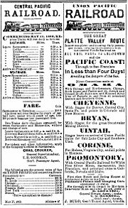
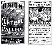
While the Council Bluffs/Omaha to San Francisco "Pacific Railroad" grade was opened in 1869, the name “Overland” was not formally adopted for any daily extra-fare train over the route until almost two decades later when the Union Pacific inaugurated service of its Overland Flyer on November 13, 1887, between Omaha and Ogden, Utah
, where passengers and through cars were transferred to the Southern Pacific which had acquired the CPRR’s operations on that line in 1885 under a 99-year lease. The UP changed its designation to the Overland Limited on November 17, 1895, and service continued as a daily train under that name in one form or another for almost seven decades. For the first dozen years that the SP met the UP’s Overland trains, however, it dubbed its service the "Ogden Gateway Route" with its connecting westbound trains operating as the Pacific Express and eastbound trains as the Atlantic Express before finally adopting the name the Overland Limited in 1899 for its portion of the run as well.
The original 1,911 miles of the route from Omaha to San Francisco traversed some of the most desolate (as well some of the most picturesque) lands of the western two-thirds of the North American continent. While the trip originally took early low fare emigrant trains a full week (or more) to complete, by 1906 the electric lighted all-Pullman Overland Limited covered the route in just 56 hours.
E. H. Harriman bought the bankrupt Union Pacific in 1897; in 1901 he assumed control of the Central Pacific and Southern Pacific as well. The rebuilding of the Overland Route followed: hundreds of miles of double track, hundreds of miles of signals, and dozens of realignments to reduce grades, curvature, and perhaps distance. (The rebuilding actually started before the CP/SP acquisition—the map in the May 1969 issue of Trains shows Howell to Bosler realigned in 1899.)
 By 1926 the UPRR route from Council Bluffs/Omaha to Ogden was continuous double track, except for the Aspen Tunnel (east of Evanston, Wyoming) which remained a bottleneck until 1949. The CPRR/SPRR portion of the route was also largely double tracked during this period, with the completion of such projects as the 1909 Hood Realignment between Rocklin and Newcastle, double tunneling along the Sierra Grade including at Cisco and the summit (Tunnel #41), and the 1924 agreement to share tracks across Nevada with the Western Pacific Railroad
's Feather River Route
.
Among the most important improvements to the original grade was the Lucin Cutoff
, a completely new 102.9 miles (165.6 km) stretch from just west of Ogden to Lucin, a few miles east of the Nevada border. It included a 12-mile (19 km) trestle on wooden pilings across the Great Salt Lake
. Opened in 1904, this line cut 43.8 miles (70.5 km) off the line, eliminated 3,919 degrees of curvature, and removed 1515 feet (461.8 m) of climb from the route, thus decreasing the steepest SP grade east of Lucin from 90 feet per mile to 21.
 But many other sections of the original 1860s grade were harder to improve on, notably over the Sierra Nevada between Colfax, California
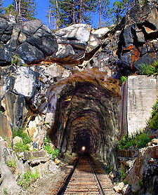
, and Reno, Nevada
. The newer second track follows a better route here and there, but the original route changed little (except for the removal of the wooden snowsheds, or their replacement by nonflammable concrete ones) until the 1993 abandonment of the 6.7-mile section of the Track No. 1 crossing of the summit between Norden and Eder which includes the original 1659 feet (505.7 m) Summit Tunnel (No. 6). Traffic was sent instead over the easier-to-maintain Track No. 2 and through the 10322 feet (3,146.1 m) tunnel called “The Big Hole” (No. 41) which had been driven under Mt. Judah a mile south of the Pass when that portion of the line was double tracked in 1925. Aside from those modifications the Sierra grade looks much the same to train passengers as it did when the line opened in 1868.
in 1889, an arrangement that continued for sixty-six years. In 1955, the passenger operations east of Omaha were again assumed by the Milwaukee Road.
 As intercity passenger rail travel began to decline after World War II and into the 1950s with the growth of the airline industry and development of the Interstate Highway System
, the Overland route gradually lost its luster and service declined. In 1955 the Overland became an Omaha-Oakland train, with no Chicago connection, and after summer 1956 it was coach-only east of Ogden/Green River—no sleepers, no diner, and no name. In 1960 even that remnant ceased running between Ogden and Laramie. After almost seven decades of continuous operation, the Overland Limited came to an end as a daily train on July 16, 1962, when the Interstate Commerce Commission
approved termination of the service. While the train continued to run until Labor Day (with some additional holiday runs from Christmas to the New Year), the name “Overland” did not appear in the schedules of the UP or SP again after its last run on January 2, 1963. The only daily passenger train service between Omaha (now via the Central Corridor
, passing through Denver
and Salt Lake City
) and San Francisco today is provided by the California Zephyr
operated by the US government-owned National Railroad Passenger Corporation (AMTRAK) which took over all long-haul intercity passenger train service in the United States in May, 1971. In 1996, the Union Pacific again acquired the Southern Pacific, resulting in the entire Chicago-Oakland line being owned by a single company.
 Heading west from Council Bluffs/Omaha over the same wide open plains of Nebraska’s Platte River
Valley that had been followed by so many wagon trains in the 1840s, ‘50s, and ‘60s, the “Overland” passed first through Lincoln
, Grand Island
, and Kearney
(196 miles from Omaha) where all the wagon trails from the Missouri River
communities between Omaha and Kansas City had once converged. There the famous Fort Kearney had been built by the U.S. Army
in 1858 to protect the Oregon–California Trail
heading west, and from which, under the direction of Union Generals U.S. Grant
and W.T. Sherman, soldiers had been dispatched to protect UP surveyors and construction crews from Indian attack as the road progressed across Nebraska
towards Wyoming
.
By the time travelers on the “Overland” crossed into Wyoming at Pine Bluffs
, they had traveled some 470 miles westward and risen in elevation above sea level from the 1,033 feet at Omaha to 5,047. The Rocky Mountains
first came into passengers’ view 20 miles further on at Hillsdale
with the appearance of the dark crests of the Laramie Range. Thirty-six miles further west the route reached Sherman, the highest point on the line at 8,013 feet, on a high and rugged upland with bold rock masses eroded into fantastic, picturesque shapes.
The route crossed the Continental Divide
at Creston, some 737 miles west of Omaha. At Green River
passengers were treated to views of two of the most spectacular rock formations in Wyoming—Man’s Face directly southwest of the station, and Castle Rock just north of it. Six miles after crossing the Bear River
at Evanston
the “Overland” entered Utah, a land which would provide passengers with close-up views of some of the most unusual and spectacular rock formations of the entire trip.
After passing Henefer
where Brigham Young
and his Mormon
pioneers had turned southward in 1847 to cross the Wasatch Mountains into Emigration Cañon, perhaps the two most famous features on the Union Pacific’s section of the Overland, Thousand Mile Tree
and Devil's Slide
, came into view on the west, and south sides of the track, respectively. Entering the Valley of the Great Salt Lake
, the train soon reached Ogden, some 1,029 miles from Omaha. Here the Union Pacific lines diverged to Los Angeles and the Pacific Northwest while the Southern Pacific (which acquired operational control of the CPRR’s original Pacific route under lease in 1885) took charge of the “Overland Limited” on to San Francisco.
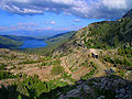
at Promontory Summit
in 1869, all trains heading in and out of Ogden on the SP passed over the site of that seminal event as they made their way around the northern end of the Great Salt Lake. In November 1903, however, the SP opened the Lucin Cutoff
, a 102.9-mile stretch of new track featuring a spectacular 12-mile long trestle built on pilings across the Great Salt Lake. Ten miles past Lucin, the “Overland” crossed into Nevada at Tecoma, the nearest railroad town to the silver, copper, and lead mines discovered in the region in 1874.
Passing through other western Nevada mining centers and through Wells
, an important supply point on the old Emigrant Trail
, the line then followed the valley of the 300-mile long Humboldt River
. Devil’s Peak, a perpendicular rock rising 500 feet from the edge of the Humboldt River, dominated the canyon scenery at Palisade while the last major stop in Nevada was Reno with the Sierra Nevada mountains dominating the view ahead.
The next hundred miles of grade from Reno
to Colfax, California
were by far the most challenging to build and provided the most impressive views of the whole route, although for much of that stretch passengers could see nothing as trains traveled through miles of tunnels and snowsheds. After passing Verdi, Nevada, the site in November, 1870, of the first train robbery on the Pacific coast, the Overland crossed into California and followed the Truckee River up a picturesque canyon to the town of Truckee on Donner Lake where the ill-fated George Donner party
had been snowbound in the winter of 1846–7.
 A serpentine climb around the east end of the lake and up Mt. Judah brought the Overland to the 1659 feet (505.7 m) Summit Tunnel at 7,018 feet at Donner Pass and the start of a 105-mile descent to Sacramento
located just 35 feet above sea level. Travel over this section could be quite treacherous in the winter as the Southern Pacific had to deal with clearing as much as 50 to 60 feet of snowfall as well as ice from water dripping in the tunnels. The miles of showsheds needed to keep the line passable left the impression among passengers that they were “railroading in a tunnel” for much of the route. The wooden snowsheds also presented another challenge of railroading “over the hill,” however, as fires were often started by lightning strikes or embers from steam locomotives.
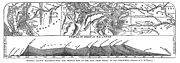
Still there were some spectacular views available to passengers in the Sierras, the most famous of which was that from “Cape Horn” just above the town of Colfax where the grade was literally carved out of the side of a mountain, providing a glorious panoramic view across Green Valley of the American River
flowing in a canyon some 1,322 feet below. This spot was so popular that for many years the Southern Pacific stopped the Overland and most other trains for a few minutes so that passengers could get off the train and take it all in from a special observation area.
When the route opened in 1869, trains reached the San Francisco Bay
area from Sacramento via a 140 mile line (built by the original Western Pacific Railroad) by way of Stockton
over Altamont Pass
, and on through Niles Cañon
first to a pier at Alameda
, and shortly thereafter to the nearby two-mile long Oakland Long Wharf
(later called the "SP Mole") from which San Francisco was then accessed by ferry. In 1876, however, the CPRR acquired a line built by the California Pacific Railroad
from Sacramento to Vallejo
and in 1879 completed an extension of that road 17 miles across the Suisun Marsh
to Benicia
. There the CPRR established a ferry service to carry its trains a little more than a mile across the Carquinez Strait
to Port Costa
from which they ran down the southern shoreline of the Strait and San Pablo Bay
, and then along eastern side of the San Francisco Bay to the Oakland Long Wharf, thereby cutting approximately fifty miles off the journey from Sacramento. After half a century of operation, however, the train ferry between was replaced by a massive drawbridge built by the SP between Benicia and Martinez
which opened in October, 1930, and is still in use today.
Union Pacific Railroad
The Union Pacific Railroad , headquartered in Omaha, Nebraska, is the largest railroad network in the United States. James R. Young is president, CEO and Chairman....
and the Central Pacific Railroad
Central Pacific Railroad
The Central Pacific Railroad is the former name of the railroad network built between California and Utah, USA that formed part of the "First Transcontinental Railroad" in North America. It is now part of the Union Pacific Railroad. Many 19th century national proposals to build a transcontinental...
/ Southern Pacific Railroad
Southern Pacific Railroad
The Southern Pacific Transportation Company , earlier Southern Pacific Railroad and Southern Pacific Company, and usually simply called the Southern Pacific or Espee, was an American railroad....
, between Council Bluffs, Iowa
Council Bluffs, Iowa
Council Bluffs, known until 1852 as Kanesville, Iowathe historic starting point of the Mormon Trail and eventual northernmost anchor town of the other emigrant trailsis a city in and the county seat of Pottawattamie County, Iowa, United States and is on the east bank of the Missouri River across...
/ Omaha, Nebraska
Omaha, Nebraska
Omaha is the largest city in the state of Nebraska, United States, and is the county seat of Douglas County. It is located in the Midwestern United States on the Missouri River, about 20 miles north of the mouth of the Platte River...
, and San Francisco, California
San Francisco, California
San Francisco , officially the City and County of San Francisco, is the financial, cultural, and transportation center of the San Francisco Bay Area, a region of 7.15 million people which includes San Jose and Oakland...
over the grade of the First Transcontinental Railroad
First Transcontinental Railroad
The First Transcontinental Railroad was a railroad line built in the United States of America between 1863 and 1869 by the Central Pacific Railroad of California and the Union Pacific Railroad that connected its statutory Eastern terminus at Council Bluffs, Iowa/Omaha, Nebraska The First...
(aka the "Pacific Railroad") which had been opened on May 10, 1869. Passenger trains that operated over the line included the Overland Flyer, later renamed the Overland Limited, which also included a connection to Chicago
Chicago
Chicago is the largest city in the US state of Illinois. With nearly 2.7 million residents, it is the most populous city in the Midwestern United States and the third most populous in the US, after New York City and Los Angeles...
. Although the passenger rail service is no longer in operation, the Overland Route remains a common name for the line from California to Chicago, now owned entirely by the Union Pacific.
History
Central Overland Route
The Central Overland Route was a transportation route from Salt Lake City, Utah south of the Great Salt Lake through the mountains of central Nevada and the Basin and Range Province to Carson City, Nevada...
, a stagecoach
Stagecoach
A stagecoach is a type of covered wagon for passengers and goods, strongly sprung and drawn by four horses, usually four-in-hand. Widely used before the introduction of railway transport, it made regular trips between stages or stations, which were places of rest provided for stagecoach travelers...
line operated by the Overland Mail Company between Salt Lake City, Utah
Salt Lake City, Utah
Salt Lake City is the capital and the most populous city of the U.S. state of Utah. The name of the city is often shortened to Salt Lake or SLC. With a population of 186,440 as of the 2010 Census, the city lies in the Salt Lake City metropolitan area, which has a total population of 1,124,197...
and Virginia City, Nevada
Virginia City, Nevada
Virginia City is a census-designated place that is the county seat of Storey County, Nevada. It is part of the Reno–Sparks Metropolitan Statistical Area. The population was 855 at the 2010 Census.- History :...
from 1861 to 1866, when Wells Fargo & Company took over the stagecoach's operation. Wells Fargo ended this stagecoach service three years later.
While the Council Bluffs/Omaha to San Francisco "Pacific Railroad" grade was opened in 1869, the name “Overland” was not formally adopted for any daily extra-fare train over the route until almost two decades later when the Union Pacific inaugurated service of its Overland Flyer on November 13, 1887, between Omaha and Ogden, Utah
Ogden, Utah
Ogden is a city in Weber County, Utah, United States. Ogden serves as the county seat of Weber County. The population was 82,825 according to the 2010 Census. The city served as a major railway hub through much of its history, and still handles a great deal of freight rail traffic which makes it a...
, where passengers and through cars were transferred to the Southern Pacific which had acquired the CPRR’s operations on that line in 1885 under a 99-year lease. The UP changed its designation to the Overland Limited on November 17, 1895, and service continued as a daily train under that name in one form or another for almost seven decades. For the first dozen years that the SP met the UP’s Overland trains, however, it dubbed its service the "Ogden Gateway Route" with its connecting westbound trains operating as the Pacific Express and eastbound trains as the Atlantic Express before finally adopting the name the Overland Limited in 1899 for its portion of the run as well.
The original 1,911 miles of the route from Omaha to San Francisco traversed some of the most desolate (as well some of the most picturesque) lands of the western two-thirds of the North American continent. While the trip originally took early low fare emigrant trains a full week (or more) to complete, by 1906 the electric lighted all-Pullman Overland Limited covered the route in just 56 hours.
E. H. Harriman bought the bankrupt Union Pacific in 1897; in 1901 he assumed control of the Central Pacific and Southern Pacific as well. The rebuilding of the Overland Route followed: hundreds of miles of double track, hundreds of miles of signals, and dozens of realignments to reduce grades, curvature, and perhaps distance. (The rebuilding actually started before the CP/SP acquisition—the map in the May 1969 issue of Trains shows Howell to Bosler realigned in 1899.)
Western Pacific Railroad
The Western Pacific Railroad was a Class I railroad in the United States. It was formed in 1903 as an attempt to break the near-monopoly the Southern Pacific Railroad had on rail service into northern California...
's Feather River Route
Feather River Route
The Feather River Route is a rail line that was built and operated by the Western Pacific Railroad. It was constructed between 1906 and 1909, and connects the cities of Oakland, California, and Salt Lake City, Utah...
.
Among the most important improvements to the original grade was the Lucin Cutoff
Lucin Cutoff
The Lucin Cutoff is a railroad line which included a railroad trestle which crossed the Great Salt Lake in Utah. Built by the Southern Pacific Company between February 1902 and March 1904 across Promontory Point, it bypassed the original Central Pacific Railroad route through Promontory Summit...
, a completely new 102.9 miles (165.6 km) stretch from just west of Ogden to Lucin, a few miles east of the Nevada border. It included a 12-mile (19 km) trestle on wooden pilings across the Great Salt Lake
Great Salt Lake
The Great Salt Lake, located in the northern part of the U.S. state of Utah, is the largest salt water lake in the western hemisphere, the fourth-largest terminal lake in the world. In an average year the lake covers an area of around , but the lake's size fluctuates substantially due to its...
. Opened in 1904, this line cut 43.8 miles (70.5 km) off the line, eliminated 3,919 degrees of curvature, and removed 1515 feet (461.8 m) of climb from the route, thus decreasing the steepest SP grade east of Lucin from 90 feet per mile to 21.
Colfax, California
Colfax is a city in Placer County, California, at the crossroads of Interstate 80 and State Route 174. It is part of the Sacramento–Arden-Arcade–Roseville Metropolitan Statistical Area. The population was 1,963 at the 2010 census...
, and Reno, Nevada
Reno, Nevada
Reno is the county seat of Washoe County, Nevada, United States. The city has a population of about 220,500 and is the most populous Nevada city outside of the Las Vegas metropolitan area...
. The newer second track follows a better route here and there, but the original route changed little (except for the removal of the wooden snowsheds, or their replacement by nonflammable concrete ones) until the 1993 abandonment of the 6.7-mile section of the Track No. 1 crossing of the summit between Norden and Eder which includes the original 1659 feet (505.7 m) Summit Tunnel (No. 6). Traffic was sent instead over the easier-to-maintain Track No. 2 and through the 10322 feet (3,146.1 m) tunnel called “The Big Hole” (No. 41) which had been driven under Mt. Judah a mile south of the Pass when that portion of the line was double tracked in 1925. Aside from those modifications the Sierra grade looks much the same to train passengers as it did when the line opened in 1868.
Connection to Chicago
Initially operated by the Milwaukee Road, the operation of the Overland Route between Chicago and Omaha was assumed by the Chicago and North Western RailwayChicago and North Western Railway
The Chicago and North Western Transportation Company was a Class I railroad in the Midwest United States. It was also known as the North Western. The railroad operated more than of track as of the turn of the 20th century, and over of track in seven states before retrenchment in the late 1970s...
in 1889, an arrangement that continued for sixty-six years. In 1955, the passenger operations east of Omaha were again assumed by the Milwaukee Road.
Demise
Interstate Highway System
The Dwight D. Eisenhower National System of Interstate and Defense Highways, , is a network of limited-access roads including freeways, highways, and expressways forming part of the National Highway System of the United States of America...
, the Overland route gradually lost its luster and service declined. In 1955 the Overland became an Omaha-Oakland train, with no Chicago connection, and after summer 1956 it was coach-only east of Ogden/Green River—no sleepers, no diner, and no name. In 1960 even that remnant ceased running between Ogden and Laramie. After almost seven decades of continuous operation, the Overland Limited came to an end as a daily train on July 16, 1962, when the Interstate Commerce Commission
Interstate Commerce Commission
The Interstate Commerce Commission was a regulatory body in the United States created by the Interstate Commerce Act of 1887. The agency's original purpose was to regulate railroads to ensure fair rates, to eliminate rate discrimination, and to regulate other aspects of common carriers, including...
approved termination of the service. While the train continued to run until Labor Day (with some additional holiday runs from Christmas to the New Year), the name “Overland” did not appear in the schedules of the UP or SP again after its last run on January 2, 1963. The only daily passenger train service between Omaha (now via the Central Corridor
Central Corridor (Union Pacific Railroad)
The Central Corridor is a rail line operated by the Union Pacific Railroad from near Winnemucca, Nevada to Denver, Colorado in the western United States. The line is in use for freight, and provides the route of the California Zephyr. The BNSF Railway has trackage rights on the entire line. The...
, passing through Denver
Denver, Colorado
The City and County of Denver is the capital and the most populous city of the U.S. state of Colorado. Denver is a consolidated city-county, located in the South Platte River Valley on the western edge of the High Plains just east of the Front Range of the Rocky Mountains...
and Salt Lake City
Salt Lake City, Utah
Salt Lake City is the capital and the most populous city of the U.S. state of Utah. The name of the city is often shortened to Salt Lake or SLC. With a population of 186,440 as of the 2010 Census, the city lies in the Salt Lake City metropolitan area, which has a total population of 1,124,197...
) and San Francisco today is provided by the California Zephyr
California Zephyr
The California Zephyr is a long passenger train route operated by Amtrak in the midwestern and western United States.It runs from Chicago, Illinois, in the east to Emeryville, California, in the west, passing through the states of Illinois, Iowa, Nebraska, Colorado, Utah, Nevada, and California...
operated by the US government-owned National Railroad Passenger Corporation (AMTRAK) which took over all long-haul intercity passenger train service in the United States in May, 1971. In 1996, the Union Pacific again acquired the Southern Pacific, resulting in the entire Chicago-Oakland line being owned by a single company.
Council Bluffs/Omaha to Ogden (via the Union Pacific)
Platte River
The Platte River is a major river in the state of Nebraska and is about long. Measured to its farthest source via its tributary the North Platte River, it flows for over . The Platte River is a tributary of the Missouri River, which in turn is a tributary of the Mississippi River which flows to...
Valley that had been followed by so many wagon trains in the 1840s, ‘50s, and ‘60s, the “Overland” passed first through Lincoln
Lincoln, Nebraska
The City of Lincoln is the capital and the second-most populous city of the US state of Nebraska. Lincoln is also the county seat of Lancaster County and the home of the University of Nebraska. Lincoln's 2010 Census population was 258,379....
, Grand Island
Grand Island, Nebraska
Grand Island is a city in and the county seat of Hall County, Nebraska, United States. The population was 48,520 at the 2010 census.Grand Island is home to the Nebraska Law Enforcement Training Center which is the sole agency responsible for training law enforcement officers throughout the state,...
, and Kearney
Kearney, Nebraska
Kearney is a city in and the county seat of Buffalo County, Nebraska, United States. The population was 30,787 at the 2010 census. It is home to the University of Nebraska-Kearney....
(196 miles from Omaha) where all the wagon trails from the Missouri River
Missouri River
The Missouri River flows through the central United States, and is a tributary of the Mississippi River. It is the longest river in North America and drains the third largest area, though only the thirteenth largest by discharge. The Missouri's watershed encompasses most of the American Great...
communities between Omaha and Kansas City had once converged. There the famous Fort Kearney had been built by the U.S. Army
United States Army
The United States Army is the main branch of the United States Armed Forces responsible for land-based military operations. It is the largest and oldest established branch of the U.S. military, and is one of seven U.S. uniformed services...
in 1858 to protect the Oregon–California Trail
Oregon Trail
The Oregon Trail is a historic east-west wagon route that connected the Missouri River to valleys in Oregon and locations in between.After 1840 steam-powered riverboats and steamboats traversing up and down the Ohio, Mississippi and Missouri rivers sped settlement and development in the flat...
heading west, and from which, under the direction of Union Generals U.S. Grant
Ulysses S. Grant
Ulysses S. Grant was the 18th President of the United States as well as military commander during the Civil War and post-war Reconstruction periods. Under Grant's command, the Union Army defeated the Confederate military and ended the Confederate States of America...
and W.T. Sherman, soldiers had been dispatched to protect UP surveyors and construction crews from Indian attack as the road progressed across Nebraska
Nebraska
Nebraska is a state on the Great Plains of the Midwestern United States. The state's capital is Lincoln and its largest city is Omaha, on the Missouri River....
towards Wyoming
Wyoming
Wyoming is a state in the mountain region of the Western United States. The western two thirds of the state is covered mostly with the mountain ranges and rangelands in the foothills of the Eastern Rocky Mountains, while the eastern third of the state is high elevation prairie known as the High...
.
By the time travelers on the “Overland” crossed into Wyoming at Pine Bluffs
Pine Bluffs, Wyoming
-Demographics:As of the census of 2000, there were 1,153 people, 482 households, and 332 families residing in the town. The population density was 357.4 people per square mile . There were 517 housing units at an average density of 160.3 per square mile...
, they had traveled some 470 miles westward and risen in elevation above sea level from the 1,033 feet at Omaha to 5,047. The Rocky Mountains
Rocky Mountains
The Rocky Mountains are a major mountain range in western North America. The Rocky Mountains stretch more than from the northernmost part of British Columbia, in western Canada, to New Mexico, in the southwestern United States...
first came into passengers’ view 20 miles further on at Hillsdale
Hillsdale, Wyoming
Hillsdale is an unincorporated community in southeastern Laramie County, Wyoming, United States. It lies along local roads east of the city of Cheyenne, the county seat of Laramie County. Its elevation is 5,640 feet . Although Hillsdale is unincorporated, it has a post office, with the ZIP...
with the appearance of the dark crests of the Laramie Range. Thirty-six miles further west the route reached Sherman, the highest point on the line at 8,013 feet, on a high and rugged upland with bold rock masses eroded into fantastic, picturesque shapes.
The route crossed the Continental Divide
Continental Divide
The Continental Divide of the Americas, or merely the Continental Gulf of Division or Great Divide, is the name given to the principal, and largely mountainous, hydrological divide of the Americas that separates the watersheds that drain into the Pacific Ocean from those river systems that drain...
at Creston, some 737 miles west of Omaha. At Green River
Green River, Wyoming
Green River is a city in and the county seat of Sweetwater County, Wyoming, United States, in the southwestern part of the state. The population was 11,808 at the 2000 census....
passengers were treated to views of two of the most spectacular rock formations in Wyoming—Man’s Face directly southwest of the station, and Castle Rock just north of it. Six miles after crossing the Bear River
Bear River (Utah)
The Bear River is a river, approximately long, in southwestern Wyoming, southeastern Idaho, and northern Utah, in the United States. The largest tributary of the Great Salt Lake, it drains a mountainous area and farming valleys northeast of the lake and southeast of the Snake River Plain...
at Evanston
Evanston, Wyoming
Evanston is a city in Uinta County, Wyoming, United States. The population was 12,359 at the 2010 census. It is the county seat of Uinta County.-Geography:Evanston is located at...
the “Overland” entered Utah, a land which would provide passengers with close-up views of some of the most unusual and spectacular rock formations of the entire trip.
After passing Henefer
Henefer, Utah
Henefer is a town in Summit County, Utah, United States. It is part of the Salt Lake City, Utah Metropolitan Statistical Area. The population was 684 at the 2000 census.-Geography:Henefer is located at ....
where Brigham Young
Brigham Young
Brigham Young was an American leader in the Latter Day Saint movement and a settler of the Western United States. He was the President of The Church of Jesus Christ of Latter-day Saints from 1847 until his death in 1877, he founded Salt Lake City, and he served as the first governor of the Utah...
and his Mormon
Mormon
The term Mormon most commonly denotes an adherent, practitioner, follower, or constituent of Mormonism, which is the largest branch of the Latter Day Saint movement in restorationist Christianity...
pioneers had turned southward in 1847 to cross the Wasatch Mountains into Emigration Cañon, perhaps the two most famous features on the Union Pacific’s section of the Overland, Thousand Mile Tree
Thousand Mile Tree
Thousand Mile Tree is a pine tree located in Weber Canyon near the community of Henefer, Utah, along the Overland Route of the Union Pacific Railroad...
and Devil's Slide
Devil's Slide (Utah)
Devil's Slide is an unusual geological formation located in northern Utah's Weber Canyon, near the community of Croydon in Morgan County, Utah, United States. The slide consists of two parallel limestone strata that have been tilted to lie vertical, protruding out of the mountainside...
, came into view on the west, and south sides of the track, respectively. Entering the Valley of the Great Salt Lake
Great Salt Lake
The Great Salt Lake, located in the northern part of the U.S. state of Utah, is the largest salt water lake in the western hemisphere, the fourth-largest terminal lake in the world. In an average year the lake covers an area of around , but the lake's size fluctuates substantially due to its...
, the train soon reached Ogden, some 1,029 miles from Omaha. Here the Union Pacific lines diverged to Los Angeles and the Pacific Northwest while the Southern Pacific (which acquired operational control of the CPRR’s original Pacific route under lease in 1885) took charge of the “Overland Limited” on to San Francisco.
Ogden to San Francisco (via the Central Pacific/Southern Pacific)
For the first 35 years after the driving of the “Last Spike”Golden spike
The "Golden Spike" is the ceremonial final spike driven by Leland Stanford to join the rails of the First Transcontinental Railroad across the United States connecting the Central Pacific and Union Pacific railroads on May 10, 1869, at Promontory Summit, Utah Territory...
at Promontory Summit
Promontory, Utah
Promontory in Box Elder County, Utah, United States, is notable as the location of Promontory Summit where the United States' Transcontinental Railroad was officially completed on May 10, 1869....
in 1869, all trains heading in and out of Ogden on the SP passed over the site of that seminal event as they made their way around the northern end of the Great Salt Lake. In November 1903, however, the SP opened the Lucin Cutoff
Lucin Cutoff
The Lucin Cutoff is a railroad line which included a railroad trestle which crossed the Great Salt Lake in Utah. Built by the Southern Pacific Company between February 1902 and March 1904 across Promontory Point, it bypassed the original Central Pacific Railroad route through Promontory Summit...
, a 102.9-mile stretch of new track featuring a spectacular 12-mile long trestle built on pilings across the Great Salt Lake. Ten miles past Lucin, the “Overland” crossed into Nevada at Tecoma, the nearest railroad town to the silver, copper, and lead mines discovered in the region in 1874.
Passing through other western Nevada mining centers and through Wells
Wells, Nevada
Wells is a city in Elko County, in northeast Nevada in the western United States. The population was 1,346 at the 2000 census. Wells is located at the junction of U.S. Route 93 and Interstate 80, approximately east of Elko and is part of the Elko Micropolitan Statistical Area.-History:The site...
, an important supply point on the old Emigrant Trail
Emigrant Trail
The Emigrant Trails were the northern networks of overland wagon trails throughout the American West, used by emigrants from the eastern United States to settle lands west of the Interior Plains during the overland migrations of the mid-19th century...
, the line then followed the valley of the 300-mile long Humboldt River
Humboldt River
The Humboldt River runs through northern Nevada in the western United States. At approximately long it is the second longest river in the Great Basin, after the Bear River. It has no outlet to the ocean, but instead empties into the Humboldt Sink...
. Devil’s Peak, a perpendicular rock rising 500 feet from the edge of the Humboldt River, dominated the canyon scenery at Palisade while the last major stop in Nevada was Reno with the Sierra Nevada mountains dominating the view ahead.
The next hundred miles of grade from Reno
Reno, Nevada
Reno is the county seat of Washoe County, Nevada, United States. The city has a population of about 220,500 and is the most populous Nevada city outside of the Las Vegas metropolitan area...
to Colfax, California
Colfax, California
Colfax is a city in Placer County, California, at the crossroads of Interstate 80 and State Route 174. It is part of the Sacramento–Arden-Arcade–Roseville Metropolitan Statistical Area. The population was 1,963 at the 2010 census...
were by far the most challenging to build and provided the most impressive views of the whole route, although for much of that stretch passengers could see nothing as trains traveled through miles of tunnels and snowsheds. After passing Verdi, Nevada, the site in November, 1870, of the first train robbery on the Pacific coast, the Overland crossed into California and followed the Truckee River up a picturesque canyon to the town of Truckee on Donner Lake where the ill-fated George Donner party
Donner Party
The Donner Party was a group of American pioneers who set out for California in a wagon train. Delayed by a series of mishaps, they spent the winter of 1846–47 snowbound in the Sierra Nevada...
had been snowbound in the winter of 1846–7.
Sacramento, California
Sacramento is the capital city of the U.S. state of California and the county seat of Sacramento County. It is located at the confluence of the Sacramento River and the American River in the northern portion of California's expansive Central Valley. With a population of 466,488 at the 2010 census,...
located just 35 feet above sea level. Travel over this section could be quite treacherous in the winter as the Southern Pacific had to deal with clearing as much as 50 to 60 feet of snowfall as well as ice from water dripping in the tunnels. The miles of showsheds needed to keep the line passable left the impression among passengers that they were “railroading in a tunnel” for much of the route. The wooden snowsheds also presented another challenge of railroading “over the hill,” however, as fires were often started by lightning strikes or embers from steam locomotives.
Still there were some spectacular views available to passengers in the Sierras, the most famous of which was that from “Cape Horn” just above the town of Colfax where the grade was literally carved out of the side of a mountain, providing a glorious panoramic view across Green Valley of the American River
American River
The American River is a California watercourse noted as the site of Sutter's Mill, northwest of Placerville, California, where gold was found in 1848, leading to the California Gold Rush...
flowing in a canyon some 1,322 feet below. This spot was so popular that for many years the Southern Pacific stopped the Overland and most other trains for a few minutes so that passengers could get off the train and take it all in from a special observation area.
When the route opened in 1869, trains reached the San Francisco Bay
San Francisco Bay
San Francisco Bay is a shallow, productive estuary through which water draining from approximately forty percent of California, flowing in the Sacramento and San Joaquin rivers from the Sierra Nevada mountains, enters the Pacific Ocean...
area from Sacramento via a 140 mile line (built by the original Western Pacific Railroad) by way of Stockton
Stockton, California
Stockton, California, the seat of San Joaquin County, is the fourth-largest city in the Central Valley of the U.S. state of California. With a population of 291,707 at the 2010 census, Stockton ranks as this state's 13th largest city...
over Altamont Pass
Altamont Pass
Altamont Pass, formerly Livermore Pass, is a mountain pass in the Diablo Range between Livermore in the Livermore Valley and Tracy in the San Joaquin Valley in Northern California...
, and on through Niles Cañon
Niles Canyon
Niles Canyon is a canyon in the San Francisco Bay Area formed by Alameda Creek. The canyon is largely in an unincorporated area of Alameda County, while the western portion of the canyon lies within the city limits of Fremont and Union City...
first to a pier at Alameda
Alameda, California
Alameda is a city in Alameda County, California, United States. It is located on Alameda Island and Bay Farm Island, and is adjacent to Oakland in the San Francisco Bay. The Bay Farm Island portion of the city is adjacent to the Oakland International Airport. At the 2010 census, the city had a...
, and shortly thereafter to the nearby two-mile long Oakland Long Wharf
Oakland Long Wharf
The Oakland Long Wharf, later known as the Oakland Pier or the SP Mole was a massive railroad wharf and ferry pier in Oakland, California. It was located at the foot of Seventh Street....
(later called the "SP Mole") from which San Francisco was then accessed by ferry. In 1876, however, the CPRR acquired a line built by the California Pacific Railroad
California Pacific Railroad
The California Pacific Railroad Company was incorporated in 1865 at San Francisco, California as the California Pacific Rail Road Company. It was renamed the California Pacific Railroad Extension Company in the spring of 1869, then renamed the California Pacific Railroad later that same year...
from Sacramento to Vallejo
Vallejo, California
Vallejo is the largest city in Solano County, California, United States. The population was 115,942 at the 2010 census. It is located in the San Francisco Bay Area on the northeastern shore of San Pablo Bay...
and in 1879 completed an extension of that road 17 miles across the Suisun Marsh
Suisun Marsh
Located in northern California the Suisun Marsh is the largest brackish marsh on west coast of the United States of America. The marsh land is part of the San Francisco Bay tidal estuary, and subject to tidal ebb and flood...
to Benicia
Benicia, California
Benicia is a waterside city in Solano County, California, United States. It was the first city in California to be founded by Anglo-Americans, and served as the state capital for nearly thirteen months from 1853 to 1854. The population was 26,997 at the 2010 census. The city is located in the San...
. There the CPRR established a ferry service to carry its trains a little more than a mile across the Carquinez Strait
Carquinez Strait
The Carquinez Strait is a narrow tidal strait in northern California. It is part of the tidal estuary of the Sacramento and the San Joaquin rivers as they drain into the San Francisco Bay...
to Port Costa
Port Costa, California
Port Costa is a census-designated place in Contra Costa County, California, United States. The population was 190 at the 2010 census.-Geography:...
from which they ran down the southern shoreline of the Strait and San Pablo Bay
San Pablo Bay
San Pablo Bay is a tidal estuary that forms the northern extension of San Francisco Bay in northern California in the United States. Most of the Bay is shallow; however, there is a deep water channel approximately in mid bay, which allows access to Sacramento, Stockton, Benicia, Martinez, and...
, and then along eastern side of the San Francisco Bay to the Oakland Long Wharf, thereby cutting approximately fifty miles off the journey from Sacramento. After half a century of operation, however, the train ferry between was replaced by a massive drawbridge built by the SP between Benicia and Martinez
Martinez, California
Martinez is a city and the county seat of Contra Costa County, California, United States. The population was 35,824 at the 2010 census. The downtown is notable for its large number of preserved old buildings...
which opened in October, 1930, and is still in use today.
See also
- First Transcontinental RailroadFirst Transcontinental RailroadThe First Transcontinental Railroad was a railroad line built in the United States of America between 1863 and 1869 by the Central Pacific Railroad of California and the Union Pacific Railroad that connected its statutory Eastern terminus at Council Bluffs, Iowa/Omaha, Nebraska The First...
– covers the construction of this rail line - Overland LimitedOverland LimitedThe Overland Limited was one of the named passenger trains on the Atchison, Topeka and Santa Fe Railway.Operating as train Nos. 7 & 8 between Chicago, Illinois, and Los Angeles, California, the line was inaugurated in 1901 and ran until the Santa Fe Eight took over the route in 1915...
– a similarly named passenger train, operated by the Atchison, Topeka and Santa Fe RailwayAtchison, Topeka and Santa Fe RailwayThe Atchison, Topeka and Santa Fe Railway , often abbreviated as Santa Fe, was one of the larger railroads in the United States. The company was first chartered in February 1859...