
Oregon Caves National Monument
Encyclopedia
Oregon Caves National Monument is a national monument in the northern Siskiyou Mountains
of southwestern Oregon
in the United States
. The main part of the 488 acres (197.5 ha) park, including the marble
cave and a visitor center, is located 20 miles (32.2 km) east of Cave Junction
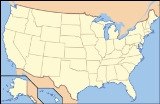
, on Oregon Route 46. A separate visitor center in Cave Junction occupies 4 acres (1.6 ha) of the total. Both parts of the monument, managed by the National Park Service
, are in southwestern Josephine County
, near the Oregon–California
border. The climate is generally mild even at the cave's elevation of about 4000 feet (1,219.2 m) above sea level, but icicles can form at the cave entrance, and winter snow sometimes blocks the park highway.
Elijah Davidson, a resident of nearby Williams
, discovered the cave in 1874. Over the next two decades, private investors failed in efforts to run successful tourist ventures at the publicly owned site. After passage of the Antiquities Act
by the United States Congress
, President William Howard Taft
established Oregon Caves National Monument, to be managed by the United States Forest Service
, in 1909. The popularity of the automobile, construction of paved highways, and promotion of tourism by boosters from Grants Pass
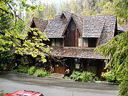
led to large increases in cave visitation during the late 1920s and thereafter. Among the attractions at the remote monument is the Oregon Caves Chateau
, a six-story hotel built in a rustic style in 1934. The Park Service, which assumed control of the monument in 1933, offers tours of the cave from mid-April through early November.
Oregon Caves is a dissolution cave, with passages totaling about 15000 feet (4,572 m), that formed in marble
. The parent rock
was originally limestone that metamorphosed to marble during the geologic processes that created the Klamath Mountains
, including the Siskiyous. Although the limestone formed about 190 million years ago, the cave itself is no older than a few million years. Valued as a tourist cave, the cavern also has scientific value; sections of the cave that are not on tour routes contain fossils of national importance.
In addition to cave touring, activities at the park include hiking, photography, and wildlife viewing. One of the park trails leads through the forest to Big Tree, which at 13 feet (4 m) is the largest diameter Douglas-fir
known in Oregon. Lodging and food are available at The Chateau and in Cave Junction. Camping is available at Forest Service campgrounds and private sites in the area.
, a coastal range that is part of the Klamath Mountains
of northwestern California
and southwestern Oregon. The main part of the park consists of 484 acres (195.9 ha) in the Rogue River – Siskiyou National Forest, about 6 miles (9.7 km) north of the Oregon–California border in Josephine County, Oregon
. An additional visitor center occupies 4 acres (1.6 ha) in the city of Cave Junction. The city is in the Illinois River
valley, about 40 miles (64.4 km) east of the Pacific Ocean. Elevations within the park range from 3680 to 5480 ft (1,121.7 to 1,670.3 m) in the mountains to 1800 feet (548.6 m) in the city.
By highway, Oregon Caves is 55 miles (88.5 km) southwest of Grants Pass
, 300 miles (482.8 km) south of Portland
and 450 miles (724.2 km) north of San Francisco. The caves are 20 miles (32.2 km) west of Cave Junction via Oregon Route 46, which intersects U.S. Route 199
at Cave Junction.
Despite the monument's name, the main cave is a single system with known passages totaling about 15000 feet (4,572 m) in length. Eight separate smaller caves have also been discovered in the monument.
Runoff from the heavily wooded monument forms small headwater streams of the Illinois River, a major tributary of the Rogue River
. One of five small spring
s in the monument becomes Upper Cave Creek, which flows on the surface before disappearing into its bed and entering the cave. Supplemented by water entering the cave from above, the stream emerges from the main entrance as Cave Creek.
suggests that they arrived in southwestern Oregon at least 8,500 years ago. At least 1,500 years before the first contact with whites, the natives established permanent villages along streams. Even so, no evidence has been found to suggest that any of the native peoples, such as the Takelma
who lived along the Rogue and Applegate
rivers in the 19th century, used the cave.
Largely bypassed by the early non-native explorers, fur traders, and settlers because of its remote location, the region attracted newcomers in quantity when prospectors found gold near Jacksonville
in the Rogue River valley in 1851. This led to the creation of Jackson County
in 1852 and, after gold discoveries near Waldo
in the Illinois River valley, to the creation of Josephine County, named for the daughter of a gold miner. Even with an influx of miners and of settlers who farmed donation land claims
, Josephine County's population was only 1,204 in 1870.
Elijah Jones Davidson, who discovered the cave in 1874, emigrated from Illinois to Oregon with his parents, who eventually settled along Williams Creek in Josephine County. Williams
, as the community came to be called, is about 12 miles (19.3 km) northeast of the cave.
Only a few people visited the cave during the next decade. Among them was Thomas Condon
, professor of geology at the University of Oregon. Guided by Davidson's brother, in 1884 he and a group of students hiked from Williams to the cavern, which they inspected by candlelight. Shortly thereafter, Walter Burch, an acquaintance of the Davidson family, tried to develop the cave as a business. Burch and his partners opened what they called Limestone Caves and charged visitors $1 each for a guided cave trip, a camping spot, pasture for horses, and cave water they described as medicinal. Although Burch and others hacked crude trails to the cave from Cave Junction and Williams, the trip was too difficult for most tourists, and Limestone Caves ceased operations in 1888.
In the early 1890s, the Oregon Caves Improvement Company, headed by Alfonso B. Smith of San Diego and two men from Kerby, Oregon
, tried to raise capital for a larger tourist business at Oregon Caves. Smith made outlandish claims about the cave and its business potential, saying that it was 22 miles (35.4 km) long, that an ordinary horse and buggy
could be driven through 10 miles (16.1 km) of it, that it had 600 separate chambers, and that the company planned to build something like a streetcar
line from Williams to the cave. Smith succeeded in wooing the The San Francisco Examiner
, which twice sent reporters to the site. The second occasion involved a cave expedition that lasted about 10 days and involved "an orgy of destruction" in which passages were widened, formations broken or deliberately removed, and directional arrows added to the cave walls. After Smith spent had spent all the company's money and borrowed more in its name, he disappeared in 1894, and the business collapsed.
Neither Burch nor Smith had owned the cave or the land around it, which belonged to the public. Beginning in the 1890s, the Federal government began regulating the use of public lands like these. In 1903, President Theodore Roosevelt
designated millions of acres of forest lands for protection, including what became Siskiyou National Forest, which surrounds the cave. The United States Forest Service
was created in 1905 to manage these reserves. Three years later, Congress passed the Antiquities Act
, which allowed the President to designate protected areas called National Monuments on public lands. In 1909, President William Howard Taft
established Oregon Caves National Monument, to be managed by the Forest Service. A year later the Forest Service employed men to guard the cave and to serve as tour guides.
Isolated and difficult to reach, the monument attracted only 1,800 visitors in 1920. The situation changed markedly when large numbers of Americans began to travel by automobile on roads paid for largely with government funds. One highway connected Grants Pass
with the California coast at Crescent City
. Another new road, the Oregon Caves Highway, led from the Grants Pass – Crescent City highway to the cave. Campaigns to attract car-driving tourists included those of the Cavemen, a booster group from Grants Pass that dressed in animal skins, posed along tour routes, and staged annual events to promote the monument. By 1928, the number of visitors to the cave had risen to about 24,000 a year.
 The visitors' need for overnight lodging led to creation of public and private campsites and rustic cabins along highways near Cave Junction and the monument. In 1923, the Forest Service signed a contract with the Oregon Caves Company, based in Grants Pass, to run the cave tours and improve the park accommodations. The Chalet, a building with a kitchen, dining room, gift shop, ticket sales area, and a dormitory for women on the Oregon Caves Company staff, was completed later that year. Three years later, the company added seven two-bedroom cabins for tourists and a dormitory for male employees. In 1928, an Oregon Caves bill written by the Forest Service and introduced by Senator Charles McNary
of Oregon won Congressional approval. It provided funds for electric lights, a power plant, a formation-washing system, and an artificial exit tunnel to eliminate the crowding that occurred when two groups on round-trip tours had to pass one another in the cave. The 500 feet (152.4 m) tunnel was completed in 1931.
Management of the monument was transferred from the Forest Service to the National Park Service in 1933, and a six-story hotel, the Oregon Caves Chateau
, was completed at the site in 1934. Gust Lium, a builder from Grants Pass, oversaw construction of the Chateau and some of the park's other buildings, which he designed in a rustic style
. Mason Manufacturing of Los Angeles
produced the Chateau's furniture in a style called Monterey
, valued in 21st century at up to $5,000 for a single chair. During the 1930s and early 1940s, the Civilian Conservation Corps
(CCC) installed water and telephone lines, improved trails, and worked on landscaping at the park. The Chalet was rebuilt in 1942 to include a third story and a larger dormitory for women.
Although a flood in 1964 caused $100,000 in damage to the Chateau, it was repaired. By 1968, a total of one million people had visited the cave. In 1987, the Chateau was declared a National Historic Landmark
. In 2001, the Park Service began running the cave tours formerly offered by private contractors, and two years later all the structures at the monument became public property managed by the Park Service. The Illinois Valley Community Development Organization, a non-profit based in Cave Junction, runs the monument's gift shop.
of rocks are formed in limestone
or dolomite
. Of the more than 3,900 caves managed by the National Park Service, only those in Oregon Caves National Monument, Kings Canyon National Park
, and Great Basin National Park
have marble caves.
The parent rock
in which the cave developed was formed about 190 million years ago as limestone that was part of a tectonic plate beneath the Pacific Ocean. Granitic
pluton
s intruded upon this part of the ocean crust, the Applegate terrane
, about 160 million years ago. As the terrane subducted
under the North American plate, the limestone was subjected to heat and pressure that metamorphosed
it to marble. Further tectonic movements eventually lifted
the marble to about 4000 feet (1,219.2 m) above sea level. The marble block containing the cave is at least 1080 feet (329.2 m) long, 490 feet (149.4 m) wide, and about 390 feet (118.9 m) high.Palmer and Palmer, p. 298
The cave's creation took place long after the marble formed. As groundwater seeped into cracks in the marble, it eventually dissolved enough rock to expand some of the cracks to the size of tunnels. Generally, the age of a cave cannot be determined directly because the cave itself is an empty space. However, scientists can sometimes determine the age of speleothem
s or sediments in a cave. An early 21st-century study of speleothem development in Oregon Caves focused on the past 380,000 years. Based on the available evidence, the cave is thought to be at least a million years old and "probably not much older than a few million" years.
Marble has a more coarse-grained texture than limestone, but both are made of calcite
(Ca
C
O
3). Caves often develop when slightly acidic groundwater dissolves calcite along natural fractures in the rock. A reversal of the dissolving process can create flowstone
and dripstone such as stalactite
s, that hang from cave ceilings like icicles, and stalagmite
s, cone-shaped masses that form on cave floors, usually directly below stalactites. These structures form when acidic groundwater with a high concentration of dissolved calcite drips slowly from the ceiling of an air-filled cave, becomes less acidic, and leaves some of its calcite behind as a solid precipitate
. Oregon Caves includes a variety of cave formations created through precipitation of calcite. Although many of the speleothems in the public sections of the cave have been broken, discolored by human skin oils, or otherwise damaged, the narrow twisting passages of the "show cave" provide enduring tourist value.
The cave is not pure marble. Dikes
of diorite
, an igneous rock
that was part of a pluton, cut through the marble in places. Shale
s and sandstone
s, which are sedimentary rock
s, are in places interbedded
with the marble. In addition, streams have carried silts and gravels from the surface into the cave.
The monument has more than 50 paleontological
sites ranging in age from Late Pleistocene
to Holocene
. A fossil
of a grizzly bear
more than 50,000 years old and a jaguar
fossil between 40,000 and 20,000 years old have been found in the cave. Other fossils include amphibians, and rare finds of the mountain beaver
, and the blue grouse
. The monument's
mammalian fossils, found in non-public sections of the cave, are of national significance.
The climate in Cave Junction, at 1800 feet (548.6 m) above sea level, is warmer and wetter than the climate at the main unit. December and January are the coldest months, when highs average about 46 °F (7.8 °C) and lows average 32 °F (0 °C). July and August are the warmest months, with an average high of 92 °F (33.3 °C) and an average low of about 50 °F (10 °C). The highest recorded temperature at Cave Junction was 112 °F (44.4 °C) in 2006, and the lowest was -6 F in 1972. Annual precipitation averages about 63 inches (1,600.2 mm). November through February are the wettest, averaging about 10 to 11 in (254 to 279.4 mm) each month.
, the monument supports 391 vascular plant
species as well as many species of bryophyte
, lichen
, and macrofungi
. Trees in the monument include Douglas-fir
, oak
, white fir
, and alder
. Among the oldest trees is Big Tree, the largest diameter Douglas-fir known in Oregon. It is 41 feet (12.5 m) in circumference near the base. Its age is estimated at 600 to 800 years and it was described in the 1930s as 14 feet (4.3 m) in diameter. The monument contains no plants with special conservation status
.
Species lists for the park include about 50 mammals, 86 birds, 11 reptiles and amphibian
s, 8 bats, more than 200 arthropod
s, 8 snails and slugs, 75 butterflies, more than 55 moths, and 8 aquatic macroinvertebrates. Of these species, 160 are found inside the cave. Outside the cave, black-tailed deer
, Stellar's Jay, Common Raven
, and Townsend's chipmunk
are among animals often seen in the park. Less commonly sighted are black bear
, cougar, northern flying squirrel
, and Pacific giant salamander
. Springs
and other wet places support flatworm
s, frogs, and snails.
Animal species in the park with special conservation status are the Northern Spotted Owl
, California mountain kingsnake, tailed frog
, Del Norte salamander
, Northern Goshawk, Olive-sided Flycatcher
, Little Willow Flycatcher
, Siskiyou gazelle beetle, and Pacific fisher. Five at-risk
species are found in the cave: Townsend's big-eared bat
, long-eared myotis
, fringed myotis
, long-legged myotis
, and Yuma myotis
.
Cave-tour tickets are available only at the monument and are sold on a first-come, first-served basis. Tours are 0.5 mile (0.80467 km) long and last 90 minutes, although visitors can choose to leave the cave about halfway through the tour. The route requires negotiating more than 500 steep and uneven stairs and passageways with as little as 45 inches (114.3 cm) between floor and ceiling. Not recommended by the Park Service for anyone with heart, lung, or mobility problems, the tour involves a total climb of 230 feet (70.1 m). Children less than 42 inches (106.7 cm) tall or who are unable to climb a set of test stairs on their own are not allowed on the full cave tour. The Park Service offers a limited number of off-trail "Introduction to Caving" tours by advanced reservation only.
Since the cave is only 44 °F (6.7 °C) inside regardless of the outdoor temperature, the Park Service recommends warm clothing for its tours. Good walking shoes are needed to negotiate slippery and uneven surfaces. Not allowed on the tours are flashlights, backpacks, large purses, tripods, or pets. To protect bats from white nose syndrome
, visitors must not take any clothing or equipment into Oregon Caves that entered any cave in Europe or any cave, mine, or bat hibernation site east of the Rocky Mountains
in North America after 2005.
Several hiking trails wind through the monument and adjacent forest lands. Big Tree Trail, 3.3 miles (5.3 km) long, gains 1100 feet (335.3 m) in elevation between the visitor center and Big Tree. No Name Trail, 1.3 miles (2.1 km) long, begins behind the visitor center, follows Cave Creek, crosses it, and then climbs steeply to the west side of the monument. Two short side trails lead from the main trail to waterfalls along No Name Creek. Cliff Nature Trail, passing over marble outcrops and through fir forests, winds for about 1 miles (1.6 km) from near the cave entrance past the cave exit to Big Tree Trail. Old Growth Trail, 0.8 miles (1.3 km) long, links the Chateau and visitor center to the main parking lot. Other named trails entering the park include Cave Creek, Mt. Elijah, and Limestone.
Lodging is available in the monument at the six-story Chateau, which has 23 rooms to rent. Hotels, bed and breakfast
s, motels, and resorts in the vicinity offer a variety of accommodations. Although no camping is allowed in the monument, the Forest Service maintains two campgrounds nearby, and there are private campgrounds and recreational vehicle parks in the vicinity. The Chateau, generally open from early May to late October, has a restaurant, coffee shop, and delicatessen
, and Cave Junction has several restaurants. The monument grounds include several picnic tables.
Siskiyou Mountains
The Siskiyou Mountains are a coastal mountain range in the northern Klamath Mountains in northwestern California and southwestern Oregon in the United States. They extend in an arc for approximately from east of Crescent City, California northeast along the north side of the Klamath River into...
of southwestern Oregon
Oregon
Oregon is a state in the Pacific Northwest region of the United States. It is located on the Pacific coast, with Washington to the north, California to the south, Nevada on the southeast and Idaho to the east. The Columbia and Snake rivers delineate much of Oregon's northern and eastern...
in the United States
United States
The United States of America is a federal constitutional republic comprising fifty states and a federal district...
. The main part of the 488 acres (197.5 ha) park, including the marble
Marble
Marble is a metamorphic rock composed of recrystallized carbonate minerals, most commonly calcite or dolomite.Geologists use the term "marble" to refer to metamorphosed limestone; however stonemasons use the term more broadly to encompass unmetamorphosed limestone.Marble is commonly used for...
cave and a visitor center, is located 20 miles (32.2 km) east of Cave Junction
Cave Junction, Oregon
Cave Junction, incorporated in 1948, is a city in Josephine County, Oregon, United States. As of the 2010 census, the city population was 1,883. Its motto is the "Gateway to the Oregon Caves," and the city got its name by virtue of its location at the junction of Redwood Highway and Caves Highway...
, on Oregon Route 46. A separate visitor center in Cave Junction occupies 4 acres (1.6 ha) of the total. Both parts of the monument, managed by the National Park Service
National Park Service
The National Park Service is the U.S. federal agency that manages all national parks, many national monuments, and other conservation and historical properties with various title designations...
, are in southwestern Josephine County
Josephine County, Oregon
Josephine County is a county located in the U.S. state of Oregon. According to Oregon Geographic Names, the county is probably named after a stream in the area called Josephine Creek, which in turn is probably named after Virginia Josephine Rollins Ort. In 2010, its population was 82,713...
, near the Oregon–California
California
California is a state located on the West Coast of the United States. It is by far the most populous U.S. state, and the third-largest by land area...
border. The climate is generally mild even at the cave's elevation of about 4000 feet (1,219.2 m) above sea level, but icicles can form at the cave entrance, and winter snow sometimes blocks the park highway.
Elijah Davidson, a resident of nearby Williams
Williams, Oregon
Williams is an unincorporated community in Josephine County, Oregon, United States.There were three different post offices in the area named for their proximity to Williams Creek: Williams, Williamsburg and Williams Creek...
, discovered the cave in 1874. Over the next two decades, private investors failed in efforts to run successful tourist ventures at the publicly owned site. After passage of the Antiquities Act
Antiquities Act
The Antiquities Act of 1906, officially An Act for the Preservation of American Antiquities , is an act passed by the United States Congress and signed into law by Theodore Roosevelt on June 8, 1906, giving the President of the United States authority to, by executive order, restrict the use of...
by the United States Congress
United States Congress
The United States Congress is the bicameral legislature of the federal government of the United States, consisting of the Senate and the House of Representatives. The Congress meets in the United States Capitol in Washington, D.C....
, President William Howard Taft
William Howard Taft
William Howard Taft was the 27th President of the United States and later the tenth Chief Justice of the United States...
established Oregon Caves National Monument, to be managed by the United States Forest Service
United States Forest Service
The United States Forest Service is an agency of the United States Department of Agriculture that administers the nation's 155 national forests and 20 national grasslands, which encompass...
, in 1909. The popularity of the automobile, construction of paved highways, and promotion of tourism by boosters from Grants Pass
Grants Pass, Oregon
-Rogue River:The Rogue River runs through Grants Pass.-Demographics:As of the census of 2000, there were 23,003 people, 9,376 households, and 5,925 families residing in the city. The population density was . There were 9,885 housing units at an average density of 1,303.3 per square mile . By 2008,...
led to large increases in cave visitation during the late 1920s and thereafter. Among the attractions at the remote monument is the Oregon Caves Chateau
Oregon Caves Chateau
The Oregon Caves Chateau is a historic American hotel that opened in 1934. It is located in Oregon Caves National Monument in southern Oregon, near Cave Junction. The Chateau was designed and built by Gust Lium, a local contractor...
, a six-story hotel built in a rustic style in 1934. The Park Service, which assumed control of the monument in 1933, offers tours of the cave from mid-April through early November.
Oregon Caves is a dissolution cave, with passages totaling about 15000 feet (4,572 m), that formed in marble
Marble
Marble is a metamorphic rock composed of recrystallized carbonate minerals, most commonly calcite or dolomite.Geologists use the term "marble" to refer to metamorphosed limestone; however stonemasons use the term more broadly to encompass unmetamorphosed limestone.Marble is commonly used for...
. The parent rock
Parent rock
Parent rock refers to the original rock from which something else was formed. It is mainly used in the context of soil formation where the parent rock will have a large influence on the nature of the resulting soil. The term is also used in the context of metamorphic rocks where again the parent...
was originally limestone that metamorphosed to marble during the geologic processes that created the Klamath Mountains
Klamath Mountains
The Klamath Mountains, which include the Siskiyou, Marble, Scott, Trinity, Trinity Alps, Salmon, and northern Yolla-Bolly Mountains, are a rugged lightly populated mountain range in northwest California and southwest Oregon in the United States...
, including the Siskiyous. Although the limestone formed about 190 million years ago, the cave itself is no older than a few million years. Valued as a tourist cave, the cavern also has scientific value; sections of the cave that are not on tour routes contain fossils of national importance.
In addition to cave touring, activities at the park include hiking, photography, and wildlife viewing. One of the park trails leads through the forest to Big Tree, which at 13 feet (4 m) is the largest diameter Douglas-fir
Douglas-fir
Douglas-fir is one of the English common names for evergreen coniferous trees of the genus Pseudotsuga in the family Pinaceae. Other common names include Douglas tree, and Oregon pine. There are five species, two in western North America, one in Mexico, and two in eastern Asia...
known in Oregon. Lodging and food are available at The Chateau and in Cave Junction. Camping is available at Forest Service campgrounds and private sites in the area.
Geography
Oregon Caves National Monument is located in the Siskiyou MountainsSiskiyou Mountains
The Siskiyou Mountains are a coastal mountain range in the northern Klamath Mountains in northwestern California and southwestern Oregon in the United States. They extend in an arc for approximately from east of Crescent City, California northeast along the north side of the Klamath River into...
, a coastal range that is part of the Klamath Mountains
Klamath Mountains
The Klamath Mountains, which include the Siskiyou, Marble, Scott, Trinity, Trinity Alps, Salmon, and northern Yolla-Bolly Mountains, are a rugged lightly populated mountain range in northwest California and southwest Oregon in the United States...
of northwestern California
California
California is a state located on the West Coast of the United States. It is by far the most populous U.S. state, and the third-largest by land area...
and southwestern Oregon. The main part of the park consists of 484 acres (195.9 ha) in the Rogue River – Siskiyou National Forest, about 6 miles (9.7 km) north of the Oregon–California border in Josephine County, Oregon
Josephine County, Oregon
Josephine County is a county located in the U.S. state of Oregon. According to Oregon Geographic Names, the county is probably named after a stream in the area called Josephine Creek, which in turn is probably named after Virginia Josephine Rollins Ort. In 2010, its population was 82,713...
. An additional visitor center occupies 4 acres (1.6 ha) in the city of Cave Junction. The city is in the Illinois River
Illinois River (Oregon)
The Illinois River is a tributary, about long, of the Rogue River in the U.S. state of Oregon. It drains part of the Klamath Mountains in northern California and southwestern Oregon. The river's main stem begins at the confluence of its east and west forks near Cave Junction in southern Josephine...
valley, about 40 miles (64.4 km) east of the Pacific Ocean. Elevations within the park range from 3680 to 5480 ft (1,121.7 to 1,670.3 m) in the mountains to 1800 feet (548.6 m) in the city.
By highway, Oregon Caves is 55 miles (88.5 km) southwest of Grants Pass
Grants Pass, Oregon
-Rogue River:The Rogue River runs through Grants Pass.-Demographics:As of the census of 2000, there were 23,003 people, 9,376 households, and 5,925 families residing in the city. The population density was . There were 9,885 housing units at an average density of 1,303.3 per square mile . By 2008,...
, 300 miles (482.8 km) south of Portland
Portland, Oregon
Portland is a city located in the Pacific Northwest, near the confluence of the Willamette and Columbia rivers in the U.S. state of Oregon. As of the 2010 Census, it had a population of 583,776, making it the 29th most populous city in the United States...
and 450 miles (724.2 km) north of San Francisco. The caves are 20 miles (32.2 km) west of Cave Junction via Oregon Route 46, which intersects U.S. Route 199
U.S. Route 199
U.S. Route 199 is a U.S. highway in the U.S. states of California and Oregon. The highway was established in 1926 as a spur of U.S. Route 99, which has since been replaced by Interstate 5. US 199 stretches from U.S. Route 101 near Crescent City, California northeast to Interstate 5 in Grants...
at Cave Junction.
Despite the monument's name, the main cave is a single system with known passages totaling about 15000 feet (4,572 m) in length. Eight separate smaller caves have also been discovered in the monument.
Runoff from the heavily wooded monument forms small headwater streams of the Illinois River, a major tributary of the Rogue River
Rogue River (Oregon)
The Rogue River in southwestern Oregon in the United States flows about in a generally westward direction from the Cascade Range to the Pacific Ocean. Known for its salmon runs, whitewater rafting, and rugged scenery, it was one of the original eight rivers named in the Wild and Scenic Rivers Act...
. One of five small spring
Spring (hydrosphere)
A spring—also known as a rising or resurgence—is a component of the hydrosphere. Specifically, it is any natural situation where water flows to the surface of the earth from underground...
s in the monument becomes Upper Cave Creek, which flows on the surface before disappearing into its bed and entering the cave. Supplemented by water entering the cave from above, the stream emerges from the main entrance as Cave Creek.
History
Archeologists believe the first humans to inhabit the Rogue River region were nomadic hunters and gatherers. Radiocarbon datingRadiocarbon dating
Radiocarbon dating is a radiometric dating method that uses the naturally occurring radioisotope carbon-14 to estimate the age of carbon-bearing materials up to about 58,000 to 62,000 years. Raw, i.e. uncalibrated, radiocarbon ages are usually reported in radiocarbon years "Before Present" ,...
suggests that they arrived in southwestern Oregon at least 8,500 years ago. At least 1,500 years before the first contact with whites, the natives established permanent villages along streams. Even so, no evidence has been found to suggest that any of the native peoples, such as the Takelma
Takelma
The Takelma were a Native American people that lived in the Rogue Valley of interior southwest Oregon, with most of their villages sited along the Rogue River. The name Takelma means Along the River.-History:...
who lived along the Rogue and Applegate
Applegate River
The Applegate River is a long tributary of the Rogue River in the U.S. state of Oregon. It drains approximately . Rising in northern California, it soon crosses the border and flows northeast then northwest to meet the Rogue about west of Grants Pass...
rivers in the 19th century, used the cave.
Largely bypassed by the early non-native explorers, fur traders, and settlers because of its remote location, the region attracted newcomers in quantity when prospectors found gold near Jacksonville
Jacksonville, Oregon
Jacksonville is a city in Jackson County, Oregon, United States, a few miles west of Medford. It was named for Jackson Creek, which runs through the community and was the site of one of the first placer gold claims in the area. It includes Jacksonville Historic District which was designated a U.S....
in the Rogue River valley in 1851. This led to the creation of Jackson County
Jackson County, Oregon
-National protected areas:* Cascade–Siskiyou National Monument* Crater Lake National Park * Klamath National Forest * Rogue River-Siskiyou National Forest * Umpqua National Forest -Demographics:...
in 1852 and, after gold discoveries near Waldo
Waldo, Oregon
Waldo is a ghost town located in Josephine County, Oregon, United States, about three miles from the California border. It was settled in 1852 as a gold mining camp called Sailor's Diggings....
in the Illinois River valley, to the creation of Josephine County, named for the daughter of a gold miner. Even with an influx of miners and of settlers who farmed donation land claims
Donation Land Claim Act
The Donation Land Claim Act of 1850 was a statute enacted by the United States Congress intended to promote homestead settlement in the Oregon Territory in the Pacific Northwest...
, Josephine County's population was only 1,204 in 1870.
Elijah Jones Davidson, who discovered the cave in 1874, emigrated from Illinois to Oregon with his parents, who eventually settled along Williams Creek in Josephine County. Williams
Williams, Oregon
Williams is an unincorporated community in Josephine County, Oregon, United States.There were three different post offices in the area named for their proximity to Williams Creek: Williams, Williamsburg and Williams Creek...
, as the community came to be called, is about 12 miles (19.3 km) northeast of the cave.
Only a few people visited the cave during the next decade. Among them was Thomas Condon
Thomas Condon
Thomas Condon was an Irish Congregational minister, geologist, and paleontologist who gained recognition for his work in the U.S. state of Oregon....
, professor of geology at the University of Oregon. Guided by Davidson's brother, in 1884 he and a group of students hiked from Williams to the cavern, which they inspected by candlelight. Shortly thereafter, Walter Burch, an acquaintance of the Davidson family, tried to develop the cave as a business. Burch and his partners opened what they called Limestone Caves and charged visitors $1 each for a guided cave trip, a camping spot, pasture for horses, and cave water they described as medicinal. Although Burch and others hacked crude trails to the cave from Cave Junction and Williams, the trip was too difficult for most tourists, and Limestone Caves ceased operations in 1888.
In the early 1890s, the Oregon Caves Improvement Company, headed by Alfonso B. Smith of San Diego and two men from Kerby, Oregon
Kerby, Oregon
Kerby is an unincorporated community in Josephine County, Oregon, United States, north of Cave Junction on U.S. Route 199, Zip code 97531. Although the current population of...
, tried to raise capital for a larger tourist business at Oregon Caves. Smith made outlandish claims about the cave and its business potential, saying that it was 22 miles (35.4 km) long, that an ordinary horse and buggy
Horse and buggy
A horse and buggy or horse and carriage refers to a light, simple, two-person carriage of the late 18th, 19th and early 20th centuries, drawn usually by one or sometimes by two horses...
could be driven through 10 miles (16.1 km) of it, that it had 600 separate chambers, and that the company planned to build something like a streetcar
Tram
A tram is a passenger rail vehicle which runs on tracks along public urban streets and also sometimes on separate rights of way. It may also run between cities and/or towns , and/or partially grade separated even in the cities...
line from Williams to the cave. Smith succeeded in wooing the The San Francisco Examiner
The San Francisco Examiner
The San Francisco Examiner is a U.S. daily newspaper. It has been published continuously in San Francisco, California, since the late 19th century.-19th century:...
, which twice sent reporters to the site. The second occasion involved a cave expedition that lasted about 10 days and involved "an orgy of destruction" in which passages were widened, formations broken or deliberately removed, and directional arrows added to the cave walls. After Smith spent had spent all the company's money and borrowed more in its name, he disappeared in 1894, and the business collapsed.
Neither Burch nor Smith had owned the cave or the land around it, which belonged to the public. Beginning in the 1890s, the Federal government began regulating the use of public lands like these. In 1903, President Theodore Roosevelt
Theodore Roosevelt
Theodore "Teddy" Roosevelt was the 26th President of the United States . He is noted for his exuberant personality, range of interests and achievements, and his leadership of the Progressive Movement, as well as his "cowboy" persona and robust masculinity...
designated millions of acres of forest lands for protection, including what became Siskiyou National Forest, which surrounds the cave. The United States Forest Service
United States Forest Service
The United States Forest Service is an agency of the United States Department of Agriculture that administers the nation's 155 national forests and 20 national grasslands, which encompass...
was created in 1905 to manage these reserves. Three years later, Congress passed the Antiquities Act
Antiquities Act
The Antiquities Act of 1906, officially An Act for the Preservation of American Antiquities , is an act passed by the United States Congress and signed into law by Theodore Roosevelt on June 8, 1906, giving the President of the United States authority to, by executive order, restrict the use of...
, which allowed the President to designate protected areas called National Monuments on public lands. In 1909, President William Howard Taft
William Howard Taft
William Howard Taft was the 27th President of the United States and later the tenth Chief Justice of the United States...
established Oregon Caves National Monument, to be managed by the Forest Service. A year later the Forest Service employed men to guard the cave and to serve as tour guides.
Isolated and difficult to reach, the monument attracted only 1,800 visitors in 1920. The situation changed markedly when large numbers of Americans began to travel by automobile on roads paid for largely with government funds. One highway connected Grants Pass
Grants Pass, Oregon
-Rogue River:The Rogue River runs through Grants Pass.-Demographics:As of the census of 2000, there were 23,003 people, 9,376 households, and 5,925 families residing in the city. The population density was . There were 9,885 housing units at an average density of 1,303.3 per square mile . By 2008,...
with the California coast at Crescent City
Crescent City, California
Crescent City is the county seat and only incorporated city in Del Norte County, California. Named for the crescent-shaped stretch of sandy beach south of the city, Crescent City had a total population of 7,643 in the 2010 census, up from 4,006 in the 2000 census...
. Another new road, the Oregon Caves Highway, led from the Grants Pass – Crescent City highway to the cave. Campaigns to attract car-driving tourists included those of the Cavemen, a booster group from Grants Pass that dressed in animal skins, posed along tour routes, and staged annual events to promote the monument. By 1928, the number of visitors to the cave had risen to about 24,000 a year.
Charles L. McNary
Charles Linza McNary was a United States Republican politician from Oregon. He served in the Senate from 1917 to 1944, and was Senate Minority Leader from 1933 to 1944. In the Senate, McNary helped to pass legislation that led to the construction of Bonneville Dam on the Columbia River, and worked...
of Oregon won Congressional approval. It provided funds for electric lights, a power plant, a formation-washing system, and an artificial exit tunnel to eliminate the crowding that occurred when two groups on round-trip tours had to pass one another in the cave. The 500 feet (152.4 m) tunnel was completed in 1931.
Management of the monument was transferred from the Forest Service to the National Park Service in 1933, and a six-story hotel, the Oregon Caves Chateau
Oregon Caves Chateau
The Oregon Caves Chateau is a historic American hotel that opened in 1934. It is located in Oregon Caves National Monument in southern Oregon, near Cave Junction. The Chateau was designed and built by Gust Lium, a local contractor...
, was completed at the site in 1934. Gust Lium, a builder from Grants Pass, oversaw construction of the Chateau and some of the park's other buildings, which he designed in a rustic style
National Park Service Rustic
National Park Service rustic, also colloquially known as Parkitecture, is a style of architecture that arose in the United States National Park System to create buildings that harmonized with their natural environment. Since its founding, the National Park Service consistently has sought to provide...
. Mason Manufacturing of Los Angeles
Los Ángeles
Los Ángeles is the capital of the province of Biobío, in the commune of the same name, in Region VIII , in the center-south of Chile. It is located between the Laja and Biobío rivers. The population is 123,445 inhabitants...
produced the Chateau's furniture in a style called Monterey
Monterey Furniture
Monterey Furniture refers to several furniture lines made from 1930 to the mid-1940s in California. Uniquely western, the line derived its character from Spanish and Dutch Colonial styles, California Mission architecture and furnishings, ranch furnishings, and cowboy accoutrements such as might be...
, valued in 21st century at up to $5,000 for a single chair. During the 1930s and early 1940s, the Civilian Conservation Corps
Civilian Conservation Corps
The Civilian Conservation Corps was a public work relief program that operated from 1933 to 1942 in the United States for unemployed, unmarried men from relief families, ages 18–25. A part of the New Deal of President Franklin D...
(CCC) installed water and telephone lines, improved trails, and worked on landscaping at the park. The Chalet was rebuilt in 1942 to include a third story and a larger dormitory for women.
Although a flood in 1964 caused $100,000 in damage to the Chateau, it was repaired. By 1968, a total of one million people had visited the cave. In 1987, the Chateau was declared a National Historic Landmark
National Historic Landmark
A National Historic Landmark is a building, site, structure, object, or district, that is officially recognized by the United States government for its historical significance...
. In 2001, the Park Service began running the cave tours formerly offered by private contractors, and two years later all the structures at the monument became public property managed by the Park Service. The Illinois Valley Community Development Organization, a non-profit based in Cave Junction, runs the monument's gift shop.
Geology and paleontology
Oregon Caves is unusual in that it was formed in marble. Most caves created by dissolvingDissolution (chemistry)
Dissolution is the process by which a solid, liquid or gas forms a solution in a solvent. In solids this can be explained as the breakdown of the crystal lattice into individual ions, atoms or molecules and their transport into the solvent. For liquids and gases, the molecules must be compatible...
of rocks are formed in limestone
Limestone
Limestone is a sedimentary rock composed largely of the minerals calcite and aragonite, which are different crystal forms of calcium carbonate . Many limestones are composed from skeletal fragments of marine organisms such as coral or foraminifera....
or dolomite
Dolomite
Dolomite is a carbonate mineral composed of calcium magnesium carbonate CaMg2. The term is also used to describe the sedimentary carbonate rock dolostone....
. Of the more than 3,900 caves managed by the National Park Service, only those in Oregon Caves National Monument, Kings Canyon National Park
Kings Canyon National Park
Kings Canyon National Park is a National Park in the southern Sierra Nevada, east of Fresno, California. The park was established in 1940 and covers...
, and Great Basin National Park
Great Basin National Park
Great Basin National Park is a United States National Park established in 1986, located in east-central Nevada near the Utah border. The park derives its name from the Great Basin, the dry and mountainous region between the Sierra Nevada and the Wasatch Mountains. Topographically, this area is...
have marble caves.
The parent rock
Parent rock
Parent rock refers to the original rock from which something else was formed. It is mainly used in the context of soil formation where the parent rock will have a large influence on the nature of the resulting soil. The term is also used in the context of metamorphic rocks where again the parent...
in which the cave developed was formed about 190 million years ago as limestone that was part of a tectonic plate beneath the Pacific Ocean. Granitic
Granite
Granite is a common and widely occurring type of intrusive, felsic, igneous rock. Granite usually has a medium- to coarse-grained texture. Occasionally some individual crystals are larger than the groundmass, in which case the texture is known as porphyritic. A granitic rock with a porphyritic...
pluton
Pluton
A pluton in geology is a body of intrusive igneous rock that crystallized from magma slowly cooling below the surface of the Earth. Plutons include batholiths, dikes, sills, laccoliths, lopoliths, and other igneous bodies...
s intruded upon this part of the ocean crust, the Applegate terrane
Terrane
A terrane in geology is short-hand term for a tectonostratigraphic terrane, which is a fragment of crustal material formed on, or broken off from, one tectonic plate and accreted or "sutured" to crust lying on another plate...
, about 160 million years ago. As the terrane subducted
Subduction
In geology, subduction is the process that takes place at convergent boundaries by which one tectonic plate moves under another tectonic plate, sinking into the Earth's mantle, as the plates converge. These 3D regions of mantle downwellings are known as "Subduction Zones"...
under the North American plate, the limestone was subjected to heat and pressure that metamorphosed
Metamorphism
Metamorphism is the solid-state recrystallization of pre-existing rocks due to changes in physical and chemical conditions, primarily heat, pressure, and the introduction of chemically active fluids. Mineralogical, chemical and crystallographic changes can occur during this process...
it to marble. Further tectonic movements eventually lifted
Tectonic uplift
Tectonic uplift is a geological process most often caused by plate tectonics which increases elevation. The opposite of uplift is subsidence, which results in a decrease in elevation. Uplift may be orogenic or isostatic.-Orogenic uplift:...
the marble to about 4000 feet (1,219.2 m) above sea level. The marble block containing the cave is at least 1080 feet (329.2 m) long, 490 feet (149.4 m) wide, and about 390 feet (118.9 m) high.Palmer and Palmer, p. 298
The cave's creation took place long after the marble formed. As groundwater seeped into cracks in the marble, it eventually dissolved enough rock to expand some of the cracks to the size of tunnels. Generally, the age of a cave cannot be determined directly because the cave itself is an empty space. However, scientists can sometimes determine the age of speleothem
Speleothem
A speleothem , commonly known as a cave formation, is a secondary mineral deposit formed in a cave. Speleothems are typically formed in limestone or dolostone solutional caves.-Origin and composition:...
s or sediments in a cave. An early 21st-century study of speleothem development in Oregon Caves focused on the past 380,000 years. Based on the available evidence, the cave is thought to be at least a million years old and "probably not much older than a few million" years.
Marble has a more coarse-grained texture than limestone, but both are made of calcite
Calcite
Calcite is a carbonate mineral and the most stable polymorph of calcium carbonate . The other polymorphs are the minerals aragonite and vaterite. Aragonite will change to calcite at 380-470°C, and vaterite is even less stable.-Properties:...
(Ca
Calcium
Calcium is the chemical element with the symbol Ca and atomic number 20. It has an atomic mass of 40.078 amu. Calcium is a soft gray alkaline earth metal, and is the fifth-most-abundant element by mass in the Earth's crust...
C
Carbon
Carbon is the chemical element with symbol C and atomic number 6. As a member of group 14 on the periodic table, it is nonmetallic and tetravalent—making four electrons available to form covalent chemical bonds...
O
Oxygen
Oxygen is the element with atomic number 8 and represented by the symbol O. Its name derives from the Greek roots ὀξύς and -γενής , because at the time of naming, it was mistakenly thought that all acids required oxygen in their composition...
3). Caves often develop when slightly acidic groundwater dissolves calcite along natural fractures in the rock. A reversal of the dissolving process can create flowstone
Flowstone
Flowstones are composed of sheetlike deposits of calcite formed where water flows down the walls or along the floors of a cave. They are typically found in "solution", or limestone caves, where they are the most common speleothem. However, they may form in any type of cave where water enters that...
and dripstone such as stalactite
Stalactite
A stalactite , "to drip", and meaning "that which drips") is a type of speleothem that hangs from the ceiling of limestone caves. It is a type of dripstone...
s, that hang from cave ceilings like icicles, and stalagmite
Stalagmite
A stalagmite is a type of speleothem that rises from the floor of a limestone cave due to the dripping of mineralized solutions and the deposition of calcium carbonate. This stalagmite formation occurs only under certain pH conditions within the underground cavern. The corresponding formation on...
s, cone-shaped masses that form on cave floors, usually directly below stalactites. These structures form when acidic groundwater with a high concentration of dissolved calcite drips slowly from the ceiling of an air-filled cave, becomes less acidic, and leaves some of its calcite behind as a solid precipitate
Precipitation (chemistry)
Precipitation is the formation of a solid in a solution or inside anothersolid during a chemical reaction or by diffusion in a solid. When the reaction occurs in a liquid, the solid formed is called the precipitate, or when compacted by a centrifuge, a pellet. The liquid remaining above the solid...
. Oregon Caves includes a variety of cave formations created through precipitation of calcite. Although many of the speleothems in the public sections of the cave have been broken, discolored by human skin oils, or otherwise damaged, the narrow twisting passages of the "show cave" provide enduring tourist value.
The cave is not pure marble. Dikes
Dike (geology)
A dike or dyke in geology is a type of sheet intrusion referring to any geologic body that cuts discordantly across* planar wall rock structures, such as bedding or foliation...
of diorite
Diorite
Diorite is a grey to dark grey intermediate intrusive igneous rock composed principally of plagioclase feldspar , biotite, hornblende, and/or pyroxene. It may contain small amounts of quartz, microcline and olivine. Zircon, apatite, sphene, magnetite, ilmenite and sulfides occur as accessory...
, an igneous rock
Igneous rock
Igneous rock is one of the three main rock types, the others being sedimentary and metamorphic rock. Igneous rock is formed through the cooling and solidification of magma or lava...
that was part of a pluton, cut through the marble in places. Shale
Shale
Shale is a fine-grained, clastic sedimentary rock composed of mud that is a mix of flakes of clay minerals and tiny fragments of other minerals, especially quartz and calcite. The ratio of clay to other minerals is variable. Shale is characterized by breaks along thin laminae or parallel layering...
s and sandstone
Sandstone
Sandstone is a sedimentary rock composed mainly of sand-sized minerals or rock grains.Most sandstone is composed of quartz and/or feldspar because these are the most common minerals in the Earth's crust. Like sand, sandstone may be any colour, but the most common colours are tan, brown, yellow,...
s, which are sedimentary rock
Sedimentary rock
Sedimentary rock are types of rock that are formed by the deposition of material at the Earth's surface and within bodies of water. Sedimentation is the collective name for processes that cause mineral and/or organic particles to settle and accumulate or minerals to precipitate from a solution....
s, are in places interbedded
Interbedding
In geology, Interbedding occurs when beds of a particular lithology lie between or alternate with beds of a different lithology. For example, sedimentary rocks may be interbedded if there were sea level variations in their sedimentary depositional environment....
with the marble. In addition, streams have carried silts and gravels from the surface into the cave.
The monument has more than 50 paleontological
Paleontology
Paleontology "old, ancient", ὄν, ὀντ- "being, creature", and λόγος "speech, thought") is the study of prehistoric life. It includes the study of fossils to determine organisms' evolution and interactions with each other and their environments...
sites ranging in age from Late Pleistocene
Late Pleistocene
The Late Pleistocene is a stage of the Pleistocene Epoch. The beginning of the stage is defined by the base of the Eemian interglacial phase before the final glacial episode of the Pleistocene 126,000 ± 5,000 years ago. The end of the stage is defined exactly at 10,000 Carbon-14 years BP...
to Holocene
Holocene
The Holocene is a geological epoch which began at the end of the Pleistocene and continues to the present. The Holocene is part of the Quaternary period. Its name comes from the Greek words and , meaning "entirely recent"...
. A fossil
Fossil
Fossils are the preserved remains or traces of animals , plants, and other organisms from the remote past...
of a grizzly bear
Grizzly Bear
The grizzly bear , also known as the silvertip bear, the grizzly, or the North American brown bear, is a subspecies of brown bear that generally lives in the uplands of western North America...
more than 50,000 years old and a jaguar
Jaguar
The jaguar is a big cat, a feline in the Panthera genus, and is the only Panthera species found in the Americas. The jaguar is the third-largest feline after the tiger and the lion, and the largest in the Western Hemisphere. The jaguar's present range extends from Southern United States and Mexico...
fossil between 40,000 and 20,000 years old have been found in the cave. Other fossils include amphibians, and rare finds of the mountain beaver
Mountain Beaver
The Mountain Beaver is the most primitive extant rodent. Not to be confused with the North American beaver Castor canadensis, or its relative the Eurasian beaver, Castor fiber, it has several common names including Aplodontia, Boomer, Ground Bear, and Giant Mole...
, and the blue grouse
Blue Grouse
The genus Dendragapus, contains two closely related species of grouse that have often been treated as a single variable taxon . The two species are the Dusky Grouse and the Sooty Grouse...
. The monument's
mammalian fossils, found in non-public sections of the cave, are of national significance.
Climate
The main unit of the monument is located in the mountains at elevations varying from 3680 to 5480 ft (1,121.7 to 1,670.3 m) above sea level. The park's nearness to the ocean contributes to its relatively mild climate. Temperatures generally range between 20 and 40 °F (-6.7 and 4.4 C) in winter and 50 and 90 °F (10 and 32.2 C) in summer. However, inside the cave, the temperature is always about 44 °F (6.7 °C). Annual precipitation, arriving mostly as wet snow, averages 55 inches (1,397 mm). Moderate winds are common.The climate in Cave Junction, at 1800 feet (548.6 m) above sea level, is warmer and wetter than the climate at the main unit. December and January are the coldest months, when highs average about 46 °F (7.8 °C) and lows average 32 °F (0 °C). July and August are the warmest months, with an average high of 92 °F (33.3 °C) and an average low of about 50 °F (10 °C). The highest recorded temperature at Cave Junction was 112 °F (44.4 °C) in 2006, and the lowest was -6 F in 1972. Annual precipitation averages about 63 inches (1,600.2 mm). November through February are the wettest, averaging about 10 to 11 in (254 to 279.4 mm) each month.
Flora and fauna
Located within the Klamath–Siskiyou region, known for its high biodiversityBiodiversity
Biodiversity is the degree of variation of life forms within a given ecosystem, biome, or an entire planet. Biodiversity is a measure of the health of ecosystems. Biodiversity is in part a function of climate. In terrestrial habitats, tropical regions are typically rich whereas polar regions...
, the monument supports 391 vascular plant
Vascular plant
Vascular plants are those plants that have lignified tissues for conducting water, minerals, and photosynthetic products through the plant. Vascular plants include the clubmosses, Equisetum, ferns, gymnosperms and angiosperms...
species as well as many species of bryophyte
Bryophyte
Bryophyte is a traditional name used to refer to all embryophytes that do not have true vascular tissue and are therefore called 'non-vascular plants'. Some bryophytes do have specialized tissues for the transport of water; however since these do not contain lignin, they are not considered to be...
, lichen
Lichen
Lichens are composite organisms consisting of a symbiotic organism composed of a fungus with a photosynthetic partner , usually either a green alga or cyanobacterium...
, and macrofungi
Mushroom
A mushroom is the fleshy, spore-bearing fruiting body of a fungus, typically produced above ground on soil or on its food source. The standard for the name "mushroom" is the cultivated white button mushroom, Agaricus bisporus; hence the word "mushroom" is most often applied to those fungi that...
. Trees in the monument include Douglas-fir
Douglas-fir
Douglas-fir is one of the English common names for evergreen coniferous trees of the genus Pseudotsuga in the family Pinaceae. Other common names include Douglas tree, and Oregon pine. There are five species, two in western North America, one in Mexico, and two in eastern Asia...
, oak
Oak
An oak is a tree or shrub in the genus Quercus , of which about 600 species exist. "Oak" may also appear in the names of species in related genera, notably Lithocarpus...
, white fir
White Fir
White Fir is a fir native to the mountains of western North America, occurring at altitudes of 900-3,400 m. It is a medium to large evergreen coniferous tree growing to 25–60 m tall and with a trunk diameter of up to 2 m . It is popular as an ornamental landscaping tree and as a Christmas Tree...
, and alder
Alder
Alder is the common name of a genus of flowering plants belonging to the birch family . The genus comprises about 30 species of monoecious trees and shrubs, few reaching large size, distributed throughout the North Temperate Zone and in the Americas along the Andes southwards to...
. Among the oldest trees is Big Tree, the largest diameter Douglas-fir known in Oregon. It is 41 feet (12.5 m) in circumference near the base. Its age is estimated at 600 to 800 years and it was described in the 1930s as 14 feet (4.3 m) in diameter. The monument contains no plants with special conservation status
Conservation status
The conservation status of a group of organisms indicates whether the group is still extant and how likely the group is to become extinct in the near future...
.
Species lists for the park include about 50 mammals, 86 birds, 11 reptiles and amphibian
Amphibian
Amphibians , are a class of vertebrate animals including animals such as toads, frogs, caecilians, and salamanders. They are characterized as non-amniote ectothermic tetrapods...
s, 8 bats, more than 200 arthropod
Arthropod
An arthropod is an invertebrate animal having an exoskeleton , a segmented body, and jointed appendages. Arthropods are members of the phylum Arthropoda , and include the insects, arachnids, crustaceans, and others...
s, 8 snails and slugs, 75 butterflies, more than 55 moths, and 8 aquatic macroinvertebrates. Of these species, 160 are found inside the cave. Outside the cave, black-tailed deer
Black-tailed Deer
Two forms of black-tailed deer or blacktail deer occupying coastal temperate rainforest on North America's Pacific coast are subspecies of the mule deer. They have sometimes been treated as a species, but virtually all recent authorities maintain they are subspecies...
, Stellar's Jay, Common Raven
Common Raven
The Common Raven , also known as the Northern Raven, is a large, all-black passerine bird. Found across the northern hemisphere, it is the most widely distributed of all corvids...
, and Townsend's chipmunk
Townsend's Chipmunk
Townsend's chipmunk is a species of rodent in the squirrel family Sciuridae. It lives in the forests of the Pacific Northwest of North America, from British Columbia through western Washington and Oregon. A large chipmunk, adults can be from nose to tail...
are among animals often seen in the park. Less commonly sighted are black bear
American black bear
The American black bear is a medium-sized bear native to North America. It is the continent's smallest and most common bear species. Black bears are omnivores, with their diets varying greatly depending on season and location. They typically live in largely forested areas, but do leave forests in...
, cougar, northern flying squirrel
Northern Flying Squirrel
The Northern flying squirrel is one of two species of the genus Glaucomys, the only flying squirrels found in North America . Unlike most members of their family, flying squirrels are strictly nocturnal...
, and Pacific giant salamander
Pacific giant salamander
Pacific giant salamanders are a family of large salamanders.The family includes only a single genus, Dicamptodon. The genus was formerly thought to contain two species, Cope's Giant Salamander on the Olympic Peninsula, Washington, and the Pacific giant salamander Pacific giant salamanders...
. Springs
Spring (hydrosphere)
A spring—also known as a rising or resurgence—is a component of the hydrosphere. Specifically, it is any natural situation where water flows to the surface of the earth from underground...
and other wet places support flatworm
Flatworm
The flatworms, known in scientific literature as Platyhelminthes or Plathelminthes are a phylum of relatively simple bilaterian, unsegmented, soft-bodied invertebrate animals...
s, frogs, and snails.
Animal species in the park with special conservation status are the Northern Spotted Owl
Northern Spotted Owl
The Northern Spotted Owl, Strix occidentalis caurina, is one of three Spotted Owl subspecies. A Western North American bird in the family Strigidae, genus Strix, it is a medium-sized dark brown owl sixteen to nineteen inches in length and one to one and one sixth pounds. Females are larger than males...
, California mountain kingsnake, tailed frog
Tailed frog
The tailed frogs are two species of frogs. The species are part of the genus, Ascaphus is the only taxon in the family Ascaphidae . The "tail" in the name is actually an extension of the male cloaca. The tail is one of two distinctive anatomical features adapting the species to life in fast-flowing...
, Del Norte salamander
Del Norte Salamander
The Del Norte Salamander is a species of salamander in the Plethodontidae family.It is endemic to the United States. Adults are 2 3/8 - 3 inches long from snout to vent, and 4 1/3 - 6 inches in total length. Its natural habitats are temperate forests and rocky areas.It is threatened by habitat...
, Northern Goshawk, Olive-sided Flycatcher
Olive-sided Flycatcher
The Olive-sided Flycatcher, Contopus cooperi, is a passerine bird. It is a medium-sized tyrant flycatcher.- Description :Adults are dark olive on the face, upperparts and flanks. They have light underparts, a large dark bill and a short tail....
, Little Willow Flycatcher
Willow Flycatcher
The Willow Flycatcher is a small insect-eating bird of the tyrant flycatcher family.Adults have brown-olive upperparts, darker on the wings and tail, with whitish underparts; they have an indistinct white eye ring, white wing bars and a small bill. The breast is washed with olive-grey. The upper...
, Siskiyou gazelle beetle, and Pacific fisher. Five at-risk
Species of Concern
In wildlife conservation, Species of Concern is an informal term, not defined in the federal Endangered Species Act. The term commonly refers to species that are declining or appear to be in need of concentrated conservation actions. Many agencies and organizations maintain lists of these at-risk...
species are found in the cave: Townsend's big-eared bat
Townsend's big-eared bat
Townsend's Big-Eared Bat is a species of vesper bat in the Vespertilionidae family.- Description :The Townsend's Big-Eared Bat is a medium-sized bat with extremely long, flexible ears and small yet noticeable lumps on each side of the snout. Its upperparts are similar to dark brown on the back,...
, long-eared myotis
Long-eared Myotis
The Long-eared Myotis is a species of vesper bat. It can be found in western Canada, the western United States, and Baja California in Mexico....
, fringed myotis
Fringed Myotis
The Fringed Myotis is a species of vesper bat in the Vespertilionidae family.It is found in British Columbia in Canada, Mexico, and the western United States....
, long-legged myotis
Long-legged Myotis
The Long-Legged Myotis is a species of vesper bat in the Vespertilionidae family.It can be found in Alberta and British Columbia in Canada, Mexico, and the western United States....
, and Yuma myotis
Yuma Myotis
The Yuma Myotis is a species of vesper bat in the Vespertilionidae family. Yuma Myotis occur in a variety of western lowland habitats where it forages for insects just above the surface of slow moving water. It eats a variety of soft-bodied insects, primarily moths. It is found in British Columbia...
.
Activities
Oregon Caves National Monument is open year-round, although snow sometimes blocks the road to the park. Cave tours are offered from mid-spring (mid-April) to late fall (early November), and the visitor center is open when the cave is open for tours. The schedule varies from season to season, but tours generally start no earlier than 9 a.m. and no later than 6 p.m. except for candlelight tours offered on Fridays and Saturdays at 6:30 p.m. between late May and early September.Cave-tour tickets are available only at the monument and are sold on a first-come, first-served basis. Tours are 0.5 mile (0.80467 km) long and last 90 minutes, although visitors can choose to leave the cave about halfway through the tour. The route requires negotiating more than 500 steep and uneven stairs and passageways with as little as 45 inches (114.3 cm) between floor and ceiling. Not recommended by the Park Service for anyone with heart, lung, or mobility problems, the tour involves a total climb of 230 feet (70.1 m). Children less than 42 inches (106.7 cm) tall or who are unable to climb a set of test stairs on their own are not allowed on the full cave tour. The Park Service offers a limited number of off-trail "Introduction to Caving" tours by advanced reservation only.
Since the cave is only 44 °F (6.7 °C) inside regardless of the outdoor temperature, the Park Service recommends warm clothing for its tours. Good walking shoes are needed to negotiate slippery and uneven surfaces. Not allowed on the tours are flashlights, backpacks, large purses, tripods, or pets. To protect bats from white nose syndrome
White nose syndrome
White nose syndrome is a poorly understood disease associated with the deaths of more than a million bats. The condition, named for a distinctive fungal growth around the muzzles and on the wings of many affected animals, was first identified in a cave in Schoharie County, New York, USA, in...
, visitors must not take any clothing or equipment into Oregon Caves that entered any cave in Europe or any cave, mine, or bat hibernation site east of the Rocky Mountains
Rocky Mountains
The Rocky Mountains are a major mountain range in western North America. The Rocky Mountains stretch more than from the northernmost part of British Columbia, in western Canada, to New Mexico, in the southwestern United States...
in North America after 2005.
Several hiking trails wind through the monument and adjacent forest lands. Big Tree Trail, 3.3 miles (5.3 km) long, gains 1100 feet (335.3 m) in elevation between the visitor center and Big Tree. No Name Trail, 1.3 miles (2.1 km) long, begins behind the visitor center, follows Cave Creek, crosses it, and then climbs steeply to the west side of the monument. Two short side trails lead from the main trail to waterfalls along No Name Creek. Cliff Nature Trail, passing over marble outcrops and through fir forests, winds for about 1 miles (1.6 km) from near the cave entrance past the cave exit to Big Tree Trail. Old Growth Trail, 0.8 miles (1.3 km) long, links the Chateau and visitor center to the main parking lot. Other named trails entering the park include Cave Creek, Mt. Elijah, and Limestone.
Lodging is available in the monument at the six-story Chateau, which has 23 rooms to rent. Hotels, bed and breakfast
Bed and breakfast
A bed and breakfast is a small lodging establishment that offers overnight accommodation and breakfast, but usually does not offer other meals. Since the 1980s, the meaning of the term has also extended to include accommodations that are also known as "self-catering" establishments...
s, motels, and resorts in the vicinity offer a variety of accommodations. Although no camping is allowed in the monument, the Forest Service maintains two campgrounds nearby, and there are private campgrounds and recreational vehicle parks in the vicinity. The Chateau, generally open from early May to late October, has a restaurant, coffee shop, and delicatessen
Delicatessen
Delicatessen is a term meaning "delicacies" or "fine foods". The word entered English via German,with the old German spelling , plural of Delikatesse "delicacy", ultimately from Latin delicatus....
, and Cave Junction has several restaurants. The monument grounds include several picnic tables.
Works cited
- Bishop, Ellen Morris (2004). Hiking Oregon's Geology, 2nd ed. Seattle: The Mountaineers Books. ISBN 0-89886-847-5.
- Douthit, Nathan (2002). Uncertain Encounters: Indians and Whites at Peace and War in Southern Oregon. Corvallis, Oregon: Oregon State University Press. ISBN 0-87071-549-6.
- Mark, Stephen R. (2006). Domain of the Cavemen: A Historic Resource Study of Oregon Caves National Monument. Seattle: National Park Service, Pacific West Region. ISBN 978-0-16-077093-7.
- Oliphant, Joe and Oliphant, Tina, eds.; Halliday, William R. (2006). "Geology of Oregon Cave Revisited" in Alpine Karst Volume 2. Dayton, Ohio: Cave Books. ISBN 978-0-939748-64-8.
- Orr, Elizabeth L., and Orr, William N. (1999). Geology of Oregon, 5th ed. Dubuque, Iowa: Kendall/Hunt Publishing Company. ISBN 0-7872-6608-6.
- Palmer, A.N and Palmer, M.V., eds.; Halliday, William R. (2009). "Oregon and Washington" in Caves and Karst of the USA. Huntsville, Alabama: National Speleological Society. ISBN 978-1-879961-28-9.
- Plummer, Charles C., and McGeary, David (1988). Physical Geology, 4th ed. Dubuque, Iowa: Wm. C. Brown Publishers. ISBN 0-697-05092-0.
External links
- Friends of Oregon Caves and Chateau
- Oregon Caves National Monument – The Oregon Encyclopedia
- Webcam – Real-time view from the main visitor center