

London Borough of Havering
Encyclopedia
The London Borough of Havering is a London borough
in North East London
, England and forms part of Outer London
. The principal town in Havering is Romford
and the other main communities are Hornchurch
, Upminster
and Rainham
. The borough is mainly characterised by suburban development with large areas of protected open space. In contrast, Romford is a major metropolitan retail and night time entertainment centre and to the south the borough extends into the London Riverside
redevelopment area of the Thames Gateway
. The name Havering is a reference to the Royal Liberty of Havering
which occupied the area for several centuries. The local authority is Havering London Borough Council
.
protected land. Those areas of development are extensive but rarely intensive. It has, at 2.6%, the lowest unemployment rate in Greater London and one of the lowest crime rates.
Havering has a significantly higher proportion of residents in white ethnic groups than other outer London boroughs (95.1% – 2001 census
). The Indian population is the most significant minority ethnic group in Havering (1.2%). The Upminster ward of the borough is the least ethnically diverse in Greater London, with a Simpson's diversity index
of 1.05.
by the River Thames
, to the west with the London Borough of Redbridge
and the London Borough of Barking and Dagenham
, to the north with Essex
and the east with Thurrock
.
hub of the borough with a small district of mainly office development close to the railway station. There is also some industry
to the south between Rainham
and the River Thames
. Light industry elsewhere in the borough has been in decline, with major employers such as the former Star Brewery
now closed down. New industrial development is encouraged in the south of the borough has been encouraged by the London Development Agency
, with the opening of the Centre for Engineering and Manufacturing Excellence
.
The main retail district is also located in Romford with several interconnected or nearby shopping arcades to the main Liberty Shopping Centre
. Romford Market
is located to the north of Romford and is the largest market within the borough and in the surrounding area. Hornchurch and Upminster are the other main retail centres with extensive high street shopping areas.
Romford has a developed night-time economy with one of the highest concentrations of bars and nightclubs anywhere in Greater London outside the West End
. Because of this concentration of entertainment facilities in one place and transport options radiating from that district, there are no other significant entertainment zones in the borough.
Havering London Borough Council applied to the Government to allow a 'super-casino' to be built in the south of the borough, however the application was rejected in May 2006.
and Hornchurch Urban District
which had been transferred to Greater London
from Essex
by the London Government Act 1963
. The name originates from the Royal Liberty of Havering
which covered broadly, but not exactly, the same area and had been abolished in 1892.
and the surrounding lands that belonged to the king. The palace itself is known to have existed since at least the reign of Edward the Confessor
when it was one of his primary residences. The area formed a liberty
from 1465 which included the parishes of Havering atte Bower, Hornchurch and Romford.
The name Havering appears in documents from around the 12th century. The origins of this name have been debated by historians since the Middle Ages
when it was linked to the legend of Edward the Confessor
and a mystical ring returned to him by Saint John the Apostle
. The event being commemorated in stained glass (from about 1407) in a chapel at Romford, that was dedicated to the king.
and fast rail
connections to central London
from transport hubs at Romford and Upminster much of Havering has considerable residential development which has occurred throughout the last century.
The development of the borough came in two distinct phases. The first middle class
suburban developments were built in the late Victorian and Edwardian period. The garden suburbs of Upminster, Emerson Park and Gidea Park (also known as Romford Garden Suburb) were spurred on by the building of the railway lines through Havering from Liverpool Street and Fenchurch Street in the late 19th century.
In the 1930s the District Line was electrified and extended to Upminster with new stations at Elm Park
and Upminster Bridge
. Also at this time new industries near the area such as the Ford Motor Company
plant at Dagenham
caused a new wave of mostly working class
developments along the route of the new Underground line. In addition to this, to the north of the borough, the large housing estates of Harold Hill
and Collier Row
were constructed to deal with the chronic housing shortages and early slum clearance programmes in central London.
 See also List of districts in Havering
This pattern of 'garden suburb' with inter- and post-war housing development still exists in the borough. Plans to extend existing developments in much of the borough are blocked as open land is protected as part of the Metropolitan Green Belt
. In contrast, the southern part of Havering adjacent to the Thames is within the London Riverside
section of the Thames Gateway
redevelopment area. New open spaces and large scale house building to provide an entirely new residential community is planned.
The most built-up areas are the traditional garden suburb districts of Hornchurch
, Emerson Park
, Gidea Park
, Harold Wood
, Romford
and Upminster
. These places have developed over the last hundred years to form a large area of continuous urban sprawl with indistinct boundaries.
Part of the sprawling residential area are the later developments of Ardleigh Green
, Chase Cross
, Collier Row
, Elm Park
, Harold Hill
, Rainham
. In contrast, Havering-atte-Bower
, North Ockendon
, Noak Hill
, and Wennington
are less intensively developed outlying districts surrounded by large areas of open land.
forms part of the borough boundary to the east with North Ockendon
the only settlement to fall outside. The A12 (near Romford) and the A13 (near Rainham) are the main trunk radial routes from central London and are located to the north and south of the borough respectively. The A127
trunk route to Southend begins at Gallows Corner
; which also forms the eastern end of the A118
local artery from Stratford. The A124 local artery from Canning Town terminates at Upminster.
of the London Underground
runs roughly east–west through the middle of the borough and there is an extensive network of London Bus
routes, linking all districts to Romford and other places beyond the borough. The London, Tilbury and Southend Railway
(operated by c2c
) passes through the borough in two places and the Great Eastern Main Line
(operated by National Express East Anglia) passes through the north of the borough serving Romford
, with a branch line to Upminster
. There are proposals for transport improvements in the south of the borough where the population is expected to rise.
, Elm Park
, Emerson Park
, Gidea Park, Gooshays, Hacton, Harold Wood
, Havering Park, Heaton, Hylands, Mawneys, Pettits, Rainham
and Wennington
, Romford Town
, St Andrews, South Hornchurch
, Squirrels Heath and Upminster
. After the 2006 local elections
the Conservative Party
had a majority on the council with 34 councillors and the second largest party represented was the Residents' Association of London
with 13 councillors. The Rainham Independent Residents Association had three councillors, the Labour Party
had two councillors and the Liberal Democrats
and the BNP
had one councillor each.
Between May 2006 and October 2008, there were three by-elections. The Residents' Association in St Andrews Ward and the Conservatives in Squirrels Health Ward each retained one seat, the Residents' Association lost South Hornchurch to an independent candidate. One councillor elected as a Conservative has resigned the whip and now sits as an independent. Following his election, the independent in South Hornchurch joined the leader of the Rainham Independent Residents' Association in forming the Independent Local Residents' Group. The other two Rainham Independent Residents' Association members formed the Rainham Residents' Association as a separate entity. As of October 2008, the current membership of the Council is Conservative Party 33; Residents' Association 12; Independent Local Residents 2; Labour Party 2; Hornchurch Residents 1; Rainham Residents 2; British National Party 1; Liberal Democrat 1. Since May 2004 the Leader of the Havering London Borough Council has been Councillor Michael White.
The 2010 local elections took place on 6 May 2010. The outcome was little change from the 2006-10 Council: Conservatives have 33, Residents 12, Labour 5 and Independent Residents 4. The BNP lost its one seat (although the BNP Member returned as an Independent Resident), while Labour increased its membership by three, taking the BNP and two Conservative seats. The Independent Residents, who had split in 2008, regained the seats lost through the split. The LibDem Member also lost, to a Residents (ex-Labour) candidate.
London Assembly constituency.
, Romford
and Upminster
with the three constituencies entirely within the borough. At the United Kingdom general election, 2010, the boundaries of these constituencies will changed to a new Hornchurch and Upminster
constituency and Rainham will become part of the new cross-borough Dagenham and Rainham
constituency.
Hesdin
, France
, community
and voluntary aided schools.
London borough
The administrative area of Greater London contains thirty-two London boroughs. Inner London comprises twelve of these boroughs plus the City of London. Outer London comprises the twenty remaining boroughs of Greater London.-Functions:...
in North East London
North East (London sub region)
The North East is a sub-region of the London Plan corresponding to the London Boroughs of Tower Hamlets, Newham, Waltham Forest, Redbridge, Havering, Barking and Dagenham, and the City of London. The sub region was established in 2008 and replaced the larger East sub region that had been...
, England and forms part of Outer London
Outer London
Outer London is the name for the group of London Boroughs that form a ring around Inner London.These were areas that were not part of the County of London and became formally part of Greater London in 1965...
. The principal town in Havering is Romford
Romford
Romford is a large suburban town in north east London, England and the administrative headquarters of the London Borough of Havering. It is located northeast of Charing Cross and is one of the major metropolitan centres identified in the London Plan...
and the other main communities are Hornchurch
Hornchurch
Hornchurch is a large suburban town in England, and part of the London Borough of Havering. Hornchurch is in North-East London .It is located east-northeast of Charing Cross and is one of the locally important district centres identified in the London Plan. It comprises a number of shopping...
, Upminster
Upminster
Upminster is a suburban town in northeast London, England, and part of the London Borough of Havering. Located east-northeast of Charing Cross, it is one of the locally important district centres identified in the London Plan, and comprises a number of shopping streets and a large residential...
and Rainham
Rainham, London
Rainham is a suburban town in northeast London, England, and part of the London Borough of Havering. Located east of Charing Cross, it is one of the locally important district centres identified in the London Plan and is surrounded by a residential area, which has grown from the historic village,...
. The borough is mainly characterised by suburban development with large areas of protected open space. In contrast, Romford is a major metropolitan retail and night time entertainment centre and to the south the borough extends into the London Riverside
London Riverside
The London Riverside is a new development area in north east London, England and part of the larger Thames Gateway redevelopment zone. The London Riverside area forms part of the Green Enterprise District, a project to create a low-carbon economy region in Greater London.It is one of two zones...
redevelopment area of the Thames Gateway
Thames Gateway
The Thames Gateway is an area of land stretching east from inner east London on both sides of the River Thames and the Thames Estuary. The area, which includes much brownfield land, has been designated a national priority for urban regeneration, taking advantage of the development opportunities...
. The name Havering is a reference to the Royal Liberty of Havering
Royal Liberty of Havering
Havering, also known as Havering-atte-Bower, was a royal manor and ancient liberty whose former area now forms part of, and gives its name to, the London Borough of Havering in Greater London...
which occupied the area for several centuries. The local authority is Havering London Borough Council
Havering London Borough Council
Havering London Borough Council is the local authority for the London Borough of Havering in Greater London, England. It is a London borough council, one of 32 in the United Kingdom capital of London. Havering is divided into 18 wards, each electing three councillors...
.
Population
In 2000 the borough had a population of 226,200 in 93,200 households over 43 square miles (111.4 km²). There is a high ratio of area per capita as large sections of Havering are parkland and 23 square miles (60 km²) (more than half the borough) is Metropolitan Green BeltMetropolitan Green Belt
The Metropolitan Green Belt is a statutory green belt around London, England. It includes designated parts of Greater London and the surrounding counties of Bedfordshire, Berkshire, Buckinghamshire, Essex, Hertfordshire, Kent and Surrey in the South East and East of England regions.-History:The...
protected land. Those areas of development are extensive but rarely intensive. It has, at 2.6%, the lowest unemployment rate in Greater London and one of the lowest crime rates.
Havering has a significantly higher proportion of residents in white ethnic groups than other outer London boroughs (95.1% – 2001 census
United Kingdom Census 2001
A nationwide census, known as Census 2001, was conducted in the United Kingdom on Sunday, 29 April 2001. This was the 20th UK Census and recorded a resident population of 58,789,194....
). The Indian population is the most significant minority ethnic group in Havering (1.2%). The Upminster ward of the borough is the least ethnically diverse in Greater London, with a Simpson's diversity index
Diversity index
A diversity index is a statistic which is intended to measure the local members of a set consisting of various types of objects. Diversity indices can be used in many fields of study to assess the diversity of any population in which each member belongs to a unique group, type or species...
of 1.05.
Neighbours
Havering is bordered to the south with the London Borough of BexleyLondon Borough of Bexley
The London Borough of Bexley lies in south east Greater London, and is a borough referred to as part of Outer London. It has common borders with the London Borough of Bromley to the south, the London Borough of Greenwich to the west, across the River Thames to the north it borders the London...
by the River Thames
River Thames
The River Thames flows through southern England. It is the longest river entirely in England and the second longest in the United Kingdom. While it is best known because its lower reaches flow through central London, the river flows alongside several other towns and cities, including Oxford,...
, to the west with the London Borough of Redbridge
London Borough of Redbridge
The London Borough of Redbridge is a London borough in outer north-east London. Its administrative headquarters is at Redbridge Town Hall in Ilford. The local authority is Redbridge London Borough Council.-Etymology:...
and the London Borough of Barking and Dagenham
London Borough of Barking and Dagenham
In 1801, the civil parishes that form the modern borough had a total population of 1,937; and the area was characterised by farming, woodland and the fishing fleet at Barking. This last industry employed 1,370 men and boys by 1850, but by the end of the century had ceased to exist; replaced by...
, to the north with Essex
Essex
Essex is a ceremonial and non-metropolitan county in the East region of England, and one of the home counties. It is located to the northeast of Greater London. It borders with Cambridgeshire and Suffolk to the north, Hertfordshire to the west, Kent to the South and London to the south west...
and the east with Thurrock
Thurrock
Thurrock is a unitary authority with borough status in the English ceremonial county of Essex. It is part of the London commuter belt and an area of regeneration within the Thames Gateway redevelopment zone. The local authority is Thurrock Council....
.
Industry and commerce
There are over 7,000 businesses based in Havering. Romford is the main commercialCommerce
While business refers to the value-creating activities of an organization for profit, commerce means the whole system of an economy that constitutes an environment for business. The system includes legal, economic, political, social, cultural, and technological systems that are in operation in any...
hub of the borough with a small district of mainly office development close to the railway station. There is also some industry
Industry
Industry refers to the production of an economic good or service within an economy.-Industrial sectors:There are four key industrial economic sectors: the primary sector, largely raw material extraction industries such as mining and farming; the secondary sector, involving refining, construction,...
to the south between Rainham
Rainham, London
Rainham is a suburban town in northeast London, England, and part of the London Borough of Havering. Located east of Charing Cross, it is one of the locally important district centres identified in the London Plan and is surrounded by a residential area, which has grown from the historic village,...
and the River Thames
River Thames
The River Thames flows through southern England. It is the longest river entirely in England and the second longest in the United Kingdom. While it is best known because its lower reaches flow through central London, the river flows alongside several other towns and cities, including Oxford,...
. Light industry elsewhere in the borough has been in decline, with major employers such as the former Star Brewery
Star Brewery
The Star Brewery was a brewery located at Romford, England. For much of its history, it has been a main industry and a significant employer in the area. It was closed in 1993 and its former site has been redeveloped as a shopping centre named The Brewery, which opened in 2001...
now closed down. New industrial development is encouraged in the south of the borough has been encouraged by the London Development Agency
London Development Agency
The London Development Agency is the Regional Development Agency for Greater London, England. It is a functional body of the Greater London Authority...
, with the opening of the Centre for Engineering and Manufacturing Excellence
Centre for Engineering and Manufacturing Excellence
The Centre for Engineering and Manufacturing Excellence is a not-for-profit education and skills organisation at Rainham, London in the London Borough of Havering....
.
The main retail district is also located in Romford with several interconnected or nearby shopping arcades to the main Liberty Shopping Centre
Liberty Shopping Centre
The Liberty, is a covered shopping mall located in the London Borough of Havering. It is the largest mall in Romford, a metropolitan centre of Outer London. It was originally built in 1968 as the Liberty Shopping Centre and underwent a four-year redevelopment completed in 2004. The centre takes its...
. Romford Market
Romford Market
Romford Market is a large open market with 270 stalls, located in Romford, London Borough of Havering, east London, England. The market is open on Wednesdays, Fridays and Saturdays from 8.30 am to 4.30 pm...
is located to the north of Romford and is the largest market within the borough and in the surrounding area. Hornchurch and Upminster are the other main retail centres with extensive high street shopping areas.
Romford has a developed night-time economy with one of the highest concentrations of bars and nightclubs anywhere in Greater London outside the West End
West End of London
The West End of London is an area of central London, containing many of the city's major tourist attractions, shops, businesses, government buildings, and entertainment . Use of the term began in the early 19th century to describe fashionable areas to the west of Charing Cross...
. Because of this concentration of entertainment facilities in one place and transport options radiating from that district, there are no other significant entertainment zones in the borough.
Havering London Borough Council applied to the Government to allow a 'super-casino' to be built in the south of the borough, however the application was rejected in May 2006.
History
The London Borough of Havering was created in 1965 by the combined former area of the Municipal Borough of RomfordMunicipal Borough of Romford
Romford was a local government district in southwest Essex from 1851 to 1965. It was significantly expanded in 1934 and gained the status of municipal borough in 1937...
and Hornchurch Urban District
Hornchurch Urban District
Hornchurch was a local government district in south west Essex, England from 1926 to 1965. The urban district council was based at Langtons House. The district formed a suburb of London and was expanded in 1934...
which had been transferred to Greater London
Greater London
Greater London is the top-level administrative division of England covering London. It was created in 1965 and spans the City of London, including Middle Temple and Inner Temple, and the 32 London boroughs. This territory is coterminate with the London Government Office Region and the London...
from Essex
Essex
Essex is a ceremonial and non-metropolitan county in the East region of England, and one of the home counties. It is located to the northeast of Greater London. It borders with Cambridgeshire and Suffolk to the north, Hertfordshire to the west, Kent to the South and London to the south west...
by the London Government Act 1963
London Government Act 1963
The London Government Act 1963 is an Act of the Parliament of the United Kingdom, which recognised officially the conurbation known as Greater London and created a new local government structure for the capital. The Act significantly reduced the number of local government districts in the area,...
. The name originates from the Royal Liberty of Havering
Royal Liberty of Havering
Havering, also known as Havering-atte-Bower, was a royal manor and ancient liberty whose former area now forms part of, and gives its name to, the London Borough of Havering in Greater London...
which covered broadly, but not exactly, the same area and had been abolished in 1892.
Early history
Modern settlement originated in Anglo-Saxon times when it consisted of Havering PalaceHavering Palace
Havering Palace was one of the many royal residences in England. It was located in the village of Havering-atte-Bower in what is now the London Borough of Havering...
and the surrounding lands that belonged to the king. The palace itself is known to have existed since at least the reign of Edward the Confessor
Edward the Confessor
Edward the Confessor also known as St. Edward the Confessor , son of Æthelred the Unready and Emma of Normandy, was one of the last Anglo-Saxon kings of England and is usually regarded as the last king of the House of Wessex, ruling from 1042 to 1066....
when it was one of his primary residences. The area formed a liberty
Liberty (division)
Originating in the Middle Ages, a liberty was traditionally defined as an area in which regalian rights were revoked and where land was held by a mesne lord...
from 1465 which included the parishes of Havering atte Bower, Hornchurch and Romford.
The name Havering appears in documents from around the 12th century. The origins of this name have been debated by historians since the Middle Ages
Middle Ages
The Middle Ages is a periodization of European history from the 5th century to the 15th century. The Middle Ages follows the fall of the Western Roman Empire in 476 and precedes the Early Modern Era. It is the middle period of a three-period division of Western history: Classic, Medieval and Modern...
when it was linked to the legend of Edward the Confessor
Edward the Confessor
Edward the Confessor also known as St. Edward the Confessor , son of Æthelred the Unready and Emma of Normandy, was one of the last Anglo-Saxon kings of England and is usually regarded as the last king of the House of Wessex, ruling from 1042 to 1066....
and a mystical ring returned to him by Saint John the Apostle
John the Apostle
John the Apostle, John the Apostle, John the Apostle, (Aramaic Yoħanna, (c. 6 - c. 100) was one of the Twelve Apostles of Jesus. He was the son of Zebedee and Salome, and brother of James, another of the Twelve Apostles...
. The event being commemorated in stained glass (from about 1407) in a chapel at Romford, that was dedicated to the king.
Settlement
Because of London UndergroundLondon Underground
The London Underground is a rapid transit system serving a large part of Greater London and some parts of Buckinghamshire, Hertfordshire and Essex in England...
and fast rail
Rail transport
Rail transport is a means of conveyance of passengers and goods by way of wheeled vehicles running on rail tracks. In contrast to road transport, where vehicles merely run on a prepared surface, rail vehicles are also directionally guided by the tracks they run on...
connections to central London
Central London
Central London is the innermost part of London, England. There is no official or commonly accepted definition of its area, but its characteristics are understood to include a high density built environment, high land values, an elevated daytime population and a concentration of regionally,...
from transport hubs at Romford and Upminster much of Havering has considerable residential development which has occurred throughout the last century.
The development of the borough came in two distinct phases. The first middle class
Middle class
The middle class is any class of people in the middle of a societal hierarchy. In Weberian socio-economic terms, the middle class is the broad group of people in contemporary society who fall socio-economically between the working class and upper class....
suburban developments were built in the late Victorian and Edwardian period. The garden suburbs of Upminster, Emerson Park and Gidea Park (also known as Romford Garden Suburb) were spurred on by the building of the railway lines through Havering from Liverpool Street and Fenchurch Street in the late 19th century.
In the 1930s the District Line was electrified and extended to Upminster with new stations at Elm Park
Elm Park tube station
Elm Park Station is a London Underground station on the District Line, located in Elm Park in the London Borough of Havering.The station is in Zone 6...
and Upminster Bridge
Upminster Bridge tube station
Upminster Bridge tube station is a London Underground station on Upminster Road in the Upminster Bridge neighbourhood of the London Borough of Havering in northeast London, England. The station is on the District line and is the penultimate station on the eastern extremity of that line...
. Also at this time new industries near the area such as the Ford Motor Company
Ford Motor Company
Ford Motor Company is an American multinational automaker based in Dearborn, Michigan, a suburb of Detroit. The automaker was founded by Henry Ford and incorporated on June 16, 1903. In addition to the Ford and Lincoln brands, Ford also owns a small stake in Mazda in Japan and Aston Martin in the UK...
plant at Dagenham
Dagenham
Dagenham is a large suburb in East London, forming the eastern part of the London Borough of Barking and Dagenham and located east of Charing Cross. It was historically an agrarian village in the county of Essex and remained mostly undeveloped until 1921 when the London County Council began...
caused a new wave of mostly working class
Working class
Working class is a term used in the social sciences and in ordinary conversation to describe those employed in lower tier jobs , often extending to those in unemployment or otherwise possessing below-average incomes...
developments along the route of the new Underground line. In addition to this, to the north of the borough, the large housing estates of Harold Hill
Harold Hill
Harold Hill is a place in the London Borough of Havering, east London, England. It is a suburban development situated 16.6 miles east-northeeast of Charing Cross....
and Collier Row
Collier Row
Collier Row is a place in north east London in the London Borough of Havering. It is a suburban development north of Romford, located north east of Charing Cross....
were constructed to deal with the chronic housing shortages and early slum clearance programmes in central London.
Districts
This pattern of 'garden suburb' with inter- and post-war housing development still exists in the borough. Plans to extend existing developments in much of the borough are blocked as open land is protected as part of the Metropolitan Green Belt
Metropolitan Green Belt
The Metropolitan Green Belt is a statutory green belt around London, England. It includes designated parts of Greater London and the surrounding counties of Bedfordshire, Berkshire, Buckinghamshire, Essex, Hertfordshire, Kent and Surrey in the South East and East of England regions.-History:The...
. In contrast, the southern part of Havering adjacent to the Thames is within the London Riverside
London Riverside
The London Riverside is a new development area in north east London, England and part of the larger Thames Gateway redevelopment zone. The London Riverside area forms part of the Green Enterprise District, a project to create a low-carbon economy region in Greater London.It is one of two zones...
section of the Thames Gateway
Thames Gateway
The Thames Gateway is an area of land stretching east from inner east London on both sides of the River Thames and the Thames Estuary. The area, which includes much brownfield land, has been designated a national priority for urban regeneration, taking advantage of the development opportunities...
redevelopment area. New open spaces and large scale house building to provide an entirely new residential community is planned.
The most built-up areas are the traditional garden suburb districts of Hornchurch
Hornchurch
Hornchurch is a large suburban town in England, and part of the London Borough of Havering. Hornchurch is in North-East London .It is located east-northeast of Charing Cross and is one of the locally important district centres identified in the London Plan. It comprises a number of shopping...
, Emerson Park
Emerson Park
Emerson Park is a suburban development in the London Borough of Havering, east London, England. It is a principally residential district located east-northeast of Charing Cross.-Housing:...
, Gidea Park
Gidea Park
Gidea Park is a place in the London Borough of Havering, east London, England. Gidea Park is a part of Romford post town.-History:Gidea Park is the location of the "Romford Garden Suburb" constructed in 1910 to 1911 on the Gidea Hall and Balgores Estates as an exhibition of town planning...
, Harold Wood
Harold Wood
Harold Wood is a place in the London Borough of Havering, east London, England.It is a suburban development situated east-northeeast of Charing Cross...
, Romford
Romford
Romford is a large suburban town in north east London, England and the administrative headquarters of the London Borough of Havering. It is located northeast of Charing Cross and is one of the major metropolitan centres identified in the London Plan...
and Upminster
Upminster
Upminster is a suburban town in northeast London, England, and part of the London Borough of Havering. Located east-northeast of Charing Cross, it is one of the locally important district centres identified in the London Plan, and comprises a number of shopping streets and a large residential...
. These places have developed over the last hundred years to form a large area of continuous urban sprawl with indistinct boundaries.
Part of the sprawling residential area are the later developments of Ardleigh Green
Ardleigh Green
Ardleigh Green is a place in the London Borough of Havering, east London, England and part of the Hornchurch post town. It is a suburban development....
, Chase Cross
Chase Cross
Chase Cross is a district of the London Borough of Havering in London, England....
, Collier Row
Collier Row
Collier Row is a place in north east London in the London Borough of Havering. It is a suburban development north of Romford, located north east of Charing Cross....
, Elm Park
Elm Park
Elm Park is a place in the London Borough of Havering, in east London, England. It is a suburban development situated east north-east of Charing Cross. Unlike the nearby suburbs of Upminster and Hornchurch, Elm Park was not developed until after the arrival of the electrified District Line in 1935...
, Harold Hill
Harold Hill
Harold Hill is a place in the London Borough of Havering, east London, England. It is a suburban development situated 16.6 miles east-northeeast of Charing Cross....
, Rainham
Rainham, London
Rainham is a suburban town in northeast London, England, and part of the London Borough of Havering. Located east of Charing Cross, it is one of the locally important district centres identified in the London Plan and is surrounded by a residential area, which has grown from the historic village,...
. In contrast, Havering-atte-Bower
Havering-atte-Bower
Havering-atte-Bower is a village and outlying settlement of the London Borough of Havering, located 15 miles northeast of Charing Cross and close to the Greater London boundary. It was one of three former parishes whose area comprised the historic Royal Liberty of Havering...
, North Ockendon
North Ockendon
North Ockendon is an outlying settlement of northeast London, England and part of the London Borough of Havering. It is located east northeast of Charing Cross and consists of a dispersed settlement within the Metropolitan Green Belt...
, Noak Hill
Noak Hill
Noak Hill is a village in the London Borough of Havering. It is in the far north east of the borough close to the Greater London boundary which is locally the M25 motorway, situated on hilly terrain. The village consists of various period homes, many of which are listed, a 19th century church and...
, and Wennington
Wennington, London
Wennington is a small village in the London Borough of Havering on the outskirts of east London. It is situated 14.8 miles east of Charing Cross....
are less intensively developed outlying districts surrounded by large areas of open land.
Roads
The M25 motorwayM25 motorway
The M25 motorway, or London Orbital, is a orbital motorway that almost encircles Greater London, England, in the United Kingdom. The motorway was first mooted early in the 20th century. A few sections, based on the now abandoned London Ringways plan, were constructed in the early 1970s and it ...
forms part of the borough boundary to the east with North Ockendon
North Ockendon
North Ockendon is an outlying settlement of northeast London, England and part of the London Borough of Havering. It is located east northeast of Charing Cross and consists of a dispersed settlement within the Metropolitan Green Belt...
the only settlement to fall outside. The A12 (near Romford) and the A13 (near Rainham) are the main trunk radial routes from central London and are located to the north and south of the borough respectively. The A127
A127 road
The A127, also known as the Southend Arterial Road, is one of the trunk roads in England linking London with Southend-on-Sea, the other being the A13. It is a dual carriageway for its entire length, rare on a trunk road since the only others are the A14 and the A282, and is known as the Southend...
trunk route to Southend begins at Gallows Corner
Gallows Corner
Gallows Corner is an area and major road junction in the London Borough of Havering near Romford.The junction is a large roundabout with five exits and a flyover...
; which also forms the eastern end of the A118
A118 road
The A118 is a road in east London, England which links Bow with Gallows Corner, east of Romford. The section from Stratford to Gallows Corner formed the original route of the A12 until the designation was transferred to the Eastern Avenue soon after the latter opened in 1925...
local artery from Stratford. The A124 local artery from Canning Town terminates at Upminster.
Public transport
The District LineDistrict Line
The District line is a line of the London Underground, coloured green on the Tube map. It is a "sub-surface" line, running through the central area in shallow cut-and-cover tunnels. It is the busiest of the sub-surface lines. Out of the 60 stations served, 25 are underground...
of the London Underground
London Underground
The London Underground is a rapid transit system serving a large part of Greater London and some parts of Buckinghamshire, Hertfordshire and Essex in England...
runs roughly east–west through the middle of the borough and there is an extensive network of London Bus
London Buses
London Buses is the subsidiary of Transport for London that manages bus services within Greater London, UK. Buses are required to carry similar red colour schemes and conform to the same fare scheme...
routes, linking all districts to Romford and other places beyond the borough. The London, Tilbury and Southend Railway
London, Tilbury and Southend Railway
The London, Tilbury and Southend Railway is an English railway line linking Fenchurch Street railway station in the City of London with northeast London and the entire length of the northern Thames Gateway area of southern Essex. It is currently known as the Essex Thameside Route by Network Rail...
(operated by c2c
C2c
c2c is a British train operating company that is part of the National Express Group. It provides passenger rail services on the London, Tilbury and Southend Railway line from Fenchurch Street railway station in the City of London to east London and the entire length of the northern Thames Gateway...
) passes through the borough in two places and the Great Eastern Main Line
Great Eastern Main Line
The Great Eastern Main Line is a 212 Kilometre major railway line of the British railway system, which connects Liverpool Street in the City of London with destinations in east London and the East of England, including Chelmsford, Colchester, Ipswich, Norwich and several coastal resorts such as...
(operated by National Express East Anglia) passes through the north of the borough serving Romford
Romford
Romford is a large suburban town in north east London, England and the administrative headquarters of the London Borough of Havering. It is located northeast of Charing Cross and is one of the major metropolitan centres identified in the London Plan...
, with a branch line to Upminster
Upminster
Upminster is a suburban town in northeast London, England, and part of the London Borough of Havering. Located east-northeast of Charing Cross, it is one of the locally important district centres identified in the London Plan, and comprises a number of shopping streets and a large residential...
. There are proposals for transport improvements in the south of the borough where the population is expected to rise.
Places of interest
- The DiverThe DiverThe Diver is a sculpture by John Kaufman located in the River Thames at Rainham, east London and is the only sculpture standing in the River Thames...
- LangtonsLangtonsLangtons is a grade II listed 18th-century house and gardens open to the public situated in Hornchurch in the London Borough of Havering, east London....
- Liberty Shopping CentreLiberty Shopping CentreThe Liberty, is a covered shopping mall located in the London Borough of Havering. It is the largest mall in Romford, a metropolitan centre of Outer London. It was originally built in 1968 as the Liberty Shopping Centre and underwent a four-year redevelopment completed in 2004. The centre takes its...
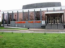
- Queen's TheatreQueen's Theatre, HornchurchThe Queen's Theatre, Hornchurch is a 500-seat theatre located in Hornchurch in the London Borough of Havering, east London.The theatre opened in its current purpose-built site on Billet Lane, Hornchurch in 1975....
- Romford MarketRomford MarketRomford Market is a large open market with 270 stalls, located in Romford, London Borough of Havering, east London, England. The market is open on Wednesdays, Fridays and Saturdays from 8.30 am to 4.30 pm...
- Gidea ParkGidea ParkGidea Park is a place in the London Borough of Havering, east London, England. Gidea Park is a part of Romford post town.-History:Gidea Park is the location of the "Romford Garden Suburb" constructed in 1910 to 1911 on the Gidea Hall and Balgores Estates as an exhibition of town planning...
- 1911 Exhibition Estate, Romford Garden Suburb - Upminster WindmillUpminster WindmillUpminster Windmill is a Grade II* listed smock mill located in Upminster in the London Borough of Havering, England. It was originally known as Abraham's Mill and was in Essex when built...
- Upminster Tithe Barn Museum of NostalgiaUpminster Tithe Barn Museum of NostalgiaThe Upminster Tithe Barn Museum of Nostalgia is a small museum located in Upminster in the London Borough of Havering, London, England. It is located at OS grid reference TQ564877....
London Borough Council
Havering elects 54 councillors from the 18 wards of Brooklands, CranhamCranham
Cranham is a residential suburb in northeast London, England and part of the London Borough of Havering. It is located east-northeast of Charing Cross and comprises an extensive built-up area to the north and a low density conservation area surrounded by open land to the south. It was historically...
, Elm Park
Elm Park
Elm Park is a place in the London Borough of Havering, in east London, England. It is a suburban development situated east north-east of Charing Cross. Unlike the nearby suburbs of Upminster and Hornchurch, Elm Park was not developed until after the arrival of the electrified District Line in 1935...
, Emerson Park
Emerson Park
Emerson Park is a suburban development in the London Borough of Havering, east London, England. It is a principally residential district located east-northeast of Charing Cross.-Housing:...
, Gidea Park, Gooshays, Hacton, Harold Wood
Harold Wood
Harold Wood is a place in the London Borough of Havering, east London, England.It is a suburban development situated east-northeeast of Charing Cross...
, Havering Park, Heaton, Hylands, Mawneys, Pettits, Rainham
Rainham, London
Rainham is a suburban town in northeast London, England, and part of the London Borough of Havering. Located east of Charing Cross, it is one of the locally important district centres identified in the London Plan and is surrounded by a residential area, which has grown from the historic village,...
and Wennington
Wennington, London
Wennington is a small village in the London Borough of Havering on the outskirts of east London. It is situated 14.8 miles east of Charing Cross....
, Romford Town
Romford
Romford is a large suburban town in north east London, England and the administrative headquarters of the London Borough of Havering. It is located northeast of Charing Cross and is one of the major metropolitan centres identified in the London Plan...
, St Andrews, South Hornchurch
South Hornchurch
South Hornchurch is a place in the London Borough of Havering, east London.It is a suburban development situated 13.6 miles east of Charing Cross. The area is a relatively recent addition, compared with the more mature suburbs in Havering. It was built on open farmland and the former site of RAF...
, Squirrels Heath and Upminster
Upminster
Upminster is a suburban town in northeast London, England, and part of the London Borough of Havering. Located east-northeast of Charing Cross, it is one of the locally important district centres identified in the London Plan, and comprises a number of shopping streets and a large residential...
. After the 2006 local elections
United Kingdom local elections, 2006
Local government elections took place in England on Thursday 4 May 2006. Polling stations were open between 7:00 and 22:00.All London borough council seats were up for election, as well as a third of the seats on each of the metropolitan borough councils, and a third of some unitary authorities...
the Conservative Party
Conservative Party (UK)
The Conservative Party, formally the Conservative and Unionist Party, is a centre-right political party in the United Kingdom that adheres to the philosophies of conservatism and British unionism. It is the largest political party in the UK, and is currently the largest single party in the House...
had a majority on the council with 34 councillors and the second largest party represented was the Residents' Association of London
Residents' Association of London
The Residents' Association of London is a minor political party in the United Kingdom, based in the London Borough of Havering, where it holds 12 seats on the council, and is the second largest party after the Conservatives....
with 13 councillors. The Rainham Independent Residents Association had three councillors, the Labour Party
Labour Party (UK)
The Labour Party is a centre-left democratic socialist party in the United Kingdom. It surpassed the Liberal Party in general elections during the early 1920s, forming minority governments under Ramsay MacDonald in 1924 and 1929-1931. The party was in a wartime coalition from 1940 to 1945, after...
had two councillors and the Liberal Democrats
Liberal Democrats
The Liberal Democrats are a social liberal political party in the United Kingdom which supports constitutional and electoral reform, progressive taxation, wealth taxation, human rights laws, cultural liberalism, banking reform and civil liberties .The party was formed in 1988 by a merger of the...
and the BNP
British National Party
The British National Party is a British far-right political party formed as a splinter group from the National Front by John Tyndall in 1982...
had one councillor each.
Between May 2006 and October 2008, there were three by-elections. The Residents' Association in St Andrews Ward and the Conservatives in Squirrels Health Ward each retained one seat, the Residents' Association lost South Hornchurch to an independent candidate. One councillor elected as a Conservative has resigned the whip and now sits as an independent. Following his election, the independent in South Hornchurch joined the leader of the Rainham Independent Residents' Association in forming the Independent Local Residents' Group. The other two Rainham Independent Residents' Association members formed the Rainham Residents' Association as a separate entity. As of October 2008, the current membership of the Council is Conservative Party 33; Residents' Association 12; Independent Local Residents 2; Labour Party 2; Hornchurch Residents 1; Rainham Residents 2; British National Party 1; Liberal Democrat 1. Since May 2004 the Leader of the Havering London Borough Council has been Councillor Michael White.
The 2010 local elections took place on 6 May 2010. The outcome was little change from the 2006-10 Council: Conservatives have 33, Residents 12, Labour 5 and Independent Residents 4. The BNP lost its one seat (although the BNP Member returned as an Independent Resident), while Labour increased its membership by three, taking the BNP and two Conservative seats. The Independent Residents, who had split in 2008, regained the seats lost through the split. The LibDem Member also lost, to a Residents (ex-Labour) candidate.
London Assembly
Havering forms part of the Havering and RedbridgeHavering and Redbridge (London Assembly constituency)
-Boundaries:It consists of the combined area of the London Borough of Havering and London Borough of Redbridge, both in East London.-Election results:...
London Assembly constituency.
UK Parliament
Until 2010 the borough was split between the parliamentary constituencies of HornchurchHornchurch (UK Parliament constituency)
Hornchurch was a borough constituency represented in the House of Commons of the Parliament of the United Kingdom. It elected one Member of Parliament by the first past the post system of election...
, Romford
Romford (UK Parliament constituency)
Romford is a constituency represented in the House of Commons of the Parliament of the United Kingdom. It elects one Member of Parliament by the first past the post system of election.- Boundaries :...
and Upminster
Upminster (UK Parliament constituency)
Upminster was a constituency of the House of Commons in east London, which returned one Member of Parliament to the House of Commons of the Parliament of the United Kingdom, elected by the first-past-the-post voting system...
with the three constituencies entirely within the borough. At the United Kingdom general election, 2010, the boundaries of these constituencies will changed to a new Hornchurch and Upminster
Hornchurch and Upminster (UK Parliament constituency)
Hornchurch and Upminster is a constituency represented in the House of Commons of the Parliament of the United Kingdom. It elects one Member of Parliament by the first past the post system of election...
constituency and Rainham will become part of the new cross-borough Dagenham and Rainham
Dagenham and Rainham (UK Parliament constituency)
Dagenham and Rainham is a constituency represented in the House of Commons of the Parliament of the United Kingdom. It elects one Member of Parliament by the first past the post system of election...
constituency.
Twinning
Havering is twinned with: Ludwigshafen, GermanyGermany
Germany , officially the Federal Republic of Germany , is a federal parliamentary republic in Europe. The country consists of 16 states while the capital and largest city is Berlin. Germany covers an area of 357,021 km2 and has a largely temperate seasonal climate...
Hesdin
Hesdin
Hesdin is a commune in the Pas-de-Calais department in northern France.-Geography:The N39, from Arras to Montreuil, used to be the main thoroughfare of the town. In the 1950s, a circular route was created to help traffic flow...
, France
France
The French Republic , The French Republic , The French Republic , (commonly known as France , is a unitary semi-presidential republic in Western Europe with several overseas territories and islands located on other continents and in the Indian, Pacific, and Atlantic oceans. Metropolitan France...
Education
The Borough is the education authority for the district providing education in a mix of foundationFoundation school
In England and Wales, a foundation school is a state-funded school in which the governing body has greater freedom in the running of the school than in community schools....
, community
Community school
The term "community school" refers to types of publicly funded school in England, Wales, the Republic of Ireland, the United States, Australia, Canada and New Zealand to a school that serves as both an educational institution and a centre of community life. A community school is both a place and a...
and voluntary aided schools.