

Romford
Encyclopedia
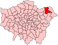
Romford is a large suburban town in north east London, England and the administrative headquarters of the London Borough of Havering
. It is located 14.1 miles (22.7 km) northeast of Charing Cross
and is one of the major metropolitan centres identified in the London Plan
. It was historically a market town
in the county of Essex
and formed the administrative centre of the liberty of Havering
, until it was dissolved in 1892. Good road links and the opening of the railway station in 1839 were key to the development of the town and the economic history of Romford is underpinned by a shift from agriculture to light industry and more recently to retail and commerce. As part of the suburban growth of London in the 20th century, Romford significantly expanded and increased in population, becoming a municipal borough
in 1937 and has formed part of Greater London
since 1965. It now forms one of the largest commercial, retail, entertainment and leisure districts outside central London and has a developed night time economy.
is a local 'back-formation
' from the name of the town; and the river is elsewhere known as the Beam. The ford most likely existed on the main London to Colchester road where it crossed that river.
on the main road to London and the regionally significant Romford Market
was established in 1247. The early history of Romford and the immediate area is agricultural and it is recorded as being the location of a number of mills used to grind corn. The area was a focus of the leather industry from the 15th to the early 19th centuries and there is record of a wide range of industries such as cloth making, weaving, charcoal burning, metal working and brewing. Communications played an important part in its development; the main road to London was maintained by the Middlesex and Essex Turnpike Trust from 1721 and Romford became a coaching town in the 18th century. Several failed attempts were made in the early 19th century to connect the town to the Thames via a Romford Canal. Initially intended to transport agricultural products to London and later intended to serve growing industrial sites in Romford, only two miles of canal were constructed and the canal company were unable to reach the town.
The development of the town was accelerated by the opening of the railway station in 1839 which stimulated the local economy and was key to the development of the Star Brewery
. Initially Eastern Counties Railway
services operated between Mile End
and Romford, with extensions to Brentwood and to Shoreditch in 1840. A second station was opened on South Street in 1892 by the London, Tilbury and Southend Railway
on the line to Upminster and Grays, giving Romford a rail connection to Tilbury Docks
. The two stations were combined into one in 1934. Light industry slowly developed, reaching a peak in the 1970s with a number of factories on the edge of town, such as the Roneo Vickers
office machinery company, Colvern manufacturers of wireless components, May's Sheet Metal Works and brush manufacturers Betterware. Suburban expansion increased the population and reinforced Romford's position as a significant regional town centre. The Liberty Shopping Centre
was constructed in the 1960s and has been recently modernised and supplemented with further shopping centres throughout the town, including The Mall, opened in 2006; and The Brewery, opened in 2000 on the site of the old Star Brewery.
 Romford formed a chapelry in the large ancient parish of Hornchurch
in the Becontree
hundred of Essex
; it included Collier Row, Harold Wood
, and Noak Hill. Through ancient custom the area enjoyed special status and a charter in 1465 removed the parish from the Becontree hundred and the county of Essex and it instead formed the independent liberty of Havering
. Over time the vestry of Romford chapelry absorbed the local powers that would usually be held by the parish authorities and in 1849 Romford became a separate parish within the liberty. Improvement commissioners
were set up in 1819 for paving, lighting, watching, and cleansing of the marketplace and main streets. As the town grew this arrangement became ineffective at controlling sanitation and in 1851 a local board of health
was set up for the parish; although its area was reduced in 1855 to cover only the town. The remainder of the parish became part of the Romford rural sanitary district
in 1875. These changes and the introduction of the Romford Poor Law Union
in 1836 eroded the powers of the liberty and it was finally abolished in 1892 and reincorporated into Essex.
The Local Government Act 1894
reformed local government and created the Romford Urban District
and Romford Rural District
to replace the local board and sanitary district; and the Romford parish was split into Romford Urban and Romford Rural along the lines of the urban district. In 1900 the parish was recombined and the urban district expanded to cover all of the former area of the historic chapelry, except for Noak Hill
which remained in the rural district and had become a parish in its own right in 1895. The enlarged urban district formed part of the London Traffic Area
from 1924 and the London Passenger Transport Area
from 1933. The suburban expansion of London caused an increase in population during the 1930s and the urban district was expanded further in 1934, taking in the parishes of Havering-atte-Bower
and Noak Hill. It was incorporated as the Municipal Borough of Romford
in 1937. In 1965 the municipal borough was abolished and its former area was combined with that of Hornchurch Urban District
; it was again removed from Essex and since then has formed the northern part of the London Borough of Havering
in Greater London
.
 There was early expansion in the 1840s in the area currently occupied by the Waterloo estate, and then known as New Romford, where 200 cottages were built. To the east of the market place from 1850 middle class suburban housing was constructed with a much larger area of 200 acres (80.9 ha) built-over to the south of the railway from 1851. Through a gradual process of selling off former manors, houses were built radiating from the town in all directions for about a mile. More significant growth occurred between 1910 and 1911 with the construction of Gidea Park Garden Suburb
, which included Raphael Park
and Gidea Park railway station
. Large sections of land to the north of the town at Collier Row
were developed in the interwar period
and after World War II
, the London County Council
built the Harold Hill
estate to the north east from 1948 to 1958.
The right to supply electricity to the town was secured by the County of London Electricity Supply Company in 1913. Initially power was generated within the Star Brewery site, with the supply switching to Barking Power Station
in 1925. Gas supply began in 1825 with gas works of 25 acres (10.1 ha) constructed by 1938. Following the Telegraph Act 1899
Romford became part of the Post Office London telephone area and the Romford exchange was recorded as having 240 subscribers in 1916. The town water supply initially came from the Havering Well, and 1859 a new public well and pump was built at the east end of the market. The South Essex Waterworks Company started installing mains water supply in 1863 and had offices in South Street. By 1905 its supply was serving Ilford, Collier Row, Ardleigh Green
, Brentwood
, and Hornchurch. Sewage works were installed by the local board at Oldchurch in 1862, with further works built in Hornchurch in 1869.
 The Romford UK Parliament constituency
consists of the Havering wards of Brooklands, Havering Park, Mawneys, Pettits, Romford Town, and Squirrel's Heath. In 2001 it had a population of 76,323. The current MP is Andrew Rosindell
, a native of the town. Romford forms part of the Havering and Redbridge London Assembly constituency
and the London European Parliament constituency
. Each ward elects three councillors to Havering London Borough Council
. From the next UK general election the constituency will also include the Hylands ward. The councillors elected in 2006 were: Brooklands – 3 Conservative; Havering Park – 2 Conservative and 1 Collier Row and Mawneys Residents Association; Mawneys – 3 Conservative; Pettits – 3 Conservative; Romford Town – 3 Conservative; Squirrel's Heath – 3 Conservative after 2007 by-election; and Hylands – 3 Conservative.
. The north of the town has developed on London Clay
and is situated as much as 150 feet (45.7 m) above sea level. The town centre is for the most part contained within a ring road formed of St Edwards Way, Mercury Gardens, Thurloe Gardens, Oldchurch Road and Waterloo Road. The market place and much of South Street and the High Street are pedestrianised. The railway cuts through the town from east to west on a viaduct, with the bulk of the central Romford area to its north. The River Rom
flows through the town in underground channels and joins the Thames after flowing through Hornchurch; elsewhere along its course it is known as the River Beam and forms part of the strategic waterways Blue Ribbon Network
. Romford has formed part of the continuously built-up area of London since the 1930s and is contiguous with Rush Green
to the west, Collier Row
to the north, Gidea Park
to the east and Hornchurch
to the south east. The Romford post town covers all of the former municipal borough and extends over a much wider area, including parts of Barking and Dagenham
and Epping Forest
. Climate data for Romford is taken from the nearest weather station at Greenwich
, around 10 miles (16.1 km) south west of the marketplace:
The Havering committee area for Romford is defined as the wards of Romford Town and Brooklands. Demographic data is produced by the Office for National Statistics
for these wards. In 2001 the population of Romford Town was 13,200 and Brooklands was 13,024, giving a total population of 26,224. In contrast, the approximate population of the area within the 2005 Romford Urban Strategy was estimated to be 36,500. 71.52% in Romford Town and 70.48% in Brooklands report their religion as Christian, compared to 76.13% for Havering, 58.23% in London and 71.74% in England. 15.71% in Romford Town and 16.62% in Brooklands report having no religion, compared to 13.18% in Havering, 15.76% in London and 14.59% in England.
as one of eleven regionally significant metropolitan centres in Greater London, with a considerable catchment area. The total commercial floorspace in the town was 353258 sqm in 2002, of which 147627 sqm is retail space and 63357 sqm is offices. The retail space is growing and in 2005 consisted of 2000000 square feet (185,806.1 m²). The retail economy is complemented by a central business district
close to the railway station, where the offices of employers such as Aon are located. Employment in the town centre was categorised in 2002 as approximately 40% commercial office, 40% comparison retail, 10% hospitality, 5% public sector, 2.5% service retail and 2.5% arts and entertainment. Compared to the similar east London areas of Ilford, Stratford and Barking, there is more comparison retail and commercial office employment in Romford and less public sector work. The total turnover of £413,395,000 in 2002 for Romford was larger than any other comparable town centre in east London and approximately 70% came from the commercial office businesses. There is a developed night time economy, greater than in any other metropolitan centre in Greater London, with 8360 sqm of cinemas, theatres and concert hall space; 9530 sqm of bars and pubs; 5510 sqm of cafes and restaurants; and 2680 sqm of fast food and take away venues. The night time economy is almost as significant as the day economy with around 12,000 visit to Romford during the day and 11,000 visit to pubs, clubs and bars at night.
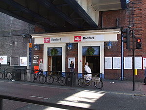 The town is served by Romford railway station
on the Great Eastern Main Line
in London fare zone 6. Trains calling at the station are operated by National Express East Anglia and are primarily of the high-frequency stopping Liverpool Street
-Shenfield
service. There are also a limited number of outer-suburban express services to Southend-on-Sea and Clacton, mostly during off-peak times. A branch line shuttle on the Romford to Upminster Line
connects Romford to Emerson Park
and Upminster
. Romford is a hub of the London Buses
network with services to Canning Town
, Stratford
, Leytonstone
and Dagenham
as well as feeder services from the large nearby housing developments at Collier Row
and Harold Hill
. There are night bus services to Stratford, Harold Hill and Paddington. Romford town centre has a very high Public Transport Accessibility Level
score of 6. The trunk A12 road passes to the north of Romford while the A118 road
from Stratford connects with it at Gallows Corner
at the start of the A127 road
to Southend. It is planned that the Liverpool Street-Shenfield service will become part of Crossrail
and there is a proposal that Romford will be served by a future extension of the East London Transit
.
, one of the few remaining dog racing tracks in London; a 16 screen multiplex cinema; and Romford Ice Arena
, which is home to the local Romford Raiders
ice hockey team. There is also a Romford F.C.
associated with the town. The town is strongly associated with the electronic music group Underworld
.
Romford's position as a focus for electronic music production was reinforced by the presence of the Strictly Underground and Suburban Base
record labels, with Suburban Base developing from the Boogie Times record store. According to a Billboard
article in 1992, Romford-produced dance music formed part of a trend favouring suburban and provincial "bedroom" record labels to those in central London. The local newspapers for the town and the borough of Havering are the Romford Recorder
, Romford and Havering Post and Romford Yellow Advertiser.
London Borough of Havering
The London Borough of Havering is a London borough in North East London, England and forms part of Outer London. The principal town in Havering is Romford and the other main communities are Hornchurch, Upminster and Rainham. The borough is mainly characterised by suburban development with large...
. It is located 14.1 miles (22.7 km) northeast of Charing Cross
Charing Cross
Charing Cross denotes the junction of Strand, Whitehall and Cockspur Street, just south of Trafalgar Square in central London, England. It is named after the now demolished Eleanor cross that stood there, in what was once the hamlet of Charing. The site of the cross is now occupied by an equestrian...
and is one of the major metropolitan centres identified in the London Plan
London Plan
The London Plan is a planning document written by the Mayor of London, England in the United Kingdom and published by the Greater London Authority. The plan was first published in final form on 10 February 2004 and has since been amended. The current version was published in February 2008...
. It was historically a market town
Market town
Market town or market right is a legal term, originating in the medieval period, for a European settlement that has the right to host markets, distinguishing it from a village and city...
in the county of Essex
Essex
Essex is a ceremonial and non-metropolitan county in the East region of England, and one of the home counties. It is located to the northeast of Greater London. It borders with Cambridgeshire and Suffolk to the north, Hertfordshire to the west, Kent to the South and London to the south west...
and formed the administrative centre of the liberty of Havering
Royal Liberty of Havering
Havering, also known as Havering-atte-Bower, was a royal manor and ancient liberty whose former area now forms part of, and gives its name to, the London Borough of Havering in Greater London...
, until it was dissolved in 1892. Good road links and the opening of the railway station in 1839 were key to the development of the town and the economic history of Romford is underpinned by a shift from agriculture to light industry and more recently to retail and commerce. As part of the suburban growth of London in the 20th century, Romford significantly expanded and increased in population, becoming a municipal borough
Municipal Borough of Romford
Romford was a local government district in southwest Essex from 1851 to 1965. It was significantly expanded in 1934 and gained the status of municipal borough in 1937...
in 1937 and has formed part of Greater London
Greater London
Greater London is the top-level administrative division of England covering London. It was created in 1965 and spans the City of London, including Middle Temple and Inner Temple, and the 32 London boroughs. This territory is coterminate with the London Government Office Region and the London...
since 1965. It now forms one of the largest commercial, retail, entertainment and leisure districts outside central London and has a developed night time economy.
History
| 1881 | 9,050 |
|---|---|
| 1891 | 10,722 |
| 1901 | 13,656 |
| 1911 | 16,970 |
| 1921 | 19,442 |
| 1931 | 35,918 |
| 1941 | war # |
| 1951 | 76,580 |
| 1961 | 114,584 |
| # no census was held due to war | |
| source: UK census | |
Toponymy
Romford is first recorded in 1177 as Romfort, which is formed from Old English 'rūm' and 'ford' and means "the wide or spacious ford". The naming of the River RomRiver Rom
The River Rom, also in places known as the River Beam, is a tributary of the River Thames in England that flows through the north east London suburbs, forming the boundary between the London boroughs of Barking and Dagenham and Havering in the south and flowing through channels underneath Romford...
is a local 'back-formation
Back-formation
In etymology, back-formation is the process of creating a new lexeme, usually by removing actual or supposed affixes. The resulting neologism is called a back-formation, a term coined by James Murray in 1889...
' from the name of the town; and the river is elsewhere known as the Beam. The ford most likely existed on the main London to Colchester road where it crossed that river.
Economic development
The town developed in the Middle AgesMiddle Ages
The Middle Ages is a periodization of European history from the 5th century to the 15th century. The Middle Ages follows the fall of the Western Roman Empire in 476 and precedes the Early Modern Era. It is the middle period of a three-period division of Western history: Classic, Medieval and Modern...
on the main road to London and the regionally significant Romford Market
Romford Market
Romford Market is a large open market with 270 stalls, located in Romford, London Borough of Havering, east London, England. The market is open on Wednesdays, Fridays and Saturdays from 8.30 am to 4.30 pm...
was established in 1247. The early history of Romford and the immediate area is agricultural and it is recorded as being the location of a number of mills used to grind corn. The area was a focus of the leather industry from the 15th to the early 19th centuries and there is record of a wide range of industries such as cloth making, weaving, charcoal burning, metal working and brewing. Communications played an important part in its development; the main road to London was maintained by the Middlesex and Essex Turnpike Trust from 1721 and Romford became a coaching town in the 18th century. Several failed attempts were made in the early 19th century to connect the town to the Thames via a Romford Canal. Initially intended to transport agricultural products to London and later intended to serve growing industrial sites in Romford, only two miles of canal were constructed and the canal company were unable to reach the town.
The development of the town was accelerated by the opening of the railway station in 1839 which stimulated the local economy and was key to the development of the Star Brewery
Star Brewery
The Star Brewery was a brewery located at Romford, England. For much of its history, it has been a main industry and a significant employer in the area. It was closed in 1993 and its former site has been redeveloped as a shopping centre named The Brewery, which opened in 2001...
. Initially Eastern Counties Railway
Eastern Counties Railway
The Eastern Counties Railway was an early English railway company incorporated in 1836. It was intended to link London with Ipswich via Colchester, and then on to Norwich and Yarmouth. Construction began in late March 1837 on the first nine miles, at the London end of the line.Construction was...
services operated between Mile End
Mile End
Mile End is an area within the East End of London, England, and part of the London Borough of Tower Hamlets. It is located east-northeast of Charing Cross...
and Romford, with extensions to Brentwood and to Shoreditch in 1840. A second station was opened on South Street in 1892 by the London, Tilbury and Southend Railway
London, Tilbury and Southend Railway
The London, Tilbury and Southend Railway is an English railway line linking Fenchurch Street railway station in the City of London with northeast London and the entire length of the northern Thames Gateway area of southern Essex. It is currently known as the Essex Thameside Route by Network Rail...
on the line to Upminster and Grays, giving Romford a rail connection to Tilbury Docks
Port of Tilbury
The Port of Tilbury is located on the River Thames at Tilbury in Essex, England. It is the principal port for London; as well as being the main United Kingdom port for handling the importation of paper. There are extensive facilities for containers, grain, and other bulk cargoes. There are also...
. The two stations were combined into one in 1934. Light industry slowly developed, reaching a peak in the 1970s with a number of factories on the edge of town, such as the Roneo Vickers
Vickers
Vickers was a famous name in British engineering that existed through many companies from 1828 until 1999.-Early history:Vickers was formed in Sheffield as a steel foundry by the miller Edward Vickers and his father-in-law George Naylor in 1828. Naylor was a partner in the foundry Naylor &...
office machinery company, Colvern manufacturers of wireless components, May's Sheet Metal Works and brush manufacturers Betterware. Suburban expansion increased the population and reinforced Romford's position as a significant regional town centre. The Liberty Shopping Centre
Liberty Shopping Centre
The Liberty, is a covered shopping mall located in the London Borough of Havering. It is the largest mall in Romford, a metropolitan centre of Outer London. It was originally built in 1968 as the Liberty Shopping Centre and underwent a four-year redevelopment completed in 2004. The centre takes its...
was constructed in the 1960s and has been recently modernised and supplemented with further shopping centres throughout the town, including The Mall, opened in 2006; and The Brewery, opened in 2000 on the site of the old Star Brewery.
Local government
Hornchurch
Hornchurch is a large suburban town in England, and part of the London Borough of Havering. Hornchurch is in North-East London .It is located east-northeast of Charing Cross and is one of the locally important district centres identified in the London Plan. It comprises a number of shopping...
in the Becontree
Becontree (hundred)
Becontree was an ancient hundred in the south west of the county of Essex, England. Its area has been entirely absorbed by the growth of London; with its name reused in 1921 for the large Becontree estate of the London County Council...
hundred of Essex
Essex
Essex is a ceremonial and non-metropolitan county in the East region of England, and one of the home counties. It is located to the northeast of Greater London. It borders with Cambridgeshire and Suffolk to the north, Hertfordshire to the west, Kent to the South and London to the south west...
; it included Collier Row, Harold Wood
Harold Wood
Harold Wood is a place in the London Borough of Havering, east London, England.It is a suburban development situated east-northeeast of Charing Cross...
, and Noak Hill. Through ancient custom the area enjoyed special status and a charter in 1465 removed the parish from the Becontree hundred and the county of Essex and it instead formed the independent liberty of Havering
Royal Liberty of Havering
Havering, also known as Havering-atte-Bower, was a royal manor and ancient liberty whose former area now forms part of, and gives its name to, the London Borough of Havering in Greater London...
. Over time the vestry of Romford chapelry absorbed the local powers that would usually be held by the parish authorities and in 1849 Romford became a separate parish within the liberty. Improvement commissioners
Improvement commissioners
Boards of improvement commissioners were ad-hoc boards created during the 18th and 19th centuries in the United Kingdom. They were an early form of local government.The first Improvement Commission was the Manchester Police Commission, established in 1765...
were set up in 1819 for paving, lighting, watching, and cleansing of the marketplace and main streets. As the town grew this arrangement became ineffective at controlling sanitation and in 1851 a local board of health
Local board of health
Local Boards or Local Boards of Health were local authorities in urban areas of England and Wales from 1848 to 1894. They were formed in response to cholera epidemics and were given powers to control sewers, clean the streets, regulate slaughterhouses and ensure the proper supply of water to their...
was set up for the parish; although its area was reduced in 1855 to cover only the town. The remainder of the parish became part of the Romford rural sanitary district
Sanitary district
Sanitary districts were established in England and Wales in 1875 and in Ireland in 1878. The districts were of two types, based on existing structures:*Urban sanitary districts in towns with existing local government bodies...
in 1875. These changes and the introduction of the Romford Poor Law Union
Poor Law Union
A Poor Law Union was a unit used for local government in the United Kingdom from the 19th century. The administration of the Poor Law was the responsibility of parishes, which varied wildly in their size, populations, financial resources, rateable values and requirements...
in 1836 eroded the powers of the liberty and it was finally abolished in 1892 and reincorporated into Essex.
The Local Government Act 1894
Local Government Act 1894
The Local Government Act 1894 was an Act of the Parliament of the United Kingdom that reformed local government in England and Wales outside the County of London. The Act followed the reforms carried out at county level under the Local Government Act 1888...
reformed local government and created the Romford Urban District
Municipal Borough of Romford
Romford was a local government district in southwest Essex from 1851 to 1965. It was significantly expanded in 1934 and gained the status of municipal borough in 1937...
and Romford Rural District
Romford Rural District
Romford Rural District was a local government district in south west Essex, England from 1894 to 1934. It surrounded, but did not include, Romford which formed a separate urban district...
to replace the local board and sanitary district; and the Romford parish was split into Romford Urban and Romford Rural along the lines of the urban district. In 1900 the parish was recombined and the urban district expanded to cover all of the former area of the historic chapelry, except for Noak Hill
Noak Hill
Noak Hill is a village in the London Borough of Havering. It is in the far north east of the borough close to the Greater London boundary which is locally the M25 motorway, situated on hilly terrain. The village consists of various period homes, many of which are listed, a 19th century church and...
which remained in the rural district and had become a parish in its own right in 1895. The enlarged urban district formed part of the London Traffic Area
London Traffic Area
The London Traffic Area was established by the London Traffic Act 1924 in order to regulate the increasing amount of motor traffic in the London area...
from 1924 and the London Passenger Transport Area
London Passenger Transport Board
The London Passenger Transport Board was the organisation responsible for public transport in London, UK, and its environs from 1933 to 1948...
from 1933. The suburban expansion of London caused an increase in population during the 1930s and the urban district was expanded further in 1934, taking in the parishes of Havering-atte-Bower
Havering-atte-Bower
Havering-atte-Bower is a village and outlying settlement of the London Borough of Havering, located 15 miles northeast of Charing Cross and close to the Greater London boundary. It was one of three former parishes whose area comprised the historic Royal Liberty of Havering...
and Noak Hill. It was incorporated as the Municipal Borough of Romford
Municipal Borough of Romford
Romford was a local government district in southwest Essex from 1851 to 1965. It was significantly expanded in 1934 and gained the status of municipal borough in 1937...
in 1937. In 1965 the municipal borough was abolished and its former area was combined with that of Hornchurch Urban District
Hornchurch Urban District
Hornchurch was a local government district in south west Essex, England from 1926 to 1965. The urban district council was based at Langtons House. The district formed a suburb of London and was expanded in 1934...
; it was again removed from Essex and since then has formed the northern part of the London Borough of Havering
London Borough of Havering
The London Borough of Havering is a London borough in North East London, England and forms part of Outer London. The principal town in Havering is Romford and the other main communities are Hornchurch, Upminster and Rainham. The borough is mainly characterised by suburban development with large...
in Greater London
Greater London
Greater London is the top-level administrative division of England covering London. It was created in 1965 and spans the City of London, including Middle Temple and Inner Temple, and the 32 London boroughs. This territory is coterminate with the London Government Office Region and the London...
.
Suburban expansion
Gidea Park
Gidea Park is a place in the London Borough of Havering, east London, England. Gidea Park is a part of Romford post town.-History:Gidea Park is the location of the "Romford Garden Suburb" constructed in 1910 to 1911 on the Gidea Hall and Balgores Estates as an exhibition of town planning...
, which included Raphael Park
Raphael Park
Raphael Park is a public park in Romford, London Borough of Havering. The park is one of a series of parks which stretch northwards from the railway line at Romford....
and Gidea Park railway station
Gidea Park railway station
Gidea Park railway station is a railway station at Gidea Park in the London Borough of Havering in east London. It was opened as Squirrels Heath & Gidea Park on 1 December 1910 by the Great Eastern Railway on their main line....
. Large sections of land to the north of the town at Collier Row
Collier Row
Collier Row is a place in north east London in the London Borough of Havering. It is a suburban development north of Romford, located north east of Charing Cross....
were developed in the interwar period
Interwar period
Interwar period can refer to any period between two wars. The Interbellum is understood to be the period between the end of the Great War or First World War and the beginning of the Second World War in Europe....
and after World War II
World War II
World War II, or the Second World War , was a global conflict lasting from 1939 to 1945, involving most of the world's nations—including all of the great powers—eventually forming two opposing military alliances: the Allies and the Axis...
, the London County Council
London County Council
London County Council was the principal local government body for the County of London, throughout its 1889–1965 existence, and the first London-wide general municipal authority to be directly elected. It covered the area today known as Inner London and was replaced by the Greater London Council...
built the Harold Hill
Harold Hill
Harold Hill is a place in the London Borough of Havering, east London, England. It is a suburban development situated 16.6 miles east-northeeast of Charing Cross....
estate to the north east from 1948 to 1958.
The right to supply electricity to the town was secured by the County of London Electricity Supply Company in 1913. Initially power was generated within the Star Brewery site, with the supply switching to Barking Power Station
Barking Power Station
Barking Power Station refers to a series of power stations at former and current sites within the London Borough of Barking and Dagenham in east London. The original power station site, of the coal-fired A, B and C stations, was at River Road, Creekmouth, on the north bank of the River Thames....
in 1925. Gas supply began in 1825 with gas works of 25 acres (10.1 ha) constructed by 1938. Following the Telegraph Act 1899
Telegraph Act 1899
The Telegraph Act 1899 is an Act of Parliament in the United Kingdom that allowed urban district, borough and burgh councils to construct and operate telephone exchanges, on a similar basis the then-usual municipal provision of other utilities....
Romford became part of the Post Office London telephone area and the Romford exchange was recorded as having 240 subscribers in 1916. The town water supply initially came from the Havering Well, and 1859 a new public well and pump was built at the east end of the market. The South Essex Waterworks Company started installing mains water supply in 1863 and had offices in South Street. By 1905 its supply was serving Ilford, Collier Row, Ardleigh Green
Ardleigh Green
Ardleigh Green is a place in the London Borough of Havering, east London, England and part of the Hornchurch post town. It is a suburban development....
, Brentwood
Brentwood, Essex
Brentwood is a town and the principal settlement of the Borough of Brentwood, in the county of Essex in the east of England. It is located in the London commuter belt, 20 miles east north-east of Charing Cross in London, and near the M25 motorway....
, and Hornchurch. Sewage works were installed by the local board at Oldchurch in 1862, with further works built in Hornchurch in 1869.
Governance
Romford (UK Parliament constituency)
Romford is a constituency represented in the House of Commons of the Parliament of the United Kingdom. It elects one Member of Parliament by the first past the post system of election.- Boundaries :...
consists of the Havering wards of Brooklands, Havering Park, Mawneys, Pettits, Romford Town, and Squirrel's Heath. In 2001 it had a population of 76,323. The current MP is Andrew Rosindell
Andrew Rosindell
Andrew Richard Rosindell is an English Conservative politician. He is the Member of Parliament for the Romford constituency in Greater London...
, a native of the town. Romford forms part of the Havering and Redbridge London Assembly constituency
Havering and Redbridge (London Assembly constituency)
-Boundaries:It consists of the combined area of the London Borough of Havering and London Borough of Redbridge, both in East London.-Election results:...
and the London European Parliament constituency
London (European Parliament constituency)
London is a constituency of the European Parliament. It currently elects 8 MEPs using the d'Hondt method of party-list proportional representation.- Boundaries :The constituency corresponds to Greater London, in the south east of the United Kingdom....
. Each ward elects three councillors to Havering London Borough Council
Havering London Borough Council
Havering London Borough Council is the local authority for the London Borough of Havering in Greater London, England. It is a London borough council, one of 32 in the United Kingdom capital of London. Havering is divided into 18 wards, each electing three councillors...
. From the next UK general election the constituency will also include the Hylands ward. The councillors elected in 2006 were: Brooklands – 3 Conservative; Havering Park – 2 Conservative and 1 Collier Row and Mawneys Residents Association; Mawneys – 3 Conservative; Pettits – 3 Conservative; Romford Town – 3 Conservative; Squirrel's Heath – 3 Conservative after 2007 by-election; and Hylands – 3 Conservative.
Geography
The town centre is about 50 feet (15.2 m) above sea level on a gravel terrace rising from the River ThamesRiver Thames
The River Thames flows through southern England. It is the longest river entirely in England and the second longest in the United Kingdom. While it is best known because its lower reaches flow through central London, the river flows alongside several other towns and cities, including Oxford,...
. The north of the town has developed on London Clay
London Clay
The London Clay Formation is a marine geological formation of Ypresian age which crops out in the southeast of England. The London Clay is well known for the fossils it contains. The fossils from the Lower Eocene indicate a moderately warm climate, the flora being tropical or subtropical...
and is situated as much as 150 feet (45.7 m) above sea level. The town centre is for the most part contained within a ring road formed of St Edwards Way, Mercury Gardens, Thurloe Gardens, Oldchurch Road and Waterloo Road. The market place and much of South Street and the High Street are pedestrianised. The railway cuts through the town from east to west on a viaduct, with the bulk of the central Romford area to its north. The River Rom
River Rom
The River Rom, also in places known as the River Beam, is a tributary of the River Thames in England that flows through the north east London suburbs, forming the boundary between the London boroughs of Barking and Dagenham and Havering in the south and flowing through channels underneath Romford...
flows through the town in underground channels and joins the Thames after flowing through Hornchurch; elsewhere along its course it is known as the River Beam and forms part of the strategic waterways Blue Ribbon Network
Blue Ribbon Network
The Blue Ribbon Network is a policy element of the London Plan relating to the naviagable waterways of London, England.Aside from the River Thames, the major components of the network are:#Grand Union Canal#Regent's Canal#River Lee Navigation#River Brent...
. Romford has formed part of the continuously built-up area of London since the 1930s and is contiguous with Rush Green
Rush Green
Rush Green is a place divided between the London Borough of Havering and the London Borough of Barking and Dagenham in east London, England. It is included in the Romford post town....
to the west, Collier Row
Collier Row
Collier Row is a place in north east London in the London Borough of Havering. It is a suburban development north of Romford, located north east of Charing Cross....
to the north, Gidea Park
Gidea Park
Gidea Park is a place in the London Borough of Havering, east London, England. Gidea Park is a part of Romford post town.-History:Gidea Park is the location of the "Romford Garden Suburb" constructed in 1910 to 1911 on the Gidea Hall and Balgores Estates as an exhibition of town planning...
to the east and Hornchurch
Hornchurch
Hornchurch is a large suburban town in England, and part of the London Borough of Havering. Hornchurch is in North-East London .It is located east-northeast of Charing Cross and is one of the locally important district centres identified in the London Plan. It comprises a number of shopping...
to the south east. The Romford post town covers all of the former municipal borough and extends over a much wider area, including parts of Barking and Dagenham
London Borough of Barking and Dagenham
In 1801, the civil parishes that form the modern borough had a total population of 1,937; and the area was characterised by farming, woodland and the fishing fleet at Barking. This last industry employed 1,370 men and boys by 1850, but by the end of the century had ceased to exist; replaced by...
and Epping Forest
Epping Forest (district)
Epping Forest is a local government district of the county of Essex, England. It is named after Epping Forest, of which the district contains a large part...
. Climate data for Romford is taken from the nearest weather station at Greenwich
Greenwich
Greenwich is a district of south London, England, located in the London Borough of Greenwich.Greenwich is best known for its maritime history and for giving its name to the Greenwich Meridian and Greenwich Mean Time...
, around 10 miles (16.1 km) south west of the marketplace:
Demography
| Romford compared (2001 Census) | |||||
|---|---|---|---|---|---|
| Statistic | Romford Town |
Brooklands | Havering | London | England |
| Ethnic group | |||||
| White | 12,247 | 11,987 | 213,421 | 5,103,203 | 44,679,361 |
| Asian | 388 | 374 | 4,088 | 866,693 | 2,248,289 |
| Black | 234 | 389 | 3,139 | 782,849 | 1,132,508 |
| Mixed | 200 | 161 | 2,298 | 226,111 | 643,373 |
| Chinese/Other | 131 | 113 | 1,302 | 193,235 | 435,300 |
| Population | |||||
| Total | 13,200 | 13,024 | 224,248 | 7,172,091 | 49,138,831 |
| Density(/hectare) | 46.05 | 31.00 | 19.97 | 45.62 | 3.77 |
| Households | 5,829 | 5,361 | 91,722 | 3,015,997 | 20,451,427 |
The Havering committee area for Romford is defined as the wards of Romford Town and Brooklands. Demographic data is produced by the Office for National Statistics
Office for National Statistics
The Office for National Statistics is the executive office of the UK Statistics Authority, a non-ministerial department which reports directly to the Parliament of the United Kingdom.- Overview :...
for these wards. In 2001 the population of Romford Town was 13,200 and Brooklands was 13,024, giving a total population of 26,224. In contrast, the approximate population of the area within the 2005 Romford Urban Strategy was estimated to be 36,500. 71.52% in Romford Town and 70.48% in Brooklands report their religion as Christian, compared to 76.13% for Havering, 58.23% in London and 71.74% in England. 15.71% in Romford Town and 16.62% in Brooklands report having no religion, compared to 13.18% in Havering, 15.76% in London and 14.59% in England.
Economy
Romford is recognised in the London PlanLondon Plan
The London Plan is a planning document written by the Mayor of London, England in the United Kingdom and published by the Greater London Authority. The plan was first published in final form on 10 February 2004 and has since been amended. The current version was published in February 2008...
as one of eleven regionally significant metropolitan centres in Greater London, with a considerable catchment area. The total commercial floorspace in the town was 353258 sqm in 2002, of which 147627 sqm is retail space and 63357 sqm is offices. The retail space is growing and in 2005 consisted of 2000000 square feet (185,806.1 m²). The retail economy is complemented by a central business district
Central business district
A central business district is the commercial and often geographic heart of a city. In North America this part of a city is commonly referred to as "downtown" or "city center"...
close to the railway station, where the offices of employers such as Aon are located. Employment in the town centre was categorised in 2002 as approximately 40% commercial office, 40% comparison retail, 10% hospitality, 5% public sector, 2.5% service retail and 2.5% arts and entertainment. Compared to the similar east London areas of Ilford, Stratford and Barking, there is more comparison retail and commercial office employment in Romford and less public sector work. The total turnover of £413,395,000 in 2002 for Romford was larger than any other comparable town centre in east London and approximately 70% came from the commercial office businesses. There is a developed night time economy, greater than in any other metropolitan centre in Greater London, with 8360 sqm of cinemas, theatres and concert hall space; 9530 sqm of bars and pubs; 5510 sqm of cafes and restaurants; and 2680 sqm of fast food and take away venues. The night time economy is almost as significant as the day economy with around 12,000 visit to Romford during the day and 11,000 visit to pubs, clubs and bars at night.
Transport
Romford railway station
Romford station is located in Romford, London Borough of Havering. It is situated between Chadwell Heath and Gidea Park. It is the western terminus of the Upminster branch line from Upminster....
on the Great Eastern Main Line
Great Eastern Main Line
The Great Eastern Main Line is a 212 Kilometre major railway line of the British railway system, which connects Liverpool Street in the City of London with destinations in east London and the East of England, including Chelmsford, Colchester, Ipswich, Norwich and several coastal resorts such as...
in London fare zone 6. Trains calling at the station are operated by National Express East Anglia and are primarily of the high-frequency stopping Liverpool Street
Liverpool Street station
Liverpool Street railway station, also known as London Liverpool Street or simply Liverpool Street, is both a central London railway terminus and a connected London Underground station in the north-eastern corner of the City of London, England...
-Shenfield
Shenfield
Shenfield is a former village and now an outer suburb of Brentwood in the borough of the same name in Essex, England.-History:The name originates from the Anglo-Saxon Chenefield, meaning 'good lands'....
service. There are also a limited number of outer-suburban express services to Southend-on-Sea and Clacton, mostly during off-peak times. A branch line shuttle on the Romford to Upminster Line
Romford to Upminster Line
The Romford to Upminster Line or Upminster Branch Line is a branch line between Romford and Upminster in the London Borough of Havering. The line is part of the Network Rail Strategic Route 7, SRS 07.09, and is classified as a rural line...
connects Romford to Emerson Park
Emerson Park
Emerson Park is a suburban development in the London Borough of Havering, east London, England. It is a principally residential district located east-northeast of Charing Cross.-Housing:...
and Upminster
Upminster
Upminster is a suburban town in northeast London, England, and part of the London Borough of Havering. Located east-northeast of Charing Cross, it is one of the locally important district centres identified in the London Plan, and comprises a number of shopping streets and a large residential...
. Romford is a hub of the London Buses
London Buses
London Buses is the subsidiary of Transport for London that manages bus services within Greater London, UK. Buses are required to carry similar red colour schemes and conform to the same fare scheme...
network with services to Canning Town
Canning Town
Canning Town is an area of east London, England. It is part of the London Borough of Newham and is situated in the area of the former London docks on the north side of the River Thames. It is the location of Rathbone Market...
, Stratford
Stratford, London
Stratford is a place in the London Borough of Newham, England. It is located east northeast of Charing Cross and is one of the major centres identified in the London Plan. It was historically an agrarian settlement in the ancient parish of West Ham, which transformed into an industrial suburb...
, Leytonstone
Leytonstone
Leytonstone is an area of east London and part of the London Borough of Waltham Forest. It is a high density suburban area, located seven miles north east of Charing Cross in the ceremonial county of Greater London and the historic county of Essex...
and Dagenham
Dagenham
Dagenham is a large suburb in East London, forming the eastern part of the London Borough of Barking and Dagenham and located east of Charing Cross. It was historically an agrarian village in the county of Essex and remained mostly undeveloped until 1921 when the London County Council began...
as well as feeder services from the large nearby housing developments at Collier Row
Collier Row
Collier Row is a place in north east London in the London Borough of Havering. It is a suburban development north of Romford, located north east of Charing Cross....
and Harold Hill
Harold Hill
Harold Hill is a place in the London Borough of Havering, east London, England. It is a suburban development situated 16.6 miles east-northeeast of Charing Cross....
. There are night bus services to Stratford, Harold Hill and Paddington. Romford town centre has a very high Public Transport Accessibility Level
Public Transport Accessibility Level
PTAL stands for Public Transport Accessibility Level. It is a method sometimes used in United Kingdom transport planning to assess the access level of geographical areas to public transport....
score of 6. The trunk A12 road passes to the north of Romford while the A118 road
A118 road
The A118 is a road in east London, England which links Bow with Gallows Corner, east of Romford. The section from Stratford to Gallows Corner formed the original route of the A12 until the designation was transferred to the Eastern Avenue soon after the latter opened in 1925...
from Stratford connects with it at Gallows Corner
Gallows Corner
Gallows Corner is an area and major road junction in the London Borough of Havering near Romford.The junction is a large roundabout with five exits and a flyover...
at the start of the A127 road
A127 road
The A127, also known as the Southend Arterial Road, is one of the trunk roads in England linking London with Southend-on-Sea, the other being the A13. It is a dual carriageway for its entire length, rare on a trunk road since the only others are the A14 and the A282, and is known as the Southend...
to Southend. It is planned that the Liverpool Street-Shenfield service will become part of Crossrail
Crossrail
Crossrail is a project to build a major new railway link under central London. The name refers to the first of two routes which are the responsibility of Crossrail Ltd. It is based on an entirely new east-west tunnel with a central section from to Liverpool Street station...
and there is a proposal that Romford will be served by a future extension of the East London Transit
East London Transit
East London Transit is a part-segregated bus rapid transit whose first phase opened in 2010, with an additional phase planned to open in 2013. The scheme has been developed by Transport for London due to the existing and anticipated demand for public transport in northeast London caused by the...
.
Culture
Havering Council's urban strategy aims to make Romford a cultural destination, whilst recognising that Hornchurch forms the main cultural hub of the borough with a large theatre and arts spaces. As a former market and coaching town, Romford is well served by public houses and two that are located in the market place are listed buildings. The market and adjacent streets also form a conservation area. Mass entertainment facilities in the town include Romford Greyhound StadiumRomford Greyhound Stadium
Romford Greyhound Stadium is a dog track located in Romford in the London Borough of Havering in east London which is owned by the Gala Coral Group. The stadium has a capacity for over 4,300 people....
, one of the few remaining dog racing tracks in London; a 16 screen multiplex cinema; and Romford Ice Arena
Romford Ice Arena
Romford Ice Arena is a sports venue located in Romford, Havering, England.It is the home of the Romford Raiders ice hockey team. In addition to ice hockey, the venue has resident professional figure skating coaches. The arena is also used for public skating, as a conference centre and party venue...
, which is home to the local Romford Raiders
Romford Raiders
The Romford Raiders are an ice hockey team based at the 1,500 seat Romford Ice Arena in Romford, Havering, east London. They were founder members of the EPIHL but now compete in the ENIHL. Their development team was the Romford Spitfires who played in Division 2 of the ENIHL before being succeeded...
ice hockey team. There is also a Romford F.C.
Romford F.C.
Romford F.C. is an English football club based in Romford, Greater London. The club are currently members of Division One North of the Isthmian League, and play at Mill Field in Aveley.-History:...
associated with the town. The town is strongly associated with the electronic music group Underworld
Underworld (band)
Underworld are a British electronic group, and principal name under which duo Karl Hyde and Rick Smith have recorded together since 1980.- Early years: 1979–1986 :...
.
Romford's position as a focus for electronic music production was reinforced by the presence of the Strictly Underground and Suburban Base
Suburban Base
Suburban Base Records was one of the biggest British jungle/drum and bass record labels based in Romford, Havering, UK. It was established by Dan Donnelly and operated in the UK from 1989 to 1997 and in the United States from 1994 to 1997.- History :...
record labels, with Suburban Base developing from the Boogie Times record store. According to a Billboard
Billboard (magazine)
Billboard is a weekly American magazine devoted to the music industry, and is one of the oldest trade magazines in the world. It maintains several internationally recognized music charts that track the most popular songs and albums in various categories on a weekly basis...
article in 1992, Romford-produced dance music formed part of a trend favouring suburban and provincial "bedroom" record labels to those in central London. The local newspapers for the town and the borough of Havering are the Romford Recorder
Romford Recorder
The Romford Recorder is a local newspaper for Romford and the London Borough of Havering. The publication claims to be the largest paid-for local paper in London....
, Romford and Havering Post and Romford Yellow Advertiser.