

California County Routes in zone G
Encyclopedia
There are 21 routes assigned to the "G" zone of the California Route Marker Program, which designates county routes in California
. The "G" zone includes county highways lying in the counties of Monterey
, San Benito
, San Luis Obispo
, Santa Clara
, and Santa Cruz
.
in Northern California
. The majority of G2 is part of the Santa Clara County Expressway System.
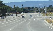
in Saratoga
, north along Quito Road. G2 is not signed along this section and is not commonly recognized as existing along this 2 lane road by either locals or mapmakers. The Quito Road portion is also maintained by the City of Saratoga rather than Santa Clara County
.
As the road leaves Saratoga and enters San Jose
, it widens to a 6 lane county-maintained expressway with a concrete island divider; at this point it becomes Lawrence Expressway. The Lawrence Expressway section from just south of Saratoga Avenue is more readily recognized as G2. Local residents almost exclusively refer to G2 as Lawrence Expressway. The road continues north, with access usually restricted to major intersections which are controlled via traffic light
s.
Lawrence Expressway continues northeasterly and junctions with I-280
and Stevens Creek Boulevard over a complex shared separated grade crossing. Lawrence proceeds under I-280 before immediately rising over Stevens Creek. Lawrence Expressway and Stevens Creek also share ramps for access to I-280 with the exception of the onramp to Southbound I-280 which is accessed directly from Lawrence Expressway, a frequent cause of confusion for drivers on Stevens Creek wishing to access I-280 due to unclear signage. Lawrence Expressway continues north into Santa Clara
and widens to 8 lanes with an HOV
lane occupying the far right lane.
Lawrence Expressway also has another separated grade interchange with El Camino Real
(SR 82
) with Lawrence Expressway passing over El Camino Real just prior to Lawrence Expressway entering Sunnyvale
. Lawrence Expressway also passes under Central Expressway (G6) on a separated grade interchange and over US 101 on a separated grade interchange. The US 101 interchange was recently upgraded to include traffic light control on G2.
G2 reaches its northern terminus at the end of Lawrence Expressway at the SR 237
Freeway. The physical road continues north as Caribbean Drive.
when it was built. At the time of G2's inception SR 85 was in the early planning stages and an interchange had been envisioned at Quito Road. However opposition to the freeway was intense in Saratoga and the planned interchange between SR 85 and G2 along with an interchange further north at Prospect Road were abandoned in favor of the existing Saratoga Avenue interchange. G2 is unsigned from SR 85 to Saratoga Avenue along Quito Road. North of Saratoga Avenue Lawrence Expressway is currently signed as G2.
In the 1990s Lawrence Expressway was widened north of I-280 to 8 lanes to accommodate an HOV carpool lane.
The section of Quito Road between Bucknall Road and Saratoga Avenue in Saratoga is slated for expansion to 3 lanes in the fall of 2006.
of the San Francisco Bay Area
from I-280
to US 101. G3 runs through Palo Alto
, California
, unincorporated Stanford University
lands, and the northwest corner of Los Altos Hills
, California and is part of the Santa Clara County Expressway System.
. East of Foothill Expressway, G3 descends down into the more urban areas of the lower peninsula going through the industrialized area of the Stanford Research Park located in Palo Alto. The road along this section has a reduced speed limit and several turnoffs along its length until it reaches El Camino Real
(SR 82
).
After SR 82, Oregon Expressway branches from Page Mill Road, which becomes a short two-lane street, and G3 follows Oregon Expressway under Caltrain
tracks and onward for the remainder of its northeastward journey. Oregon Expressway resumes expressway status with limited access confined mainly to large intersections. G3 reaches its eastern terminus at its junction with US 101.
Page Mill Road (no longer designated G3) continues southwest of I-280 for 6 miles (9.7 km), a twisting two-lane road that climbs to Skyline Boulevard (SR 35
) at the crest of the Santa Cruz Mountains
. It passes the entrance to Palo Alto's Foothills Park (which is accessible to Palo Alto residents and their guests only) and the Monte Bello
and Los Trancos Open Space Preserve
s. Under the name West Alpine Road, the road descends west of Skyline Boulevard to a turn-off that leads to Portola Redwoods State Park
, where the original Page (saw)mill is located. No artifacts remain at the mill site, which is accessible only by trail, either from Portola Redwoods state park or from Skyline Boulevard (SR 35).
. G4 is part of the Santa Clara County Expressway System.
 G4 begins in the south at its interchange with SR 17 and Camden Avenue as San Tomas Expressway in the city of Campbell
. The road is three lanes wide in each direction, with an HOV carpool lane occupying the right lane, from SR 17 north to El Camino Real
(SR 82
), where it expands to four lanes in each direction with an HOV lane until San Tomas "ends" at US 101. The majority of intersections along San Tomas are at grade controlled by traffic light
s. The only separated grade intersections along San Tomas are at SR 17, US 101, Winchester, and the junction with Central Expressway (G6). G4 intersects at grade with El Camino Real in Santa Clara
. Further north in Santa Clara, G4 crosses US 101 and becomes Montague Expressway.
Montague Expressway is signed as an east–west route, however it is not signed as G4 along its entire length. Montague continues east as an 8 lane road until it crosses Interstate 880 on the San Jose/Milpitas
city line, where it loses a lane to become a 6 lane road. G4 reaches its eastern terminus at Interstate 680
but the physical road continues as Landess Ave. further east until it ends at its intersection with Piedmont Road.
Original plans called for G4 to originate at present day G21's junction with US 101, then head north via present day Capitol Expressway, Hillsdale Avenue, and Camden Avenue where it would have met the present day southern terminus. These plans were never brought to fruition.
From SR 82 south to Interstate 280
, G4 is an unsigned part of the Juan Bautista De Anza National Historic Trail
which follows the route Juan Bautista de Anza
took leading his expedition into California from Mexico in 1775-76 (note: to continue north on the trail you must utilize Saratoga Avenue to access I-280 as G4 has no interchange with the interstate).
. G5 connects Palo Alto
, California
to the Silicon Valley
proper closely paralleling I-280
through the lower Santa Cruz Mountains
foothills. This route is part of the Santa Clara County Expressway System.
in Cupertino
, California
. It proceeds northwest directly east of I-280 making it a viable alternative route for short trips between Cupertino and Palo Alto
. The road is a four-lane expressway along its entire route. Access is generally limited to major intersections that are governed by traffic lights. G5 travels through several affluent neighborhoods in Los Altos
before climbing up into the foothills
to its northern terminus at the intersection with Page Mill Road (G3). The physical road continues north as Junipero Serra Boulevard and passes the back entrances to Stanford University
.
In 1970 one of the first scientifically-designed noise barrier
s in the nation was conceived for Foothill Expressway in a study overseen by the Santa Clara County Public Works Department using Sunnyvale
consultant ESL Inc.
, California
. This designation is a bit odd as Central Expressway parallels US 101, El Camino Real
(SR 82
) and I-280
, all of which are signed north–south. This route is part of the Santa Clara County Expressway System.
. In Palo Alto, G6 remains a major surface street with four lanes of traffic and a center turning lane to service the many driveways and turnoffs available. At the Palo Alto – Mountain View
border at San Antonio Road, G6's character changes, removing the driveways and frequent intersections and adding a center divider, and is renamed Central Expressway. Central continues east as a 4 lane road through the city of Mountain View. Through this section Central Expressway has more at-grade intersections than is typical for a designated expressway. This section's intersections are primarily at-grade with cross streets controlled by traffic lights, although there are some overpasses, such as for San Antonio Road, Shoreline Blvd., Whisman Ave, SR 237
and SR 85
.
Up to this point, the road parallels the Caltrain
rail line, which limits the intersections and driveways on the south side of the road.
After crossing under SR 85
, Central Expressway takes on a very freeway-like appearance (which is not typical for most county roads) for several miles through Sunnyvale
. Through this section Central Expressway has a wide center divider and a sequence of several separated grade interchanges with main cross streets and no turnoffs or driveways. The final in this sequence is at Lawrence Expressway. East of Lawrence Expressway, Central Expressway resumes at grade intersections along with sporadic HOV lanes at the approaches to intersections. Central has one final separated grade interchange with San Tomas Expressway. Central reaches its end at De La Cruz Blvd in Santa Clara, just outside the north end of San Jose International Airport
. Route G6 makes a turn on to De La Cruz for a few hundred feet until it reaches US 101, which serves as the route's eastern terminus.
had been widened as an alternate route. Central Expressway still acts as an alternate route to US 101 through the west valley, however usage has declined as both freeways are now much larger and more direct routes. Construction was completed in 2007 near the eastern terminus widening Central Expressway to accommodate an HOV lane and a reconfiguration of the intersection with Lafayette Street.
Central Expressway is currently signed as G6 sporadically along its entire length.
In 1982, the prohibition against bicyclists using Central Expressway's shoulders was lifted. All pedestrian prohibitions were repealed by 2003.
southeast of Gilroy
. The road is known as Bloomfield Avenue for its entire length, which runs from State Route 25 near US 101 to State Route 152.
, USA to near Downtown San Jose
. G8 runs for 29.4 miles (47 km) over both rural roads, expressway and urban streets, but it is most commonly known by residents for its expressway portion, Almaden Expressway. G8 is also part of the Santa Clara County Expressway System.
in Gilroy
. It proceeds north along Watsonville Road as a two-lane country road until it reaches the intersection of Watsonville Rd and Uvas Road. G8 turns left and proceeds north along Uvas Road which is a winding two-lane mountain road that passes by Uvas, Chesbro and Calero reservoirs and their surrounding parks. In Calero Reservoir County Park, Uvas Road is renamed McKean Road and proceeds into the Almaden Valley
area of San Jose
. At the north end of McKean Rd, G8 turns briefly right on Harry Road for a short distance and then left on to the south end of Almaden Expressway.
As Almaden Expressway G8 expands to a 4-8 lane divided expressway with a large center divider and the majority of access limited to major intersections controlled by traffic signals. The major exception to this is near Highway 85
and Blossom Hill Road (G10) where there are several major shopping centers.
G8 intersects G10 at Blossom Hill Rd and SR 85 a quarter mile north. This interchange is one of the busiest in Silicon Valley
due to several shopping centers and a Costco
warehouse store all sharing driveways with this interchange. G8 continues north resuming its expressway design. G8 shares a separated grade interchange with the terminus of Capitol Expressway Auto Mall and again with Curtner Avenue. Other intersections along this part of the route are at grade. Almaden Expressway crosses State Route 87
with which it shares a northbound only interchange.
G8 continues past the north end of Almaden Expressway on to Almaden Road which is a 4 lane city street. At the intersection Almaden Rd and Alma Avenue, G8 turns east along Alma Ave and proceeds for about a quarter mile to its eastern terminus at First Street (SR 82
).
G8 is signed sporadically along its entire length.
and unincorporated Santa Clara County
. The route runs along Leavesley Road from State Route 152
's northern interchange with US 101 and then curves southward onto Ferguson Road. The route's southern terminus is at Route 152 (Pacheco Pass Highway) east of Gilroy.
, in Silicon Valley
. The route runs for 10.34 miles (16.64 km) and is a city street for its entire length.
(formerly Saratoga Avenue) in Los Gatos
. G10 travels east on Los Gatos-Saratoga Road to the end of that road then turns north east along Los Gatos Boulevard. G10 proceeds for 3/4 of a mile (1.2 km) to Blossom Hill Road where it turns east. Along this stretch, G10 is a narrow road that proceeds over Blossom Hill, the hill that the road takes its name from. At the base of Blossom Hill, G10 enters San Jose
and the Almaden Valley neighborhood.
G10 proceeds as a busy 4-6 lane artery through this area, intersecting Almaden Expressway and further east, through the Blossom Valley neighborhood of San Jose, to SR 85
. Prior to the completion of SR 85 in 1994, which G10 roughly parallels, Blossom Hill Road was the major accessway to this area of San Jose from the west.
G10 reaches its eastern terminus at SR 82
, a few hundred feet (~100 m) shy of US 101. Blossom Hill Road continues to US 101 and then over the freeway becoming Silver Creek Valley Road.
.
. The route runs from Watsonville
and Pajaro
along San Juan Road through the Pajaro Valley and terminates at US 101
south of Aromas
.
and Monterey
Counties. The route, running almost 11 miles (18 km), begins at US 101 near Prunedale
and follows San Miguel Canyon Road 4 miles (6 km) north-northwestward to Hall Road, onto which the route turns westward for 3 miles (5 km) passing through the community of Las Lomas
. This portion arrives at Elkhorn Road, where G12 turns northward for 1 miles (2 km) before joining Salinas Road first to enter Pajaro
, where the route becomes Porter Road, and then to enter Watsonville
, where the route joins Main Street and terminates at State Route 129
.
and San Benito
Counties. The route runs almost 16 miles (26 km) between King City in Monterey County and Route 25 in San Benito County.
, California
, in the southern part of the county to Lake Nacimiento
and then continues into northern San Luis Obispo County connecting to West 24th Street in Paso Robles where it meets U.S. Route 101 and SR 46
near the California Mid-State Fair fairgrounds.
County Route G14 is a California State Scenic Highway
.
. The road parallels US 101 (and therefore El Camino Real
) between King City
and Soledad
, with 101 to the west of the Salinas River
and G15 to the east and following the western foot of the Gabilan Range
.
The route begins at US 101 southeast of King City
and follows First Street through the city, where it intersects County Route G13 and exits the city as Metz Road. G15 follows this road 17 miles (27 km) northwestward, bypassing Greenfield
and terminating at State Route 146
near Soledad.
in Monterey County, California
. The route, beginning in Carmel
, follows Carmel Valley Road along the Carmel River
into the Carmel Valley and southeastward into the community of the same name
, near which the road intersects with Monterey County Route G20. After 41 miles (66 km) the route turns east
ward onto Arroyo Seco Road. Upon entering the Salinas Valley
, G16 joins Elm Avenue, later passing through Greenfield
, crossing the Salinas River
, and terminating at Monterey County Route G15 near the valley's eastern edge.
on both ends.
halfway between Monterey
and Salinas
.
, USA along the eastern side of the Silicon Valley
. Capitol Expressway is part of the Santa Clara County Expressway System.
. Along this section Capitol Expressway is lined with many car dealerships with multiple driveways and turnoffs in addition to at grade crossings with smaller roads. At the interchange with SR 87 the road becomes Capitol Expressway and takes on a more traditional expressway appearance with limited turnoffs and most entrances being solely at large intersections.
Capitol Expressway continues south east to a junction with Highway 101 and then into East San Jose
. In East San Jose Capitol Expressway intersects with I-680
and officially ends at Jackson Avenue, changing names into E. San Antonio Street.
A common misconception is that Capitol Expressway makes an abrupt turn to the northeast toward Alum Rock
. This road is actually called Capitol Avenue and continues on towards Milpitas
and serves as a major corridor through the North Valley. Capitol Avenue reaches its northern terminus in Milpitas at the intersection of Montague Expressway.
In the late 1990s the portion of the Expressway from Almaden Expressway to SR 87 was transferred from Santa Clara County
to the city of San Jose. The road was then renamed Capitol Expressway Auto Mall.
Capitol Expressway is currently unsigned from Almaden Expressway to SR 87 however it is signed east of SR 87.
County routes in California
In the U.S. state of California, county routes are controlled and maintained by the respective counties in which they reside. However, they are generally patrolled by the state's California Highway Patrol....
. The "G" zone includes county highways lying in the counties of Monterey
Monterey County, California
Monterey County is a county located on the Pacific coast of the U.S. state of California, its northwestern section forming the southern half of Monterey Bay. The northern half of the bay is in Santa Cruz County. As of 2010, the population was 415,057. The county seat and largest city is Salinas...
, San Benito
San Benito County, California
San Benito County is a county located in the Coast Range Mountains of the U.S. state of California, south of San Jose. As of 2010 the population was 55,269. The county seat is Hollister, which includes nearly two-thirds of the county's population. El Camino Real passes through the county and...
, San Luis Obispo
San Luis Obispo, California
San Luis Obispo is a city in California, located roughly midway between San Francisco and Los Angeles on the Central Coast. Founded in 1772 by Spanish Fr. Junipero Serra, San Luis Obispo is one of California’s oldest communities...
, Santa Clara
Santa Clara County, California
Santa Clara County is a county located at the southern end of the San Francisco Bay Area in the U.S. state of California. As of 2010 it had a population of 1,781,642. The county seat is San Jose. The highly urbanized Santa Clara Valley within Santa Clara County is also known as Silicon Valley...
, and Santa Cruz
Santa Cruz County, California
Santa Cruz County is a county located on the Pacific coast of the U.S. state of California, on the California Central Coast. The county forms the northern coast of the Monterey Bay. . As of the 2010 U.S. Census, its population was 262,382. The county seat is Santa Cruz...
.
G1
County Route G2, more commonly known as Lawrence Expressway and Quito Road, is a busy 9.7 mile (16 km) long north–south link through Silicon ValleySilicon Valley
Silicon Valley is a term which refers to the southern part of the San Francisco Bay Area in Northern California in the United States. The region is home to many of the world's largest technology corporations...
in Northern California
Northern California
Northern California is the northern portion of the U.S. state of California. The San Francisco Bay Area , and Sacramento as well as its metropolitan area are the main population centers...
. The majority of G2 is part of the Santa Clara County Expressway System.
Route description
G2 runs from the Quito Road overcrossing of SR 85California State Route 85
State Route 85 is a freeway which connects Mountain View and southern San Jose. The entire freeway is named the West Valley Freeway. The majority of the route is also named the Norman Y. Mineta Highway, with the exception of the portion of Highway 85 passing through Saratoga which is named the CHP...
in Saratoga
Saratoga, California
Saratoga is a city in Santa Clara County, California, USA. It is located on the west side of the Santa Clara Valley, directly west of San Jose, in the San Francisco Bay area. The population was 29,926 at the 2010 census....
, north along Quito Road. G2 is not signed along this section and is not commonly recognized as existing along this 2 lane road by either locals or mapmakers. The Quito Road portion is also maintained by the City of Saratoga rather than Santa Clara County
Santa Clara County, California
Santa Clara County is a county located at the southern end of the San Francisco Bay Area in the U.S. state of California. As of 2010 it had a population of 1,781,642. The county seat is San Jose. The highly urbanized Santa Clara Valley within Santa Clara County is also known as Silicon Valley...
.
As the road leaves Saratoga and enters San Jose
San Jose, California
San Jose is the third-largest city in California, the tenth-largest in the U.S., and the county seat of Santa Clara County which is located at the southern end of San Francisco Bay...
, it widens to a 6 lane county-maintained expressway with a concrete island divider; at this point it becomes Lawrence Expressway. The Lawrence Expressway section from just south of Saratoga Avenue is more readily recognized as G2. Local residents almost exclusively refer to G2 as Lawrence Expressway. The road continues north, with access usually restricted to major intersections which are controlled via traffic light
Traffic light
Traffic lights, which may also be known as stoplights, traffic lamps, traffic signals, signal lights, robots or semaphore, are signalling devices positioned at road intersections, pedestrian crossings and other locations to control competing flows of traffic...
s.
Lawrence Expressway continues northeasterly and junctions with I-280
Interstate 280 (California)
Interstate 280 is a 57-mile long north–south Interstate Highway in the San Francisco Bay Area of Northern California. It connects San Jose and San Francisco, running along just to the west of the cities of San Francisco Peninsula for most of its route.I-280 from its northern end at King...
and Stevens Creek Boulevard over a complex shared separated grade crossing. Lawrence proceeds under I-280 before immediately rising over Stevens Creek. Lawrence Expressway and Stevens Creek also share ramps for access to I-280 with the exception of the onramp to Southbound I-280 which is accessed directly from Lawrence Expressway, a frequent cause of confusion for drivers on Stevens Creek wishing to access I-280 due to unclear signage. Lawrence Expressway continues north into Santa Clara
Santa Clara, California
Santa Clara , founded in 1777 and incorporated in 1852, is a city in Santa Clara County, in the U.S. state of California. The city is the site of the eighth of 21 California missions, Mission Santa Clara de Asís, and was named after the mission. The Mission and Mission Gardens are located on the...
and widens to 8 lanes with an HOV
HOV
HOV may refer to:* High-occupancy vehicle lane* Ørsta-Volda Airport, Hovden in Hovden, Norway* Hovig* A small street gang located in Naperville* see Hov...
lane occupying the far right lane.
Lawrence Expressway also has another separated grade interchange with El Camino Real
El Camino Real (California)
El Camino Real and sometimes associated with Calle Real usually refers to the 600-mile California Mission Trail, connecting the former Alta California's 21 missions , 4 presidios, and several pueblos, stretching from Mission San Diego de Alcalá in San Diego...
(SR 82
California State Route 82
State Route 82 is a state highway in the U.S. state of California that runs from U.S. Route 101 at Blossom Hill Road in San Jose to Interstate 280 in San Francisco following the San Francisco Peninsula...
) with Lawrence Expressway passing over El Camino Real just prior to Lawrence Expressway entering Sunnyvale
Sunnyvale, California
Sunnyvale is a city in Santa Clara County, California, United States. It is one of the major cities that make up the Silicon Valley located in the San Francisco Bay Area...
. Lawrence Expressway also passes under Central Expressway (G6) on a separated grade interchange and over US 101 on a separated grade interchange. The US 101 interchange was recently upgraded to include traffic light control on G2.
G2 reaches its northern terminus at the end of Lawrence Expressway at the SR 237
California State Route 237
State Route 237 runs from El Camino Real in Mountain View to Interstate 680 in Milpitas. It runs south of the San Francisco Bay, connecting the East Bay to the Peninsula.This route is part of the California Freeway and Expressway System....
Freeway. The physical road continues north as Caribbean Drive.
History
G2 was first signed as a Santa Clara County Route in 1962. County Route G2 was originally planned to link up with SR 85California State Route 85
State Route 85 is a freeway which connects Mountain View and southern San Jose. The entire freeway is named the West Valley Freeway. The majority of the route is also named the Norman Y. Mineta Highway, with the exception of the portion of Highway 85 passing through Saratoga which is named the CHP...
when it was built. At the time of G2's inception SR 85 was in the early planning stages and an interchange had been envisioned at Quito Road. However opposition to the freeway was intense in Saratoga and the planned interchange between SR 85 and G2 along with an interchange further north at Prospect Road were abandoned in favor of the existing Saratoga Avenue interchange. G2 is unsigned from SR 85 to Saratoga Avenue along Quito Road. North of Saratoga Avenue Lawrence Expressway is currently signed as G2.
In the 1990s Lawrence Expressway was widened north of I-280 to 8 lanes to accommodate an HOV carpool lane.
The section of Quito Road between Bucknall Road and Saratoga Avenue in Saratoga is slated for expansion to 3 lanes in the fall of 2006.
G3
County Route G3, more commonly known as Page Mill Road and Oregon Expressway is a short 4.5 mile (7 km) northeast-southwest arterial route that spans the lower peninsula regionSan Francisco Peninsula
The San Francisco Peninsula is a peninsula in the San Francisco Bay Area that separates the San Francisco Bay from the Pacific Ocean. On its northern tip is the City and County of San Francisco. Its southern base is in Santa Clara County, including the cities of Palo Alto, Los Altos, and Mountain...
of the San Francisco Bay Area
San Francisco Bay Area
The San Francisco Bay Area, commonly known as the Bay Area, is a populated region that surrounds the San Francisco and San Pablo estuaries in Northern California. The region encompasses metropolitan areas of San Francisco, Oakland, and San Jose, along with smaller urban and rural areas...
from I-280
Interstate 280 (California)
Interstate 280 is a 57-mile long north–south Interstate Highway in the San Francisco Bay Area of Northern California. It connects San Jose and San Francisco, running along just to the west of the cities of San Francisco Peninsula for most of its route.I-280 from its northern end at King...
to US 101. G3 runs through Palo Alto
Palo Alto, California
Palo Alto is a California charter city located in the northwest corner of Santa Clara County, in the San Francisco Bay Area of California, United States. The city shares its borders with East Palo Alto, Mountain View, Los Altos, Los Altos Hills, Stanford, Portola Valley, and Menlo Park. It is...
, California
California
California is a state located on the West Coast of the United States. It is by far the most populous U.S. state, and the third-largest by land area...
, unincorporated Stanford University
Stanford University
The Leland Stanford Junior University, commonly referred to as Stanford University or Stanford, is a private research university on an campus located near Palo Alto, California. It is situated in the northwestern Santa Clara Valley on the San Francisco Peninsula, approximately northwest of San...
lands, and the northwest corner of Los Altos Hills
Los Altos Hills, California
Los Altos Hills is an incorporated town in Santa Clara County, California, United States. The population was 7,922 at the 2010 census. Located in Silicon Valley, Los Altos Hills is one of the wealthiest cities in the nation.-Strictly residential:...
, California and is part of the Santa Clara County Expressway System.
Route description
G3 begins in the west at its interchange with I-280 in Los Altos Hills just south of Stanford University. It proceeds northeast as a four lane expressway over the rolling hills of Stanford University until it reaches Foothill Expressway (G5) with which it shares an at-grade intersectionAt-grade intersection
An at-grade intersection is a junction at which two or more transport axes cross at the same level .-Traffic management:With areas of high or fast traffic, an at-grade intersection normally requires a traffic control device such as a stop sign, traffic light or railway signal to manage conflicting...
. East of Foothill Expressway, G3 descends down into the more urban areas of the lower peninsula going through the industrialized area of the Stanford Research Park located in Palo Alto. The road along this section has a reduced speed limit and several turnoffs along its length until it reaches El Camino Real
El Camino Real (California)
El Camino Real and sometimes associated with Calle Real usually refers to the 600-mile California Mission Trail, connecting the former Alta California's 21 missions , 4 presidios, and several pueblos, stretching from Mission San Diego de Alcalá in San Diego...
(SR 82
California State Route 82
State Route 82 is a state highway in the U.S. state of California that runs from U.S. Route 101 at Blossom Hill Road in San Jose to Interstate 280 in San Francisco following the San Francisco Peninsula...
).
After SR 82, Oregon Expressway branches from Page Mill Road, which becomes a short two-lane street, and G3 follows Oregon Expressway under Caltrain
Caltrain
Caltrain is a California commuter rail line on the San Francisco Peninsula and in the Santa Clara Valley in the United States. The northern terminus of the rail line is in San Francisco, at 4th and King streets; its southern terminus is in Gilroy...
tracks and onward for the remainder of its northeastward journey. Oregon Expressway resumes expressway status with limited access confined mainly to large intersections. G3 reaches its eastern terminus at its junction with US 101.
Page Mill Road (no longer designated G3) continues southwest of I-280 for 6 miles (9.7 km), a twisting two-lane road that climbs to Skyline Boulevard (SR 35
California State Route 35
State Route 35 in the U.S. state of California, generally known as Skyline Boulevard, is a two-lane road running along the western ridge of Silicon Valley in California. It runs from Highway 17 to San Francisco at State Route 1. It provides scenic views of both the Santa Cruz Mountains, the...
) at the crest of the Santa Cruz Mountains
Santa Cruz Mountains
The Santa Cruz Mountains, part of the Pacific Coast Ranges, are a mountain range in central California, United States. They form a ridge along the San Francisco Peninsula, south of San Francisco, separating the Pacific Ocean from San Francisco Bay and the Santa Clara Valley, and continuing south,...
. It passes the entrance to Palo Alto's Foothills Park (which is accessible to Palo Alto residents and their guests only) and the Monte Bello
Monte Bello Open Space Preserve
Monte Bello Open Space Preserve is a open space preserve, located near Palo Alto in the Santa Cruz Mountains, in San Mateo and Santa Clara Counties, California. The preserve encompasses the upper Stevens Creek watershed in the valley between Monte Bello Ridge and Skyline Ridge...
and Los Trancos Open Space Preserve
Los Trancos Open Space Preserve
Los Trancos Open Space Preserve is a 274-acre open space preserve, located in San Mateo and Santa Clara Counties, California, near Los Altos Hills, California. The preserve contains about 5 miles of hiking trails, of which 2.1 miles are open to equestrians, and none are open to bicycles.The area...
s. Under the name West Alpine Road, the road descends west of Skyline Boulevard to a turn-off that leads to Portola Redwoods State Park
Portola Redwoods State Park
Portola Redwoods State Park is a California state park, located in San Mateo County. Peters Creek and Pescadero Creek meet in Portola, and are the park's primary watercourses, and feature numerous tributaries. Tip Toe Falls is a small waterfall along Fall Creek, a tributary of Pescadero Creek...
, where the original Page (saw)mill is located. No artifacts remain at the mill site, which is accessible only by trail, either from Portola Redwoods state park or from Skyline Boulevard (SR 35).
History
This route was designated in 1962. G3 is currently signed its entire length. It was originally known as Mayfield-Pescadero Road.G4
County Route G4, more commonly referred to as San Tomas Expressway and Montague Expressway is a busy 14.5 mile (23 km) long link across Silicon ValleySilicon Valley
Silicon Valley is a term which refers to the southern part of the San Francisco Bay Area in Northern California in the United States. The region is home to many of the world's largest technology corporations...
. G4 is part of the Santa Clara County Expressway System.
Route description
Campbell, California
Campbell is a city in Santa Clara County, California, a suburb of San Jose, and part of Silicon Valley, in the San Francisco Bay Area. As of the 2010 U.S. Census, Campbell's population is 39,349...
. The road is three lanes wide in each direction, with an HOV carpool lane occupying the right lane, from SR 17 north to El Camino Real
El Camino Real (California)
El Camino Real and sometimes associated with Calle Real usually refers to the 600-mile California Mission Trail, connecting the former Alta California's 21 missions , 4 presidios, and several pueblos, stretching from Mission San Diego de Alcalá in San Diego...
(SR 82
California State Route 82
State Route 82 is a state highway in the U.S. state of California that runs from U.S. Route 101 at Blossom Hill Road in San Jose to Interstate 280 in San Francisco following the San Francisco Peninsula...
), where it expands to four lanes in each direction with an HOV lane until San Tomas "ends" at US 101. The majority of intersections along San Tomas are at grade controlled by traffic light
Traffic light
Traffic lights, which may also be known as stoplights, traffic lamps, traffic signals, signal lights, robots or semaphore, are signalling devices positioned at road intersections, pedestrian crossings and other locations to control competing flows of traffic...
s. The only separated grade intersections along San Tomas are at SR 17, US 101, Winchester, and the junction with Central Expressway (G6). G4 intersects at grade with El Camino Real in Santa Clara
Santa Clara, California
Santa Clara , founded in 1777 and incorporated in 1852, is a city in Santa Clara County, in the U.S. state of California. The city is the site of the eighth of 21 California missions, Mission Santa Clara de Asís, and was named after the mission. The Mission and Mission Gardens are located on the...
. Further north in Santa Clara, G4 crosses US 101 and becomes Montague Expressway.
Montague Expressway is signed as an east–west route, however it is not signed as G4 along its entire length. Montague continues east as an 8 lane road until it crosses Interstate 880 on the San Jose/Milpitas
Milpitas, California
Milpitas is a city in Santa Clara County, California. It is a suburb of the major city of San Jose, California. It is located with San Jose to its south and Fremont to its north, at the eastern end of State Route 237 and generally between Interstates 680 and 880 which run roughly north/south...
city line, where it loses a lane to become a 6 lane road. G4 reaches its eastern terminus at Interstate 680
Interstate 680 (California)
Interstate 680 is a north–south Interstate Highway in Northern California. It curves around the eastern cities of the San Francisco Bay Area from San Jose to Interstate 80 at Cordelia, bypassing cities along the eastern shore of San Francisco Bay such as Oakland and Richmond while serving...
but the physical road continues as Landess Ave. further east until it ends at its intersection with Piedmont Road.
History
G4 was designated and signed in 1962 along the San Tomas portions. Montague was designated later around 1978. Whether this has anything to do with Montague not being physically signed as G4 is uncertain. Emergency Call boxes along Montague however are labeled as being on G4 leaving no doubt that Montague is part of G4.Original plans called for G4 to originate at present day G21's junction with US 101, then head north via present day Capitol Expressway, Hillsdale Avenue, and Camden Avenue where it would have met the present day southern terminus. These plans were never brought to fruition.
From SR 82 south to Interstate 280
Interstate 280 (California)
Interstate 280 is a 57-mile long north–south Interstate Highway in the San Francisco Bay Area of Northern California. It connects San Jose and San Francisco, running along just to the west of the cities of San Francisco Peninsula for most of its route.I-280 from its northern end at King...
, G4 is an unsigned part of the Juan Bautista De Anza National Historic Trail
Juan Bautista de Anza National Historic Trail
thumb|325px|MAP: [[Juan Bautista de Anza]] National Historic Trail routes in [[Arizona]] and [[California]].The Juan Bautista de Anza National Historic Trail is a National Park Service unit in the United States National Historic Trail and National Millennium Trail programs...
which follows the route Juan Bautista de Anza
Juan Bautista de Anza
Juan Bautista de Anza Bezerra Nieto was a Novo-Spanish explorer and Governor of New Mexico for the Spanish Empire.-Early life:...
took leading his expedition into California from Mexico in 1775-76 (note: to continue north on the trail you must utilize Saratoga Avenue to access I-280 as G4 has no interchange with the interstate).
G5
County Route G5, more often referred to as Foothill Expressway, is a 4 lane, 7.24 mile (11.6 km) long, northwest-southeast route in Santa Clara CountySanta Clara County, California
Santa Clara County is a county located at the southern end of the San Francisco Bay Area in the U.S. state of California. As of 2010 it had a population of 1,781,642. The county seat is San Jose. The highly urbanized Santa Clara Valley within Santa Clara County is also known as Silicon Valley...
. G5 connects Palo Alto
Palo Alto, California
Palo Alto is a California charter city located in the northwest corner of Santa Clara County, in the San Francisco Bay Area of California, United States. The city shares its borders with East Palo Alto, Mountain View, Los Altos, Los Altos Hills, Stanford, Portola Valley, and Menlo Park. It is...
, California
California
California is a state located on the West Coast of the United States. It is by far the most populous U.S. state, and the third-largest by land area...
to the Silicon Valley
Silicon Valley
Silicon Valley is a term which refers to the southern part of the San Francisco Bay Area in Northern California in the United States. The region is home to many of the world's largest technology corporations...
proper closely paralleling I-280
Interstate 280 (California)
Interstate 280 is a 57-mile long north–south Interstate Highway in the San Francisco Bay Area of Northern California. It connects San Jose and San Francisco, running along just to the west of the cities of San Francisco Peninsula for most of its route.I-280 from its northern end at King...
through the lower Santa Cruz Mountains
Santa Cruz Mountains
The Santa Cruz Mountains, part of the Pacific Coast Ranges, are a mountain range in central California, United States. They form a ridge along the San Francisco Peninsula, south of San Francisco, separating the Pacific Ocean from San Francisco Bay and the Santa Clara Valley, and continuing south,...
foothills. This route is part of the Santa Clara County Expressway System.
Route description
G5 begins at its southeastern end at I-280Interstate 280 (California)
Interstate 280 is a 57-mile long north–south Interstate Highway in the San Francisco Bay Area of Northern California. It connects San Jose and San Francisco, running along just to the west of the cities of San Francisco Peninsula for most of its route.I-280 from its northern end at King...
in Cupertino
Cupertino, California
Cupertino is an affluent suburban city in Santa Clara County, California in the U.S., directly west of San Jose on the western edge of the Santa Clara Valley with portions extending into the foothills of the Santa Cruz Mountains. The population was 58,302 at the time of the 2010 census. Forbes...
, California
California
California is a state located on the West Coast of the United States. It is by far the most populous U.S. state, and the third-largest by land area...
. It proceeds northwest directly east of I-280 making it a viable alternative route for short trips between Cupertino and Palo Alto
Palo Alto, California
Palo Alto is a California charter city located in the northwest corner of Santa Clara County, in the San Francisco Bay Area of California, United States. The city shares its borders with East Palo Alto, Mountain View, Los Altos, Los Altos Hills, Stanford, Portola Valley, and Menlo Park. It is...
. The road is a four-lane expressway along its entire route. Access is generally limited to major intersections that are governed by traffic lights. G5 travels through several affluent neighborhoods in Los Altos
Los Altos, California
Los Altos is a city at the southern end of the San Francisco Peninsula, in the San Francisco Bay Area. The city is in Santa Clara County, California, United States. The population was 28,976 according to the 2010 census....
before climbing up into the foothills
Foothills
Foothills are geographically defined as gradual increases in elevation at the base of a mountain range. They are a transition zone between plains and low relief hills to the adjacent topographically high mountains.-Examples:...
to its northern terminus at the intersection with Page Mill Road (G3). The physical road continues north as Junipero Serra Boulevard and passes the back entrances to Stanford University
Stanford University
The Leland Stanford Junior University, commonly referred to as Stanford University or Stanford, is a private research university on an campus located near Palo Alto, California. It is situated in the northwestern Santa Clara Valley on the San Francisco Peninsula, approximately northwest of San...
.
History
G5 was designated in 1962 and is currently signed its entire length. The route was built upon the right-of-way for the Los Altos branch of the Peninsular Railway. The buildings along the route at Loyola Corners in Los Altos are historical railroad station buildings.In 1970 one of the first scientifically-designed noise barrier
Noise barrier
A noise barrier is an exterior structure designed to protect sensitive land uses from noise pollution...
s in the nation was conceived for Foothill Expressway in a study overseen by the Santa Clara County Public Works Department using Sunnyvale
Sunnyvale, California
Sunnyvale is a city in Santa Clara County, California, United States. It is one of the major cities that make up the Silicon Valley located in the San Francisco Bay Area...
consultant ESL Inc.
G6
County Route G6, which comprises Central Expressway and part of Alma Street in Palo Alto is signed as a 12.3 miles (19.8 km) long, east–west route in the western portion of Silicon ValleySilicon Valley
Silicon Valley is a term which refers to the southern part of the San Francisco Bay Area in Northern California in the United States. The region is home to many of the world's largest technology corporations...
, California
California
California is a state located on the West Coast of the United States. It is by far the most populous U.S. state, and the third-largest by land area...
. This designation is a bit odd as Central Expressway parallels US 101, El Camino Real
El Camino Real (California)
El Camino Real and sometimes associated with Calle Real usually refers to the 600-mile California Mission Trail, connecting the former Alta California's 21 missions , 4 presidios, and several pueblos, stretching from Mission San Diego de Alcalá in San Diego...
(SR 82
California State Route 82
State Route 82 is a state highway in the U.S. state of California that runs from U.S. Route 101 at Blossom Hill Road in San Jose to Interstate 280 in San Francisco following the San Francisco Peninsula...
) and I-280
Interstate 280 (California)
Interstate 280 is a 57-mile long north–south Interstate Highway in the San Francisco Bay Area of Northern California. It connects San Jose and San Francisco, running along just to the west of the cities of San Francisco Peninsula for most of its route.I-280 from its northern end at King...
, all of which are signed north–south. This route is part of the Santa Clara County Expressway System.
Route description
Route G6 actually begins in the west at Oregon Expressway as Alma Street in Palo AltoPalo Alto, California
Palo Alto is a California charter city located in the northwest corner of Santa Clara County, in the San Francisco Bay Area of California, United States. The city shares its borders with East Palo Alto, Mountain View, Los Altos, Los Altos Hills, Stanford, Portola Valley, and Menlo Park. It is...
. In Palo Alto, G6 remains a major surface street with four lanes of traffic and a center turning lane to service the many driveways and turnoffs available. At the Palo Alto – Mountain View
Mountain View, California
-Downtown:Mountain View has a pedestrian-friendly downtown centered on Castro Street. The downtown area consists of the seven blocks of Castro Street from the Downtown Mountain View Station transit center in the north to the intersection with El Camino Real in the south...
border at San Antonio Road, G6's character changes, removing the driveways and frequent intersections and adding a center divider, and is renamed Central Expressway. Central continues east as a 4 lane road through the city of Mountain View. Through this section Central Expressway has more at-grade intersections than is typical for a designated expressway. This section's intersections are primarily at-grade with cross streets controlled by traffic lights, although there are some overpasses, such as for San Antonio Road, Shoreline Blvd., Whisman Ave, SR 237
California State Route 237
State Route 237 runs from El Camino Real in Mountain View to Interstate 680 in Milpitas. It runs south of the San Francisco Bay, connecting the East Bay to the Peninsula.This route is part of the California Freeway and Expressway System....
and SR 85
California State Route 85
State Route 85 is a freeway which connects Mountain View and southern San Jose. The entire freeway is named the West Valley Freeway. The majority of the route is also named the Norman Y. Mineta Highway, with the exception of the portion of Highway 85 passing through Saratoga which is named the CHP...
.
Up to this point, the road parallels the Caltrain
Caltrain
Caltrain is a California commuter rail line on the San Francisco Peninsula and in the Santa Clara Valley in the United States. The northern terminus of the rail line is in San Francisco, at 4th and King streets; its southern terminus is in Gilroy...
rail line, which limits the intersections and driveways on the south side of the road.
After crossing under SR 85
California State Route 85
State Route 85 is a freeway which connects Mountain View and southern San Jose. The entire freeway is named the West Valley Freeway. The majority of the route is also named the Norman Y. Mineta Highway, with the exception of the portion of Highway 85 passing through Saratoga which is named the CHP...
, Central Expressway takes on a very freeway-like appearance (which is not typical for most county roads) for several miles through Sunnyvale
Sunnyvale, California
Sunnyvale is a city in Santa Clara County, California, United States. It is one of the major cities that make up the Silicon Valley located in the San Francisco Bay Area...
. Through this section Central Expressway has a wide center divider and a sequence of several separated grade interchanges with main cross streets and no turnoffs or driveways. The final in this sequence is at Lawrence Expressway. East of Lawrence Expressway, Central Expressway resumes at grade intersections along with sporadic HOV lanes at the approaches to intersections. Central has one final separated grade interchange with San Tomas Expressway. Central reaches its end at De La Cruz Blvd in Santa Clara, just outside the north end of San Jose International Airport
San Jose International Airport
Norman Y. Mineta San Jose International Airport is a city-owned public-use airport serving the city of San Jose in Santa Clara County, California, United States. It is named for San Jose native Norman Yoshio Mineta, who was Transportation Secretary in the Cabinet of George W...
. Route G6 makes a turn on to De La Cruz for a few hundred feet until it reaches US 101, which serves as the route's eastern terminus.
History
Central Expressway was first designated in 1962. Central Expressway was a vital route through the western Silicon Valley in the days before US 101 and I-280Interstate 280 (California)
Interstate 280 is a 57-mile long north–south Interstate Highway in the San Francisco Bay Area of Northern California. It connects San Jose and San Francisco, running along just to the west of the cities of San Francisco Peninsula for most of its route.I-280 from its northern end at King...
had been widened as an alternate route. Central Expressway still acts as an alternate route to US 101 through the west valley, however usage has declined as both freeways are now much larger and more direct routes. Construction was completed in 2007 near the eastern terminus widening Central Expressway to accommodate an HOV lane and a reconfiguration of the intersection with Lafayette Street.
Central Expressway is currently signed as G6 sporadically along its entire length.
In 1982, the prohibition against bicyclists using Central Expressway's shoulders was lifted. All pedestrian prohibitions were repealed by 2003.
G7
County Route G7 is a road in Santa Clara CountySanta Clara County, California
Santa Clara County is a county located at the southern end of the San Francisco Bay Area in the U.S. state of California. As of 2010 it had a population of 1,781,642. The county seat is San Jose. The highly urbanized Santa Clara Valley within Santa Clara County is also known as Silicon Valley...
southeast of Gilroy
Gilroy, California
Gilroy is the southernmost city in Santa Clara County, California, United States. The population was 48,821 at the 2010 census. Gilroy is well-known for its garlic crop and for the annual Gilroy Garlic Festival, featuring various garlicky foods, including garlic ice cream. Gilroy also produces...
. The road is known as Bloomfield Avenue for its entire length, which runs from State Route 25 near US 101 to State Route 152.
G8
County Route G8 is an important north–south arterial from the south valley area of Santa Clara County, CaliforniaSanta Clara County, California
Santa Clara County is a county located at the southern end of the San Francisco Bay Area in the U.S. state of California. As of 2010 it had a population of 1,781,642. The county seat is San Jose. The highly urbanized Santa Clara Valley within Santa Clara County is also known as Silicon Valley...
, USA to near Downtown San Jose
Downtown San Jose
Downtown San Jose is the central business district of San Jose, California, United States. The area is generally located north of Interstate 280 and east of Guadalupe Parkway, which roughly parallels the Guadalupe River. The region is bound to the north by U.S...
. G8 runs for 29.4 miles (47 km) over both rural roads, expressway and urban streets, but it is most commonly known by residents for its expressway portion, Almaden Expressway. G8 is also part of the Santa Clara County Expressway System.
Route description
G8 begins in the south at the its junction with State Route 152California State Route 152
State Route 152 is a state highway that runs near the latitudinal middle of the U.S. state of California from Watsonville to Route 99 southeast of Merced...
in Gilroy
Gilroy, California
Gilroy is the southernmost city in Santa Clara County, California, United States. The population was 48,821 at the 2010 census. Gilroy is well-known for its garlic crop and for the annual Gilroy Garlic Festival, featuring various garlicky foods, including garlic ice cream. Gilroy also produces...
. It proceeds north along Watsonville Road as a two-lane country road until it reaches the intersection of Watsonville Rd and Uvas Road. G8 turns left and proceeds north along Uvas Road which is a winding two-lane mountain road that passes by Uvas, Chesbro and Calero reservoirs and their surrounding parks. In Calero Reservoir County Park, Uvas Road is renamed McKean Road and proceeds into the Almaden Valley
Almaden Valley, San Jose, California
Almaden Valley is an upper-class neighborhood of about 37,000 in the southwestern portion of San Jose, California, USA, roughly equivalent to the 95120 ZIP Code. The neighborhood is south east of the town of Los Gatos, west of the Santa Teresa neighborhood of San Jose and south of Coleman Ave...
area of San Jose
San Jose, California
San Jose is the third-largest city in California, the tenth-largest in the U.S., and the county seat of Santa Clara County which is located at the southern end of San Francisco Bay...
. At the north end of McKean Rd, G8 turns briefly right on Harry Road for a short distance and then left on to the south end of Almaden Expressway.
As Almaden Expressway G8 expands to a 4-8 lane divided expressway with a large center divider and the majority of access limited to major intersections controlled by traffic signals. The major exception to this is near Highway 85
California State Route 85
State Route 85 is a freeway which connects Mountain View and southern San Jose. The entire freeway is named the West Valley Freeway. The majority of the route is also named the Norman Y. Mineta Highway, with the exception of the portion of Highway 85 passing through Saratoga which is named the CHP...
and Blossom Hill Road (G10) where there are several major shopping centers.
G8 intersects G10 at Blossom Hill Rd and SR 85 a quarter mile north. This interchange is one of the busiest in Silicon Valley
Silicon Valley
Silicon Valley is a term which refers to the southern part of the San Francisco Bay Area in Northern California in the United States. The region is home to many of the world's largest technology corporations...
due to several shopping centers and a Costco
Costco
Costco Wholesale Corporation is the largest membership warehouse club chain in the United States. it is the third largest retailer in the United States, where it originated, and the ninth largest in the world...
warehouse store all sharing driveways with this interchange. G8 continues north resuming its expressway design. G8 shares a separated grade interchange with the terminus of Capitol Expressway Auto Mall and again with Curtner Avenue. Other intersections along this part of the route are at grade. Almaden Expressway crosses State Route 87
California State Route 87
State Route 87 , locally called Highway 87 or the Guadalupe Freeway, is a north–south state highway entirely within San Jose, California, United States. Its name was changed from Guadalupe Parkway in 2004 after its entire constructed length was upgraded to a freeway...
with which it shares a northbound only interchange.
G8 continues past the north end of Almaden Expressway on to Almaden Road which is a 4 lane city street. At the intersection Almaden Rd and Alma Avenue, G8 turns east along Alma Ave and proceeds for about a quarter mile to its eastern terminus at First Street (SR 82
California State Route 82
State Route 82 is a state highway in the U.S. state of California that runs from U.S. Route 101 at Blossom Hill Road in San Jose to Interstate 280 in San Francisco following the San Francisco Peninsula...
).
History
G8 was originally designated in 1962 along Almaden Expwy which had begun construction in 1959. Almaden Expwy was not completed to its southern terminus until 1984. Before that time the section between McKean Rd and the southern end of the expressway (which was further north at the time) took a zig zag path from McKean Rd to Harry Rd to Almaden Road (S) to Barnes Lane, to the then southern end of Almaden Expwy.G8 is signed sporadically along its entire length.
G9
County Route G9 is a county road in GilroyGilroy, California
Gilroy is the southernmost city in Santa Clara County, California, United States. The population was 48,821 at the 2010 census. Gilroy is well-known for its garlic crop and for the annual Gilroy Garlic Festival, featuring various garlicky foods, including garlic ice cream. Gilroy also produces...
and unincorporated Santa Clara County
Santa Clara County, California
Santa Clara County is a county located at the southern end of the San Francisco Bay Area in the U.S. state of California. As of 2010 it had a population of 1,781,642. The county seat is San Jose. The highly urbanized Santa Clara Valley within Santa Clara County is also known as Silicon Valley...
. The route runs along Leavesley Road from State Route 152
California State Route 152
State Route 152 is a state highway that runs near the latitudinal middle of the U.S. state of California from Watsonville to Route 99 southeast of Merced...
's northern interchange with US 101 and then curves southward onto Ferguson Road. The route's southern terminus is at Route 152 (Pacheco Pass Highway) east of Gilroy.
G10
County Route G10, more commonly known along the majority of its route as Blossom Hill Road for the majority of its length is an important east–west arterial roadway through the Almaden Valley area of Santa Clara County, CaliforniaSanta Clara County, California
Santa Clara County is a county located at the southern end of the San Francisco Bay Area in the U.S. state of California. As of 2010 it had a population of 1,781,642. The county seat is San Jose. The highly urbanized Santa Clara Valley within Santa Clara County is also known as Silicon Valley...
, in Silicon Valley
Silicon Valley
Silicon Valley is a term which refers to the southern part of the San Francisco Bay Area in Northern California in the United States. The region is home to many of the world's largest technology corporations...
. The route runs for 10.34 miles (16.64 km) and is a city street for its entire length.
Route description
G10 begins at its western end at the junction of SR 17 and Los Gatos-Saratoga RoadCalifornia State Route 9
State Route 9 is mainly a rural and mountainous route in the U.S. state of California that travels 35 miles from SR 1 near Santa Cruz to SR 17 in Los Gatos, passing through the San Lorenzo Valley and the Saratoga Gap...
(formerly Saratoga Avenue) in Los Gatos
Los Gatos, California
The Town of Los Gatos is an incorporated town in Santa Clara County, California, United States. The population was 29,413 at the 2010 census. It is located in the San Francisco Bay Area at the southwest corner of San Jose in the foothills of the Santa Cruz Mountains...
. G10 travels east on Los Gatos-Saratoga Road to the end of that road then turns north east along Los Gatos Boulevard. G10 proceeds for 3/4 of a mile (1.2 km) to Blossom Hill Road where it turns east. Along this stretch, G10 is a narrow road that proceeds over Blossom Hill, the hill that the road takes its name from. At the base of Blossom Hill, G10 enters San Jose
San Jose, California
San Jose is the third-largest city in California, the tenth-largest in the U.S., and the county seat of Santa Clara County which is located at the southern end of San Francisco Bay...
and the Almaden Valley neighborhood.
G10 proceeds as a busy 4-6 lane artery through this area, intersecting Almaden Expressway and further east, through the Blossom Valley neighborhood of San Jose, to SR 85
California State Route 85
State Route 85 is a freeway which connects Mountain View and southern San Jose. The entire freeway is named the West Valley Freeway. The majority of the route is also named the Norman Y. Mineta Highway, with the exception of the portion of Highway 85 passing through Saratoga which is named the CHP...
. Prior to the completion of SR 85 in 1994, which G10 roughly parallels, Blossom Hill Road was the major accessway to this area of San Jose from the west.
G10 reaches its eastern terminus at SR 82
California State Route 82
State Route 82 is a state highway in the U.S. state of California that runs from U.S. Route 101 at Blossom Hill Road in San Jose to Interstate 280 in San Francisco following the San Francisco Peninsula...
, a few hundred feet (~100 m) shy of US 101. Blossom Hill Road continues to US 101 and then over the freeway becoming Silver Creek Valley Road.
History
G10 was designated in 1964 as a county road. As of 2005, however, the road is no longer maintained by the county and is city street along its entire length. G10 is also only sporadically signed along its route and has been largely abandoned by the county after the completion of SR 85California State Route 85
State Route 85 is a freeway which connects Mountain View and southern San Jose. The entire freeway is named the West Valley Freeway. The majority of the route is also named the Norman Y. Mineta Highway, with the exception of the portion of Highway 85 passing through Saratoga which is named the CHP...
.
G11
County Route G11 is a road in unincorporated Monterey CountyMonterey County, California
Monterey County is a county located on the Pacific coast of the U.S. state of California, its northwestern section forming the southern half of Monterey Bay. The northern half of the bay is in Santa Cruz County. As of 2010, the population was 415,057. The county seat and largest city is Salinas...
. The route runs from Watsonville
Watsonville, California
Watsonville is a city in Santa Cruz County, California, United States. The population was 51,199 according to the 2010 census.Located on the central coast of California, the economy centers predominantly around the farming industry. It is known for growing strawberries, apples, lettuce and a host...
and Pajaro
Pajaro, California
Pajaro is a census-designated place in Monterey County, California, United States. Pajaro is located on the south bank of the Pajaro River northeast of its mouth, at an elevation of 26 feet . The population was 3,070 at the 2010 census, down from 3,384 at the 2000 census...
along San Juan Road through the Pajaro Valley and terminates at US 101
U.S. Route 101
U.S. Route 101, or U.S. Highway 101, is an important north–south U.S. highway that runs through the states of California, Oregon, and Washington, on the West Coast of the United States...
south of Aromas
Aromas, California
Aromas is a census-designated place in Monterey County, and San Benito County, California, United States. The CDP straddles the border of the two counties, with Monterey County to the west and San Benito County to the east. The Santa Cruz County line is less than a mile to the Northwest, and...
.
G12
County Route G12 is a road in Santa CruzSanta Cruz County, California
Santa Cruz County is a county located on the Pacific coast of the U.S. state of California, on the California Central Coast. The county forms the northern coast of the Monterey Bay. . As of the 2010 U.S. Census, its population was 262,382. The county seat is Santa Cruz...
and Monterey
Monterey County, California
Monterey County is a county located on the Pacific coast of the U.S. state of California, its northwestern section forming the southern half of Monterey Bay. The northern half of the bay is in Santa Cruz County. As of 2010, the population was 415,057. The county seat and largest city is Salinas...
Counties. The route, running almost 11 miles (18 km), begins at US 101 near Prunedale
Prunedale, California
Prunedale is a census-designated place in Monterey County, California, United States. Prunedale is located north of Salinas, at an elevation of 92 feet . The population was 17,560 residents at the time of the 2010 census, up from 16,432 at the 2000 census...
and follows San Miguel Canyon Road 4 miles (6 km) north-northwestward to Hall Road, onto which the route turns westward for 3 miles (5 km) passing through the community of Las Lomas
Las Lomas, California
Las Lomas is a census-designated place in Monterey County, California, United States. Las Lomas is located north-northwest of Prunedale, at an elevation of 43 feet...
. This portion arrives at Elkhorn Road, where G12 turns northward for 1 miles (2 km) before joining Salinas Road first to enter Pajaro
Pajaro, California
Pajaro is a census-designated place in Monterey County, California, United States. Pajaro is located on the south bank of the Pajaro River northeast of its mouth, at an elevation of 26 feet . The population was 3,070 at the 2010 census, down from 3,384 at the 2000 census...
, where the route becomes Porter Road, and then to enter Watsonville
Watsonville, California
Watsonville is a city in Santa Cruz County, California, United States. The population was 51,199 according to the 2010 census.Located on the central coast of California, the economy centers predominantly around the farming industry. It is known for growing strawberries, apples, lettuce and a host...
, where the route joins Main Street and terminates at State Route 129
California State Route 129
State Route 129 is a state highway in the U.S. state of California in Santa Cruz County. The highway connects State Route 1 in Watsonville east to U.S. Route 101.-Route description:...
.
G13
County Route G13 is a county road in MontereyMonterey County, California
Monterey County is a county located on the Pacific coast of the U.S. state of California, its northwestern section forming the southern half of Monterey Bay. The northern half of the bay is in Santa Cruz County. As of 2010, the population was 415,057. The county seat and largest city is Salinas...
and San Benito
San Benito County, California
San Benito County is a county located in the Coast Range Mountains of the U.S. state of California, south of San Jose. As of 2010 the population was 55,269. The county seat is Hollister, which includes nearly two-thirds of the county's population. El Camino Real passes through the county and...
Counties. The route runs almost 16 miles (26 km) between King City in Monterey County and Route 25 in San Benito County.
G14
County Route G14, running approximately 62 miles (100 km), connects the Mission San Antonio area northwest of JolonJolon, California
Jolon is an unincorporated community in Monterey County, California. It is located south of King City, at an elevation of 971 feet . Jolon is located in the Salinas Valley in a rural area located about 6 miles from Mission San Antonio de Padua, and is part of Fort Hunter Liggett.The town was...
, California
California
California is a state located on the West Coast of the United States. It is by far the most populous U.S. state, and the third-largest by land area...
, in the southern part of the county to Lake Nacimiento
Lake Nacimiento
Lake Nacimiento is an long lake on the Nacimiento River in northern San Luis Obispo County, California. The lake contains many arms including Snake Creek and Dip Creek, nearer the dam, and the central Las Tablas and Franklin Creeks. Because of the dragon-like shape created by the positions of...
and then continues into northern San Luis Obispo County connecting to West 24th Street in Paso Robles where it meets U.S. Route 101 and SR 46
California State Route 46
State Route 46 is an east–west state highway in the U.S. state of California. It is a major crossing of the Coast Ranges, connecting SR 1 on the Central Coast near Cambria and US 101 in Paso Robles with SR 99 at Famoso in the San Joaquin Valley. East of Paso Robles, where it carried U.S...
near the California Mid-State Fair fairgrounds.
County Route G14 is a California State Scenic Highway
State Scenic Highway System (California)
The State Scenic Highway System is a list of highways, mainly state highways, that have been designated by the California Department of Transportation as scenic highways. The California State Legislature, primarily through Section 263 of the Streets and Highways Code, makes highways eligible for...
.
G15
Monterey County Route G15 is a road running almost 19 miles (31 km) along the eastern edge of the Salinas ValleySalinas Valley
The Salinas Valley lies south of San Francisco, California.The word "salina" is spanish for salt marsh, salt lake or salt pan.-Geography:The Salinas Valley runs approximately south-east from Salinas towards King City. The valley lends its name to the geologic province in which it's located, the...
. The road parallels US 101 (and therefore El Camino Real
El Camino Real (California)
El Camino Real and sometimes associated with Calle Real usually refers to the 600-mile California Mission Trail, connecting the former Alta California's 21 missions , 4 presidios, and several pueblos, stretching from Mission San Diego de Alcalá in San Diego...
) between King City
King City, California
King City is a city in Monterey County, California, United States. King City is located on the Salinas River southeast of Salinas, at an elevation of 335 feet . It lies along U.S. Route 101 in the Salinas Valley of the Central Coast of California. King City is a member of the Association of...
and Soledad
Soledad, California
Soledad, meaning "solitude" and "loneliness" in Spanish, is a city in Monterey County, California, United States. Soledad is located southeast of Salinas, at an elevation of 190 feet...
, with 101 to the west of the Salinas River
Salinas River (California)
The Salinas River is the largest river of the central coast of California, running and draining 4,160 square miles. It flows north-northwest and drains the Salinas Valley that slices through the Coast Range south from Monterey Bay...
and G15 to the east and following the western foot of the Gabilan Range
Gabilan Range
The Gabilan Range or Gabilan Mountains are located on the Pacific Coast Range of California's Central Coast trending in a northwest-southeast direction along the Monterey County and San Benito County line. It is bordered by the Diablo Range, the San Andreas Fault, and State Route 25 to the east and...
.
The route begins at US 101 southeast of King City
King City, California
King City is a city in Monterey County, California, United States. King City is located on the Salinas River southeast of Salinas, at an elevation of 335 feet . It lies along U.S. Route 101 in the Salinas Valley of the Central Coast of California. King City is a member of the Association of...
and follows First Street through the city, where it intersects County Route G13 and exits the city as Metz Road. G15 follows this road 17 miles (27 km) northwestward, bypassing Greenfield
Greenfield, California
Greenfield is a city in Monterey County, California, United States. Greenfield is located southeast of Salinas, at an elevation of 289 feet . The city was the fastest growing in the county during the 2000s, the population was 12,583 in 2000, increasing to 16,330 in the 2010 census. Its most...
and terminating at State Route 146
California State Route 146
State Route 146 is a state highway in the U.S. state of California in Monterey and San Benito Counties. The route serves as an entryway to the Pinnacles National Monument, located in the Gabilan Mountains, from both the Salinas Valley on the west and State Route 25 on the east.This route is...
near Soledad.
G16
Monterey County Route G16 runs 56 miles (90 km) between the Santa Lucia Range and the Sierra de SalinasSierra de Salinas
Sierra de Salinas is a mountain range in the California Coast Ranges, located in central Monterey County, California. The range is a part of the Salinian Block and lies between the Santa Lucia Range to the west and the Salinas Valley. Salinas River, and Gabilan Range to the east....
in Monterey County, California
Monterey County, California
Monterey County is a county located on the Pacific coast of the U.S. state of California, its northwestern section forming the southern half of Monterey Bay. The northern half of the bay is in Santa Cruz County. As of 2010, the population was 415,057. The county seat and largest city is Salinas...
. The route, beginning in Carmel
Carmel-by-the-Sea, California
Carmel-by-the-Sea, often called simply Carmel, is a small city in Monterey County, California, United States, founded in 1902 and incorporated in 1916. Situated on the Monterey Peninsula, the town is known for its natural scenery and rich artistic history...
, follows Carmel Valley Road along the Carmel River
Carmel River
The Carmel River is a river on the Central Coast of California in Monterey County that originates in the Santa Lucia Mountains. The river flows northwest through the Carmel Valley with its mouth at the Pacific Ocean south of Carmel-by-the-Sea. It is often considered the northern boundary of Big Sur...
into the Carmel Valley and southeastward into the community of the same name
Carmel Valley Village, California
Carmel Valley Village is a census-designated place in Monterey County, California, United States. At the time of the 2010 census the population was 4,407, down from 4,700 at the 2000 census. In November 2009, a majority of residents voted against incorporation.-Geography and ecology:Carmel Valley...
, near which the road intersects with Monterey County Route G20. After 41 miles (66 km) the route turns east
East
East is a noun, adjective, or adverb indicating direction or geography.East is one of the four cardinal directions or compass points. It is the opposite of west and is perpendicular to north and south.By convention, the right side of a map is east....
ward onto Arroyo Seco Road. Upon entering the Salinas Valley
Salinas Valley
The Salinas Valley lies south of San Francisco, California.The word "salina" is spanish for salt marsh, salt lake or salt pan.-Geography:The Salinas Valley runs approximately south-east from Salinas towards King City. The valley lends its name to the geologic province in which it's located, the...
, G16 joins Elm Avenue, later passing through Greenfield
Greenfield, California
Greenfield is a city in Monterey County, California, United States. Greenfield is located southeast of Salinas, at an elevation of 289 feet . The city was the fastest growing in the county during the 2000s, the population was 12,583 in 2000, increasing to 16,330 in the 2010 census. Its most...
, crossing the Salinas River
Salinas River (California)
The Salinas River is the largest river of the central coast of California, running and draining 4,160 square miles. It flows north-northwest and drains the Salinas Valley that slices through the Coast Range south from Monterey Bay...
, and terminating at Monterey County Route G15 near the valley's eastern edge.
G18
This route is signed as Jolon Road and runs between U.S. Route 101U.S. Route 101
U.S. Route 101, or U.S. Highway 101, is an important north–south U.S. highway that runs through the states of California, Oregon, and Washington, on the West Coast of the United States...
on both ends.
G20
County Route G20, also known as Laureles Grade, is a steep, winding road running 6 miles (10 km) to connect Carmel Valley with State Route 68California State Route 68
State Route 68 is a state highway that runs from Pacific Grove to Salinas in Monterey County. It is about long.-Route description:This route is part of the California Freeway and Expressway System and is eligible for the State Scenic Highway System. However, only the part from SR 1 to the Salinas...
halfway between Monterey
Monterey, California
The City of Monterey in Monterey County is located on Monterey Bay along the Pacific coast in Central California. Monterey lies at an elevation of 26 feet above sea level. As of the 2010 census, the city population was 27,810. Monterey is of historical importance because it was the capital of...
and Salinas
Salinas, California
Salinas is the county seat and the largest municipality of Monterey County, California. Salinas is located east-southeast of the mouth of the Salinas River, at an elevation of about 52 feet above sea level. The population was 150,441 at the 2010 census...
.
G21
Santa Clara County Route G21, more commonly known as Capitol Expressway for the majority of its length is a 9.5 mile (15 km) long east–west expressway completely in San Jose, CaliforniaSan Jose, California
San Jose is the third-largest city in California, the tenth-largest in the U.S., and the county seat of Santa Clara County which is located at the southern end of San Francisco Bay...
, USA along the eastern side of the Silicon Valley
Silicon Valley
Silicon Valley is a term which refers to the southern part of the San Francisco Bay Area in Northern California in the United States. The region is home to many of the world's largest technology corporations...
. Capitol Expressway is part of the Santa Clara County Expressway System.
Route description
G21 begins as Capitol Expressway Auto Mall in the west at its separated grade junction with Almaden Expressway as a continuation of Hillsdale Avenue. It travels east along Capitol Expressway Auto Mall as an unsigned city maintained street until the road reaches State Route 87California State Route 87
State Route 87 , locally called Highway 87 or the Guadalupe Freeway, is a north–south state highway entirely within San Jose, California, United States. Its name was changed from Guadalupe Parkway in 2004 after its entire constructed length was upgraded to a freeway...
. Along this section Capitol Expressway is lined with many car dealerships with multiple driveways and turnoffs in addition to at grade crossings with smaller roads. At the interchange with SR 87 the road becomes Capitol Expressway and takes on a more traditional expressway appearance with limited turnoffs and most entrances being solely at large intersections.
Capitol Expressway continues south east to a junction with Highway 101 and then into East San Jose
East San Jose
East San Jose is the name for several neighborhoods east of downtown San Jose, California. These neighborhoods include:* King and Story* Alum Rock* East Foothills* Little Portugal-Demographics:...
. In East San Jose Capitol Expressway intersects with I-680
Interstate 680 (California)
Interstate 680 is a north–south Interstate Highway in Northern California. It curves around the eastern cities of the San Francisco Bay Area from San Jose to Interstate 80 at Cordelia, bypassing cities along the eastern shore of San Francisco Bay such as Oakland and Richmond while serving...
and officially ends at Jackson Avenue, changing names into E. San Antonio Street.
A common misconception is that Capitol Expressway makes an abrupt turn to the northeast toward Alum Rock
Alum Rock, California
Alum Rock is a census-designated place in Santa Clara County, California, United States and a community of San Jose. The CDP, which excludes all annexed areas, had a population of 15,536 at the 2010 census. Alum Rock was named after a rock formerly thought to be composed of alum in nearby Alum...
. This road is actually called Capitol Avenue and continues on towards Milpitas
Milpitas, California
Milpitas is a city in Santa Clara County, California. It is a suburb of the major city of San Jose, California. It is located with San Jose to its south and Fremont to its north, at the eastern end of State Route 237 and generally between Interstates 680 and 880 which run roughly north/south...
and serves as a major corridor through the North Valley. Capitol Avenue reaches its northern terminus in Milpitas at the intersection of Montague Expressway.
History
Capitol Expressway was designated in 1978 from Almaden Expressway to US 101. Construction on the eastern portion from US 101 to I-680 was not completed until 1997.In the late 1990s the portion of the Expressway from Almaden Expressway to SR 87 was transferred from Santa Clara County
Santa Clara County, California
Santa Clara County is a county located at the southern end of the San Francisco Bay Area in the U.S. state of California. As of 2010 it had a population of 1,781,642. The county seat is San Jose. The highly urbanized Santa Clara Valley within Santa Clara County is also known as Silicon Valley...
to the city of San Jose. The road was then renamed Capitol Expressway Auto Mall.
Capitol Expressway is currently unsigned from Almaden Expressway to SR 87 however it is signed east of SR 87.