
Los Trancos Open Space Preserve
Encyclopedia

San Mateo County, California
San Mateo County is a county located in the San Francisco Bay Area of the U.S. state of California. It covers most of the San Francisco Peninsula just south of San Francisco, and north of Santa Clara County. San Francisco International Airport is located at the northern end of the county, and...
and Santa Clara
Santa Clara County, California
Santa Clara County is a county located at the southern end of the San Francisco Bay Area in the U.S. state of California. As of 2010 it had a population of 1,781,642. The county seat is San Jose. The highly urbanized Santa Clara Valley within Santa Clara County is also known as Silicon Valley...
Counties, California
California
California is a state located on the West Coast of the United States. It is by far the most populous U.S. state, and the third-largest by land area...
, near Los Altos Hills, California
Los Altos Hills, California
Los Altos Hills is an incorporated town in Santa Clara County, California, United States. The population was 7,922 at the 2010 census. Located in Silicon Valley, Los Altos Hills is one of the wealthiest cities in the nation.-Strictly residential:...
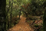
. The preserve contains about 5 miles (8 km) of hiking trails
Trail
A trail is a path with a rough beaten or dirt/stone surface used for travel. Trails may be for use only by walkers and in some places are the main access route to remote settlements...
, of which 2.1 miles (3.4 km) are open to equestrians
Equestrianism
Equestrianism more often known as riding, horseback riding or horse riding refers to the skill of riding, driving, or vaulting with horses...
, and none are open to bicycle
Bicycle
A bicycle, also known as a bike, pushbike or cycle, is a human-powered, pedal-driven, single-track vehicle, having two wheels attached to a frame, one behind the other. A person who rides a bicycle is called a cyclist, or bicyclist....
s.
The area was once a part of a 13,300 acre (53.8 km²) rancho. The preserve's acreage was purchased by state senator Louis Oneal in the early 1900s, who raised horses there. It was sold to a developer in the 1950s. Power and water lines were run to the property in the 1960s, but development was abandoned when the city of Palo Alto discovered the high cost of providing city services to the area. The preserve was acquired by the Midpeninsula Regional Open Space District
Midpeninsula Regional Open Space District
The Midpeninsula Regional Open Space District is a special-purpose district that manages over of open space in 25 preserves in the San Francisco Bay Area. It includes parts of Santa Clara, San Mateo and Santa Cruz Counties. The District was created by voter initiative in 1972...
in 1976. This was technically illegal, since San Mateo County was outside of district jurisdiction at the time.
While the preserve is relatively small compared to other preserves and parks in the area, it has one notable feature: about one mile (1.5 km) of the San Andreas Fault
San Andreas Fault
The San Andreas Fault is a continental strike-slip fault that runs a length of roughly through California in the United States. The fault's motion is right-lateral strike-slip...
runs underneath it. Several series of markers throughout the preserve indicate where the ground has broken during various earthquakes.
Additionally, a 1.5 mile (2.4 km) trail follows the main break caused by the 1906 San Francisco earthquake
1906 San Francisco earthquake
The San Francisco earthquake of 1906 was a major earthquake that struck San Francisco, California, and the coast of Northern California at 5:12 a.m. on Wednesday, April 18, 1906. The most widely accepted estimate for the magnitude of the earthquake is a moment magnitude of 7.9; however, other...
. This trail includes several interpretive stations that point out various quake-caused features and phenomenon. Guided "quake walks" are held about once a month.
External links
- Los Trancos page at MROSD
- Trailspotting: Hiking Los Trancos Open Space Preserve GPS/Mapping data, hike description & photos