

B roads in Zone 6 of the Great Britain numbering scheme
Encyclopedia
Great Britain road numbering scheme
The Great Britain road numbering scheme is a numbering scheme used to classify and identify all roads in Great Britain. Each road is given a single letter, which represents the road's category, and a subsequent number, with a length of between 1 and 4 digits. Originally introduced to arrange...
for the rationale behind the numbers allocated.
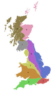
Zone 6 (3 digits)
| Road | From | To | Notes |
|---|---|---|---|
| B600 | Alfreton Alfreton Alfreton is a town and civil parish in Amber Valley, Derbyshire, England, adjoining the Bolsover and North East Derbyshire districts. It was formerly a Norman Manor and later an Urban District. The population of the Alfreton Ward was 7,928 at the 2001 Census... |
Nuthall Nuthall Nuthall is a village located in Nottinghamshire, England, neighbouring Kimberley, Watnall, Cinderhill and Basford.It is part of the Borough of Broxtowe.... , Nottingham Nottingham Nottingham is a city and unitary authority in the East Midlands of England. It is located in the ceremonial county of Nottinghamshire and represents one of eight members of the English Core Cities Group... |
Previously the A613 |
| B660 | Bedford Bedford Bedford is the county town of Bedfordshire, in the East of England. It is a large town and the administrative centre for the wider Borough of Bedford. According to the former Bedfordshire County Council's estimates, the town had a population of 79,190 in mid 2005, with 19,720 in the adjacent town... |
Ramsey St Mary's Ramsey St Mary's Ramsey St Mary's is a village in Ramsey civil parish, part of the Huntingdonshire district of Cambridgeshire, England.-Church:During the 1850s, the need for a church in Ramsey St Mary's was realised, due to an increase in the population of Ramsey which was outgrowing the capacity of the Parish... |
|
| B663 | Bythorn Bythorn Bythorn – in Huntingdonshire , England – is a village near Molesworth west of Huntingdon.... |
Caldecott Caldecott The Caldecott Medal is an award for children's book illustration.Caldecott may also refer to:- Places :* Caldecott, Northamptonshire, United Kingdom* Caldecott, Rutland, United Kingdom* Caldecott, a district of Abingdon, Oxfordshire, United Kingdom... |
|
| B668 | Oakham Oakham -Oakham's horseshoes:Traditionally, members of royalty and peers of the realm who visited or passed through the town had to pay a forfeit in the form of a horseshoe... |
A1 at Stretton Stretton, Rutland Stretton is a small village and civil parish in the county of Rutland, England, just off the A1 Great North Road. The Ecclesiastical parish of Stretton shares the same boundaries and is part of the Rutland deanery of the diocese of Peterborough. The incumbent is The Revd Richard Jan... |
|
| B669 | Desborough Desborough Desborough is a town in Northamptonshire, England. It is one of the founding 12 members of the Charter of European Rural Communities and through this has links with 26 other EU member towns and villages... |
Wilbarston Wilbarston Wilbarston is a village and civil parish in the English county of Northamptonshire in the Welland valley. It is administered as part of the borough of Kettering and is five miles east of the Leicestershire town of Market Harborough, via the A427... |
|
| B671 | Wansford, Cambridgeshire (A47 road A47 road The A47 is a trunk road in England originally linking Birmingham to Great Yarmouth. Most of the section between Birmingham and Nuneaton is now classified as the B4114.-Route:... ) |
Elton Hall Elton Hall Elton Hall is a baronial hall in Elton, Cambridgeshire. It has been the ancestral home of the Proby family since 1660.The hall lies in an estate through which the River Nene runs... (A605 road A605 road The A605 road is a main road in the English counties of Northamptonshire and Cambridgeshire.-Route :The A605 strikes north from junction 13 of the trunk A14 road through the eastern parts of Thrapston, skirts the village of Thorpe Waterville, bypasses Oundle to its east, crosses the River Nene,... ) |
|
| B675 (defunct) | A60 at Hoton Hoton Hoton is a village and civil parish in the Charnwood district of Leicestershire, England. The parish has a population of around 350. It is on the A60, north-east of Loughborough. The village is just south of the border with Nottinghamshire. Nearby places are Prestwold , Wymeswold , and... , Leicestershire |
Former A6 at Quorn, Leicestershire Quorn, Leicestershire Quorn is a village in Leicestershire, England, situated next to the university town of Loughborough. Quorn's name was shortened from Quorndon in 1889, to avoid postal difficulties owing to its similarity to the name of another village, Quarndon, a few miles away. Its original name is said to derive... |
Now declassified, no longer a B road |
| B676 | A60 at Cotes, Leicestershire Cotes, Leicestershire Cotes is a hamlet and very small civil parish near the town of Loughborough in Leicestershire, England, with a population of about 50.It lies on the River Soar, and Cotes Bridge provides the main bridging point in that area. The A60 Trunk Road goes over Cotes Bridge on its way out of Loughborough... |
A1 at Colsterworth Colsterworth Colsterworth is a village and civil parish in the South Kesteven district of Lincolnshire, England. The village, together with the hamlet of Woolsthorpe-by-Colsterworth, had a population of 1,508 according to the 2001 census. It lies half a mile to the west of the A1, seven miles south of Grantham... , Lincolnshire |
In two sections; uses A6006 between Melton Mowbray Melton Mowbray Melton Mowbray is a town in the Melton borough of Leicestershire, England. It is to the northeast of Leicester, and southeast of Nottingham... and a point near Old Dalby Old Dalby Old Dalby is a village in the English county of Leicestershire. It is located to the north-west of Melton Mowbray. It was originally known as "Wold Dalby" or "Dalby on the Wolds".-Village:... , Leicestershire - truncated at eastern end, used to run to Bourne, Lincolnshire Bourne, Lincolnshire Bourne is a market town and civil parish on the western edge of the Fens, in the District of South Kesteven in southern Lincolnshire, England.-The town:... , now A151 A151 road The A151 road is relatively minor part of the British road system. It lies entirely in the county of Lincolnshire, England. Its western end lies at coordinates otherwise, 1... and B1193 |
| B679 | A60 in West Bridgford West Bridgford West Bridgford is a town in the Rushcliffe borough of Nottinghamshire, England. It lies immediately south of the city of Nottingham, delimited by the River Trent; this proximity means that it forms a continuous urban area with Nottingham, effectively makes West Bridgford a suburb of the city, and... |
A453 A453 road The A453 road was formerly the main trunk road connecting the English cities of Nottingham and Birmingham. However, the middle section of this mainly single-carriageway road has largely been downgraded to B roads or unclassified roads following the construction of the parallel M42-A42 link around... at Silverdale, Nottinghamshire |
Formerly part of the A648 |
| B680 | A60 at Ruddington Ruddington Ruddington is an English village situated five miles south of Nottingham in the Borough of Rushcliffe. It had a population of 6,441 at the 2001 UK census.... , Nottinghamshire |
B679 at Wilford Wilford Wilford is a village close to the centre the city of Nottingham, UK, on the banks of the River Trent. It has been described as a semi-rural village in a city. The village is bounded to the north and west by the River Trent and to the east by the embankment of the now closed Great Central Railway... , Nottinghamshire |
|
| B683 | A60 south of Mansfield Mansfield Mansfield is a town in Nottinghamshire, England. It is the main town in the Mansfield local government district. Mansfield is a part of the Mansfield Urban Area.... |
A611 north of Nottingham Nottingham Nottingham is a city and unitary authority in the East Midlands of England. It is located in the ceremonial county of Nottinghamshire and represents one of eight members of the English Core Cities Group... |
Zone 6 (4 digits)
| Road | From | To | Notes |
|---|---|---|---|
| B6000 | A6 at the Cock Pitt, Derby Derby Derby , is a city and unitary authority in the East Midlands region of England. It lies upon the banks of the River Derwent and is located in the south of the ceremonial county of Derbyshire. In the 2001 census, the population of the city was 233,700, whilst that of the Derby Urban Area was 229,407... |
A6 at Traffic Street Island, Derby Derby Derby , is a city and unitary authority in the East Midlands region of England. It lies upon the banks of the River Derwent and is located in the south of the ceremonial county of Derbyshire. In the 2001 census, the population of the city was 233,700, whilst that of the Derby Urban Area was 229,407... |
via Derby Midland Station and Derbyshire Royal Infirmary Derbyshire Royal Infirmary The London Road Community Hospital, , is a hospital in Derby, part of the Derby Hospitals NHS Foundation Trust. It is based in the city centre... . London Road section was formerly part of A6 before that was rerouted via Pride Parkway |
| B6001 | A619 north of Bakewell Bakewell Bakewell is a small market town in the Derbyshire Dales district of Derbyshire, England, deriving its name from 'Beadeca's Well'. It is the only town included in the Peak District National Park, and is well known for the local confection Bakewell Pudding... |
A6187 at Hathersage Hathersage Hathersage is a village in the Derbyshire Peak District, in England. It lies on the north bank of the River Derwent, approximately 10 miles west of Sheffield... |
|
| B6002 | B5010 at Sandiacre Sandiacre Sandiacre is a town in the Borough of Erewash in Derbyshire, in the East Midlands region of England adjoining the border with Nottinghamshire.... |
B6450 at Long Eaton railway station Long Eaton railway station Long Eaton railway station serves the town of Long Eaton in Derbyshire, in the United Kingdom. It lies on the Midland Main Line and the Derby - Nottingham line south east of Derby... |
|
| B6003 | Stapleford, Nottinghamshire Stapleford, Nottinghamshire -External links:***... |
Chilwell Chilwell Chilwell is a residential suburb of Greater Nottingham, in the Borough of Broxtowe of Nottinghamshire, west of Nottingham city. Until 1974 it was part of Beeston and Stapleford Urban District, having been in Stapleford Rural District until 1935.-History:... |
|
| B6004 | Arnold, Nottinghamshire Arnold, Nottinghamshire Arnold is a suburb of Nottingham, England. It is to the north-east of the city boundary, and is in the local government district of Gedling. It has only had a market since 1968, and had a number of factories associated with the hosiery industry... |
Stapleford, Nottinghamshire Stapleford, Nottinghamshire -External links:***... |
Between Bilborough Bilborough Bilborough is a suburb of the city of Nottingham, England.Located just off the A6002 road is Bilborough College.Bilborough has a high street containing a bank , a butcher's shop, a Gregg's, a library and a Co-op store among others.... and Stapleford, Nottinghamshire Stapleford, Nottinghamshire -External links:***... merges with the A6002 |
| B6005 | Beeston Beeston, Nottinghamshire Beeston is a town in Nottinghamshire, England. It is southwest of Nottingham city centre. Although typically regarded as a suburb of the City of Nottingham, and officially designated as part of the Nottingham Urban Area, for local government purposes it is in the borough of Broxtowe, lying outside... |
Chilwell Chilwell Chilwell is a residential suburb of Greater Nottingham, in the Borough of Broxtowe of Nottinghamshire, west of Nottingham city. Until 1974 it was part of Beeston and Stapleford Urban District, having been in Stapleford Rural District until 1935.-History:... |
Bypasses by A6005 |
| B6006 | A52 A52 road The A52 is a major road in the East Midlands, England. It runs east from the junction with the A53 at Newcastle-under-Lyme near Stoke-on-Trent via Ashbourne, Derby, Stapleford, Nottingham, West Bridgford, Bingham, Grantham, Boston and Skegness before terminating on the east Lincolnshire coast at... at Bramcote Hills Bramcote Hills Bramcote Hills forms the northern area of the village and Nottingham suburb of Bramcote, Nottinghamshire, built in the 1950s. It is separated from the main part of the village by the A52 Derby Road .... |
Beeston Beeston, Nottinghamshire Beeston is a town in Nottinghamshire, England. It is southwest of Nottingham city centre. Although typically regarded as a suburb of the City of Nottingham, and officially designated as part of the Nottingham Urban Area, for local government purposes it is in the borough of Broxtowe, lying outside... |
|
| B6007 | A609 in Ilkeston Ilkeston Ilkeston is a town within the Borough of Erewash, in Derbyshire, England. It lies on the River Erewash, from which the local borough takes its name. Its population at the 2001 census was 37,550... |
A6007 in Ilkeston | Bypassed by A6007 |
| B6008 | Bilborough Bilborough Bilborough is a suburb of the city of Nottingham, England.Located just off the A6002 road is Bilborough College.Bilborough has a high street containing a bank , a butcher's shop, a Gregg's, a library and a Co-op store among others.... |
Bulwell Bulwell Bulwell is an English market town approximately northwest of Nottingham city centre, on the northern edge of the city. The United Kingdom Census 2001 showed there were almost 30,000 people living in the Bulwell area, accounting for over 10% of the population of the city of Nottingham.-Early... |
|
| B6009 | Hucknall Hucknall Hucknall, formerly known as Hucknall Torkard, is a town in Greater Nottingham, Nottinghamshire, England, in the district of Ashfield. The town was historically a centre for framework knitting and then for mining but is now a focus for other industries as well providing housing for workers in... |
Watnall Watnall Watnall is an area of settlement in Nottinghamshire, England. It is part of Greasley civil parish, and is located one mile north of Kimberley. The village is barely separated from Nuthall. Generally both areas are considered to be more affluent and middle-class than the neighbouring town of... |
|
| B6010 | Kimberley Kimberley, Nottinghamshire Kimberley is a town in Nottinghamshire, England, lying 6 miles northwest of Nottingham along the A610. The town grew as a centre for coal mining, brewing and hosiery manufacturing... |
Greasley Greasley Greasley is a parish north west of Nottingham in Nottinghamshire, England. Although it is thought there was once a village called Greasley, there is no settlement of that name today. The built up areas in the parish are Giltbrook, Moorgreen , Newthorpe, Watnall and parts of Eastwood, Kimberley and... |
|
| B6011 | Hucknall Hucknall Hucknall, formerly known as Hucknall Torkard, is a town in Greater Nottingham, Nottinghamshire, England, in the district of Ashfield. The town was historically a centre for framework knitting and then for mining but is now a focus for other industries as well providing housing for workers in... |
A60 at Burntstump Hill | |
| B6012 | Rowsley Rowsley Rowsley is a village on the A6 road in the English county of Derbyshire.It is at the point where the River Wye flows into the River Derwent and prospered from mills on both.-Overview:... |
Baslow Baslow Baslow is a village in Derbyshire, England, in the Peak District, lying between Sheffield and Bakewell. It is situated on the River Derwent just north of Chatsworth House. A seventeenth century bridge spans the river in the village, alongside which is a contemporary toll house... |
|
| B6013 | Belper Belper Belper is a town and civil parish in the local government district of Amber Valley in Derbyshire, England.-Geography:Belper is situated eight miles north of Derby and is centred in the valley of the River Derwent... |
Shirland Shirland Shirland is a parish and former mining village in Derbyshire, England. It is continuous with the villages of Higham, Stretton and Stonebroom. Shirland has existed since at least 1086. Local politics is largely Labour. The River Amber flows through the parish.... |
|
| B6014 | Mansfield Mansfield Mansfield is a town in Nottinghamshire, England. It is the main town in the Mansfield local government district. Mansfield is a part of the Mansfield Urban Area.... |
Tansley Tansley Tansley is a village on the southern edge of the Derbyshire Peak District, two miles east of Matlock.-History:Tansley is recorded in the Domesday Book as Tanslege, and its name comes from the combination of the Old English words lega, meaning "wood or glade" and tan meaning "a branch of a... |
|
| B6016 | Lower Hartshay Lower Hartshay Lower Hartshay is a very small village in the Amber Valley District, in the English county of Derbyshire. It is on Hartshay Brook and near the A38 road. The nearest town is Ripley. There is the corresponding hamlet of Upper Hartshay just south.- References :... |
Selston Selston Selston is a hilltop village and civil parish in the District of Ashfield in Nottinghamshire, England. At the time of the 2001 census it had a population of 12,208 St Helen's Church dates back to 1150 AD although the exterior of the church was altered by restoration and enlargement in 1899... |
|
| B6017 | Leabrookes | Somercotes Somercotes Somercotes is a village and Parish in the District of Amber Valley in the English county of Derbyshire, close to the border with Nottinghamshire. It is a former mining village and was once surrounded by more than five pits. It is now one of the fastest developing villages in the Amber Valley area,... |
Short link road between B6016 and B600 |
| B6018 | Sutton in Ashfield | Selston Selston Selston is a hilltop village and civil parish in the District of Ashfield in Nottinghamshire, England. At the time of the 2001 census it had a population of 12,208 St Helen's Church dates back to 1150 AD although the exterior of the church was altered by restoration and enlargement in 1899... |
|
| B6019 | Alfreton Alfreton Alfreton is a town and civil parish in Amber Valley, Derbyshire, England, adjoining the Bolsover and North East Derbyshire districts. It was formerly a Norman Manor and later an Urban District. The population of the Alfreton Ward was 7,928 at the 2001 Census... |
Kirkby in Ashfield | |
| B6020 | Kirkby in Ashfield | Rainworth Rainworth Rainworth is a village which is split between the Newark and Sherwood and the Mansfield districts of Nottinghamshire, England.To the north of Rainworth is the village of Clipstone and to the east are the villages of Bilsthorpe and Farnsfield. Mansfield lies two miles to the west. The village of... |
|
| B6021 | Sutton in Ashfield | Annesley Annesley Annesley is a village and civil parish in the District of Ashfield in Nottinghamshire, England, located between Hucknall and Kirkby-in-Ashfield. According to the 2001 census the parish had a population of 1,096. Nearby to the west is Annesley Woodhouse... |
|
| B6022 | A38 in Sutton in Ashfield | B6139 in Sutton in Ashfield | |
| B6023 | Intersection with A38 and A6075 east of Sutton in Ashfield | A38 west of Sutton in Ashfield | Part of the A38 through Sutton until bypassed. |
| B6024 | Worksop Worksop Worksop is the largest town in the Bassetlaw district of Nottinghamshire, England on the River Ryton at the northern edge of Sherwood Forest. It is about east-south-east of the City of Sheffield and its population is estimated to be 39,800... |
Roundabout with A57 and A60 | Part of A60 until bypassed by A57 |
| B6025 | A61 north of Alfreton Alfreton Alfreton is a town and civil parish in Amber Valley, Derbyshire, England, adjoining the Bolsover and North East Derbyshire districts. It was formerly a Norman Manor and later an Urban District. The population of the Alfreton Ward was 7,928 at the 2001 Census... |
Tibshelf Tibshelf Tibshelf is a village and civil parish in Derbyshire, England. It is in the Bolsover district of the county. Its population at the 2001 UK census was 3,548.... |
|
| B6026 | Sutton in Ashfield | Tibshelf Tibshelf Tibshelf is a village and civil parish in Derbyshire, England. It is in the Bolsover district of the county. Its population at the 2001 UK census was 3,548.... |
|
| B6027 | A38 | Huthwaite Huthwaite Huthwaite is a small village in Nottinghamshire, England, located to the west of Mansfield, close to the Derbyshire border. Before 1907 the village was known as Hucknall-under-Huthwaite and also Dirty Hucknall.-Derivation of Name:... |
|
| B6028 | Sutton in Ashfield | Stanton Hill Stanton Hill Stanton Hill is a small village in the Ashfield district of Nottinghamshire, England, located three miles west of Mansfield and one mile north-west of Sutton-in-Ashfield.-History:... |
|
| B6030 | Mansfield Mansfield Mansfield is a town in Nottinghamshire, England. It is the main town in the Mansfield local government district. Mansfield is a part of the Mansfield Urban Area.... |
A614 A614 road The A614 is a main road in England running through the counties of Nottinghamshire, South Yorkshire and the East Riding of Yorkshire.Beginning at Redhill, near Calverton in Nottinghamshire at a roundabout with the A60, the road meets the A6097 at a junction which looks like a roundabout but... south of Ollerton Ollerton Ollerton is a town in Nottinghamshire, England, on the edge of Sherwood Forest in the area known as the Dukeries. It forms part of the civil parish of Ollerton and Boughton.... |
|
| B6031 | Church Warsop Church Warsop Church Warsop is a village in Nottinghamshire, England. It is located 1 mile north of Warsop and is within the Warsop civil parish.The parish church of St Peter and St Paul is early Norman.... |
B6407 east of Shirebrook Shirebrook Shirebrook is a town in the Bolsover district of north-east Derbyshire on the border with Nottinghamshire, England. At the 2001 UK Census it had a population of 9,291 , 10,412... |
|
| B6032 | A60 in Mansfield Woodhouse Mansfield Woodhouse Mansfield Woodhouse is a large village about 2 kilometres north of Mansfield itself, in Nottinghamshire, England. With a history dating back before the Romans, it is still noteworthy for its stone built town centre... |
A6075 in Mansfield Woodhouse Mansfield Woodhouse Mansfield Woodhouse is a large village about 2 kilometres north of Mansfield itself, in Nottinghamshire, England. With a history dating back before the Romans, it is still noteworthy for its stone built town centre... |
|
| B6033 | Mansfield Mansfield Mansfield is a town in Nottinghamshire, England. It is the main town in the Mansfield local government district. Mansfield is a part of the Mansfield Urban Area.... |
Forest Town Forest Town, Nottinghamshire Forest Town is a former mining village located in the outskirts of Mansfield, in Nottinghamshire, England. The football team, Forest Town F.C. currently play in the Central Midlands League Supreme Division. The Garibaldi School is the local secondary school... |
|
| B6034 | Worksop Worksop Worksop is the largest town in the Bassetlaw district of Nottinghamshire, England on the River Ryton at the northern edge of Sherwood Forest. It is about east-south-east of the City of Sheffield and its population is estimated to be 39,800... |
Rufford | Uses the A616 A616 road The A616 is a road which links Newark-on-Trent, Nottinghamshire, to the M1 motorway at Junction 30, then reappears at Junction 35A and goes on to Huddersfield, West Yorkshire.... for part of its route. |
| B6035 | Warsop Warsop Warsop is a civil parish in the District of Mansfield in Nottinghamshire, England, located on the outskirts of Sherwood Forest. According to the 2001 census it had a population of 12,365.... |
A6075 | |
| B6036 | Kelstedge | B6014 near Stretton Stretton, Derbyshire Stretton is a small village and civil parish in Derbyshire, England. It is located near the towns of Clay Cross and three and a half miles from Alfreton on the A61. The nearest waterways are the River Amber and Smithy Brook... |
|
| B6038 | North Wingfield North Wingfield North Wingfield is a large village in the English county of Derbyshire, located approximately 4½ miles south-east of Chesterfield, and 1 mile north-east of Clay Cross. It is in the North East Derbyshire district... |
Hasland Hasland Hasland is a suburb in the south-east of Chesterfield, Derbyshire, England. Although many local residents refer to it as a village, it expanded greatly during the 20th century and now merges with Chesterfield itself.- Churches :... |
|
| B6039 | Chesterfield Chesterfield Chesterfield is a market town and a borough of Derbyshire, England. It lies north of Derby, on a confluence of the rivers Rother and Hipper. Its population is 70,260 , making it Derbyshire's largest town... |
Tibshelf Tibshelf Tibshelf is a village and civil parish in Derbyshire, England. It is in the Bolsover district of the county. Its population at the 2001 UK census was 3,548.... |
|
| B6040 | Roundabout with A57 A57 road The A57 is a major road in England. It runs east from Liverpool to Lincoln, via Warrington, Cadishead, Irlam, Patricroft, Eccles, Salford and Manchester, then through the Pennines over the Snake Pass , around the Ladybower Reservoir, through Sheffield and past Worksop... |
Gateford Gateford Gateford is a village in Nottinghamshire, England. It is located 1 mile north-west of Worksop. Since 1995 radical changes have developed in Gateford, such as the Celtic Point shopping centre and the Ashes Park Avenue estate. Gateford also has a primary school called Gateford Park Primary School.... |
A57 through Worksop Worksop Worksop is the largest town in the Bassetlaw district of Nottinghamshire, England on the River Ryton at the northern edge of Sherwood Forest. It is about east-south-east of the City of Sheffield and its population is estimated to be 39,800... until bypassed. |
| B6041 | Manton Manton, Nottinghamshire Manton is a former mining village and suburb of south-east Worksop, north Nottinghamshire. Manton Colliery was one of the few pits in the county to generally support the strike in 1984-5... |
Gateford Gateford Gateford is a village in Nottinghamshire, England. It is located 1 mile north-west of Worksop. Since 1995 radical changes have developed in Gateford, such as the Celtic Point shopping centre and the Ashes Park Avenue estate. Gateford also has a primary school called Gateford Park Primary School.... |
Goes round northern suburbs of Worksop Worksop Worksop is the largest town in the Bassetlaw district of Nottinghamshire, England on the River Ryton at the northern edge of Sherwood Forest. It is about east-south-east of the City of Sheffield and its population is estimated to be 39,800... |
| B6042 | A60 west of Welbeck Abbey Welbeck Abbey Welbeck Abbey near Clumber Park in North Nottinghamshire was the principal abbey of the Premonstratensian order in England and later the principal residence of the Dukes of Portland.-Monastic period:... |
Creswell Creswell, Derbyshire Creswell is a village located in Bolsover, near Worksop, Derbyshire, England, United Kingdom. It is best known for Creswell Crags and Creswell Model Village.... |
Rerouted by approximately 150m to the north in 2006/7 to minimise the impact of traffic on Creswell Crags Creswell Crags Creswell Crags is a limestone gorge on the border between Derbyshire and Nottinghamshire, England near the villages of Creswell, Whitwell and Elmton... |
| B6043 | Whitwell Common | A619 east of Whitwell Whitwell, Derbyshire Whitwell is a small village located in Derbyshire, England.Although Whitwell celebrated its 1,000th anniversary in the 'Whitwell 1000' Celebrations of 1989 it is much older than this celebration suggests.The earliest written references to Whitwell are from the Anglo-Saxon charters however many of... |
A619 branch road through Whitwell |
| B6044 | A638 A638 road The A638 is a main road in England that runs between the A1 at Markham Moor in Nottinghamshire and Chain Bar Junction 26 of the M62 motorway south of Bradford in West Yorkshire.... in Retford Retford Retford is a market town in Nottinghamshire in the East Midlands of England, located 31 miles from the city of Nottingham, and 23 miles west of Lincoln, in the district of Bassetlaw. The town is situated in a valley with the River Idle and the Chesterfield Canal running through the centre of the... |
Retford Retford Retford is a market town in Nottinghamshire in the East Midlands of England, located 31 miles from the city of Nottingham, and 23 miles west of Lincoln, in the district of Bassetlaw. The town is situated in a valley with the River Idle and the Chesterfield Canal running through the centre of the... train station |
|
| B6045 | Worksop Worksop Worksop is the largest town in the Bassetlaw district of Nottinghamshire, England on the River Ryton at the northern edge of Sherwood Forest. It is about east-south-east of the City of Sheffield and its population is estimated to be 39,800... |
Drakeholes | |
| B6047 | A607 at Melton Mowbray Melton Mowbray Melton Mowbray is a town in the Melton borough of Leicestershire, England. It is to the northeast of Leicester, and southeast of Nottingham... |
A4304 at Market Harborough Market Harborough Market Harborough is a market town within the Harborough district of Leicestershire, England.It has a population of 20,785 and is the administrative headquarters of Harborough District Council. It sits on the Northamptonshire-Leicestershire border... |
By way of Great Dalby Great Dalby thumb|left|Great Dalby parish church of St. SwithunGreat Dalby is a small village 3 miles south of Melton Mowbray, Leicestershire.It has a population of between 300-400 and the parish church of St. Swithun was built during the 14th century.... , Thorpe Satchville, Twyford Twyford, Leicestershire Twyford is in the south of the parish of Twyford and Thorpe, and the name is derived from the two fords in the village. There are two churches in the village; St Andrew , which is a Grade I listed building with some parts dated from the 12th century, and a Methodist church.The other main focal... , Tilton on the Hill Tilton on the Hill Tilton on the Hill is a village and civil parish in the Harborough district of Leicestershire. It lies 2 miles north of the A47, on the B6047 to Melton Mowbray. Halstead civil parish was merged with Tilton in 1935, while the deserted medieval village of Whatborough was merged in 1994... and Tur Langton Tur Langton Tur Langton is a small village in the heart of Leicestershire in England.-External links:**... |
| B6048 | A619 north of Bakewell Bakewell Bakewell is a small market town in the Derbyshire Dales district of Derbyshire, England, deriving its name from 'Beadeca's Well'. It is the only town included in the Peak District National Park, and is well known for the local confection Bakewell Pudding... |
B6012 north of Edensor Edensor Edensor is a village in Derbyshire, England. It is the closest village to Chatsworth House and much of it belongs to the Dukes of Devonshire. Originally the village was close to the River Derwent immediately below Chatsworth, but the Dukes had it moved out of sight over a hill, apart from one... |
|
| B6049 | Blackwell in the Peak Blackwell in the Peak Blackwell is a village in the Derbyshire Dales local government district of Derbyshire, England, on the A6 main road between Bakewell and Buxton.It is sometimes referred to as "Blackwell-in-the-Peak" to distinguish it from Blackwell near Alfreton.... |
Brough-on-Noe | |
| B6050 | Chesterfield Chesterfield Chesterfield is a market town and a borough of Derbyshire, England. It lies north of Derby, on a confluence of the rivers Rother and Hipper. Its population is 70,260 , making it Derbyshire's largest town... |
A619 east of Baslow Baslow Baslow is a village in Derbyshire, England, in the Peak District, lying between Sheffield and Bakewell. It is situated on the River Derwent just north of Chatsworth House. A seventeenth century bridge spans the river in the village, alongside which is a contemporary toll house... |
|
| B6051 | Chesterfield Chesterfield Chesterfield is a market town and a borough of Derbyshire, England. It lies north of Derby, on a confluence of the rivers Rother and Hipper. Its population is 70,260 , making it Derbyshire's largest town... |
A621 at Owler Bar Owler Bar Owler Bar is a small area of settlement and locally important road junction in Derbyshire, England. It lies at an altitude of 305 metres and is located just south of the county border with Sheffield, on the edge of the Peak District National Park. It lies five miles west of the town of Dronfield... |
|
| B6052 | Chesterfield Chesterfield Chesterfield is a market town and a borough of Derbyshire, England. It lies north of Derby, on a confluence of the rivers Rother and Hipper. Its population is 70,260 , making it Derbyshire's largest town... |
Eckington Eckington, Derbyshire Eckington is a town in North East Derbyshire, 7 miles north of Chesterfield and 8.5 miles south of Sheffield on the border with South Yorkshire.Eckington has a population of 11,152.... |
|
| B6053 | Staveley Staveley, Derbyshire Staveley is a town within the borough of Chesterfield, in Derbyshire, England. The town is situated alongside the River Rother, adjacent to Eckington to the north, Barlborough to the east, Sutton-cum-Duckmanton civil parish to the south and Brimington to the west.-History:It has traditionally been... |
Beighton Beighton Beighton ward —which includes the districts of Beighton, Hackenthorpe, Owlthorpe, and Sothall—is one of the 28 electoral wards in City of Sheffield, England. It is located in the eastern part of the city, on the border with Rotherham and covers an area of 5.7 km2... |
|
| B6054 | Highlane | Calver Calver Calver is a village in Derbyshire, England.-Overview:Calver is a small village situated in the Derwent Valley, Derbyshire. The village is bordered by the River Derwent and intersected by the A623 trunk road, responsible for carrying traffic between Manchester to the west, Sheffield to the north &... |
Uses A6102 as part of the route. Western section past Owler Bar Owler Bar Owler Bar is a small area of settlement and locally important road junction in Derbyshire, England. It lies at an altitude of 305 metres and is located just south of the county border with Sheffield, on the edge of the Peak District National Park. It lies five miles west of the town of Dronfield... now A625 A625 road The A625 is a rural road which runs through north Derbyshire and the Peak District. First named Ecclesall Road, it begins at the Moore Street roundabout in Sheffield and runs southwesterly towards Hathersage after a change in name to Hathersage Road... . |
| B6055 | A625 A625 road The A625 is a rural road which runs through north Derbyshire and the Peak District. First named Ecclesall Road, it begins at the Moore Street roundabout in Sheffield and runs southwesterly towards Hathersage after a change in name to Hathersage Road... |
A6178 | |
| B6056 | Eckington Eckington, Derbyshire Eckington is a town in North East Derbyshire, 7 miles north of Chesterfield and 8.5 miles south of Sheffield on the border with South Yorkshire.Eckington has a population of 11,152.... |
Dronfield Woodhouse Dronfield Woodhouse Dronfield Woodhouse is a district of Dronfield, in northeast Derbyshire, England. Its habitation has existed as early as the 11th century and its main road features a 13th century house and a 19th century Primary School .Although Dronfield Woodhouse today constitutes the western half of the town... |
|
| B6057 | Chesterfield Chesterfield Chesterfield is a market town and a borough of Derbyshire, England. It lies north of Derby, on a confluence of the rivers Rother and Hipper. Its population is 70,260 , making it Derbyshire's largest town... |
Dronfield Dronfield Dronfield is a town in North East Derbyshire in the North Midlands region of England. It comprises the three communities of Dronfield, Dronfield Woodhouse and Coal Aston. It is sited in the valley of the small River Drone, and lies between the town of Chesterfield and the city of Sheffield. The... |
Part of A61 until bypassed. |
| B6058 | Mosborough Mosborough Mosborough ward — which includes the districts of Halfway, Mosborough village, Waterthorpe, and Westfield — is one of the 28 electoral wards in City of Sheffield, England. It is located in the eastern part of the city, on the border with Rotherham, and covers an area of 8.9 km2.... |
Killamarsh Killamarsh Killamarsh is a town in North East Derbyshire. It borders South Yorkshire to its north and west. It lies between Halfway and Mosborough to the west, Renishaw to the south, Beighton and Sothall to the northwest, Wales to the northeast, Harthill to its east and the Rother Valley Country Park to its... |
|
| B6059 | South Anston | Wales, South Yorkshire Wales, South Yorkshire Wales is a village and a civil parish in the Metropolitan Borough of Rotherham in South Yorkshire, England. It is on the border of South Yorkshire and Derbyshire... |
|
| B6060 | South Anston | Wickersley Wickersley Wickersley is a village and civil parish in the Metropolitan Borough of Rotherham in South Yorkshire, England, situated from central Rotherham. The area is very near to road junctions for the M1, M18 and A1... |
|
| B6061 | A623 at Sparrowpit Sparrowpit Sparrowpit is a small hamlet between Chapel-en-le-Frith and Peak Forest in the High Peak area of the Peak District, Derbyshire, England.The name is derived from 'spar row pit' from the fluorspar mines.... |
Mam Tor Mam Tor Mam Tor is a hill near Castleton in the High Peak of Derbyshire, England. Its name literally translates as Heights of the Mother and it is also known as the Shivering Mountain on account of the instability of its lower shale layers... |
|
| B6062 | A6 near Whaley Bridge Whaley Bridge Whaley Bridge is a small town and civil parish in the High Peak district of Derbyshire, England, situated on the River Goyt. Whaley Bridge is approximately south of Manchester, north of Buxton , east of Macclesfield and west of Sheffield, and had a population of 6,226 at the 2001 census. This... |
A624 north of Chapel en le Firth | Part of A625 A625 road The A625 is a rural road which runs through north Derbyshire and the Peak District. First named Ecclesall Road, it begins at the Moore Street roundabout in Sheffield and runs southwesterly towards Hathersage after a change in name to Hathersage Road... before it was rerouted and bypassed by A6 |
| B6063 | A6135 in Gleadless, South Yorkshire | Gleadless | |
| B6064 | Gleadless | Orgreave, South Yorkshire Orgreave, South Yorkshire Orgreave is a village and civil parish in South Yorkshire, England.At the time of the 2001 census, the parish had a population of 761.Orgreave forms part of the Metropolitan Borough of Rotherham; until 1974, it was part of the Rotherham Rural District, the town of Rotherham being to the... |
|
| B6065 | Gleadless | Handsworth Handsworth, South Yorkshire Handsworth is a suburb of south eastern Sheffield, in South Yorkshire, England. Handsworth has a population of approximately 15,000. It covers an overall area of approximately... |
|
| B6066 | Woodhouse Woodhouse, South Yorkshire Woodhouse ward—which includes the district of Woodhouse and most of Handsworth—is one of the 28 electoral wards in City of Sheffield, England. It is located in the southeastern part of the city and covers an area of 7 km2. The population of this ward in 2001 was 17,900 people in... |
Catcliffe Catcliffe Catcliffe is a village and civil parish on the north-west bank of the River Rother in South Yorkshire, England. It is located in the Metropolitan Borough of Rotherham, about south of the town of Rotherham and east of Sheffield City Centre.-History:... |
|
| B6067 | A57 A57 road The A57 is a major road in England. It runs east from Liverpool to Lincoln, via Warrington, Cadishead, Irlam, Patricroft, Eccles, Salford and Manchester, then through the Pennines over the Snake Pass , around the Ladybower Reservoir, through Sheffield and past Worksop... |
Brinsworth Brinsworth Brinsworth is a village and civil parish in the Metropolitan Borough of Rotherham, in South Yorkshire, England. It is situated close to the River Rother between Rotherham and Sheffield . At the time of the 2001 census it had a population of 8,950.-History:Brinsworth is located about mile south... |
|
| B6068 | Beauchief | Ecclesall Ecclesall Ecclesall Ward—which includes the neighbourhoods of Bents Green, Ecclesall, Greystones, Millhouses, and Ringinglow—is one of the 28 electoral wards in City of Sheffield, England. It is located in the southwestern part of the city and covers an area of 9.4 km2. The population of... |
|
| B6069 | Sheffield Sheffield Sheffield is a city and metropolitan borough of South Yorkshire, England. Its name derives from the River Sheaf, which runs through the city. Historically a part of the West Riding of Yorkshire, and with some of its southern suburbs annexed from Derbyshire, the city has grown from its largely... |
Fulwood | |
| B6070 | City Road (A6135) in Sheffield Sheffield Sheffield is a city and metropolitan borough of South Yorkshire, England. Its name derives from the River Sheaf, which runs through the city. Historically a part of the West Riding of Yorkshire, and with some of its southern suburbs annexed from Derbyshire, the city has grown from its largely... |
Burngreave Road (A6135) in Sheffield Sheffield Sheffield is a city and metropolitan borough of South Yorkshire, England. Its name derives from the River Sheaf, which runs through the city. Historically a part of the West Riding of Yorkshire, and with some of its southern suburbs annexed from Derbyshire, the city has grown from its largely... |
Via A61 in Sheffield Sheffield Sheffield is a city and metropolitan borough of South Yorkshire, England. Its name derives from the River Sheaf, which runs through the city. Historically a part of the West Riding of Yorkshire, and with some of its southern suburbs annexed from Derbyshire, the city has grown from its largely... |
| B6071 | Farm Bridge (A61), Sheffield Sheffield Sheffield is a city and metropolitan borough of South Yorkshire, England. Its name derives from the River Sheaf, which runs through the city. Historically a part of the West Riding of Yorkshire, and with some of its southern suburbs annexed from Derbyshire, the city has grown from its largely... |
B6073, Attercliffe Attercliffe Attercliffe is an industrial suburb of northeast Sheffield, England on the south bank of the River Don.-History:The name Attercliffe can be traced back as far as an entry in the Domesday book -Ateclive- meaning at the cliffe, a small escarpment that lay alongside the River Don... , Sheffield Sheffield Sheffield is a city and metropolitan borough of South Yorkshire, England. Its name derives from the River Sheaf, which runs through the city. Historically a part of the West Riding of Yorkshire, and with some of its southern suburbs annexed from Derbyshire, the city has grown from its largely... |
Shrewsbury Road, Talbot Street, Bernard Road |
| B6072 | Sheffield Sheffield Sheffield is a city and metropolitan borough of South Yorkshire, England. Its name derives from the River Sheaf, which runs through the city. Historically a part of the West Riding of Yorkshire, and with some of its southern suburbs annexed from Derbyshire, the city has grown from its largely... Park Square Park Square, Sheffield Park Square is a major roundabout in Sheffield, England. The Sheffield Parkway, a major road from M1 Junction 33, terminates here. It is located next to Ponds Forge, a swimming pool and a venue for the games... A61 |
Sheffield Sheffield Sheffield is a city and metropolitan borough of South Yorkshire, England. Its name derives from the River Sheaf, which runs through the city. Historically a part of the West Riding of Yorkshire, and with some of its southern suburbs annexed from Derbyshire, the city has grown from its largely... Park Square Park Square, Sheffield Park Square is a major roundabout in Sheffield, England. The Sheffield Parkway, a major road from M1 Junction 33, terminates here. It is located next to Ponds Forge, a swimming pool and a venue for the games... A57 |
Part of Park Square Park Square, Sheffield Park Square is a major roundabout in Sheffield, England. The Sheffield Parkway, a major road from M1 Junction 33, terminates here. It is located next to Ponds Forge, a swimming pool and a venue for the games... roundabout |
| B6073 | Exchange Place (A61), Sheffield Sheffield Sheffield is a city and metropolitan borough of South Yorkshire, England. Its name derives from the River Sheaf, which runs through the city. Historically a part of the West Riding of Yorkshire, and with some of its southern suburbs annexed from Derbyshire, the city has grown from its largely... |
Attercliffe Road (A6178), Attercliffe Attercliffe Attercliffe is an industrial suburb of northeast Sheffield, England on the south bank of the River Don.-History:The name Attercliffe can be traced back as far as an entry in the Domesday book -Ateclive- meaning at the cliffe, a small escarpment that lay alongside the River Don... , Sheffield Sheffield Sheffield is a city and metropolitan borough of South Yorkshire, England. Its name derives from the River Sheaf, which runs through the city. Historically a part of the West Riding of Yorkshire, and with some of its southern suburbs annexed from Derbyshire, the city has grown from its largely... |
|
| B6074 | Wicker Wicker (Sheffield) The Wicker is an arterial street in Sheffield, England, noted for its history and the Grade II* listed Wicker Arches viaduct that crosses it. It runs in a north-east to south-westerly direction between Lady's Bridge and Wicker Arches... (A6109), Sheffield Sheffield Sheffield is a city and metropolitan borough of South Yorkshire, England. Its name derives from the River Sheaf, which runs through the city. Historically a part of the West Riding of Yorkshire, and with some of its southern suburbs annexed from Derbyshire, the city has grown from its largely... |
Penistone Road (A61) | Nursery Street, Neepsend Lane |
| B6075 | Sheaf Square Sheaf Square Sheaf Square is a municipal square lying immediately east of the city centre of Sheffield, England. The sides of the square are lined with major buildings: Sheffield railway station, the Showroom Cinema, Sheffield Science Park, the early nineteenth century Howard Hotel, in addition to the site of... , Sheffield Sheffield Sheffield is a city and metropolitan borough of South Yorkshire, England. Its name derives from the River Sheaf, which runs through the city. Historically a part of the West Riding of Yorkshire, and with some of its southern suburbs annexed from Derbyshire, the city has grown from its largely... |
Fitzalan Square Fitzalan Square Fitzalan Square is a municipal square situated in the city centre of Sheffield in South Yorkshire, England. The present day square is one of the busiest areas of the city centre with traffic and pedestrians continually moving through the area... , Sheffield Sheffield Sheffield is a city and metropolitan borough of South Yorkshire, England. Its name derives from the River Sheaf, which runs through the city. Historically a part of the West Riding of Yorkshire, and with some of its southern suburbs annexed from Derbyshire, the city has grown from its largely... |
Pond Street, Flat Street |
| B6076 | Walkley Walkley Walkley is an electoral ward in Sheffield, South Yorkshire, England.Walkley ward—which includes the districts of Netherthorpe, Upperthorpe, Walkley and parts of Neepsend—is one of the 28 electoral wards in City of Sheffield, England. It is located in the northwestern part of the city... |
Low Holdworth | West Route |
| B6077 | Walkley Walkley Walkley is an electoral ward in Sheffield, South Yorkshire, England.Walkley ward—which includes the districts of Netherthorpe, Upperthorpe, Walkley and parts of Neepsend—is one of the 28 electoral wards in City of Sheffield, England. It is located in the northwestern part of the city... |
Low Holdworth | East Route |
| B6078 | Sheffield Sheffield Sheffield is a city and metropolitan borough of South Yorkshire, England. Its name derives from the River Sheaf, which runs through the city. Historically a part of the West Riding of Yorkshire, and with some of its southern suburbs annexed from Derbyshire, the city has grown from its largely... |
Hillsborough Park Hillsborough Park Hillsborough Park is a large parkland area in Hillsborough, Sheffield, South Yorkshire, England. The park was created in 1897 by the Dixon Family, who built Hillsborough Hall. It is now owned by Sheffield City Council and the hall is used as a library.... |
|
| B6079 | Worksop Worksop Worksop is the largest town in the Bassetlaw district of Nottinghamshire, England on the River Ryton at the northern edge of Sherwood Forest. It is about east-south-east of the City of Sheffield and its population is estimated to be 39,800... |
A1 at Ranby Ranby, Nottinghamshire Ranby is a small village in the north of Nottinghamshire, next to the Chesterfield Canal and adjacent to the A1. It is known for its two schools, the prep school Ranby House and the primary school Ranby Primary School, and the nearby church All Saints Babworth.Ranby Prison is located on the A620 to... |
|
| B6080 | A6178 in Sheffield Sheffield Sheffield is a city and metropolitan borough of South Yorkshire, England. Its name derives from the River Sheaf, which runs through the city. Historically a part of the West Riding of Yorkshire, and with some of its southern suburbs annexed from Derbyshire, the city has grown from its largely... |
B6082 in Sheffield Sheffield Sheffield is a city and metropolitan borough of South Yorkshire, England. Its name derives from the River Sheaf, which runs through the city. Historically a part of the West Riding of Yorkshire, and with some of its southern suburbs annexed from Derbyshire, the city has grown from its largely... |
|
| B6081 | Sheffield Sheffield Sheffield is a city and metropolitan borough of South Yorkshire, England. Its name derives from the River Sheaf, which runs through the city. Historically a part of the West Riding of Yorkshire, and with some of its southern suburbs annexed from Derbyshire, the city has grown from its largely... |
Heeley Heeley Heeley is a former cluster of villages now a suburb in the south of the City of Sheffield, England. The village has existed at least since 1343, its name deriving from Heah Leah, High Lea then Hely, meaning a high, woodland clearing... |
|
| B6082 | Sheffield Sheffield Sheffield is a city and metropolitan borough of South Yorkshire, England. Its name derives from the River Sheaf, which runs through the city. Historically a part of the West Riding of Yorkshire, and with some of its southern suburbs annexed from Derbyshire, the city has grown from its largely... |
Concord Park Concord Park Concord Park is a large park in the North of Sheffield, England, between Shiregreen and Wincobank.The park consists of Concord Park Golf Course, a country park and Woolley Woods, bordered by Ecclesfield Road.... |
|
| B6083 | A6178 | B6082 | |
| B6085 | A6178 in Attercliffe Attercliffe Attercliffe is an industrial suburb of northeast Sheffield, England on the south bank of the River Don.-History:The name Attercliffe can be traced back as far as an entry in the Domesday book -Ateclive- meaning at the cliffe, a small escarpment that lay alongside the River Don... , Sheffield Sheffield Sheffield is a city and metropolitan borough of South Yorkshire, England. Its name derives from the River Sheaf, which runs through the city. Historically a part of the West Riding of Yorkshire, and with some of its southern suburbs annexed from Derbyshire, the city has grown from its largely... |
A6102 in Darnall Darnall Darnall ward—which includes the districts of Attercliffe, Carbrook, Darnall, Tinsley, and parts of Handsworth—is one of the 28 electoral wards in City of Sheffield, South Yorkshire, England. It is located in the eastern part of the city and covers an area of 17.4 km2. The... |
Darnall Road |
| B6086 | Wincobank | Harley, South Yorkshire | |
| B6087 | Parson Cross | Ecclesfield Ecclesfield Ecclesfield is a suburb and civil parish in the City of Sheffield in South Yorkshire, England, about north of Sheffield City Centre. At the 2001 census the civil parish— which also includes the Sheffield suburbs of Chapeltown, Grenoside, High Green, and formerly Thorpe Hesley —had a population... |
|
| B6088 | A616 A616 road The A616 is a road which links Newark-on-Trent, Nottinghamshire, to the M1 motorway at Junction 30, then reappears at Junction 35A and goes on to Huddersfield, West Yorkshire.... west of Stocksbridge Stocksbridge Stocksbridge is a small town and civil parish in the City of Sheffield, in South Yorkshire, England, with a population of 13,663. It lies just to the east of the Peak District.... |
A6102 east of Stocksbridge Stocksbridge Stocksbridge is a small town and civil parish in the City of Sheffield, in South Yorkshire, England, with a population of 13,663. It lies just to the east of the Peak District.... |
Was A616 A616 road The A616 is a road which links Newark-on-Trent, Nottinghamshire, to the M1 motorway at Junction 30, then reappears at Junction 35A and goes on to Huddersfield, West Yorkshire.... until bypassed. |
| B6089 | Rotherham Rotherham Rotherham is a town in South Yorkshire, England. It lies on the River Don, at its confluence with the River Rother, between Sheffield and Doncaster. Rotherham, at from Sheffield City Centre, is surrounded by several smaller settlements, which together form the wider Metropolitan Borough of... |
Brampton | |
| B6090 | Hooton Roberts Hooton Roberts Hooton Roberts is a village and civil parish in the Metropolitan Borough of Rotherham in South Yorkshire, England. It has a population of 181.... |
Harley | |
| B6091 | Nether Haugh | Hoober | |
| B6092 | Swinton Swinton, South Yorkshire Swinton is a suburban town within the Metropolitan Borough of Rotherham, in South Yorkshire, England on part of the west bank of the River Don... |
Low Stubbin | |
| B6093 | Hooton Roberts Hooton Roberts Hooton Roberts is a village and civil parish in the Metropolitan Borough of Rotherham in South Yorkshire, England. It has a population of 181.... |
Bramley | |
| B6094 | Conisbrough Conisbrough Conisbrough is a town within the Metropolitan Borough of Doncaster, in South Yorkshire, England. It is located roughly midway between Doncaster and Rotherham, and is built alongside the River Don at... |
Wadworth Wadworth Wadworth is a village and civil parish in the Metropolitan Borough of Doncaster in South Yorkshire, England. It has a population of 1,229. Notable buildings in the village include Wadworth Hall.-References:... |
|
| B6096 | Hoyland Hoyland Hoyland is a town near Barnsley in Northern England. The town developed from the hamlets of Upper Hoyland, Hoyland, and Hoyland Common.The town has also been known as Nether Hoyland. That name was given to it when to prevent confusion with High Hoyland. When the urban district council was formed... |
Darfield Darfield, South Yorkshire Darfield is a village within the Metropolitan Borough of Barnsley, South Yorkshire, England. It lies east of the town of Barnsley. It had a population of 8,066 at the 2001 UK Census.-History:... |
|
| B6097 | Hoyland Hoyland Hoyland is a town near Barnsley in Northern England. The town developed from the hamlets of Upper Hoyland, Hoyland, and Hoyland Common.The town has also been known as Nether Hoyland. That name was given to it when to prevent confusion with High Hoyland. When the urban district council was formed... |
Wath-upon-Dearne Wath-upon-Dearne Wath-upon-Dearne is a small town on the south side of the Dearne Valley in the historic county of the West Riding of Yorkshire and the Metropolitan Borough of Rotherham, South Yorkshire, England, lying 5 miles north of Rotherham, almost midway between Barnsley and Doncaster. It has a population... |
|
| B6099 | Dodworth Dodworth Dodworth is a village in the metropolitan borough of Barnsley in South Yorkshire, England. It has a population of 5,742.-History:Dodworth is a former coal mining village with approximately 5,800 people The land occupying the former mine is now the Dodworth Business Park... |
Kingston | |
| B6100 | Kendray Kendray Kendray is a village in Barnsley, South Yorkshire, England that lies between Sheffield Road and Doncaster Road, both of which lead out of/ in to Barnsley town centre.... |
Worsbrough Bridge | |
| B6101 | Marple Marple, Greater Manchester Marple is a small town within the Metropolitan Borough of Stockport, in Greater Manchester, England. It lies on the River Goyt southeast of Stockport.Historically part of Cheshire, Marple has a population of 23,480 .-Toponymy:... |
New Mills New Mills New Mills is a town in Derbyshire, England approximately south-east of Stockport and from Manchester. It is sited at the confluence of the rivers Goyt and Sett, on the border of Cheshire. The town stands above the Torrs, a deep gorge, cut through Woodhead Hill Sandstone of the Carboniferous period... |
|
| B6102 | Marple Marple, Greater Manchester Marple is a small town within the Metropolitan Borough of Stockport, in Greater Manchester, England. It lies on the River Goyt southeast of Stockport.Historically part of Cheshire, Marple has a population of 23,480 .-Toponymy:... |
Marple | |
| B6104 | Romiley Romiley Romiley is an area of the Metropolitan Borough of Stockport, Greater Manchester, England. It borders Marple, Bredbury and Woodley. In Roman times there is thought to have been a settlement along Sandy Lane... |
Marple Bridge Marple Bridge Marple Bridge is a village within the Metropolitan Borough of Stockport, in Greater Manchester, England. It lies on the River Goyt, which runs through the centre of the village, and is close to the town of Marple.... |
|
| B6105 | Glossop Glossop Glossop is a market town within the Borough of High Peak in Derbyshire, England. It lies on the Glossop Brook, a tributary of the River Etherow, about east of the city of Manchester, west of the city of Sheffield. Glossop is situated near Derbyshire's county borders with Cheshire, Greater... |
Crowden Crowden, Derbyshire Crowden is a landmark hamlet in the High Peak district of Derbyshire, miles northeast of Glossop and miles southwest of Holme in West Yorkshire, as well as from the larger city of Manchester and from the town of Barnsley... |
|
| B6106 | Holmfirth Holmfirth Holmfirth is a small town located on the A6024 Woodhead Road in the Holme Valley, within the Metropolitan Borough of Kirklees, West Yorkshire, England. Centred upon the confluence of the Holme and Ribble rivers, Holmfirth is south of Huddersfield and from Glossop. It mostly consists of... |
Millhouse Green Millhouse Green Millhouse Green is a village on the north banks of the River Don on the A628 road west of Penistone in the English county of South Yorkshire.Administratively, Millhouse Green forms part of the Metropolitan Borough of Barnsley and Penistone civil parish.... |
|
| B6107 | Holmfirth Holmfirth Holmfirth is a small town located on the A6024 Woodhead Road in the Holme Valley, within the Metropolitan Borough of Kirklees, West Yorkshire, England. Centred upon the confluence of the Holme and Ribble rivers, Holmfirth is south of Huddersfield and from Glossop. It mostly consists of... |
Marsden Marsden, West Yorkshire Marsden is a large village within the Metropolitan Borough of Kirklees, in West Yorkshire, England, west of Huddersfield and located at the confluence of the River Colne and the Wessenden Brook... |
|
| B6108 | Armitage Bridge Armitage Bridge Armitage Bridge is a village approximately south of Huddersfield, in the Holme Valley, West Yorkshire, England. It is situated between Berry Brow and South Crosland and straddles the River Holme... |
Meltham Meltham Meltham is a small town and civil parish within the Metropolitan Borough of Kirklees, in West Yorkshire, England. It lies in the Holme Valley, below Wessenden Moor, four and a half miles south-west of Huddersfield on the edge of the Peak District National Park... |
|
| B6109 | Slaithwaite Slaithwaite Slaithwaite is a village within the Metropolitan Borough of Kirklees, in West Yorkshire, England. It lies in the Colne Valley laying across the River Colne and the Huddersfield Narrow Canal, approximately southwest of Huddersfield. The pronunciation of Slaithwaite varies... |
B6107 south of Slaithwaite | |
| B6112 | Salterhebble Salterhebble Salterhebble is an area of Halifax, a town within the Metropolitan Borough of Calderdale, in West Yorkshire, England. Salterhebble is located where the Hebble Brook flows into the River Calder... |
Outlane Outlane Outlane is a village near Huddersfield, West Yorkshire, England with a population of 710 according to the 2001 census. It is situated north-west of the Huddersfield town centre... |
part of the road was formerly the A6026 |
| B6113 | West Vale West Vale West Vale is a village in Calderdale, West Yorkshire, England. It is south of Halifax, west of Elland and north-west of Huddersfield.-Location:... |
Ripponden Ripponden Ripponden is a village and civil parish within the Metropolitan Borough of Calderdale, in West Yorkshire, England, near Halifax, on the River Ryburn. It is the site of a Roman settlement, and there is a Roman Road over nearby Blackstone Edge, a rocky ridge of Millstone Grit... |
|
| B6114 | Rastrick Rastrick Rastrick is a village in the county of West Yorkshire, England, near Halifax. It is perhaps best known for its association, along with its neighbour Brighouse, with the Brighouse and Rastrick Brass Band... |
Scammonden Scammonden Scammonden was a village close to Huddersfield, in the Colne Valley, England, before it was flooded in the 1960s to create the Scammonden Reservoir. The M62 motorway crosses the dam wall and then passes through a cutting to the west over which Scammonden Bridge carries a B-road. The Chapel of St... |
most of the road was formerly the A6025 |
| B6116 | Kirkburton Kirkburton Kirkburton is a village, civil parish and local government ward in the metropolitan county of West Yorkshire, England, south east of Huddersfield, in the Metropolitan Borough of Kirklees... |
Scissett Scissett Scissett is a village in West Yorkshire, England. It is 14 km south east of Huddersfield and 16 km north west of Barnsley. According to the 2001 census, the village had a population of 1,324... |
|
| B6128 | Horbury Horbury -Demography:In 2008 Horbury had a largely white population compared with Yorkshire and the Humber.-Population change:The population of Horbury in 2001 was 10,002-Transport:... |
A662 northwest of Dewsbury Dewsbury Dewsbury is a minster town in the Metropolitan Borough of Kirklees, in West Yorkshire, England. It is to the west of Wakefield, east of Huddersfield and south of Leeds... |
by way of Ossett Ossett Ossett is a market town within the metropolitan borough of the City of Wakefield, in West Yorkshire, England. It is located on junction 40 of the M1 motorway, half-way between Dewsbury, to the west, and Wakefield, to the east. In the 2001 census, it was classified as part of the West Yorkshire... |
| B6130 | Shadsworth, Blackburn | Intack, Blackburn | Part of the Blackburn Ring Road |
| B6136 | Castleford Castleford Castleford is the largest of the "five towns" district in the metropolitan borough of the City of Wakefield, in West Yorkshire, England. It is near Pontefract, and has a population of 37,525 according to the 2001 Census, but has seen a rise in recent years and is now around 45-50,000. To the north... |
Knottingley Knottingley Knottingley is a town within the metropolitan borough of the City of Wakefield in West Yorkshire, England on the River Aire and the A1 road. It has a population of 13,503.... |
|
| B6137 | Garforth Garforth Garforth is a town within the City of Leeds metropolitan borough, in West Yorkshire, England. The 2001 Census lists 23,892 residents in the Garforth and Swillington ward - 80.57% of which are homeowners, 20% more than the average for Leeds. Garforth itself has 15,394 of those people... |
A1 road near Kippax Kippax, West Yorkshire Kippax is a village and civil parish in the City of Leeds metropolitan borough, West Yorkshire, England. It is situated in the east of the city, near to Garforth and Great Preston.... |
|
| B6138 | Mytholmroyd Mytholmroyd Mytholmroyd is a town within the Metropolitan Borough of Calderdale, in West Yorkshire, England. It lies east of Hebden Bridge and west of Halifax.... |
Blackstone Edge Blackstone Edge Blackstone Edge is a gritstone escarpment at 1,549 feet above sea level in an area of moorland on the Greater Manchester–West Yorkshire county boundary, England.... |
|
| B6144 | Haworth Haworth Haworth is a rural village in the City of Bradford metropolitan borough of West Yorkshire, England. It is located amongst the Pennines, southwest of Keighley and west of Bradford. The surrounding areas include Oakworth and Oxenhope... |
Bradford Bradford Bradford lies at the heart of the City of Bradford, a metropolitan borough of West Yorkshire, in Northern England. It is situated in the foothills of the Pennines, west of Leeds, and northwest of Wakefield. Bradford became a municipal borough in 1847, and received its charter as a city in 1897... |
|
| B6154 | Leeds Leeds Leeds is a city and metropolitan borough in West Yorkshire, England. In 2001 Leeds' main urban subdivision had a population of 443,247, while the entire city has a population of 798,800 , making it the 30th-most populous city in the European Union.Leeds is the cultural, financial and commercial... |
Stanningley Stanningley Stanningley is a district of Pudsey, West Yorkshire, England. It is situated approximately west of Leeds city centre on the original main road from Leeds to Bradford... |
|
| B6156 | Calverley Calverley Calverley is a village in the City of Leeds metropolitan borough in West Yorkshire, England, on the A657 road, midway between Leeds city centre and Bradford... |
Stanningley Stanningley Stanningley is a district of Pudsey, West Yorkshire, England. It is situated approximately west of Leeds city centre on the original main road from Leeds to Bradford... |
|
| B6157 | Moor Allerton, Leeds Leeds Leeds is a city and metropolitan borough in West Yorkshire, England. In 2001 Leeds' main urban subdivision had a population of 443,247, while the entire city has a population of 798,800 , making it the 30th-most populous city in the European Union.Leeds is the cultural, financial and commercial... |
Stanningley Stanningley Stanningley is a district of Pudsey, West Yorkshire, England. It is situated approximately west of Leeds city centre on the original main road from Leeds to Bradford... |
|
| B6159 | Headingley Headingley Headingley is a suburb of Leeds in West Yorkshire, England. It is approximately two miles out of the city centre, to the north west along the A660 road... , Leeds |
Halton Halton, Leeds Halton is a district of east Leeds, West Yorkshire, England, situated between Cross Gates to the north, Halton Moor to the west, Colton to the east and Whitkirk to the South. Temple Newsam lies directly south of the estate.-History:... , Leeds |
|
| B6160 | Addingham Addingham Addingham is a village and civil parish in the English county of West Yorkshire. It is situated on the A65, west of Ilkley, north west of Bradford and around north west of Leeds. It is located in the valley of the River Wharfe and is only from the Yorkshire Dales National Park... |
Aysgarth Aysgarth Aysgarth is a village and civil parish in Wensleydale, in the Richmondshire district of North Yorkshire, England. The village is in the Yorkshire Dales National Park, about sixteen miles south-west from Richmond... |
|
| B6161 | A61 at Killinghall Killinghall Killinghall is a village and civil parish in the Harrogate district of North Yorkshire, England.It is located three miles north of Harrogate extending south from the bridges on the A61 over the river Nidd. The undeveloped area between Killinghall and Harrogate is known as Killinghall Moor. The... |
A658 near Pool in Wharfedale | |
| B6162 | Harrogate Harrogate Harrogate is a spa town in North Yorkshire, England. The town is a tourist destination and its visitor attractions include its spa waters, RHS Harlow Carr gardens, and Betty's Tea Rooms. From the town one can explore the nearby Yorkshire Dales national park. Harrogate originated in the 17th... |
Beckwithshaw Beckwithshaw Beckwithshaw is a village in the Harrogate district of North Yorkshire, England about south-west of Harrogate.-Amenities:The village has a primary school, a pub and a 19-century church, dedicated to St Michael and All Angels. A board in the church names all the vicars, the first being Charles... |
|
| B6163 | Knaresborough Knaresborough Knaresborough is an old and historic market town, spa town and civil parish in the Borough of Harrogate, North Yorkshire, England, located on the River Nidd, four miles east of the centre of Harrogate.-History:... |
A661 A661 road The A661 is an A road running between Wetherby and Harrogate in West and North Yorkshire, England. The road is approximately in length.... near Follifoot Follifoot Follifoot is a large village and civil parish in the Harrogate district of North Yorkshire, England. It is situated on the A658 road and south east from the town centre of Harrogate.-History:... |
|
| B6164 | Knaresborough Knaresborough Knaresborough is an old and historic market town, spa town and civil parish in the Borough of Harrogate, North Yorkshire, England, located on the River Nidd, four miles east of the centre of Harrogate.-History:... |
Kirk Deighton Kirk Deighton Kirk Deighton is a village and civil parish in the Harrogate district of North Yorkshire, England. It is situated to the immediate north west of Wetherby and near the A1. The village has a population of less than 500 people. Kirk Deighton is set along the county border line between West Yorkshire... |
|
| B6165 | Knaresborough Knaresborough Knaresborough is an old and historic market town, spa town and civil parish in the Borough of Harrogate, North Yorkshire, England, located on the River Nidd, four miles east of the centre of Harrogate.-History:... |
Pateley Bridge Pateley Bridge Pateley Bridge is a small market town in Nidderdale in the Borough of Harrogate, North Yorkshire, England, on the River Nidd.It has the oldest sweet shop in England and is the home of the Nidderdale Museum.... |
|
| B6166 | A46 A46 road The A46 is an A road in England. It starts east of Bath, Somerset and ends in Cleethorpes, North East Lincolnshire, but it does not form a continuous route. Large portions of the old road have been lost, bypassed, or replaced by motorway development... south of Newark-on-Trent Newark-on-Trent Newark-on-Trent is a market town in Nottinghamshire in the East Midlands region of England. It stands on the River Trent, the A1 , and the East Coast Main Line railway. The origins of the town are possibly Roman as it lies on an important Roman road, the Fosse Way... |
A46 A46 road The A46 is an A road in England. It starts east of Bath, Somerset and ends in Cleethorpes, North East Lincolnshire, but it does not form a continuous route. Large portions of the old road have been lost, bypassed, or replaced by motorway development... /A1 north of Newark |
A46 through Newark until bypassed. |
| B6168 | A693, Annfield Plain Annfield Plain Annfield Plain is a village in County Durham, in England. It is situated on a plateau between the towns of Stanley, to the north-east, and Consett, to the west. According to the 2001 census, Annfield Plain has a population of 3,569. Along with much of the surrounding area, Annfield Plain's... |
A692, Mountsett, near Flint Hill | Passes through Annfield Plain Annfield Plain Annfield Plain is a village in County Durham, in England. It is situated on a plateau between the towns of Stanley, to the north-east, and Consett, to the west. According to the 2001 census, Annfield Plain has a population of 3,569. Along with much of the surrounding area, Annfield Plain's... , Catchgate Catchgate Catchgate is a former mining village in County Durham, England. It has a population of approximately 3,000 people.Its nearest town is Stanley, also a former coal mining community... , Harelaw Harelaw Harelaw is a village in County Durham, in England. It is situated to the north of Annfield Plain.... and Flint Hill |
| B6170 | Ashton-under-Lyne Ashton-under-Lyne Ashton-under-Lyne is a market town in the Metropolitan Borough of Tameside, Greater Manchester, England. Historically a part of Lancashire, it lies on the north bank of the River Tame, on undulating land at the foothills of the Pennines... |
Hyde Hyde, Greater Manchester Hyde is a town in the Metropolitan Borough of Tameside, Greater Manchester, England. As of the 2001 census, the town had a population of 31,253. Historically part of Cheshire, it is northeast of Stockport, west of Glossop and east of Manchester.... |
|
| B6171 | Heaviley, Stockport Stockport Stockport is a town in Greater Manchester, England. It lies on elevated ground southeast of Manchester city centre, at the point where the rivers Goyt and Tame join and create the River Mersey. Stockport is the largest settlement in the metropolitan borough of the same name... |
Offerton Offerton, Greater Manchester Offerton is a suburb of Stockport, Greater Manchester. It includes the areas of Bosden Farm, Foggbrook and the Offerton Estate. It has one high school, Offerton School.-History:... , Stockport Stockport Stockport is a town in Greater Manchester, England. It lies on elevated ground southeast of Manchester city centre, at the point where the rivers Goyt and Tame join and create the River Mersey. Stockport is the largest settlement in the metropolitan borough of the same name... |
|
| B6174 | Mottram in Longdendale Mottram in Longdendale Mottram in Longdendale is an unparished village within the Metropolitan Borough of Tameside, in Greater Manchester, England. It lies in the valley of Longdendale, on the border with Derbyshire and close to the Peak District neighbouring Broadbottom and Hattersley. Mottram in Longdendale Parish was... |
Hattersley Hattersley Hattersley is a residential area within the Metropolitan Borough of Tameside, in Greater Manchester, England. It is to the east of Hyde and 6 miles west of the Peak District National Park.... |
|
| B6175 | Greenfield Greenfield, Greater Manchester Greenfield is a village in the Saddleworth parish of the Metropolitan Borough of Oldham in Greater Manchester, England. It is east of Oldham, and east-northeast of the city of Manchester... |
Dukinfield Dukinfield Dukinfield is a small town within the Metropolitan Borough of Tameside, in Greater Manchester, England. It lies in central Tameside on the south bank of the River Tame, opposite Ashton-under-Lyne, and is east of the city of Manchester... |
|
| B6176 | Stalybridge Stalybridge Stalybridge is a town in the Metropolitan Borough of Tameside in Greater Manchester, England, with a population of 22,568. Historically a part of Cheshire, it is east of Manchester city centre and northwest of Glossop. With the construction of a cotton mill in 1776, Stalybridge became one of... |
Stalybridge Stalybridge Stalybridge is a town in the Metropolitan Borough of Tameside in Greater Manchester, England, with a population of 22,568. Historically a part of Cheshire, it is east of Manchester city centre and northwest of Glossop. With the construction of a cotton mill in 1776, Stalybridge became one of... |
|
| B6179 | Little Eaton Little Eaton Little Eaton is a village in the English county of Derbyshire. The name originated from Anglo Saxon times and means the little town by the water.... |
Watch Horn | 10.5 miles long |
| B6180 | A56 A56 road The A56 is a road in England which extends between the city of Chester in Cheshire and the village of Broughton in North Yorkshire. The road contains a mixture of single and dual carriageway sections, and traverses environments as diverse as the dense urban sprawl of inner city Manchester and the... in Broughton Broughton, Greater Manchester Broughton is an inner city area of Salford, in Greater Manchester, England. It lies on the east bank of the River Irwell and A56 road, in the northeastern part of the City of Salford, north-northwest of Manchester city centre and south of Prestwich. Broughton consists of Broughton Park, Higher... , Salford |
A665 in Cheetham Hill Cheetham Hill Cheetham Hill is an inner city area of Manchester, England. As an electoral ward it is known as Cheetham and has a population of 12,846. It lies on the west bank of the River Irk, north-northeast of Manchester city centre and close to the boundary with the City of Salford... , Manchester |
Waterloo Road |
| B6182 | A6 in Salford City of Salford The City of Salford is a city and metropolitan borough of Greater Manchester, England. It is named after its largest settlement, Salford, but covers a far larger area which includes the towns of Eccles, Swinton-Pendlebury, Walkden and Irlam which apart from Irlam each have a population of over... |
A6042 in Manchester | Greengate and New Bridge Street |
| B6186 | A56 A56 road The A56 is a road in England which extends between the city of Chester in Cheshire and the village of Broughton in North Yorkshire. The road contains a mixture of single and dual carriageway sections, and traverses environments as diverse as the dense urban sprawl of inner city Manchester and the... Broughton Broughton, Greater Manchester Broughton is an inner city area of Salford, in Greater Manchester, England. It lies on the east bank of the River Irwell and A56 road, in the northeastern part of the City of Salford, north-northwest of Manchester city centre and south of Prestwich. Broughton consists of Broughton Park, Higher... , Salford |
A6 in Salford | Frederick Road and Camp Street |
| B6187 | A56 A56 road The A56 is a road in England which extends between the city of Chester in Cheshire and the village of Broughton in North Yorkshire. The road contains a mixture of single and dual carriageway sections, and traverses environments as diverse as the dense urban sprawl of inner city Manchester and the... Broughton Broughton, Greater Manchester Broughton is an inner city area of Salford, in Greater Manchester, England. It lies on the east bank of the River Irwell and A56 road, in the northeastern part of the City of Salford, north-northwest of Manchester city centre and south of Prestwich. Broughton consists of Broughton Park, Higher... , Salford |
A576 in Broughton, Salford | Knoll Street and Great Clowes Street |
| B6198 | A56 A56 road The A56 is a road in England which extends between the city of Chester in Cheshire and the village of Broughton in North Yorkshire. The road contains a mixture of single and dual carriageway sections, and traverses environments as diverse as the dense urban sprawl of inner city Manchester and the... Whitefield Whitefield, Greater Manchester Whitefield is a town within the Metropolitan Borough of Bury, in Greater Manchester, England. It lies on undulating ground in the Irwell Valley, along the south bank of the River Irwell, south-southeast of Bury, and to the north-northwest of the city of Manchester... |
A665 in Whitefield | Church Lane |
| B6199 | A579 at Over Hulton Over Hulton Over Hulton is a suburb of Westhoughton within the Metropolitan Borough of Bolton, in Greater Manchester,England.It lies south west of Bolton.-History:... |
A575 A575 road The A575 is an A road in Greater Manchester which connects Worsley and Farnworth.- Route :The road begins in Worsley village near junction 13 of the M60 at the A572, where this road goes beneath the M60. It crosses the East Lancashire Road - A580. It then goes through Walkden past the railway... at Farnworth Farnworth Farnworth is within the Metropolitan Borough of Bolton in Greater Manchester, England. It is located southeast of Bolton, 6 miles south-west of Bury , and northwest of Manchester.... |
Plodder Lane |
| B6200 | Attercliffe Attercliffe Attercliffe is an industrial suburb of northeast Sheffield, England on the south bank of the River Don.-History:The name Attercliffe can be traced back as far as an entry in the Domesday book -Ateclive- meaning at the cliffe, a small escarpment that lay alongside the River Don... |
Swallownest | Formerly A57 A57 road The A57 is a major road in England. It runs east from Liverpool to Lincoln, via Warrington, Cadishead, Irlam, Patricroft, Eccles, Salford and Manchester, then through the Pennines over the Snake Pass , around the Ladybower Reservoir, through Sheffield and past Worksop... until the construction of new A57 link road onto the Sheffield Parkway Sheffield Parkway The Sheffield Parkway is a major dual carriageway which runs between the City of Sheffield and junction 33 of the M1 in South Yorkshire, England. The 5.5 mile road was opened in 1974, and runs to the east of the City, connecting Park Square in the City centre with the inner ring road, outer ring... |
| B6212 | B6213 in Bury Bury Bury is a town in Greater Manchester, England. It lies on the River Irwell, east of Bolton, west-southwest of Rochdale, and north-northwest of the city of Manchester... |
A58 A58 road The A58 is a major road in northern England that runs between Prescot, Merseyside and Wetherby, West Yorkshire.It runs north east from Prescot on the outskirts of Liverpool via St Helens, Ashton-in-Makerfield, Hindley, Westhoughton, Bolton, Bury, Heywood, Rochdale and Littleborough then over the... in Bury Bury Bury is a town in Greater Manchester, England. It lies on the River Irwell, east of Bolton, west-southwest of Rochdale, and north-northwest of the city of Manchester... |
Fenton Street, Harvey Street, Newbold Street and Stephen Street |
| B6213 | A676 near Hawkshaw Hawkshaw, Greater Manchester Hawkshaw is a village in the Metropolitan Borough of Bury, in Greater Manchester, England. Historically part of Lancashire, it has a population of around 1,000 people. The village has a small shop and 2 pubs called The Red Lion and The Waggon and Horses.... |
B6214 in Bury | Tottington Road, Bury Road, Market Street and Turton Road |
| B6214 | Haslingden Haslingden Haslingden is a small town in Rossendale, Lancashire, England. It is north of Manchester. The name means 'valley of the hazels', though the town is in fact set on a high and windy hill. In the early 20th century Haslingden had the status of a municipal borough, but following local government... |
Bury Bury Bury is a town in Greater Manchester, England. It lies on the River Irwell, east of Bolton, west-southwest of Rochdale, and north-northwest of the city of Manchester... |
Helmshore Road, Lumb Carr Road, Longsight Road, Brandlesholme Road and Crostons Road |
| B6215 | B6214 in Brandlesholme Brandlesholme Brandlesholme is a suburb north of Bury in Greater Manchester, England, half-way between Bury town centre and Ramsbottom.Brandlesholme Road is the main road through the area. At its furthermost south junction it meets with Tottington Road and Crostons Road, providing access to Bury Town Centre... |
A676 near Holcombe Brook | Brandlesholme Road and Holcombe Road |
| B6219 | A56 A56 road The A56 is a road in England which extends between the city of Chester in Cheshire and the village of Broughton in North Yorkshire. The road contains a mixture of single and dual carriageway sections, and traverses environments as diverse as the dense urban sprawl of inner city Manchester and the... in Bury |
B6222 in Bury | Wellington Road, Parkhills Road, Heywood Street, Bond Street and Parsonage Street |
| B6225 | Milnrow Milnrow Milnrow is a suburban town within the Metropolitan Borough of Rochdale, in Greater Manchester, England. It lies on the River Beal at the foothills of the South Pennines, and forms a continuous urban area with Rochdale... |
Littleborough | Runs between the A640 A640 road The A640 is a road in England which runs between Rochdale in Greater Manchester and Huddersfield in West Yorkshire.The Rochdale terminus is the junction of Drake Street and Manchester Road... in Milnrow and the A58 A58 road The A58 is a major road in northern England that runs between Prescot, Merseyside and Wetherby, West Yorkshire.It runs north east from Prescot on the outskirts of Liverpool via St Helens, Ashton-in-Makerfield, Hindley, Westhoughton, Bolton, Bury, Heywood, Rochdale and Littleborough then over the... in Littleborough |
| B6230 | Walton-le-Dale Walton-le-Dale Walton-le-Dale is a village in the Borough of South Ribble, in Lancashire, England. It lies on south bank of the River Ribble, and the south-side of the city of Preston, adjacent to Bamber Bridge.-Toponymy:... |
Samlesbury Samlesbury Samlesbury is a small village and civil parish in the South Ribble borough of Lancashire, England. Samlesbury Hall, a historic house, is located in the village as well as Samlesbury Aerodrome... |
|
| B6231 | Darwen Darwen Darwen is a market town and civil parish located within Lancashire, England. Along with its northerly neighbour, Blackburn, it forms the Borough of Blackburn with Darwen — a unitary authority area... |
Church Church, Lancashire Church is a large village in Hyndburn, Lancashire, England; situated a mile west of Accrington. The local travel links are located less than a mile from the village centre to Church and Oswaldtwistle railway station and to Blackpool Airport. Also, the main road running through the village is the... |
|
| B6232 | M65 M65 motorway The M65 is a motorway in Lancashire, England. It runs from just south of Preston through the major junction of the M6 and M61 motorways, east past Darwen, Blackburn, Accrington, Burnley, Nelson and ends at Colne.-History:... junction 5 |
Haslingden Haslingden Haslingden is a small town in Rossendale, Lancashire, England. It is north of Manchester. The name means 'valley of the hazels', though the town is in fact set on a high and windy hill. In the early 20th century Haslingden had the status of a municipal borough, but following local government... |
|
| B6233 | Blackburn | Ramsgreave Ramsgreave Ramsgreave is a civil parish in the Ribble Valley district , in Lancashire, England. The parish is located on the northern edge of Blackburn although it is just outside the Blackburn with Darwen unitary district, and although the south and east of the parish is suburban, the parish also includes a... |
|
| B6234 | Knuzden | Oswaldtwistle Oswaldtwistle Oswaldtwistle is a town within the Hyndburn borough of Lancashire, England. It lies on the course of the Leeds and Liverpool Canal, east-southeast of Blackburn and is contiguous to Accrington.-History:... |
|
| B6235 | B6232 near Haslingden Haslingden Haslingden is a small town in Rossendale, Lancashire, England. It is north of Manchester. The name means 'valley of the hazels', though the town is in fact set on a high and windy hill. In the early 20th century Haslingden had the status of a municipal borough, but following local government... |
Helmshore Helmshore Helmshore is a village in the Rossendale Valley, Lancashire, England. It is situated south of Haslingden, broadly between the A56 and the B6235, approximately 16 miles north of Manchester.- Early history :... |
|
| B6236 | Blackburn | Haslingden Haslingden Haslingden is a small town in Rossendale, Lancashire, England. It is north of Manchester. The name means 'valley of the hazels', though the town is in fact set on a high and windy hill. In the early 20th century Haslingden had the status of a municipal borough, but following local government... |
Formerly A677 |
| B6237 | Church Church, Lancashire Church is a large village in Hyndburn, Lancashire, England; situated a mile west of Accrington. The local travel links are located less than a mile from the village centre to Church and Oswaldtwistle railway station and to Blackpool Airport. Also, the main road running through the village is the... |
Accrington Accrington Accrington is a town in Lancashire, within the borough of Hyndburn. It lies about east of Blackburn, west of Burnley, north of Manchester city centre and is situated on the mostly culverted River Hyndburn... |
|
| B6241 | Preston | Deepdale Deepdale Deepdale is a stadium in the Deepdale area of Preston, England, the home of Preston North End F.C. and, up to 2010, England's National Football Museum. Preston North End are one of the founder members of the Football League.- History :... , Preston |
Ring road around the north side of Preston and Fulwood Fulwood, Lancashire Fulwood is an unparished area of the City of Preston, Lancashire, England, about north of the city centre. It had a population of 33,171 in 2001.- Economy and society :Fulwood remains a distinctive division of Preston... |
| B6242 | A5085 at Preston | A6 at Preston | |
| B6243 | Preston | Clitheroe Clitheroe Clitheroe is a town and civil parish in the Borough of Ribble Valley in Lancashire, England. It is 1½ miles from the Forest of Bowland and is often used as a base for tourists in the area. It has a population of 14,697... |
Via Longridge Longridge Longridge is a small town and civil parish in the borough of Ribble Valley in Lancashire, England. It is situated north-east of the city of Preston, at the western end of Longridge Fell, a long ridge above the River Ribble. Its nearest neighbours are Grimsargh and the Roman town of Ribchester , ... |
| B6245 | A666 A666 road The A666 is a major road in Greater Manchester and Lancashire, England. Known as Manchester Road, Bolton Road, or Blackburn Road, depending on which area it is in, it runs from its junction with A6 and A580 at the Irlams o' th' Height boundary with Pendlebury near Manchester, through Pendlebury,... in Wilpshire Wilpshire Wilpshire is a village and civil parish in the county of Lancashire, England. It is north of Blackburn, and forms part of the town's urban area, although it is in the Ribble Valley local government district... |
B6243 near Longridge Longridge Longridge is a small town and civil parish in the borough of Ribble Valley in Lancashire, England. It is situated north-east of the city of Preston, at the western end of Longridge Fell, a long ridge above the River Ribble. Its nearest neighbours are Grimsargh and the Roman town of Ribchester , ... |
Via Salesbury Salesbury Salesbury is a village and civil parish in the Ribble Valley on the outskirts of Blackburn, England. This completely rural parish descends northwards to a secluded and wooded reach where the River Ribble falls over shelving rocks. The Old English name is 'Salebyry', dating from 1246 AD and... , Clayton-le-Dale Clayton-le-Dale Clayton-le-Dale is a village and civil parish situated on the A59 road near Blackburn, in Lancashire, England. The village is in the Ribble Valley local government district.... (junction with A59 A59 road The A59 is a major road in the United Kingdom that runs from Liverpool in Merseyside, to York in North Yorkshire.-Merseyside:The A59 begins in the centre of Liverpool at the mouth of the Birkenhead Tunnel, and heads north out of the city, first as Scotland Road in Vauxhall, then Kirkdale Road,... ), and Ribchester Ribchester Ribchester is a village and civil parish within the Ribble Valley district of Lancashire, England. It lies on the banks of the River Ribble, northwest of Blackburn and east of Preston.The village has a long history with evidence of Bronze Age beginnings... |
| B6246 | Whalley Whalley, Lancashire Whalley is a large village in the Ribble Valley on the banks of the River Calder in Lancashire, England. It is overlooked by Whalley Nab, a large picturesque wooded hill over the river from the village.... |
B6243 near Great Mitton Great Mitton Great Mitton is a village and a civil parish in the Ribble Valley, Lancashire, England. It is separated from the civil parish of Little Mitton by the River Ribble, both lie about 3 miles from the town of Clitheroe... |
|
| B6247 | Barrowford Barrowford Barrowford is a large village and civil parish in the Pendle district of Lancashire, England. It is situated to the north of Nelson on the other side of the M65 motorway, and forms part of the Burnley/Nelson conurbation. It also comprises the area of Lowerford and sometimes gets confused with its... |
Colne Colne Colne is the second largest town and civil parish in the Borough of Pendle in Lancashire, England, with a population of 20,118. It lies at the eastern end of the M65, 6 miles north-east of Burnley, with Nelson immediately adjacent, in the Aire Gap with two main roads leading into the Yorkshire... |
|
| B6248 | Brierfield | Fence Fence, Lancashire Fence is a village in Pendle, Lancashire close to the towns of Nelson and Burnley. It lies alongside the A6068 road, known locally as the Padiham bypass... |
|
| B6249 | Nelson Nelson, Lancashire Nelson is a town and civil parish in the Borough of Pendle in Lancashire, England, with a population of 28,998 in 2001. It lies 4 miles north of Burnley on the Leeds and Liverpool Canal.... |
Wheatley Lane, Fence Fence, Lancashire Fence is a village in Pendle, Lancashire close to the towns of Nelson and Burnley. It lies alongside the A6068 road, known locally as the Padiham bypass... |
|
| B6250 | Colne Colne Colne is the second largest town and civil parish in the Borough of Pendle in Lancashire, England, with a population of 20,118. It lies at the eastern end of the M65, 6 miles north-east of Burnley, with Nelson immediately adjacent, in the Aire Gap with two main roads leading into the Yorkshire... |
Trawden Trawden Trawden is a medium sized village in Trawden Forest Parish of Pendle, Lancashire, England, situated at the foot of Boulsworth Hill. Agriculture was the main industry of the village and surrounding area, although it did have several mills. Most of these have now been demolished for, or converted to... |
|
| B6251 | A59 near Horton Horton, Lancashire Horton is a village and a civil parish in the Ribble Valley District, in the English county of Lancashire. It is near the town of Barnoldswick. Horton has a place of worship. For transport there is the A59 road nearby.- References :... |
||
| B6252 | Barnoldswick Barnoldswick Barnoldswick is a town and civil parish within the West Craven area of the Borough of Pendle in Lancashire, England just outside the Yorkshire Dales National Park and the Forest of Bowland Area of Outstanding Natural Beauty. The town is built in the shadow of Weets Hill, and Stock Beck, a... |
A56 in Thornton in Craven Thornton in Craven Thornton-in-Craven is a village and civil parish in the Craven district of North Yorkshire, England. It is approx from the border with Lancashire and north of Earby. Barnoldswick is nearby. The Pennine Way passes through the village, as does the A56 road... |
|
| B6253 | A65 at Hellifield Hellifield Hellifield is a village and civil parish in the Craven district of North Yorkshire, England . The village once was an important railway junction on the Settle-Carlisle Railway between the Midland Railway and the Lancashire and Yorkshire Railway, but Hellifield railway station is now a shadow of... |
A682 near Hellifield | |
| B6254 | A65 at Kendal Kendal Kendal, anciently known as Kirkby in Kendal or Kirkby Kendal, is a market town and civil parish within the South Lakeland District of Cumbria, England... |
A6 at Carnforth Carnforth - References :... |
A601(M) A601(M) motorway The A601 is a motorway in Lancashire, England. It is 1.1 miles long, and meets the M6 at Junction 35. It is a unique motorway within the United Kingdom as it has a dual carriageway section leading north from Junction 35 of the M6, with a single carriageway section leading south, where it... terminates onto this road |
| B6255 | Hawes Hawes Hawes is a small market town and civil parish in the Richmondshire district of North Yorkshire, England, being granted its market charter in 1699... |
Ingleton Ingleton, North Yorkshire Ingleton is a village and civil parish in the Yorkshire Dales in North Yorkshire, England. It is famous for walking, hiking and caving. Favourite walks are the Ingleton Waterfalls Trail and the climb up Ingleborough which is one of the famous Three Peaks. Directly from the village visitors can... |
|
| B6258 | Bamber Bridge Bamber Bridge Bamber Bridge is a village to the south of Preston, Lancashire, England. The name derives from the Old English 'bēam' and 'brycg', which probably means "tree-trunk bridge". It is mentioned in an undated medieval document. The village is often referred to as "Brig" by residents... |
Walton-le-Dale Walton-le-Dale Walton-le-Dale is a village in the Borough of South Ribble, in Lancashire, England. It lies on south bank of the River Ribble, and the south-side of the city of Preston, adjacent to Bamber Bridge.-Toponymy:... |
Formerly part of A6 |
| B6259 | Warcop Warcop Warcop is a village and civil parish in the Eden district of Cumbria, England. It is near the A66 road and is north of Kirkby Stephen.It had its own railway station, Warcop railway station from 1862 to 1962... |
Garsdale Garsdale Garsdale is a civil parish occupying a narrow populated valley in Cumbria, England. It is on the western slopes of the Pennines, between Baugh Fell to the north, and Rise Hill to the south. The main hamlet, called “The Street”, lies on the A684 road, east of Sedbergh, and west of Hawes... |
|
| B6260 | M6 M6 motorway The M6 motorway runs from junction 19 of the M1 at the Catthorpe Interchange, near Rugby via Birmingham then heads north, passing Stoke-on-Trent, Manchester, Preston, Carlisle and terminating at the Gretna junction . Here, just short of the Scottish border it becomes the A74 which continues to... / A685 A685 road The A685 is a road in Cumbria, England, that runs 28 miles from Kendal to Brough.-Route:The A685 begins in Kendal town centre off the A6. It heads in a north-easterly direction to the village of Tebay and junction 38 of the M6 motorway. From the M6 the A685 has primary status as it heads in an... at Tebay Tebay Tebay is a village and civil parish in Cumbria, England, within the traditional borders of Westmorland. It lies in the upper Lune Valley, at the head of the Lune Gorge. The parish of Tebay had a population of 728 recorded in the 2001 census,... |
B6542 at Appleby-in-Westmorland Appleby-in-Westmorland Appleby-in-Westmorland is a town and civil parish in Cumbria, in North West England. It is situated within a loop of the River Eden and has a population of approximately 2,500. It is in the historic county of Westmorland, of which it was the county town. The town's name was simply Appleby, until... |
Passes through Tebay Tebay Tebay is a village and civil parish in Cumbria, England, within the traditional borders of Westmorland. It lies in the upper Lune Valley, at the head of the Lune Gorge. The parish of Tebay had a population of 728 recorded in the 2001 census,... , Orton, Eden Orton, Eden Orton is a village and civil parish in Cumbria, England, south of Penrith, Cumbria, from Appleby-in-Westmorland, the M6 motorway near to the Lake District. It is set at the foot of Orton Scar in the upper Lune Valley... , Hoff Hoff, Cumbria Hoff is a hamlet and civil parish in the Edendistrict of the county of Cumbria, England. Hoff consists of a number of houses, a former pub, The New Inn, a postbox; and, formerly, a pioneering solar-powered lamppost. The name Hoff originates from old Norse and means 'a heathen sanctuary or temple'.... and Burrells Burrells Burrells is a hamlet in the Eden District, in the English county of Cumbria. Burrells is located on the B6260 Road in between the town of Appleby-in-Westmorland and the hamlet of Hoff. Its post code is CA16.- References :*... |
| B6261 | A685, Gaisgill | A6, Shap Rural Shap Rural Shap Rural is a very large, but sparsely populated, civil parish in the Eden District of Cumbria in England, covering part of the Lake District National Park. It has a population of 119.... , Shap Shap Shap is a linear village and civil parish located amongst fells and isolated dales in Eden district, Cumbria, England. The village lies along the A6 road and the West Coast Main Line, and is near to the M6 motorway... |
Passes through Orton, Eden Orton, Eden Orton is a village and civil parish in Cumbria, England, south of Penrith, Cumbria, from Appleby-in-Westmorland, the M6 motorway near to the Lake District. It is set at the foot of Orton Scar in the upper Lune Valley... and Oddendale |
| B6262 | A6, Eamont Bridge Eamont Bridge Eamont Bridge is a small village immediately to the south of Penrith, Cumbria.The village is named after the River Eamont and straddles the boundary between the ancient counties of Cumberland and Westmorland... |
A66, near Penrith Penrith, Cumbria Penrith was an urban district between 1894 and 1974, when it was merged into Eden District.The authority's area was coterminous with the civil parish of Penrith although when the council was abolished Penrith became an unparished area.... |
Passes through Brougham, Cumbria Brougham, Cumbria Brougham is a small village and civil parish on the outskirts of Penrith in the Eden District of Cumbria, England... |
| B6264 | A689 A689 road The A689 is a road in northern England, that runs east from Junction 44 of the M6 motorway, north of the centre of Carlisle in Cumbria, to Hartlepool, in the North East.... |
A7, Stanwix Bank | |
| B6265 | Green Hammerton Green Hammerton Green Hammerton is a village and civil parish in the Harrogate district of North Yorkshire, England. It is situated on the A59 road and 10 miles west of York.... |
Skipton Skipton Skipton is a market town and civil parish within the Craven district of North Yorkshire, England. It is located along the course of both the Leeds and Liverpool Canal and the River Aire, on the south side of the Yorkshire Dales, northwest of Bradford and west of York... |
|
| B6267 | Masham Masham Masham is a small market town and civil parish in the Harrogate district of North Yorkshire, England. It has a population of 1,235. Situated in Wensleydale on the western bank of the River Ure, the name derives from the Anglo-Saxon "Mæssa's Ham", the homestead belonging to Mæssa. The Romans had... |
A61 near Skipton-on-Swale Skipton-on-Swale Skipton-on-Swale is a small village and civil parish in the Hambleton district of North Yorkshire, England. It lies on the A61 road, about 4 miles west of Thirsk.... |
|
| B6268 | Bedale Bedale Bedale is a market town and civil parish in the district of Hambleton, North Yorkshire, England. It lies north of Leeds, southwest of Middlesbrough, and south west of the county town of Northallerton... |
Masham Masham Masham is a small market town and civil parish in the Harrogate district of North Yorkshire, England. It has a population of 1,235. Situated in Wensleydale on the western bank of the River Ure, the name derives from the Anglo-Saxon "Mæssa's Ham", the homestead belonging to Mæssa. The Romans had... |
|
| B6270 | Nateby, Cumbria Nateby, Cumbria Nateby is a village and civil parish in the Eden district of Cumbria, England. It is situated very near the town of Kirkby Stephen, near the River Eden, and on the borders of the Yorkshire Dales and North Yorkshire. Nearby are the Nine Standards Rigg hills... |
A6108 A6108 road The A6108 road is an A road in North Yorkshire, England. It runs from Scotch Corner passing through Richmond where it meets the A6136 road to Catterick and entering the border of the Yorkshire Dales National Park, then it enters Leyburn at a junction with the A684 road to Bedale and Hawes, it... |
|
| B6271 | Richmond, North Yorkshire Richmond, North Yorkshire Richmond is a market town and civil parish on the River Swale in North Yorkshire, England and is the administrative centre of the district of Richmondshire. It is situated on the edge of the Yorkshire Dales National Park, and serves as the Park's main tourist centre... |
Northallerton Northallerton Northallerton is an affluent market town and civil parish in the Hambleton district of North Yorkshire, England. It lies in the Vale of Mowbray and at the northern end of the Vale of York. It has a population of 15,741 according to the 2001 census... |
|
| B6273 | A638 A638 road The A638 is a main road in England that runs between the A1 at Markham Moor in Nottinghamshire and Chain Bar Junction 26 of the M62 motorway south of Bradford in West Yorkshire.... Wragby, West Yorkshire |
A6195 south of Middlecliffe Middlecliffe Middlecliffe is a small South Yorkshire hamlet straddling the road between Darfield and Great Houghton, close to Barnsley, where Middlecliff Lane joins the B6273 road. It is mostly a collection of current and former council houses, served by a Post Office, small corner shop and a Working Mens club... , South Yorkshire |
|
| B6274 | Richmond, North Yorkshire Richmond, North Yorkshire Richmond is a market town and civil parish on the River Swale in North Yorkshire, England and is the administrative centre of the district of Richmondshire. It is situated on the edge of the Yorkshire Dales National Park, and serves as the Park's main tourist centre... |
Staindrop Staindrop Staindrop is a village in County Durham, in England. It is situated to the east of Barnard Castle. Lord Barnard of Raby Castle also resides on the border.The village has one of the long greens typical of County Durham... |
|
| B6275 | A1(M) | A68 | Roman Road |
| B6276 | Middleton-in-Teesdale Middleton-in-Teesdale Middleton-in-Teesdale is a small market town in County Durham, in England. It is situated on the north side of Teesdale between Eggleston and Newbiggin, a few miles to the north west of Barnard Castle... |
Brough Brough, Cumbria Brough, sometimes known as Brough under Stainmore, is a village and civil parish in the Eden district of Cumbria, England, on the western fringe of the Pennines near Stainmore. The village is on the A66 trans-Pennine road, and the Swindale Beck, and is about south east of Appleby-in-Westmorland... |
|
| B6277 | A66 near Greta Bridge Greta Bridge Greta Bridge is a village on the River Greta in County Durham, England.-Geography and administration:Greta Bridge lies in the Pennine hills near to Barnard Castle... |
Alston Alston, Cumbria Alston is a small town in Cumbria, England on the River South Tyne. It is one of the highest elevation towns in the country, at about 1,000 feet above sea level.-Geography:... |
|
| B6278 | Barnard Castle Barnard Castle Barnard Castle is an historical town in Teesdale, County Durham, England. It is named after the castle around which it grew up. It sits on the north side of the River Tees, opposite Startforth, south southwest of Newcastle upon Tyne, south southwest of Sunderland, west of Middlesbrough and ... |
Shotley Bridge Shotley Bridge Shotley Bridge is a village in the Derwent Valley, adjoining the town of Consett in County Durham, England. Shotley Bridge was once the heart of Britain's swordmaking industry.The origins of swordmaking here dated from 1691... |
|
| B6279 | Eggleston Eggleston Eggleston is a village in County Durham, in England. It is situated in Teesdale, a few miles north-west of Barnard Castle.-History:The village is first mentioned in tax records of 1196. The remains of ridge and furrow from the medieval period can still be seen. Many of the cottages date from the... |
Haughton le Skerne Haughton Le Skerne Haughton-le-Skerne is a suburb of Darlington in the ceremonial county of County Durham, England. It is situated in the north east of Darlington. The suburb lies to the west of the River Skerne.... |
|
| B6280 | Blackwell Blackwell, County Durham Blackwell is a suburb in the borough of Darlington and the ceremonial county of County Durham, England. It is situated towards the edge of the West End of Darlington, beside the River Tees. Blackwell consists of large 1930s style semi-detached and detached houses, and private, newly-built homes... |
A66 | |
| B6282 | Middleton-in-Teesdale Middleton-in-Teesdale Middleton-in-Teesdale is a small market town in County Durham, in England. It is situated on the north side of Teesdale between Eggleston and Newbiggin, a few miles to the north west of Barnard Castle... |
Shildon Shildon Shildon is a town in County Durham, in England. It is situated 2 miles to the south east of Bishop Auckland and 11 miles north of Darlington. It is 13 miles away from Durham, 23 miles from Sunderland and 23 miles from Newcastle-upon-Tyne... |
|
| B6285 | Bedale Bedale Bedale is a market town and civil parish in the district of Hambleton, North Yorkshire, England. It lies north of Leeds, southwest of Middlesbrough, and south west of the county town of Northallerton... |
A1 near Burneston Burneston Burneston is a village and civil parish in the Hambleton district of North Yorkshire, England. According to the 2001 census it had a population of 244. The village is close to the A1 road and is about four miles south-east of Bedale.... |
|
| B6286 | A690, Willington Willington, County Durham Willington is a former-pit town in County Durham, England. It is in the foothills of the Pennines and near the River Wear close to Crook and Bishop Auckland. Like many communities in the area, Willington's economy was largely based on coal mining. The closure of the colliery in 1967 therefore hit... |
A689, Toronto, County Durham Toronto, County Durham Toronto is a village in County Durham, in England. It is situated a short distance to the north of Bishop Auckland and was represented in Wear Valley District Council until that authority was merged into Durham County Council in April 2009.- History :... |
Passes through Sunnybrow and Hunwick Hunwick Hunwick is a semi-rural village in County Durham, England. There are actually two villages that are often referred to collectively as Hunwick, Hunwick and New Hunwick although it is generally accepted that the two villages are now as one.... |
| B6287 | A688, Coundon Coundon "Coundon is not a place I would lie about and say it was perfect or anything like that. P.S. Jack, I, Brett Davidson, am ending our relationship because you are a bum." - Brett DavidsonCoundon is an old mining village in County Durham, England... |
A167, Ferryhill Ferryhill Ferryhill is a town in south-central County Durham, England with a population of around 11,651 people, making it the 8th biggest town in the County. It is in the Durham County Unitary area... |
Passes through Coundon Coundon "Coundon is not a place I would lie about and say it was perfect or anything like that. P.S. Jack, I, Brett Davidson, am ending our relationship because you are a bum." - Brett DavidsonCoundon is an old mining village in County Durham, England... , Leeholme Leeholme Leeholme is a village in County Durham, in England. It is situated immediately to the north of Coundon.-History:Leeholme secondary school was situated alongside what is now the Leeholme working mens club. The school has been demolished. Leeholme is approximitly 2.2 miles from the market town of... , Kirk Merrington Kirk Merrington Kirk Merrington is a village in County Durham, in England. It is situated between the towns of Bishop Auckland and Ferryhill.It is part of the Spennymoor township.... |
| B6288 | A167 Croxdale Croxdale Croxdale is a village in the civil parish of Croxdale and Hett, about 3 miles south of Durham City, in County Durham in England and on the A167 road, formerly part of the Great North Road.It is the location of Croxdale Hall, a Grade I listed building... |
B6287 Kirk Merrington Kirk Merrington Kirk Merrington is a village in County Durham, in England. It is situated between the towns of Bishop Auckland and Ferryhill.It is part of the Spennymoor township.... |
Passes through Tudhoe Tudhoe Tudhoe is a village in County Durham, in England. It is situated approximately south of the City of Durham. It lies just outside Spennymoor, a short distance to the west of the Great North Road. The village is now a quiet backwater, its green a cul-de-sac that runs down from the main road towards... , Spennymoor Spennymoor Spennymoor is a town in County Durham, England. It stands above the Wear Valley approximately seven miles south of Durham. The town was founded over 160 years ago... |
| B6295 | Langley on Tyne | A689, Cowshill Cowshill Cowshill is a village in County Durham, in England. It is situated at the top of Weardale, between Lanehead and Wearhead.... |
Passes through Langley-on-Tyne, Catton, Northumberland Catton, Northumberland Catton is a village in Northumberland, England. It is about to the southwest of Hexham.-External links:*... , Thornley Gate, Sinderhope Sinderhope Sinderhope is a village situated on the east Allen Valley in south-west Northumberland.The population is spread over farms in an area approximately . The population is around 80... , Allenheads Allenheads Allenheads is a village in Northumberland, England, situated in the Pennines to the north of Weardale. It is the village at the highest altitude in England. Allenheads is situated 8 miles further along the river East Allen from Allendale... |
| B6296 | A691, Lanchester Lanchester, County Durham Lanchester is a village and civil parish in County Durham, England, and was in the former district of Derwentside . It is to the west of the city of Durham and from the former steel town of Consett, and has a population of slightly over 4,000 people.Although there was a small drift mine on the... |
A689, Wolsingham Wolsingham Wolsingham is a small market town in Weardale, County Durham, England. It is situated by the River Wear, between Crook and Stanhope in North West Durham.-History:Wolsingham sits at the confluence of the River Wear and Waskerley Beck... |
Passes through Hollinside Terrace, Satley Satley Satley is a village and civil parish in County Durham, England. It is situated a few miles to the south of Consett.Oddly, the village has the dialling code 01388 which is generally thought of as a South Durham area code, most notably for Bishop Auckland however the village is very firmly a North... , High Stoop High Stoop High Stoop is a village in County Durham, in England. It is situated a short distance to the north-west of Tow Law, on the A68.... , Wolsingham Wolsingham Wolsingham is a small market town in Weardale, County Durham, England. It is situated by the River Wear, between Crook and Stanhope in North West Durham.-History:Wolsingham sits at the confluence of the River Wear and Waskerley Beck... |
| B6298 | A689 Crook, County Durham Crook, County Durham Crook is a market town in County Durham, England. It is situated about 10 miles south-west of Durham.Crook lies a couple of miles north of the River Wear, on the A690 from Durham... |
B6299 Billy Hill | Passes through Crook, Billy Row and Billy Hill |
| B6299 | A690, Willington, County Durham Willington, County Durham Willington is a former-pit town in County Durham, England. It is in the foothills of the Pennines and near the River Wear close to Crook and Bishop Auckland. Like many communities in the area, Willington's economy was largely based on coal mining. The closure of the colliery in 1967 therefore hit... |
A68, Tow Law Tow Law Tow Law is a town and civil parish in County Durham, England. According to the 2001 census it had a population of 1,952. It is situated a few miles to the south of Consett. Tow Law Town football team are based in the town. The town constituted an urban district from 1894 until 1974... |
Passes through Willington, Billy Hill and Sunderland, Weardale |
| B6300 | A690, Meadowfield Meadowfield Meadowfield is a small village in County Durham, England, situated approximately 2 miles south-west of Durham on the A690. It is situated within the civil parish of Brandon and Byshottles.... |
A167, Sunderland Bridge, County Durham | Passes through Meadowfield and Browney |
| B6301 | Lanchester Lanchester, County Durham Lanchester is a village and civil parish in County Durham, England, and was in the former district of Derwentside . It is to the west of the city of Durham and from the former steel town of Consett, and has a population of slightly over 4,000 people.Although there was a small drift mine on the... |
A68, Tow Law Tow Law Tow Law is a town and civil parish in County Durham, England. According to the 2001 census it had a population of 1,952. It is situated a few miles to the south of Consett. Tow Law Town football team are based in the town. The town constituted an urban district from 1894 until 1974... |
Passes through Cornsay Colliery Cornsay Colliery Cornsay Colliery is a village in County Durham, England. It is situated a few miles to the west of Durham, close to Cornsay, Quebec and Esh Winning.... , Hedley Hill |
| B6302 | Cornsay Colliery Cornsay Colliery Cornsay Colliery is a village in County Durham, England. It is situated a few miles to the west of Durham, close to Cornsay, Quebec and Esh Winning.... |
A690 Stonebridge, near Nevilles Cross | Passes through Broompark Broompark Broompark is a village in County Durham, England. It is situated a short distance to the west of Durham.... , Ushaw Moor Ushaw Moor Ushaw Moor is an old pit village in County Durham, in England. It is situated to the west of Durham, a short distance to the south of Bearpark.-Etymology:... and Esh Winning Esh Winning Esh Winning is a village, and location of a former colliery, in County Durham, England. It is situated in the Deerness Valley to the west of Durham... |
| B6303 | Allendale Allendale, Northumberland Allendale is a large village in south west Northumberland, England. Allendale is within the - the second largest of the 40 AONBs in England and Wales... |
Catton Catton, Northumberland Catton is a village in Northumberland, England. It is about to the southwest of Hexham.-External links:*... |
|
| B6305 | Hexham Hexham Hexham is a market town and civil parish in Northumberland, England, located south of the River Tyne, and was the administrative centre for the Tynedale district from 1974 to 2009. The three major towns in Tynedale were Hexham, Prudhoe and Haltwhistle, although in terms of population, Prudhoe was... |
A686, Langley on Tyne | Passes through Lowgate and Langley on Tyne |
| B6306 | Hexham Hexham Hexham is a market town and civil parish in Northumberland, England, located south of the River Tyne, and was the administrative centre for the Tynedale district from 1974 to 2009. The three major towns in Tynedale were Hexham, Prudhoe and Haltwhistle, although in terms of population, Prudhoe was... |
Edmundbyers Edmundbyers Edmundbyers is a village in County Durham, in England. It is situated a few miles to the west of Consett, near Derwent Reservoir.-Etymology:... |
Passes through Ruffside, Blanchland Blanchland Blanchland is a model village in Northumberland, England, right on the County Durham boundary with picturesque houses, set against a backdrop of deep woods and open moors.... , Slaley, Northumberland Slaley, Northumberland Slaley is a village in Northumberland, England. It is situated to the southeast of Hexham.To the north of the village there is a disused nuclear bunker. The bunker was opened in 1961 and closed 1991.-External links:*... , Fellside, Hexham Hexham Hexham is a market town and civil parish in Northumberland, England, located south of the River Tyne, and was the administrative centre for the Tynedale district from 1974 to 2009. The three major towns in Tynedale were Hexham, Prudhoe and Haltwhistle, although in terms of population, Prudhoe was... |
| B6307 | A695 Dilston | Linnels Bank | Passes through Dilston |
| B6308 | Medomsley Medomsley Medomsley is a village in County Durham, in England. It is situated to the north-east of Consett.The Church, which is dedicated to St. Mary Magdalene appears to have been started in the mid 12th century, extended in the late 13th century and, as with many churches, restored in the late 19th... |
A692 Delves Lane Delves Lane Delves Lane is a small village near Consett, County Durham, England, and is not far from the village of Lanchester. There is a village hall, which was constructed in 1925.- Education :... |
Passes through Consett Consett Consett is a town in the northwest of County Durham, England, about southwest of Newcastle upon Tyne. It is home to 27,394 .Consett sits high on the edge of the Pennines. In 1841, it was a village community of only 145, but it was about to become a boom town: below the ground was coking coal and... |
| B6309 | Leadgate, County Durham Leadgate, County Durham Leadgate is a village in County Durham, in England. It is situated to the north-east of Consett. The Roman road Dere Street runs straight through the middle of Leadgate.... |
Stocksfield Stocksfield Stocksfield is a small, sprawling commuter village situated close to the River Tyne, about west of Newcastle upon Tyne and east of Hexham in the southern part of Northumberland, England... , Northumberland |
Passes through Whittonstall and Ebchester Ebchester Ebchester is a village in County Durham, in England. It is situated to the north of Consett and to the south east of Whittonstall.The parish church, which is dedicated to St. Ebba is of ambiguous origin, being of partly Norman construction with a foundation, described as being pre-Conquest... |
| B6310 | Burnopfield Burnopfield Burnopfield is a village in County Durham, in England. It is situated north of Stanley, close to the River Derwent and is 564 feet above sea level.A village with local school, churches and newsagents... |
A691, Blackhill near Consett Consett Consett is a town in the northwest of County Durham, England, about southwest of Newcastle upon Tyne. It is home to 27,394 .Consett sits high on the edge of the Pennines. In 1841, it was a village community of only 145, but it was about to become a boom town: below the ground was coking coal and... |
Passes through Hamsterley Mill Hamsterley Mill Hamsterley Mill is a village in County Durham, around 3 miles from Burnopfield and approximately the same distance from Consett.... and Medomsley Medomsley Medomsley is a village in County Durham, in England. It is situated to the north-east of Consett.The Church, which is dedicated to St. Mary Magdalene appears to have been started in the mid 12th century, extended in the late 13th century and, as with many churches, restored in the late 19th... |
| B6311 | Clough Dene, near Tantobie Tantobie Tantobie is a former colliery village in County Durham, in England. It is situated to the south of Stanley and Annfield Plain.The etymology is doubtful: it looks as if it ends in Old Norse by "village", "farm", like Lockerbie and Formby, but the meaning is uncertain.To the east is a small housing... |
Flint Hill | Passes through Tantobie Tantobie Tantobie is a former colliery village in County Durham, in England. It is situated to the south of Stanley and Annfield Plain.The etymology is doubtful: it looks as if it ends in Old Norse by "village", "farm", like Lockerbie and Formby, but the meaning is uncertain.To the east is a small housing... |
| B6312 | Witton Gilbert Witton Gilbert Witton Gilbert is a village and civil parish in County Durham, England. It is situated to the north-west of Durham.The village once had a railway station on the... |
Plawsworth Plawsworth Plawsworth is a village in County Durham, in England. It is situated a short distance to the east of Sacriston, on the A167 between Durham and Chester-le-Street.... |
|
| B6313 | A693 Oxhill | A167 Chester-le-Street Chester-le-Street Chester-le-Street is a town in County Durham, England. It has a history going back to Roman times when it was called Concangis. The town is located south of Newcastle upon Tyne and west of Sunderland on the River Wear... |
Passes through South Moor, Craghead Craghead Craghead is a former mining village in County Durham, England. It is located at the bottom of the valley to the south of Stanley, on the main road between Stanley and Durham, and not far from the village of Edmondsley.... |
| B6314 | Burnopfield Burnopfield Burnopfield is a village in County Durham, in England. It is situated north of Stanley, close to the River Derwent and is 564 feet above sea level.A village with local school, churches and newsagents... |
Rowlands Gill | |
| B6315 | Ryton Ryton, Tyne and Wear Ryton is a semi-rural small town near the western border of Tyne and Wear, England. Once an independent town in County Durham it became incorporated into the metropolitan county of Tyne and Wear and the Metropolitan Borough of Gateshead in 1974. It has a population of 15,742.- Location :Ryton lies... |
Rowlands Gill | Passes through Woodside, Greenside, High Spen High Spen High Spen is an old mining village in the Metropolitan Borough of Gateshead. There is an entrance to Chopwell Wood, whose forest festival and Christmas Trees attract many visitors to the village every year. High Spen has one pub, called The Bute Arms, and two Working Men's clubs... and Highfield |
| B6316 | Whickham Whickham Whickham is a town in North East England, four miles south west of Newcastle upon Tyne and four and a half miles west of Gateshead. Whickham is part of the Metropolitan Borough of Gateshead. Its postal address is Whickham, Newcastle upon Tyne. Whickham is situated on high ground overlooking the... |
A692, Sunniside, Gateshead Sunniside, Gateshead Sunniside is a large village in the Metropolitan Borough of Gateshead, England just south of Whickham, and is at one end of the Tanfield Railway. It has a large park and also a busy Front Street with a collection of shops and amenities, which include a local co-operative store, a premier... |
|
| B6317 | A694, Blaydon Blaydon Blaydon-on-Tyne is a town in the North East of England in the Metropolitan Borough of Gateshead. The former urban district, however, extends much further, its fourteen and a half square miles constituting the largest administrative district, after Newcastle, on Tyneside... |
A695, near Crawcrook | Passes through Ryton Ryton, Tyne and Wear Ryton is a semi-rural small town near the western border of Tyne and Wear, England. Once an independent town in County Durham it became incorporated into the metropolitan county of Tyne and Wear and the Metropolitan Borough of Gateshead in 1974. It has a population of 15,742.- Location :Ryton lies... , Barmoor and Crawcrook Crawcrook Crawcrook is a semi-rural village close to the western border of the metropolitan county of Tyne and Wear in England. Traditionally an independent village in County Durham it has since been incorporated into the Metropolitan Borough of Gateshead.-Location:... |
| B6318 | Heddon-on-the-Wall Heddon-on-the-Wall Heddon-on-the-Wall is a village just outside Throckley, Northumberland, England, located on Hadrian's Wall. Heddon-on-the-Wall is roughly nine miles west of the centre of Newcastle upon Tyne... |
A7, south of Langholm Langholm Langholm , also known colloquially as the "Muckle Toon", is a burgh in Dumfries and Galloway, Scotland, on the River Esk and the A7 road.- History:... |
Includes the Military Road, which runs alongside Hadrian's Wall Hadrian's Wall Hadrian's Wall was a defensive fortification in Roman Britain. Begun in AD 122, during the rule of emperor Hadrian, it was the first of two fortifications built across Great Britain, the second being the Antonine Wall, lesser known of the two because its physical remains are less evident today.The... , some of which was demolished in the 18th century to provide material for the road. At 61.4 miles (98.8 km), it is the longest B Road in Mainland Britain. |
| B6321 | A695 A695 road A695 road is a road in northern England linking Newcastle-upon-Tyne, Tyne and Wear, with Hexham, Northumberland. It was part of the proposed A695 Shields Road Motorway.-References:... near Dilston |
B6318 | Passes through Corbridge Corbridge Corbridge is a village in Northumberland, England, situated west of Newcastle and east of Hexham. Villages in the vicinity include Halton, Acomb, Aydon and Sandhoe.-Roman fort and town:... and Aydon Aydon Aydon is a village in Northumberland, England. It is about northeast of Corbridge on the B6321 road. The village is about from Newcastle along the main A69 road. The A68 road is close by, leading to Jedburgh and Darlington... |
| B6325 | South Muskham | North Muskham North Muskham North Muskham is a village located between the River Trent and the A1 road near Newark-upon-Trent, in Nottinghamshire, England. It is close to the border with Lincolnshire.The village appears in the Domesday Book as Muscham... |
A1 until bypassed, then A6065 until A46 bypass around Newark Newark-on-Trent Newark-on-Trent is a market town in Nottinghamshire in the East Midlands region of England. It stands on the River Trent, the A1 , and the East Coast Main Line railway. The origins of the town are possibly Roman as it lies on an important Roman road, the Fosse Way... |
| B6326 | A46 north of Newark Newark-on-Trent Newark-on-Trent is a market town in Nottinghamshire in the East Midlands region of England. It stands on the River Trent, the A1 , and the East Coast Main Line railway. The origins of the town are possibly Roman as it lies on an important Roman road, the Fosse Way... |
A1 south of Newark | A1 until bypassed, then A6065 until A46 bypass. |
| B6342 | Crossroads with A68 and A6079 A6079 road The A6079 is a road in Northumberland, northern England, that runs eight miles from Hexham to the A68 road. The road begins off the A69 road to the north of Hexham, before passing the villages of Acomb and Wall before meeting the B6318 road just to the south of Chollerford - unusually, traffic on... near Colwell Colwell, Northumberland Colwell is a village in Northumberland, England. It is about to the north of Hexham.- Governance :Colwell is in the parliamentary constituency of Hexham.... |
B6341 at Rothbury Rothbury Rothbury is a town and civil parish in Northumberland, England. It is located on the River Coquet, northwest of Morpeth and north-northwest of Newcastle upon Tyne... |
Over 20 miles long; goes through Little Bavington, crosses A696 A696 road The A696 is a major road in northern England, that runs from Otterburn in Northumberland to Newcastle upon Tyne.-Route:The A696 begins at a junction with the A68 road . It heads in a south-easterly direction through the village of Otterburn, and then past Kirkwhelpington... near Kirkharle Kirkharle Kirkharle is a hamlet in the county of Northumberland in Northern England located about west of the town of Morpeth, just to the west of the crossroads of the A696 and B6342 roads.-Landmarks:... , then through Cambo Cambo Cambo is a village in Northumberland, England. It is about to the west of the county town of Morpeth at the junction of the B6342 and B6343 roads... and Ewesley |
| B6357 | A68 near Jedburgh Jedburgh Jedburgh is a town and former royal burgh in the Scottish Borders and historically in Roxburghshire.-Location:Jedburgh lies on the Jed Water, a tributary of the River Teviot, it is only ten miles from the border with England and is dominated by the substantial ruins of Jedburgh Abbey... |
Annan Annan, Dumfries and Galloway The royal burgh of Annan is a well-built town, red sandstone being the material mainly used. Each year in July, Annan celebrates the Royal Charter and the boundaries of the Royal Burgh are confirmed when a mounted cavalcade undertakes the Riding of the Marches. Entertainment includes a... |
Passes the A74(M) and B7076 B roads in Zone 7 of the Great Britain numbering scheme B roads are numbered routes in Great Britain of lesser importance than A roads. See the article Great Britain road numbering scheme for the rationale behind the numbers allocated.-Zone 7 :-Zone 7 :... (former A74 before bypass by motorway) near Kirkpatrick Fleming (north of Junction 21) |
| B6359 | A7, north of Hawick Hawick Hawick is a town in the Scottish Borders of south east Scotland. It is south-west of Jedburgh and south-southeast of Selkirk. It is one of the farthest towns from the sea in Scotland, in the heart of Teviotdale, and the biggest town in the former county of Roxburghshire. Hawick's architecture is... |
East of Melrose Melrose, Scotland Melrose is a small town and civil parish in the Scottish Borders, historically in Roxburghshire. It is in the Eildon committee area.-Etymology:... , (A6091) |
Meets at a cross roads on the A699 |
| B6373 | A6106 in Dalkeith Dalkeith Dalkeith is a town in Midlothian, Scotland, lying on the River North Esk. It was granted a burgh of barony in 1401 and a burgh of regality in 1540... , Scotland |
A6106 in Dalkeith | Wholly within Dalkeith, original route of A68 |
| B6374 | Heage Heage The village of Heage in Derbyshire is situated midway between Belper and Ripley and is today famous for its recently-restored six-sailed windmill. Work on building the mill started in 1791 and it was first recorded as working in 1797... |
Ripley Ripley, Derbyshire Ripley is a town in the Amber Valley area of Derbyshire in England.- Earliest history :Not much information is available as to when Ripley was founded, but it existed at the time of the Domesday Book, when it was held by a man called Levenot.... |
|
| B6383 | Barnoldswick Barnoldswick Barnoldswick is a town and civil parish within the West Craven area of the Borough of Pendle in Lancashire, England just outside the Yorkshire Dales National Park and the Forest of Bowland Area of Outstanding Natural Beauty. The town is built in the shadow of Weets Hill, and Stock Beck, a... |
Kelbrook Kelbrook Kelbrook is a village in the Borough of Pendle, in Lancashire, England. It lies on the A56 road between Colne and Earby. It has a population of 1,026.... |
by way of Salterforth Salterforth Salterforth is a village and civil parish within the Borough of Pendle in Lancashire, England. It lies on the B6383 road that connects Barnoldswick to the A56 road at Kelbrook. The Leeds and Liverpool Canal cuts through the village and there are several narrowboat moorings at Salterforth... |
| B6384 | Holme, Cumbria Holme, Cumbria Holme is a village and civil parish in the South Lakeland district of Cumbria, England, about north of Burton-in-Kendal and south east of Milnthorpe. The parish had a population of 1,167 at the 2001 census.-History:... |
Milnthorpe Milnthorpe Milnthorpe is a large village within the South Lakeland district of Cumbria, England. Straddling the A6 road, the town contains several old hostelries and hosts a market in The Square every Friday... |
|
| B6385 | Crooklands Crooklands Crooklands is a village in South Lakeland, Cumbria, England, south of Kendal on the A65 road. The Lancaster Canal and Peasey Beck pass through Crooklands... |
Milnthorpe Milnthorpe Milnthorpe is a large village within the South Lakeland district of Cumbria, England. Straddling the A6 road, the town contains several old hostelries and hosts a market in The Square every Friday... |
|
| B6386 | Southwell Southwell, Nottinghamshire Southwell is a town in Nottinghamshire, England, best known as the site of Southwell Minster, the seat of the Church of England diocese that covers Nottinghamshire... |
A614 A614 road The A614 is a main road in England running through the counties of Nottinghamshire, South Yorkshire and the East Riding of Yorkshire.Beginning at Redhill, near Calverton in Nottinghamshire at a roundabout with the A60, the road meets the A6097 at a junction which looks like a roundabout but... |
|
| B6387 | Ollerton Ollerton Ollerton is a town in Nottinghamshire, England, on the edge of Sherwood Forest in the area known as the Dukeries. It forms part of the civil parish of Ollerton and Boughton.... |
Gamston Gamston, Bassetlaw Gamston is a village four miles south of Retford in the county of Nottinghamshire. The village lies on the A638 road between Retford and the Markham Moor junction with the A1 and the A57 roads... |
|
| B6391 | A666 road A666 road The A666 is a major road in Greater Manchester and Lancashire, England. Known as Manchester Road, Bolton Road, or Blackburn Road, depending on which area it is in, it runs from its junction with A6 and A580 at the Irlams o' th' Height boundary with Pendlebury near Manchester, through Pendlebury,... near Cadshaw Cadshaw Cadshaw is a village in the unitary borough of Blackburn with Darwen, in Lancashire, England.... |
Bromley Cross Bromley Cross Bromley Cross is a suburb of the unparished area of South Turton in the Metropolitan Borough of Bolton, Greater Manchester, England. Historically a part of Lancashire, it lies on the southern edge of the West Pennine Moors.... , Bolton Bolton Bolton is a town in Greater Manchester, in the North West of England. Close to the West Pennine Moors, it is north west of the city of Manchester. Bolton is surrounded by several smaller towns and villages which together form the Metropolitan Borough of Bolton, of which Bolton is the... |
|
| B6399 | A698 | B6357 (north of Newcastleton Newcastleton Newcastleton, or Copshaw Holm is a village in the Scottish Borders, a few miles from the border of Scotland with England. The village is in Liddesdale and is on the Liddel Water, and is the site of Hermitage Castle.-History:... ) |
Starts at the end of Hawick Hawick Hawick is a town in the Scottish Borders of south east Scotland. It is south-west of Jedburgh and south-southeast of Selkirk. It is one of the farthest towns from the sea in Scotland, in the heart of Teviotdale, and the biggest town in the former county of Roxburghshire. Hawick's architecture is... one-way system |
| B6403 | Colsterworth Colsterworth Colsterworth is a village and civil parish in the South Kesteven district of Lincolnshire, England. The village, together with the hamlet of Woolsthorpe-by-Colsterworth, had a population of 1,508 according to the 2001 census. It lies half a mile to the west of the A1, seven miles south of Grantham... |
A17 at Byards Leap Byards Leap Byard's Leap is a hamlet in the North Kesteven district of Lincolnshire, England, and lies 3 miles west of Cranwell. It is part of the civil parish of Cranwell and Byard's Leap. The hamlet is associated with various legends.... |
Forms part of the Roman road Roman road The Roman roads were a vital part of the development of the Roman state, from about 500 BC through the expansion during the Roman Republic and the Roman Empire. Roman roads enabled the Romans to move armies and trade goods and to communicate. The Roman road system spanned more than 400,000 km... Ermine Street Ermine Street Ermine Street is the name of a major Roman road in England that ran from London to Lincoln and York . The Old English name was 'Earninga Straete' , named after a tribe called the Earningas, who inhabited a district later known as Armingford Hundred, around Arrington, Cambridgeshire and Royston,... |
| B6407 | Pleasley Pleasley Pleasley is a small village in between the nearby towns of Chesterfield and Mansfield, it is 8 km south east of Bolsover, Derbyshire, England and 4 km north west of Mansfield, Nottinghamshire... |
Sookholme | |
| B6411 | A635 A635 road The A635 is a main road that runs between Manchester and Doncaster running east–west through Stalybridge, Saddleworth Moor, Holmfirth and Barnsley.... Hickleton Hickleton Hickleton is a village and civil parish in the Metropolitan Borough of Doncaster in South Yorkshire, England. It has a population of 290.There are records of Hickleton’s history dating back to Saxon times, although some consider the settlement has Roman roots.More recently, it was the 'estate... , South Yorkshire |
B6273 Great Houghton Great Houghton, South Yorkshire Great Houghton is a village and civil parish in the Metropolitan Borough of Barnsley in South Yorkshire, England), on the border with West Yorkshire. It lies to the west of Thurnscoe, on the B6411 road, and is located at approximately 53° 33' 20" North, 1° 21' West, at an elevation of around 60... , South Yorkshire |
|
| B6412 | Lazonby Lazonby Lazonby is a village and civil parish in the Lower Eden Valley of Cumbria about north north east of Penrith.The total population of the ward of Lazonby, which also includes the nearby villages of North Dykes, Great Salkeld and Salkeld Dykes, was 1,425 at the time of the 2001 UK Census... |
A66 near Temple Sowerby Temple Sowerby Temple Sowerby is a village and civil parish in Cumbria, northern England. It is close to the main east–west A66 road about east of Penrith in the Eden Valley.... |
|
| B6413 | A6071 at Brampton, Carlisle, Cumbria | A6 at Plumpton, Cumbria Plumpton, Cumbria Plumpton is a small village about north of Penrith, Cumbria.The village is made up of the former separate hamlets of Salkeld Gate and Brockleymoor and consists mainly of houses along a minor road connecting the A6 to the B5305 near Skelton and also a few houses and farms along the A6 itself.Close... |
By way of Castle Carrock Castle Carrock Castle Carrock is a village and civil parish on the B6413 road, in the City of Carlisle District, in the English county of Cumbria. It has a pub , a primary school and many walks... , Cumrew Cumrew Cumrew is a small village and civil parish in north-east Cumbria, England about south of Brampton and east of Carlisle.Local farms include Helme Farm, Saughtregate, Turnberry, Albyfield and Cumrew Farm.-Governance:... , Newbiggin, Croglin Croglin Croglin is the name of a village, beck , and grange in Cumbria in England.Croglin is a quiet picturesque fellside village between the Pennines and the River Eden, about south-east of Carlisle. The surrounding land is used for agriculture, mainly sheep... , High Bankhill, Kirkoswald Kirkoswald, Cumbria The village, civil parish and former market town of Kirkoswald lies in the Lower Eden Valley of Cumbria, formerly Cumberland, about from Penrith. The village is usually referred to locally as KO.... and Lazonby Lazonby Lazonby is a village and civil parish in the Lower Eden Valley of Cumbria about north north east of Penrith.The total population of the ward of Lazonby, which also includes the nearby villages of North Dykes, Great Salkeld and Salkeld Dykes, was 1,425 at the time of the 2001 UK Census... |
| B6417 | Pleasley Pleasley Pleasley is a small village in between the nearby towns of Chesterfield and Mansfield, it is 8 km south east of Bolsover, Derbyshire, England and 4 km north west of Mansfield, Nottinghamshire... |
Clowne Clowne Clowne is a village and civil parish in the Bolsover district of Derbyshire, England. It forms part of the Bolsover constituency. Clowne lies north east of Chesterfield and south west of Worksop. It is mentioned in the Domesday Book as Clune... |
|
| B6418 | Long Duckmanton Long Duckmanton Long Duckmanton is a village in the civil parish of Sutton-cum-Duckmanton, in North East Derbyshire, located between Bolsover and Chesterfield. It is located 3km west of Bolsover and about 18km south-east of the city of Sheffield.... |
Clowne Clowne Clowne is a village and civil parish in the Bolsover district of Derbyshire, England. It forms part of the Bolsover constituency. Clowne lies north east of Chesterfield and south west of Worksop. It is mentioned in the Domesday Book as Clune... |
|
| B6419 | Bolsover Bolsover Bolsover is a town near Chesterfield, Derbyshire, England. It is 145 miles from London, 18 miles from Sheffield, 26 miles from Nottingham and 54 miles from Manchester. It is the main town in the Bolsover district.The civil parish for the town is called... |
Renishaw Renishaw, Derbyshire Renishaw is a village in the district of North East Derbyshire in England.Renishaw lies on the A6135 between the villages of Eckington and Barlborough. To the west of the village is a section of the Trans Pennine Trail long distance footpath which runs along a former railway line. Adjacent to this... |
|
| B6420 | Badworth | A1/A57 A57 road The A57 is a major road in England. It runs east from Liverpool to Lincoln, via Warrington, Cadishead, Irlam, Patricroft, Eccles, Salford and Manchester, then through the Pennines over the Snake Pass , around the Ladybower Reservoir, through Sheffield and past Worksop... /A614 A614 road The A614 is a main road in England running through the counties of Nottinghamshire, South Yorkshire and the East Riding of Yorkshire.Beginning at Redhill, near Calverton in Nottinghamshire at a roundabout with the A60, the road meets the A6097 at a junction which looks like a roundabout but... |
|
| B6430 | A6 south of Catterall Catterall Catterall is a civil parish in the county of Lancashire in the north of England, located within the Borough of Wyre. Historically in the Amounderness Hundred, it is situated on the A6 between Lancaster and Preston, a short distance from the town of Garstang, and Myerscough College. The Wyre, Calder... |
A6 north of Garstang | |
| B6441 | Hartshay Hill (Ripley Ripley, Derbyshire Ripley is a town in the Amber Valley area of Derbyshire in England.- Earliest history :Not much information is available as to when Ripley was founded, but it existed at the time of the Domesday Book, when it was held by a man called Levenot.... ) |
Greenwich (Ripley Ripley, Derbyshire Ripley is a town in the Amber Valley area of Derbyshire in England.- Earliest history :Not much information is available as to when Ripley was founded, but it existed at the time of the Domesday Book, when it was held by a man called Levenot.... ) |
|
| B6447 | Ewood | Beardwood Beardwood Beardwood is a village suburb of Blackburn in Lancashire, England.It is relatively close to the village of Mellor, and has a local high school. It is a few miles away from Blackburn Town Centre.... |
Part of the Blackburn Ring Road |
| B6463 | New Rossington | Todwick Todwick Todwick is a village and civil parish in the Metropolitan Borough of Rotherham in South Yorkshire, England. It has a population of 1,637, and contains a primary school and a nursery, "Todwick Early Years". Todwick also is home to one pub, The Red Lion, and a church... |
|
| B6465 | Ashford-in-the-Water Ashford-in-the-Water Ashford-in-the-Water is a village in the Derbyshire Peak District, England, and on the River Wye. It is known for the quarrying of Ashford Black Marble , and for the Maiden's Garlands made to mark the deaths of virgins in the village until 1801. Some of these are preserved in the parish church... |
Wardlow Wardlow Wardlow is a parish and linear village in the Derbyshire Dales two miles from Tideswell, Derbyshire, England. The small village contains the church of the Good Shepherd, and within the settlement is the small hamlet of Wardlow Mires which contains a notable pub... |
|
| B6469 | A57 A56 road The A56 is a road in England which extends between the city of Chester in Cheshire and the village of Broughton in North Yorkshire. The road contains a mixture of single and dual carriageway sections, and traverses environments as diverse as the dense urban sprawl of inner city Manchester and the... in Manchester Manchester Manchester is a city and metropolitan borough in Greater Manchester, England. According to the Office for National Statistics, the 2010 mid-year population estimate for Manchester was 498,800. Manchester lies within one of the UK's largest metropolitan areas, the metropolitan county of Greater... |
A635 A635 road The A635 is a main road that runs between Manchester and Doncaster running east–west through Stalybridge, Saddleworth Moor, Holmfirth and Barnsley.... in Manchester |
Whitworth Street West, Whitworth Street and Fairfield Street |
| B6478 | Clitheroe Clitheroe Clitheroe is a town and civil parish in the Borough of Ribble Valley in Lancashire, England. It is 1½ miles from the Forest of Bowland and is often used as a base for tourists in the area. It has a population of 14,697... |
Long Preston Long Preston Long Preston is a village and civil parish in the Craven district of North Yorkshire, England, in the Yorkshire Dales. It lies along the A65 road, and is 12 miles from the larger town of Skipton and four miles from the town of Settle... |
|
| B6479 | Ribblehead Ribblehead Ribblehead is the area of moorland at the head of the River Ribble in the area known as Ribblesdale, in the Yorkshire Dales National Park, England.... |
Settle Settle Settle is a small market town and civil parish within the Craven district of North Yorkshire, England. It is served by the Settle railway station, which is located near the town centre, and Giggleswick railway station which is a mile away. It is from Leeds Bradford Airport... |
|
| B6480 | A683 near Farleton, Lancashire | A65 near Clapham, North Yorkshire Clapham, North Yorkshire Clapham is a village in the Craven district of North Yorkshire, England. It was previously in the West Riding of Yorkshire. It lies within the Yorkshire Dales National Park 6 miles north west of Settle just off the A65.-History:... |
|
| B6521 | Eyam Eyam Eyam is a small village in Derbyshire, England. The village is best known for being the "plague village" that chose to isolate itself when the plague was discovered there in August 1665, rather than let the infection spread... |
A6187 | |
| B6524 | A197 Loansdean, Morpeth Morpeth, Northumberland Morpeth is the county town of Northumberland, England. It is situated on the River Wansbeck which flows east through the town. The town is from the A1, which bypasses it. Since 1981, it has been the administrative centre of the County of Northumberland. In the 2001 census the town had a population... |
A696 Belsay Belsay Belsay is a village in Northumberland, England. It is situated about to the north-west of Ponteland on the A696 which links the village with Newcastle upon Tyne and Jedburgh.... |
Passes through Loansdean, West Edington, Whalton Whalton Whalton is a small village in Northumberland, England.It hosts an annual Bale Fire on July 4th, the date on which midsummer's eve was celebrated before the introduction of the Gregorian calendar to England in 1752... |
| B6525 | A1 Scremerston Scremerston Scremerston is a village in Northumberland, England. The village lies on the North Sea coast about south of Berwick-upon-Tweed. Scremerston lies adjacent to the A1, the main national north/south trunk road, providing access to Newcastle upon Tyne to the south, and to the Scottish capital Edinburgh... |
A697 Wooler Wooler Wooler is a small town in Northumberland, England. It lies on the edge of the Northumberland National Park, by the Cheviot Hills and so is a popular base for walkers and is referred to as the "Gateway to the Cheviots"... |
Passes through Ancroft, Barmoor Castle Barmoor Castle Barmoor Castle is a privately owned 19th century country house built on an ancient site in Northumberland. It is a Grade II* listed building... (near Lowick Lowick, Northumberland Lowick is a village in Northumberland, England. It appears in records as early as 1181 as Lowich, and in 1242 as Lowyc. The name derives from Old English meaning settlement on the River Low.-Landmarks:... ), Doddington, Wooler Wooler Wooler is a small town in Northumberland, England. It lies on the edge of the Northumberland National Park, by the Cheviot Hills and so is a popular base for walkers and is referred to as the "Gateway to the Cheviots"... |
| B6528 | A69, Horsley Horsley, Northumberland Horsley is a small village west of Newcastle upon Tyne and east of Hexham. The A69 road used to pass through the village but now bypasses the village just to the north.- Governance :Horsley is in the parliamentary constituency of Hexham.... , Northumberland |
A69, Denton | Passes through Heddon-on-the-Wall Heddon-on-the-Wall Heddon-on-the-Wall is a village just outside Throckley, Northumberland, England, located on Hadrian's Wall. Heddon-on-the-Wall is roughly nine miles west of the centre of Newcastle upon Tyne... , Throckley Throckley Throckley is a village, located approximately 11 km west of Newcastle upon Tyne, in North East England. Hadrian's Wall passes through the village, its course traced by the village's main road, Hexham Road.... , Walbottle Walbottle Walbottle is a village in Tyne and Wear. It is a western suburb of Newcastle upon Tyne. The village name, recorded in 1176 as "Walbotl", is derived from the Old English botl on the Roman Wall... , Blucher |
| B6529 | A68 Corbridge Corbridge Corbridge is a village in Northumberland, England, situated west of Newcastle and east of Hexham. Villages in the vicinity include Halton, Acomb, Aydon and Sandhoe.-Roman fort and town:... |
B6321 Corbridge Corbridge Corbridge is a village in Northumberland, England, situated west of Newcastle and east of Hexham. Villages in the vicinity include Halton, Acomb, Aydon and Sandhoe.-Roman fort and town:... |
|
| B6530 | B6321 Corbridge | A69 near Corbridge Corbridge Corbridge is a village in Northumberland, England, situated west of Newcastle and east of Hexham. Villages in the vicinity include Halton, Acomb, Aydon and Sandhoe.-Roman fort and town:... |
Passes through Corbridge Corbridge Corbridge is a village in Northumberland, England, situated west of Newcastle and east of Hexham. Villages in the vicinity include Halton, Acomb, Aydon and Sandhoe.-Roman fort and town:... - Newcastle Rd. |
| B6531 | B6305 Battle Hill, Hexham Hexham Hexham is a market town and civil parish in Northumberland, England, located south of the River Tyne, and was the administrative centre for the Tynedale district from 1974 to 2009. The three major towns in Tynedale were Hexham, Prudhoe and Haltwhistle, although in terms of population, Prudhoe was... |
A69 Burnland Terrace | Passes through Hexham Hexham Hexham is a market town and civil parish in Northumberland, England, located south of the River Tyne, and was the administrative centre for the Tynedale district from 1974 to 2009. The three major towns in Tynedale were Hexham, Prudhoe and Haltwhistle, although in terms of population, Prudhoe was... |
| B6532 | A691, Framwellgate Moor Framwellgate Moor Framwellgate Moor is a village and civil parish in County Durham, England. It is situated to the north of Durham, and is adjacent to Pity Me and Newton Hall. It has a population of 5,404.... |
A693, Stanley | Passes through Sacriston Sacriston Sacriston is a village and civil parish in County Durham, England, situated north of the city of Durham.Although the area has been populated since the Bronze Age, the first recorded settlement dated back to the 13th century to Sacristan's Heugh. According to old maps it was once known as... , Edmondsley Edmondsley Edmondsley is a small village in County Durham, England. It is situated a few miles south-west of Chester-le-Street, near the villages of Craghead and Sacriston.... , Craghead Craghead Craghead is a former mining village in County Durham, England. It is located at the bottom of the valley to the south of Stanley, on the main road between Stanley and Durham, and not far from the village of Edmondsley.... , The Middles, Stanley, County Durham Stanley, County Durham Stanley is a former colliery town and civil parish in County Durham, England. Centred on a hilltop between Chester-le-Street and Consett, the town lies south west of Gateshead.... |
| B6533 | Sheffield Parkway Sheffield Parkway The Sheffield Parkway is a major dual carriageway which runs between the City of Sheffield and junction 33 of the M1 in South Yorkshire, England. The 5.5 mile road was opened in 1974, and runs to the east of the City, connecting Park Square in the City centre with the inner ring road, outer ring... /A630 |
Catcliffe Catcliffe Catcliffe is a village and civil parish on the north-west bank of the River Rother in South Yorkshire, England. It is located in the Metropolitan Borough of Rotherham, about south of the town of Rotherham and east of Sheffield City Centre.-History:... |
|
| B6535 | Rishton Rishton Rishton is a small town in the Hyndburn district of Lancashire, England, about west of Clayton-le-Moors and north-east of Blackburn. It was an urban district from 1894 to 1974.... |
Great Harwood Great Harwood Great Harwood is a small town in the Hyndburn district of Lancashire, England, north-east of Blackburn.-History:Great Harwood is a town with a industrial heritage. The Mercer Hall Leisure Centre in Queen Street and the town clock pay tribute to John Mercer , the 'father' of Great Harwood, who... |
Formerly the A6064 A roads in Zone 6 of the Great Britain numbering scheme List of A roads in zone 6 in Great Britain starting east of the A6 and A7 roads and west of the A1 .-Single- and double-digit roads:-Triple-digit roads:-Four-digit roads :-Four-digit roads :... |
| B6539 | Moor Hill roundabout, A61, Sheffield Sheffield Sheffield is a city and metropolitan borough of South Yorkshire, England. Its name derives from the River Sheaf, which runs through the city. Historically a part of the West Riding of Yorkshire, and with some of its southern suburbs annexed from Derbyshire, the city has grown from its largely... |
Corporation Street, A61, Sheffield Sheffield Sheffield is a city and metropolitan borough of South Yorkshire, England. Its name derives from the River Sheaf, which runs through the city. Historically a part of the West Riding of Yorkshire, and with some of its southern suburbs annexed from Derbyshire, the city has grown from its largely... |
Formerly the A57 |
| B6540 | A50 A50 road The A50 is a major trunk road in England. It runs from Warrington to Leicester; however, it was once a much longer route.-Current route:... , Castle Donington Castle Donington Castle Donington is a village, with a population of around 7000 in the North West of Leicestershire, part of the Derby postcode area and on the edge of the National Forest. It is the closest town to East Midlands Airport.-Transport and housing:... |
Long Eaton Long Eaton Long Eaton is a town in Derbyshire, England. It lies just north of the River Trent about southwest of Nottingham and is part of the Nottingham Urban Area... , The Green |
|
| B6542 | Appleby-in-Westmorland Appleby-in-Westmorland Appleby-in-Westmorland is a town and civil parish in Cumbria, in North West England. It is situated within a loop of the River Eden and has a population of approximately 2,500. It is in the historic county of Westmorland, of which it was the county town. The town's name was simply Appleby, until... |
A66 |