
Walkley
Encyclopedia
Walkley is an electoral ward in Sheffield
, South Yorkshire
, England
.
Walkley ward—which includes the districts
of Netherthorpe, Upperthorpe, Walkley and parts of Neepsend—is one of the 28 electoral wards in City of Sheffield
, England
. It is located in the northwestern part of the city and covers an area of 3.8 km2. The population of this ward in 2001 was 17,900 people in 8,700 households. The ward is in Sheffield Central Parliamentary Constituency.
. It lies north-east of Crookes
and south of Hillsborough.
open space. Originally an area of working-class Victorian terraces, it was reconstructed in the 1960s as an area of tower block
s and medium-rise flats with a few houses. In the late 1990s the tower blocks were reclad and many of the other flats demolished and replaced by modern housing.
open space and south east of Walkley. Building in the area began in the late Georgian
period, from which the former infirmary
(now offices) and a few houses survive. Construction continued, with many large Victorian houses and a car-free late-20th-century housing estate
surviving. The Kelvin Flats were a landmark in the area, of similar design to now listed Park Hill, but were demolished in the early 1990s. The area is served by the Infirmary Road Sheffield Supertram
stop.
Sheffield
Sheffield is a city and metropolitan borough of South Yorkshire, England. Its name derives from the River Sheaf, which runs through the city. Historically a part of the West Riding of Yorkshire, and with some of its southern suburbs annexed from Derbyshire, the city has grown from its largely...
, South Yorkshire
South Yorkshire
South Yorkshire is a metropolitan county in the Yorkshire and the Humber region of England. It has a population of 1.29 million. It consists of four metropolitan boroughs: Barnsley, Doncaster, Rotherham, and City of Sheffield...
, England
England
England is a country that is part of the United Kingdom. It shares land borders with Scotland to the north and Wales to the west; the Irish Sea is to the north west, the Celtic Sea to the south west, with the North Sea to the east and the English Channel to the south separating it from continental...
.
Walkley ward—which includes the districts
Districts of Sheffield
Sheffield is a city and metropolitan borough in the north of England. The neighbourhoods of Sheffield vary widely in size and history. Many of the neighbourhoods developed from villages or hamlets that have become absorbed into Sheffield as the city has grown...
of Netherthorpe, Upperthorpe, Walkley and parts of Neepsend—is one of the 28 electoral wards in City of Sheffield
Sheffield
Sheffield is a city and metropolitan borough of South Yorkshire, England. Its name derives from the River Sheaf, which runs through the city. Historically a part of the West Riding of Yorkshire, and with some of its southern suburbs annexed from Derbyshire, the city has grown from its largely...
, England
England
England is a country that is part of the United Kingdom. It shares land borders with Scotland to the north and Wales to the west; the Irish Sea is to the north west, the Celtic Sea to the south west, with the North Sea to the east and the English Channel to the south separating it from continental...
. It is located in the northwestern part of the city and covers an area of 3.8 km2. The population of this ward in 2001 was 17,900 people in 8,700 households. The ward is in Sheffield Central Parliamentary Constituency.
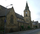
Walkley
Walkley is a suburb in the north west of Sheffield in EnglandEngland
England is a country that is part of the United Kingdom. It shares land borders with Scotland to the north and Wales to the west; the Irish Sea is to the north west, the Celtic Sea to the south west, with the North Sea to the east and the English Channel to the south separating it from continental...
. It lies north-east of Crookes
Crookes
Crookes ward—which includes the districts of Crookes, Steelbank, Crosspool, and Sandygate —is one of the 28 electoral wards in City of Sheffield, England. It is located in the western part of the city and covers an area of 3.9 km2...
and south of Hillsborough.
Netherthorpe
Netherthorpe is a council estate lying south-east of the PonderosaPonderosa (Sheffield)
The Ponderosa is a recreation area within the City of Sheffield, South Yorkshire, England. Although not a public park it was designated as Open Space by Sheffield City Council in the 1993 Unitary Development Plan. It covers an area of over 10 hectares and is located at , 1.5 km west of the...
open space. Originally an area of working-class Victorian terraces, it was reconstructed in the 1960s as an area of tower block
Tower block
A tower block, high-rise, apartment tower, office tower, apartment block, or block of flats, is a tall building or structure used as a residential and/or office building...
s and medium-rise flats with a few houses. In the late 1990s the tower blocks were reclad and many of the other flats demolished and replaced by modern housing.
Upperthorpe
Upperthorpe lies north-west of the PonderosaPonderosa (Sheffield)
The Ponderosa is a recreation area within the City of Sheffield, South Yorkshire, England. Although not a public park it was designated as Open Space by Sheffield City Council in the 1993 Unitary Development Plan. It covers an area of over 10 hectares and is located at , 1.5 km west of the...
open space and south east of Walkley. Building in the area began in the late Georgian
Georgian architecture
Georgian architecture is the name given in most English-speaking countries to the set of architectural styles current between 1720 and 1840. It is eponymous for the first four British monarchs of the House of Hanover—George I of Great Britain, George II of Great Britain, George III of the United...
period, from which the former infirmary
Hospital
A hospital is a health care institution providing patient treatment by specialized staff and equipment. Hospitals often, but not always, provide for inpatient care or longer-term patient stays....
(now offices) and a few houses survive. Construction continued, with many large Victorian houses and a car-free late-20th-century housing estate
Housing estate
A housing estate is a group of buildings built together as a single development. The exact form may vary from country to country. Accordingly, a housing estate is usually built by a single contractor, with only a few styles of house or building design, so they tend to be uniform in appearance...
surviving. The Kelvin Flats were a landmark in the area, of similar design to now listed Park Hill, but were demolished in the early 1990s. The area is served by the Infirmary Road Sheffield Supertram
Sheffield Supertram
The Supertram, officially called the Stagecoach Supertram, is a light rail tram system in the City of Sheffield, South Yorkshire, England...
stop.