

The Thumb
Encyclopedia
Michigan
Michigan is a U.S. state located in the Great Lakes Region of the United States of America. The name Michigan is the French form of the Ojibwa word mishigamaa, meaning "large water" or "large lake"....
, so named because the Lower Peninsula
Lower Peninsula of Michigan
The Lower Peninsula of Michigan is the southern of the two major landmasses of the U.S. state of Michigan. It is surrounded by water on all sides except its southern border, which it shares with Ohio and Indiana. Geographically, the Lower Peninsula has a recognizable shape that many people...
is shaped like a mitten; thus the Thumb is the area that looks like the thumb
Thumb
The thumb is the first digit of the hand. When a person is standing in the medical anatomical position , the thumb is the lateral-most digit...
of the mitten. The Thumb is generally considered to be in the Mid-Michigan area of the state, located east of Flint/Tri-Cities
Flint/Tri-Cities
The Flint/Tri-Cities Region or Saginaw Valley is a region in the Lower Peninsula of the U.S. state of Michigan. The region is composed of the area surrounding Flint, Michigan, the Tri Cities, the Saginaw Bay and Saginaw River . Flint's population is 102,434; it is the seventh largest city in Michigan...
region, and north of Southeast Michigan
Southeast Michigan
Southeast Michigan, also called Southeastern Michigan, is a region in the Lower Peninsula of the U.S. state of Michigan that is home to a majority of the state's businesses and industries as well as slightly over half of the state's population, most of whom are concentrated in Metro...
. The thumb is also branded as the Blue Water Area of Michigan.
The counties which constitute the Thumb are those forming the extended peninsula that stretches northward into Lake Huron
Lake Huron
Lake Huron is one of the five Great Lakes of North America. Hydrologically, it comprises the larger portion of Lake Michigan-Huron. It is bounded on the east by the Canadian province of Ontario and on the west by the state of Michigan in the United States...
and Saginaw Bay
Saginaw Bay
Saginaw Bay is a bay within Lake Huron located on the eastern side of the U.S. state of Michigan. It forms the space between Michigan's Thumb region and the rest of the Lower Peninsula of Michigan. Saginaw Bay is in area...
. There is no formal declaration for which of these counties are part of the Thumb. However, virtually all common definitions include Huron
Huron County, Michigan
-Highways:* M-19* M-25* M-53* M-142-Demographics:As of the census of 2000, there were 36,079 people, 14,597 households, and 10,144 families residing in the county. The population density was 43 people per square mile . There were 20,430 housing units at an average density of 24 per square mile...
, Tuscola
Tuscola County, Michigan
-Highways:* M-15* M-24* M-25* M-46* M-81* M-138-Demographics:As of the census of 2000, there were 58,266 people, 21,454 households, and 15,983 families residing in the county. The population density was 72 people per square mile . There were 23,378 housing units at an average density of 29 per...
, and Sanilac
Sanilac County, Michigan
-Highways:* M-19* M-25* M-46* M-53* M-81* M-90-History:Sanilac County was probably named for a Wyandot chief named Sanilac. See List of Michigan county name etymologies....
counties. This definition is almost always extended to include Lapeer
Lapeer County, Michigan
-Demographics:As of the census of 2000, there were 87,904 people, 30,729 households, and 23,876 families residing in the county. The population density was 134 people per square mile . There were 32,732 housing units at an average density of 50 per square mile...
and St. Clair
St. Clair County, Michigan
-Interstates:* I-69 enters the county from the west, coming from Lansing and Flint, terminating at the approach to the Blue Water Bridge in Port Huron....
counties as well.
Economy
The Thumb region is very flat with fertile soilSoil
Soil is a natural body consisting of layers of mineral constituents of variable thicknesses, which differ from the parent materials in their morphological, physical, chemical, and mineralogical characteristics...
, the reason for its historical role as a chiefly agricultural area. Major agricultural products are sugar beets, navy beans, corn
Maize
Maize known in many English-speaking countries as corn or mielie/mealie, is a grain domesticated by indigenous peoples in Mesoamerica in prehistoric times. The leafy stalk produces ears which contain seeds called kernels. Though technically a grain, maize kernels are used in cooking as a vegetable...
, fruits, and fish from the Saginaw Bay
Saginaw Bay
Saginaw Bay is a bay within Lake Huron located on the eastern side of the U.S. state of Michigan. It forms the space between Michigan's Thumb region and the rest of the Lower Peninsula of Michigan. Saginaw Bay is in area...
and Lake Huron
Lake Huron
Lake Huron is one of the five Great Lakes of North America. Hydrologically, it comprises the larger portion of Lake Michigan-Huron. It is bounded on the east by the Canadian province of Ontario and on the west by the state of Michigan in the United States...
. Few of the residents commute for work to Metropolitan Detroit or Flint
Flint, Michigan
Flint is a city in the U.S. state of Michigan and is located along the Flint River, northwest of Detroit. The U.S. Census Bureau reports the 2010 population to be placed at 102,434, making Flint the seventh largest city in Michigan. It is the county seat of Genesee County which lies in the...
or the Tri-Cities. Large cities in the Thumb area are Port Huron
Port Huron, Michigan
Port Huron is a city in the U.S. state of Michigan and the county seat of St. Clair County. The population was 30,184 at the 2010 census. The city is adjacent to Port Huron Township but is administratively autonomous. It is joined by the Blue Water Bridge over the St. Clair River to Sarnia,...
, Lapeer
Lapeer, Michigan
Lapeer is a city in the U.S. state of Michigan and is the county seat of Lapeer County. As of the 2010 census, the city population was 8,841. Most of the city was incorporated from land that was formerly in Lapeer Township, though portions were also annexed from Mayfield Township and Elba...
, Marysville
Marysville, Michigan
Marysville is a city in St. Clair County of the U.S. state of Michigan. The population was 9,684 at the 2000 census.-Geography:* According to the United States Census Bureau, the city has a total area of , of which, of it is land and of it is water.* It is considered to be part of the Thumb of...
, St. Clair
St. Clair, Michigan
St. Clair is a city in St. Clair County in the U.S. state of Michigan. The population was 5,802 at the 2000 census. The city is located on the St. Clair River near the southeast corner of St. Clair Township.-Geography:...
, Sandusky, Bad Axe, and Caro
Caro, Michigan
Caro is a city in and the county seat of Tuscola County, Michigan, United States. The population was 4,229 at the 2010 census and 4,145 at the 2000 census ....
. The majority of these cities are in the southern portion of the Thumb.
Industry
See also: List of companies based in MichiganThe Thumb has many notable businesses, many linked to agriculture.
- Intertape Polymer Group, Inc. has a major factory in MarysvilleMarysville, MichiganMarysville is a city in St. Clair County of the U.S. state of Michigan. The population was 9,684 at the 2000 census.-Geography:* According to the United States Census Bureau, the city has a total area of , of which, of it is land and of it is water.* It is considered to be part of the Thumb of...
. - CargillCargillCargill, Incorporated is a privately held, multinational corporation based in Minnetonka, Minnesota. Founded in 1865, it is now the largest privately held corporation in the United States in terms of revenue. If it were a public company, it would rank, as of 2011, number 13 on the Fortune 500,...
Salt operates a large salt mine and factory in St. ClairSt. Clair, MichiganSt. Clair is a city in St. Clair County in the U.S. state of Michigan. The population was 5,802 at the 2000 census. The city is located on the St. Clair River near the southeast corner of St. Clair Township.-Geography:...
. This is the only plant in the U.S.A. that produces AlbergerAlberger processThe Alberger process is a method of producing salt.It involves mechanical evaporation, and uses an open evaporating pan and steam energy. It results in a unique, three-dimensional flake salt of extremely light bulk density. It is highly prized in the fast food industry, due to its low sodium and...
saltSaltIn chemistry, salts are ionic compounds that result from the neutralization reaction of an acid and a base. They are composed of cations and anions so that the product is electrically neutral...
, which is especially prized in the fast food industry because of its higher volume (due to its unique shape) and lower sodium content (for a given volume, not weight). This is part of Michigan's large salt-mining industry. - Cooperative Elevator Company has been named the top Michigan Agriculture Exporter by the Michigan Department of Agriculture. Its headquarters are in PigeonPigeon, MichiganPigeon is a village in Huron County in the U.S. state of Michigan. The population was 1,207 at the 2000 census. The village is within Winsor Township.-Geography:*According to the United States Census Bureau, the village has a total area of , all land....
, and it has branch elevators in DeckervilleDeckerville, MichiganDeckerville is a village in Sanilac County in the U.S. state of Michigan. The population was 944 at the 2000 census.-Geography:According to the United States Census Bureau, the village has a total area of , all land.-Demographics:...
, AkronAkron, MichiganAkron is a village in Tuscola County of the U.S. state of Michigan. The population was 461 at the 2000 census.The village is located on the boundary between Akron Township on the north and Fairgrove Township on the south, with the village area approximately evenly split between the two...
, GagetownGagetown, MichiganGagetown is a village in Tuscola County in the U.S. state of Michigan. The population was 389 at the 2000 census. It is located in the northeastern corner of Elmwood Township....
, SebewaingSebewaing, MichiganSebewaing is a village in Huron County in the U.S. state of Michigan. The population was 1,974 at the 2000 census. The village is within Sebewaing Township. This small community is known as the Sugar Beet Capital, due to the Michigan Sugar slicing mill located within the village and the yearly...
, ElktonElkton, MichiganElkton is a village in Huron County in the U.S. state of Michigan. The population was 863 at the 2000 census. The village is within Oliver Township, along the Pinnebog River....
, and Bad Axe.
- Detroit EdisonDetroit EdisonThe Detroit Edison Company, founded in 1903, is an investor-owned electric utility which serves most of Southeast Michigan. Its parent company, DTE Energy , provides energy services to a variety of clients beyond Detroit Edison's service area.- History :...
is the operator of five power plants in the Thumb area: St. Clair and Belle River Power PlantBelle River Power PlantBelle River Power Plant is a major coal- and natural gas-fired power plant owned by Detroit Edison, a subsidiary of DTE Energy. It is located in St. Clair County, Michigan, on the peninsula formed by the St. Clair and Belle rivers. The plant was built across M-29 from the St. Clair Power Plant in...
s in East China TownshipEast China Township, MichiganEast China Charter Township is a charter township of St. Clair County in the U.S. state of Michigan. The population was 3,630 at the 2000 census. East China Township is home to the St. Clair and Belle River Power Plants...
, Marysville Power Plant in MarysvilleMarysville, MichiganMarysville is a city in St. Clair County of the U.S. state of Michigan. The population was 9,684 at the 2000 census.-Geography:* According to the United States Census Bureau, the city has a total area of , of which, of it is land and of it is water.* It is considered to be part of the Thumb of...
, Harbor BeachHarbor Beach, MichiganHarbor Beach is a city in Huron County in the U.S. state of Michigan. The population was 1,837 at the 2000 census, with an estimated population of 1,587 in 2009.-Geography:...
Powerplant, and Greenwood Energy Center in Greenwood TownshipGreenwood Township, St. Clair County, MichiganGreenwood Township is a civil township of St. Clair County in the U.S. state of Michigan. The population was 1,373 at the 2000 census.- Communities:...
. - Dow AgroSciencesDow AgroSciencesDow AgroSciences LLC is a wholly owned subsidiary of the Dow Chemical Company specializing in not only agricultural chemicals such as pesticides, but also seeds and biotechnology solutions. The company is based in Indianapolis, Indiana, in the United States...
Harbor BeachHarbor Beach, MichiganHarbor Beach is a city in Huron County in the U.S. state of Michigan. The population was 1,837 at the 2000 census, with an estimated population of 1,587 in 2009.-Geography:...
manufactures agricultural chemicals: weed killer, fungicides, fertilizers and plant nutrients and herbicides. - Mueller Industries owns and operates Mueller Brass in Port HuronPort Huron, MichiganPort Huron is a city in the U.S. state of Michigan and the county seat of St. Clair County. The population was 30,184 at the 2010 census. The city is adjacent to Port Huron Township but is administratively autonomous. It is joined by the Blue Water Bridge over the St. Clair River to Sarnia,...
. - Grand Trunk Western Railway has a major rail yard in Port Huron TownshipPort Huron Township, MichiganPort Huron Charter Township is a charter township of St. Clair County in the U.S. state of Michigan. The population was 8,615 at the 2000 census...
. - Marysville Hydrocarbons is an ethanolEthanolEthanol, also called ethyl alcohol, pure alcohol, grain alcohol, or drinking alcohol, is a volatile, flammable, colorless liquid. It is a psychoactive drug and one of the oldest recreational drugs. Best known as the type of alcohol found in alcoholic beverages, it is also used in thermometers, as a...
plant in MarysvilleMarysville, MichiganMarysville is a city in St. Clair County of the U.S. state of Michigan. The population was 9,684 at the 2000 census.-Geography:* According to the United States Census Bureau, the city has a total area of , of which, of it is land and of it is water.* It is considered to be part of the Thumb of...
. - Michigan Ethanol, a partner of Broin Companies, operates a corn ethanolCorn ethanolCorn ethanol is ethanol produced from corn as a biomass through industrial fermentation, chemical processing and distillation. Corn is the main feedstock used for producing ethanol fuel in the United States and it is mainly used as an oxygenate to gasoline in the form of low-level blends, and to a...
production facility in southwest CaroCaro, MichiganCaro is a city in and the county seat of Tuscola County, Michigan, United States. The population was 4,229 at the 2010 census and 4,145 at the 2000 census ....
. - Michigan Sugar CompanyMichigan Sugar CompanyMichigan Sugar Company is an agricultural cooperative, based in Bay City, Michigan, that specializes in the processing of beet sugar. Founded in 1906, Michigan Sugar sells beet sugar under the brand names Big Chief and Pioneer....
, an agricultural cooperative owned by 1200 farmers, operates four plants in the area. It is the successor to the 100-year-old "Big Chief" and "Pioneer" Sugar companies. Local plants are located in CaroCaro, MichiganCaro is a city in and the county seat of Tuscola County, Michigan, United States. The population was 4,229 at the 2010 census and 4,145 at the 2000 census ....
, SebewaingSebewaing, MichiganSebewaing is a village in Huron County in the U.S. state of Michigan. The population was 1,974 at the 2000 census. The village is within Sebewaing Township. This small community is known as the Sugar Beet Capital, due to the Michigan Sugar slicing mill located within the village and the yearly...
, CroswellCroswell, MichiganCroswell is a city in Sanilac County in the U.S. state of Michigan. The population was 2,467 at the 2000 census.-Geography:*According to the United States Census Bureau, the city has a total area of , all land....
, and headquarters in Bay CityBay City, MichiganBay City is a city in the U.S. state of Michigan located near the base of the Saginaw Bay on Lake Huron. As of the 2010 census, the city's population was 34,932, and is the principal city of the Bay City Metropolitan Statistical Area, which is included in the Saginaw-Bay City-Saginaw Township North...
. - DomtarDomtarDomtar Corporation is the largest integrated producer of uncoated freesheet paper in North America and the second largest in the world based on production capacity, and is also a manufacturer of papergrade pulp....
operates a paper mill in Port HuronPort Huron, MichiganPort Huron is a city in the U.S. state of Michigan and the county seat of St. Clair County. The population was 30,184 at the 2010 census. The city is adjacent to Port Huron Township but is administratively autonomous. It is joined by the Blue Water Bridge over the St. Clair River to Sarnia,...
. - Keihin Michigan Manufacturing operates a auto part manufacturing plant in CapacCapac, MichiganCapac is a village in Mussey Township, St. Clair County in the U.S. state of Michigan. The population was 1,775 at the 2000 census.-History:Capac was founded and platted by a group of men from Romeo headed by George R. Funstan and Judge DeWitt C. Walker in 1857. The judge named it after Huayna...
, they build HVACHVACHVAC refers to technology of indoor or automotive environmental comfort. HVAC system design is a major subdiscipline of mechanical engineering, based on the principles of thermodynamics, fluid mechanics, and heat transfer...
and intake manifold assemblies that are used in Honda vehicles. - Sensient Technologies Corporation, Harbor BeachHarbor Beach, MichiganHarbor Beach is a city in Huron County in the U.S. state of Michigan. The population was 1,837 at the 2000 census, with an estimated population of 1,587 in 2009.-Geography:...
, makes food flavors and colors, yeast dehydrated products and vegetable protein extract. - Star of the West Milling Co. which has grain elevators in VassarVassar, MichiganVassar is a city in Tuscola County in the U.S. state of Michigan. The small town was founded March 1, 1849. The population was 2,697 at the 2010 census and 2,823 at the 2000 census...
and Cass CityCass City, MichiganCass City is a village in Tuscola County in the Flint/Tri-Cities area of the U.S. state of Michigan. The population was 2,428 at the 2010 U.S. Census and 2,643 at the 2000 U.S. Census . It is located along the M-81 state trunkline approximately 4 miles west of that highway's intersection with M-53...
, joined with Eastern Michigan Grain in EmmettEmmett, MichiganEmmett is a village in St. Clair County of the U.S. state of Michigan. The population was 251 at the 2000 census. The village is located within Emmett Township.-Geography:...
.
Tourism
Caseville, Michigan
Caseville is a city in Huron County in the U.S. state of Michigan. The population was 888 at the 2000 census. The city is surrounded by Caseville Township. It is home to the 10-day festival, a tribute to Jimmy Buffett's song "Cheeseburger in Paradise"...
, Harbor Beach
Harbor Beach, Michigan
Harbor Beach is a city in Huron County in the U.S. state of Michigan. The population was 1,837 at the 2000 census, with an estimated population of 1,587 in 2009.-Geography:...
, Lakeport, Lexington
Lexington, Michigan
Lexington is a village in Sanilac County in the U.S. state of Michigan. The population was 1,104 at the 2000 census. The village is located within Lexington Township.-Geography:...
, Port Austin
Port Austin, Michigan
Port Austin is a village in Huron County in the U.S. state of Michigan. The population was 737 at the 2000 census. The village is within Port Austin Township.-Geography:...
, Port Hope
Port Hope, Michigan
Port Hope is a village in Huron County of the U.S. state of Michigan. As of the 2000 census, the village population was 310. The village is within Rubicon Township.-Geography:...
, Port Huron
Port Huron, Michigan
Port Huron is a city in the U.S. state of Michigan and the county seat of St. Clair County. The population was 30,184 at the 2010 census. The city is adjacent to Port Huron Township but is administratively autonomous. It is joined by the Blue Water Bridge over the St. Clair River to Sarnia,...
, Port Sanilac
Port Sanilac, Michigan
Port Sanilac is a village in Sanilac Township, Sanilac County in the U.S. state of Michigan. The population was 658 at the 2000 census.-History:...
, Sebewaing
Sebewaing, Michigan
Sebewaing is a village in Huron County in the U.S. state of Michigan. The population was 1,974 at the 2000 census. The village is within Sebewaing Township. This small community is known as the Sugar Beet Capital, due to the Michigan Sugar slicing mill located within the village and the yearly...
, and St. Clair
St. Clair, Michigan
St. Clair is a city in St. Clair County in the U.S. state of Michigan. The population was 5,802 at the 2000 census. The city is located on the St. Clair River near the southeast corner of St. Clair Township.-Geography:...
enjoy seasonal tourism, due to their locations on Lake Huron
Lake Huron
Lake Huron is one of the five Great Lakes of North America. Hydrologically, it comprises the larger portion of Lake Michigan-Huron. It is bounded on the east by the Canadian province of Ontario and on the west by the state of Michigan in the United States...
, Saginaw Bay
Saginaw Bay
Saginaw Bay is a bay within Lake Huron located on the eastern side of the U.S. state of Michigan. It forms the space between Michigan's Thumb region and the rest of the Lower Peninsula of Michigan. Saginaw Bay is in area...
, or St. Clair River
St. Clair River
The St. Clair River is a river in central North America which drains Lake Huron into Lake St Clair, forming part of the international boundary between the Canadian province of Ontario and the U.S. state of Michigan...
. The Thumb lies within the east-central tourism region of the state
The Tip of The Thumb Heritage Water Trail
Tip of The Thumb Heritage Water Trail
Water trails are routes on navigable waterways such as rivers, lakes, and canals for people using small non-motorized boats such as kayaks, canoes, rafts, or rowboats. The trails are designed and implemented to foster an interactive historical educational experience...
is a nonprofit citizens organization working with the Huron County Parks to establish and maintain a water trail along Michigan’s Lake Huron’s shoreline.
Unique to the Thumb
Unique features in the area include the following:- AlgonacAlgonac, MichiganAlgonac is a city in St. Clair County of the U.S. state of Michigan. The population was 4,613 at the 2000 census.Algonac is located at the southern end of the St. Clair River, just before it splits into a large delta region known as the St. Clair Flats. The St. Clair River drains Lake Huron into...
, known as the Venice of Michigan because of its many canals, is a part of the largest freshwater deltaRiver deltaA delta is a landform that is formed at the mouth of a river where that river flows into an ocean, sea, estuary, lake, reservoir, flat arid area, or another river. Deltas are formed from the deposition of the sediment carried by the river as the flow leaves the mouth of the river...
in the world, that of the St. Clair RiverSt. Clair RiverThe St. Clair River is a river in central North America which drains Lake Huron into Lake St Clair, forming part of the international boundary between the Canadian province of Ontario and the U.S. state of Michigan...
into Lake St. ClairLake Saint Clair (North America)Lake St. Clair is a fresh-water lake named after Clare of Assisi that lies between the Province of Ontario and the State of Michigan, and its midline also forms the boundary between Canada and the United States of America. Lake St. Clair includes the Anchor Bay along the Metro Detroit coastline...
. - Bad Axe was named after a broken axe found lodged in the knot of a tree at the clearing of the settlement's chief crossroads.
- Bay Port, is the world's largest freshwater fishing port.
- Harbor BeachHarbor Beach, MichiganHarbor Beach is a city in Huron County in the U.S. state of Michigan. The population was 1,837 at the 2000 census, with an estimated population of 1,587 in 2009.-Geography:...
is the home of the largest man-made harbor and the Harbor Beach LightHarbor Beach LightThe Harbor Beach Lighthouse is a "sparkplug lighthouse" located at the end of the north breakwall entrance to the harbor of refuge on Lake Huron. The breakwall and light were created by the United States Army Corps of Engineers to protect the harbor of Harbor Beach, Michigan, which is the greatest...
. - Harvest Wind Farm, an electrical generation project of John Deere Wind Energy and Wolverine Power Supply Cooperative.
- Huron County Nature Center includes a 120 acre (0.4856232 km²) wilderness arboretum that has been under the care of the Huron County Women's Clubs for more than 50 years.
- Kernan Memorial Nature Sanctuary is a 45 acres (182,108.7 m²) refuge with 4000 feet (1,219.2 m) of shoreline acquired October 30, 1989 on Lake HuronLake HuronLake Huron is one of the five Great Lakes of North America. Hydrologically, it comprises the larger portion of Lake Michigan-Huron. It is bounded on the east by the Canadian province of Ontario and on the west by the state of Michigan in the United States...
, in Huron CountyHuron County, Michigan-Highways:* M-19* M-25* M-53* M-142-Demographics:As of the census of 2000, there were 36,079 people, 14,597 households, and 10,144 families residing in the county. The population density was 43 people per square mile . There were 20,430 housing units at an average density of 24 per square mile...
. On the western coast of Whiskey Harbor, this area is a great place to see migratory birds in early March and November. - KindeKinde, MichiganKinde is a village in Huron County in the U.S. state of Michigan. The population was 534 at the 2000 census.The village is located on the boundary between Dwight Township and Lincoln Township, with about half of the village in both...
was once the bean capital of the world. Michigan Bean soup has been a staple for over a hundred years in the U.S. SenateUnited States SenateThe United States Senate is the upper house of the bicameral legislature of the United States, and together with the United States House of Representatives comprises the United States Congress. The composition and powers of the Senate are established in Article One of the U.S. Constitution. Each...
dining room. - PigeonPigeon, MichiganPigeon is a village in Huron County in the U.S. state of Michigan. The population was 1,207 at the 2000 census. The village is within Winsor Township.-Geography:*According to the United States Census Bureau, the village has a total area of , all land....
is the home of the Cooperative Elevator Company, one of the largest grain elevators in the state. - Port HuronPort Huron, MichiganPort Huron is a city in the U.S. state of Michigan and the county seat of St. Clair County. The population was 30,184 at the 2010 census. The city is adjacent to Port Huron Township but is administratively autonomous. It is joined by the Blue Water Bridge over the St. Clair River to Sarnia,...
is the maritime capital of the Great LakesGreat LakesThe Great Lakes are a collection of freshwater lakes located in northeastern North America, on the Canada – United States border. Consisting of Lakes Superior, Michigan, Huron, Erie, and Ontario, they form the largest group of freshwater lakes on Earth by total surface, coming in second by volume...
, where Lake HuronLake HuronLake Huron is one of the five Great Lakes of North America. Hydrologically, it comprises the larger portion of Lake Michigan-Huron. It is bounded on the east by the Canadian province of Ontario and on the west by the state of Michigan in the United States...
flows into the St. Clair RiverSt. Clair RiverThe St. Clair River is a river in central North America which drains Lake Huron into Lake St Clair, forming part of the international boundary between the Canadian province of Ontario and the U.S. state of Michigan...
. This is the largest city in the Thumb area. It was the boyhood home of Thomas EdisonThomas EdisonThomas Alva Edison was an American inventor and businessman. He developed many devices that greatly influenced life around the world, including the phonograph, the motion picture camera, and a long-lasting, practical electric light bulb. In addition, he created the world’s first industrial...
. - The Sanilac PetroglyphsSanilac Petroglyphs Historic State ParkSanilac Petroglyphs Historic State Park is a state park in Michigan containing Michigan's only known rock carvings attributable to Native American Indians...
were discovered after massive firesThumb FireThe great Thumb Fire took place on September 5, 1881, in the Thumb area of Michigan in the United States. The fire, which burned over a million acres in less than a day, was the consequence of drought, hurricane-force winds, heat, the after-effects of the Port Huron Fire of 1871, and the...
swept the Lower Peninsula in 1881. Native AmericansNative Americans in the United StatesNative Americans in the United States are the indigenous peoples in North America within the boundaries of the present-day continental United States, parts of Alaska, and the island state of Hawaii. They are composed of numerous, distinct tribes, states, and ethnic groups, many of which survive as...
created this unusual artwork 300 to 1,000 years ago. The petroglyphs provide a glimpse into the lives of an ancient woodland people who occupied Michigan's Thumb area. - SebewaingSebewaing, MichiganSebewaing is a village in Huron County in the U.S. state of Michigan. The population was 1,974 at the 2000 census. The village is within Sebewaing Township. This small community is known as the Sugar Beet Capital, due to the Michigan Sugar slicing mill located within the village and the yearly...
is the sugar beetSugar beetSugar beet, a cultivated plant of Beta vulgaris, is a plant whose tuber contains a high concentration of sucrose. It is grown commercially for sugar production. Sugar beets and other B...
capital of the world, and home to one of the four Michigan Sugar CompanyMichigan Sugar CompanyMichigan Sugar Company is an agricultural cooperative, based in Bay City, Michigan, that specializes in the processing of beet sugar. Founded in 1906, Michigan Sugar sells beet sugar under the brand names Big Chief and Pioneer....
factories in the Thumb region. The sugar companies were organized with money from lumber barons such as Rasmus Hanson. - St. ClairSt. Clair, MichiganSt. Clair is a city in St. Clair County in the U.S. state of Michigan. The population was 5,802 at the 2000 census. The city is located on the St. Clair River near the southeast corner of St. Clair Township.-Geography:...
boasts the world's largest boardwalk along freshwater, the St. Clair RiverSt. Clair RiverThe St. Clair River is a river in central North America which drains Lake Huron into Lake St Clair, forming part of the international boundary between the Canadian province of Ontario and the U.S. state of Michigan...
. - Michigan Underwater PreservesMichigan Underwater PreservesMichigan Underwater Preserves or Michigan Bottomland Preserves are protected areas of the Great Lakes on Michigan's coast. The eleven designated areas, comprising a surface area of over , are considered to be "Underwater museums" and serve to protect concentrations of shipwrecks, unique geologic...
are protected areas of the Great LakesGreat LakesThe Great Lakes are a collection of freshwater lakes located in northeastern North America, on the Canada – United States border. Consisting of Lakes Superior, Michigan, Huron, Erie, and Ontario, they form the largest group of freshwater lakes on Earth by total surface, coming in second by volume...
on MichiganMichiganMichigan is a U.S. state located in the Great Lakes Region of the United States of America. The name Michigan is the French form of the Ojibwa word mishigamaa, meaning "large water" or "large lake"....
's coast. There are nineteen major shipwrecks in the 276 square miles (714.8 km²) of the Thumb Area Bottomland PreserveThumb Area Bottomland PreserveThe Thumb Area Underwater Preserve is a preservation area in Lake Huron in the U.S. state of Michigan. It is in size and is located off Michigan's Thumb north of Detroit.-Description:...
and the Sanilac Shores Underwater PreserveSanilac Shores Underwater PreserveThe Sanilac Shores Underwater Preserve was established to promote conservation of the submerged historical resources in Lake Huron near Port Sanilac, Michigan. The Sanilac Shores Underwater Preserve spans a total of of Lake Huron...
which expands a total of 163 square miles (422.2 km²) of Lake HuronLake HuronLake Huron is one of the five Great Lakes of North America. Hydrologically, it comprises the larger portion of Lake Michigan-Huron. It is bounded on the east by the Canadian province of Ontario and on the west by the state of Michigan in the United States...
. - CasevilleCaseville, MichiganCaseville is a city in Huron County in the U.S. state of Michigan. The population was 888 at the 2000 census. The city is surrounded by Caseville Township. It is home to the 10-day festival, a tribute to Jimmy Buffett's song "Cheeseburger in Paradise"...
is the home of the annual Cheeseburger in CasevilleCheeseburger in CasevilleCheeseburger in Caseville is a festival that takes place in Caseville, Michigan. Cheeseburger is a festival in tribute to Jimmy Buffett, and different types of cheeseburgers. The 10-day long festival takes place in the final weeks of August, celebrating the final weeks of summer vacation...
festival, a hometown festival devoted to Jimmy BuffettJimmy BuffettJames William "Jimmy" Buffett is a singer-songwriter, author, entrepreneur, and film producer. He is best known for his music, which often portrays an "island escapism" lifestyle. Together with his Coral Reefer Band, Buffett's musical hits include "Margaritaville" , and "Come Monday"...
's song "Cheeseburger in ParadiseCheeseburger In Paradise"Cheeseburger in Paradise" is a song written and performed by American popular music singer Jimmy Buffett. It appeared on his 1978 album Son of a Son of a Sailor and was released as a single, reaching #32 on the Billboard Hot 100...
".
Traveling around the Thumb
A favorite of tourists who visit this area is traveling the Lake HuronLake Huron
Lake Huron is one of the five Great Lakes of North America. Hydrologically, it comprises the larger portion of Lake Michigan-Huron. It is bounded on the east by the Canadian province of Ontario and on the west by the state of Michigan in the United States...
and Saginaw Bay
Saginaw Bay
Saginaw Bay is a bay within Lake Huron located on the eastern side of the U.S. state of Michigan. It forms the space between Michigan's Thumb region and the rest of the Lower Peninsula of Michigan. Saginaw Bay is in area...
shoreline via M-25
M-25 (Michigan highway)
M-25 is a state trunkline highway in the US state of Michigan. The route follows an arc-like shape closely along the Lake Huron shore of the Thumb in the eastern Lower Peninsula between Port Huron and Bay City. It serves the lakeshore resorts along Lake Huron and Saginaw Bay and generally lies...
(formerly US 25 until 1973). M-25 starts at the end of I-69
Interstate 69
Interstate 69 is an Interstate Highway in the United States. It exists in two parts: a completed highway from Indianapolis, Indiana, northeast to the Canadian border in Port Huron, Michigan, and a mostly proposed extension southwest to the Mexican border in Texas...
/I-94
Interstate 94
Interstate 94 is the northernmost east–west Interstate Highway, connecting the Great Lakes and Intermountain regions of the United States. I-94's western terminus is in Billings, Montana at a junction with Interstate 90; its eastern terminus is the U.S...
in Port Huron
Port Huron, Michigan
Port Huron is a city in the U.S. state of Michigan and the county seat of St. Clair County. The population was 30,184 at the 2010 census. The city is adjacent to Port Huron Township but is administratively autonomous. It is joined by the Blue Water Bridge over the St. Clair River to Sarnia,...
at the foot of the Blue Water Bridge
Blue Water Bridge
The Blue Water Bridge is a twin-span international bridge across the St. Clair River that links Port Huron, Michigan, USA and Sarnia, Ontario, Canada...
and ends in Bay City
Bay City, Michigan
Bay City is a city in the U.S. state of Michigan located near the base of the Saginaw Bay on Lake Huron. As of the 2010 census, the city's population was 34,932, and is the principal city of the Bay City Metropolitan Statistical Area, which is included in the Saginaw-Bay City-Saginaw Township North...
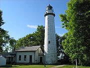
. The whole route is about 160 miles (257.5 km), and passes through quaint cities and villages. Along M-25 you can see five lighthouses: Fort Gratiot Lighthouse
Fort Gratiot Lighthouse
Fort Gratiot Light, the first lighthouse in the state of Michigan, was constructed north of Fort Gratiot in 1829 by Lucius Lyon, who later became one of Michigan's first U.S. Senators....
, Port Sanilac lighthouse, Pointe aux Barques Lighthouse, Harbor Beach Light
Harbor Beach Light
The Harbor Beach Lighthouse is a "sparkplug lighthouse" located at the end of the north breakwall entrance to the harbor of refuge on Lake Huron. The breakwall and light were created by the United States Army Corps of Engineers to protect the harbor of Harbor Beach, Michigan, which is the greatest...
, and the Port Austin Lighthouse
Port Austin Lighthouse
Port Austin Lighthouse is a lighthouse off the shore of Lake Huron, about north of Port Austin, Huron County Michigan sitting on a rocky reef , which is just north of the tip of the Thumb and a real hazard to navigation.-History:The original plans were for this lighthouse to be built on shore...
.
The Great Lakes Circle Tour
Great Lakes Circle Tour
The Great Lakes Circle Tour is a designated scenic road system connecting all of the Great Lakes and the St. Lawrence River. It consists of routes for circumnavigating the lakes, either individually or collectively.-Lake Superior Circle Tour:...
is a designated scenic road system connecting all of the Great Lakes and the St. Lawrence River. Port Huron in eastern Michigan is a good starting point for the circle tour of Lake Huron. M-25 winds around the Thumb and along the Saginaw Bay to Saginaw and Bay City. Do not forget to go to the beach and walk the boardwalks in Lexington
Lexington, Michigan
Lexington is a village in Sanilac County in the U.S. state of Michigan. The population was 1,104 at the 2000 census. The village is located within Lexington Township.-Geography:...
and Port Austin
Port Austin, Michigan
Port Austin is a village in Huron County in the U.S. state of Michigan. The population was 737 at the 2000 census. The village is within Port Austin Township.-Geography:...
.
.jpg)
Lighthouse Tour
In order from east to west:- Huron LightshipHuron LightshipThe United States lightship Huron is a lightvessel that was launched in 1920. It is now a museum ship moored in Pine Grove Park, Port Huron, St. Clair County, Michigan.-Great Lakes lightships:...
-- Lake HuronLake HuronLake Huron is one of the five Great Lakes of North America. Hydrologically, it comprises the larger portion of Lake Michigan-Huron. It is bounded on the east by the Canadian province of Ontario and on the west by the state of Michigan in the United States...
/ St. Clair RiverSt. Clair RiverThe St. Clair River is a river in central North America which drains Lake Huron into Lake St Clair, forming part of the international boundary between the Canadian province of Ontario and the U.S. state of Michigan...
-- Port HuronPort Huron, MichiganPort Huron is a city in the U.S. state of Michigan and the county seat of St. Clair County. The population was 30,184 at the 2010 census. The city is adjacent to Port Huron Township but is administratively autonomous. It is joined by the Blue Water Bridge over the St. Clair River to Sarnia,... - Fort Gratiot Light -- Lake Huron / St. Clair River—Port Huron
- Port Sanilac Light -- Lake Huron-- Port SanilacPort Sanilac, MichiganPort Sanilac is a village in Sanilac Township, Sanilac County in the U.S. state of Michigan. The population was 658 at the 2000 census.-History:...
-- Private - White Rock Memorial Light -- Lake Huron -- White RockWhite Rock, MichiganWhite Rock is a tiny unincorporated community of Sherman Township at the southeast corner of Huron County in the U.S. state of Michigan. The community is at the mouth of White Rock Creek on the shore of Lake Huron...
-- Private - Harbor Beach LightHarbor Beach LightThe Harbor Beach Lighthouse is a "sparkplug lighthouse" located at the end of the north breakwall entrance to the harbor of refuge on Lake Huron. The breakwall and light were created by the United States Army Corps of Engineers to protect the harbor of Harbor Beach, Michigan, which is the greatest...
-- Lake Huron -- Harbor BeachHarbor Beach, MichiganHarbor Beach is a city in Huron County in the U.S. state of Michigan. The population was 1,837 at the 2000 census, with an estimated population of 1,587 in 2009.-Geography:... - Pointe aux Barques LightPointe aux Barques LightThe Pointe aux Barques Lighthouse ranks among the ten oldest lighthouses in Michigan. It is an active lighthouse maintained by the US Coast Guard remotely, located in Lighthouse County Park on Lake Huron near Port Hope, Michigan in Huron County...
-- Lake Huron—near Port HopePort Hope, MichiganPort Hope is a village in Huron County of the U.S. state of Michigan. As of the 2000 census, the village population was 310. The village is within Rubicon Township.-Geography:... - Port Austin Light -- Lake Huron -- Port AustinPort Austin, MichiganPort Austin is a village in Huron County in the U.S. state of Michigan. The population was 737 at the 2000 census. The village is within Port Austin Township.-Geography:...
- Charity Island Light -- Saginaw BaySaginaw BaySaginaw Bay is a bay within Lake Huron located on the eastern side of the U.S. state of Michigan. It forms the space between Michigan's Thumb region and the rest of the Lower Peninsula of Michigan. Saginaw Bay is in area...
- Saginaw River Light -- Saginaw RiverSaginaw RiverThe Saginaw River is a river in the U.S. state of Michigan. It is formed by the confluence of the Tittabawassee and Shiawassee rivers southwest of Saginaw. It flows northward into the Saginaw Bay of Lake Huron just northeast of Bay City. The watershed area is .The river is an important shipping...
Thumb counties
Huron
Huron CountyHuron County, Michigan
-Highways:* M-19* M-25* M-53* M-142-Demographics:As of the census of 2000, there were 36,079 people, 14,597 households, and 10,144 families residing in the county. The population density was 43 people per square mile . There were 20,430 housing units at an average density of 24 per square mile...
is located at the tip of the thumb. The county is surrounded on three sides by water – Saginaw Bay
Saginaw Bay
Saginaw Bay is a bay within Lake Huron located on the eastern side of the U.S. state of Michigan. It forms the space between Michigan's Thumb region and the rest of the Lower Peninsula of Michigan. Saginaw Bay is in area...
and Lake Huron
Lake Huron
Lake Huron is one of the five Great Lakes of North America. Hydrologically, it comprises the larger portion of Lake Michigan-Huron. It is bounded on the east by the Canadian province of Ontario and on the west by the state of Michigan in the United States...
, and has over 90 miles (144.8 km) of shoreline, from White Rock
White Rock, Michigan
White Rock is a tiny unincorporated community of Sherman Township at the southeast corner of Huron County in the U.S. state of Michigan. The community is at the mouth of White Rock Creek on the shore of Lake Huron...
on Lake Huron
Lake Huron
Lake Huron is one of the five Great Lakes of North America. Hydrologically, it comprises the larger portion of Lake Michigan-Huron. It is bounded on the east by the Canadian province of Ontario and on the west by the state of Michigan in the United States...
to Sebewaing
Sebewaing, Michigan
Sebewaing is a village in Huron County in the U.S. state of Michigan. The population was 1,974 at the 2000 census. The village is within Sebewaing Township. This small community is known as the Sugar Beet Capital, due to the Michigan Sugar slicing mill located within the village and the yearly...
on Saginaw Bay
Saginaw Bay
Saginaw Bay is a bay within Lake Huron located on the eastern side of the U.S. state of Michigan. It forms the space between Michigan's Thumb region and the rest of the Lower Peninsula of Michigan. Saginaw Bay is in area...
, and more shoreline parks than any other county in the state.
The county's economy relies on agriculture and ranks as one of the top agricultural counties in Michigan. Rich farmland inland produces beans, sugar beets and grain, including most of the world's supply of navy beans. Tourism is also important to Huron County with bay front and lakefront towns such as Sebewaing
Sebewaing, Michigan
Sebewaing is a village in Huron County in the U.S. state of Michigan. The population was 1,974 at the 2000 census. The village is within Sebewaing Township. This small community is known as the Sugar Beet Capital, due to the Michigan Sugar slicing mill located within the village and the yearly...
, Caseville
Caseville, Michigan
Caseville is a city in Huron County in the U.S. state of Michigan. The population was 888 at the 2000 census. The city is surrounded by Caseville Township. It is home to the 10-day festival, a tribute to Jimmy Buffett's song "Cheeseburger in Paradise"...
, Port Austin
Port Austin, Michigan
Port Austin is a village in Huron County in the U.S. state of Michigan. The population was 737 at the 2000 census. The village is within Port Austin Township.-Geography:...
, Port Hope
Port Hope, Michigan
Port Hope is a village in Huron County of the U.S. state of Michigan. As of the 2000 census, the village population was 310. The village is within Rubicon Township.-Geography:...
, and Harbor Beach
Harbor Beach, Michigan
Harbor Beach is a city in Huron County in the U.S. state of Michigan. The population was 1,837 at the 2000 census, with an estimated population of 1,587 in 2009.-Geography:...
, attracting tourists from all over. Huron County borders the Saginaw Bay
Saginaw Bay
Saginaw Bay is a bay within Lake Huron located on the eastern side of the U.S. state of Michigan. It forms the space between Michigan's Thumb region and the rest of the Lower Peninsula of Michigan. Saginaw Bay is in area...
and Lake Huron
Lake Huron
Lake Huron is one of the five Great Lakes of North America. Hydrologically, it comprises the larger portion of Lake Michigan-Huron. It is bounded on the east by the Canadian province of Ontario and on the west by the state of Michigan in the United States...
. There are two state parks – Sleeper State Park
Sleeper State Park
Albert E. Sleeper State Park is a state park in the U.S. state of Michigan. The park is located in Lake Township, near Caseville in Huron County close to the tip of The Thumb of Michigan. The park is named for former Michigan Governor Albert E...
and Port Crescent State Park
Port Crescent State Park
Port Crescent State Park is a state park in the U.S. state of Michigan. The park is located in Huron County at the tip of The Thumb of Michigan...
. Three roadside parks – Jenks Park, Brown Park, and White Rock Park. Also, Huron County maintains nine county parks along the shoreline, which are Caseville Park, Lighthouse Park, Stafford Park, McGraw Park, Philp Park, Port Austin Bird Creek Park, Wagener Park, Oak Beach Park, and Sebewaing Park.
The county seat is Bad Axe, located in the center of the county.
Sanilac
The County of SanilacSanilac County, Michigan
-Highways:* M-19* M-25* M-46* M-53* M-81* M-90-History:Sanilac County was probably named for a Wyandot chief named Sanilac. See List of Michigan county name etymologies....
has the largest area of land in The Thumb. Like other counties, Sanilac has fertile and flat land, great for growing crops. Towns like Lexington
Lexington, Michigan
Lexington is a village in Sanilac County in the U.S. state of Michigan. The population was 1,104 at the 2000 census. The village is located within Lexington Township.-Geography:...
and Port Sanilac
Port Sanilac, Michigan
Port Sanilac is a village in Sanilac Township, Sanilac County in the U.S. state of Michigan. The population was 658 at the 2000 census.-History:...
bring in many tourists from the Detroit Area
Metro Detroit
The Detroit metropolitan area, often referred to as Metro Detroit, is the metropolitan area located in Southeast Michigan centered on the city of Detroit which shares an international border with Windsor, Ontario. The Detroit metropolitan area is the second largest U.S. metropolitan area...
. Sandusky is the county seat and largest city.
Tuscola
Like Huron County, TuscolaTuscola County, Michigan
-Highways:* M-15* M-24* M-25* M-46* M-81* M-138-Demographics:As of the census of 2000, there were 58,266 people, 21,454 households, and 15,983 families residing in the county. The population density was 72 people per square mile . There were 23,378 housing units at an average density of 29 per...
is mostly dependent on agriculture. Industries such as sugar refining and ethanol processing, as well as growing various grains and beans, make up most of the economy. Caro
Caro, Michigan
Caro is a city in and the county seat of Tuscola County, Michigan, United States. The population was 4,229 at the 2010 census and 4,145 at the 2000 census ....
, one of the largest cities in The Thumb (the largest if you exclude St. Clair and Lapeer Counties), is named after Cairo, Egypt and is the county seat. Tuscola County only has 18 miles (29 km) of shoreline along Saginaw Bay
Saginaw Bay
Saginaw Bay is a bay within Lake Huron located on the eastern side of the U.S. state of Michigan. It forms the space between Michigan's Thumb region and the rest of the Lower Peninsula of Michigan. Saginaw Bay is in area...
, so it is not as dependent on tourism as the other counties in the area. Tuscola County is economically tied to the surrounding region as well as to the Saginaw
Saginaw, Michigan
Saginaw is a city in the U.S. state of Michigan and the seat of Saginaw County. The city of Saginaw was once a thriving lumber town and manufacturing center. Saginaw and Saginaw County lie in the Flint/Tri-Cities region of Michigan...
, Bay City
Bay City, Michigan
Bay City is a city in the U.S. state of Michigan located near the base of the Saginaw Bay on Lake Huron. As of the 2010 census, the city's population was 34,932, and is the principal city of the Bay City Metropolitan Statistical Area, which is included in the Saginaw-Bay City-Saginaw Township North...
, and Flint
Flint, Michigan
Flint is a city in the U.S. state of Michigan and is located along the Flint River, northwest of Detroit. The U.S. Census Bureau reports the 2010 population to be placed at 102,434, making Flint the seventh largest city in Michigan. It is the county seat of Genesee County which lies in the...
areas.
Lapeer
Lapeer CountyLapeer County, Michigan
-Demographics:As of the census of 2000, there were 87,904 people, 30,729 households, and 23,876 families residing in the county. The population density was 134 people per square mile . There were 32,732 housing units at an average density of 50 per square mile...
is economically attached to Flint
Flint, Michigan
Flint is a city in the U.S. state of Michigan and is located along the Flint River, northwest of Detroit. The U.S. Census Bureau reports the 2010 population to be placed at 102,434, making Flint the seventh largest city in Michigan. It is the county seat of Genesee County which lies in the...
and Detroit
Detroit, Michigan
Detroit is the major city among the primary cultural, financial, and transportation centers in the Metro Detroit area, a region of 5.2 million people. As the seat of Wayne County, the city of Detroit is the largest city in the U.S. state of Michigan and serves as a major port on the Detroit River...
. Lapeer derives from the French word for Flint, la pierre. Lapeer's economy depends on manufacturing more than agriculture. Although it is landlocked, Lapeer County has many inland bodies of water such as Lake Pleasant, Lake Metamora, Nepessing Lake, Bronson Lake and Barnes Lake. These lakes bring in many campers and tourists. Lapeer County's geography is very different than any other county in The Thumb.
St. Clair
St. Clair CountySt. Clair County, Michigan
-Interstates:* I-69 enters the county from the west, coming from Lansing and Flint, terminating at the approach to the Blue Water Bridge in Port Huron....
has the largest population in The Thumb. Many residents farther north in The Thumb, especially Sanilac County
Sanilac County, Michigan
-Highways:* M-19* M-25* M-46* M-53* M-81* M-90-History:Sanilac County was probably named for a Wyandot chief named Sanilac. See List of Michigan county name etymologies....
, travel to Port Huron
Port Huron, Michigan
Port Huron is a city in the U.S. state of Michigan and the county seat of St. Clair County. The population was 30,184 at the 2010 census. The city is adjacent to Port Huron Township but is administratively autonomous. It is joined by the Blue Water Bridge over the St. Clair River to Sarnia,...
for shopping and work. It is the farthest county to the east in Michigan, and most of the eastern border is the St. Clair River
St. Clair River
The St. Clair River is a river in central North America which drains Lake Huron into Lake St Clair, forming part of the international boundary between the Canadian province of Ontario and the U.S. state of Michigan...
, which separates Michigan
Michigan
Michigan is a U.S. state located in the Great Lakes Region of the United States of America. The name Michigan is the French form of the Ojibwa word mishigamaa, meaning "large water" or "large lake"....
from Ontario
Ontario
Ontario is a province of Canada, located in east-central Canada. It is Canada's most populous province and second largest in total area. It is home to the nation's most populous city, Toronto, and the nation's capital, Ottawa....
. For the most part, St. Clair County is flat and agriculturally dominating in the north and west, but also has steep hills and small canyons near the Black River, although manufacturing dominates in and around Port Huron
Port Huron, Michigan
Port Huron is a city in the U.S. state of Michigan and the county seat of St. Clair County. The population was 30,184 at the 2010 census. The city is adjacent to Port Huron Township but is administratively autonomous. It is joined by the Blue Water Bridge over the St. Clair River to Sarnia,...
.
Borderline regions
Some areas of the thumb are debatable, but nearly all definitions will include Huron, Sanilac, and Tuscola Counties, known as the tri-county region. Disputed areas include:- St. Clair CountySt. Clair County, Michigan-Interstates:* I-69 enters the county from the west, coming from Lansing and Flint, terminating at the approach to the Blue Water Bridge in Port Huron....
, especially the southern portion. - Lapeer CountyLapeer County, Michigan-Demographics:As of the census of 2000, there were 87,904 people, 30,729 households, and 23,876 families residing in the county. The population density was 134 people per square mile . There were 32,732 housing units at an average density of 50 per square mile...
- RichmondRichmond, MichiganRichmond is a city on the border between Macomb and St. Clair counties in the U.S. state of Michigan. The population was 4,897 at the 2000 census. The 2008 Census Bureau Estimate places the population at 5,606. Most of the city is located in Macomb County, though there is a small portion in St....
and Northern Macomb CountyMacomb County, Michigan-Demographics:As of the census of 2000, there were 788,149 people, 309,203 households, and 210,876 families residing in the county. The population density was 1,640 people per square mile . There were 320,276 housing units at an average density of 667 per square mile...
. - Genesee CountyGenesee County, Michigan-Interstates:* I-69* I-75* I-475-Michigan State Trunklines:* M-13* M-15* M-21* M-54* M-57-Demographics:As of the census of 2000, there were 436,141 people, 169,825 households, and 115,990 families residing in the county. The population density was 682 people per square mile . There were 183,630...
, although it has a more urban setting, may be seen as part of the thumb peninsula.
The Blue Water Area
The Blue Water Area is another term describing the Thumb of Michigan. The term is usually used in respect to St. Clair CountySt. Clair County, Michigan
-Interstates:* I-69 enters the county from the west, coming from Lansing and Flint, terminating at the approach to the Blue Water Bridge in Port Huron....
, parts of Sanilac County
Sanilac County, Michigan
-Highways:* M-19* M-25* M-46* M-53* M-81* M-90-History:Sanilac County was probably named for a Wyandot chief named Sanilac. See List of Michigan county name etymologies....
, Northern Macomb County
Macomb County, Michigan
-Demographics:As of the census of 2000, there were 788,149 people, 309,203 households, and 210,876 families residing in the county. The population density was 1,640 people per square mile . There were 320,276 housing units at an average density of 667 per square mile...
, and Eastern Lapeer County
Lapeer County, Michigan
-Demographics:As of the census of 2000, there were 87,904 people, 30,729 households, and 23,876 families residing in the county. The population density was 134 people per square mile . There were 32,732 housing units at an average density of 50 per square mile...
. The title is also extended to include all of Michigan's Thumb.
The Blue Water Area is so named because of the Blue Water Bridge
Blue Water Bridge
The Blue Water Bridge is a twin-span international bridge across the St. Clair River that links Port Huron, Michigan, USA and Sarnia, Ontario, Canada...
and the area's many bodies of water. It is a loosely defined sub-region of the Thumb, usually pertaining to tourism.
Discover the Blue
Discover the Blue is a promotion by the Blue Water Area Convention and Visitor's Bureau to attract visitors to the shoreline of eastern Michigan. Communities participating in Discover the Blue range from Algonac (at the southern end of the Thumb) to Port Austin (at the tip of the Thumb).Land features
See also List of Michigan state parksProtected areas of Michigan
The protected areas of Michigan come in an array of different types and levels of protection. Michigan has five units of the National Park Service system. There are 14 federal wilderness areas; the majority of these are also tribal-designated wildernesses. It has one of the largest state forest...
and geography of Michigan
Michigan
Michigan is a U.S. state located in the Great Lakes Region of the United States of America. The name Michigan is the French form of the Ojibwa word mishigamaa, meaning "large water" or "large lake"....
.
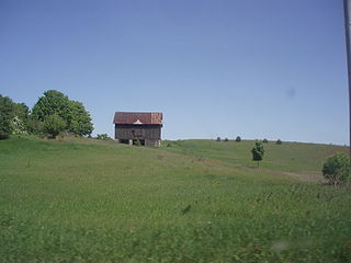
- The Thumb's landscape ranges from a flat sandy plain, that hugs the shores of Lake Huron and Saginaw Bay, to a gently rolling topography, which is fertile and well suited for agriculture. Perhaps, the most unusual geographic formation, however, is a rugged glacial ridge, known collectively, as the Hadley Hills, which extends in a northeasterly direction through the center of The Thumb, from the southwestern portion of the peninsula.
- All counties except for LapeerLapeer County, Michigan-Demographics:As of the census of 2000, there were 87,904 people, 30,729 households, and 23,876 families residing in the county. The population density was 134 people per square mile . There were 32,732 housing units at an average density of 50 per square mile...
border the Saginaw BaySaginaw BaySaginaw Bay is a bay within Lake Huron located on the eastern side of the U.S. state of Michigan. It forms the space between Michigan's Thumb region and the rest of the Lower Peninsula of Michigan. Saginaw Bay is in area...
or Lake HuronLake HuronLake Huron is one of the five Great Lakes of North America. Hydrologically, it comprises the larger portion of Lake Michigan-Huron. It is bounded on the east by the Canadian province of Ontario and on the west by the state of Michigan in the United States...
. - The places with the highest elevation are all associated with the Hadley Hills, and are located in Lapeer CountyLapeer County, Michigan-Demographics:As of the census of 2000, there were 87,904 people, 30,729 households, and 23,876 families residing in the county. The population density was 134 people per square mile . There were 32,732 housing units at an average density of 50 per square mile...
, they are: Pinnacle Point, at 1262 feet (384.7 m), Kerr (Cemetery) Hill, at 1258 feet (383.4 m), both in Hadley TownshipHadley Township, MichiganHadley Township is a civil township of Lapeer County in the U.S. state of Michigan. The population was 4,655 at the 2000 census.- Communities :...
, Mt Christie, at 1251 feet (381.3 m), in Metamora TownshipMetamora Township, MichiganMetamora Township is a civil township of Lapeer County in the U.S. state of Michigan. The population was 4,184 at the 2000 census. The 2008 census estimate places the population at 4,582.- Communities :...
, and a point near MayvilleMayville, MichiganMayville is a village in Tuscola County, in the U.S. state of Michigan. The population was 1,055 at the 2000 census. The village is within Fremont Township along the boundary with Dayton Township.-Geography:...
, reaching up to 1050 feet (320 m) above sea level. - The lowest place in the Thumb region is in the Saginaw Valley, the far western part of the thumb, at a low 585 feet (178.3 m) above sea level.
- Huron CountyHuron County, Michigan-Highways:* M-19* M-25* M-53* M-142-Demographics:As of the census of 2000, there were 36,079 people, 14,597 households, and 10,144 families residing in the county. The population density was 43 people per square mile . There were 20,430 housing units at an average density of 24 per square mile...
is very flat and is home to wind turbineWind turbineA wind turbine is a device that converts kinetic energy from the wind into mechanical energy. If the mechanical energy is used to produce electricity, the device may be called a wind generator or wind charger. If the mechanical energy is used to drive machinery, such as for grinding grain or...
s and large fields. - The "tip of the Thumb" is Pointe Aux Barques, between Port AustinPort Austin, MichiganPort Austin is a village in Huron County in the U.S. state of Michigan. The population was 737 at the 2000 census. The village is within Port Austin Township.-Geography:...
and Grindstone City. - MarletteMarlette, MichiganMarlette is a city in Sanilac County in the U.S. state of Michigan. The 2006 US Census population estimate was 2,053. The city is located within Marlette Township, but is politically autonomous....
is also called the "heart of the Thumb" because of its central position on the peninsula.
Major rivers
The Thumb has many waterways.- Cass RiverCass RiverThe Cass River is a river in the Thumb region of the U.S. state of Michigan. It drains large portions of Sanilac and Tuscola counties and smaller portions of Genesee, Huron, Lapeer, and Saginaw counties....
has many branches, one of which flows into the Shiawassee RiverShiawassee RiverThe Shiawassee River in the U.S. state of Michigan is long and generally flows in a northerly direction. It merges together with the Flint River, the Cass River and the Tittabawassee River to form the Saginaw River, which drains into the Saginaw Bay of Lake Huron.-Description:Supporting...
in the Shiawassee National Wildlife RefugeShiawassee National Wildlife RefugeThe Shiawassee National Wildlife Refuge is a 9,427 acre National Wildlife Refuge in Saginaw County managed by the United States Fish and Wildlife Service. It is located in the central portion of the lower peninsula of the U.S. state of Michigan, approximately 25 miles south of the Saginaw Bay in...
at 43°22′42"N 83°59′04"W less than 1 miles (2 km) from where the Shiawassee merges with the Tittabawassee RiverTittabawassee RiverThe Tittabawassee River is a stream which flows in a generally southeasterly direction through the Lower Peninsula of the U.S. state of Michigan. The river begins at Secord Lake in Clement Township, at the confluence of the East Branch and the Middle Branch...
to form the Saginaw RiverSaginaw RiverThe Saginaw River is a river in the U.S. state of Michigan. It is formed by the confluence of the Tittabawassee and Shiawassee rivers southwest of Saginaw. It flows northward into the Saginaw Bay of Lake Huron just northeast of Bay City. The watershed area is .The river is an important shipping... - The PinnebogPinnebog RiverThe Pinnebog River is a river in the Thumb region of the U.S. state of Michigan. The river flows into Lake Huron on the west side of the "tip" of the "thumb"....
, Shebahyonk, and Pigeon RiversPigeon River (Lake Huron)The Pigeon River, also known as the East Branch Pigeon River, is a stream in Huron County in the Thumb of the U.S. state of Michigan.The stream rises from the confluence of Appin and Livingston drains at , in southern Sheridan Township...
all rise in the center of Huron CountyHuron County, Michigan-Highways:* M-19* M-25* M-53* M-142-Demographics:As of the census of 2000, there were 36,079 people, 14,597 households, and 10,144 families residing in the county. The population density was 43 people per square mile . There were 20,430 housing units at an average density of 24 per square mile...
and empty into the Saginaw BaySaginaw BaySaginaw Bay is a bay within Lake Huron located on the eastern side of the U.S. state of Michigan. It forms the space between Michigan's Thumb region and the rest of the Lower Peninsula of Michigan. Saginaw Bay is in area...
. - St. Clair RiverSt. Clair RiverThe St. Clair River is a river in central North America which drains Lake Huron into Lake St Clair, forming part of the international boundary between the Canadian province of Ontario and the U.S. state of Michigan...
, connects Lake HuronLake HuronLake Huron is one of the five Great Lakes of North America. Hydrologically, it comprises the larger portion of Lake Michigan-Huron. It is bounded on the east by the Canadian province of Ontario and on the west by the state of Michigan in the United States...
to Lake St. ClairLake Saint Clair (North America)Lake St. Clair is a fresh-water lake named after Clare of Assisi that lies between the Province of Ontario and the State of Michigan, and its midline also forms the boundary between Canada and the United States of America. Lake St. Clair includes the Anchor Bay along the Metro Detroit coastline...
, and is the farthest east border in Michigan. It forms a low impression in eastern St. Clair CountySt. Clair County, Michigan-Interstates:* I-69 enters the county from the west, coming from Lansing and Flint, terminating at the approach to the Blue Water Bridge in Port Huron....
, and has a deltaRiver deltaA delta is a landform that is formed at the mouth of a river where that river flows into an ocean, sea, estuary, lake, reservoir, flat arid area, or another river. Deltas are formed from the deposition of the sediment carried by the river as the flow leaves the mouth of the river...
at its mouth (North America's largest freshwater delta), which includes Harsens IslandHarsens IslandHarsens Island is a wet marshy location at the mouth of the St. Clair River in the U.S. state of Michigan. Politically, the island is in Clay Township of St. Clair County.-History:...
and Walpole IslandWalpole IslandWalpole Island is an island and Indian reserve in southwestern Ontario, Canada, on the border between Ontario and Michigan in the United States. It is located in the mouth of the St. Clair River on Lake St. Clair, approximately thirty miles northeast of Detroit, Michigan, and Windsor, Ontario.In...
, Ontario. Ferries cross the river at AlgonacAlgonac, MichiganAlgonac is a city in St. Clair County of the U.S. state of Michigan. The population was 4,613 at the 2000 census.Algonac is located at the southern end of the St. Clair River, just before it splits into a large delta region known as the St. Clair Flats. The St. Clair River drains Lake Huron into...
and Marine CityMarine City, MichiganMarine City is a city in St. Clair County in the U.S. state of Michigan. Located on the west bank of the St. Clair River, it is one of the cities in the River District north of Detroit and south of Lake Huron. The population was 4,652 at the 2000 census...
, these being international border crossings. - Black RiverBlack River (St. Clair County)Black River is an river in the U.S. state of Michigan, flowing into the St. Clair River at in the city of Port Huron. The Black River Canal in northern Port Huron extends east into Lake Huron near Krafft Road....
rises near Minden CityMinden City, MichiganMinden City is a village in Sanilac County of the U.S. state of Michigan. As of the 2000 census, the village population was 242. The village is located within Minden Township...
and flows into the St. Clair River at Port HuronPort Huron, MichiganPort Huron is a city in the U.S. state of Michigan and the county seat of St. Clair County. The population was 30,184 at the 2010 census. The city is adjacent to Port Huron Township but is administratively autonomous. It is joined by the Blue Water Bridge over the St. Clair River to Sarnia,...
. The Black River forms a basin in Sanilac CountySanilac County, Michigan-Highways:* M-19* M-25* M-46* M-53* M-81* M-90-History:Sanilac County was probably named for a Wyandot chief named Sanilac. See List of Michigan county name etymologies....
, and northern St. Clair CountySt. Clair County, Michigan-Interstates:* I-69 enters the county from the west, coming from Lansing and Flint, terminating at the approach to the Blue Water Bridge in Port Huron....
. - The north branch of the Flint RiverFlint River (Michigan)The Flint River is a river in the Flint/Tri-Cities region of Michigan in the United States. It flows through the city of Flint and the counties of Genesee, Lapeer and Saginaw.- Course :...
lies in northern Lapeer CountyLapeer County, Michigan-Demographics:As of the census of 2000, there were 87,904 people, 30,729 households, and 23,876 families residing in the county. The population density was 134 people per square mile . There were 32,732 housing units at an average density of 50 per square mile...
. It rises near North BranchNorth Branch, MichiganNorth Branch is a village in Lapeer County in the U.S. state of Michigan. The population was 1,027 at the 2000 census. The village is located within North Branch Township.-Geography:...
. The southern branch flows through the central and southern portion of Lapeer County, and merges with the North Branch just north of the Holloway Reservoir.
History and local culture
See also: Timeline of Michigan historyTimeline of Michigan history
- Natural history :*13000 BC to 12000 BC The most recent of four major glaciers started to recede leaving a tundra like environment...
and history of Michigan
Michigan
Michigan is a U.S. state located in the Great Lakes Region of the United States of America. The name Michigan is the French form of the Ojibwa word mishigamaa, meaning "large water" or "large lake"....
Naming and founding of the Thumb
The earliest name for the Thumb of Michigan was Skenchioe, which is shown on early maps in the late 17th century and is of Iroquois origin. Skenchioe was the early home of the Native people called the Fox. There is no definite documentation on the meaning of the name Schenchioe although the name red fox is implied. The Onondaga word for a champain or large plain is uchwuntschios and "ganhuntios" while sgechnaxen means red fox.Maps from the early 18th century, show the Thumb of Michigan as Le Pays Plat, which is French and means the Flat Country. The British used this name in maps of the late-18th century calling the Thumb of Michigan in English the Flat Country.
The Thumb of Michigan county name Tuscola is probably of Chippewa/Ottawa origin and likely means shelf, dish, or plate like land—Flat Country. The Chippewa and Ottawa often used bark from a tree or a shell as a plate. Their words tessi aki means plateau, tableland, or flat country. Esse in Chippewa/Ottawa means shell, and "essimig" means a breast-plate.
Culture
Persons of EuropeanEuropean ethnic groups
The ethnic groups in Europe are the various ethnic groups that reside in the nations of Europe. European ethnology is the field of anthropology focusing on Europe....
ancestry have formed the overwhelming majority of the population since the late 19th century. The land was settled mostly by English
English people
The English are a nation and ethnic group native to England, who speak English. The English identity is of early mediaeval origin, when they were known in Old English as the Anglecynn. England is now a country of the United Kingdom, and the majority of English people in England are British Citizens...
and Scots-Irish immigrants, many of whom arrived from Canada
Canada
Canada is a North American country consisting of ten provinces and three territories. Located in the northern part of the continent, it extends from the Atlantic Ocean in the east to the Pacific Ocean in the west, and northward into the Arctic Ocean...
. Other settlers of the same ancestry migrated from eastern states such as New York, Pennsylvania and New England. Later 19th and 20th century residents included Polish
Poles
thumb|right|180px|The state flag of [[Poland]] as used by Polish government and diplomatic authoritiesThe Polish people, or Poles , are a nation indigenous to Poland. They are united by the Polish language, which belongs to the historical Lechitic subgroup of West Slavic languages of Central Europe...
and German
Germans
The Germans are a Germanic ethnic group native to Central Europe. The English term Germans has referred to the German-speaking population of the Holy Roman Empire since the Late Middle Ages....
immigrants who migrated from Europe through the Detroit area. Many of the customs, much of the regional lifestyle, and even the local accent, strongly reflect these origins. Examples are polka shows on local radio stations and the Kinde, Michigan
Kinde, Michigan
Kinde is a village in Huron County in the U.S. state of Michigan. The population was 534 at the 2000 census.The village is located on the boundary between Dwight Township and Lincoln Township, with about half of the village in both...
Polkafest.
These European latecomers, arriving many years after the initial waves of arrivals to the Atlantic coast region from Europe, encountered aboriginal peoples for whom many sites in the Thumb were named. The name of Tuscola County was derived from a native word, Saginaw (both the city and county) is taken from an Ojibwe term, and Sanilac, which is the name of a county, is believed to be a Wyandotte name derivation, as well. Among other Thumb place names, Sebewaing is another location with a name derived from the Ojibwe. These tribally-influenced place names greatly outnumber those of any Thumb sites which may have been named with strictly European-influenced words.
Historical events
- The great Thumb FireThumb FireThe great Thumb Fire took place on September 5, 1881, in the Thumb area of Michigan in the United States. The fire, which burned over a million acres in less than a day, was the consequence of drought, hurricane-force winds, heat, the after-effects of the Port Huron Fire of 1871, and the...
took place on September 5, 1881 in the Thumb area of MichiganMichiganMichigan is a U.S. state located in the Great Lakes Region of the United States of America. The name Michigan is the French form of the Ojibwa word mishigamaa, meaning "large water" or "large lake"....
. The fire, which burned over a million acreAcreThe acre is a unit of area in a number of different systems, including the imperial and U.S. customary systems. The most commonly used acres today are the international acre and, in the United States, the survey acre. The most common use of the acre is to measure tracts of land.The acre is related...
s (4,000 km²) in less than a day, was the consequence of droughtDroughtA drought is an extended period of months or years when a region notes a deficiency in its water supply. Generally, this occurs when a region receives consistently below average precipitation. It can have a substantial impact on the ecosystem and agriculture of the affected region...
, hurricane-force winds, heat, the after-effects of the Port Huron Fire of 1871Port Huron Fire of 1871The Port Huron Fire of Sunday October 8, 1871 burned a number of cities including White Rock and Port Huron, and much of the countryside in the "Thumb" region of the U.S. state of Michigan...
and the ecological damage wrought by the era's loggingLoggingLogging is the cutting, skidding, on-site processing, and loading of trees or logs onto trucks.In forestry, the term logging is sometimes used in a narrow sense concerning the logistics of moving wood from the stump to somewhere outside the forest, usually a sawmill or a lumber yard...
techniques. - The Great Lakes Storm of 1913Great Lakes Storm of 1913The Great Lakes Storm of 1913, historically referred to as the "Big Blow", "Jeff Kinsland's Wash," the "Freshwater Fury" or the "White Hurricane", was a blizzard with hurricane-force winds that devastated the Great Lakes Basin in the Midwestern United States and the Canadian province of Ontario...
was a November blizzardBlizzardA blizzard is a severe snowstorm characterized by strong winds. By definition, the difference between blizzard and a snowstorm is the strength of the wind. To be a blizzard, a snow storm must have winds in excess of with blowing or drifting snow which reduces visibility to 400 meters or ¼ mile or...
with hurricane-force winds which devastated the Great Lakes BasinGreat Lakes BasinThe Great Lakes Basin consists of the Great Lakes and the surrounding lands of the states of Illinois, Indiana, Michigan, Minnesota, New York, Ohio, Pennsylvania, and Wisconsin in the United States, and the province of Ontario in Canada, whose direct surface runoff and watersheds form a large...
in the United States Midwest and the Canadian province of OntarioOntarioOntario is a province of Canada, located in east-central Canada. It is Canada's most populous province and second largest in total area. It is home to the nation's most populous city, Toronto, and the nation's capital, Ottawa....
. The storm battered and overturned ships on four of the five Great Lakes, particularly Lake HuronLake HuronLake Huron is one of the five Great Lakes of North America. Hydrologically, it comprises the larger portion of Lake Michigan-Huron. It is bounded on the east by the Canadian province of Ontario and on the west by the state of Michigan in the United States...
. - The Port HuronPort Huron, MichiganPort Huron is a city in the U.S. state of Michigan and the county seat of St. Clair County. The population was 30,184 at the 2010 census. The city is adjacent to Port Huron Township but is administratively autonomous. It is joined by the Blue Water Bridge over the St. Clair River to Sarnia,...
area is one of oldest settlements in the state of Michigan. - Colonial forts such as Fort GratiotFort GratiotFort Gratiot was an American stockade fort in Fort Gratiot, Michigan, in Saint Clair County, Michigan.The Army constructed Fort Gratiot in 1814 as an outpost to guard the juncture of the Saint Clair River and Lake Huron. The fort took the name of the engineer supervising its construction, Charles...
(north of Port HuronPort Huron, MichiganPort Huron is a city in the U.S. state of Michigan and the county seat of St. Clair County. The population was 30,184 at the 2010 census. The city is adjacent to Port Huron Township but is administratively autonomous. It is joined by the Blue Water Bridge over the St. Clair River to Sarnia,...
) and Fort Sinclair (near present day St. ClairSt. Clair, MichiganSt. Clair is a city in St. Clair County in the U.S. state of Michigan. The population was 5,802 at the 2000 census. The city is located on the St. Clair River near the southeast corner of St. Clair Township.-Geography:...
) were built along the St. Clair River. - Bad Axe was named so because Captain Rudolph Papst found an old axe in 1861, when he was clearing land for the present-day Huron CountyHuron County, Michigan-Highways:* M-19* M-25* M-53* M-142-Demographics:As of the census of 2000, there were 36,079 people, 14,597 households, and 10,144 families residing in the county. The population density was 43 people per square mile . There were 20,430 housing units at an average density of 24 per square mile...
seat.
Notable people (by town)
More comprehensive lists are available at individual cities, villages, etc. See local towns of interest at the bottom of the page for links.Cass City
- Brewster H. ShawBrewster H. ShawBrewster Hopkinson Shaw, Jr. is a former NASA astronaut, a retired U.S. Air Force colonel and former executive at Boeing. Shaw was inducted into the U.S. Astronaut Hall of Fame on May 6, 2006....
- retired United States Air ForceUnited States Air ForceThe United States Air Force is the aerial warfare service branch of the United States Armed Forces and one of the American uniformed services. Initially part of the United States Army, the USAF was formed as a separate branch of the military on September 18, 1947 under the National Security Act of...
colonel and former NASANASAThe National Aeronautics and Space Administration is the agency of the United States government that is responsible for the nation's civilian space program and for aeronautics and aerospace research...
astronaut.
Harbor Beach
- Frank MurphyFrank MurphyWilliam Francis Murphy was a politician and jurist from Michigan. He served as First Assistant U.S. District Attorney, Eastern Michigan District , Recorder's Court Judge, Detroit . Mayor of Detroit , the last Governor-General of the Philippines , U.S...
- Detroit mayor, Michigan governor, U.S. Attorney General and Justice of the United States Supreme Court.
Lapeer
- Marguerite de AngeliMarguerite de AngeliMarguerite de Angeli was a bestselling author and illustrator of children's books including the 1950 Newbery Award winning book The Door in the Wall...
, children's book author, Newbery Award winner - Danelle GayDanelle GayDanelle Marie Gay is a beauty queen from Lapeer, Michigan who has competed in the Miss USA pageant.Gay won the Miss Michigan USA 2006 title in a state pageant held in Port Huron, Michigan in late 2005...
, Miss Michigan USAMiss Michigan USAThe Miss Michigan USA competition is the pageant that selects the representative for the state of Michigan in the Miss USA pageant.Michigan is recognized by as being within the top 15 states in terms of Miss USA success. Their first Miss USA victory was in 1990, and notable because Carole Gist...
2006 - Terry KnightTerry KnightTerry Knight , born Richard Terrance Knapp, was an American rock and roll music producer, promoter, singer, songwriter and radio personality, who enjoyed some success in radio, modest success as a singer, but phenomenal success as the original manager-producer for Grand Funk Railroad and the...
, singer, DJ, manager, Terry Knight and the PackTerry Knight and the PackTerry Knight and the Pack was, between 1965 and 1967, an American rock band from Flint, Michigan. The band was signed to the Lucky Eleven label throughout its short recording career.-Career:...
, Grand Funk RailroadGrand Funk RailroadGrand Funk Railroad is an American rock band that was highly popular during the 1970s. Grand Funk Railroad toured constantly to packed arenas worldwide. A popular take on the band during its heyday was that, although the critics hated them, audiences loved them... - Jake LongJake LongJake Edward Long is an American football offensive tackle for the Miami Dolphins of the National Football League . He was drafted by the Dolphins first overall in the 2008 NFL Draft. He played college football at Michigan...
, offensive lineman, Miami DolphinsMiami DolphinsThe Miami Dolphins are a Professional football team based in the Miami metropolitan area in Florida. The team is part of the Eastern Division of the American Football Conference in the National Football League... - Terry NicholsTerry NicholsTerry Lynn Nichols is a convicted bomber's accomplice. Prior to his incarceration, he held a variety of short-term jobs, working as a farmer, grain elevator manager, real estate salesman, ranch hand, and house husband. He met his future co-conspirator, Timothy McVeigh, during a brief stint in the...
, accomplice in the Oklahoma City bombingOklahoma City bombingThe Oklahoma City bombing was a terrorist bomb attack on the Alfred P. Murrah Federal Building in downtown Oklahoma City on April 19, 1995. It was the most destructive act of terrorism on American soil until the September 11, 2001 attacks. The Oklahoma blast claimed 168 lives, including 19... - Jim SlaterJim Slater (hockey player)James Slater is a professional ice hockey center who currently plays for the Winnipeg Jets of the National Hockey League. His father, Bill Slater, was a defensive lineman in the NFL for the Minnesota Vikings and the New England Patriots...
, hockey player Atlanta ThrashersAtlanta ThrashersThe Atlanta Thrashers were a professional ice hockey team based in Atlanta, Georgia, United States. Atlanta was granted a franchise in the National Hockey League on June 25, 1997, and became the league's 28th franchise when it began play in the 1999–2000 NHL season...
Port Huron
- Thomas EdisonThomas EdisonThomas Alva Edison was an American inventor and businessman. He developed many devices that greatly influenced life around the world, including the phonograph, the motion picture camera, and a long-lasting, practical electric light bulb. In addition, he created the world’s first industrial...
- Inventor and entrepreneur settled in Port Huron from 1854 to 1863. - Obadiah GardnerObadiah GardnerObadiah Gardner was an American politician from the U.S. state of Maine. Gardner was a businessman and member of the Democratic Party who served in several minor state executive positions before serving a single six-year term in the United States Senate.Gardner was born near Port Huron, Michigan...
- US Senator for Maine - Terry McMillanTerry McMillanTerry McMillan is an American author. Her interest in books comes from working at a library when she was sixteen. She received her BA in journalism in 1986 at University of California, Berkeley. Her work is characterized by strong female protagonists.Her first book, Mama, was published in 1987...
- Award-winning author of Waiting to ExhaleWaiting to ExhaleWaiting to Exhale is a 1995 romance film starring Whitney Houston and Angela Bassett, directed by Forest Whitaker. The movie was adapted from the 1992 novel of the same name by Terry McMillan. Loretta Devine, Lela Rochon, Dennis Haysbert, Michael Beach, Gregory Hines, Donald Faison and Mykelti...
, and How Stella Got Her Groove BackHow Stella Got Her Groove BackHow Stella Got Her Groove Back is a 1998 romance film, directed by Kevin Rodney Sullivan. The film stars Angela Bassett, Taye Diggs, Whoopi Goldberg and Regina King. This film is an adaptation of Terry McMillan's bestselling novel by the same title...
Local elected officials
Local politicians in Washington and Lansing are listed below.United States Congress
District 10 - Northern Macomb, and all of St Clair, Lapeer, Sanilac, and Huron County.- Candice S. Miller, RepublicanRepublican Party (United States)The Republican Party is one of the two major contemporary political parties in the United States, along with the Democratic Party. Founded by anti-slavery expansion activists in 1854, it is often called the GOP . The party's platform generally reflects American conservatism in the U.S...
District 5 - Saginaw/Bay City Area, and all of Genesse and Tuscola.
- Dale E. KildeeDale E. KildeeDale Edward Kildee is the U.S. Representative for Michigan's 5th congressional district, serving since 1977. He is a member of the Democratic Party. The district includes Flint, Saginaw and Bay City...
, DemocratDemocratic Party (United States)The Democratic Party is one of two major contemporary political parties in the United States, along with the Republican Party. The party's socially liberal and progressive platform is largely considered center-left in the U.S. political spectrum. The party has the lengthiest record of continuous...
Michigan House
32nd District - Northern Macomb and two townships in St Clair County.- Daniel Acciavatti, Republican
81st District - Most of St Clair County, except Port Huron.
- Jud Gilbert, - Republican
82nd District - All of Lapeer County.
- John Stahl, Republican
83rd District - City of Port Huron, Fort Gratiot, and all of Sanilac County.
- John Espinoza, Democrat
84th District - Huron and Tuscola County.
- Terry Brown, Democrat
Colleges and universities
- St. Clair County Community CollegeSt. Clair County Community CollegeSt. Clair County Community College, or SC4 is a two-year community college located in Port Huron, Michigan. It serves as the primary center of higher education for the Blue Water Area. SC4 offers Associate degree and certificate programs. It also offers online classes and transfer programs to...
, with the main campus in Port Huron, and learning centers in Huron, Sanilac, and Lapeer Counties. - Baker CollegeBaker CollegeBaker College is a private not-for-profit American college in Michigan, founded in 1911. Its campuses are located throughout the Lower Peninsula of Michigan....
, with a campus in Cass City, Sandusky, and Port Huron. - University of Michigan - Flint, Saginaw Valley State UniversitySaginaw Valley State UniversitySaginaw Valley State University, commonly known as SVSU, is a state university in the U.S. state of Michigan. It is located in the middle of Michigan's lower peninsula in the Saginaw Valley region. The university is located in Kochville Township, Saginaw County...
, and Delta CollegeDelta College (Michigan)Delta College is a two-year community college located southwest of Bay City, Michigan. Delta College's district had its beginning in 1955 with Saginaw, Midland, and Bay counties making up the district. In 1957, the voters of the tri-counties approved the construction of the college, and it opened...
, while not in the Thumb, are universities and colleges that attract many residents from the Thumb.
Harbor Beach
- Frank MurphyFrank MurphyWilliam Francis Murphy was a politician and jurist from Michigan. He served as First Assistant U.S. District Attorney, Eastern Michigan District , Recorder's Court Judge, Detroit . Mayor of Detroit , the last Governor-General of the Philippines , U.S...
Memorial Museum and home. - Grice House MuseumGrice House MuseumThe Grice House is located at 865 North Huron Avenue in Harbor Beach, Michigan. It is a museum showing life in years gone by.-History:The Grice House was built by James G. Grice, who immigrated to the United States from England in the early 1860s with five of his seven sons and one daughter. By...
- Harbor BeachHarbor Beach, MichiganHarbor Beach is a city in Huron County in the U.S. state of Michigan. The population was 1,837 at the 2000 census, with an estimated population of 1,587 in 2009.-Geography:...
Marysville
- Marysville Historical Museum - MarysvilleMarysville, MichiganMarysville is a city in St. Clair County of the U.S. state of Michigan. The population was 9,684 at the 2000 census.-Geography:* According to the United States Census Bureau, the city has a total area of , of which, of it is land and of it is water.* It is considered to be part of the Thumb of...
- Wills Ste. Claire Auto Museum - MarysvilleMarysville, MichiganMarysville is a city in St. Clair County of the U.S. state of Michigan. The population was 9,684 at the 2000 census.-Geography:* According to the United States Census Bureau, the city has a total area of , of which, of it is land and of it is water.* It is considered to be part of the Thumb of...
Port Huron
.jpg)
Port Huron Museum
The Port Huron Museum is a series of five museums located in Port Huron, Michigan, USA. It includes the Carnegie Center -- Port Huron Museum, Huron Lightship, Thomas Edison Depot Museum, USCGC Bramble , and Fort Gratiot Lighthouse. The museum was founded in 1967....
- a series of five museums - Port Huron
Port Huron, Michigan
Port Huron is a city in the U.S. state of Michigan and the county seat of St. Clair County. The population was 30,184 at the 2010 census. The city is adjacent to Port Huron Township but is administratively autonomous. It is joined by the Blue Water Bridge over the St. Clair River to Sarnia,...
- Carnegie Center - Port HuronPort Huron, MichiganPort Huron is a city in the U.S. state of Michigan and the county seat of St. Clair County. The population was 30,184 at the 2010 census. The city is adjacent to Port Huron Township but is administratively autonomous. It is joined by the Blue Water Bridge over the St. Clair River to Sarnia,...
- Huron LightshipHuron LightshipThe United States lightship Huron is a lightvessel that was launched in 1920. It is now a museum ship moored in Pine Grove Park, Port Huron, St. Clair County, Michigan.-Great Lakes lightships:...
- Port HuronPort Huron, MichiganPort Huron is a city in the U.S. state of Michigan and the county seat of St. Clair County. The population was 30,184 at the 2010 census. The city is adjacent to Port Huron Township but is administratively autonomous. It is joined by the Blue Water Bridge over the St. Clair River to Sarnia,... - Thomas Edison Depot MuseumThomas Edison Depot MuseumThe Thomas Edison Depot Museum is located underneath the Blue Water Bridge connecting Port Huron, Michigan to Sarnia, Ontario, Canada. The depot is owned and operated by the Port Huron Museum and is the actual depot that inventor Thomas Edison worked out of as a news butcher between 1859 and 1863...
- Port HuronPort Huron, MichiganPort Huron is a city in the U.S. state of Michigan and the county seat of St. Clair County. The population was 30,184 at the 2010 census. The city is adjacent to Port Huron Township but is administratively autonomous. It is joined by the Blue Water Bridge over the St. Clair River to Sarnia,... - USCGC Bramble (WLB-392)USCGC Bramble (WLB-392)USCGC Bramble is one of the 39 original seagoing buoy tenders built between 1942-1944 for the United States Coast Guard. Bramble is currently a museum ship, part of Port Huron Museum, located in Port Huron, Michigan. She will be closed to the public effective August 14, 2011, owing to a lack of...
- Port HuronPort Huron, MichiganPort Huron is a city in the U.S. state of Michigan and the county seat of St. Clair County. The population was 30,184 at the 2010 census. The city is adjacent to Port Huron Township but is administratively autonomous. It is joined by the Blue Water Bridge over the St. Clair River to Sarnia,... - Fort Gratiot LighthouseFort Gratiot LighthouseFort Gratiot Light, the first lighthouse in the state of Michigan, was constructed north of Fort Gratiot in 1829 by Lucius Lyon, who later became one of Michigan's first U.S. Senators....
- Port HuronPort Huron, MichiganPort Huron is a city in the U.S. state of Michigan and the county seat of St. Clair County. The population was 30,184 at the 2010 census. The city is adjacent to Port Huron Township but is administratively autonomous. It is joined by the Blue Water Bridge over the St. Clair River to Sarnia,...
Elsewhere in the Thumb
- Sanilac County Historical Museum - Port SanilacPort Sanilac, MichiganPort Sanilac is a village in Sanilac Township, Sanilac County in the U.S. state of Michigan. The population was 658 at the 2000 census.-History:...
- Bad Axe Historical Society Museum - Bad Axe
- Capac Historical Museum - CapacCapac, MichiganCapac is a village in Mussey Township, St. Clair County in the U.S. state of Michigan. The population was 1,775 at the 2000 census.-History:Capac was founded and platted by a group of men from Romeo headed by George R. Funstan and Judge DeWitt C. Walker in 1857. The judge named it after Huayna...
- Pointe aux Barques Lighthouse near Port HopePort Hope, MichiganPort Hope is a village in Huron County of the U.S. state of Michigan. As of the 2000 census, the village population was 310. The village is within Rubicon Township.-Geography:...
- St. Clair County Farm Museum - Goodells
Radio
The Thumb Area Radio Region lies between the Detroit Radio Market, the Tri-Cities Radio Market and the Flint Market, with stations in Port HuronPort Huron, Michigan
Port Huron is a city in the U.S. state of Michigan and the county seat of St. Clair County. The population was 30,184 at the 2010 census. The city is adjacent to Port Huron Township but is administratively autonomous. It is joined by the Blue Water Bridge over the St. Clair River to Sarnia,...
and Sarnia, Ontario
Sarnia, Ontario
Sarnia is a city in Southern Ontario, Canada . It is the largest city on Lake Huron and is located where the upper Great Lakes empty into the St. Clair River....
also serving the region.
Powerful local stations include; WMIC
WMIC
WMIC is a news/talk and country radio station licensed to Sandusky, Michigan. WMIC signed on the air at 1560 kHz on June 27, 1968, and changed its frequency to the current 660 in 1987, serving Sandusky, the Thumb and the Blue Water area of Michigan. Part of WMIC 660's success is mostly due to...
AM 660, WBGV
WBGV
WBGV is a radio station broadcasting a country music format. Licensed to Marlette, Michigan. It first began broadcasting in 1999. It serves the central area of Michigan's Thumb, and can be heard as far away as Port Huron, Lapeer, Romeo, and Bad Axe.WBGV offers a wide range of modern country music,...
FM 92.5, WTGV FM 97.7 of Sandusky; WPHM
WPHM
WPHM is a news, talk and sports radio station in Port Huron, Michigan that broadcasts on AM 1380 with 5,000 watts. WPHM is owned by Radio First. The station includes programming from Dr. Joy Browne, Sean Hannity, Glenn Beck, Dave Ramsey, and local morning show host Paul Miller...
AM 1380 of Port Huron; WIDL
WIDL
WIDL is a radio station broadcasting a hot adult contemporary format. Licensed to Caro, Michigan, it first began broadcasting at 104.9 MHz...
FM 92.1 of Caro;WLEW
WLEW-FM
WLEW-FM is a radio station in Bad Axe, Michigan, serving the Thumb area of Michigan. It is owned by Thumb Broadcasting and broadcasts from studios on South Van Dyke Road in Bad Axe. Unusual for small-town radio stations, WLEW-FM is locally programmed and does not rely on satellite feeds for any...
FM 102.1 of Bad Axe; and WLCO
WLCO
WLCO is a radio station broadcasting a country music format. Licensed to Lapeer, Michigan, it first began broadcasting under the WTHM call sign. The station's format, from Citadel Media, is called "Real Country" and combines classic country favorites with select current titles...
AM 1530 in Lapeer. Other radio stations broadcasting to the thumb area include WJR
WJR
WJR is a radio station in Detroit, Michigan, United States. It broadcasts a news/talk format. It is a class A clear channel station whose broadcasts can be heard throughout most of the Midwest, eastern United States and Canada at night, making it one of the most powerful radio stations in the...
, WWJ
WWJ (AM)
WWJ is Detroit, Michigan's only 24-hour all-news radio station. Broadcasting at 950 kHz, the station is owned and operated by CBS Corporation subsidiary CBS Radio. The station first went on the air on August 20, 1920 with the call sign 8MK...
, and WXYT of Detroit; WSGW
WSGW (AM)
WSGW is a radio station broadcasting a news-talk format. Licensed to Saginaw, Michigan, it first began broadcasting in 1950. WSGW also has a sister station, WSGW-FM 100.5, which also has a news-talk format. The two stations identify themselves separately on air. WSGW-AM is branded as NewsRadio...
, WKCQ
WKCQ
WKCQ is a radio station licensed to Saginaw, Michigan. The station has broadcast a popular country music format since 1968 . Every year since 1993, the station hosts a free concert on Ojibway Island in downtown Saginaw.- Sources :*...
and WHNN
WHNN
WHNN is an FM radio station serving the Saginaw-Bay City-Midland area and Flint with its classic hits format. It broadcasts on FM frequency 96.1 and is under ownership of Cumulus Media...
of Saginaw; and CFCO of Chatham, Ontario.
Local Radio Stations in the Thumb Area
Newspaper
- Daily editions of the Detroit Free PressDetroit Free PressThe Detroit Free Press is the largest daily newspaper in Detroit, Michigan, USA. The Sunday edition is entitled the Sunday Free Press. It is sometimes informally referred to as the "Freep"...
and The Detroit NewsThe Detroit NewsThe Detroit News is one of the two major newspapers in the U.S. city of Detroit, Michigan. The paper began in 1873, when it rented space in the rival Free Press's building. The News absorbed the Detroit Tribune on February 1, 1919, the Detroit Journal on July 21, 1922, and on November 7, 1960,...
are available throughout the area. - The Bay City TimesBay City TimesThe Bay City Times is a newspaper published in Bay City, Michigan, United States, published Thursdays, Fridays and Sundays, with a Tuesday edition jointly-published with The Saginaw News. The paper is published by Booth Newspapers, owned by Advance Publications...
and Saginaw News are available in northern and western portions of the area, while the Flint JournalFlint JournalThe Flint Journal is the largest newspaper published in Flint, Michigan. Published Tuesdays, Thursdays, Fridays and Sundays, it serves Genesee, Lapeer and Shiawassee Counties...
is available in Lapeer County.
Huron County newspapers
- Harbor Beach Times
- Huron County Press
- Huron Daily Tribune http://www.michigansthumb.com
- News Weekly, The
- The Lakeshore Guardian
- Thumb Blanket
Lapeer County newspapers
- Buyer's Guide
- County Press, The http://www.countypress.com
- LA View
- Webco Press
Sanilac County newspapers
- Brown City Banner
- Buyers Guide
- Camden Publications
- Deckerville Recorder
- Marlette Leader
- Sandusky Tribune
- Sanilac County News http://www.sanilaccountynews.com
St. Clair County newspapers
- Blue Water Shopper
- Port Huron Times Herald-USA Today http://www.thetimesherald.com
- Thumb Print News, The
- Voice, The
- Yale Expositor, The
Tuscola County Newspapers
- Tuscola County Advertiser http://www.tuscolatoday.com
- Cass City Chronicle
- Cass River Trader
- Reese Reporter
- Vassar Pioneer Times
Broadcast television
The Lapeer CountyLapeer County, Michigan
-Demographics:As of the census of 2000, there were 87,904 people, 30,729 households, and 23,876 families residing in the county. The population density was 134 people per square mile . There were 32,732 housing units at an average density of 50 per square mile...
, St. Clair County
St. Clair County, Michigan
-Interstates:* I-69 enters the county from the west, coming from Lansing and Flint, terminating at the approach to the Blue Water Bridge in Port Huron....
and Sanilac County
Sanilac County, Michigan
-Highways:* M-19* M-25* M-46* M-53* M-81* M-90-History:Sanilac County was probably named for a Wyandot chief named Sanilac. See List of Michigan county name etymologies....
area lies in the Detroit Television Market. The far northern and western areas lie inside the Flint/Tri-Cities Television Market. The only broadcast TV station licensed to the Thumb region is WDCQ-TV, the PBS station licensed to Bad Axe.
Flint/Tri-Cities
- WSMHWSMHWSMH is the Fox-affiliated television station for the Flint/Tri-Cities market that is licensed to Flint. It broadcasts a high definition digital signal on UHF channel 16 from a 245 kilowatt, high transmitter on Aman Rd near St. Charles, Michigan...
, Fox 66 - WEYI-TVWEYI-TVWEYI-TV is the NBC-affiliated television station for the Flint/Tri-Cities market that is licensed to Saginaw. The station broadcasts a high definition digital signal on UHF channel 30 from a 193 kilowatt, high transmitter at its studios on West Willard Road in Vienna Township along the Genesee and...
, NBC / CW 25 - WJRT-TVWJRT-TVWJRT-TV, channel 12, is the ABC-affiliated station for the Flint/Tri-Cities television market, owned by SJL Broadcasting. Its studios are located in Flint, Michigan, with offices and a second newsroom for the Tri-Cities located in Saginaw...
, ABC 12 - WNEM-TVWNEM-TVWNEM-TV is the CBS-affiliated television station for the Flint/Tri-Cities market in Michigan. It is licensed to Bay City, and broadcasts a high definition digital signal on UHF channel 22 . Owned by the Meredith Corporation, the station has studios on North Franklin Street in downtown Saginaw, as...
, CBS / MyTV 5 - WDCQ-TV, PBS 19
- WCMZ-TV, PBS 28
Sarnia/Windsor Ontario
- CBET-DT, CBC 9
- CBLN-TV-2, CBC 34
- CIII-TV, Global 22/29
- CICO-DTTVOntarioTVOntario, often referred to only as TVO , is a publicly funded, educational English-language television station and media organization in the Canadian province of Ontario. It is operated by the Ontario Educational Communications Authority, a Crown corporation owned by the Government of Ontario...
, TVO 32/59 - CKCO-TV, CTV 42
- CBLFT-17, Radio-Canada 68
Detroit area
- WJBKWJBKWJBK is the Fox–owned and operated television station in Detroit, Michigan broadcasting on digital channel 7...
, Fox 2 - WDIV-TVWDIV-TVWDIV-TV, virtual channel 4, is an NBC-affiliated television station based in Detroit, Michigan, United States. It is owned by Post-Newsweek Stations and is the flagship station and home base of the group with the offices of the group located alongside WDIV's studios; the "Local" branding now...
, NBC 4 - WXYZ-TVWXYZ-TVWXYZ-TV, channel 7, is an ABC-affiliated television station in Detroit, Michigan, USA. WXYZ-TV is owned by the E.W. Scripps Company, and is the media company's largest-market TV station property...
, ABC 7 - WWJ-TVWWJ-TVWWJ-TV, virtual channel 62 , is the CBS-owned and operated television station in Detroit, Michigan. It is co-owned with Detroit's CW station, WKBD-TV , and the two stations share a studio in Southfield, Michigan, a Detroit suburb....
, CBS 62 - WTVSWTVSWTVS, branded as Detroit Public TV, is the Public Broadcasting Service member Public television station in Detroit, Michigan. Broadcasting since 1955, its vision statement is "educate, entertain and inspire — in partnership with our community." The viewer supported station produces many local...
, PBS 56 - WKBDWKBDWKBD-TV, virtual channel 50 , is an owned and operated station of the CW Television Network, based in Detroit, Michigan. The station is owned and operated by the CBS Corporation, and is one-half of a duopoly with sister station WWJ-TV . Its studios and transmitters are located at 11 mile and...
, CW 50 - WMYDWMYDWMYD is the MyNetworkTV-affiliated television station for Southeast Michigan licensed to Detroit. It broadcasts a high definition digital signal on UHF channel 21 from a transmitter on Eight Mile Road in Oak Park along the Oakland and Wayne County line. The station can also be seen on Comcast...
, MyTV 20 - WADLWADL (TV)WADL Channel 38 is a full-power, commercially licensed broadcast television station in the Midwestern United States. As an independent television station licensed to the town of Mount Clemens, Michigan, the station serves the entire Detroit metropolitan area. The station also serves most of the...
, independent 38
Alpena area
- WBKB-TVWBKB-TVWBKB-TV is the CBS-affiliated television station for the Alpena area of Michigan's Northern Lower Peninsula. It broadcasts a high definition digital signal on VHF channel 11 from a transmitter south of Hubbard Lake near M-72 in Alcona County. The station can also be seen on Charter channel 10 and...
, CBS / Fox / MyTV 11
Transportation

Borders
The border between Port Huron, MichiganPort Huron, Michigan
Port Huron is a city in the U.S. state of Michigan and the county seat of St. Clair County. The population was 30,184 at the 2010 census. The city is adjacent to Port Huron Township but is administratively autonomous. It is joined by the Blue Water Bridge over the St. Clair River to Sarnia,...
and Sarnia, Ontario
Sarnia, Ontario
Sarnia is a city in Southern Ontario, Canada . It is the largest city on Lake Huron and is located where the upper Great Lakes empty into the St. Clair River....
is one of the busiest connections between Canada and the US. Crossings include the two Blue Water Bridge
Blue Water Bridge
The Blue Water Bridge is a twin-span international bridge across the St. Clair River that links Port Huron, Michigan, USA and Sarnia, Ontario, Canada...
s and the two St. Clair River Railway Tunnels
St. Clair Tunnel
The St. Clair Tunnel is the name for two separate rail tunnels which were built under the St. Clair River between Sarnia, Ontario and Port Huron, Michigan. It was the first full-size subaqueous tunnel built in North America. -First tunnel :The St. Clair Tunnel Company opened the first tunnel in...
. Ferries also connect to Canada at Marine City
Marine City, Michigan
Marine City is a city in St. Clair County in the U.S. state of Michigan. Located on the west bank of the St. Clair River, it is one of the cities in the River District north of Detroit and south of Lake Huron. The population was 4,652 at the 2000 census...
and Algonac
Algonac, Michigan
Algonac is a city in St. Clair County of the U.S. state of Michigan. The population was 4,613 at the 2000 census.Algonac is located at the southern end of the St. Clair River, just before it splits into a large delta region known as the St. Clair Flats. The St. Clair River drains Lake Huron into...
.
Major highways
(organized by numbers) I-69Interstate 69Interstate 69 is an Interstate Highway in the United States. It exists in two parts: a completed highway from Indianapolis, Indiana, northeast to the Canadian border in Port Huron, Michigan, and a mostly proposed extension southwest to the Mexican border in Texas...
begins at the Blue Water BridgeBlue Water BridgeThe Blue Water Bridge is a twin-span international bridge across the St. Clair River that links Port Huron, Michigan, USA and Sarnia, Ontario, Canada...
, proceeds west through FlintFlint, MichiganFlint is a city in the U.S. state of Michigan and is located along the Flint River, northwest of Detroit. The U.S. Census Bureau reports the 2010 population to be placed at 102,434, making Flint the seventh largest city in Michigan. It is the county seat of Genesee County which lies in the...
, then LansingLansing, MichiganLansing is the capital of the U.S. state of Michigan. It is located mostly in Ingham County, although small portions of the city extend into Eaton County. The 2010 Census places the city's population at 114,297, making it the fifth largest city in Michigan...
, and then turns south to Angola, IndianaAngola, IndianaAngola is a city in Pleasant Township, Steuben County, Indiana, United States. The population was 8,612 at the 2010 census. The city is the county seat of Steuben County . Angola was founded by Thomas Gale and Cornelius Gilmore. Angola is home to Trine University...
. I-94Interstate 94Interstate 94 is the northernmost east–west Interstate Highway, connecting the Great Lakes and Intermountain regions of the United States. I-94's western terminus is in Billings, Montana at a junction with Interstate 90; its eastern terminus is the U.S...
is the only precisely east-west U.S. interstate that has a terminus in a foreign country. It has its eastern terminus at the U.S. side of the Blue Water BridgeBlue Water BridgeThe Blue Water Bridge is a twin-span international bridge across the St. Clair River that links Port Huron, Michigan, USA and Sarnia, Ontario, Canada...
in Port Huron, MichiganPort Huron, MichiganPort Huron is a city in the U.S. state of Michigan and the county seat of St. Clair County. The population was 30,184 at the 2010 census. The city is adjacent to Port Huron Township but is administratively autonomous. It is joined by the Blue Water Bridge over the St. Clair River to Sarnia,...
, at the Sarnia, OntarioSarnia, OntarioSarnia is a city in Southern Ontario, Canada . It is the largest city on Lake Huron and is located where the upper Great Lakes empty into the St. Clair River....
, Canada border, where together with I-69 it meets Ontario Highway 402.
 M-15M-15 (Michigan highway)M-15 is a north–south state trunkline highway in the US state of Michigan. The southern terminus is a junction with US Highway 24 just south of Clarkston on the northwestern edge of the Detroit metropolitan area. The trunkline is a recreational route running north and northwest to the...
 M-19M-19 (Michigan highway)M-19 is a state trunkline highway in the US state of Michigan. It begins northeast of Detroit at a junction with I-94 and runs northward to a junction with M-142 just east of Bad Axe in the thumb.-Route description:...
- old
 M-21M-21 (Michigan highway)M-21 is an east–west state trunkline highway in the US state of Michigan connecting the cities of Grand Rapids and Flint. The highway passes through rural farming country and several small towns along its course through the Lower Peninsula...
(largely replaced by I-69)  M-24M-24 (Michigan highway)M-24 is a state trunkline highway in the U.S. state of Michigan that extends through Southeast Michigan, from northeast Auburn Hills to Unionville. It starts at an interchange with Interstate 75 and ends where it merges with M-25...
 M-25M-25 (Michigan highway)M-25 is a state trunkline highway in the US state of Michigan. The route follows an arc-like shape closely along the Lake Huron shore of the Thumb in the eastern Lower Peninsula between Port Huron and Bay City. It serves the lakeshore resorts along Lake Huron and Saginaw Bay and generally lies...
is a highway of an arc-like shape closely following the outline of the Thumb along the Lake Huron/Saginaw Bay shoreline between Port Huron and Bay City. It is generally a scenic drive. M-29M-29 (Michigan highway)M-29 is a state trunkline highway in the US state of Michigan that runs in a south–north direction from Chesterfield Township to Marysville. It generally runs along the shore of Lake St. Clair and the St. Clair River....
 M-46M-46 (Michigan highway)M-46 is an east–west state trunkline highway in the US state of Michigan between Muskegon and Port Sanilac, terminating near Lake Michigan and Lake Huron on each end. Except for the north–south segment that corresponds with the US Highway 131 freeway between Cedar Springs and Howard City, M-46 is...
is a cross peninsular road, running across the mitten and the Thumb—from Port SanilacPort Sanilac, MichiganPort Sanilac is a village in Sanilac Township, Sanilac County in the U.S. state of Michigan. The population was 658 at the 2000 census.-History:...
on the Lake HuronLake HuronLake Huron is one of the five Great Lakes of North America. Hydrologically, it comprises the larger portion of Lake Michigan-Huron. It is bounded on the east by the Canadian province of Ontario and on the west by the state of Michigan in the United States...
shore; through SaginawSaginaw, MichiganSaginaw is a city in the U.S. state of Michigan and the seat of Saginaw County. The city of Saginaw was once a thriving lumber town and manufacturing center. Saginaw and Saginaw County lie in the Flint/Tri-Cities region of Michigan...
near Saginaw BaySaginaw BaySaginaw Bay is a bay within Lake Huron located on the eastern side of the U.S. state of Michigan. It forms the space between Michigan's Thumb region and the rest of the Lower Peninsula of Michigan. Saginaw Bay is in area...
; and then on to MuskegonMuskegon, MichiganMuskegon is a city in the U.S. state of Michigan. As of the 2010 census, the city population was 38,401. The city is the county seat of Muskegon County...
on the Lake MichiganLake MichiganLake Michigan is one of the five Great Lakes of North America and the only one located entirely within the United States. It is the second largest of the Great Lakes by volume and the third largest by surface area, after Lake Superior and Lake Huron...
shore. This east-west surface route nearly bisects the Lower Peninsula of Michigan latitudinally. M-53M-53 (Michigan highway)M-53 is a gateway route to The Thumb region of the US state of Michigan, carrying vacationers to the many cottages and resorts located on Saginaw Bay and Lake Huron in the vicinity of Caseville and Port Austin. This highway is also used to transport agricultural and manufactured products from the...
(Van Dyke Road) is a gateway route to The Thumb of Michigan, carrying vacationers to the resorts and cottages on Saginaw Bay and Lake Huron in the vicinity of Caseville and Port Austin. It goes up the middle of the Thumb, and directly connects in Macomb County, MichiganMacomb County, Michigan-Demographics:As of the census of 2000, there were 788,149 people, 309,203 households, and 210,876 families residing in the county. The population density was 1,640 people per square mile . There were 320,276 housing units at an average density of 667 per square mile...
to the M-53 expressway. It is an important route for agricultural and manufactured goods. M-81M-81 (Michigan highway)M-81 is a state trunkline in the Lower Peninsula of the US state of Michigan that travels from the city of Saginaw at the junction with M-13 and ends at the junction with M-53 east of Cass City over the county line in Greenleaf Township in northwestern Sanilac County.-Route description:M-81 starts...
 M-90M-90 (Michigan highway)M-90 is a state trunkline highway in The Thumb region of the US state of Michigan. It runs from near North Branch eastward to Lexington situated on Lake Huron. The highway is a lightly traveled roadway that runs through rural farmlands. The trunkline runs mostly east–west with two short north–south...
 M-136M-136 (Michigan highway)M-136 is a state highway in the US state of Michigan that runs from Brockway to north of Port Huron in the lower Thumb area of the Lower Peninsula. The route serves as a connector between M-19 and the coastal route, M-25.-Route description:...
 M-138M-138 (Michigan highway)M-138 is a long state trunkline highway in the Thumb region of the US state of Michigan.-Route description:M-138 begins at a junction with M-15 just west of the hamlet of Munger, in Bay County's Merritt Township. Known to locals as Munger Road, the route then heads due east through agricultural...
 M-142M-142 (Michigan highway)M-142 is a state trunkline highway in the Thumb region of the US state of Michigan. It is a "trans-peninsular" route in that it travels from Bay Port on Saginaw Bay to Harbor Beach on Lake Huron, thereby crossing the thumb peninsula.-Route description:...
Rail
- Main article: Michigan ServicesMichigan ServicesMichigan Services is an umbrella term used by Amtrak to describe passenger rail service by three routes connecting Chicago, Illinois, with the Michigan cities of Grand Rapids, Port Huron, and Detroit, and other stations along the three lines...
Area Amtrak
Amtrak
The National Railroad Passenger Corporation, doing business as Amtrak , is a government-owned corporation that was organized on May 1, 1971, to provide intercity passenger train service in the United States. "Amtrak" is a portmanteau of the words "America" and "track". It is headquartered at Union...
stations are in Lapeer, Port Huron, and Flint. Local railroads are the Grand Trunk Western Railroad
Grand Trunk Western Railroad
The Grand Trunk Western Railroad is an important subsidiary of the Canadian National Railway , constituting the majority of CN's Chicago Division ....
, CSX Transportation
CSX Transportation
CSX Transportation operates a Class I railroad in the United States known as the CSX Railroad. It is the main subsidiary of the CSX Corporation. The company is headquartered in Jacksonville, Florida, and owns approximately 21,000 route miles...
, Canadian National Railway
Canadian National Railway
The Canadian National Railway Company is a Canadian Class I railway headquartered in Montreal, Quebec. CN's slogan is "North America's Railroad"....
, and the Huron and Eastern Railway
Huron and Eastern Railway
Huron and Eastern Railway is a short line railroad operating of track in The Thumb of the lower peninsula of Michigan. It is one of many shortlines owned by Rail America, and was the first railroad owned by the conglomerate....
. Pere Marquette Railway
Pere Marquette Railway
The Pere Marquette Railway was a railroad that operated in the Great Lakes region of the United States and Canada. The railroad had trackage in the states of Michigan, Ohio, Indiana and the Canadian province of Ontario. Its primary connections included Buffalo; Toledo; and Chicago.The company was...
was a railroad that had lines throughout the Thumb; its lines are now either abandoned or in use by CSX, or Huron and Eastern.
Major railroad centers are Vassar
Vassar, Michigan
Vassar is a city in Tuscola County in the U.S. state of Michigan. The small town was founded March 1, 1849. The population was 2,697 at the 2010 census and 2,823 at the 2000 census...
, Bad Axe and Port Huron
Port Huron, Michigan
Port Huron is a city in the U.S. state of Michigan and the county seat of St. Clair County. The population was 30,184 at the 2010 census. The city is adjacent to Port Huron Township but is administratively autonomous. It is joined by the Blue Water Bridge over the St. Clair River to Sarnia,...
.
Airports
The only international airport in the Thumb is St. Clair County International AirportSt. Clair County International Airport
St. Clair County International Airport is a public airport owned by the government of St. Clair County, Michigan, USA. It is located in Kimball Township, five miles southwest of the central business district of Port Huron.-Facilities:...
about 6 miles (9.7 km) outside Port Huron. City airports include: Caro Municipal, Dupont-Lapeer Airport, Huron County Memorial Airport, Marine City Airport, Marlette Municipal, Sandusky City, and Yale Airport. Scheduled airline service is available from MBS International Airport
MBS International Airport
MBS International Airport is located in Freeland, Michigan, serving the nearby cities of Midland, Bay City, and Saginaw. It was formerly named Tri City Airport or Freeland Tri-City Airport...
in Freeland, Michigan
Freeland, Michigan
Freeland is an unincorporated community in Tittabawassee Township, Saginaw County of the U.S. state of Michigan. It is also a census-designated place for statistical purposes and without any legal status as an incorporated municipality. As of the 2000 census, the CDP population was 5,147. The...
and Flint Bishop International Airport
Bishop International Airport
Bishop International Airport is an airport located in the city of Flint, Michigan. The third busiest airport in Michigan, it surpassed competitor MBS International Airport in terms of airline operations in 2002. In 2007, 1,072,420 passengers used Bishop Airport, followed by a slight drop to...
. While neither of these airports is in the Thumb, both are relatively close by.
Area codes
Area code 989Area code 989
989 is the area code for central Michigan, the northeastern Lower Peninsula, and portions of the Thumb. Major cities and towns in the 989 region include Alma, Alpena, Bad Axe, Bay City, Caro, Clare, Midland, Mt. Pleasant, Owosso, and Saginaw. The 989 region was formerly part of area code 517.Area...
covers about half of the Thumb: Huron, Tuscola, and far northern Sanilac County (and the Marlette, Michigan
Marlette, Michigan
Marlette is a city in Sanilac County in the U.S. state of Michigan. The 2006 US Census population estimate was 2,053. The city is located within Marlette Township, but is politically autonomous....
area). The Thumb's other half is covered by area code 810
Area code 810
-Cities covered:*Brighton*Burton*Clio*Fenton*Flint*Flushing*Grand Blanc*Hamburg*Lakeland*Lapeer*Linden*Marine City*Marysville*Mount Morris*Port Huron*Sandusky*St...
, which takes in most of Sanilac, Lapeer, Genesee and Saint Clair Counties. All of Macomb County is served by area code 586
Area code 586
Area code 586 is the telephone area code serving Macomb County in the Metro Detroit area, located in the state of Michigan. It was originally part of area code 313 , and then became part of 810 , until 2001 when 586 was assigned.Major...
, as is a small part of south-western Saint Clair County.
Local cities and villages of interest
- AkronAkron, MichiganAkron is a village in Tuscola County of the U.S. state of Michigan. The population was 461 at the 2000 census.The village is located on the boundary between Akron Township on the north and Fairgrove Township on the south, with the village area approximately evenly split between the two...
(Tuscola) - AlgonacAlgonac, MichiganAlgonac is a city in St. Clair County of the U.S. state of Michigan. The population was 4,613 at the 2000 census.Algonac is located at the southern end of the St. Clair River, just before it splits into a large delta region known as the St. Clair Flats. The St. Clair River drains Lake Huron into...
(St. Clair) - ApplegateApplegate, MichiganApplegate is a village in Sanilac County of the U.S. state of Michigan. As of the 2000 census, the village population was 287. Applegate is in the southeast corner of Washington Township on the boundary with Sanilac Township.-History:...
(Sanilac) - AlmontAlmont, MichiganAlmont is a village in Lapeer County in the U.S. state of Michigan. The population was 2,803 at the 2000 census. The village is located within Almont Township....
(Lapeer) - Bad Axe (Huron)
- Brown CityBrown City, MichiganBrown City is a city in Lapeer and Sanilac counties in the U.S. state of Michigan. The population was 1,334 at the 2000 census. The city is located almost exclusively in Sanilac County, with only a small portion of the city extending into Lapeer County....
(Sanilac/Lapeer) - CapacCapac, MichiganCapac is a village in Mussey Township, St. Clair County in the U.S. state of Michigan. The population was 1,775 at the 2000 census.-History:Capac was founded and platted by a group of men from Romeo headed by George R. Funstan and Judge DeWitt C. Walker in 1857. The judge named it after Huayna...
(St. Clair) - CaroCaro, MichiganCaro is a city in and the county seat of Tuscola County, Michigan, United States. The population was 4,229 at the 2010 census and 4,145 at the 2000 census ....
(Tuscola) - CarsonvilleCarsonville, MichiganCarsonville is a village in Sanilac County of the U.S. state of Michigan. As of the 2000 census, the village population was 502. The village is situated at on the boundary between Bridgehampton Township and Washington Township, with about half the village in each.The village began with a store...
(Sanilac)
- CasevilleCaseville, MichiganCaseville is a city in Huron County in the U.S. state of Michigan. The population was 888 at the 2000 census. The city is surrounded by Caseville Township. It is home to the 10-day festival, a tribute to Jimmy Buffett's song "Cheeseburger in Paradise"...
(Huron) - Cass CityCass City, MichiganCass City is a village in Tuscola County in the Flint/Tri-Cities area of the U.S. state of Michigan. The population was 2,428 at the 2010 U.S. Census and 2,643 at the 2000 U.S. Census . It is located along the M-81 state trunkline approximately 4 miles west of that highway's intersection with M-53...
(Tuscola) - CliffordClifford, MichiganClifford is a village in Lapeer County of the U.S. state of Michigan. As of the 2000 census, the village population was 324. The village is within Burlington Township.-Geography:...
(Lapeer) - ColumbiavilleColumbiaville, MichiganColumbiaville is a village in Lapeer County in the U.S. state of Michigan. The population was 815 at the 2000 census. The village is within Marathon Township on the Flint River.-History:...
(Lapeer) - CroswellCroswell, MichiganCroswell is a city in Sanilac County in the U.S. state of Michigan. The population was 2,467 at the 2000 census.-Geography:*According to the United States Census Bureau, the city has a total area of , all land....
(Sanilac) - DeckervilleDeckerville, MichiganDeckerville is a village in Sanilac County in the U.S. state of Michigan. The population was 944 at the 2000 census.-Geography:According to the United States Census Bureau, the village has a total area of , all land.-Demographics:...
(Sanilac) - DrydenDryden, MichiganDryden is a village in Lapeer County in the U.S. state of Michigan. The population was 815 at the 2000 census. The village is located within Dryden Township.-Education:...
(Lapeer) - ElktonElkton, MichiganElkton is a village in Huron County in the U.S. state of Michigan. The population was 863 at the 2000 census. The village is within Oliver Township, along the Pinnebog River....
(Huron) - EmmettEmmett, MichiganEmmett is a village in St. Clair County of the U.S. state of Michigan. The population was 251 at the 2000 census. The village is located within Emmett Township.-Geography:...
(St. Clair)
- FairgroveFairgrove, MichiganFairgrove is a village in Tuscola County in the U.S. state of Michigan. The population was 627 at the 2000 census. The village is located within Fairgrove Township.-Geography:...
(Tuscola) - ForestvilleForestville, MichiganForestville is a village in Sanilac County in the U.S. state of Michigan. As of the 2000 census, the village population was 127. It does not have a true harbor onto Lake Huron, but the village does have a boat launch site. Forestville receives city water from nearby Harbor Beach...
(Sanilac) - GagetownGagetown, MichiganGagetown is a village in Tuscola County in the U.S. state of Michigan. The population was 389 at the 2000 census. It is located in the northeastern corner of Elmwood Township....
(Tuscola) - Harbor BeachHarbor Beach, MichiganHarbor Beach is a city in Huron County in the U.S. state of Michigan. The population was 1,837 at the 2000 census, with an estimated population of 1,587 in 2009.-Geography:...
(Huron) - Imlay CityImlay City, MichiganImlay City is a city in Lapeer County in the U.S. state of Michigan. The population was 3,869 at the 2000 census and 3,597 at the 2010 census.-Education:Imlay City has five public schools and one private school...
(Lapeer) - KindeKinde, MichiganKinde is a village in Huron County in the U.S. state of Michigan. The population was 534 at the 2000 census.The village is located on the boundary between Dwight Township and Lincoln Township, with about half of the village in both...
(Huron) - KingstonKingston, MichiganKingston is a village in Tuscola County in the U.S. state of Michigan. The population was 450 at the 2000 census. The village is located at the southern edge of Kingston Township and is partially within Koylton Township.-Geography:...
(Tuscola) - LapeerLapeer, MichiganLapeer is a city in the U.S. state of Michigan and is the county seat of Lapeer County. As of the 2010 census, the city population was 8,841. Most of the city was incorporated from land that was formerly in Lapeer Township, though portions were also annexed from Mayfield Township and Elba...
(Lapeer) - LexingtonLexington, MichiganLexington is a village in Sanilac County in the U.S. state of Michigan. The population was 1,104 at the 2000 census. The village is located within Lexington Township.-Geography:...
(Sanilac)
- Marine CityMarine City, MichiganMarine City is a city in St. Clair County in the U.S. state of Michigan. Located on the west bank of the St. Clair River, it is one of the cities in the River District north of Detroit and south of Lake Huron. The population was 4,652 at the 2000 census...
(St. Clair) - MarletteMarlette, MichiganMarlette is a city in Sanilac County in the U.S. state of Michigan. The 2006 US Census population estimate was 2,053. The city is located within Marlette Township, but is politically autonomous....
(Sanilac) - MarysvilleMarysville, MichiganMarysville is a city in St. Clair County of the U.S. state of Michigan. The population was 9,684 at the 2000 census.-Geography:* According to the United States Census Bureau, the city has a total area of , of which, of it is land and of it is water.* It is considered to be part of the Thumb of...
(St. Clair) - MayvilleMayville, MichiganMayville is a village in Tuscola County, in the U.S. state of Michigan. The population was 1,055 at the 2000 census. The village is within Fremont Township along the boundary with Dayton Township.-Geography:...
(Tuscola) - MelvinMelvin, MichiganMelvin is a village in Sanilac County in the U.S. state of Michigan. As of the 2000 census, the village population was 160. The village is within Speaker Township.-Geography:...
(Sanilac) - MemphisMemphis, MichiganMemphis is a city on the line between Macomb and St. Clair counties in the U.S. state of Michigan. The population was 1,129 at the 2000 census.-Geography:...
(St. Clair/Macomb) - MetamoraMetamora, MichiganMetamora is a village in Lapeer County in the U.S. state of Michigan. The population was 507 at the 2000 census. The village is located within Metamora Township.-Geography:...
(Lapeer) - MillingtonMillington, MichiganMillington is a village in Tuscola County in the U.S. state of Michigan. The population was 1,137 at the 2000 census. The village is located within Millington Township....
(Tuscola) - Minden CityMinden City, MichiganMinden City is a village in Sanilac County of the U.S. state of Michigan. As of the 2000 census, the village population was 242. The village is located within Minden Township...
(Sanilac)
- North BranchNorth Branch, MichiganNorth Branch is a village in Lapeer County in the U.S. state of Michigan. The population was 1,027 at the 2000 census. The village is located within North Branch Township.-Geography:...
(Lapeer) - Otter LakeOtter Lake, MichiganOtter Lake is a village in the U.S. state of Michigan. Approximately half of the village lies in Marathon Township in Lapeer County and half in Forest Township in Genesee County...
(Lapeer/Genesee) - OwendaleOwendale, MichiganOwendale is a village in Huron County of the U.S. state of Michigan. As of the 2000 census, the village population was 296. The village is within Brookfield Township.-Geography:...
(Huron) - PeckPeck, MichiganPeck is a village in Sanilac County of the U.S. state of Michigan. As of the 2000 census, the village population was 599. The village is in Elk Township.-Geography:According to the United States Census Bureau, the village has a total area of , all land....
(Sanilac) - PigeonPigeon, MichiganPigeon is a village in Huron County in the U.S. state of Michigan. The population was 1,207 at the 2000 census. The village is within Winsor Township.-Geography:*According to the United States Census Bureau, the village has a total area of , all land....
(Huron) - Port AustinPort Austin, MichiganPort Austin is a village in Huron County in the U.S. state of Michigan. The population was 737 at the 2000 census. The village is within Port Austin Township.-Geography:...
(Huron) - Port HopePort Hope, MichiganPort Hope is a village in Huron County of the U.S. state of Michigan. As of the 2000 census, the village population was 310. The village is within Rubicon Township.-Geography:...
(Huron) - Port HuronPort Huron, MichiganPort Huron is a city in the U.S. state of Michigan and the county seat of St. Clair County. The population was 30,184 at the 2010 census. The city is adjacent to Port Huron Township but is administratively autonomous. It is joined by the Blue Water Bridge over the St. Clair River to Sarnia,...
(St. Clair) - Port SanilacPort Sanilac, MichiganPort Sanilac is a village in Sanilac Township, Sanilac County in the U.S. state of Michigan. The population was 658 at the 2000 census.-History:...
(Sanilac)
- ReeseReese, MichiganReese is a village in Tuscola and Saginaw counties in the U.S. state of Michigan. Located almost entirely in Tuscola County's Denmark Township, the village includes only a tiny portion of Blumfield Township in Saginaw County...
(Tuscola/Saginaw) - RichmondRichmond, MichiganRichmond is a city on the border between Macomb and St. Clair counties in the U.S. state of Michigan. The population was 4,897 at the 2000 census. The 2008 Census Bureau Estimate places the population at 5,606. Most of the city is located in Macomb County, though there is a small portion in St....
(Macomb/St. Clair) - Sandusky (Sanilac)
- SebewaingSebewaing, MichiganSebewaing is a village in Huron County in the U.S. state of Michigan. The population was 1,974 at the 2000 census. The village is within Sebewaing Township. This small community is known as the Sugar Beet Capital, due to the Michigan Sugar slicing mill located within the village and the yearly...
(Huron) - St. ClairSt. Clair, MichiganSt. Clair is a city in St. Clair County in the U.S. state of Michigan. The population was 5,802 at the 2000 census. The city is located on the St. Clair River near the southeast corner of St. Clair Township.-Geography:...
(St. Clair) - UnionvilleUnionville, MichiganUnionville is a village in Tuscola County in the U.S. state of Michigan. The population was 605 at the 2000 census. The village is located in the northwestern corner of Columbia Township.-Geography:...
(Tuscola) - VassarVassar, MichiganVassar is a city in Tuscola County in the U.S. state of Michigan. The small town was founded March 1, 1849. The population was 2,697 at the 2010 census and 2,823 at the 2000 census...
(Tuscola) - YaleYale, MichiganYale is a city in St. Clair County in the U.S. state of Michigan. The population was 2,063 at the 2000 census. Yale is considered unofficially as the Bologna Capital of the world, in part due to its . Yale bologna is sold in grocery stores throughout the area. Yale is also home to the Yale...
(St. Clair) - UblyUbly, MichiganUbly is a village in Huron County in the U.S. state of Michigan. The population was 873 at the 2000 census. The village is within Bingham Township.On February 25, 2004, a wolverine was spotted in Michigan for the first time in over 200 years near Ubly....
(Huron)
Further reading
- Ackerman, Emma J. Thumb Fires of 1871 and 1881. CMU Term Paper, 1968.
- DuMond, Neva. Thumb diggings; adventures into Michigan's Thumb area. Lexington, Mich, 1962.
- The Great Fire of 1881: A Collection of Stories. Caro, MI: Tuscola County Advertiser, 1981.
- Hatt, R. T. --The petroglyphs, by D. J. Richards.--An archeological survey of the petroglyph site, by M. Papworth (republished from the Michigan archeologist, Dec. 1957) The Sanilac petroglyphs. Bloomfield Hills, MichiganBloomfield Hills, MichiganBloomfield Hills is a city in Oakland County of the U.S. state of Michigan, northwest of downtown Detroit. As of the 2010 census, the city population was 3,869...
: Cranbrook Institute of Science, 1958 - House Party: Reminiscences by Traditional Musicians and Square Dance Callers in Michigan's Thumb Area. Port Huron, MI: Museum of Arts and History, 1982.
- Schultz, Gerard. A History of Michigan's Thumb.
- Smith, Dee. Treks into the Past: Historical Sketches of Michigan's Thumb. Decatur, MI: Heritage Valley Publishing, 1989.
- Southgate, Jerry D. Thumb's Forest Fire of 1881. Central Michigan University Term Paper, 1967.
External links
- Blue Water Convention and Visitors Bureau.
- Clarke Historical Library, Central Michigan University, Bibliography on Michigan (arranged by counties and regions).
- Great Lakes Coast Watch
- Huron County economic development corporation/Community calendars, webcams and more.
- List of Museums, other attractions compiled by state government.
- Michigan Geology -- Clarke Historical Library, Central Michigan University.
- Michigan Historical Markers
- Michigan Department of Natural Resources website, harbors, hunting, resources and more.
- Information about Michigan's Thumb
- Michigan's Official Economic Development and Travel Site, including interactive map, information on attractions, museums, etc.
- Interactive map of lighthouses in area.
- Seeing the Light: Terry Pepper on lighthouses of the Western Great Lakes.
- Info Michigan