

Roads in Saskatchewan
Encyclopedia
Saskatchewan
, the middle of Canada's
three prairie provinces, has an area of 588276.09 square kilometres (227,134.7 sq mi) and population of 990,212 (according to 2007 estimates), mostly living in the southern half of the province.
Currently Ministry of Highways and Infrastructure
operates over 26,000 km of highways and divided highways
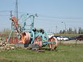
, over 800 bridges, 12 separate ferries, one barge. There are also municipal roads which comprise different surfaces. Asphalt concrete pavements comprise almost 9,000 km, granular pavement almost 5,000 km , non structural or thin membrane surface TMS are close to 7,000 kmand finally gravel highways make up over 5, 600 km through the province. TMS roads are maintained by the provincial government department: Saskatchewan Highways and Transportation. In the northern sector, ice road
s which can only be navigated in the winter months comprise another approximately 150 km of travel. Dirt roads also still exist in rural areas and would be maintained by the local resident. All in all Saskatchewan consists of over 250000 km (155,343.2 mi) of roads, the highest amount of road surface compared to any other Canadian province. Roads need to be constructed for the hot summer months, as well as the frigid winter months. Saskatchewan Highways and Transportation seeks to provide an operational transportation system that ensures the safe travel of people and products within a vast province. Crack filling, snow and ice removal, pavement marking, signage, lighting and infrastructure planning. The rural municipalities
care for rural roads of which 97 per cent are gravel and the rest asphalt surface which is similar to Ireland's road system
.
. The Boundary Survey Trail, The Telegraph Line Trail, Fort Pelly – Fort Ellice Trail, The Fort Qu'Appelle – Touchwood Hills Trail, Touchwood – Fort Pelly Trail, Fort Qu'Appelle – Touchwood Trail, Fort à la Corne – Cumberland House Trail, Fort à la Corne – Fort Ellice Trail, the Green Lake Trail, Fort Ellice – Fort Qu'Appelle Trail, Fort Qu'Appelle – Cypress Hills Trail, The Whoop-Up Trail, Wood Mountain Trail, the Milk River Trail, Fort Walsh – Wood Mountain Trail, Carlton Trail, and NWMP commission Trail were a few of the early trails between trading posts.
between 1881 and 1885. The first proposal was northerly through the District of Saskatchewan
of the North West Territories
to support the fur trade economic industry. The final established route was through the District of Assiniboia of the North West Territories. The new economy saw grain and agricultural farming as a viable alternative and Clifford Sifton
implemented a massive immigration policy in support of settling the west. The rail lines followed the established trails generally as the most practical method of traveling through the prairies.
 The early trail days employed Red River cart and bull or horse and cart. This method of travel was upgraded to rail travel until the advent of the industrial revolution
and mechanized motor travel. Automobile
and truck
travel was employed in the early 20th century with early highways and roads being under construction. The early roadways for the main, ran parallel to the rail lines. The auto was abandoned in the depression years of the dirty thirties, and cars were towed by horse and became known as Bennett buggies. The years following World War II
showed much growth as the social economic lifestyle of Saskatchewan changed considerably. Gone were the farmers on each quarter section, and also leaving the prairie landscape were elevators. Grain storage elevators used to be required every 6 miles for loads by horse and cart. Combines introduced large scale farms, trucks introduced larger centres with a larger quantity of elevators. Soon also the branch rail lines disappeared. As farms became larger, so too did many of the early township roads and road allowances disappear.
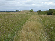
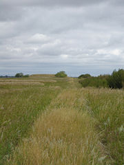 Early surveyors surveyed the prairies into township and range lines which were 6 miles apart. Townships which comprised 36 sections had surveyed road allowances through them. Sections themselves were one mile square, and had monuments placed at each corner. The west side of the range road allowance (travel north and south) meets with the iron post set at the surveyed location, and the south side of the township road (road travels east and west) also meets up with the survey marker. Therefore road allowances are always to the east and north of the markers.
 Township roads and range road
s have a definite numbering system which is used across rural municipalities. The numbers help to establish the location of the roads as they exist with relation to the legal land description survey system. Range road
s travel in a north and south direction between the meridians parallel to the latitudinal lines. Range roads indicate firstly the meridian number. In Saskatchewan roads near the Manitoba border would begin with 1 as they would be west of the prime or First Meridian
, then the range numbers would be west of the second and finally west of the Third Meridian
. There are no roads in Saskatchewan west of the Fourth Meridian
as the Fourth Meridian line defines the border between Alberta
and Saskatchewan
. A range is numbered at 6 miles increments. The next two digits would be the range number which increments from east to west from a meridian line. The last range number shows how many miles within the range the road is located starting at the eastern most edge of the range and traveling west. Whereas, a township road number first states the township number. A township number is determined by traveling north from the border between United States
and Canada
(at 49°N latitude
) and incrementing every 6 miles northward. The miles within the township are indicated next, and as a township is 6 miles in length, the mile number is therefore between 0 and 5. Township and range roads can begin and end, as they meet with geological features such as lakes, or urban centres such as cities. As they mark a definite location such as a longitudes and latitudes, the naming convention is the same across Saskatchewan. Township and range roads can be either gravel, highway, or municipal paved road. The Dominion Land Survey system designated a township road allowance every mile apart, and allowed for a range road allowance every two miles apart.
For example Range Road 3054 runs concurrent with Lorne Avenue in Saskatoon
as well as Saskatchewan Highway 219
south of the city of Saskatoon
. The numbers therefore mean that the road is west of the third meridian and is located in the 5th range west of the third meridian. And the road is 4 miles west of the range border within range 5. Mathematically this particular range road is therefore located (5 − 1) × 6 + 4 = 28 miles west of the third meridian. Taking now a township road, for example, Township Road 390, which is concurrent with Saskatchewan Highway 784
at Warman, Saskatchewan
. This road is located in the 39th township north of the United States
and Canada
border, and as well, the road is immediately on the border edge of the township and does not progress by any amount of miles within the township. So therefore this road is mathematically speaking (39 − 1) × 6 = 228 miles north of the United States
and Canada
border.
s of Ontario may be named after people, geographic features, or communities, so also can Saskatchewan municipal roads and highways be designated with a naming system upon submission to Saskatchewan Highways and Transportation. Many municipal roads are named after sidings, one-room school houses
, or ghost towns
of Saskatchewan. For example Strehlow Road which intersects with Saskatchewan Highway 11
north of Dundurn, Saskatchewan
, indicates a ghost town
of Strehlow. As well, Grasswood Road indicates the hamlet of Grasswood, Saskatchewan
, as well as the original one-room school house of Grasswood School district #3998. Indi road south of Dundurn, Saskatchewan
, indicates by marker and commemorative signage the original CNR siding of Indi, Saskatchewan.
 Highway naming began in the 1920s with the two-digit numbering series 1 through 99. These are the main travel routes between main centres, and were typically designated the more important highways of Saskatchewan; however, the rapid expansion of highway development in the 1960s necessitated the use of three-digit highway numbers as well. The two digits of the first highways are often designated in the three-digit numbers as the additional highway may be an extension of the two-digit highway. So the highways numbered between 100 to 199 typically include northern routes. The 200 to 299 numbered highways comprise scenic provincial routes or travel to a provincial or regional park. A Saskatchewan town may be accessed via a highway numbered between 300 to 399. The highway numbering series between 600 to 699 include gravel road
s which extend across the province in a north and south direction with the 600 series incrementing in travel east to west. The highways of Saskatchewan designated with the numbers between 700 to 799 are also typically gravel road
s maintained by the rural municipality
. The three digit highway numbers beginning with 7 extend east and west across Saskatchewan, and increment higher with travel from south to north. The final highway numbering system in use comprises the numbers 900–999 which are far north roads accessing communities or resources north of the tree line. Besides these provincial numbers, some highways have commemorative names.
Highways in Saskatchewan do not have typical exit number
s, but rather name the turn off road or in one instance use exit letters for Saskatchewan Highway 11
.
Saskatchewan covers a vast area, with the majority of the south central grasslands supporting an agricultural economy. The province sustains only 2% of Canada's population, and 20% of Canada's roads. Challenges are presented to support increased demands on the road infrastructure. Over 4,000 km of rail lines are not being used (and this number is rising), with this mode of transportation replaced by vehicular traffic. As well Saskatchewan's economy is diversifying into the oil and gas sector, and mining which also is increasing truck traffic. Roads are becoming secondary highways to provide means for the agricultural farmer or the industry trucker to find a route to a city market or consolidated elevator. The quantity of smaller wood grain elevators has declined in favour of concrete inland grain terminals. Grain hauling by truck by tonne-kilometre has increased 17 times over the level of the 1970s. Thin membrane surface TMS roads handle vehicle and light traffic routes. Gravel highways suffice if the average annual daily traffic (AADT) is below 150 vehicles a day. Saskatchewan classifies road system depending on amount of use or road function and can be further designated as major arterial
, minor arterial
, collector and local.
Saskatchewan
Saskatchewan is a prairie province in Canada, which has an area of . Saskatchewan is bordered on the west by Alberta, on the north by the Northwest Territories, on the east by Manitoba, and on the south by the U.S. states of Montana and North Dakota....
, the middle of Canada's
Canada
Canada is a North American country consisting of ten provinces and three territories. Located in the northern part of the continent, it extends from the Atlantic Ocean in the east to the Pacific Ocean in the west, and northward into the Arctic Ocean...
three prairie provinces, has an area of 588276.09 square kilometres (227,134.7 sq mi) and population of 990,212 (according to 2007 estimates), mostly living in the southern half of the province.
Currently Ministry of Highways and Infrastructure
Ministry of Highways and Infrastructure (Saskatchewan)
The Ministry of Highways and Infrastructure or Highways and Infrastructure — Government of Saskatchewan Ministry of Highways is divided into the Operations, Policy and Programs, and Corporate Services Divisions and the Communications Branch. The ministry is the employer of over 1,476...
operates over 26,000 km of highways and divided highways
Dual carriageway
A dual carriageway is a class of highway with two carriageways for traffic travelling in opposite directions separated by a central reservation...
, over 800 bridges, 12 separate ferries, one barge. There are also municipal roads which comprise different surfaces. Asphalt concrete pavements comprise almost 9,000 km, granular pavement almost 5,000 km , non structural or thin membrane surface TMS are close to 7,000 kmand finally gravel highways make up over 5, 600 km through the province. TMS roads are maintained by the provincial government department: Saskatchewan Highways and Transportation. In the northern sector, ice road
Ice road
Ice roads are frozen, human-made structures on the surface of bays, rivers, lakes, or seas in the far north. They link dry land, frozen waterways, portages and winter roads, and are usually remade each winter. Ice roads allow temporary transport to areas with no permanent road access...
s which can only be navigated in the winter months comprise another approximately 150 km of travel. Dirt roads also still exist in rural areas and would be maintained by the local resident. All in all Saskatchewan consists of over 250000 km (155,343.2 mi) of roads, the highest amount of road surface compared to any other Canadian province. Roads need to be constructed for the hot summer months, as well as the frigid winter months. Saskatchewan Highways and Transportation seeks to provide an operational transportation system that ensures the safe travel of people and products within a vast province. Crack filling, snow and ice removal, pavement marking, signage, lighting and infrastructure planning. The rural municipalities
Rural municipality
A rural municipality, often abbreviated RM, is a form of municipality in the Canadian provinces of Manitoba and Saskatchewan, perhaps best comparable to counties or townships in the western United States...
care for rural roads of which 97 per cent are gravel and the rest asphalt surface which is similar to Ireland's road system
Regional road
A regional road in Ireland is a class of road not forming a major route , but nevertheless forming a link in the national route network. There are over 11,600 kilometres of regional roads. Regional roads are numbered with three digit route numbers, prefixed by "R" A regional road in Ireland is a...
.
History and trails
Saskatchewan roads first began as hunting trails following the paths of animals. During the 18th and 19th centuries, fur trading posts were established, and named Red River cart trails appeared networking across Rupert's LandRupert's Land
Rupert's Land, or Prince Rupert's Land, was a territory in British North America, consisting of the Hudson Bay drainage basin that was nominally owned by the Hudson's Bay Company for 200 years from 1670 to 1870, although numerous aboriginal groups lived in the same territory and disputed the...
. The Boundary Survey Trail, The Telegraph Line Trail, Fort Pelly – Fort Ellice Trail, The Fort Qu'Appelle – Touchwood Hills Trail, Touchwood – Fort Pelly Trail, Fort Qu'Appelle – Touchwood Trail, Fort à la Corne – Cumberland House Trail, Fort à la Corne – Fort Ellice Trail, the Green Lake Trail, Fort Ellice – Fort Qu'Appelle Trail, Fort Qu'Appelle – Cypress Hills Trail, The Whoop-Up Trail, Wood Mountain Trail, the Milk River Trail, Fort Walsh – Wood Mountain Trail, Carlton Trail, and NWMP commission Trail were a few of the early trails between trading posts.
Early railways
The early rail line was constructed by the Canadian Pacific RailwayCanadian Pacific Railway
The Canadian Pacific Railway , formerly also known as CP Rail between 1968 and 1996, is a historic Canadian Class I railway founded in 1881 and now operated by Canadian Pacific Railway Limited, which began operations as legal owner in a corporate restructuring in 2001...
between 1881 and 1885. The first proposal was northerly through the District of Saskatchewan
District of Saskatchewan
The District of Saskatchewan was a regional administrative district of Canada's Northwest Territories. Much of the area was incorporated into the province of Saskatchewan. The western part became part of Alberta, and the eastern part is now part of Manitoba. Its capital was Prince Albert...
of the North West Territories
Territorial evolution of Canada
The federation of Canada was created in 1867 when three colonies of British North America were united. One of these colonies split into two new provinces, three other colonies joined later...
to support the fur trade economic industry. The final established route was through the District of Assiniboia of the North West Territories. The new economy saw grain and agricultural farming as a viable alternative and Clifford Sifton
Clifford Sifton
Sir Clifford Sifton, PC, KCMG was a Canadian politician best known for being Minister of the Interior under Sir Wilfrid Laurier...
implemented a massive immigration policy in support of settling the west. The rail lines followed the established trails generally as the most practical method of traveling through the prairies.
Evolution
Industrial Revolution
The Industrial Revolution was a period from the 18th to the 19th century where major changes in agriculture, manufacturing, mining, transportation, and technology had a profound effect on the social, economic and cultural conditions of the times...
and mechanized motor travel. Automobile
Automobile
An automobile, autocar, motor car or car is a wheeled motor vehicle used for transporting passengers, which also carries its own engine or motor...
and truck
Truck
A truck or lorry is a motor vehicle designed to transport cargo. Trucks vary greatly in size, power, and configuration, with the smallest being mechanically similar to an automobile...
travel was employed in the early 20th century with early highways and roads being under construction. The early roadways for the main, ran parallel to the rail lines. The auto was abandoned in the depression years of the dirty thirties, and cars were towed by horse and became known as Bennett buggies. The years following World War II
World War II
World War II, or the Second World War , was a global conflict lasting from 1939 to 1945, involving most of the world's nations—including all of the great powers—eventually forming two opposing military alliances: the Allies and the Axis...
showed much growth as the social economic lifestyle of Saskatchewan changed considerably. Gone were the farmers on each quarter section, and also leaving the prairie landscape were elevators. Grain storage elevators used to be required every 6 miles for loads by horse and cart. Combines introduced large scale farms, trucks introduced larger centres with a larger quantity of elevators. Soon also the branch rail lines disappeared. As farms became larger, so too did many of the early township roads and road allowances disappear.
Dominion Land Survey system
Township roads and range roads
Range road
Range Road is a Canadian term that refers to roads that run north-south along the range grid lines of a survey system. Range Roads are perpendicular to township roads Range Road is a Canadian term that refers to roads that run north-south along the range grid lines of a survey system. Range...
s have a definite numbering system which is used across rural municipalities. The numbers help to establish the location of the roads as they exist with relation to the legal land description survey system. Range road
Range road
Range Road is a Canadian term that refers to roads that run north-south along the range grid lines of a survey system. Range Roads are perpendicular to township roads Range Road is a Canadian term that refers to roads that run north-south along the range grid lines of a survey system. Range...
s travel in a north and south direction between the meridians parallel to the latitudinal lines. Range roads indicate firstly the meridian number. In Saskatchewan roads near the Manitoba border would begin with 1 as they would be west of the prime or First Meridian
Dominion Land Survey
The Dominion Land Survey is the method used to divide most of Western Canada into one-square-mile sections for agricultural and other purposes. It is based on the layout of the Public Land Survey System used in the United States, but has several differences...
, then the range numbers would be west of the second and finally west of the Third Meridian
106th meridian west
The meridian 106° west of Greenwich is a line of longitude that extends from the North Pole across the Arctic Ocean, North America, the Pacific Ocean, the Southern Ocean, and Antarctica to the South Pole....
. There are no roads in Saskatchewan west of the Fourth Meridian
110th meridian west
The meridian 110° west of Greenwich is a line of longitude that extends from the North Pole across the Arctic Ocean, North America, the Pacific Ocean, the Southern Ocean, and Antarctica to the South Pole....
as the Fourth Meridian line defines the border between Alberta
Alberta
Alberta is a province of Canada. It had an estimated population of 3.7 million in 2010 making it the most populous of Canada's three prairie provinces...
and Saskatchewan
Saskatchewan
Saskatchewan is a prairie province in Canada, which has an area of . Saskatchewan is bordered on the west by Alberta, on the north by the Northwest Territories, on the east by Manitoba, and on the south by the U.S. states of Montana and North Dakota....
. A range is numbered at 6 miles increments. The next two digits would be the range number which increments from east to west from a meridian line. The last range number shows how many miles within the range the road is located starting at the eastern most edge of the range and traveling west. Whereas, a township road number first states the township number. A township number is determined by traveling north from the border between United States
United States
The United States of America is a federal constitutional republic comprising fifty states and a federal district...
and Canada
Canada
Canada is a North American country consisting of ten provinces and three territories. Located in the northern part of the continent, it extends from the Atlantic Ocean in the east to the Pacific Ocean in the west, and northward into the Arctic Ocean...
(at 49°N latitude
49th parallel north
The 49th parallel north is a circle of latitude that is 49 degrees north of the Earth's equatorial plane. It crosses Europe, Asia, the Pacific Ocean, North America, and the Atlantic Ocean....
) and incrementing every 6 miles northward. The miles within the township are indicated next, and as a township is 6 miles in length, the mile number is therefore between 0 and 5. Township and range roads can begin and end, as they meet with geological features such as lakes, or urban centres such as cities. As they mark a definite location such as a longitudes and latitudes, the naming convention is the same across Saskatchewan. Township and range roads can be either gravel, highway, or municipal paved road. The Dominion Land Survey system designated a township road allowance every mile apart, and allowed for a range road allowance every two miles apart.
For example Range Road 3054 runs concurrent with Lorne Avenue in Saskatoon
Saskatoon
Saskatoon is a city in central Saskatchewan, Canada, on the South Saskatchewan River. Residents of the city of Saskatoon are called Saskatonians. The city is surrounded by the Rural Municipality of Corman Park No. 344....
as well as Saskatchewan Highway 219
Saskatchewan Highway 219
Highway 219 is a secondary highway in the Canadian province of Saskatchewan, running from Saskatoon south to the vicinity of the Gardiner Dam development and the north end of Lake Diefenbaker....
south of the city of Saskatoon
Saskatoon
Saskatoon is a city in central Saskatchewan, Canada, on the South Saskatchewan River. Residents of the city of Saskatoon are called Saskatonians. The city is surrounded by the Rural Municipality of Corman Park No. 344....
. The numbers therefore mean that the road is west of the third meridian and is located in the 5th range west of the third meridian. And the road is 4 miles west of the range border within range 5. Mathematically this particular range road is therefore located (5 − 1) × 6 + 4 = 28 miles west of the third meridian. Taking now a township road, for example, Township Road 390, which is concurrent with Saskatchewan Highway 784
Saskatchewan Highway 784
Highway 784 is a highway in the Canadian province of Saskatchewan. It runs from Highway 4 to Highway 41 near Aberdeen. Highway 784 is about 124 km long.Highway 784 also passes near Struan, Dalmeny, Warman, and Clarkboro...
at Warman, Saskatchewan
Warman, Saskatchewan
-History:The town of Warman was born when the Canadian National Railway running from Humboldt to North Battleford intersected with the Canadian Pacific Railway running from Regina to Prince Albert. This took place in the fall of 1904....
. This road is located in the 39th township north of the United States
United States
The United States of America is a federal constitutional republic comprising fifty states and a federal district...
and Canada
Canada
Canada is a North American country consisting of ten provinces and three territories. Located in the northern part of the continent, it extends from the Atlantic Ocean in the east to the Pacific Ocean in the west, and northward into the Arctic Ocean...
border, and as well, the road is immediately on the border edge of the township and does not progress by any amount of miles within the township. So therefore this road is mathematically speaking (39 − 1) × 6 = 228 miles north of the United States
United States
The United States of America is a federal constitutional republic comprising fifty states and a federal district...
and Canada
Canada
Canada is a North American country consisting of ten provinces and three territories. Located in the northern part of the continent, it extends from the Atlantic Ocean in the east to the Pacific Ocean in the west, and northward into the Arctic Ocean...
border.
Naming of roads
Just as county highwayCounty highway
A county highway is a road in the United States and in the Canadian province of Ontario that is designated and/or maintained by the county highway department...
s of Ontario may be named after people, geographic features, or communities, so also can Saskatchewan municipal roads and highways be designated with a naming system upon submission to Saskatchewan Highways and Transportation. Many municipal roads are named after sidings, one-room school houses
One-room school
One-room schools were commonplace throughout rural portions of various countries including the United States, Canada, Australia, New Zealand, United Kingdom, Ireland and Spain in the late 19th and early 20th centuries. In most rural and small town schools, all of the students met in a single room...
, or ghost towns
Ghost towns in Saskatchewan
The following is a list of communities that no longer exist or former Villages/Towns that have become unincorporated hamlets in the province of Saskatchewan, Canada....
of Saskatchewan. For example Strehlow Road which intersects with Saskatchewan Highway 11
Saskatchewan Highway 11
Highway 11 is a major north-south highway in Saskatchewan, Canada that connects the province's three largest cities: Regina, Saskatoon and Prince Albert. It is a structural pavement major arterial highway which is approximately long. It is also known as the Louis Riel Trail after the 19th century...
north of Dundurn, Saskatchewan
Dundurn, Saskatchewan
-Sites of interest:Blackstrap Provincial park and Blackstrap Ski Hill a conservation area with man made lake as well as a man made mountain is located 7 kilometers or 5 miles to the east of town. In 1969, 1970 Mount Blackstrap was constructed to host the 1971 Canada Winter Games which were awarded...
, indicates a ghost town
Ghost towns in Saskatchewan
The following is a list of communities that no longer exist or former Villages/Towns that have become unincorporated hamlets in the province of Saskatchewan, Canada....
of Strehlow. As well, Grasswood Road indicates the hamlet of Grasswood, Saskatchewan
Grasswood, Saskatchewan
Grasswood, also known as Grasswood Park, is an unincorporated hamlet in Saskatchewan. It is part of the Corman Park rural municipality and is located just south of the city limits of Saskatoon. A second unincorporated hamlet, Furdale, is directly to the west.The area comprises primarily residences...
, as well as the original one-room school house of Grasswood School district #3998. Indi road south of Dundurn, Saskatchewan
Dundurn, Saskatchewan
-Sites of interest:Blackstrap Provincial park and Blackstrap Ski Hill a conservation area with man made lake as well as a man made mountain is located 7 kilometers or 5 miles to the east of town. In 1969, 1970 Mount Blackstrap was constructed to host the 1971 Canada Winter Games which were awarded...
, indicates by marker and commemorative signage the original CNR siding of Indi, Saskatchewan.
Naming of highways
Gravel road
A gravel road is a type of unpaved road surfaced with gravel that has been brought to the site from a quarry or stream bed. They are common in less-developed nations, and also in the rural areas of developed nations such as Canada and the United States. In New Zealand, they are known as 'metal roads'...
s which extend across the province in a north and south direction with the 600 series incrementing in travel east to west. The highways of Saskatchewan designated with the numbers between 700 to 799 are also typically gravel road
Gravel road
A gravel road is a type of unpaved road surfaced with gravel that has been brought to the site from a quarry or stream bed. They are common in less-developed nations, and also in the rural areas of developed nations such as Canada and the United States. In New Zealand, they are known as 'metal roads'...
s maintained by the rural municipality
Rural municipality
A rural municipality, often abbreviated RM, is a form of municipality in the Canadian provinces of Manitoba and Saskatchewan, perhaps best comparable to counties or townships in the western United States...
. The three digit highway numbers beginning with 7 extend east and west across Saskatchewan, and increment higher with travel from south to north. The final highway numbering system in use comprises the numbers 900–999 which are far north roads accessing communities or resources north of the tree line. Besides these provincial numbers, some highways have commemorative names.
- The Red Coat TrailRed Coat TrailThe Red Coat Trail is a route that approximates the path taken in 1874 by the North-West Mounted Police in their quest to bring law and order to the Canadian West.-Travel route:...
or Saskatchewan Highway 13Saskatchewan Highway 13Highway 13 is a highway in the Canadian province of Saskatchewan. It runs from the Alberta border until it transitions into Highway 2 at the Manitoba border near Antler. Highway 13 is about 676 km long.Highway 13 passes through Shaunavon, Assiniboia, Weyburn, Redvers and Carlyle...
commemorates the Red Coat trail taken by Sir Redvers Buller during the Red River Rebellion. - Louis Riel TrailSaskatchewan Highway 11Highway 11 is a major north-south highway in Saskatchewan, Canada that connects the province's three largest cities: Regina, Saskatoon and Prince Albert. It is a structural pavement major arterial highway which is approximately long. It is also known as the Louis Riel Trail after the 19th century...
includes 364 km of Saskatchewan Highway 11Saskatchewan Highway 11Highway 11 is a major north-south highway in Saskatchewan, Canada that connects the province's three largest cities: Regina, Saskatoon and Prince Albert. It is a structural pavement major arterial highway which is approximately long. It is also known as the Louis Riel Trail after the 19th century...
. - Yellowhead HighwayYellowhead HighwayThe Yellowhead Highway is a major east-west highway connecting the four western Canadian provinces of British Columbia, Alberta, Saskatchewan, and Manitoba. Although part of the Trans-Canada Highway system, the highway should not be confused with the more southerly, originally-designated...
or Saskatchewan Highway 16Saskatchewan Highway 16Highway 16 is a provincial paved highway in the Canadian province of Saskatchewan. It is the Saskatchewan section of the Yellowhead Highway, and also the Trans-Canada Highway Yellowhead section. The main purpose of this highway is to connect Saskatchewan with Canadian cities such as Edmonton and...
connects the four western provinces in an east and west travel route north of the Saskatchewan Highway 1Saskatchewan Highway 1Highway 1 is the Saskatchewan section of the Trans-Canada Highway mainland route. The total distance of the Trans-Canada Highway in Saskatchewan is . The highway traverses Saskatchewan from the western border with Alberta, from Highway 1, to Manitoba where it continues as Highway 1, PTH 1. The...
. - CanAm HighwayCanAm HighwayCanAm Highway passes through these states in the United States; Texas, New Mexico, Colorado, Wyoming, South Dakota, North Dakota, as well as the province of Saskatchewan, Canada. The international Can-Am Highway travels along U.S. Route 85 and Interstate 25, connecting Mexico to Canada through...
travels in a north south direction comprising Saskatchewan Highways SK 35Saskatchewan Highway 35Highway 35 is a paved undivided provincial highway in the Canadian province of Saskatchewan. It runs from the US Border near Port of Oungre to a dead end near the north shore of Tobin Lake. Saskatchewan Highway 35 SK Hwy 35) is about long. The CanAm Highway comprises Saskatchewan Highways 35,...
, Sk 39Saskatchewan Highway 39Highway 39 is a provincial paved undivided highway located in the southern portion of the Canadian province of Saskatchewan connecting North Portal and Moose Jaw in the north. This is a primary Saskatchewan highway maintained by the provincial and national governments providing a major trucking...
, Sk 6Saskatchewan Highway 6Highway 6 is a paved undivided major provincial highway in the Canadian province of Saskatchewan. It runs from Montana Highway 16 at the Saskatchewan border with the US near the Canada customs port of Regway to Highway 55 near Choiceland. Highway 6 is about long. The CanAm Highway comprises ...
, Sk 3Saskatchewan Highway 3Highway 3 is a major provincial paved undivided highway in the Canadian province of Saskatchewan. It runs from the Alberta border, continues west as Alberta Highway 45 to the Manitoba border, and then continues east as Highway 77. Highway 3 is about 615 km long. The CanAm Highway comprises ...
, Sk 2Saskatchewan Highway 2Highway 2 is a provincial highway in the Canadian province of Saskatchewan. It is the longest Saskatchewan Highway, at 809 km . The highway is partially divided and undivided. However, only about near Moose Jaw, near Chamberlain, and near Prince Albert are divided highway...
as well as U.S. Route 85U.S. Route 85U.S. Route 85 is a north–south United States highway that runs for in the Mountain - Northern Plains states of the United States. The southern terminus of the route is at the United States-Mexico border in El Paso, Texas, connecting with Mexican Federal Highway 45...
. This super corridor connects TexasTexasTexas is the second largest U.S. state by both area and population, and the largest state by area in the contiguous United States.The name, based on the Caddo word "Tejas" meaning "friends" or "allies", was applied by the Spanish to the Caddo themselves and to the region of their settlement in...
in southern United StatesUnited StatesThe United States of America is a federal constitutional republic comprising fifty states and a federal district...
to northern SaskatchewanSaskatchewanSaskatchewan is a prairie province in Canada, which has an area of . Saskatchewan is bordered on the west by Alberta, on the north by the Northwest Territories, on the east by Manitoba, and on the south by the U.S. states of Montana and North Dakota....
. - Saskota Flyway Scenic Drive Route or Saskatchewan Highway 9Saskatchewan Highway 9Highway 9, Highway 9 is a provincial paved undivided highway in the Canadian province of Saskatchewan. It runs from North Dakota Highway 8 at the US border near Port of Northgate until it transitions into Provincial Road 283 at the Manitoba border...
is a historic north south route between North DakotaNorth DakotaNorth Dakota is a state located in the Midwestern region of the United States of America, along the Canadian border. The state is bordered by Canada to the north, Minnesota to the east, South Dakota to the south and Montana to the west. North Dakota is the 19th-largest state by area in the U.S....
United StatesUnited StatesThe United States of America is a federal constitutional republic comprising fifty states and a federal district...
and northern SaskatchewanSaskatchewanSaskatchewan is a prairie province in Canada, which has an area of . Saskatchewan is bordered on the west by Alberta, on the north by the Northwest Territories, on the east by Manitoba, and on the south by the U.S. states of Montana and North Dakota....
. - Trans-Canada HighwayTrans-Canada HighwayThe Trans-Canada Highway is a federal-provincial highway system that joins the ten provinces of Canada. It is, along with the Trans-Siberian Highway and Australia's Highway 1, one of the world's longest national highways, with the main route spanning 8,030 km...
or Saskatchewan Highway 1Saskatchewan Highway 1Highway 1 is the Saskatchewan section of the Trans-Canada Highway mainland route. The total distance of the Trans-Canada Highway in Saskatchewan is . The highway traverses Saskatchewan from the western border with Alberta, from Highway 1, to Manitoba where it continues as Highway 1, PTH 1. The...
connects ten Canadian provinces in an east and west travel route south of the Yellowhead HighwayYellowhead HighwayThe Yellowhead Highway is a major east-west highway connecting the four western Canadian provinces of British Columbia, Alberta, Saskatchewan, and Manitoba. Although part of the Trans-Canada Highway system, the highway should not be confused with the more southerly, originally-designated...
. - Northern Woods and Water RouteNorthern Woods and Water RouteThe Northern Woods and Water Route is a route through northern British Columbia, Alberta, Saskatchewan and Manitoba. As early as the 1950s community groups came together to establish a northern travel route; this was proposed as the Northern Yellowhead Transportation Route...
which comprises an east and west scenic route along Saskatchewan Highway 9Saskatchewan Highway 9Highway 9, Highway 9 is a provincial paved undivided highway in the Canadian province of Saskatchewan. It runs from North Dakota Highway 8 at the US border near Port of Northgate until it transitions into Provincial Road 283 at the Manitoba border...
and Saskatchewan Highway 55Saskatchewan Highway 55Highway 55 is a provincial paved undivided highway in the Canadian province of Saskatchewan. It runs from Alberta Highway 55 near the Alberta border until Highway 9. Highway 55 is 652 km long. It forms part of the interprovincial Northern Woods and Water Route.-Attractions:On the West portion...
. The tree line marks the separation of Saskatchewan prairies and parkland and the northern lakeland and forested area. Northern Saskatchewan was home to the fur trade industry and the earliest trading post economy. Northern Woods and Water Route commemorates the waterways and woodland areas first valued in this area by first nations and fur trader. - Veterans Memorial HighwaySaskatchewan Highway 2Highway 2 is a provincial highway in the Canadian province of Saskatchewan. It is the longest Saskatchewan Highway, at 809 km . The highway is partially divided and undivided. However, only about near Moose Jaw, near Chamberlain, and near Prince Albert are divided highway...
is the official name of Saskatchewan Highway 2Saskatchewan Highway 2Highway 2 is a provincial highway in the Canadian province of Saskatchewan. It is the longest Saskatchewan Highway, at 809 km . The highway is partially divided and undivided. However, only about near Moose Jaw, near Chamberlain, and near Prince Albert are divided highway...
between Moose Jaw and Prince Albert. - Hanson Lake Road: Primary gravel Saskatchewan Highway 120Saskatchewan Highway 120Highway 120 is a highway in the Canadian province of Saskatchewan. It runs from Highway 55 to Highway 920 within the Narrow Hills Provincial Park. Highway 926 is about 97 km long....
and primary paved Saskatchewan Highway 106Saskatchewan Highway 106Highway 106, the Hanson Lake Road, has sections of provincial paved divided highway and provincial gravel highway in the Canadian province of Saskatchewan. It runs from Highway 55 near Smeaton to Highway 167 in Creighton. Highway 106 is about 327 km long...
between Prince AlbertPrince Albert, SaskatchewanPrince Albert is the third-largest city in Saskatchewan, Canada. It is situated in the centre of the province on the banks of the North Saskatchewan River. The city is known as the "Gateway to the North" because it is the last major centre along the route to the resources of northern Saskatchewan...
and Flin FlonFlin FlonFlin Flon is a Canadian mining city located on the border of Manitoba and Saskatchewan, with the majority of the city located within Manitoba.- Founding :...
.
Highways in Saskatchewan do not have typical exit number
Exit number
An exit number is a number assigned to a road junction, usually an exit from a freeway. It is usually marked on the same sign as the destinations of the exit, as well as a sign in the gore....
s, but rather name the turn off road or in one instance use exit letters for Saskatchewan Highway 11
Saskatchewan Highway 11
Highway 11 is a major north-south highway in Saskatchewan, Canada that connects the province's three largest cities: Regina, Saskatoon and Prince Albert. It is a structural pavement major arterial highway which is approximately long. It is also known as the Louis Riel Trail after the 19th century...
.
Current infrastructure system
At its peak, in the mid 1970s, Saskatchewan hosted 16,679 km of rail lines, which has declined to 13,041 as of 1999. As rail lines are abandoned, a trend which is still continuing, and as elevators are consolidated, the demand for improved roads and highways is ongoing. Improvements are being made on the highway and road network to provide reduced damage to the road system by overweight vehicles. This is achieved by two methods, legislation on trucking, and upgrading the road system to support the vehicle weight.Saskatchewan covers a vast area, with the majority of the south central grasslands supporting an agricultural economy. The province sustains only 2% of Canada's population, and 20% of Canada's roads. Challenges are presented to support increased demands on the road infrastructure. Over 4,000 km of rail lines are not being used (and this number is rising), with this mode of transportation replaced by vehicular traffic. As well Saskatchewan's economy is diversifying into the oil and gas sector, and mining which also is increasing truck traffic. Roads are becoming secondary highways to provide means for the agricultural farmer or the industry trucker to find a route to a city market or consolidated elevator. The quantity of smaller wood grain elevators has declined in favour of concrete inland grain terminals. Grain hauling by truck by tonne-kilometre has increased 17 times over the level of the 1970s. Thin membrane surface TMS roads handle vehicle and light traffic routes. Gravel highways suffice if the average annual daily traffic (AADT) is below 150 vehicles a day. Saskatchewan classifies road system depending on amount of use or road function and can be further designated as major arterial
Arterial road
An arterial road, or arterial thoroughfare, is a high-capacity urban road. The primary function of an arterial road is to deliver traffic from collector roads to freeways, and between urban centres at the highest level of service possible. As such, many arteries are limited-access roads, or feature...
, minor arterial
Arterial road
An arterial road, or arterial thoroughfare, is a high-capacity urban road. The primary function of an arterial road is to deliver traffic from collector roads to freeways, and between urban centres at the highest level of service possible. As such, many arteries are limited-access roads, or feature...
, collector and local.
External links
- Appendix A, Long-Term Pavement Performance Maintenance and Rehabilitation Data Collection Guide, FHWA-HRT-06-068 - LTPP - Pavements - FHWA
- Saskatchewan’s Asset Management Cycle Authors: Josh Safronetz, M
- Submission to the Canada Transportation Act Review Panel
See also
- List of Saskatchewan provincial highways
- Ministry of Highways and InfrastructureMinistry of Highways and Infrastructure (Saskatchewan)The Ministry of Highways and Infrastructure or Highways and Infrastructure — Government of Saskatchewan Ministry of Highways is divided into the Operations, Policy and Programs, and Corporate Services Divisions and the Communications Branch. The ministry is the employer of over 1,476...
- Numbered highways in Canada
- Saskatchewan Portal
- WikiProject Canada Roads / Saskatchewan