
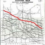
Saskatchewan Highway 16
Encyclopedia

Highway
A highway is any public road. In American English, the term is common and almost always designates major roads. In British English, the term designates any road open to the public. Any interconnected set of highways can be variously referred to as a "highway system", a "highway network", or a...
in the Canadian
Canada
Canada is a North American country consisting of ten provinces and three territories. Located in the northern part of the continent, it extends from the Atlantic Ocean in the east to the Pacific Ocean in the west, and northward into the Arctic Ocean...
province of Saskatchewan
Saskatchewan
Saskatchewan is a prairie province in Canada, which has an area of . Saskatchewan is bordered on the west by Alberta, on the north by the Northwest Territories, on the east by Manitoba, and on the south by the U.S. states of Montana and North Dakota....
. It is the Saskatchewan section of the Yellowhead Highway
Yellowhead Highway
The Yellowhead Highway is a major east-west highway connecting the four western Canadian provinces of British Columbia, Alberta, Saskatchewan, and Manitoba. Although part of the Trans-Canada Highway system, the highway should not be confused with the more southerly, originally-designated...
, and also the Trans-Canada Highway
Trans-Canada Highway
The Trans-Canada Highway is a federal-provincial highway system that joins the ten provinces of Canada. It is, along with the Trans-Siberian Highway and Australia's Highway 1, one of the world's longest national highways, with the main route spanning 8,030 km...
Yellowhead section. The main purpose of this highway
Highway
A highway is any public road. In American English, the term is common and almost always designates major roads. In British English, the term designates any road open to the public. Any interconnected set of highways can be variously referred to as a "highway system", a "highway network", or a...
is to connect Saskatchewan
Saskatchewan
Saskatchewan is a prairie province in Canada, which has an area of . Saskatchewan is bordered on the west by Alberta, on the north by the Northwest Territories, on the east by Manitoba, and on the south by the U.S. states of Montana and North Dakota....
with Canadian cities such as Edmonton and Winnipeg
Winnipeg
Winnipeg is the capital and largest city of Manitoba, Canada, and is the primary municipality of the Winnipeg Capital Region, with more than half of Manitoba's population. It is located near the longitudinal centre of North America, at the confluence of the Red and Assiniboine Rivers .The name...
. The highway runs from the Alberta
Alberta
Alberta is a province of Canada. It had an estimated population of 3.7 million in 2010 making it the most populous of Canada's three prairie provinces...
border in Lloydminster (50th Street) to the Manitoba
Manitoba
Manitoba is a Canadian prairie province with an area of . The province has over 110,000 lakes and has a largely continental climate because of its flat topography. Agriculture, mostly concentrated in the fertile southern and western parts of the province, is vital to the province's economy; other...
border near Marchwell. Major cities it passes through are Saskatoon, North Battleford
North Battleford, Saskatchewan
In the late 2000s a large number of Ruthenians have emigrated to Canada, concentrating in North Battleford.-History:Prior to European settlement, the Battlefords area was home to several aboriginal groups...
in the central part of the province, Yorkton
Yorkton, Saskatchewan
Yorkton is a city located in southeastern Saskatchewan, Canada, near the Manitoba border. Founded and incorporated in 1882 by a group of settlers from Ontario, it has grown to 15,038 residents as of the 2006 census. The city is bordered by the Rural Municipality of Orkney No. 244 and the Rural...
in the far east and Lloydminster to the far west.
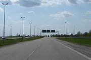
The highway is four lanes through Saskatchewan from the Alberta
Alberta
Alberta is a province of Canada. It had an estimated population of 3.7 million in 2010 making it the most populous of Canada's three prairie provinces...
border to just west of Floral
Floral, Saskatchewan
Floral, Saskatchewan is a small unincorporated village located in the southeast city limits of Saskatoon, just east of Highway 16 off the Floral Road exit in the province of Saskatchewan, Canada. Floral is part of rural municipality Corman Park No. 344, Saskatchewan...
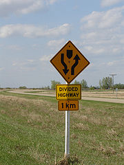
; the rest of the road is two lanes, but plans exist to twin
Dual carriageway
A dual carriageway is a class of highway with two carriageways for traffic travelling in opposite directions separated by a central reservation...
the route and gain expressway
Limited-access road
A limited-access road known by various terms worldwide, including limited-access highway, dual-carriageway and expressway, is a highway or arterial road for high-speed traffic which has many or most characteristics of a controlled-access highway , including limited or no access to adjacent...
status. Similarly, Highway 16, the continuation of the highway into Manitoba, is also to be twinned and become an expressway. The road also serves as part of the Circle Drive in Saskatoon.
The Yellowhead began as the Yellowhead Red River cart trail. When the province was surveyed, the road evolved from a dirt to gravel to all weather road known as Provincial Highway 5 from the Alberta
Alberta
Alberta is a province of Canada. It had an estimated population of 3.7 million in 2010 making it the most populous of Canada's three prairie provinces...
–Saskatchewan border to Saskatoon, and as Provincial Highway 14 from Saskatoon to the Manitoba
Manitoba
Manitoba is a Canadian prairie province with an area of . The province has over 110,000 lakes and has a largely continental climate because of its flat topography. Agriculture, mostly concentrated in the fertile southern and western parts of the province, is vital to the province's economy; other...
–Saskatchewan border. In the late 1950s and 1960s, the highway was straightened and widened. On August 15, 1970 the Yellowhead was opened for the northern Trans-Canada route. The highway was completely designated for the entire route as Saskatchewan Highway 16 in 1976.
West
| Communities: west |
|---|
|
Survey markers were erected in Lloydminster to demark the Saskatchewan–Alberta
Alberta
Alberta is a province of Canada. It had an estimated population of 3.7 million in 2010 making it the most populous of Canada's three prairie provinces...
border. Lloydminster is Canada's only border city and the gateway to Alberta
Alberta
Alberta is a province of Canada. It had an estimated population of 3.7 million in 2010 making it the most populous of Canada's three prairie provinces...
. It currently ranks in size as the 89th largest city in Canada. The two sides of the city rank 10th in Alberta and 11th in Saskatchewan in municipal population. If the city were entirely in one province or the other, Lloydminster's population would rank ninth in Alberta and fifth in Saskatchewan. It is renowned for its booming petroleum
Petroleum
Petroleum or crude oil is a naturally occurring, flammable liquid consisting of a complex mixture of hydrocarbons of various molecular weights and other liquid organic compounds, that are found in geologic formations beneath the Earth's surface. Petroleum is recovered mostly through oil drilling...
industry and the OTS Heavy Oil Science Centre. The highway is surveyed north of the Battle River and south of the North Saskatchewan River. Lashburn
Lashburn, Saskatchewan
-Demographics:-External links:...
, a town of 914 in 2006 maintains the Lashburn Municipal Campground.
Waseca is a village of 144 in 2006. Maidstone
Maidstone, Saskatchewan
-Transportation:The community is served by Maidstone Aerodrome which is located northwest.-External links:...
, a town
Town
A town is a human settlement larger than a village but smaller than a city. The size a settlement must be in order to be called a "town" varies considerably in different parts of the world, so that, for example, many American "small towns" seem to British people to be no more than villages, while...
of 1,037 in 2006 is home to the rural municipality
Rural municipality
A rural municipality, often abbreviated RM, is a form of municipality in the Canadian provinces of Manitoba and Saskatchewan, perhaps best comparable to counties or townships in the western United States...
office for Eldon No. 471
Eldon No. 471, Saskatchewan
Eldon No. 471, Saskatchewan, is a rural municipality of 1,473 rural residents in the northwestern part of Saskatchewan, Canada. Local Improvement District 24-5-3 was formed April 26, 1907. The RM of Eldon No. 471 was incorporated December 9, 1909...
and the Maidstone Campground. In 1975, a canola (rapeseed) plant statue was built alongside the Yellowhead in the centre of the town of Maidstone.
Bresaylor Heritage Museum still preserves heritage of Paynton and Bresaylor on Main Street, Bresaylor.
The Battlefords are the next large centre along the Yellowhead comprising, Battleford is a town of 3,685 residents(2006) and, North Battleford
North Battleford, Saskatchewan
In the late 2000s a large number of Ruthenians have emigrated to Canada, concentrating in North Battleford.-History:Prior to European settlement, the Battlefords area was home to several aboriginal groups...
, a city of 13,190 residents Travelers can rest at the Eiling Kramer Campground or The Battlefords Provincial Park. North Battleford has an equestrian statue of a Royal Canadian Mounted Police officer located at the junction of Highway 40
Saskatchewan Highway 40
Highway 40 is a highway in the northwest portion of the Canadian province of Saskatchewan connecting Alberta to Highway 3, 4 km west of Shellbrook, Saskatchewan. Areas of this highway between the Alberta border and North Battleford are called The Poundmaker Trail. Pitikwahanapiwiyin Highway...
and the Yellowhead. It is here that the North Saskatchewan River is crossed via a Borden Bridge
Borden Bridge
Borden Bridge is an abandoned arch bridge that spans across the North Saskatchewan River near Borden, Saskatchewan, Canada. The bridge used to carry Saskatchewan Highway 16, but is still open to foot traffic.-History:...
, the Yellowhead travels north of the North Saskatchewan River henceforth, and south of the Thickwood Hills. Denholm is a village
Village
A village is a clustered human settlement or community, larger than a hamlet with the population ranging from a few hundred to a few thousand , Though often located in rural areas, the term urban village is also applied to certain urban neighbourhoods, such as the West Village in Manhattan, New...
of 61 persons, Maymont
Maymont, Saskatchewan
-Demographics:-External links:*...
, a village
Village
A village is a clustered human settlement or community, larger than a hamlet with the population ranging from a few hundred to a few thousand , Though often located in rural areas, the term urban village is also applied to certain urban neighbourhoods, such as the West Village in Manhattan, New...
of 130 in 2006, and Fielding
Fielding, Saskatchewan
Fielding, Saskatchewan is an unincorporated area in the rural municipality of Mayfield No. 406, Saskatchewan, in the Canadian province of Saskatchewan. Fielding is located on Saskatchewan Highway 16, the Yellowhead in north western Saskatchewan. Fielding post office first opened in 1905 at the...
is a small unincorporated area of Mayfield No. 406
Mayfield No. 406, Saskatchewan
Mayfield No. 406, Saskatchewan, is a rural municipality of 394 rural residents in the northwestern part of Saskatchewan, Canada. The RM was incorporated December 19, 1909...
which intersperse travel between the Battlefords and Saskatoon
Saskatoon
Saskatoon is a city in central Saskatchewan, Canada, on the South Saskatchewan River. Residents of the city of Saskatoon are called Saskatonians. The city is surrounded by the Rural Municipality of Corman Park No. 344....
. The Yellowhead still travels parallel with the North Saskatchewan River on the south side of the highway affording the traveler with spectacular river valley panoramic views. Radisson
Radisson, Saskatchewan
-Transportation:The community is served by Radisson Airport which is located adjacent to Radisson.- See also :* List of communities in Saskatchewan* List of towns in Saskatchewan-External links:*...
is a town
Town
A town is a human settlement larger than a village but smaller than a city. The size a settlement must be in order to be called a "town" varies considerably in different parts of the world, so that, for example, many American "small towns" seem to British people to be no more than villages, while...
of 421 in 2006 which also provides services and campground. Borden incorporated as a village
Village
A village is a clustered human settlement or community, larger than a hamlet with the population ranging from a few hundred to a few thousand , Though often located in rural areas, the term urban village is also applied to certain urban neighbourhoods, such as the West Village in Manhattan, New...
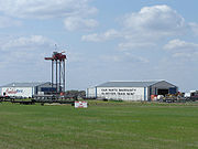
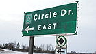
in 1909 and still maintains village status with a population of 223 in 2006. The Borden Bridge campground is located 55 kilometres (34.2 mi) from Saskatoon. Near here is a scenic viewpoint stop-off area. The new Borden Bridge provides twinned highway service across the North Saskatchewan River. The old Borden Bridge was a narrow, two-way traffic bridge enhanced with arches, which is still visible from the new bridge. Saskatoon, a city of 202,340 in 2006, is the largest city of the province, serving interprovincial travellers with a bypass road named Circle Drive.
East
| Communities: east |
|---|
|
Elstow
Elstow, Saskatchewan
- See also :* List of communities in Saskatchewan* Villages of Saskatchewan* Elstow-External links:*******...
a village of 91 residents, and Colonsay
Colonsay, Saskatchewan
-History:Colonsay experienced a record setting 167-day-long frost-free period in 1978, which was, to the dismay of a number of residents, still not a long enough growing season for yams or sweet potatoes ....
a village of 245 residents are the next settlements in the Allan Hills area of Saskatchewan. Viscount
Viscount, Saskatchewan
-Area statistics:*Lat 51° 57' 00" N*Long 105° 39' 00" W*Dominion Land Survey Sec.29, Twp.34, R.26, W2*Time zone UTC-6-Location: -See also:*List of communities in Saskatchewan...
boasted 251 folk in 2006. Plunkett, a village, maintains its status with 75 residents on the last census. Guernsey
Guernsey, Saskatchewan
-Climate:- See also :* List of communities in Saskatchewan* Villages of Saskatchewan-External links:*******-References:...
is located at the border of the rural municipalities
Rural municipality
A rural municipality, often abbreviated RM, is a form of municipality in the Canadian provinces of Manitoba and Saskatchewan, perhaps best comparable to counties or townships in the western United States...
of Usborne
Usborne No. 310, Saskatchewan
This article is about the rural municipality in Canada. For other places with the same name, see UsborneUsborne No. 310, Saskatchewan, is a rural municipality of 566 rural residents in the central part of Saskatchewan, Canada. The RM was incorporated December 13, 1909...
and Wolverine No. 340
Wolverine No. 340, Saskatchewan
Wolverine No. 340, Saskatchewan is a rural municipality in central Saskatchewan, Canada east of Saskatoon Wolverine No. 340 started out with the name Plasterfield from December 13, 1909 until March 31, 1910 when the name changed to Wolverine No. 340...
west of the Yellowhead at the Hwy 668
Saskatchewan Highway 668
Highway 668 is a highway in the Canadian province of Saskatchewan. It runs from Highway 365 near Watrous until it becomes Highway 396. Highway 668 is about 34 km long.Highway 668 also intersects Highway 761....
intersection. Lanigan
Lanigan, Saskatchewan
Lanigan is a town in south-central Saskatchewan, Canada, at the intersection of TransCanada Yellowhead Highway 16 and Highway 20, approximately 117 km east of Saskatoon and 170 km north of Regina.-Famous people:...
is a town of 1,233 residents(2006). Dafoe
Dafoe, Saskatchewan
- See also :* RCAF Station Dafoe* List of communities in Saskatchewan* Villages of Saskatchewan-External links:********-Footnotes:...
maintains village status with its 10 residents in 2006. This village is south of Big Quill Lake, and north of the Touchwood Hills
Touchwood Hills
Touchwood Hills are a range of hills located in the Canadian province of Saskatchewan.In 2005, Ducks Unlimited Canada announced a ten-year study of how nesting success of prairie waterfowl varies in relation to the landscape types of the prairie pothole region, to be conducted in the Touchwood...
. Located at the CanAm highway
Saskatchewan Highway 6
Highway 6 is a paved undivided major provincial highway in the Canadian province of Saskatchewan. It runs from Montana Highway 16 at the Saskatchewan border with the US near the Canada customs port of Regway to Highway 55 near Choiceland. Highway 6 is about long. The CanAm Highway comprises ...
intersection.
Wynyard
Wynyard, Saskatchewan
-Climate:-Sites of interest:Frank Cameron Museum provides local historical artifacts as well as tourism information and is located in Wynyard. Wynyard Regional Park is the local camping site and is 2 km or 1 mi from Wynyard. Wynyard is located just to the south of Big Quill Lake which is the...
a town of 1,744 residents on the 2006 census is located just east of the Hwy 640
Saskatchewan Highway 640
Highway 640 is a highway in the Canadian province of Saskatchewan. It runs from south to north beginning at Saskatchewan Highway 364 near Edenwold and ending at Saskatchewan Highway 349 in Barrier Valley No. 397 between Archerwill and Naicam for a length of . Sk 640 intersects with Sk 16, the...
intersection and is in the northern area of the Touchwood Hills. Wynyard and District Regional Park is located 2.4 kilometres (1.5 mi) south of the Yellowhead at the intersection with Hwy 640
Saskatchewan Highway 640
Highway 640 is a highway in the Canadian province of Saskatchewan. It runs from south to north beginning at Saskatchewan Highway 364 near Edenwold and ending at Saskatchewan Highway 349 in Barrier Valley No. 397 between Archerwill and Naicam for a length of . Sk 640 intersects with Sk 16, the...
.
The population of Elfros
Elfros, Saskatchewan
Elfros is a village in Saskatchewan, Canada, within Elfros RM 307. Elfros was first settled by Icelandic immigrants, and 23.95% of the present inhabitants are of Icelandic descent. As of the the population is 110....
has dropped from about 300 residents in 1955 to 110 in 2006. It is located at the intersection of Hwy 35
Saskatchewan Highway 35
Highway 35 is a paved undivided provincial highway in the Canadian province of Saskatchewan. It runs from the US Border near Port of Oungre to a dead end near the north shore of Tobin Lake. Saskatchewan Highway 35 SK Hwy 35) is about long. The CanAm Highway comprises Saskatchewan Highways 35,...
. Leslie Station, established in 1909, changed name to Leslie in 1962.
Foam Lake
Foam Lake, Saskatchewan
-References:...
is south of the lake of the same name and west of the Hwy 310
Saskatchewan Highway 310
Highway 310 is a highway in the Canadian province of Saskatchewan. It runs from Highway 10/Highway 22 near Balcarres to Highway 5 near Kuroki. Highway 310 is about 130 km long.Highway 310 passes near the communities of Ituna and Foam Lake...
intersection. Foam Lake incorporated as a village in 1909, and a town in 1924, and still maintains town status with a population of 1,123 residents in 2006.
Sheho
Sheho, Saskatchewan
-Area statistics: *Lat 51° 35' 00" N*Long 103° 13' 00" W*Dominion Land Survey NE Sec.9, Twp.30, R.9, W2*Time zone UTC-6-Location: -See also:*List of communities in Saskatchewan...
is located 2 miles (3.2 km) south of Sheho Lake, north of the Beaver Hills, at the Hwy 617
Saskatchewan Highway 617
Highway 617 is a highway in the Canadian province of Saskatchewan. It runs from Highway 22 near Endeavour to Highway 15 near Fairlight. The highway passes alongside the ghost town of Bateman. Highway 617 is about 56 km long....
intersection. The statue of a sharp-tailed grouse, Saskatchewan's provincial bird, was erected in 1985 at Sheho to commemorate both the 80th anniversary of the province of Saskatchewan as well as the incorporation of Sheho as a village. To the south of Foam Lake are the rolling Beaver Hills area. Sheho had a population near 300 in a district of about 1,500 in 1955, which has dropped to the current village population of 121 (2006). This area of the rail and Yellowhead highway runs southwest of the Whitesand River in this area.
Insinger
Insinger, Saskatchewan
Insinger, Saskatchewan is an unincorporated area in the rural municipality of Insinger No. 275, Saskatchewan, in the Canadian province of Saskatchewan. Insinger is located on Saskatchewan Highway 16, the Yellowhead in south eastern Saskatchewan. Lawrie post office first opened in 1898 at the...
today is just a small hamlet within Insinger No. 275
Insinger No. 275, Saskatchewan
This article is about the rural municipality in Canada. For other places with the same name, see Foam Lake, SaskatchewanInsinger No. 275, Saskatchewan is a rural municipality of 373 rural residents in the east central part of Saskatchewan, Canada. The RM was incorporated January 1, 1913...
Rural municipality
Rural municipality
A rural municipality, often abbreviated RM, is a form of municipality in the Canadian provinces of Manitoba and Saskatchewan, perhaps best comparable to counties or townships in the western United States...
. Next is Theodore
Theodore, Saskatchewan
-Area statistics: *Lat 51° 57' 00" N*Long 105° 39' 00" W*Dominion Land Survey Sec.15, Twp.28, R.7, W2.*Time zone UTC-6-Location: -See also:*List of communities in Saskatchewan...
a village of 339 residents, and then Springside which is located at the intersection of the Yellowhead with Hwy 47
Saskatchewan Highway 47
Highway 47 is a highway in the Canadian province of Saskatchewan. It runs from North Dakota Highway 40 at the Canada–United States border until Highway 49 near Preeceville...
and Hwy 726
Saskatchewan Highway 726
Highway 726 is a highway in the Canadian province of Saskatchewan. It runs from Highway 651/Highway 16 near Theodore to Highway 8. Highway 726 is about 85 km long....
south of Good Spirit Lake. The Royal Canadian Air Force (RCAF) Station Yorkton
Yorkton, Saskatchewan
Yorkton is a city located in southeastern Saskatchewan, Canada, near the Manitoba border. Founded and incorporated in 1882 by a group of settlers from Ontario, it has grown to 15,038 residents as of the 2006 census. The city is bordered by the Rural Municipality of Orkney No. 244 and the Rural...
was renamed White Spruce in 1966. Yorkton is a city of 15,038(2006) Yorkton is north of Roussay and Leech lakes at the junction of Hwy 52
Saskatchewan Highway 52
Highway 52 is a highway in the Canadian province of Saskatchewan. It runs from Highway 15 to Highway 10 in Yorkton near Pleasant Heights. Highway 52 is about 71 km long....
, Hwy 10
Saskatchewan Highway 10
Highway 10 is a provincial paved undivided highway in the Canadian province of Saskatchewan. It runs from Highway 1 near Balgonie until it transitions into PTH 5 at the Manitoba border. Highway 10 is about 228 km long....
, Saskota Travel Route
Saskatchewan Highway 9
Highway 9, Highway 9 is a provincial paved undivided highway in the Canadian province of Saskatchewan. It runs from North Dakota Highway 8 at the US border near Port of Northgate until it transitions into Provincial Road 283 at the Manitoba border...
, and the Yellowhead.
Clonmel is a hamlet within Saltcoats No. 213
Saltcoats No. 213, Saskatchewan
This article is about the rural municipality in Canada. For other places with the same name, see Saltcoats Saltcoats No. 213, Saskatchewan, is a rural municipality of 746 rural residents in the east central part of Saskatchewan, Canada. The RM was incorporated December 9, 1912. Other localities...
Rural municipality
Rural municipality
A rural municipality, often abbreviated RM, is a form of municipality in the Canadian provinces of Manitoba and Saskatchewan, perhaps best comparable to counties or townships in the western United States...
. Stirling was the first naming of Saltcoats
Saltcoats, Saskatchewan
Saltcoats is a small town in East Central Saskatchewan near the Manitoba border in Canada. The town's population is around 500. The town was built in the late 19th century, and its economy was driven by the railway...
, which is now a town of 467. Bredenbury
Bredenbury, Saskatchewan
Bredenbury is a town, in the rural municipality of Saltcoats, No. 213, in the Canadian province of Saskatchewan. Bredenbury is located on Highway 16 in eastern Saskatchewan. The population of Bredenbury is 329. The main industries in the area are farming as well as potash mining near Esterhazy...
, a town of 329 (in 2006) is located at the Hwy 637
Saskatchewan Highway 637
Highway 637 is a highway in the Canadian province of Saskatchewan. It runs from Highway 10 near Dunleath to Highway 8/Highway 49 near Norquay. Highway 637 is about 87 km long....
junction. Churchbridge
Churchbridge, Saskatchewan
-Notable people from Churchbridge:* Kevin S. Kaminski was a professional Canadian ice hockey player.*Dr. W.G. McKenzie was a family physician for the area from 1898 to 1976.*Lionel G...
is a town of 704 as of the 2006 census located at the Hwy 80
Saskatchewan Highway 80
Highway 80 is a highway in the Canadian province of Saskatchewan. It runs from Highway 22 near Esterhazy to Highway 8/Highway 10 near Wroxton. Highway 80 is about 66 km long....
intersection. A large Canadian Dollar Coin was erected in 1993 at Churchbridge south of the Yellowhead to commemorate Rita Swanson, the artist resident of Churchbridge whose design was chosen to mark Canada's 125th birthday in 1992.
Langenburg, Saskatchewan
Langenburg is a town in the rural municipality of Langenburg, RM No. 181, located within the Saskatchewan Association of Rural Municipalities SARM Division No. 1 and Census Division No...
has grown to a town of 1,048 persons in 2006 and is situated on the Hwy 8
Saskatchewan Highway 8
Highway 8 is a highway in the Canadian province of Saskatchewan. It runs from North Dakota Highway 28 at the US border near Elmore until it transitions into Highway 982 just outside the Porcupine Provincial Forest...
and Yellowhead intersection. Langenburg is home to the world's largest swing, named Goliath, and is the last incorporated Saskatchewan community before the Manitoba provincial border.
Red River Trail
Travel across Canada originated in the early 19th century when the Hudson's Bay Company and North West Company wanted to transport furs from the east to Fort St. JamesFort St. James, British Columbia
Fort St. James is a district municipality and former fur trading post in north-central British Columbia, Canada. It is located on the south-eastern shore of Stuart Lake in the Omineca Country, at the northern terminus of Highway 27, which connects to Highway 16 at Vanderhoof...
in the New Caledonia district, British Columbia
British Columbia
British Columbia is the westernmost of Canada's provinces and is known for its natural beauty, as reflected in its Latin motto, Splendor sine occasu . Its name was chosen by Queen Victoria in 1858...
. Sir George Simpson, governor of the Hudson's Bay Company, employed a surveyor, James Macmillan, to find a route west. James Macmillan used an Iroquois guide "Tête Jaune" (Pierre Bostonais) to help find the most feasible path. Leather was needed at Fort St. James
Fort St. James, British Columbia
Fort St. James is a district municipality and former fur trading post in north-central British Columbia, Canada. It is located on the south-eastern shore of Stuart Lake in the Omineca Country, at the northern terminus of Highway 27, which connects to Highway 16 at Vanderhoof...
for moccasins and mukluks. The path from Saskatchewan to British Columbia
British Columbia
British Columbia is the westernmost of Canada's provinces and is known for its natural beauty, as reflected in its Latin motto, Splendor sine occasu . Its name was chosen by Queen Victoria in 1858...
through the Rocky Mountains
Rocky Mountains
The Rocky Mountains are a major mountain range in western North America. The Rocky Mountains stretch more than from the northernmost part of British Columbia, in western Canada, to New Mexico, in the southwestern United States...
became known as the Leather Pass or Leather Track and more commonly the Yellowhead. Tête Jaune or Yellowhead was the moniker for Pierre Bostonais, which referred to his blonde hair. Pierre Bostonais, the founder of the Yellowhead trail, has also been recorded as Pierre Hatsinaton and his nickname Tête Jaune Cache.
The beginnings of this overland route can be found in the 19th century travel along the Carlton Trail
Carlton Trail
The Carlton Trail was the primary land transportation route connecting the various parts of the Canadian Northwest for most of the 19th Century. It stretched from the Red River Colony up to what is today Fort Qu'Appelle, Saskatchewan via Fort Ellice...
, a Red River cart dirt trail which connected Fort Gary, Fort Ellice, Fort Carlton, Fort Battleford, and Fort Pitt through a northerly route. In 1876, Battleford became the capital of the North-West Territories. This area at the junction of the Battle River and the North Saskatchewan River
North Saskatchewan River
The North Saskatchewan River is a glacier-fed river that flows east from the Canadian Rockies to central Saskatchewan. It is one of two major rivers that join to make up the Saskatchewan River....
was home to Cole's Post as early as 1780. A Hudson's Bay Company store and trading post, the North-West Mounted Police barracks and Government House were all established in 1876.
Immigration and settlements
The railways would not build across the western frontier without settlement as it would be too costly to provide train service across a barren wilderness. The Clifford Sifton immigration policy encourages settlers to arrive. Western settlement began and immigration encroached across the Manitoba border into the North-West Territories, later to become Saskatchewan. Immigration settlement to the last best westLast best West
"Last Best West" was a phrase used to market the Canadian prairies to prospective immigrants. The phrase was used to advertise the Canadian west abroad, and in Eastern Canada, during the heyday of western settlement from 1896 until the start of the First World War.One of the key considerations for...
and the highway early beginnings began in the southeast. The federal government survey crew reached this southeastern area of the District of Assiniboia, North-West Territories in 1880. In 1881, the province of Manitoba expanded to its present boundaries and land could be purchased for $10 an acre. U.S. President Lincoln's Homestead Act
Homestead Act
A homestead act is one of three United States federal laws that gave an applicant freehold title to an area called a "homestead" – typically 160 acres of undeveloped federal land west of the Mississippi River....
was passed in 1862 and lands there were taken. In 1872, Canada passed the Dominion Lands Act
Dominion Lands Act
The Dominion Lands Act was an 1872 Canadian law that aimed to encourage the settlement of Canada's Prairie provinces. It was closely based on the United States Homestead Act, setting conditions in which the western lands could be settled and their natural resources developed...
, attracting homesteaders to the West.
With the establishment of settlements and population came the attendant need for education, health, fire and police protection and an urgent need to improve methods of travel. The North-West Territories
Territorial evolution of Canada
The federation of Canada was created in 1867 when three colonies of British North America were united. One of these colonies split into two new provinces, three other colonies joined later...
established departments, which did not last long, and were soon replaced by a rural administrative system called local improvement districts (LID). Local improvement districts were very large, and with the early dirt trails for roads, and a limited number of automobiles, the area was found much too large to administer. The LID soon gave way to the rural municipality
Rural municipality
A rural municipality, often abbreviated RM, is a form of municipality in the Canadian provinces of Manitoba and Saskatchewan, perhaps best comparable to counties or townships in the western United States...
(RM) system of rural civic administration and encompassed on average nine townships, three by three in area, which were each 6 miles (9.7 km) square, and with some modifications is still the rural administration in use today. This civic government with its elected officials attended to the maintenance and construction of the early pioneer road.
Provincial Highway 14
Provincial Highway 14, the precursor of the Yellowhead Saskatchewan Highway 16 followed the surveyed grade of the Manitoba and North West railway, later the CPRCanadian Pacific Railway
The Canadian Pacific Railway , formerly also known as CP Rail between 1968 and 1996, is a historic Canadian Class I railway founded in 1881 and now operated by Canadian Pacific Railway Limited, which began operations as legal owner in a corporate restructuring in 2001...
between the Manitoba border and Saskatoon.
Roads in Saskatchewan
Saskatchewan, the middle of Canada's three prairie provinces, has an area of and population of 990,212 , mostly living in the southern half of the province....
was designed on 90-degree, right-angle corners as the distance traversed the prairie along range roads and township roads. 1926 Saskatchewan map Two-horse then eight-horse scrapers maintained these early dirt roads.
Up until 1904 all municipal affairs were administered by the Territorial Dept. of Public Works. In 1904, [Churchbridge]...became a potion of a larger area known as a Local Improvement District of approximately 144 miles (231.7 km) square miles...Road construction costs around 1900, were very low. The cost of building a road 20 feet (6.1 m) wide with an 0 in 18 in (0.4572 m) crown cost approximately $30, per 1 miles (1.6 km)
The rail line was graded in 1907 and the Pleasant Hill branch connecting Sutherland to Viscount was operational in 1908. The Great West Express provided passenger service between Winnipeg and Saskatoon during the years 1909 to 1960. The Local Improvement District #17T2 was the first administrative government in the area starting in 1907 serving until the incorporation of Viscount No. 341
Viscount No. 341, Saskatchewan
This article is about the rural municipality in Canada. For other places with the same name, see ViscountViscount No. 341, Saskatchewan, is a rural municipality of 386 rural residents in the central part of Saskatchewan, Canada. The RM was incorporated December 13, 1909...
in 1909.
Elstow first formed in the area known as Lakeview. Administrative affairs were handled from 1905 to 1909 by the Local Improvement District #17-A3 and then by rural municipality
Rural municipality
A rural municipality, often abbreviated RM, is a form of municipality in the Canadian provinces of Manitoba and Saskatchewan, perhaps best comparable to counties or townships in the western United States...
Blucher No. 343
Blucher No. 343, Saskatchewan
Blucher No. 343 is a rural municipality in north-central Saskatchewan on the South Saskatchewan River. It is located in Division No. 15.According to the Canada 2001 Census:*Population: 1476*% Change : 27.8*Dwellings: 567*Area : 789.28...
. The station of Fountain was on the rail line and Provincial Highway 14 in 1907. Lanigan received steel in 1907. Lanigan was a CPR
Canadian Pacific Railway
The Canadian Pacific Railway , formerly also known as CP Rail between 1968 and 1996, is a historic Canadian Class I railway founded in 1881 and now operated by Canadian Pacific Railway Limited, which began operations as legal owner in a corporate restructuring in 2001...
junction point and five rail lines served the area from Lanigan, as well as Provincial highway 14 (the Yellowhead) and Hwy 20
Saskatchewan Highway 20
Highway 20 is a major road intended for travel by the public between Highway 11 Lumsden to Highway 3 at Birch Hills. Saskatchewan's main roadways are located in the central/southern geographical land area of rolling prairie and grass land in a western Canadian prairie province. This highway is one...
. Humboldt and Watson were served to the north, and Nokomis to the south as well as the main Saskatoon Winnipeg line. The rail came to Wynyard in 1909, and three years later the area incorporated as a town. Wynyard was the CPR
Canadian Pacific Railway
The Canadian Pacific Railway , formerly also known as CP Rail between 1968 and 1996, is a historic Canadian Class I railway founded in 1881 and now operated by Canadian Pacific Railway Limited, which began operations as legal owner in a corporate restructuring in 2001...
divisional point
Divisional point
In Canada, a divisional point is a railway depot that includes more than just a basic siding or station.- Overview :In the coal and steam era, a divisional point would include such amenities as a substantial passenger station, freight and baggage sheds, a roundhouse, water tank, coaling and sanding...
.
Laxdal received its post office in 1907, and renamed to Mozart in 1909.
Provincial Highway 5
Canadian National Railway
The Canadian National Railway Company is a Canadian Class I railway headquartered in Montreal, Quebec. CN's slogan is "North America's Railroad"....
line between Saskatoon and the Alberta
Alberta
Alberta is a province of Canada. It had an estimated population of 3.7 million in 2010 making it the most populous of Canada's three prairie provinces...
border at Lloydminster. In 1903–1904 the Canadian Pacific Railway and the Grand Trunk Railway extended southeast from Saskatoon.
One benefit from the grading of the two railways was that good construction roads paralleled the lines. Thus, the modern Yellowhead highway between Saskatoon and Lanigan owes its origins to the grading crews.
The one event that had the greatest impact on the western segment of the Yellowhead was the decision of Donald Mann1926 Saskatchewan mapDonald MannSir Donald Mann was a Canadian railway contractor and entrepreneur.Born at Acton, Ontario, Mann studied as a Methodist minister but worked in lumber camps in Ontario and Michigan before moving to Winnipeg, Manitoba...
and William MackenzieWilliam Mackenzie (railway entrepreneur)Sir William Mackenzie was a Canadian railway contractor and entrepreneur.Born near Peterborough, Ontario, Mackenzie became a teacher and politician before entering business as the owner of a sawmill and gristmill in Kirkfield, Ontario...
, owners of the Canadian Northern, to build from Manitoba to the Pacific.
Whereas Langham and Dalmeny were both a part of the historical Provincial Highway
Roads in Saskatchewan
Saskatchewan, the middle of Canada's three prairie provinces, has an area of and population of 990,212 , mostly living in the southern half of the province....
5 they are not located directly upon the Yellowhead Highway (Saskatchewan Highway 16) presently. This survey crossed the North Saskatchewan River
North Saskatchewan River
The North Saskatchewan River is a glacier-fed river that flows east from the Canadian Rockies to central Saskatchewan. It is one of two major rivers that join to make up the Saskatchewan River....
twice before reaching North Battleford
North Battleford, Saskatchewan
In the late 2000s a large number of Ruthenians have emigrated to Canada, concentrating in North Battleford.-History:Prior to European settlement, the Battlefords area was home to several aboriginal groups...
. The stage coach route followed along to the south of the North Saskatchewan River
North Saskatchewan River
The North Saskatchewan River is a glacier-fed river that flows east from the Canadian Rockies to central Saskatchewan. It is one of two major rivers that join to make up the Saskatchewan River....
, and the steel to the north of the North Saskatchewan River
North Saskatchewan River
The North Saskatchewan River is a glacier-fed river that flows east from the Canadian Rockies to central Saskatchewan. It is one of two major rivers that join to make up the Saskatchewan River....
. The postal service was later given to the rails, and dissolved the use of the stage coach trail.
The ferry crossing was near the present Borden Bridge. This parkland area north of the river was termed the Baltimore district.
The first railway crossing was at Ceepee located on the southeast river bank of the North Saskatchewan River
North Saskatchewan River
The North Saskatchewan River is a glacier-fed river that flows east from the Canadian Rockies to central Saskatchewan. It is one of two major rivers that join to make up the Saskatchewan River....
.
The first siding west of Saskatoon was Goodrich, which is more commonly known as Radisson today.
There were two L.I.D.'s that formed the municipality. the northern one was L.I.D. 21-D-3 and the southern portion was L.I.D. 20-D-3The local improvement districts administered the area between 1906 and the formation of Great Bend No. 405
Great Bend No. 405, Saskatchewan
Great Bend No. 405, Saskatchewan, is a rural municipality of 458 rural residents in the northwestern part of Saskatchewan, Canada. Local Improvement District 20 E 3 was established on June 5, 1905. Local L.I.D 20 D 3 was formed on August 13, 1906. L.I.D. 21 D 3 was formed on November 14,...
in 1910. Local Improvement district No. 21-J-3 handled affairs between 1905 and 1910 when the local government was taken over by Mayfield No. 406
Mayfield No. 406, Saskatchewan
Mayfield No. 406, Saskatchewan, is a rural municipality of 394 rural residents in the northwestern part of Saskatchewan, Canada. The RM was incorporated December 19, 1909...
rural municipality
Rural municipality
A rural municipality, often abbreviated RM, is a form of municipality in the Canadian provinces of Manitoba and Saskatchewan, perhaps best comparable to counties or townships in the western United States...
.
July 28, 1905, Lloydminster was reached by the Canadian Northern Railway
Canadian Northern Railway
The Canadian Northern Railway is a historic Canadian transcontinental railway. At its demise in 1923, when it was merged into the Canadian National Railway , the CNoR owned a main line between Quebec City and Vancouver via Ottawa, Winnipeg, and Edmonton.-Manitoba beginnings:CNoR had its start in...
and November 24, 1905, Edmonton. The oil capital, Lloydminster was founded by the Barr colonists' settlement of 1903. Maymont saw its beginnings arise from a few Barr colonists who settled here en route to the Britannia settlement.
The rails arrived in the Battlefords in 1906. The Cutknife Highway Hwy Highway 674
Saskatchewan Highway 674
Highway 674 is a highway in the Canadian province of Saskatchewan. It runs from Highway 40 near Cut Knife to Highway 697. Highway 674 is about 80 km long.Other highways that connect with Highway 674 are Highway 16 and Highway 26...
to the south and the Paynton Ferry on the north crossing the North Saskatchewan River
North Saskatchewan River
The North Saskatchewan River is a glacier-fed river that flows east from the Canadian Rockies to central Saskatchewan. It is one of two major rivers that join to make up the Saskatchewan River....
were both constructed in 1906–1907 creating the main intersection of Provincial Highway 5 (Yellowhead Highway) and Highway 674
Saskatchewan Highway 674
Highway 674 is a highway in the Canadian province of Saskatchewan. It runs from Highway 40 near Cut Knife to Highway 697. Highway 674 is about 80 km long.Other highways that connect with Highway 674 are Highway 16 and Highway 26...
.
Automobile and road evolution
The car appeared in the early 20th century to be pulled by horse again in the dirty thirties. In 1906, cars could be registered, and plates were issued as early as 1912. In the late 1920s the roads were gravelled near the larger centers such as Yorkton, Saskatoon, the Battlefords, and Lloydminster. All-weather roads were developed in the 1930s, which began to depart from the surveyed township roads connecting centres directly. Roads also were constructed to allow for rain run-off, with a rounded top surface.Lack of roads and excessive difficulties in building them throughout the district were major problems of the [Churchbridge] council as a resolution as passed and forwarded to the Provincial Government indicate. In a preamble to their resolution they point out that Good roads are the most important factor in forming a well to-do and contented population. and the Burden [sic] of building good roads would be too strenuous for the present generations. In Jan. 1910 records show us that L.I.D. No. 12 A-1 has become Local Improvement District No. 211.
On February 20, 1907, J.B. Gibson introduced the first car in Yorkton. It was a 20 horsepower Reo. Within the space of a few months, several other cars appeared on the streets of Yorkton, and the pattern spread to other towns along the line.
A chain-driven Case was the first gasoline power buggy driven in Paynton
Paynton, Saskatchewan
- See also :* List of communities in Saskatchewan* Villages of Saskatchewan-External links:*******-Footnotes:...
by Eddie Langier followed by Alex McKay's McLaughlin automobile
McLaughlin automobile
The McLaughlin automobile company began life in 1876 as the McLaughlin Carriage Company, a blacksmith's shop in the village of Enniskillen, located north east of Oshawa, Ontario, Canada. The company began making horse-drawn carriages in the mid 19th Century, moving to Oshawa, Ontario in 1876...
.
...when this was a Local Improvement District ... men worked out the taxes by building up the road with pick and shovel and a team of horses and what we called a scraper.
Norman Lambert of Denholm sold Ford Model T
Ford Model T
The Ford Model T is an automobile that was produced by Henry Ford's Ford Motor Company from September 1908 to May 1927...
gas-powered buggies and the McLaughlin Buicks providing a 15- or 20-minute driving lesson to the proud new owner.
The roads were just prairie trails which wound around bluffs, up and down hills. These roads were quite adequate for horses, but were a different story for cars; very few of the roads went on the square where the roads allowances were finally surveyed. When it rained there was always a mud puddle at the bottom of every hill and every car that went through made the ruts deeper and deeper until you were stuck. The coming of cars soon made a big difference. The prairie trails proved inadequate and road allowances were graded and built up; culverts had to be installed where the natural water runs were. The new graded roads were a big improvement but many a muddy mile was driven over the country roads. Gradually, some of the main highways would get some gravel and it was quite a pleasure to pull of a muddy country road on to a few miles of gravel—Les Moffatt.
Mr. Hugh Gibson thought oxen were too slow—so he bought a motorcycle, then in 1912 he bought a Maxwell car, the first car in the area. [Maymont]
In the spring of 1912, debentures were sold to Wood and Gandy Co. for $17,700, so five new, steel road graders were purchased from Hamilton Machinery Co....World War II ended...Victory bonds were cashed and a Crawler tractor with a carry-all scraper was purchased. The first motor patrol operator was hired at $125 per month. Snow removal became necessary so a V-plow attachment and a set of chains were added...[1954-1956] Highway #14 had been reconstructed so the R.M. posted new signs for the towns at junctions..
Radisson became a town July 1, 1913, eight years following the arrival of the rail.
On January 1, 1913, our [Churchbridge] district became part of the R.M. No. 211Churchbridge No. 211, SaskatchewanThis article is about the rural municipality in Canada. For other places with the same name, see ChurchbridgeChurchbridge No. 211, Saskatchewan, is a rural municipality of 679 rural residents in the east centralpart of Saskatchewan, Canada. The RM was incorporated January 1, 1913...
.
A by-law passed in 1913 limited speed to 10 m.p.h. [10 miles (16.1 km)/hour ] for motor vehicles, amended in 1917 to 15 m.p.h. [15 miles (24.1 km)/per hour ] and again in 1937 to 20 m.p.h. [20 miles (32.2 km)/per hour ] Provincial licenses were required for cars in 1913 and the license number and make of car to be registered with the secretary-treasurer. A person had to be 18 years of age to drive a car. In 1917 motor vehicles were required to be operated in a manner not to frighten horses.
I.J. Carruthers operated Carruthers Garage in Lashburn, and six Model T Ford cars were shipped here October 5, 1917. These cars required assembly, and in total 18 cars were sold in 1917, and 24 in 1918 with prices ranging from $563 to $818. Lashburn was served by Provincial Highway 5, the early name for Saskatchewan Highway 16.
The Viscount RM arranged for surveys for the area's main roads in 1917.
The Canadian Pacific Railway
Canadian Pacific Railway
The Canadian Pacific Railway , formerly also known as CP Rail between 1968 and 1996, is a historic Canadian Class I railway founded in 1881 and now operated by Canadian Pacific Railway Limited, which began operations as legal owner in a corporate restructuring in 2001...
came to Lloydminster in 1926.
In 1927 the Department of Highways suggested that the Jasper Highway follow the C.N.R. tracks between Radisson and Borden, but the Town did not agree with this and asked that the old highway on the square be continued—6 miles (9.7 km) or 7 miles (11.3 km) east of Radisson, thence south 4 miles (6.4 km) to a point near Borden. This plan was followed at that time. In 1930 a delegation from council addressed the Minister of Highways and the Cabinet at Regina requesting that #5 Highway be an all-weather highway across the Province. In other words gravel all the way. In 1947 several lots on the north of the town were sold to the Provincial Department of Highways for the construction of Highway #5 to by-pass the town on the north end.
The company that built the old highway (#5) that paralleled the Canadian National Railway...grading that road in 1928 or 1929 with their four horse teams.
The construction of Number 14 Highway between LaniganThe Provincial Number 14 was graveled in 1930. The 1930s saw the beginnings of gravel roads, and the surface from Wynyard to Manitoba was gravel, and the 1940s saw the entire eastern route graveled.Lanigan, SaskatchewanLanigan is a town in south-central Saskatchewan, Canada, at the intersection of TransCanada Yellowhead Highway 16 and Highway 20, approximately 117 km east of Saskatoon and 170 km north of Regina.-Famous people:...
and SaskatoonSaskatoonSaskatoon is a city in central Saskatchewan, Canada, on the South Saskatchewan River. Residents of the city of Saskatoon are called Saskatonians. The city is surrounded by the Rural Municipality of Corman Park No. 344....
was started in 1929. It was to have an earth-built road bed, with a right of way of 66 feet (20.1 m) and a road surface of 24 feet (7.3 m).
North Saskatchewan River
The North Saskatchewan River is a glacier-fed river that flows east from the Canadian Rockies to central Saskatchewan. It is one of two major rivers that join to make up the Saskatchewan River....
. This northwestern route was gravelled by 1955. The Borden Bridge–Saskatoon cut off was officially opened on October 20, 1969, shortening the trip between North Battleford and Saskatoon by 6 miles (9.7 km) As the highway was developed and the course straightened out, some towns disappeared as they were disconnected from the Yellowhead route. Dalmeny survived the Borden Bridge–Saskatoon straightening project.
Some highway construction ensued as a make work project of the thirties. A work and wages program provided assistance to farmers during the depression years of the Dirty Thirties. The municipality received improved roads under this program wherein many RM roads were gravelled.
In January 1943, rates for roadwork were set at 80 cents an hour for a man with a four-horse team, a single man received 40 cents an hour and a man with a two-horse team could receive 65 cents per hour. The foreman collected wages of 50 cents an hour for roadwork.
A larger improvement came about as a part of the industrial revolution in the 1940s following the return of the men from World War II. Following World War II
World War II
World War II, or the Second World War , was a global conflict lasting from 1939 to 1945, involving most of the world's nations—including all of the great powers—eventually forming two opposing military alliances: the Allies and the Axis...
improved economic and farming factors saw an increase of taxation, and mechanized road building programs resulting in better roads.
The [Churchbridge] municipality had now acquired power road building and maintenance equipment.In 1958, the road construction equipment was traded for an Adams No. 440 motor grader and snow plow. Improved highways and travel by automobile soon saw the demise of a great majority of settlements along the prairie which were lively communities in the first half of the 20th century.
Saskatchewan Highway 1
Highway 1 is the Saskatchewan section of the Trans-Canada Highway mainland route. The total distance of the Trans-Canada Highway in Saskatchewan is . The highway traverses Saskatchewan from the western border with Alberta, from Highway 1, to Manitoba where it continues as Highway 1, PTH 1. The...
was officially opened in 1962 along the southern route.
The highway [near Sheho] is currently [1955] being re-rerouted and completely rebuilt.In 1955, the Battlefords were served by Highways 4
Saskatchewan Highway 4
Highway 4 is a major highway in the Canadian province of Saskatchewan. It runs from U.S. Route 191 at the United States border near Monchy to Highway 224/Highway 904 at Meadow Lake Provincial Park. Highway 4 is about 653 km long....
, 5
Saskatchewan Highway 5
This article focuses on the current designated Saskatchewan Highway 5, for Provincial Highway 5, Evergreen route portion, north west of Saskatoon see Saskatchewan Highway 16....
, and 40
Saskatchewan Highway 40
Highway 40 is a highway in the northwest portion of the Canadian province of Saskatchewan connecting Alberta to Highway 3, 4 km west of Shellbrook, Saskatchewan. Areas of this highway between the Alberta border and North Battleford are called The Poundmaker Trail. Pitikwahanapiwiyin Highway...
as well as the CNR
Canadian National Railway
The Canadian National Railway Company is a Canadian Class I railway headquartered in Montreal, Quebec. CN's slogan is "North America's Railroad"....
and CPR
Canadian Pacific Railway
The Canadian Pacific Railway , formerly also known as CP Rail between 1968 and 1996, is a historic Canadian Class I railway founded in 1881 and now operated by Canadian Pacific Railway Limited, which began operations as legal owner in a corporate restructuring in 2001...
. Saskatchewan Highway 16, then Provincial Highway 5 was nicknamed the Evergreen Route. Fort Battleford is still a national historic site. In 1955 it was predicted that the Trans-Canada Yellowhead would soon be hard surfaced along the route.
As of 1955,
Highway No. 5 is an excellent all-weather hard-top road running into Saskatoon and connecting with good roads to other centres.
Archaeology site
The original Kirilovka Doukhobor Village was discovered by the Saskatchewan Highways and Transportation when undertaking construction of new lanes for Provincial Hwy 5 northwest of Saskatoon, and west of Langham. Excavations commenced August 23, 1996. A 1944 aerial photograph was superimposed upon the Hwy 5 construction area showing house foundations.Yellowhead Highway
Saskatchewan Highway 1
Highway 1 is the Saskatchewan section of the Trans-Canada Highway mainland route. The total distance of the Trans-Canada Highway in Saskatchewan is . The highway traverses Saskatchewan from the western border with Alberta, from Highway 1, to Manitoba where it continues as Highway 1, PTH 1. The...
opened, and soon after, the Yellowhead became eligible for federal funding. The opening ceremonies for the Yellowhead were held in 1962, and the highway was finished in 1965. Provincial highway 14 was widened in 1957. The route was straightened bypassing Plunkett and Viscount.
The 1957 road specifications were a right of way of 150′ and a road surface of 38′. The centre 22′ of this road was oiled, leaving 8′ gravel shoulders on each side.
In 1968 the road was once again rebuilt...the right of way was widened to 180′ and the road. Improvements were made on this northern route, and on August 15, 1970, the Yellowhead Route was officially opened.
This road was fully paved....In 1978 when #14 became part of the Yellowhead Route the number was changed to 16.
The Yellowhead Regional Economic Development Authority (REDA) came into formation April 1998 to encourage economic development by towns, villages, rural municipalities along the Yellowhead Route. This was Saskatchewan's 25th REDA and it included the founding members of LangenburgLangenburg, SaskatchewanLangenburg is a town in the rural municipality of Langenburg, RM No. 181, located within the Saskatchewan Association of Rural Municipalities SARM Division No. 1 and Census Division No...
, ChurchbridgeChurchbridge, Saskatchewan-Notable people from Churchbridge:* Kevin S. Kaminski was a professional Canadian ice hockey player.*Dr. W.G. McKenzie was a family physician for the area from 1898 to 1976.*Lionel G...
and BredenburyBredenbury, SaskatchewanBredenbury is a town, in the rural municipality of Saltcoats, No. 213, in the Canadian province of Saskatchewan. Bredenbury is located on Highway 16 in eastern Saskatchewan. The population of Bredenbury is 329. The main industries in the area are farming as well as potash mining near Esterhazy...
, MacNutt, Langenburg No. 181Langenburg No. 181, SaskatchewanThis article is about the rural municipality in Canada. For other places with the same name, see LangenburgLangenburg No. 181, Saskatchewan, is a rural municipality of 558 rural residents in the east central part of Saskatchewan, Canada. On May 1, 1897, Local Improvement District No. 79, was...
and Churchbridge No. 211Churchbridge No. 211, SaskatchewanThis article is about the rural municipality in Canada. For other places with the same name, see ChurchbridgeChurchbridge No. 211, Saskatchewan, is a rural municipality of 679 rural residents in the east centralpart of Saskatchewan, Canada. The RM was incorporated January 1, 1913...
.
Divided highway
Canada is one of the only industrialized countries without a federally funded highway system...Recent federal policy changes have meant that freight, which was moved by rail, is now being moved by road. This has placed enormous stress on our roads. A strong national roads system is essential to the transfer of goods and services across this country.Highways and Transportation Minister Judy Bradley
A ribbon-cutting ceremony was held August 24, 2000 when 10.7 kilometres (6.6 mi) of the Yellowhead highway were twinned
Dual carriageway
A dual carriageway is a class of highway with two carriageways for traffic travelling in opposite directions separated by a central reservation...
in the summer of 2000 between Lashburn and Marshall. East of Marshall, the highway connected to the already twinned section. Grading will begin to twin
Dual carriageway
A dual carriageway is a class of highway with two carriageways for traffic travelling in opposite directions separated by a central reservation...
another 16.2 kilometres (10.1 mi) section of highway between Lashburn and Maidstone in 2000, with the paving of this section completed in 2001. Highways and Transportation Minister Maynard Sonntag commented that
twinning on the Yellowhead Highway will help to saveThe four-lane twinned highway between Saskatoon and North Battleford was officially opened December 8, 1997 by Highways and Transportation Minister Judy Bradley and Federal Transport Minister David Collenette. $42.4 million was spent on this twinning creating
lives, along with improving driver safety and comfort...We are on track to meeting our twinning commitment for the national highway system.Highways and Transportation Minister Maynard Sonntag
92 kilometres (57.2 mi) of new highway, a new bridge over the north Saskatchewan River near Borden and a new railway underpass. - Government of SaskatchewanConstruction of these improvements cost $42.4 million. The Strategic Highway Improvement Program (SHIP) was a program between the federal and provincial government to upgrade highways with a main focus over five years to twin this section of the Yellowhead. By 2012 the Yellowhead is to be twinned from Saskatoon to the Alberta border. $164 million has been allocated for the two national highways in Saskatchewan, to finish twinning the Trans-Canada Highway 1
Saskatchewan Highway 1
Highway 1 is the Saskatchewan section of the Trans-Canada Highway mainland route. The total distance of the Trans-Canada Highway in Saskatchewan is . The highway traverses Saskatchewan from the western border with Alberta, from Highway 1, to Manitoba where it continues as Highway 1, PTH 1. The...
and to twin the Yellowhead between North Battleford and Lloydminster by the Federal and provincial governments on March 5, 2003.