
List of crossings of the Danube River
Encyclopedia

Danube
The Danube is a river in the Central Europe and the Europe's second longest river after the Volga. It is classified as an international waterway....
river, from its source in Germany
Germany
Germany , officially the Federal Republic of Germany , is a federal parliamentary republic in Europe. The country consists of 16 states while the capital and largest city is Berlin. Germany covers an area of 357,021 km2 and has a largely temperate seasonal climate...
to its mouth in the Black Sea
Black Sea
The Black Sea is bounded by Europe, Anatolia and the Caucasus and is ultimately connected to the Atlantic Ocean via the Mediterranean and the Aegean seas and various straits. The Bosphorus strait connects it to the Sea of Marmara, and the strait of the Dardanelles connects that sea to the Aegean...
. Next to each bridge listed is information regarding the year in which it was constructed and for what use it was constructed (foot bridge, bicycle bridge, road bridge or railway bridge), and the distance from the mouth of the river in kilometres where available. Bridges not primarily intended for public use but which have limited access (generally only in the daytime and only for bicycle and foot traffic) are included.
Crossings
| Crossing | Distance | Carries | Location | Built | Coordinates |
|---|---|---|---|---|---|
Germany |
|||||
| Donaueschingen Donaueschingen Donaueschingen is a German town in the Black Forest in the southwest of the federal state of Baden-Württemberg in the Schwarzwald-Baar Kreis. It stands near the confluence of the two sources of the river Danube .... road bridge |
Bundesstraße 27 | Brigach Brigach The Brigach is the shorter of two streams that jointly form the river Danube in Baden-Württemberg, Germany. The Brigach has its source at 925 metres above sea level within St. Georgen in the Black Forest. The Brigach crosses the city Villingen-Schwenningen. After 43 km from the source, Brigach... -Breg Breg Breg may refer to:* Breg , a river in Germany.* Breg a settlement in the Majšperk municipality in Slovenia.* Breg a settlement in the Mežica municipality in Slovenia.* Breg, Sevnica a settlement in the Sevnica municipality in Slovenia.... |
47.95524°N 8.490115°E | ||
| 2710 km (1,683.9 mi) | Nendingen Nendingen Nendingen is a German village with 2850 inhabitants in Baden-Württemberg. The Danube flows through Nendingen, which lies between the towns Tuttlingen and Mühlheim an der Donau. Nendingen was founded by Nando, an Alamanni, between 260 and 300 AD.... |
1902 | |||
| Munderkingen Munderkingen Munderkingen is a town in the district of Alb-Donau in Baden-Württemberg in Germany. It is situated on the Danube, 9 km southwest of Ehingen, and 31 km southwest of Ulm.... |
1893 | ||||
| Oberdischingen Oberdischingen Oberdischingen is a town in the district of Alb-Donau in Baden-Württemberg in Germany.... /Ersingen road bridge |
2602.55 km (1,617.2 mi) | k7412 | Ulm Ulm Ulm is a city in the federal German state of Baden-Württemberg, situated on the River Danube. The city, whose population is estimated at 120,000 , forms an urban district of its own and is the administrative seat of the Alb-Donau district. Ulm, founded around 850, is rich in history and... /Neu-Ulm Neu-Ulm Neu-Ulm is a town in Bavaria, capital of the Neu-Ulm district. Neighbouring towns include Ulm, Senden, Pfaffenhofen an der Roth, Holzheim, Nersingen and Elchingen. The population is 51,110 .-History:... |
||
| Ersingen weir | 2600.83 km (1,616.1 mi) | ||||
| Road bridge | 2600.79 km (1,616.1 mi) | Im Ried | |||
| bicycle/pedestrian bridge | 2599.01 km (1,615 mi) | Laupheimer Straße | |||
| Railway bridge | 2598.99 km (1,614.9 mi) | ||||
| Road bridge | 2598.2 km (1,614.5 mi) | Donaustraße | |||
| Road bridge over Danube Canal | Im Ried | ||||
| Field path crossing over Danube Canal | |||||
| Railway bridge over Danube Canal | |||||
| Field path crossing over Danube Canal | |||||
| Road bridge over Danube Canal | Donaustraße | ||||
| Field path crossing over Danube Canal | Reprechweg | ||||
| Power plant crossing over Danube Canal (with disused sluice) | 2595.8 km2595.8 km (1,613 mi) | ||||
| Donaustetten road bridge | 2595.44 km (1,612.7 mi) | ||||
| Gögglingen road bridge | 2593.63 km (1,611.6 mi) | ||||
| Gronne footbridge | 2591.26 km (1,610.1 mi) | ||||
| Kast Bridge | 2590.78 km (1,609.8 mi) | ||||
| Footbridge at Wiblingen hydro-power station | 2589.16 km (1,608.8 mi) | ||||
| Adenauer Bridge | 2586.6 km (1,607.2 mi) | Bundesstraße 10 | |||
| Adenauer Bridge footbridge | 2586.58 km (1,607.2 mi) | ||||
| Railway bridge | 2586.2 km (1,607 mi) | ||||
| Herd Bridge | 2585.5 km (1,606.6 mi) | ||||
| Gänstor Bridge | 2584.9 km (1,606.2 mi) | ||||
| Friedrichsau footbridge | 2583.5 km (1,605.3 mi) | ||||
| Böfinger Halde hydro-power station, with sluice | 2581.6 km (1,604.1 mi) | ||||
| Thalfingen road bridge | 2579 km (1,602.5 mi) | ||||
| Leibi–Oberelchingen road bridge | 2576 km (1,600.7 mi) | ||||
| Oberelchingen Elchingen Elchingen is a municipality about 7 km east of Ulm–Neu-Ulm in the district of Neu-Ulm in Bavaria, GermanyMunicipality parts:* Thalfingen: 4 211 residents, 8.83 km²* Oberelchingen: 3 024 residents, 7.31 km²... hydro-power station (no public crossing, with sluice) |
2575 km (1,600 mi) | ||||
| Motorway bridge with footbridge | 2574.9 km (1,600 mi) | Bundesautobahn 7 | |||
| Leipheim Leipheim Leipheim is a town in the district of Günzburg, in Bavaria, Germany. It is situated on the Danube, 5 km west of Günzburg, and 17 km northeast of Ulm. The village Riedheim and the hamlet Weissingen are districts of Leipheim... hydro-power station (no public crossing, with sluice) |
2568.5 km (1,596 mi) | Günzburg Günzburg Günzburg is a Große Kreisstadt and capital of the district of Günzburg in Swabia, Bavaria. This district was constituted in 1972 by combining the city of Günzburg—which had not previously been assigned to a Kreis —with the district of Günzburg and the district of Krumbach.Günzburg lies... |
|||
| Leipheim motorway bridge | 2567.51 km (1,595.4 mi) | Bundesautobahn 8 Bundesautobahn 8 is an autobahn in southern Germany that runs 497 km from the Luxembourg A13 motorway at Schengen via Neunkirchen, Pirmasens, Karlsruhe, Stuttgart, Ulm, Augsburg and Munich to the Austrian West Autobahn near Salzburg.... |
2001 | ||
| Leipheim road bridge (direct boat to train access) | 2566.5 km (1,594.8 mi) | ||||
| Power station | |||||
| Road bridge | Heidenheimer Straße (Günzburg–Niederstotzingen Niederstotzingen Niederstotzingen is a small city in the district of Heidenheim in Baden-Württemberg in southern Germany. It is situated 17 km southeast of Heidenheim, and 24 km northeast of Ulm. The city consists of four sections or villages; Niederstotzingen, Oberstotzingen, Stetten ob Lontal and the... ) |
||||
| Road bridge | Bundesstraße 16 Bundesstraße 16 The Bundesstraße 16 or B 16 is one of the German federal highways crossing southern Bavaria from east to south. It runs from the Bavarian Forest to Regensburg and then along the river Danube to Günzburg. From Roding to Regensburg the highway is developed without any junctions and is in parts signed... |
||||
| Road bridge at Reisensburg | |||||
| Hydro-power station (no public crossing) | Offingen Offingen Offingen is a municipality in the district of Günzburg in Bavaria in Germany.... |
||||
| Railway bridge | Neuoffingen-Donauwörth Donauwörth Donauwörth is a city in the German State of Bavaria , in the region of Swabia . It is said to have been founded by two fisherman where the Danube and Wörnitz rivers meet... line |
||||
| Road bridge | Gundelfingen Gundelfingen Gundelfingen im Breisgau is a municipality directly north of the city Freiburg in Baden-Württemberg in southern Germany.Gundelfingen is one of the larger municipalities in the Breisgau-Hochschwarzwald district... -Offingen road |
||||
| Faimingen hydro-power station | Lauingen Lauingen Lauingen is a town in the district of Dillingen in Bavaria, Germany. It is located on the left bank of the Danube, 5 km west of Dillingen, and 37 km northeast of Ulm.St. Albert the Great was born in Lauingen, c. 1200.... |
||||
| Road bridge | Lauingen-Gundremmingen Gundremmingen Gundremmingen is a municipality in the district of Günzburg in Bavaria in Germany. It is well known for the Gundremmingen Nuclear Power Plant.-Gundremmingen Nuclear Power Station:... road |
||||
| Road bridge | Lauingen east bypass Bypass Bypass may refer to:* Bypass , in effects units, a switch that allows sound* Bypass , in computing, circumventing security features in hacking, or taking a different approach to an issue in troubleshooting* Bypass * Bypass surgery... |
||||
| Hydro-power station | Dillingen an der Donau | ||||
| Road bridge | Dillingen-Holzheim Holzheim Holzheim may refer to several places in Germany:*in Bavaria:**Holzheim, Dillingen, in the district of Dillingen**Holzheim, Donau-Ries, in the Donau-Ries district**Holzheim, Neu-Ulm, in the district of Neu-Ulm... road |
||||
| Road bridge | Höchstädt-Wertingen Wertingen Wertingen is a municipality in the district of Dillingen in Bavaria, Germany. It is located 13 km east of Dillingen, and 28 km northwest of Augsburg.The German band Killerpilze comes from Wertingen.... road |
Höchstädt an der Donau Höchstädt an der Donau Höchstädt an der Donau is a town in the district of Dillingen, Bavaria, Germany. It is situated near the banks of the River Danube. It consists of the following neighborhoods: Höchstädt an der Donau, Deisenhofen, Oberglauheim, Schwennenbach and Sonderheim.... |
|||
| Road bridge | Donaumünster/Erlingshofen-Rettingen Tapfheim Tapfheim is a municipality in the district of Donau-Ries in Bavaria in Germany.... (Mertingen, Wertingen) |
Donaumünster/Erlingshofen Tapfheim Tapfheim is a municipality in the district of Donau-Ries in Bavaria in Germany.... |
|||
| Road bridge | 2007 | ||||
| Marxheim Danube Bridge | Marxheim Marxheim Marxheim is a municipality in the district of Donau-Ries in Bavaria in Germany.... |
||||
| Bertoldsheim weir | |||||
| Bittenbrunn weir | Neuburg an der Donau Neuburg an der Donau Neuburg an der Donau, literally Neuburg on the Danube River, is a town which is the capital of the Neuburg-Schrobenhausen district in the state of Bavaria in Germany.-Divisions:The municipality has 16 divisions:-History:... |
||||
| Elisa Bridge | |||||
| Bergheim Bergheim -Places:*Heidelberg-Bergheim — a district of Heidelberg in Germany*Bergheim, Bavaria — a municipality in Bavaria, Germany*Bergheim, North Rhine-Westphalia — the capital of the Rhein-Erft-Kreis district in North Rhine-Westphalia, Germany... weir |
|||||
| Dam | Ingolstadt Ingolstadt Ingolstadt is a city in the Free State of Bavaria, in the Federal Republic of Germany. It is located along the banks of the Danube River, in the center of Bavaria. As at 31 March 2011, Ingolstadt had 125.407 residents... |
||||
| Glacis Bridge | 1996-98 | 48° 45′ 24″ N, 11° 25′ 28″ E | |||
| Konrad Adenauer Bridge | |||||
| Danube footbridge | |||||
| Ingolstadt railway bridge | 1869, 1999-2001 | 48° 45′ 51.6″ N, 11° 26′ 13.7″ E | |||
| Schiller Bridge | |||||
| Motorway bridge A9 | Bundesautobahn 9 | ||||
| Großmehring Großmehring Großmehring is a municipality in the district of Eichstätt in Bavaria in Germany.... road bridge |
|||||
| Pförring Pförring Pförring is a municipality in the district of Eichstätt in Bavaria in Germany.... road bridge |
|||||
| Vohburg weir | Vohburg an der Donau | ||||
| Agnes Bernauer Bridge | |||||
| Road bridge bypassing town centre | |||||
| Road bridge | 2432.4 km (1,511.4 mi) | Bundesstraße 299 Bundesstraße 299 The Bundesstraße 299 or B 299 is a major route in the Oberpfalz region of Bavaria. It runs through Neumarkt in der Oberpfalz, Amberg and Weiden.... |
Neustadt an der Donau Neustadt an der Donau Neustadt an der Donau is a town in Lower Bavaria on the Danube in Bavaria, Germany. Lying on the western border of Landkreis Kelheim, Neustadt is primarily known for the thermal spa Bad Gögging. Neustadt had a population of 12,753 as of December 31, 2003.... |
||
| Kelheim Maximilian Bridge | 2414.25 km (1,500.1 mi) | Kelheim Kelheim Kelheim is a municipality in Bavaria, capital of the district Kelheim. It is situated at the confluence of Altmühl and Danube. As of June 30, 2005, the town had a population of 15,667.... |
|||
| Kelheim Europa Bridge | 2412.72 km (1,499.2 mi) | 1977 | |||
| Saal Saal an der Donau Saal is a municipality in the district of Kelheim in Bavaria in Germany. It is located along the banks of the Danube River, around 25 km southwest of Regensburg.-Ortsteile:Villages affiliated to the administration of Saal are* Buchhofen... road bridge (north branch) |
2410.1 km (1,497.6 mi) | ||||
| Poikam Bad Abbach Bad Abbach is a municipality in the district Kelheim, Bavaria, Germany. Due to its sulphurous springs it has the status of a spa town.-External links:*... railway bridge |
2401.96 km (1,492.5 mi) | Danube Valley Railway Danube Valley Railway (Bavaria) The Danube Valley Railway in Bavaria in southern Germany is the railway line that runs from Regensburg via Ingolstadt and Donauwörth to Ulm, just over the Bavarian border in Baden-Württemberg.... |
|||
| Bad Abbach Bad Abbach Bad Abbach is a municipality in the district Kelheim, Bavaria, Germany. Due to its sulphurous springs it has the status of a spa town.-External links:*... barrier bridge |
2400.24 km (1,491.4 mi) | ||||
| Sinzing Sinzing Sinzing is a municipality in the district of Regensburg in Bavaria in Germany.-History:Sinzing first appears in historical records in 921. In 1031 the part known as Eilsbrunn was mentioned. This was, however almost completely destroyed during the Thirty Years' War. Also destroyed were the... motorway bridge |
2387.6 km (1,483.6 mi) | Bundesautobahn 3 | Regensburg Regensburg Regensburg is a city in Bavaria, Germany, located at the confluence of the Danube and Regen rivers, at the northernmost bend in the Danube. To the east lies the Bavarian Forest. Regensburg is the capital of the Bavarian administrative region Upper Palatinate... |
1961-66 | |
| Sinzing railway bridge | 2386.71 km (1,483 mi) | Danube Valley Railway | |||
| Mariaort railway bridge | 2385.68 km (1,482.4 mi) | Nuremberg Nuremberg Nuremberg[p] is a city in the German state of Bavaria, in the administrative region of Middle Franconia. Situated on the Pegnitz river and the Rhine–Main–Danube Canal, it is located about north of Munich and is Franconia's largest city. The population is 505,664... –Regensburg line |
1872 | ||
| Pfaffenstein motorway bridge | 2381.11 km (1,479.6 mi) | Bundesautobahn 93 Bundesautobahn 93 The Bundesautobahn 93 is an autobahn in Bavaria with a length of 276 km. It consists of two parts one is a short track, from the A 8, near the Austrian border, to the Inntal Autobahn in Tyrol, Austria, the other from Hof A 72 in the north of Bavaria to Holledau A 9. A... |
1963-67 | ||
| Regensburg hydro-power station | 2381 km (1,479.5 mi) | footbridge | |||
| Upper Palatinate Upper Palatinate The Upper Palatinate is one of the seven administrative regions of Bavaria, Germany, located in the east of Bavaria.- History :The region took its name first in the early 16th century, because it was by the Treaty of Pavia one of the main portions of the territory of the Wittelsbach Elector... Bridge across Rhine–Main–Danube Canal |
2380.17 km (1,479 mi) | ||||
| Pfaffenstein footbridge, between island (Wöhrd) and Stadtamhof | |||||
| Iron footbridge to island (Wöhrd) | |||||
| Regensburg Stone Bridge | 1135–1146 | ||||
| Protzenweiher bridge across Rhine-Main-Danube Canal (now closed to traffic) | 2379.56 km (1,478.6 mi) | ||||
| Iron bridge | |||||
| Gries foot and bicycle bridge between island (Wöhrd) and Stadtamhof | |||||
| Nibelungen Bridge Nibelungen Bridge (Regensburg) The Nibelungen Bridge is a dual road bridge with two sections spanning both arms of the Danube at kilometre mark 2378.39 in Regensburg, Germany. The current bridge, the third on the site, was erected in 2001–04 to replace a bridge erected in 1950 which was no longer adequate for traffic... |
2378.39 km (1,477.9 mi) | 1935–1938; 1950; 2001–04 | |||
| Schwabelweis railway bridge | 2376.82 km (1,476.9 mi) | Regensburg-Hof Hof, Germany Hof is a city located on the banks of the Saale in the northeastern corner of the German state of Bavaria, in the Franconia region, at the Czech border and the forested Fichtelgebirge and Frankenwald upland regions.... line |
1933, by the Johann Wilhelm Spaeth engineering firm | ||
| Schwabelweis road bridge | 2376.32 km (1,476.6 mi) | Bundesstraße 8 Bundesstraße 8 The Bundesstraße 8 is a road in southwestern Germany of great historical importance. It has existed since the 9th century, known then as Via Publica, and until recent times was a key trade route linking the towns of Duisburg, Cologne, Frankfurt, Würzburg, Nuremberg, Regensburg and Passau... , Bundesstraße 15 |
1979-81 | ||
| Donaustauf road bridge | 2369.65 km (1,472.4 mi) | Bavarian State Route 2145 | 1985 | ||
| Wörth Wörth an der Donau Wörth an der Donau is a town in the district of Regensburg, in Bavaria, Germany. It is situated on the left bank of the Danube, 22 km east of Regensburg.- References :... Danube Bridge |
2358.27 km (1,465.4 mi) | Bundesautobahn 3 | 1977-79 | ||
| Pfatter Pfatter Pfatter is a municipality in the district of Regensburg in Bavaria, Germany.-Municipality structure:*Pfatter *Geisling *Griesau *Gmünd *Leiterkofen... road bridge |
2353.33 km (1,462.3 mi) | Bavarian State Route 2146 | |||
| road bridge | 2321.82 km (1,442.7 mi) | Straubing west bypass | Straubing Straubing Straubing is an independent city in Lower Bavaria, southern Germany. It is seat of the district of Straubing-Bogen. Annually in August the Gäubodenvolksfest, the second largest fair in Bavaria, is held.... |
||
| Agnes Bernauer Bridge | 2320 km (1,441.6 mi) | Bavarian State Route 2141 (old B20) | |||
| Schloßbrücke | Chamer Straße, Bavarian State Route 2141 | ||||
| Reibersdorf road bridge | 2316.98 km (1,439.7 mi) | Bundesstraße 20 | 1974-77 | ||
| Bogen railway bridge | 2311.28 km (1,436.2 mi) | Straubing-Miltach Miltach Miltach is a municipality in the district of Cham in Bavaria in Germany.... line |
|||
| Bogen road bridge (Franz Xaver Hafner Bridge) | 2308.4 km (1,434.4 mi) | ||||
| Metten motorway bridge | 2290.12 km (1,423 mi) | Bundesautobahn 3 | Deggendorf Deggendorf Deggendorf is a town in Bavaria, capital of the district Deggendorf.The earliest traces of settlement in the area are found near the Danube, about 8,000 years ago. Both Bronze Age and Celtic era archeological finds indicate continuous habitation through the years... |
1978-81 | |
| Deggendorf railway bridge | 2285.87 km (1,420.4 mi) | Bavarian Forest Railway Bavarian Forest railway The Bavarian Forest Railway links the heart of the Bavarian Forest around Regen and Zwiesel to Plattling and the Danube valley on one side, and the Czech Republic through Bayerisch Eisenstein on the other... |
1877 | ||
| Fischerdorf motorway bridge | 2285.5 km (1,420.1 mi) | Bundesautobahn 92 Bundesautobahn 92 The connects Munich with Deggendorf, and is 134 kilometers long. Between the interchange Neufahrn and the interchange Munich Airport it has three lanes, otherwise two with a shoulder... |
1988-91 | ||
| Maximilian Bridge, Deggendorf | 2284.6 km (1,419.6 mi) | ||||
| Deggenau motorway bridge | 2282.5 km (1,418.3 mi) | Bundesautobahn 3 | 1970-75 | ||
| Danube Forest Bridge | 2266.22 km (1,408.2 mi) | Passau Passau Passau is a town in Lower Bavaria, Germany. It is also known as the Dreiflüssestadt or "City of Three Rivers," because the Danube is joined at Passau by the Inn from the south and the Ilz from the north.... valley |
|||
| Vilshofen Vilshofen an der Donau Vilshofen an der Donau is a town in the German district of Passau.-Demographics:ReligionThe population of Vislhofen is overwhelmingly Christian. In Vilshofen there is a Catholic Church, a Protestant Church and a new Apostolic Church... road bridge |
2249.16 km (1,397.6 mi) | ||||
| Schalding motorway bridge | 2234.26 km (1,388.3 mi) | Bundesautobahn 3 | 1969-73 | ||
| Kachlet power station | 2230.43 km (1,385.9 mi) | pedestrian/bicycle path | |||
| Kachlet Bridge | 2230.28 km (1,385.8 mi) | Ilz Valley Railway | |||
| Franz Josef Strauß Bridge | 2230.1 km (1,385.7 mi) | Bundesstraße 388 | |||
| Schanzl Bridge | 2226.98 km (1,383.8 mi) | 1968-70 | |||
| Luitpold Bridge | 2225.75 km (1,383 mi) | 1910 | |||
| Kräutlstein Bridge | 2223.29 km (1,381.5 mi) | Passau–Hauzenberg railway | |||
| Jochenstein power station openable bridge (southern part in Austria) | 2203.31 km (1,369.1 mi) | pedestrian/bicycle path | |||
Austria |
|||||
| Niederranna Danube bridge | 2194 km (1,363.3 mi) | Niederranna Hofkirchen im Mühlkreis Hofkirchen im Mühlkreis is a municipality in the district of Rohrbach in Upper Austria, Austria.... -Wesenufer Waldkirchen am Wesen Waldkirchen am Wesen is a municipality in the district of Schärding in Upper Austria, Austria.... road |
1980 | ||
| Aschach Danube bridge | 2160 km (1,342.2 mi) | road | Eferding Basin | 1964 | |
| Ottensheim-Wilhering power station | 2146.7 km (1,333.9 mi) | pedestrian/bicycle path | |||
| Nibelungen Bridge | 2135.1 km (1,326.7 mi) | road, tram, pedestrians, bicycles | Linz Linz Linz is the third-largest city of Austria and capital of the state of Upper Austria . It is located in the north centre of Austria, approximately south of the Czech border, on both sides of the river Danube. The population of the city is , and that of the Greater Linz conurbation is about... |
1938-41 (previous bridges 1501, 1869) | |
| Linz railway bridge | 2133.9 km (1,325.9 mi) | railway, road, pedestrians - to be closed in 2012 | 1900 | ||
| VÖEST Voestalpine Voestalpine AG is an international steel company based in Linz, Austria. The company is active in steel, automotive, railway systems, profilform and tool steel industries.... Bridge |
2133.5 km (1,325.7 mi) | Mühlkreis Autobahn (A7) Mühlkreis Autobahn The Mühlkreis Autobahn is an Autobahn in the Austrian state of Upper Austria. It runs from the West Autobahn and the city of Linz to the Mühlviertel in the north, where it ends near the small municipality of Unterweitersdorf.... , bicycle path |
1968-72 | ||
| Steyregg Danube bridge | 2127.7 km (1,322.1 mi) | street | Steyregg Steyregg Steyregg is a municipality in the district of Urfahr-Umgebung in Upper Austria, Austria.-History:The town was once part of the territory owned by the Liechtenstein Family as a fiefdom, 'Lord of Steyregg' was one of the family's titles.-References:... |
1979 | |
| railway bridge | 2127.6 km (1,322 mi) | 1873 | |||
| Abwinden-Asten power station | 2119.6 km (1,317.1 mi) | pedestrian/bicycle path | |||
| Mauthausen Danube bridge | 2111.1 km (1,311.8 mi) | street | Mauthausen Mauthausen Mauthausen is a small market town in Upper Austria, Austria. It is located at about 20 kilometers east of the city of Linz, and has a population of 4,850 .During World War II, it became the site of the Mauthausen-Gusen concentration camp complex.... |
1962 | |
| railway bridge | 2111.1 km (1,311.8 mi) | Danube Bank Railway | 1872 | ||
| Wallsee-Mitterkirchen power station | 2094.5 km (1,301.5 mi) | Wallsee | 1968 | 48° 10′ 0″ N, 14° 41′ 42″ E | |
| Engineer Helbich Bridge (until 2006 Grein Danube bridge) | 2080.8 km (1,293 mi) | road | Grein Grein Grein is a municipality in the district Perg in Upper Austria, Austria.... |
1968 | |
| Persenbeug Danube bridge (Ybbs-Persenbeug power station) | 2060.4 km (1,280.3 mi) | Persenbeug Persenbeug-Gottsdorf Persenbeug-Gottsdorf is a town in the district of Melk in the Austrian state of Lower Austria.... |
1959 | ||
| Pöchlarn Danube bridge | 2043.6 km (1,269.8 mi) | road, pedestrian/bicycle path | Pöchlarn Pöchlarn Pöchlarn is a town in the district of Melk in the Austrian state of Lower Austria. Painter and writer Oskar Kokoschka was born here in 1886.- People :* Rüdiger von Bechelaren* Oskar Kokoschka* Johann Rasch* Ursula Strauss, actress... |
2002 | |
| Melk power station | 2038 km (1,266.4 mi) | pedestrian/bicycle crossing | Melk Melk Melk is a city of Austria, in the federal state of Lower Austria, next to the Wachau valley along the Danube. Melk has a population of 5,222 .... |
||
| road bridge | 2034.5 km (1,264.2 mi) | 1972 | |||
| road bridge | 2003.6 km (1,245 mi) | road, pedestrian/bicycle path | Mautern an der Donau Mautern an der Donau Mautern an der Donau is a town in the district of Krems-Land in the Austrian state of Lower Austria. It is a municipality with about 3,500 inhabitants, situated on the southern bank of the Danube opposite Krems/Stein. In former times ships cruising the Danube had to pay a toll when they passed... |
1895, rebuilt 1945 | |
| railway bridge | 2001.5 km (1,243.7 mi) | Krems an der Donau | 1889 | ||
| St. Pölten Sankt Pölten Sankt Pölten is the capital city of the State of Lower Austria in northeast Austria. With inhabitants , it is Lower Austria's largest city... Bridge |
1999.8 km (1,242.6 mi) | Kremser Straße (B37), pedestrian/bicycle path | 1971 | ||
| Traismauer Danube motorway bridge (St. George's Bridge) | Krems Expressway (S33), pedestrian/bicycle path | Tulln Tulln an der Donau Tulln an der Donau is a town in the Austrian state of Lower Austria, and the seat of the Tulln district. Because of its abundance of parks and other green spaces, Tulln is often referred to as Blumenstadt, meaning city of flowers... Basin |
2007-present, due to open 2010 | 48° 22′ 59″ N, 15° 43′ 23″ E | |
| Altenwörth power station | 1980.4 km (1,230.6 mi) | pedestrian/bicycle crossing | |||
| Rose Bridge | 1965.4 km (1,221.2 mi) | B19 Tulln Road | Tulln Tulln an der Donau Tulln an der Donau is a town in the Austrian state of Lower Austria, and the seat of the Tulln district. Because of its abundance of parks and other green spaces, Tulln is often referred to as Blumenstadt, meaning city of flowers... |
1992-96 | 48° 20′ 4″ N, 16° 1′ 39″ E |
| railway bridge | 1963.2 km (1,219.9 mi) | 1875 | 48° 20′ 7″ N, 16° 3′ 32″ E | ||
| Old Danube Bridge | 1963.2 km (1,219.9 mi) | 1950 | 48° 20′ 7″ N, 16° 3′ 32″ E | ||
| Greifenstein power station | 1949.2 km (1,211.2 mi) | pedestrian/bicycle crossing | 48° 21′ 15″ N, 16° 14′ 30″ E | ||
| Barrier dam (across New Danube New Danube The New Danube is a side channel on the eastern side of the Danube in Vienna, Austria. It was created to provide flood relief by containing excess water. The Donauinsel , made out of the removed material, separates the new waterway from the main channel of the river... ) |
1938.1 km (1,204.3 mi) | pedestrian/bicycle crossing between Langenzersdorf Langenzersdorf Langenzersdorf is a town in the district of Korneuburg in Lower Austria, Austria.... and the Danube Island |
Vienna Valley | 1975 | 48° 17′ 54.2″ N, 16° 20′ 52.3″ E |
| Jedlesee Bridge (across New Danube) | pedestrian/bicycle crossing | Vienna Vienna Vienna is the capital and largest city of the Republic of Austria and one of the nine states of Austria. Vienna is Austria's primary city, with a population of about 1.723 million , and is by far the largest city in Austria, as well as its cultural, economic, and political centre... |
1983 | ||
| North Bridge | 1932.6 km (1,200.9 mi) | feeder road for Danube Bankside Autobahn A22 | 1962-64, replacing 1872 bridge | 48° 15′ 18″ N, 16° 22′ 48″ E | |
| Steinitz Footbridge, formerly North Footbridge | 1932.5 km (1,200.8 mi) | pedestrian and bicycle path | 1995 | 48° 15′ 18″ N, 16° 22′ 51″ E | |
| Floridsdorf Bridge | 1931.7 km (1,200.3 mi) | Floridsdorfer Straße B226, tramway, pedestrian/bicycle path | 1924, replacing 1874 Franz Joseph Bridge; rebuilt 1945-46 | 48° 14′ 51″ N, 16° 23′ 7″ E | |
| North Railway Bridge | 1931.2 km (1,200 mi) | railway crossing between Brigittenau and Floridsdorf, non-public footbridge | 1957, replacing 1874 | 48° 14′ 39″ N, 16° 23′ 22″ E | |
| Georg Danzer Georg Danzer Georg Franz Danzer was an Austrian singer-songwriter. Although he is credited as one of the pioneers of Austropop , he always refused to be part of this genre.Danzer was successful as a solo... Bridge |
1931.2 km (1,200 mi) | Vienna U-Bahn Vienna U-Bahn The Vienna U-Bahn is a rapid transit system consisting of five lines. It is the backbone of one of the best performing public transport systems worldwide according to UITP in June 2009. More than 1.3 million passengers use the Vienna U-Bahn every day... line U6, pedestrian/bicycle path |
1991-96 | 48° 14′ 38″ N, 16° 23′ 23″ E | |
| Brigittenau Bridge | 1930.4 km (1,199.5 mi) | Klosterneuburger Straße B14, pedestrian/bicycle path | 1982 | 48° 14′ 16″ N, 16° 23′ 40″ E | |
| Ponte Cagrana pontoon bridge (across New Danube) | pedestrian/bicycle access, closed in winter and high water | 2000 | 48° 13′ 50.3″ N, 16° 24′ 33.9″ E | ||
| Reichsbrücke Reichsbrücke The Reichsbrücke is Vienna's most famous bridge, linking Mexicoplatz in Leopoldstadt with the Donauinsel in Donaustadt on the other side of the Danube. It lies on an important axis leading from the city centre at Stephansplatz, through Praterstern, and on to Kagran in the north-east... |
1928.9 km (1,198.6 mi) | Angerner Straße (B 8), pedestrian/bicycle path (upper level), Vienna U-Bahn line U1 (lower level) | 1872-76 (replacing 1937, 1980) | 48° 13′ 42″ N, 16° 24′ 36″ E | |
| Kaisermühlen Bridge (across New Danube) | pedestrian/bicycle path | 1993 | 48° 13′ 21.5″ N, 16° 25′ 11.7″ E | ||
| Weir 1 (across New Danube) | 1926.2 km (1,196.9 mi) | pedestrian/bicycle path | 1978 | 48° 12′ 42.1″ N, 16° 26′ 13.1″ E | |
| Donaustadt Donaustadt Donaustadt is the 22nd district of Vienna, Austria .Donaustadt is the eastern fourth of Vienna.- Geography :The Donaustadt district is in the northeast part of Vienna and is the largest of the districts in area, occupying about one-quarter of the Vienna city area, 102.24 km².It borders the... Bridge |
1926 km (1,196.8 mi) | 1996-97 southbound vehicles relieving Prater Bridge; 1997-2006 buses; from October 2010, Vienna U-Bahn line U2 | 1995-97 | 48° 12′ 34″ N, 16° 26′ 11″ E | |
| Prater Bridge | 1925.8 km (1,196.6 mi) | Vienna Southeast Bypass motorway A23 | 1967-70, widened and raised 1996-97 | 48° 12′ 25.5″ N, 16° 26′ 11.2″ E | |
| Stadtlau East Railway Bridge (formerly Stadtlau State Railway Bridge) | 1925 km (1,196.1 mi) | railway line | 1931-32 (replacing 1870) | 48° 12′ 6″ N, 16° 26′ 39″ E | |
| Steinsporn Bridge (New Danube) | pedestrian/bicycle path | 1974 | 48° 11′ 36.4″ N, 16° 27′ 50.7″ E | ||
| Freudenau hydro-power station | 1921.1 km (1,193.7 mi) | covered pedestrian/bicycle path with viewing platform | 1992-98 | 48° 10′ 36″ N, 16° 28′ 52″ E | |
| Waluliso Bridge pontoon bridge (across New Danube) | pedestrian/bicycle access, closed in winter and high water | 1998 | 48° 10′ 32.7″ N, 16° 29′ 28.3″ E | ||
| Weir 2 (across New Danube) | 1918.3 km (1,192 mi) | pedestrian/bicycle path | 1988 | 48° 9′ 48.3″ N, 16° 30′ 43.5″ E | |
| Mannswörth pipeline bridge | 1917.7 km (1,191.6 mi) | 20 pipes for natural gas and liquid petroleum products, non-public footbridge | 1959-61 | 48° 9′ 28″ N, 16° 30′ 58″ E | |
| Barbara pipeline bridge | 1914.4 km (1,189.6 mi) | natural gas pipeline | 1957 | 48° 8′ 27″ N, 16° 33′ 10″ E | |
| Road bridge | 1886.2 km (1,172 mi) | Bad Deutsch-Altenburg Bad Deutsch-Altenburg Bad Deutsch-Altenburg is a town in the district of Bruck an der Leitha in Lower Austria in Austria.- People :* Anton Durcovici , Bishop of Iaşi * Ernest Windholz, politician* Hannes Swoboda... |
1972 | ||
Slovakia |
|||||
| Lafranconi Bridge Lafranconi Bridge Lafranconi Bridge is a concrete motorway bridge in Bratislava, Slovakia, located on the D2 motorway. It was built in 1985-1991, with its right half opened in 1990 and the rest in 1992. It is 766 m long , and has a 30 m wide four-lane motorway. There are lanes for cyclists and pedestrians as well. ... (Most Lafranconi) |
Motorway D2 (Slovakia), bicycle and pedestrian path, water and gas pipes | Bratislava Bratislava Bratislava is the capital of Slovakia and, with a population of about 431,000, also the country's largest city. Bratislava is in southwestern Slovakia on both banks of the Danube River. Bordering Austria and Hungary, it is the only national capital that borders two independent countries.Bratislava... |
1992 | 48.1425°N 17.081667°E | |
| New Bridge Nový Most Nový Most is a road bridge over the Danube in Bratislava, the capital of Slovakia. It is the 32nd-tallest, and thus shortest, member of the World Federation of Great Towers, and is the only bridge to be a member... (Nový most) |
road bridge, bicycles, pedestrians | 1967-72 | 48.1384°N 17.104581°E | ||
| Old Bridge Starý most (Bratislava) Starý most is the oldest still-standing bridge over the river Danube in Bratislava, Slovakia. The 460 meter long bridge includes a wooden pathway for pedestrians, a two-lane road and railway track, connecting unspoiled historic Bratislava with Petržalka. The bridge was closed for all traffic since... (Starý most) |
street, with wooden pedestrian path; disused rail line | 1946, replacing 1891 Franz Joseph Bridge (most Františka Jozefa - originally a railway bridge) | 48.138333°N 17.117222°E | ||
| Apollo Bridge Most Apollo Apollo Bridge in Bratislava is a road bridge over the Danube in the capital of Slovakia.The bridge was opened to the public on September 5, 2005. It is named for the "Apollo" oil refinery which was situated on the left river bank in this area before World War II... (Most Apollo) |
street | 2003-05 | 48.1375°N 17.128056°E | ||
| Harbour Bridge Prístavný most Prístavný most is a double-floor motorway-railroad truss bridge over the Danube in Bratislava, Slovakia, near the Port of Bratislava. It lies on the D1 motorway. It is a 599 m long bridge , and was built between 1977 and 1985... (Prístavný most) |
D1 Motorway, Bratislava–Hegyeshalom railway line, bicycle and pedestrian paths | 1977-85 | 48.135°N 17.140278°E | ||
| Gabčíkovo hydro-power station | road | Gabčíkovo Gabcíkovo Gabčíkovo is a municipality in Slovakia. It has around 5,100 inhabitants of whom 90% are Hungarians.The Hungarian name of the village was first recorded in 1102 as Beys and preserves the name of its erstwhile pecheneg inhabitants, pecheneg being besenyő in Hungarian... |
1991-96 | 47°52′48"N 17°32′21"E | |
Slovakia |
|||||
| Vámosszabadi Bridge | road | Medveďovo / Vámosszabadi | 47°47′37"N 17°39′5"E | ||
| Komárom Rail Bridge | rail | Komárom Komárom Komárom is a city in Hungary on the right bank of the Danube in Komárom-Esztergom county.The city of Komárom was formerly a separate suburban village called... / Komárno Komárno Komárno is a town in Slovakia at the confluence of the Danube and the Váh rivers. Komárno was formed from part of a historical town in Hungary situated on both banks of the Danube. Following World War I, the border of the newly created Czechoslovakia cut the historical, unified town in half,... |
1910/1955 | 47°45′25"N 18°5′13"E | |
| Erzsébet Bridge | road | Komárom Komárom Komárom is a city in Hungary on the right bank of the Danube in Komárom-Esztergom county.The city of Komárom was formerly a separate suburban village called... / Komárno Komárno Komárno is a town in Slovakia at the confluence of the Danube and the Váh rivers. Komárno was formed from part of a historical town in Hungary situated on both banks of the Danube. Following World War I, the border of the newly created Czechoslovakia cut the historical, unified town in half,... |
1910/1955 | 47°45′5"N 18°7′15"E | |
| Mária Valéria bridge Mária Valéria bridge The Mária Valéria bridge joins Esztergom in Hungary and Štúrovo in Slovakia, across the River Danube. The bridge is some 500 metres in length... |
road | Štúrovo Štúrovo Štúrovo is a town in Slovakia, situated on the River Danube. Its population in 2005 was 11,172.The town is situated opposite the Hungarian city of Esztergom. The Mária Valéria bridge connects the settlements. The bridge was destroyed in 1944 during World War II, but reconstructed in... –Esztergom Esztergom Esztergom , is a city in northern Hungary, 46 km north-west of the capital Budapest. It lies in Komárom-Esztergom county, on the right bank of the river Danube, which forms the border with Slovakia there.... |
1895/1922/2001 | 47°47′43"N 18°43′49"E | |
Hungary |
|||||
| Megyeri Bridge formerly Northern M0 Danube bridge | M0 M0 motorway (Hungary) The M0 motorway is a ringroad around Budapest, the capital of Hungary. The ring presently connects motorways M1, M7, M6, M5, M4, M3, M2, connecting currently to Highway 11. The southern section of the ringroad currently does not comply with formal motorway specifications. The whole length of the... motorway north |
Budakalász Budakalász Budakalász is a town in Pest county, Budapest metropolitan area, Hungary.- External links :*... -Budapest Budapest Budapest is the capital of Hungary. As the largest city of Hungary, it is the country's principal political, cultural, commercial, industrial, and transportation centre. In 2011, Budapest had 1,733,685 inhabitants, down from its 1989 peak of 2,113,645 due to suburbanization. The Budapest Commuter... |
2008 | 47°36′25.68"N 19°5′31.97"E | |
| Northern Rail Bridge (Északi vasúti híd) | Budapest Budapest Budapest is the capital of Hungary. As the largest city of Hungary, it is the country's principal political, cultural, commercial, industrial, and transportation centre. In 2011, Budapest had 1,733,685 inhabitants, down from its 1989 peak of 2,113,645 due to suburbanization. The Budapest Commuter... -Esztergom Esztergom Esztergom , is a city in northern Hungary, 46 km north-west of the capital Budapest. It lies in Komárom-Esztergom county, on the right bank of the river Danube, which forms the border with Slovakia there.... suburban railway line |
Budapest Budapest Budapest is the capital of Hungary. As the largest city of Hungary, it is the country's principal political, cultural, commercial, industrial, and transportation centre. In 2011, Budapest had 1,733,685 inhabitants, down from its 1989 peak of 2,113,645 due to suburbanization. The Budapest Commuter... |
1896/1955/2008 | 47°33′47.25"N 19°4′2.68"E | |
| Árpád Bridge Árpád Bridge Árpád Bridge or Árpád híd is a bridge in Budapest, Hungary, connecting northern Buda and Pest across the Danube.It is the longest bridge in Hungary, spanning about 2 km with the sections leading up to the bridge, and 928 m without them... |
Róbert Károly Boulevard/Hungária Boulevard – Flórián Square | 1950/1984 | 47°32′16"N 19°03′12"E | ||
| Margaret Bridge Margaret Bridge Margit híd or Margaret Bridge is a bridge in Budapest, Hungary, connecting Buda and Pest across the Danube. It is the second northernmost and second oldest public bridge in Budapest.... (Margit híd) |
Grand Boulevard Nagykörut Nagykörút was a Hungarian newspaper in the mid-Twentieth century, edited by the writer Jenő Rejtő.... – Margit Boulevard |
1876 | 47°30′53"N 19°02′37"E | ||
| Kossuth Bridge Kossuth Bridge The Kossuth Bridge or Kossuth híd was a bridge that stood over the river Danube in Budapest from 1945 to 1960.After the Soviet Red Army took Budapest in early 1945, they found all the city's seven bridges had been demolished by retreating Nazi troops... (dismantled 1960) |
Batthyány Square Batthyány Square Batthyány Square is a town square in Budapest. It is located on the Buda side of the Danube directly opposite the Hungarian Parliament Building... – Kossuth Square |
1945 | |||
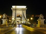
| Széchenyi Chain Bridge Széchenyi Chain Bridge The Széchenyi Chain Bridge is a suspension bridge that spans the River Danube between Buda and Pest, the western and eastern sides of Budapest, the capital of Hungary... (Széchenyi lánchíd) |
1849/1949 | 47°29′56"N 19°02′37"E | |||
| Elisabeth Bridge (Erzsébet híd) | 1903/1964 | 47°29′27"N 19°02′56"E | |||
| Liberty Bridge Liberty Bridge (Budapest) The Szabadság híd or Liberty Bridge in Budapest, Hungary, connects Buda and Pest across the River Danube. It is the third southernmost public road bridge in Budapest, located at the southern end of the City Centre.... (Szabadság híd) |
1896 | 47°29′09"N 19°03′18"E | |||
| Petőfi Bridge Petofi Bridge Petőfi híd or Petőfi Bridge is a bridge in Budapest, connecting Pest and Buda across the Danube... |
Grand Boulevard Nagykörut Nagykörút was a Hungarian newspaper in the mid-Twentieth century, edited by the writer Jenő Rejtő.... |
1937 | 47°28′44"N 19°03′48"E | ||
| Lágymányosi Bridge Lágymányosi Bridge Rákóczi Bridge is a bridge in Budapest, Hungary, connecting the settlements of Buda and Pest across the Danube. The construction of the steel girder bridge was started in 1992 to the plans of Tibor Sigrai.It is named after the south Buda district of Lágymányos... |
Könyves Kálmán Boulevard/Hungária Boulevard | 1995 | 47°28′07"N 19°04′03"E | ||
| Southern Railway bridge (Déli összekötő vasúti híd) | Several MÁV MAV The acronym/initialism MAV may have several meanings, including:*Mathematical Association of Victoria of Victoria, Australia*Municipal Association of Victoria of Victoria, Australia*Micro air vehicle, a type of remotely controlled unmanned aerial vehicle... line |
1873/1913/1953 | 47°28′6.35"N 19°4′2.5"E | ||
| Southern (Hárosi) M0 Bridge (Deák Ferenc, Soroksári híd) | M0 M0 motorway (Hungary) The M0 motorway is a ringroad around Budapest, the capital of Hungary. The ring presently connects motorways M1, M7, M6, M5, M4, M3, M2, connecting currently to Highway 11. The southern section of the ringroad currently does not comply with formal motorway specifications. The whole length of the... motorway |
1990 | 47°23′20.75"N 19°0′50.51"E | ||
| Pentele bridge | 1682 km (1,045.1 mi) | M8 motorway | Dunaújváros Dunaújváros Dunaújváros is a Hungarian city in Central Transdanubia, along the Danube river. It is in Fejér county.-History:Dunaújváros is one of the newest cities of the country... |
2007 | 46°54′11.33"N 18°57′27.08"E |
| Beszédes József Bridge | 1560.55 km (969.7 mi) | Road 54 | Solt Solt Solt is a town in Bács-Kiskun county, Hungary. Near Solt there is a high-power medium wave transmitter.- Early Solt :The region has been populated since the Stone Age. The results of diggings brought up Roman coins, weapons, and bodies. The road from the province of Pannonia to Dacia cut through... –Dunaföldvár Dunaföldvár Dunaföldvár is a town in Tolna County, Hungary.- External links :*... |
1928-1930 | 46°48′37.93"N 18°55′59.33"E |
| Szent László Bridge | 1498.8 km (931.3 mi) | M9 motorway | Szekszárd Szekszárd Szekszárd is a city in Hungary and the capital of Tolna county. By population, Szekszárd is the smallest county capital in Hungary; by area, it is the second smallest -Location:... |
2003 | 46°21′8.22"N 18°53′43.99"E |
| Stephan Türr István Türr István Türr , was a Hungarian soldier, revolutionary, canal architect and engineer, remembered in Italy for his role in that country's unification and his association with Garibaldi... Bridge (Türr István híd) |
1480.22 km (919.8 mi) | Road 55 | Baja Baja, Hungary Baja is a city in , southern Hungary. It is the second largest city in the county, after the county seat at Kecskemét, and is home to around 37,000 people.... |
1906-1908 | 46°11′34.86"N 18°55′37.86"E |
Serbian |
|||||
| Road bridge | Batina Batina Batina is a village and port on the right bank of the Danube in the region of Baranja, Croatia, 25 km northeast of Osijek. Its elevation is 105 m. The chief occupation is farming. Administratively, it is located in the Draž municipality within the Osijek-Baranja County.-Geography:Batina is... –Bezdan Bezdan Bezdan is a village located in Bačka, Vojvodina, Serbia. It is situated in the Sombor municipality, West Bačka District... |
||||
| Road bridge | Erdut Erdut Erdut is a village and a municipality in eastern Croatia. It is located in the Osijek-Baranja County, eastern Slavonia, 37 km east of Osijek. The elevation of the village of Erdut is 158 m... –Bogojevo Bogojevo Bogojevo is a village in Serbia. It is situated in the Odžaci municipality, West Bačka District, Vojvodina province. The village has an ethnic Hungarian majority and its population numbering 2,120 people .-History:... |
||||
| Railway bridge | Erdut Erdut Erdut is a village and a municipality in eastern Croatia. It is located in the Osijek-Baranja County, eastern Slavonia, 37 km east of Osijek. The elevation of the village of Erdut is 158 m... –Bogojevo Bogojevo Bogojevo is a village in Serbia. It is situated in the Odžaci municipality, West Bačka District, Vojvodina province. The village has an ethnic Hungarian majority and its population numbering 2,120 people .-History:... |
||||
| Road bridge | 1297 km (805.9 mi) | Ilok Ilok Ilok is the easternmost town and municipality in Croatia. Located in the Syrmia region, it lies on a hill overlooking the Danube river, which forms the border with the Vojvodina region of Serbia. The population of the town of Ilok is 5,036, while the total municipality population is 6,750... –Bačka Palanka |
|||
Serbia |
|||||
| Liberty Bridge, Novi Sad (Most Slobode) | 1257.6 km (781.4 mi) | Road bridge | Novi Sad Novi Sad Novi Sad is the capital of the northern Serbian province of Vojvodina, and the administrative centre of the South Bačka District. The city is located in the southern part of Pannonian Plain on the Danube river.... |
2005 | |
| Varadin Bridge Varadin Bridge Varadin Bridge is a bridge on the Danube river in Novi Sad, Serbia. The bridge was built in 2000, after the previous bridge at this location was destroyed during NATO bombardment on April 1, 1999.... (Varadinski most) |
1255 km (779.8 mi) | Road bridge | 2000 | ||
| Road-Railway Bridge Road-Railway Bridge Road–Railway Bridge is a bridge on the Danube river in Novi Sad, Serbia. The bridge was built in 2000, after the previous bridge at this location was destroyed during NATO bombardment in 1999. The Road–Railway Bridge is temporary and will be removed when the new permanent bridge is built at this... |
1255 km (779.8 mi) | Road and railway bridge | 2000 | ||
| Beška Bridge | 1232 km (765.5 mi); At 50 m high it is the tallest bridge over the Danube. | European route E75 European route E75 European route E 75 is part of the International E-road network, which is a series of main roads in Europe.The E 75 starts from Vardø, Norway in the Barents Sea and runs south through Finland, Poland, Czech Republic, Slovakia, Hungary, Serbia and Republic of Macedonia to Sitia, Greece on... |
Beška | 1975 | |
| Beška 2 Bridge | 1232 km (765.5 mi); Identical twin bridge to Beška Bridge, only 4 meters downstream, to double traffic capacity. | European route E75 European route E75 European route E 75 is part of the International E-road network, which is a series of main roads in Europe.The E 75 starts from Vardø, Norway in the Barents Sea and runs south through Finland, Poland, Czech Republic, Slovakia, Hungary, Serbia and Republic of Macedonia to Sitia, Greece on... |
Beška | October 3 2011 | |
| Zemun-Borča Bridge (Kineski most) | Road bridge | Belgrade Belgrade Belgrade is the capital and largest city of Serbia. It is located at the confluence of the Sava and Danube rivers, where the Pannonian Plain meets the Balkans. According to official results of Census 2011, the city has a population of 1,639,121. It is one of the 15 largest cities in Europe... |
construction begins in late 2011, due to open in 2014 | ||
| Pančevo Bridge Pancevo Bridge Pančevo Bridge or colloquially Pančevac is the only bridge over the Danube in Belgrade, the capital of Serbia... (Pančevački most) |
Road and railway bridge | Belgrade Belgrade Belgrade is the capital and largest city of Serbia. It is located at the confluence of the Sava and Danube rivers, where the Pannonian Plain meets the Balkans. According to official results of Census 2011, the city has a population of 1,639,121. It is one of the 15 largest cities in Europe... |
1946 | ||
| Kovin Bridge | 1112.1 km (691 mi) | Street bridge | Smederevo–Kovin | 1976 | |
Romanian |
|||||
| Iron Gate I dam | 945 km (587.2 mi) | Road | Iron Gate Iron Gate (Danube) The Iron Gates The gorge lies between Romania in the north and Serbia in the south. At this point, the river separates the southern Carpathian Mountains from the northwestern foothills of the Balkan Mountains. The Romanian, Hungarian, Slovakian, Turkish, German and Bulgarian names literally mean... |
1972 | 44°40′15"N 22°31′45"E |
| Trajan's Bridge Trajan's bridge Trajan's Bridge or Bridge of Apollodorus over the Danube was a Roman segmental arch bridge, the first to be built over the lower Danube. For more than a thousand years, it was the longest arch bridge in the world, in terms of both total and span length... |
Road | Drobeta-Turnu Severin Drobeta-Turnu Severin Drobeta-Turnu Severin is a city in Mehedinţi County, Oltenia, Romania, on the left bank of the Danube, below the Iron Gates.The city administers three villages: Dudaşu Schelei, Gura Văii, and Schela Cladovei... / Kladovo Kladovo Kladovo is a town and municipality in the Bor District of eastern Serbia. It is situated on the right bank of the Danube river... |
(built in Roman Roman Empire The Roman Empire was the post-Republican period of the ancient Roman civilization, characterised by an autocratic form of government and large territorial holdings in Europe and around the Mediterranean.... times) |
44°37′25.57"N 22°40′1.38"E | |
| Iron Gate II dam - Ostrovul Mare Bridge Ostrovul Mare Bridge The Ostrovul Mare Bridge is a suspension bridge over the Gogoşu branch of the Danube, close to the Iron Gate II Hydro Power Plant and part of the Iron Gate II border crossing point between Romania and Serbia.... |
863 km (536.2 mi) | Road | 1984 / 1998 (for the crossing bridge) | 44°18′16"N 22°33′54"E | |
Bulgaria |
|||||
| Danube Bridge 2 | 796 km (494.6 mi) | E79 European route E79 European route E 79 is a road part of the International E-road network. It begins in Miskolc, Hungary and ends in Thessaloniki, Greece, also running through Romania and Bulgaria... , Corridor IV Road and railway |
Vidin Vidin Vidin is a port town on the southern bank of the Danube in northwestern Bulgaria. It is close to the borders with Serbia and Romania, and is also the administrative centre of Vidin Province, as well as of the Metropolitan of Vidin... / Calafat Calafat Calafat is a city in Dolj County, Romania, on the river Danube, opposite the Bulgarian city of Vidin, to which it is linked by ferryboat. The construction of the Calafat-Vidin Bridge is planned between the two cities.... |
under construction, due to open 2012 | 43°59′38"N 22°54′24"E |
| Oryahovo-Bechet Bridge | Road | Oryahovo Oryahovo Oryahovo is a port city in northwestern Bulgaria, part of Vratsa Province. It is located in a hilly country on the right bank of the Danube, just east of the mouth of the river Ogosta, a few more kilometres downstream from where the Jiu flows into the Danube on Romanian territory. The town is... / Bechet Bechet Bechet is a city in Dolj County, Oltenia, Romania, on the river Danube, opposite the Bulgarian city of Oryahovo.- External links :*... |
Planned | ||
| Constantine's Bridge Constantine's Bridge Constantine's Bridge was a Roman bridge over the Danube. It was completed or rebuilt in 328 and remained in use for no more than four decades. With an overall length of 2437 m, 1137 m of which spanned the Danube's riverbed, Constantine's Bridge is considered the longest ancient river bridge and... |
Roman road Roman road The Roman roads were a vital part of the development of the Roman state, from about 500 BC through the expansion during the Roman Republic and the Roman Empire. Roman roads enabled the Romans to move armies and trade goods and to communicate. The Roman road system spanned more than 400,000 km... |
Oescus Oescus Oescus, or Palatiolon Palatiolum, was an ancient town in Moesia, northwest of the modern Bulgarian city of Pleven, near the village of Gigen. It is a Daco-Moesian toponym. Ptolemy calls it a Triballian town, but it later became Roman... / Celei Corabia Corabia is a small Danube port located in Olt County, Romania, which used to be part of the now-dissolved Romanaţi County before World War II... |
328 328 Year 328 was a leap year starting on Monday of the Julian calendar. At the time, it was known as the Year of the Consulship of Ianuarinus and Iustus... , destroyed mid-4th century |
43°45′49"N 24°27′25"E | |
| Hydro-power complex Nikopol-Turnu Măgurele | 578 km (359.2 mi) | Road and railway | Nikopol Nikopol, Bulgaria Nikopol is a town in northern Bulgaria, the administrative center of Nikopol municipality, part of Pleven Province, on the right bank of the Danube river, 4 km downstream from the mouth of the Osam river. It spreads at the foot of steep chalk cliffs along the Danube and up a narrow valley... / Turnu Măgurele Turnu Magurele Turnu Măgurele is a city in Teleorman County, Romania . Developed nearby the site once occupied by the medieval port of Turnu, it is situated north-east of the confluence between the Olt River and the Danube.... |
Proposed | 43°42′48"N 24°49′31"E |
| Danube Bridge | 488.7 km (303.7 mi) | E70 European route E70 European route E 70 is an A-Class West-East European route, extending from A Coruña in Spain in the west to the Georgian city of Poti in the east.-Itinerary:... , E85 European route E85 European route E 85 is part of the International E-road network, which is a series of main roads in Europe.The E 85 starts from Klaipėda runs south through Belarus, Ukraine, Romania, Bulgaria to Greece, ending at Alexandroupolis.... , Corridor IX Road and railway |
Rousse Rousse Ruse is the fifth-largest city in Bulgaria. Ruse is situated in the northeastern part of the country, on the right bank of the Danube, opposite the Romanian city of Giurgiu, from the capital Sofia and from the Bulgarian Black Sea Coast... / Giurgiu Giurgiu Giurgiu is the capital city of Giurgiu County, Romania, in the Greater Wallachia. It is situated amid mud-flats and marshes on the left bank of the Danube facing the Bulgarian city of Rousse on the opposite bank. Three small islands face the city, and a larger one shelters its port, Smarda... |
1954 | 43°53′14"N 26°00′27"E |
| Hydro-power complex Silistra-Călăraşi | 380 km (236.1 mi) | Road and railway | Silistra Silistra Silistra is a port city of northeastern Bulgaria, lying on the southern bank of the lower Danube at the country's border with Romania. Silistra is the administrative centre of Silistra Province and one of the important cities of the historical region of Southern Dobrudzha... / Călărași Calarasi Călăraşi , the capital of Călăraşi County and Sud-Muntenia Region in the Wallachia region, is situated in south-east Romania, on the bank of Danube's Borcea branch, at about 12 kilometers from the Bulgarian border and 125 kilometers from Bucharest.... |
Planned | |
Romania |
|||||
| Anghel Saligny Bridge | 300 km (186.4 mi) | Railway | Cernavodă Cernavoda Cernavodă is a town in Constanţa County, Dobrogea, Romania with a population of 20,514.The town's name is derived from the Slavic černa voda , meaning "black water". This name is regarded by some scholars as a calque of the earlier Thracian name Axíopa, from IE *n.ksei "dark" and upā "water"... –Feteşti Fetesti Feteşti is a city and municipality in Ialomiţa County, Romania, with a population of 34,076. It is located in the Bărăgan plain, on the Borcea branch of the Danube. Feteşti has the second largest population in Ialomiţa, after Slobozia.... |
1895 | 44°22′47.94"N 27°51′24.44"E |
| Cernavodă Bridge | 300.07 km (186.5 mi) | A2-The Sun Motorway and railway | Cernavodă Cernavoda Cernavodă is a town in Constanţa County, Dobrogea, Romania with a population of 20,514.The town's name is derived from the Slavic černa voda , meaning "black water". This name is regarded by some scholars as a calque of the earlier Thracian name Axíopa, from IE *n.ksei "dark" and upā "water"... –Feteşti Fetesti Feteşti is a city and municipality in Ialomiţa County, Romania, with a population of 34,076. It is located in the Bărăgan plain, on the Borcea branch of the Danube. Feteşti has the second largest population in Ialomiţa, after Slobozia.... |
1987 | |
| Giurgeni – Vadu Oii Bridge | 238 km (147.9 mi) | European route E60 European route E60 European route E 60 is a E-road running from Brest, France , to Irkeshtam, Kyrgyzstan... |
Giurgeni Giurgeni Giurgeni is a commune located in Ialomiţa County, Romania. It is composed of a single village, Giurgeni.... –Hârşova Hârsova Hârşova is a town located on the right bank of the Danube, in Constanţa County, Romania, with a population of 11,000.The village of Vadu Oii is administered by the town... |
1970 | 44°45′15"N 27°52′36"E |
River source: convergence at 47.950961°N 8.520412°E (?)
External links
- This article includes information translated from the German-language Wikipedia article :de:Liste der Donaubrücken. The German-language article cites the following sources: Liste sämtlicher Brücken über die Donau (PDF) – Quelle: donauschifffahrt.info Liste der Schleusen – Quelle: donauschifffahrt.info / Die Donau ~ Faszination eines Flusses Die interaktive Kulturkarte entlang der Donau Arbeitsgemeinschaft Donauländer Wiener Donaubrücken Donaubrücken bei brueckenbau-links.de