
Coyoacán
Encyclopedia
Coyoacán refers to one of the sixteen boroughs (delegaciones) of the Federal District of Mexico City
as well as the former village which is now the borough’s “historic center.” The name comes from Nahuatl
and most likely means “place of coyote
s,” when the Aztec
s named a pre-Hispanic village on the southern shore of Lake Texcoco
which was dominated by the Tepanec
people. Against Aztec domination, these people welcomed Hernán Cortés
and the Spanish, who used the area as a headquarters during the Spanish conquest of the Aztec Empire and made it the first capital of New Spain
between 1521 and 1523. The village, later municipality
, of Coyoacan remained completely independent of Mexico City through the colonial period into the 19th century. In 1857, the area was incorporated into the Federal District when this district was expanded. In 1928, the borough was created when the Federal District was divided into sixteen boroughs. The urban sprawl
of Mexico City reached the borough in the mid 20th century, turning farms, former lake and forests into developed areas, but many of the former villages have kept their original layouts, plazas and narrow streets and have conserved structure built from the 16th to the early 20th centuries. This has made the borough of Coyoacan, especially its historic center a popular place to visit on weekends.
(main square) of Mexico City. This area is filled with narrow cobblestone streets and small plazas, which were laid out during the colonial period, and today give the area a distinct and bohemian
identity. The area is filled with mostly single family homes, which were former mansions and country homes built between the colonial period to the mid 20th century. The Project for Public Spaces
ranked the neighborhood as one of the best urban spaces to live in North America in 2005 and is the only Mexican neighborhood on the list. This area was designated as a "Barrio Mágico"
by the city in 2011.
The center of Coyoacán is relatively peaceful during the week, but it becomes crowded and festive on weekends and holidays. After the Zocalo, the most-visited place in Mexico City is this historic center, especially the twin plazas in its center. According to the borough, the area receives about 70,000 people each weekend. The area is a stop for both the Turibus and Tranvia Turistico tour bus routes, on their routes though San Ángel
, Ciudad Universitaria
and other locations in the south of Mexico City. People come to enjoy the still somewhat rural atmosphere of the area as well as the large number of restaurants, cafes, cantinas, museums, bookstores and other cultural attractions. Some of these businesses have been around for almost a century. In the two main plazas and even in smaller ones such as the one in the neighboring Santa Catarina neighborhood. Mimes, clowns, musicians, folk and indigenous dancers, storytellers and other street performers can be found entertaining crowds. Vendors sell street food such as ice cream, homemade fruit drinks, esquites
(flavored corn kernels) and corn-on-the-cob served with mayonnaise, lime, chili pepper and grated cheese, amaranth
bars, and various candies. In the evening, food vendors tend to sell more hot items such as quesadilla
s, sope
s, torta
s, tostada
s, pozole
s and more. One known food vendor goes by the name of Rogelio. He is known for making pancakes (called hotcakes) in the shape of animals and humans. These are usually eaten as a snack with jam, cream and other toppings.
The tourism has been a mixed blessing for the historic center as commercial establishments open, helping the economy, but also push residents out. In the historic center, there are over 860 retail businesses, mostly restaurants, about 200 of which were established in the last five years. Residents attribute the growth to Mexico City’s promotion of the area tourism in general as well as the opening of commercial centers in the borough. While the growing business helps the economy, resident groups fear that the area will lose its current character, as many businesses are opening in formerly residential buildings, with questionable legal basis. Currently, most of the borough, especially in historic center, is residential with older adults. Property prices are high, leading to sales not to new families but rather to larger commercial interests, squeezing out smaller businesses along with residents. Neighborhood groups have formed to confront the changes and preserve the historic value of the area. Another serious problem for the area is the traffic jams and serious lack of parking in the historic center. The quantity of cars and the lack of traffic patrols have meant the proliferation of “franeleros” or people who illegally take possession of public areas such as streets to charge for parking.
The historic area is centered on two large plazas filled with Indian laurel trees called the Jardin del Centenario and the Jardín Hidalgo. These plazas cover an area of 24,000m2, which were renovated, along with the areas around them in 2008. The green areas were rehabilitated, and areas were paved with red and black volcanic stone. Renovation of the two plazas and the streets around them cost 88.3 million pesos. For over twenty five years, these plazas, especially Plaza Hidalgo, and the streets around them were filled with vendors (wandering and with stalls). When renovation efforts began, 150 vendors were removed from the plazas proper with about 500 total including the surrounding streets. While the practice was illegal, it had been tolerated by authorities, even though it caused damage to the plazas and caused traffic problems. One of the main goals of the renovation work in 2008 was to remove these vendors and move them to a new crafts bazaar built nearby. Initially, opposition to the removal of the vendors came not only from the vendors themselves, but also from some neighborhood groups and local businesses who feared their removal would hurt tourism. When renovation work finished in 2009, police were assigned to the plazas to keep vendors from returning, leading to confrontations, both physically in the plazas and legally in the courts. The borough began to issue some permits for vendors, but there was opposition. Eventually, a group representing the vendors obtained a court order to allow forty vendors to return to the plazas, citing the history of tolerating such activity in the past. This order is still opposed by some neighborhood groups, but as of 2010, there are still a limited number of these vendors selling in the plazas.
Plaza Hidalgo, also called Jardín (garden) Hidalgo is the main plaza or square of the borough. It is bordered by Calle Carillo Puerto on the east, Calle Caballocalco on the west, Calle B. Dominguez and the Casa Municipal on the north and the Plaza del Centenario and the Parish is San Juan Bautista on the south. In the center of the plaza, there is an early 20th century kiosk
with a stained glass cupola
topped by a bronze
eagle. This kiosk was donated to the then village by Porfirio Díaz
for the then-upcoming Centennial of Mexico’s Independence
in 1910. The eagle design is one adopted by Mexico after the French Intervention
. As the plaza is named after Miguel Hidalgo y Costilla, a statue of the priest, created by Luis Arias can also be found on the plaza. Behind it is a sculpture carved from a tree trunk called “La Familia de Antonio Alvarez Portual y Josué.
The Plaza del Centenario (also called the Jardín del Centenario) is slightly smaller and located just west of the Plaza Hidalgo, separated by Calle Carrillo Puerto. This plaza originally was part of the very large atrium
that belonged to Parish of San Juan Bautista during the colonial period. The main entrance to this atrium still exist on the west side of this plaza and are called the Arcadas Atrial or the Arcos del Jardín del Centennario. This entrance was built in the 16th century of stone with decorative motifs that show both European and indigenous influence. The current name for this area comes from the Centennial of Mexico’s Independence. In the center of the plaza, there is a fountain which contains a bronze sculpture of two coyotes, which refer to the borough’s name. The south side of the plaza is lined with cafes and restaurants, including the well-known Café El Parnaso, and the north side features a very large crafts markets.
The Casa Municipal, also referred to as the Casa de Cortés, is a building located on the north side of the Plaza Hidalgo. It has served as an administrative/governmental building since it was constructed in the 18th century. The erroneous name of Casa de Cortés (House of Cortés, referring to Hernán Cortés), comes from Coyoacán’s association with the conquistador. Cortés did live in Coyoacán in 1521 and 1522, while the destroyed Aztec city of Tenochtitlan was being rebuilt into Mexico City, and the area was the capital of the colony of New Spain. However, Cortés never lived at the site, despite a plaque on building that says that he did. Cortés residence in Coyoacán was on lands that belonged to the then leader of the indigenous of this area, Juan de Guzmán Iztolinque
, in the area where the La Conchita Church and plaza are found now. What Cortés eventually built here where administrative buildings for the offices used to manage the vast lands he was granted as the Marquis del Valle de Oaxaca, which included the Coyoacán area. Local legend states that this was the location were Cuauhtémoc
was tortured as the Spanish tried to learn of the whereabouts of more treasure.
The current structure was built in the mid 18th century, by Cortés’ descendents, who still carried the title of the Marquis of the Valle de Oaxaca to replace the old structure, which had deteriorated. In the 1850s, the building began to be used as the seat of the government of the municipality of Coyoacán, which then belonged to the State of Mexico, very separate from Mexico City. When the borough of Coyoacán was created in 1928, as part of the Federal District, the building remained the government seat but of the modern “delegación.” The structure was declared a Colonial Monument by INAH in 1932.
The structure is much the same as it was when it was constructed in the 18th century. The facade is simple and is fronted by a series of columns in sandstone and wood over which is a roof. The door and window jambs are typical of civil constructions of the 18th century with wrought iron work. The facade is topped by a wide cornice
and inverted arches. At the very front is a sculpture of two coyotes in volcanic stone, the current logo of the borough. Above the entrance is the coat of arms granted to Coyoacán by Charles IV of Spain
. On one side of the building is the Sala de Cabildos, or City Council Hall. It was painted by Aurora Reyes Flores
with a mural depicting pre-Hispanic Coyoacan and includes depictions of the landscape of the area including the Xitle
volcano, the Tepaneca god Xocotlhuetzin as well as the Mesoamerican deity Quetzalcoatl
. Next to this hall is an attached chapel. The mural in the chapel was done by Diego Rosales in 1961, depicting the early history of Mexico with personages such as Cuauhtémoc, Cortés, La Malinche
and Pedro de Alvarado
. Scenes of the work cover the walls and the ceiling.
One of the most important historic buildings in the borough is the Parish of San Juan Bautista. Built between 152 and 1552, it is one of three oldest parish churches in Mexico City, along with the ones in Tlalpan
and the small community of Amaqueman. Originally, this church and the cloister next to it were constructed as a monastery by the Dominicans, but the complex was transferred to the Franciscans. Over time, as the complex deteriorated and was reconstructed and restored various time, most was replaced so that now the only original parts from the 16th century are the choir area, the Rosario Chapel and the main altar. However, much of the same layout remains. The parish church has a large open chapel, but only a portion of the atrium it had in the 16th century. During much of the colonial period, the atrium functioned as a cemetery. Today, much of this atrium is now the Plaza del Centenario. The interior of the church has seven chapels, with the Rosario Chapel containing an ornate Baroque
altarpiece from the end of the 17th century. The monastery portion is two floors surrounding a large inner courtyard. It conserves a large part of the original wood beams and decorative work in wood which was done by indigenous hands. The feast day for San Juan Bautista is 24 June. In the church a special altar is installed and mass is said all day. The most important mass occurs at midday with mariachi music, with a meal offered in the adjoining monastery building. The event is organized by 24 civil associations and the chaplains of the parish.
In 2005, the San Juan Bautista church underwent renovations to its tower, atrium, facade, portal for pilgrims, the north and south sides and the cupola and more under the supervision of INAH and academics from UNAM
. Prior to this, there had been no restoration work to the building for about a century. The cupola was particularly damaged, with trees and other plants growing out of it. Much of the work was to make straight many of the walls and floors, which had cracked and warped. Studies were done on the building to determine what materials in what colors were used in order to use the same. It was declared a National Monument in 1934. The work was sponsored by government and private funds.
Other landmarks off the plazas include the Museo Nacional de Culturas Populares, and the Acuavida Coyoacán. The Museo Nacional de Culturas Populares (National Museum of Popular Culture) is located just off the Plaza del Centenario, and features mostly temporary exhibits related to popular or mass culture such as one related to lucha libre
wrestling. The museum was created in 1982, to show the values and ways of live of the various modern cultural groups in Mexico. It has various halls, an auditorium and two courtyards in which are exhibitions, auditions, concerts, plays, recitals and craft workshops for children. The Acuavida Coyacán Aquarium is on the north side of the Plaza del Centenario. It offers exhibits of fishes, reptiles, live coral, aquatic plants and more, including the only freshwater manta ray
in captivity in the Americas.
The rest of the historic center and nearby neighborhoods are filled with homes built from the colonia era to the middle of the 20th century, many of which have been catalogued for their historic value. Many of these homes can be found one two of the historic center’s oldest streets, the Calle de Higuera, which leads southeast away from the Parish of San Juan Miguel and to the La Concepción neighborhood and Calle Francisco Sosa, which leads away from the same area towards San Angel. Calle Francisco Sosa alone has 65 structures catalogued by INAH for their historic value. One of the most important of these structures is the Casa de Ordaz, located on Calle Francisco Sosa on the corner with the Plaza de Centenario. ) It was long thought to have belonged to conquistador Diego de Ordaz
, who died in 1532, but research has shown that it was built sometime in the 18th century. Remodeling work was authorized on the Casa de Ordaz in 2004 by the INAH, but complaint stated that the owner, Banamex, gutted the interior and exceeded the limits set for the work by INAH. However, the chronicler of the borough, Luis Everaert, stated that the only original part of the building was the facade, which was not changed. The house underwent modification in the 1930s. In the 1920s, it was a school for girls, the first in Coyoacan, In the 1930s, it was the Institutio Centroamericano, a middle school for boys. The Instituto Italiano de Cultura (Italian Cultural Institute) on Francisco Sosa Street is house in a structure built between the 17th and 18th centuries and remodeled in the 20th. This structure is an adobe and stone mansion with a flat red façade with Moorish style decorative features. It has an inner courtyard with a tile decorated fountain and a private altar. It houses the cultural offices of the Italian Embassy. The main house of the San Pedro Martír Hacienda is located off of Belisario Dominguez Street. The house is now divided into three independent parts, but they retain their original facades. In 1932, this house was where the Escuela de Pintura al Aire Libre (Open Air Painting School) was established, which was an important artistic movement.
, Iztapalapa
, Xochimilco
, Tlalpan
and Álvaro Obregón
. Border roads include Avenida Río Churubusco, Calzada Ermita Iztapalapa, Calzada de la Viga, Canal Nacional, Calzada del Hueso, Avenida del Bordo, Calzado Acoxpa, Calzada de Tlalpan, Avenida de Pedregal, Anillo Periférico
, Boulevard de las Cataratas, Circuito Universitario, Avenida Ciudad Universitaria, San Jerónimo, Río Magdalena and Avenida Universidad.
Sixty nine percent of the land is residential, 60% is open or green space and the rest is mixed use or commercial. The borough contains 167,157 housing units with between two and four occupant, which is 7.5% of the total of the District. It contains 7.2% of the total population of the Federal District. This population has fallen slightly from 640,423 to 628,063 (2000 to 2005) as the overall population of Mexico City has risen.
However, quality of life in this borough his ranked among the top in the nation and has been ranked internationally. Coyoacan was ranked third best place to live in the country in 2004 by the United Nations Development Programme
, behind Benito Juarez and San Pedro Garza García
in Nuevo León
. The ranking is based on income levels, health and education. Coyoacan was ranked sixth in education, fourth in income and fifth in health. In quality of life, which takes into account factors such as crime statistics, Coyoacan ranked second behind Benito Juarez in Mexico City. This ranks the quality of life as equivalent to that in developed countries. In 2004, Coyoacan was ranked the fifth most livable neighborhood in North America, ahead of Rittenhouse, Philadelphia and behind Camden, Maine. The borough contains 228 preschools, 227 primary schools, 103 middle schools, and 66 technical, preparatory and other high schools serving about 155,000 students. Illiteracy is lower here than in the rest of the Federal District at 1.9% for residents over the age of 15. About 55% of the population is of working age with less than 2% unemployed. 77.8% are employed in commerce and services, with 7% in industry; 44.8% of industrial jobs is related to pharmaceuticals with food processing accounting for 18.7%. However, industry accounts for 47.3% of the borough GDP, followed by services at 32.6% and commerce at 16.7%. As of 2004, the borough accounted for 4.1% of Mexico City’s total GDP, but its industry accounts for 21% of industrial GDP. Tourism is an important part of the borough commerce and services sector. However, there are only nine hotels rated with three stars or above.
Most of the borough located at 2240 meters above sea level with little variation. Minor elevations are located in Ciudad Universitaria, San Francisco Culuacán and Santa Úrusula Coapa. The most important elevation is in the far south called the Cerro del Zacatépel which rises to 2420masl. Parks and other green spaces cover 4,318,783.56m2 and can be found in most of the communities of the borough. Soil composition is of two types, of volcanic origin and the former lakebed of Lake Texcoco. Volcanic land is subdivided by volcanic rock which is decomposing and that which has not. The best known of the areas with still-hard lava rock is called the Pedregal, which covers the communities of the Ciudad Universitaria, the Pedregal de Carrasco, Santa Úrsula Coapa, Copilco el Alto, Viveros de Coyocan and the Villa de Coyoacán or historic center. The southeast of the borough is dominated by volcanic rock from an eruption of a now dormant volcano called Xitle
. This lava bed covers the current communities of Colonia Santo Domingo, Colonia Ajusco and Pueblo de Santa Úrsula. Decomposing volcanic rock is mostly found by the former lake. The borough is part of the Pánuco River
Basin, in the subregion of the Lake Texcoco Zumpango. The lake no longer exists except for a canal called the Canal Nacional which is on the east border. Two rivers pass through the territory called the Río Magdalena and Río Mixcoac. Both of these are almost fully encased in cement tubes as they pass through. These two rivers join to form the Río Churubusco on the border with Benito Juárez.
The borough is divided into 140 communities, classified as colonias, pueblos, unidades habitacionales and barrios. The oldest of these divisions are former villages which are distinguished by their colonial era churches and who still celebrate their feast of their patron saint much as they did when they were independent, with fireworks, masses, processions, folk and indigenous dance and more. A number of these villages also have certain unique traditions associated with these celebrations. These barrios and pueblos can still be somewhat distinguished by their narrow, winding roads and alleyways. Culturally, they are still distinguished by having their own histories and legends. Many of the old villages are linked by the old Calle Real, which was renamed Santa Catarina, then Benito Juarez and now Francisco Sosa. Today, this road extends from Plaza or Jardín Hidalgo to the Panzacola Bridge. This street used to have a trolley car that linked the historic center of Coyoacán with San Ángel and Churubusco. At first this trolley was pulled by mules, but later it was electrified. Sometime after that, it was replaced by modern busses. Another main road in the borough is La Higuera, which links Plaza Hidalgo which the La Conchita Plaza.
In additions to structures from the colonial era, Coyoacán has important structure from the 19th century, replicas of colonial and 19th century buildings constructed in the 20th century and modern buildings. In total, the borough contains 349 registered buildings of cultural or historic importance, with 157 of these in the historic center. Coyoacán was declared a “Zona Típica y Pintoresca del Distrito Federal” (Typical and Picturesque Zone of the Federal District) by INAH in 1934 due to is historical, cultural and artistic value. This declaration recognizes 278 buildings within the borough. This historic center has the most with fifty buildings on 86 blocks over 1.64km2.
Despite its rural past with villages and farmlands, today the borough is urban, with all of its territory paved and developed with the exception of parks and other reserved green spaces as it is completely integrated with the urban sprawl of Mexico City. This has brought a number of problems to the area. Traffic in Coyoacán in some of the worst in the city. While there are 70.7 km of primary roads through the borough, with 8,200,947m2 of pavement, many sections have maintained the narrow winding streets and plazas from its colonial past. These sections bring in a large number of visitors, especially on weekends and holidays, with these roads unable to cope with the volume of traffic and need for parking. Other issues are graffiti and vandalism, and other crimes, the most serious of which is theft/robber, followe by assault. However, Coyoacán generates only 7.2% of all crime reports in Mexico City.
and Greg Kinnear
was filmed partly on the Plaza Santa Catarina.
The feast day for this neighborhood is 8 December. The facade of the La Conchita Church is decorated with a large flower portal, usually donated by a sister community of Coyoacán such as Los Reyes or La Candelaria. The festival begins with chamber music and then the patron image of the Virgin Mary is “awakened” with the song Las Mañanitas
as she is surrounded by numerous floral arrangements for mass. On the plaza in front of the church, wind bands play while participants share tamale
s and atole
. Later in the night, student musical groups perform “callejoneadas” where the roam the streets playing music as a traveling party.
Most of the area’s oldest buildings are located on this plaza, Calle Fernando Sosa, which leads to Villa Coyoacán and Calle Fernandez Leal. The Casa Colorada or Casa de la Malinche is located on a corner of the Plaza La Conchita, but it is not open to the public. It is said that Hernán Cortés built it for La Malinche his lover and translator, and historians believe he had his Spanish wife, Catalina Juárez de Marcaida murdered there. In despite of the house’s historic and aesthetic value, it does not receive much attention. The reason for this is that La Malinche is often blamed for the downfall of the Aztec Empire, acting as a traitor against her own people.
La Casa de los Padres Camilos (The House of the Camillo Priests) is on Fernandez Leal Street in the Barrio de la Concepcion. This structure was part of a farm and hospice which was owned by a Camillian
religious order. The brothers cultivated a number of crops including fruit trees and flowers. Today the main house is used for commercial purposes but the building retains many of its original architectural details It is a small stone-block building with a door made of black stone. Added to this was a hall in the early 1900s. Opposite the Casa de los Camilos is the Jardín Frida Kahlo which has a statue of the painter and a fountain.
. Inside there are 400 year old murals. It was declared a National Monument in 1932. There are also several restored colonial era houses around it. On one side, there is Casa de Cultura de Coyacán which hold art and cultural events. Once part of a hacienda, behind the building there are large gardens filled with vegetation.
The Dolores del Río House is located on Salvador Novo Street in Barrio de Santa Catarina. It is also known as “La Econdida” (The Hidden One), where Mexican actress Dolores del Río
lived. It is neo-Colonial in design when it was built for her, but it has since been remodeled and has a more modern appearance. It still functions as a private residence.
The Miguel Angel de Quevedo
House is on Francisco Sosa Street in Barrio de Santa Catarina. It is a very large structure for the area, filled with trees and plants both inside and out. Originally, these gardens were watered with river flow from the Río Magdalena, but this river is no longer accessible because it is encased. It is still used as a residence.
The Casa del Indio Fernández House is located on Dulce Oliva Street in Barrio de Santa Catarina. The house was constructed over twenty years by architect Manuel Parra for Mexican filmmaker Emilio “Indio” Fernández
, who died in the house in 1986. The house is colonial in style with a facade constructed from volcanic rock. Today it belongs to Fernandez’s daughter, Adela.
The Casa de Cultura Jesús Reyes Heroles is located on Francisco Sosa, named after a historian and political scientist from Veracruz. The house is on a property, which was called Izotitlán, meaning “izotes” a type of wild palm to make hats. In the colonial period, the house belonged to Juan de Luis Celis who had a small paper factory. It changed hands several times by the 20th century, but all this time, the structure kept its original appearance including very old atrium cross in the first courtyard. In the 1940s, it was enlarged, but its colonial style was respected. The building gained its current function in 1985, when President Miguel de la Madrid donated the house and lands to create a cultural center. Today, the center has three art galleries, named after Alfredo Ramos Martinez, Guillermo Kahlo and Miguel Alvarez Acosta to house temporary exhibits, an area to teach the culinary arts and two multiuse rooms. At the beginning of the 20th century, the Casa de Cultura Jesús Reyes Heroles was inhabited by María Concepción Armida, who is being considered for beatification
by the Catholic Church. It is said that she performed a number of miracles in this house. Behind this house is the Callejón del Aguacate, which is said to be haunted by the ghost associated with the woman, and local school children are known to go looking for the ghost.
The San José del Altillo Church is located on the corner of Avenida Universidad and Miguel Angel de Quevedo. This area was once the El Altillo Hacienda. This hacienda was donated by its last owner, Aguayo Piña to the Misioneros del Espíritu Santo religious order in the very early 19th century. Here they founded the Centro de Espiritualidad San José del Altillo spiritual center. Today, the church site has a modern structure on it, built by architect Enrique de la Mora.
According to legend, the San Antonio Panzacola Chapel was built by the mother of a group of smugglers to fulfill a promise or to offer gratitude. It is also said that it was the transfer point and a customs checkpoint for goods heading from Coyoacan and San Angel to Mexico City.
The Casa Alvarado is now the home of the Fonoteca National or National Sound Library. Octavio Paz
died here in 1998.
The "Alfredo Guati Rojo" National Watercolor Museum is dedicated to watercolor paintings. It was founded by Cuernavaca
-born watercolor artist Alfredo Guati in 1967. Originally located in Colonia Roma
, it was moved to its current location near Santa Catarina after the 1985 earthquake.
, Octavio Paz
, Mario Moreno and Dolores del Río
. The Frida Kahlo Museum, popularly called “La Casa Azul” (The Blue House) is one of the most popular sites in Coyoacán. It is a deep blue house on Londres Street, built in the early 20th century in which Frida Kahlo
was born in 1907and in which she spent the last thirteen years of her life. The house contains a selection of Kahlo’s personal art collection and a large collection of pre-Hispanic artifacts, Mexican folk art (mostly indigenous inspired jewelry and clothes which she wore) and works by José María Velasco
, Paul Klee
and Diego Rivera
. The museum also contains a café and a small gift shop. The Kahlo pieces are some of her minor works and include El Marxismo Dará la Salud, which shows her casting away her crutches. There is an unfinished portrait of Joseph Stalin
, who became a hero to Kahlo after Rivera had a falling out with Trotsky. In this portrait, Stalin stands before a wheelchair. The folk art collection contains Rivera’s collection of retablos
.
The Leon Trotsky Museum
is located near the Frida Kahlo Museum. Trotsky
was forced into exile in 1929 by Josef Stalin and in 1937, due to efforts by Diego Rivera and Frida Kahlo, he was granted asylum in Mexico. At first, Trotsky and his wife lived in the La Casa Azul with Frida, but after a falling out with Diego Rivera, the couple moved to this house on Viena Street in 1938. The house looks like a fortress, and it was fortified to protect Trotsky from assassins. It has high outer walls and watchtowers once occupied by armed guards. Inside, there is a small house and garden. The house and garden were original with the defenses added later after an attack led by David Alfaro Siqueiros
, who shot up the house. Trotsky and his wife survived by hiding under furniture. The bullet holes from this attack remain on the outer walls of the house.
However, in 1940, a Spanish Stalin supporter by the name of Ramón Mercader
managed to gain entry to the house and to kill Trotsky with an ice pick. The room in which Trotsky was killed remains exactly as it was at that moment, including the papers and the books in their exact positions. As a museum, some other buildings were added along the walls which contain photos from Trotsky’s lifetime, biographical notes in Spanish and memorabilia such as Trotsky trademark small round glasses. In the garden, there is a tomb which contains Trotsky’s and his wife’s ashes. The complex also houses the Instituto del Derecho de Asilo y las Libertades Públicas (Institute for the Right of Asylum and Public Liberties) which was founded in 1990 and the Rafael Galván Library, which contains a collection of books with social themes. These organizations occasionally sponsor events such as expositions and conferences.
The Escuela Superior de Musica (Higher School of Music) on Vallarta Street in Colonia Del Carmen is an imitation of the house occupied by Shakespeare’s Othello
. It stands out due to its many stained glass windows with Arab phrases inscribed against a stucco facade. This school used to be a pulque
ria called La Rosita, which was frequently by intellectuals in the area. When this bar was demolished, it took with it a mural done by Diego Rivera.
The La Capilla Theater is on Madrid Street in Colonia Del Carmen. This building was part of the ruins on a portion of an old hacienda purchased by Salvador Novo
around 1950. In the ruins of this structure he visualized a theater and hired Alejandro Prieto to make the adaptation. This theater was opened to the public in 1953 along with a restaurant called El Reflectorio alongside. Later a bar called El Habito, today called El Vicio was added. The theater remains as one of the more important cultural venues in the borough.
The Juárez Institute is located on the corner of Cuauhtemoc and Abasolo Streets. It was built in the 19th century. Originally, this was part of a Presbyterian church complex, but this church has since moved to another location on Cuauhtemoc street. Today, it houses an educational institution. The building is two floors, with a sober facade made of stone and brick. The sides are framed by sandstone, with the main entrance on Cuauhtemoc. The interior has a large courtyard which contains gardens.
The Coyoacan Market was built in 1956 by Pedro Ramírez Vázquez
in a Functionalist style on a site which originally was stables and horse corrals.
. In the 17th century, the Spanish built the monastery of Churubusco over a ceremonial site dedicated to the god Huitzilopochtli
. This monastery complex is best known for its role during the Mexican-American War. The Mexicans had fortified monastery and fought until they ran out of ammunition and then beaten only after hand-to-hand combat. When U.S. General David Twiggs asked Mexican General Pedro María de Anaya to surrender his ammunition, the reply is said to have been “If there were any, you would not be here.” There is a memorial to this event outside the main entrance. The monastery’s church still retains its original function, but the most of the rest of the complex is now the Museo Nacional de las Intervenciones
. The collection includes an American map of the facility from 1847, artifacts from the French Intervention in Mexico and a plot by Henry Lane Wilson
to bring down the government of Francisco I. Madero
in 1913.
The Casa de Cristo (House of Christ) is located on Heroes Street in Churubusco. It was constructed in 1906 as a residence for Bertha Vizcayno de Vergara who remained there until 1967. Today, it is still private property but is used as a restaurant. It has three floors and twelve rooms, with walls of brick and limestone and wood roof decorated with tiles. The front has sandstone Ionic columns. The name comes from the inscription of “Casa de Cristo” over the main entrance.
, they decided to go inside after leaving the image in a supposedly secure place. When they were done drinking, they could not find the image where they left it or anywhere nearby. A few days later a “tlachiquero” (one who takes nectar out of maguey plants) heard a child’s cry in the area and found the image. Word went out to try and find which church the image belonged to. Representatives of various communities come to claim it, but none could lift the image. When it was the turn of the Pueblo de los Reyes, they prayed that the image would be light as a feather for them and the easily lifted it. The returned home joyous to have been chosen by the image. Later, representatives of Santiago Zapotitlan came to reclaim the image, but again it became too heavy to lift and it has remained in the church ever since. The festival called the Recibimiento del Señor de las Misericordia occurs in September in both Los Reyes and La Candelaria. It celebrates the arrival of the image according to the legend. From June until September, the image is sent out to visit various communities in the borough. During the ceremony to return the image to its home church, the people of La Candelaria bring the image and the people of Los Reyes receive it with much fanfare.
On 6 January in the Pueblo de los Reyes, the main square of the community is decorated with flower portals and “carpets” made by carefully arranging colored sawdust on the ground. There are also processions and a ceremony called the “vítor” used to announce coming of the festival. Reeds are cut and decorated with multicolored crepe paper and half inflated balloons and then are given to children as they pass by on the streets. There is also a parade that features “mojigangas” which are large structures made of cardboard and paper in the shape of human figures. These are hollow and placed on the shoulders of parade participants. An image of the Nativity and the Three Wise Men is carried through the town on a truck from which bags of candies are tossed to children.
The image for the La Candelaria neighborhood is an image of the Virgin Mary called the “Virgen de la Candelaria.” The feast day for this image occurs on 2 February in the Pueblo de la Candelaria. This event is organized by a “mayordomo” who is chosen each year and last for ten days. It includes religious activities such as a novena and a special Mass. It also includes cultural, sporting and recreational activities, which also gives the event the alternate name of “La Semana Cultural de La Candelaria” (Culture Week of La Candelaria). During Holy Week
, La Candelaria holds a passion play
which runs about 4 km from the main plaza to the Huayamilpas Ecological and Recreational Park.
The feast day of Francis of Asisi, patron of the Barrio Cuadrante de San Francisco is announced by a band playing wind instruments playing through the streets. In addition to more common elements, the celebration also includes the lighting by candle of three large wooden crosses, performed by groups performing indigenous dances suchas Concheros or Aztecas. The crosses are eventually surrounded by a multitude of candles in the night as people pray. The origin of this tradition is unknown.
The feast day of Saint Ursula, patroness of Santa Ursula Coapa last for about a week. The first three days are dedicated to 40 hours of prayer. Other religious events include processions on Calzada de Tlalpan and the blessing of taxi drivers. Cultural and recreational activities include a marathon, fireworks, including those on large frames called “toritos” (little bulls) and “castillos” (castles), indigenous and folk dancing including Concheros, Santiagueros and Chinelos, and music played by wind bands especially from neighboring Tepepan and San Lucas Xochimanca.
Other traditional neighborhoods include San Lucas, San Mateo, El Niño Jesús, San Francisco and San Antonio. The San Lucas and San Mateo barrios are sliced through by small arroyos and used to be surrounded by cornfields and pastures for cattle. The El Niño Jesús and San Francisco barrios and filled with very winding alleyways over black volcanic rock, called pedregal, from an ancient eruption of Xitle. These two are separated from the historic center by Avenida Miguel A de Quevedo. The San Antonio barrio is very small with an equally small chapel by the name of San Antonio Panzacola. This chapel belonged to the Carmelites
and is located alongside a old stone bridge over the Río Magdalena.
 The name comes from the Nahuatl
original “Coyohuacán.” It is most often translated as “place of coyotes” but other possible translations such as “skinny coyote” and “place of wells” and “land of the water of the jackal or coyote” have also been proposed. The area’s Nahuatl glyph
prominently depicts the figure of a coyote in profile, with its tongue hanging out and down halfway across the body where it curls. This tongue position often indicates hunger or thirst, but can also indicate tiredness. This glyph was likely devised when the pre-Hispanic settlement was founded around the 10th and 12th century.
In the pre-Hispanic period, Coyoacán was originally an independent dominion or altepetl
. It was a major centre of trade on the southern shore of Lake Texcoco
. Its people were Tecpanecas, who were farmers and stoneworkers specializing in the volcanic stone from the old lava flow of Xitle. It had been a Tepaneca dominion for 300 years until the Aztecs took over in the 15th century.
The Aztecs gave the area its current name; however their rule was hated by the native Tepanecas, who welcomed Hernán Cortés
and the Spanish, allowing them to use this southern port on Lake Texcoco as a headquarters during the conquest of Tenochtitlan. After the Aztec capital was destroyed, Cortés remained in Coyoacan and made it the first capital of New Spain
from 1521 to 1523. During the colonial period, the village remained independent of Mexico City, separated by farmland and lakes, filled with haciendas and monasteries. This allowed the area to maintain much of its plazas and narrow cobblestone streets to this day. One important monastery was the Churubusco monastery
, at which the Battle of Churubusco
took place on August 20, 1847 during the Mexican American War. Ten years later, the area became part of the Federal District of Mexico City when it was expanded by the 1857 Constitution .
From the rest of the 19th century to the middle of the 20th, Coyoacan remained separate from Mexico City proper, keeping its rural reputation and gaining one for cantina
s and pulque bars. During the Mexican Revolution
, Victoriano Huerta
was sometimes found in cantinas here, proclaiming that the “only foreigners welcome (in Mexico) were Hennessy and Martell.” The historic center and other villages were linked to each other and Mexico City proper by rail lines and trolleys. The rail line linked Mexico City and the historic center from the 1860s to the early 1900s. Many of the old villages were linked by a trolley on Santa Catarina Road, now Francisco Sosa. This trolley was initially pulled by mules but later it became electrified. In the 1920s, areas of the borough became a magnet for artists and intellectuals after being promoted by Francisco Sosa
. Over time, it attracted names such as Salvador Novo, Octavio Paz, Mario Moreno and Dolores del Río, exiles such as Leon Trotsky and Romania’s King Carl
, as well as its two most famous residents, Diego Rivera and Frida Kahlo. This also gave the area a bohemian reputation. In 1923, the Escuela de Pintura al Aire Libre (Open Air School of Painting) was established at the former San Pedro Martír Hacienda, establishing the area as an artists’ enclave. From the 1920s to the 1940s, the area was a mix of rural farms an d upper class families who were building mansions and country homes. In the 1930s, Attending mass on Sundays was a must although attendance was segregated by social class and age. It was commons for the youth to go to the Cine Centenario movie theatre (now a Sanborns) after mass. Some youth, called “Vanguardias” preferred to meet on Thursdays and Sundays in private home to watch alternative films such as documentaries and animated features. Other forms of entertainment included picking fruit from trees or horse racing on Xicotencatl Street. The main street market, or tianguis
, for the area was called Luis Mondragon, which installed each Friday where the Coyoacan gymnasium is now, selling food stuffs, domestic animals and other necessities. There were also about 25 pulque bars or pulquerías. The area was officially designated the borough of Coyoacán in 1928.
By the mid 20th century, the urban sprawl of Mexico City began to envelope the borough, much as it was doing to other former villages and municipalities in the Federal District such as Tacuba, Tacubaya
, Mixcoac and others. The rural economy gave way as fields and orchards were built over, as well as the remaining lake and conifer forests. This has deforested the area and depleted the soil leaving very little wildlife. There have been efforts to cultivate artificial forests, mostly of eucalyptus and other trees in areas such as Zacatépetl, which had been completely deforested.
This integration into the city proper has brought with it big city problems. The first is that redevelopment will take over areas which still maintain some of their rural or village feel, which has happened in other formerly independent communities. In 2008, neighborhood groups worked against the construction of new apartment complexes in the borough in order to halt further urbanization. Another problem is the proliferation of graffiti
and vandalism, especially in the historic center and areas where there are large housing projects. On some streets such as Xicotencatle, Malitzen Abasolo, Moctezuma, Tres Cruces and Avenida México, the problem is severe and growing. The area’s popularity, both as a place to live and as a place to visit on weekends, along with its narrow winding streets has caused it to have some of the worst traffic problems in the city, with traffic jams and parking problems. In spite of the fact that there are six parking garages in the historic center, drivers in the area still jockey for spaces on the street. The six public garages are always full. This makes for big business for establishments which offer valet parking and for franeleros. Franeleros are people who illegally take over public street parking and charge for it. The “franeleros” charge to “take care of vehicle” but also threaten to damage those who refuse to pay. There are an estimated 250 franeleros working the borough, and in 2010, the city government proposed regulating them instead of eliminating them, which the residents of Coyoacan and neighboring San Angel have strongly rejected. One last issue is the proliferation of unauthorized street vendors and tianguis markets.
During the 2000s, the city and borough have done major rehabilitation and reconstruction work in the borough, especially in the historic center, renovating plazas, colonial buildings and streets. This work moved to areas in and around the Plaza Hidalgo and Plaza del Centenario in 2008, with the main goals being the redesign of the plazas, the renovation of the Parish of San Juan Bautista and the removal of street stalls in and around the plazas. Opposition to the removal of the vendors came not only from the vendors themselves, but also from some neighborhood groups and local businesses who feared their removal would hurt tourism. In March 2008, the two plazas were closed off by authorities for renovation work, forcing the removal of more than 500 street stalls for renovation of the two plazas and the streets around them costing 88.3 million pesos. When the plazas reopened in 2009, there were confrontations between the vendors and authorities, both on the plazas with police and in the courts, despite the fact that the borough built a nearby bazaar on Felipe Carrillo Puerto. Vendor’s groups eventually obtained a court order to allow for about forty vendors in the plazas, citing the 25 years or so when about 150 vendors were tolerated on the premises, even though this order is opposed by residents’ groups. As of 2010, most vendors remain off the two plazas proper.
In 2010, the borough hosted an event in the Jardín Hidalgo where the Guinness Record
for largest mug of hot chocolate in the world was broken.
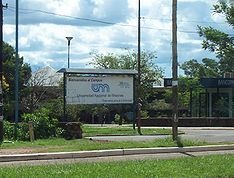 The Ciudad Universitaria (University City) is UNAM
's main campus. Designed by architects Mario Pani
and Enrique del Moral, it was built in the 1950s to move the university from the scatters colonial buildings in the historic center of Mexico City
.
It was declared a World Heritage Site
by UNESCO
in 2007.
The Biblioteca Central (Central Library)
is a large rectangular prism in the center of the campus. It was built by Gustavo Saavedra, Juan Martínez
and Juan O’Gorman. O’Gorman was in charge of decorating the four sides with multicolored mosaics of stone pieces brought from all parts of Mexico. The murals relates to the history of Mexico. The north side reflects the pre-Hispanic period; the south reflects the colonial period and the east is about the modern period. The west side is meant to represent Mexico today with the coat of arms of the university in the center with José Vasconcelos
’ motto of “Por mi raza hablará mi espíritu” (For my race, speaks my spirit.). These mosaics are the largest of their type in the world.
The Torre de Rectoría (Dean’s Tower) is the main administration building for UNAM. It was designed by Mario Pani, Enrique del Moral and Salvador Ortega as a tower of glass and marble, decorated with three-dimensional murals by David Alfaro Siqueiros
, mixing painting and sculpting. The north side has a piece entitled “El Pueblo a la Universidad y la Universidad al pueblo” (People to the University and University to the People). The work on the south side is called “Estudiantes que extiende sus brazos a la cultura” (Students who extend their arms to culture). On the east side is an unfinished work related to the culture of Mexico.
The Centro Cultural Universitario was built between 1976 and 1980 by engineers and architects of the school headed by Arcadio Artis Espiritu and Orso Nuñez Ruiz Velasco. It was created to house facilities related to various art forms and by artists from all over the world as well as Mexico. It is built over volcanic rock, oriented north-south and is surrounded by desert vegetation. The main entrance on Avenida Insurgentes contains a mural by Carlos Mérida. The complex contains the National Library and National Periodical Collection, the Instituto de Estudio Bibliográficos, the Coordinacion de Diffusion Cultural and the Julio Torre Bookstore/Café.
The Estadio Olímpico México 68
is the main sports facility built for the Olympic Games of 1968
held in Mexico City. It was constructed to simulate a volcanic cone with a wide crater. The high relief decoration in the front was designed by Diego Rivera and created as a mosaic using naturally colored stones. Today, the stadium is the home of the Pumas professional soccer team.
The Sala Nezahualcóyotl is a concert hall and the main site for the UNAM philharmonic orchestra. The building was inaugurated in 1976. It was designed acoustically to allow the orchestra to be in the center of the hall and seats 2311 people around a 240m2 stage.
The Sala Migual Covarrubias y Carlos Chávez is used primarily for dance recitals but has also hosted operatic events, musical theater and stage plays.
The Juan Ruiz de Alarcón Theater and Sor Juana Inés de la Cruz Forum were both inaugurated in 1979 as space for cultural events under the same roof. They have a capacity of 430 and 120 spectators respectively. The Forum does not define stage and audience space so that the facility can be adapted to a number of different arrangements. The stage of the Theatre, with its 12 meter walls, can be disassembled partially or fully.
The Espacio Escultórico or Sculpture Space is a monumental sculpture made of 64 stone triangular blocks arranced in a circle such that from above, it looks like a crown. Inside this space is exposed naturally occurring volcanic stone. The outside of the sculpture retains its natural vegetation. The idea is to combine nature and art and represents the cosmology of pre-Hispanic Mexico.
The Universum Museo de Ciencias is an interactive museum with 315 exhibits related to the natural and physical sciences. Halls are named for mathematics, chemistry, energy, biological diversity, agriculture and food, ecology, human biology and health, Science in the big city, animal behavior and society and more.
Running across the borough from the east end and ending in the west near the university campus is Avenida Miguel Angel de Quevedo. This street is lined with bookstores, such as Nalanda, El Sotano de Coyoacan, “Octavio Paz” and two branches of the Gandhi chain. The first was one of the Gandhi stores, placed in 1973 at the site of a former supermarket. The bookstores are here because the area is close to the Ciudad Universitaria and the student population that lives in the area. The bookstores have attracted other cultural businesses such as theaters cafes and restaurants. The second Gandhi store, called Gandhi 2000, was built to be a cultural center as well as a bookstore with literature related events, children’s activities, concerts and more. It also has a series of nude sculpture by Gabriel Ponzanelli.
Ciudad Universitaria is very large, so you might need a Ciudad Universitaria's map.
is located on the west side of the borough just north of the Ciudad Universitaria. This land once belonged to Miguel Angel de Quevedo, but they were nationalized under President Venustiano Carranza and today it serves as a park and a plant nursery for trees used in reforestation projects. It is the first plant nursery of its kind in Mexico. Today, it not only germinates and grows trees for reforestation projects, it is considered to be one of Mexico City’s “lungs.” This and other areas serve to recharge aquifers and add oxygen to the air. In the past, this park was also home to the first Escuela Nacional de Tauromaquia (National School of Bullfighting) .
Centro Nacional de las Artes (National Arts Center) is located on Avenida Rio Churubusco just east of Calazada de Tlalpan. It contains the Blas Galindo Auditorium, the Teatro de las Artes, two other theaters, the national music conservatory as well as schools of theater, dance, cinema, painting, sculpture and engraving. The building is modern. It has a bookstore and art materials shop open to the public.
Anahuacalli
is a museum designed by Diego Rivera to house his personal collection of pre-Hispanic art. It also contains some of his own work as well. The building is towering and fortress-like made of volcanic stone, incorporating stylistic features from several pre-Hispanic cultures. The name means “house of Anáhuac” Anáhuac was the Nahuatl
name for the Valley of Mexico
. The exhibits are mostly pottery and stone figures and other pieces chosen for their artistic value. Rivera’s works on display are murals on the walls and ceilings, studies of major murals done in other locations such as El Hombre en el Cruce de los Caminos, which reflects the original El Hombre, Controlador del Universo, which is in the Palacio de Bellas Artes
.
The Casa del Sol (House of the Sun) was constructed by the Aguilar and Quevedo families. In this house, Venustiano Carranza
composed the Constitution of 1917. Legend says it was originally a country home for Miguel Angel de Quevedo. Today it is a privately owned building with a restaurant and catering business.
The Casa de Cultura Raúl Anguiano is located in the Pedregal area on a property with a 2 hectare lake. It is named after a Mexican artist whose work reflected the country’s political and artistic history. The Casa de Cultura Ricardo Flores Magón was opened in 1986 with the name of Casa del Pueblo. Its currently named after a journalist and ideologue from the Mexican Revolution
. This building is one of the few built specifically to be a cultural center to serve the eastern side of the borough, which is densely populated due to apartment complexes such as the CTM Infonavit Culhuacan and the Alianza Popular Revolucionaria. The building contains a stage theater, a multipurpose room, an open air theater and a library. Other museums in the borough include the Museo de Arte Escultórico Geles Cabrera on Xicotencatl Street in Colonia del Carmen, the Museo del Automóvil on Avenida Division del Norte in Pueblo de San Pablo Tepetlapa, the Museo del Retrato Hablado on Avenida Universidad in Colonia del Carmen, Museo Cultural de las Artes Graficas on Calzada de Tlapan in Barrio de San Diego Churubusco and the Museo Alejandro Galindo on Avenida Santa Úrsula in Colonia Santa Úrsula. Other theaters includeTeatro Rafael Solana on Miguel Angel de Quevedo in Barrio del Cuadrante de San Francisco, Foro de la Conchita Forum on Vallara in the center, the Teatro Santa Catarina in Barrio Santa Catarina, the Teatro Coyoacan /Foro Rodolfo Usigli on Heroes Street in Barrio de San Mateo Churubusco, Teatro La Capilla on Madrid in Colonia del Carmen, Centro Nacional de las Artes in Calzada de Tlalpan in Colonia Country Club.
, USA
.
Mexico City
Mexico City is the Federal District , capital of Mexico and seat of the federal powers of the Mexican Union. It is a federal entity within Mexico which is not part of any one of the 31 Mexican states but belongs to the federation as a whole...
as well as the former village which is now the borough’s “historic center.” The name comes from Nahuatl
Nahuatl
Nahuatl is thought to mean "a good, clear sound" This language name has several spellings, among them náhuatl , Naoatl, Nauatl, Nahuatl, Nawatl. In a back formation from the name of the language, the ethnic group of Nahuatl speakers are called Nahua...
and most likely means “place of coyote
Coyote
The coyote , also known as the American jackal or the prairie wolf, is a species of canine found throughout North and Central America, ranging from Panama in the south, north through Mexico, the United States and Canada...
s,” when the Aztec
Aztec
The Aztec people were certain ethnic groups of central Mexico, particularly those groups who spoke the Nahuatl language and who dominated large parts of Mesoamerica in the 14th, 15th and 16th centuries, a period referred to as the late post-classic period in Mesoamerican chronology.Aztec is the...
s named a pre-Hispanic village on the southern shore of Lake Texcoco
Lake Texcoco
Lake Texcoco was a natural lake formation within the Valley of Mexico. The Aztecs built the city of Tenochtitlan on an island in the lake. The Spaniards built Mexico City over Tenochtitlan...
which was dominated by the Tepanec
Tepanec
The Tepanecs or Tepaneca are a Mesoamerican people who arrived in the Valley of Mexico in the late 12th or early 13th centuries. The Tepanec were a sister culture of the Aztecs as well as the Acolhua and others—these tribes spoke the Nahuatl language and shared the same general pantheon, with...
people. Against Aztec domination, these people welcomed Hernán Cortés
Hernán Cortés
Hernán Cortés de Monroy y Pizarro, 1st Marquis of the Valley of Oaxaca was a Spanish Conquistador who led an expedition that caused the fall of the Aztec Empire and brought large portions of mainland Mexico under the rule of the King of Castile in the early 16th century...
and the Spanish, who used the area as a headquarters during the Spanish conquest of the Aztec Empire and made it the first capital of New Spain
New Spain
New Spain, formally called the Viceroyalty of New Spain , was a viceroyalty of the Spanish colonial empire, comprising primarily territories in what was known then as 'América Septentrional' or North America. Its capital was Mexico City, formerly Tenochtitlan, capital of the Aztec Empire...
between 1521 and 1523. The village, later municipality
Municipalities of Mexico
Municipalities are the second-level administrative division in Mexico . There are 2,438 municipalities in Mexico, making the average municipality population 45,616...
, of Coyoacan remained completely independent of Mexico City through the colonial period into the 19th century. In 1857, the area was incorporated into the Federal District when this district was expanded. In 1928, the borough was created when the Federal District was divided into sixteen boroughs. The urban sprawl
Urban sprawl
Urban sprawl, also known as suburban sprawl, is a multifaceted concept, which includes the spreading outwards of a city and its suburbs to its outskirts to low-density and auto-dependent development on rural land, high segregation of uses Urban sprawl, also known as suburban sprawl, is a...
of Mexico City reached the borough in the mid 20th century, turning farms, former lake and forests into developed areas, but many of the former villages have kept their original layouts, plazas and narrow streets and have conserved structure built from the 16th to the early 20th centuries. This has made the borough of Coyoacan, especially its historic center a popular place to visit on weekends.
Villa Coyoacán or historic center
To distinguish it from the rest of Coyoacán borough, the former independent community is referred to as Villa Coyoacán or the historic center of the borough. Consisting now of 29 blocks, it is one of the oldest neighborhoods in Mexico City, located 10 km south of the ZocaloZócalo
The Zócalo is the main plaza or square in the heart of the historic center of Mexico City. The plaza used to be known simply as the "Main Square" or "Arms Square," and today its formal name is Plaza de la Constitución...
(main square) of Mexico City. This area is filled with narrow cobblestone streets and small plazas, which were laid out during the colonial period, and today give the area a distinct and bohemian
Bohemian
A Bohemian is a resident of the former Kingdom of Bohemia, either in a narrow sense as the region of Bohemia proper or in a wider meaning as the whole country, now known as the Czech Republic. The word "Bohemian" was used to denote the Czech people as well as the Czech language before the word...
identity. The area is filled with mostly single family homes, which were former mansions and country homes built between the colonial period to the mid 20th century. The Project for Public Spaces
Project for Public Spaces
Project for Public Spaces is a nonprofit organization based in New York dedicated to creating and sustaining public places that build communities. Planning and design rooted in the community form the cornerstone of PPS’s work. Building on the techniques of William H...
ranked the neighborhood as one of the best urban spaces to live in North America in 2005 and is the only Mexican neighborhood on the list. This area was designated as a "Barrio Mágico"
Barrios Mágicos of Mexico City
The “Barrios Mágicos” of Mexico City is a list of twenty one areas in the Federal District, which have been named “magical neighborhoods” in order to attract tourism to them. The program is sponsored by the city government but is patterned after the “Pueblos Mágicos” program of the Mexican...
by the city in 2011.
The center of Coyoacán is relatively peaceful during the week, but it becomes crowded and festive on weekends and holidays. After the Zocalo, the most-visited place in Mexico City is this historic center, especially the twin plazas in its center. According to the borough, the area receives about 70,000 people each weekend. The area is a stop for both the Turibus and Tranvia Turistico tour bus routes, on their routes though San Ángel
San Ángel
San Ángel is a colonia or neighborhood of Mexico City, located in the southwest in Álvaro Óbregon borough. Historically, it was a rural community, called Tenanitla in the pre Hispanic period. Its current name is derived from the El Carmen monastery school called San Ángel Mártir...
, Ciudad Universitaria
Ciudad Universitaria
Ciudad Universitaria , Mexico, is UNAM's main campus, located in Coyoacán borough in the southern part of Mexico City. Designed by architects Mario Pani and Enrique del Moral, it encloses the Olympic Stadium, about 40 faculties and institutes, the Cultural Center, an ecological reserve, the Central...
and other locations in the south of Mexico City. People come to enjoy the still somewhat rural atmosphere of the area as well as the large number of restaurants, cafes, cantinas, museums, bookstores and other cultural attractions. Some of these businesses have been around for almost a century. In the two main plazas and even in smaller ones such as the one in the neighboring Santa Catarina neighborhood. Mimes, clowns, musicians, folk and indigenous dancers, storytellers and other street performers can be found entertaining crowds. Vendors sell street food such as ice cream, homemade fruit drinks, esquites
Esquites
Esquites is a Mexican snack or antojito. Shops and market stalls selling corn also tend to sell Esquites. Festival and fair stalls may sell them too. The word esquites comes from the Nahuatl word ízquitl, which means "toasted corn"....
(flavored corn kernels) and corn-on-the-cob served with mayonnaise, lime, chili pepper and grated cheese, amaranth
Amaranth
Amaranthus, collectively known as amaranth, is a cosmopolitan genus of herbs. Approximately 60 species are recognized, with inflorescences and foliage ranging from purple and red to gold...
bars, and various candies. In the evening, food vendors tend to sell more hot items such as quesadilla
Quesadilla
A quesadilla is a flour or corn tortilla filled with a savoury mixture containing cheese and other ingredients, then folded in half to form a half-moon shape. This dish originated in Mexico, and the name is derived from the Spanish word queso ....
s, sope
Sope
A sope is a traditional Mexican dish originating in the city of Culiacán. Originally called gordita or pelliscadas in Culiacán. It is an antojito which at first sight looks like an unusually thick tortilla with vegetables and meat toppings...
s, torta
Torta
Torta is a Spanish word with a huge array of culinary meanings depending from the area and period of history in question. It originated in different regional variants of flatbread, of which the torta de gazpacho and torta cenceña are still surviving in certain areas of central Spain. Tortas are...
s, tostada
Tostada
Tostada is a Spanish word which literally means "toasted". It is used in Latin America to name several different traditional local dishes which have in common the fact they are toasted or use a toasted ingredient as the main base of their preparation. There is a gender difference between "tostada"...
s, pozole
Pozole
Pozole is a ritually significant, traditional pre-Columbian soup or stew from Mexico. Pozole was mentioned in Fray Bernardino de Sahagún's "General History of the Things of New Spain" circa 1500 CE. It is made from nixtamalized cacahuazintle corn, with meat, usually pork, chicken, turkey, pork...
s and more. One known food vendor goes by the name of Rogelio. He is known for making pancakes (called hotcakes) in the shape of animals and humans. These are usually eaten as a snack with jam, cream and other toppings.
The tourism has been a mixed blessing for the historic center as commercial establishments open, helping the economy, but also push residents out. In the historic center, there are over 860 retail businesses, mostly restaurants, about 200 of which were established in the last five years. Residents attribute the growth to Mexico City’s promotion of the area tourism in general as well as the opening of commercial centers in the borough. While the growing business helps the economy, resident groups fear that the area will lose its current character, as many businesses are opening in formerly residential buildings, with questionable legal basis. Currently, most of the borough, especially in historic center, is residential with older adults. Property prices are high, leading to sales not to new families but rather to larger commercial interests, squeezing out smaller businesses along with residents. Neighborhood groups have formed to confront the changes and preserve the historic value of the area. Another serious problem for the area is the traffic jams and serious lack of parking in the historic center. The quantity of cars and the lack of traffic patrols have meant the proliferation of “franeleros” or people who illegally take possession of public areas such as streets to charge for parking.
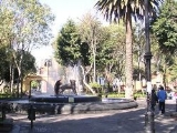
The historic area is centered on two large plazas filled with Indian laurel trees called the Jardin del Centenario and the Jardín Hidalgo. These plazas cover an area of 24,000m2, which were renovated, along with the areas around them in 2008. The green areas were rehabilitated, and areas were paved with red and black volcanic stone. Renovation of the two plazas and the streets around them cost 88.3 million pesos. For over twenty five years, these plazas, especially Plaza Hidalgo, and the streets around them were filled with vendors (wandering and with stalls). When renovation efforts began, 150 vendors were removed from the plazas proper with about 500 total including the surrounding streets. While the practice was illegal, it had been tolerated by authorities, even though it caused damage to the plazas and caused traffic problems. One of the main goals of the renovation work in 2008 was to remove these vendors and move them to a new crafts bazaar built nearby. Initially, opposition to the removal of the vendors came not only from the vendors themselves, but also from some neighborhood groups and local businesses who feared their removal would hurt tourism. When renovation work finished in 2009, police were assigned to the plazas to keep vendors from returning, leading to confrontations, both physically in the plazas and legally in the courts. The borough began to issue some permits for vendors, but there was opposition. Eventually, a group representing the vendors obtained a court order to allow forty vendors to return to the plazas, citing the history of tolerating such activity in the past. This order is still opposed by some neighborhood groups, but as of 2010, there are still a limited number of these vendors selling in the plazas.
Plaza Hidalgo, also called Jardín (garden) Hidalgo is the main plaza or square of the borough. It is bordered by Calle Carillo Puerto on the east, Calle Caballocalco on the west, Calle B. Dominguez and the Casa Municipal on the north and the Plaza del Centenario and the Parish is San Juan Bautista on the south. In the center of the plaza, there is an early 20th century kiosk
Kiosk
Kiosk is a small, separated garden pavilion open on some or all sides. Kiosks were common in Persia, India, Pakistan, and in the Ottoman Empire from the 13th century onward...
with a stained glass cupola
Cupola
In architecture, a cupola is a small, most-often dome-like, structure on top of a building. Often used to provide a lookout or to admit light and air, it usually crowns a larger roof or dome....
topped by a bronze
Bronze
Bronze is a metal alloy consisting primarily of copper, usually with tin as the main additive. It is hard and brittle, and it was particularly significant in antiquity, so much so that the Bronze Age was named after the metal...
eagle. This kiosk was donated to the then village by Porfirio Díaz
Porfirio Díaz
José de la Cruz Porfirio Díaz Mori was a Mexican-American War volunteer and French intervention hero, an accomplished general and the President of Mexico continuously from 1876 to 1911, with the exception of a brief term in 1876 when he left Juan N...
for the then-upcoming Centennial of Mexico’s Independence
Mexican War of Independence
The Mexican War of Independence was an armed conflict between the people of Mexico and the Spanish colonial authorities which started on 16 September 1810. The movement, which became known as the Mexican War of Independence, was led by Mexican-born Spaniards, Mestizos and Amerindians who sought...
in 1910. The eagle design is one adopted by Mexico after the French Intervention
French intervention in Mexico
The French intervention in Mexico , also known as The Maximilian Affair, War of the French Intervention, and The Franco-Mexican War, was an invasion of Mexico by an expeditionary force sent by the Second French Empire, supported in the beginning by the United Kingdom and the Kingdom of Spain...
. As the plaza is named after Miguel Hidalgo y Costilla, a statue of the priest, created by Luis Arias can also be found on the plaza. Behind it is a sculpture carved from a tree trunk called “La Familia de Antonio Alvarez Portual y Josué.
The Plaza del Centenario (also called the Jardín del Centenario) is slightly smaller and located just west of the Plaza Hidalgo, separated by Calle Carrillo Puerto. This plaza originally was part of the very large atrium
Atrium (architecture)
In modern architecture, an atrium is a large open space, often several stories high and having a glazed roof and/or large windows, often situated within a larger multistory building and often located immediately beyond the main entrance doors...
that belonged to Parish of San Juan Bautista during the colonial period. The main entrance to this atrium still exist on the west side of this plaza and are called the Arcadas Atrial or the Arcos del Jardín del Centennario. This entrance was built in the 16th century of stone with decorative motifs that show both European and indigenous influence. The current name for this area comes from the Centennial of Mexico’s Independence. In the center of the plaza, there is a fountain which contains a bronze sculpture of two coyotes, which refer to the borough’s name. The south side of the plaza is lined with cafes and restaurants, including the well-known Café El Parnaso, and the north side features a very large crafts markets.
The Casa Municipal, also referred to as the Casa de Cortés, is a building located on the north side of the Plaza Hidalgo. It has served as an administrative/governmental building since it was constructed in the 18th century. The erroneous name of Casa de Cortés (House of Cortés, referring to Hernán Cortés), comes from Coyoacán’s association with the conquistador. Cortés did live in Coyoacán in 1521 and 1522, while the destroyed Aztec city of Tenochtitlan was being rebuilt into Mexico City, and the area was the capital of the colony of New Spain. However, Cortés never lived at the site, despite a plaque on building that says that he did. Cortés residence in Coyoacán was on lands that belonged to the then leader of the indigenous of this area, Juan de Guzmán Iztolinque
Juan de Guzmán
Don Juan de Guzmán Itztolinqui was a post-Conquest tlatoani of the altepetl of Coyoacán in the Valley of Mexico....
, in the area where the La Conchita Church and plaza are found now. What Cortés eventually built here where administrative buildings for the offices used to manage the vast lands he was granted as the Marquis del Valle de Oaxaca, which included the Coyoacán area. Local legend states that this was the location were Cuauhtémoc
Cuauhtémoc
Cuauhtémoc was the Aztec ruler of Tenochtitlan from 1520 to 1521...
was tortured as the Spanish tried to learn of the whereabouts of more treasure.
The current structure was built in the mid 18th century, by Cortés’ descendents, who still carried the title of the Marquis of the Valle de Oaxaca to replace the old structure, which had deteriorated. In the 1850s, the building began to be used as the seat of the government of the municipality of Coyoacán, which then belonged to the State of Mexico, very separate from Mexico City. When the borough of Coyoacán was created in 1928, as part of the Federal District, the building remained the government seat but of the modern “delegación.” The structure was declared a Colonial Monument by INAH in 1932.
The structure is much the same as it was when it was constructed in the 18th century. The facade is simple and is fronted by a series of columns in sandstone and wood over which is a roof. The door and window jambs are typical of civil constructions of the 18th century with wrought iron work. The facade is topped by a wide cornice
Cornice
Cornice molding is generally any horizontal decorative molding that crowns any building or furniture element: the cornice over a door or window, for instance, or the cornice around the edge of a pedestal. A simple cornice may be formed just with a crown molding.The function of the projecting...
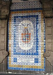
and inverted arches. At the very front is a sculpture of two coyotes in volcanic stone, the current logo of the borough. Above the entrance is the coat of arms granted to Coyoacán by Charles IV of Spain
Charles IV of Spain
Charles IV was King of Spain from 14 December 1788 until his abdication on 19 March 1808.-Early life:...
. On one side of the building is the Sala de Cabildos, or City Council Hall. It was painted by Aurora Reyes Flores
Aurora Reyes Flores
Aurora Reyes Flores was a Mexican painter, as well as the first female exponent of Mexican muralism.- Biography :...
with a mural depicting pre-Hispanic Coyoacan and includes depictions of the landscape of the area including the Xitle
Xitle
Xitle is a volcano in the Ajusco range in Cumbres del Ajusco National Park. It is located in the Tlalpan borough in the southwestern part of Mexico City. It is an ash cone volcano with a conical form, round base, altitude of approximately 300m, and a slope between 30° and 40°.Xitle registered its...
volcano, the Tepaneca god Xocotlhuetzin as well as the Mesoamerican deity Quetzalcoatl
Quetzalcoatl
Quetzalcoatl is a Mesoamerican deity whose name comes from the Nahuatl language and has the meaning of "feathered serpent". The worship of a feathered serpent deity is first documented in Teotihuacan in the first century BCE or first century CE...
. Next to this hall is an attached chapel. The mural in the chapel was done by Diego Rosales in 1961, depicting the early history of Mexico with personages such as Cuauhtémoc, Cortés, La Malinche
La Malinche
La Malinche , known also as Malintzin, Malinalli or Doña Marina, was a Nahua woman from the Mexican Gulf Coast, who played a role in the Spanish conquest of Mexico, acting as interpreter, advisor, lover and intermediary for Hernán Cortés...
and Pedro de Alvarado
Pedro de Alvarado
Pedro de Alvarado y Contreras was a Spanish conquistador and governor of Guatemala. He participated in the conquest of Cuba, in Juan de Grijalva's exploration of the coasts of Yucatan and the Gulf of Mexico, and in the conquest of Mexico led by Hernan Cortes...
. Scenes of the work cover the walls and the ceiling.
One of the most important historic buildings in the borough is the Parish of San Juan Bautista. Built between 152 and 1552, it is one of three oldest parish churches in Mexico City, along with the ones in Tlalpan
Tlalpan
Tlalpan is one of the sixteen administrative boroughs of the Federal District of Mexico City. It is the largest borough, with over eighty percent under conservation as forest and other ecologically sensitive area. The rest, almost all of it on the northern edge, has been urban since the mid 20th...
and the small community of Amaqueman. Originally, this church and the cloister next to it were constructed as a monastery by the Dominicans, but the complex was transferred to the Franciscans. Over time, as the complex deteriorated and was reconstructed and restored various time, most was replaced so that now the only original parts from the 16th century are the choir area, the Rosario Chapel and the main altar. However, much of the same layout remains. The parish church has a large open chapel, but only a portion of the atrium it had in the 16th century. During much of the colonial period, the atrium functioned as a cemetery. Today, much of this atrium is now the Plaza del Centenario. The interior of the church has seven chapels, with the Rosario Chapel containing an ornate Baroque
Baroque
The Baroque is a period and the style that used exaggerated motion and clear, easily interpreted detail to produce drama, tension, exuberance, and grandeur in sculpture, painting, literature, dance, and music...
altarpiece from the end of the 17th century. The monastery portion is two floors surrounding a large inner courtyard. It conserves a large part of the original wood beams and decorative work in wood which was done by indigenous hands. The feast day for San Juan Bautista is 24 June. In the church a special altar is installed and mass is said all day. The most important mass occurs at midday with mariachi music, with a meal offered in the adjoining monastery building. The event is organized by 24 civil associations and the chaplains of the parish.
In 2005, the San Juan Bautista church underwent renovations to its tower, atrium, facade, portal for pilgrims, the north and south sides and the cupola and more under the supervision of INAH and academics from UNAM
Unam
UNAM or UNaM may refer to:* National University of Misiones, a National University in Posadas, Argentina*National Autonomous University of Mexico , the large public autonomous university based in Mexico City...
. Prior to this, there had been no restoration work to the building for about a century. The cupola was particularly damaged, with trees and other plants growing out of it. Much of the work was to make straight many of the walls and floors, which had cracked and warped. Studies were done on the building to determine what materials in what colors were used in order to use the same. It was declared a National Monument in 1934. The work was sponsored by government and private funds.
Other landmarks off the plazas include the Museo Nacional de Culturas Populares, and the Acuavida Coyoacán. The Museo Nacional de Culturas Populares (National Museum of Popular Culture) is located just off the Plaza del Centenario, and features mostly temporary exhibits related to popular or mass culture such as one related to lucha libre
Lucha libre
Lucha libre is a term used in Mexico, and other Spanish-speaking countries, for a form of professional wrestling that has developed within those countries...
wrestling. The museum was created in 1982, to show the values and ways of live of the various modern cultural groups in Mexico. It has various halls, an auditorium and two courtyards in which are exhibitions, auditions, concerts, plays, recitals and craft workshops for children. The Acuavida Coyacán Aquarium is on the north side of the Plaza del Centenario. It offers exhibits of fishes, reptiles, live coral, aquatic plants and more, including the only freshwater manta ray
Manta ray
The manta ray is the largest species of the rays. The largest known specimen was more than across, with a weight of about . It ranges throughout waters of the world, typically around coral reefs...
in captivity in the Americas.
The rest of the historic center and nearby neighborhoods are filled with homes built from the colonia era to the middle of the 20th century, many of which have been catalogued for their historic value. Many of these homes can be found one two of the historic center’s oldest streets, the Calle de Higuera, which leads southeast away from the Parish of San Juan Miguel and to the La Concepción neighborhood and Calle Francisco Sosa, which leads away from the same area towards San Angel. Calle Francisco Sosa alone has 65 structures catalogued by INAH for their historic value. One of the most important of these structures is the Casa de Ordaz, located on Calle Francisco Sosa on the corner with the Plaza de Centenario. ) It was long thought to have belonged to conquistador Diego de Ordaz
Diego de Ordaz
Diego de Ordaz , born in Castroverde de Campos, Zamora province, Spain, in 1480, died in Venezuela in 1532, was a Spanish explorer and soldier.-Early career:Diego de Ordaz arrived in Cuba at a young age...
, who died in 1532, but research has shown that it was built sometime in the 18th century. Remodeling work was authorized on the Casa de Ordaz in 2004 by the INAH, but complaint stated that the owner, Banamex, gutted the interior and exceeded the limits set for the work by INAH. However, the chronicler of the borough, Luis Everaert, stated that the only original part of the building was the facade, which was not changed. The house underwent modification in the 1930s. In the 1920s, it was a school for girls, the first in Coyoacan, In the 1930s, it was the Institutio Centroamericano, a middle school for boys. The Instituto Italiano de Cultura (Italian Cultural Institute) on Francisco Sosa Street is house in a structure built between the 17th and 18th centuries and remodeled in the 20th. This structure is an adobe and stone mansion with a flat red façade with Moorish style decorative features. It has an inner courtyard with a tile decorated fountain and a private altar. It houses the cultural offices of the Italian Embassy. The main house of the San Pedro Martír Hacienda is located off of Belisario Dominguez Street. The house is now divided into three independent parts, but they retain their original facades. In 1932, this house was where the Escuela de Pintura al Aire Libre (Open Air Painting School) was established, which was an important artistic movement.
The borough
The borough of Coyoacán was created in 1928, when the Federal District of Mexico City was divided into 16 administrative parts. The borough is named after the old village of Coyoacán, where the borough government is seated. This borough is much larger than the village, extending for 54.4km2 in the geographic center of the Federal District. Accounting for 3.6% of the Federal District, it is the tenth largest borough. The borough is bordered to the north by the boroughs of Benito JuárezBenito Juárez, D.F.
Benito Juárez is one of the 16 delegaciones into which Mexico's Federal District is divided. It is a largely residential area, located to the south of historic center of Mexico City, although there are pressures for areas to convert to commercial use. It was named after Benito Juárez, president in...
, Iztapalapa
Iztapalapa
Iztapalapa is one of the Federal District of Mexico City’s 16 boroughs, located on the east side of the entity. The borough is named after and centered on the formerly independent municipality of Iztapalapa, which is officially called Iztapalapa de Cuitláhuac for disambiguation purposes...
, Xochimilco
Xochimilco
Xochimilco is one of the sixteen delegaciones or boroughs within Mexican Federal District. The borough is centered on the formerly independent city of Xochimilco, which was established on what was the southern shore of Lake Xochimilco in the pre-Hispanic period...
, Tlalpan
Tlalpan
Tlalpan is one of the sixteen administrative boroughs of the Federal District of Mexico City. It is the largest borough, with over eighty percent under conservation as forest and other ecologically sensitive area. The rest, almost all of it on the northern edge, has been urban since the mid 20th...
and Álvaro Obregón
Álvaro Obregón, D.F.
Álvaro Obregón is one of the 16 delegaciones into which Mexico's Federal District is divided. It contains a large portion of the south-west part of Mexico City. It had a 2010 census population of 727,034 inhabitants and lies at an elevation of 2,319 m...
. Border roads include Avenida Río Churubusco, Calzada Ermita Iztapalapa, Calzada de la Viga, Canal Nacional, Calzada del Hueso, Avenida del Bordo, Calzado Acoxpa, Calzada de Tlalpan, Avenida de Pedregal, Anillo Periférico
Anillo Periférico
The Anillo Periférico is the name given to the outer beltway of Mexico City. The beltway gained major media attention when the Mexico City mayor, Andrés Manuel López Obrador, started a project to turn a southern section of the ring into a two-story highway...
, Boulevard de las Cataratas, Circuito Universitario, Avenida Ciudad Universitaria, San Jerónimo, Río Magdalena and Avenida Universidad.
Sixty nine percent of the land is residential, 60% is open or green space and the rest is mixed use or commercial. The borough contains 167,157 housing units with between two and four occupant, which is 7.5% of the total of the District. It contains 7.2% of the total population of the Federal District. This population has fallen slightly from 640,423 to 628,063 (2000 to 2005) as the overall population of Mexico City has risen.
However, quality of life in this borough his ranked among the top in the nation and has been ranked internationally. Coyoacan was ranked third best place to live in the country in 2004 by the United Nations Development Programme
United Nations Development Programme
The United Nations Development Programme is the United Nations' global development network. It advocates for change and connects countries to knowledge, experience and resources to help people build a better life. UNDP operates in 177 countries, working with nations on their own solutions to...
, behind Benito Juarez and San Pedro Garza García
San Pedro Garza García
San Pedro Garza García is a city-municipality of the Mexican state of Nuevo León and is part of Monterrey's Metropolitan Area, based on the suburban North American model...
in Nuevo León
Nuevo León
Nuevo León It is located in Northeastern Mexico. It is bordered by the states of Tamaulipas to the north and east, San Luis Potosí to the south, and Coahuila to the west. To the north, Nuevo León has a 15 kilometer stretch of the U.S.-Mexico border adjacent to the U.S...
. The ranking is based on income levels, health and education. Coyoacan was ranked sixth in education, fourth in income and fifth in health. In quality of life, which takes into account factors such as crime statistics, Coyoacan ranked second behind Benito Juarez in Mexico City. This ranks the quality of life as equivalent to that in developed countries. In 2004, Coyoacan was ranked the fifth most livable neighborhood in North America, ahead of Rittenhouse, Philadelphia and behind Camden, Maine. The borough contains 228 preschools, 227 primary schools, 103 middle schools, and 66 technical, preparatory and other high schools serving about 155,000 students. Illiteracy is lower here than in the rest of the Federal District at 1.9% for residents over the age of 15. About 55% of the population is of working age with less than 2% unemployed. 77.8% are employed in commerce and services, with 7% in industry; 44.8% of industrial jobs is related to pharmaceuticals with food processing accounting for 18.7%. However, industry accounts for 47.3% of the borough GDP, followed by services at 32.6% and commerce at 16.7%. As of 2004, the borough accounted for 4.1% of Mexico City’s total GDP, but its industry accounts for 21% of industrial GDP. Tourism is an important part of the borough commerce and services sector. However, there are only nine hotels rated with three stars or above.
Most of the borough located at 2240 meters above sea level with little variation. Minor elevations are located in Ciudad Universitaria, San Francisco Culuacán and Santa Úrusula Coapa. The most important elevation is in the far south called the Cerro del Zacatépel which rises to 2420masl. Parks and other green spaces cover 4,318,783.56m2 and can be found in most of the communities of the borough. Soil composition is of two types, of volcanic origin and the former lakebed of Lake Texcoco. Volcanic land is subdivided by volcanic rock which is decomposing and that which has not. The best known of the areas with still-hard lava rock is called the Pedregal, which covers the communities of the Ciudad Universitaria, the Pedregal de Carrasco, Santa Úrsula Coapa, Copilco el Alto, Viveros de Coyocan and the Villa de Coyoacán or historic center. The southeast of the borough is dominated by volcanic rock from an eruption of a now dormant volcano called Xitle
Xitle
Xitle is a volcano in the Ajusco range in Cumbres del Ajusco National Park. It is located in the Tlalpan borough in the southwestern part of Mexico City. It is an ash cone volcano with a conical form, round base, altitude of approximately 300m, and a slope between 30° and 40°.Xitle registered its...
. This lava bed covers the current communities of Colonia Santo Domingo, Colonia Ajusco and Pueblo de Santa Úrsula. Decomposing volcanic rock is mostly found by the former lake. The borough is part of the Pánuco River
Pánuco River
The Pánuco River is a river in Mexico that flows from the River Moctezuma in the Valley of Mexico to the Gulf of Mexico.At its source, it serves as a channel for water-drainage for Mexico City. From there, it becomes the state border between Hidalgo and Querétaro as it moves towards San Luis...
Basin, in the subregion of the Lake Texcoco Zumpango. The lake no longer exists except for a canal called the Canal Nacional which is on the east border. Two rivers pass through the territory called the Río Magdalena and Río Mixcoac. Both of these are almost fully encased in cement tubes as they pass through. These two rivers join to form the Río Churubusco on the border with Benito Juárez.
The borough is divided into 140 communities, classified as colonias, pueblos, unidades habitacionales and barrios. The oldest of these divisions are former villages which are distinguished by their colonial era churches and who still celebrate their feast of their patron saint much as they did when they were independent, with fireworks, masses, processions, folk and indigenous dance and more. A number of these villages also have certain unique traditions associated with these celebrations. These barrios and pueblos can still be somewhat distinguished by their narrow, winding roads and alleyways. Culturally, they are still distinguished by having their own histories and legends. Many of the old villages are linked by the old Calle Real, which was renamed Santa Catarina, then Benito Juarez and now Francisco Sosa. Today, this road extends from Plaza or Jardín Hidalgo to the Panzacola Bridge. This street used to have a trolley car that linked the historic center of Coyoacán with San Ángel and Churubusco. At first this trolley was pulled by mules, but later it was electrified. Sometime after that, it was replaced by modern busses. Another main road in the borough is La Higuera, which links Plaza Hidalgo which the La Conchita Plaza.
In additions to structures from the colonial era, Coyoacán has important structure from the 19th century, replicas of colonial and 19th century buildings constructed in the 20th century and modern buildings. In total, the borough contains 349 registered buildings of cultural or historic importance, with 157 of these in the historic center. Coyoacán was declared a “Zona Típica y Pintoresca del Distrito Federal” (Typical and Picturesque Zone of the Federal District) by INAH in 1934 due to is historical, cultural and artistic value. This declaration recognizes 278 buildings within the borough. This historic center has the most with fifty buildings on 86 blocks over 1.64km2.
Despite its rural past with villages and farmlands, today the borough is urban, with all of its territory paved and developed with the exception of parks and other reserved green spaces as it is completely integrated with the urban sprawl of Mexico City. This has brought a number of problems to the area. Traffic in Coyoacán in some of the worst in the city. While there are 70.7 km of primary roads through the borough, with 8,200,947m2 of pavement, many sections have maintained the narrow winding streets and plazas from its colonial past. These sections bring in a large number of visitors, especially on weekends and holidays, with these roads unable to cope with the volume of traffic and need for parking. Other issues are graffiti and vandalism, and other crimes, the most serious of which is theft/robber, followe by assault. However, Coyoacán generates only 7.2% of all crime reports in Mexico City.
Other neighborhoods of the borough
For long before it became a borough, the area was home to a number of small community and villages. Vestiges of a number of these communities can still be distinguished by street layouts and by customs and traditions which have survived. Many of the old villages, now called colonias, pueblos and barrios (roughly “neighborhood”) are linked by the old Calle Real, which was renamed Santa Catarina, then Benito Juarez and now Francisco Sosa. Today, this road extends from Plaza Hidalgo to the Panzacola Bridge in Santa Catarina. This street used to have a trolley car that linked the historic center of Coyoacán with San Ángel and Churubusco. At first this trolley was pulled by mules, but later it was electrified. Sometime after that, it was replaced by modern busses. Another main road in the borough is La Higuera, which links Plaza Hidalgo which the La Conchita Plaza in the La Concepción neighborhood. These two roads, along with other colonial-era roads still have structures which are centuries old. Another street with a number of country mansions and homes is Calle de Fernandez Leal, mostly built at the beginning of the 20th century. A film called “The Matador, with Pierce BrosnanPierce Brosnan
Pierce Brendan Brosnan, OBE is an Irish actor, film producer and environmentalist. After leaving school at 16, Brosnan began training in commercial illustration, but trained at the Drama Centre in London for three years...
and Greg Kinnear
Greg Kinnear
Gregory "Greg" Kinnear is an American actor and television personality who first rose to stardom in 1991. He has appeared in more than 20 motion pictures, and was nominated for an Academy Award for his role in As Good as It Gets.-Early life:Kinnear was born in Logansport, Indiana, the son of...
was filmed partly on the Plaza Santa Catarina.
La Concepción
One neighborhood which is as old as the historic center is the La Concepción or La Conchita neighborhood (Barrio de la Concepción), an area where the Spanish conquistadors settled in the 1520s. The neighborhood centers on a small plaza with a church just southeast of Villa Coyoacán or the historic center. This main chapel and plaza are called the Purísima Concepción Chapel and the Plaza de la Conchita. This plaza is surrounded by very small streams still fed by a spring called Los Camilos. According to INAH, the plaza was a pre-Hispanic ceremonial center, on which Cortés had this chapel built. Here, the first mass was celebrated and according to tradition, La Malinche prayed here. The official name of the building is the Purísima Concepción Chapel but its more common name La Conchita “the little shell.” It is thought that this chapel lies on the site of springs which once provided potable water to Tenochitlan .The feast day for this neighborhood is 8 December. The facade of the La Conchita Church is decorated with a large flower portal, usually donated by a sister community of Coyoacán such as Los Reyes or La Candelaria. The festival begins with chamber music and then the patron image of the Virgin Mary is “awakened” with the song Las Mañanitas
Las Mañanitas
Las Mañanitas is a traditional Mexican birthday song sung in many Latin American countries at birthday parties, usually sung before eating cake and especially as part of the custom of serenading unmarried women. The tradition of the song can be tracked back to 1896 in the mexican city Zacatecas...
as she is surrounded by numerous floral arrangements for mass. On the plaza in front of the church, wind bands play while participants share tamale
Tamale
A tamale — or more correctly tamal — is a traditional Latin American dish made of masa , which is steamed or boiled in a leaf wrapper. The wrapping is discarded before eating...
s and atole
Atole
Atole is a traditional masa-based Mexican and Central American hot drink. Chocolate atole is known as champurrado or atole...
. Later in the night, student musical groups perform “callejoneadas” where the roam the streets playing music as a traveling party.
Most of the area’s oldest buildings are located on this plaza, Calle Fernando Sosa, which leads to Villa Coyoacán and Calle Fernandez Leal. The Casa Colorada or Casa de la Malinche is located on a corner of the Plaza La Conchita, but it is not open to the public. It is said that Hernán Cortés built it for La Malinche his lover and translator, and historians believe he had his Spanish wife, Catalina Juárez de Marcaida murdered there. In despite of the house’s historic and aesthetic value, it does not receive much attention. The reason for this is that La Malinche is often blamed for the downfall of the Aztec Empire, acting as a traitor against her own people.
La Casa de los Padres Camilos (The House of the Camillo Priests) is on Fernandez Leal Street in the Barrio de la Concepcion. This structure was part of a farm and hospice which was owned by a Camillian
Camillians
The Camillians or Ministers to the Sick are a Roman Catholic religious order of the type of Regular Clerks, founded by Saint Camillus de Lellis. A red cross was chosen by Camillus as the distinguishing badge for the members of the Order to wear upon their black cassocks...
religious order. The brothers cultivated a number of crops including fruit trees and flowers. Today the main house is used for commercial purposes but the building retains many of its original architectural details It is a small stone-block building with a door made of black stone. Added to this was a hall in the early 1900s. Opposite the Casa de los Camilos is the Jardín Frida Kahlo which has a statue of the painter and a fountain.
Santa Catarina
The Santa Catarina neighborhood is home to a large number of Coyoacán’s landmarks. It is located just west of the Plaza del Centenario along Calle Francisco Sosa. It is a small square with a bright yellow chapel named the Capilla de Santa Catarina. This chapel was built for use by the indigenous population in the very early colonial period. The building today conserves some of the original built in the 1520s when it was originally built as an open chapel, and ornamental work done in the mid 17th century, when the nave with cannon vault was added. Later a tower and a linterna were added, but these fell in the 1985 earthquake1985 Mexico City earthquake
The 1985 Mexico City earthquake, a magnitude 8.0 earthquake that struck Mexico City on the early morning of 19 September 1985 at around 7:19 AM , caused the deaths of at least 10,000 people and serious damage to the greater Mexico City Area. The complete seismic event...
. Inside there are 400 year old murals. It was declared a National Monument in 1932. There are also several restored colonial era houses around it. On one side, there is Casa de Cultura de Coyacán which hold art and cultural events. Once part of a hacienda, behind the building there are large gardens filled with vegetation.
The Dolores del Río House is located on Salvador Novo Street in Barrio de Santa Catarina. It is also known as “La Econdida” (The Hidden One), where Mexican actress Dolores del Río
Dolores del Río
Dolores del Río was a Mexican film actress. She was a star of Hollywood films during the silent era and in the Golden Age of Hollywood...
lived. It is neo-Colonial in design when it was built for her, but it has since been remodeled and has a more modern appearance. It still functions as a private residence.
The Miguel Angel de Quevedo
Miguel Ángel de Quevedo
For the journalist, please see Miguel Ángel QuevedoMiguel Ángel de Quevedo was a Mexican architect, engineer, and environmentalist who founded Mexico City's Viveros de Coyoacán arboretum, as well as numerous other construction projects in Mexico City, and throughout the country, and promoted the...
House is on Francisco Sosa Street in Barrio de Santa Catarina. It is a very large structure for the area, filled with trees and plants both inside and out. Originally, these gardens were watered with river flow from the Río Magdalena, but this river is no longer accessible because it is encased. It is still used as a residence.
The Casa del Indio Fernández House is located on Dulce Oliva Street in Barrio de Santa Catarina. The house was constructed over twenty years by architect Manuel Parra for Mexican filmmaker Emilio “Indio” Fernández
Emilio Fernández
Emilio "El Indio" Fernández was an actor, screenwriter and director of the cinema of Mexico. He is best known for his work as director of the film Maria Candelaria which won the Grand Prix at the 1946 Cannes Film Festival.-Early life:Fernández was born in Mineral del Hondo, Coahuila...
, who died in the house in 1986. The house is colonial in style with a facade constructed from volcanic rock. Today it belongs to Fernandez’s daughter, Adela.
The Casa de Cultura Jesús Reyes Heroles is located on Francisco Sosa, named after a historian and political scientist from Veracruz. The house is on a property, which was called Izotitlán, meaning “izotes” a type of wild palm to make hats. In the colonial period, the house belonged to Juan de Luis Celis who had a small paper factory. It changed hands several times by the 20th century, but all this time, the structure kept its original appearance including very old atrium cross in the first courtyard. In the 1940s, it was enlarged, but its colonial style was respected. The building gained its current function in 1985, when President Miguel de la Madrid donated the house and lands to create a cultural center. Today, the center has three art galleries, named after Alfredo Ramos Martinez, Guillermo Kahlo and Miguel Alvarez Acosta to house temporary exhibits, an area to teach the culinary arts and two multiuse rooms. At the beginning of the 20th century, the Casa de Cultura Jesús Reyes Heroles was inhabited by María Concepción Armida, who is being considered for beatification
Beatification
Beatification is a recognition accorded by the Catholic Church of a dead person's entrance into Heaven and capacity to intercede on behalf of individuals who pray in his or her name . Beatification is the third of the four steps in the canonization process...
by the Catholic Church. It is said that she performed a number of miracles in this house. Behind this house is the Callejón del Aguacate, which is said to be haunted by the ghost associated with the woman, and local school children are known to go looking for the ghost.
The San José del Altillo Church is located on the corner of Avenida Universidad and Miguel Angel de Quevedo. This area was once the El Altillo Hacienda. This hacienda was donated by its last owner, Aguayo Piña to the Misioneros del Espíritu Santo religious order in the very early 19th century. Here they founded the Centro de Espiritualidad San José del Altillo spiritual center. Today, the church site has a modern structure on it, built by architect Enrique de la Mora.
According to legend, the San Antonio Panzacola Chapel was built by the mother of a group of smugglers to fulfill a promise or to offer gratitude. It is also said that it was the transfer point and a customs checkpoint for goods heading from Coyoacan and San Angel to Mexico City.
The Casa Alvarado is now the home of the Fonoteca National or National Sound Library. Octavio Paz
Octavio Paz
Octavio Paz Lozano was a Mexican writer, poet, and diplomat, and the winner of the 1990 Nobel Prize for Literature.-Early life and writings:...
died here in 1998.
The "Alfredo Guati Rojo" National Watercolor Museum is dedicated to watercolor paintings. It was founded by Cuernavaca
Cuernavaca
Cuernavaca is the capital and largest city of the state of Morelos in Mexico. It was established at the archeological site of Gualupita I by the Olmec, "the mother culture" of Mesoamerica, approximately 3200 years ago...
-born watercolor artist Alfredo Guati in 1967. Originally located in Colonia Roma
Colonia Roma
Colonia Roma is a colonia or neighborhood located in the Cuauhtémoc borough of Mexico City just west of the city’s historic center. The area was a very shallow part of Lake Texcoco, dotted with tiny islands and one small island village of Aztacalco during the pre-Hispanic period...
, it was moved to its current location near Santa Catarina after the 1985 earthquake.
Colonia del Carmen
Colonia del Carmen was not a village in the past, but it is best known for having several of the borough’s museums and other landmarks. The Del Carmen colonia has had a intellectual and vanguard reputation since the 1920s, when it was the home of Salvador NovoSalvador Novo
Salvador Novo López was a Mexican writer, poet, playwright, translator, television presenter, entrepreneur, and the official chronicler of Mexico City, his birthplace and home. As a noted intellectual, he influenced popular perceptions of politics, media, the arts, and Mexican society in general...
, Octavio Paz
Octavio Paz
Octavio Paz Lozano was a Mexican writer, poet, and diplomat, and the winner of the 1990 Nobel Prize for Literature.-Early life and writings:...
, Mario Moreno and Dolores del Río
Dolores del Río
Dolores del Río was a Mexican film actress. She was a star of Hollywood films during the silent era and in the Golden Age of Hollywood...
. The Frida Kahlo Museum, popularly called “La Casa Azul” (The Blue House) is one of the most popular sites in Coyoacán. It is a deep blue house on Londres Street, built in the early 20th century in which Frida Kahlo
Frida Kahlo
Frida Kahlo de Rivera was a Mexican painter, born in Coyoacán, and perhaps best known for her self-portraits....
was born in 1907and in which she spent the last thirteen years of her life. The house contains a selection of Kahlo’s personal art collection and a large collection of pre-Hispanic artifacts, Mexican folk art (mostly indigenous inspired jewelry and clothes which she wore) and works by José María Velasco
José María Velasco
José María Velasco may refer to:*José María Velasco Gómez, 19th century Mexican painter*José María Velasco Ibarra , president of Ecuador*José María Velasco, México, city in Mexican state of Edomex...
, Paul Klee
Paul Klee
Paul Klee was born in Münchenbuchsee, Switzerland, and is considered both a German and a Swiss painter. His highly individual style was influenced by movements in art that included expressionism, cubism, and surrealism. He was, as well, a student of orientalism...
and Diego Rivera
Diego Rivera
Diego María de la Concepción Juan Nepomuceno Estanislao de la Rivera y Barrientos Acosta y Rodríguez was a prominent Mexican painter born in Guanajuato, Guanajuato, an active communist, and husband of Frida Kahlo . His large wall works in fresco helped establish the Mexican Mural Movement in...
. The museum also contains a café and a small gift shop. The Kahlo pieces are some of her minor works and include El Marxismo Dará la Salud, which shows her casting away her crutches. There is an unfinished portrait of Joseph Stalin
Joseph Stalin
Joseph Vissarionovich Stalin was the Premier of the Soviet Union from 6 May 1941 to 5 March 1953. He was among the Bolshevik revolutionaries who brought about the October Revolution and had held the position of first General Secretary of the Communist Party of the Soviet Union's Central Committee...
, who became a hero to Kahlo after Rivera had a falling out with Trotsky. In this portrait, Stalin stands before a wheelchair. The folk art collection contains Rivera’s collection of retablos
Votive paintings of Mexico
Votive paintings in Mexico go by several names in Spanish such as “ex voto,” “retablo” or “lamina,” which refer to their purpose, place often found, or material from which they are traditionally made respectively. The painting of religious images to give thanks for a miracle or favored received in...
.
The Leon Trotsky Museum
Leon Trotsky Museum, Mexico City
The Leon Trotsky House Museum is a museum honoring Leon Trotsky and an organization that works to promote political asylum, located in the Coyoacán borough of Mexico City. The center of the complex is the house in which Trotsky lived with his wife from 1939 to 1940, and where the Russian dissident...
is located near the Frida Kahlo Museum. Trotsky
Leon Trotsky
Leon Trotsky , born Lev Davidovich Bronshtein, was a Russian Marxist revolutionary and theorist, Soviet politician, and the founder and first leader of the Red Army....
was forced into exile in 1929 by Josef Stalin and in 1937, due to efforts by Diego Rivera and Frida Kahlo, he was granted asylum in Mexico. At first, Trotsky and his wife lived in the La Casa Azul with Frida, but after a falling out with Diego Rivera, the couple moved to this house on Viena Street in 1938. The house looks like a fortress, and it was fortified to protect Trotsky from assassins. It has high outer walls and watchtowers once occupied by armed guards. Inside, there is a small house and garden. The house and garden were original with the defenses added later after an attack led by David Alfaro Siqueiros
David Alfaro Siqueiros
José David Alfaro Siqueiros was a social realist painter, known for his large murals in fresco that helped establish the Mexican Mural Renaissance, together with works by Diego Rivera and José Clemente Orozco, and also a member of the Mexican Communist Party who participated in an...
, who shot up the house. Trotsky and his wife survived by hiding under furniture. The bullet holes from this attack remain on the outer walls of the house.
However, in 1940, a Spanish Stalin supporter by the name of Ramón Mercader
Ramón Mercader
Jaime Ramón Mercader del Río Hernández was a Spanish communist who became famous as the murderer of Russian Communist ideologist Leon Trotsky in 1940, in Mexico...
managed to gain entry to the house and to kill Trotsky with an ice pick. The room in which Trotsky was killed remains exactly as it was at that moment, including the papers and the books in their exact positions. As a museum, some other buildings were added along the walls which contain photos from Trotsky’s lifetime, biographical notes in Spanish and memorabilia such as Trotsky trademark small round glasses. In the garden, there is a tomb which contains Trotsky’s and his wife’s ashes. The complex also houses the Instituto del Derecho de Asilo y las Libertades Públicas (Institute for the Right of Asylum and Public Liberties) which was founded in 1990 and the Rafael Galván Library, which contains a collection of books with social themes. These organizations occasionally sponsor events such as expositions and conferences.
The Escuela Superior de Musica (Higher School of Music) on Vallarta Street in Colonia Del Carmen is an imitation of the house occupied by Shakespeare’s Othello
Othello
The Tragedy of Othello, the Moor of Venice is a tragedy by William Shakespeare, believed to have been written in approximately 1603, and based on the Italian short story "Un Capitano Moro" by Cinthio, a disciple of Boccaccio, first published in 1565...
. It stands out due to its many stained glass windows with Arab phrases inscribed against a stucco facade. This school used to be a pulque
Pulque
Pulque, or octli, is a milk-colored, somewhat viscous alcoholic beverage made from the fermented sap of the maguey plant, and is a traditional native beverage of Mexico. The drink’s history extends far back into the Mesoamerican period, when it was considered sacred, and its use was limited to...
ria called La Rosita, which was frequently by intellectuals in the area. When this bar was demolished, it took with it a mural done by Diego Rivera.
The La Capilla Theater is on Madrid Street in Colonia Del Carmen. This building was part of the ruins on a portion of an old hacienda purchased by Salvador Novo
Salvador Novo
Salvador Novo López was a Mexican writer, poet, playwright, translator, television presenter, entrepreneur, and the official chronicler of Mexico City, his birthplace and home. As a noted intellectual, he influenced popular perceptions of politics, media, the arts, and Mexican society in general...
around 1950. In the ruins of this structure he visualized a theater and hired Alejandro Prieto to make the adaptation. This theater was opened to the public in 1953 along with a restaurant called El Reflectorio alongside. Later a bar called El Habito, today called El Vicio was added. The theater remains as one of the more important cultural venues in the borough.
The Juárez Institute is located on the corner of Cuauhtemoc and Abasolo Streets. It was built in the 19th century. Originally, this was part of a Presbyterian church complex, but this church has since moved to another location on Cuauhtemoc street. Today, it houses an educational institution. The building is two floors, with a sober facade made of stone and brick. The sides are framed by sandstone, with the main entrance on Cuauhtemoc. The interior has a large courtyard which contains gardens.
The Coyoacan Market was built in 1956 by Pedro Ramírez Vázquez
Pedro Ramírez Vázquez
Pedro Ramírez Vázquez is a late twentieth century Mexican architect. He was born in Mexico City. He was persuaded to study architecture by writer and poet Carlos Pellicer....
in a Functionalist style on a site which originally was stables and horse corrals.
Churubusco
The Churubusco neighborhood has the historic Dieguinos monastery located near the ancient road to Iztapalapa. In the pre-Hispanic period, this area was a small island, which was called Teopanzolco, at the juncture of Lake Texcoco and Lake XochimilcoLake Xochimilco
Lake Xochimilco is an ancient endorheic lake located in the Valley of Mexico, part of a series of lakes, which included the brackish Lake Texcoco, Lake Zumpango, and Lake Xaltocan and the fresh water Lake Chalco...
. In the 17th century, the Spanish built the monastery of Churubusco over a ceremonial site dedicated to the god Huitzilopochtli
Huitzilopochtli
In Aztec mythology, Huitzilopochtli, also spelled Uitzilopochtli , was a god of war, a sun god, and the patron of the city of Tenochtitlan. He was also the national god of the Mexicas of Tenochtitlan.- Genealogy :...
. This monastery complex is best known for its role during the Mexican-American War. The Mexicans had fortified monastery and fought until they ran out of ammunition and then beaten only after hand-to-hand combat. When U.S. General David Twiggs asked Mexican General Pedro María de Anaya to surrender his ammunition, the reply is said to have been “If there were any, you would not be here.” There is a memorial to this event outside the main entrance. The monastery’s church still retains its original function, but the most of the rest of the complex is now the Museo Nacional de las Intervenciones
Museo Nacional de las Intervenciones
The Museo Nacional de las Intervenciones is located in a former monastery, which was built on top of an Aztec shrine. The museum in split into two sections...
. The collection includes an American map of the facility from 1847, artifacts from the French Intervention in Mexico and a plot by Henry Lane Wilson
Henry Lane Wilson
Henry Lane Wilson was an American diplomat.-Biography:He was born in Crawfordsville, Montgomery County, Indiana to Indiana congressman James Wilson and his wife, Emma Wilson; he was the younger brother of John L. Wilson, and had been named for Henry Smith Lane...
to bring down the government of Francisco I. Madero
Francisco I. Madero
Francisco Ignacio Madero González was a politician, writer and revolutionary who served as President of Mexico from 1911 to 1913. As a respectable upper-class politician, he supplied a center around which opposition to the dictatorship of Porfirio Díaz could coalesce...
in 1913.
The Casa de Cristo (House of Christ) is located on Heroes Street in Churubusco. It was constructed in 1906 as a residence for Bertha Vizcayno de Vergara who remained there until 1967. Today, it is still private property but is used as a restaurant. It has three floors and twelve rooms, with walls of brick and limestone and wood roof decorated with tiles. The front has sandstone Ionic columns. The name comes from the inscription of “Casa de Cristo” over the main entrance.
Pueblo de los Reyes, La Candelaria and other traditional “barrios”
While lacking in landmarks, La Candelaria and Los Reyes are considered to be the two most traditional communities in the borough, with mostly religious traditions that extend back into the colonial period. Much of Los Reyes’ traditions revolve around a crucifix imaged called the Señor de las Misericordias. According to legend, sometime in the 18th century, residents of Santiago Zapotitlan, today in Tlahuac borough, were carrying the image to Mexico City for restoration. Upon encountering a business producing pulquePulque
Pulque, or octli, is a milk-colored, somewhat viscous alcoholic beverage made from the fermented sap of the maguey plant, and is a traditional native beverage of Mexico. The drink’s history extends far back into the Mesoamerican period, when it was considered sacred, and its use was limited to...
, they decided to go inside after leaving the image in a supposedly secure place. When they were done drinking, they could not find the image where they left it or anywhere nearby. A few days later a “tlachiquero” (one who takes nectar out of maguey plants) heard a child’s cry in the area and found the image. Word went out to try and find which church the image belonged to. Representatives of various communities come to claim it, but none could lift the image. When it was the turn of the Pueblo de los Reyes, they prayed that the image would be light as a feather for them and the easily lifted it. The returned home joyous to have been chosen by the image. Later, representatives of Santiago Zapotitlan came to reclaim the image, but again it became too heavy to lift and it has remained in the church ever since. The festival called the Recibimiento del Señor de las Misericordia occurs in September in both Los Reyes and La Candelaria. It celebrates the arrival of the image according to the legend. From June until September, the image is sent out to visit various communities in the borough. During the ceremony to return the image to its home church, the people of La Candelaria bring the image and the people of Los Reyes receive it with much fanfare.
On 6 January in the Pueblo de los Reyes, the main square of the community is decorated with flower portals and “carpets” made by carefully arranging colored sawdust on the ground. There are also processions and a ceremony called the “vítor” used to announce coming of the festival. Reeds are cut and decorated with multicolored crepe paper and half inflated balloons and then are given to children as they pass by on the streets. There is also a parade that features “mojigangas” which are large structures made of cardboard and paper in the shape of human figures. These are hollow and placed on the shoulders of parade participants. An image of the Nativity and the Three Wise Men is carried through the town on a truck from which bags of candies are tossed to children.
The image for the La Candelaria neighborhood is an image of the Virgin Mary called the “Virgen de la Candelaria.” The feast day for this image occurs on 2 February in the Pueblo de la Candelaria. This event is organized by a “mayordomo” who is chosen each year and last for ten days. It includes religious activities such as a novena and a special Mass. It also includes cultural, sporting and recreational activities, which also gives the event the alternate name of “La Semana Cultural de La Candelaria” (Culture Week of La Candelaria). During Holy Week
Holy Week
Holy Week in Christianity is the last week of Lent and the week before Easter...
, La Candelaria holds a passion play
Passion play
A Passion play is a dramatic presentation depicting the Passion of Jesus Christ: his trial, suffering and death. It is a traditional part of Lent in several Christian denominations, particularly in Catholic tradition....
which runs about 4 km from the main plaza to the Huayamilpas Ecological and Recreational Park.
The feast day of Francis of Asisi, patron of the Barrio Cuadrante de San Francisco is announced by a band playing wind instruments playing through the streets. In addition to more common elements, the celebration also includes the lighting by candle of three large wooden crosses, performed by groups performing indigenous dances suchas Concheros or Aztecas. The crosses are eventually surrounded by a multitude of candles in the night as people pray. The origin of this tradition is unknown.
The feast day of Saint Ursula, patroness of Santa Ursula Coapa last for about a week. The first three days are dedicated to 40 hours of prayer. Other religious events include processions on Calzada de Tlalpan and the blessing of taxi drivers. Cultural and recreational activities include a marathon, fireworks, including those on large frames called “toritos” (little bulls) and “castillos” (castles), indigenous and folk dancing including Concheros, Santiagueros and Chinelos, and music played by wind bands especially from neighboring Tepepan and San Lucas Xochimanca.
Other traditional neighborhoods include San Lucas, San Mateo, El Niño Jesús, San Francisco and San Antonio. The San Lucas and San Mateo barrios are sliced through by small arroyos and used to be surrounded by cornfields and pastures for cattle. The El Niño Jesús and San Francisco barrios and filled with very winding alleyways over black volcanic rock, called pedregal, from an ancient eruption of Xitle. These two are separated from the historic center by Avenida Miguel A de Quevedo. The San Antonio barrio is very small with an equally small chapel by the name of San Antonio Panzacola. This chapel belonged to the Carmelites
Carmelites
The Order of the Brothers of Our Lady of Mount Carmel or Carmelites is a Catholic religious order perhaps founded in the 12th century on Mount Carmel, hence its name. However, historical records about its origin remain uncertain...
and is located alongside a old stone bridge over the Río Magdalena.
History
Nahuatl
Nahuatl is thought to mean "a good, clear sound" This language name has several spellings, among them náhuatl , Naoatl, Nauatl, Nahuatl, Nawatl. In a back formation from the name of the language, the ethnic group of Nahuatl speakers are called Nahua...
original “Coyohuacán.” It is most often translated as “place of coyotes” but other possible translations such as “skinny coyote” and “place of wells” and “land of the water of the jackal or coyote” have also been proposed. The area’s Nahuatl glyph
Glyph
A glyph is an element of writing: an individual mark on a written medium that contributes to the meaning of what is written. A glyph is made up of one or more graphemes....
prominently depicts the figure of a coyote in profile, with its tongue hanging out and down halfway across the body where it curls. This tongue position often indicates hunger or thirst, but can also indicate tiredness. This glyph was likely devised when the pre-Hispanic settlement was founded around the 10th and 12th century.
In the pre-Hispanic period, Coyoacán was originally an independent dominion or altepetl
Altepetl
The altepetl, in Pre-Columbian and Spanish conquest-era Aztec society, was the local, ethnically based political entity. The word is a combination of the Nahuatl words ā-tl, meaning water, and tepē-tl, meaning mountain....
. It was a major centre of trade on the southern shore of Lake Texcoco
Lake Texcoco
Lake Texcoco was a natural lake formation within the Valley of Mexico. The Aztecs built the city of Tenochtitlan on an island in the lake. The Spaniards built Mexico City over Tenochtitlan...
. Its people were Tecpanecas, who were farmers and stoneworkers specializing in the volcanic stone from the old lava flow of Xitle. It had been a Tepaneca dominion for 300 years until the Aztecs took over in the 15th century.
The Aztecs gave the area its current name; however their rule was hated by the native Tepanecas, who welcomed Hernán Cortés
Hernán Cortés
Hernán Cortés de Monroy y Pizarro, 1st Marquis of the Valley of Oaxaca was a Spanish Conquistador who led an expedition that caused the fall of the Aztec Empire and brought large portions of mainland Mexico under the rule of the King of Castile in the early 16th century...
and the Spanish, allowing them to use this southern port on Lake Texcoco as a headquarters during the conquest of Tenochtitlan. After the Aztec capital was destroyed, Cortés remained in Coyoacan and made it the first capital of New Spain
New Spain
New Spain, formally called the Viceroyalty of New Spain , was a viceroyalty of the Spanish colonial empire, comprising primarily territories in what was known then as 'América Septentrional' or North America. Its capital was Mexico City, formerly Tenochtitlan, capital of the Aztec Empire...
from 1521 to 1523. During the colonial period, the village remained independent of Mexico City, separated by farmland and lakes, filled with haciendas and monasteries. This allowed the area to maintain much of its plazas and narrow cobblestone streets to this day. One important monastery was the Churubusco monastery
Museo Nacional de las Intervenciones
The Museo Nacional de las Intervenciones is located in a former monastery, which was built on top of an Aztec shrine. The museum in split into two sections...
, at which the Battle of Churubusco
Battle of Churubusco
The Battle of Churubusco took place on August 20, 1847, in the immediate aftermath of the Battle of Contreras during the Mexican-American War. After defeating the Mexican army at Churubusco, the U.S. Army was only 5 miles away from Mexico City, the capital of the nation...
took place on August 20, 1847 during the Mexican American War. Ten years later, the area became part of the Federal District of Mexico City when it was expanded by the 1857 Constitution .
From the rest of the 19th century to the middle of the 20th, Coyoacan remained separate from Mexico City proper, keeping its rural reputation and gaining one for cantina
Cantina
Cantina is a word that can refer to various places and establishments. It is similar in etymology to "canteen", and is derived from the Italian word for a cellar, winery, or vault.Cantinas are found in many towns of Italy...
s and pulque bars. During the Mexican Revolution
Mexican Revolution
The Mexican Revolution was a major armed struggle that started in 1910, with an uprising led by Francisco I. Madero against longtime autocrat Porfirio Díaz. The Revolution was characterized by several socialist, liberal, anarchist, populist, and agrarianist movements. Over time the Revolution...
, Victoriano Huerta
Victoriano Huerta
José Victoriano Huerta Márquez was a Mexican military officer and president of Mexico. Huerta's supporters were known as Huertistas during the Mexican Revolution...
was sometimes found in cantinas here, proclaiming that the “only foreigners welcome (in Mexico) were Hennessy and Martell.” The historic center and other villages were linked to each other and Mexico City proper by rail lines and trolleys. The rail line linked Mexico City and the historic center from the 1860s to the early 1900s. Many of the old villages were linked by a trolley on Santa Catarina Road, now Francisco Sosa. This trolley was initially pulled by mules but later it became electrified. In the 1920s, areas of the borough became a magnet for artists and intellectuals after being promoted by Francisco Sosa
Francisco Sosa
Francisco Sosa is a Paraguayan football forward who played for Paraguay in the 1950 FIFA World Cup. He also played for Cerro Porteño.-External links:*...
. Over time, it attracted names such as Salvador Novo, Octavio Paz, Mario Moreno and Dolores del Río, exiles such as Leon Trotsky and Romania’s King Carl
Carol I of Romania
Carol I , born Prince Karl of Hohenzollern-Sigmaringen was reigning prince and then King of Romania from 1866 to 1914. He was elected prince of Romania on 20 April 1866 following the overthrow of Alexandru Ioan Cuza by a palace coup...
, as well as its two most famous residents, Diego Rivera and Frida Kahlo. This also gave the area a bohemian reputation. In 1923, the Escuela de Pintura al Aire Libre (Open Air School of Painting) was established at the former San Pedro Martír Hacienda, establishing the area as an artists’ enclave. From the 1920s to the 1940s, the area was a mix of rural farms an d upper class families who were building mansions and country homes. In the 1930s, Attending mass on Sundays was a must although attendance was segregated by social class and age. It was commons for the youth to go to the Cine Centenario movie theatre (now a Sanborns) after mass. Some youth, called “Vanguardias” preferred to meet on Thursdays and Sundays in private home to watch alternative films such as documentaries and animated features. Other forms of entertainment included picking fruit from trees or horse racing on Xicotencatl Street. The main street market, or tianguis
Tianguis
A tianguis is an open air market or bazaar that is traditionally held on certain market days in a town or city neighborhood in Mexico and Central America. This bazaar tradition has its roots well into the pre-Hispanic period and continues in many cases essentially unchanged into the present day....
, for the area was called Luis Mondragon, which installed each Friday where the Coyoacan gymnasium is now, selling food stuffs, domestic animals and other necessities. There were also about 25 pulque bars or pulquerías. The area was officially designated the borough of Coyoacán in 1928.
By the mid 20th century, the urban sprawl of Mexico City began to envelope the borough, much as it was doing to other former villages and municipalities in the Federal District such as Tacuba, Tacubaya
Tacubaya
Tacubaya is a section of Mexico City located in the west in the Miguel Hidalgo borough. The area has been inhabited since before the Christian era, with its name coming from Nahuatl meaning “where water is gathered.” From the colonial period to the beginning of the 20th century, Tacubaya was...
, Mixcoac and others. The rural economy gave way as fields and orchards were built over, as well as the remaining lake and conifer forests. This has deforested the area and depleted the soil leaving very little wildlife. There have been efforts to cultivate artificial forests, mostly of eucalyptus and other trees in areas such as Zacatépetl, which had been completely deforested.
This integration into the city proper has brought with it big city problems. The first is that redevelopment will take over areas which still maintain some of their rural or village feel, which has happened in other formerly independent communities. In 2008, neighborhood groups worked against the construction of new apartment complexes in the borough in order to halt further urbanization. Another problem is the proliferation of graffiti
Graffiti
Graffiti is the name for images or lettering scratched, scrawled, painted or marked in any manner on property....
and vandalism, especially in the historic center and areas where there are large housing projects. On some streets such as Xicotencatle, Malitzen Abasolo, Moctezuma, Tres Cruces and Avenida México, the problem is severe and growing. The area’s popularity, both as a place to live and as a place to visit on weekends, along with its narrow winding streets has caused it to have some of the worst traffic problems in the city, with traffic jams and parking problems. In spite of the fact that there are six parking garages in the historic center, drivers in the area still jockey for spaces on the street. The six public garages are always full. This makes for big business for establishments which offer valet parking and for franeleros. Franeleros are people who illegally take over public street parking and charge for it. The “franeleros” charge to “take care of vehicle” but also threaten to damage those who refuse to pay. There are an estimated 250 franeleros working the borough, and in 2010, the city government proposed regulating them instead of eliminating them, which the residents of Coyoacan and neighboring San Angel have strongly rejected. One last issue is the proliferation of unauthorized street vendors and tianguis markets.
During the 2000s, the city and borough have done major rehabilitation and reconstruction work in the borough, especially in the historic center, renovating plazas, colonial buildings and streets. This work moved to areas in and around the Plaza Hidalgo and Plaza del Centenario in 2008, with the main goals being the redesign of the plazas, the renovation of the Parish of San Juan Bautista and the removal of street stalls in and around the plazas. Opposition to the removal of the vendors came not only from the vendors themselves, but also from some neighborhood groups and local businesses who feared their removal would hurt tourism. In March 2008, the two plazas were closed off by authorities for renovation work, forcing the removal of more than 500 street stalls for renovation of the two plazas and the streets around them costing 88.3 million pesos. When the plazas reopened in 2009, there were confrontations between the vendors and authorities, both on the plazas with police and in the courts, despite the fact that the borough built a nearby bazaar on Felipe Carrillo Puerto. Vendor’s groups eventually obtained a court order to allow for about forty vendors in the plazas, citing the 25 years or so when about 150 vendors were tolerated on the premises, even though this order is opposed by residents’ groups. As of 2010, most vendors remain off the two plazas proper.
In 2010, the borough hosted an event in the Jardín Hidalgo where the Guinness Record
Guinness World Records
Guinness World Records, known until 2000 as The Guinness Book of Records , is a reference book published annually, containing a collection of world records, both human achievements and the extremes of the natural world...
for largest mug of hot chocolate in the world was broken.
Ciudad Universitaria
Unam
UNAM or UNaM may refer to:* National University of Misiones, a National University in Posadas, Argentina*National Autonomous University of Mexico , the large public autonomous university based in Mexico City...
's main campus. Designed by architects Mario Pani
Mario Pani
Mario Pani Darqui was a Mexican architect and urbanist, one of the most active under the rule of president Miguel Alemán Valdés...
and Enrique del Moral, it was built in the 1950s to move the university from the scatters colonial buildings in the historic center of Mexico City
Historic center of Mexico City
The historic center of Mexico City is also known as the "Centro" or "Centro Histórico." This neighborhood is focused on the Zócalo or main plaza in Mexico City and extends in all directions for a number of blocks with its farthest extent being west to the Alameda Central The Zocalo is the largest...
.
It was declared a World Heritage Site
World Heritage Site
A UNESCO World Heritage Site is a place that is listed by the UNESCO as of special cultural or physical significance...
by UNESCO
UNESCO
The United Nations Educational, Scientific and Cultural Organization is a specialized agency of the United Nations...
in 2007.
The Biblioteca Central (Central Library)
Central Library (UNAM)
Central Library , is the main library in the Ciudad Universitaria Campus of the National Autonomous University of Mexico . It holds one of the largest collections in Mexico...
is a large rectangular prism in the center of the campus. It was built by Gustavo Saavedra, Juan Martínez
Juan Martínez
Juan Martínez Brito is a retired discus thrower from Cuba, who represented his native country at the 1992 Summer Olympics. His personal best is 70.00 metres, thrown on May 21, 1983 in Havana, Cuba....
and Juan O’Gorman. O’Gorman was in charge of decorating the four sides with multicolored mosaics of stone pieces brought from all parts of Mexico. The murals relates to the history of Mexico. The north side reflects the pre-Hispanic period; the south reflects the colonial period and the east is about the modern period. The west side is meant to represent Mexico today with the coat of arms of the university in the center with José Vasconcelos
José Vasconcelos
José Vasconcelos Calderón was a Mexican writer, philosopher and politician. He is one of the most influential and controversial personalities in the development of modern Mexico. His philosophy of "indigenismo" affected all aspects of Mexican sociocultural, political, and economic...
’ motto of “Por mi raza hablará mi espíritu” (For my race, speaks my spirit.). These mosaics are the largest of their type in the world.
The Torre de Rectoría (Dean’s Tower) is the main administration building for UNAM. It was designed by Mario Pani, Enrique del Moral and Salvador Ortega as a tower of glass and marble, decorated with three-dimensional murals by David Alfaro Siqueiros
David Alfaro Siqueiros
José David Alfaro Siqueiros was a social realist painter, known for his large murals in fresco that helped establish the Mexican Mural Renaissance, together with works by Diego Rivera and José Clemente Orozco, and also a member of the Mexican Communist Party who participated in an...
, mixing painting and sculpting. The north side has a piece entitled “El Pueblo a la Universidad y la Universidad al pueblo” (People to the University and University to the People). The work on the south side is called “Estudiantes que extiende sus brazos a la cultura” (Students who extend their arms to culture). On the east side is an unfinished work related to the culture of Mexico.
The Centro Cultural Universitario was built between 1976 and 1980 by engineers and architects of the school headed by Arcadio Artis Espiritu and Orso Nuñez Ruiz Velasco. It was created to house facilities related to various art forms and by artists from all over the world as well as Mexico. It is built over volcanic rock, oriented north-south and is surrounded by desert vegetation. The main entrance on Avenida Insurgentes contains a mural by Carlos Mérida. The complex contains the National Library and National Periodical Collection, the Instituto de Estudio Bibliográficos, the Coordinacion de Diffusion Cultural and the Julio Torre Bookstore/Café.
The Estadio Olímpico México 68
Estadio Olímpico Universitario
Estadio Olímpico Universitario is a stadium located in Ciudad Universitaria, Mexico City. It was built in 1952 and at that time was the largest stadium in Mexico. This stadium has a capacity of 63,186 . During the 50s and the 60s this stadium was used mostly for college American football matches...
is the main sports facility built for the Olympic Games of 1968
1968 Summer Olympics
The 1968 Summer Olympics, officially known as the Games of the XIX Olympiad, were an international multi-sport event held in Mexico City, Mexico in October 1968. The 1968 Games were the first Olympic Games hosted by a developing country, and the first Games hosted by a Spanish-speaking country...
held in Mexico City. It was constructed to simulate a volcanic cone with a wide crater. The high relief decoration in the front was designed by Diego Rivera and created as a mosaic using naturally colored stones. Today, the stadium is the home of the Pumas professional soccer team.
The Sala Nezahualcóyotl is a concert hall and the main site for the UNAM philharmonic orchestra. The building was inaugurated in 1976. It was designed acoustically to allow the orchestra to be in the center of the hall and seats 2311 people around a 240m2 stage.
The Sala Migual Covarrubias y Carlos Chávez is used primarily for dance recitals but has also hosted operatic events, musical theater and stage plays.
The Juan Ruiz de Alarcón Theater and Sor Juana Inés de la Cruz Forum were both inaugurated in 1979 as space for cultural events under the same roof. They have a capacity of 430 and 120 spectators respectively. The Forum does not define stage and audience space so that the facility can be adapted to a number of different arrangements. The stage of the Theatre, with its 12 meter walls, can be disassembled partially or fully.
The Espacio Escultórico or Sculpture Space is a monumental sculpture made of 64 stone triangular blocks arranced in a circle such that from above, it looks like a crown. Inside this space is exposed naturally occurring volcanic stone. The outside of the sculpture retains its natural vegetation. The idea is to combine nature and art and represents the cosmology of pre-Hispanic Mexico.
The Universum Museo de Ciencias is an interactive museum with 315 exhibits related to the natural and physical sciences. Halls are named for mathematics, chemistry, energy, biological diversity, agriculture and food, ecology, human biology and health, Science in the big city, animal behavior and society and more.
Running across the borough from the east end and ending in the west near the university campus is Avenida Miguel Angel de Quevedo. This street is lined with bookstores, such as Nalanda, El Sotano de Coyoacan, “Octavio Paz” and two branches of the Gandhi chain. The first was one of the Gandhi stores, placed in 1973 at the site of a former supermarket. The bookstores are here because the area is close to the Ciudad Universitaria and the student population that lives in the area. The bookstores have attracted other cultural businesses such as theaters cafes and restaurants. The second Gandhi store, called Gandhi 2000, was built to be a cultural center as well as a bookstore with literature related events, children’s activities, concerts and more. It also has a series of nude sculpture by Gabriel Ponzanelli.
Ciudad Universitaria is very large, so you might need a Ciudad Universitaria's map.
Other landmarks in the borough
The Viveros de CoyoacánViveros de Coyoacán
Viveros de Coyoacán is a combination tree nursery and public park which covers 38.9 hectares in the Coyoacán borough of Mexico City. The nursery was founded by Miguel Angel de Quevedo in the early 20th century as a way to provide seedlings for the reforestation of Mexico’s badly damaged forests,...
is located on the west side of the borough just north of the Ciudad Universitaria. This land once belonged to Miguel Angel de Quevedo, but they were nationalized under President Venustiano Carranza and today it serves as a park and a plant nursery for trees used in reforestation projects. It is the first plant nursery of its kind in Mexico. Today, it not only germinates and grows trees for reforestation projects, it is considered to be one of Mexico City’s “lungs.” This and other areas serve to recharge aquifers and add oxygen to the air. In the past, this park was also home to the first Escuela Nacional de Tauromaquia (National School of Bullfighting) .
Centro Nacional de las Artes (National Arts Center) is located on Avenida Rio Churubusco just east of Calazada de Tlalpan. It contains the Blas Galindo Auditorium, the Teatro de las Artes, two other theaters, the national music conservatory as well as schools of theater, dance, cinema, painting, sculpture and engraving. The building is modern. It has a bookstore and art materials shop open to the public.
Anahuacalli
Anahuacalli Museum
The Museo Diego Rivera Anahuacalli or simply Anahuacalli Museum is a museum located in Coyoacán, in the south of Mexico City.The unique museum was conceived and created by muralist Diego Rivera, who, motivated by his own interest in Mexican culture, collected near 60,000 pre-Hispanic pieces during...
is a museum designed by Diego Rivera to house his personal collection of pre-Hispanic art. It also contains some of his own work as well. The building is towering and fortress-like made of volcanic stone, incorporating stylistic features from several pre-Hispanic cultures. The name means “house of Anáhuac” Anáhuac was the Nahuatl
Nahuatl
Nahuatl is thought to mean "a good, clear sound" This language name has several spellings, among them náhuatl , Naoatl, Nauatl, Nahuatl, Nawatl. In a back formation from the name of the language, the ethnic group of Nahuatl speakers are called Nahua...
name for the Valley of Mexico
Valley of Mexico
The Valley of Mexico is a highlands plateau in central Mexico roughly coterminous with the present-day Distrito Federal and the eastern half of the State of Mexico. Surrounded by mountains and volcanoes, the Valley of Mexico was a centre for several pre-Columbian civilizations, including...
. The exhibits are mostly pottery and stone figures and other pieces chosen for their artistic value. Rivera’s works on display are murals on the walls and ceilings, studies of major murals done in other locations such as El Hombre en el Cruce de los Caminos, which reflects the original El Hombre, Controlador del Universo, which is in the Palacio de Bellas Artes
Palacio de Bellas Artes
The Palacio de Bellas Artes is the most important cultural center in Mexico City as well as the rest of the country of Mexico...
.
The Casa del Sol (House of the Sun) was constructed by the Aguilar and Quevedo families. In this house, Venustiano Carranza
Venustiano Carranza
Venustiano Carranza de la Garza, was one of the leaders of the Mexican Revolution. He ultimately became President of Mexico following the overthrow of the dictatorial Huerta regime in the summer of 1914 and during his administration the current constitution of Mexico was drafted...
composed the Constitution of 1917. Legend says it was originally a country home for Miguel Angel de Quevedo. Today it is a privately owned building with a restaurant and catering business.
The Casa de Cultura Raúl Anguiano is located in the Pedregal area on a property with a 2 hectare lake. It is named after a Mexican artist whose work reflected the country’s political and artistic history. The Casa de Cultura Ricardo Flores Magón was opened in 1986 with the name of Casa del Pueblo. Its currently named after a journalist and ideologue from the Mexican Revolution
Ricardo Flores Magón
Cipriano Ricardo Flores Magón was a noted Mexican anarchist and social reform activist. His brothers Enrique and Jesús were also active in politics. Followers of the Magón brothers were known as Magonistas....
. This building is one of the few built specifically to be a cultural center to serve the eastern side of the borough, which is densely populated due to apartment complexes such as the CTM Infonavit Culhuacan and the Alianza Popular Revolucionaria. The building contains a stage theater, a multipurpose room, an open air theater and a library. Other museums in the borough include the Museo de Arte Escultórico Geles Cabrera on Xicotencatl Street in Colonia del Carmen, the Museo del Automóvil on Avenida Division del Norte in Pueblo de San Pablo Tepetlapa, the Museo del Retrato Hablado on Avenida Universidad in Colonia del Carmen, Museo Cultural de las Artes Graficas on Calzada de Tlapan in Barrio de San Diego Churubusco and the Museo Alejandro Galindo on Avenida Santa Úrsula in Colonia Santa Úrsula. Other theaters includeTeatro Rafael Solana on Miguel Angel de Quevedo in Barrio del Cuadrante de San Francisco, Foro de la Conchita Forum on Vallara in the center, the Teatro Santa Catarina in Barrio Santa Catarina, the Teatro Coyoacan /Foro Rodolfo Usigli on Heroes Street in Barrio de San Mateo Churubusco, Teatro La Capilla on Madrid in Colonia del Carmen, Centro Nacional de las Artes in Calzada de Tlalpan in Colonia Country Club.
Twinning
Coyoacán is a Sister City of Arlington County, VirginiaVirginia
The Commonwealth of Virginia , is a U.S. state on the Atlantic Coast of the Southern United States. Virginia is nicknamed the "Old Dominion" and sometimes the "Mother of Presidents" after the eight U.S. presidents born there...
, USA
United States
The United States of America is a federal constitutional republic comprising fifty states and a federal district...
.
Notable people/residents
- Frida KahloFrida KahloFrida Kahlo de Rivera was a Mexican painter, born in Coyoacán, and perhaps best known for her self-portraits....
- Diego RiveraDiego RiveraDiego María de la Concepción Juan Nepomuceno Estanislao de la Rivera y Barrientos Acosta y Rodríguez was a prominent Mexican painter born in Guanajuato, Guanajuato, an active communist, and husband of Frida Kahlo . His large wall works in fresco helped establish the Mexican Mural Movement in...
- Adriana Miranda Samano
- Dolores del RíoDolores del RíoDolores del Río was a Mexican film actress. She was a star of Hollywood films during the silent era and in the Golden Age of Hollywood...
- Leon TrotskyLeon TrotskyLeon Trotsky , born Lev Davidovich Bronshtein, was a Russian Marxist revolutionary and theorist, Soviet politician, and the founder and first leader of the Red Army....
(Лeв Трóцкий) - Jorge IbarguengoitiaJorge IbargüengoitiaJorge Ibargüengoitia Antillón , was a Mexican novelist and playwright who achieved great popular success with his satires, three of which have appeared in English: Las Muertas , Dos Crimenes , and Los Relámpagos de Agosto Jorge Ibargüengoitia Antillón (Guanajuato, Mexico, January 22, 1928 -...
- Miguel Angel de QuevedoMiguel Ángel de QuevedoFor the journalist, please see Miguel Ángel QuevedoMiguel Ángel de Quevedo was a Mexican architect, engineer, and environmentalist who founded Mexico City's Viveros de Coyoacán arboretum, as well as numerous other construction projects in Mexico City, and throughout the country, and promoted the...
- Hernán CortésHernán CortésHernán Cortés de Monroy y Pizarro, 1st Marquis of the Valley of Oaxaca was a Spanish Conquistador who led an expedition that caused the fall of the Aztec Empire and brought large portions of mainland Mexico under the rule of the King of Castile in the early 16th century...
- David Alfaro SiqueirosDavid Alfaro SiqueirosJosé David Alfaro Siqueiros was a social realist painter, known for his large murals in fresco that helped establish the Mexican Mural Renaissance, together with works by Diego Rivera and José Clemente Orozco, and also a member of the Mexican Communist Party who participated in an...
- Luis BuñuelLuis BuñuelLuis Buñuel Portolés was a Spanish-born filmmaker — later a naturalized citizen of Mexico — who worked in Spain, Mexico, France and the US..-Early years:...
- Diana BrachoDiana BrachoDiana Bracho is a Mexican film, television and stage actress.-Early life:Diana Bracho is the daughter of actor/director Julio Bracho, the niece of actress Andrea Palma and the mother of actor Julio Bracho . She married Dr. Felipe Bracho, a university professor. They have a daughter, Andrea...
- Salvador NovoSalvador NovoSalvador Novo López was a Mexican writer, poet, playwright, translator, television presenter, entrepreneur, and the official chronicler of Mexico City, his birthplace and home. As a noted intellectual, he influenced popular perceptions of politics, media, the arts, and Mexican society in general...
- Sergio PitolSergio PitolSergio Pitol Demeneghi is a prominent Mexican writer, translator and diplomat. In 2005 he received the Cervantes Prize, the most prestigious literary award in the Spanish-speaking world....
- Emilio FernándezEmilio FernándezEmilio "El Indio" Fernández was an actor, screenwriter and director of the cinema of Mexico. He is best known for his work as director of the film Maria Candelaria which won the Grand Prix at the 1946 Cannes Film Festival.-Early life:Fernández was born in Mineral del Hondo, Coahuila...
- Laura EsquivelLaura EsquivelLaura Esquivel is a Mexican author making a noted contribution to Latin-American literature. She was born the third of four children of Julio César Esquivel, a telegraph operator, and Josefa Valdés.-Literary career:...
- Miguel de la Madrid Hurtado
- Zelia NuttallZelia Nuttall-References:-External links:* by Alfred M. Tozzer on American Ethnography....
archaeologist - Adolfo Aguilar ZinserAdolfo Aguilar ZínserAdolfo Aguilar Zínser was a Mexican scholar, diplomat and politician who served as a National Security Advisor to President Vicente Fox and as a UN Security Council Ambassador in the midst of the US invasion of Iraq....
- Lila DownsLila DownsLila Downs is a Mexican singer-songwriter. She performs her own compositions as well as tapping into Mexican traditional and popular music...
- Adolfo GillyAdolfo GillyAdolfo Atilio Gilly Malvagni , is an author of various books on the history of and politics of Mexico and Latin America and professor of History and Political Science at the School of Social and Political Sciences at the Universidad Nacional Autónoma de México in Mexico City where he has been...
- Ardnaxela
- Benjamin TraversBenjamin TraversBenjamin Travers was a British surgeon.He was born in Cheapside, London, the second of the ten children of Joseph Travers, a London sugar broker. After being educated at Cheshunt Grammar School, he was further educated privately before joining his father's counting house in 1799.In August, 1800 he...